
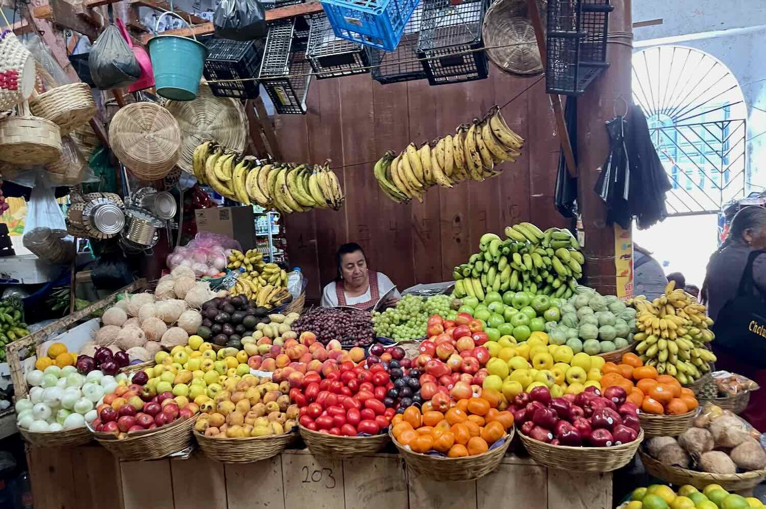
Cycling Colombia Part 1: Cartagena to Caucasia
We had arrived at the Darien Gap in Panama, where all roads end - requiring travel by air or water to reach Colombia. Our ‘quick, 1-hour flight’ from Panama to Colombia took 19 hours longer than expected, but at least our bicycles survived unscathed. Eventually we arrived in the historic, walled city of Cartagena. From there we cycled across a broad plain whose culture reminded us more of the Caribbean than South America. Airy buildings with thatched roofs lined chocolate-brown waterways and seaside beaches, with vast expanses of green savanna in between. Soaked in sweat from the heat and humidity, we looked forward to the higher elevations and cooler temperatures of the Andes Mountains which lay in our path to the south.
Cycling Into Guatemala: San Cristóbal de las Casas, Mexico to Cuatro Caminos, Guatemala
We wanted to savor our final few days in Mexico. So instead of heading straight for the border, we lingered in one more magical town and cycled through a countryside dotted with picturesque lakes. We finally said “good-bye” to Mexico at a little-used border crossing at the top of a really big hill. During our first couple of days in Guatemala we cycled along a quiet road lined with scenic rock formations - until we took refuge from the rain in a woodland bungalow, at a quirky and off-the-beaten-path recreational park.

Cycling the Chiapas Highlands: Arriaga to San Cristóbal de las Casas, Mexico
Departing Arriaga, Mexico we had nowhere to go but up. First, we cycled upwards from the hot and humid coastal plain through the gorgeous Sierra Madre del Sur, where a close encounter with wild coatis boosted our spirits. Next we crossed a broad, highland valley that took us to the state’s bustling capital city. But it was the second big climb, up onto the high Chiapas Plateau that nearly did us in. After gaining a mile and a half in elevation in a single day, we cycled into the magical town of San Cristóbal de las Casas - exhausted but victorious. San Cristóbal ended up being a wonderful place to hang out, becoming one of our favorite cities in Mexico.

Mezcal Mountains and Windy Lowlands: Cycling from Oaxaca to Arriaga, Mexico
After a wonderful layover in Oaxaca, we saddled up and cycled down the Pan-American Highway towards Guatemala. The road took us eastward through the heartland of mezcal production, then over a series of high mountain passes. After descending onto the Pacific coastal plain, we battled both the fierce winds that blow across the narrowest part of Mexico and a mysterious animal we found in our hotel room in the middle of the night. Our final stop was the bustling commercial hub of Arriaga, where we rested before tackling the big climb back into the Sierras.

TransMexico Norte Part 6: Cycling from Izúcar de Matamoros to Oaxaca, Mexico
The final leg of the TransMexico Norte bikepacking route took us across high ridges in the Sierra Madre del Sur. Daily thunderstorms ensured that we started our days early, and sought shelter in the afternoons. We traveled through the cradle of the Mixtec civilization, whose people have inhabited the high mountain valleys for thousands of years - and whose descendants remain to this day. On the final day of cycling, we dropped down into the Valley of Oaxaca for an extended layover, where we celebrated Mexico’s Independence Day.

TransMexico Norte Part 5: Cycling from Toluca to Izúcar de Matamoros, Mexico
After a break of nearly two months, we were finally back on the TransMexico Norte bikepacking route. We had spent much of the rainy season off our bikes, exploring Belize and Mexico City. But with a new, shorter deadline for cycling to the Guatemalan border, we had to get back on the road - even if it meant dealing with daily tropical downpours. Before long we had descended out of the high plains into lowland mountains shrouded in lush forests. Once again we discovered the pleasures of cycling through novel landscapes, and uncovering the hidden gems - like massive caves and offbeat museums - that other tourists rarely see.

TransMexico Norte Part 4: Cycling from Guanajuato to Toluca, Mexico
From Guanajuato, the TransMexico Norte bikepacking route took us into the country’s central volcanic belt, passing between two majestic volcanos and through two of the country’s most popular tourist towns. Along the way, we cycled among the steep-sided foothills of towering cinder cones, as well as through fertile lowlands of sugar cane and agave. Ubiquitous, colorful murals proclaimed Mexico’s love for Monarch butterflies, which overwinter each year among the pines on the slopes of a few, high, volcanic peaks. Just as the rainy season began in earnest, we reached the city of Toluca, where we would take some time off our bikes to let the rains pass.

TransMexico Norte Part 3: Cycling from Zacactecas to Guanajuato, Mexico
The sweet fragrance of a guava candy factory, or the scent of tanned hides from a long line of leather shops. The heat of the sun from a cloudless sky, or a cool breeze blowing across desolate hills. The sound of church bells, or a roving band of mariachis singing songs of love and loss. And the beauty of a mountain overlook, or a tranquil plaza in a colonial village. Traveling this part of the TransMexico Norte bikepacking route has served up a feast for the senses - anchored on each end by two of Mexico’s fabled silver cities, which at one time generated most of the wealth in the world.

TransMexico Norte Part 2: Cycling from Durango to Zacatecas, Mexico
The TransMexico Norte bikepacking route hugs the foothills of the Sierra Madre mountains on its way from Durango to Zacatecas. As we followed the route, we found ourselves alternately climbing up into the cool, pine-cloaked mountains, then plunging back down onto Mexico’s hot, arid, central plateau. There, at the edge of the desert, we cycled between bustling cities and magical towns that trace their histories to the Spanish empire’s hunger for silver and gold.
TransMexico Norte Part 1: Cycling from Mazatlan to Durango, Mexico
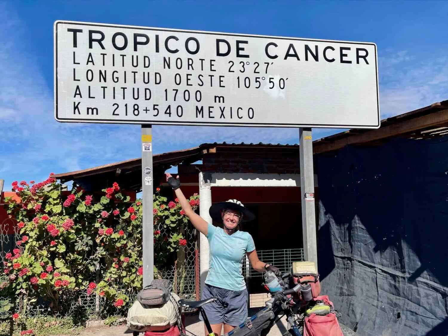
Saying farewell to Baja, we voyaged across the Sea of Cortez to mainland Mexico. From there, an arduous but spectacular 9,000 ft ascent (2,750 m) would take us from the coast to the heights of Mexico’s Sierra Madre mountains. Along the way we officially crossed into the tropics and rode through grand, colonial-era towns built on the mining of silver and gold.
Baja Divide, Part 3: Cycling from Bahía de los Ángeles to San Ignacio
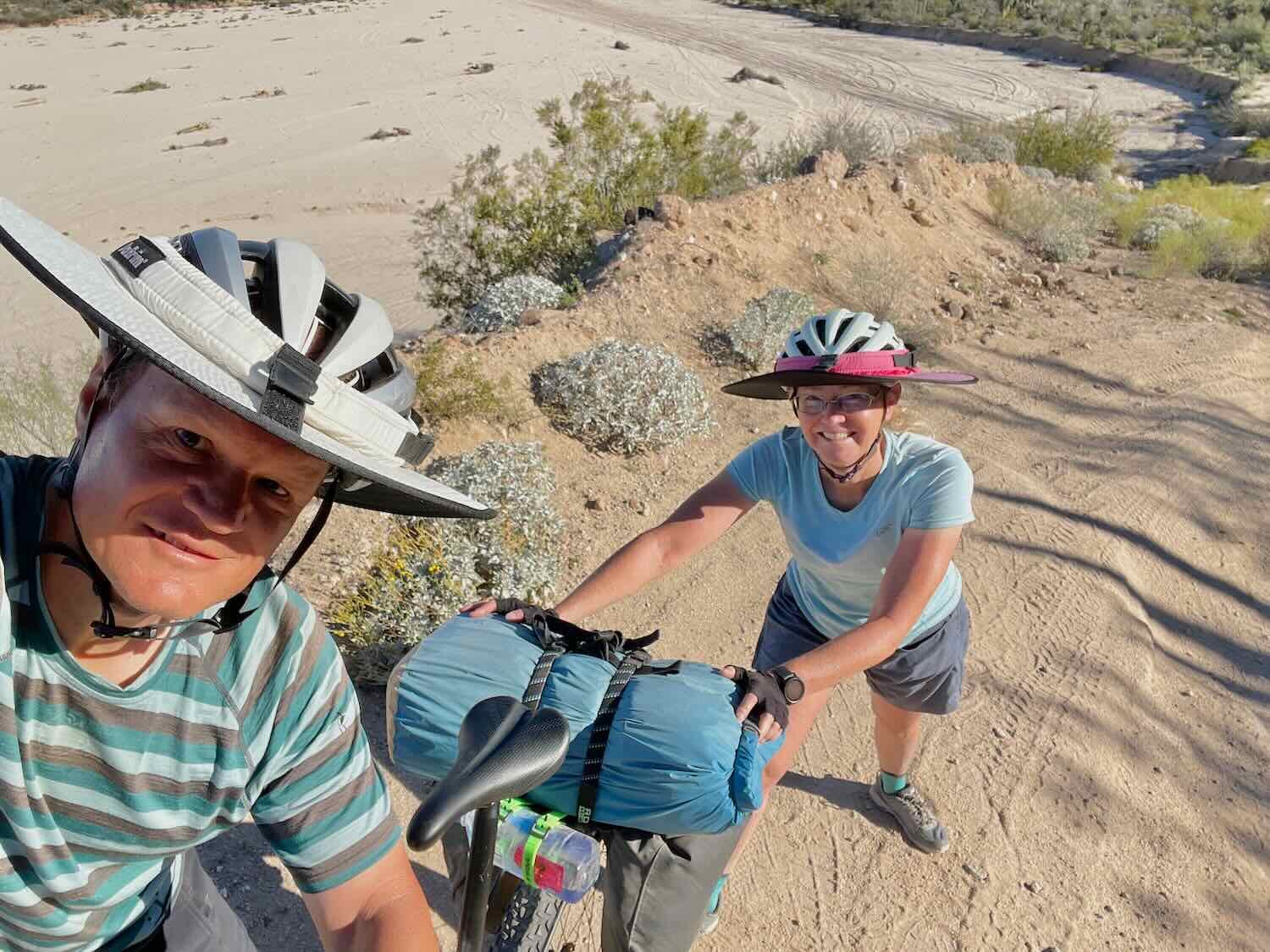
After visits to a few dentists in Ensenada and Tijuana, we resumed our bicycle trip where we left off. A beautiful ride through Baja’s central desert brought us to a laid back, coastal village and our first encounter with the Sea of Cortez. From there, we savored the sensation of returning to Baja’s remote backcountry as we cycled between remote desert ranches through ankle-deep sand, where shade was a precious commodity in the sun-baked landscape - until we finally arrived at the palm-studded oasis of Misión San Ignacio.

Baja Divide, Part 2: Cycling from Vicente Guerrero to Nuevo Rosarito
We began this leg of the Baja Divide bikepacking route with a sense of excitement and anticipation. We would finally cycle into Baja’s iconic central desert, with its giant cacti and other strange plants that look like they came right out of a Dr. Seuss book. The dry, rugged deserts would challenge our water planning skills. And we would tackle the infamous Section 8, the longest stretch of the Baja Divide without any access to food or water. The rewards for those challenges included magical landscapes, lots of wildlife sightings, and a once-in-a-lifetime campsite on a secluded Baja beach.

Baja Divide, Part 1: Cycling from San Diego, California to Vicente Guerrero, Baja
Baja California has a special allure for travelers, and cyclists are not immune. Since its inception in 2017, the Baja Divide bikepacking route has captivated off-road cyclists with the promise of pristine ocean shores, grand desert crossings, friendly cultural connections, and up-close encounters with weird and wonderful plants that grow nowhere else in the world. How could we resist? After traversing the urban sprawl of San Diego, we were thrown into a new world of adventure. Each day brought fresh challenges and surprises as we cycled through remote mountain passes between colorful, laid-back towns on the backroads of Baja.
Pacific Coast Route, Part 3: Cycling from Brookings, Oregon to Marina, California
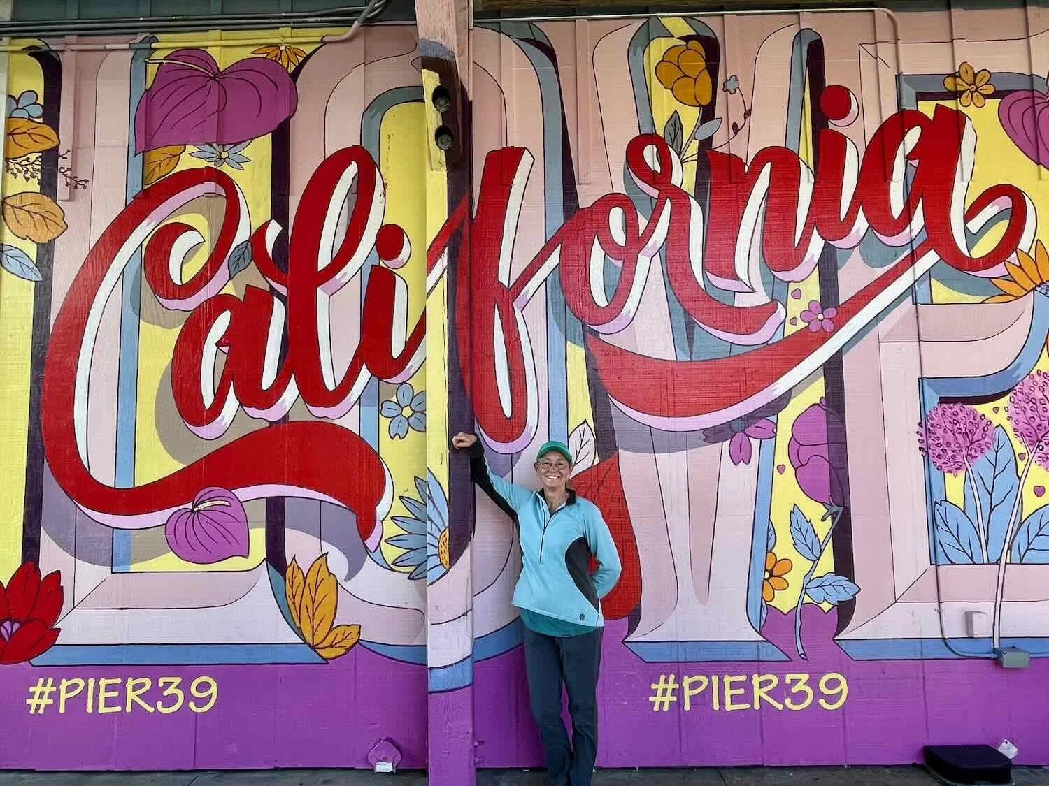
Cycling southward into California, we entered the realm of the coastal redwood forests. Dark, wet, awe inspiring, and infused with an ancient majesty, these temperate rainforests are a highlight of any journey on the Pacific Coast Bike Route. We pedaled through groves of trees as tall as skyscrapers, and trunks big enough to drive through. But the scenery was not all forest. The route passed sea cliffs, sandy coves, and even the metropolis of San Francisco, ensuring that each day was an adventure.

Pacific Coast Route, Part 2: Cycling from Astoria to Brookings, Oregon
The first 100 miles of the Pacific Coast Bike Route in Oregon brought back a flood of memories, as we cycled along roads we had traveled just four years earlier. Yet as we continued southward, the ocean cliffs, secluded beaches, and lush forests seemed to grow even more stunning with each mile. Even the onset of the rainy season in the temperate rainforest couldn’t dampen our spirits - as a series of storms showed off the fierce beauty of the Pacific Ocean.

Pacific Coast Route, Part 1: Cycling from Sedro-Woolley, Washington to Astoria, Oregon
Upon arriving at the Pacific Coast, we had entered a new world. We now cycled through the most densely populated part of Washington, albeit on more rural, secondary roads. Our route constantly rose and fell, as we traversed the stony ridges that form the backbone of Puget Sound’s islands. Evenings were marked by blazing orange sunsets. Mornings were shrouded in mist. And spooky sounds in the forest at night heralded the approach of Halloween, as we made our way south towards Oregon.

Cycling Over the Cascades: Libby, Montana to Sedro-Woolley, Washington
Golden leaves and chilly temperatures signaled the arrival of fall as we departed from Libby, Montana. We cycled westward in hopes of reaching the milder Pacific Coast for the winter. But the Northern Cascades stood in our way, and we had to make it over the mountains before snow closed the high passes for the season. As we approached the Cascades, we cycled through the dry forests and open grasslands of the Okanogan region, following the path of several big rivers. And when we arrived in the mountains, good luck provided us with unseasonably warm and dry weather. We had a fabulous ride through some of the Northwest’s most scenic landscapes, without the hassle of summer crowds. In the end, we couldn’t have asked for a better ride.

The Icefields Parkway: Cycling from Prince George to Golden, British Columbia
Heading east from Prince George, BC, we climbed steadily into the Northern Rocky Mountains. Before long we were cycling through some of the most majestic and stunning mountains we had ever seen. Power outages, campground closures, and a toothache had us constantly changing our plans. But each day we were rewarded with a sense of wonder at the vast wilderness of rock, ice and forests at the top of the world along the Icefields Parkway in Jasper and Banff National Parks.

The Yellowhead Highway: Cycling from Kitwanga to Prince George, British Columbia
The Yellowhead Highway across central British Columbia had a completely different feel than the roads we had cycled farther north. We now biked through small towns every 20-25 miles. Each town had its own personality, with monuments linked to its history. Meanwhile the dense conifer forests were replaced by ever-larger hayfields, characteristic of the Fraser Plateau. Contact with other travelers, a couple of wildlife encounters, and a few mechanical surprises kept us on our toes, ensuring that each day was an adventure.

The Stewart-Cassiar Highway: Cycling from Watson Lake, Yukon to Kitwanga, British Columbia
Cycling southward across British Columbia, we entered another region of vast and sparsely populated wilderness. With only a couple of small towns, this 550 mile route is known for its abundant salmon and bears. We were lucky enough to see both, as well as watching the landscape slowly transition from boreal forest to habitats more familiar in the lower 48 states - while the dramatic, ice-covered peaks of the coastal mountain range provided stunning views to the west.