Pacific Coast Route, Part 2: Cycling from Astoria to Brookings, Oregon
23 October - 7 November 2022
23 October - Astoria to Manzanita, OR (46.7 mi, 75.2 km)
24-25 October - Rain days in Manzanita, OR
26 October - Manzanita to Pacific City, OR (55.0 mi, 88.5 km)
27 October - Pacific City to Beverly Beach, OR (43.8 mi, 70.5 km)
28 October - Beverly Beach to Newport, OR (6.0 mi, 9.7 km)
29 October - Newport to Cape Perpetua, OR (28.6 mi, 46.0 km)
30 October - Cape Perpetua to Reedsport, OR (45.7 mi, 73.5 km)
31 October-2 November - Rain days in Reedsport, OR
3 November - Newport to Bandon, OR (48.3 mi, 77.7 km)
4 November - Bandon to Port Orford, OR (31.0 mi, 50.0 km)
5 November - Port Orford to Brookings, OR (56.7 mi, 91.2 km)
6-7 November - Rain days in Brookings, OR
Cycling Down Memory Lane
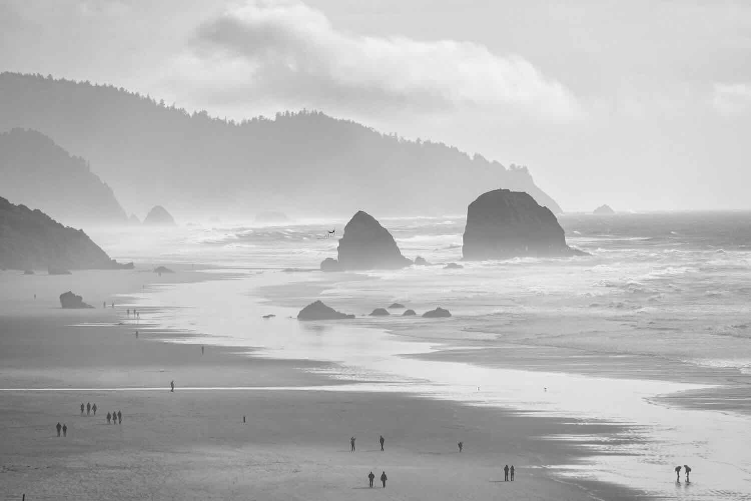
The northern Oregon coast is so beautiful and packed with history that no fewer than three long-distance bicycle routes pass through: the Pacific Coast Route, the TransAmerica Route and the Lewis and Clark Trail. All three use essentially the same roads that cruise along the coast in a pleasing roller-coaster of hills and valleys. The scenery constantly changes, as the route launches from low, sandy beaches and grassy estuaries up onto 800 ft high, rocky bluffs, and then back down again.
Our departure along the Astoria Riverwalk brought back a flood of memories for a couple of reasons. Foremost was that in 2018 we had cycled this path, going the opposite direction, as we wrapped up our first cross-country bike tour on the TransAmerica Bicycle Route. Now we took our time, enjoying the sensation of being back in familiar territory. There were the big vats of brewing beer (Astoria has one brew pub for every 2,000 residents), the multitude of references to seafood (especially salmon and tuna), and the soaring Astoria-Megler Bridge.
A vintage bicycle adorns the wall of a restaurant. Astoria, Oregon, USA. Copyright © 2019-2022 Pedals and Puffins.
Big, stainless steel vats at the Fort George Brewing Company (Astoria’s largest). Astoria, Oregon, USA. Copyright © 2019-2022 Pedals and Puffins.


The luxurious Cannery Pier Hotel is built at the end of an old dock, on an historic salmon and tuna canning site. It was built using materials and construction similar to the original canneries, but we hear the accommodations are a lot more comfortable. Astoria, Oregon, USA. Copyright © 2019-2022 Pedals and Puffins.
An image of a salmon graces the sign for the West Mooring Basin Docks. Astoria, Oregon, USA. Copyright © 2019-2022 Pedals and Puffins.
Admiring the 4-mile long (6.5 km) Astoria-Megler Bridge, at the mouth of the Columbia River. Astoria, Oregon, USA. Copyright © 2019-2022 Pedals and Puffins.
The second reason our departure from Astoria felt special was because we had finally reached the mouth of the Columbia River. It was almost exactly one month (and more than 1,000 miles of travel) since we had cycled past the source of the Columbia River near Canal Flats, British Columbia. Along the way we had watched the river grow from a narrow channel meandering through wetlands bordered by mountains, into a 4-mile wide (6.5 km) river hosting a fleet of large container ships. We felt a close attachment to this iconic river that had been such a big part of our cycling landscape. And now it was time to say farewell, once more.
Big shipping barges park at the mouth of the Columbia River. They wait here for one of the fabled Pilot Boats to lead them safely to ports in Vancouver, Washington and Portland, Oregon. Astoria, Oregon, USA. Copyright © 2019-2022 Pedals and Puffins.
The morning was cold, but clear, making for an enjoyable ride through the coastal hills.
Departing Astoria via the Lewis and Clark River Bridge. Astoria, Oregon, USA. Lewis and Clark River, Astoria. Copyright © 2019-2022 Pedals and Puffins.Lewis
Two hours later we reached Seaside, Oregon, and finally arrived at the Pacific Ocean. The ride along the oceanfront Promenade brought back another flood of memories. There was a mist in the air, not so different from when we had arrived in August 2018. The tide was out, exposing a very wide, sandy beach. Recent stormy weather had kicked up the surf, so that a parade of big, frothy waves pounded the beach. Nobody was swimming in the rough water. But there still were quite a few people out enjoying a walk along the boardwalk, or playing in the sand.
The Pacific Ocean was looking a bit rough following several days of stormy weather. Seaside, Oregon, USA. Seaside. Copyright © 2019-2022 Pedals and Puffins.

We stopped at the monument that marks the “End of the Trail” for Lewis and Clark (but not for us). Seaside, Oregon, USA. Copyright © 2019-2022 Pedals and Puffins.
Along the waterfront, another cyclist stopped to chat with us. He was from Seaside, and said he always enjoyed a quick visit with anyone cycling through town on a longer bike tour. His claim to fame was that he rode from Astoria to the Oregon/California border in less than 24 hours several years ago. (For comparison, it would end up taking us eight days of cycling to cover the same distance.) Of course, he had a van for support, he didn’t have to carry much weight, and he benefitted from a brisk tailwind for the entire ride. Still, it was a pretty impressive feat.
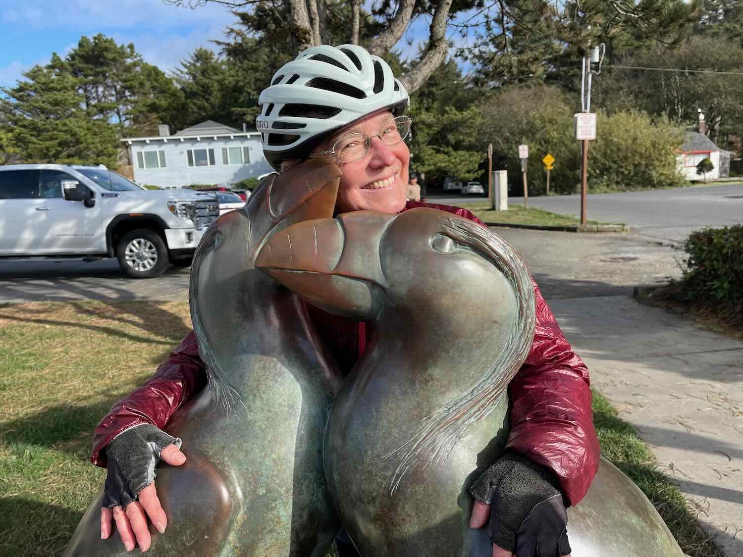
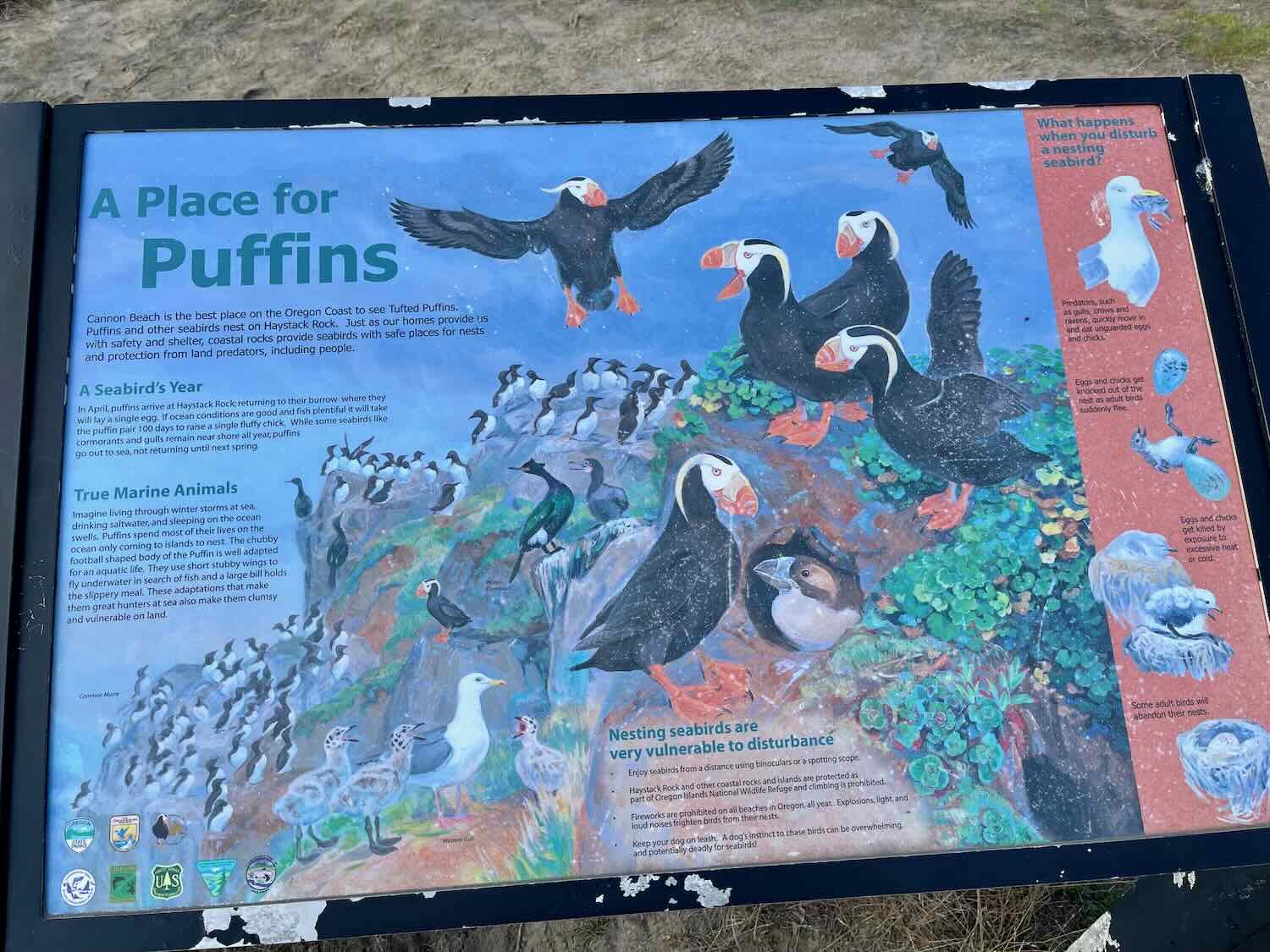
In the town of Cannon Beach, we spotted a statue that stopped us in our tracks. Puffins! The image of two of our namesake birds nuzzling each other affectionately was too endearing to pass by. PedalingGal just had to join in the hug.
A group hug with two bronze tufted puffins made PedalingGal’s day. Cannon Beach, Oregon, USA. Copyright © 2019-2022 Pedals and Puffins.
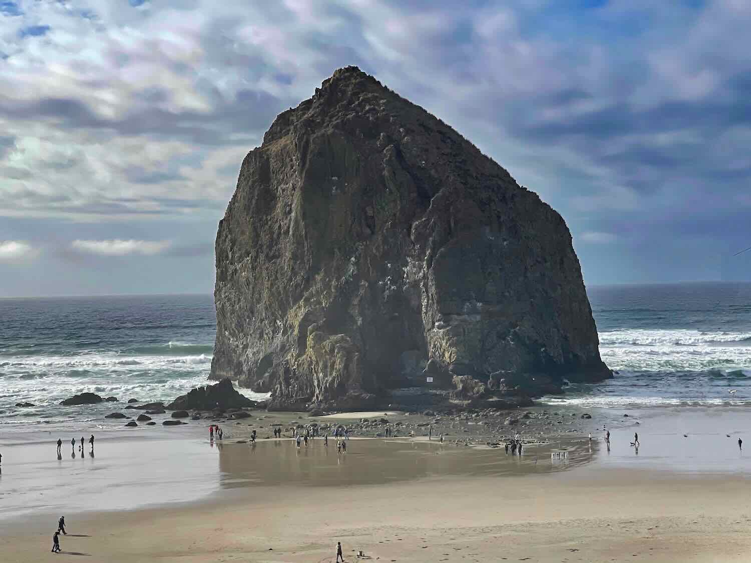
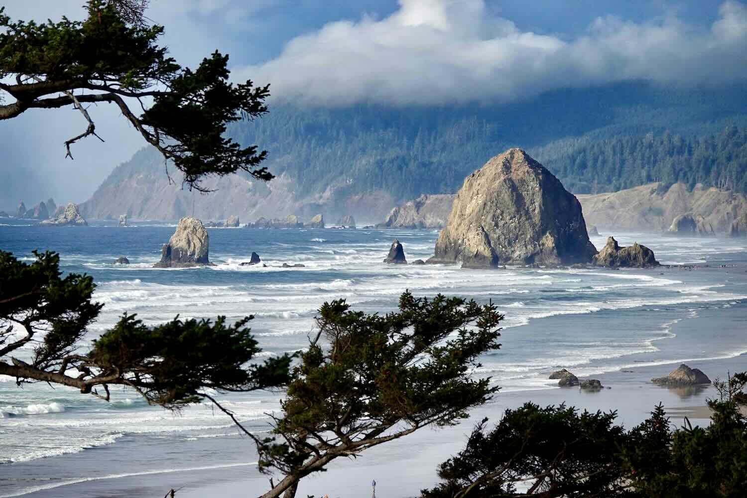
The sea stacks (rocky outcrops) that decorate the Oregon coast are especially picturesque here, including the famous Haystack Rock. Several movies have been filmed on this iconic beach including Point Break, one of the Twilight movies, and The Goonies. The big rocks are also important breeding cliffs for tufted puffins (hence the statue in town). But, unfortunately, all of them are out at sea this time of year, so we didn’t see any live puffins.
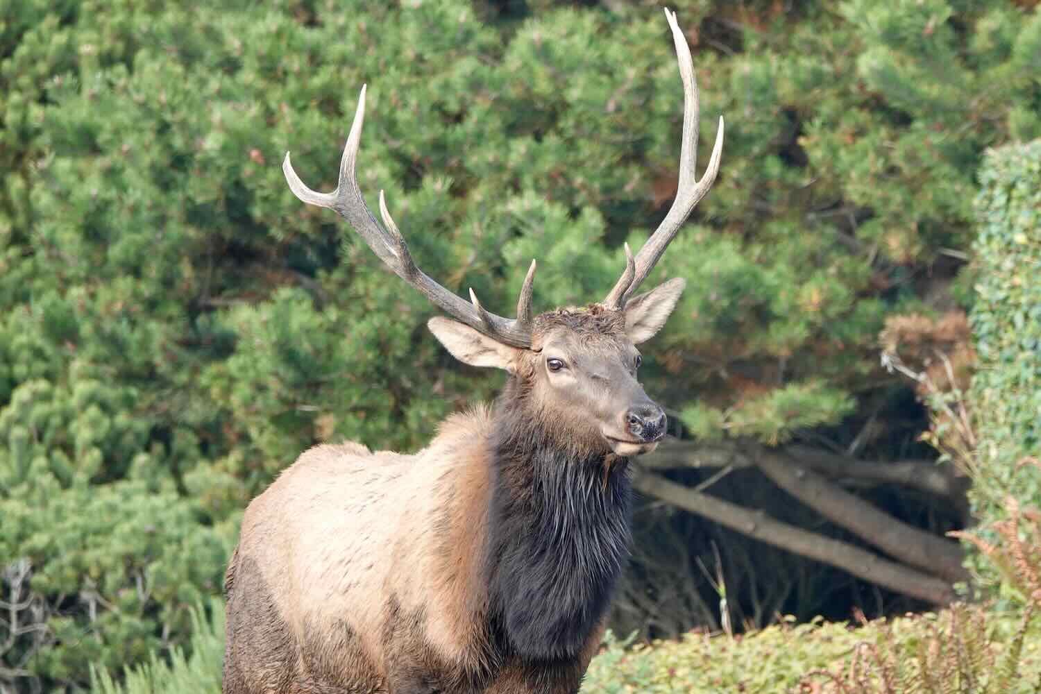
Just as we were heading out of Cannon Beach, we were stunned to see a herd of elk strolling through the middle of town. Apparently they are Roosevelt Elk, native to the area. At first it was just a few females. But they were soon joined by a young male and a couple of little ones. We watched in amusement as traffic came to a halt while the parade of elk made its way through town and casually munched on shrubs decorating the front lawns of nearby houses. Then, after nearly 20 elk had already passed, the big male bull finally sauntered onto the scene. Unlike the other elk, the bull remained vigilant and didn’t feed very much. He was too busy keeping an eye on things. You definitely wouldn’t want to mess with him. In fact, a local police officer drove by and provided a warning to not get too close. He told us that recently someone did approach the elk, and was attacked by one of the animals.
Out of nowhere, a herd of elk emerged from a residential neighborhood and started walking down a busy street. Cannon Beach, Oregon, USA. Copyright © 2019-2022 Pedals and Puffins.

From Cannon Beach to Manzanita we took the time to stop at some of the scenic overlooks. They’ve done a good job of providing informational signs at the overlooks that talk about the area’s geology, wildlife and history.
Checking out informational signs along the route. Cannon Beach, Oregon, USA. Copyright © 2019-2022 Pedals and Puffins.
Our only major hurdle was the quarter-mile long Arch Cape Tunnel. There’s just a narrow shoulder through the tunnel on busy Hwy 101. Given that this is a well-traveled bicycle route, there is a button before entering the tunnel that activates flashing lights to alert drivers that there are cyclists present inside - and theoretically requires them to slow down. But adding to the level of difficulty, southbound cyclists have to ascend a steady climb for the entire 0.25-mile (0.4 km) length of the tunnel. We cycled as fast as we could up the incline, wanting to spend as little time inside the narrow passage as possible. Fortunately, there was a gravel pull-out on the far side. We stopped there to catch our breath after the sprint through the tunnel.


In Astoria we had left the Puget Lowlands behind and entered the wet and mossy realm of the temperate coastal rainforests. Now, whenever our route ascended onto one of the cliffs that tower above the ocean, the rainforest would envelop us. The temperature would drop, the air would grow markedly more humid, and the trees would create a dark, deep-green tunnel. Everything was covered with moss, and the morning fog lasted well into the middle part of the day. The cool air was a blessing as we worked our way up 500+ ft (150+ m) hills, but it could be a bit chilly when we cruised downhill.
In the Pacific Northwest Coastal Forests, everything is covered in a blanket of moss. Oswald West State Park, Oregon, USA. Copyright © 2019-2022 Pedals and Puffins.
Whenever the road would break out of the forest, exquisite views of the Pacific Ocean could be seen from viewpoints at the top of the cliffs. The big waves crashing ashore along the beaches took on a whole new appearance when viewed from several hundred feet in the air. It was awesome to watch the endless march of the surf toward the shore.
The town of Manzanita (our destination for the day) as seen from a viewpoint along the Pacific Coast Bike Route. We were mesmerized by the sight of the big waves crashing ashore. Oswald West State Park, Oregon, USA. Copyright © 2019-2022 Pedals and Puffins.
Unfortunately, we had failed to make it across the Pacific Northwest coast before the rainy season set in. With November fast approaching, the beautiful, clear days we had experienced while cycling across most of Washington were now behind us. The weather for the next few days was shaping up to be downright nasty. Heavy rains and strong winds were forecast. So we booked a hotel room in Manzanita and hunkered down, hoping to wait out the storm.
Staying Cozy in Manzanita, Oregon
Our sanctuary in Manzanita turned out to be a fantastic place to spend a couple of days. We snagged a suite with a kitchenette plus a whole wall full of windows overlooking the ocean, at off-season rates. For the next two days we enjoyed home-cooked meals and occasional walks along the beach when the weather temporarily cleared. But the best part was being able to look out the picture windows and watch the constantly-changing moods of the sea and sky.
Our cozy room, with a panoramic view of the Pacific Ocean. Manzanita, Oregon, USA. Copyright © 2019-2022 Pedals and Puffins.
The rain began during the first night, and pounded the town until around noon the next day, with winds gusting to 30 mph (50 kph). But then the skies cleared, and we were able to go for a breezy walk on the beach. We were practically the only ones there, and it was very peaceful to have the beach almost all to ourselves.
Big waves discouraged any thought of wading in the surf. We had viewed Manzanita Beach from the top of those cliffs on our way into town the day before. Manzanita, Oregon, USA. Copyright © 2019-2022 Pedals and Puffins.
As the day drew to a close, new storm clouds gathered on the horizon. Manzanita, Oregon, USA. Copyright © 2019-2022 Pedals and Puffins.
The next day ended up being much stormier, especially in the afternoon. The wind and rain were quite intense, and we were glad to be safe in our refuge at the motel.
As the storm whipped up the surf, we watched some of the biggest waves yet through the big windows of our nice, dry hotel room. Manzanita, Oregon, USA. Copyright © 2019-2022 Pedals and Puffins.
Camping Among Rabbits
After two rain days, we finally got back on the bikes. The morning was misty and damp, but thankfully it didn’t rain. The scenery continued to be beautiful. There were lots of bays bordered by long, sandy spits with tree-covered hills, and big, empty beaches or rocky bluffs going down to the sea. We were entertained by the cheeky sense of humor displayed by some of the residents along the route.
Some good advice. Rockaway Beach, Oregon, USA. Copyright © 2019-2022 Pedals and Puffins.
This boat has personality. Rockaway Beach, Oregon, USA. Copyright © 2019-2022 Pedals and Puffins.
We were cycling along a sea wall near the mouth of Tillamook Bay, when we heard the sound of a very-low-flying helicopter out over the water. We stopped to find out what was happening. From the shore, we spotted a Coast Guard helicopter hovering over a boat. As we watched, it lifted a person off of the boat, and slowly reeled them up into the helicopter’s cabin. But although the weather was a bit rough, this didn’t look like an emergency rescue in action. Once the person had been lifted to safety, both the helicopter and the boat slowly moved away down the channel. Our best guess was that this was a drill. But it was still quite interesting to watch.
This helicopter had just lifted someone off of a boat and into the cabin of the helicopter. It looked like a Coast Guard rescue drill. Barview, Oregon, USA. Copyright © 2019-2022 Pedals and Puffins.
In the town of Tillamook, we spotted a group of bronze elk that appeared to be singing in a choir, or perhaps howling at the moon? We’re not quite sure.


Tillamook is, of course, famous for its dairy products. Much of the land surrounding the town is especially good for raising dairy cattle, although there are fewer farms now than there used to be. They gave rise to a very large cheese and diary product industry. Throughout the western United States, Tillamook yogurt, ice cream, and cheese dominate many grocery store shelves. When we crossed the United States from east to west in 2018, we stopped to visit the town’s large cheese factory. The factory tour was fascinating.
Shortly after leaving Tillamook our route took a rare and welcome turn onto a dirt road. A couple of cars passed us slowly on the rutted road, but otherwise we were alone for the better part of an hour. We ascended onto a coastal ridge, cycling through an active forest management area. Quite a bit of the forest along the route had been cut and subsequently replanted. On the hillsides, you could see large patches of healthy forest in various ages of regeneration. We noticed some older, very large stumps that might have been from the original, old-growth forest. It seemed likely that the more recent harvest was from a second-growth forest that had already matured over the past 80+ years.
Cycling in the dirt. Southwest of Tillamook, Oregon, USA. Copyright © 2019-2022 Pedals and Puffins.
A large flock of fox sparrows darted around in the shrubby fields left behind after the harvest. Southwest of Tillamook, Oregon, USA. Copyright © 2019-2022 Pedals and Puffins.
Once back on the black-top, we started the steep, 800 ft (250 m) climb up and over Cape Lookout. On our way up we stopped for a break at the Anderson Overlook. It’s one of the iconic vistas, providing a bird’s-eye-view along the 5-mile sand spit that protrudes from the Cape, with its endless beach. Big waves continued to hammer the beach below us.


On the far side of the Cape, we passed through the Sand Lake Recreation Area, with its acres of sand dunes. These dunes come as a surprise, because they lie more than 200 ft (60 m) above sea level.
The dunes at Sand Lake Recreation Area. Oregon, USA. Copyright © 2019-2022 Pedals and Puffins.
Almost there… Just north of Pacific City. Oregon, USA. Copyright © 2019-2022 Pedals and Puffins.
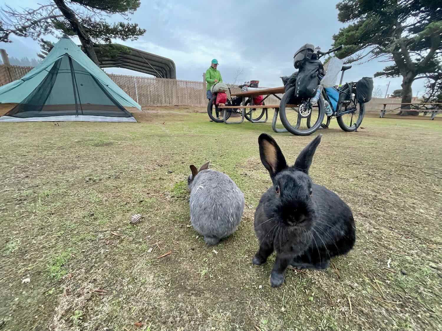
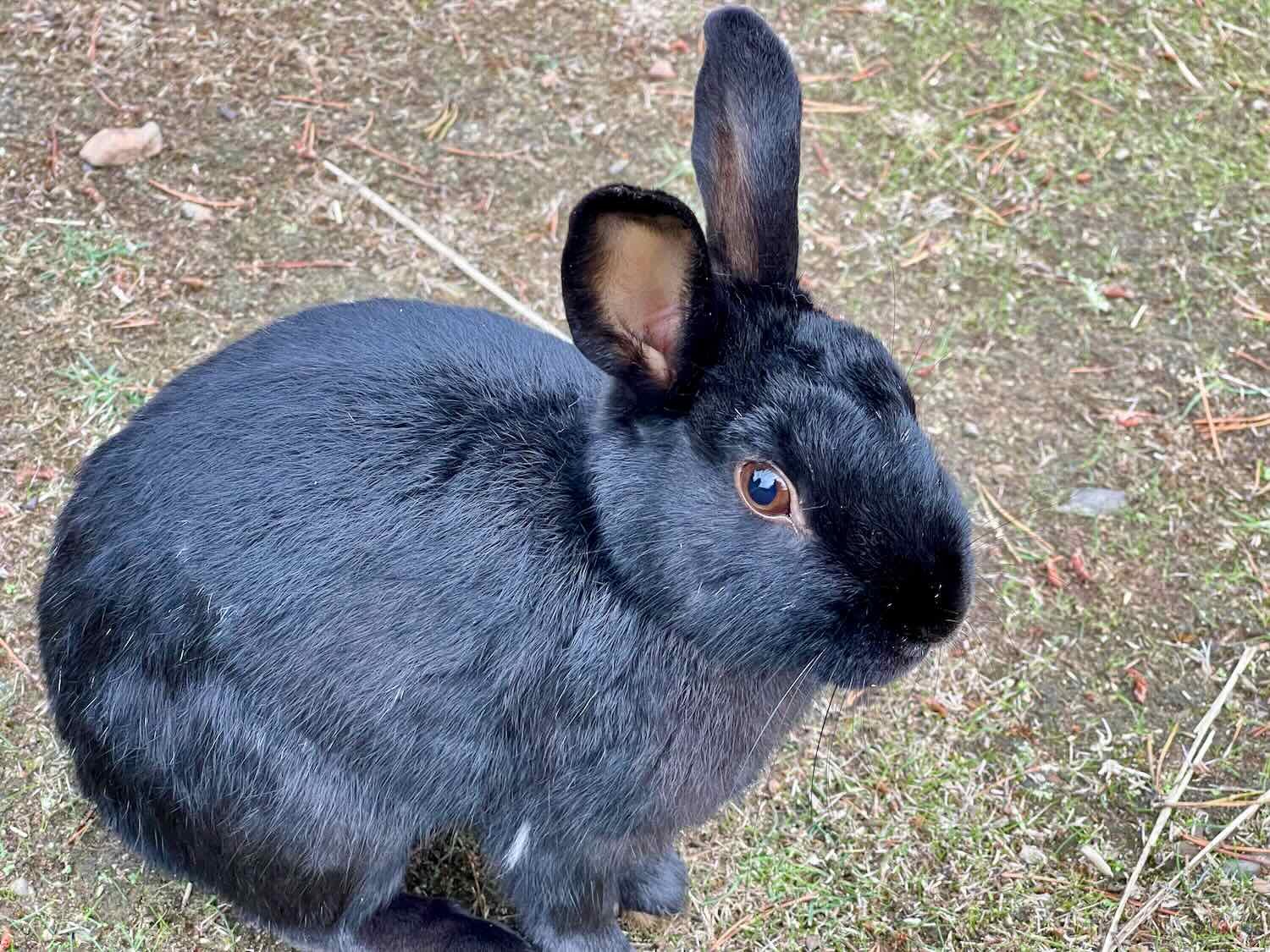
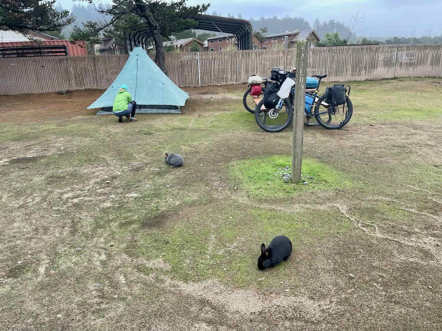
We stayed at the Webb County Campground in Pacific City. When we cycled past here four years ago this campground had been full, and we ended up having to stay in a postage-stamp-sized campground along a busy road instead. This was definitely an upgrade. But what we hadn’t expected was that the campground would be overrun with bunnies. We were told by the campground host that the campground really belonged to the bunnies, but that they allow people to stay there also. It was clear that people feed them, because they were very tame. And if they heard the rustling of potential food, they would amble up for a closer look, hoping for a handout (we did not feed them). It was amusing, for sure.
A Rendezvous With Whales
We awoke to a clear morning, with even a few patches of blue sky. It was going to be a great day for a ride. We couldn’t resist taking a photo of our bikes, with the blue skies and (relatively) calm seas in the background.
Our bikes enjoying the view from an overlook. Winema Beach, Oregon, USA. Copyright © 2019-2022 Pedals and Puffins.
The coast continues to be decorated with scenic sea stacks. The lone tree on this rock island caught our eye. Gleneden Beach, Oregon, USA. Copyright © 2019-2022 Pedals and Puffins.
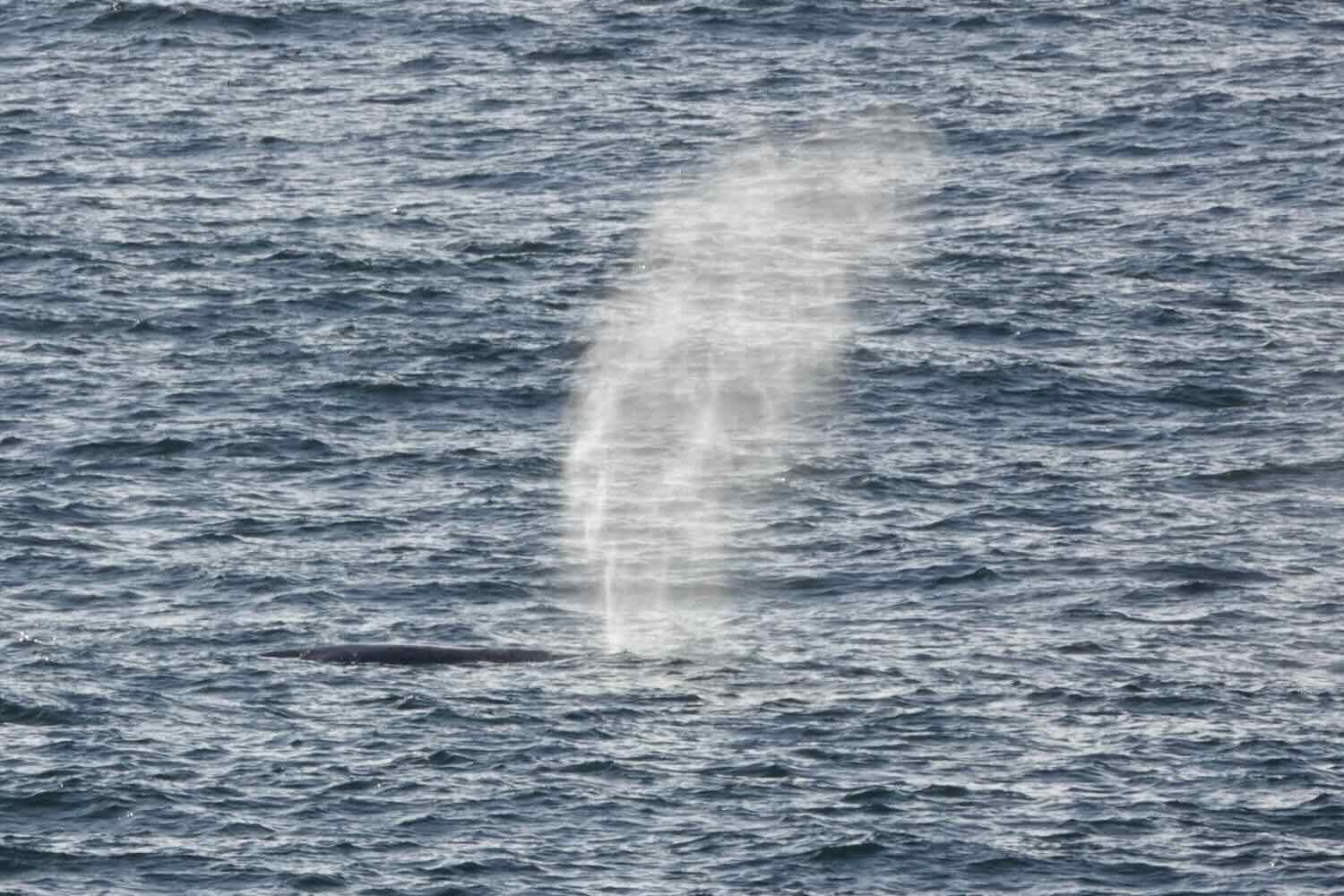
When we stopped for an impromptu break at the viewpoint over Boiler Bay, we didn’t realize that we were in for a special treat. Looking out towards the sea, we noticed a puff of water bursting into the air. Could it be? We watched a bit longer, and soon confirmed that a pod of whales was passing by. Every 5-8 minutes, a group of maybe six whales surfaced for a breath not far from the point of land where we stood. They were gray whales, migrating south to the warmer waters of Baja. Perhaps we would see them again, there.

It was only afterward, when we cycled into the town of Depoe Bay, that we realized this is a big whale-watching spot. The town’s welcome sign proclaims that it’s the Whale Watching Capital of Oregon. And a charming statue gave us a picture of what a whole gray whale would actually look like.


Toward the end of the day as we rode along a sandy cliff, we came across a backpacker hiking the Oregon Coast Trail. We hadn’t met any other backpackers (it was quite late in the season), so we stopped to visit and make sure he was okay. His name was Geoff, and he had gotten here by a rather circuitous route. Over the summer he had planned a thru-hike of the Pacific Crest Trail (PCT), which runs along the spine of the Cascade and Sierra Nevada Mountains. He ended up completing most of the trail, but he had to skip a section in Oregon due to forest fires. Having finished the route in Southern California, he had come back north in hopes of completing the Oregon section that he had missed.
Unfortunately, by this time of year the PCT is deep under snow. So Geoff decided to hike the Oregon Coast Trail instead. He was hoping for milder weather, since this route is not in the high mountains. We admired his persistence, especially since the weather wasn’t that great along the coast, with rain, rain and more rain. It was only slightly better than deep snow. We wished him well, and headed on down the road.
A view from Otter Rock, where we met a backpacker walking the Oregon Coast Trail. Oregon, USA. Copyright © 2019-2022 Pedals and Puffins.
By the time we reached Beverly Beach State Park, it was getting quite late. At the entrance, we were struck by how huge it was. The park had more than 250 camping sites, plus 21 yurts for rent. That doesn’t count the additional hiker/biker and group campsites. To manage all of the traffic, the entrance to the campground had four different lanes for cars - each designated for a certain kind of camper and/or reservation status. It was like rolling up to Disney World in the woods. We’d never seen a campground entrance quite like it.
The hiker/biker sites were closed for maintenance, so we were told to choose a site in the regular campground. We knew that more rain was coming, and had even hoped we might be able to rent a yurt. But none of the yurts were available, so we tried to pick a campsite that we thought would drain water pretty well. The campground had a lot of vacant sites to choose from. It took us way too long to pick one, because we ended up trying too hard to find the perfect site (which never exists). We finally landed at a campsite just a couple of spots away from another cyclist. Chatting with him, we learned that he was originally from Fairbanks. He told us that his first bicycle tour had been down the Alaska Highway, from Fairbanks to Seattle. Someday he wants to ride the Stewart-Cassiar Highway. We told him how much we enjoyed that segment of our trip, and encouraged him to do it.
As we were finishing our dinner in the dark, we were surprised when Geoff, the backpacker, walked up. He had a headlight on, so we didn’t recognize him until he was standing right next to us. He was looking for a campsite. While we were talking, he ended up deciding to continue hiking in the dark for another 10+ miles to the next town. He put us to shame. We were getting ready for bed.
A Short, Wet Day
We should have followed Geoff’s lead. It started drizzling at around 4am. Pretty soon after that, we were listening to the sound of a hard, steady rain on our tent.
Just as light began to filter through the trees at dawn, an ominously big puddle started to form on the ground on one side of our tent, close to PedalingGal’s head. As she laid in her sleeping bag, watching the water inches from her head, she noticed that it was raising fast. The puddle was becoming a small pond. Within about 15 minutes, the water was lapping at the edge of the tent. Making matters worse, the rain that was landing on the top of the tent and running down the sides was splashing so hard on the rapidly raising puddle that it caused a backsplash that sent droplets inside the tent, getting our down sleeping bags wet. Getting any of your down gear wet is one of those things that is particularly stressful, because it can take days to dry. Plus, down loses its warmth when wet. It was starting to get serious.
PedalingGuy sprung to the rescue. He pulled on his raincoat, then grabbed a trowel and some sticks to dig a drainage ditch from our fast-rising puddle into some nearby, lower bushes. It took him about 20 minutes to complete construction on two drainage canals, and the two biggest puddles finally started to recede. A major disaster averted.
Back in the tent, we considered what to do next. The weather forecast called for the rain to continue most of the day. And although there would likely be a break of a couple of hours in the afternoon, the rain would then fall again all night. We decided to abort, and get a hotel in Newport, just six miles (9.5 km) up the road.
Using a mobile phone from inside the tent, we quickly settled on a hotel close to a grocery store and some dining options. Then, we packed up the tent, and cycled out into the rain. One silver lining to all the wet weather was that the area’s rough-skinned newts were out-and-about. These amphibians are most visible during rainy and overcast days in the spring and fall, when they migrate - leading them to wander across paths and roads. Their backs are dull brown, but their bellies are a flaming-orange. The bright color is a warning to predators - these newts excrete a powerful neurotoxin when threatened. So handling them is not advised.
A rough-skinned newt out walking on the road. Beverly Beach State Park. Oregon, USA. Copyright © 2019-2022 Pedals and Puffins.
In less than a mile of riding we were soaked to the bone. There was no avoiding it. The steady rain was “enhanced” by all the cars that passed us, splashing us from their tires. We went straight to the hotel, arriving way too early for a normal check-in time. We arrived wet and bedraggled, hoping they would let us into a room anyway.
We must have looked sufficiently pitiful because, miraculously, the receptionist took pity on us and checked us into a room. He told us it was the earliest he had ever let anyone check in. Furthermore, he proceeded to refuse to check in some other guests who arrived just after us in a car.
We could not have been happier. Upon closing the door of our room behind us, we started peeling off the layers of soaked clothing. We had a hard time finding places to hang everything to dry. And as we ran the heater to help warm our bodies, steam rose off off our stuff and made the room feel like a sauna. Warm showers helped revive us, but added to the moisture in the air. With rain still coming down outside, there really wasn’t much chance of lowering the humidity in the room without running the air conditioner - which wasn’t an option given how cold it was. Even so, we felt very grateful just to be out of the rain and have on dry clothes.
With the rain still falling, we decided that the closest restaurant would be the the best one, regardless of the food. That happened to be a place next door to the hotel, which had a fun, 60’s soda fountain theme. Burgers were their specialty. They served 1/4 lb, 1/2 lb, 1.0 lb, and even 2.0 lb burgers. We had trouble picturing someone eating a 2 lb burger. That would be like eating eight McDonalds quarter pounders. But since it was hard to imagine eating anything but a burger here, we went with the flow and both had a burger for lunch - sticking to the smaller sizes. We finished off the meal with decadent desserts.
A slice of cherry pie a la mode and “Death by Chocolate.” Newport, Oregon, USA. Copyright © 2019-2022 Pedals and Puffins.
A Two Day Dash
It was still raining the next morning. We decided to wait for the rain to stop, then ride a short day to a campground. If we were lucky, the next day would be rain-free, and we could get in a longer day of cycling before the next set of storms kicked in.
We finally left the comfort of our hotel around 10:30am, despite being warned by the front desk manager that it didn’t look like the rain was going to stop that day. To our delight, he was wrong and the rain wasn’t too bad. Even though there was a thick mist, it wasn’t as bitter cold as it had been in recent days. And as we rode, the fog slowly started to lift. Before long we could even see some of the adjacent coastline through the mist.
We passed the South Beach Fish Market, where they seem to sell a bit of everything. Newport, Oregon, USA. Copyright © 2019-2022 Pedals and Puffins.
With Halloween only a couple of days away, we spotted a few skeletons lurking in the mist.


Colorful crab-pot buoys make festive tree ornaments. The different colors and patterns on the buoys are actually fisherman-specific, and identify the owner of the crab pots. Seal Rock, Oregon, USA. Copyright © 2019-2022 Pedals and Puffins.
For most of the day our route hugged the coast, staying very close to the ocean. The rapid succession of storms had really whipped up the surf. There was something genuinely compelling about the way the water moved. We stopped often to admire the stormy seas, and watch the waves crashing along the rocky shoreline.
Rough seas near Waldport, Oregon, USA. Copyright © 2019-2022 Pedals and Puffins.
There were just a couple of miles left in our ride for the day when we came across an especially impressive sight. Dubbed the Devil’s Churn, it’s a narrow channel in the rocky coastline. The trough funneled the incoming waves until they smashed against the rocks in a riot of frothy water. The sea water was so churned up that it looked like cream swirling around in a giant cauldron.
Milky seawater crashes into narrow, rocky channel at the Devil’s Churn. Yachats, Oregon, USA. Copyright © 2019-2022 Pedals and Puffins.
We thought we had a brilliant plan to stay at the Cape Perpetua campground in Siuslaw National Forest. With the end of the summer tourist season, many US Forest Service campgrounds in the area were closed, including the one at Cape Perpetua. But “closed” doesn’t preclude staying within the campground. The water is turned off and there’s no trash service (you have to pack out your trash), but that just makes it a bit more like wild camping. Plus, there’s usually a gate across the entrance road, so cars can’t get in. If you are not in a car, you can walk or bike around the gate and use any of the empty campsites as long as you “leave no trace” when you’re done. Even better, there likely won’t be anyone else in the campground with you. It sounded pretty sweet.
When we cycled into the campground we even had a nice surprise. The water spigots had not been turned off, and we would have access to potable water.
Just after we pitched our tent, a car drove into the campground heading for a camper parked at the far end. The car stopped near our campsite, and a friendly couple got out to talk with us. They were wearing Forest Service uniforms, but we learned that they were volunteers who had permission to keep their RV in the campground. They chatted amiably with us about our trip, and said that if we needed anything we should not hesitate to let them know. That was really nice of them.
After setting up camp, we did something we would later regret. We ate our dinner at the picnic table in our campsite. For many months when we were cycling through grizzly bear country, we were always careful to eat our meals away from our campsite. Even if we stayed in a campground, we would try to find a different, vacant campsite where we could eat to keep our own site scent-free. But since reaching the Pacific Coast, we had relaxed that practice and started allowing ourselves to eat dinner at our own campsite. That’s what we did at Cape Perpetua.
After dinner it was already twilight. But we knew that it was just a short, one-mile walk to the “Giant Spruce Tree,” which sounded really cool. So we set off down the trail in the fading light. By the time we reached the tree it was nearly dark. Even so, we could still see and appreciate the majestic presence of the 500-year old Sitka spruce. The tree is 15 ft (4.6 m) in diameter, and over 200 ft tall (60 m). And like many of these rainforest giants, it has a cave-sized opening at its base where the “nurse tree” that nurtured the spruce as a sapling had long since rotted away. We lingered for a while in the presence of the great tree, feeling just a bit of the grandeur that would have characterized this coastal forest in the past, when massive trees were more common.
Sharing some love with the Giant Spruce Tree. Cape Perpetua Campground, Oregon, USA. Copyright © 2019-2022 Pedals and Puffins.
Thieves in the Night
We made our way back to the campsite, using our headlamps to illuminate the trail in the dark. By the time we were ready for bed, the humidity that permeates the rainforest had turned into a thick mist, to the point where it was almost a drizzle. We hustled into the tent, hoping to stay as un-wet as possible. (You never seem to get totally dry in the Oregon rainforest during the rainy season. There are just various levels of wetness.)
We weren’t even settled in when we heard it. There was a very low-pitched, menacing growl, alarmingly close to our tent.
Springing into action, PedalingGuy whipped out our flashlight and PedalingGal took the safety off of her bear spray. But really, it didn’t sound like a bear. When we shined the flashlight around the campsite we couldn’t see anything in the mist. The light probably scared whatever-it-was away. Afterward, we speculated about what it might have been, but we really couldn’t say.
Just when we started to relax, we heard something chittering over on the other side of our tent. That was a sound we recognized. Shining the flashlight, PedalingGal saw the rear ends of two raccoons scuttle off into the woods - probably a mother and her kit. The growl we had heard was most likely another raccoon in a dispute with these two about who would have dibs on our food. That solved the mystery, but set us up for a night of drama.
A couple of things probably contributed to the special attention we got from the raccoons that night. First, we ate at our own picnic table which invariably leaves tantalizing smells on the table, and a few dropped crumbs on the ground to draw the raccoons in. Second, we were the only campers for miles, in an area where the raccoons had probably learned to forage among the human leftovers from more than 30 active campsites. So even if we didn’t have a lot of obvious food laying around, we were pretty much the only targets that night for a bunch of hungry raccoons that were used to stealing their dinner. And third, we hadn’t bothered to take our food out of our panniers and stow it away from camp. It would not be a big step for the raccoons to locate it once they had decided to visit our campsite.
Whatever the causes, we were in for a long night. Campground raccoons can be notoriously bold and persistent. Each time we chased them away, it wasn’t long before the raccoons came back. Pretty quickly we realized that we needed to strengthen our defenses. We were particularly concerned that they would chew into our panniers in search of the food. As you might imagine, we considered getting holes in our waterproof panniers, during the rainy season in the rainforest, as an extremely undesirable scenario.
PedalingGuy volunteered to go out in the heavy mist and remove the food bags from our panniers. It was too dark and wet to go searching for a place to hang the food. So he secured the bags to his bike rack thinking that if the ‘coons tried to steal a bag, they would knock over the bike and be frightened away (and probably wake us up so we could chase them off). There was no guarantee that the raccoons wouldn’t still gnaw on our panniers, since they probably now smelled like food. But if we were lucky, they would get frustrated at being constantly chased away and perhaps move on.
After all that commotion, things quieted down for a while. We finally drifted off to sleep.
Then, around 1am PedalingGal heard a thump in the night that woke her out of a restless sleep. Within a minute she heard rustling sounds, and she gradually realized it was coming from outside the tent. She grabbed the flashlight and shone it toward the bikes, catching another glimpse of a raccoon’s rear end as it ran away. By now we were both awake. From inside the tent we could see that one of the food bags had been pulled off the bike rack and was on the ground (although still tied to the rack).
PedalingGuy went back out into the damp night to reposition both the food bags and the bikes. He moved the bikes away from the picnic table where they had been leaning, which had given the ‘coon easy access to the food bag. He balanced the food bags on the bike racks, and then put a couple of aluminum cans on top of the food bags. The idea was that if a raccoon tried to grab a bag, the cans would fall and clatter, again, potentially scaring the critters away.
Although we slept fitfully, the rest of the night passed without incident. It seemed as if we had finally worn down the raccoons’ resolve to try and steal our food.
Off to a Slow Start
But the lack of a good night’s sleep took its toll in the morning. It seemed like everything was going wrong.
As we were packing up our thoroughly wet gear before leaving camp, PedalingGuy noticed something stuck in his tire. He pulled on it out of curiosity, and out came a metal staple. When the tire started quickly losing air, he wasn’t prepared. Suddenly we were in panic mode, trying to find our tire plugs. He started spinning the tire in hopes of getting the sealant to stick, but instead it just spewed sealant all over his clothing. We finally forced a Dynaplug into the very small hole. At least it was now plugged, and holding air.
Next we tried to check the tire’s pressure. But when we put the pressure gauge against the tire’s air valve, the nozzle of the gage jammed. Within moments nearly all of the air had been let out of the tire. So we had to pump it back up to full pressure, a big chore with our plus-sized tires and little pump. We took turns pumping. Luckily, PedalingGuy was able to fix the nozzle on the pressure gauge. But its days might be numbered.
After that we took a good look at the food bags, and assessed the damage. The raccoon’s sharp teeth had penetrated the bear-proof material in three different places, leaving little holes. The odor-proof plastic bag inside was also punctured. And the critter’s teeth had gone all the way through into one of our freeze dried dinners. We had to throw it away. Plus, there was now powdered lasagna residue on the inside of the bag, which would add to its effectiveness as a future raccoon attractant.
Ursacks may be bear-proof, but a raccoon’s sharp teeth can do some damage. Cape Perpetua Campground, Oregon, USA. Copyright © 2019-2022 Pedals and Puffins.
Those problems were exacerbated by a multitude of other, little annoyances like the soggy state of all our clothing and gear, plus the fact that the tent was now filthy because of dirt sticking to its wet surface. In a fairly glum mood, we finally got on the road a couple of hours later than usual.
A Good Day, After All
But the blues didn’t last long once we were on our bikes. We ended up enjoying a day full of delightful surprises. The scenery continued to be amazing, and we both agreed that the coastline of Oregon continued to get more and more beautiful as we headed south.
Just 10 minutes after leaving the campground we stopped at another overlook with two cool geologic features. Thor’s Well was a stone sinkhole that fills with water at high tide. Nearby, The Spouting Horn is a much smaller stone chimney that shoots water vapor up into the air as the waves wash in. It looks surprisingly similar to a whale shooting water out of its blowhole.
The Spouting Horn shoots a puff of seawater into the air. Cape Perpetua Scenic Area, Oregon, USA. Cape Perpetua Scenic Area. Copyright © 2019-2022 Pedals and Puffins.
Other sights along the way included more rainforests, piles of California sea lions, more sand dunes, and a big, juicy banana slug.
The route continued to ascend into moss-covered rainforests. In one park the forest looks so much like Middle Earth that they’ve named a path the Hobbit Trail. Carl G. Washburne Memorial State Park, Oregon, USA. Copyright © 2019-2022 Pedals and Puffins.
California Sea Lions lolling about on the rocky shoreline (as seen from a cliff above). Florence, Oregon, USA. Copyright © 2019-2022 Pedals and Puffins.
Sand dunes at the mouth of the Siuslaw River. Florence, Oregon, USA. Copyright © 2019-2022 Pedals and Puffins.
An iconic symbol of the Pacific Northwest, banana slugs are the second-largest species of slug in the world. This one’s not even that big. They can grow up to 10 inches long. South of Dunes City, Oregon, USA. Copyright © 2019-2022 Pedals and Puffins.
Somewhere along the way we crossed paths with Geoff, the backpacker, again. We stopped to chat with him and shared stories about how we were all coping with the rain. It sounded like Geoff was being challenged, also. He even spent a night or two sheltered in campground bathrooms, in order to get out of the constant rain. He was pleased that he managed to do so without being discovered or inconveniencing anyone. Fortunately, although coastal Oregon campgrounds are brimming with people in the summer, they are often empty (or nearly so) during the cold, rainy winter.
View towards the Umpqua River from the heights of a big hill. North of Gardiner, Oregon, USA. Copyright © 2019-2022 Pedals and Puffins.
On our way into Reedsport we passed a shipyard with 8-10 large boats in dry dock. Most of them looked like fishing boats.
The shipyard North of Reedsport. Oregon, USA. Copyright © 2019-2022 Pedals and Puffins.
Refuge in Reedsport, Oregon
It rained almost constantly for three straight days as we hunkered down in a hotel in Reedsport. That gave us a chance to catch up on some chores. In addition to the usual stuff like laundry, we patched the holes in the food bags that had been damaged by the campground raccoon. We also gave the zippers on our tent a thorough cleaning. All the moisture had caused a layer of dust and grit to stick to the zippers, making them hard to use. If we didn’t get them cleaned soon, we ran the risk of ruining them completely. And a tent without zippers isn’t much use.
During our last morning at the hotel, we were surprised to see Geoff, the backpacker, eating in the hotel’s breakfast room. He had arrived a day after us. He said that he had stopped at the McDonalds across the street for a meal and to try to dry out. And while he was sitting there eating, he saw the hotel. Temptation prevailed, and on the spur of the moment, he decided to give himself a break and wait out the rain in a hotel room, as well. It’s too bad we didn’t run into him sooner. It would have been fun to spend some time together. As it was, we parted ways once again.
Another Two-Day Dash
The morning we departed from Reedsport was cold (37F/2.5C).
We stopped for a rest break at a small park just before the big bridge over Coos Bay. From there the Pacific Coast Bike Route showed two options, both of which made wide arcs to the east or west to avoid staying on Hwy 101 through the small city of Coos Bay. Online, most cyclists recommend against taking Hwy 101 through this area because there’s no bike lane, and you end up riding on the sidewalk. In the busy summer season, the roads and sidewalks here can be packed with people. But we were in the mood to shorten our ride, so we decided to try and save some time and energy by staying on Highway 101.
It ended up being the right choice for us. The sidewalk riding was easy on our wide tires, and we made great time. Perhaps because it was the off season, the roads and sidewalks weren’t busy at all. And cycling through small cities like Coos Bay can be interesting, too. There were big lumber and wood processing operations along the waterfront. Plus, we shaved six miles off of the day’s ride.
We decided to cycle along Hwy 101 through the town of Coos Bay. It was the right choice for us. Oregon, USA. Copyright © 2019-2022 Pedals and Puffins.
One site we particularly enjoyed was a group of three, large murals found in a central town courtyard, dedicated to Olympic long-distance runner Steve Prefontaine. He was born in Coos Bay, and lived in Oregon his whole life. His promising running career was cut short when he was killed in a car crash at the age of 24.
Several movies have been made about Prefontaine’s life. He’s remembered as a very spirted runner with many memorable quotes, such as: “To give anything less than your best is to sacrifice the gift,” and “I’m going to work so that it’s a pure guts race at the end, and if it is, I am the only one who can win it.” He was known as a front runner - someone who likes to lead the pack from the very beginning. It was a tactic his coaches discouraged, since it is often not the best way to win a race. But his fierce personality drove him to compete in each race from start to finish. The thought of holding anything back just didn’t sit well with him.
Murals of Steve Prefontaine, the famous long-distance runner, tower over a small courtyard. Coos Bay, Oregon, USA. Copyright © 2019-2022 Pedals and Puffins.
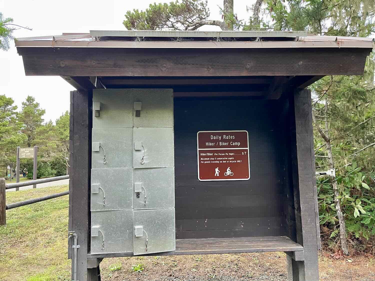
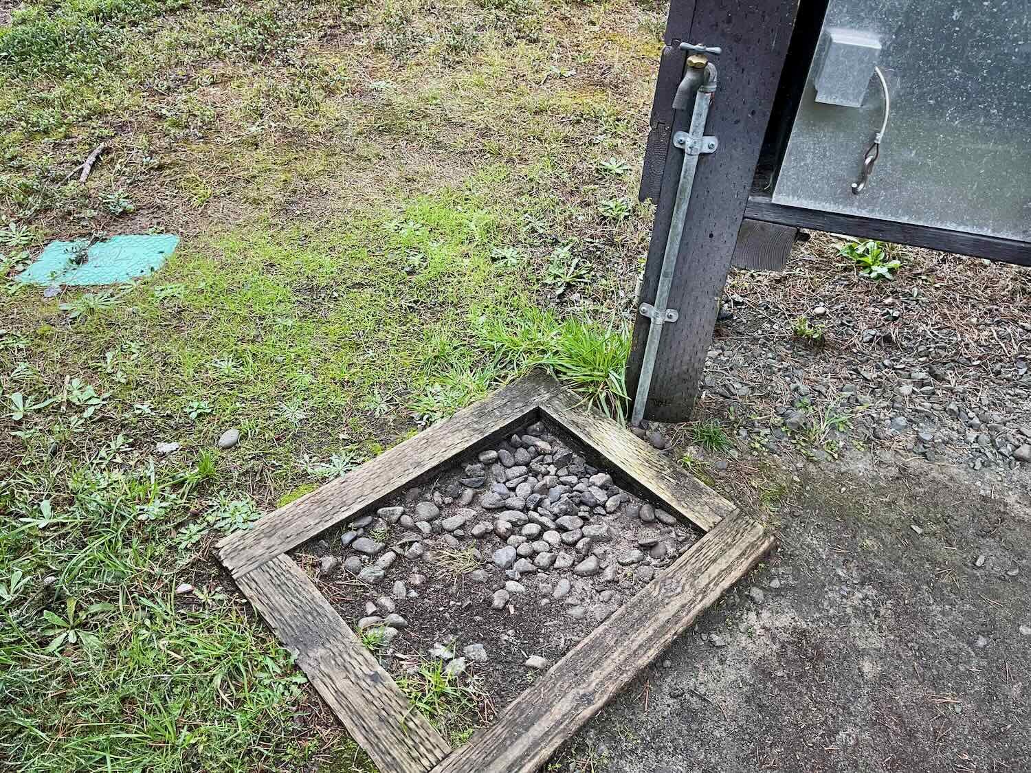
When we arrived at the Bullards Beach State Park campground, we were impressed by the design of the hiker/biker facilities. They were easily some of the best we had seen along the route. A wooden fence enclosed the area, with enough space for 8-10 tents scattered among enough trees and shrubs to provide both shade and a bit of privacy. Most of the sites had their own picnic table and a simple bike rack that made it easy to secure the bikes for safety. On one side, there was a kiosk with a bank of metal food lockers, each one with a power socket inside for charging electronic devices. None of the other campgrounds we stayed at had anything like that. The kiosk also had a bicycle mount on one side, with basic tools for performing bike maintenance. There even was a water spigot right there, as well. (Most hiker/biker camping areas don’t have their own water, so you have to walk some distance to the main campground for water.) And lastly, heated bathrooms with flush toilets were just a short walk away. It was luxurious.
After setting up camp we walked out to the Coquille River, and wandered around the campground to stretch our legs. In the campground, we saw a flock of wild turkeys.
Wild turkeys wandered through the campground. Bullards Beach State Park, Oregon, USA. Copyright © 2019-2022 Pedals and Puffins.
The next day got off to a good start. With our food safely stowed in the metal food locker, no critters disturbed us during the night. And even though a light rain fell a couple of times, the tent was mostly dry in the morning. A true miracle.
It hadn’t felt that cold when we woke up, but a light drizzle began to fall as we cycled the short, 20-minute ride into the town of Bandon. At the same time, the wind speed started to rise. Before long we had a 20 mph headwind, and we started to feel cold.
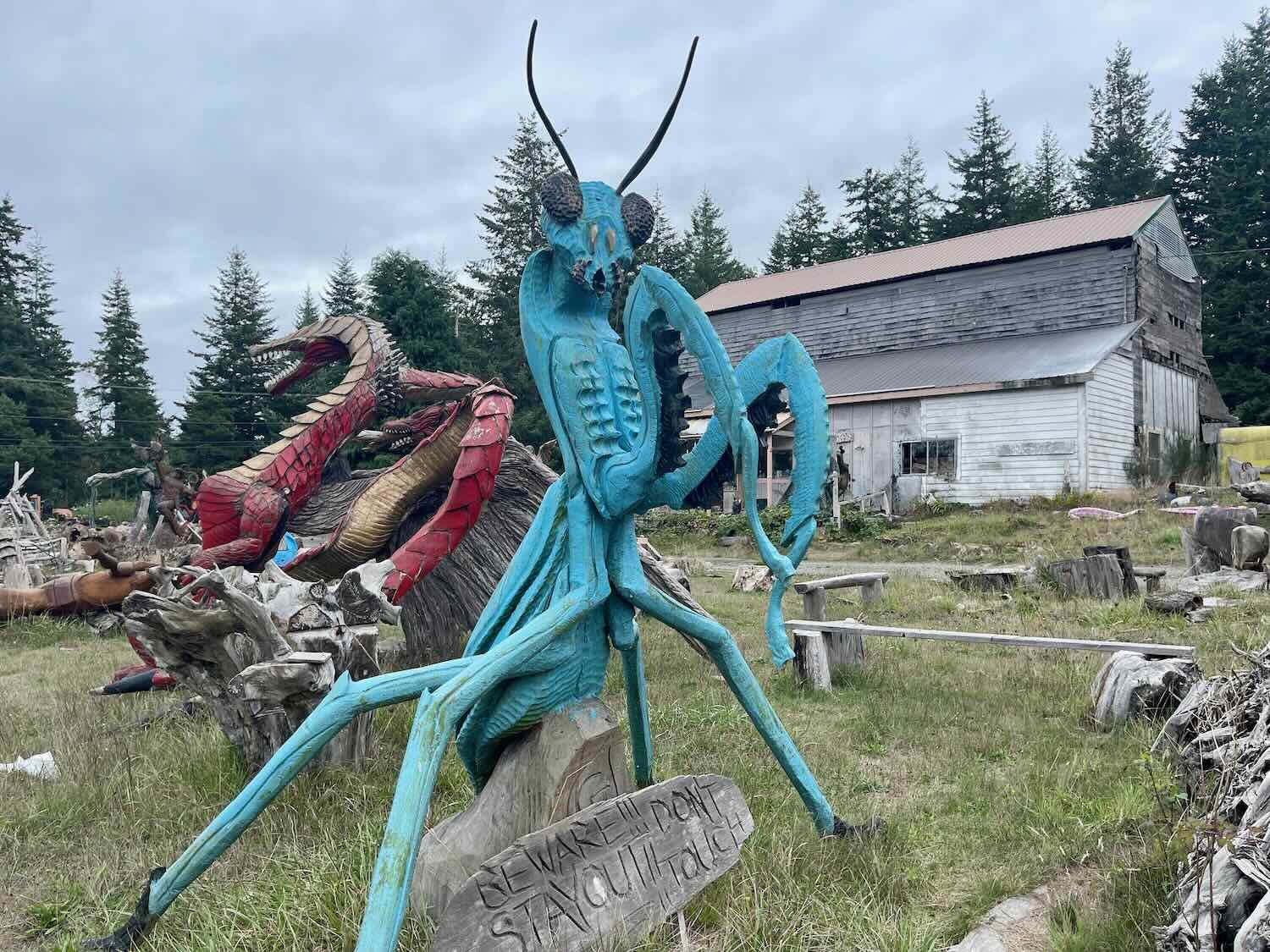
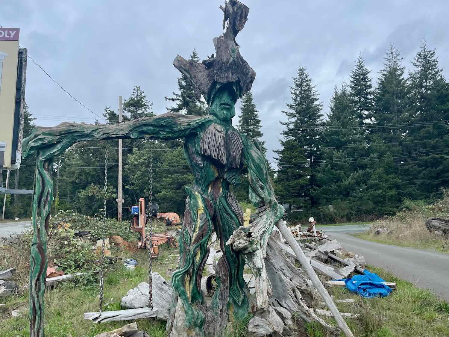
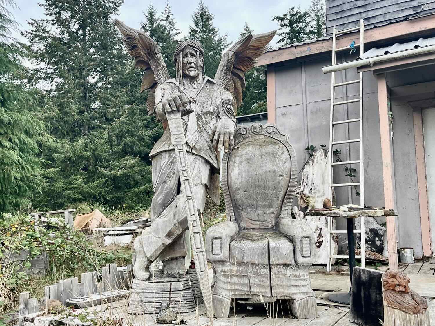
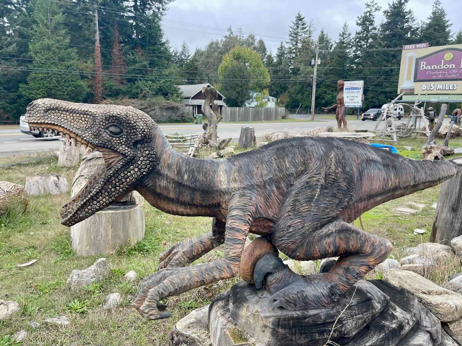
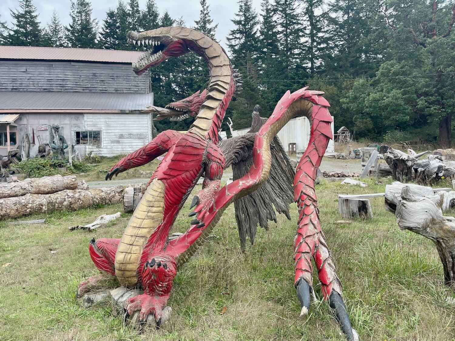
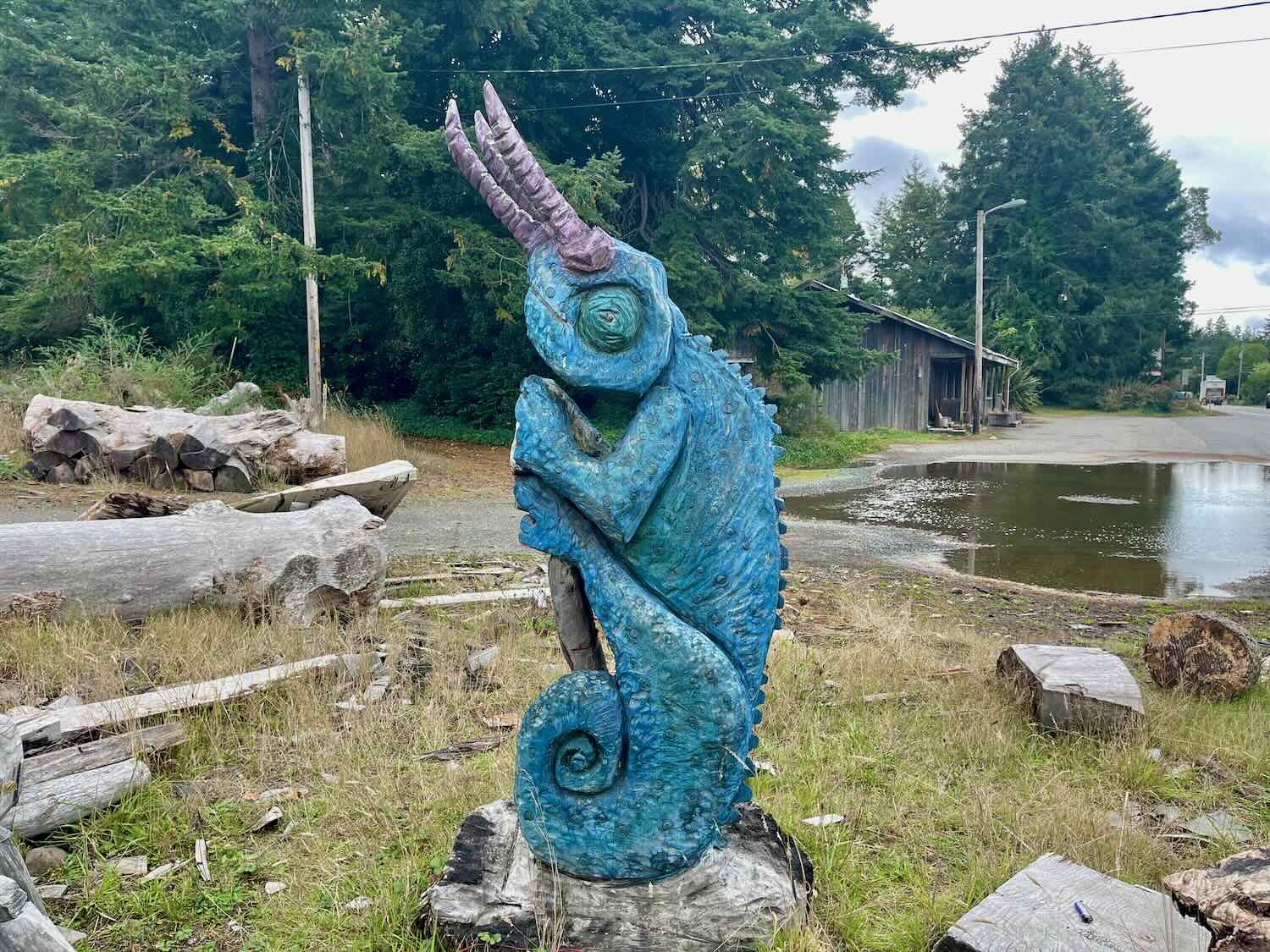
We stopped for breakfast at a restaurant in Bandon, which gave the rain a chance to pass. Back out on the road, the headwind was still blowing but at least we were dry. We stopped to have a look at a fanciful collection of wood carvings populating the yard of a ramshackle gallery.
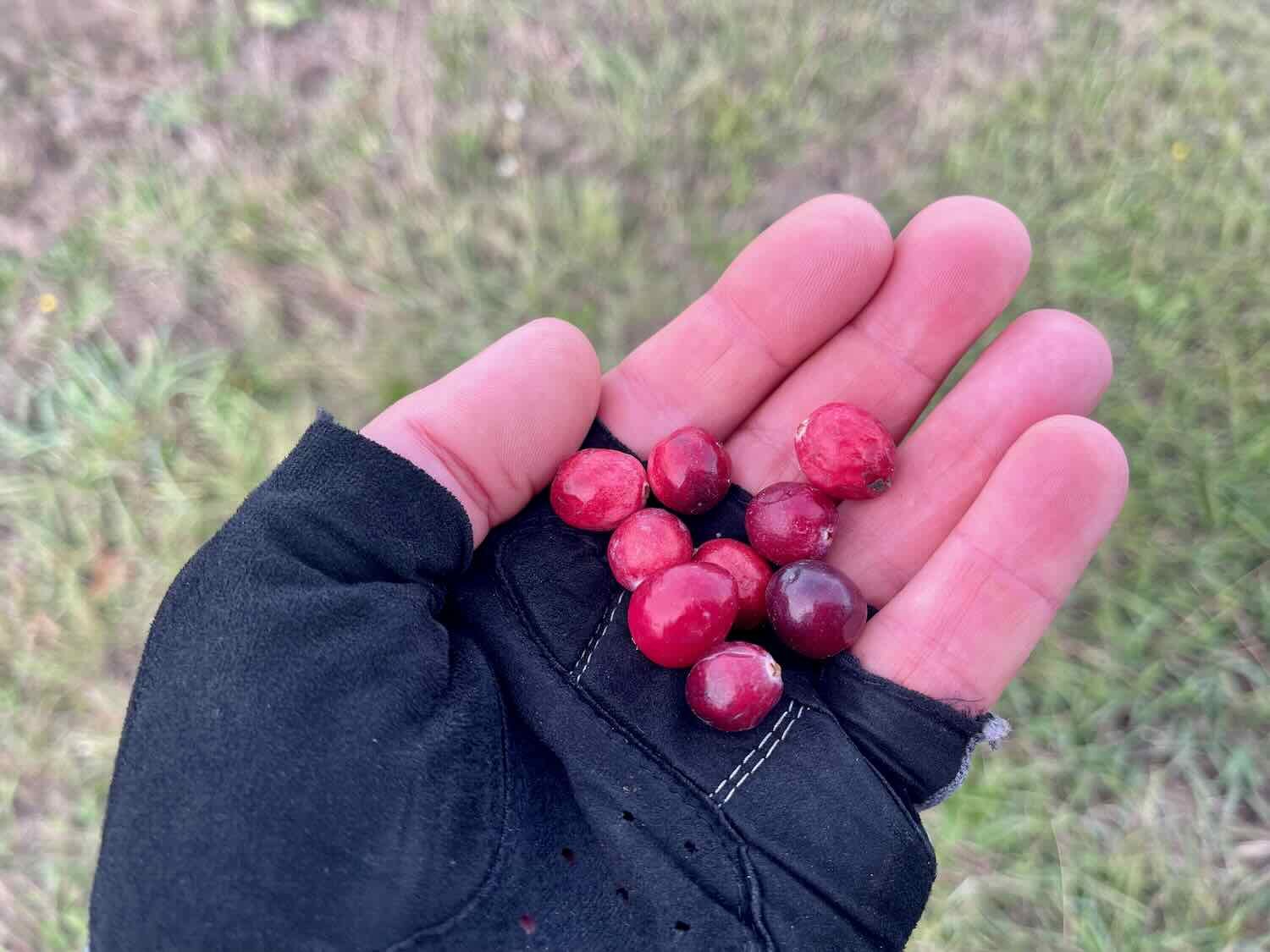
The other notable feature of the day’s ride was that we found ourselves cycling through cranberry country. We passed an Ocean Spray processing plant, and several cranberry farms. And for many miles the road margin was littered with cranberries that had fallen off trucks transporting the berries to the processing plant.

Two young, black-tailed deer out in a field. North of Langlois, Oregon, USA. Copyright © 2019-2022 Pedals and Puffins.
Unfortunately, the good weather didn’t last. By 11am it had started to rain again.
A half hour later we rolled into “world famous” Langlois, Oregon. That title is definitely a bit tongue-in-cheek. Most people have probably never heard of Langlois. And the self-anointed designation is less than 20 years old. Apparently, it stems from a dispute between the town and the Oregon Department of Transportation (ODOT) about the speed limit. In the early 2000’s the residents asked ODOT to lower the highway’s speed limit through town. But after conducting a study, the state agency informed the town that they didn’t have enough “roadside culture” to visually alert people that they were driving through a town. In response, the citizens sprung into action to put up the welcome sign which proclaims the town to be “world famous,” and emphasizing other roadside “attractions” for visitors. For example, you can now eat “world famous” hotdogs at the general store.
Their efforts paid off, and the highway now has a slower speed through town. But the burst of civic pride that stemmed from these events has continued. Langlois now boasts a visitors center, a visitors guide that is distributed up-and-down the coast, and they even own the url “worldfamouslanglois.com.”
But we had more mundane needs when we arrived in Langlois. By then the wind had whipped the rain up into a proper storm. We took refuge under an awning at the local market, hoping to wait for the rain to pass once again. But the weather forecast predicted strong winds and rain for the rest of the day and night. That’s when we decided to shorten our day, and make a hotel reservation in the next town down the road.


With the storm still raging, we put our heads down and pushed the final 14 miles (22.5 km) into the town of Port Orford.
It was nice to see that cyclists were welcome at the motel where we stayed in Port Orford. Oregon, USA. Copyright © 2019-2022 Pedals and Puffins.
We were hugely grateful to get out of the rain. But the check-in process at the motel was complicated by the fact that they were in the middle of a major renovation. The lobby of the motel was in complete disarray because they were installing a cafe. The poor housekeeper was doubling as the receptionist, and juggling too many things at once. She took a while to check us in, because she couldn’t find our room key.
But after a bit of delay we were finally settled in our room. And on the bright side, the wifi at the hotel was blazingly fast - some of the fastest speeds we’ve seen in months.
A lovely painting on the wall above the bed was part of the renovations under way at our motel in, Port Orford, Oregon, USA. Copyright © 2019-2022 Pedals and Puffins.
All afternoon the wind howled and the rain whipped through town. At times it was a proper gale. It was wonderful to be safely indoors.
A Big Day to Brookings, Oregon
The next morning the air had cleared. And although the humidity was very high, there wasn’t as much fog as usual. We could finally see the ocean, which was right across the road from our motel.
The beach at Battle Rock Park, across the road from our hotel. Port Orford, Oregon, USA. Copyright © 2019-2022 Pedals and Puffins.
We enjoyed a wonderful ride on our final, full day of cycling in Oregon. We both felt strong. There was even a bit of a tailwind. If anyone ever tells you that you will mostly get tailwinds while riding southward along the Pacific Coast, don’t believe them. We were about to leave Oregon and this was our first one.
And as the weather cleared we were treated to more spectacular scenery. The road dove up and down from sea level near sandy beaches and marshes, up to headlands with fabulous views. Most of the shoreline was festooned with rock chimneys and sea stacks. It reminded us of the rocky seascapes that are often depicted in oriental art. Sometimes there was a light mist hovering in some of the coves. And the high waves crashed impressively along the cliffs.
A wall of ferns along the road. Humbug Mountain State Park, Oregon, USA. Copyright © 2019-2022 Pedals and Puffins.
Early in the day we spotted a couple of dinosaurs in the forest at the Prehistoric Gardens.
There’s a brachiosaurus in the forest! Prehistoric Gardens, Port Orford, USA. Copyright © 2019-2022 Pedals and Puffins.
The vast majority of the route passed through wild forests, as we cycled through a succession of state parks, recreation areas and state scenic corridors. There was only one town, Gold Beach, where we stopped for lunch.


Celebrating our arrival at Kissing Rock. South of Gold Beach, Oregon, USA. Copyright © 2019-2022 Pedals and Puffins.
It was clear from the heavy layer of moss that we were still in the rainforest. Cape Sebastian State Park. Oregon, USA. Copyright © 2019-2022 Pedals and Puffins.
A flock of buffleheads takes flight near Pistol River, Oregon, USA. Copyright © 2019-2022 Pedals and Puffins.
Along the way we crossed Oregon’s highest bridge. It’s not very long. But it spans a surprisingly deep and narrow canyon, with a shallow stream at the bottom. It seemed odd that the sign for the bridge would need to advise people against diving. But these days people seem keen to “BASE jump” off of just about anything.


We managed to cycle the 56+ miles (90+ km) to Brookings and still arrive before dark, even with numerous photo stops along the way. As we pedaled into town we passed a cluster of cell towers. We hoped that would translate into good reception - and maybe even good wifi speeds - for yet another rain delay over the next couple of days.
Mobile reception should be pretty good. There was a forest of cell towers as we entered town. Brookings, Oregon, USA. Copyright © 2019-2022 Pedals and Puffins.
For the next two days we remained indoors while the rain fell in buckets and a cold wind blew. About three inches of rain fell while we were there. In case you don’t follow the weather much, rest assured that three inches of rain in two days is more than enough to keep the campgrounds clear of people, the raiding raccoons hungry, the hikers taking refuge in bathrooms overnight, and sane cyclists off the roads.
It’s Been a Wild Ride
We’ve thoroughly enjoyed our ride down the Pacific Coast Route in Oregon. From our perspective, the natural beauty of the rugged coastline just continued to increase as we made our way southward. Much of the region has been protected in parks, yielding unparalleled cycling along unspoiled cliffs, beaches, and marshes, while the lush, green, temperate rainforests exude a quiet sense of mystery. By traveling in the off season, we benefitted from tranquil campgrounds, small crowds, and reasonable hotel rates. Even the storms that battered the coast provided an atmosphere of misty adventure, complemented by beautifully fierce seas with pounding surf.
The downside was that it took us twice as long to cycle across Oregon as we had hoped. For each day of cycling, there was a day where we were hunkered down in a hotel room, as storms raged outside. We hoped that the weather would improve when we crossed into California, to start the next leg of our journey.