Baja Divide, Part 1: Cycling from San Diego, California to Vicente Guerrero, Baja

11 -28 January 2023
Prologue: Getting to the Start of the Baja Divide
11 Jan - Encinitas to San Diego, CA (44.0 mi, 70.8 km)
Baja Divide Section #1
12 Jan - San Diego to Otay Mountain Wilderness, CA (24.0 mi, 38.6 km)
13 Jan - Otay Mountain Wilderness, CA to Tecate, Baja (23.7 mi, 38.1 km)
14-17 Jan - Rain Days in Tecate, Baja
Baja Divide Section #2
18 Jan - Tecate to Sierra Juarez Wild Camp #1, Baja (20.6 mi, 33.2 km)
19 Jan - Sierra Juarez Wild Camp #1 to Wild Camp #2, Baja (32.2 mi, 51.8 km)
20 Jan - Sierra Juarez Wild Camp #2 to Ojos Negros, Baja (23.0 mi, 37.0 km)
21 Jan - Layover in Ojos Negros
Baja Divide Section #3
22 Jan - Ojos Negros to Sierra Juarez Wild Camp #3, Baja (23.9 mi, 38.5 km)
23 Jan - Sierra Juarez Wild Camp #3 to Santo Tomás, Baja (25.2 mi, 40.6 km)
Baja Divide Section #4
24 Jan - Santo Tomás to Ejido Eréndira, Baja (28.4 mi, 45.7 km)
25 Jan - Ejido Eréndira to Punta Colonet, Baja (25.4 mi, 40.9 km)
Baja Divide Section #5
26 Jan - Punta Colonet to Vicente Guerrero, Baja (29.0 mi, 46.7 km)
27-28 Jan - Layover in Vicente Guerrero, Baja
Baja California, A Place Like No Other
Glance at any map of Mexico, and there is an unusual feature that draws your eyes to the west. A thin sliver of land appears to have been torn away from the country’s western coast, hanging on to the mainland by a thread at its northern end. You get the feeling that if you could grab the tip of the peninsula and drag it to the southeast, that it would snap back into place with the rest of Mexico. Cabo San Lucas would sit next door to Puerto Vallarta. And the deep blue Gulf of California would disappear.
That’s how Mexico would have looked about 8 million years ago. But since then, this strip of land has been pulling away from the North American tectonic plate, and sliding northwestward at a rate of about 2 inches a year. As the earth cooled towards a series of ice ages, and our first human ancestors began walking on two legs in Africa, Baja California went its own way. Due to its long isolation from the mainland, some of the most unique and fascinating ecosystems in the world have evolved here. As nature enthusiasts, we were eager to see some of the weird and wonderful plants and animals that call Baja home.
Baja California is drifting away from Mexico at a rate of nearly two inches per year, creating an isolated peninsula with species found nowhere else in the world. (Our route on the Baja Divide is shown in red.). Copyright © 2019-2023 Pedals and Puffins.
We were also looking forward to getting back on the dirt. Our decision to ride Tumbleweed mountain bikes had been based on an assumption that we would be traveling long distances on unpaved back roads. But in our effort to outrun the onset of winter, we elected to cycle southward on mostly paved roads for the past several months. In Mexico that would change, as we set our sights on conquering the Baja Divide bikepacking route.
The Baja peninsula is long. At 760 miles (1,220 km), it’s longer than the boot of Italy. But the Baja Divide doesn’t take the straightest route. It criss-crosses back and forth, several times, from the Pacific Ocean to the Gulf of California - often crossing steep mountains and ravines on unforgiving, unmaintained, rocky dirt roads. So by the time we complete the route, we will have cycled nearly 1,700 miles (2,700 km) - with 95% of that on unpaved roads. Without a doubt, our rides were about to become a lot more remote, exotic, and challenging.
But first we had to get to the starting line.
Prologue: Getting to the Start of the Baja Divide
We had spent the Christmas and New Year’s holidays in Encinitas, California - planning ahead and prepping our gear for the transition back to dirt roads. That meant we still had about a day’s ride to reach the official start of the Baja Divide route, which begins at the San Diego Airport.
So in January 2023 we spent one, last day of cycling on the Pacific Coast Bicycle Route in California. We’d only been on the road for about a half hour when we noticed a big congregation of cars and trucks near one of the beaches, and heard a voice coming over a loudspeaker. A sign announced that this was a World Junior Surfing Championship event. We just had to stop and check it out.
An elevated booth was set up at one end of the parking lot, where the announcers and judges could get a good view of the surfers. The rest of the beachfront was lined with photographers peering through massive lenses, plus a crowd of friends, family, coaches, and curious onlookers like us. Unfortunately, the waves were breaking very far out on the water. So the competitors were a long distance away, and hard for us to see. After watching only a couple of runs, we headed down the road.
The onshore crowd waits and watches for the surfers to catch a wave at the World Junior Surfing Championships. Cardiff State Beach, California, USA. Cardiff State Beach. Copyright © 2019-2023 Pedals and Puffins.
Our route hugged the shoreline near Point La Jolla, where we stopped to watch the high tide send waves crashing through Sunny Jim sea cave. Point La Jolla Cove, La Jolla, California, USA. Copyright © 2019-2023 Pedals and Puffins.
At Point La Jolla, we were captivated by the remarkable performances of a group of Brandt’s cormorants that were nesting close to the pedestrian walkway. A couple of the nesting pairs had already laid eggs. But most of them were still in the process of courting, or trying to attract a mate. The males put on a particularly dazzling display by tilting their heads backwards and showing off the bright blue skin on the underside of their bill, while pointing their tails upwards and fluttering their wings. It was really beautiful, and a thrill to watch.
A male Brandt’s cormorant strikes a pose, hoping to win the heart of a female. La Jolla Cove, California, USA. Copyright © 2019-2023 Pedals and Puffins.
A pair of Brandt’s cormorants tend their precious egg. La Jolla Cove, California, USA. Copyright © 2019-2023 Pedals and Puffins.
One of the reasons we had lingered so long in Encinitas was the rain. Over the new year, and into the first couple weeks of January, California was hammered by a series of intense rain events. Meteorologists were working overtime to report on all of the wind, flood, wave and landslide damage caused by an “atmospheric river” that swept exceptional levels of moisture onto the coast. While most of the chaos took place north of our location, we still got a big dose of rain in the San Diego area.
South of La Jolla, we caught a glimpse of some of that damage. Large puddles still covered parts of the Ocean-Front Walk at Mission Beach, where we saw signs that sand had been washed up into the alleys between buildings, and evidence that some of the waterfront businesses had been flooded. A bull dozer was out on the beach, re-distributing sand that had accumulated in a drift along the sea wall.
A still-flooded section of the Ocean-Front Walk at Mission Beach. Recent, heavy rains and high seas had brought sand and seawater up to the houses and storefronts that line the waterfront. Mission Beach, California, USA. Copyright © 2019-2023 Pedals and Puffins.
An Urban Beginning to the Baja Divide
Before long we reached the San Diego Airport, and the official start of the Baja Divide.
The route skirted the northern edge of San Diego Bay, with the city’s high-rise skyline visible across the water. Harborview, San Diego, California, USA. Copyright © 2019-2023 Pedals and Puffins.
Heading for San Diego’s hip Gasslamp Quarter, we stopped to admire some of the big ships on display along the Embarcadero. A diverse array of ships can be seen there, ranging from the elegant, 19th century Star of India (the world’s oldest, still active sailing ship) to the colossal USS Midway (one of the country’s longest-serving aircraft carriers). It’s a great way to appreciate, first hand, the astonishing ingenuity and rapid innovation in shipbuilding over just a few generations.


Gradually, the touristy areas of the Embarcadero gave way to a more industrial landscape. We cycled past the giant shipyard at Naval Base San Diego, where we saw the tops of massive ships peeking over a perimeter wall that was several stories high.
Our timing was a bit unfortunate, though. We ended up passing the 4-mile long shipyard in the middle of a shift change. The naval base employs roughly 35,000 people. Consequently, hoards of workers carrying hard hats streamed out of the gates of the shipyard just as we arrived. Some of them gathered in crowds along our path, heading for public transportation. Others piled into cars that jostled for street access with incoming vehicles that carried the next shift’s workers. We had to stay on high-alert to avoid colliding with the mobs of pedestrians and cars.
The main gate at Naval Base San Diego. California, USA. Copyright © 2019-2023 Pedals and Puffins.
Then we turned onto a bike path that followed the Sweetwater River. In the blink of an eye, the crowds vanished. The “river” was confined within a man-made, concrete channel. But it still offered a quiet haven for both people and wildlife. For the final half-hour of our ride we felt the stress melt away. There were large groups of ducks and shorebirds in the river, with a surprising amount of diversity. Even though it was starting to get late in the day, we took the time to enjoy watching the birds for a while, before heading for a hotel in Chula Vista for the night.
A redhead duck floats on the Sweetwater River. Chula Vista, California, USA. CA. Copyright © 2019-2023 Pedals and Puffins.
The next morning got off to a rough start. Just as we were getting ready to leave the hotel, PedalingGal got very sick. She stood up to leave, and suddenly became extremely dizzy and nauseous. Our best guess is that it was a reaction to something she ate for breakfast. It was more than an hour before she started to feel well enough to get back on her bike. And she still wasn’t 100% for the rest of the day.
The day’s ride started along the Sweetwater River greenway. But the character of the trail was totally different from the day before. The concrete channel and paved trail were gone. We rode along mostly dirt paths through riparian woodlands.
Negotiating a narrow boardwalk on the Sweetwater Park Trail. Chula Vista, California, USA. Copyright © 2019-2023 Pedals and Puffins.
At the edge of the city we rode up a gentle incline to the foot of Otay Mountain. We would later learn that just four days after we passed through, this road was closed due to flooding as more wet weather soaked the San Diego area. But for us it was a sunny, pleasant ride.
Staying One Step Ahead of Disaster
The news that we had just made it through this section before the road was closed got us thinking about all of the times since beginning this trip that we had squeaked through an area, just before conditions took a turn for the worse. Here are some of the ones we know about:
The Dalton Highway, Alaska. We cycled through an area known as Finger Mountain, with forest fires visible from the road. A few days later, a couple traveling in an RV told us that authorities had closed the road due to heavy smoke, shortly after we had passed through.
Jasper, Alberta. When we arrived at the Whistler Campground in Jasper National Park, we were told that we could only stay one night because the campground was closing the next morning, until further notice. The reason for the closure was a massive, regional power outage caused by a wildfire. We dashed into Jasper to buy some badly-needed supplies from the only supermarket that was still open for business - competing with other shoppers for the last few items on the shelves. The next morning, we had to leave, as the town and campground officially shut down behind us.
The Cascade Mountains, Washington. We cycled across these mountains on the North Cascades Highway in mid-October. Just over two weeks later, the road we had used experienced its first snow closure. And less than three weeks after we had passed through, the road was closed for the season due to heavy snow. Snow-mobiles only!
Big Sur, California. The coastal highway through Big Sur is known for being vulnerable to landslides caused by big storms. In fact, our trip was delayed for several days while we waited for a rockslide to be cleared from the road. But we were lucky. The day after we made it through Big Sur, heavy rains closed the road again. And the “atmospheric river” event that drenched northern California in the winter of 2022/2023 brought even more carnage. As of this writing, the coastal highway through Big Sur was still closed.
Humboldt County/Santa Cruz/Santa Barbara, California. All of these areas were severely impacted by the 2022/2023 heavy rains. Based on news reports, many sections of the Pacific Coast bicycle route were probably impassible at times due to flooding. This all occurred within weeks of our travel through the area.
Otay Lakes Road, San Diego, California. On the first segment of the Baja Divide, this road was closed due to flooding just four days after we rode through.
Tecate to Ojos Negros, Baja, Mexico. Several days after we crossed the highest point on the Baja Divide, the Sierra Juarez Mountains received 6 inches (15 cm) of snow.
Reflecting on all of these brushes with disaster (or at least significant inconvenience), we are extremely grateful to still be out on the road and feel that luck has been on our side.
Into the Wilderness - No One Said It Would Be Easy
At the foot of Otay Mountain there was a large RV park with a well-stocked convenience store, where we stopped to fortify ourselves for the climb ahead. From there, the route runs 12 miles through the remote Otay Mountain Wilderness, an area containing some of the tallest mountain peaks in the region. Once we entered the wilderness area, we were passed by a few border patrol trucks. But overall we would experience a deep sense of solitude, with only distant views of the cities to our west, and almost no sounds except the gusts of wind rustling through the grasses and sage.
The Baja Divide heads straight for the wilderness, on a dirt road that climbs rapidly up into the mountains. Otay Mountain Wilderness, California, USA. Copyright © 2019-2023 Pedals and Puffins.
But as we got ready to head up the hill, we hit a snag. There was a gate across the road that we were supposed to take, and it was locked. Some scouting of the fence surrounding the road proved unhelpful. There didn’t seem to be any good places to get through the fence that didn’t require heavy lifting, crawling and/or negotiating around barbed wire. Unsure how to proceed, we even considered whether we should take a long detour on the paved road around the mountain. As we were standing near the gate, bemoaning the possibility of having to unload our bikes and lift them over, a savior came along. A guy who worked in the RV park rode up on a golf cart and told us that we could just go into the store and ask “the ranger” for the combination to the lock. It was almost too good to be true. But PedalingGuy went inside, got the code, and voilà, we were in. But we had lost a lot of time pondering how to get over or around the gate.
In hindsight, it’s probably just as well that we didn’t realize how difficult this first segment of the Baja Divide would be. The trail notes for the Baja Divide state that “the first part” of the climb up Otay Mountain is steep. And, yes, the first half mile is particularly brutal, maxing out at a 20% gradient. We had expected this. So we gamely pushed our bikes up the hill, fully expecting things to get easier just around the next bend. The trail notes also refer to the route as following a “well graded” gravel road. But the heavy, recent rains had significantly degraded the road surface, exposing plenty of drainage ruts and stones. When combined with the steep gradient, the damaged road surface became particularly difficult to ride. We were in for a real adventure.
Pushing a bike up the initial hill, with the RV park still visible in the valley below. Otay Mountain Wilderness, California, USA. Copyright © 2019-2023 Pedals and Puffins.
Our confidence was boosted when, after the initial, steep hill, the road moderated to a still-tough-but-manageable gradient of about 8.5%. We hopped onto our bikes, and pedaled slowly up the mountain.
Getting in some actual bike riding. Otay Mountain Wilderness, California, USA. Copyright © 2019-2023 Pedals and Puffins.
Although the locked gate kept most cars except for border patrol off the road, the sky above us was much busier. Border Patrol helicopters flew by frequently. Most of the time they proceeded quickly, at an altitude well above the surrounding landscape - as if they were just passing through. But a couple of times the helicopters flew by slowly, very low, just above the trees in the deep, narrow canyons. Several passed close enough overhead that we could wave to the occupants. They were definitely keeping an eye on things.
US Customs and Border Patrol helicopter, patrolling the uninhabited lands along the US-Mexico border. Otay Mountain Wilderness, California, USA. Copyright © 2019-2023 Pedals and Puffins.
But the rideable terrain didn’t last very long. Pretty soon the ascent kicked back into high gear. For the rest of the day the gradient rarely dropped below 10%, with many sections pressing 15%. The road snaked along on a small shelf, with the terrain rising steeply to our left, and falling off precipitously to our right. Hairpin turns had convex mirrors installed, allowing motorists and cyclists to spot oncoming traffic around the blind corners. This was particularly helpful, because most of the road was too narrow for two vehicles to pass each other. Having some advance warning about oncoming traffic was definitely a necessity.
Cliff edge along the narrow road up the mountain. Near this spot we saw a car at the bottom of the ravine, that had apparently run off the road some time in the past. Otay Mountain Wilderness, California, USA. Copyright © 2019-2023 Pedals and Puffins.
Dozens of hairpin turns were equipped with convex mirrors so drivers could see around the blind corners. Otay Mountain Wilderness, California, USA. Copyright © 2019-2023 Pedals and Puffins.
In the end, we pushed and sometimes rode our bikes up the mountain. It took forever - clocking three hours to travel about four miles (6.4 km). By this time we really regretted our late start in the morning due to illness, plus the time we had spent trying to figure out how to get through the gate at the bottom of the mountain. It didn’t help that PedalingGal was still not quite herself after the bout of nausea.
Pushing up the mountain some more. Otay Mountain Wilderness, California, USA. Copyright © 2019-2023 Pedals and Puffins.
As we climbed higher and higher, the view back towards San Diego, La Jolla, and Tijuana got more expansive and stunning. It’s not easy to capture the vast expanses in a photo, but we hope these images start to convey some of the feeling we experienced of being at the top of the world.
In the evening twilight we reached nearly 2,500 ft (760 m) above sea level. San Diego, the Lower Otay Reservoir, and and the Pacific Ocean can be seen in the background. Otay Mountain Wilderness, California, USA. Copyright © 2019-2023 Pedals and Puffins.
With two miles still to go to the top of the climb, the sun was getting pretty low on the horizon. It was clear we would not make it over the pass before dark. So we started looking for a place to camp. We headed up a small side road that followed a line of electrical utility poles until we found a level spot.
Darkness was setting in, and a stiff breeze was blowing. In addition, the terrain was very hard and rocky, making it tough to drive tent stakes into the ground. For the first time in six months of bike travel, we decided to “cowboy camp” - that is, to sleep without a tent. Most of the time passing through Alaska and Canada there were too many biting insects to even consider not using the tent. Other places were too public or were very moist, so that even if it didn’t rain you would be soaked by dew in the morning without a tent. We seemed to finally find the perfect conditions for sleeping under the stars just when we needed it. Keeping it simple, we staked down a ground cloth in the middle of the utility road, and spread our sleeping bags out on top.
Our “cowboy camp” on a ground cloth, along a quiet service road. Otay Mountain Wilderness, California, USA. Copyright © 2019-2023 Pedals and Puffins.
As night fell, the view from our campsite was breathtaking. We could see the glow of lights from San Diego and Tijuana, across the border in Mexico. Between us and the city, an expanse of pitch-black, unlit wilderness stretched towards the flanks of the mountain. In the silence of a winter desert night, we rested our weary legs.
The lights of San Diego and Tijuana glow on the horizon. Otay Mountain Wilderness, California, USA. Copyright © 2019-2023 Pedals and Puffins.
As we set up camp in the darkness, it took longer than usual to do even simple things. Complicating matters, this was our first night using the new alcohol stove. We had sent our trusty WindMaster canister stove back home, with the expectation that fuel canisters would be hard to come by in Latin America. Now we had to figure out how to cook on a whole new system. But PedalingGuy actually got the flame going pretty quickly in the dark. A hot, hearty dinner did us both good.
As we ate, the helicopters continued to pass back and forth in the dark. But before we were ready for bed, they stopped. The only sounds we heard for the rest of the night came whenever the wind would kick up, rustling the nearby vegetation. But just as quickly, the wind would die down again to a complete calm. The night passed peacefully. It felt good to just lie there under the stars. For nearly 10 hours, we both slept really well.
Into Mexico
It took some effort to get ourselves going in the morning. We had only 25 miles (40 km) to go for the day, with a lot of it downhill. So we took our time getting ready. But once again, we underestimated how hard the cycling on the Baja Divide route would be.
We had about 2 miles remaining before we would reach the top of the pass, at a place called Doghouse Junction. Fortunately, the gradient at the top was a smidgen less steep. With our slightly fresher legs we were able to cycle most of the distance to the top. With only short sections of pushing, we covered the last two miles in just over an hour - a huge improvement from the day before.
The final push to the top of the pass. Otay Mountain Wilderness, California, USA. Copyright © 2019-2023 Pedals and Puffins.
Both of us were thrilled to finally make it to the top of the pass. Doghouse Junction, Otay Mountain Wilderness, California, USA. Copyright © 2019-2023 Pedals and Puffins.
Starting the descent down the far side of Otay Mountain, with Tijuana Mexico in the distance. Otay Mountain Wilderness, California, USA. Copyright © 2019-2023 Pedals and Puffins.
The ride down the far side of Otay Mountain was also VERY steep. We had to rely on our brakes a lot, so we stopped every so often to enjoy the view while we let our brakes cool off.
Barreling down the road from Doghouse Junction. Otay Mountain Wilderness, California, USA. Copyright © 2019-2023 Pedals and Puffins.
A characteristic of the mountains in this area is how they rise up steeply from the surrounding lowlands, in what are called “sky islands.” These “islands” of mountain habitat often contain rare species. Here, the sky islands of the San Ysidro Mountains fade into the distance. Otay Mountain Wilderness, California, USA. Copyright © 2019-2023 Pedals and Puffins.
Our little road continued to hug the sides of steep-sloped mountains, with deep ravines in between. Otay Mountain Wilderness, California, USA. Copyright © 2019-2023 Pedals and Puffins.
A California thrasher was one of the few birds we heard singing. Otay Mountain Wilderness, California, USA. Copyright © 2019-2023 Pedals and Puffins.
As we got close to the end of the dirt road, we started seeing signs warning us of a “dead end, locked gate.” Of course, that was not a good sign. We didn’t have any other route options. So we pressed forward hoping that the gate, if indeed locked, would take the same code that we had used to get through the gate at the start of the climb into the mountains.
We did not like the message on this sign. Locked gates are a huge hassle for people on fully-loaded bicycles. Otay Mountain, California, USA. Copyright © 2019-2023 Pedals and Puffins.
When we got to the gate, we were not happy to find that it was, in fact, locked. Worse, the code we had used on the previous gate didn’t work. A quick look around confirmed that there were no good ways to get through the barbed wire. It was looking increasingly like we might have to lift our bikes over this one.
But we weren’t quite ready to accept that fate just yet. We tried fiddling with the lock, hoping that it might be some easy-to-guess variation of the combination of numbers from the previous lock. As we were trying out different combinations, luck smiled upon us. A border patrol official just happened to drive up the remote dirt road where we were. He saw us, stopped his truck, and got out to help. To our great relief, he gladly came and unlocked the gate for us. It was awesome. We were back on our way.
But although we were back on the pavement, the cycling didn’t get much easier. Of course, a big part of it was that our legs were already tired from the monumental climb the day before. But we also had well over 1,000 ft (305 m) of steady climbing at gradients of 6%-8% ahead of us. Compounding the challenge, there was almost no shoulder on the very busy highway. Cars whizzed by us at unpleasantly fast speeds (up to 70 mph), while we struggled to hold our line on the slow grind to the top. With the exception of a glorious 1.5 mile (2.4 km) section where we were able to take a car-free side road, we had no choice but to cycle on the highway. We put our heads down and pushed forward. It was stressful and exhausting. After nearly 1.5 hours of this, PedalingGal couldn’t take it anymore. We stopped in a gravel pull-out so she could collect herself and regain some strength. Then forced our way up the final stretch to the top.
From there, a swift, two mile descent to the border helped us recover, both physically and psychologically. The border crossing, while slightly confusing, was actually not too bad. There wasn’t a stop for US Customs. At the Mexican customs gate, the agents didn’t require us to open our panniers, except for the handlebar bags. We then proceeded to the Mexican immigration office, where the border agent asked us if we were planning to stay in Mexico more than 10 days. When we said, “yes,” we were relieved that he automatically issued us 180-day visas, because we had heard that shorter, 90-day visas had also been issued recently (and 90 days would have been too short for the route we hoped to take across the country). There wasn’t any fuss. After paying for our visas and getting our entry stamps, we were officially in Mexico.
Welcome to Mexico! Our border crossing went smoothly. Tecate, Baja California, Mexico. Copyright © 2019-2023 Pedals and Puffins.
By the time we cleared the border it was already 3:30 in the afternoon, and we still had three very slow miles to go before reaching our hotel. We discovered that Tecate, Mexico is VERY hilly, with many streets plunging up and down through narrow ravines and over rocky hills. We made a quick stop at a bank to get some pesos, then cycled the steep, neighborhood roads - arriving at the hotel in the fading light.
Rain Days in Tecate, Mexico
We ended up spending four days at the hotel in Tecate, due to another bout of heavy rain. Every day it rained in buckets - with over four inches of rain (10+ cm) falling during our stay. There was no way we could have cycled on the dirt roads of the Baja Divide with all of that rain. In fact, it was this set of storms that closed the road from San Diego to Otay Mountain, where we had passed just a few days before.
PedalingGal looks longingly out a window at the hotel, watching the rain coming down. Tecate, Baja California, Mexico. Copyright © 2019-2023 Pedals and Puffins.
The Hotel Hacienda Santana was a pretty interesting place to stay. It’s a historic building that was used by Tecate’s town fathers, the Santana brothers, as a lodge and cantina in the early 20th century. The hotel is lovingly decorated with antiques from that period. It was a lot like staying in a historic Portuguese posada.


While we waited out the storms, we frequently ate at the delightful Pueblo Nuevo restaurant across the street. No matter what time of day we went over for a meal, the restaurant was crowded with locals - always a good sign. Tecate, Baja California, Mexico. Copyright © 2019-2023 Pedals and Puffins.
The Heights of the Sierra Juarez
The rain finally ended. We actually considered delaying our departure one more day, because there were still huge puddles everywhere from the recent storms. But we were itching to get going. So, we packed up and hit the road.
The Sierra Juarez Mountains that lay in our path were quite distinctive. The hillsides were strewn with over-sized, smooth, granite boulders, thrust upward when the Pacific and North American tectonic plates collided. Millenia of cracking and weathering have softened the appearance of these boulders into rounded blobs - but looks are deceiving. This is a hard and challenging landscape where few people travel, and even fewer try to make a living.
The rocky, boulder-strewn hills of the Sierra Juarez. Tecate, Baja California, Mexico. Copyright © 2019-2023 Pedals and Puffins.
The next couple of days of cycling would take us way up into the backcountry of the Sierra Juarez. In fact, in the first few days we would cross the highest point on the Baja Divide route - more than 4,700 ft (1,400 m) above sea level. There was no time to ease into it. Right out of the gate, we needed to be prepared for some of the toughest cycling on the entire route.
Just over an hour into the ride, we turned off of the main highway and onto the dirt. As we progressed, the road surfaces changed continuously. Sometimes steep, sometimes flat. Sometimes deeply rutted and rocky, and sometimes almost smooth. The recent, heavy rains probably made any existing ruts in the road quite a bit worse. There were a surprising number of water crossings, which would likely have been dry in most other years. And there were large, muddy puddles wherever the road had a low spot. Some of the puddles covered the entire road, from one side to the other. The murky water in the puddles made it tough to judge how deep they were. It wasn’t always easy to decide whether to cycle through the water or bushwhack around it. Sometimes bushwhacking wasn’t an option because of dense vegetation or a barbed wire fence, in which case we would take our chances with cycling though the water.
The recent, heavy rains had probably deepened the existing ruts on our road up into the mountains. Sierra Juarez, Baja California, Mexico. Copyright © 2019-2023 Pedals and Puffins.
Trying to keep shoes dry while crossing a small stream. Sierra Juarez, Baja California, Mexico. Copyright © 2019-2023 Pedals and Puffins.
The puddles in the road were frequent, and deep. Sierra Juarez, Baja California, Mexico. Copyright © 2019-2023 Pedals and Puffins.
Then, about three hours into our ride, we saw two guys who had ridden past us on loaded motorbikes heading back in our direction. One of them stopped to tell us that a stream up ahead was running high, and that they had been unable to get across. They were abandoning their trip. He cautioned us to be careful.
We continued down the trail, hoping that perhaps we could carry the bikes across the stream. Both our SON dynamo hubs and Rohloff internal-gear hubs don’t like being submerged in water for very long. That makes water crossings challenging if they are much more than a foot deep. We hoped that our day’s ride wouldn’t end there.
When we arrived at the stream, it definitely looked deep at the road crossing. PedalingGuy scouted along the banks, both upstream and down, looking for a more shallow area for us to cross. He discovered a gravel island that split the stream in two. Using a stick, PedalingGuy tested the depth of the stream on both sides of the island, and fortunately it wasn’t too deep. So he rolled up his leggings, changed into a pair of sandals, and heroically carried our heavy bikes and gear across the stream. Our journey would continue after all.
Carrying our bikes across a swollen stream. Anything deeper than about a foot of water is a problem for us, because our Rohloff and SON hubs don’t like being submerged. Cañon Manteca, Sierra Juarez, Baja California, Mexico. Copyright © 2019-2023 Pedals and Puffins.
When we had just about half of our gear across the stream, a side-by-side came up the road carrying a full family of five, plus their dog. Each family member got out of the vehicle and greeted us with a handshake. They seemed surprised to encounter anyone in this out-of-the-way location. They stopped at the stream crossing to generously make sure we were doing okay, and that we didn’t need any help. They even offered to carry a bike across the stream in their vehicle. But we were almost done, and we weren’t sure how good the driver was at stream crossings, so we declined. They then got in their vehicle and powered through the water, waving good-bye from the far side. After watching them go, we were glad we hadn’t attempted to take our bikes through the stream at the road crossing. The water there was deep enough to wash up inside of their vehicle.


Early in the day we had seen hardly anyone on the dirt road. But in the afternoon things got busier. We got the feeling that lots of folks were itching to get out in the backcountry after waiting out the rain.
First there were the two guys on motorcycles and the family in the side-by-side. Soon after that we were overtaken by a guy on a motorbike who stopped to talk. Kevin was from Tucson, and fulfilling a bucket-list dream of motor biking down to the tip of Baja. He had come across the Baja Divide bicycle route on the internet, and decided that it looked like fun on a motorbike. Later we were passed by a caravan of 5-6 overlanding-type pickup trucks, and another half dozen motorbikes, probably all local folks from Tecate.
Most of the landscape was pretty wild, with little evidence of people besides the occasional barbed-wire fence. But every so often the land would open up into a high valley. And these flatter areas invariably showed signs of human use. Typically there would be a few rough-around-the-edges, highly weathered buildings, a lot of fences, and a sign proclaiming the name of a ranch. But most of the buildings appeared to be unoccupied. They were likely only used seasonally, when running cattle in the highlands. There were even a couple of signs advertising “cabañas,” implying a desire to attract tourists. However, we didn’t see any evidence that such services were actually available.
The few areas of flat land in the mountains seemed to invariably be part of someone’s ranch, with a sign by the road proclaiming the ranch’s name. Rancho Ojos Verdes, Sierra Juarez, Baja California, Mexico. Copyright © 2019-2023 Pedals and Puffins.
Our progress up the mountain was incredibly slow. We had originally thought we might be able to cycle 30 miles (48 km) on the first day. But that turned out to be wildly unrealistic. We only managed to cover 20 miles (32 km) before the sun started getting close to the horizon. We were not just slowed by the terrain. We also enjoyed fairly long conversations with almost everyone who we saw out on the route. It became apparent that we were not going to make it to the town of Ojos Negros in two days, as planned. Luckily we had hedged our bets, and brought along enough water for three days.
PedalingGal, inching her way to the top of a steep hill. Our progress up the mountain was considerably slower than expected. Sierra Juarez, Baja California, Mexico. Copyright © 2019-2023 Pedals and Puffins.
We found a nice, secluded campsite in a clearing among the bushes, down a small dirt path off of the road. It was exquisitely quiet there. And after the sun set it got really cold. We both ended up shivering our way through dinner, partly because of the cold, and partly from being exhausted. It was awesome to finally settle into our sleeping bags and feel the warmth returning to our tired bodies.
The next morning there was frost on everything. Fortunately, we awoke to a cloudless sky. The sun here gets right to work, warming things up pretty quickly once it gets above the horizon. Ice crystals were soon melting away in the sun’s bright light. But our water bottles, which had frozen solid over night, took a bit longer to thaw.
A layer of frost covered everything in the morning, including a frozen water bottle. Sierra Juarez, Baja California, Mexico. Copyright © 2019-2023 Pedals and Puffins.
We still had nearly 30 miles (48 km) to go before reaching the summit of the pass, adding a sense of urgency to our cycling for the day. The terrain remained difficult, with the first 10 miles (16 km) seeming to take forever.
Road conditions remained challenging on our second day out of Tecate. Sierra Juarez, Baja California, Mexico. Copyright © 2019-2023 Pedals and Puffins.
But about three hours into the ride, it became a lot easier. For the rest of the day we were able to bike most of the way (instead of walking). We passed through more areas where the landscape opened up into high, grassy valleys surrounded by a necklace of mountains. In Colorado, we would have called these areas “parks.” And just like in Colorado, the parks were home to ranches populated by cows and horses - although the number of animals was fairly low.
A handsome herd of pinto ponies, on a ranch high in the mountains south of Tecate. Sierra Juarez, Baja California, Mexico. Copyright © 2019-2023 Pedals and Puffins.
This sign, near one of the remote ranches, politely urged passers-by to respect nature, and not to dump any trash. Sierra Juarez, Baja California, Mexico. Copyright © 2019-2023 Pedals and Puffins.
This tree appeared to be the community pantry for the area’s acorn woodpeckers They store acorns in the holes for future use. We had never seen a tree so completely covered with woodpecker holes. Copyright © 2019-2023 Pedals and Puffins.
At some point during the day, PedalingGuy misjudged the depth of a puddle in the road, and got bogged down in the middle of one that was a couple of feet deep. As the afternoon started to drift toward evening, and his shoes still had not dried out, we stopped by the side of the road so that he could change into dry socks and sandals. While we were there, we were surprised to see another bikepacker coming down the mountain towards us, traveling in the opposite direction. Conventional wisdom says that it’s best to tackle the Baja Divide from north to south, so most cyclists (including us) head in that direction. But Charlie had started on the southern end, and was finishing up his ride in Tecate. He was in a jovial mood, and stopped to take our photo before bounding down the road. It all happened so fast, we didn’t manage to get a photo of him before he had disappeared.
After almost nine hours of cycling, we finally reached the top of the pass - the highest point on the Baja Divide route. It was pretty late in the day, but we were ecstatic. There’s nothing quite like the feeling of reaching the top of a very difficult climb. There’s a powerful feeling of accomplishment, buoyed by the knowledge that the next part of the ride will be downhill. It was fun to stop briefly and revel in the moment.
We made it! After two tough days of cycling, we reached the highest point on the Baja Divide (4,700 ft / 1,400 m). Sierra Juarez, Baja California, Mexico. Copyright © 2019-2023 Pedals and Puffins.
Although the light was fading, we figured it was best to descend a little bit before making camp. That gave us a chance to find a spot that might be a bit warmer, and less exposed to the wind. There were more pines and oak trees a little farther down the mountain, so we looked for a spot among the trees for shelter.
It was when we started to set up camp that PedalingGuy realized he’d lost his click-stand - the metal stick that holds up his bike when it’s parked. He had used it to prop up his bike when we stopped to change his shoes. Our best guess was that he left it there after being distracted by the conversation with Charlie. It was a big loss. Everything is much easier when you are able to stand your bike upright, especially while getting gear packed and unpacked. We’d love to be able to get him a replacement, but it would be really difficult. There’s only one manufacturer of click-stands and they’re only sold in the USA, online (not in stores). Unfortunately, it looks like PedalingGuy will have to set his bike down on its side from now on.
There was a steady, light rain most of the night. Fortunately, the rain wasn’t hard enough to create puddles around the tent, so we stayed pretty dry. But in the morning, a sheen of ice had formed on the tent, freezing the zipper shut. (We later met another cyclist who told us it had gotten down to 25F/-4C).
The morning dawned with a cloudless sky. We stayed in our sleeping bags, hoping the sun’s rays would dry and warm the tent. But there was a flaw in the plan. We had pitched our tent in the shadow of one of the biggest oak trees around (and there weren’t that many trees). So by 8:30am there still wasn’t any direct sunlight on our tent. We ended up shaking off the ice as best we could, before packing up the tent.
The previous night’s rain, on top of all the recent rains, made the Baja Divide trail extra-muddy. We started seeing more sections of road that were churned-up by vehicle tires into rutted mud-pits. Sierra Juarez, Baja California, Mexico. Copyright © 2019-2023 Pedals and Puffins.
What are those things? Are they a set of ancient, astrological time-pieces? The spirits of three sisters? The claws of an underground creature poking through the earth’s crust? Or just three rocks? Sierra Juarez, Baja California, Mexico. Copyright © 2019-2023 Pedals and Puffins.
About two hours into the ride we came to another stream that was flowing pretty fast. It looked like it might be deep, so we stopped. As we were assessing the situation, another cyclist rode up. Alejandro was from Canada, and he was not deterred by the water. He was already wearing shorts, so he just waded across the stream, pushing his bike. As a result, we could see that the water was shallower than we had thought - it didn’t even rise up to the hubs on Alejandro’s bike. We were able to cross without any problems.
Crossing the rushing water. Sierra Juarez, Baja California, Mexico. Copyright © 2019-2023 Pedals and Puffins.
A slow but steady climb lifted us out of the river valley. There, at the top of the hill, was Alejandro. He was waiting for his riding companion, who was behind us. As we were chatting with Alejandro, George his companion arrived. To our surprise, George (who’s from Germany) was also riding a Tumbleweed bike. The highly-regarded Tumbleweed bike we ride is made by a small, but fast-growing company which expanded by 100% from one employee to two employees last year. The company has only been around for a few years, so there are not many Tumbleweed bikes out there. George was the very first person we had ever encountered riding one (we also have a friend in Colorado who owns one). George had a lot of the same components on his bike that we did, so we talked with him about his gear. It was fun visiting with Alejandro and George, and learning a bit more about them.
Three tumbleweeds (photo with George from Germany). Sierra Juarez, Baja California, Mexico. Copyright © 2019-2023 Pedals and Puffins.
The final descent off of the ridge was long and fast. The four of us powered down the hill into the small settlement of Ejido Juarez. From there, Alejandro and George continued on to Ojos Negros, while we stopped at a small shop in town for drinks and a snack. We had been conserving our water supply to be sure to have enough for three days of riding, so we were ready for some serious hydrating. We sat on the front steps of the tienda enjoying our break, while a local dog kept us company, hoping for a handout.
Every little shop we’ve encountered in Mexico has a callejero (street dog) or two hanging around, hoping for a handout. This one was pretty mellow. Ejido Juarez, Baja California, Mexico. Copyright © 2019-2023 Pedals and Puffins.
On arriving in Ojos Negros we went straight to the hotel in the center of town. But no one was there at the office. After inquiring at a house next door, we were directed to a shop across the street. There, the woman behind the register placed a phone call, and told us someone would be along to help us shortly. But after waiting a few minutes, another lady came by in a pickup truck. She told us it would be at least a half hour before someone could come by to give us a room. However, she also told us that there were two other hotels in town, and it was fine with her if we decided not to wait, but to go to one of the other hotels. She even gave us directions to the other two hotels. So, that’s what we decided to do.
We finally ended up at the third hotel, after deciding that the second one was a bit too far away from other services in town. This one had a bigger-than-average grocery store just down the street, and the room had a heater to keep us warm at night. That sealed the deal.
Our large, comfortable room at the Hotel del Real. Ojos Negros, Baja California, Mexico. Copyright © 2019-2023 Pedals and Puffins.
The abarrotes (grocery) store down the street from our hotel turned out to be the best in town. It had everything we needed. Ojos Negros, Baja California, Mexico. Copyright © 2019-2023 Pedals and Puffins.
Our next stop was dinner at Restaurante Rosita. There was another cyclist sitting at an adjacent table, so we introduced ourselves. Jefferson was from New Jersey, and was also cycling the Baja Divide. By coincidence, he had also cycled the Western Wildlands bikepacking route in 2020 (a year before us). As we waited for our meal, we enjoyed talking with him about both the Western Wildlands route and the challenges we were facing at the start of the Baja Divide. The food at La Rosita was delicious, and we ended up back there a couple of times.
Restaurante Rosita, our go-to spot for delicious meals. Ojos Negros, Baja California, Mexico. Copyright © 2019-2023 Pedals and Puffins.
Back into the Mountains
After taking a day to do laundry and chill out in Ojos Negros, we were back on the road. Alejandro, George and Jefferson had left the previous day, so we saw their fresh bicycle tracks on the trail all day.
We left town on a wide dirt road, heading back into the Sierra Juarez mountains. The ride was much more manageable today - partly because we have gained some conditioning, and partly because the steeper sections were a lot shorter. We really enjoyed being able to ride our bikes for most of the way.
Today’s route started with a wide, well-maintained, dirt road out of town. Ojos Negros, Baja California, Mexico. Copyright © 2019-2023 Pedals and Puffins.
The new obstacle we encountered was a series of closed gates across the road. Most of them could be opened, although signs posted on some of them indicated that motorbikes and 4-wheelers were prohibited. But there were several cases where we had to push our bikes under the fences to get through. Plus, there have been more “private property, no trespassing” signs. It seems as though some of the landowners are not very pleased to have strangers passing through on the remote, dirt roads. One section of the Baja Divide (further south) has already been rerouted to avoid an inhospitable landowner. We got the feeling that some of these other sections might end up having to be rerouted in the future. But since bicycles are much less noisy, and tear up the roads a lot less than motorbikes and 4-wheelers, our hope is that the landowners will not lump all travelers in the same no trespassing bucket in the future. For all cyclists passing though, keep in mind the importance of leaving gates the way you found them and not damaging fencing as you pass through. Nothing upsets a landowner more than having to repair damaged fences or having their animals get out because someone failed to close a gate behind them.
Closing a barbed-wire gate after passing through. Sierra Juarez, Baja California, Mexico. Copyright © 2019-2023 Pedals and Puffins.
Pushing a bike under a barbed-wire fence because the gate on the road was locked. Sierra Juarez, Baja California, Mexico. Copyright © 2019-2023 Pedals and Puffins.
Signs like this one indicated that motorbikes and 4x4s were prohibited on many sections of the road. Fortunately, bicycles still seem to be welcome. Sierra Juarez, Baja California, Mexico. Copyright © 2019-2023 Pedals and Puffins.
Every so often along the remote back roads we encountered elaborate, roadside memorials. This one was for a motorbike rider. Sierra Juarez, Baja California, Mexico. Copyright © 2019-2023 Pedals and Puffins.
We were still in the California Chaparral and Sage ecoregion. The similarities between the natural areas of Southern California and northern Baja are striking. Sierra Juarez, Baja California, Mexico. Copyright © 2019-2023 Pedals and Puffins.
A new species for us was the white-tailed antelope squirrel. Although we’ve traveled within their range in the USA, we hadn’t seen this particular ground squirrel before. One of the most abundant species we’ve seen since arriving in Baja is white-crowned sparrows. The overwintering flocks that inhabit the chaparral can be really big, with many dozens of birds feeding among the short grass that grows between the low bushes.


Among the boulders that lined one section of the road, we were surprised to see some bright green moss and ferns. It turns out that the lip ferns are uniquely adapted to taking advantage of the extra moisture that can be found in the crevasses between the rocks. That’s pretty cool.
A lip fern, found growing among granite boulders in the dry and harsh chaparral. Sierra Juarez, Baja California, Mexico. Copyright © 2019-2023 Pedals and Puffins.
On the stretch of road between Ojos Negros and Uruapan, we saw even fewer people than before. We were passed by just a single truck, and one group of three motorbikes. There were fewer ranches as well, with some broad valleys untouched by human development. For most of the ride, the sense of solitude and distance from human settlements was palpable.


Around 3pm we were just shy of the summit - much better progress than we had been making previously. We came upon a nice, flat area that looked good for camping. At the same time, we noticed some low clouds moving in from the Pacific. We decided to stop for the evening, figuring that it might be a bit drier on the eastern side of the mountain ridge. Best of all, it gave us time to set up camp and eat before dark (something we hadn’t been able to do since starting the Baja Divide route).
We ended up following a foot path for about a quarter mile, where we found a beautiful camping spot hidden from the road. It’s definitely easier to relax and unwind when you don’t have to worry about being seen by someone who might be traveling the road late at night - something that is rare on these remote roads, but happens on occasion.
Our campsite on the third night of wild camping in the Sierra Juarez. Baja California, Mexico. Copyright © 2019-2023 Pedals and Puffins.
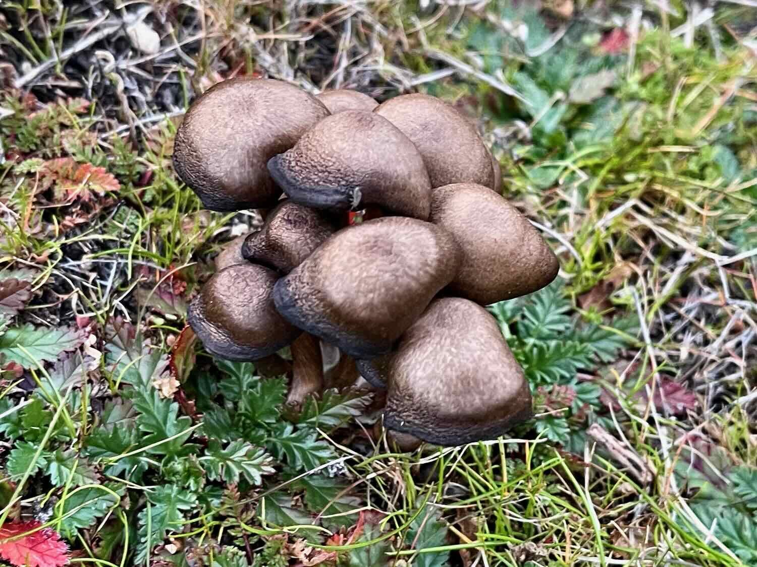
By the time we finished dinner around 4:30pm, it was already very cold. We went for a short walk to check out the surrounding area. Along the way we spotted a black-tailed jackrabbit. We were especially pleased to get photos of this one, since most of the jackrabbits we have seen in the past have not waited around for pictures. There were also small clumps of mushrooms that probably popped up due to the recent rains.

Hard Work Heading Downhill
During the night we finally heard some coyotes. We’ve been seeing their tracks in the mud all up and down the dirt roads, but hadn’t heard them at all. It seemed strange, because the coyotes had been so vocal up north in the United States and Canada. But in the mountains south of Ojos Negros, we heard them calling a couple of times. Perhaps the abundance of jackrabbits in this area was a draw for the coyotes. We were happy to hear them. It makes the wilderness seem even more wild.
That night was probably our coldest so far. After midnight, PedalingGal had some trouble staying warm. We were glad we had decided to stay on the less-misty side of the mountains. Any extra moisture would have made it feel even colder.
In the morning, everything was once again covered with frost and ice. We stayed burrowed within our sleeping bags until the sun came up over the eastern ridge. This time we were smart, and pitched our tent out in the open. So the tent got the benefit of the full sun. That helped get things warmed up. Pretty soon it was above freezing and time to head out.
The morning light, starting to warm things up. Sierra Juarez, Baja California, Mexico. Copyright © 2019-2023 Pedals and Puffins.
By this point we were only 1.5 miles (2.4 km) from the top of the pass. But, unsurprisingly, it was a very tough 1.5 miles. Rising out of the valley where we had camped, the mountain ridge was steep and incredibly rocky. We did a lot of walking to get to the top.
Pushing a bike up to the top of the pass. Sierra Juarez, Baja California, Mexico. Copyright © 2019-2023 Pedals and Puffins.
From there, the descent into the town of Uruapan looks steep on a map profile. But it would be hard to describe just how precipitous some of the sections were. Because even though the overall gradient is sharp, it is punctuated by many small ravines that send the road on a roller-coaster of even steeper ups and downs. Plus, for many miles the road was littered with loose rocks and gravel that made it feel like we were cycling on ball bearings. PedalingGal walked most of the steeper hills, and PedalingGuy walked a lot of it, too. It was really important to be careful. There wouldn’t be any vehicles coming up into these hills to provide help if we got hurt - the roads appeared impassible to most any motorized vehicle. A damaged bike could also spell the end of a trip. (Later we heard that a cyclist was seriously injured this year on that descent, and had to abandon their ride. Damaged bikes are also very common, with wheels and tires being particularly vulnerable).
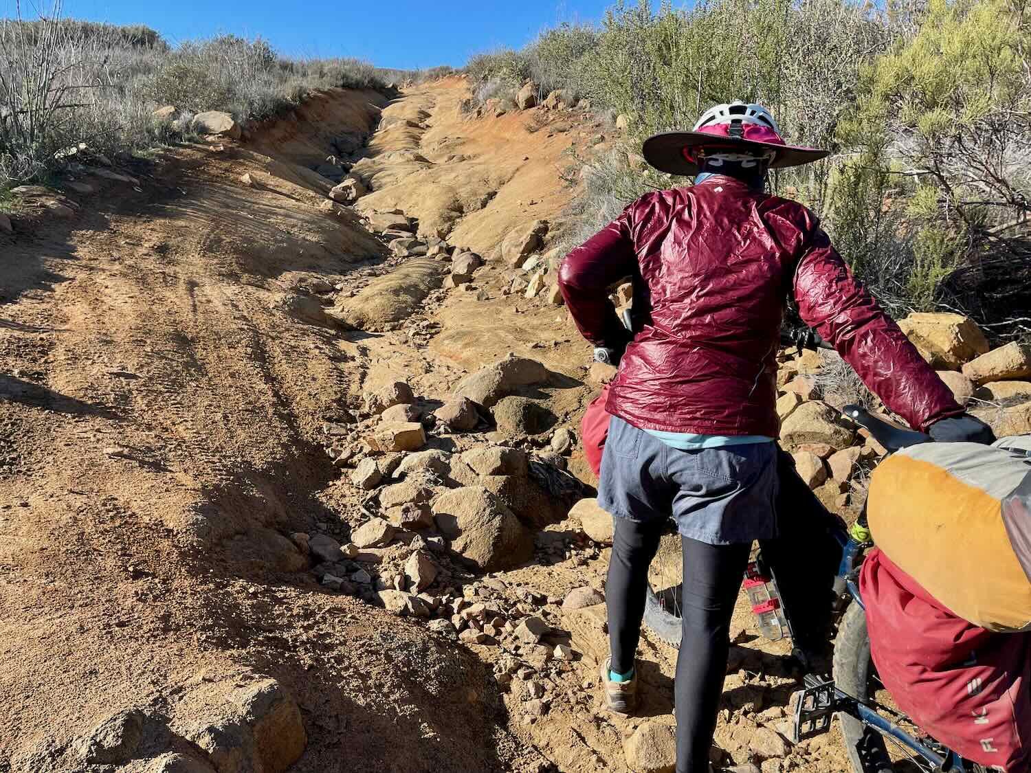

Even after we had gotten past the steepest section at the top, the road continued to throw challenges at us - alternately rocky, or rutted, or loose, fine gravel. Based on previous reports we had expected the descent to be slow. But it was a whole lot slower than we anticipated. In the end, it took us five hours to cover the first 15 miles (24 km) of “downhill” cycling.
The rugged Sierra Juarez. Baja California, Mexico. Copyright © 2019-2023 Pedals and Puffins.
Palms planted at a very remote ranch. Sierra Juarez, Baja California, Mexico. Copyright © 2019-2023 Pedals and Puffins.
Afternoon glow. Sierra Juarez, Baja California, Mexico. Copyright © 2019-2023 Pedals and Puffins.
One of many steep climbs out of narrow ravines that cut across our path. Sierra Juarez, Baja California, Mexico. Copyright © 2019-2023 Pedals and Puffins.
A backcountry horse, surprised to see anybody out on this road. Sierra Juarez, Baja California, Mexico. Copyright © 2019-2023 Pedals and Puffins.
As we came close to the village of Ejido Uruapan, the road surface improved a lot. Little by little, we were able to pick up the pace and cruise into town. Sierra Juarez, Baja California, Mexico. Copyright © 2019-2023 Pedals and Puffins.
Sticking to our pattern, we stopped at the little store in Ejido Uruapan for a quick drink and an ice cream bar. But it was already mid-afternoon, and we didn’t want to reach the next town too late in the day. So we kept our rest break short.
Five minutes later we found ourselves rolling onto Hwy 1, the only paved transportation artery running the length of the Baja Peninsula. We cruised along on pavement to the town of Santo Tomás. We really needed the easy few miles on pavement to make it to a hotel before dark. Tired as we were, we fairly sprinted over the next six miles, looking forward to a bed and a big, restaurant meal.
Our bikes, resting in Santo Tomás at the end of a long ride. Outside the Palomar Hotel. Santa Tomás, Baja California, Mexico. Copyright © 2019-2023 Pedals and Puffins.
By this point we had gotten far enough into Baja that we couldn’t be too picky about where we would spend the night. For example, there are only two hotels in Santo Tomás (plus a couple stores, a restaurant, and a mission church). So, you have to know your priorities when choosing a hotel. Given that the overnight low would be around 30F (-1C), our number one priority was getting a room with heat. And it turned out that only one of the two hotels offered heated rooms. So the choice was pretty easy. But what about our other priorities?
Ground floor or roll-up access (for our bikes): Check. The room we got in Santo Tomás was at the top of a ramp where we could roll our bikes right to the door.
Enough room for the bikes: This is kind of a squishy criteria because we always seem to be able to get the bikes into the room, no matter how small. But it’s nice when there’s plenty of space to move around, even with the bikes in the room. This room was a little tight for that.
Internet access: Check. This was actually pretty good, and was definitely better than what we had in Ojos Negros. It wasn’t blazingly fast (5Mbps downlink and 1.5 Mbps uplink), but it was stable, and we could get things done. In general, hotel internet access can be pretty poor in Baja. But hotels along Highway 1 tend to be better.
Noise: We like to try to get as quiet a room as possible. But in this hotel, all of the rooms faced the busy highway. Sound insulation was minimal, with open air gaps around some of the thin windows. Plus, there were a few sheep and chickens housed just a few meters from our window. Quiet was not something we would achieve.
Hot water: There was definitely hot water in our room (unlike some of the other rooms in the same hotel, according to the proprietor). But we both struggled to get it to work. Finding the right balance of hot and cold water was very tricky. In the end, we both figured it out. But it was touch-and-go for a while.
Arriving At the Sea
We both slept very well. The sound from the highway didn’t bother us too much, and happily, the sheep and chickens slept all night. Feeling refreshed, we were out on the road earlier than usual.
That turned out to be a good thing. Trail notes warn cyclists that the climb out of Santo Tomás into the coastal mountains is very steep. And that climb was all it was rumored to be - several miles of 10%-12% gradients, in the direct sun. We quickly shed most of our layers, getting down to short sleeves before we were even halfway up. The fact that we made the climb in the early morning, while the air was still quite cool, made all the difference in our comfort.
A steep climb out of Santo Tomás took us into the coastal mountains. Santa Tomás, Baja California, Mexico. Copyright © 2019-2023 Pedals and Puffins.
In theory, we had entered a new ecoregion - the Baja California Desert - as soon as we arrived in the town of Ejido Uruapan yesterday. So it was surprising that the most noticeable change in the landscape was how much greener it was than the Sierra Juarez. Perhaps is was just our timing, having arrived here after a period of heavy rains. Or perhaps the persistent mists from the Pacific Ocean really do keep the desert a bit greener here. We can’t say for sure. But the bright green grass that blanketed the ground was striking, and very lovely.
Another difference was in the quality of the haciendas that we passed in the mountains. In the Sierra Juarez, the buildings tended to be weather-beaten structures that looked like they had seen better days. Here, in the coastal mountains, we passed a number of prosperous looking ranches, even on remote sections of the road. Most of the structures looked well cared for. Many had a chapel or small church associated with a large main home, and a variety of out-buildings.
Rancho el Chocolate (referring to a muddy stream of that name, nearby), looked prosperous and well-maintained. Coastal Mountains, Baja California, Mexico. Copyright © 2019-2023 Pedals and Puffins.
An out-of-service windmill near a mountain ranch. Coastal Mountains, Baja California, Mexico. Copyright © 2019-2023 Pedals and Puffins.
One of the local cows, taking a break from grazing. Coastal Mountains, Baja California, Mexico. Copyright © 2019-2023 Pedals and Puffins.
The road we followed to the coast was marked with arrows in various colors. Our best guess was that this was part of a route popular with motorbikes and/or other off-road vehicles. Perhaps it was even the course for an off-road race like the Baja 1000, something that Baja has become famous for over the years.
Sign marking a motorbike route. We saw these signs frequently as we headed for the Pacific Coast. Coastal Mountains, Baja California, Mexico. Copyright © 2019-2023 Pedals and Puffins.
Around five hours into the ride we finally came within sight of the Pacific Ocean. It was a rocky shoreline, but didn’t have as many cliffs as in Northern California or Oregon. Instead, the rugged hills tumbled down into the water. But there were familiar aspects as well, especially the sandy coves surrounded by rocky shores, and the uplands being grazed by a small number of cattle.
Our first view of the Pacific Ocean after leaving Santo Tomás. Coastal Mountains, Baja California, Mexico. Copyright © 2019-2023 Pedals and Puffins.
The wild Baja coastline, tumbling down to the sea. La Costa Pacífica, Baja California, Mexico. Copyright © 2019-2023 Pedals and Puffins.
Almost immediately after we saw the ocean, we also spotted a wonderful new plant. Shaw’s agave is one of those Baja specialties - endemic to a narrow strip of land stretching about 200 miles southward from the US border. The coastal hills were sprinkled with clusters of the large (up to 3 feet tall) rosettes, which immediately captured our attention. Even better, they bloom in the winter. So we saw a number of the flaming yellow flower clusters, reaching up to 12 feet (3.7 m) into the sky.


The cycling along the Pacific shoreline was tough at first, with lots of steep hills and loose gravel surfaces. There was one spot were the route seemed to plunge directly over a cliff by almost anyone’s definition. Luckily, there was an alternate path that looped around the cliff on a long hairpin turn. It was still treacherously steep and rocky, but nothing like the road that the Baja Divide route supposedly followed. We were glad we didn’t have to belay our bikes down that slope.
Our route supposedly headed over this cliff. Luckily, there was a longer way around. La Costa Pacífica, Baja California, Mexico. Copyright © 2019-2023 Pedals and Puffins.
But before long the terrain grew more mellow, and we saw a lot more houses, and even community settlements. We also were passed by a higher number of cars going back and forth. Many of the homes were unfinished, standing in various stages of incomplete development. We wondered if these were like the gypsy homes in Romania, which are built in stages as cash becomes available to the family. It may not be that long before the Baja coastline doesn’t feel so remote anymore.
We got a kick out of this sign near one remote settlement. The “topes” (speed bumps) referenced are just the regular bumps in a Baja backroad found about every 5 meters. We weren’t too worried about encountering any chupacabras, but you never know. Rancho Tampico, Baja California, Mexico. Copyright © 2019-2023 Pedals and Puffins.
Fishing boats hauled up on a high bluff. Rancho Mira Mar, Baja California, Mexico. Copyright © 2019-2023 Pedals and Puffins.
The town of Punta Cabras had lots of homes under construction, and seemed like it was growing. La Costa Pacífica, Baja California, Mexico. Copyright © 2019-2023 Pedals and Puffins.
A view of the wild, rocky coast. La Costa Pacífica, Baja California, Mexico. Copyright © 2019-2023 Pedals and Puffins.
We had planned on camping by the coast for the night. But as evening drew near, a very strong wind began to blow. Also, we weren’t sure we could find a quiet spot hidden from view (which we thought was important given recent theft in the area). We made the decision to push on a few more miles and get a hotel room in Ejido Eréndira.
Ejido Eréndira sits on a sandy cliff above the sea. La Costa Pacífica, Baja California, Mexico. Copyright © 2019-2023 Pedals and Puffins.
By the time we reached the hotel it was getting pretty late, and the sun was sinking toward the horizon. We really needed this hotel to work out for us. But when we arrived, there was no one around to check us in. In fact, there didn’t seem to be any guests, or anyone else at the hotel at all. It looked deserted. We started to think that we might be in trouble.
Several attempts to call the phone number posted online did not produce any results. The house next door seemed like it might be affiliated with the hotel, so we knocked on the door - but no one answered. Starting to feel our options dwindling, we looked online. But there were no other hotels in town. Things weren’t lookin good.
We stood out by the road, hoping someone would see us and offer to help. A few minutes later, to our great relief, a pickup truck finally pulled into the parking lot and two people got out. And, yes, they were the hotel managers. We were going to have a place to spend the night after all. The room didn’t have heat (it seems that the further south we go, the less likely the hotel rooms will have heat). But it had electricity and hot water. Most importantly, it got us out of the wind. Around 8:30 in the evening, the wind started blowing like crazy. We could hear it howling outside. That made us even more happy with the decision to spend the night in a sturdy building, rather than in our tent. We asked for extra blankets, and hoped that the beds would be warm.
The next morning we stopped at the small grocery in town for breakfast. Ejido Eréndira, Baja California, Mexico. Copyright © 2019-2023 Pedals and Puffins.
Ejido Eréndira (pop. 1,500) is a really spread-out little town. We cycled for a half hour before we reached the last few houses. South of town we cycled past a number of big farms, proudly proclaiming that they were USDA certified organic. This is where some of the winter produce that gets shipped the the USA comes from. And beyond that we continued to pass small, coastal settlements (one of which had the tongue-in-cheek name of “Malibu Sur”). It was only after cycling about five miles that we finally found ourselves back in relatively undisturbed natural areas.
Most of the farms along this stretch of coast boasted that they were growing organic produce to USDA standards. Ejido Eréndira, Baja California, Mexico. Copyright © 2019-2023 Pedals and Puffins.
For several hours our route stayed very close to the shoreline. We saw lots of big waves crashing dramatically against the rocky coast. The open grasslands were full of birds, like meadowlarks, mountain bluebirds, and plovers.
Watching a wave curl. La Costa Pacífica, Baja California, Mexico. Copyright © 2019-2023 Pedals and Puffins.
A mountain bluebird searches for lunch in the grass. La Costa Pacífica, Baja California, Mexico. Copyright © 2019-2023 Pedals and Puffins.
Then, quite suddenly, we rounded a bend in the shoreline which gave us a view across a large cove. On the far side of the cove, we were astonished to see four separate sea spouts shooting water high into the air. They were so powerful that they looked like geysers. It was spectacular, and it stopped us in our tracks. The tides and the waves must have been perfect, because the spouts were really active, jettisoning water a couple of times per minute. We stood there watching from a distance, in awe of the fabulous display.
Sea spouts on la Costa Pacífica, south of Ejido Eréndira. Baja California, Mexico. Copyright © 2019-2023 Pedals and Puffins.
From there, our route took us right over to the sea spouts. Unlike in the USA, where something like this would be considered a public hazard that needed to be fenced, you could walk right out on the rocks. Of course, PedalingGuy did that. PedalingGal was more timid, only approaching when PedalingGuy beckoned her to come closer. But he had a blast, walking out among the jets of seawater shooting into the air.
Approaching an active sea spout. La Costa Pacífica, Baja California, Mexico. Copyright © 2019-2023 Pedals and Puffins.
Look how high it shoots into the air! La Costa Pacífica, Baja California, Mexico. Copyright © 2019-2023 Pedals and Puffins.
As we were getting ready to leave, three guys on motorbikes rode up. One of them, Klaus, stopped to talk with us. He was from San Diego, and told us he had been taking motorbike vacations along this shore for 30 years. And in that time he had only seen the spouts this active one other time, because the tides and waves have to be at just the right levels. That made us feel really lucky, and like we had come upon something truly special.
A couple of motorbikers joined us by the sea spouts. According to them, seeing the spouts this active is incredibly rare. La Costa Pacífica, Baja California, Mexico. Copyright © 2019-2023 Pedals and Puffins.
Not long after we left the sea spouts, our route turned inland and climbed back into the hills. The riding was tough, but manageable. This was typical coastal riding, with flattish plateaus cut across by deep, steep-sided ravines. In some places the road seemed to descend at a cliff-like angle into the ravines. Whenever there was an option to take a longer, more gently-graded route (still very steep), we took it. But there were some hairy descents, and very difficult climbs.
Wondering about which line to take to get up that hill. Coastal Mountains, Baja California, Mexico. Copyright © 2019-2023 Pedals and Puffins.
Shaw’s agave, in three stages of bloom. Coastal Mountains, Baja California, Mexico. Copyright © 2019-2023 Pedals and Puffins.
After a hair-raisingly steep descent off of the interior plateau, we finally enjoyed some easy riding on the road into town. Punta Colonet, Baja California, Mexico. Copyright © 2019-2023 Pedals and Puffins.
After settling in at a modest hotel, we walked into Punta Colonet. Dinner was an awesome pizza at Benny’s. Punta Colonet, Baja California, Mexico. Copyright © 2019-2023 Pedals and Puffins.
High Winds on the Highway
The forecast for the next day called for high winds - 20 mph sustained winds with gusts to 30 mph. It just wasn’t realistic for us to consider cycling on the next section of the Baja Divide - up a 3,000 ft (915 m) mountain through a sandy arroyo with multiple stream crossings that would probably be deeper and muddier than usual because of the rain. Instead, we decided to follow the main Hwy 1 from Punta Colonet to the town of Vicente Guerrero.
A local cat came to see us off, as we departed the hotel in Punta Colonet. Baja California, Mexico. Copyright © 2019-2023 Pedals and Puffins.
Although we were following the highway, we rarely had to ride on the road. That was great, because this section of the highway had no shoulder, and only one lane for traffic in each direction. It would have been very stressful to ride on the pavement. But with our 3-inch (76 mm) tires, we had no problem cycling on the dirt, gravel, sandy, and muddy double-tracks that paralleled the highway almost the whole way.
Crystalline iceplant is common in this part of Baja. We saw lots of it growing on sandy sections of the double-track that parallels Hwy 1. Los Laureles, Baja California, Mexico. Copyright © 2019-2023 Pedals and Puffins.
The scenery along the highway provided a fascinating contrast with the remote backroads we had traveled so far. South of Punta Colonet, the mountains recede from the coast, creating a fertile plain between the highlands and the sea. Never much more than six miles wide, these lowlands have been almost completely transformed into farms. We passed mile after mile of tilled fields, greenhouses and pastures, periodically interrupted by small, highway-focused towns.
Raspberries being grown in the shade along Hwy 1. Los Laureles, Baja California, Mexico. Copyright © 2019-2023 Pedals and Puffins.
Row after row of plants growing in the shade of fabric tents. Los Laureles, Baja California, Mexico. Copyright © 2019-2023 Pedals and Puffins.
As expected, the wind buffeted us like crazy all day. In the morning, we had a cross-tailwind. That wasn’t so bad, except that our deBrim hats (big-brimmed helmet attachments for sun protection) acted like wind sails. At times we must have looked like we were drunk, wobbling on our bikes as the deBrims caught the full force of the wind and pushed us from side to side. Pretty soon we wizened up, and took the deBrims off. But our troubles weren’t over. Later in the day the wind shifted to a headwind, slowing our progress considerably. It was a pleasure to finally arrive in Vicente Guerrero, and find a room out of the wind.
We spent some time in Vicente Guerrero regrouping, cleaning up, and taking care of some routine bike maintenance. This was one of the bigger towns we would pass through, so we wanted to make sure we got everything in order before shoving off on the next leg of the trip. It proved to be a good decision - we had a big, comfortable room, strong and stable wifi, and access to everything we could want in town. That break set us up for success down the road.
While staying in the town of Vicente Guerrero we visited the highly-recommended FASS Bikes shop. Owner Salvador Basurto made us feel right at home. We even signed his Baja Divide wall map. Vicente Guerrero, Baja California, Mexico. Copyright © 2019-2023 Pedals and Puffins.
We’re Not On Pavement Anymore
Our first couple of weeks on the Baja Divide have been a roller coaster, both physically and mentally. As we were getting started, someone told us that the first 10 days of cycling on the Divide are the hardest - and that’s likely to prove true. We’ve already crested the highest pass, and tackled every type of surface from big rocks to deep sand while enduring bone-chilling cold and fierce winds. It definitely builds character.
But the rewards have more than outweighed the hardships. The scenery has been endlessly fascinating, with some truly awesome moments - like the view from the top of Otay Mountain to the magical sea spouts on a remote uninhabited section of the coast. We’ve met dozens of wonderful people along the way, eager to befriend two crazy Americans on bikes. And we’ve savored the deep silence of starlit nights in the Sierra Juarez. It feels like a new start on a fantastic journey.