Mezcal Mountains and Windy Lowlands: Cycling from Oaxaca to Arriaga, Mexico
20 - 30 September 2023
20 Sep - Oaxaca to Santiago Matatlán (27.8 mi, 44.7 km)
21 Sep - Santiago Matatlán to El Camarón (53.9 mi, 86.7 km)
22 Sep - Rest day in El Camarón
23 Sep - El Camarón to Magdalena Tequisistlán (45.3 mi, 72.9 km)
24 Sep - Magdalena Tequisistlán to Jalapa (12.5 mi, 20.1 km)
25 Sep - Rest day in Jalapa
26 Sep - Jalapa to Ixtepec (39.0 mi, 62.8 km)
27 Sep - Ixtepec to Santiago Niltepec (42.0 mi, 67.6 km)
28 Sep - Santiago Niltepec to Chahuites (39.2 mi, 63.1 km)
29 Sep - Chahuites to Arriaga (24.5 mi, 39.4 km)
30 Sep - Rest day in Arriaga
The Skinny Part of Mexico
As the geographic link between North and Central America, it’s easy to think of Mexico as a country that runs primarily from north to south. But that’s an illusion. The truth is that Mexico is a whole lot wider than it is tall. Starting near Mexico City, the country sweeps eastward in a huge, graceful arc around the bottom of the Gulf of Mexico. At the bottom part of that curve Mexico narrows into a small strip of land that runs nearly due east from Oaxaca. At barely 125 miles from coast to coast, the Isthmus of Tehuantepec is the skinniest part of Mexico.
Consequently, to continue our journey south we had to travel eastward across the isthmus. We decided to follow the Pan-American Highway through this section because its smooth pavement and less rugged terrain would help us cover the distance to Guatemala more efficiently. The clock was winding down on our Mexican tourist visas. So by choosing a route with fewer cycling days to reach the border, we would have more flexibility in our schedule if we ran into any mechanical or health problems, or if we wanted to spend some extra time in the areas we passed through. We really wanted to savor our last few weeks in Mexico, without feeling rushed.
Rendezvous With A Very Big Tree
The ride out of Oaxaca was surprisingly relaxed. After leaving the city centro on a protected bike lane, we hopped onto a smooth, shaded bike path that ran down the center of a large avenue. That bike path took us out of the city, and nearly all the way to our first stop - a rendezvous with a really big tree.
Cycling out of the city on a smooth, shady bike path. Oaxaca de Juárez, State of Oaxaca, Mexico. Copyright © 2019-2023 Pedals and Puffins.
In less than an hour we arrived in the town of Santa María del Tule (pop. 8,270), whose claim to fame is that it is home to the widest tree in the world - the great Tule Cypress. We first heard about this tree when we were traveling among some other really big trees - the Coastal Redwoods in California - and had been looking forward to seeing it for the past 10 months. We were finally going to meet this famous giant.
And it was very impressive. It’s not incredibly tall, like the redwoods and sequoias. Instead this Montezuma cypress tree has a massive trunk topped by a wonderfully thick, dark green canopy of branches and leaves that create a large, cool shadow. With a circumference of 177 ft (54 m), it would take about 30 adults with their arms outstretched to encircle the entire tree. It’s truly in a class of its own, being 30% bigger at its base than the fattest redwood or sequoia trees. Standing under the tree is like being inside a sacred hall, with a huge dome overhead. We spent about half an hour admiring the tree and sitting within its shadow.
Arrival in Santa María del Tule. The massive canopy of the Tule Cypress rises up in the background, dwarfing the large church that can be seen to its right. State of Oaxaca, Mexico. Copyright © 2019-2023 Pedals and Puffins.
The massive trunk of the Tule Cypress, with its cathedral-like columns and canopy arching overhead. With a circumference of 177 ft, it’s the widest tree in the world. Santa María del Tule, State of Oaxaca, Mexico. Copyright © 2019-2023 Pedals and Puffins.
There is a beautiful garden with some really exotic-looking flowers in the plaza facing the Tule Cypress. The hanging lobster claw flower (on the right) was particularly striking. Santa María del Tule, State of Oaxaca, Mexico. Copyright © 2019-2023 Pedals and Puffins.
The town’s municipal building was still decked out in the colors of the Mexican Flag, following recent celebrations of Mexico’s Independence Day (16 September). Three mind-bogglingly tall Mexican fan palms stood to one side. It’s amazing how tall these palms grow on such a thin trunk. Santa María del Tule, State of Oaxaca, Mexico. Copyright © 2019-2023 Pedals and Puffins.
The Capital of Mezcal
After our long break visiting with the Tule Cypress we cycled out onto the Camino del Mezcal (the “Mezcal Way”).
This sign announced that we were cycling into the heartland of mezcal production. Tlacolula de Matamoros, State of Oaxaca, Mexico. Copyright © 2019-2023 Pedals and Puffins.
Mezcal is tequila’s bolder, more bohemian cousin. Although both spirits are made from agave plants, production of tequila is much more regulated than mezcal. For example, tequila can only be made from a single species called blue agave, while mezcal can be made from any of more than 30 different species of agave. Tequila also is distilled in large batches over steam, whereas mezcal is mostly distilled at small, artisanal workshops in clay pots, over an open fire. As a result, tequila has a more consistent, refined flavor, while mezcal can be extremely variable. Adding to its edgy reputation, mezcal usually has a higher alcohol content than tequila. Although tequila is more well known, those in the know consider tequila just one of many varieties of mezcal. And the state of Oaxaca is the epicenter of mezcal production, where 90% of the world’s supply is made.
Before long we were cycling past dozens of agave farms and their associated distilleries. The ones closest to Oaxaca were the biggest, with large fields of agaves, big stainless steel tanks, and fancy signage.
Large fields of agaves spread out across the Oaxaca Valley, growing the main ingredient for mezcal. Tlacolula de Matamoros, State of Oaxaca, Mexico. Copyright © 2019-2023 Pedals and Puffins.
In a few places we saw fields of cockscomb flowers among the agaves. These weren’t being grown as part of the mezcal production. Instead, these flowers are popular as decorations for celebrating the of the Day of the Dead - a huge holiday in Oaxaca that falls around Halloween. Unión Zapata, State of Oaxaca, Mexico. Copyright © 2019-2023 Pedals and Puffins.
Some of the mezcalerías closest to Oaxaca were pretty big operations, with large, stainless steel tanks. San Francisco Lachigoló, State of Oaxaca, Mexico. Copyright © 2019-2023 Pedals and Puffins.
But as we got farther from the city, we saw more and more small distilleries, often with home-made signs and very rustic buildings.
The sign outside a small-scale mezcaleria. Zapata, State of Oaxaca, Mexico. Copyright © 2019-2023 Pedals and Puffins.
Most mezcal is distilled over open fires in small batches. Unión Unión Zapata, State of Oaxaca, Mexico. Copyright © 2019-2023 Pedals and Puffins.
In the early afternoon we rolled into the town of Santiago Matatlán - the self-proclaimed “World Capital of Mezcal.” The main highway through town is lined with family-run mezcalerías, and we enjoyed strolling among the buildings to check out the distilling process. There were piles of agave piñas (the hearts of the agave plants that are roasted to make mezcal), horses dragging milling stones to crush the piñas into pulp, and stills powered by open fires in brick and palm-thatched workshops. All throughout town the air had the slightly sweet and heady scent of fermenting agave.
Approaching the Mezcal Capital of the World (“Capital Mundial del Mezcal”). Santiago Matatlán, State of Oaxaca, Mexico. Copyright © 2019-2023 Pedals and Puffins.
A pile of agave piñas, waiting to be roasted and crushed to release their sugar for producing mezcal. Santiago Matatlán, State of Oaxaca, Mexico. Copyright © 2019-2023 Pedals and Puffins.
A mescalero follows behind his horse, as it pulls a millstone over the roasted agave pulp to squeeze out the sugary sap. Santiago Matatlán, State of Oaxaca, Mexico.Copyright © 2019-2023 Pedals and Puffins.
A storefront at one of the small mezcalerías, with their small-batch labels neatly arranged for sale. Santiago Matatlán, State of Oaxaca, Mexico. Copyright © 2019-2023 Pedals and Puffins.
After cooling off in the shade we walked to the town’s small central plaza, which was set back a couple of blocks from the highway. There were quite a few mezcal-themed murals painted around town. But they’re not just marketing hype. The majority of Oaxaca’s mezcal is produced in Santiago Matatlán, which is home to more than 140 mezcalerías - that’s one for every 25 residents. Pretty much everyone in town is connected to the industry in some way.
A spooky mural depicting a calaca (skeleton) as an agave farmer. He’s cutting the leaves off of an agave plant to create a piña. Santiago Matatlán, State of Oaxaca, Mexico. Copyright © 2019-2023 Pedals and Puffins.
This mural had a gentler theme, depicting the warm and kind faces of the mezcaleros. Many families in this area have been producing mezcal using traditional methods, handed down over the generations, for more than 200 years. Santiago Matatlán, State of Oaxaca, Mexico. Copyright © 2019-2023 Pedals and Puffins.
The next morning we awoke to a surreal scene. Several dark, thick plumes of smoke were rising up from different parts of town. The billowing clouds were so voluminous it looked like a building was burning down. But there were no sirens and no one seemed concerned. Our best guess was that some of the mezcalerías were either burning the mash leftover after crushing the sugars out of the roasted agaves, or had just started the fires for their distilling process.
But the smoke didn’t rise up into the sky. A temperature inversion trapped the thick cloud close to the ground. By the time we hit the road, the smoke had formed a blanket of blue-gray haze that rested just over the roofs of the buildings in the village. We could smell the acrid smoke in the air. But the mountains in the distance and the powder-blue sky above remained crystal clear - unobstructed by the haze.
Smoke from several big fires blanketed the village as we cycled away in the early morning. Santiago Matatlán, State of Oaxaca, Mexico. Copyright © 2019-2023 Pedals and Puffins.
The Tail End of the Rainy Season
On the road into Oaxaca, we had been traveling during the peak of the rainy season - and hustling to our destination each day to stay ahead of the afternoon thunderstorms. But in the second half of September, the probability of rain began to drop off rapidly. So much so that by the beginning of October, on any given day it was less than half as likely to rain as it would have been in mid-September.
The change was really noticeable. During our stay in Oaxaca, the daily thunderstorms simply vanished. Sometimes the sky would look dark and threatening, but a light shower was the worst we had to deal with. And by the time we departed, rain had disappeared from the daily forecast.
Now, as we rode over the mountain ridges that lay between us and the Pacific coastal plain, the lack of rain was already beginning to show. Although the landscape was still very green compared to the late spring, before the rains had started, the shades of green were not quite so vibrant as they had been a few weeks earlier. The leaves looked weathered, with overtones of brown and yellow. The tropical “fall” was in the air.
A remote valley winds its way towards the Sierra Madre de Oaxaca. With the rainy season winding down, the vegetation on the mountainsides has started to look a bit more yellow and brown. Agua Santa, State of Oaxaca, Mexico. Copyright © 2019-2023 Pedals and Puffins.
The road out of Santiago Matatlán was incredibly scenic, with two big mountain climbs and a long ride through a stunning canyon. At times the walls of the valley closed in, and we were cycling through a gorge as beautiful as any we’d ever seen. Other times we had expansive views of the undulating Sierra Madre de Oaxaca, fading away in layers into the distance.
At times the canyon walls closed in around the road, creating dramatic scenery. Our road can be seen down in the valley below. Near San Pedro Totolapa, State of Oaxaca, Mexico. Copyright © 2019-2023 Pedals and Puffins.
A golden-fronted woodpecker rested for a moment on one of the many cacti growing in the forest. Near San Pedro Totolapa, State of Oaxaca, Mexico. Copyright © 2019-2023 Pedals and Puffins.
Without the arrival of afternoon clouds, the day’s ride became especially hot. We were both overheating even before we started the second big climb, and we still had a lot of cycling ahead of us. We stopped at several shops along the way to rest in the shade and drink something cold. And as the day wore on, we took even more breaks along the side of the road wherever we could find shade - which wasn’t very often. By the end of the day our skin and clothes were crusted with salt.
Stopping for a nice, cold drink at a roadside farmacia. San Pedro Totolapa, State of Oaxaca, Mexico. Copyright © 2019-2023 Pedals and Puffins.
We took rest breaks in the shade, wherever we could find it. Near San Pedro Totolapa, State of Oaxaca, Mexico. Copyright © 2019-2023 Pedals and Puffins.
As we neared the top of the second ridge, layers of mountains faded away into the distance. Near San Pedro Totolapa, State of Oaxaca, Mexico. Copyright © 2019-2023 Pedals and Puffins.
Every so often, tall steep cliffs would come right up to the road. Near San José de Gracia, State of Oaxaca, Mexico. Copyright © 2019-2023 Pedals and Puffins.
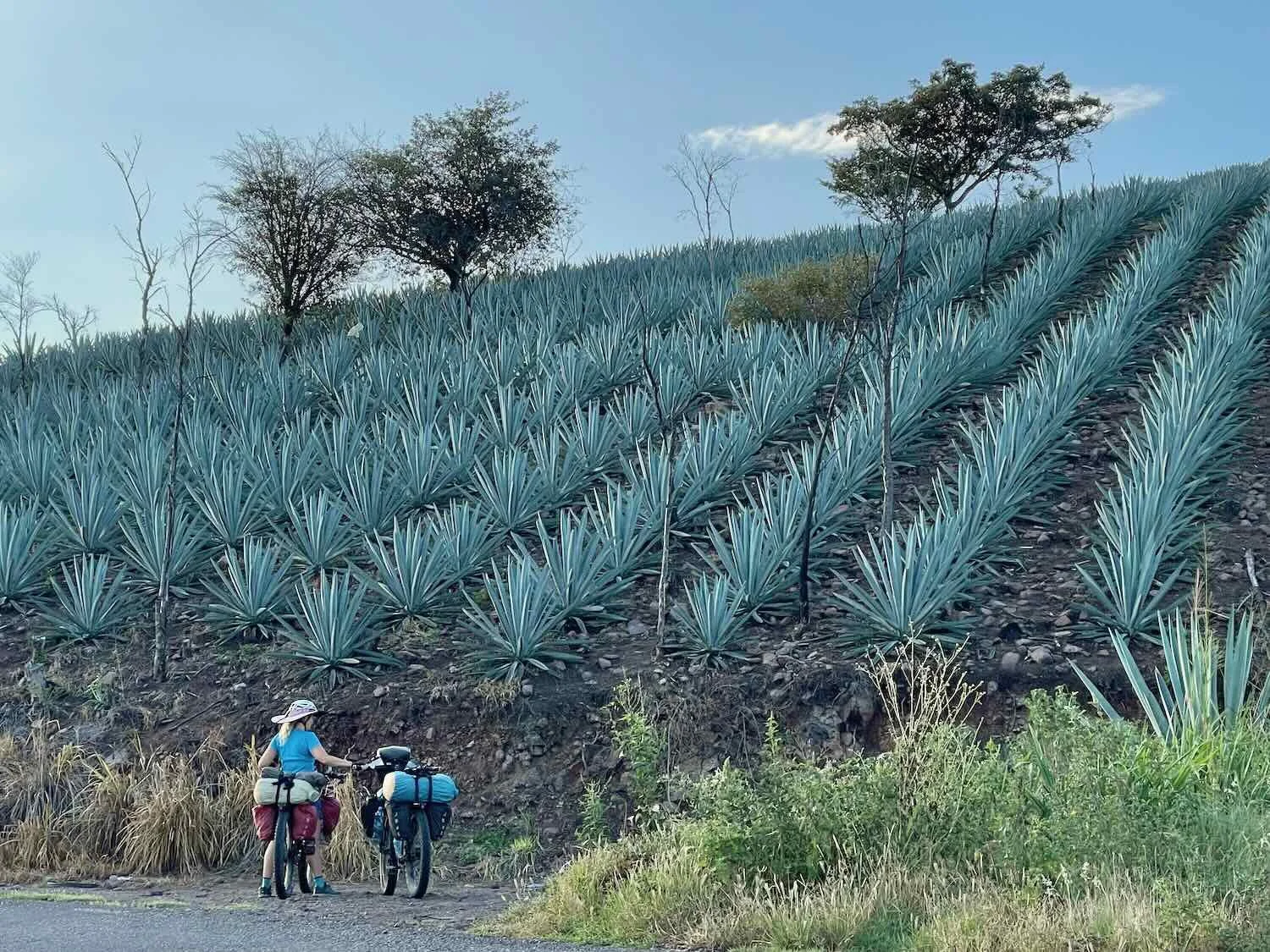
Agave Covered Mountainsides
Although there was a fair amount of intact forest at the highest elevations, large swaths of forest all along the road between Santiago Matatlán and El Camarón had been cleared and planted in agave fields. We were impressed by the sheer number of small agave farms that feed the mezcal industry in Oaxaca. Some of the fields were in surprisingly remote areas, on incredibly steep slopes reaching nearly all the way to the tops of the hills. It looked as if one good rainstorm would wash everything away down the valleys. We couldn’t help but ponder whether people’s taste for mezcal was having a negative impact on these mountain habitats.
Large patches of forest between Santiago Matatlán and El Camarón had been cleared and planted into fields of agave to feed the mezcal industry. Near Las Ánimas, State of Oaxaca, Mexico. Copyright © 2019-2023 Pedals and Puffins.
The Tip of a Human Wave
It was along this stretch of highway that we saw the first trickle of people migrating northward towards the USA, which would later become a flood. Prior to this, we had only encountered migrants on a couple of occasions. For example, while stopped on a bridge over some railroad tracks on the outskirts of Zacatecas, we watched a train pass below us that had dozens of people riding on top of the boxcars as they headed north. But by and large, our route through the mountains was not one that was heavily used by migrants. That was about to change.
We had just passed a police checkpoint and were slogging up a hill when we saw a pickup truck stop by the side of the road. It had pulled over to unload about 10 people that had been riding in the back, carrying their belongings in plastic bags. The driver apparently did not want to get caught with a truckload of migrants at the checkpoint. So the group was left standing by the side of the road. We wondered what they would do next. Most of the land in that area was fenced off with barbed wire, and planted in fields of corn or agave. But later we would see many migrants simply walk past other police checkpoints, where the guards seemed much more focused on intercepting drug smugglers and human traffickers, rather than interrupting the flow of the individual migrants.
As the day progressed several more pickup trucks full of people passed us, and we began to encounter groups of 5-10 migrants walking northward along the margins of the road. Little did we realize how dramatically that would increase in the days that followed.
A Shrimp in the Mountains
At 54 miles (86 km), it had been a very long day of riding including around 3,500 ft of climbing over two big ridges. We were totally wiped out when we finally crawled into the town of El Camarón (pop. 2,400) around 5pm.
From our perspective, it seemed odd to name a mountain town El Camarón (“The Shrimp”). By bicycle, the ocean still felt like it was very far away. But in truth, El Camarón was less than 100 miles from the coast - not particularly far when traveling by car or truck. We actually saw quite a bit of fresh shrimp being sold in the town market.
The hotel along the highway wasn’t anything to get excited about, but it did have a barely working air conditioner that needed to be forcefully coaxed into turning on by one of the hotel staff. He jiggled some wires, twisted some broken knobs, and hit it with his hand in order to get it to run. It then roared like a jet engine. But that wasn’t so bad because it helped to drown out the noise from the road, which had more than its share of large trucks. They produced their own roar as they used engine braking to slow down at the edge of town.
Most importantly, the hotel was a safe place to stay. Camping along this section of the Pan-American Highway was not advised - we knew of at least one case where a cyclist had been robbed while camping near the town about eight months prior. So we were happy to have a secure place to rest. After checking in we just laid on the bed for about an hour, soaking up the cool air. It was heavenly.
In fact, the long, hot day of cycling had taken a lot out of us, so we ended up taking a rest day in El Camarón in spite of the meager accommodations. It was a gritty, truck-stop kind of town. But it did have a 24-hr grocery store that had all the supplies we needed. And an inexpensive taco stand just down the road provided tasty, filling meals.
The ‘letras’ sign near the center of town. El Camarón, State of Oaxaca, Mexico. Copyright © 2019-2023 Pedals and Puffins.
This was one of the most elaborate entrances to a town cemetery that we had ever seen. El Camarón, State of Oaxaca, Mexico. Copyright © 2019-2023 Pedals and Puffins.
Three Ridges and a Big Descent
Both the daytime and nighttime temperatures were getting warmer as we dropped in elevation on our way to the Pacific coastal plain. Fortunately we got a nice, early start on our bike ride to Magdalena Tequisistlán because it would be another long, hot one. As we rolled out onto the highway at 6:40am, it was already 80F (27C).
But the ride to the coast would not be all downhill. In fact, three big ridges stood between us and the lowlands. And right out of the gate, our route launched into a grueling, 10 mile (16 km) climb. For the first hour we continued to cycle through dry, agave farming country.
Agaves need to grow for seven to ten years before their piñas are large enough to harvest for production of mezcal. These agaves were really big - perhaps getting close to harvestable age. East of El Camarón, State of Oaxaca, Mexico. Copyright © 2019-2023 Pedals and Puffins.
As we climbed onto a ridge of the Sierra de Oaxaca, the fields of agave blanketed the valley below us. East of El Camarón, State of Oaxaca, Mexico. Copyright © 2019-2023 Pedals and Puffins.
Soon we had gained enough altitude that we found ourselves cycling through the higher-elevation pine-oak forests. The change in vegetation was very noticeable. The agave farms disappeared. And on the upper slopes of the mountain the trees were still lush and green, as well as being much taller and more dense.
Looking across the Rio Candelaria Valley, from the heights of the Sierra Madre de Oaxaca. We could see how the dense farms in the valley tapered off, then disappeared on the higher slopes of the distant mountains. East of El Camarón, State of Oaxaca, Mexico. Copyright © 2019-2023 Pedals and Puffins.
It took us nearly 2.5 hours to crawl to the crest of the first ridge. Near the top of the pass we saw the steaming hulk of an inter-city bus that had overheated on its way up the far side. A foggy cloud billowed out across the road, as the passengers and driver waited patiently for the engine to cool down enough to get back on the bus and continue. We could relate to that bus. It was only a little after 9am, but the temperature was now over 90F (32C), and we were hot and steamy ourselves.
An inter-city bus had to stop at the top of the mountain to let its engine cool. The cloud of steam billowing over the road was coming from the bus’s engine. El Convento Pass, East of El Camarón, State of Oaxaca, Mexico. Copyright © 2019-2023 Pedals and Puffins.
A large, neon-pink and yellow shrine marked the top of the ridge. El Convento Pass, East of El Camarón, State of Oaxaca, Mexico. Copyright © 2019-2023 Pedals and Puffins.
It was during our climb of the second ridge of the day that we started seeing more groups of migrants. The first folks we saw were walking in a group of five or six people, including a very young girl who looked like she was not quite seven years old. As we rode by, they asked us for water and food for the girl. We had left El Camarón with only the supplies we expected to need for ourselves that day, but we were able to share some water and a granola bar. By the end of the day we had passed hundreds of people walking along the highway in groups of three to ten people all heading to the United States. Occasionally, we would get a little cheer for the USA from some of the migrants who guessed that we must have come from there.
The climb of the third and final ridge was really tough. When we finally reached the summit the temperature was pushing 100F (38C), with no clouds, practically no shade, and blistering sunshine. We both overheated.
So it was absolutely wonderful when we finally reached the little tienda at the top of the last mountain pass. We plopped ourselves into a couple of plastic chairs in the shade and drank all of the Powerade that the proprietor had in stock.
From there we flew down the far side of the mountain and onto the coastal plain - dropping nearly 2,000 ft (610 m) in just over half an hour. It felt amazing to coast most of the way down in the oppressive heat.
When we reached the turn off of the highway into the town of Magdalena Tequisistlán (pop. 3,600) we encountered something we hadn’t seen before. The village had installed a road block with a guard station on the only road into town. The guard was not particularly friendly and seemed suspicious of why we wanted to go into town. He indicted that we should turn around and go back out to the main road.
Once we told him that we were hoping to stay at the hotel in town, he brightened up and decided to let us through. Even so, he asked us to write our names and nationalities in a notebook before welcoming us and lifting the gate. This town was definitely trying to keep tabs on who was coming and going, presumably in an effort to keep the town from being inundated with all of the migrants along the main road, as well as the cartels that are active in the border region.
Although the Pan-American Highway was perfectly safe during the daytime, camping just wasn’t a good option. It was very hot and humid, even at night. Much of the land was private, there were no campgrounds, migrants on their way to the USA were everywhere, smugglers were more active near the border, and theft was a real danger. Most of the migrants were traveling light, with a small bag or backpack which they could easily protect at night. We felt like much more of a target with all our gear and bicycles. That was a key reason we decided to go from hotel-to-hotel along this stretch of the route.
We arrived at the hotel in Magdalena Tequisistlán shortly before 2pm, as the temperature hit a scorching 102F (39C). We were definitely ready to call it a day. Happily, the hotel had air conditioning and pretty good wifi. We had a bit of an adventure negotiating our bikes up the VERY narrow and curved staircase onto the second floor, but we got the job done. There wasn’t any hot water, but that wasn’t a problem at all. The cool water in the shower felt awesome on our overheated skin. We spent the rest of the day hunkered down at the hotel, except for a brief excursion to get some ham, cheese and bread to make a simple dinner in our room.
We stayed at the only hotel in town. Fortunately, in addition to having a cheery exterior, this hotel had air conditioning. Magdalena Tequisistlán, State of Oaxaca, Mexico. Copyright © 2019-2023 Pedals and Puffins.
In theory the hotel had hot water. But it was one of those electrical, “heat as you go” “use at your own risk” systems, and it didn’t work. We didn’t mind. The cool water felt great after a long, hot bike ride. Plus, we’re never particularly eager to have live electrical wires so close to our shower water. Magdalena Tequisistlán, State of Oaxaca, Mexico. Copyright © 2019-2023 Pedals and Puffins.
Cycling Onto the Isthmus of Tehuantepec
We both slept great. The bed at this hotel was a lot more comfortable than the one in El Camarón, the air conditioning kept us cool, and it was very quiet. The perfect combination for a good night’s rest.
With the brutal heat along the coast, we decided to keep our first day of cycling on the Isthmus of Tehuantepec as short as possible. We didn’t bother to rush out the door in the morning because if we arrived in the next town too early, we would likely have to sit around for a couple of hours in the heat before being able to check into another hotel room. It seemed like a much better idea to continue waiting in this air conditioned room as long as possible. We finally hit the road a bit before 8:30am.
A white-throated magpie-jay posed for us along the road towards the highway. It’s actually a different species from the one we had seen previously in the Sierra Madre mountains up north (which has a black throat). Magdalena Tequisistlán, State of Oaxaca, Mexico. Copyright © 2019-2023 Pedals and Puffins.
About halfway through our ride we passed the glistening mound of the Volcán Salado (a.k.a., the “saline volcano”). It’s not really a volcano. Rather it is a mineralized outcrop created by a freshwater spring that is super-saturated with calcium carbonate. As the water evaporates at the surface, it leaves behind an ever-growing mound of minerals that resembles a frothy waterfall. Near San José, State of Oaxaca, Mexico. Copyright © 2019-2023 Pedals and Puffins.
It took us less than an hour to cover the first two thirds of the ride. Concerned that we would arrive in the town of Jalapa too early, we decided to stop at an inviting-looking, roadside restaurant. It was a modest place, with some tables under a thatched roof and a cooking area behind a wall of corrugated metal. But the dining area looked cool and breezy - perfect for a short rest. We sat down for a second breakfast comprised of eggs, beans, goat cheese and tortillas all cooked over an open wood fire. The ladies who worked there were sweet and friendly, as well as being somewhat amused by our arrival on bicycles. We couldn’t hear everything they said to each other, but we got the feeling they were discussing how crazy we were to be out cycling in this heat.
Enjoying a second breakfast at a roadside comedor. Llano Grande, State of Oaxaca, Mexico. Copyright © 2019-2023 Pedals and Puffins.
When we arrived at the Hotel Emmanuel around 10:45am, they were still cleaning the rooms so we had to wait about an hour before checking in. But it was definitely worth the wait. It turned out to be a very nice hotel and a real bargain.
We ended up spending an extra day in the town of Jalapa (pop. 9,000), waiting out a coastal heat wave where the afternoon temperature got up to 104F (40C). In an effort to stay cool, we used “take out” to bring all of our meals back to our air-conditioned room (because none of the restaurants in town had AC).
While out searching for food, we encountered more fancy wall murals, a group of women in the town square singing religious hymns, and the outdoor market. The market was a bit of an obstacle course in places as we wound our way among the many ropes that were used to help keep the vendors’ umbrellas and canopies in place. Jalapa can get pretty windy, so the plastic and canvas tarps often had multiple ropes tying them to telephone poles, manhole covers, cast iron window grates, metal railings and any other reliably stationary object in the vicinity.
A mural depicting some of the area’s iconic birds including a caracara, several hummingbirds, and a resplendent quetzal. Santa María Jalapa del Marqués, State of Oaxaca, Mexico. Copyright © 2019-2023 Pedals and Puffins.
A group of women sang religious songs on Sunday afternoon in the town’s main plaza. Santa María Jalapa del Marqués, State of Oaxaca, Mexico. Copyright © 2019-2023 Pedals and Puffins.
We took a tuk-tuk ride out to a store along the highway to pick up a few specialty items. Our driver was a good sport, and took this photo for us. Santa María Jalapa del Marqués, State of Oaxaca, Mexico. Copyright © 2019-2023 Pedals and Puffins.
The outdoor market was pretty big once all the vendors got set up. But it took them a while. Jalapa can be very windy, so the vendors used lots of rope to tie down their canopies - creating an obstacle course in some places. Santa María Jalapa del Marqués, State of Oaxaca, Mexico. Copyright © 2019-2023 Pedals and Puffins.
There were many signs around town displaying the alphabet in sign language and braille, as well as this mural encouraging recognition and friendship of the disabled. Santa María Jalapa del Marqués, State of Oaxaca, Mexico. Copyright © 2019-2023 Pedals and Puffins.
The Winds of Tehuantepec
The ride from Jalapa to Ixtepec began with a climb over two sizable ridges. But we were feeling fresh and well rested, so we reached the top of the second ridge in just under an hour. From the top of the ridge we had a big downhill onto a long, relatively flat stretch of coastal grasslands. Even though we still had a little over 30 miles (48 km) to go, it seemed like the day’s ride might fly by.
A rapid descent dropped us down to an altitude of only 200 ft above sea level (61 m) - nearly 5,000 ft (1,500 m) lower in elevation than Oaxaca. At the bottom of the descent our route turned to the northeast, onto an autopista (superhighway) with a nice, wide shoulder to ride on. A line of fairly tall hills rose up to our left. But for the rest of the ride, the land to our right sloped gently away onto a broad, grassy plain that extended towards the Pacific Ocean. That’s when we hit the wind.
As mentioned above, the Isthmus of Tehuantepec is the narrowest part of Mexico - where the Gulf of Mexico and Pacific Ocean are at their closest. The other big geographic novelty of the isthmus is that, right at the narrowest part, there is a 25-mile wide gap (40 km) in the nearly continuous line of mountains that runs from Alaska to Patagonia. As a result, the gap funnels strong winds between the mountains, causing famously treacherous conditions. In the winter, when the phenomenon is strongest, the Winds of Tehuantepec can blow at speeds of 50 mph (80 kph) for days.
The winds are so fierce that cyclists and trucks have been known to get blown off the road in this area. Some cyclists have even been forced to load their bikes on buses in order to make it across. We were a little concerned about the winds we might encounter, but fortunately we cycled across the gap before the onset of the most ferocious winds, which arrive in October. Nonetheless, we still had to contend with a blustery headwind that was blowing 20 mph (32 kph), with gusts up to 35 mph (56 kph). That slowed us down a lot.
The Winds of Tehuantepec are a hassle for cyclists, but they can be downright dangerous for high-profile vehicles. Fortunately, when we rode through the area the winds were not as strong as they sometimes can be. Hwy 185D near Magdalena Tlacotepec, State of Oaxaca, Mexico. Copyright © 2019-2023 Pedals and Puffins.
For the next three hours we slogged along into the headwind. It was hot, dry, and tiring. We counted our blessings that when we had turned into the wind, we had also gotten back onto the autopista. So we had a nice, wide, safe shoulder to ride on that kept us well away from the traffic, even when our bikes occasionally swerved as we were blown around by the wind. We stopped often under highway overpasses to rest, since they provided shelter from both the sun and wind. We were also glad that we had brought along enough to drink, because there weren’t any services until we finally reached the city of Ixtepec. Even so, it was a challenge to keep from overheating.
This blackbelly racerunner has the right idea by staying close to the ground, and out of the gusty winds that blow across the Isthmus of Tehuantepec. Near Ixtepec, State of Oaxaca, Mexico. Copyright © 2019-2023 Pedals and Puffins.
The city of Ixtepec is located down a side road, away from the autopista. As a result we still had several more miles of cycling to go after turning off the highway, towards town. We were really tired and eager to get out of the wind, so the last bit of cycling seemed to go on forever. Finally, we reached a modern convenience store. It was air conditioned, and they had a couple of stools for patrons inside - pure paradise. We sat on the stools savoring a couple of cold drinks, before heading down the last leg of our ride into town.
One of several large, impressive murals that greeted us on the way into the town of Ciudad Ixtepec. State of Oaxaca, Mexico. Copyright © 2019-2023 Pedals and Puffins.
Another one of the town’s striking murals. This one honored the life of Benito Juárez, Mexico’s most famous president. Ciudad Ixtepec, State of Oaxaca, Mexico. Copyright © 2019-2023 Pedals and Puffins.
But we were in for a rude surprise when we arrived in the city center. There were three nice hotels, so we had felt confident we’d be able to get a good room. To our dismay, two of them were fully booked, and the third told us we could not bring the bikes up into our room. This was the first time since leaving Alaska that a hotel would not allow us to keep the bikes in the room, and it was a real drag. Tired and frustrated, we rolled our bikes over to a bench in the main plaza to try and figure out what to do next. A quick internet search revealed that there were a couple of other, older hotels about a mile further down the road (away from the autopista), so we headed in that direction.
We were greatly relieved that one of the hotels had a room for us that had air conditioning. For a budget hotel, it was not a bargain. In fact, it was slightly more expensive than the much nicer hotels in the city center. The room was a bit shabby, with large gaps around the door that would let in bugs, and let out some of the cold air from the AC. There was no toilet seat. (Not sure what happens to all the missing toilet seats in Mexico?) But the mattresses were comfortable, and the wifi was shockingly fast - about 10x faster than even the best internet speeds we’d had in a long time.
A Creature in the Night
Most of the night passed peacefully. But around 4am PedalingGuy had gotten up to use the bathroom, and was returning to bed in the dark. Suddenly, a couple of empty plastic bottles that we had placed in a corner made a loud clatter, as if something had knocked them over like a bunch of bowling pins.
In the very dim light PedalingGuy saw the shadow of a small animal, about the size of a squirrel without a tail, darting around the room. In the heat of the moment, he decided it was best not to think too much about how whatever-it-was might have teeth and put up a fight. Instead he just chased after it and grabbed it - still unable to see what he was holding because of the darkness.
But once he had the squirmy thing firmly in his grasp, his mind started racing. The first thought was that it might not have been the smartest thing in the world to grab an unknown animal in the dark. The next rapid thought was, “what in the world is this thing?” It felt all squishy, like a water balloon with legs and a head. He then quickly remembered that he had seen a very small, pug puppy outside in the courtyard of the hotel when we checked in. It’s amazing how squishy and squirmy a pug puppy can be.
Apparently PedalingGal had not properly latched the door to the room when she had stepped out briefly the previous evening. In her defense, the door was tricky to shut. But the door must have drifted open a little during the night, and the little puppy, looking for some company, had found its way into our room. Pretty quickly PedalingGuy deposited the surprised and confused puppy outside, and re-latched the door. Properly this time. Unfortunately the crashing bottles and the scramble to catch the dog woke us both up, and we didn’t get much more sleep after that.
Another Day in the Wind
Unable to fall back to sleep, we were up and out of bed early and on the road before sunrise. But it was a very long ride just to get back to the autopista. It took us nearly an hour to cross the city and return to the highway, including a stop for a quick, convenience store breakfast. It was a really good thing that we had gotten such an early start, or we would have been toast as the temperature climbed rapidly later in the morning.
Once we were cycling on the autopista, the ride went a whole lot faster. Although we still had to contend with the wind and heat, the excellent road margin continued, and the terrain was very gentle as we cycled along the edge of the coastal plain.
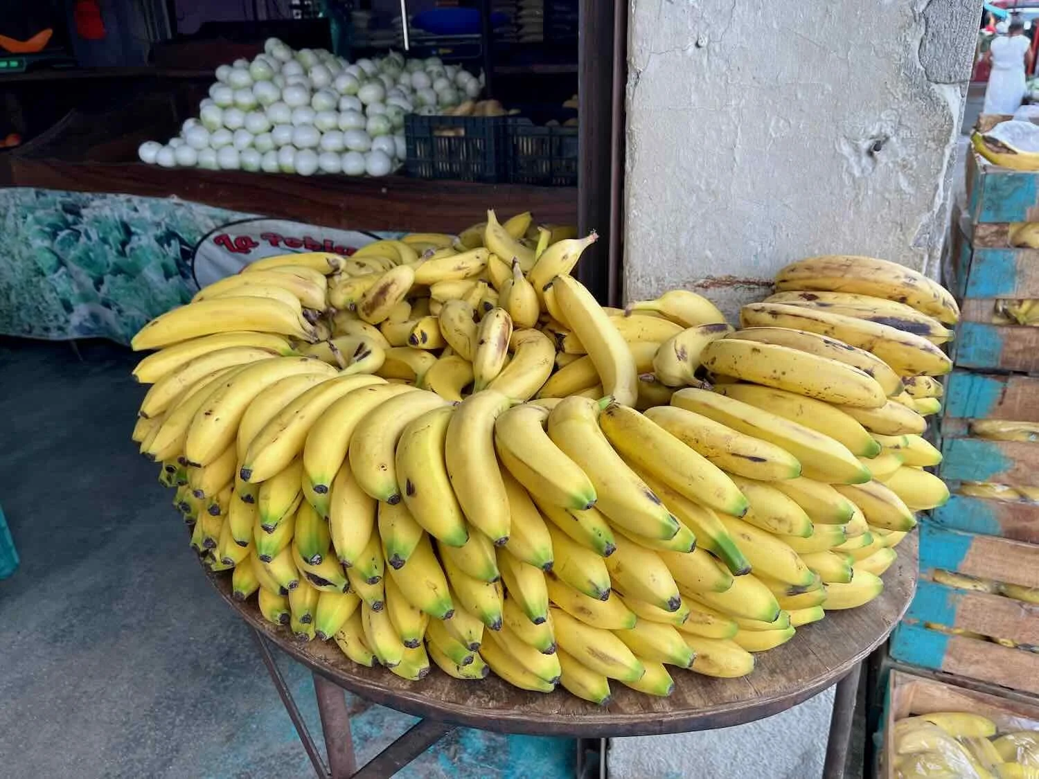
The wind continued with the same intensity as the previous day, if not a little bit more. As if to accentuate the point that this was a windy place, we cycled past many miles of wind energy turbines, all pointed northward to catch the Winds of Tehuantepec blowing across the isthmus. For the first time on this trip, we started to see small groves of banana trees and large woodlands of Mexican palmetto.
One of the many large wind farms that are positioned to catch the energy from the Winds of Tehuantepec. Near La Venta, State of Oaxaca, Mexico. Copyright © 2019-2023 Pedals and Puffins.
Even with the early start to the day, the hot sun and wind took their toll on us. We were quite ready to finish for the day when we rolled into Santiago Niltepec (pop. 3,220) around 11:40am.
To be honest, we had pretty low expectations for this hotel. But it turned out to be better than expected. We got a big room with air conditioning and hot water. The windows weren’t very well sealed, so we had the usual problem of the AC having trouble fully cooling the room - but it was way better than being outside.
Before dinner we walked over to the town plaza. There was an old church that looked like it had definitely seen better days. The Church of Esquipulas had been badly damaged by a series of severe earthquakes in 2017, and was no longer in use. Big cracks could be seen in the bell towers, which were being held together - very precariously - by a few wooden beams.
The ‘letras’ sign in the town’s central plaza. Santiago Niltepec, State of Oaxaca, Mexico. Copyright © 2019-2023 Pedals and Puffins.
The Church of Esquipulas was badly damaged by a series of earthquakes in 2017, and was no longer in use. We were intrigued by the strong indigenous influences on the church’s decorative facade. Santiago Niltepec, State of Oaxaca, Mexico. Copyright © 2019-2023 Pedals and Puffins.
On the other side of the central plaza stood another, bigger church, the Templó de Santiago Apóstol. The facade of this church looked like it had recently been painted, and it was radiant in the afternoon light. Next to the church was something we hadn’t seen before. A large, open-air hall was lined with pews facing an altar on one side. We later learned that this church had also been damaged in the 2017 earthquakes. In response, the town built the open-air nave as a place to hold services while the main church was being structurally repaired. (The biggest of these earthquakes had a magnitude of 8.2, and was the strongest one in the world that year. It severely damaged more than 40,000 buildings in Mexico.)
The Templó de Santiago Apóstol near the town’s central plaza. On the left, an open-air worship area was built after a series of earthquakes in 2017 made services inside the church unsafe. Santiago Niltepec, State of Oaxaca, Mexico. Copyright © 2019-2023 Pedals and Puffins.
It ended up being a rough night. In addition to the occasional roar of trucks going across the nearby overpass, a dog at the hotel was apparently on guard duty all night. He seemed to find something alarming to bark at every hour or so. There were almost certainly migrants who weren’t lucky enough to get a room wandering around the perimeter of the hotel at night. Whenever we started to drift off to sleep, the dog would start barking again. Unable to get much rest, we were up and out of bed by 5am. And once again we were on the road well before sunrise.
A Reprieve from the Wind
For the first time in a long time the morning air felt fresh, if not exactly cool. Even better, the wind was very light. We had finally gotten past the gap in the mountains that supercharged the wind across the isthmus. As we cycled down the highway, the sun began to peek over the mountains ahead of us. It was lovely, and our energy soon kicked in.
Without having to struggle into a headwind, the 40 mile (65 km) ride seemed positively easy. We cycled past several big orchards of mangos and bananas. The mountains to our north had gotten much taller, and now looked extremely rugged.
Staying close in the rear-view mirror. (PedalingGuy needs to clean his mirror more often.) Near Las Petacas, State of Oaxaca, Mexico. Copyright © 2019-2023 Pedals and Puffins.
One of several large mango orchards we passed along our route. Near Santo Domingo Zanatepec, State of Oaxaca, Mexico. Copyright © 2019-2023 Pedals and Puffins.
We saw this Central American milksnake along the side of the road. Unfortunately, it had been hit by a car, and was not alive. General Pascual Fuentes, State of Oaxaca, Mexico. Copyright © 2019-2023 Pedals and Puffins.
We rolled into the town of Chahuites (pop. 11,050) just after 11:00am, and were thrilled when the hotel where we stopped allowed us to get a room right away. After cooling off in the air conditioned room and showering away the crust of salt, we went for a walk around town.
An attractive statue at the entrance to town. Chahuites, State of Oaxaca, Mexico. Copyright © 2019-2023 Pedals and Puffins.
The ‘letras’ sign in the town square. Chahuites, State of Oaxaca, Mexico. Copyright © 2019-2023 Pedals and Puffins.
A cheerful street, decked out in the red, white and green colors of the Mexican flag. Chahuites, State of Oaxaca, Mexico. Copyright © 2019-2023 Pedals and Puffins.
Some musical instruments, temporarily idle while their owners took a rest from busking along a busy street. Chahuites, State of Oaxaca, Mexico. Copyright © 2019-2023 Pedals and Puffins.
Our Last Day Cycling in the Lowlands
The route from Chahuites to Arriaga would be our last on the Pacific coastal plain for a long time. It was also the day when we would hit our lowest elevation (20 ft above sea level) and reach our closest point to the Pacific coast (2.5 miles) since we left Matzalan five months ago. With a little less than 25 miles of cycling (40 km), it was also a comfortably short day. Finally, an overcast sky kept the morning from getting nearly as hot as it had been for the past few days. As a result, we were able to take our time and enjoy the ride a bit more.
In several places the cultivated fields gave way to areas covered with marshes and small ponds. For the first time in a long while, we passed ditches full of standing water along the road. This landscape was much wetter, and more humid, than most of the places we had traveled in Mexico. We stopped a couple of times to check out the wildlife in the marshes. We really enjoyed seeing the variety and abundance of birds.
This lovely plant’s name, stinking passionflower, refers to the pungent smell given off when the leaves are bruised. Los Cantiles, State of Oaxaca, Mexico. Copyright © 2019-2023 Pedals and Puffins.
A flock of black-bellied whistling ducks comes in for a landing. Los Cantiles, State of Oaxaca, Mexico. Copyright © 2019-2023 Pedals and Puffins.
Black-bellied whistling ducks eyed us cautiously as we watched them from the side of the road. Los Cantiles, State of Oaxaca, Mexico. Copyright © 2019-2023 Pedals and Puffins.
A family of black-necked stilts resting near the edge of a pond. Los Cantiles, State of Oaxaca, Mexico. Copyright © 2019-2023 Pedals and Puffins.
We were never too far from a few, lurking cows. Los Cantiles, State of Oaxaca, Mexico. Copyright © 2019-2023 Pedals and Puffins.
Even with all the stops along the road we arrived in the city of Arriaga (pop. 25,400) just after 10am. We went straight to our target hotel and were absolutely thrilled when they told us they had a room available for us right away. So before 11am we were settling into a pleasant room with a comfortable bed, air conditioning, hot water, pretty strong wifi, and plenty of room for the bikes. We couldn’t have asked for more.
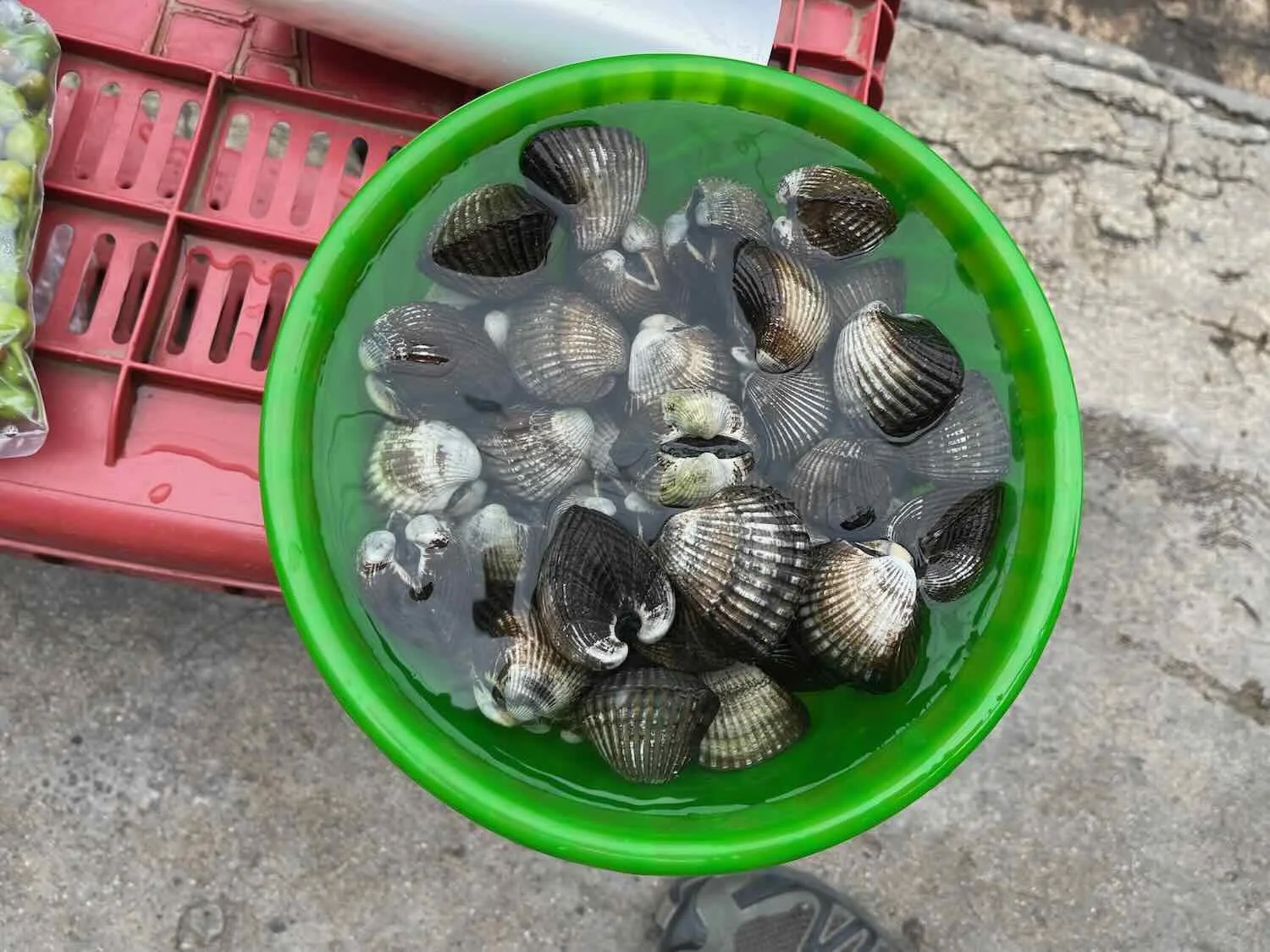
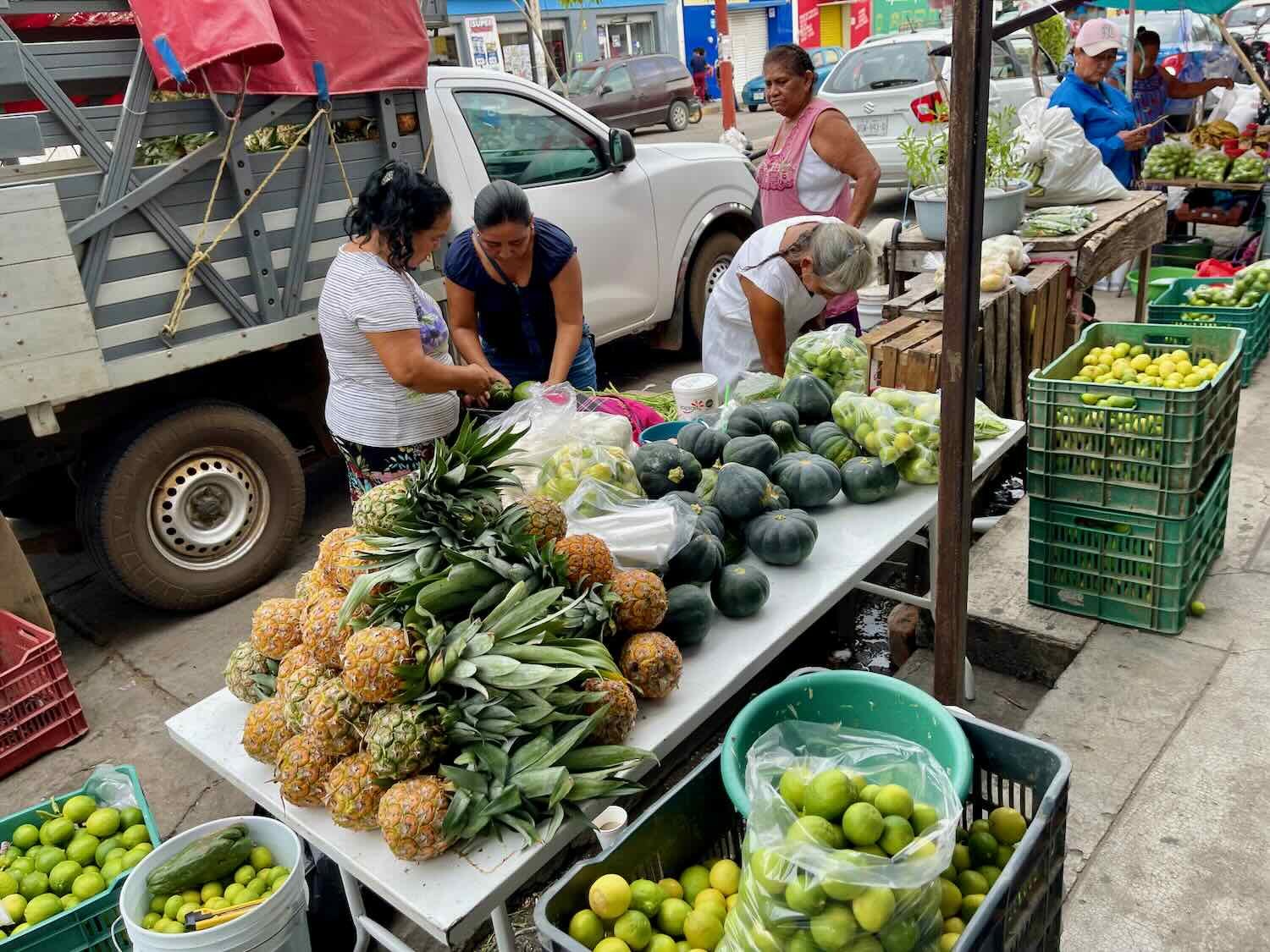
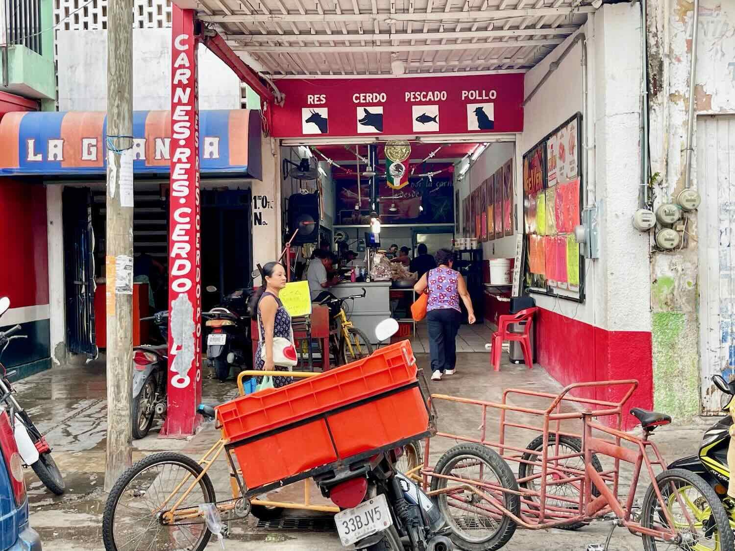
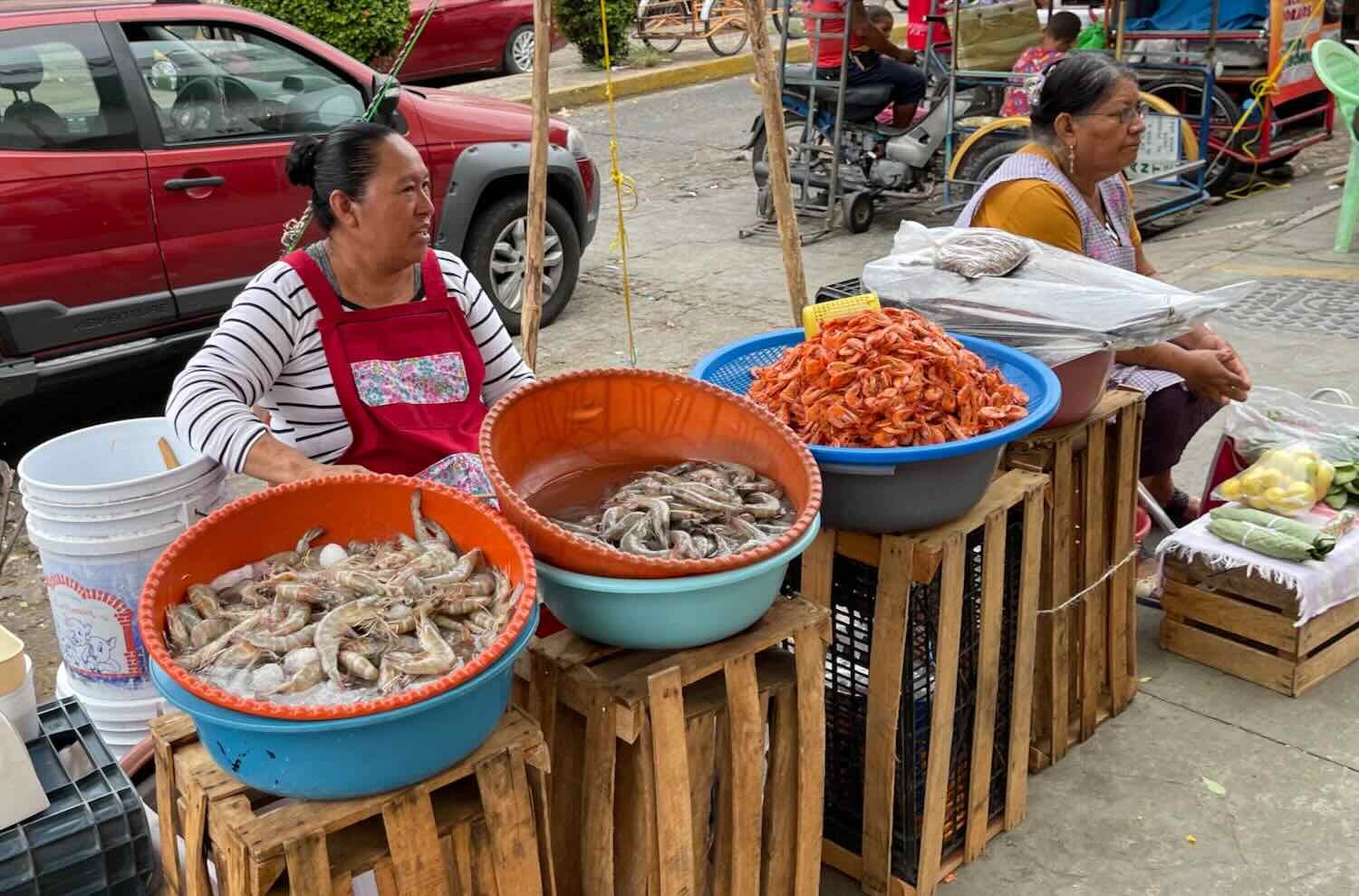
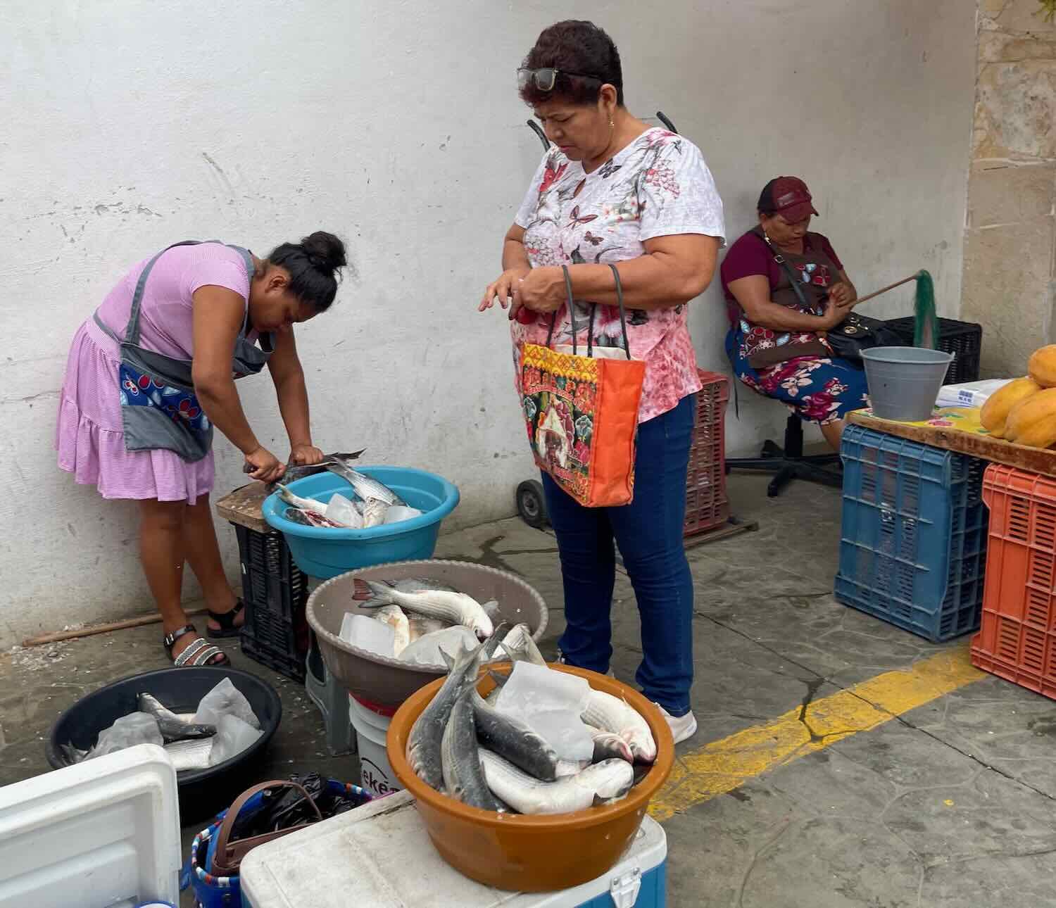
After cooling off a bit in our room, we went for a walk. Arriaga was a bustling town with a sprawling commercial district, packed with shoppers and vendors selling everything imaginable. The public market was huge - as big as any we’d seen in even bigger cities like Oaxaca. In addition to the usual piles of produce, herbs and freshly butchered meat there were many vendors selling seafood from the nearby Pacific coast. Fish and shrimp seemed to be particularly popular.
The ‘letras’ sign in the city’s central plaza. Arriaga, State of Chiapas, Mexico. Copyright © 2019-2023 Pedals and Puffins.
The public market was as big as others we had seen in cities ten times larger than Arriaga. It was also bustling with activity. Arriaga, State of Chiapas, Mexico. Copyright © 2019-2023 Pedals and Puffins.
Apparently Arriaga’s prominence as a commercial trading center goes back to the early 1900s, when the Pan-American Railway was routed through town. It’s still a central hub for agricultural products grown in Chiapas that are shipped to bigger population centers farther north. However, the railway tracks through the center of town town were no longer being used. Workers were in the process of removing the old tracks, creating a big pile of dismantled steel rails in the process.
Even though Arriaga had an edgy vibe because of the ubiquitous migrants hanging out near food stores and on most of the side streets, we decided to take a rest day before tackling the big climb back up into the mountains. As is our custom, we went for a morning walk. However, other than the city market and the central plaza, there wasn’t a lot to see. We walked up and down the main thoroughfares a couple of times, but the idea of wandering down any of the side streets wasn’t appealing. We made several passes through the municipal market, enjoying the sights and colors of Mexican commerce.
A River of People
By the time we reached Arriaga, the river of people walking northward had grown from a trickle to a flood. What started out as small groups of three to ten people ended up being thousands of migrants in an almost steady stream walking, resting in the shade of roadside trees or buildings, and often paying locals to give them rides to the next town up the road.
From what we could tell, transporting migrants north toward the USA had become a big business - not just for the smuggling cartels, but also for many locals in this area. We saw dozens of guys giving paid transportation to groups of migrants in tuk-tuks, on the backs of motorbikes, or in rickshaw-like carts being pulled by motorcycles. All day they would zip past us empty, returning in the other direction with as many people as they could squeeze into their vehicles. It was common to see three or four people riding precariously on the back of a single, modest motorcycle. There even were some places along the road, often near clusters of shops, where crowds of migrants would gather, presumably to catch the rides.
Everything was done in plain site of the authorities, who didn’t appear to do anything to discourage the migration. At one point we passed an immigration checkpoint along the highway where officers were stopping and checking vehicles heading north. Right next to the checkpoint a large crowd of migrants had gathered, and a woman in uniform was giving them an informational speech. We wondered what she was saying. One thing was clear, she was not turning anyone back. So what were the immigration officials checking for? Maybe they were focused on trying to catch human traffickers or drug smugglers. But there seemed to be the implicit understanding that as long as all the migrants continued onward to the United States, they would be allowed to pass through Mexico unimpeded.
We didn’t have a lot of direct interactions with the migrants, except in passing along the margins of the highway. Often they would ask us one of three questions: 1) do you have water? 2) do you have food? Or, 3) how far is the next town? We certainly could relate to the need to have plenty of water while traveling in the hot sun. But pretty soon we realized that there was no way we could help all of the people headed north.
Services along the highway were also being strained by the sheer volume of people passing through - especially the hotels. Many of the migrants traveled with enough money to be able to stay in hotels along the way. And since it was not safe to wild camp in this area, everyone - the migrants, regular travelers and us - was competing for the same, limited set of hotel rooms. One hotel where we stayed had even set up a row of hammocks on a balcony that people could rent for less than the cost of a private room. Before long we realized that as long as we traveled along the same route as the migrants, we would need to secure a hotel room by midday or all the rooms would be taken before we arrived. That gave us extra motivation to end our cycling days early (in addition to our desire to get out of the afternoon sun).
All told, it was a pretty eye-opening experience to cycle along the Pan-American Highway during one of the most massive human migrations in history. We will never forget the sight of an endless line of people making their way northward toward the USA. But after our stop in Arriaga we would be turning off the coastal highway, heading back into the mountains - and off of the main migration route. To be honest, it would be a relief. The scale of the migration problem is simply overwhelming.
Summary: A Journey from Mountains to Marshes
Well, it wasn’t all downhill. But we did cycle from an elevation of 5,100 ft (1,555 m) in Oaxaca to nearly sea level. Along the way we crossed five high passes in the Sierra Madre de Oaxaca, where lush forests still clung to the tallest peaks. In the valleys, rows of agaves destined to fill bottles of Oaxaca’s famous mezcal grew in a patchwork of fields. After a big, final descent on the Pan-American Highway, we reached the hot and humid Pacific coastal plain. There we encountered a tectonic movement of people, slowly working their way northward among the banana farms and marshes, with the hope that a dangerous and illegal crossing into the United States would lead to a better future.
We passed through a string of modest towns, varying from colorful and quaint to bustling and scruffy. After two days battling the Winds of Tehuantepec we finally landed in the commercial hub of Arriaga, where we rested a day before tackling the climb back into the mountains. Touring the steamy, coastal lowlands had been a nice change of pace - especially with the chance to see the abundant birdlife in the marshes. But we were definitely ready to leave the Pan-American Highway behind, and head back into the highlands for some relief from the heat.