TransMexico Norte Part 6: Cycling from Izúcar de Matamoros to Oaxaca, Mexico
29 August to 19 September 2023
29 Aug - Izúcar de Matamoros to Tehuitzingo (28.8 mi, 46.3 km)
30 Aug - Tehuitzingo to Acatlán de Osorio (25.2 mi, 40.6 km)
31 Aug-1 Sep - Rain days in Acatlán de Osorio
2 Sep - Acatlán de Osorio to Huajuapan (39.0 mi, 62.8 km)
3 Sep - Rest day in Huajuapan
4 Sep - Huajuapan to Tamazulápam del Progreso (25.3 mi, 40.7 km)
5 Sep - Tamazulápam del Progreso to Asunción de Nochixtlán (32.7 mi, 52.6 km)
6 Sep - Asunción de Nochixtlán to Oaxaca (53.1 mi, 85.5 km)
7-19 Sep - Independence Day Layover in Oaxaca
A Tragedy on the Highway
Within a few minutes of cycling out of the town of Izúcar de Matamoros we were passed by the first ambulance. It’s not that unusual for the occasional emergency vehicle to pass us out on the road, with their lights flashing and sirens wailing. Most of the rural towns probably don’t have much in the way of emergency medical services. So when there’s a serious injury or health episode an EMS team is dispatched from a bigger town, and races out to the village to render aid. In addition, we have heard that emergency services in Mexico are often run by private individuals who operate their own ambulances. So multiple ambulances can show up at the same accident, at the same time, and offer competing prices. As a result, we didn’t think that anything unusual was going on when the first couple of ambulances passed us in the early morning.
However, within the next half hour several more emergency vehicles zoomed past us, including a couple of additional ambulances. That was not normal. We wondered out loud if there was an accident somewhere down the road. But for the next three hours of cycling, we didn’t encounter any problems, so the worries about an accident slowly faded away.
After cresting our first large ridge for the day, we entered a broad valley called Puerto del Gato that was sprinkled with one of the most awesome species of cactus we have ever seen. There is no English common name for these giants - which occur only in south-central Mexico. In Spanish they’re known as candelabros, and it’s easy to see why. Their thick, spiked arms resemble a huge, dense, multi-branched candle holder. They’re so big that they towered over the shrubby deciduous forest, where they could be seen popping up through the canopy all over the hillsides. It was a very unique and beautiful landscape.
Posing with a stunning candelabro. These awesome giants are native to a relatively small area in south-central Mexico. Near Tehuitzingo, State of Puebla, Mexico. Copyright © 2019-2023 Pedals and Puffins.
The candelabros grow so big that they tower over the surrounding trees. It was fascinating to see them poking up through the forest all over the mountainsides. Near Tehuitzingo, State of Puebla, Mexico. Copyright © 2019-2023 Pedals and Puffins.
About two thirds of the way through the day’s ride we finally saw it - a long line of cars stopped along the road ahead of us. There had been an accident, after all. And even before we saw the crash itself, we realized that it must have been really bad. Nearly four hours had passed since the emergency vehicles had rushed to the scene that morning. And they still weren’t letting cars through in either direction.
We carefully worked our way past the long line of cars that stretched down the highway. Hwy 190, approaching Tehuitzingo, State of Puebla, Mexico. Copyright © 2019-2023 Pedals and Puffins.
After moving in, around and between cars we eventually reached the front of the line. And what we saw didn’t look good. Only a small part of the accident scene was visible. The rest was hidden from our view, around a bend in the road. But what we could see looked terrible. The crushed, mangled and burned-out skeleton of a small car lay partially in the ditch alongside the road. Just beyond the car, a broad swath of vegetation on the hillside was charred black - suggesting that there had been a pretty big fire associated with the crash. And as bad as that car was, it probably wasn’t the worst part of the accident. From what we could tell, the focus off the police and emergency crews was still farther up the road.
We could see the burned-out remains of a small car in the road ahead. But the attention of the police and emergency crews was still farther down the road - out of sight, around a bend. Hwy 190, approaching Tehuitzingo, State of Puebla, Mexico. Copyright © 2019-2023 Pedals and Puffins.
We waited there with our bikes for about an hour, unable to see how much progress was being made with the accident cleanup ahead. Then a couple of journalists who had been at the main accident site came over to where we were standing, and we were able to gain some insights into what had happened. Augusín and Dañi told us the accident had involved a truck and two cars. Four people had been critically injured. But, miraculously, all were still alive when they left in the ambulances. It was amazing that anyone could have survived in the crushed car that we could see. We hoped that they would all make it through this awful tragedy, somehow.
A short while later, PedalingGuy walked further up the road to a spot where he could better see around the bend in the road. From what he saw, it looked like the emergency workers still had a lot of work to do. A large truck carrying flammable liquids was toppled onto its side, completely blocking one lane. And another, smashed car was being slowly winched up onto a flatbed truck for removal from the other lane. There were 30-40 assorted officials that were involved in the cleanup including local police, state police, highway police, firemen, highway department workers, and various others like a guy who had a private water truck, a couple of tow truck drivers and ambulance staff.
The truck laying on its side had been in an accident with two other cars. Lettering on the back indicated that the truck was carrying a flammable liquid, which must have caught on fire at some point. There was a large, melted area of tarmac at the crash site. Plus, the vegetation on the entire hillside above the crash site had been charred by flames. Hwy 190, approaching Tehuitzingo, State of Puebla, Mexico. Copyright © 2019-2023 Pedals and Puffins.
After another half hour of waiting, we asked one of the policemen at the site if we could walk through, past the accident, with our bikes. We were motivated by the fact that it was getting unbearably hot standing around in the sun. At first they said “no.” But then a couple of policemen seemed to agree that it would be okay for us to pass as long as we stayed far to one side. It was impossible to determine who was in charge, but as long as someone gave us the ok, we decided to go with it.
We walked forward with our bikes. But as we got near the flammable tanker one of the firemen noticed us, and told us we could not yet pass. He waved at us to go back. So we backtracked a couple of dozen yards to wait.
Moments later there was an explosion and a huge flame burst out of the tank with the flammable liquid, that was laying on its side. Everyone, including the firemen, police, highway workers, tow truck drivers, and us ran for the hills trying to get as far from the burning truck as fast as possible. Our minds were racing, wondering how flammable and toxic the liquid in the truck might be, and how far away was a safe distance.
We took our bikes up to a line of shady trees about 100 yards from the now burning tanker. It felt like a reasonably safe distance, but it was likely no one really knew. With the expectation that we were likely to be waiting there for a lot longer, we set our bikes down and rested in the shade with a bunch of other people. We couldn’t see the burning tanker because it was hidden around the bend in the road. But we could see black smoke rising from the site, and flickering flames from a telephone pole that had caught fire as well. Occasionally, a stream of water would be visible above the trees as the emergency crew tried to douse the flames with a hose coming from the water truck.
In a surprisingly short amount of time following the explosion, the officials decided to start letting cars through. There may have been some concern about how long people had been waiting in the hot sun. Most people did not have water, so the baking heat, with temperatures approaching 100F (38C), was making everyone uncomfortable. They took down the yellow hazard tape that they had strung across the road and waved us forward, ahead of all the cars. As we got close to the accident site, we were actually surprised by this decision. The flammable liquids truck that had exploded was still burning. Motivated by the desire not to go out in a blaze of glory if the tanker exploded again, we hustled through the accident site as fast as we could.
When we reached the safety zone on the far side, we found chaos. Cars coming the other direction had gotten impatient while waiting, and many of them had tried to pass other cars by driving forward in the oncoming lane (our lane). The entire, two-lane highway was a jumbled parking lot of vehicles taking up both lanes of the road, and stretching for several miles. There was no way for the cars behind us to get through. Thankfully, we were able to weave our way between the mass of cars on our bicycles.
At this point we were headed downhill, so we were able to cycle very quickly. With the traffic jam blocking all of the cars behind us, we had the road to ourselves for nearly a half hour. That was a great relief. Pretty soon we rolled into the town of Tehuitzingo, glad to be safely off the road as the mess from the accident slowly unwound for the rest of the afternoon.
But we hadn’t escaped the accident, completely. The entire town of Tehuitzingo had no internet or cell phone service when we arrived. The receptionist at our hotel explained that it had been out since 7am, when the cable lines had apparently been knocked down by a car accident on the highway north of town…
The Cradle of the Mixtecs
Lightning and thunder boomed for several hours during the night. The next morning a steamy haze hung in the air, making for some sweaty cycling. After three hot hours cycling uphill, we finally reached the top of the ridge that lay between us and our destination for the day.
This lovely church seemed to be in perfect harmony with the shades of green on the mountainside. El Papayo, State of Puebla, Mexico. Copyright © 2019-2023 Pedals and Puffins.
A small tienda near the top of the pass had a couple of chairs and tables situated in the shadow of a big shade tree. It looked so inviting we promptly took a rest break, enjoying a couple of cold drinks before zooming down the far side of the mountain in 90F heat (32C).
Before long we were rolling into the small city of Acatlán de Osorio (pop. 20,000), known as the “Cradle of the Mixtecs.” Throughout history, Mexico has been a swirling cauldron of diverse cultures that rose and fell, fought and cooperated, influenced and displaced each other over time. Among these groups, the Mixtecs are one of the oldest and most enigmatic. Evidence of Mixtec settlements in the Puebla-Oaxaca region dates back 3,500 years. Yet they didn’t achieve the prominence of other cultures like the Olmecs, Mayans, Toltecs and Aztecs, in part because they rarely coalesced into larger cities. In fact, the biggest archaeological site associated with the Mixtecs, Monte Albán near Oaxaca, was originally built by a different culture (the Zapotecs) and was mainly used by Mixtecs as a religious site after it had been abandoned by the Zapotecs. Monte Albán was never a major residential site for the Mixtecs.
Throughout their history, Mixtecs thrived in relatively small, isolated communities nestled in remote mountain valleys that were ruled by local, royal families. The Mixtec cultural identity was maintained through a shared language (although there are nearly 50 existing, distinct dialects), commerce, marriage alliances and military cooperation as needed.
In spite of their geographic isolation, the Mixtecs had an outsized impact on some of the other, better known Mexican civilizations. Mixtec craftsmen were renowned for their skill in metallurgy, stonework, wood carving and pottery making. Products manufactured by the Mixtecs have been found among the “luxury” items discovered in excavated sites of pretty much all the other great Mexican civilizations.
When the conquistadors arrived in Mexico, the Mixtecs were only partially under Aztec domination, and fiercely resisted the Spanish invasion. At that time Acátlan de Osorio - the city we had just arrived in - was a prominent regional center for the Mixtecs and it remains an important part of their cultural heartland.
Arriving in the Cradle of the Mixtecs (Cuna de la Mixteca). Acatlán de Osorio, State of Puebla, Mexico. Copyright © 2019-2023 Pedals and Puffins.
The modern city is pretty big, and we cycled for nearly a mile along urban roads before reaching the main plaza, flanked by a glowing, yellow cathedral. It was a lovely sight after having spent the last week passing through towns that had rather dull urban centers.
The picturesque, central plaza. Acatlán de Osorio, State of Puebla, Mexico. Copyright © 2019-2023 Pedals and Puffins.
The weather forecast for the next couple of days was not encouraging. Rain was expected to blow into town around noon, and continue off and on for several days. So we decided to hunker down and let the bad weather pass. The conditions looked better for cycling after that.
We went out shopping to get some food and drinks, and it was in this town that we first encountered a phenomenon that would recur often throughout the rest of our travels in Mexico. PedalingGuy is a big fan of sugar-free drinks, so he typically shops for diet or sugar-free sodas. Many of the little tiendas in Mexico don’t carry any sugar-free drinks (except water), but if we looked around we could usually find a shop or two that sold some. In Acátlan, when we tried to buy some Coke Zero, the shopkeeper looked at the bottle, then cautioned us in a serious tone that we were about to buy a sugar-free drink. She wanted to make sure we weren’t making a mistake. They just don’t see that many customers who want to buy it (most Mexicans prefer “natural” sugar to artificial sweeteners). Plus, the labels on regular Coke and Coke Zero look very similar. The shopkeeper probably had some previous customers accidentally purchase the sugar-free version, and end up unhappy about it later. Once we told her that, yes, we really meant to buy Coke Zero, she was glad to sell it to us.
Acátlan’s big claim to fame is its spring fair, which is held for nine days during Holy Week. Drawing as many as 10,000 visitors, the fair features crafts for sale, horse races, bull riding (rodeo style), sports exhibitions, a parade, and the famous Dance of the Tecuanes. We first encountered hints of this traditional dance when we saw a statue of a Tecuán (a beast modeled after the jaguar) at the entrance to the town of Axochiapan. In the dance, a person dressed as a Tecuán chases people dressed as domestic animals (pigs, cows, chickens) with a whip and menaces people in the audience. This continues until the Tecuán is finally surrounded by participants dressed as peasants from different villages, who work together to subdue and “kill” the beast. They say it is a celebration of cooperation among the disparate Mixtec communities in the face of mortal danger.
Throughout the town we saw references to the fair and to the Dance of the Tecuanes. Billboards and wall murals contained images of the masks used by the dancers. And copies of the masks hung on the walls of many businesses.
A billboard near the central plaza advertised the Acátlan Cultural Fair for 2023. A Tecuán mask can be seen near the bottom of the mural. Acatlán de Osorio, State of Puebla, Mexico. Copyright © 2019-2023 Pedals and Puffins.
This mural depicts some of the masks of the Dance of the Tecuanes. The central face is one of the old, tired villagers who struggle against the beast. It’s flanked by jaguar masks, half hidden behind the villager. Acatlán de Osorio, State of Puebla, Mexico. Copyright © 2019-2023 Pedals and Puffins.
A chef sears some “al pastor” meat for our taco dinner. Acatlán de Osorio, State of Puebla, Mexico Copyright © 2019-2023 Pedals and Puffins.
But this was not the season for the Dance of the Tecuanes. Instead, preparations were under way throughout town for the celebration of Mexico’s Independence Day, which falls on September 16 (not Cinco de Mayo as many Americans think). Although the holiday was still over two weeks away, work crews were busy hanging banners, streamers, bells, and other decorations in the colors of the Mexican flag. And vendors began popping up on street corners selling everything from hair ribbons, to noise makers and actual flags in anticipation of the big event. Over the two days that we were there, it was fun to watch Acátlan de Osorio transform into a red, white and green spectacle of patriotic color.
A pop-up vendor selling accessories for celebration of Mexico’s Independence Day. Acatlán de Osorio, State of Puebla, Mexico. Copyright © 2019-2023 Pedals and Puffins.
Even the central cathedral got dressed up in preparation for Independence Day. Acatlán de Osorio, State of Puebla, Mexico. Copyright © 2019-2023 Pedals and Puffins.
A Long, Hot Day
The next cycling day was one of our most difficult since leaving Toluca. Over the first 34 miles (55 km) we would ascend roughly 4,000 ft (1,220 m). So, of course, we planned to get a nice early start. Too bad things didn’t quite work out that way.
We wanted our tires to be near their maximum pressure to get the best performance on the pavement for a long day. But we had forgotten to check and adjust the tire pressures the night before. In the morning, we decided it was really important for our tires to be in top form, so we took the time to check the tire pressures and pump them up. That took some time. But when we got to the last one, we discovered that PedalingGal’s front tire had lost a lot of air. There had to be a leak.
At first we couldn’t find it. But once we pumped up the tire, voilà, we heard the telltale hissing sound of air escaping through the treads. We found the hole and plugged it, and that seemed to fix the problem. However, we had lost a lot of time. We didn’t get on the road until nearly 8am, which was was not the early start we had targeted, and was actually later than normal. Not exactly an auspicious start.
Fortunately, the steepest climbs came within the first three hours, so we were able to get that section behind us well before noon. Along the way we spent several hours cycling through the southwestern corner of a small, but fascinating ecosystem called the Tehuacán Valley. The landscape was noticeably shrubbier and drier than the forests around Acátlan. Apparently this isolated, mountain valley is a center of extreme endemism and diversity - 2,700 species of plants have been identified there, of which nearly 30% are found nowhere else. One species that we couldn’t help but notice was the mezcal tetecho cactus. Its tall, skinny, solitary, un-branched columns rose up to 50 ft (15m) high, towering above the surrounding, shrubby forest.
The surprisingly tall columns of the mezcal tetecho cactus gave the landscape a unique look. These cacti are only found in south-central Mexico. Near Petlalcingo, State of Puebla, Mexico. Copyright © 2019-2023 Pedals and Puffins.
A floral arch marked the turnoff to the village of Tecomate. State of Puebla, Mexico. Copyright © 2019-2023 Pedals and Puffins.
As the day wore on, the heat and the endless climb started to get to us. The final two hours of cycling to the top of the ridge were quite challenging. We stopped often to buy cold drinks, sit in the shade, or just catch our breath by the side of the road. PedalingGal got low on electrolytes, and ended up taking two salt tablets at a rest stop - in addition to guzzling sports drinks. Our legs were shot at the end of the day.
Taking a moment to rest and rehydrate along the side of the road. Approaching Santa Gertrudis Salitrillo, State of Puebla, Mexico. Copyright © 2019-2023 Pedals and Puffins.
The ridges of the Sierra Madre del Sur marched away from us, into the distance. Near Reforma, State of Oaxaca, Mexico. Copyright © 2019-2023 Pedals and Puffins.
When we finally reached the small city of Huajuapan (pop. 56,000), it was nearly 5pm. To our delight, the hotel we checked into was one of the best we’d stayed in for a while, with a spacious room, comfortable beds, air conditioning, and (finally) good wifi. The biggest downfall was that there weren’t any restaurants nearby, and the two local tiendas were both minuscule. Although one of them actually had a bottle of Coke Zero on the shelf, the proprietor told us that it was very old, and even recommended that we probably shouldn’t buy it. So we didn’t. Before leaving, we asked if he would be open the following day (Sunday). He indicated that the tienda would be closed on Sunday, but if we knocked on the door of his house he should be home, and he would open up for us. We thought that was very hospitable of him.
Having worn ourselves out on the day’s ride, we made the decision to take a rest day. PedalingGal, in particular, needed to recover from the dehydration she suffered out on the road.
Resting in Huajuapan
After a restful night we took a morning walk into the center of the city, approximately 1.5 miles away (2.4 km). For breakfast we enjoyed some of the best pozole (hominy and chicken soup) in Mexico from a small, unassuming stall in the city market. According to the sign, Abuela Rosita started serving pozole here in 1947. Quite a tradition. The soup was absolutely delicious.
A breakfast of pozole soup at Rosita’s in the city market. Huajuapan de León, State of Oaxaca, Mexico. Copyright © 2019-2023 Pedals and Puffins.
The masterpiece - a perfectly seasoned bowl of fresh, Mexican pozole. Huajuapan de León, State of Oaxaca, Mexico. Copyright © 2019-2023 Pedals and Puffins.
Our walk took us past the Municipal Building, whose facade was covered with dramatic, historical murals honoring the town’s traditions, pivotal events, and most famous citizens. Huajuapan de León, State of Oaxaca, Mexico. Copyright © 2019-2023 Pedals and Puffins.
In the evening we took a taxi back into town for dinner, where we snagged a balcony table overlooking the central plaza and cathedral. The food was okay, but the highlight of the dinner was a couple of smoothies topped with whipped cream and fresh fruit. We enjoyed watching the evening sunlight slowly turn the cathedral a stunning golden hue. Every 15 minutes, a guy would emerge from the church to ring one of the bells. And the streets below were crowded with colorful vendors.
The best part of our meal was two, whipped-cream topped, mixed fruit smoothies. Huajuapan de León, State of Oaxaca, Mexico. Copyright © 2019-2023 Pedals and Puffins.
As the sun sank towards the horizon, it lit up the central cathedral with a golden glow. Huajuapan de León, State of Oaxaca, Mexico. Copyright © 2019-2023 Pedals and Puffins.
After dinner we took a stroll around the plaza, soaking up the lively atmosphere. After dark, the plaza was packed with families out enjoying the cool evening air. All the public spaces were decorated with red, white and green lights for the fast-approaching Independence Day celebrations. It was a wonderful way to end our day.
Children practiced their artistic skills on pages torn from coloring books and attached to easels in the town plaza. This was a public activity we saw in several town squares in southern Mexico. Huajuapan de León, State of Oaxaca, Mexico. Copyright © 2019-2023 Pedals and Puffins.

The Town of Music
The road from Huajuapan to Tamazulápam served up another day of mountain cycling. Although the elevation gain was a bit less than on the ride into Huajuapan, the distance was 30% shorter - which made the hills quite a bit steeper. We chugged along, enjoying a continuous series of panoramic vistas.
Heading up into the mountains. El Molino, State of Oaxaca, Mexico. Copyright © 2019-2023 Pedals and Puffins.
By mid morning we had gained about 1,200 ft (365 m) and reached the top of the first big ridge. For the next 40 minutes we cycled over undulating hills, past overlooks with views into a broad, arid valley. The scrubby trees were smaller and a lot more spread out than they had been higher on the mountain.
Looking out over the high, dry valley that lay between a couple of mountain ridges in southern Mexico. Corral de Piedra, State of Oaxaca, Mexico. Copyright © 2019-2023 Pedals and Puffins.
But before long it was back to the climbing. As we ascended the next mountain pass the lush, green forests returned. Although there were a few, scattered patches of corn, there was significantly less farming up in the highlands.
Our route cut through sections of the mountains, and snaked its way up into the Sierra Madre del Sur. Curvas del Mono, State of Oaxaca, Mexico. Copyright © 2019-2023 Pedals and Puffins.
What’s more, the road signs started to get more and more difficult for us to read. Many town names were based on traditional, native Mexican words full of X’s and unfamiliar combinations of letters. The X’s were particularly problematic because they could represent any of five different sounds found in English including X, Z, S, SH, or H - sometimes taking on different sounds within the same word (when there are multiple X’s). It was quite challenging to figure out the correct pronunciation for a town’s name, unless we heard someone else say it first.
The names of towns have been getting progressively more challenging for us. When people asked us where we were headed, they frequently had to correct our pronunciation of words full of X’s and other unfamiliar combinations of letters. Near Xaxarja, State of Oaxaca, Mexico. Copyright © 2019-2023 Pedals and Puffins.
When we rolled into the town of Tamazulápam (pop. 6,650), the first thing we noticed was the music. It was being broadcast from somewhere near the central plaza, and it was really, really loud. Like, outdoor rock concert loud. We could hear it even on the outskirts of the village, more than a mile away. But we could tell that it wasn’t live music. Instead, it was a recording of old pop and bossa nova tunes (think, The Girl from Ipanema and Feelings) played on an organ. We figured there must be a festival going on in the centro.
Unsurprisingly, rain was forecast for the late afternoon and evening. So after arriving in town we rested just briefly before heading out for an early dinner. By that time the music had stopped, and many of the vendors that we had seen earlier lining the main plaza had packed up their stalls and gone home. We bought a couple of drinks and enjoyed them in the peaceful, leafy park. The playground was crowded with kids burning off some steam while their parents lounged on benches and chatted nearby.
A statue of Benito Juárez, who was one of Mexico’s most famous presidents, sits in the main plaza. He’s especially revered around here, because he was born and raised in the state of Oaxaca. Central Plaza, Tamazulápam del Progreso, Oaxaca, Mexico. Copyright © 2019-2023 Pedals and Puffins.
An enigmatic painting on a large slab of rock showed a battle between a serpent warrior and a frog warrior. Central Plaza, Tamazulápam del Progreso, Oaxaca, Mexico. Copyright © 2019-2023 Pedals and Puffins.
In Tamazulápam the cathedral does not rise up adjacent to the central plaza, the way it does in many other Mexican towns. Instead there was a large, walled-off, well-manicured garden that sat between the central plaza and the big church. We took a stroll through the garden’s tranquil, flagstone paths among neatly-trimmed hedges and topiary images of animals like birds and deer. The cathedral itself had some baroque touches, but the carvings were much more subdued than what we had seen on a lot of the old mission churches. What stood out was the two-toned painting, with ochre-colored accents against a warm yellow base. It really was quite different from any other churches we had seen along our route.
The town’s church had a striking, and very uniquely painted facade. Church of Santa María de la Natividad, Tamazulápam del Progreso, State of Oaxaca, Mexico. Copyright © 2019-2023 Pedals and Puffins.
The interior was just as unusual. Although the only hues were a muted mix of light cocoa, cream and ivory, the design used big blocks of color that looked like something out of a fairytale castle (unlike most churches, in which the stone interior is left largely unpainted). A massive, gold-leaf altarpiece covered nearly the entire wall on the far side of the church. And up on the ceiling, white plaster patches fanned out in a spider web across the church’s dome in an effort to repair damage from earthquakes that happened in 1980 and 1999.
We were impressed by the bold design of the church’s interior, as well as the spider web of plaster in the main dome - repairs to cracks that formed after earthquakes in the late 20th century. Church of Santa María de la Natividad, Tamazulápam del Progreso, State of Oaxaca, Mexico. Copyright © 2019-2023 Pedals and Puffins.
Then it was time to find some dinner. The receptionist at our hotel had recommended a specific restaurant. But after walking down the main street for a while, we couldn’t find it. She had also told us that if we couldn’t find the restaurant, we could ask pretty much anybody were it was, and they would know. So after deciding we must have missed it, we asked a local couple sitting on a nearby bench where to find the restaurant “El Portal.” This seemed to amuse them very much. As it turned out, we were practically standing right in front of it. However, the name on the restaurant was De La Parroquia - not El Portal. It’s just that everyone in town called it “El Portal” because it was in a building with colonnades. Ah, well. At least we provided some entertainment for a couple of folks that evening. Even better, the restaurant turned out to be an excellent place for dinner. So everyone was happy in the end.
To our utter surprise, the VERY loud organ music started up again around sunset (about 6:30pm). Several hours later, it was still going strong. Even inside our hotel room, the music was loud enough that we had to raise our voices to speak to each other. Curious about whether there was a festival or something like that, we inquired at the front desk of our hotel. But we were told that it was simply “the custom” for the central cathedral to play loud music every day. Really. He assured us that it should end by 10 or 11pm. And fortunately, it did. We were able to enjoy a quiet night of rest, after all.
At 6:30am the next morning the music started again. PedalingGuy said it didn’t bother him. But by that point PedalingGal couldn’t wait to get away. The melodious strains of organ music playing an old ABBA tune followed us as we cycled away from town.
Crossing the Sierra Madre del Sur
This was the day that we would cross over the highest pass that lay between the lowlands of Puebla and the Oaxaca Valley. Fortunately, we had been gaining elevation each day for a while, so the final push over the Sierra Madre del Sur actually required a little less climbing than we’d tackled on recent rides. Still, it took us more than three hours of steadily laboring uphill to finally reach the top of the ridge.
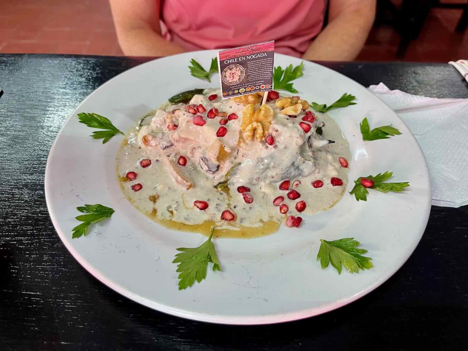
Along the way we had our first sighting of ripe pomegranates growing here and there in people’s gardens. Although pomegranates are not native to Mexico, they’re actually an important ingredient in a national dish that’s closely associated with the celebration of Mexico’s Independence Day - Chile en Nogada (a stuffed poblano pepper topped with white walnut sauce and sprinkled with pomegranate seeds). And it’s no coincidence that they ripen just in time for this dish to be served all over the country in the month leading up to Independence Day (September 16).


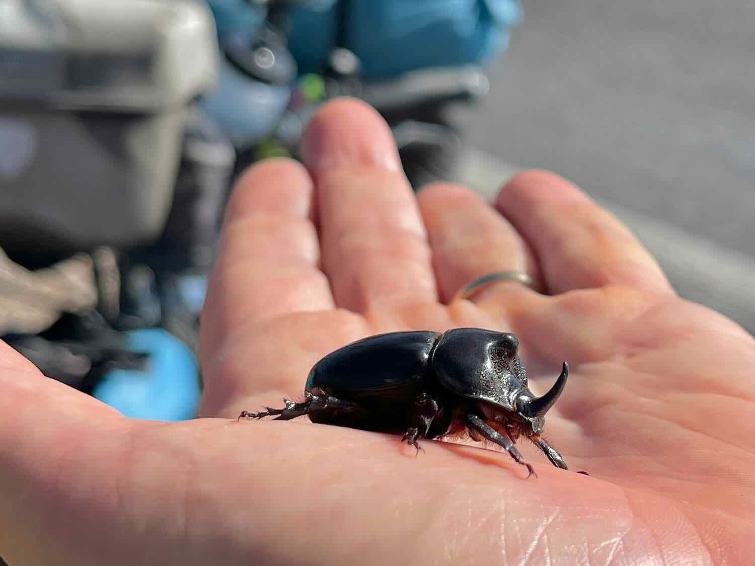
As we gained altitude, we started to see some really big bugs buzzing through the air. They made such a loud noise that at first PedalingGuy thought one of his tires had sprung a leak and was hissing as air escaped. Luckily, that was not the case. Once we realized the sound was coming from really big bugs, we thought they might be cicadas. With each mile, they became more numerous. And pretty soon we started seeing a few walking along on the road, so we stopped to have a look.
They weren’t cicadas, after all. They were much more fun. The big bugs turned out to be western rhinoceros beetles, complete with a nice, big horn on their snouts. Not long after that we reached the top of the pass, at 8,100 ft (2,470 m) - 5,000 ft higher than we’d been not that long ago.

View from near the top of the pass in the Sierra Madre del Sur mountains. Cerro de los Corazones, State of Oaxaca, Mexico. Copyright © 2019-2023 Pedals and Puffins.
A fast descent off of the mountain brought us rolling into the town of Santo Domingo Yanhuitlán right around lunch time. On the way into town we were stopped in our tracks by the sight of the monumental, 16th century ex-convent that looms over the otherwise modest village. It sits on top of what looks like a small hill, but which is actually the remains of a pre-Hispanic ceremonial site that was razed by the Dominicans to create a platform for the convent. Today, the colossal stone building serves as a museum and cultural center.
Built with thick walls and massive stone buttresses, this Dominican ex-convent dominates any view from within the town. Santo Domingo Yanhuitlán, State of Oaxaca, Mexico. Copyright © 2019-2023 Pedals and Puffins.
We don’t usually stop for a meal along the route, preferring to take quick breaks for light snacks until we reach our final destination for the day. But the climb over the pass had made us hungrier than usual, and as noon approached we started looking for a place to stop for some food. We ended up at a small taco stand that is typical of the ‘comedors’ that pop up near the edges of small towns all along the highway. In these little restaurants you can usually count on grabbing a quick meal of good, fresh, and inexpensive food.
This small, roadside ‘comedor’ didn’t appear to have a name. But the cook served us some hearty tacos to get us down the road. San Mateo Yucucui, State of Oaxaca, Mexico. Copyright © 2019-2023 Pedals and Puffins.
From there it was a relatively easy, half hour sprint into the town of Nochixtlán (pop. 15,850). The day ended with a slightly hectic ride down the busy main road, into a dense, urban center with narrow, one-way streets. We checked into a tiny hotel that had only a handful of rooms just before it started to rain. And before we were even settled in, the rain came down in buckets. We were very happy to have a roof over our heads.
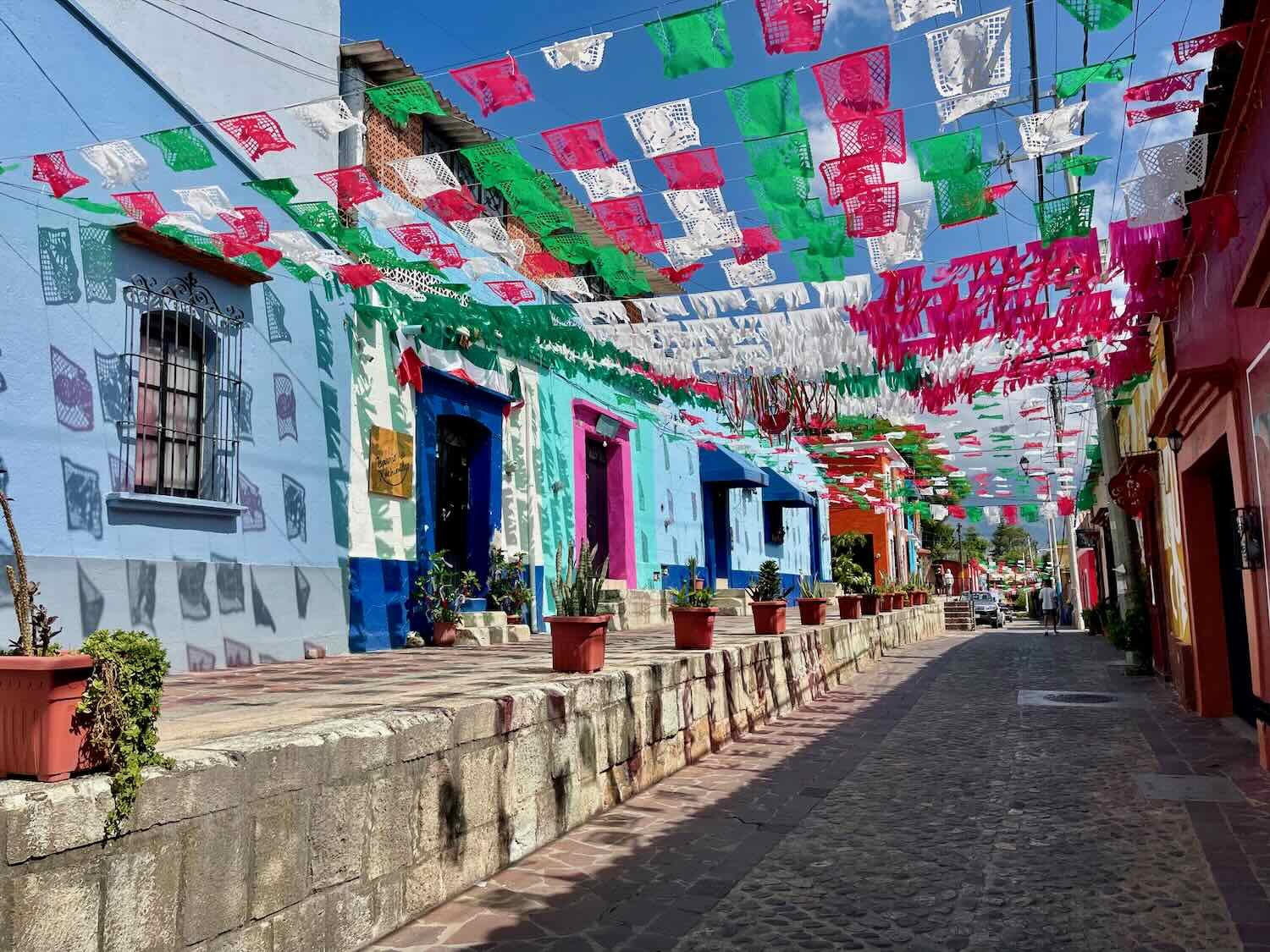
Like many of the towns we’ve visited in Mexico, this one was decked out in vibrant colors. We’ve really come to appreciate the festive flags and streamers that brighten up the city streets. Asunción de Nochixtlán, State of Oaxaca, Mexico. Copyright © 2019-2023 Pedals and Puffins.
During an early evening break in the rain, we walked over to the main plaza. The central gazebo was under renovation, with a large section of the plaza being cordoned off from use. As a result, the plaza was surprisingly empty of people. It was very different from most of the towns we had visited, where the plaza was always crowded with families in the evening. There were some kids practicing in a marching band on one side, near the church. But that was about it. After dinner the clouds had moved in again, and we just made it back to the hotel before another burst of storms rolled through.
The central cathedral was decked out inside as if for a special event - maybe a wedding? It was impossible to know for sure. Asunción de Nochixtlán, State of Oaxaca, Mexico. Copyright © 2019-2023 Pedals and Puffins.
Our Long-Awaited Return to Oaxaca
Twenty years ago we had spent 10 days in Oaxaca, which became one of our most memorable vacations ever. We had dined on mole negro on a terrace overlooking the main plaza, visited the famous Monte Albán archaeological site, and toured some of the indigenous artisan communities that surround the city. Now we were eager to return, and feel the magic of this very special city once again.
But first we had to get there. With a long and challenging day of cycling ahead of us, we arose at 5am to be sure to get an early start. We were out the door and on the road just before sunrise. It was a great way to start the day.
To simplify our lives and reduce the amount of climbing we would have to do while traversing the last couple of ridges in the Sierra Madre del Sur, we opted to ride on the autopista, one of Mexico’s superhighways. They’re often toll roads, and they are engineered to plow over difficult terrain by slicing through mountain ridges and crossing steep ravines on soaring bridges. Best thing for cyclists, they typically have wide, smoothly-paved margins that allow for safe and hassle-free riding - even when there is fast-moving traffic on the road.
For the first four hours of cycling, the traffic wasn’t even that busy. And by taking the autopista we saved ourselves 12 miles of cycling (19 km), and 1,000 ft of climbing (305 m). As a result, the ride to Oaxaca was just a little bit long and challenging, instead of being an exercise in misery.
The first 1.5 hours were some of the easiest - including a nice, long descent - and the miles flew by. Then we hit some more serious hills. For the next couple of hours we traversed a succession of ridges in the Sierra Madre de Sur that were just long enough to wear out our legs before sending us into 40mph (65kph) descents. But it could have been a lot worse. The autopista softened a lot of the terrain, especially by crossing a number of deep ravines on lofty bridges.
Admiring a devil’s tongue barrel cactus by the side of the highway. San Jerónimo Sosola, State of Oaxaca, Mexico. Copyright © 2019-2023 Pedals and Puffins.
In the highest valleys of the Sierra Madre del Sur, the hillsides were blanketed with dense, humid forests. San Jerónimo Sosola, State of Oaxaca, Mexico. Copyright © 2019-2023 Pedals and Puffins.
As we began our descent towards the Oaxaca Valley, the forests transitioned to drier, more open woodlands, with grasslands and pasture in between. The number of small farms started to increase again, as well. San Jerónimo Sosola, State of Oaxaca, Mexico. Copyright © 2019-2023 Pedals and Puffins.
About halfway through the ride we officially emerged from the Sierra Madre del Sur and into the Oaxaca Valley - a broad, high, relatively flat region surrounded by mountains. It is a cradle of ancient civilization - the people who lived here 4,000 years ago are believed to have been among the first to cultivate corn, squash, chili peppers, black beans, avocados, and the agaves used to make mezcal.
We took a roadside break next to this boarded-up building. It was painted with images celebrating the cultivation of corn. Cruz de Piedra, State of Oaxaca, Mexico. Copyright © 2019-2023 Pedals and Puffins.
PedalingGal’s click-stand had been bent when her bike fell over prior to our long layover in Toluca/Mexico City. Our repair job using duct tape and a short piece of PVC tubing seemed to be holding up okay. Cruz de Piedra, State of Oaxaca, Mexico. Copyright © 2019-2023 Pedals and Puffins.
The small towns surrounding Oaxaca have a tradition of developing unique crafts - with the specific skills, designs and color schemes being handed down from one generation to another. Several of the towns we passed on the way to Oaxaca appeared to specialize in the production of brightly-colored, hand carved, wooden toy trucks, which were appealingly displayed by the side of the road. Santiago Tenango, State of Oaxaca, Mexico. Copyright © 2019-2023 Pedals and Puffins.
This billboard reminded us that the Oaxaca Valley is the heartland of mezcal - tequila’s lesser known, more complex, and more potent cousin. San Pablo Huitzo, State of Oaxaca, Mexico. Copyright © 2019-2023 Pedals and Puffins.
Finally, after more than 5.5 hours of cycling, the road finally leveled out and we entered the city of Oaxaca. The endless succession of hills had sapped the energy from our legs, so it was a thrill to be able to cycle along at a brisk, even pace.
Made it to the city of Oaxaca, the land of seven moles. Oaxaca de Juárez, Mexico. Copyright © 2019-2023 Pedals and Puffins.
Unfortunately the nice, wide shoulder on our road disappeared at the edge of town. So we opted to cross over to a quieter and safer street that paralleled the highway. It was a bit of a challenge to follow, because it alternated between pavement and dirt, as well as weaving back and forth across a set of abandoned railroad tracks. But as we got closer into the city center, the track itself became a pedestrian/bike path that was constructed by filling dirt in between the rails (which had been left in place) - a nice, low cost version of a rail trail. It was a bit tricky when there were oncoming cyclists or pedestrians, since the space between the rails wasn’t quite wide enough for passing. Otherwise, it made for a smooth, direct ride.
Cycling the Avenida Ferrocarril rail trail. Oaxaca de Juárez, Mexico. Copyright © 2019-2023 Pedals and Puffins.
When our route turned back onto the pavement, we were in for another surprise. The road we had chosen launched up the side of a steep hill called the Cerro del Fortín. This arm of the Sierra Madre mountains reaches down towards the city center from the higher ridges to the north. And our road took the scenic route, hugging the edge of the mountain on its way towards a bluff overlooking the city.
Fortunately, there was a sidewalk that separated us from the fast-moving traffic. But there were several indications along the way that this was not meant to be a bicycle path. Most notably, the words No Bicis (“no bicycles”) were painted on the sidewalk every so often. That was probably because at almost every road crossing the sidewalk included several oversized stairs that we had to push our bikes up and over. It was a tough slog at the end of a long day. Since there was no one else using the sidewalk and the road was very treacherous, we decided to remain on the sidewalk and take our chances that we were violating some rule. At least we would stay safe.
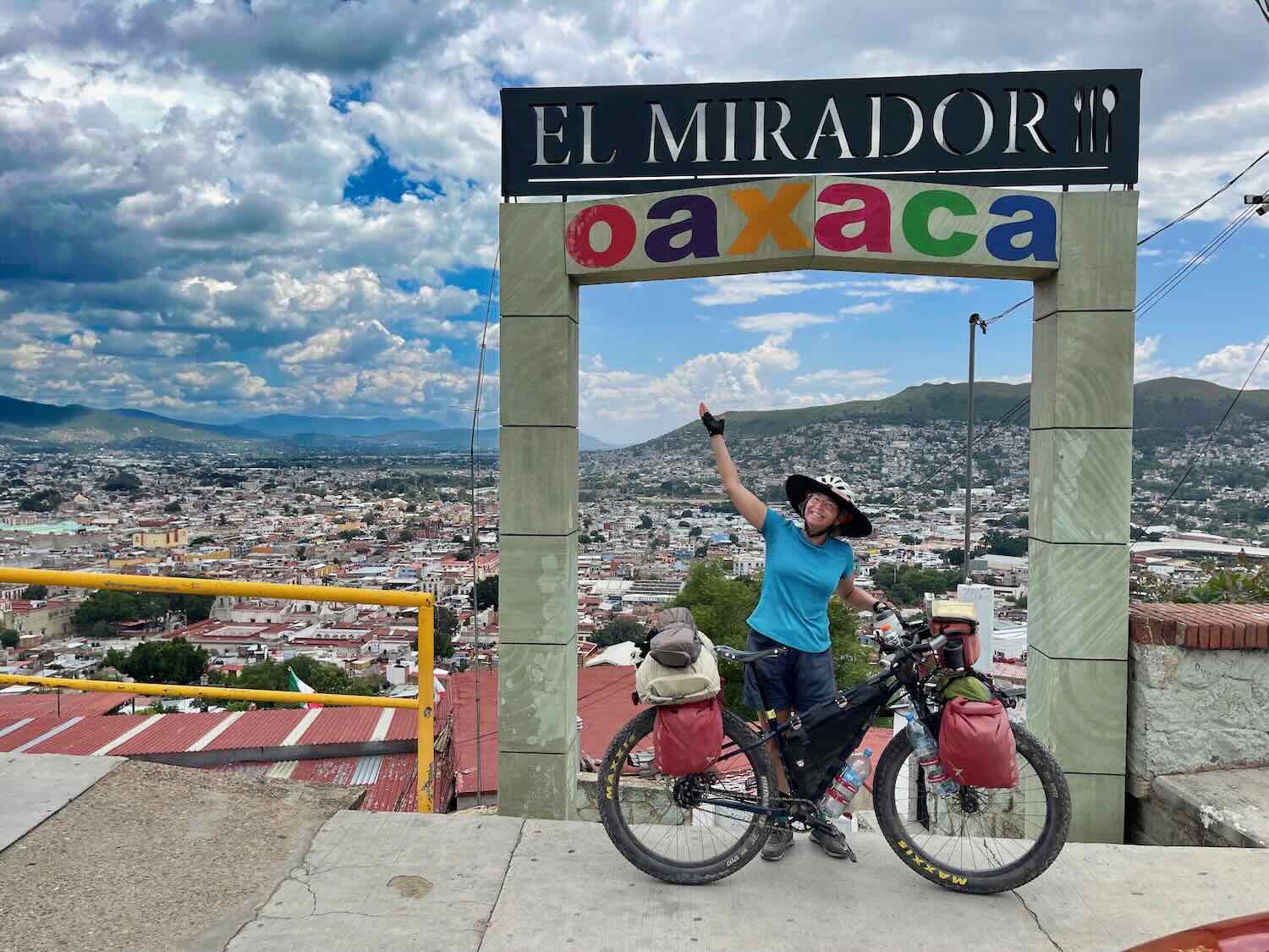
But when we reached the top it was all worth it. A small parking area marked the Mirador del Cerro del Fortín - an overlook that rises several hundred feet above the city. There was an awesome view. We sat on one of the walls for a quick breather, admiring the vista, before heading down the other side.
Made it to the top of the Mirador del Cerro del Fortín. Oaxaca de Juárez, Mexico. Copyright © 2019-2023 Pedals and Puffins.
Usually we are able to just roll into a city or town and check into the hotel of our choice. Rarely have we run into any problems. But Oaxaca ended up being one of those places where settling down in a hotel room was a bit more challenging. As best as we could figure, the primary drivers were that most of the hotels are quite small (often with fewer than 10 rooms) and we were there over the Independence Day holiday (which is a pretty big deal in Mexico). Combined with the fact that Oaxaca is always a very popular tourist destination, we found that many of the hotels were filled to capacity on random nights, preventing us from using any single hotel as a base to explore the city.
So we ended up staying at three different hotels in Oaxaca. Fortunately, that didn’t disrupt our plans too much. On the bright side, we got to stay a couple of different parts of the city, which gave us a chance to explore new neighborhoods.
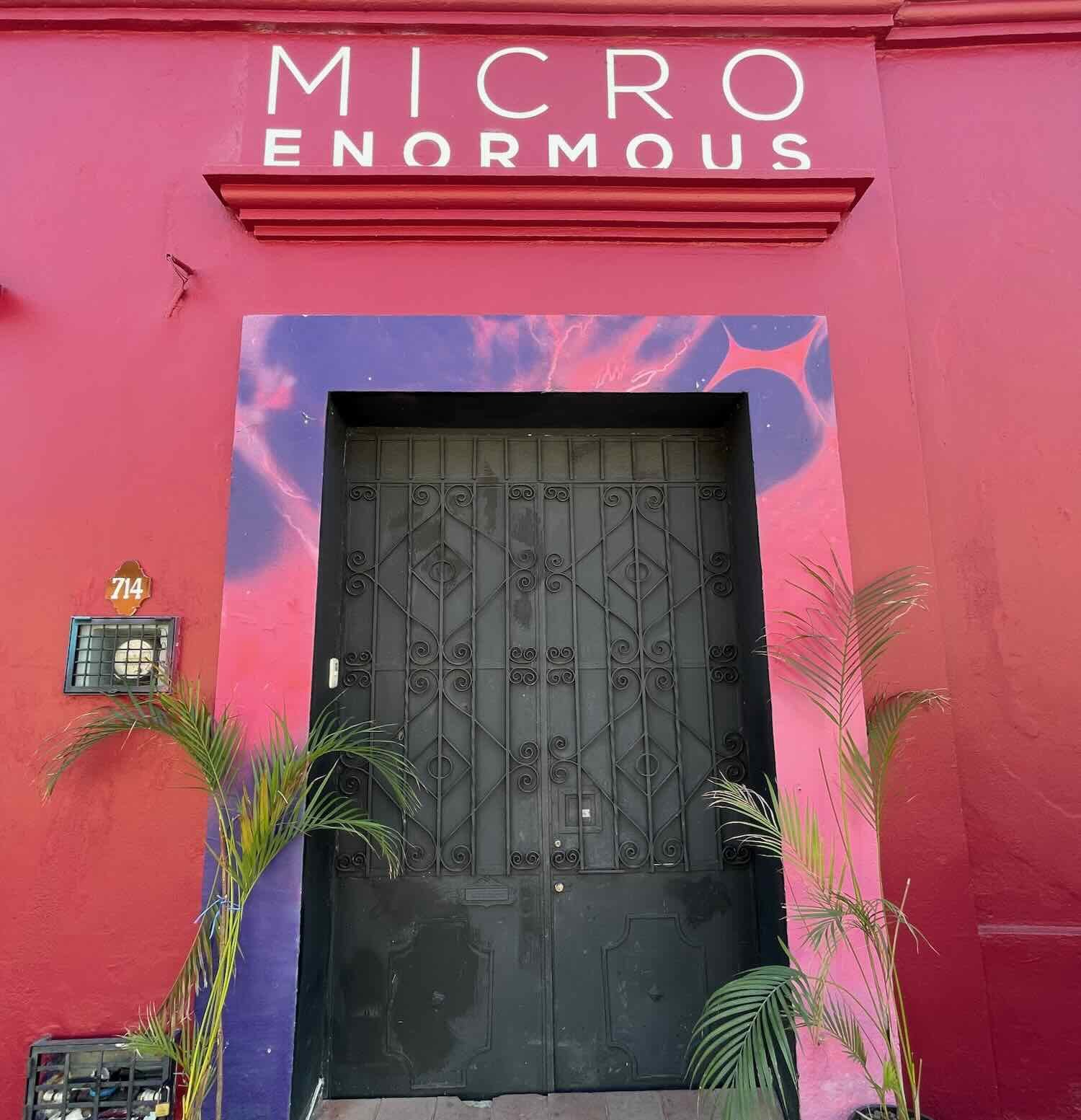
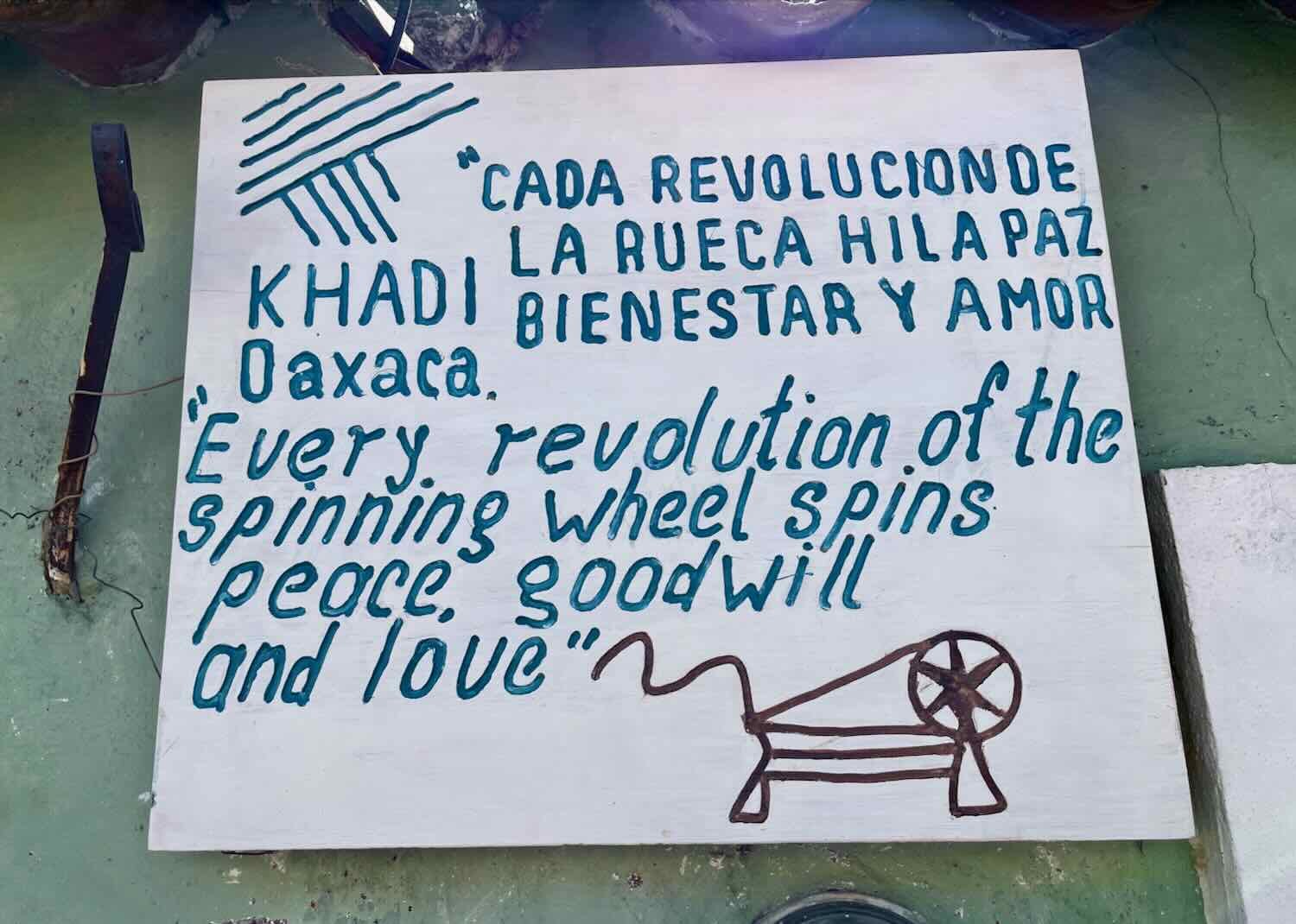
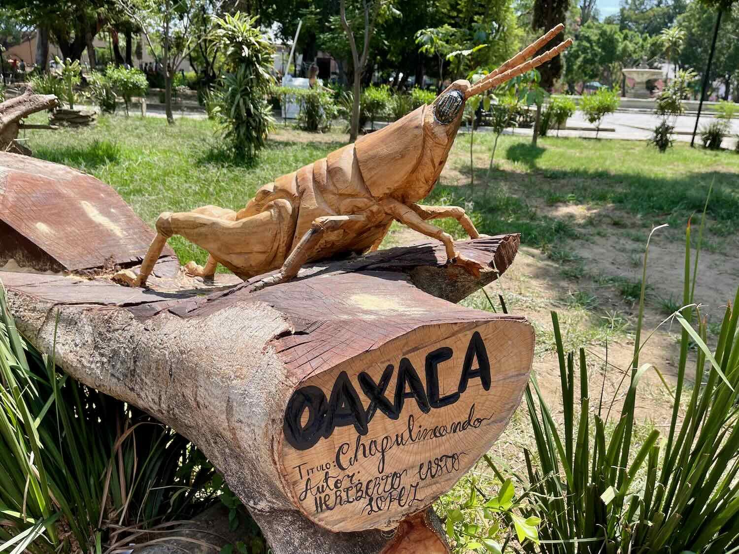
Independence Day Layover In Oaxaca
We spent the next 12 days in the city, wandering the historic streets, hanging out in the shaded, central plaza, and exploring the cultural highlights of this very special place. Below are just some of the photos we took, while soaking up the vibrant spirit of Oaxaca.
One of the most beautiful tree species in the city was the African tulip tree. These thick shade trees, festooned with giant orange blossoms, were common throughout the city. Oaxaca de Juárez, Mexico. Copyright © 2019-2023 Pedals and Puffins.
A quiet moment near the Church of Santo Domingo de Guzmán. The interior of the church has a unique, incredibly ornate, carved and painted ceiling that is unlike any other we’ve seen in Mexico (see photo below). Oaxaca de Juárez, Mexico. Copyright © 2019-2023 Pedals and Puffins.


The state of Oaxaca is the heartland of mezcal production in Mexico. 90% of all mezcal worldwide is grown, distilled, and bottled in the state. This shop in a city market had dozens of the local, artisanal brands for sale. Oaxaca de Juárez, Mexico. Copyright © 2019-2023 Pedals and Puffins.
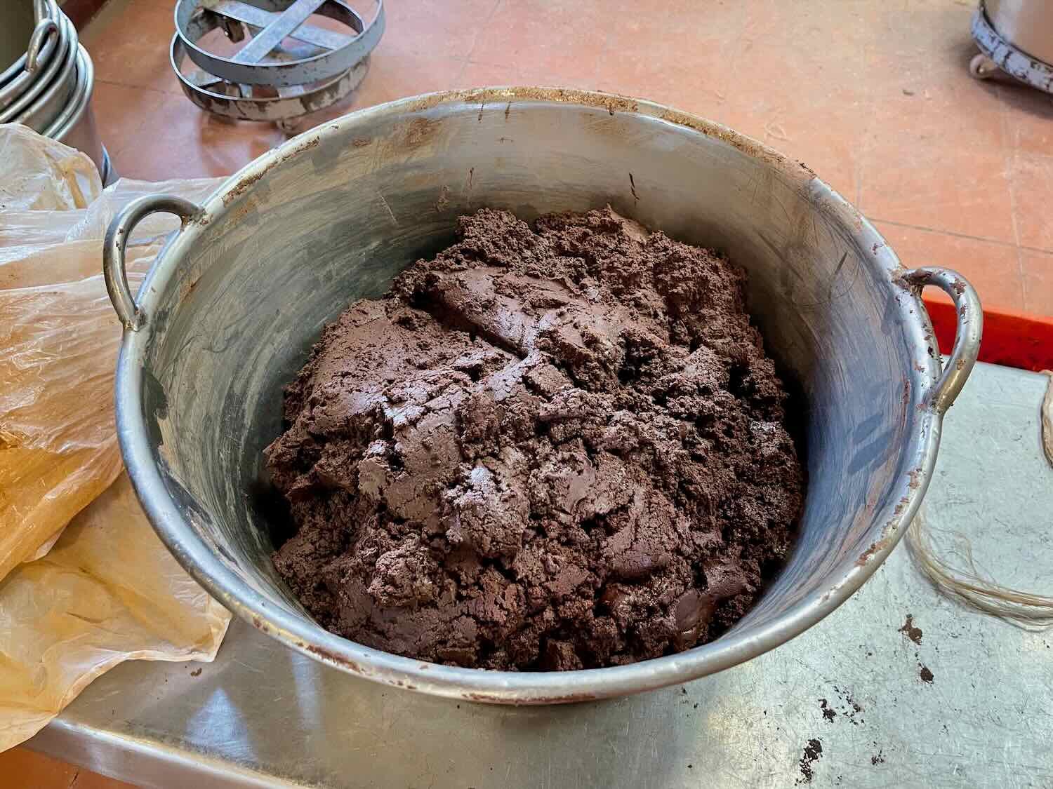
Cacao - the bean used to make chocolate - is not actually grown in Oaxaca. But the region’s ancient importance as a center of trade made it a hub for the processing of cacao and production of chocolate dating back to ancient times. Today, Oaxaca is probably Mexico’s premier center of expertise in traditional uses of chocolate, including in mole sauces and a wide variety of artisanal drinks. Of course, they also produce chocolate sweets. Several dulcerías and bakeries in town grind their own cocoa and produce chocolate on site.
A worker guides a mixture of cocoa beans, sugar, cinnamon, and probably some other secret ingredients, into a grinder to produce chocolate paste. Oaxaca de Juárez, Mexico. Copyright © 2019-2023 Pedals and Puffins.

We took a tour of the Oaxaca Ethnobotanical Garden, where we learned about many of the native plants that have traditional uses in Mexican culture. It was fascinating to see some of the more unusual plants, like teosinte, that is the ancestor for modern corn (maize). There were also many other plants on display that are used for food, production of dyes, fibers for cloth, and traditional medicines.
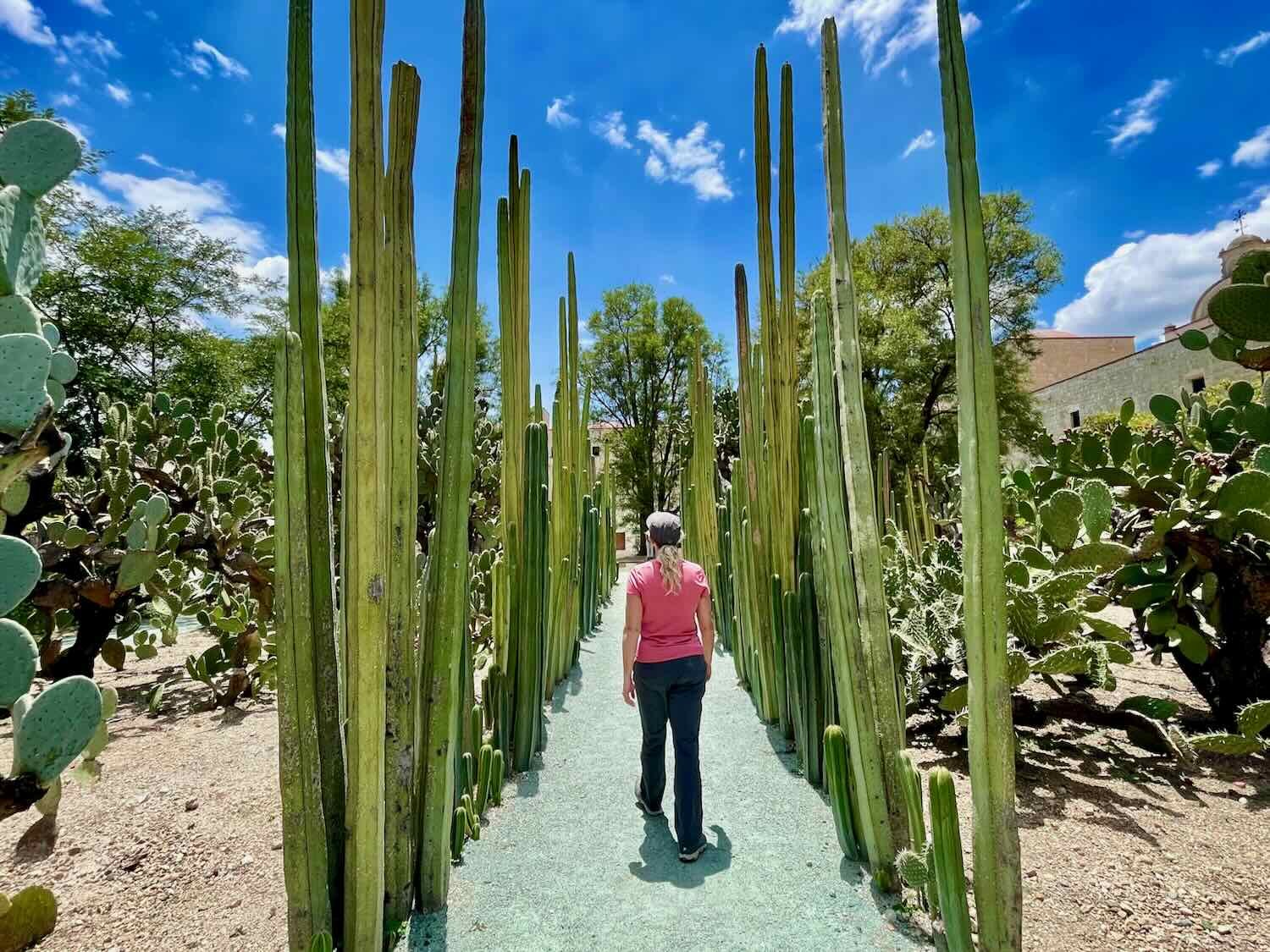
A grove of Mexican fence-post cacti in the Oaxaca Ethnobotanical Garden. Oaxaca de Juárez, Mexico. Copyright © 2019-2023 Pedals and Puffins.

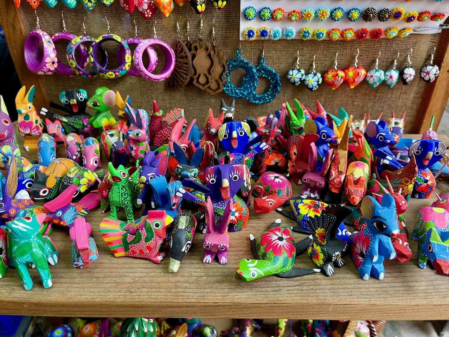
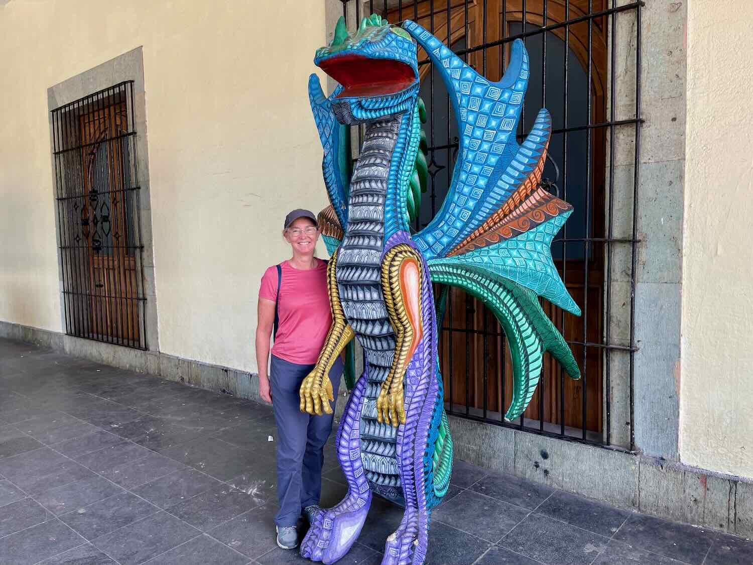
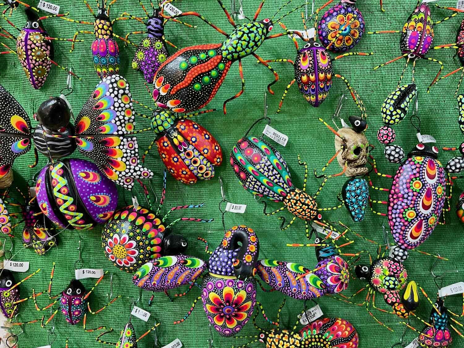
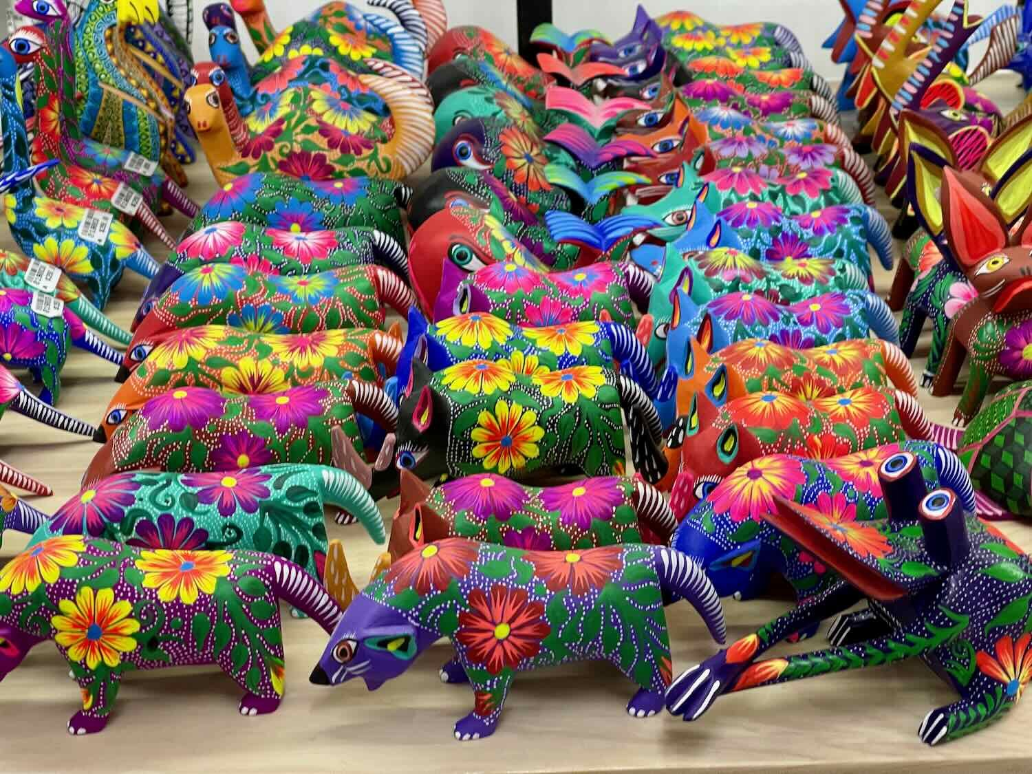
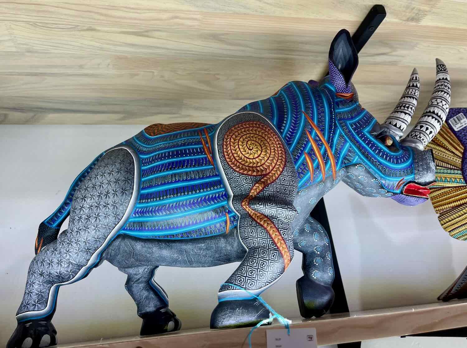
One of our favorite memories from our trip to Oaxaca 20 years ago was a visit to a small town where locals produced alebrijes - the extremely colorful and fanciful little animals carved from copal wood. On this trip, we enjoyed checking out the various alebrije shops and admiring the immense range of colors and designs that had evolved since our previous visit - from shelves full of tiny figurines to a larger-than-life dragon standing on a street corner.
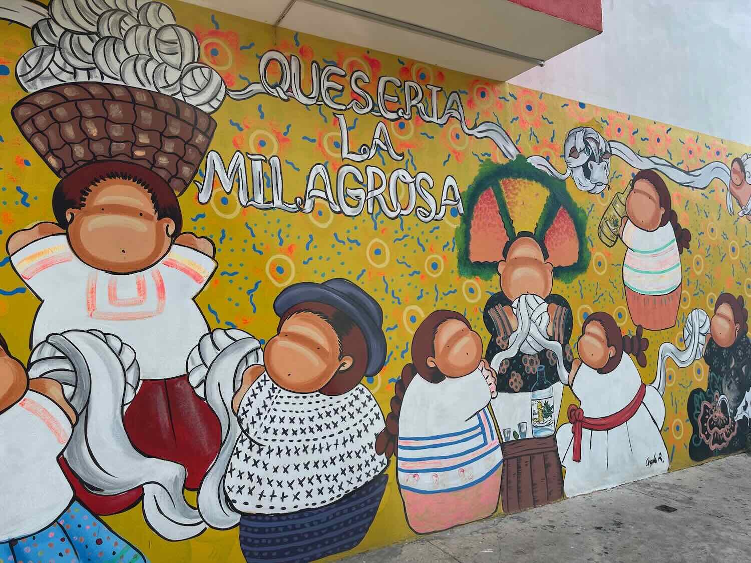
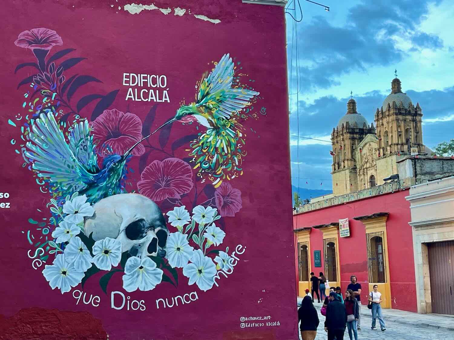
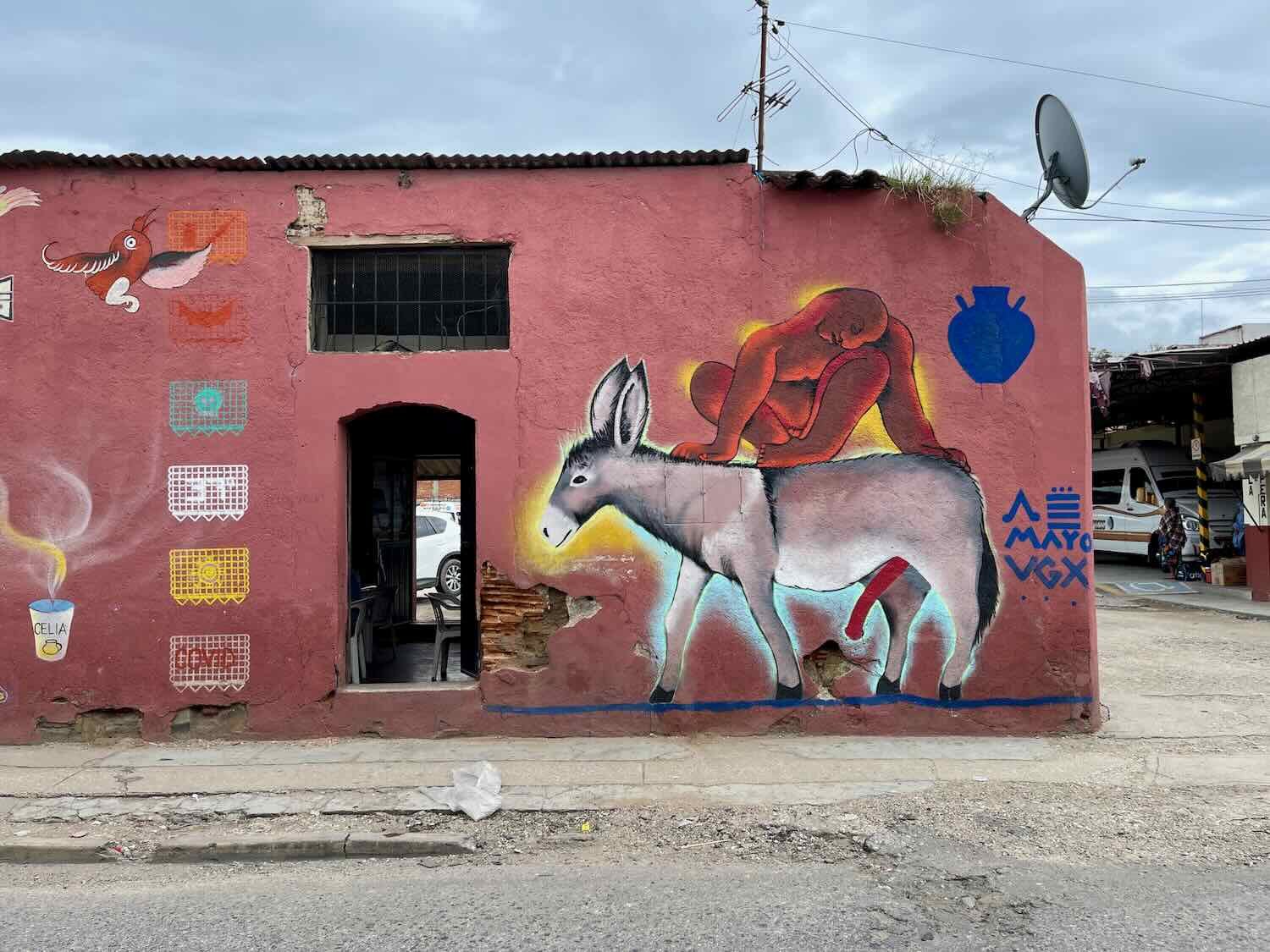
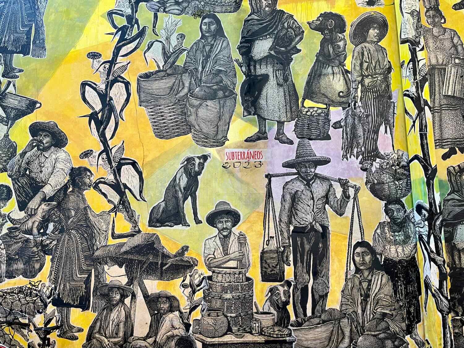
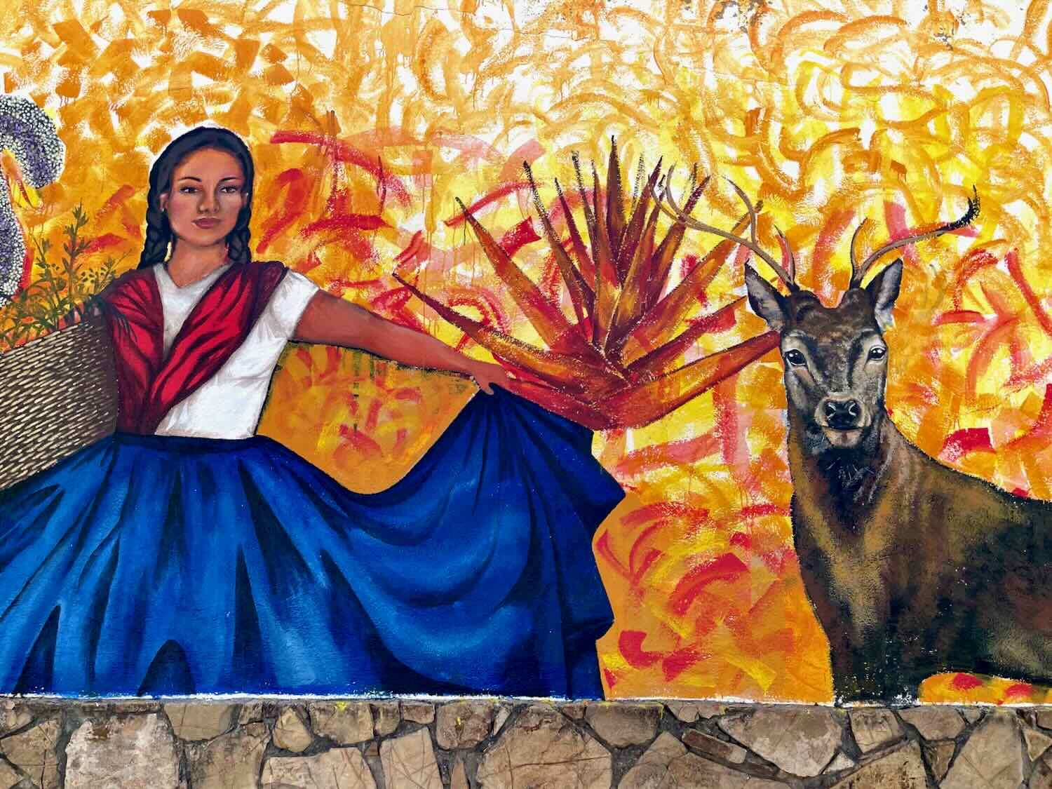
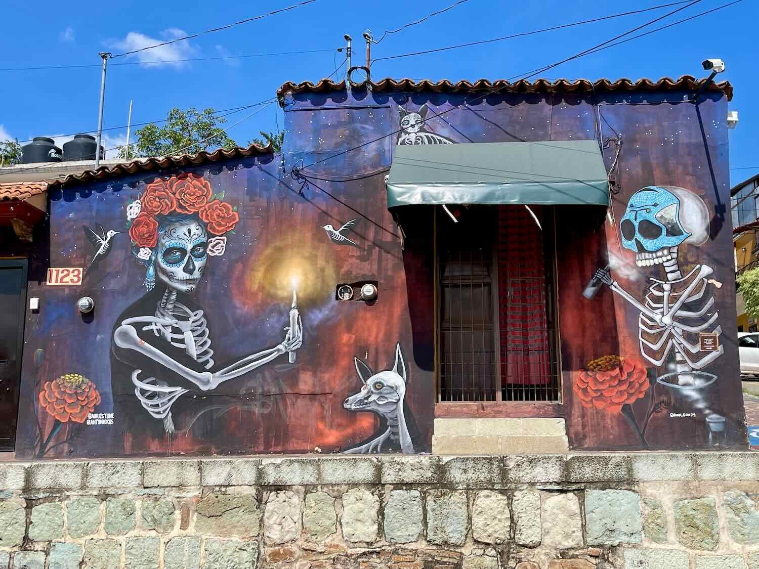
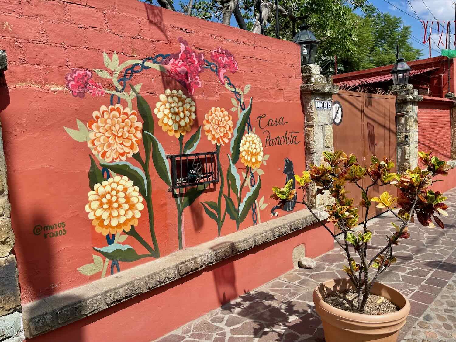
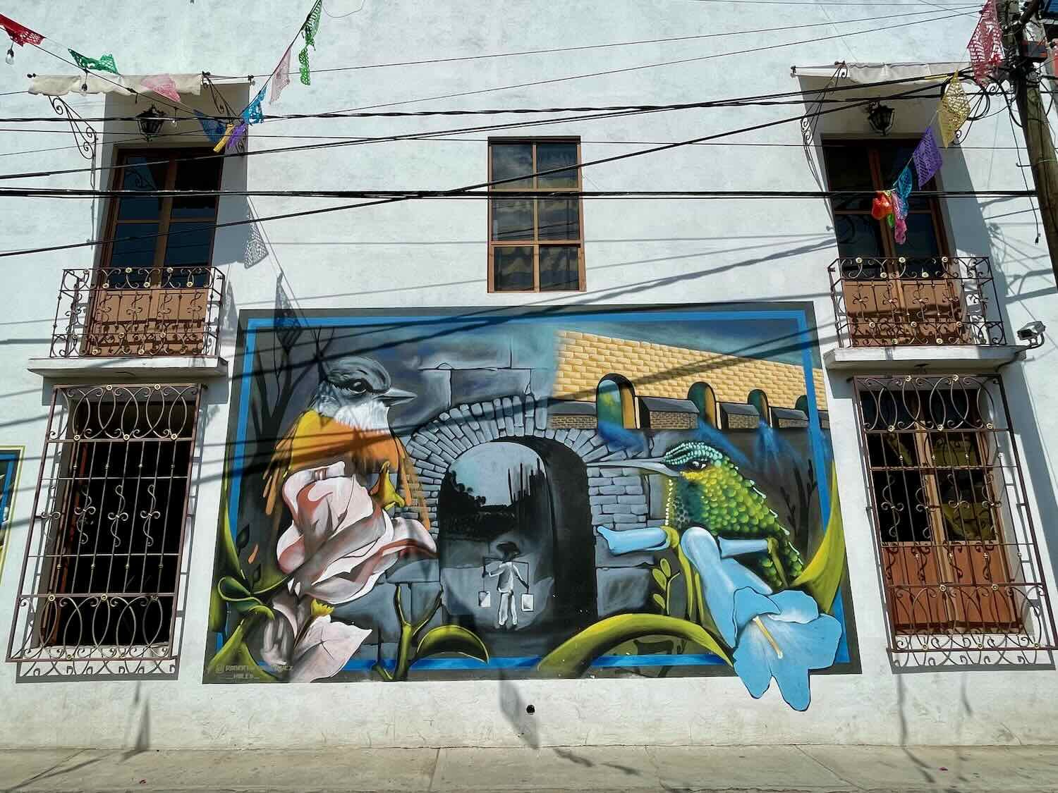
Like many other Mexican towns, Oaxaca has a whole lot of murals painted around the city, varying widely in style and symbolism.


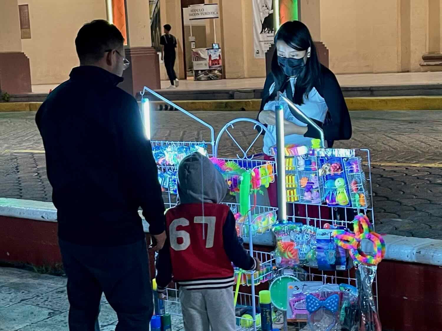
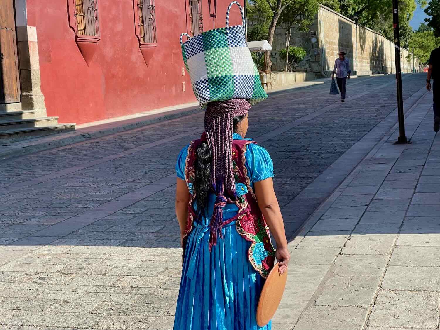
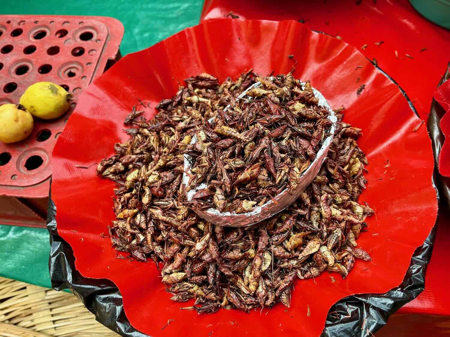
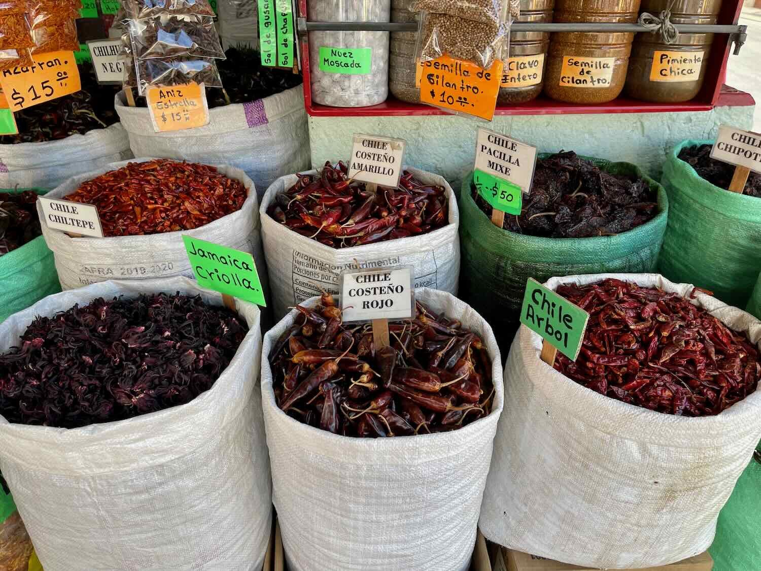
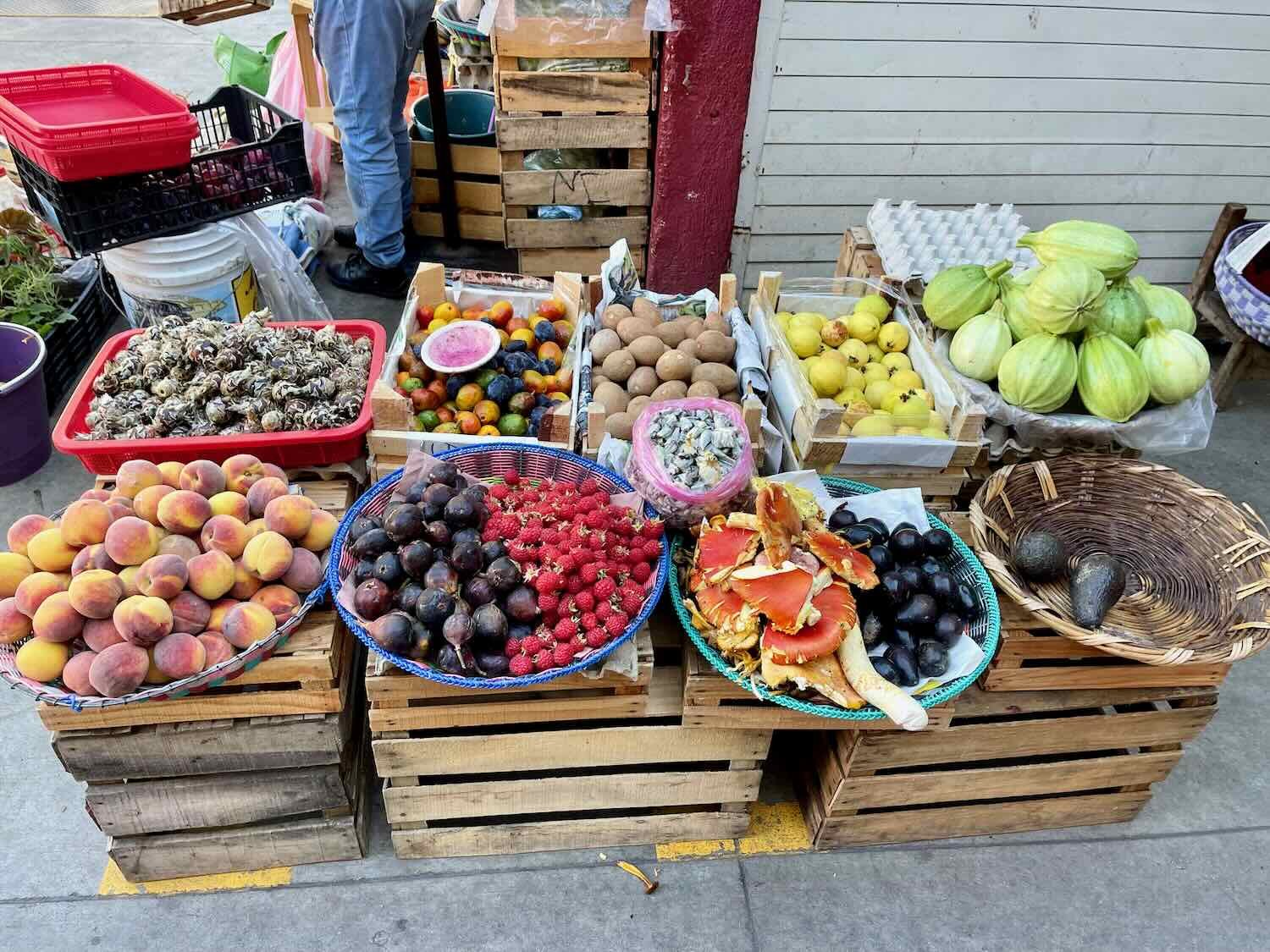
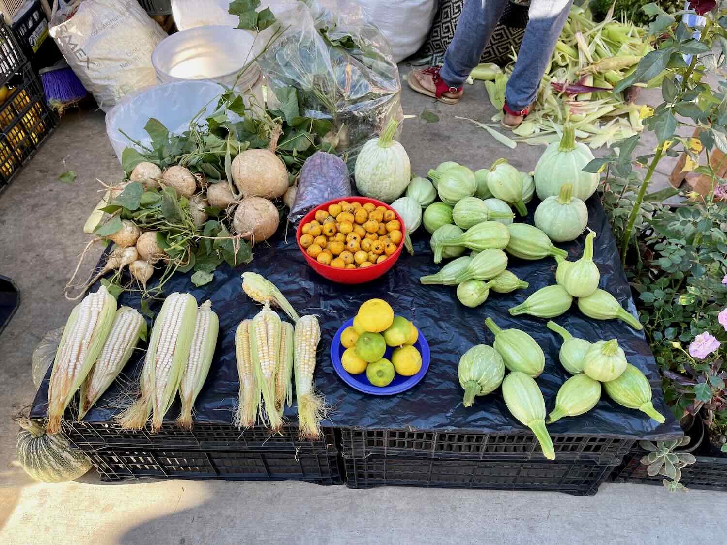
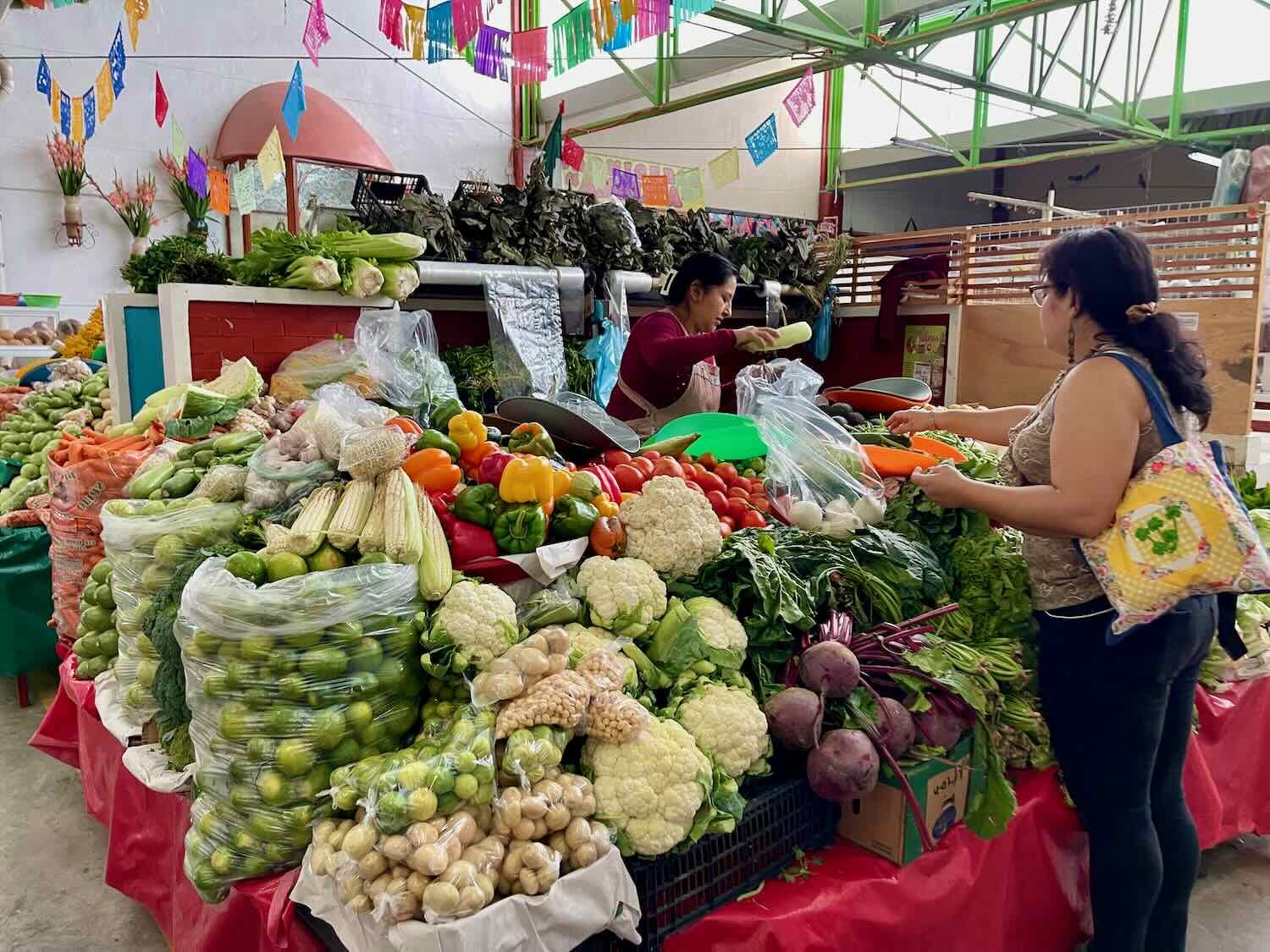
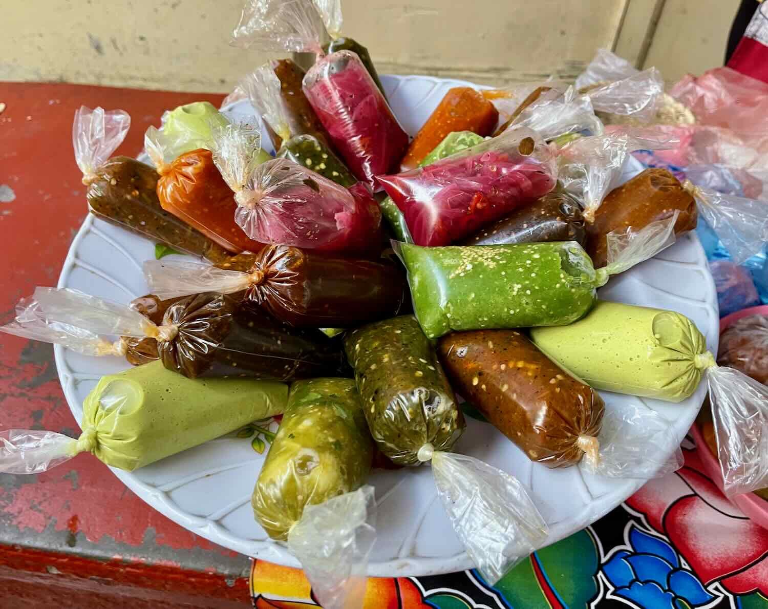
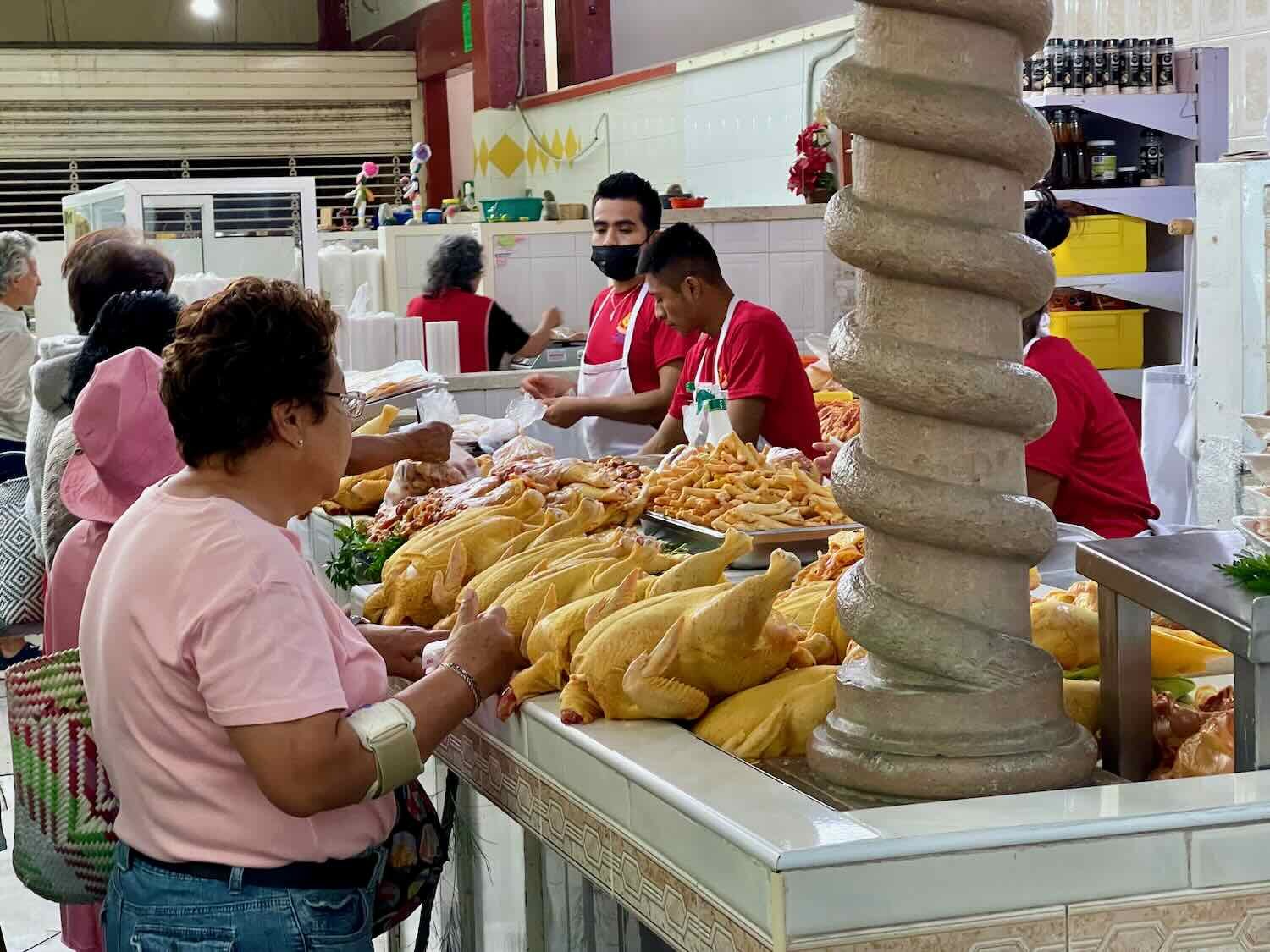
Oaxaca is the most ethnically diverse state in Mexico, as well as being a center of culinary excellence. As a result, a stroll through Oaxaca’s traditional markets offers a level of variety and visual pleasure that is even greater than the typical Mexican market. There were lots of fruits, vegetables and sauces for sale that we found completely unfamiliar. But perhaps the most famous Oaxacan market item is chapulines - salted and dried grasshoppers. They’re a local delicacy that dates back to prehistoric times.
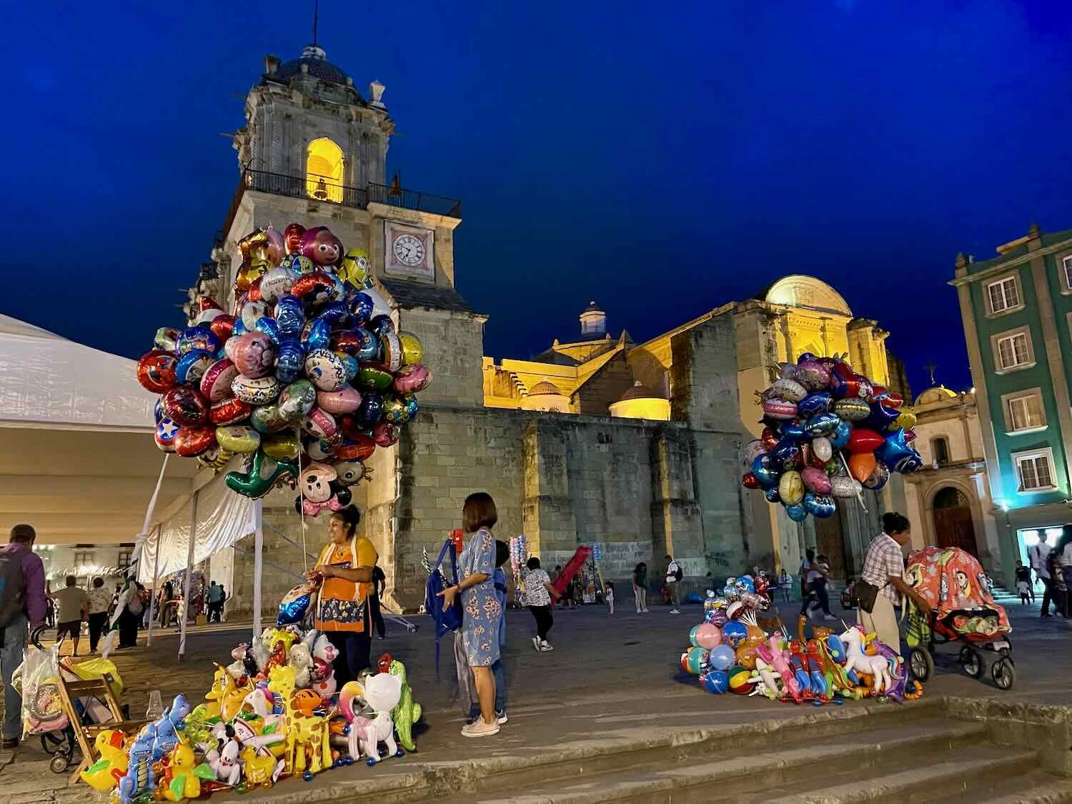
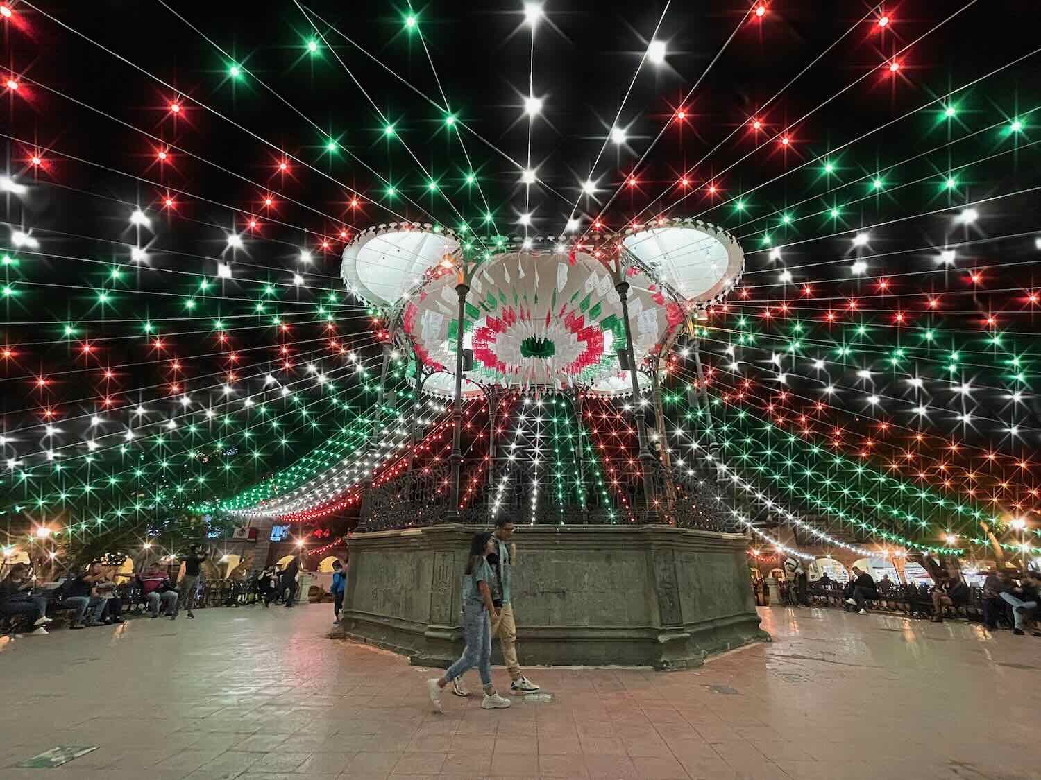
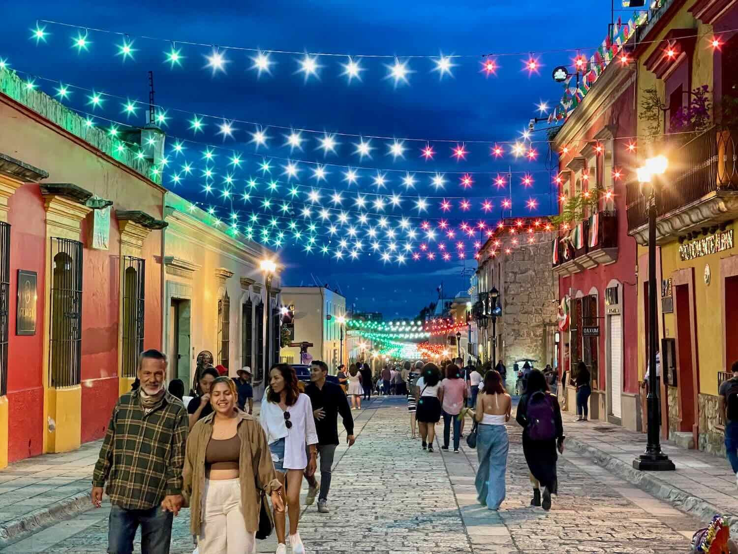
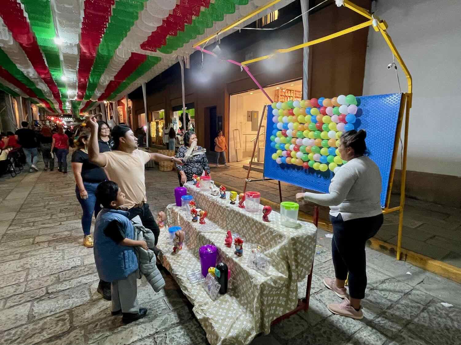
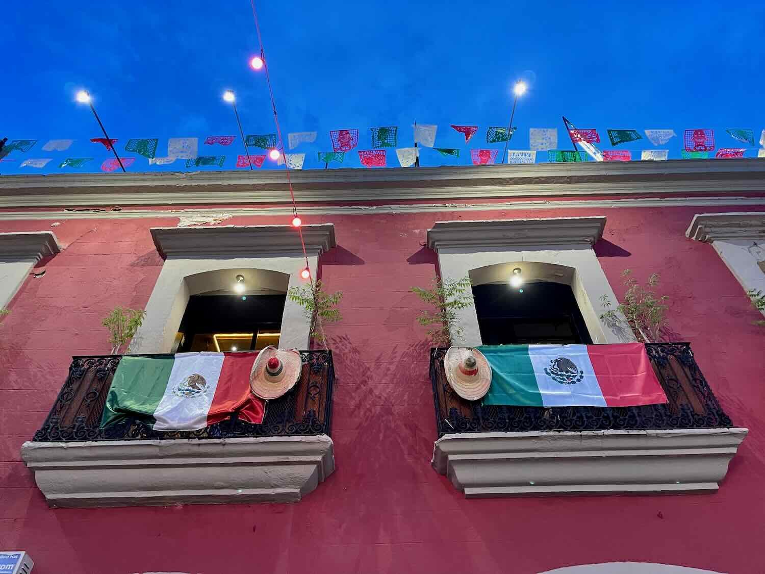
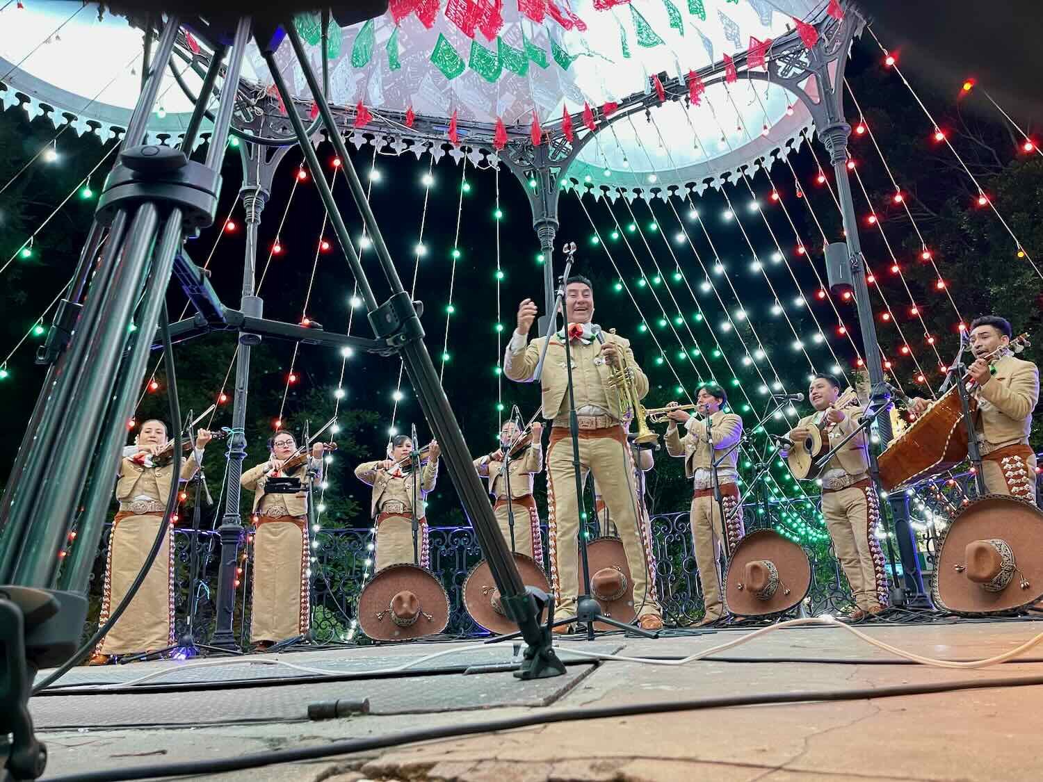
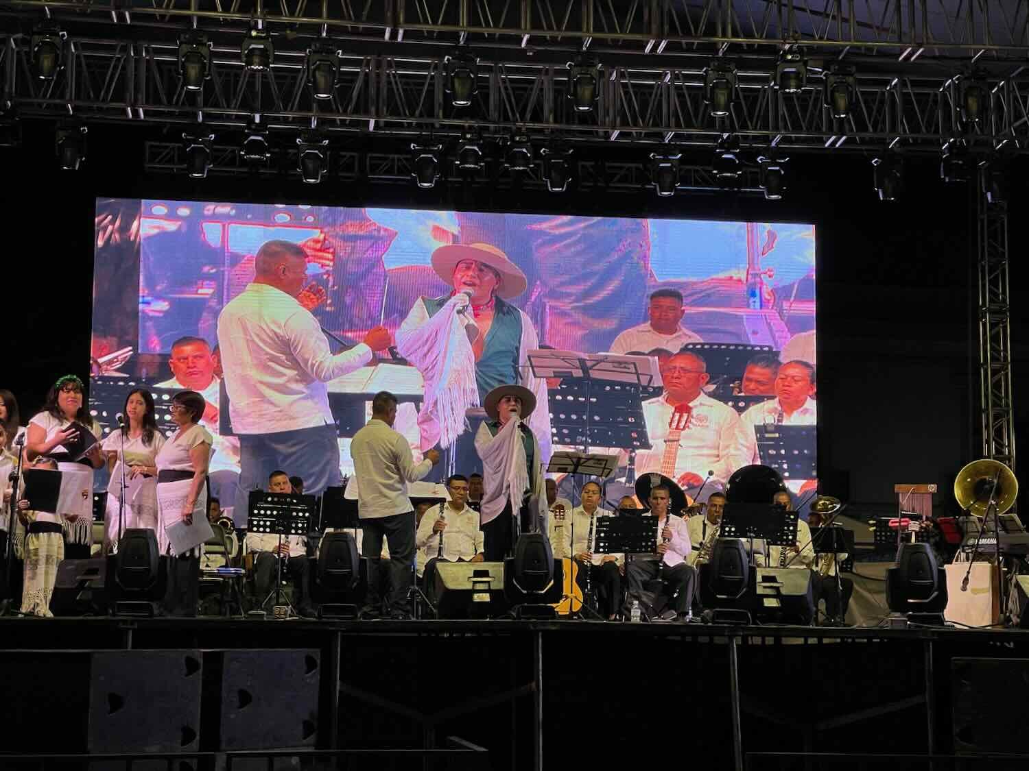
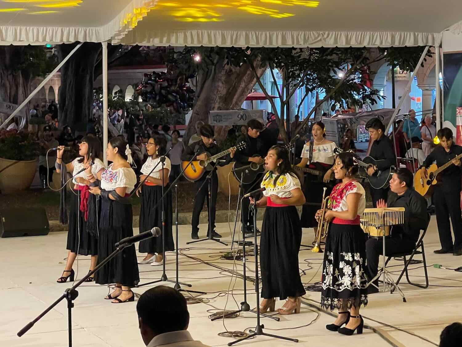
We were fortunate to spend Mexico’s Independence Day (September 16) in Oaxaca, and to have the chance to join in several weeks of celebrations surrounding the holiday. From the earliest days in September, towns all over Mexico decorate their public spaces and buildings with the red, white and green colors of the flag. Oaxaca’s city center was adorned with strings of colored lights and fluttering pennants. Buildings were draped in flags and garlands. Every morning a military guard raised the Mexican flag in the central plaza. And every evening a similar ceremony lowered the flag, after which a group of soldiers marched away with the flag held at their shoulders. The country’s signature Independence Day dish - chile en nogada - was on the menu in most restaurants. And nearly every night there was live entertainment in the central plaza. We reveled in the festive atmosphere, taking long walks every morning and evening.


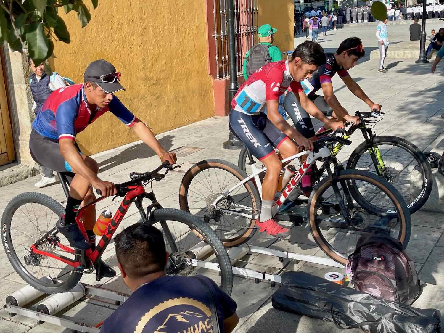
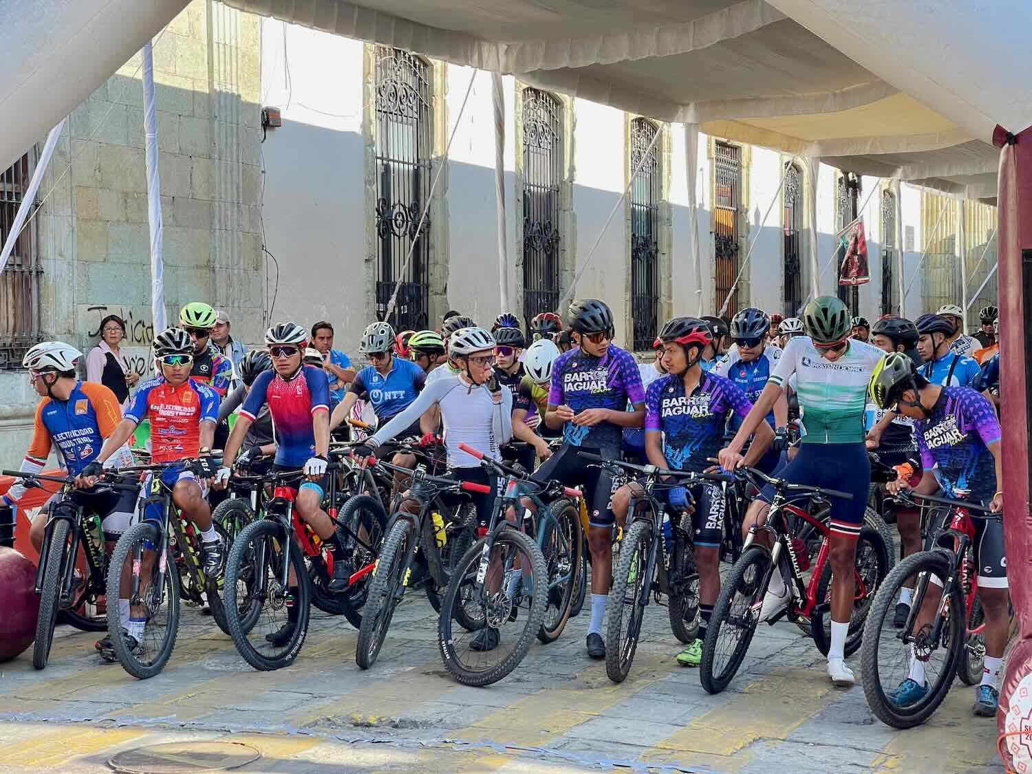
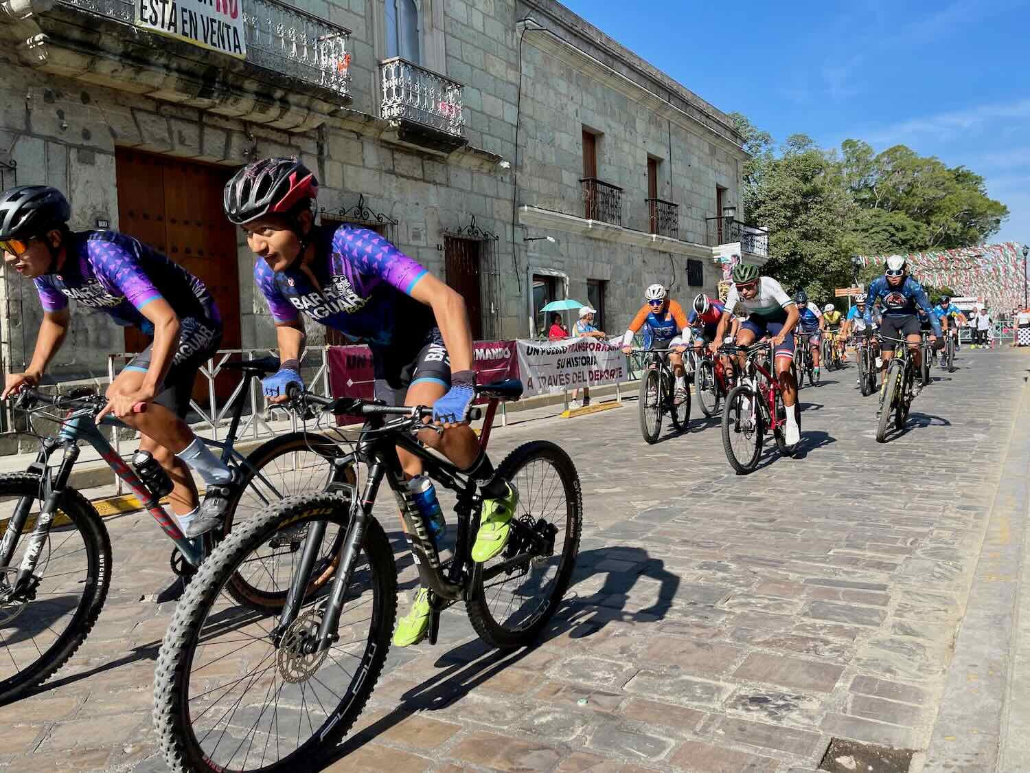
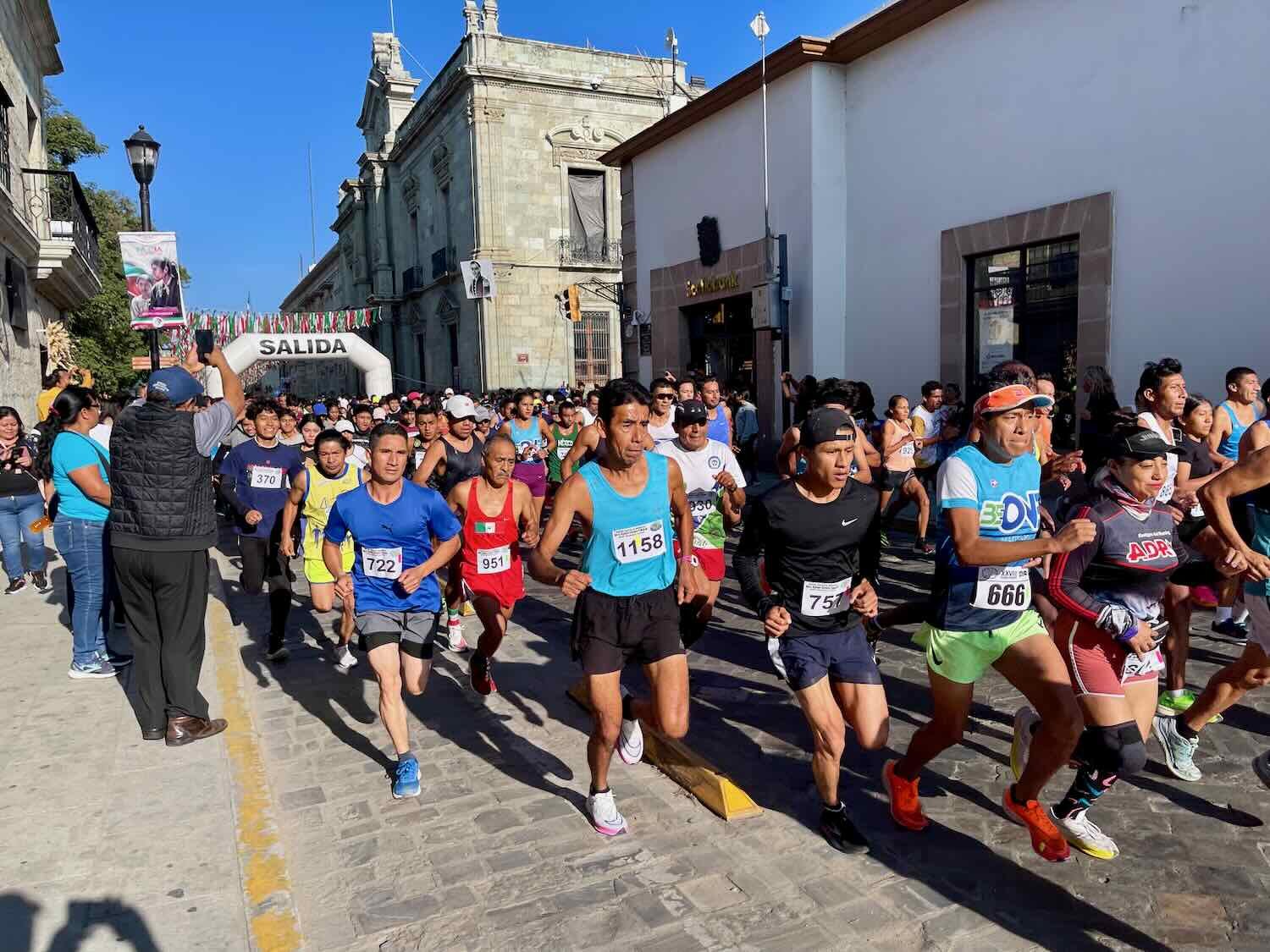
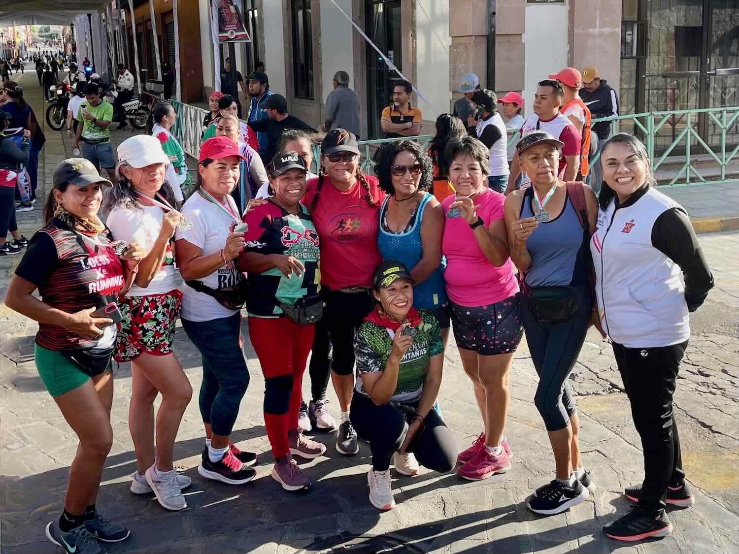
Sports were also a big part of the celebrations. On several different mornings, we witnessed organized runs and bike races.

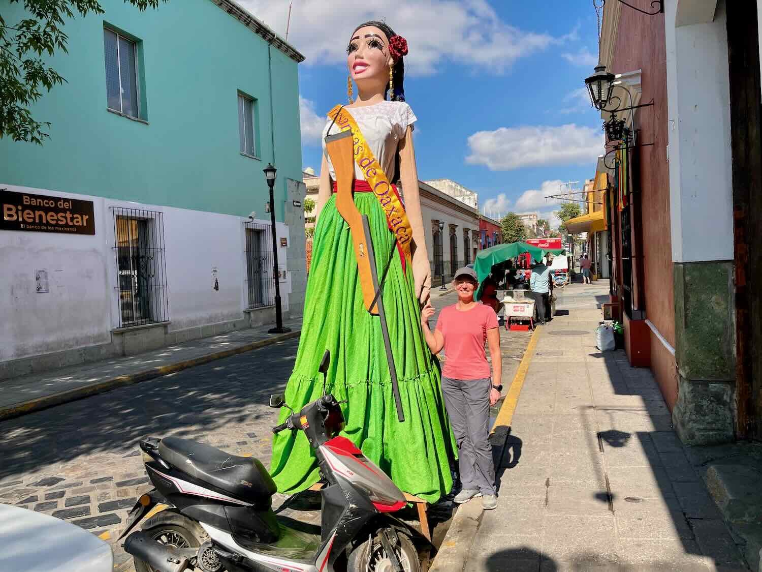
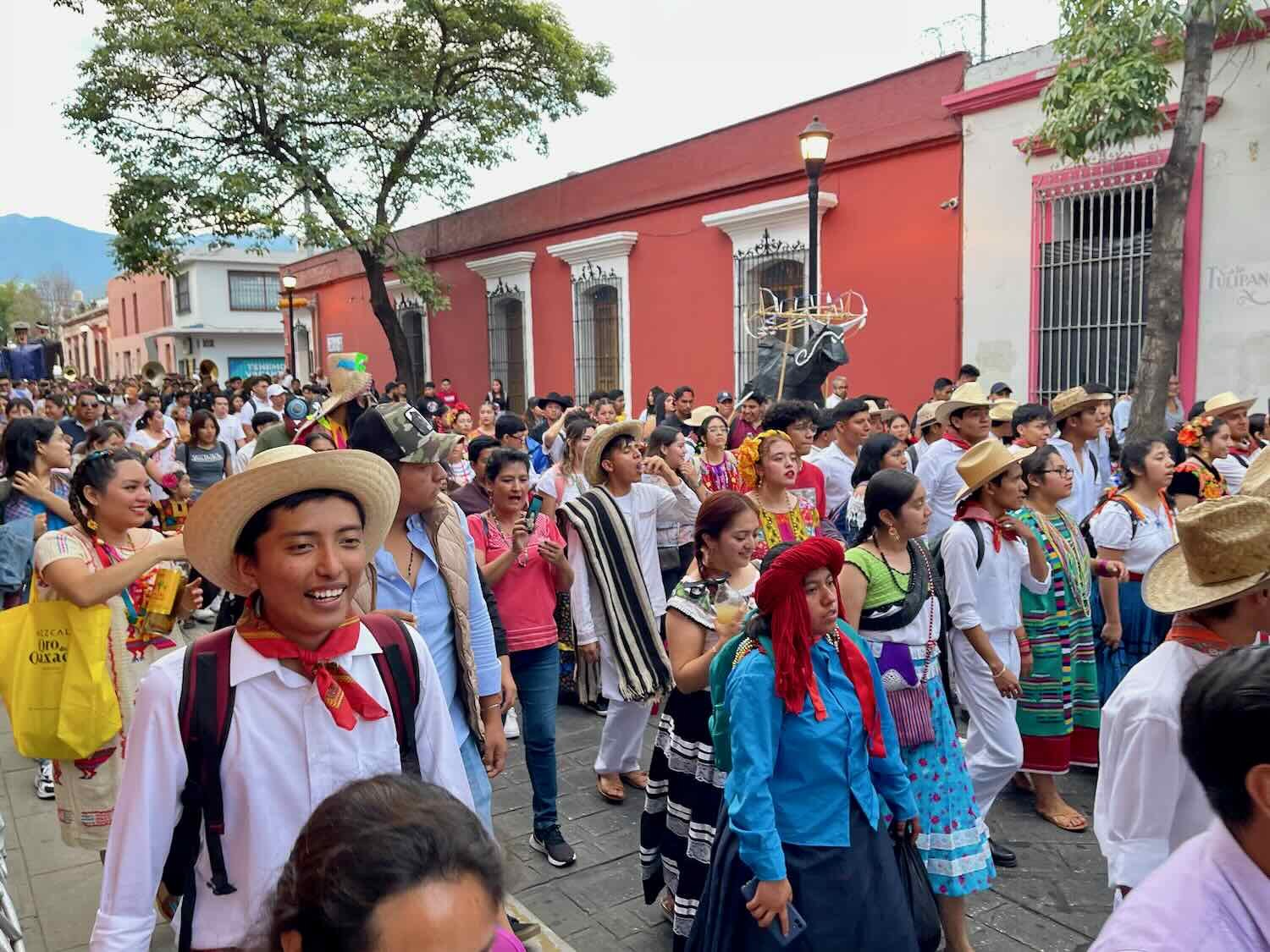
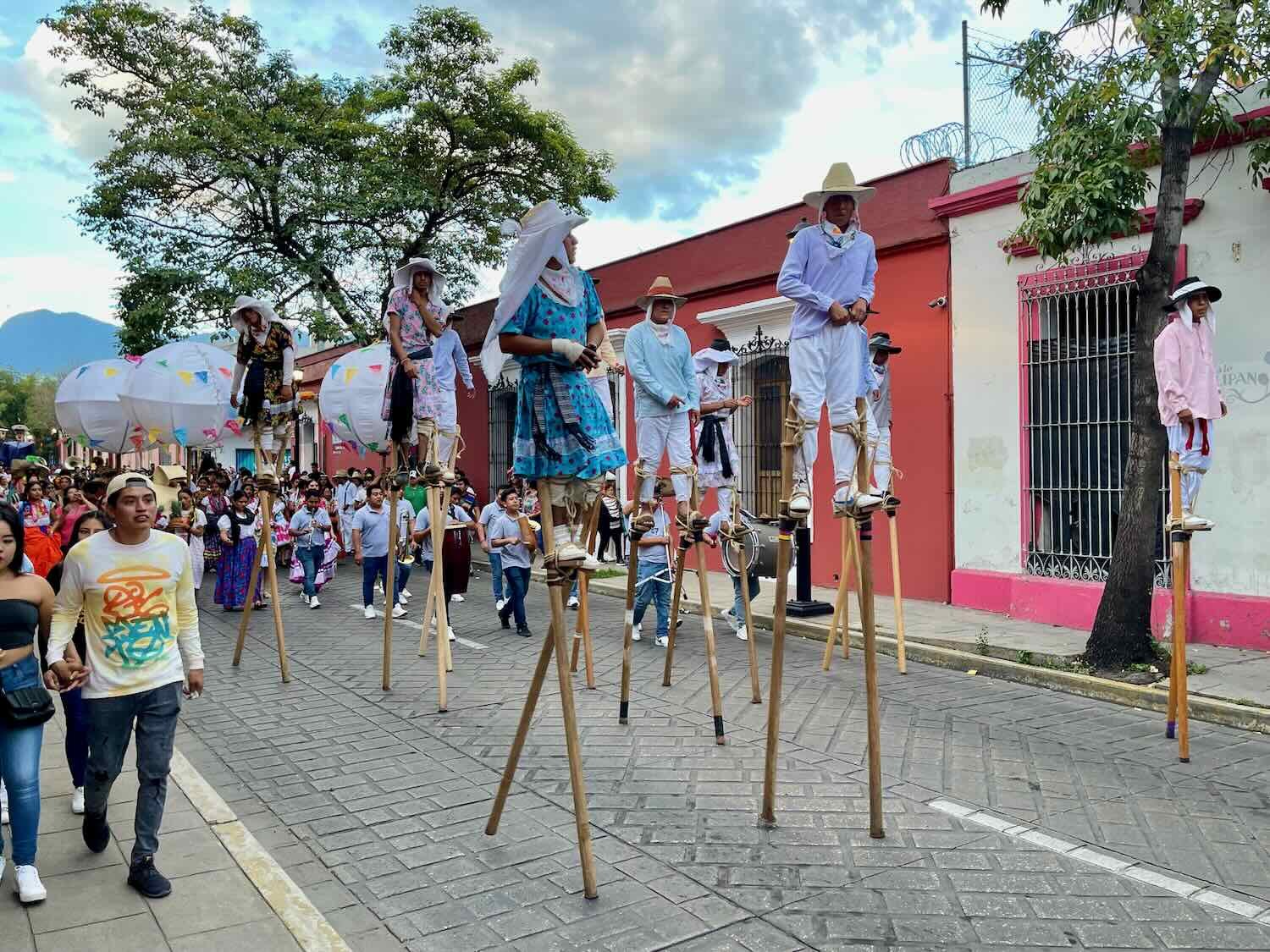
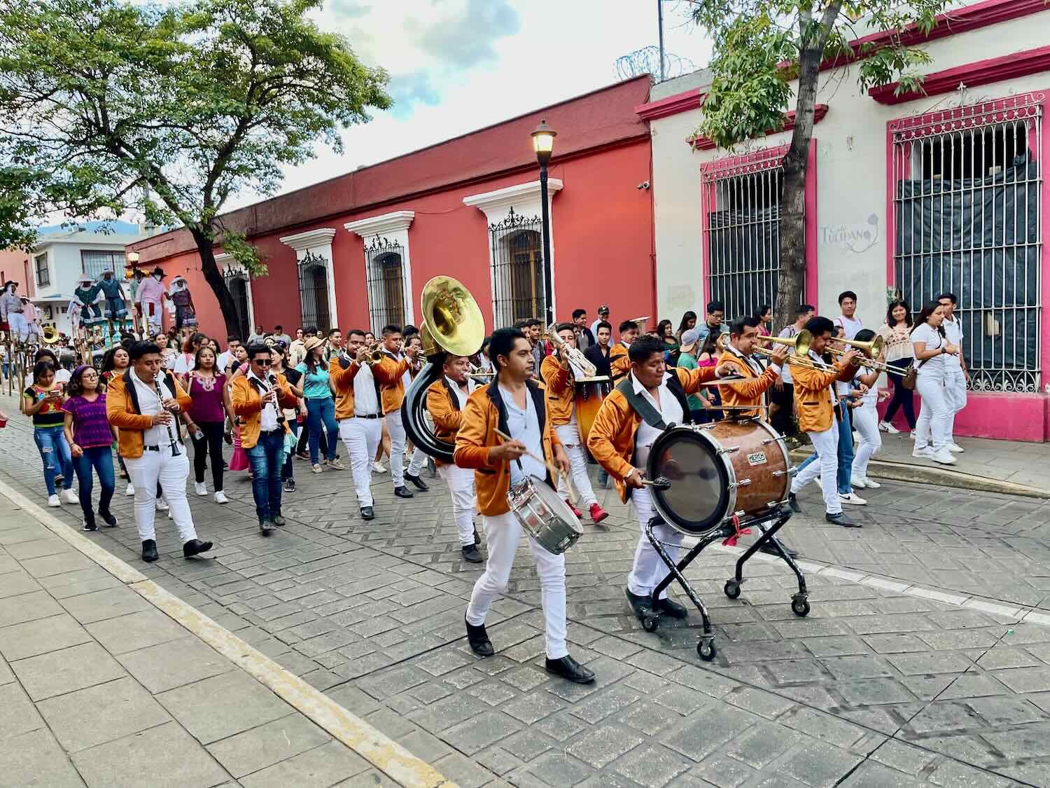
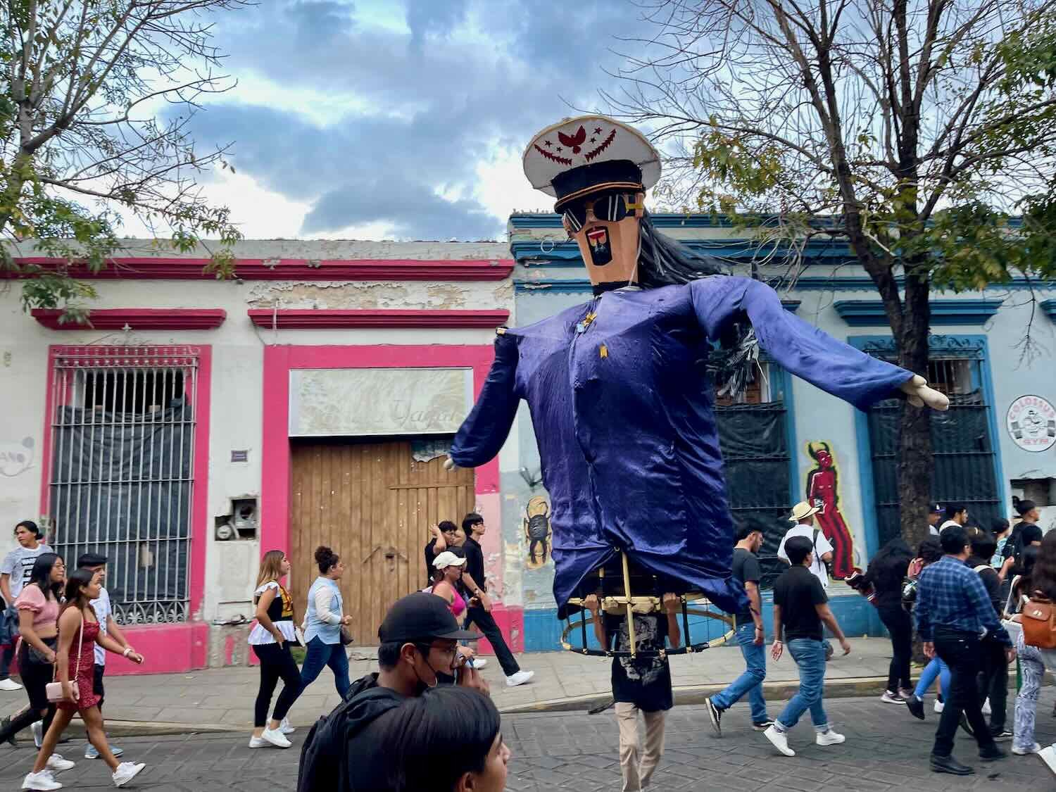
On the day before our departure there was a big parade that passed right by our hotel. Oaxaca loves to celebrate the diversity of its many towns and cultures. One of the favorite traditions on holidays is to have residents from surrounding towns come to the city and participate in a parade, dressed in traditional attire. Marching bands and people walking on stilts added to the festive atmosphere as folks from the various villages walked by, carrying signs proclaiming their town of origin.
The End of the TransMexico Norte
Our arrival in Oaxaca marked the end of the TransMexico Norte route, which we had followed since departing from Mazatlán back in early May. From here the scenery, wildlife and weather would become increasingly tropical and novel for us. It had been a fabulous journey across central Mexico, giving us the chance to get to know our southern neighbor more intimately. The segment from Matamoros to Oaxaca, in particular, brought us closer to the ancient culture of the Mixtecs that have lived here for thousands of years, in the cradle of American civilization. Each day brought a flood of wonderful experiences full of vivid colors, unfamiliar traditions, architectural beauty, and natural wonders in the endless variety that defines Mexico. We can’t wait to see what comes next.