The Yellowhead Highway: Cycling from Kitwanga to Prince George, British Columbia

17 - 26 August 2022
17 August - Kitwanga to New Hazelton (32.9 mi, 53.0 km)
18 August - Layover in New Hazelton
19 August - New Hazelton to Smithers (42.3 mi, 68.1 km)
20-21 August - Layover in Smithers
22 August - Smithers to Houston (41.6 mi, 67.0 km)
23 August - Houston to Burns Lake (49.1 mi, 79.0 km)
24 August - Burns Lake to Fraser Lake (44.5 mi, 71.6 km)
25 August - Fraser Lake to Vanderhoof (37.6 mi, 60.5 km)
26 August - Vanderhoof to Prince George (62.4 mi, 100.4 km)
Totems from the Past
On this leg of our journey, we left the extensive wilderness of northwestern British Columbia behind. Over the next ten days we would cycle along the Yellowhead Highway, through more densely populated areas with small towns every 20-25 miles (35-40 km). If we were lucky, the towns would have a store and maybe a restaurant or two. Railroad tracks, rumbling wheels, and train whistles became a regular feature of our days (and nights) as we followed the historic route of the Grand Trunk Pacific Railway towards the Rocky Mountains.
Our route joined the Yellowhead Highway at the town of Kitwanga, nestled in a valley surrounded by scenic mountains.
The Seven Sisters Mountains provided a scenic backdrop as our route led us toward the Yellowhead Highway. Kitwanga, British Columbia, Canada. Copyright © 2019-2022 Pedals and Puffins.
A nearby fort had protected the local Native American clan for nearly 100 years. But in 1835, rival tribes were able to attack and burn down the fort, forcing the inhabitants to move to the present townsite at Kitwanga.
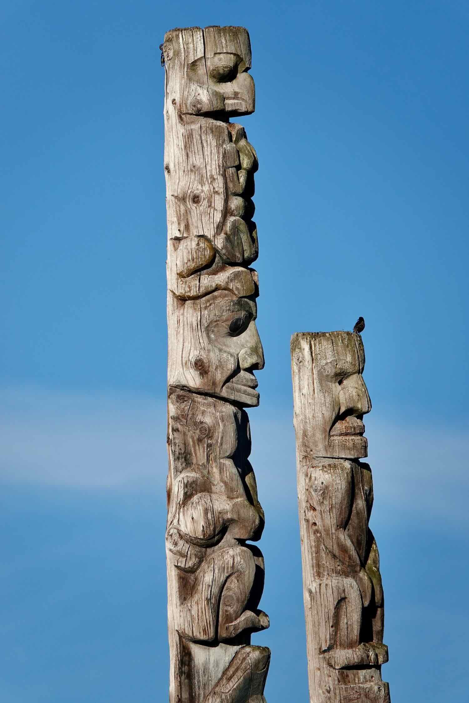
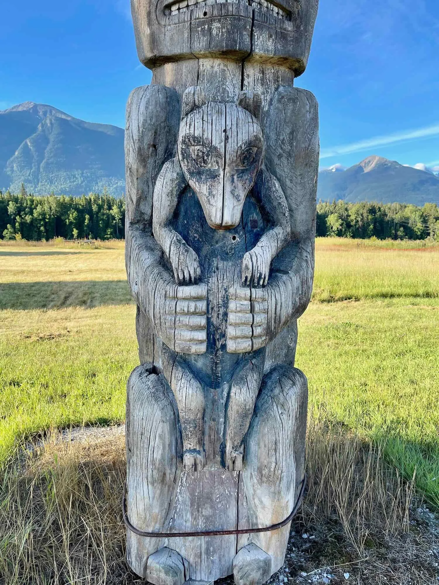
After the move, the people of Kitwanga recorded the history of their ancestral leaders and the fight to save the fort in a series of totem poles. The poles, now showing their age but still projecting a quiet grandeur, have been gathered for display and preservation in a residential section of town. As we passed through town, we visited the totem poles and were struck by their tangible authenticity, as well as their artistry. It was a special experience to see these poles situated within the community that created them as part of their shared history.
The totem poles of Kitwanga project a quiet grandeur. It was rewarding to see these authentic, local treasures displayed within the community that created them. Kitwanga, British Columbia, Canada. Copyright © 2019-2022 Pedals and Puffins.
Our path through town also took us past Kitwanga’s historic wooden church, which also dated from the 1800s. The main church was destroyed by a fire in 2021. But the elegantly detailed, wooden bell tower still rises above the surrounding fields.
The wooden bell tower of St. Paul’s Anglican Church in Kitwanga, British Columbia, Canada. Copyright © 2019-2022 Pedals and Puffins.
A Busy Highway Through Towns and Fields
When we reached the Yellowhead Highway, it was time for breakfast. A window seat at the junction’s cafe provided us with a view of the steady flow of traffic at this busy highway crossroads. Multiple trucks laden with freshly-cut logs maneuvered for parking space so that their drivers could dash into the convenience store for a coffee or snack. For us, it was an early glimpse into the critical importance of the Yellowhead Highway to British Columbia’s timber industry. Numerous logging operations and sawmills send their products to market via this highway, and to international shipping facilities in the port city of Prince Rupert (where the highway meets the sea).
Lumber trucks lined up outside the N&V Johnson Cafe, situated at a key junction along the Yellowhead Highway. Kitwanga, British Columbia, Canada. Copyright © 2019-2022 Pedals and Puffins.
In fact, we started to think of the Yellowhead Highway as the “road of the princes.” Two of the biggest cities along the route are Prince Rupert (at the Pacific coast) and Prince George (just west of the Rocky Mountains). When discussing our route, we often referred to the cities by name. But PedalingGuy had a bit of trouble remembering which princes were which. At various times he referred to one or the other of the cities as Prince Edward, Prince Albert, or Prince Charles. We had some fun with that.
Two of the biggest cities along the Yellowhead Highway are named after British princes. Sometimes we had trouble keeping the names of the princes straight. Yellowhead Highway, British Columbia, Canada. Copyright © 2019-2022 Pedals and Puffins.
As we left the cafe, we were glad to see that the highway shoulder was generally wider than it had been on the more lightly-traveled Stewart-Cassiar Highway. This was important because traffic on the Yellowhead Highway was intense - a steady stream of fast-moving cars, 18-wheelers, double tractor-trailers, and logging trucks. RVs, which had been the dominant type of vehicle in the north, were now relatively scarce. But the shoulder was littered with gravel and debris, which would prove to be a menace for our tires. And every so often, the shoulder would disappear or crumble away into a roadside ditch for several miles at a time. Those sections could feel dangerous, and were a source of stress whenever they occurred.
Grasslands In the Valleys
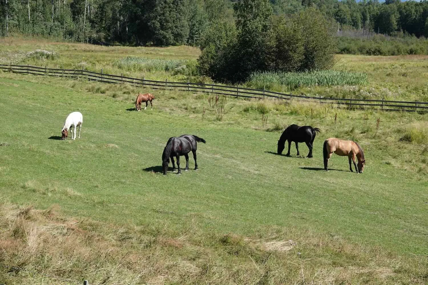
From Kitwanga, the Yellowhead Highway makes a wide sweep to the north. This detour allows the route to follow two major river valleys, and skirt around the imposing Bulkley Mountains. Very quickly we noticed the presence of hayfields and pastures in the valleys, which had been almost non-existent further north. It was a sign that we were transitioning from the dense spruce forests of the mountains to the Fraser Plateau - a large, relatively flat area that dominates central British Columbia. This region hosts rare grasslands, which make up less than 1% of the province’s landscape. Most of the native grasslands on the plateau have been converted to agriculture, so we found ourselves pedaling past hayfields and pastures inhabited by livestock.
As we approached the Fraser Plateau of Central British Columbia, hayfields and pastures became common along our route. Here, the Bulkley Mountains rise in the background. Yellowhead Highway, British Columbia, Canada. Copyright © 2019-2022 Pedals and Puffins.
As we entered New Hazelton (pop. 600), we were struck by the town’s displays of civic pride. The first sign was a billboard by the highway honoring Carol Huynh, an Olympic wrestling champion who calls New Hazelton home.
New Hazelton is proud of its local Olympic champion, Carol Huynh. Yellowhead Highway, British Columbia, Canada. Copyright © 2019-2022 Pedals and Puffins.
Just down the road, the whimsical figure of a lumberjack climbing a tree caught our eye, and caused us to detour to the town’s Visitor Center. There they have erected a collection of fun, larger-than-life statues that commemorate various “characters” from the region’s past: the logger, a miner, and a horse packer. Each statue has a plaque that succinctly describes the importance of the profession in the town’s history. It was an impressively effective way to draw people in, and get them hooked on learning more about this upbeat community.
Whimsical statues represent historical figures at the New Hazelton Visitor Center. This one is a logger. Yellowhead Highway, British Columbia, Canada. Copyright © 2019-2022 Pedals and Puffins.
The Salmon of Witset Canyon
We spent a rest day in New Hazelton enjoying the motel’s truly fast wifi (something we hadn’t had for several weeks). Then, we were back on the road.
At the convenience store in Witset, two other cyclists rolled in just as we were getting ready to leave. HJ and Leena were from Australia, and headed for Jasper National Park. They had recently started their bike tour in Prince Rupert, BC, where the Yellowhead Highway begins at the Pacific Ocean. Compared to us, they were traveling pretty heavy (Leena had a midsized plastic cooler strapped on the back of her bike!). We ended up talking with them for a long time about equipment, the places we’ve been, and past tours (they had driven around Africa in a van). Their plans for this tour were fluid, but they figured they would probably cycle back to Vancouver to visit with some friends who lived there. Eventually, we bid them farewell and continued on our way.
The Witset Village Adult Learning Center has columns painted like totem poles. Yellowhead Highway, British Columbia, Canada. Copyright © 2019-2022 Pedals and Puffins.
Just 0.5 miles down the road from the convenience store is Witset Canyon. There, the Bulkley River cascades over a small waterfall into a cauldron of rapids. It then churns through a canyon where the rocky shorelines converge to create a narrow chute about a quarter of a mile long. The canyon is known as a place where you can stop to see salmon attempting to leap over the falls, and where local, native fishermen use large nets to catch salmon. We stopped to check it out.
From the bridge over the canyon we could see the dark silhouettes of salmon in the river far below. These were steelhead salmon, which don’t turn bright red during migration the way sockeye salmon do. They are shining silver, with the males developing a rose-colored stripe along their sides. As the water heaved and swirled through the canyon, the salmon hugged the shoreline next to the rocky cliffs, trying to stay out of the main current. This made them easier to see. We spotted dozens of the big fish slowly forcing their way upstream, and resting in quiet eddies along the rocks.
On the far side of the canyon, we had a perfect view of the waterfall. There is a fish ladder, but many of the fish seem to miss it (or maybe it was closed). The fish that made it to the foot of the waterfall then launched themselves valiantly into the air in an attempt to pass this giant obstacle. We watched for more than an hour as these determined fish leaped and strained in an effort to get past the waterfall. As far as we could tell, not one of them succeeded (hence, the need for the fish ladder).
Witset Canyon on the Bulkley River, as seen from the far shore. From this angle, we had a clear view of the waterfall at the head of the canyon. Yellowhead Highway, British Columbia, Canada. Copyright © 2019-2022 Pedals and Puffins.
For more than an hour, we watched steelhead salmon attempt to jump over the falls. None of them seemed to make it to the top. Yellowhead Highway, British Columbia, Canada. Copyright © 2019-2022 Pedals and Puffins.
While we were there, several groups of Native Americans arrived and began fishing for the salmon. They used enormous fish nets on long poles to scoop up salmon from the rapids below the falls. One guy worked from a dangerous, but clearly productive spot on the cliff right next to the waterfall. Somehow he avoided slipping and falling into the river. And nearly every time he brought up his net, it was writhing with up to six large salmon. Often, he would throw most or all of the salmon back into the water, keeping only the largest fish. Perhaps there is a regulation governing the size of the fish they are allowed to harvest. But it was a bit disconcerting to see the released fish crash against the rocks as they fell back into the river. The fisherman didn’t take much care to try and reduce injury to the fish when he set them free.
A Native fisherman scooped up steelhead salmon with a long-poled fishing net. It looked like dangerous work, fishing on a steep ledge right above the churning rapids. Witset Canyon, Yellowhead Highway, British Columbia, Canada. Copyright © 2019-2022 Pedals and Puffins.
Another Native fisherman hands a salmon to a boy on the shore. The boy took the salmon and placed it in a cooler farther up on the river bank. Witset Canyon, Yellowhead Highway, British Columbia, Canada. Copyright © 2019-2022 Pedals and Puffins.
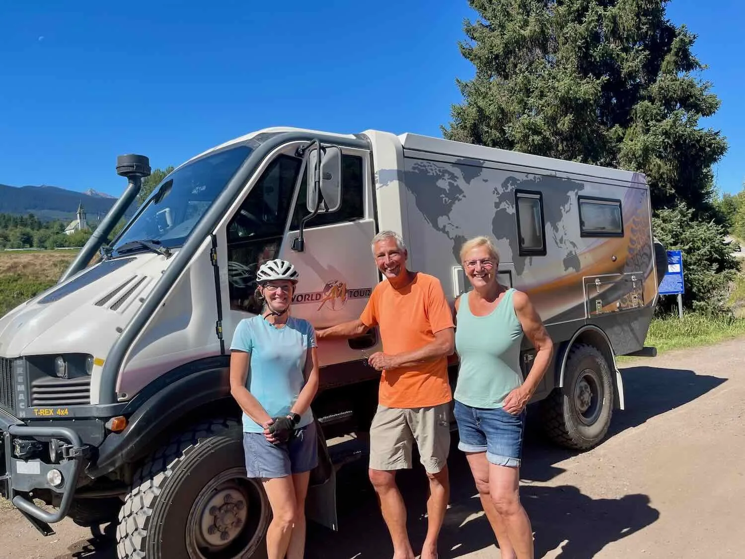
While we were at the canyon, a Dutch couple arrived in a custom RV. PedalingGuy started talking with them about their vehicle, and that’s how we met Atte and Marijke. They’ve traveled all over the world in that RV, and we enjoyed hearing about all of the places they had visited. They were nearing the end of a multi-year tour around the Americas that had started in Tierra del Fuego, and they seemed to be enjoying life.
You Never Know What You Will See Next
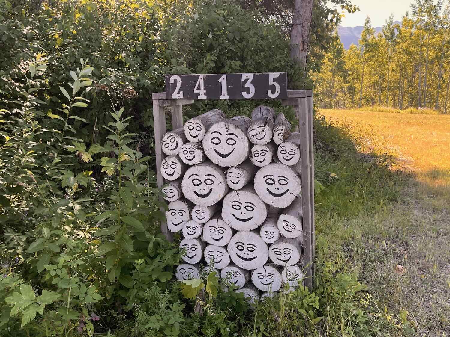
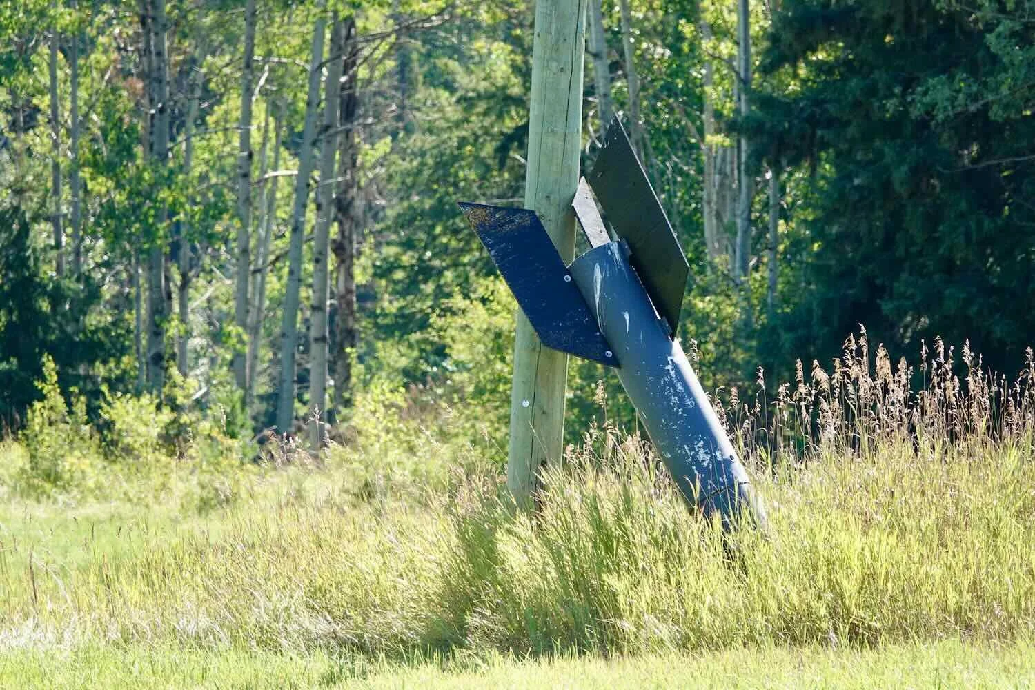
As we cycled further down the highway, wildlife sightings plummeted. Now, the things that caught our attention were mostly man-made. Eclectic, roadside objects popped up often enough to keep us entertained. One homeowner turned a stack of logs into a happy-face congregation. That was clearly intended to make other people smile. Unless what looked like a bomb replica was just coincidental, there must be a story behind that one.
Taking a Break in Smithers, BC
As we approached the town of Smithers, the Hudson Bay Mountain commanded our attention. Alpine imagery and mountain sport motifs are prominent throughout Smithers.
Hudson Bay Mountain towers over the Bulkley Valley near Smithers. Yellowhead Highway, British Columbia, Canada. Copyright © 2019-2022 Pedals and Puffins.
For some time, we both had been hearing a loud clicking sound in our pedals while riding. The sound, and the sensation of roughness when pedaling was starting to get both annoying, and a bit worrisome. So we headed to a bike shop in Smithers to see if we could have someone help diagnose the problem. But it was Friday afternoon. Plus, the store was short-handed and had fallen behind on their existing repair work. The employees seemed really frazzled, and they were not eager to take on another repair job. As a result, they sent us away.
Without other options, we decided that we might as well clean and add chain lube to our pedals (we didn’t have any pedal grease). We figured that any extra lubricant would be better than nothing. Miraculously, that made the clicking noises go away. But we knew that the fix would be temporary. At some point we would need to get some proper pedal grease, probably when we reached the city of Prince George in a few more days.
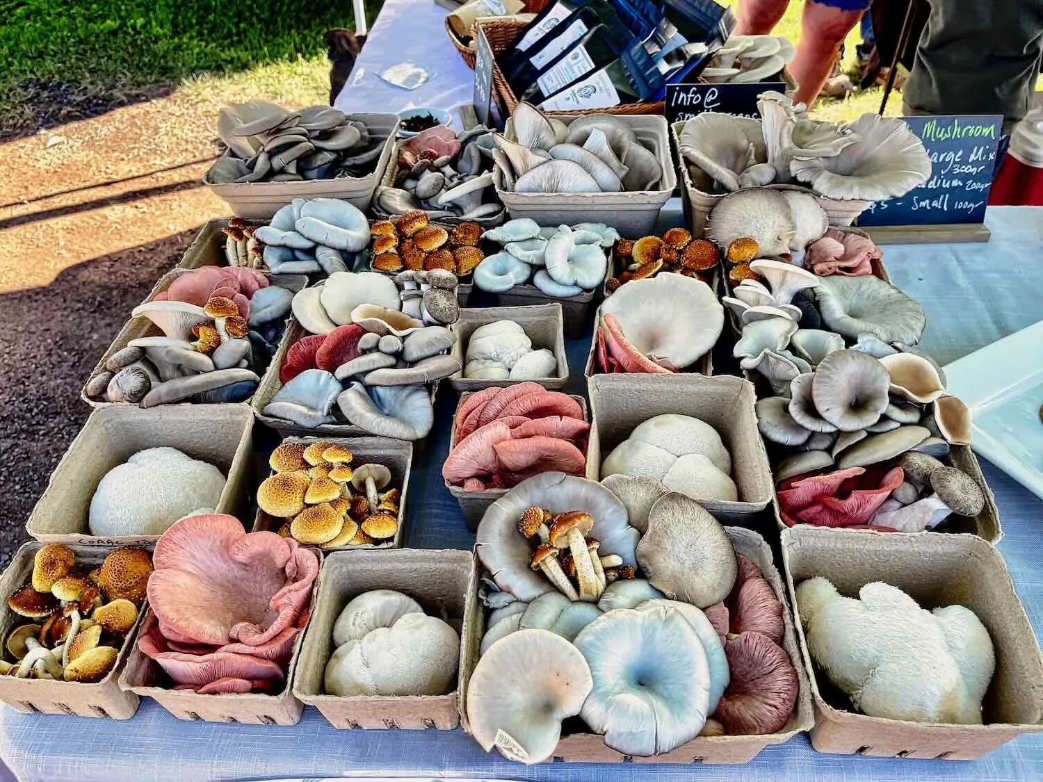
While hanging out in Smithers, we took the time to wander around town and to visit the Saturday morning farmers’ market. The market is modest in size (about 15 tents) but it had a wonderful selection of local produce, as well as some other fun stuff for sale. There was a mushroom vendor that had an astonishing selection of merchandise, in a wide range of sizes and colors. A flower-seller had gorgeous bouquets on display. And we ended up buying a box of six, hot-out-of-the-fryer apple fritters, which were delicious. They were absolutely packed with apples.

Cooking up apple fritters at the Smithers Farmers Market. Yellowhead Highway, British Columbia, Canada. Copyright © 2019-2022 Pedals and Puffins.
Other sights around Smithers:
This striking statue graces the top of a monument dedicated to the wilderness outfitters of Smithers. Yellowhead Highway, British Columbia, Canada. Copyright © 2019-2022 Pedals and Puffins.
A statue of the town’s mascot, Alpine Al with his alpenhorn, graces the entrance to Main Street. Yellowhead Highway, British Columbia, Canada. Copyright © 2019-2022 Pedals and Puffins.
With a business like this in town, there’s no excuse for going away dirty. They have the means to clean almost anything. Smithers, Yellowhead Highway, British Columbia, Canada. Copyright © 2019-2022 Pedals and Puffins.
Cycling Over Hungry Hill
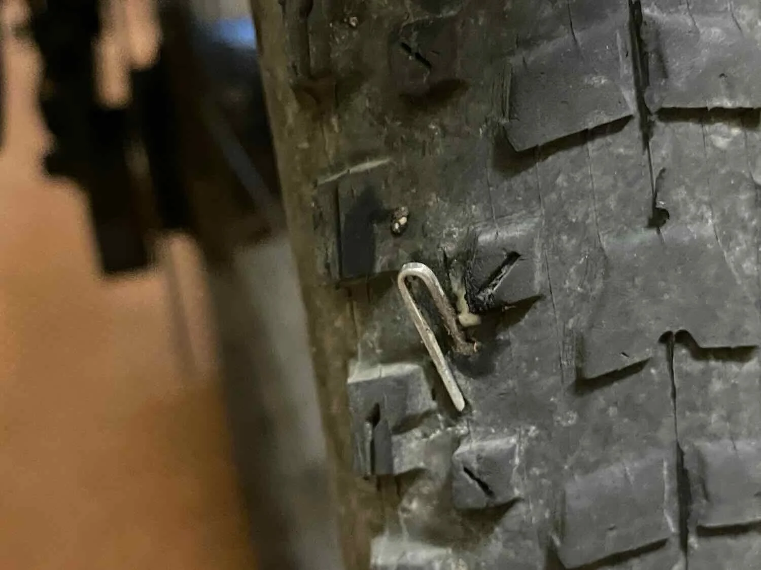
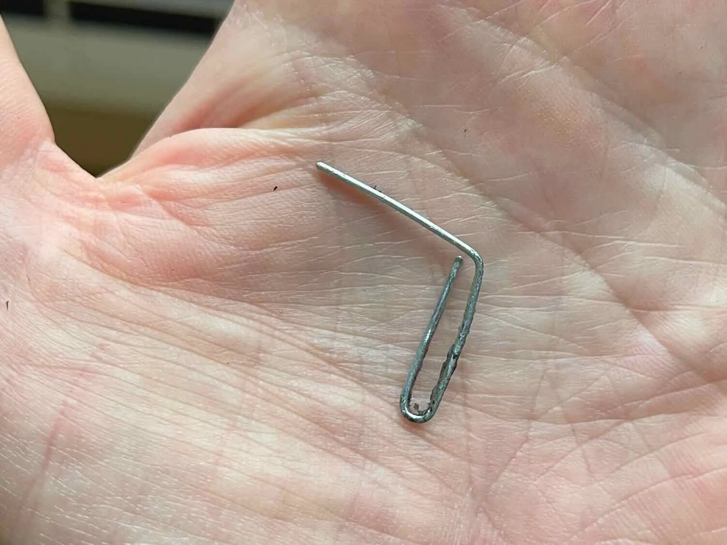
As we prepared to leave Smithers, we discovered our first tire casualty resulting from all the debris along the shoulder of the Yellowhead Highway. PedalingGuy’s back tire was flat. On inspection, we discovered an opened paper clip stuck in the treads. It was lodged in there pretty good, and we had to use a pair of pliers to yank it out - causing sealant to start bubbling out of the hole. We inserted a Dynaplug to stop the leakage, and that seems to have fixed it.
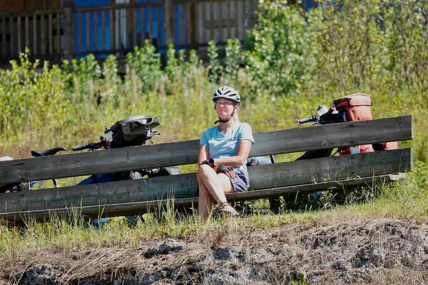
One of the things that has been great about cycling in western Canada is that many of the highway rest stops have picnic tables and trash cans. That’s made it easy for us to comfortably take breaks for roadside snacks. We’re not averse to breaking out our own camp chairs if needed. But it sure saves time and energy when we can just pull off the road and have a seat at a table. And it’s awesome to be able to dispose of any trash right away, instead of having to store it somewhere on the bike and carry it down the road.
Canada’s inclination to put picnic tables at highway rest stops brings a smile to PedalingGuy’s face. We were always grateful for these little oases along the road. Yellowhead Highway, British Columbia, Canada. Copyright © 2019-2022 Pedals and Puffins.
Although wildlife sightings were getting more rare, we actually had two exciting moments on the stretch of road between Smithers and Houston, BC. The first was a handsome coyote at the edge of a small forest clearing. We’re used to seeing the smaller, skinnier coyotes of the American Southwest. This one seemed big and well-fed by comparison, and it had a luxurious coat. We both marveled at how healthy it looked.
We spotted this handsome coyote along the Yellowhead Highway. British Columbia, Canada. Copyright © 2019-2022 Pedals and Puffins.
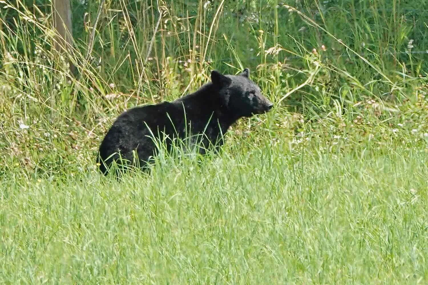
A short time later PedalingGuy stopped to photograph a big, black animal in the grass at the far side of an open field. At first PedalingGal thought it was a cow. This area was mostly covered with farmland, hayfields and pastures broken up by modest-sized patches of forest. But, sure enough, it was a bear - our 14th bear sighting of the trip. As soon as it realized it was being watched, the bear ran off into the woods like a rocket.
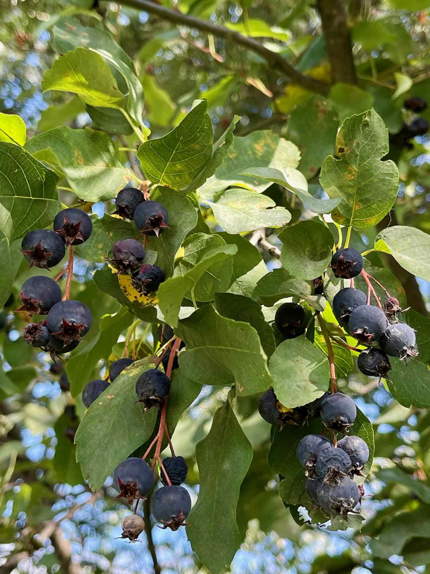
Saskatoon berries - a native shrub that looks like a blueberry, tastes like an earthy cherry, is related to apples, and has superfood properties to rival the fashionable açai - are in season, and we encountered a few plants near a roadside stop. They were delicious. It’s likely that both the coyote and the bear were helping themselves to these roadside treats.
Speaking of bears… the big climb for the day was up and over a ridge called “Hungry Hill.” There are various theories about where the name came from. Locals prefer the version that says the hill got its name because of the number of car transmissions it has chewed up over the years. But between the years of 1998-2005, Hungry Hill took on a whole different meaning. A sign at the rest area on top of the hill tells the story of The Phantom, a very large grizzly bear that terrorized the area’s ranchers from 1998-2001, killing more than 30 adult cows. Local’s called the bear The Phantom because of it’s cleverness in avoiding traps set by the province’s wildlife officers for three years. When the bear was finally caught in a snare, it broke free just as two wildlife officers were approaching, and it charged at them. They both fired their rifles, killing the bear less than 10 meters before it reached them in its fury.
After its death, the bear was weighed at over 1,000 pounds (455 kg). That’s enormous. Most grizzly bears weigh 400-790 lbs (although coastal brown bears can get bigger). The bear would have been 11 ft tall (3.4 m) when standing upright. And some of the cows that it killed were estimated to weigh 1,500 lbs (680 kg). It’s no wonder this bear has entered the realm of legends.
But the story doesn’t end there. In 2005 news of another giant bear spread like wildfire in the Hungry Hill area. History seemed to be repeating itself. Ranchers would find slaughtered cattle. Wildlife officers were tasked with capturing and eliminating the bear. But this time the story ended more quickly. Four years after the death of the Phantom, almost to the day, the second grizzly was captured and killed. This one weighed in at 975 lbs (442 kg), and experts believe the two bears were probably related.
By comparison to these tales, our ride was pretty tame. Each day the hayfields grow bigger and the woodlots get smaller. From the top of Hungry Hill we rolled downhill most of the way into Houston, BC.
Bringing in the hay on one of the large farms blanketing the Fraser Plateau. Yellowhead Highway, British Columbia, Canada. Copyright © 2019-2022 Pedals and Puffins.
Canada’s largest fishing rod, in Houston. Yellowhead Highway, British Columbia, Canada. Copyright © 2019-2022 Pedals and Puffins.
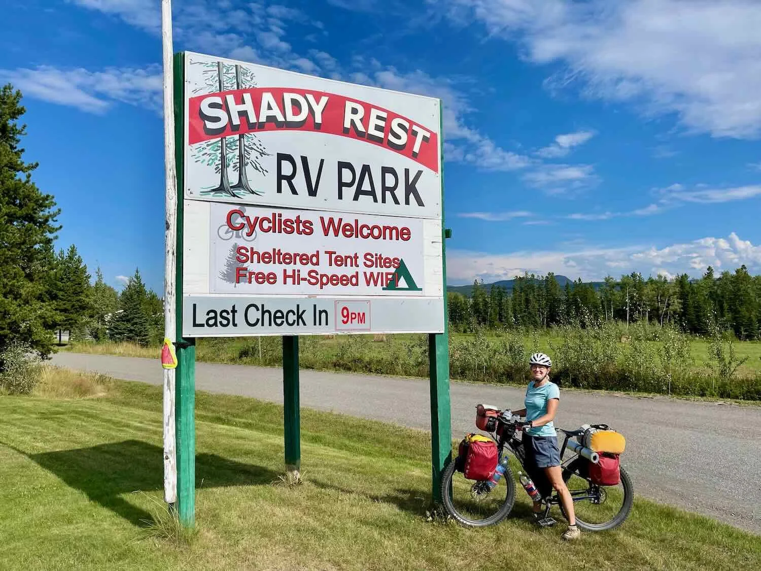
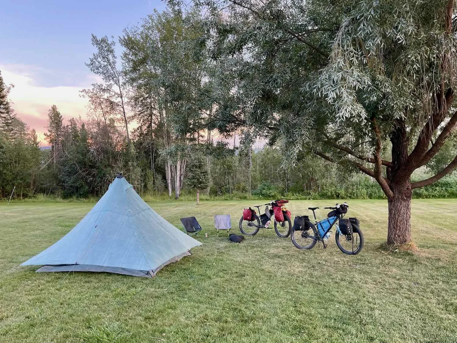
After a quick dinner, we headed out to an RV park and campground on the far side of town. We were delighted to see a “cyclists welcome” sign at the entrance. Unfortunately, when we checked in at the office we discovered that all of the regular tent sites were occupied, by contractors working on the railroad. But the campground manager really was bicycle friendly. He offered to let us camp under a big willow tree in a grassy field at the back of the campground. As far as we were concerned, that was great - possibly even better than being sandwiched between the contractors in the main camping area. We passed the rest of the afternoon and evening relaxing in our camp chairs, under the tree by our tent.
Hot Afternoons in City Parks
By the time we rolled out of Houston, BC, we had long since left the cold, rain-soaked days of northern British Columbia behind. In fact, as we made our way along the Yellowhead Highway, south-central BC and the northwestern USA were sweltering in an August heat wave. Under cloudless skies, the sun baked the asphalt on the highway so that by mid-morning it was quite warm. And by noon, the temperature rose to 88F (31C).
The next two towns on our route, Burns Lake and Fraser Lake, both offer free camping in their city parks. The campsites are basic, but the locations along lakeshores make for a pleasant setting.
The impressive entry sign at the Burns Lake municipal campground. Yellowhead Highway, British Columbia, Canada. Copyright © 2019-2022 Pedals and Puffins.
In Burns Lake we made friends with our neighbors in the campground, Alvin and Mary. Alvin generously agreed to keep an eye on our tent while we went into town for dinner. Later in the evening, we visited with them for a while. Alvin and Mary travel around western North America in the summers, spend winters in Arizona, and spend a month each year in Puerta Vallarta, Mexico. We shared stories about the various sights we’ve seen traveling in Mexico and the western US. And in a lovely gesture of generosity, they shared some ice cream with us. We thoroughly enjoyed their company.
The weather continued to be hot and muggy as we cycled from Burns Lake to Fraser Lake. We tried to cover the miles as quickly as possible, to avoid biking in the hottest part of the afternoon.
The scenery was pleasant, with rolling, tree-covered hills and a couple of lakes. But although the road signs keep telling us to watch out for all kinds of wildlife, we didn’t see any.
This highway sign suggested that there were a lot of big animals to watch out for (moose, bear and deer). But we didn’t see any that day. Yellowhead Highway, British Columbia, Canada. Copyright © 2019-2022 Pedals and Puffins.
The municipal park in Fraser Lake is located on a grassy, open area right next to the lake. We pitched our tent in the early afternoon. But with the lack of shade, we headed back into town to find some air conditioning. We ate a leisurely, early dinner. Then we hung out in the shade until about 7:30pm, when the temperature finally started to cool off. We ended the evening with a pleasant walk along the shoreline of Fraser Lake, as the sun set behind some distant hills.
Sunset over Fraser Lake, British Columbia. Yellowhead Highway, Canada. Copyright © 2019-2022 Pedals and Puffins.
But city park campgrounds have their downsides, especially the fact that sites are usually very close together, and people often arrive late at night - just looking for a free place to sleep. At Fraser Lake, right as we were going to bed around 10pm, an Airstream pulled up in the site next to ours. For the next eight hours we listened to their chaos of banging doors, yelling and arguing with each other, two yapping dogs that didn’t seem to sleep, and an apparently-sick child that coughed all night. Oh, and a set of railroad tracks passed within 50 yards of the campground, with trains passing and blowing their horns every hour or so. Needless to say, we didn’t get much rest.
The Geographic Center of British Columbia
Our campground neighbors were up and banging around before dawn, which helped us get an early start as well. An hour into our ride we stopped for a break in the shade at a convenience store. While we were there, a regional bus on its way to Prince Rupert stopped at the store to give the riders a break. Four folks from Germany who were on the bus came over to talk with us. They were all cyclists, and had done some bicycle touring in Europe. They had a lot of questions about our route and gear, and were definitely impressed that we planned to cycle all the way to South America. Before heading back to the bus, they mentioned that they had seen another cyclist heading our way.
It wasn’t long after leaving the store that we crossed paths with the cyclist from Quebec. He had hopped on his bicycle and ridden away from his home near Montreal, without having a firm itinerary. He told us he planned to cycle to Prince Rupert, then take a ferry to Victoria, BC. But other than that he didn’t have firm plans. We also heard about his bicycle troubles. He had cracked the rim on one of his wheels when he hit a pothole, and had to have the wheel replaced in Prince George. Even though our wide tires may not be as fast as the skinny tires used by our friend from Quebec, we are happy that we don’t have to worry about cracked rims or broken spokes - which are much more common on narrower rims. We have really abused our wheels over the last couple years, and they take everything we throw at them without any trouble.
Shortly after our visit with the other cyclist, we almost had a wildlife sighting. Remember how we had seen a bear along the highway between Smithers and Houston, and at first PedalingGal thought it was a cow? Well, PedalingGuy stopped to take a photo of what he thought might be a bear in the woods. This time, it turned out to be a cow.
This is a cow, not a bear. Yellowhead Highway, British Columbia, Canada. Copyright © 2019-2022 Pedals and Puffins.
On the way into the city of Vanderhoof, we passed a really huge sawmill, with endless stacks of milled wooden boards. We know the sawmills out west can be really big, but this was possibly the largest we have ever seen. That helped to explain the constant stream of logging trucks that passed us while rumbling up and down the Yellowhead Highway. Later, we looked up the sawmill online and watched a fascinating video that showed how the logs are processed into boards. It’s amazing how fast and automated the process of milling logs has become.
Giant stacks of lumber covered many acres of ground at the sawmill near Vanderhoof. Yellowhead Highway, British Columbia, Canada. Copyright © 2019-2022 Pedals and Puffins.
But apparently Vanderhoof’s biggest claim to fame is that it is near the “geographical center” of British Columbia. The designation seems to confer an aura of importance - enough that they thought it was worth pointing this out on the town’s welcome sign.
If British Columbia is “the best place on earth” (the province’s official slogan), then Vanderhoof must be awesome. It’s at the geographical center of the province. Yellowhead Highway, British Columbia, Canada. Copyright © 2019-2022 Pedals and Puffins.
A Very Lucky Day
We don’t have any photos of our ride from Vanderhoof to Prince George, BC. But that doesn’t mean the day was uneventful. In fact, we dodged no less than four bullets over the course of the day.
Lucky Break #1: Not long after leaving Vanderhoof, we realized that we must have just missed getting soaked by a really big rainstorm. The road was very wet, there were deep puddles, and water was rushing down through the roadside gullies for several miles. But no rain fell on us. We marveled at our good timing as we pedaled along the rain-soaked road.
Lucky Break #2: About 2 hrs into our ride, we started seeing ominous signs about a construction zone ahead. Then, after a quick break, we saw a construction worker setting up a traffic stop right across the road from us. It looked like they were prepping to take the road down to a single-lane of traffic. Not wanting to get stuck riding in a pilot car, we sped out of the parking lot before the construction worker saw us.
But when we reached a rest area just up the road, we needed to stop and use the facilities. While we were at the rest area, we started to hear the sound of heavy equipment coming up the road in our direction. With a sense of urgency, we jumped back on our bikes. At the exit from the rest area’s parking lot, there was a new sign telling vehicles to wait for the pilot car before proceeding. There were already 3-4 cars waiting. We passed them and took off down the road, hoping to stay ahead of the construction workers.
Fortunately, as we cycled through the construction zone, nobody bothered us. We saw the pilot car heading in the opposite direction with a long line of cars, and waved to the driver, hoping that being friendly would encourage them to let us pass through. In truth, actual construction work hadn’t started yet, so there really wasn’t any danger. But it was a big relief when we exited the construction zone. We dodged the second bullet.
Lucky Break #3: Around 2pm we stopped at another convenience store for some drinks in the heat of the day. Just as we were parking our bikes under an awning, it started to rain. Hard. Surprisingly, we hadn’t been fully aware that a rainstorm was sneaking up on us from behind. The rain came pouring down for 30 minutes, as we watched from inside the dry and comfortable store. Our timing was perfect.
Lucky Break #4: As we cycled into the city of Prince George, a very large, dark cloud was approaching from the west. You’re probably starting to see a pattern here. Most of our luck had to do with the weather. This storm was particularly nerve-racking, because we could see it coming from a long way off. We were both certain that our luck had run out, and we would get wet this time.
Just six miles (9.7 km) from our hotel, PedalingGuy’s back tire suddenly started spewing sealant out of a major puncture. His tire went flat very quickly. We pulled over to the side of the highway, and as efficiently as we could, we shoved in three Dynaplugs to stop the loss of air. Then, as we were pumping up the tire, air started leaking out around the valve stem. After screwing the valve on tighter, we finally got the tire to hold air. But it was almost completely deflated at this point. We pumped vigorously with our little hand-pump to fill the big, plus-sized tire up to pressure. It seemed almost certain that this slowdown had used up enough precious time that we would get soaked from the rain.
But once again, the rain held off until literally the final moments. We pulled up to the hotel and were able to park our bicycles inside a small corridor that fully protected them from the elements. Then, within a minute of our arrival, the rain started pelting down with thunder and high winds. We felt unbelievably lucky (even given the flat tire).
This is the only photo we took on our 60+ mile ride (100+ km) into Prince George. But it’s a good one. It signaled our arrival in town, having dodged heavy rain and construction zones all day. Yellowhead Highway, British Columbia, Canada. Copyright © 2019-2022 Pedals and Puffins.
By comparison, the rest of the day had been pretty uneventful. We did have one very unpleasant section of riding where we had to climb a half-mile long, steep hill with literally no shoulder. Worse, we were pressed up against a concrete barrier on the right-hand side. Many cars and trucks moved over and gave us some room as we labored up the hill, but not all of them. Some big vehicles passed us way too close for comfort. When we got to the top, it was a huge relief. That might have been one of the more dangerous sections of road we have ever ridden.
Bicycle Maintenance In Prince George
One of our highest priorities in Prince George was to have a bike shop take a look at our pedals, which we had attempted to repair in Smithers. We carry tools to fix most things on our bikes, but there are a few things that require specialized tools. Our pedals, for instance, require a long socket wrench extension to get at the bearings. We considered getting new pedals, but in the end the bike shop was able to find replacement bearings. So we just had the mechanic replace the old bearings and add a ton of grease inside the pedals to protect the bearings from water. Since then, our pedals have been riding smoothly. We’re happy to have had that problem diagnosed, and properly repaired.