The Icefields Parkway: Cycling from Prince George to Golden, British Columbia
1 - 17 September 2022
1 September - Prince George to Sugarbowl-Grizzly Den, BC (57.0 mi, 91.7 km)
2 September - Sugarbowl-Grizzly Den to Lasalle Lakes, BC (47.5 mi, 76.4 km)
3 September - Lasalle Lakes to McBride, BC (29.5 mi, 47.5 km)
4 September - Rain day in McBride, BC
5 September - McBride to Mt. Robson, BC (51.0 mi, 82.1 km)
6 September - Mt Robson, BC, to Jasper, AB (55.2 mi, 88.8 km)
7 September - Jasper to Honeymoon Lake, AB (30.7 mi, 49.4 km)
8 September - Honeymoon Lake to Columbia Icefield, AB (35.0 mi, 56.3 km)
9 September - Columbia Icefield to Waterfowl Lakes, AB (42.7 mi, 68.7 km)
10 September - Waterfowl Lakes to Mosquito Creek, AB (21.4 mi, 34.4 km)
11 September - Mosquito Creek to Lake Louise, AB (18.3 mi, 29.5 km)
12 September - Rest day in Lake Louise, AB
13 September - Lake Louise, AB to Golden, BC (52.2 mi, 84.0 km)
14-17 September - Layover in Golden, BC
Ascending Into the Northern Rocky Mountains
As we headed eastward out of Prince George along the Yellowhead Highway, the character of our route changed completely.
For starters, we no longer encountered towns every 20-25 miles. Suddenly, the gap between shops and gas stations jumped five-fold, to more than 120 miles (196 km). In addition, the paved margin of the road was reasonably wide, and very good for cycling.
On this leg of our journey, we headed back into the wilderness. This roadside sign highlighted just how remote our route would be. Yellowhead Highway, British Columbia, Canada. Copyright © 2019-2022 Pedals and Puffins.
Immediately after departing Prince George we started gaining elevation. For the most part the hills were long, with only modest gradients. That allowed us to maintain a reasonable pace even as we climbed steadily towards the Rocky Mountains. It was the first of September, and we could feel the initial hints of fall in the air. Billowy, white clouds covered the sun for most of the day, keeping the temperature comfortably cool.
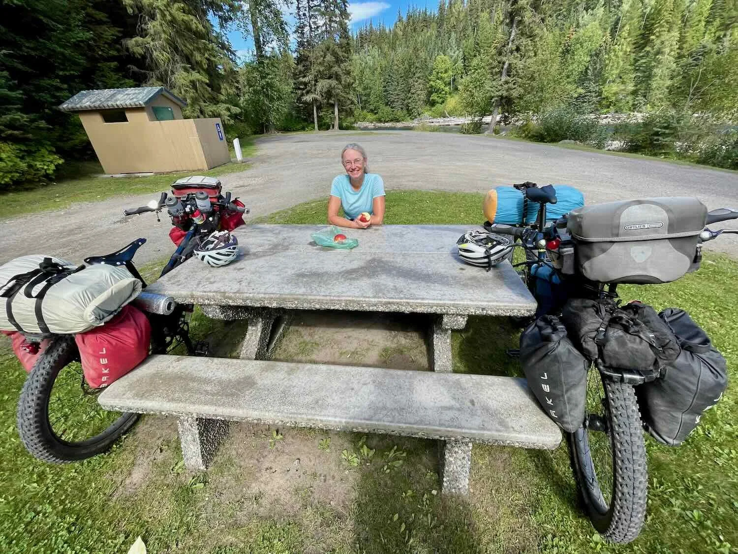
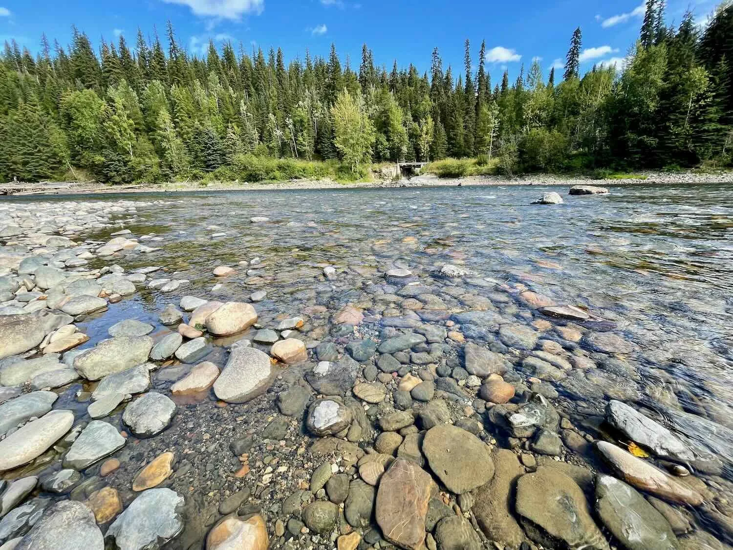
Shortly after noon we stopped for a break at a lovely rest area. It was located at the bottom of a steep access road. But the tranquil picnic area was worth the effort we had to expend to climb back up the hill on our way out. It was situated next to the Bowron River - a fast-flowing, clear mountain stream. We stood on the river bank and speculated about where the biggest trout might be hiding among the cobblestones, big boulders, and woody debris strewn along the river’s path.
As the day progressed, we noticed more and more changes in the landscape around us. From our point of view on the highway, the most striking changes were visible whenever the road cut through the top of a ridge. The fertile, grassy slopes of the Fraser Plateau were replaced by rugged bedrock, which was covered with a thin layer of mossy earth and topped with dense conifer forests. We even spotted our first western red cedar tree. And towards the end of the first day’s ride out of Prince George, we officially entered the Northern Rocky Mountains ecoregion.
It’s starting to look a lot like the Northern Rocky Mountains. Bedrock outcrops topped with moss and conifer trees signaled that we had entered a new ecoregion. Yellowhead Highway, British Columbia, Canada. Copyright © 2019-2022 Pedals and Puffins.
We had planned to find a place to wild camp in Sugarbowl-Grizzly Den Provincial Park. But most of the side “roads” shown in our mapping app turned out to be hiking paths, not trails where we could take our bicycles. As we cycled onward, we started to wonder how long it might be before we could find anywhere to camp.
Then, just about a mile before we reached the far boundary of the park, we saw a wide, well-groomed gravel road leading into the woods. We decided to explore it, in hopes of finding a campsite. To our dismay, the road was bordered by dense forest unsuitable for camping. Several times we nearly gave up and turned around to leave. But after cycling down the gravel road for nearly two miles (3.2 km), we found ourselves in a big, open, gravel quarry. It was perfect. We were far enough from the highway that it was very quiet. We found a nice, level spot on the gravel for our tent, and we even had a pretty view of Grizzly Ridge to our south.
The evening was comfortably cool, and there were no mosquitos. We seemed to finally be out of the worst part of the mosquito season. It was a pleasure to relax around camp, and go for a walk. In the sand at the bottom of the quarry we saw some deer tracks, as well as some others that were probably coyote tracks. Just after dark we were serenaded by a barred owl hooting in the woods nearby.
A coyote left its footprints in the sand of an old gravel quarry, near our campsite in Sugarbowl- Grizzly Den Provincial Park. Yellowhead Highway, British Columbia, Canada. Copyright © 2019-2022 Pedals and Puffins.
During the night we did experience a bit of unexpected excitement. The wind picked up, and pretty soon there was a stiff breeze blowing. Unfortunately, the gravel where we pitched our tent did not hold the stakes very well. In the pre-dawn darkness, one of the stakes pulled out of the ground, causing the Dyneema material that our tent is made from to flap noisily in the wind. PedalingGuy went outside to reset the stake, and pound in some of the others that were getting loose. But by morning, the front door stake had pulled out as well. It’s just one of the occasional hazards of sleeping out in a tent.
As we were packing up the tent the next morning, we noticed a large flock of birds fluttering around near the bottom of the gravel pit. We went over to investigate, and found several hundred pine siskins coming down to eat the fine-grained sand that had collected there. Like many species of birds that have a lot of hard seeds in their diet, pine siskins need to ingest sand to help grind down the seeds in their gizzards. The grit in the bottom of this gravel pit seemed to be just what these birds needed.
A couple of pine siskins having sand for breakfast. The gritty sand helps the birds break down the hard-coated pine seeds that make up the bulk of their diet. Yellowhead Highway, British Columbia, Canada. Copyright © 2019-2022 Pedals and Puffins.
A highlight of our ride that day was a lunch stop at Joe Boo’s Mobile Eatery - a permanently parked food truck along the highway, very far from any other services. They make spectacular sandwiches which are particularly appreciated given how little food is available in the area. While we munched on our sandwiches at this incongruous restaurant in the wilderness, we chatted with a man who had stopped by with his granddaughter for a piece of pie. It turned out that he was a bike mechanic, and had done some cycling trips in the past. He enjoyed talking about the technical aspects of our bikes with PedalingGuy (like the choice of tire size and how the Rohloff hubs worked). He stayed and talked with us for the entire time that we were there.
After leaving Joe Boo’s, we cycled pretty hard to reach our campground. It was a hot afternoon, and we both got tired. The hills heading upward seemed to go on forever.
When we arrived at Lasalle Lakes Campground, we found the area around the lake teeming with miniature western toads. They were less than an inch long, and they seemed to be everywhere. You literally had to be vigilant while walking not to step on any of them. We carefully checked the area under our tent to be sure it was toad-free before staking it down.
After pitching our tent, we headed over to the lake. There was a beach and a dock where a couple of other campers were swimming. PedalingGuy dove in, and swam out to the floating dock. But the water was too cold for PedalingGal, so she just waded in up to her knees. At the edge of the lake, the source of the toads became clear. The shallow water was full of little tadpoles in various stages of metamorphosis - many of them had rudimentary legs just starting to form. There were soon going to be a lot more toads on the beach.
PedalingGuy went for a dip in the chilly water of Lasalle Lake. Here, he’s swimming back to the beach after a rest on the floating dock. Yellowhead Highway, British Columbia, Canada.. Copyright © 2019-2022 Pedals and Puffins.
A Big Storm in McBride, BC
Getting out of the campground at Lasalle Lakes was one of the hardest parts of our ride the next day. The lake lies about 200 ft (61 m) below the highway, but the road out is only 0.3 mi (0.5 km) long - resulting in an average gradient of 13%. Of course, the rise was uneven so some sections were much steeper than that. We both made it to the top of the hill without getting off to walk, but it took a few minutes to catch our breath once we reached the highway.
As we rested by the side of the road, we were surprised to see that the surrounding mountains were obscured by a haze of smoke. For the past six weeks, rainy weather had suppressed forest fires in the region, and helped to clear the air. But with the return of fair weather, smoke was now blowing up from the south.
Unfortunately, the haze remained heavy in the sky all day. The shadowy, dark green shapes of the Rocky Mountains (on our left) and the Cariboo Mountains (on our right) marched along on either side of us, without ever quite coming into focus.
Halfway through the day’s ride, we stopped for a brief rest on a gravel side road that led into an area of forest that had recently been logged. Woody debris left over after the timber had been removed was stacked high in numerous slash piles that resembled giant beaver lodges. Managed forests were widespread in this region, and we frequently passed areas with active logging operations, or in various stages of regrowth. Sometimes there were even signs posted along the highway noting the years in which a section of forest had been logged, replanted, or thinned.
A slash pile of woody debris left over after the surrounding forest had been harvested for timber. It’s a common practice in forestry to burn these piles to reduce the dried wood scattered on the ground, which decreases the risk of future wildfires. Yellowhead Highway, British Columbia, Canada. Copyright © 2019-2022 Pedals and Puffins.
A few hayfields lined the highway as we approached the town of McBride. Yellowhead Highway, British Columbia, Canada. Approaching McBride. Copyright © 2019-2022 Pedals and Puffins.
Arriving in McBride, BC. Yellowhead Highway, British Columbia, Canada. Copyright © 2019-2022 Pedals and Puffins.
We had been keeping an eye on the weather, and the forecast didn’t look too good. The day after our arrival in McBride, rain was likely - including the possibility of severe thunderstorms. We debated whether to keep going in spite of the rain, but decided against it. So we hunkered down in McBride for a day to wait out the bad weather.
During our layover day in McBride, the skies looked stormy and we could see rain falling in the surrounding mountains. But for much of the day there was no rain in town. We started to think that perhaps we should have kept cycling. But then things got interesting.
While we were having an early dinner at a local restaurant, a huge windstorm blew into town. We had a table by the window, so we could see the tempest as it blasted down the city’s main street. Dust, leaves and debris went flying through the air as the wind whipped the trees into a frenzy.
A fierce windstorm blew through McBride as we watched through a restaurant window. British Columbia, Canada. Copyright © 2019-2022 Pedals and Puffins.
Pretty soon the power went out - not just at the restaurant, but throughout the entire town. We had to pay for our dinner with cash, since the restaurant couldn’t process our credit card. Complicating matters even further, the store manager had trouble figuring out how much to charge us because she was used to relying on the electronic cash register to calculate the bills. PedalingGuy let her use the calculator on his phone, but she still struggled to do the math correctly. After a few tense minutes, we finally got it sorted out.
When we headed back to our hotel room, the wind was still howling. Fortunately we made it back before the rain began to fall. But power was out at the motel, too. A falling tree limb had brought down a power line that cut electricity to everyone along the Yellowhead Highway for 20 miles in both directions from McBride. Fortunately, we could use our camping headlamps to get a few things done in the darkened motel room. But we didn’t relish the idea of running down the batteries on our phones, which we use for navigation, without any assurance that we could recharge them in the morning. So we headed to bed early.
Arriving in the Big Mountains
Power was restored shortly before dawn. Thankfully, we were able to charge up our devices a bit in the morning, while getting ready to depart.
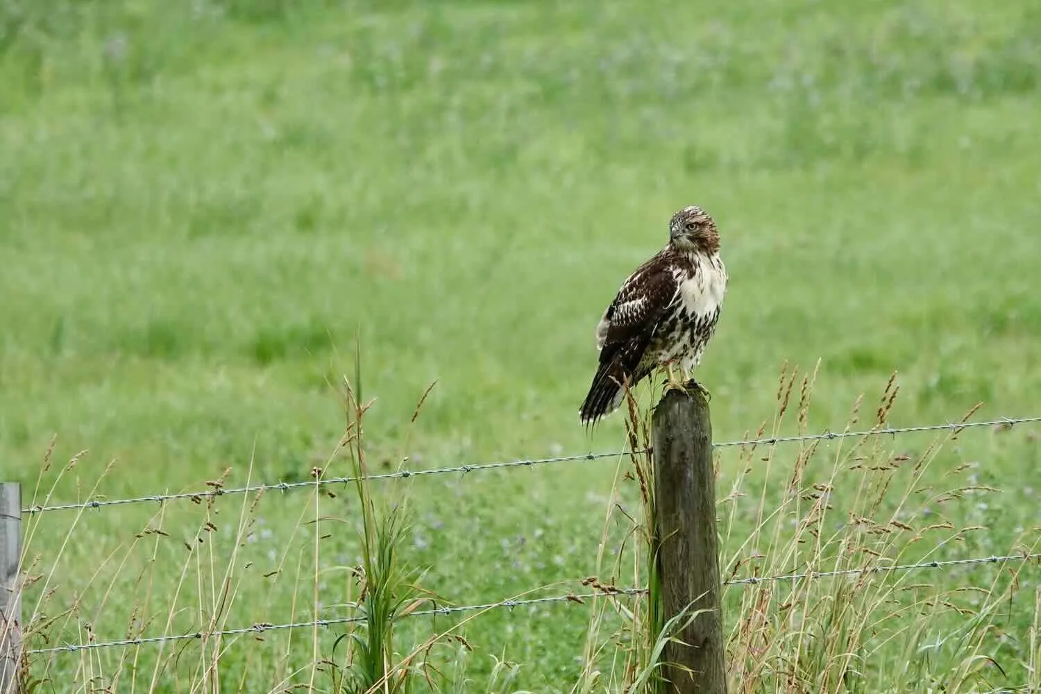
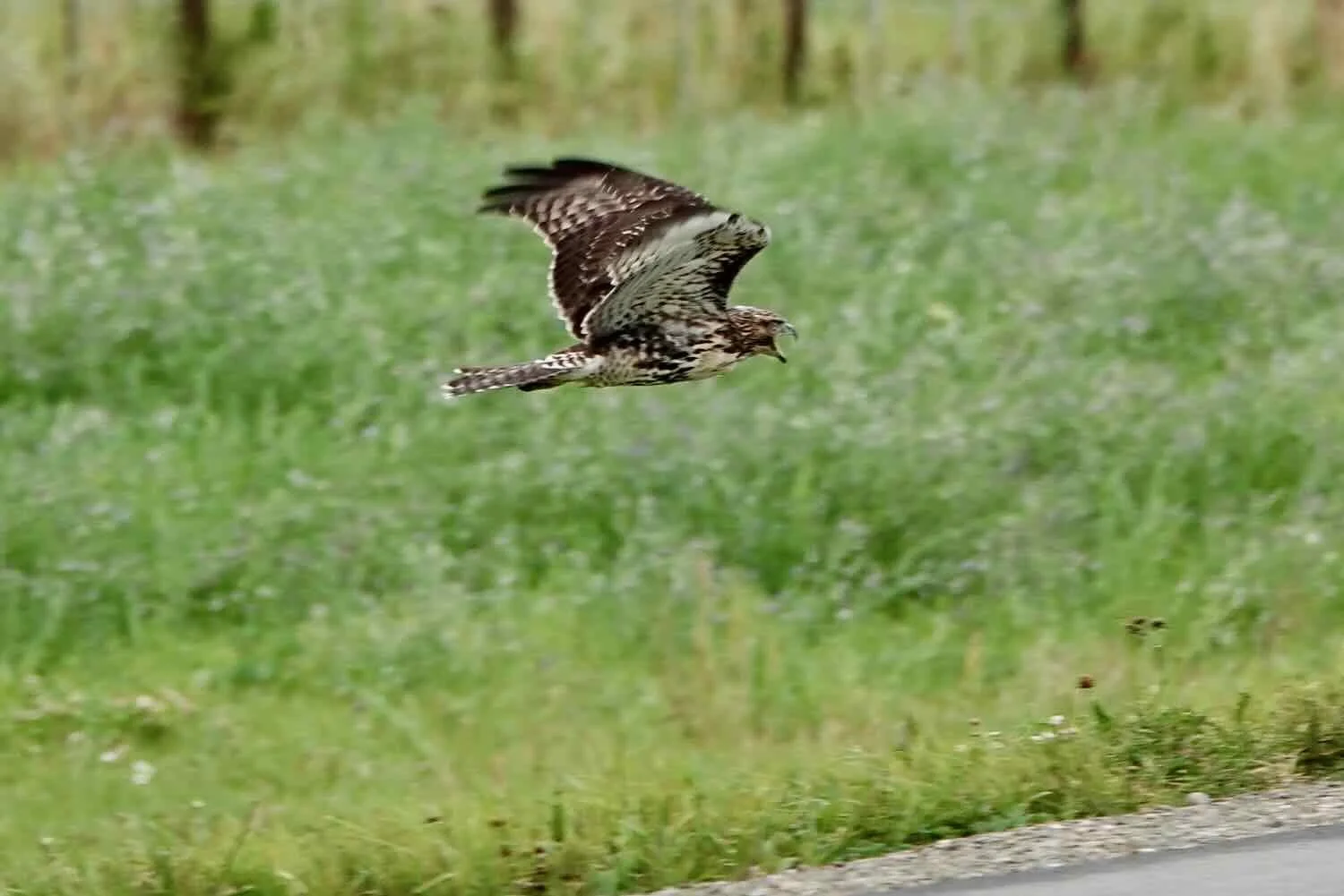
During the early part of the day, we traveled through more hay fields and farmland. A juvenile red-tailed hawk perched on a fence post was not too pleased when we stopped to take its photo.
Although the storms of the previous day had passed, the weather remained extremely unsettled. Low-hanging clouds wrapped around the surrounding mountains in layers, creating some beautiful views. And the mountains now sported a dusting of new snow on the higher peaks - the first snow of the coming winter season. That made the mountains especially pretty in the morning light. But it also was a reminder that we needed to make progress moving south to stay ahead of the winter weather.
A blanket of new snow looked lovely on the surrounding mountain peaks, which were shrouded in low-hanging clouds. Yellowhead Highway, British Columbia, Canada. Copyright © 2019-2022 Pedals and Puffins.
Oh, and we passed an oversized billboard along the way promoting “World Class Chicken Races.” Huh? If we had been in a car, this sign might have been enough to get us to turn around and go back up the road to find out what this was all about. Instead, we just had to use our imaginations. But it turns out that yes, in fact, they host daily chicken races at Fort St. James - a Canadian national historic site. Spectators are even given “chicken bucks” that they can use to bet on the competitors. If you are wondering why a national historic site has chicken races, a Parks Canada spokesperson has been quoted as saying that back in the day, horse races were held at the fort for the entertainment of the residents. And since horse racing isn’t really feasible these days, they hold chicken races instead.
This sign along the Yellowhead Highway tickled our imaginations. British Columbia, Canada. Copyright © 2019-2022 Pedals and Puffins.
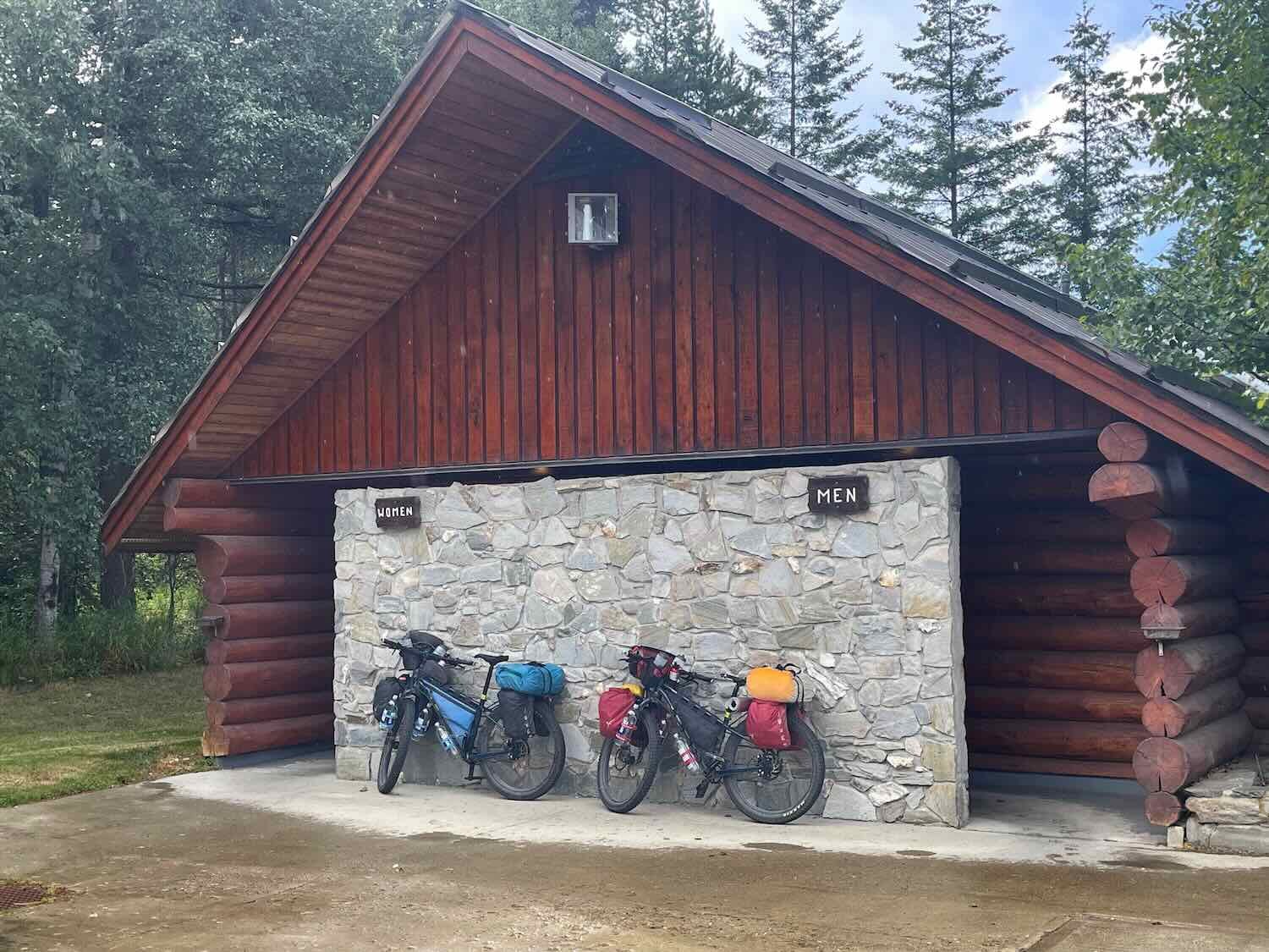
Despite the brooding clouds, we were lucky that the rain held off for most of the day. But eventually the weather changed again. We were only about 10 miles (16 km) from the Mount Robson campground, climbing a long, steady hill, when the rain started to fall. We pushed our pace hard, hoping to find a place to pull off the road and dry off. Finally, at the very top of the 5-mile long hill (8 km), we veered into a rest area and headed straight for the building that housed the restrooms. The roof extended for a couple feet beyond the walls of the building, providing just enough shelter to keep our bikes out of the rain.
There were also a couple of covered information kiosks, so we headed over to check them out while we waited for the weather to clear. We learned that this rest stop had been dedicated to Terry Fox, a long-distance runner who became a national hero when he attempted to run across Canada with an artificial leg in 1980, to raise funding and awareness for cancer research. Although cancer took his life at age 22, before he could finish his cross-country run, he had won the hearts of millions of Canadians. An annual Terry Fox Run is still held in over 60 countries, making it the single, biggest, one-day fundraiser for cancer research in the world.
Twenty minutes later, the storm finally passed and headed up the valley, leaving patches of blue sky behind.
Rainstorm drifting away from us, up the Fraser River Valley. Yellowhead Highway, British Columbia, Canada. Copyright © 2019-2022 Pedals and Puffins.
As the clouds lifted, we finally saw the majestic face of Mount Robson. At 12,972 ft (3,954 m) high, it is the tallest mountain in the Canadian Rockies. But what makes it even more special is that it ascends a stunning 9,760 ft (2,975 m) from the surrounding lowlands, making it the most prominent mountain in the North American Rockies. The approach on the Yellowhead Highway from the southwest beautifully frames the mountain as it rises from deep-green foothills to its lofty, striated, snow-capped peak. It was exciting to watch it reveal itself as the clouds dissipated, and we stopped often to admire its grand facade.
Entering Mount Robson Provincial Park, with the namesake mountain in the background. Yellowhead Highway, British Columbia, Canada. Copyright © 2019-2022 Pedals and Puffins.
On arrival, we went straight to the Cafe at the foot of the mountain for dinner. While relaxing in the cafe, we met Katie and Alan from Winnipeg, who were visiting the park with their cute puppy. We learned that they are avid travelers, and had spent extended vacations in countries all over the world. They had already done a great job of training their little canine companion to handle travel well. She rested quietly in her carrying case, seemingly immune to all of the hubbub in the cafe.
Katie and Alan visited with us in the Mount Robson Cafe, while their puppy chilled out in her carrying case. Yellowhead Highway, British Columbia, Canada. Copyright © 2019-2022 Pedals and Puffins.
After dinner we pitched our tent in the Mount Robson campground. The campsites were widely spaced, with plenty of vegetation to provide privacy between campers. We found a nice, peaceful spot far away from the busy roadway with its many park visitors.
The next day it was clear that we had truly arrived in the big mountains. Overnight the temperature had dipped down into the mid-30s Fahrenheit (1-2C). The cold weakened our resolve to make an early start, and kept us in our sleeping bags until almost 8am.
But once we were up and about, we enjoyed a gloriously clear morning. With the clouds gone, we could see the full beauty of Mount Robson. Of course, we couldn’t help taking a bunch more photos of the spectacular mountain.
Mount Robson, the highest point in the Canadian Rockies, looked magnificent in the morning sunshine. Yellowhead Highway, British Columbia, Canada. Copyright © 2019-2022 Pedals and Puffins.
Before long, though, gray skies returned and darkened the mountains that rose up on both sides of the highway. Our route continued upstream along the Fraser River, passing picturesque Moose Lake. There was one particularly striking mountain that had dark layers of rock on top, a lighter band of rock across the middle, and a blanket of dark green trees at its base. We never discovered the mountain’s proper name, but ‘Oreo Mountain’ seemed appropriate to us. Although the surrounding mountains were reputed to host mountain goats and bighorn sheep, our efforts to spot any at a distance were fruitless.
We caught these Canada geese lurking along the marshy edge of Moose Lake. Yellowhead Highway, British Columbia, Canada. Copyright © 2019-2022 Pedals and Puffins.
At the top of Yellowhead Pass, we stopped at a lovely picnic area before crossing the ridge into the province of Alberta. A small lake at the top of the pass provided a tranquil setting for a refreshing break.
Our bikes, taking a rest near Portal Lake, at the top of Yellowhead Pass. Yellowhead Highway, British Columbia, Canada. Copyright © 2019-2022 Pedals and Puffins.
The ‘Welcome to Alberta’ sign marked the beginning of our descent into Jasper National Park. Yellowhead Highway, Alberta, Canada. Copyright © 2019-2022 Pedals and Puffins.
After a quick and fun descent from the pass, we headed straight for the Whistler Campground in Jasper National Park to secure a campsite. It was only then that we learned that the entire region had been without electric power for the past two days. An out-of-control wildfire burning about 10 miles (15 km) north of Jasper had damaged some key electrical transmission infrastructure, and there was no estimated timeframe for when the power might be restored. Almost everyone was convinced the power would not come back on for either the campground or the town of Jasper “anytime soon.”
As a result, the National Park staff informed us that the campground would be closed beginning at 11am the next day. Now you might wonder, as we did, why they need power to run a campground. That would be a very good question. Since this was a campground with electric lights in the bathrooms, hot water, and a couple of other things powered by electricity, there would be a few adjustments people might have to make. But it is camping after all, and everyone should have flashlights and be able to manage without electricity. Nonetheless, these closures are made high up the bureaucratic food chain and one just has to accept that someone has good reasons.
The campground closing the next day threw a wrench into our plans. We had hoped to take a rest day in Jasper to stock up on food for the ride down the Icefields Parkway. As it was, we didn’t have enough food on hand to make the trip. The woman in the campground office made us especially nervous by telling us that most businesses in town were closed, and that we might not be able to get any groceries at all. When she realized that we were on bicycles without many options, she took pity on us and offered to bring us some oatmeal and energy bars from home. It was a very generous gesture.
But in the end it wasn’t necessary. After pitching our tent we raced into Jasper to hunt for food. To our great relief, one grocery store was open and operating on power from a generator. The store was packed with anxious shoppers, all trying to grab the dwindling supply of groceries from the shelves. But PedalingGuy was able to secure some fresh items for dinner, plus a few non-perishable foods for the road. In the end, we ate like kings on a park bench in downtown Jasper.
It was fairly late when we returned to our campsite. A luminous moon rose over the eastern mountains, and provided silvery light as we finally ended our day around 10pm.
Moonrise over an eastern ridge of the Rocky Mountains near Whistler Campground. Jasper National Park, Alberta, Canada. Copyright © 2019-2022 Pedals and Puffins.
Onto the Icefields Parkway
During the early morning hours it started to rain, and it kept raining well past the time we had planned to get going. That was a bit of a problem since we had to vacate the campground by 11am because of the fire closure. When the rain finally dissipated, we hustled to get everything packed up and finish our breakfast. In the end, we were on the road just before the deadline.
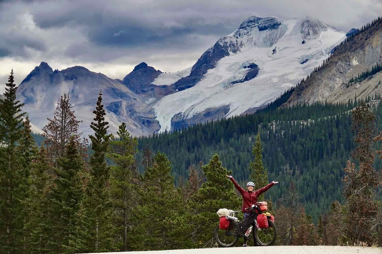
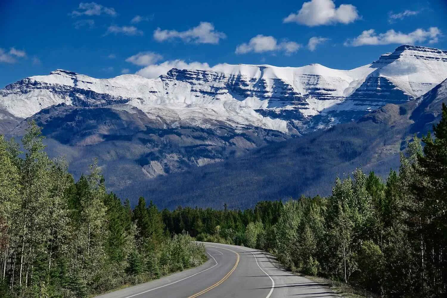
That’s when we began to realize what a truly stunning road the Icefields Parkway is. The scenery for the next five days was a never-ending parade of absolutely gorgeous mountain vistas. It’s hard to describe the continuous sense of wonder that we felt, pedaling through some of the most breathtaking landscapes in Canada. It’s probably a lovely drive, even if you’re in a car. But it must go by too fast. On a bicycle, each new mountain reveals its beauty slowly. We stopped frequently to soak up the majesty of the Canadian Rockies.
Soaking up the view from an overlook, high above the Athabasca River. Jasper National Park, Icefields Parkway, Alberta, Canada. Copyright © 2019-2022 Pedals and Puffins.
One of the things that impressed us the most was that the nature of the mountains kept changing, so that the scenery never felt monotonous. Each ridge, or set of high peaks, or cliffs rising up to lone bluffs had its own, unique qualities. It was as if an artist threw out all geological consistency, and constructed a series of mountains that were designed solely with the intention of creating an infinite variety of shapes and forms.
Throughout the day we steadily gained altitude, which slowed our ride a bit in addition to all of the photo stops. At one point, we spotted a drawing that someone had etched into a flat piece of rock at the side of the road. It seemed to be expressing a mixture of happiness (perhaps with the awesome scenery) and frustration (maybe because of the relentless climb). Whatever was on the artist’s mind, it amused us.
An expression of happy, and not-so-happy feelings probably left at the side of the road by a passing cyclist. Jasper National Park, Icefields Parkway, Alberta, Canada. Copyright © 2019-2022 Pedals and Puffins.
In response to the power outage in Jasper, Parks Canada had actually closed a total of four campgrounds along the northern stretch of the Icefields Parkway. So we headed for the first open campground available - a small collection of unserviced sites near Honeymoon Lake.
When we arrived at the campground around 4pm, we found a total circus. All 25 sites were already occupied. Furthermore, a steady stream of cars and RVs kept coming and driving slowly through the campground, hoping (unsuccessfully) to secure a place for the night. In a few of the sites, RVs had doubled-up to share a space (which is frowned upon by Parks Canada, but was being tolerated under the circumstances). There were two big reasons for this intense crush of campers. Foremost was the closure of the four biggest campgrounds in Jasper National Park (because of the power outage), with hundreds of campsites in each. That action had removed nearly 1,500 campsites from use.
Exacerbating the situation, camping along roadways outside of designated campgrounds is strictly forbidden within the park. There is zero tolerance for boondocking or wild camping (even for cyclists), with violators subject to a mandatory court appearance and a $25,000 fine. Yes, that’s $25K. (This was just one case we encountered in Canada where fines seemed to be extraordinarily high. There were others, which gave us the impression that Canadians take their rules particularly seriously.)
Inevitably, that left hundreds of extra campers desperately competing for the few remaining sites.
We were lucky to be on bicycles, though, because there was a small space designated for cyclists-only. It was big enough to hold several tents. We were the first cyclists to arrive, so our priority was to pitch our tent and stake out our space - to head off the possibility that any RVs or car-campers might get the notion that they could take over the unoccupied cyclists’ area. We were glad to have that space, even though it was right next to the busy campground entrance.
Before long another cyclist arrived and joined us at the campsite. Xanthea was from Australia and cycling solo throughout the Northwest. She had worked for an outdoor gear business, and enjoyed talking with us about our respective set-ups. She was headed north, and let us know that there were no cyclist campsites further south, so we should be sure to arrive at campgrounds early, and should probably even make a reservation for when we plan to arrive at Lake Louise.
Later, another cyclist from Montréal stopped by. He also was headed north. But he decided not to stay at Honeymoon Lake. He had heard that everything was shut down in Jasper, and wanted to camp further up the road so that he could bypass Jasper tomorrow.
In spite of the crowded conditions, the campground quieted down at night. A great horned owl hooted in the forest as we drifted off to sleep.
The Columbia Icefield
The next morning we headed up the Icefields Parkway with a brisk chill in the air. But it wasn’t long before we warmed up. Our route climbed steadily all day towards the Columbia Icefield, near one of the highest points on the parkway. It was a good thing we only had 33 miles (53 km) to cover. We were able to take our time and continue to enjoy the endlessly majestic scenery.
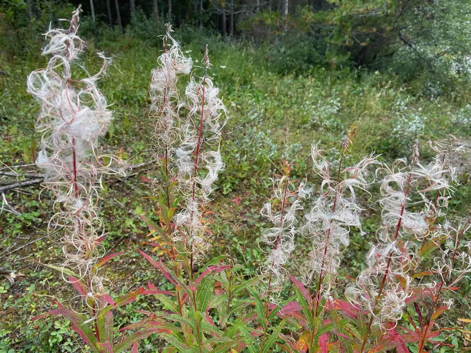
In another sign of the approaching autumn, the fireweed along the roadsides had all gone to seed. The bright pink flowers were replaced by wispy seed tufts, that made the plants look like they were covered with soft down. The leaves of the fireweed plants were also turning from green to a striking red color. We’re lucky to have such an abundance of an attractive, native plant.
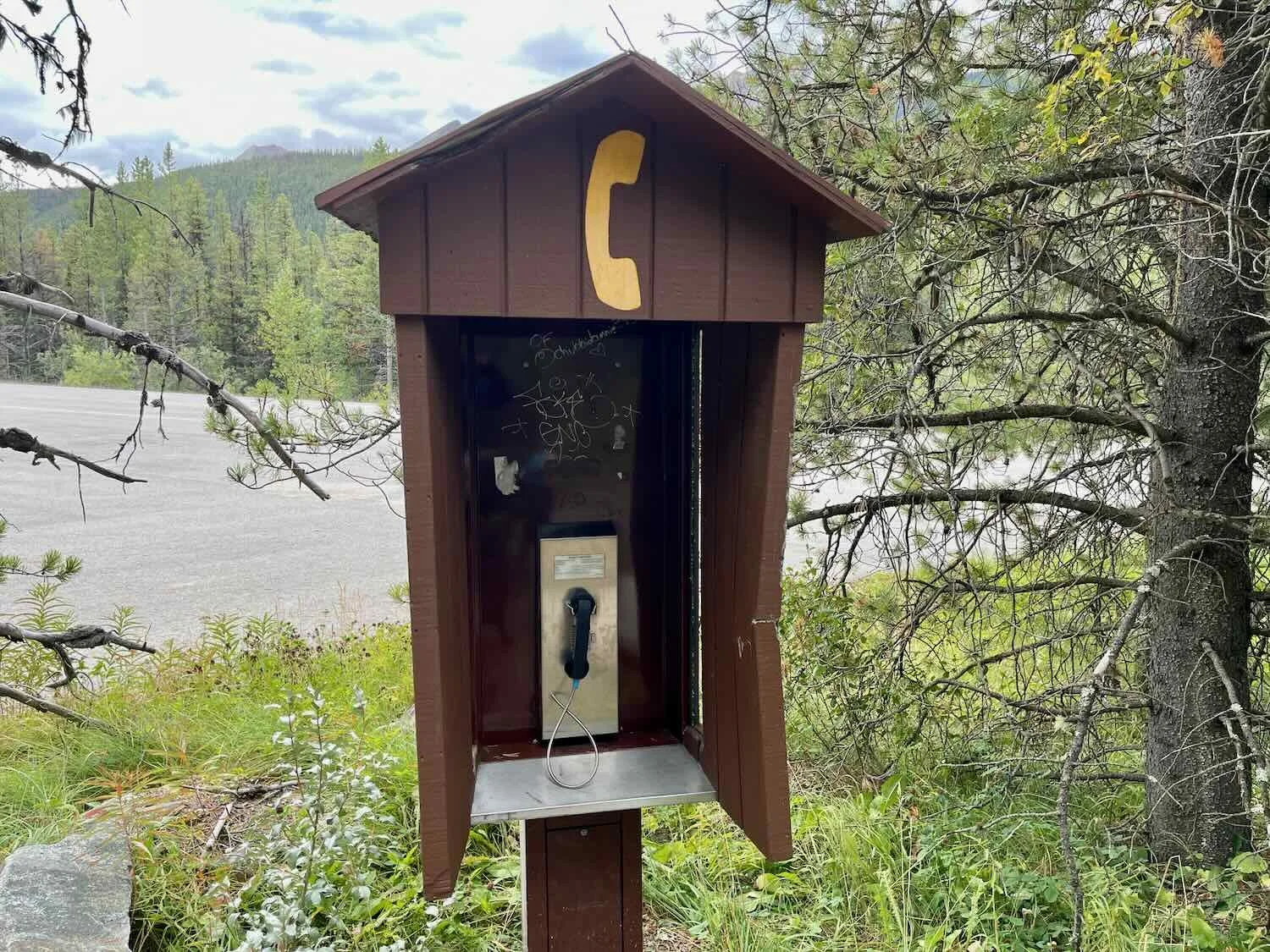
Every so often we saw a phone booth perched on the side of the road. These weren’t the usual ‘emergency phone’ set-ups that just dial for help. They were full-fledged telephones with a keypad that could be used to call for a variety of different services. We checked, and sure enough they even had a dial tone. In this day of ubiquitous cell phones, it seemed quaint to see these relics of the past - but they’re probably a huge help if you run into trouble far from any town since wireless signals are rarely available.
We appreciated the helpful wooden signs scattered along the highway that pointed out the names of prominent mountain features. Copyright © 2019-2022 Pedals and Puffins.
But although the Icefields Parkway delivered incomparable scenic beauty, we were struck by how little wildlife we observed. Virtually all the animals we saw were either ravens, jays, juncos, or squirrels. Roadside signs indicated that large animals like bighorn sheep, mountain goats or elk must be around sometimes, but we didn’t see anything larger than a raven. It’s likely that these animals are only near the road during other seasons. But it was a big change from the roads we had traveled elsewhere in the Yukon and British Columbia, where bears and moose, in particular, were easy to see.
This golden-mantled ground squirrel was one of the few mammals we saw along the Icefields Parkway. Jasper National Park, Icefields Parkway, Alberta, Canada. Copyright © 2019-2022 Pedals and Puffins.
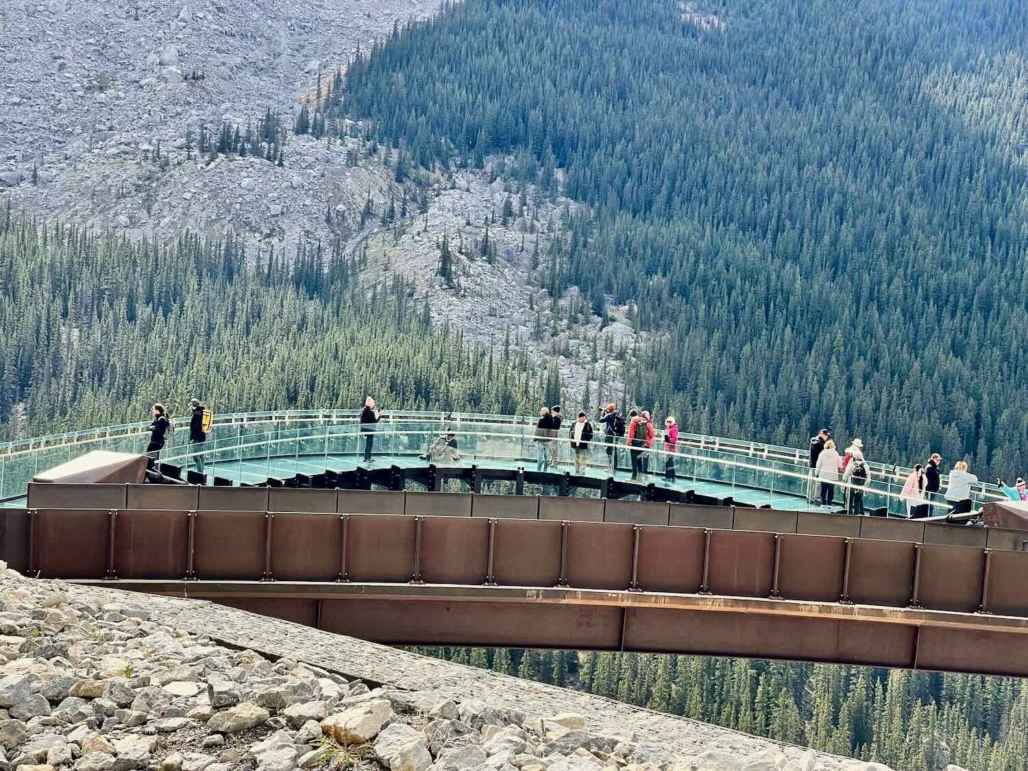
As we approached the top of the pass, the Columbia Icefield began to dominate the landscape ahead. We also passed Tangle Creek Falls, and a futuristic “skywalk” that juts out over the Sunwapta River to provide tourists with an exclusive (and expensive) view of the Icefield.
It was hard to get a feel for just how enormous the Icefield really is, even though we could see that it envelops a very large mountain. It is, however, the largest Icefield in the Rocky Mountains, blanketing roughly 125 square miles (325 ha) under up to 1,200 ft (365m) of ice. Its massive branches reach down the slopes of multiple mountain peaks, and can be seen from many angles - from quite a long distance away. When viewed from the Icefields Visitor Center, you start to get a feel for its incredible size when you spot the tiny form of a big tour bus and smaller-than-ant tourists way out on the white ice sheet.
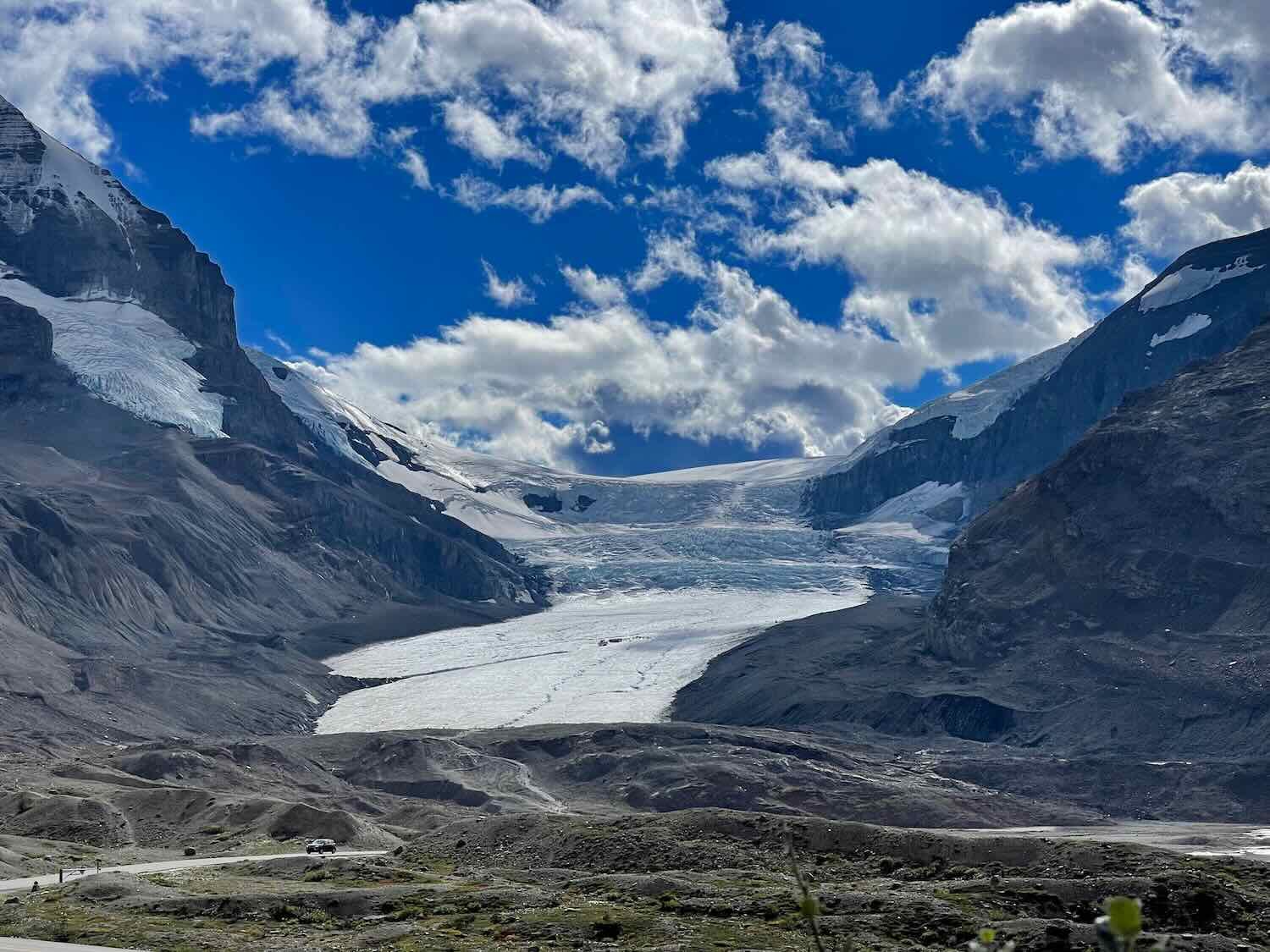
Our final approach to the Columbia Icefield, the largest in the Rocky Mountains. Jasper National Park, Icefields Parkway, Alberta, Canada. Copyright © 2019-2022 Pedals and Puffins.
We stopped at the Icefields Visitors Center desk to ask about accommodations at upcoming campgrounds. As far as the information officer knew, there were no hiker/biker sites in the Banff campgrounds (as Xanthea had told us). However, she did say that we could camp in unofficial sites at the campgrounds if needed, and that Park staff would understand because we were on bikes. That gave us some comfort. There was still a high probability of overcrowding because of the ongoing campground closures further north towards Jasper.
After lunch at the visitors center, we headed up to the Icefields Tent-Only Campground. There was a nice, walk-in section where we selected a lovely spot by a tumbling creek. The rushing waters of the creek helped to block out the noise from the Parkway and nearby campsites. By early evening, all of the campground’s car-accessible tent sites were full, and a lot of the walk-in sites were occupied. It was nice to see a healthy population of tent campers here, something that is rare in typical, RV-dominated, National Park campgrounds.
Our walk-in campsite near the Columbia Icefield. Jasper National Park, Icefields Parkway, Alberta, Canada. Copyright © 2019-2022 Pedals and Puffins.
In the main part of the campground, we met a friendly couple from Vancouver. They were interested in bike touring, and eager to hear about our ride. The guy had hitchhiked through Central America in the past. But we were dismayed to learn that he had a pretty negative view of the United States. He said he wanted to spend as little time there as possible. We got the impression he thought it would be dangerous. The cyclist Xanthea also had been worried about cycling in the USA. She believed people in the States don’t like cyclists. We assured them all that the opposite was true, and that cycling in America is both safe, and brings out the best in people. It’s a shame that our country has such a bad reputation in the foreign press, which has a big influence on people and provides a very distorted view of America. We have been told numerous times by people who actually visited the United States for cycling trips that it was one of their favorite countries to cycle in, and that they were particularly impressed with how friendly everyone was.
Before bed we decided that it was time to make a reservation for a campsite in Lake Louise. That’s when we discovered that there were no campsites available for Saturday night, the day we had hoped to arrive. So we reserved a campsite for Sunday. That meant we had an extra day to spend along the Icefields Parkway, and allowed us to cover less distance each of the remaining days. Not such a bad outcome.
Unfortunately, neither one of us slept well that night. Our lovely campsite turned out to have some major flaws. The worst was that the ground wasn’t really flat. It felt like we were “high centered,” with our heads and feet lower than our bodies. That’s a bad combination for sleeping.
In addition, it was a very, very cold night. The temperature dropped to 19F (-7C). We hadn’t fully prepared for it, so we both got cold. We ended up donning our down jackets and balaclavas in an effort to keep warm, but it wan’t enough. Next time we’ll have to layer on even more clothes.
As a result, we were both sleep-deprived in the morning. We had considered staying there another day and visiting the icefield up close. But neither one of us wanted to spend another night in that campground. So we hit the road again. It was a fabulously clear morning, with a deep blue sky framing the still-gorgeous mountains.
The view as we departed the Columbia Icefield and approached the summit of Sunwapta Pass. Jasper National Park, Icefields Parkway, Alberta, Canada. Copyright © 2019-2022 Pedals and Puffins.
Our campsite had been just two miles from the top of Sunwapta Pass, the boundary between Jasper and Banff National Parks. We stopped at the summit to check out the marker that separates these two iconic parks.
This monument stands at the top of Sunwapta Pass, and marks the boundary between Jasper and Banff National Parks. Icefields Parkway, Alberta, Canada. Copyright © 2019-2022 Pedals and Puffins.
The Road to Lake Louise
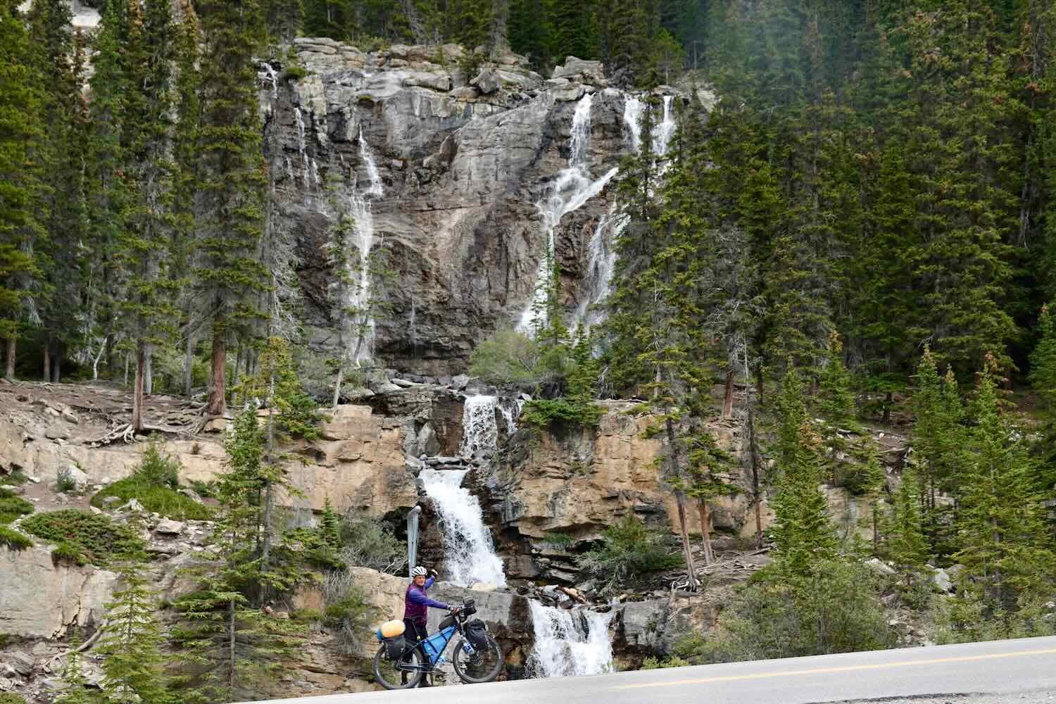
Fortunately, the day’s route included a lot of descents. Once we reached the top of the pass, we had 25 miles of mostly downhill cycling to reach Saskatchewan Crossing. Along the way we passed famous landmarks like the Big Bend (an enormous hairpin turn where the Parkway descends rapidly along the lower slopes of Parker Ridge), and the Weeping Wall.
The Weeping Wall. Banff National Park, Icefields Parkway, Alberta, Canada. Copyright © 2019-2022 Pedals and Puffins.
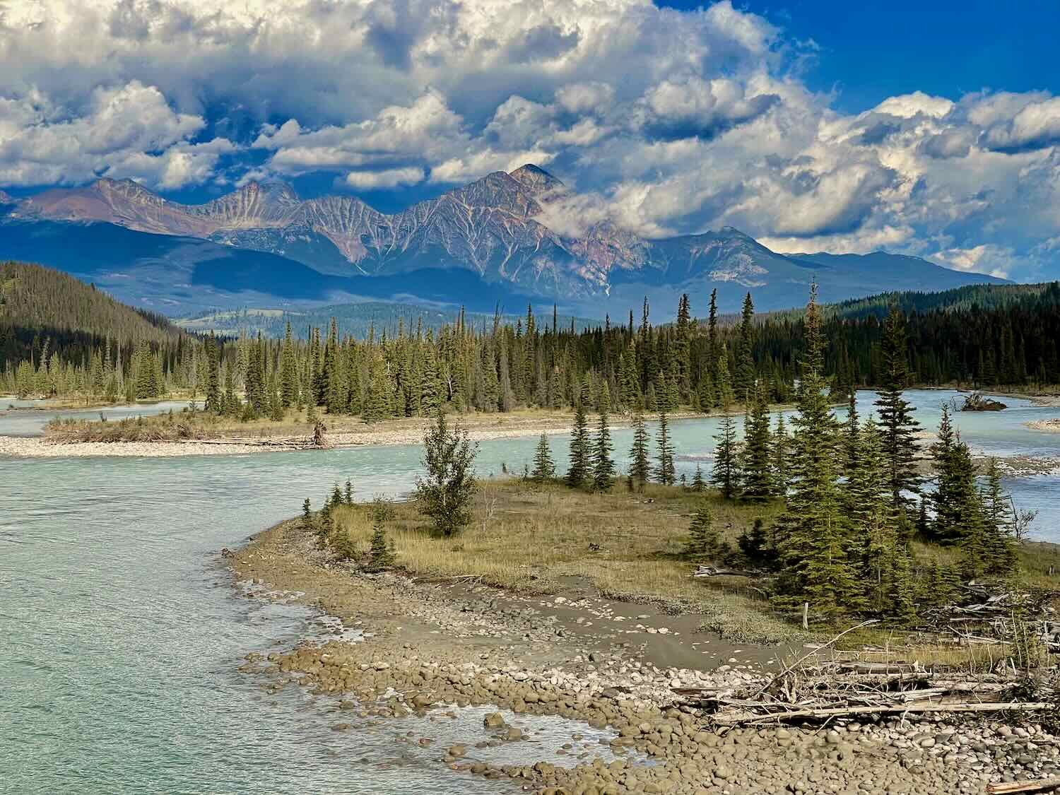
But one of the most intriguing sights that stopped us in our tracks is not even mentioned on the official park maps. Right near the bottom of the Big Bend, the North Saskatchewan River suddenly plunges over a shelf and disappears completely into a 5-foot wide hole in the ground. We stopped our bikes and edged a bit closer to investigate. We discovered that the river cascades through the hole and down into an incredibly deep and contorted slot canyon. We were able to walk a short distance down a gravel road, where a bridge crosses over the canyon. But even from the bridge it was impossible to see the river at the bottom of the canyon below. There were no informational signs marking the spot, and barely enough room for a car to pull over for the view. While we were there, not a single other vehicle stopped to take a look. We felt like we had uncovered something completely unique and special, that few other park visitors experience.
To our surprise, the North Saskatchewan River suddenly disappeared completely into a hole in the ground near the bottom of the Big Bend. Banff National Park, Icefields Parkway, Alberta, Canada. Copyright © 2019-2022 Pedals and Puffins.
We arrived at the rest area of Saskatchewan Crossing in the early afternoon, hungry for lunch. The convenience store and the cafe at the crossing were surprisingly overpriced, even for this expensive tourist area. But we needed to get enough food for two more nights of camping, so we bit the bullet and bought just enough to get us to Lake Louise.
As we were heading out of the store, we met a friendly couple from Belgium who were traveling on an extended bike tour throughout North America. They had spent the past three months cycling in the United States. Starting in San Francisco, they went south through California and Arizona, then back north through Utah, Wyoming and Montana. They warmed our hearts by telling us that they had a wonderful time cycling in the USA, and that (in their opinion) the Americans were incredibly generous and friendly - even more than the Canadians they had met. After the negative comments from other cyclists we had met recently (who had never cycled in the USA), it was nice to hear that people with real experience in the United States had a much more positive point of view.
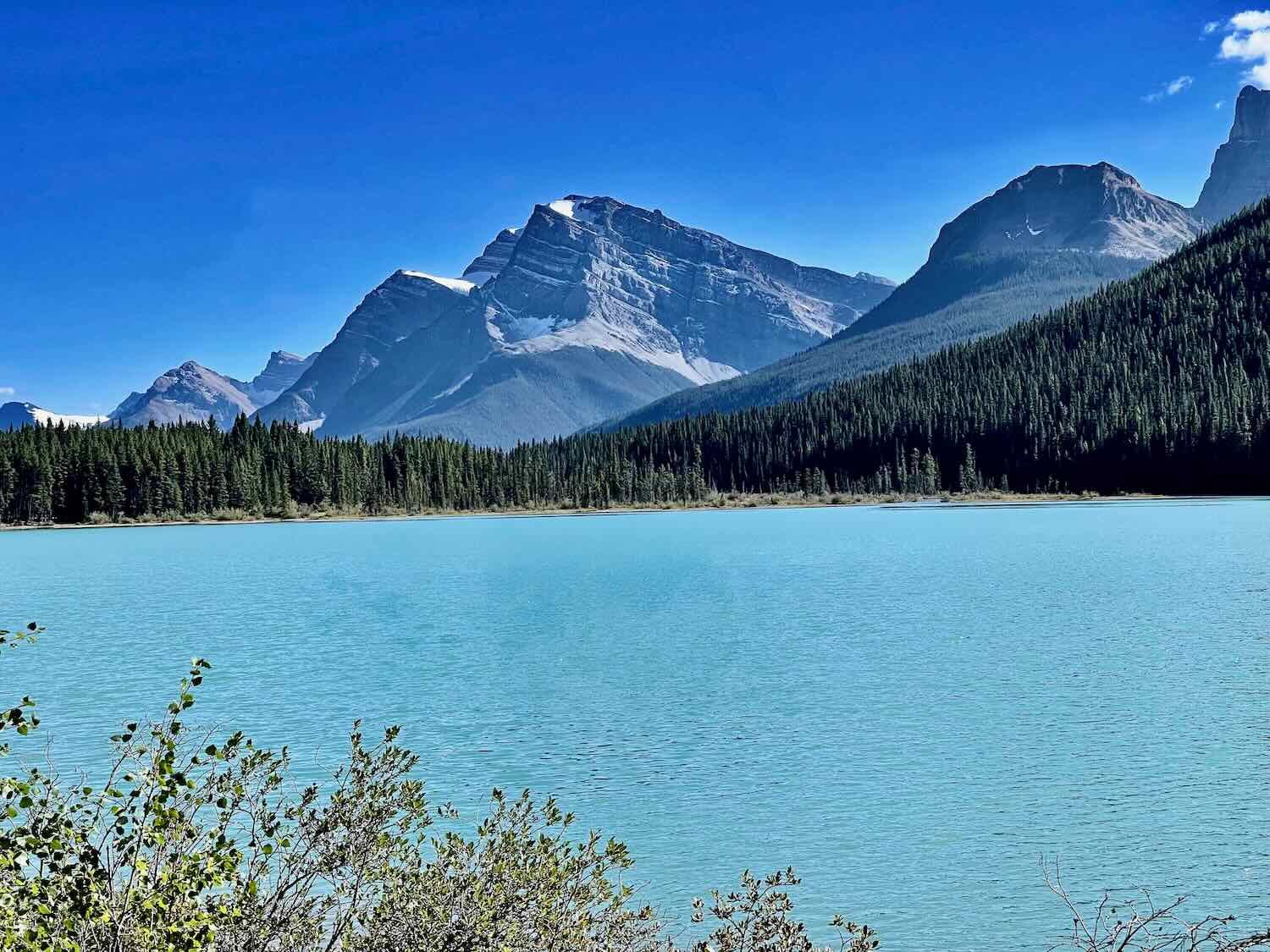
From Saskatchewan Crossing we cycled uphill for 3-4 miles, climbing out of the river valley. The scenery continued to be impressive, with stunning mountain views at every turn.
Fortunately, we didn’t have any trouble finding a campsite at the Waterfowl Lake Campground, even though we arrived around 5pm. We were ready for a peaceful night, and the chance to catch up on some sleep.
It was another very cold night, but at least we were a little bit more prepared. And at 28F (-2.5C), it wasn’t quite as frigid as our night spend by the icefield. But the campground was situated in a low valley, on the north-facing slope of the mountains, in a dense stand of conifers, with a high ridge to the east that blocked the morning sun. So, needless to say, it didn’t warm up much in the morning. It took us even longer than ever to work up the motivation to get out of bed.
Unfortunately, PedalingGuy spent the night suffering from a bad toothache. He hadn’t mentioned it before, but he’d had the toothache now for a couple of days and it seemed to be getting worse. We added finding a dentist to our list of things to do in Lake Louise.
At just 20.5 miles (33 km) the day’s ride was going to be short. But it began with a 2.5 hour climb over Bow Pass, the highest point on the Icefields Parkway. Out on the road, where the sun was shining brightly, we heated up quickly and were peeling off layers every few miles.
Once over the pass, we were surprised to see huge numbers of cars and RVs parked in the various access points to Bow Lake. PedalingGuy stopped to chat with a couple who were picnicking near the entrance to a crowded parking lot, and to ask them what was going on. There were so many vehicles that we figured there must be some kind of event. But they said, no, it was just another Saturday at Bow Lake. As one of the closer attractions to Calgary, it gets a lot of visitors.
We learned that they were from Calgary, and were visiting the park just for the day. They were really friendly, asking about our trip, and remarking that we both seemed fit, if not a bit crazy. They told us about how the parkway used to be much less busy, and how they could remember winters being much colder when they were younger. They shared some of their garden-grown cherry tomatoes with us, which were bursting with sweet flavor. But after a while we started to worry about getting to our campground in time to secure a site, so we said goodbye, and headed down the road.
Even so, we arrived at our target, the Mosquito Creek Campground, later than we had planned - about 2:30 in the afternoon. This campground was relatively small, with just 35 formal sites. And the last available campsite was literally taken by another guy just as we rode up. Not a great situation. But a sign at the campground entrance said that “overflow camping” was allowed, as long as you didn’t camp on the grassy lawn near the entrance, or build a fire outside of a fire pit.
In the end, that turned out to be a good deal for us. We interpreted “overflow camping” to include more than just the parking lot near the entrance to the campground, where all of the RVs end up. Instead, we walked down a gravel service road away from the other campers and found a nice opening in the forest that was almost as good as a wild camping spot. It was farther from the parkway than the formal campsites, and we wouldn’t have to contend with other campers and RVs driving past us all night. We pitched our tent in the clearing, and paid for a night in the campground.
Then, for the first time in a while, we had time to relax at our campsite. It was a real treat to sit in the shade on our camp chairs, nibble on some snacks, and admire the mountains without being too cold, too hot, rained upon, crowded by other people, or under time pressure for some other reason. Both the food and the down time were good for us.
Evening light on the mountains near our quiet spot at Mosquito Creek Campground. The formal campground was full, so we found a more private spot in a gravel opening down a service road. Banff National Park, Icefields Parkway, Alberta, Canada. Copyright © 2019-2022 Pedals and Puffins.
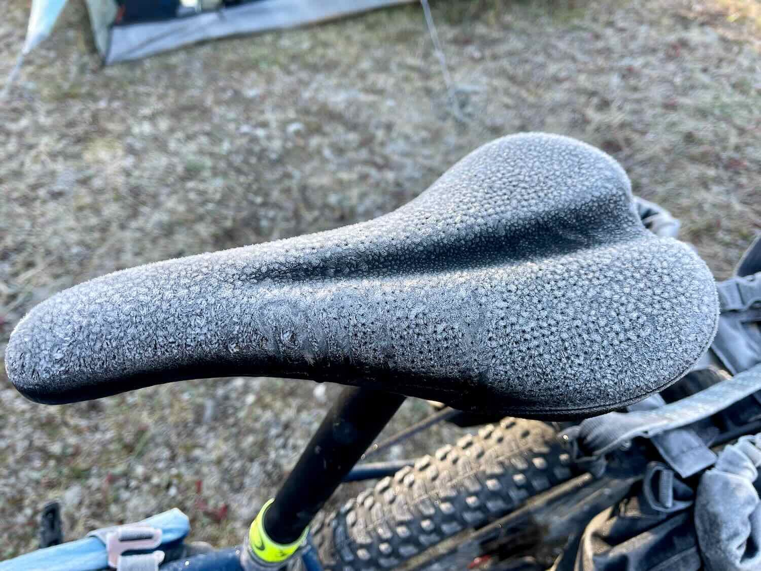
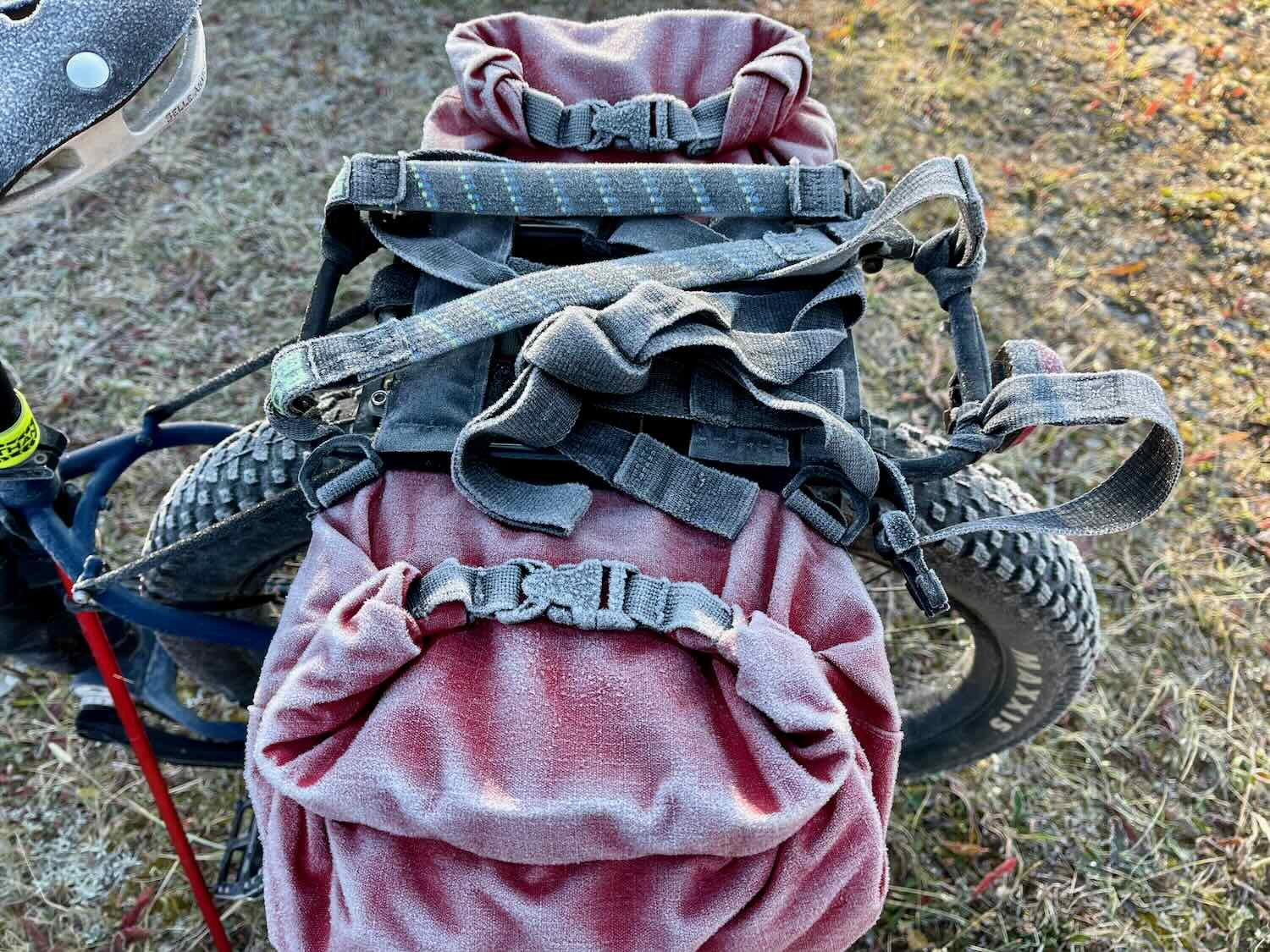
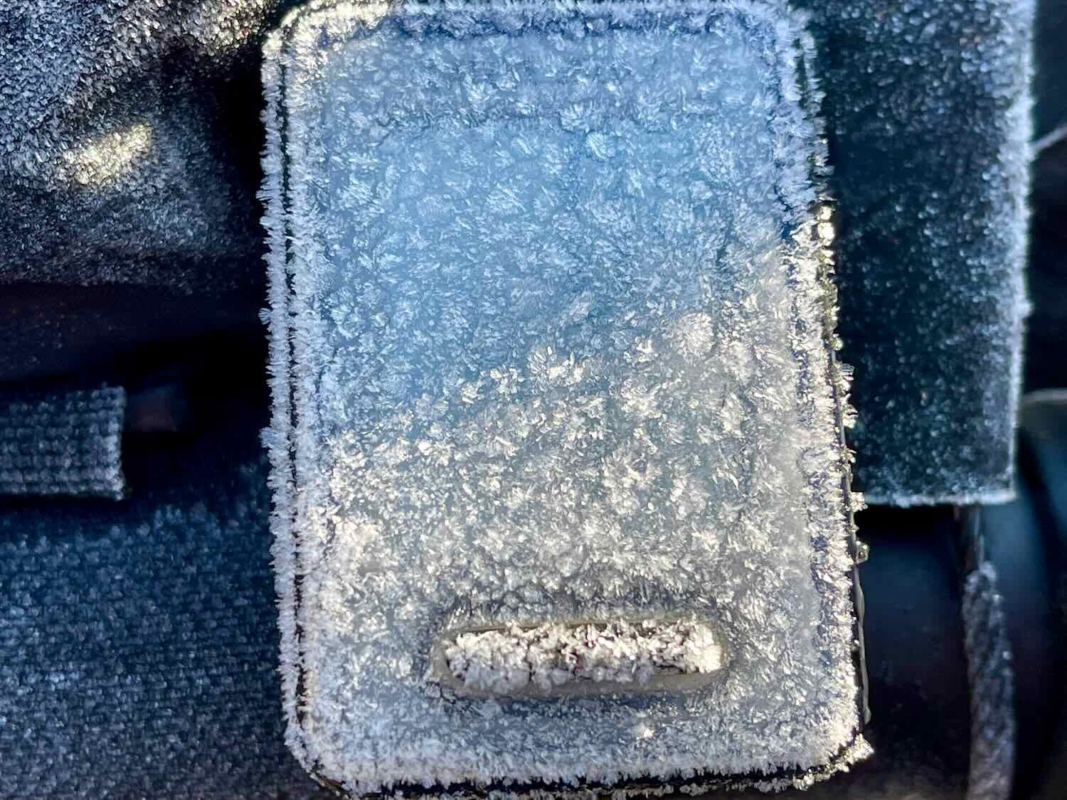
The next morning when we crawled out of our tent, we found frost on the tent, our bikes, and on the grass nearby. Fortunately, our campsite in the forest clearing received the direct rays from the morning sun. So it didn’t take nearly as long as usual for things to warm up nicely. We moved our bikes into the sunshine to help thaw the frost off our stuff as quickly as possible. The tent, on the other hand, was pitched in the shadow of a tree. So it took a bit longer for the frost to melt away from the tent.
But PedalingGuy’s toothache had gotten worse. So even though the campsite was nearly perfect, he didn’t sleep that well. We needed to come up with a plan to get him to a dentist soon.
Fortunately, the bike ride to Lake Louise was pretty easy. It was short, and mostly downhill. We covered the miles in just about two hours. But there was now a definite haze in the air, which increased as we approached town. Folks said that it was smoke from forest fires burning to our south.
After a short ride, we arrived in Lake Louise just after noon. Lake Louise, Alberta, Canada. Copyright © 2019-2022 Pedals and Puffins.
Apparently bears are regularly seen around here. The Lake Louise Tent Campground is protected by a heavy-duty electric fence, with an electrified cattle-guard at the vehicle entrance. The fence was installed in 2003, in response to a 1995 grizzly bear attack on campers in a tent that left six people injured. At this point we’ve camped many nights in grizzly country, but we worry about bears the most whenever we use a formal campground. That’s because it’s the bears that become accustomed to people, and that are constantly exposed to the tantalizing smells of campers grilling their morning eggs and bacon, that are most likely to cross the line and attack people in their camp. So, under the circumstances, it was nice to know we had the added protection of the fence while we slept.
The Lake Louise Tent Campground is surrounded by an electric fence to keep bears and other large wildlife out. The grate that the car is on is also electrified. That keeps both people, and the local wildlife, safe. Lake Louise, Alberta, Canada. Copyright © 2019-2022 Pedals and Puffins.
Another nice feature at the Lake Louise campground was the designation of two of the camping loops as “no campfire” zones. These campsites don’t have fire rings, and fires are not permitted. It’s perfect for us because we don’t want to breathe any more smoke from fires, plus the lack of campfires generally leads to quieter neighbors. It increasingly strikes us as odd that people complain so much about having to breathe smoke from forest fires, but then they light a fire and douse themselves and their neighbors in thick smoke whenever they go camping.
We planned to stay two nights in the campground while we worked on scheduling a dentist appointment for PedalingGuy. The lady who checked us in to the campground told us that folks from Lake Louise who need to see a dentist go either to Calgary (a big city about 120 miles away) or Golden (a smaller town just 50 miles away). That helped us narrow our search region.
But after setting up camp and securing our stuff, the top priority was an eating a big dinner at the Town Grill. The restaurant was ideal because it had a booth near an electrical outlet where we could charge our depleted devices. We set up a charging station and fully charged two phones, two spare batteries, and a camera battery over the course of a leisurely dinner. We even got dessert to prolong our stay, and satisfy our appetites.
Two slices of chocolate cake with ice cream helped us prolong our charging time at the Town Grill. Of course, they were delicious, too. Lake Louise, Alberta, Canada. Copyright © 2019-2022 Pedals and Puffins.
Back at the campground we availed ourselves of the hot showers, which were awesome. Seven days had passed since our last, proper shower. It felt really good to be clean.
As the evening drew to a close, another couple from a nearby campsite struck up a conversation with us. Mark and Jan were from Kalispell, MT. They are retired, and are avid backpackers. They had lots of stories to tell from their adventures hiking the Pacific Crest Trail. Jan had been hiking a section of the Pacific Crest Trail in Oregon just a few days earlier, when she learned that the trail ahead was closed due to an outbreak of Novovirus in some of the water sources. Mark had gone to pick her up, and they were now car-camping their way through Jasper and Banff National Parks. We talked with them for a long time before finally heading to bed after dark.
On our rest day in Lake Louise we went to the town’s Visitors Center to use their public wifi. They had a convenient area for people to sit at a counter, which had electrical outlets where we could keep our devices topped up. But the wifi turned out to be painfully slow. We ended up creating hotspots with our phones to use the 5G cell signal instead of the wifi. In the end, that worked well enough. And it was definitely a bonus to have access to the electrical outlets and a nice, desk-like shelf to type on.
After some research, PedalingGuy made a dentist appointment in Golden, British Columbia. PedalingGal worked on securing a hotel reservation, and planning out a route to get us there. This detour meant that we would skip visiting the town of Banff and Kootenay National Park. But on the bright side, we would get to ride across Yoho National Park on the Trans-Canada Highway.
With that important task complete, we went shopping at the one outdoor store in town, and ended up buying a bag full of stuff. Most importantly, we picked up a few new ultralight tent stakes. We have thoroughly abused our existing stakes, especially whenever we stayed at campgrounds where the ground has been packed so hard it might as well be concrete. Several of our stakes were chipped or bent. Now we won’t have to worry about not having enough stakes if we need to camp in windy conditions.
After an evening walk through the nearby forest, we headed back to camp.
Sunset over the mountains near Lake Louise Campground. Some haze from forest fires turned the sunset a mellow orange. Lake Louise, Alberta, Canada. Copyright © 2019-2022 Pedals and Puffins.
A Rainy Ride Through Yoho National Park
Cloudy skies kept the temperature mild overnight. It ‘only’ got down to 45F (7C) overnight in Lake Louise. That was great, because it was a bit easier to get out of bed in the morning.
We had expected rain to begin during the night, and last through the morning. But that turned out to be an overly pessimistic forecast. We were thrilled that as the sun came up, it had not yet started raining.
We rushed to get everything packed away while the weather was still cooperating. As we were busily taking down the tent, our neighbor, Mark, came over to talk with us again. He didn’t seem bothered that we kept working on taking down the tent while he was talking, which was great because we really wanted to get that done. He checked the weather app on his phone, and let us know that it was now unlikely to start raining until 11am. That was very good news, but we still didn’t want to take any chances. We focused on getting everything stowed away in our waterproof bags, before finally being able to relax and visit with Mark.
Jan came over and joined us. They had questions abut our rain gear, how heavy our luggage was, and other stuff like that. Mark was really sweet, and gave us each an energy bar for breakfast. The two of them had finally decided on a backpacking trip that they would take through the national park. It was going to be a 4-day hike, and it was nice to see how excited they were about getting out on a trail together.
Once we got rolling, the weather stayed pleasant for the first hour or so of our ride. The roads were dry when we crossed the border back into British Columbia. And there were only a few drops of rain falling by the time we reached the Yoho Brothers Trading Post, a convenience store near the small town of Field. We stopped there for a light breakfast, then hit the road again.
The Yoho Brothers Trading Post is the only place to grab some supplies on the road between Lake Louise (Alberta) and Golden (British Columbia). Trans-Canada Highway, British Columbia, Canada. Copyright © 2019-2022 Pedals and Puffins.
But the air was still quite smoky. And with the added moisture, the surrounding mountains were quite dim all day. Clouds clung to the lower slopes, further obscuring the scenery. It was not a day for sightseeing.
Rain and a haze from forest fire smoke hung over the mountains on our descent toward Golden. Trans-Canada Highway, British Columbia, Canada. Copyright © 2019-2022 Pedals and Puffins.
Low clouds shrouded the foothills of the mountains along our route. Trans-Canada Highway, British Columbia, Canada. Copyright © 2019-2022 Pedals and Puffins.
Not long after we left the trading post the rain started. Fortunately, it was just a light rain for most of the day. But it came down steadily for at least an hour, so we got quite wet. On the bright side, the rain was light enough that few puddles formed, and the spray from passing traffic wasn’t too bad.
The highway from Lake Louise to Golden heads mostly downhill. We flew down the road. And after a while the rain stopped. It was starting to seem like the day’s ride might be pretty easy. We even paused to take some photos of the misty clouds.
But you should never count your chickens before they’ve hatched. About seven miles (11.3 km) from our destination, we hit a major construction zone. They are widening Hwy 1 to make four lanes through an area where the road just barely clings to the side of a mountain. Suddenly, we had to work our way through six miles (9.7 km) of obstacles. The first couple of miles were the worst, as we struggled up a steep hill without any margin, smashed up against a high vertical concrete wall on our right, with traffic just inches away on our left (including huge trucks). The problem with going up a steep hill at only 2-3 mph in a construction zone is that it can be difficult to maintain your line, which is an important safety consideration with vehicles trying to squeeze by. Although it wasn’t raining, the road was wet and slippery, with lots of puddles and potholes. It may have been the most dangerous cycling we have ever done. It was stressful and exhausting.
About 1.5 miles (2.4 km) into the construction zone, we finally got close to the top of the hill. We had pulled off on the side of the road to catch our breath and let some traffic pass, when a sympathetic construction worker approached us. She said it was fine if we wanted to continue cycling through, but offered to give us a ride in a car if we wanted it. We thanked her and declined the offer. Our current bikepacking set-up is much more difficult to load into a vehicle than the previous bike touring set-up we’ve used in years past. We never liked having to load our bikes into vehicles in the past, but now we find it particularly agonizing. Anyway, the worst of the ride was presumably behind us. Hearing that we would cycle through, the construction worker said she thought we were brave (it seemed like she meant that as a compliment), and let us pass. Unfortunately that compliment also made us wonder if we had made the correct decision, not knowing what was in store for us up ahead.
Once we crested the hill, and started going downhill, it definitely got easier. We were able to ride out in the traffic lane and keep up with the speed of the cars on the decent, all the way through the end of the construction zone. It was a huge relief when it was over.
After that we only had to ride a couple of more miles to reach our hotel in Golden - pretty much all downhill. But, of course, it started to rain again. We cycled into town under a steady rain that left us soaked upon arrival. It was supposed to keep raining over the next few days, so having a hotel room was delightful. Resting inside, out of the elements, was a nice change of pace.
Overall we had an amazing time cycling to, and through the Icefields Parkway. Nothing we had ever seen had prepared us for the sheer majesty and variety of scenery that can be viewed along the stretch of highway from Mount Robson, through Jasper and Banff National Parks. It was well worth the chilly mornings, power outages, and long hills to experience a ride of such magical beauty
Epilogue: Dental Work While on Tour
Cutting right to the chase, the dental work in Golden did not go as planned. An initial exam showed that PedalingGuy had an infected tooth that required root canal surgery. We extended our stay in Golden so that he could have the surgery performed by the local dentist.
But as a general dentist, she was unable to complete the procedure. So after four hours in the dentist’s chair, PedalingGuy learned that he would have to see a root canal specialist to complete the job. We spent our Saturday trying to figure out a plan that would let PedalingGuy have the necessary work done by an endodontist. But these specialists are only found in bigger cities, which our original cycling plan did not include. A city like Calgary that was only 4-5 hours drive away by car can take 5 days to reach by bicycle. That was extra time we did not have if we were to make it over the Cascade Mountains before the higher passes were snowed in.
In the end, we settled on a plan to have the procedure completed by a specialist in Kalispell, Montana followed by a visit to another dentist in Libby, Montana in order to install a new crown. Normally getting a crown made takes two weeks and two dentist visits. They first measure the tooth and then send a mold to a specialist who makes the crown. But with some extra effort we were lucky enough to find a dentist in Libby who uses CAD/CAM to design and make the crown in just one day.
Getting our schedule to align with three dentists each in a different town (counting Golden) and five appointments was a logistical challenge, to say the least. Traveling by bicycle presented further challenges. But we were hopeful that we could manage to keep all the appointments, and still stay on schedule to get over the Cascade Mountains. A lot of pieces would have to fall into place for this plan to work. But at least we knew what we were aiming for, and we could set our sights on accomplishing it.
In between appointments and planning sessions, we had a few opportunities to get out and about in the charming village of Golden. Here are a few of the sights around town..
The most recognizable landmark in Golden is a covered, wooden bridge that was built as a community project in the early 2000’s. Golden, British Columbia, Canada. Copyright © 2019-2022 Pedals and Puffins.
Over the weekend, Golden hosted an Ultra Stage Run. It included three days of trail runs, with races of various lengths up to 60km each day. On the final day we stopped by the finish line to watch some of the competitors bring it home.
Finish line of the Golden Ultra Race, in the town park in Golden, British Columbia, Canada. Copyright © 2019-2022 Pedals and Puffins.