Cycling Into Guatemala: San Cristóbal de las Casas, Mexico to Cuatro Caminos, Guatemala
19 - 26 October 2023
19 Oct - San Cristóbal de las Casas to Teopisca, Mexico (21.1 mi, 34.0 km)
20 Oct - Teopisca to Comitán, Mexico (34.8 mi, 56.0 km)
21 Oct - Rest day in Comitán, Mexico
22 Oct - Comitán to Lagos de Montebello, Mexico (35.2 mi, 56.6 km)
23 Oct - Lagos de Montebello, Mexico to Villas del Bosque, Guatemala (24.4 mi, 39.3 km)
24 Oct - Villas del Bosque to Cuatro Caminos, Guatemala (23.7 mi, 38.1 km)
25-26 Oct - Layover in Cuatro Caminos, Guatemala
The Road to Guatemala
The city of San Cristóbal de las Casas, where we had spent the previous week, is less than 100 miles (160 km) from the border with Guatemala. But, as usual, we didn’t plan on taking the most direct route. Instead, we would cycle southward for a couple of days before turning east to visit the lovely Lagunas de Montebello National Park, which sits just a stone’s throw from the border. That gave us a chance to savor our last few days in Mexico.
Heading South
Long breaks make for soft legs. So we decided to keep our first day back on the bikes relatively short. Still, in this part of the world there is always a mountain ridge between where you are, and where you want to go. It took us quite a while to get all the way out of the city, with slow, block-by-block city cycling from the historic center to the highway.
At the edge of the city we finally reached the base of the big climb. The busy highway didn’t have a shoulder, so we spent most of the uphill ride cycling in the concrete gutter that bordered the road. These drainage ditches are very common in the rainier parts of Mexico and Central America. And although you can cycle in them in a pinch, it’s not much fun. The sides are slanted, so that you’re riding on an angled surface. Plus, they’re often full of debris and mud. It was slow going on the way to the top, and we didn’t feel comfortable enough to stop and take any photos. On the bright side, the day remained pleasantly cool, and the road was bordered by verdant pine forests that provided plenty of shade.
We rolled into the small city of Teopisca (pop. 20,000) early enough to beat the afternoon rains, which had become a regular feature again as we got closer to Guatemala. We even had time to wander over to the main plaza, with its handsome, yet simple church, meticulously trimmed trees, and strikingly tiled benches.
The Church of San Agustín dominated one side of the central plaza. Teopisca, State of Chiapas, Mexico. Copyright © 2019-2023 Pedals and Puffins.
Trees in the central plaza were neatly trimmed, with not a branch out of place. Teopisca, State of Chiapas, Mexico. Copyright © 2019-2023 Pedals and Puffins.
The benches in the main plaza were decorated with ornate tiles - some of the fanciest benches we’ve seen anywhere. Teopisca, State of Chiapas, Mexico. Copyright © 2019-2023 Pedals and Puffins.
The next day we ramped up our cycling, covering nearly twice the distance, with almost double the elevation gain of the previous day. We were lucky that the sky was overcast, which kept us cool and comfortable. With only one stop for a quick breakfast, it took us just about three hours to reach the top of the pass.
This handsome, gray horse was unperturbed by the sight of two outlandish cyclists passing by. Amatenango Del Valle, State of Chiapas, Mexico. Copyright © 2019-2023 Pedals and Puffins.
In one spot the highway cut through a hill, creating a small cliff beside the road. On the rocky wall the plants were so pleasingly arranged it looked as if someone had planted a garden. Near Amatenango del Valle, State of Chiapas, Mexico. Copyright © 2019-2023 Pedals and Puffins.
From there we enjoyed a fast descent to the Pueblo Mágico of Comitán. On the way down we passed a number of towns where small, family-owned shops lined the highway selling all manner of colorful crafts, as well as necessities like engine oil and antifreeze.
Exuberantly painted, locally crafted pottery for sale by the side of the road. Amatenango del Valle, State of Chiapas, Mexico. Copyright © 2019-2023 Pedals and Puffins.
We got a kick out of these colorful chairs, made from recycled tires. Guadalupe Victoria, State of Chiapas, Mexico. Copyright © 2019-2023 Pedals and Puffins.
A small town ‘gas station’ with a miniature but thorough selection of products for passing motorists. Guadalupe Victoria, State of Chiapas, Mexico. Copyright © 2019-2023 Pedals and Puffins.
As we drew closer to the city, the military and police presence increased dramatically. We cycled through two military checkpoints. Police patrols with armed officers riding in the back of pickup trucks passed us several times out on the road. And a convenience store where we stopped for a quick break had two, heavily armed security guards. All of them were very friendly, wishing us safe travels. But there was no escaping the sense that there are serious public safety concerns near the border.
The Magical Town of Comitán
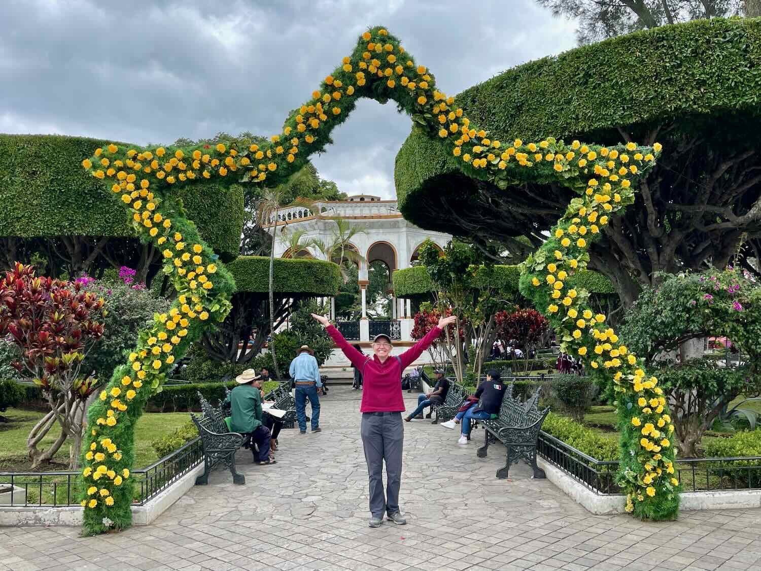
We arrived in Comitán (pop. 113,500) early enough in the afternoon to have time for a walk around the historic center. In the main plaza, a team of folks was decorating several star-shaped archways with artificial flowers in the traditional colors of the Day of the Dead (which was less than two weeks away): purple, red, orange and yellow. The bright colors added a festive glow to the park, which sported vigorously-trimmed trees similar to those we had seen in Teopisca.
Our arrival in the final Pueblo Mágico that we would visit in Mexico. Comitán de Domínguez, State of Chiapas, Mexico. Copyright © 2019-2023 Pedals and Puffins.

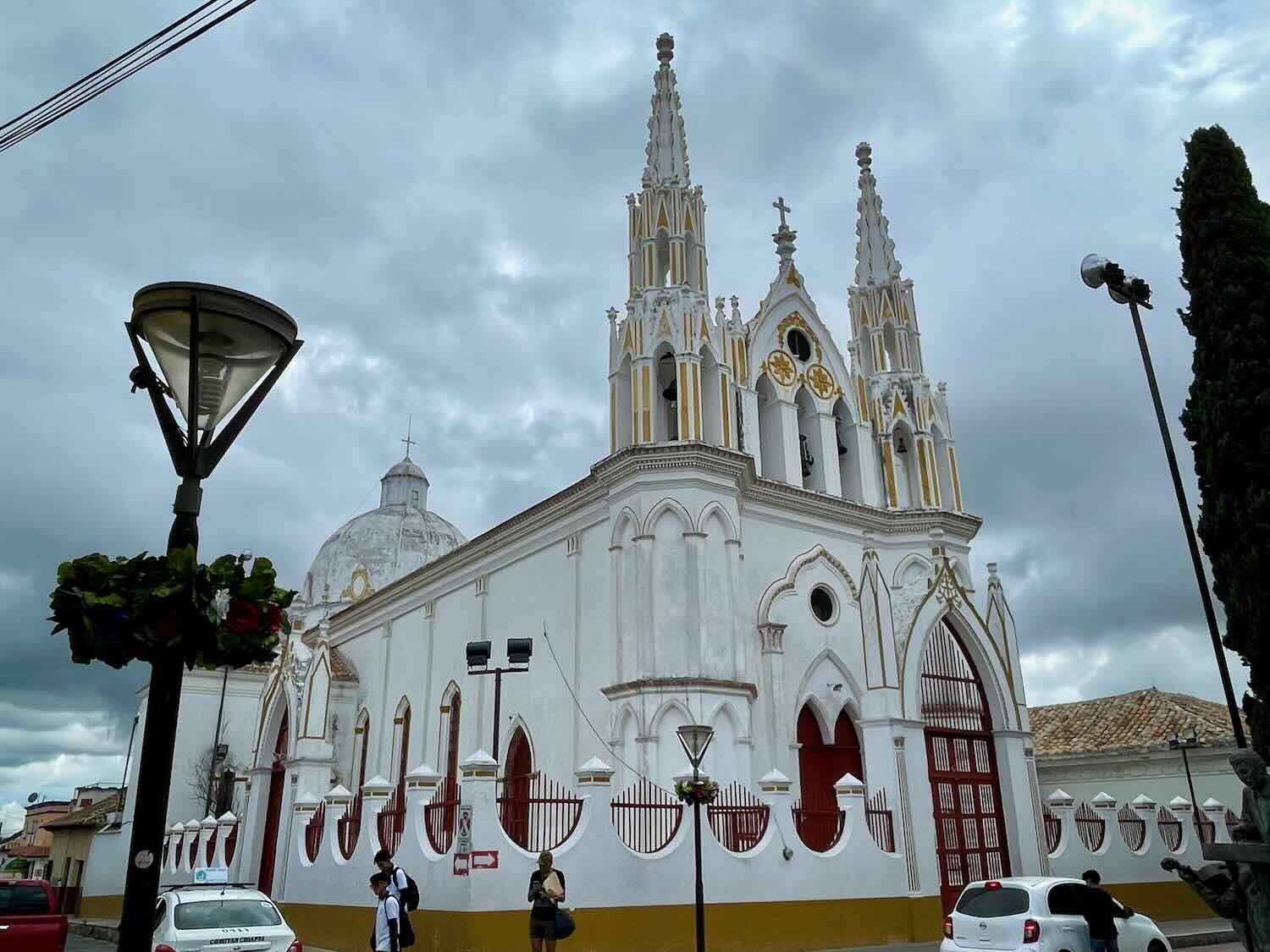
The mustard-yellow Church of Santo Domingo stood out on one side of the central plaza. Like other churches we’ve seen in southern Mexico, it had a relatively plain exterior. Its most notable feature was a series of decorative stone columns on the base of the bell tower. Apparently these were only recently discovered, underneath the stucco exterior. Comitán de Domínguez, State of Chiapas, Mexico. Copyright © 2019-2023 Pedals and Puffins.
Although the massive Church of Santo Domingo made a striking addition to the central plaza, the delicately designed Church of San José was probably the most attractive church in the city. The story of the Church of San José is reminiscent of the more famous Church of St. Michael in San Miguel de Allende, where they say that a local architect designed the facade using photographs of European churches. Judging by the incorporation of similar columns and tall, thin spires in both churches, it even seems like they might have been using the same photos.

We spent the next day hanging out in Comitán. The city’s buildings tumbled down the steep side of a mountain that sloped precipitously away from the historic town center. This resulted in some pretty stunning views down the streets that plunged headlong over the cliff.
The view down one of the streets in Comitán. The city was built right on the slope of a steep mountainside that dropped several hundred feet in less than a mile. Comitán de Domínguez, State of Chiapas, Mexico. Copyright © 2019-2023 Pedals and Puffins.
A man led his horse and burros down a quiet, morning street in the city. Comitán de Domínguez, State of Chiapas, Mexico. Copyright © 2019-2023 Pedals and Puffins.
On the other side of the city the mountain continued to rise up into the heavens, with a small parking area and overlook at the top. At two miles (3.2 km) it wasn’t a particularly long walk to the overlook. But it was pretty steep. And on the final stretch as we walked up, Google maps sent us onto a badly-eroded path straight up the side of the mountain.
We should have known better than to trust Google maps at that point. Before long, the path disappeared into a bunch of impassable shrubs, and we had to retrace our steps. It wasn’t the first time the app had led us astray. We had flashbacks to hauling our touring bikes up steep staircases in European towns when Google maps sent us on routes that were clearly meant for pedestrians, not cyclists. But we were determined to make it to the top. So we headed back down to the paved road, where a long switchback eventually got us up the mountain. At least it was walkable.
It took us a little over an hour to reach the overlook. When we emerged from the trees onto the hilltop, the view was awesome. We were so high (more than 500 ft above the city) that everything looked really small. In the distance, the buildings faded away into a broad agricultural valley.
View from the Mirador de Comitán, back towards the city. Comitán de Domínguez, State of Chiapas, Mexico. Copyright © 2019-2023 Pedals and Puffins.
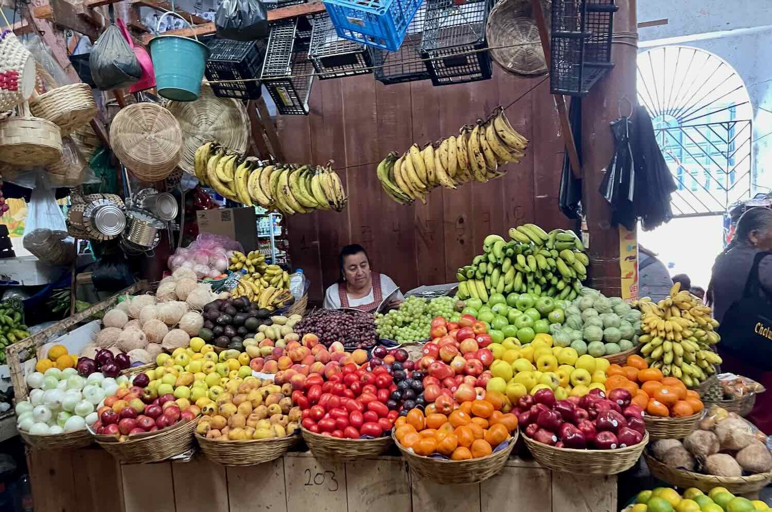
From there we headed back to the city center, where we wandered around the municipal market, enjoying the bountiful displays, carefully laid out by each individual vendor. Ubiquitous decorations for the upcoming Day of the Dead celebration (1-2 November) added another layer of macabre color everywhere we went.
Mexicans seem to take great pride in displaying their items for sale in the most appealing way possible. Comitán de Domínguez, State of Chiapas, Mexico. Copyright © 2019-2023 Pedals and Puffins.
This store went all out with its decorations for celebrating the Day of the Dead. Comitán de Domínguez, State of Chiapas, Mexico. Copyright © 2019-2023 Pedals and Puffins.
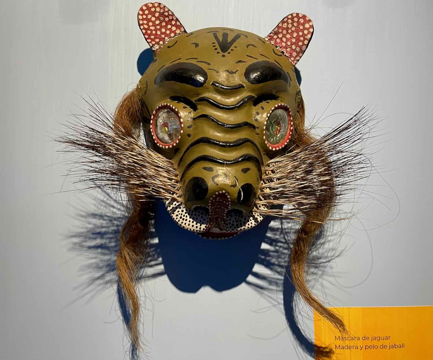
We ended our afternoon with a visit to the city’s small but well-regarded archaeological museum. The permanent exhibit contained hundreds of items excavated from surrounding Mayan sites, displayed in chronological order. The ancient artifacts were complemented by an entertaining, temporary exhibit of modern ceremonial masks.
The heads from a variety of Mayan figurines. It was interesting to see the wide range of faces and expressions. Museum of Archaeology, Comitán de Domínguez, State of Chiapas, Mexico. Copyright © 2019-2023 Pedals and Puffins.

Returning to our hotel, we caught this cat snoozing comfortably in one of the potted plants. Like the cat, we were ready to just relax for the rest of the day. Comitán de Domínguez, State of Chiapas, Mexico. Copyright © 2019-2023 Pedals and Puffins.
Cycling to the Lagunas de Montebello
From Comitán we left the highway and turned east across the Chiapas Highlands. After crossing the deep valley that we had seen from the mountain overlook, and climbing a couple of hundred feet out the other side, we entered a peaceful, rural landscape characterized by short, steep, scenic hills interspersed with marshy lowlands.
We cycled past numerous small towns surrounded by small farms. Most of the fields were being cultivated in the ‘old way,’ with rows of corn planted in mounds that had either beans or squash growing in between. (The beans and squash help maintain the nutrients in the soil, and reduce the amount of fertilizer required.) There also were a few small banana and coffee plantations. And every once in a while we would find ourselves cycling through young forests, grasslands or wetlands.
In one marshy area we spotted a group of half a dozen wood storks. We were a bit surprised to see them. But it turns out that we were right on the edge of their winter range. La Patria, State of Chiapas, Mexico. Copyright © 2019-2023 Pedals and Puffins.
We passed this water treatment facility for one of the rural towns. They were clearly trying to convince everyone of how good their water treatment was, by listing all of the ways the water was purified. We were particularly struck by their claim that they produced “The purest water with the best taste in the region.” However, most people in the area still boil their water before using it. Chiapas is notorious for the high proportion travelers who have “stomach trouble” while visiting. El Triunfo, State of Chiapas, Mexico. Copyright © 2019-2023 Pedals and Puffins.
A herd of horses grazed among a grove of pine trees. El Triunfo, State of Chiapas, Mexico. Copyright © 2019-2023 Pedals and Puffins.
Cycling among the pines in the Chiapas Highlands. Near El Naranjo, State of Chiapas, Mexico. Copyright © 2019-2023 Pedals and Puffins.
We were charmed by a close encounter with a family of three rufous-capped warblers who were chattering loudly in some brush by the road. Near El Naranjo, State of Chiapas, Mexico. Copyright © 2019-2023 Pedals and Puffins.
One of the many cornfields carved into the landscape. Near Ojo de Agua, State of Chiapas, Mexico. Copyright © 2019-2023 Pedals and Puffins.
About five hours into our ride we finally entered the lakes region of southern Mexico, less than four miles (6.5 km) from the border with Guatemala. We knew we had arrived when the road dipped down next to a narrow cove that was filled with vividly green water, reflecting the bromeliad-laden branches of the cloud forest overhead. In fact, the intense colors of the lakes is one of the most famous characteristics of the Lagos de Montebello National Park. There are approximately 60 lakes in the park that started out as sinkholes in the limestone bedrock. And they say that each lake has a different color ranging from turquoise blue to emerald green, and even purple (or so they say… we didn’t see any purple lakes).
The vivid, pea green water of Laguna Bosque Azul. Lagos de Montebello, State of Chiapas, Mexico. Copyright © 2019-2023 Pedals and Puffins.
Before long we arrived at one of the small cabaña developments within the park, delighted that we got there before the afternoon rains began. As we got closer to Guatemala, we found ourselves back in the rainy season, where big storms would roll through every afternoon. What’s more, the Lagos area was located within a particularly damp cloud forest. So anything that got wet would stay that way. (In fact, even our possessions that started out ‘dry’ would end up feeling considerably more damp and clammy after a night in the drafty, wooden cabin.) At least the roof over our heads kept the worst of the moisture away.
Our cabin in Lagos de Montebello National Park. Interestingly, all of the cabins in the area had the same, A-frame design. The sharply peaked roof helped keep moisture from pooling on top and causing damage. Cabañas Los Jardines, Lagos de Montebello National Park, State of Chiapas, Mexico. Copyright © 2019-2023 Pedals and Puffins.
Inside the cabins were pretty rustic. But they did include a private bath with hot water - a real treat after a day of cycling. Cabañas Los Jardines, Lagos de Montebello National Park, State of Chiapas, Mexico. Copyright © 2019-2023 Pedals and Puffins.
The facility had a very simple restaurant, consisting of a couple of wooden tables in the registration building. So after cleaning up we treated ourselves to a late lunch/early dinner. Like a lot of the rural comedors where we’ve eaten, there was no menu. But none was needed, because there was only one entree available - eggs. So, that’s what we had. The eggs were accompanied by ham, tortillas, red beans, goat cheese and salsa. By the time we finished everything, we were stuffed.
The first rainstorm rolled through while we were eating, but we were fortunate that there was a break in the weather after that. It gave us the chance to take a very hilly, but pleasant walk to the nearest town. The roadsides were covered with small, shade-grown coffee plantations. And the town itself was perched high on an outcrop overlooking the lowlands, where the lakes were hidden from view among the tree-covered hills.


View towards the Lagos de Montebello region, from the hilltop town of Antelá. State of Chiapas, Mexico. Copyright © 2019-2023 Pedals and Puffins.
The next morning we continued cycling through the Lagos de Montebello, passing another one of the famous lakes. This one was a bright blue, reflecting the gorgeously clear sky that greeted us at the start of our ride.
The shimmering blue water of Laguna Encantada. Lagos de Montebello National Park, State of Chiapas, Mexico. Copyright © 2019-2023 Pedals and Puffins.
Cycling through the Lagos de Montebello National Park. State of Chiapas, Mexico. Copyright © 2019-2023 Pedals and Puffins.
Crossing the Border from Mexico to Guatemala
About an hour into the ride we reached the edge of the Chiapas Plateau, and plunged headlong back into the Chiapas Depression - dropping 1,000 ft (305 m) in a matter of minutes. Fortunately, the surface of the dirt road was in pretty good shape, so the intense downhill cycling wasn’t too technical and we could ride the whole way. Even with disk brakes our hands soon ached from squeezing the brake levers, and we stopped a couple of times to let our brakes cool off.
Cycling into the outskirts of Carmen Xhán, the town at the bottom of the steep descent off of the Chiapas Plateau. State of Chiapas, Mexico. Copyright © 2019-2023 Pedals and Puffins.
We arrived in the Mexican border town of Carmen Xhán (pop. 1,130) a little before the immigration office was supposed to open. That gave us a bit of time to stop at a small store before tackling the border crossing.
The wall of a convenience store near the Mexico-Guatemala border was painted with a sugar-free (‘sin azúcar’) pop logo. And we were happy to discover that they really did have some cold, sugar-free drinks inside. Nine times out of ten, even when there’s a sugar-free ad outside, the tiendas in small towns don’t really have any sugar-free drinks. Carmen Xhán, State of Chiapas, Mexico. Copyright © 2019-2023 Pedals and Puffins.
It was a little after 9am when we arrived at the Mexican immigration office. But even though the office was supposed to have opened at 9am, a lady in uniform standing by the door told us it was still closed - and wouldn’t open until 10am. That was still more than a half hour away. Resigned to the delay, we propped our bikes against a couple of trees outside the office and made ourselves comfortable, along with the 10-12 other folks who were waiting to get inside.
Then, miraculously, around 9:30am the office opened. We got in line behind about a dozen locals who were all processed through very quickly, using identification cards instead of passports.
When they got to us, however, the process slowed dramatically. In reality, it probably took less than ten minutes for the two of us. But it felt a lot longer because we had seen everyone else go through so quickly. For a border crossing, it was actually very easy. The immigration officer didn’t ask us any questions. She just looked very carefully at our passports and tourist cards, and double checked things on a computer before stamping us out of Mexico. It was time to enter Guatemala.
But that was easier said than done. There is a truly nasty, half mile hill with a 15% grade to get from the Mexican immigration office to the Guatemalan border. We managed to cycle about 3/4 of the way up before we were off our bikes and pushing across the line.
We made it to Guatemala! The steep hill leading up to the border had us off our bikes and pushing across. Mexico-Guatemala border near Gracias a Dios, Dept of Huehuetenango, Guatemala. Copyright © 2019-2023 Pedals and Puffins.
While the physical entry into Guatemala was a challenge, the paperwork was just as easy as our departure from Mexico. No questions asked, no customs forms, and no hassles. We simply handed our passports to the bored-looking immigration officer. He wasn’t in any hurry, and took his time reviewing our passports. Then he mysteriously got up and left, going into a back room for several minutes. We started to wonder what was up, and whether there was some kind of problem. But a few minutes later he returned carrying the passport stamp. We must have been the first people to require it that day - and maybe even the first people who required it in a long time. Our impression was that this border crossing was primarily used by locals. Not many foreigners cross here. Without a word, he stamped our passports and handed them back to us. And that was that.
After departing the immigration office, we inched our way down another steep hill (a theme is definitely emerging here) through throngs of pedestrians, tuk-tuks, pickup trucks and delivery trucks. We ran a half mile gauntlet of wall-to-wall, small shops selling every type of clothing or household item you can think of, plus a handful of food stalls.
Our first order of business after entering Guatemala was to change our remaining Mexican pesos into quetzales, the Guatemalan currency. We had heard that there was a bank in town, and we found it at the bottom of the first big hill. But when we got there, we also found a long line of about 10-15 people waiting outside. A bank employee guarding the door would only let one person through at a time, when a previous customer departed. At the rate they were letting people into the bank (one every 15-20 minutes), it looked like we were in for a very long wait.
We parked our bikes nearby. PedalingGal stayed with the bikes, while PedalingGuy went to stand in line at the bank. Time ticked by. A half hour later, only two or three people had been let into the bank and it was starting to look grim. We didn’t really have time to wait another couple of hours or more before getting a chance to change our money.
PedalingGuy left his place in line, and came back to confer about what to do next. We noticed that there was a hotel next door to the bank, and figured they might be able to change our pesos, or at least point us to someone else who could. But when PedalingGuy went into the hotel to ask, the two very young teenagers behind the desk couldn’t offer any help.
And so, we decided that changing our pesos would have to wait. Then, just as we were about to cycle out of town, we realized that there was another hotel very close by. Figuring we had nothing to lose, PedalingGal went inside to ask about changing money. And with great confidence, the guy behind the desk told her that she could get quetzales from the little store next door.
It seemed too good to be true, especially since we had parked our bikes right across the street from the store, and could have easily gone there from the start. But sure enough, the guy at the store said that he could change all of our cash for us, and at a surprisingly good rate as well. We quickly exchanged the cash, before he could change his mind. It was a huge relief to have some local currency in our pockets, and to not have to worry about carrying around pesos that we would need to change later. We cycled out of Gracias a Dios in high spirits. Of course, the ride out of town involved slogging up another big, steep hill. But that gave us a chance to enjoy a sweeping view of the town, with Mexico receding into the distance.
The view back towards the Mexico-Guatemala border, from the hill we climbed on our way out of town. Gracias a Dios, Dept of Huehuetenango, Guatemala. Copyright © 2019-2023 Pedals and Puffins.
Gorgeous Guatemala
The first hour and a half of cycling in Guatemala continued to be super-hilly, with almost every significant incline rising up at a 15% gradient or more. But once we turned southward along the foothills of the Guatemalan Highlands, the cycling got a lot easier - and incredibly scenic. We rode past sheer, rocky cliffs topped with deep green trees and grassy slopes. The final leg of cycling passed quickly as we soaked up the scenery in the new country.
This friendly donkey paid a visit while we were stopped by the side of the road for a quick break at the top of one of the steep hills. Near Finca La Trinidad, Dept of Huehuetenango, Guatemala. Copyright © 2019-2023 Pedals and Puffins.
Sheer canyon walls and rocky outcrops provided a stunning backdrop for the final part of the day’s ride. South of Finca la Trinidad, Dept of Huehuetenango, Guatemala. Copyright © 2019-2023 Pedals and Puffins.
A horse or donkey skull marks the edge of this cornfield. South of Guaxacaná, Dept of Huehuetenango, Guatemala. Copyright © 2019-2023 Pedals and Puffins.
Most of the route was rideable, but in the heat of the afternoon, a few hills had us off and pushing our bikes. The afternoon rain clouds were already starting to build over the mountains. South of Guaxacaná, Dept of Huehuetenango, Guatemala. Copyright © 2019-2023 Pedals and Puffins.
Once again, we arrived at the remote cabin where we planned to stay, just a few minutes before the afternoon rain started to fall. It was wonderful to have a roof over our heads, to be off the road and out of the rain. The cabins were rustic, but quite a bit more comfortable than the ones in Lagos de Montebello. The bathroom, in particular, was just as good as we’ve had in some hotels. A particularly nice feature was that a small stream ran directly in front of the cabins, flowing over a series of small waterfalls in a concrete spillway. The manager said the water came from a mountain spring that originated just up the hill. The sound of rushing water cascading through the channel was soothing, and helped to block out any sound from the highway or farms in the area.
The Villas del Bosque had a cascading stream right next to the cabins, which created a pleasant white noise that made the property seem remote and quiet. Between Guaxacaná and Nentón, Dept of Huehuetenango, Guatemala. Copyright © 2019-2023 Pedals and Puffins.
The rain finally began to dissipate around 4pm, allowing us to go out in search of dinner without getting too wet. We walked about a half mile to the little village just down the road which does not seem to have a name. There we found a small, roadside comedor called 2 Hermanas (‘two sisters’) run by two very sweet ladies who seemed surprised to see us. As usual, the restaurant did not have a menu. One of the ladies just described the two or three dishes that were available, and we chose from among those.
We ordered the chicken quesadillas with black beans and salsa. To drink we asked (as usual) if they had any sugar-free soda, fully expecting that they would say ‘no.’ It’s very rare (although not impossible) for the small, roadside restaurants to have sugar-free drinks. So we were surprised and delighted when they said yes, they did have it.
That’s when we noticed one of the sisters discreetly leaving through a side door and disappearing down the road. She returned a few minutes later with our sugar-free soda, and a few other items in a small bag.
The quesadillas were tasty, but not quite enough to fill us up. So we asked the ladies what else they were serving that evening, and ordered some fried chicken. Once again, one of the sisters slipped out the side door, returning with another bag of food. The crackling sound of frying chicken commenced shortly after she returned. That’s when we realized that the little comedor didn’t keep any (or much) food on-site. Instead they used the store down the road as their pantry. It’s not a bad strategy, really, especially if they didn’t get a lot of customers or have refrigeration on site. Buying everything as needed from the store around the corner helped to ensure that everything was fresh and they only purchased what they needed. Small scale, just-in-time inventory management at its best.
Not long after we were in bed that night it started pouring rain, and the storms lasted for the rest of the night. The next morning it was still raining. So we stayed in bed, waiting to see if it would end. We had the flexibility to stay in the cabin another day if necessary, although it wouldn’t be ideal. But eventually the rain stopped, and we managed to get out on the road around 8:30am. By then the clouds were starting to break up, and it actually turned out to be a lovely day for cycling.
A Flying Rock and an Elephant
The first half of the day’s ride descended slowly out of the highlands and back into the very southern end of the Chiapas Depression. Along the way, volcanic outcrops rose up out of the forest, creating evocative shapes that had captured the imagination of previous travelers - and resulting in several of the rock formations having whimsical names.
The piedra vola (‘flying rock’) rested precariously on a narrow, stony pedestal. Between Guaxacaná and Nentón, Dept of Huehuetenango, Guatemala. Copyright © 2019-2023 Pedals and Puffins.
Someone added an eye and a tusk to this rock, to enhance its appearance as ‘Elephant Rock’. Nentón, Dept of Huehuetenango, Guatemala. Copyright © 2019-2023 Pedals and Puffins.
As we descended into the valley the landscape became more populated, with farms and villages lining the highway.
Neat rows of freshly harvested peanuts were spread out on a plastic tarp in the sun to dry. El Pelillo, Dept of Huehuetenango, Guatemala. Copyright © 2019-2023 Pedals and Puffins.

Since entering Guatemala we’ve only seen these brahmin-style cattle. No more Herefords or black angus cows here. North of Cuatro Caminos, Dept of Huehuetenango, Guatemala. Copyright © 2019-2023 Pedals and Puffins.
The security presence in this part of Guatemala was markedly less than we had seen in Mexico near the city of Comitán. Once we had left the border behind, we saw hardly any police or military vehicles. But as we were catching our breath at the top of one particularly steep hill, we were approached by a military truck coming in the opposite direction, with some heavily armed soldiers riding in the back. The truck was proceeding very, very slowly, as it followed behind an officer who was walking out in front.
When the officer saw us, he signaled for the truck to stop and came over to talk to us. These moments are always a little bit unnerving - you can never be quite sure why a soldier might want to talk to you. But as usual, the officer turned out to be very friendly. He introduced himself as Rafael. We started our conversation in Spanish, but as soon as he learned that we were from the United States, he switched to English - which he spoke fluently. As we chatted with him, he told us that he had studied at a military training center in the USA. He had also spent time in Taiwan (Guatemala is one of only 13 countries that recognize Taiwan as a sovereign nation) and spoke some Chinese. Along with his indigenous language, that made him conversant in at least four very different languages - pretty impressive. He struck us as very well traveled and cosmopolitan in his world view. It was a pleasure talking with him.
He was concerned that we might encounter protesters blocking the road on the way to Guatemala City, where there recently had been protests related to a presidential election. When we told him we were heading up into the mountains instead, he was impressed and indicated that the protests shouldn’t be a problem - but the very steep mountains would be the challenge in that direction. We told him we were okay with steep mountains, while wondering if we really were - especially given how concerned he was, and how steep some of the Guatemalan mountains had been already.
It was early afternoon when we rolled up to our hotel, in a place called Victoria Center. But our check-in proved to be less than straightforward. Usually when we arrive at a hotel, PedalingGuy stays with our bikes while PedalingGal handles the registration process, including checking to make sure the room is in a good location, and that we can get the bikes inside. But when PedalingGal went to have a look at the room, she found herself walking down a path into a wooded area, armed with only a key and a ‘bungalow’ number.
First she passed a big, multi-story building, then a large basketball court flanked by bleachers, then she strolled for a while through the forest (where there were more than a few mosquitoes), past a duck pond, and multiple paths heading off in different directions. After nearly a half mile of walking, just as she was starting to think she might be lost, the bungalow appeared up on a hill among the trees. Unfortunately, when she went inside she discovered that the room had not yet been cleaned - the bed was unmade and there was trash laying around. So she hiked back to the main office to try again.
The ‘bungalows’ at Victoria Center are tucked back in a wooded area away from the road. It’s very nice and peaceful. But the paths are a bit confusing (note the signage above), and we were lucky not to get lost the first couple of times we went looking for our room. Even though the sign on the far right says ‘bungalows’, our bungalow was to the left. Cuatro Caminos, Dept of Huehuetenango, Guatemala. Copyright © 2019-2023 Pedals and Puffins.
The receptionist was very apologetic, and quickly called the cleaning staff to locate another room for us. With our new key in hand, we decided to both cycle back to the bungalows because we fully expected the second room to be just fine. But when we had entered the room and opened the bathroom door, we were assaulted with the strong odor of mold. Adding to our distress, the bathroom ceiling was stained black with mold. That was not good. We stood around for a minute or two debating what to do. It was a big bother to go back to the reception office again. But we really didn’t want to spend time in a room with such a bad mold problem.
So, back we went. We left the bikes in the room and hiked back to the office. After discussing the situation with the receptionist, she said she would have a colleague show us some other rooms that we could choose from. It was a bit of a complicated discussion, and we weren’t completely sure what the receptionist was recommending. But one thing was clear: she wanted us to wait for someone else to arrive. We waited in suspense to see what would happen next.
Eventually a guy and a woman showed up in a pickup truck, and we understood that they were going to drive us around to see some of the other room options. The truck was required because the rooms were spread out across the wooded area, and nobody wanted to do that much walking. So we hopped in the truck to go have a look.
We ended up looking at three other rooms before finding one that was big enough for the bikes and didn’t have any mold. But what had looked like it might turn into a disaster actually worked out very well in the end. It’s even possible we got the best room that they had (at least as far as we were concerned). Most importantly, it was spacious, had a great air conditioner, and was mold free. We were happy.
We hadn’t been in the room long before we noticed that the sky was clouding over and there was thunder rumbling in the distance. Our hunger was starting to build, but the restaurant was nearly a half mile away - back by the registration office. We decided to make a run for it, hoping to get there before the rain started.
As we raced the last 50 yards, big drops began to fall. But we were lucky. We made it into the restaurant without getting too wet. Once we were inside, a huge storm blew through with thunder and lightning cracking very close by. The lights flickered. It rained in buckets for about a half hour, but cleared up again just in time for our walk back to the room. Very lucky, indeed.
Resort Life in a Small Guatemalan Town
Theoretically the rainy season in Guatemala is supposed to end by mid-November. We had been expecting to enjoy long, clear, sunny days by this time. But it was not to be. Tropical storms were still swirling in both the Atlantic and the Pacific, bringing lots of moisture all across the country. The next couple of days looked like they would be particularly wet and rainy. And since we were about to climb back up into the mountains, we decided to take a few days off to let the worst of the rain pass.
Victoria Center was kind of an anomalous place for a small town like Cuatro Caminos (pop. 500). In addition to the restaurant and the bungalows tucked back in the woods, there was a full-blown recreation area attached to the property. There was the basketball court that we had passed on our way in. But there was a lot more to it as well, including a multi-story gym, a very large swimming pool with multiple water slides, a wave pool, a hot tub, a big playground, a trampoline, a couple of ball pits, and a picnic area with palapas. Statues of characters like Mickey Mouse, Shrek, and Yogi Bear were sprinkled throughout the grounds. It was like a mini amusement park. And while we were there, several school groups arrived to turn their kids loose in the park for the day.
Micky Mouse welcomed us to the recreational park at Victoria Center. Cuatro Caminos, Dept of Huehuetenango, Guatemala. Copyright © 2019-2023 Pedals and Puffins.
Rides to keep your kids entertained, near the restaurant at Victoria Center. Cuatro Caminos, Dept of Huehuetenango, Guatemala. Copyright © 2019-2023 Pedals and Puffins.
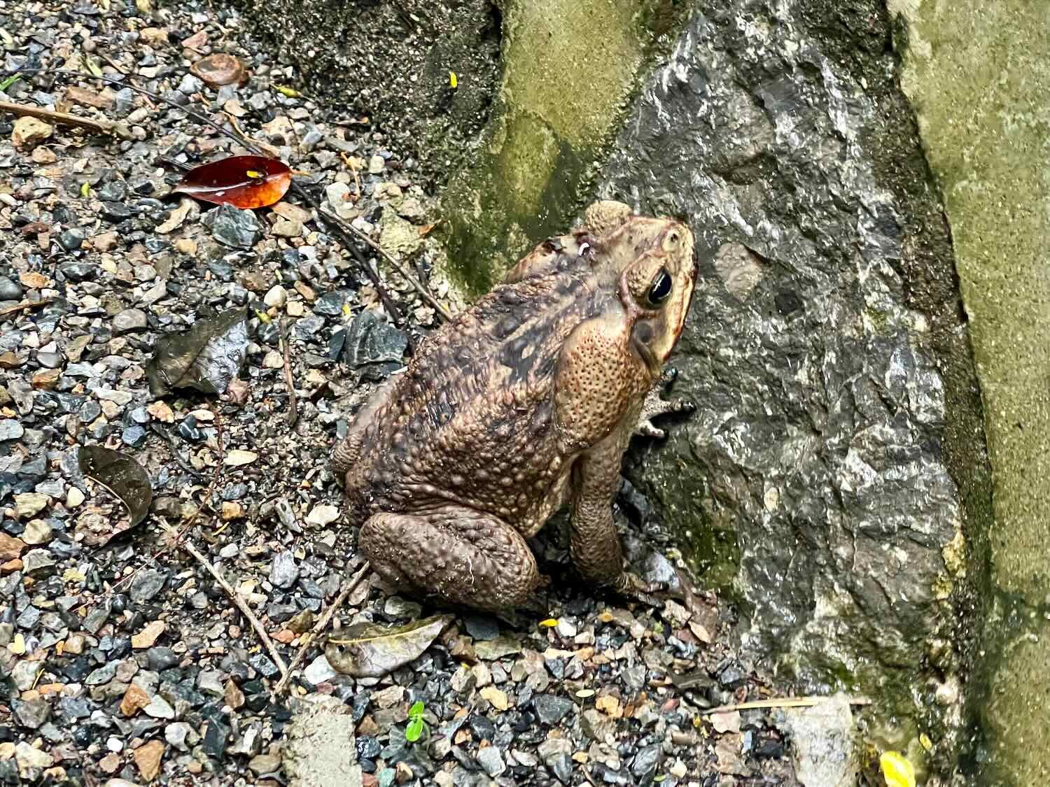
The wooded area around the bungalows was also very nice. There were big trees draped with bromeliads. We heard lots of birds calling from up in the branches. And on one walk we spotted a giant toad, which lived up to its name. It’s hard to tell from the photo below, but that toad was easily 7 inches (18 cm) from nose to rear end.

But there was one big downside - the mosquitoes. The duck pond in the woods seemed to be a fantastic mosquito breeding spot. We attempted to go for a nature walk one morning, but ended up bailing out and going back to our room, to avoid getting eaten alive. It’s not that we’re wimps with respect to getting a few mosquito bites. It turns out that the mosquitoes at this elevation can carry dengue fever, which is a pretty nasty disease. At best it can leave you feeling miserable, and at worst it can be fatal. On top of that, cases of dengue reached record levels in Guatemala this summer. On 30 August 2023, less than two months prior, the Guatemalan Congress had declared a health emergency to deal with the dengue outbreak. Needless to say, we decided it was better to be safe (inside our hotel room) than sorry.
Fixing a Broken Odometer
During our long ride up the mountain from Tuxtla Gutiérrez to San Cristóbal de las Casas, PedalingGuy’s bike fell over. Ever since then his odometer had stopped working. He tried several fixes while out on the road, to no avail. So during our rainy layover in Victoria Center we decided to tackle the problem systematically, and try to get to the bottom of it once and for all. He checked the various parts of the odometer, but everything seemed fine.
Finally, we took a close look at the full length of the wires that lead from the handlebar mount to the wheel sensor. There are two wires, and one of them was cut almost clean through. PedalingGuy used a knife to strip the plastic casing off of the two damaged ends and wind them together. Then we wrapped the whole thing in electrical tape (which we luckily had in our tool kit) to protect the exposed wire.
PedalingGuy carefully preps the wire on his odometer for field surgery. Cuatro Caminos, Dept of Huehuetenango, Guatemala. Copyright © 2019-2023 Pedals and Puffins.
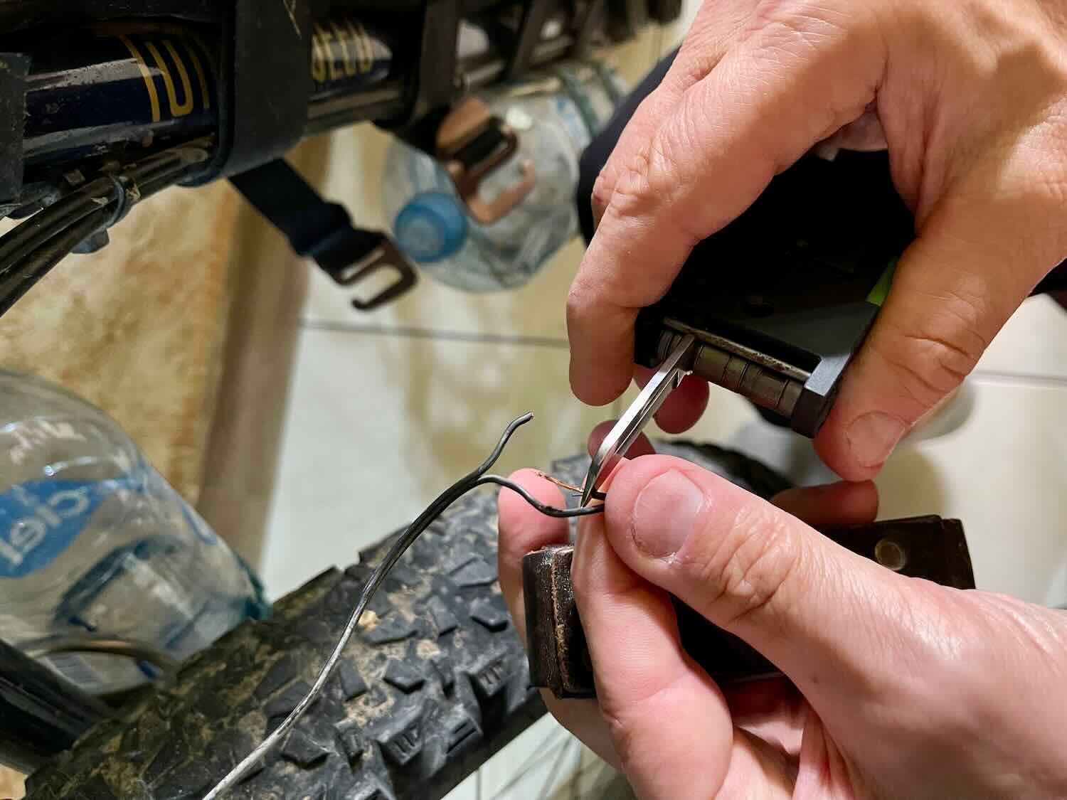

And as if by a miracle (or as if we actually knew what we were doing) it worked! We tested it a couple of times and all seemed to be good as new. (Note from the future: after more than 150 miles of cycling (240 km), the odometer is still working perfectly.)
Signs of Death Everywhere
Actually, they were almost all happy signs. By the time we were ready to leave Cuatro Caminos, the Day of the Dead (1-2 November) was only a week away. And Guatemalans appeared to embrace the yin-yang of death and celebration with almost as much enthusiasm as Mexicans. The extent of decorations in public places rivaled Christmas. There were cheerful, smiling skulls and skeletons everywhere.
In the coming days, the build up of anticipation for the Day of the Dead would grow even more pronounced. So it seems fitting to end this post with a photo of the grinning skeleton that kept us company while we ate our meals in the restaurant at Victoria Center. Feliz Día de los Muertos!
The toothy grin of La Calavera Catrina, with her trademark flamboyant hat, heralded the arrival of the Day of the Dead. Although Catrina is primarily associated with Mexico, Guatemalans have embraced her as well. Victoria Center Restaurant, Cuatro Caminos, Dept of Huehuetenango, Guatemala. Copyright © 2019-2023 Pedals and Puffins.