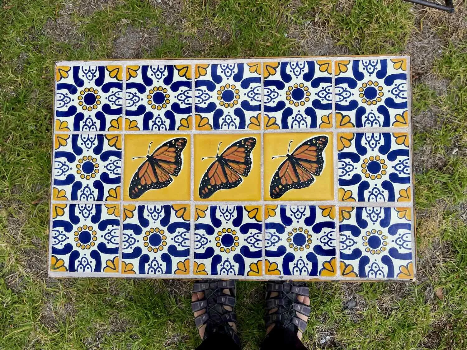
TransMexico Norte Part 4: Cycling from Guanajuato to Toluca, Mexico

14 June - 7 July 2023
14 June - Guanajuato to Wild Camp Sierra Santa Rosa (18.5 mi, 29.8 km)
15 June - Wild Camp Sierra Santa Rosa to San Miguel de Allende (30.1 mi, 48.4 km)
16-17 June - Layover in San Miguel de Allende
18 June - San Miguel de Allende to Apaseo el Alto (49.3 mi, 79.3 km)
19 June - Apaseo el Alto to Puruagua (32.5 mi, 52.3 km)
20 June - Puruagua to Irimbo (32.0 mi, 51.5 km)
21 June - Irimbo to Zitácuaro (29.8 mi, 48.0 km)
22 June - Layover in Zitácuaro
23 June - Zitácuaro to Macheros (13.4 mi, 21.6 km)
24 June - Macheros to Valle de Bravo (30.5 mi, 49.0 km)
25-26 June - Layover in Valle de Bravo
27 June - Valle de Bravo to Mesón Viejo (27.0 mi, 43.5 km)
28 June - Mesón Viejo to Toluca (29.0 mi, 46.7 km)
29 June-7 July - Layover in Toluca
A Change in the Mountains
The city of Guanajuato sits in a high valley, nestled among mountains that surround it on almost all sides. To the untrained eye, these mountains might seem like a continuation of the Sierra Madre range that runs down the western side of Mexico. But they’re not.
Wrapping like a sash from west to east across the southern part of the country, the mountains of the Trans-Mexican Volcanic Belt are a lot younger than the sierras. They started to form only 20 million years ago, when mammals were already common on the great grasslands of North America, and the dinosaurs were long gone. There are still six active volcanoes in the region - two of which have erupted since 2015 (in fact, one of them erupted just 20 days before our arrival in Guanajuato, closing the Mexico City airport due to volcanic ash in the air). And more than 20 others have erupted within the last 10,000 years, giving them that classic, conical volcano shape. Needless to say, we would be cycling through some rugged mountains.
Source of the Silver
We departed the city of Guanajuato shortly after 6am, and it was already pretty warm. Given the fact that the city is completely surrounded by mountains, it was no surprise that our route headed uphill.
At the edge of town we turned onto a gravel road towards the mining town of El Cubo, and immediately the road got very steep. There was a surprising amount of traffic, as well. Our best guess was that we had bad timing, coinciding with rush hour for the workers heading up to the mines. We were passed by a constant stream of cars, pickup trucks with guys riding in the back, and even a few buses. All of them kicked up clouds of dust. Plus, the road was quite narrow. With the steep hill, dusty conditions, and fumes belching from the vehicle engines as they strained up the mountainside it was a very tiring, unpleasant and stressful ride.
Our route headed up into the mountains, climbing rapidly along the slopes of this valley (road is visible on the left hillside). A steady stream of cars, trucks and buses kicked up so much dust from the gravel road that the valley was filled with a brown haze. Departing the city of Guanajuato, Mexico. Copyright © 2019-2023 Pedals and Puffins.
We could hardly believe it, but as we progressed the road got even steeper, with gradients hovering around 20% (for reference, 12% is considered the maximum gradient for a safe roadway). Pretty soon we were off our bikes and pushing up the hill at a snail’s pace. It took us nearly three hours to cover the five miles (8 km) from the edge of the city to a hill overlooking the mining town of El Cubo. Tired and thirsty, we stopped for a drink and banana break at a tiny store perched on top of the ridge.
As we got higher into the mountains, we started seeing evidence that we were approaching an active mine - like this underground mining truck heading towards us on the road. Near El Cubo Silver Mine, State of Guanajuato, Mexico. Copyright © 2019-2023 Pedals and Puffins.
The view across the valley of El Cubo. We could see a long bank of mine tailings on the far side that was labeled with the name of the mining company. Our route would take us across that valley, and right up next to the active mining operations (dirt road, lower right). From there we would head up and over that ridge (distant road on mountainside, upper right). El Cubo Silver Mine, Sate of Guanajuato, Mexico. Copyright © 2019-2023 Pedals and Puffins.
But the little shop didn’t have all the supplies we needed for a wild camp in the mountains. So we zoomed down a precipitous hill into the mountain town of El Cubo (pop. 522). Within a matter of minutes we arrived at the slightly larger town store. We’d lost enough sweat on the hike up the mountain that we were already thirsty for another couple of cold drinks. So, after purchasing a bunch of water and some food, we took another break. It was a nice, refreshing stop. That ended up being a good thing because - little did we know - we had a lot more hike-a-bike ahead of us.
Arrival at the main store in a remote mining town. They had everything we needed for a night camping up on the ridge. Village of El Cubo, State of Guanajuato, Mexico. Copyright © 2019-2023 Pedals and Puffins.
We thought this slide in the town park was pretty clever. It’s made out of an old mining vehicle. Village of El Cubo, State of Guanajuato, Mexico. Copyright © 2019-2023 Pedals and Puffins.
It was another steep hike up and out of the town’s valley. We climbed up onto a ridge that brought us right next to the large Guanajuato Silver 2023 sign we had seen on the mountainside from the other side of the valley (photo above). When we arrived, a dump truck had just disgorged a big pile of dirt, completely blocking our road. Luckily, another piece of heavy machinery came along and pushed the dirt around. So instead of a 3-meter high pile of dirt, there was only 1-2 feet of soft dirt now covering the road. We thought for a moment that we wouldn’t be allowed to pass. But the mining employees overseeing the work seemed unconcerned and waved us through without hesitation, despite all the heavy machinery activity just a few feet away. We were happy to be on our way, since there were no good options for a detour.
However, the dirt was still loose and unpacked. We had a tough slog through ankle-deep soil while pushing our bikes up the hill. One of the mine workers assisted by helping to push PedalingGal’s bike through the sand trap - probably in an effort to hurry us along so they could get back to work.
This photo was taken right after we got past the area where the miners were dumping fresh dirt on the road. You can see the dump truck and other heavy equipment in the background. El Cubo Silver Mine, State of Guanajuato, Mexico. Copyright © 2019-2023 Pedals and Puffins.
Dodging more dump trucks, we cycled toward a large, flat area where gravel was being pushed into piles and loaded onto more trucks. After a few minutes of watching all the activity, it wasn’t quite clear to us what they were accomplishing even though they all seemed very busy. But they must have been doing something right. The El Cubo mine is the centerpiece of Guanajuato Silver’s operations, yielding most of the ore currently being produced from one of the top five silver mining regions in the world.
Trucks moving gravel into piles, and loading it into more trucks. El Cubo Silver Mine, State of Guanajuato. Copyright © 2019-2023 Pedals and Puffins.
Immediately after that we lost our road. It just disappeared. We had a GPS route to guide us that supposedly followed a road, but there was no road. The mining operations had moved so much earth in that area that the roads on the ground no longer matched the ones on our map. Making matters worse, the gravel roads that were there weaved around in a confusing maze. We weren’t completely sure how to get up and over the mountains. We ended up having to backtrack, but eventually we decided just to follow the most-used track in the area. The biggest clue was that we could see a series of dump trucks rolling down a narrow dirt road as they came over the top of a distant ridge. We just had to find the right connecting road in the valley to get us there.
Unsurprisingly, the road up the side of the mountain was really steep. We ground our way up the hill, pushing our bikes some more - while dodging dump trucks as they rumbled up and down. It was a narrow, one-lane track. So whenever a truck came along, we had to find a way to get off the road to let them squeeze by.
That turned out to be very tricky, because on one side there was an abrupt hill, with no room for us to get off the road. And on the other side was a steep cliff that plummeted hundreds of feet down the valley, with a thin, soft, shoulder. Whenever we tried to get off the road, the loose dirt on the shoulder gave way under our feet, threatening to send us sliding down the mountainside. We had to keep our wits about us, and plan ahead for where we would be able to safely get off the road well before an approaching truck reached our position, because dump trucks don’t stop very well going downhill on narrow dirt roads.
One of the dump trucks passing us as we pushed our way up into the mountains. El Cubo Silver Mine, State of Guanajuato, Mexico. Copyright © 2019-2023 Pedals and Puffins.
Trying to avoid getting hit by a mining truck on its way up the hill. We stopped at this location for a picture because the road was a bit wider. In most places the road was considerably more narrow. PedalingGal is standing on a soft shoulder, where one false step could lead to a joyride down the side of the mountain, and into the valley below. El Cubo Silver Mine, State of Guanajuato, Mexico. Copyright © 2019-2023 Pedals and Puffins.
Finally, after two full hours making our way up the hill, our route turned off of the main gravel route and onto a minor forest road. After that, we didn’t see a single vehicle. Plus, we entered an oak woodland that even provided some shade. The silence on the ridge top helped the stress of the climb melt away. And even though the road surface was a lot more rough, our mood improved dramatically. It was heaven. More than seven hours into our ride, we finally reached the top of the pass at 8,750+ ft (2,670 m).
A particularly large roadside shrine marked the top of the pass. We could appreciate how people might want some divine help making their way along these rough and steep roads. Sierra Santa Rosa, State of Guanajuato, Mexico. Copyright © 2019-2023 Pedals and Puffins.
The descent on the far side of the pass was bumpy, but it still was exhilarating to be able to ride our bikes instead of all the walking we had done earlier in the day.
Descent through the dry oak forest. Sierra Santa Rosa, State of Guanajuato, Mexico. Copyright © 2019-2023 Pedals and Puffins.
Late in the day we missed a turn onto a small dirt track. Luckily, it worked out for the best because 0.5 mi later we found a good campsite. It was right by the road. But since the route we were now on had more in common with a horse trail than a real road, we figured it would be okay. Before pitching the tent, we set up our camp chairs and just rested our legs. In 10 hours of travel time, we had covered just 17 miles (27.5 km) - a large portion of which was hike-a-bike up roads that were too steep to ride. We were ready for for a good night’s sleep.
Cycling to “The Heart of Mexico”
The next day we had to backtrack about a half mile uphill. But from there, the overall trajectory was downhill. It was slow going at first because the road surface was still very rutted and rocky. That’s the conundrum with off road cycling - you go slow uphill, but the downhills don’t always pay it back if the terrain is rugged. We kept hoping that it would improve, but for the first two hours, it did not. We weaved and bounced our way down off the mountain, maintaining just enough control to keep the wheels underneath us. We finally reached the town of Remátalo (pop. 343), where we had a very refreshing break at the little tienda.
Easing our way down out of the Sierra Santa Rosa mountains. Approaching Remátalo, State of Guanajuato, Mexico. Copyright © 2019-2023 Pedals and Puffins.
Our arrival in Remátalo marked our departure from the volcanic mountains, and return to the Mexican central plain. Although the gradient was still theoretically going down, it was pretty hard to tell. Much more obvious was the fact that the road was like a roller coaster of short hills with slow, steep climbs followed by brake-gripping descents. Acacia-studded grasslands covered the hills, with pale gray mountains in the background.
Filling up on fluids at the small store in San Damián. State of Guanajuato, Mexico. Copyright © 2019-2023 Pedals and Puffins.
With temperatures reaching 96F (35.5C), we had one more, heart-stopping, steep climb on cobblestone roads leading into San Miguel de Allende. It didn’t help that the city streets were busy, and too narrow for both cars and bikes at the same time. In the historic town center, the roads had not changed much from the days in which horses were the primary means of transportation. Difficult-to-ride cobblestones on steep, narrow streets with high curbs on each side, combined with lots of people walking or in cars, made progress a challenge. We would ride a short distance, only to have to abandon the road and walk our bikes on the sidewalk until we were blocked. We would then return to the road until having to restart the process on the sidewalk.
We were relived to see it was worth the effort when we finally arrived at the lovely main plaza, with the huge, gorgeous, rose-colored Church of St. Michael the Archangel glowing against the clear blue sky. Around a corner near our hotel, the imposing walls of the 250 year old Church of St Francis towered over us. Inside the courtyard of the hotel, a quiet patio offered a shady place to rest at the end of a long day.
Old stone walls of the Church of St. Francis towered over the street where we stayed. San Miguel de Allende, State of Guanajuato, Mexico. Copyright © 2019-2023 Pedals and Puffins.
The courtyard of our hotel provided a shady, relatively cool and quiet place to rest at the end of the day. San Miguel de Allende, State of Guanajuato, Mexico. Copyright © 2019-2023 Pedals and Puffins.
After recuperating in an air conditioned room for a couple of hours, we went for a walk through the town’s historic center, affectionately referred to as “the Heart of Mexico.” The streets were crowded with folks out for an evening stroll. There were multiple mariachi bands playing in the main plaza. And the surrounding cobblestoned, pedestrian alleys were particularly lively with families and tourists all soaking up the ambiance as lights came on to illuminate the historic buildings.
The historic center of the city was lit up at night, accentuating the old world charm of the historic buildings. San Miguel de Allende, State of Guanajuato, Mexico. Copyright © 2019-2023 Pedals and Puffins.
The city is known for its thriving artistic scene. Many shops sell colorful, high quality, locally sourced crafts. San Miguel de Allende, State of Guanajuato, Mexico. Copyright © 2019-2023 Pedals and Puffins.
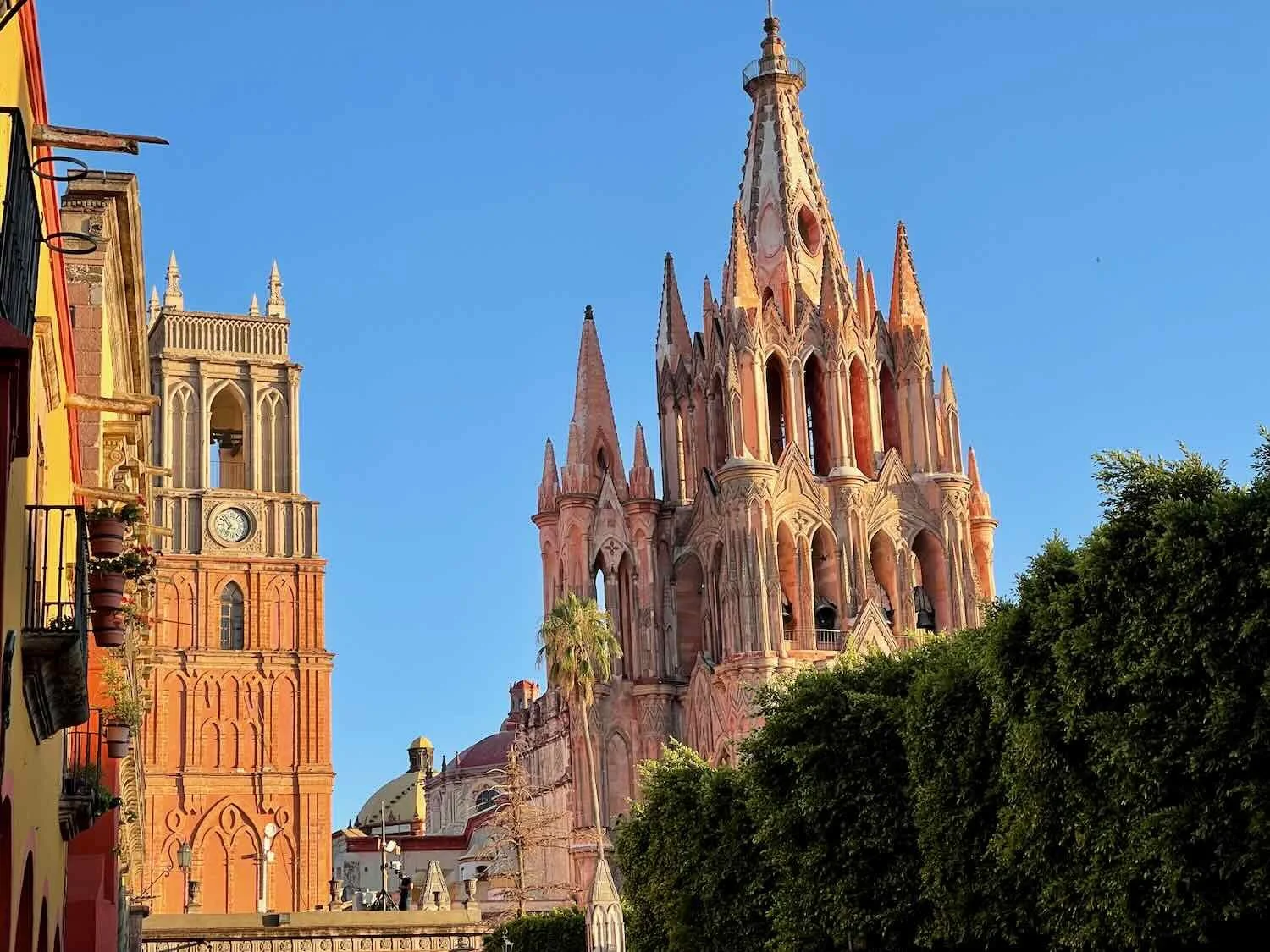
The Church of St. Michael the Archangel was just as striking under the floodlights as it had been in the heat of the afternoon. The flamboyantly romantic church was built in the late 1800s, so its facade lacks the intricately-baroque carvings common on older Mexican churches. Instead it is a neo-gothic bouquet of slender, sculpted towers, columns, arches and turrets. They say that the self-taught, native architect who designed the facade took inspiration from postcards of European cathedrals, including the famous and very memorable Sagrada Familia in Barcelona, Spain. Its distinctive, pink glow comes from the natural color of the stones, which were cut from a quarry in a nearby volcano.
The Church of St. Michael the Archangel provides a stunning backdrop for the city’s central plaza, both day and night. San Miguel de Allende, State of Guanajuato, Mexico. Copyright © 2019-2023 Pedals and Puffins.
Despite its superficial similarities to the silver cities like Guanajuato, San Miguel de Allende was never a major mining center. For centuries, it owed its prosperity to its convenient location between Mexico City and the rich silver and gold mines. Citizens grew wealthy supporting the movement of goods and services among the agricultural/administrative centers to the southeast, and the mining/industrial areas to the northwest. For a long time, the city prospered.
But in the early 1900s, San Miguel’s fortunes were fading and people moved away. By the 1920s the city was in danger of becoming a ghost town. That’s when San Miguel took a radically different path than other cities in the region. In the 1930s an American expat and an exiled Peruvian artist “discovered” San Miguel and were smitten by its dilapidated beauty. Together they started an art institute. But their plans were derailed by WWII.
It was after the war that things really took off. The American had served in the US armed forces during the war, and afterwards he saw a huge opportunity. Recruiting for students heavily among war veterans, he got the art institute accredited in both Canada and the US (through the GI Bill) - sealing the town’s fate as a destination for artsy foreigners. Today, one out of every ten people living in San Miguel de Allende is an expat, most of them from the US and Canada. The corresponding influx of wealth, and interest in Mexican culture, drove the restoration of the city’s historical buildings and made it one of the top destinations for foreign tourists.
As a result, San Miguel has a different feel from other Mexican cities. It is a fusion of traditional Mexican architecture overlaid with expat artistic flare. It’s a very beautiful city, with a laid-back vibe. We spent a couple of days enjoying the picturesque, yellow, orange and rust-colored alleys, and evenings on the lively plaza.
View towards the Church of San Felipe Neri, on a typical gold and ochre-colored street in the historic district. San Miguel de Allende, State of Guanajuato, Mexico. Copyright © 2019-2023 Pedals and Puffins.

A line of bells on the Church of Santo Domingo. San Miguel de Allende, State of Guanajuato, Mexico. Copyright © 2019-2023 Pedals and Puffins.
This hotel in the old town was covered with lush, green vines. San Miguel de Allende, State of Guanajuato, Mexico. Copyright © 2019-2023 Pedals and Puffins.
We were surprised to find a rookery of great egrets nesting in one of the city’s urban parks. When were were there, the juvenile egrets were almost fully grown, and nearly as big as the adults. Parque el Chorro, San Miguel de Allende, State of Guanajuato, Mexico. Copyright © 2019-2023 Pedals and Puffins.
Cleaning the streets in old-town. Mexicans are very particular about keeping their sidewalks and cobblestone streets clean and relatively dust-free. San Miguel de Allende, State of Guanajuato, Mexico. Copyright © 2019-2023 Pedals and Puffins.
Many of the main roads in the city were choked with cars in the afternoon. But it was possible to find quieter back streets in the mornings. San Miguel de Allende, State of Guanajuato, Mexico. Copyright © 2019-2023 Pedals and Puffins.
The entrance to another quiet courtyard. San Miguel de Allende, State of Guanajuato, Mexico. Copyright © 2019-2023 Pedals and Puffins.
View of the city from the aptly named Balcones neighborhood. San Miguel de Allende, State of Guanajuato, Mexico. San Miguel de Allende, state of Guanajuato, Mexico. Copyright © 2019-2023 Pedals and Puffins.
Several mariachi bands played music each evening in the plaza, in front of the Church of San Miguel. This band was notable in that one of the musicians was playing a full-sized harp. San Miguel de Allende, State of Guanajuato, Mexico. Copyright © 2019-2023 Pedals and Puffins.
Near the end of our stay we went out to the main plaza at sunset. As dusk approached, we sat on a bench admiring the Church of St. Michael the Archangel in the fading light and listening to the mariachis serenade the crowd. After a service ended, a big crowd emerged from the church and most of the people settled down in the plaza until every bench was occupied. Folks seemed to be trying to position themselves so that they could get a good view of the church. We didn’t really think anything of it at first, since the church was beautifully lit, and it seemed like a perfectly normal thing to do on a Friday night.
Then, suddenly, fireworks erupted from the courtyard in front of the church, less than 50 yds away from where we were sitting. Through a lucky accident, we had one of the best seats in the plaza for watching the show. It was loud, bright, festive and exciting. The fireworks continued for at least a half hour, maybe more. We learned later that it was a celebration for Saint Anthony of Padua, one of the biggest festivals of the year in San Miguel. It was a magical display, reminiscent of watching fireworks over Cinderella’s Castle at Disney World - but more special by virtue of being completely unexpected.
Fireworks over the Church of St. Michael the Archangel, celebrating the Day of Saint Anthony of Padua. San Miguel de Allende, State of Guanajuato, Mexico. Copyright © 2019-2023 Pedals and Puffins.
A Big Cycling Event
The ride out of San Miguel de Allende began with the usual strenuous climb back up into the hills. Motorized vehicles often struggle up these hills as much as we do, revving their engines as they crawl along. And since emissions standards aren’t too strict in Mexico, many cars and trucks spout tons of exhaust fumes. We try to avoid these roads whenever possible. In this case, we were able to take a narrow back alley for part of the way. Unfortunately, the alley turned into a one-way road, just wide enough for a single vehicle. Of course, we were going the wrong direction, which required us to dip into driveways and other passageways whenever a car needed to pass going the opposite direction.
Fortunately, after reaching the top of the mountain we turned onto a nice, quiet, secondary road. And pretty soon we were cycling on cobblestones that rattled our bikes, brains and bones. For the next six hours, stretches of cobblestones near small towns alternated with more remote sections of dirt and gravel - following a sinuous path along the foothills between two extinct volcanoes.
After an extended descent out of the highlands, we entered a new ecoregion. The lowland canyons that lie between the volcanoes are known as the Bajío. Before human settlement, the valleys were covered with dry forests where the trees grew up to 40 ft (12 m) high. But hundreds of years of extensive disturbance from forestry, ranching and mining, and the heavy industry that followed, have virtually eliminated the original ecological communities. Today, only a few pockets of native forest remain, mostly on ridges and isolated mountain peaks. In its place, a lot of the landscape is covered by weedy, dry scrub. As a result, we didn’t notice a lot of difference between the habitats in the bajío versus the central high plains.
Nearly five hours into our ride we were very surprised to find ourselves surrounded by dozens of mountain bikers, all heading in the same direction. This was a pretty remote area, where the scattered towns rarely had more than a couple of hundred residents. Yet there we were, being passed by a steady stream of folks on bikes bombing down a hillside. Before long one of the riders stopped to chat with us. From Arturo we learned that this was an event organized by a cycling club. There were two loops of different distances - 34 km and 60 km. And it looked like more than 100 people were participating.
Soon we came upon a bunch of cyclists taking a break at what appeared to be the end of the ride. There were a couple of canopies set up for shade, and a big spread with fresh fruit and other snacks. Arturo was there, and he had already mentioned to some of the others that he had met us. So they were expecting us. A couple of guys asked us to pose for a photo, and before you could say, “Alaska to Patagonia,” everyone was lining up for a photo with the crazy Americans who had ridden their bikes down from the Arctic Ocean. It was fun and festive as successive groups of folks posed with us, and mobile phone cameras were passed around so people could take photos.
Out in the middle of a very rural area, we suddenly found ourselves in the middle of an organized bike ride. Multiple photos ensued. The first cyclist we met, Arturo, is on the far left. Village of El Pie, State of Querétaro, Mexico. Copyright © 2019-2023 Pedals and Puffins.
After the extended photo shoot, we continued downhill to a small town with a tienda for a much needed rest break. While we sat in the shade enjoying our cold drinks, a few, straggling cyclists continued to pass by. By then it was scorching hot, again. The average high here at this time of year is 80F (26.5C), with only a 10% chance of temperatures exceeding 87F (30.5C). But the high temperature that day would get into the high 90sF (36.5C). One reason it was so hot was that the rainy season, which usually starts in early June and cools things off, was late this year. In fact, three quarters of the way through June we had seen almost no rain at all. (El Niño, a cyclical warming of the Pacific Ocean, had begun in the spring of 2023. Western Mexico is typically drier during El Niño years.) So, the good news was that it wasn’t raining. But the bad news was that it was 15+F degrees hotter than it might otherwise be.
After some more bone-rattling downhills on the cobblestones, we finally approached a paved section where we could pick up some steam. Along the way, we were passed by a number of the cyclists who were now on their way home. Some were still on their bikes, but most were in cars. A lot of them honked and waved to us as they drove by, which also lifted our spirits.
Cycling along the cobblestones in the bajío region of Mexico. The cone of an ancient, extinct volcano rises in the background. Cameras de Amexhe, State of Guanajuato, Mexico. Copyright © 2019-2023 Pedals and Puffins.
One thing we noted was that there was a very big social component to their cycling event. After the cars with cyclists had passed us, we ended up passing them again, while they congregated at stores and bars along the way. They had taken a big, communal, rest break at the end of their ride (where we took all those photos) sharing food and drinks. But it seemed like that wasn’t enough to satisfy their desire to socialize. Many of them also stopped in groups on their way home, parking their cars along the road, and gathering on the front porches of little tiendas or taquerías to drink and visit some more, before saying, adios.
When we finally reached the paved road we found ourselves on a long, slow climb. By this time it was close to 3:30pm. The blacktop was radiating heat, making us feel much hotter than when we were on the dirt. Luckily, there was a bus stop with a nice, big awning part way up the hill. We stopped for a rest on the bench at the bus stop, appreciating the shade.
Right before the big climb, we passed a field of cultivated agave. This is not an official, tequila producing region, so these agaves will probably be used to make mezcal. Marroquín, State of Guanajuato, Mexico. Copyright © 2019-2023 Pedals and Puffins.
From the heights of the hill we could see a dense development of nearly identical housing units. In fact, in this area we saw two or three of these developments - which are completely different in character from the typical Mexican villages, where no two houses are alike. They seemed to be associated with several big car, electronics, cement, and home product factories nearby. Marroquín, State of Guanajuato, Mexico. Copyright © 2019-2023 Pedals and Puffins.
After reaching the top of the ridge, the cycling got a lot easier, and we quickly covered the final couple of miles to the city of Apaseo El Alto (pop. 28,260). Unfortunately, none of the hotels in town had air conditioning (as mentioned above, it’s usually cooler here). But we did secure a nice enough room that had screens on the windows and a ceiling fan. So there was hope for a good night’s sleep.
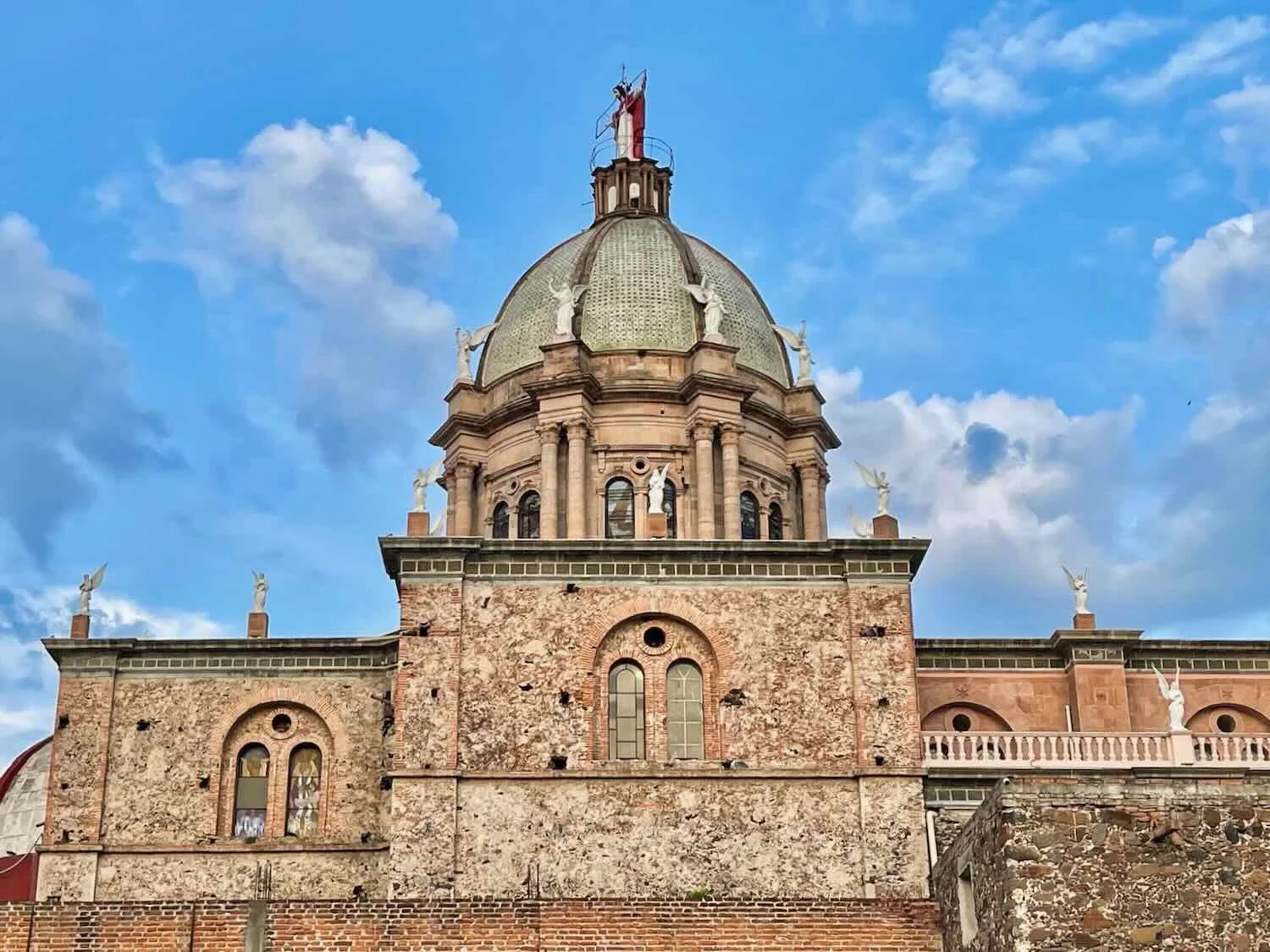
In the evening we walked to the main square for dinner. The Sacred Heart of Jesus Church dominates the plaza, and it’s quite a sight. It was modeled after St. Peter’s Basilica in Rome, so it has some of the basilica’s most striking features including a Greek-style portico with Corinthian columns, lines of statues along the edge of the roof, and a tall dome. On top of the dome rests a five ton, cement statue of Jesus with open arms, in a gesture of protection for the city. A similar statue in red and white sits above the altar inside.
The facade of the Sacred Heart of Jesus Church was designed to look like St. Peter’s Basilica in Rome. Apaseo el Alto, State of Guanajuato, Mexico. Copyright © 2019-2023 Pedals and Puffins.
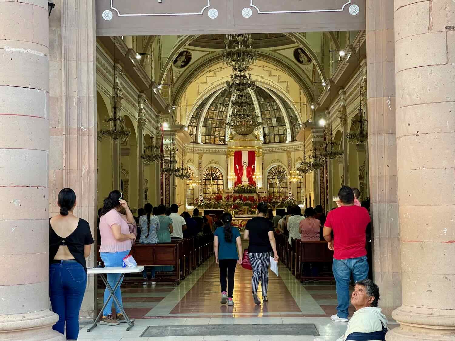
You may have noticed a theme if you have read a few of our posts. We often visit the central cathedrals in Mexican towns. There are multiple reasons for this. The cathedrals are typically the most grand structures in town and are usually located near the busy town square, which also is an interesting place to visit. But perhaps more importantly for hungry cyclists, the town square near the cathedral is one of the best places to find food. Sometimes we eat in restaurants, but there often will be vendors with street food that can also be interesting. Occasionally there are even mariachi bands and festivals. The town squares, with their cathedrals, remain the center of many Mexican towns. Visiting them is one of the easiest ways to get a feel for a town if you have limited time.
An Odd Little Town
We both slept poorly because of the heat. Our hotel room never really cooled down, even with the window open and the ceiling fan spinning all night. In the morning, when we opened the door we could feel the cool air flowing into the room from the cross breeze that was created. However, it also let in 10+ mosquitoes. So we were glad we had kept the door shut throughout the night, even though we had been tempted to open it for the cool breeze.
The day’s ride was not a particularly long one, especially since more than 80% was on pavement. Even with a few lengthy hills, we made good time. But the heat was really oppressive, so we stopped a number of times for cold drinks and a rest in the shade. Plus, for most of the day there was no shoulder on the road. We had to get off the road every once in a while to allow trucks or buses to pass - including a couple of cars passing where they shouldn’t have that were coming in the opposite direction. It didn’t help that we both were very tired.
Around noon, we had only 5.5 miles to go (9 km). That’s when our route left the pavement and turned onto a quiet rural road. At first we savored the silence, enjoying the absence of so many cars and trucks. After 15 minutes, the road turned to cobblestones, and then rough dirt. It was also extremely hilly, wearing us out even more in the midday sun.
Following a grueling four miles on the badly damaged dirt road, we plunged down a cobblestone descent into the town of Puruagua (pop. 2,800), and sought out the only hotel in town. But when we arrived there was no one around. That’s actually pretty common for small town hotels, so we weren’t too concerned at first. But they usually leave a phone number posted on the door so you can call someone and let them know you would like to check in. In this case, there wasn’t any information posted about how to contact the owners. The front doors were open, so PedalingGuy waited outside with the bikes while PedalingGal went inside to investigate.
She walked throughout the whole complex, calling out, but no one was there. While inside, she could see that several sections of the hotel looked like they were under repair. There were stacks of roofing tiles and bags of cement all around the dusty lobby. More disconcerting, many of the rooms appeared to be in various stages of disrepair, and most had no bedding on the beds. The hotel looked like it might have been quite nice at one time, but it was suffering from neglect. We started to worry that the hotel was not in business anymore.
Back outside, we asked a guy who had been sitting nearby if he knew whether the hotel was open. He said that it was. Then he went to the gate of a house across the street, and whistled a few times to try to get someone’s attention, without success. When no one appeared, he told us he didn’t know where the proprietor was, and left. By this point, we were definitely concerned.
Then a lady walked by, paying no attention to the fact that we were sitting on the front steps of the hotel. Hoping for a miracle, we asked if she knew how we could get in touch with the owners of the hotel. Surprisingly enough, this technique of asking random strangers for help is frequently successful in small towns, since everyone seems to know each other. Suddenly she took notice of us. She said the hotel was open, and that she could help us. She never made it clear what her association was with the hotel, but at this point we were used to the fact that family members, extended family, friends, part-time employees and others often help out when the owners are absent from these small hotels.
PedalingGal followed her inside to have a look at the only two rooms that she said were ready to be used. Given the options, we took a room that was right next to the reception desk. We paid the lady in cash, she put the money in her pocket, and we crossed our fingers, hoping that she really was affiliated with the hotel. After that, she said she had to go home and feed her kids, so we were left alone in the empty hotel.
There’s only one hotel in town, but there wasn’t anyone around when we arrived. Eventually someone came along who was able to get us into one of the few rooms ready to rent. Puruagua, State of Guanajuato, Mexico. Copyright © 2019-2023 Pedals and Puffins.
After dropping off our things in the room, we walked over to the main square, with its big stone church. We bought a couple of drinks and sat on a bench among the shade trees that lined the edge of the plaza. It seemed odd that there were not very many people around. Usually small town plazas are popular places for social gathering. But here there were just a couple of bored vendors, with not much else going on. We hit up several of the town’s tiny shops in an effort to pull together enough food for a night of camping, then headed back to the hotel.
The Church of San José Obrera framed by rows of trees in the town square. Puruagua, State of Guanajuato, Mexico. Copyright © 2019-2023 Pedals and Puffins.
When we arrived back at the hotel an older guy, a middle aged woman, and a little kid were watching television in the lobby, right next to our room. The sound on the TV was pretty loud, so we decided it might be a good idea to change rooms. Luckily, the guy seemed to work there, and he showed us another room that was ready (not one of the rooms that the lady had offered earlier). This one was all the way in the back of the hotel, quite far from the lobby and the main road. It was a big improvement, so we said we’d like to take it.
But then we hit a snag. He couldn’t find the key to the room. The hotel had a bank of cubby holes mounted on the wall behind the reception desk, each one labeled with a room number, and each one was supposed to have a key inside. But many of the keys were missing. And even in the cubby holes that had keys, 75% of them seemed to be in the wrong box. The poor guy called the lady over to help him, but try as they might, they couldn’t find a key that would work with the room we hoped to occupy. We even started to help them by going behind reception desk and checking the draws and cubbies ourselves, because we desperately wanted to change rooms. No one could find the correct key, anywhere.
It was starting to look like we wouldn’t be able to move after all. But then, just as things were looking bad, the guy and the lady had a quick side conversation, and they decided they would let us have their house keeping key - the one that the hotel kept so that staff could get in to the room if a guest lost the primary key. It may have been a master key that would work for any of the rooms (we were not sure). But since there weren’t any other guests, it didn’t really matter. It was very nice of them to do that. We moved our gear to the new room, happy to be away from the noisy lobby.
Settled into our new room, we decided that we would not follow the TransMexico Norte bikepacking route into the Sierra Puruagua mountains and camp the next day. Neither of us was well rested, and this hotel room - which did not have a ceiling fan or screens on the windows - did not look like the kind of place where we would get a good night’s sleep. We decided that the next day we would take a paved road to another town. Even if we had to stay in hot hotel rooms for the next few nights, at least we would not have to climb a dusty, rocky mountain road without any sleep. We went to bed early.
Monarch Butterfly Country
As expected, we didn’t sleep very well. We got out of bed early, and hit the road around 6am.
The day started with a 40 minute downhill run, back into the bajío lowlands. It was a pleasant change from the heart-pumping, uphill starts we’d had for the past four cycling days. Not long after that, though, we turned onto a busy highway that ran past expansive fields of corn, sugar cane and agave. For the next two hours, the cycling was harder. The route profile was almost all uphill, and the road was very narrow with no shoulder. Plus, there was a lot of traffic, including quite a few heavy trucks and buses. We rode on the dirt service road where we could, but it was stressful.
We were impressed by the collection of used rear-view mirrors at this shop. Maravatío, Michoacán, Mexico. Copyright © 2019-2023 Pedals and Puffins.
On the far side of a busy town, we stopped at a gas station for a break. Within a minute, a guy pulled up on a motorcycle to introduce himself. That’s how we met Danny. He was a member of an online community known as the Red de Apoyo Cicloviajero de México (a.k.a., the “Mexican Support Network for Touring Cyclists”). The group was started in 2018 when two European cyclists were murdered on a remote stretch of road in southern Mexico. Members of the network (known locally as RACmx) are available to offer help and advice to anyone traveling by bicycle in Mexico (as well as Mexican cyclists traveling abroad). They also advocate for cycling safety at the national level. Danny saw our panniers, and was eager to introduce himself.
He was so enthusiastic about being of assistance that we felt a little bit bad about telling him we didn’t need any help. But we had fun talking with him. We learned that he owned a beverage warehouse across the road from the gas station, and that he enjoyed bringing cyclists to his home for meals. On his mobile phone, he showed us photos of other cyclists that he had met, some of whom had stayed at his home.
It was also at that gas station where we got the first indication that we were entering monarch butterfly country. A big mural painted along the side of the parking area showed a map with the location of nearby butterfly sanctuaries, as well as a whimsical rendition of what its like to be in a forest full of monarch butterflies.
A map painted on the wall next to a gas station showed the location of nearby monarch butterfly sanctuaries. Maravatío, Michoacán, Mexico. Copyright © 2019-2023 Pedals and Puffins.
This mural depicted a cloud of monarch butterflies, like you might encounter during the winter up in Mexico’s mountain butterfly sanctuaries. Maravatío, Michoacán, Mexico. Copyright © 2019-2023 Pedals and Puffins.
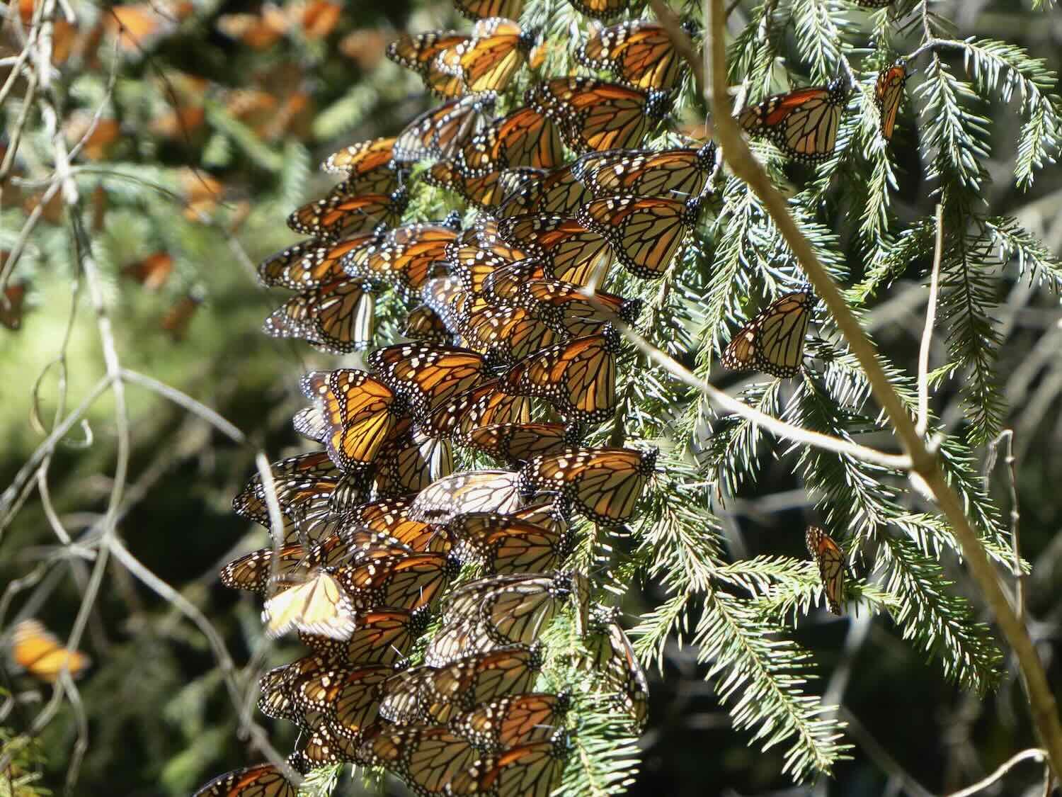
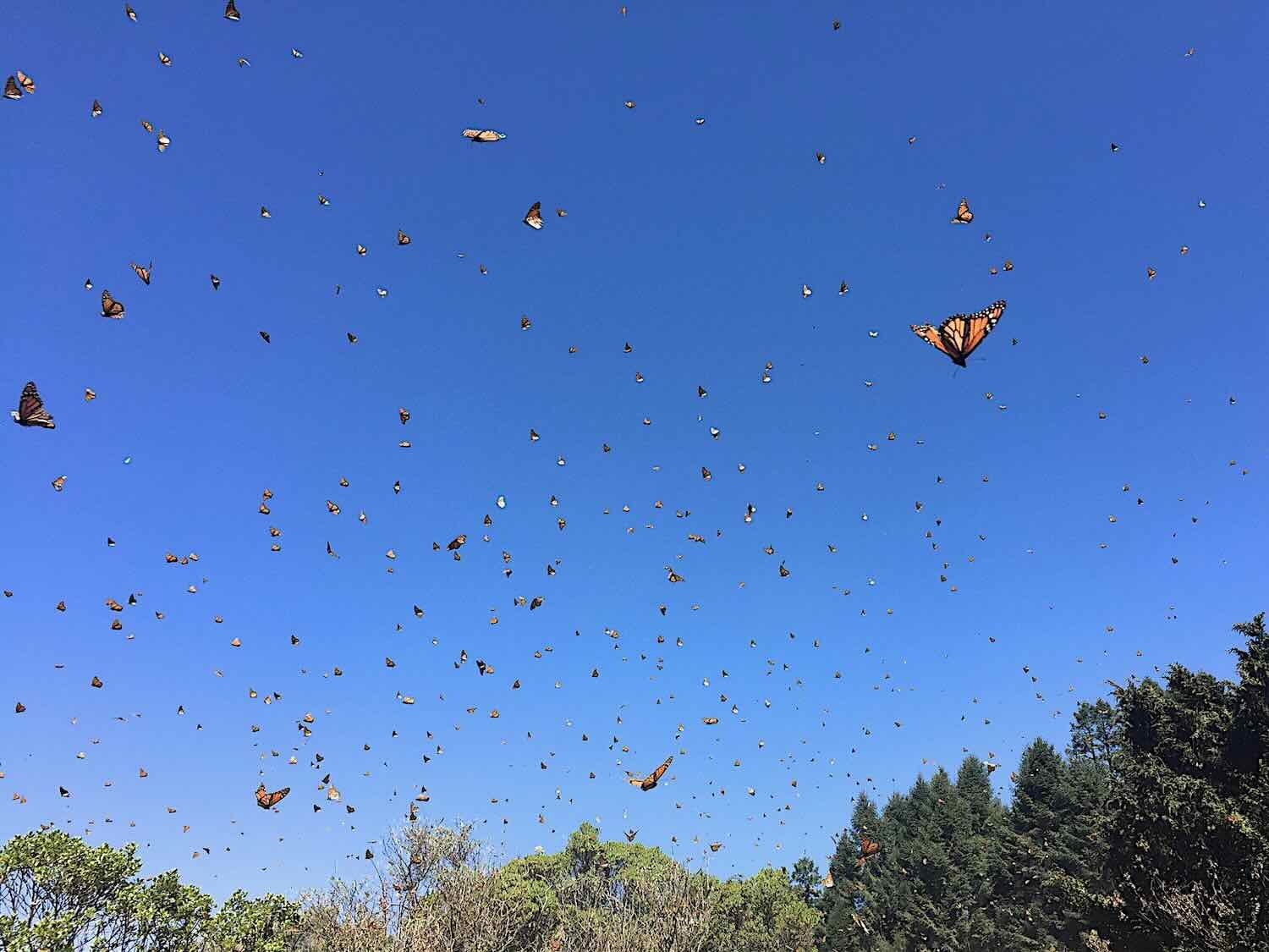
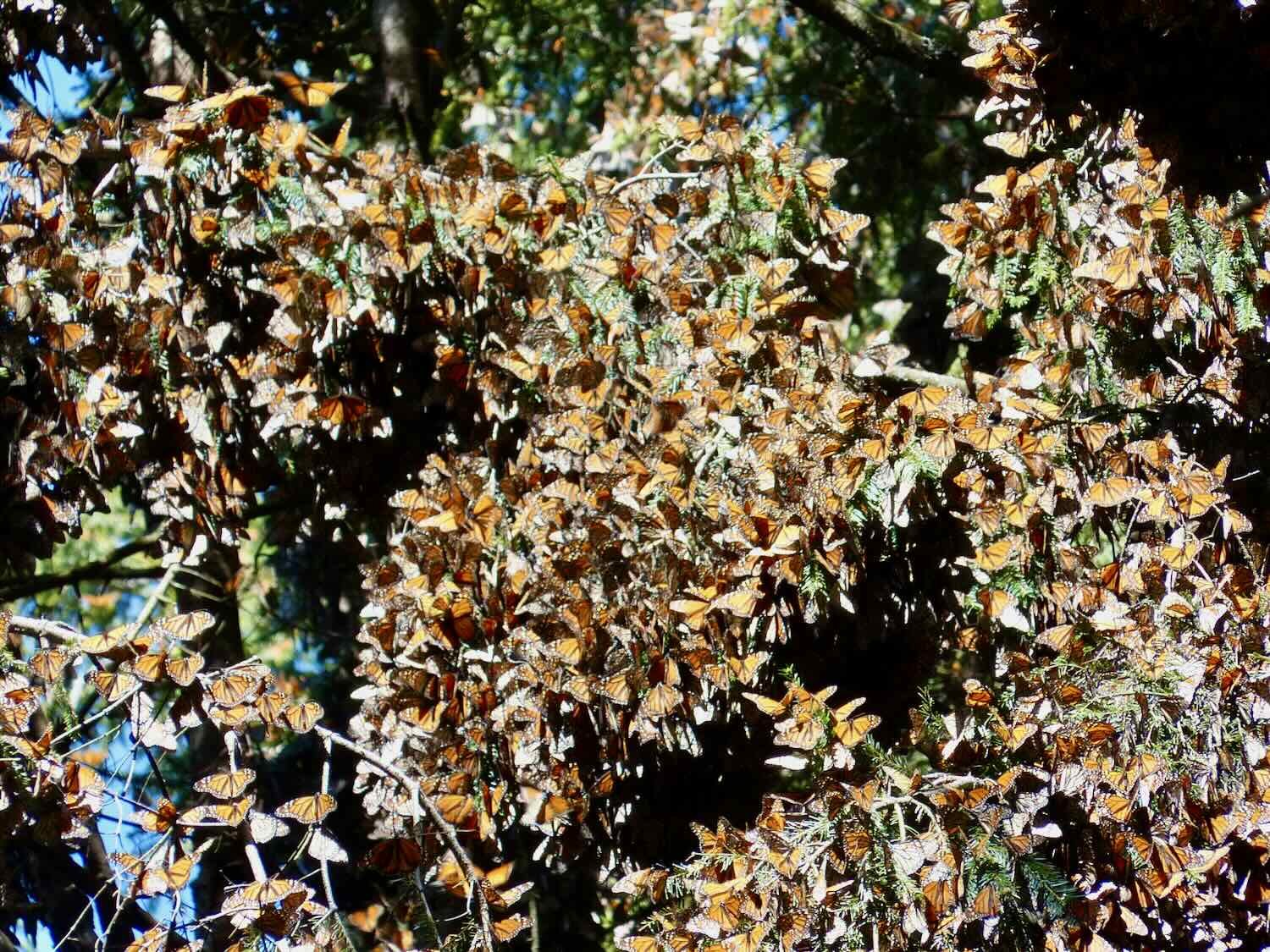
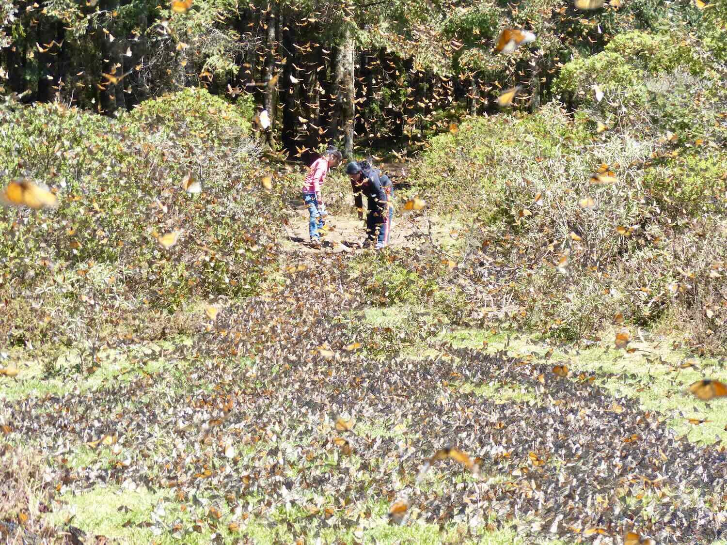
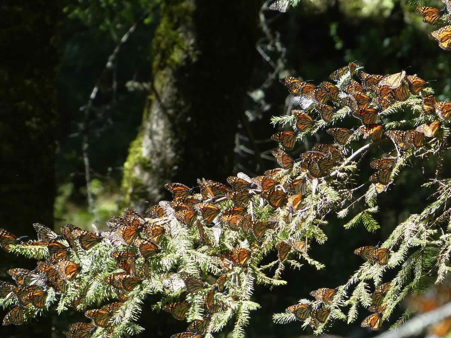
The story of the monarch butterflies is one of the most fascinating phenomena in nature. Monarchs are the only species of butterfly to make an annual, two-way, long distance migration. Each year, over the course of multiple generations, the butterflies leave Mexico to breed as far north as Canada. Then they return to spend their winters huddled together in masses of millions of butterflies, high on the peaks of just a few mountains in central Mexico - all within the pine forests of the Trans-Mexico Volcanic Belt. Very little is understood about how these small, fragile insects repeatedly find their way, over successive generations, to the same precise locations, across thousands of miles, to places they have never been, and could not know from experience. It’s truly extraordinary.
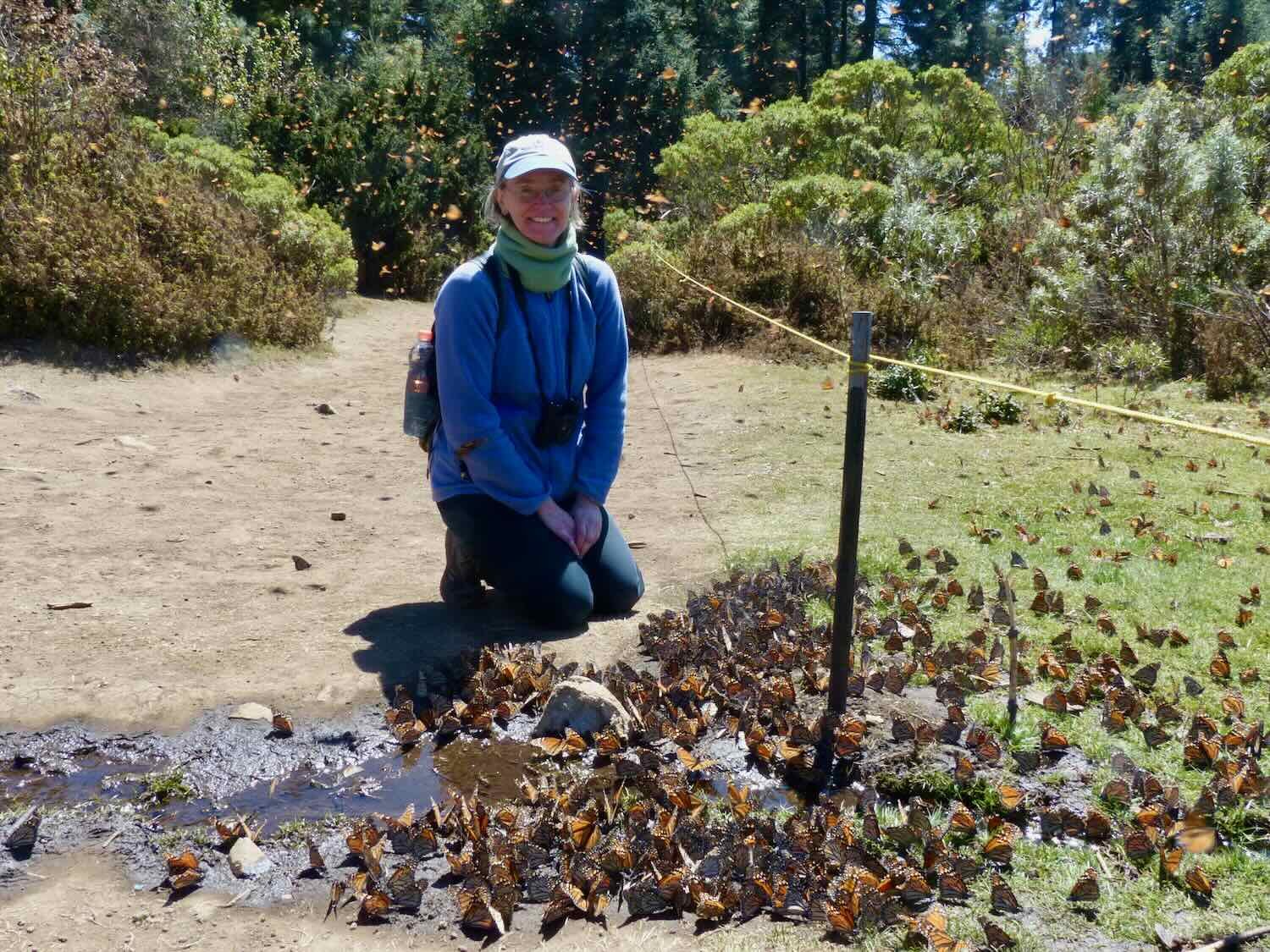
But we wouldn’t be seeing any live monarch butterflies on this trip. It’s the summer, and the monarchs are up in the US and Canada, breeding the young that will make the next trip south to Mexico in the fall. However, in 2016 we had traveled to Mexico specifically to see the Monarch butterfly wintering grounds at El Rosario Butterfly Sanctuary, only eight miles (13 km) from our route. The experience of seeing the millions of butterflies was beyond description. So we couldn’t resist including a couple of our photos from 2016 in this post (see below).
On this trip, it was back to the climbing. Over the next two hours, we ascended back into the trans-Mexico volcanic belt pine forests, where the monarch butterflies return each year. And eventually we arrived in the town of Irimbo. We were quite happy that it was just past noon, so we wouldn’t have to cycle in the hottest part of the day. (If it looks like our daily mileage has been rather low lately, it is true. Motivated by the unusually hot weather, we had decided it was best to stop cycling by noon-2pm if a good town or camping opportunity was available. We have found it best to avoid cycling in the extreme heat as much as possible.)
Despite its cheery name, the Hotel Fiesta Monarca (named in honor of the butterflies) near the town of Irimbo had seen better days. The owner was no longer investing much in its upkeep, and the manager seemed like he was just trying to keep the place from falling apart. Loss of business from the pandemic was exacerbated by a February 2022 shootout at a nearby highway intersection. Michoacán state police were ambushed at night within sight of the hotel, by cartel members who were trying to keep the police from reaching the site of another cartel altercation to the north. No one was killed, but the event cast a dark cloud over the area. Things haven’t been the same since.
It was still relatively early in the day. So after settling in at the hotel, we walked into the center of town - which was about a half mile away. Irimbo (pop. 3,550) is actually pretty big, and the commercial center was bustling with activity. There were lots of shops and restaurants. We found a lovely little cafe near the main plaza, and enjoyed the best meal we’d had since leaving San Miguel de Allende. A highlight was that we could order sides of steamed vegetables with our meals - not a common option in Mexico. It was nice to see the resilience of the town, after hearing about the problems they were facing.
The ‘letras’ sign in the center of town. Irimbo, Michoacán, Mexico. Copyright © 2019-2023 Pedals and Puffins.
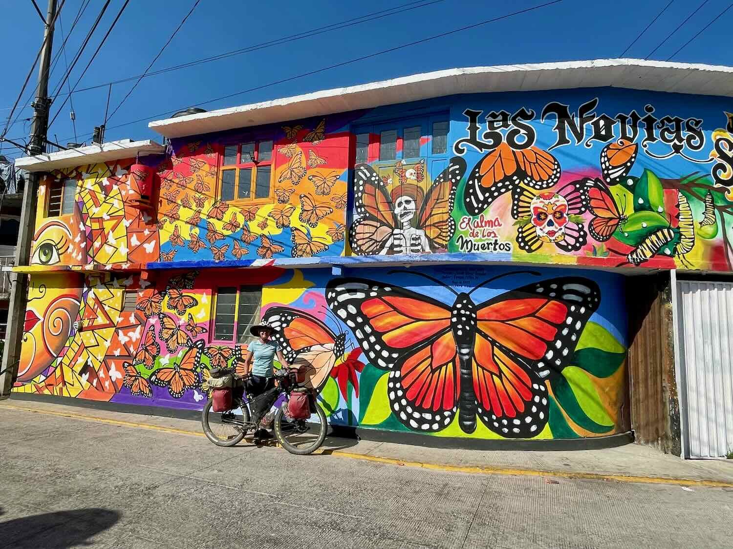
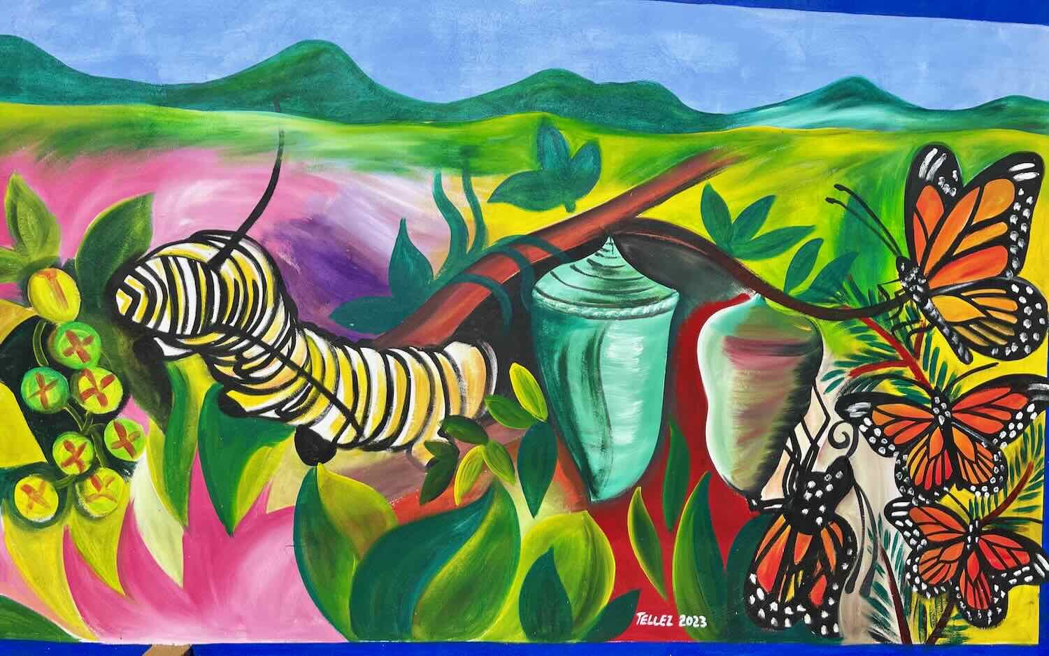
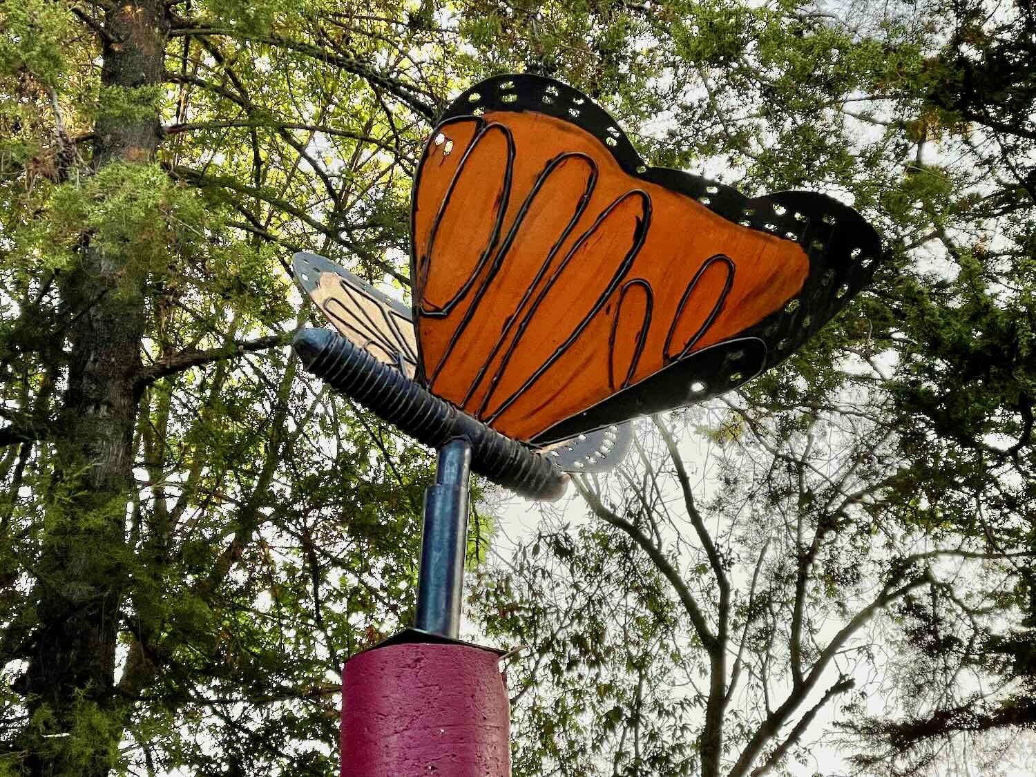
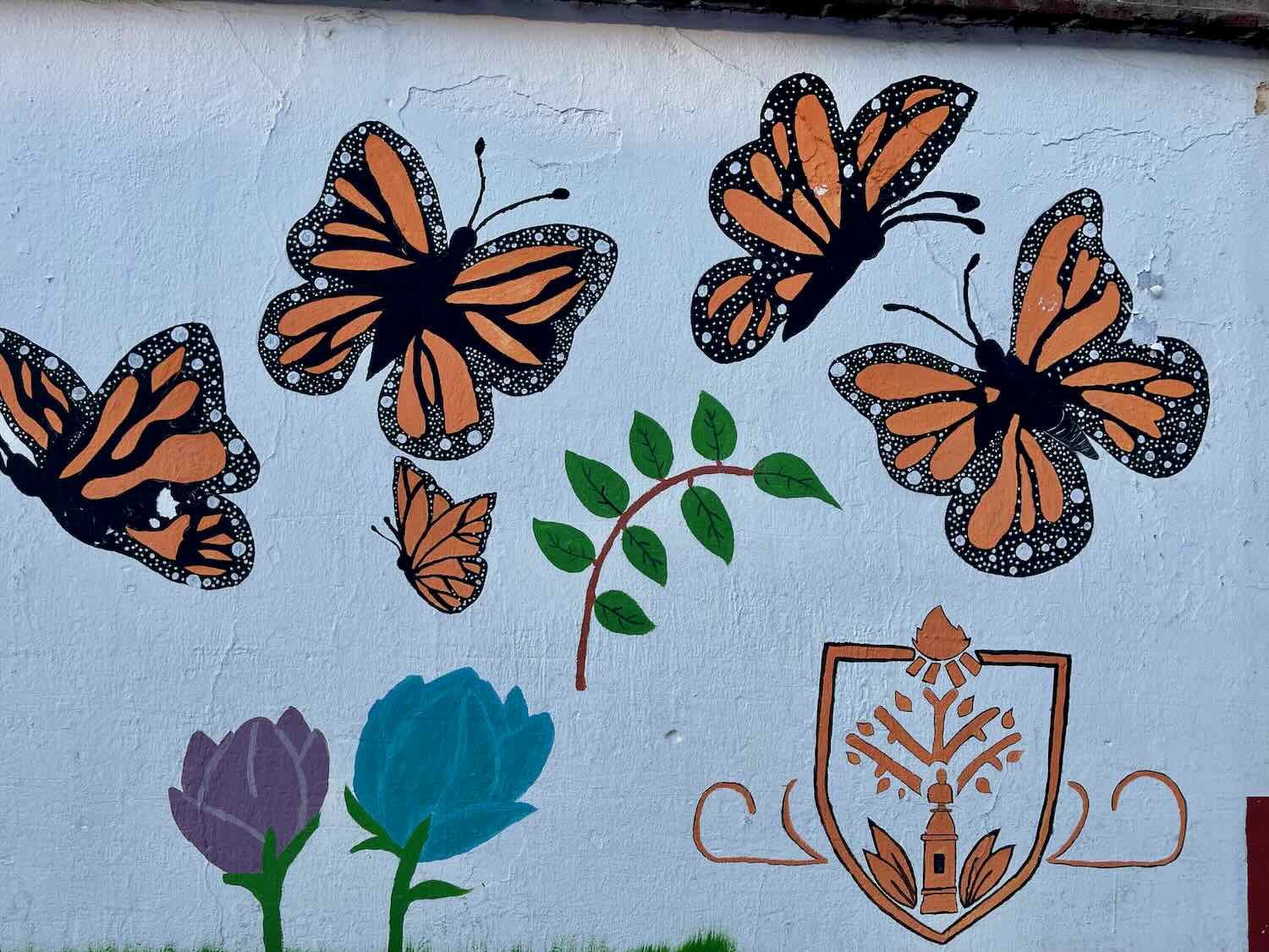
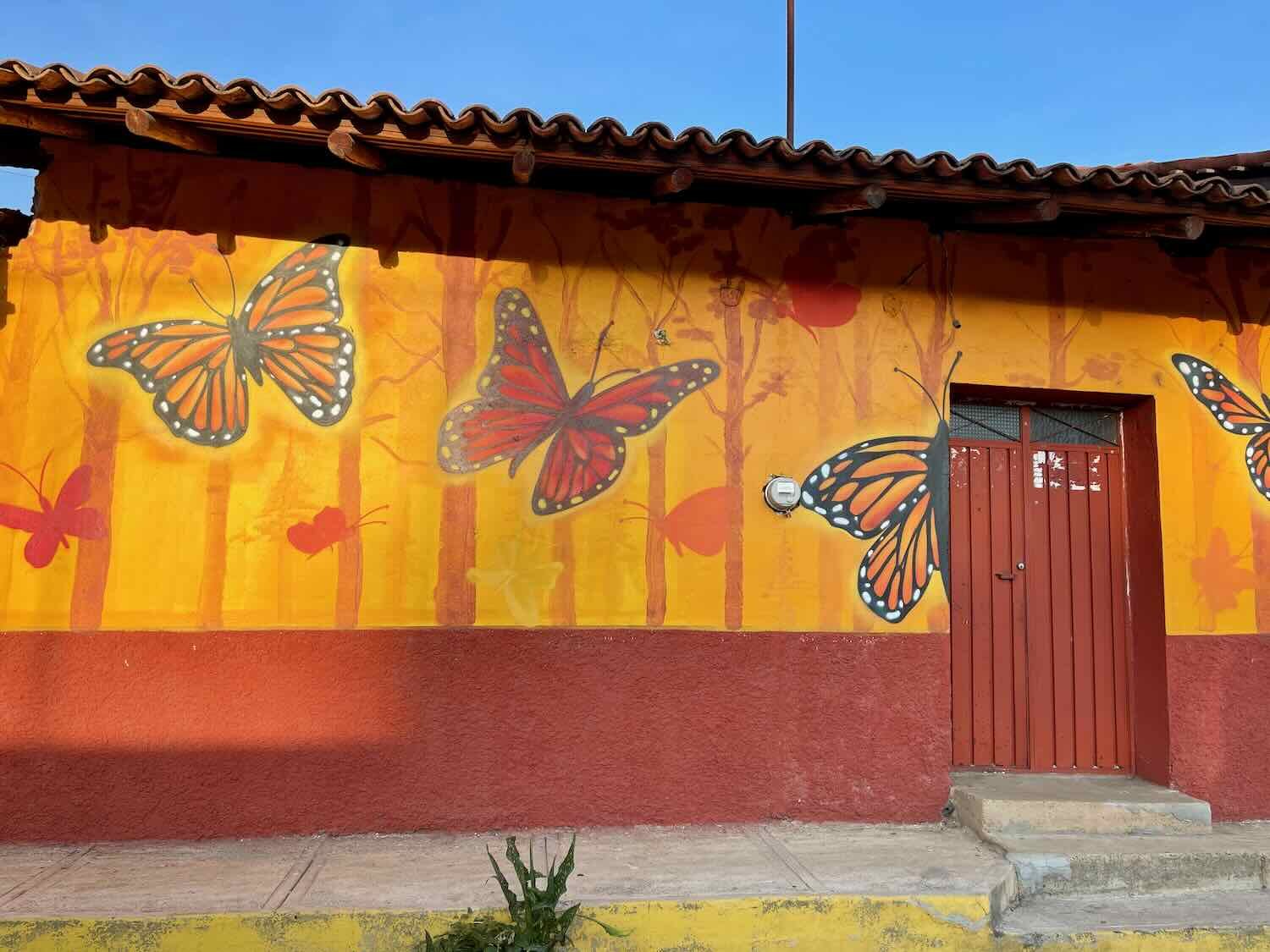
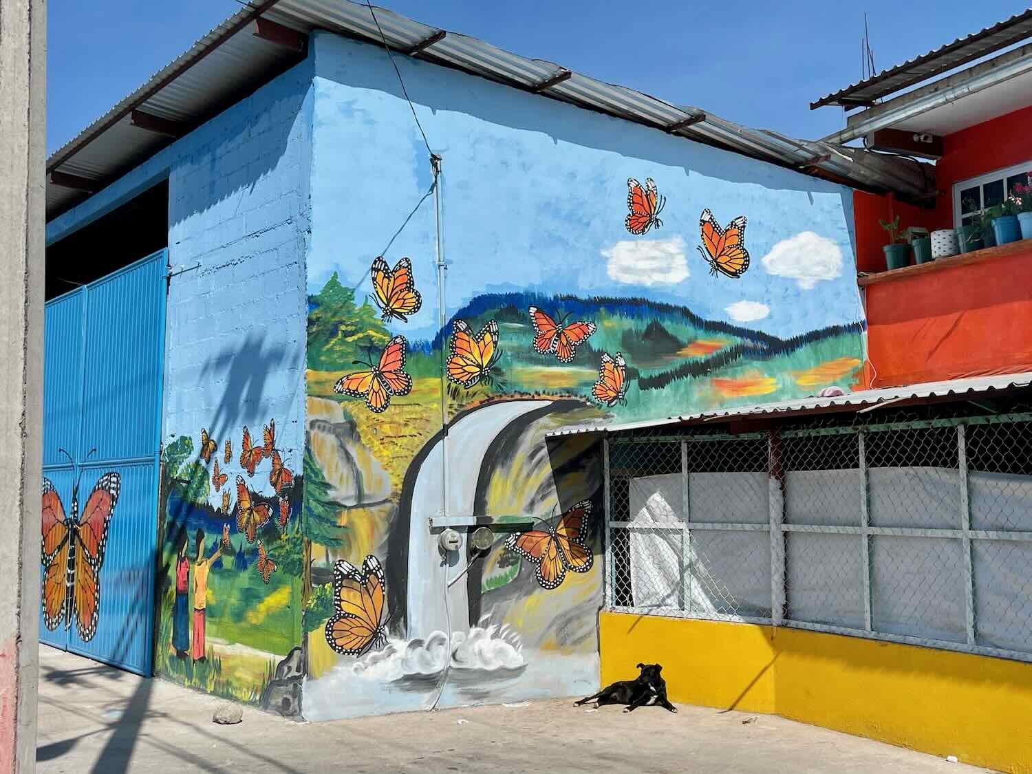
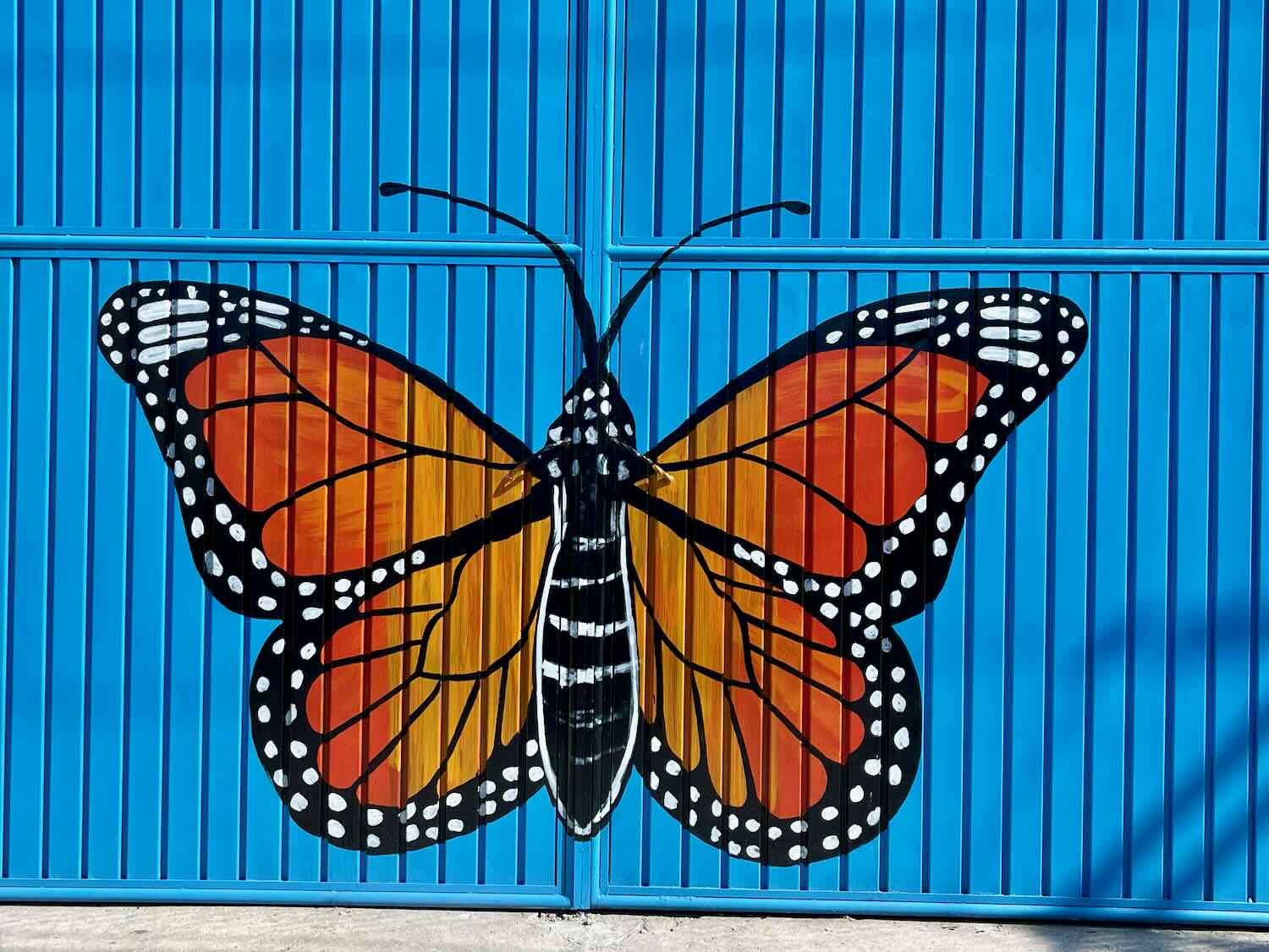
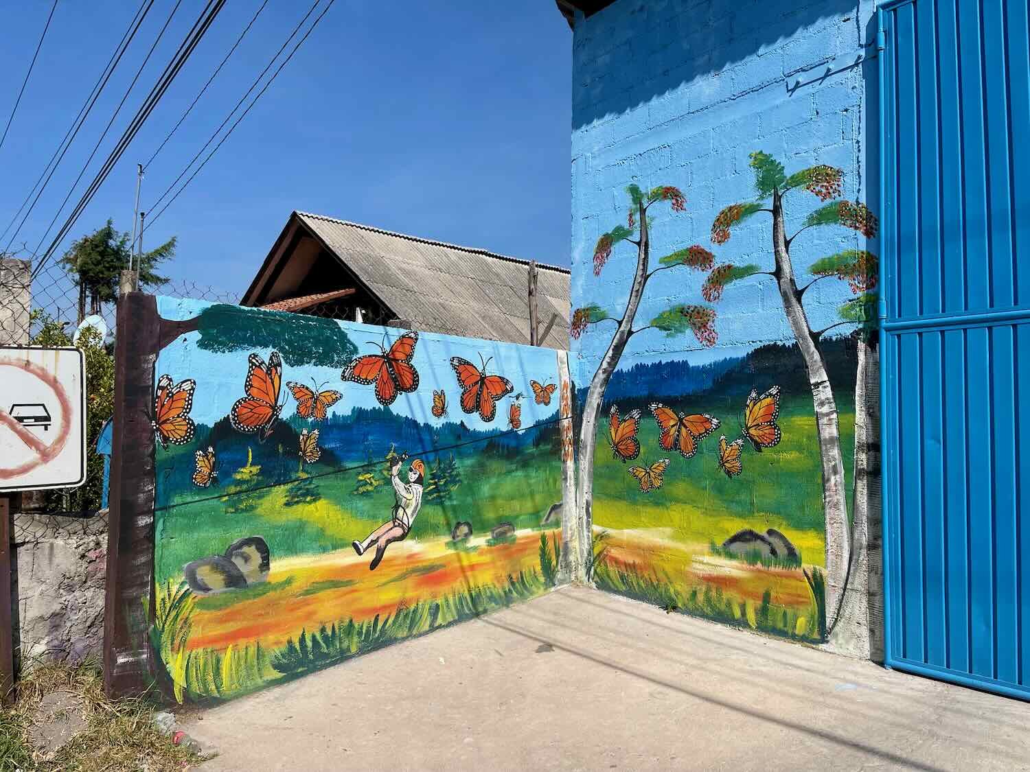
After a short, restless night we were back on the road at 6am. The day began with 3.5 hrs of tarmac cycling in the heart of monarch butterfly country. Every small town and village that we passed was decorated with colorful murals and other art depicting the butterflies. Besides being a wonderful natural phenomenon, the return of the monarchs each fall has a deeper, more spiritual meaning in Mexico. Since before the arrival of the Spanish, native people in the area believed that the monarch butterflies were the souls of their ancestors returning to Earth from the afterlife. Eager to convert native people to Catholicism, missionaries later linked indigenous beliefs about their ancestors to celebration of the Day of the Dead. The power of this mix of religious and traditional beliefs is evident in the prodigious amount of public art glorifying the monarchs.
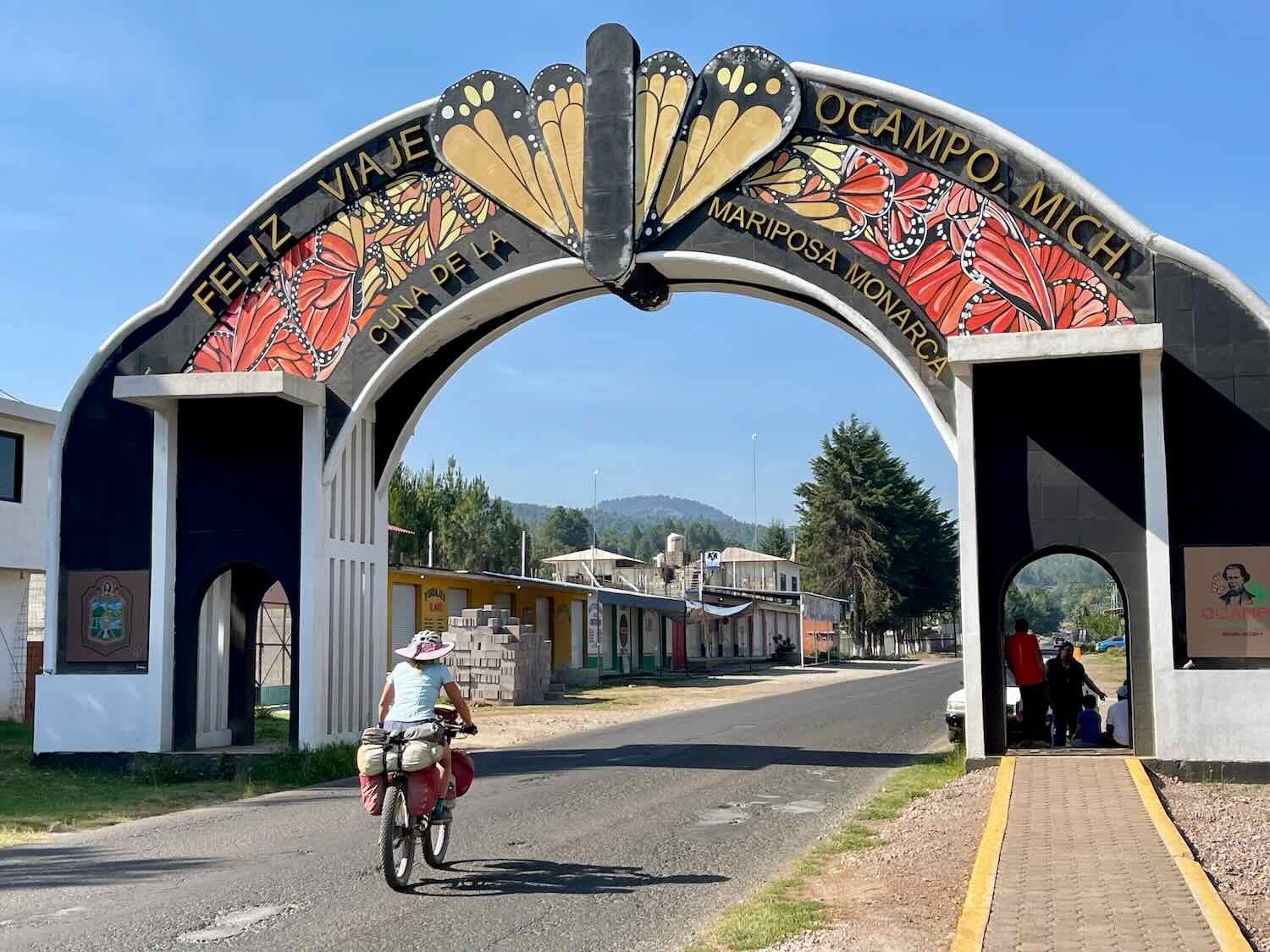
This roadside sign welcomed us to the País de la Monarca (a.k.a., “Monarch Country”). North of Ocampo, Michoacán, Mexico. Copyright © 2019-2023 Pedals and Puffins.
Our destination in the city of Zitácuaro lay about 1,300 ft (400 m) lower in elevation than the high plateau we had been cycling across. As we neared the city, we tore down a steep-walled canyon into the valley. The surrounding mountains were a series of high, pointed peaks, looking very much like ancient volcanoes.
As we approached Zitácuaro, one particular store caught our eye. They were selling a type of passive solar water heater that we had seen in great abundance all over Mexico. The high cost of heating fuel, combined with creative financing initiatives that helped low income households purchase these devices, has resulted in an explosion in the use of passive solar for heating water. If you looked out over the rooftops of any small town in Mexico, a sizable proportion of the homes would have these devices installed. Even more striking was that many isolated, rural homes had them as well.
We had personally become very acquainted with them, as almost all of the rural and small town hotels where we stayed used this type of water heater. Unfortunately, quite a few of them didn’t spring for a big enough heater, which often results in hot water running out quickly, or not being available at all if other hotel guests got to the hot water first. But the fact that they have greatly increased access to hot water all across Mexico is pretty profound.
A store selling various models of Mexico’s most popular form of solar water heater. These devices are found in large numbers throughout the country’s small towns and rural areas. Curungueo, Michoacán, Mexico. Copyright © 2019-2023 Pedals and Puffins.
The final run into Zitácuaro was challenging, with a ton of fast-moving traffic in multiple lanes. It was awesome when we finally reached the edge of the city and were able to get onto a dedicated bike path. It didn’t come a moment too soon. Right after riding onto the bike path we crawled up one last, big hill to the center of the city. It was just a little bit after 11am.
Thus, the hunt for a hotel began. For a city of its size, Zitácuaro (pop. 87,000), has surprisingly few hotels that have air conditioning. Our first stop was a big hotel in the center that had great ratings online. But despite what the online booking sites said, they did not actually have air conditioning in the rooms. Plus, they would not let us check in until 3pm, which was still four hours away. We decided to look elsewhere.
The next two places we checked also had problems. Interestingly, we thought the first one would be a sure bet, since it was called the Hotel Ciclovía (the “bike path hotel”). But it could only be accessed via a steep set of circular stairs. No way we could get our bikes up into the building. The other hotel seemed nice, but they also didn’t have air conditioning. And the only windows opened up onto the busiest street in town. The one room we looked at must have been over 100F (38C) inside and it would be horribly noisy with the windows open. So we passed on that hotel, too.
Running out of options, we sat on a curb and checked the internet for more ideas. Having come to the conclusion that we would have to forego air conditioning, we broadened our search and discovered the Hotel Conquistador, a quite nice hotel at a very reasonable cost, in a great location. When we checked in, they even gave us a huge oscillating fan to help cool the room. The beds were comfortable and the wifi was fast. It all worked out just fine.
The interior courtyard of the Hotel Conquistador includes colorful stained glass. Zitácuaro, Michoacán, Mexico. Copyright © 2019-2023 Pedals and Puffins.
Zitácuaro is definitely not a tourist town, and it had a totally different feel than the silver mining cities that had anchored our cycling route since we made the climb up into the Sierra Madre mountains. Even in the heart of the city, there are no quaint colonial streets, historic buildings, or museums.
Manufacturing and commerce are the big economic drivers in Zitácuaro. In fact, it seemed like every available inch of sidewalk space was occupied by vendors selling an astonishing diversity of produce, street food, and all manner of small-to-medium sized household goods. We even had a hard time locating the central cathedral, because it was completely obscured by market stalls several aisles deep. The only open space was found near a monument in the central plaza, and even this area was being encroached by vendors from all sides. Sometimes it feels like there are more folks selling things than are buying. Mexicans are very hard working people.
Every inch of space on the city sidewalks was occupied by local vendors, selling products mainly targeting the local population. This was not a tourist-oriented town. Zitácuaro, Michoacán, Mexico. Copyright © 2019-2023 Pedals and Puffins.
We did find some breathing room near a monument on the central plaza honoring the life and achievements of Benito Juárez, Mexico’s first indigenous president and one of the most revered leaders in the country’s history. Zitácuaro, Michoacán, Mexico. Copyright © 2019-2023 Pedals and Puffins.
As with so many of these cities in the foothills, the ride out of town began with a really big, uphill climb. Within 30 minutes we had reached the edge of town and enjoyed a fantastic view back into the valley, with mountain ridges fading into the distance.
View back toward the city of Zitácuaro, as we headed south into the mountains. La Carolina, Michoacán, Mexico. Copyright © 2019-2023 Pedals and Puffins.
From there it was an “all uphill” day, as we wound our way through farm-covered lowlands up into the mountains. Gradually the route changed from pavement, to rough asphalt, and finally to dirt. The mountainsides were covered with a thick blanket of forest, with an impressive diversity of broadleaf trees. The scenery was strikingly similar to the Appalachian Mountains in the USA. And we enjoyed a cool breeze in the shade of the trees. It was a wonderful ride.
Our route took us up into the leafy forests of the Sierra Zitácuaro, where we enjoyed riding in the cool shade of the trees. Foothills of Cerro Pelón, Michoacán, Mexico. Copyright © 2019-2023 Pedals and Puffins.
As we approached the mountain town of Macheros (pop. 355), we briefly descended into a broad agricultural valley. It was still very early - just after 9am. With less than 1.5 mi to go, we had visions of enjoying a relaxing, afternoon walk in the woods.
The lovely valley of Rincón del Ahorcado, high in the foothills of Cerro Pelón. The view gave us the feeling of cycling through West Virginia. Approaching Macheros, State of Mexico, Mexico. Copyright © 2019-2023 Pedals and Puffins.
A beautiful horse came over to say, hello. Macheros, State of Mexico, Mexico. Copyright © 2019-2023 Pedals and Puffins.
But then things got tough. The road pitched up at a vicious gradient, which continued unabated all the way into Macheros. We pushed our bikes up the concrete ramp that substituted for a road. It took us a little over an hour to cover the final 1.5 miles, and it was exhausting. When we finally got to the top of the hill, our hopes were raised when we saw that there was a little store. But try as we might, we couldn’t rouse anyone to sell us a drink. So we pushed on.
Slowly making our way up the steep concrete ramp that serves as the road into Macheros, State of Mexico, Mexico. Copyright © 2019-2023 Pedals and Puffins.
The cheerful Church of San Isidro stood near the intersection of the turn to our hotel. Macheros, State of Mexico, Mexico. Copyright © 2019-2023 Pedals and Puffins.
But the climb was worth the effort. Near the top of the mountain we found the Cerro Pelón Butterfly B&B. It was a lovely oasis. Serving primarily as a basecamp for tourists visiting a nearby monarch butterfly sanctuary in the winter, it’s also a tranquil, off-the-beaten-path refuge for people in the summer. The hotel and its grounds were lovingly maintained by a local family, with each room having a unique and authentic Mexican decor. A very unexpected treat in such a small community in the mountains.
Monarch butterfly mural painted on a wall at the Cerro Pelón Butterfly B&B. Macheros, State of Mexico, Mexico. Copyright © 2019-2023 Pedals and Puffins.
Since we had arrived very early in the day, there weren’t any rooms available yet. While we waited in the lobby, we chatted with the hotel proprietor, Joel. He had lived for a while in Long Island, New York, so he spoke very good English. We enjoyed hearing the backstory of how he had started the B&B over 10 years ago, when a film crew from Belgium asked if he could arrange a place for them to stay while filming a documentary about the butterflies. Joel had been working as a tour guide at the butterfly sanctuary, but had no experience running a hotel. Without hesitation, he agreed to host the crew.
Through trial and error, he quickly learned the ropes of how to host guests, set prices, prepare invoices, and handle all of the aspects of the business. Soon he was building a multi-room hotel, managing relationships with other tour guides and local farmers who would provide horses for tourists to ride up the mountain, overseeing a restaurant and managing a nonprofit that paid local residents to serve as forest guards for the monarch reserve. It was pretty amazing how a little stroke of luck in the hands of an industrious person could turn into a significant business that employs him, some of his family, and many others in the community.
As we were talking, PedalingGal started to feel very sick. She had suffered from stomach trouble in the morning, but powered through it with the help of some Imodium. Now it was catching up with her. So as soon as the room was ready, she went to lay down and slept for the next three hours. There went any plans for a walk in the woods.
After PedalingGal was finally back on her feet, we wandered around the garden and the tiny town.
View of the Cerro Pelón (a.k.a., “Bald Hill”), location of the monarch butterfly sanctuary. Millions of butterflies return each November to overwinter in huge clusters among the pine trees on the upper slopes of the mountain. Macheros, State of Mexico, Mexico. Copyright © 2019-2023 Pedals and Puffins.
Angel’s trumpet, growing in the garden of the B&B. Macheros, State of Mexico, Mexico. Copyright © 2019-2023 Pedals and Puffins.
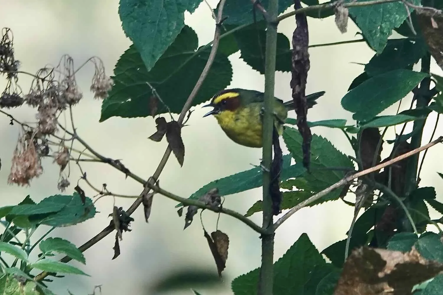
A broad-billed hummingbird looking for nectar among the blossoms of an African lily. Macheros, State of Mexico, Mexico. Copyright © 2019-2023 Pedals and Puffins.
Then it was time for dinner. We enjoyed a delicious meal in the hotel’s restaurant, run by Joel’s mom - who also teaches classes in traditional cooking. Images of butterflies were everywhere.
After dinner we went up onto the fourth floor observation deck to watch the sunset. Unfortunately we were just a bit too late. The sun had already dipped behind the mountain and a thick cloud bank. But the view from the roof was superb. We stayed to watch the light fade over the picturesque valley below.
Sunset behind the Sierra Zitácuaro mountains. Macheros, State of Mexico, Mexico. Copyright © 2019-2023 Pedals and Puffins.
Into the Valle de Bravo
From the town of Macheros we would drop more than 2,000 ft (610 m) down into one of Mexico’s most popular mountain valleys. The main TransMexico Norte bikepacking route takes a very strenuous road southward through some of the most rugged and hilly sections of the Sierra Zitácuaro. But given PedalingGal’s recent bout of stomach trouble, we decided that might be biting off a little bit more than we could chew. Instead, we decided to take an alternate route recommended by another cyclist who had ridden it just two months earlier. By heading a few miles to the east, we could take a route that was 12 miles shorter (19 km), with 3,000 ft less of climbing (915 m) - turning a 2-day long, arduous ride into a manageable one day ride.
The first six miles (9.6 km) of both routes was the same. It included a super-fast, 1,400 ft (427 m) descent. The air was fresh and cool because of the relatively high elevation, and PedalingGal even wore her down jacket for the first 45 minutes. Along the way we passed a number of avocado orchards interspersed with the still-thick forest.
Much of the alternate route was “paved.” But it was in pretty rough shape. Big sections of the asphalt were all torn up, leaving huge potholes and lots of debris in the road. Consequently, there were hardly any cars. We enjoyed a serene ride through a patchwork of forest and farms. It was still before 10am when we reached the shores of Lake Avándaro.
A section of the alternate route from Macheros to Valle de Bravo on the TransMexico Norte bikepacking route. The severe damage to the road really cut down on traffic, and we were passed by only a handful of cars. North of Valle de Bravo, State of Mexico, Mexico. Copyright © 2019-2023 Pedals and Puffins.
At one point, we actually saw the chicken cross the road. We didn’t have a chance to ask her why she did it. North of Valle de Bravo, State of Mexico, Mexico. Copyright © 2019-2023 Pedals and Puffins.
On a remote rural road, we spied our favorite breed of cattle - an Oreo Cookie cow (a.k.a., a Belted Galloway). We have seen this breed only 4-5 times over the years, mostly in the USA. They seem to be a hobby cow, since we usually see them in groups of only 1-3 individuals (never in big herds). There was only one, lone Cookie cow here. North of Valle de Bravo, State of Mexico, Mexico. Copyright © 2019-2023 Pedals and Puffins.
The first stretch of highway after we reached the shore of Lake Avándaro was tough. For about half an hour, we labored up a steep hill with no shoulder and a constant stream of fast-moving traffic. But once we got past that, the hills were quite gentle and we made great time. The road stayed pretty close to the shoreline, giving us expansive views of the jade-green water from the hills overlooking the lake.
The town of Valle de Bravo sits on the shore of Lake Avándaro, a reservoir created in 1947. Sailing and other water sports are one of the reasons Valle de Bravo is such a popular destination for Mexicans on vacation. Lake Avándaro, State of Mexico, Mexico. Copyright © 2019-2023 Pedals and Puffins.
Everything we had read warned us against trying to cycle into Valle de Bravo (pop. 24,150) on a weekend, because the tourist traffic can be really horrendous. So, of course, we arrived on a Saturday. We were expecting the worst, but it actually wasn’t too bad until we reached the edge of town. Then it became very hectic. Valle de Bravo is another one of Mexico’s Pueblos Mágicos (magical towns), with a historic, colonial center that has very narrow streets. Most of them have been made one-way to help traffic flow, but there’s still a lot of congestion. We carefully picked our way towards the center of town.
This sign reminded us that we are still in monarch butterfly country. Valle de Bravo, State of Mexico, Mexico. Copyright © 2019-2023 Pedals and Puffins.
When we arrived at our target hotel we were once again dismayed to discover that they had no air conditioning. You may have noticed another theme, here. A constant quest for air conditioning was becoming our number one priority. When it is really hot there is no greater luxury. Scorching days, steamy nights, and little sleep can wear you down more than the cycling.
Very few hotels in Valle de Bravo had air conditioning, and this was supposed to be one of them. We were now back at a lower elevation, and the nights were definitely going to be warm. Although the rooms looked large and comfortable, and the hotel was just a couple of blocks from the main plaza, we still took a few minutes to consider our options. We went back and forth a couple of times, but finally decided to stay there because of its great location.
After settling in we went for a walk around the central square. The town was really busy, with tons of shops and street vendors. Even in the heat of the afternoon, there were quite a few folks hanging out in the main plaza.
The whimsical statue Volar (“to fly”), in the town’s popular, central plaza. Valle de Bravo, State of Mexico, Mexico. Copyright © 2019-2023 Pedals and Puffins.
Indigenous street vendors in traditional dress. Bright colors, embroidery and lace are common elements, giving the dresses a strikingly formal look. Central plaza, Valle de Bravo, State of Mexico, Mexico. Copyright © 2019-2023 Pedals and Puffins.
Dinner was accompanied by a couple of delicious and colorful margaritas. Valle de Bravo, State of Mexico, Mexico. Copyright © 2019-2023 Pedals and Puffins.
The Church of San Francisco overlooked the bustling central plaza in the fading light. First built in 1880, it was renovated in the 1990s, so it looked quite modern. Valle de Bravo, State of Mexico, Mexico. Copyright © 2019-2023 Pedals and Puffins.
The inside of the Church of San Francisco also looked fresh and modern. Although there were statues and other works of art that dated back to the 16th century, much of the church’s interior was renovated in the late 20th century. Valle de Bravo, State of Mexico, Mexico. Copyright © 2019-2023 Pedals and Puffins.
The First Signs of Rain
We spent two more days in Valle de Bravo, enjoying the ambiance of this Pueblo Mágico. We were lucky to be there on a Sunday, when the city market comes to life - taking over several city blocks so that there’s barely enough room to squeeze through between the stalls. We wandered through some of the chaos, enjoying the sights and sounds of vendors vying for the the attention of the crowds.
An awesome selection of produce at the Sunday market. Valle de Bravo, State of Mexico, Mexico. Copyright © 2019-2023 Pedals and Puffins.
In the evening we went out for a sunset stroll through the area around the plaza. At an ice cream parlor (of course) another patron struck up a conversation with us. Alejandro was from Mexico City, but had attended college in the USA and spoke perfect English. We learned that he visited Valle de Bravo regularly to go sailing on his boat, and that for many years he was involved in competitive sailing. Even as we spoke, some of his friends were competing in an international sailing event (the Volvo Ocean 65 in the Mediterranean), and that they were in second place! Very cool. He also used to do some bike touring, and had cycled from Belgium to Spain in the 1990s. It was really fun talking with him, and we exchanged contact information with the hope of keeping in touch.
As our conversation was winding down, it began to rain. This was something of a shock to our system, since we hadn’t seen rain for quite a while. Before we had made it down the block, the rain was coming down in buckets. We ducked under the awning of a pharmacy, and watched as all the street vendors and storefronts sprang into action, hustling to get their products stowed away, out of the downpour.
Everybody in the town plaza huddled under the canopy of the central gazebo to escape the evening rainstorm. Valle de Bravo, State of Mexico, Mexico. Copyright © 2019-2023 Pedals and Puffins.
But summer storms rarely last long, and this was no exception. In less than 10 minutes the rain had subsided to a mild drizzle and we were able to walk back to our lodging without getting too wet. However, it was a warning of things to come. We had been incredibly lucky that the summer rainy season was late in arriving (it usually begins at the start of June). That meant we had been cycling in unusually hot weather, but at least we weren’t having to contend with being wet all the time. Now we were going to have to factor rain into our plans.
It rained hard a couple of more times during the night. But once we were back in the hotel, we were happy about it. The rain really helped to cool down our hot, stuffy room. Sleeping would be easier.
We had originally planned to leave the next morning, and our alarm went off at 5am. But a quick check of the weather showed that it was likely to be rainy all afternoon and evening. The next day looked better. So pretty quickly we decided to abort, and went back to bed.
Two and a half hours later, we finally roused ourselves and headed out for a morning walk around town. This time we steered southward, toward the lake shore. Along the way we passed a tiny, postage-stamp sized park surrounding a huge, old Montezuma cypress tree (a.k.a., an ahuehuete, the national tree of Mexico). The tree was estimated to be 700 years old. That’s an auspicious age, because it would mean the tree was a seedling at the time that the Aztecs founded Tenochtitlan, their capital, on the site that is now occupied by Mexico City. The little park was also said to be where the first Catholic mass was held in Valle de Bravo, at the founding of the city in 1530.
One of the nicknames for Valle de Bravo is “The Switzerland of Mexico.” Perhaps that’s because of its location in a mountain valley. But, honestly, given the preponderance of Mediterranean-style stucco-and-stone buildings and the Spanish-colonial vibe, most people wouldn’t immediately associate Valle de Bravo with Switzerland. However, we did spot a few cross-timbered buildings near the lake that looked like they would have been at home in a Swiss town.
We were surprised to come across this little enclave of cross-timbered buildings among the stucco-and-stone architecture that dominates in the valley. It was the only area that really evoked the town’s nickname, “The Switzerland of Mexico.” Valle de Bravo, State of Mexico, Mexico. Copyright © 2019-2023 Pedals and Puffins.
There was no promenade along the waterfront of Lake Avándaro. Instead there was a wide, paved area that ran along several blocks of shops and restaurants, on a hillside overlooking the lake. We took our time strolling along the Embarcadero, enjoying the views and checking out the public art. On our way back to the hotel we looped through the city on the alleys where we had seen the Sunday market the previous day. But all the vendors had disappeared, and the streets were quiet.
Engaging with the public art along the Embarcadero. Valle de Bravo, State of Mexico, Mexico. Copyright © 2019-2023 Pedals and Puffins.
View of the restaurant and party boats docked on the shores of Lake Avándaro. Embarcadero, Valle de Bravo, State of Mexico, Mexico. Copyright © 2019-2023 Pedals and Puffins.
That evening it rained several more times. We were happy to be lodging indoors, and crossed our fingers that the forecast for clearer weather would hold until we reached Toluca, two days away.
The Road Between the Volcanos
Valle de Bravo and the city of Toluca lie just over 50 miles apart. But a huge ridge lies in between. Not far to our south was the massive Volcán Nevado de Toluca (a.k.a., the “snow-capped volcano of Toluca”). At 15,354 ft in elevation (4,680 m) it is Mexico’s fourth highest peak. And just north of our route lay the Volcán San Antonio, rising a respectable 12,051 ft (3,673 m). Over the millennia each of these volcanoes generated massive lava flows that blanketed the slopes of their cinder cones. Where the ancient lava rocks from these two volcanoes met lies a 10,600 ft (3,230 m) high pass. That’s where our route would go.
Predictably, the first day’s ride out of Valle de Bravo was all uphill. Right out of the gate we were grinding our way up the side of the mountain. The first four hours were the worst, with hazards everywhere. There was hardly any shoulder to ride on, often with a steep drop-off at the edge of the asphalt. Plus, there was a steady stream of vehicles driving almost bumper to bumper, including a high proportion of gravel trucks. We had to keep a close eye on the traffic, and frequently had to move off the road to let trucks and buses pass since there road was not big enough for all of us. Because they were moving so slowly, the trucks typically had a line of cars stacked up behind them. Frustrated car drivers would then try to pass the trucks - both going up and downhill - even in no-passing zones. And it seemed like all of the trucks rumbled slowly by, belching thick clouds of choking black smoke. Before long, we both suffered from a hacking cough.
On the bright side, the temperature stayed comfortably cool as we gained elevation. In addition, the pine forest lining the road was pretty thick, so we enjoyed a fair amount of shade.
Needless to say, the day didn’t lend itself to taking photos. Most of the time when we’re cycling we have a huge advantage over cars because we can stop and enjoy vistas along the way, even in areas where a car wouldn’t be able to pull off the road. But that wasn’t the case on this stretch of highway. Even the thick forest conspired against us taking photos, closing off any potential views.
After four hours of cycling we stopped at a tiny shop in the village of Los Saucos (pop. 970), where we bought just enough food and water for one wild camp in the mountains. Then we pushed on for another 3.5 hours. Toward the end of the day we started to become tired, so we stopped wherever we could to rest.
We had heard that there was an area where you could get away from the road and camp out of sight, not far from the town of Mesón Viejo (pop. 510). After looking around we found a dirt path that led up the side of a steep hill to a grassy spot that leveled out a little bit. Along the way we passed a cleared area in the forest that was planted with potatoes, so it looked like the dirt path was probably used regularly by locals. But at least it was hidden from the main road.
As we were pitching our tent, a farmer came up the hill with a tank of herbicide strapped to his back. His name was Davíd, and he told us he was going farther up the hill to another potato field, to spray the potatoes before it rained that evening. We asked him if it was okay to camp there, and he said it was fine. That was a relief.
The sky looked pretty ominous, with dark clouds approaching. So we hustled to set up the tent and had an early dinner. We were all washed up and ready for bed by 5pm. That was great, because it gave us some time to relax in our camp chairs before the rain started again. Around 5:45pm the rain finally came, and we headed into our shelter.
We lay inside, listening to the rain on the tent. About a half hour later, during a break in the rain, Davíd came back. We could hear him sit down on the grass to rest near the tent. Sensing that he wanted to visit one more time, we opened the door to say, hello. Now that his work was done, Davíd was in a social mood and we talked for quite a while. We learned that he had lived in the USA for six years, mostly in Pennsylvania (where he still had family), and that he also had spent some time in the Carolinas. He talked about how the rain was late this year, keeping temperatures in these high mountains pleasant (we were camped at 9,300 ft). Once the rains started, it would get much colder and it might even snow in the winter. He was hoping for rain to help his potato crop, but he was not looking forward to the cold. As the sun dipped toward the horizon, he said goodbye and walked down the hill toward home.
It was an eventful night. Shortly before 9pm the sky opened up and the rain came down in buckets, with lots of lightning and thunder. Fortunately, our tent kept us dry.
But PedalingGuy had to deal with another problem. His inflatable pillow had sprung an air leak. The last night we had camped (on the road to San Miguel de Allende) his pillow had lost some air, but he hadn’t been sure whether there was an actual leak. Now, he was sure. He ended up having to improvise another pillow made out of a stuff sack with clothes inside. Even though we had used the stuff sack technique for making pillows while camping years ago, it now seemed very inadequate. It’s not a big deal on a short bike tour. But it’s not particularly comfortable for a trip that is going to last a couple more years. We were either going to have to patch the hole, or get him a new pillow at some point.
The next morning it wasn’t raining, but it was very damp. We had camped in the grass, so our feet became waterlogged. Luckily, neither the tent nor our panniers had leaked, so we were happy about that. We had been a little bit worried that all of the heat, spines, dry conditions, and frequent scrapes in the dirt - especially in Baja - had possibly compromised the water resistance of our gear. But everything seemed to be okay. As a bonus, the heavy rain washed away a lot of the dust and dirt that had accumulated on our bikes and gear. Even better, we had a gorgeous view down the hill towards the village of Mesón Viejo.
View towards the town of Mesón Viejo. State of Mexico, Mexico. Copyright © 2019-2023 Pedals and Puffins.
The ride from our camp to the top of the pass took more than 2.5 hrs, and it was very stressful. Cars and trucks roared past us on a narrow, steep and winding road with no shoulder. We pulled over to the side of the road often to catch our breath and let the other vehicles pass.
It was a glorious moment when we finally reached the top of the pass. There was a gravel parking area with a huge, attractive mosaic sign. The mosaic showed a map of the area with images depicting some of the major products from each region. The sign is apparently rather famous locally, and not surprisingly is simply called, “El Mapa.” We stopped to celebrate reaching the highest point on our journey so far (appx. 10,600 ft or 3,230 m), and to take a rest before heading down the far side of the mountain.
“El Mapa” - a huge, beautiful mosaic map depicting the State of Mexico. It sits at the top of the pass between Valle de Bravo and Toluca. State of Mexico, Mexico. Copyright © 2019-2023 Pedals and Puffins.
The downhill was much better than the uphill. We were able to cycle a whole lot faster, so we weren’t getting passed by nearly as many vehicles. Plus, it’s a lot less tiring. And since the trucks’ engines don’t have to work very hard going downhill, they don’t emit as much smoke and fumes. We still got off the road a couple of times to let trucks or buses pass, but it wasn’t that bad.
In less than a half hour we reached the outskirts of Toluca and stopped for a rest break at a convenience store. They had a wonderful, shaded bench for travelers like us. It was great to relax for a bit, before tackling the ride into the large city.
A fantastic church facade on the way into Toluca. Zinacantepec, State of Mexico, Mexico. Copyright © 2019-2023 Pedals and Puffins.
It took us less than two hours to cover the final 20 miles (32 km) into the city. There was a very nice, gentle downhill gradient the whole way, which helped us keep up a brisk pace. Not long after our break the road widened into a big, multi-lane highway, with the lane farthest to the right reserved for buses. Cycling in the bus lane had its challenges, including occasional buses (of course), plus quite a few cars using it to make right hand turns, or even for parking. But it was way better than having to ride out in the main traffic lanes.
Arch over an entrance to the city of Toluca. The inscription reads, “Toluca is the Province, and the Province is Our Heritage.” Toluca, State of Mexico, Mexico. Copyright © 2019-2023 Pedals and Puffins.
We got into Toluca pretty early and ended up having to wait more than two hours for our room to be ready. That was a drag. But we finally had a hotel room with air conditioning!! In addition to being a lot more comfortable, the AC also helped us to dry out our wet gear. We spread out our damp sleeping bags on the beds, hung our soggy tent in the bathroom, and opened all of our panniers to let the moisture out. It felt wonderful to be cool and dry.
Taking Care of Business
We spent the next week taking care of business in Toluca. We had been in Mexico for nearly six months, and our tourist cards were about to expire. Since we had to leave Mexico in order to get new tourist visas, we had arranged to fly out of Mexico City and go to Belize for a few weeks. We would then return to Mexico and pick up our cycling trip to South America where we left off. Our hope was that we could get another six month tourist visa upon our return, in order to finish our trip south through Mexico. With the rainy season now in full swing, we also wanted to take some time off the bikes and avoid the worst of the rains.
Typically we would have aimed for lodging close to the historic center of town in Toluca. But we had other needs now. We wanted to find a place to store our bikes safely - possibly for 1-2 months. And we needed to get some other things in order before leaving Mexico.
We ended up staying in a modern hotel outside of the town center. It was close to a shopping mall where we could have a lot of services close by. Unlike indoor malls in the USA which have fallen on hard times, this mall (like most in Mexico), was thriving. No matter when we went, it was always packed with shoppers. And given Mexico’s strong focus on families, there were plenty of things for children to do. Inside the mall there was a playground, a mini-train that drove kids in circles around the halls, and even a carousel.
A couple of carousel ponies, inside a shopping mall. Toluca, State of Mexico, Mexico. Copyright © 2019-2023 Pedals and Puffins.
We also were struck by the propensity for the shops to display items in huge quantities. There must be something appealing to Mexican shoppers about seeing vast amounts of a product for sale. The rule seemed to apply to almost any type of merchandise, whether it be shoes, toilet paper, backpacks, etc. We found the mountains of toilet paper (several stories high) in the supermarket particularly amusing.


An “urban-inspired” clothing store called Cuidado con el Perro (“Beware of the Dog”) had a fun approach to its marketing. We got a kick out of all the dog-themed decorations in the store, including a rainbow-colored bulldog at the entrance, and dog-headed mannequins showing off the clothing.


Unfortunately, we never did get a good look at the Nevado de Toluca volcano. It rained, often quite hard, every single day. With all the storms and humidity in the air, the massive cone was perpetually shrouded in clouds. Perhaps another day.
Ready for the Next Chapter
We have traveled more than 7,800 miles (12,550 km) since departing from Deadhorse, Alaska, a year ago. That puts us just a little over a third of the way to the tip of South America. We had hoped to make it to Patagonia in two years, but because of some unexpected slowdowns in Baja Mexico, a bountiful number of dentist visits along the way, hitting the rainy season in the Pacific Northwest, some road closures, and our visa issues in Mexico, it now looked like it would be a three year journey. The couple cyclists we encountered heading the opposite direction had both been on a five-year plan. We know of others where it took seven years. Everyone has their own pace. The slower you go, the more you see and experience along the way. The greater risk is to go too fast, rather than too slow, with such a once-in-a-lifetime experience.
So far it has it has been an extraordinary journey, from the Arctic Ocean all the way to the tropics. Each mountain pass, each freezing night or rainy day, each beautiful vista or magical wildlife sighting, and each encounter with the generous people of Canada, Mexico and the USA has been a precious gift. The moments of beauty far outweighed the challenges along the way. We are glad to be able to take a rest to avoid cycling through some of the tropical rainy season. But when we return to Mexico with new visas, we will be eager to get back on our bicycles. There’s still a lot more of the Americas to see.