Baja Divide, Part 3: Cycling from Bahía de los Ángeles to San Ignacio
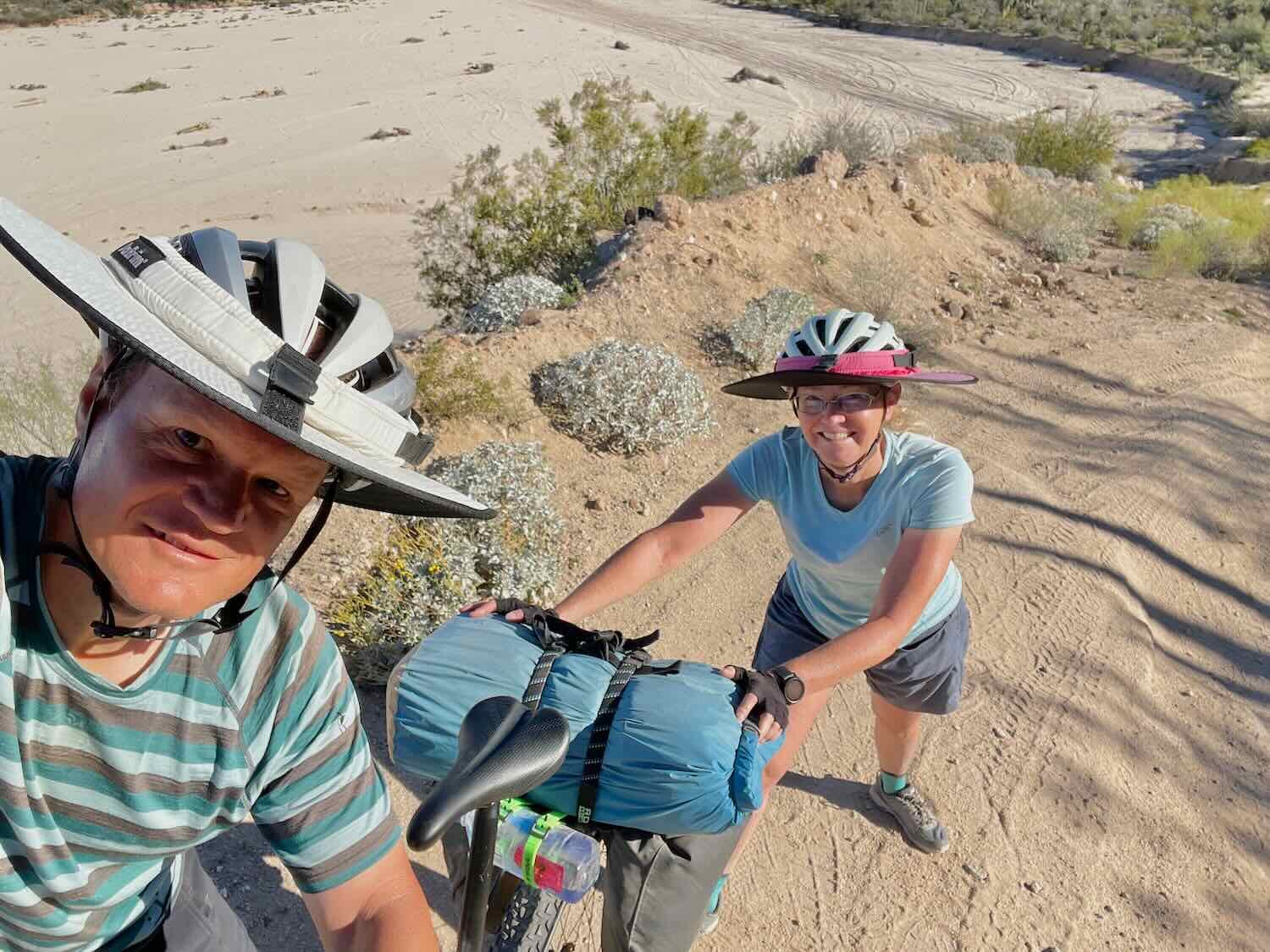
3 - 14 March 2023
Baja Divide Section #9
3 March - Hwy 1 to Bahía de los Ángeles (41.3 mi, 66.5 km)
4-5 March - Layover in Bahía de los Ángeles
Baja Divide Section #10
6 March - Bahía de los Ángeles to Wild Camp W of San Rafael (31.0 mi, 50.0 km)
7 March - Wild Camp S of Bahía de los Ángeles to Wild Camp S of San Rafael (29.0 mi, 46.7 km)
8 March - Wild Camp S of San Rafael to Rancho Escondido (13.4 mi, 21.5 km)
9 March - Rancho Escondido to Rancho Piedra Blanca (20.5 mi, 33.0 km)
10 March - Rancho Piedra Blanca to Wild Camp N of Vizcaíno (31.8 mi, 51.2 km)
11 March - Wild Camp N of Vizcaíno to Vizcaíno (16.9 mi, 27.2 km)
12 March - Layover in Vizcaíno
Baja Divide Section #11
13 March - Vizcaîno to San Ignacio (45.0 mi, 72.4 km)
14 March - Layover in San Ignacio
A Detour to Enseñada
At a tiny, weather-beaten hotel in remote, central Baja, one of PedalingGuy’s teeth started to hurt. So instead of cycling the next leg of the Baja Divide, we switched gears and tried to figure out how to get him to a dentist. Somehow we managed to transport our bikes and ourselves to the bustling port town of Enseñada via a hair-raising, 7-8 hour ride on a regional bus. And in between dental visits in Tijuana and Enseñada, we had the chance to get out and visit this pleasant city by the sea.
Enseñada is a popular port-of-call for cruise ships, with a sprawling tourist district known as the “Baja Riviera.” There, flag-lined promenades lead day-trippers past brightly colored shops where they can can buy t-shirts, sombreros, and fish tacos. We spent an afternoon strolling along this sun-drenched waterfront.
Most of the bigger towns in Baja have one of these signs, proclaiming the name of the town in brightly painted, capital letters. It makes for a good photo op. A giant cruise ship and some big cranes at the seaport are visible in the background. Enseñada, Baja California, Mexico. Copyright © 2019-2023 Pedals and Puffins.
International flags line the walkway outside the city’s cultural museum on the Baja Riviera. Enseñada, Baja California, Mexico. Copyright © 2019-2023 Pedals and Puffins.
A fisherman is one of several figures of historical significance represented by statues along the waterfront. Enseñada, Baja California, Mexico. Copyright © 2019-2023 Pedals and Puffins.
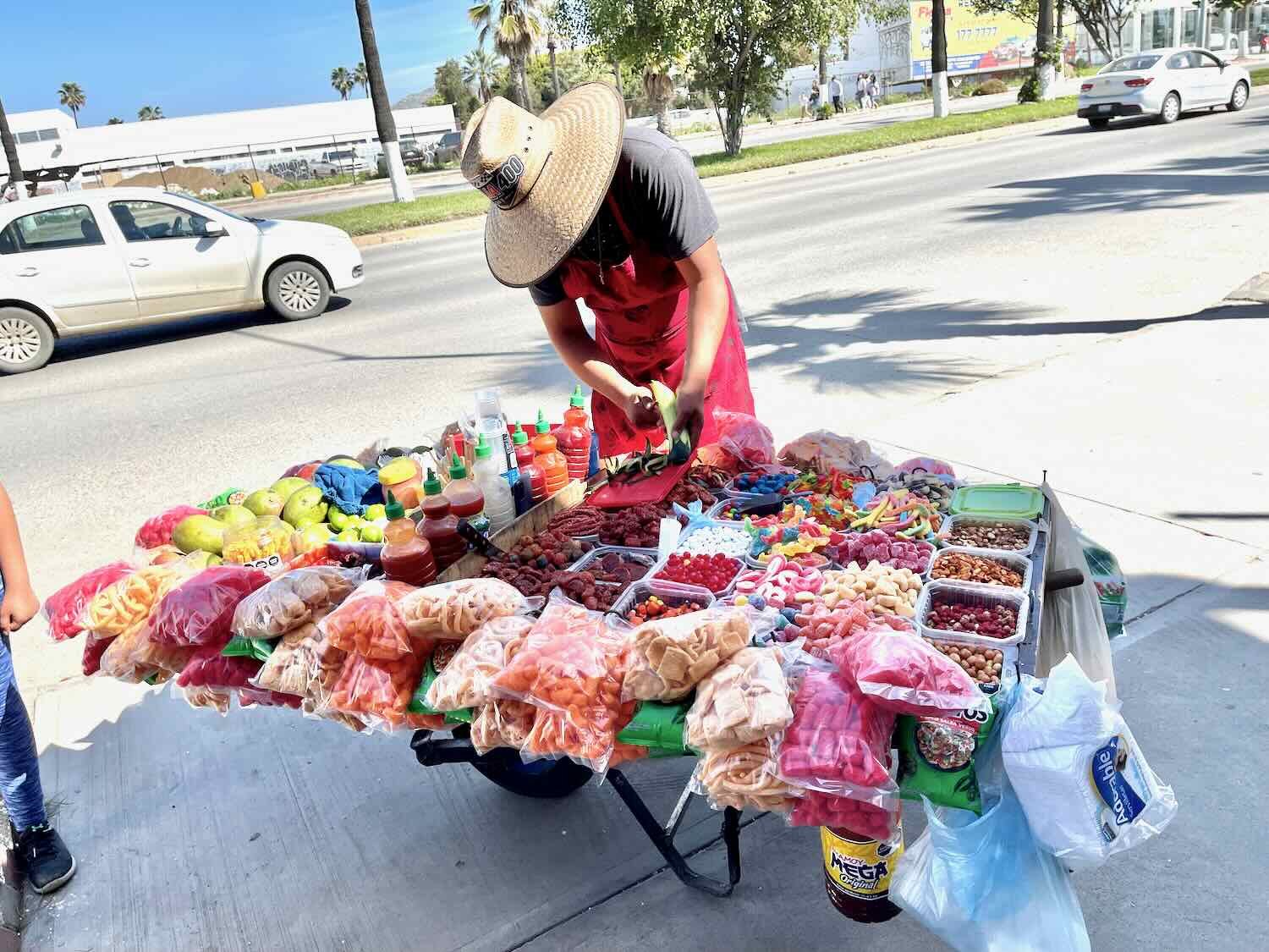
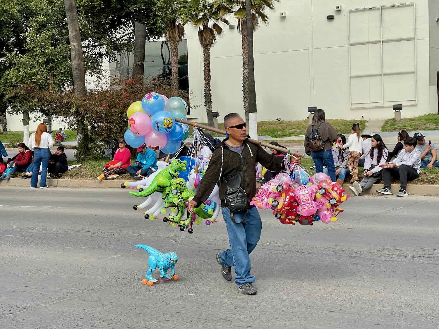
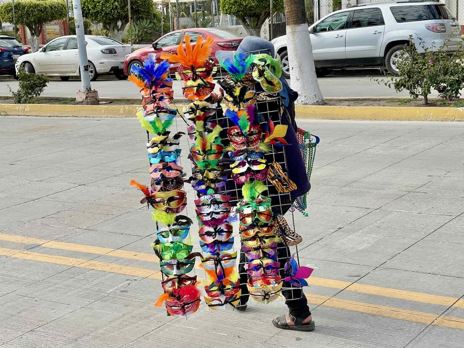
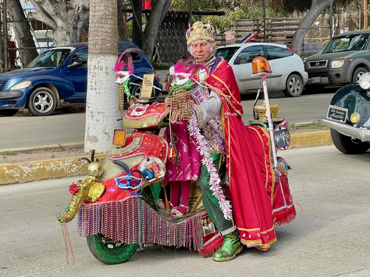
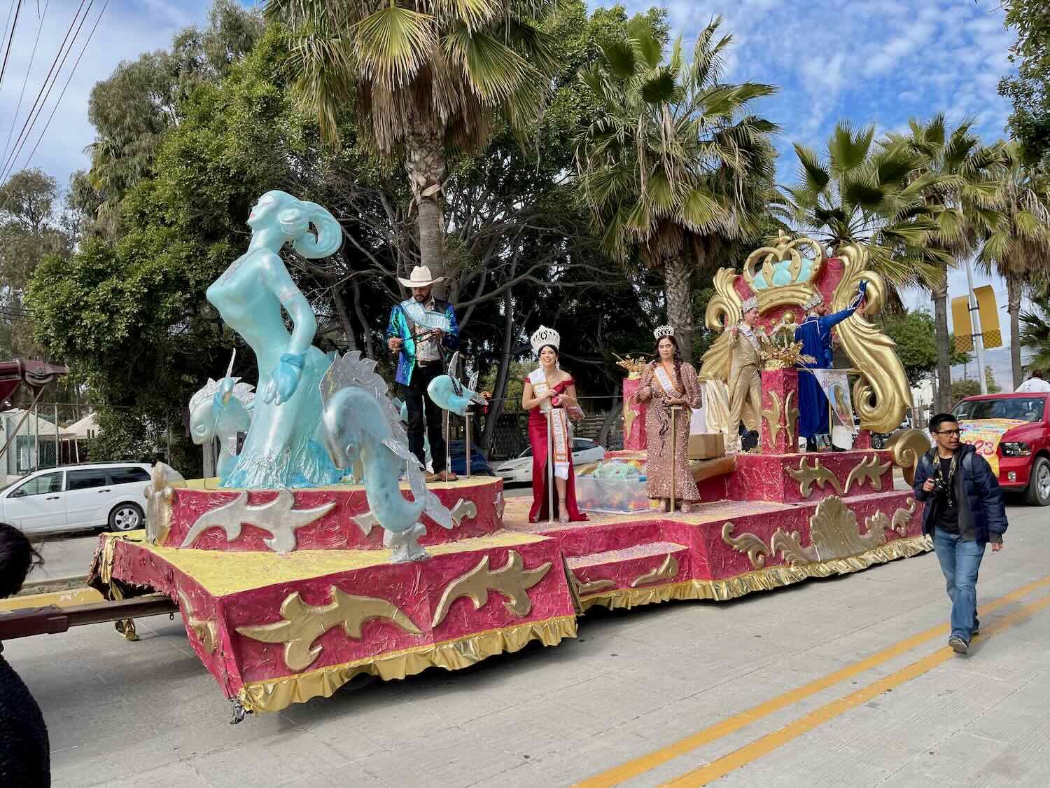
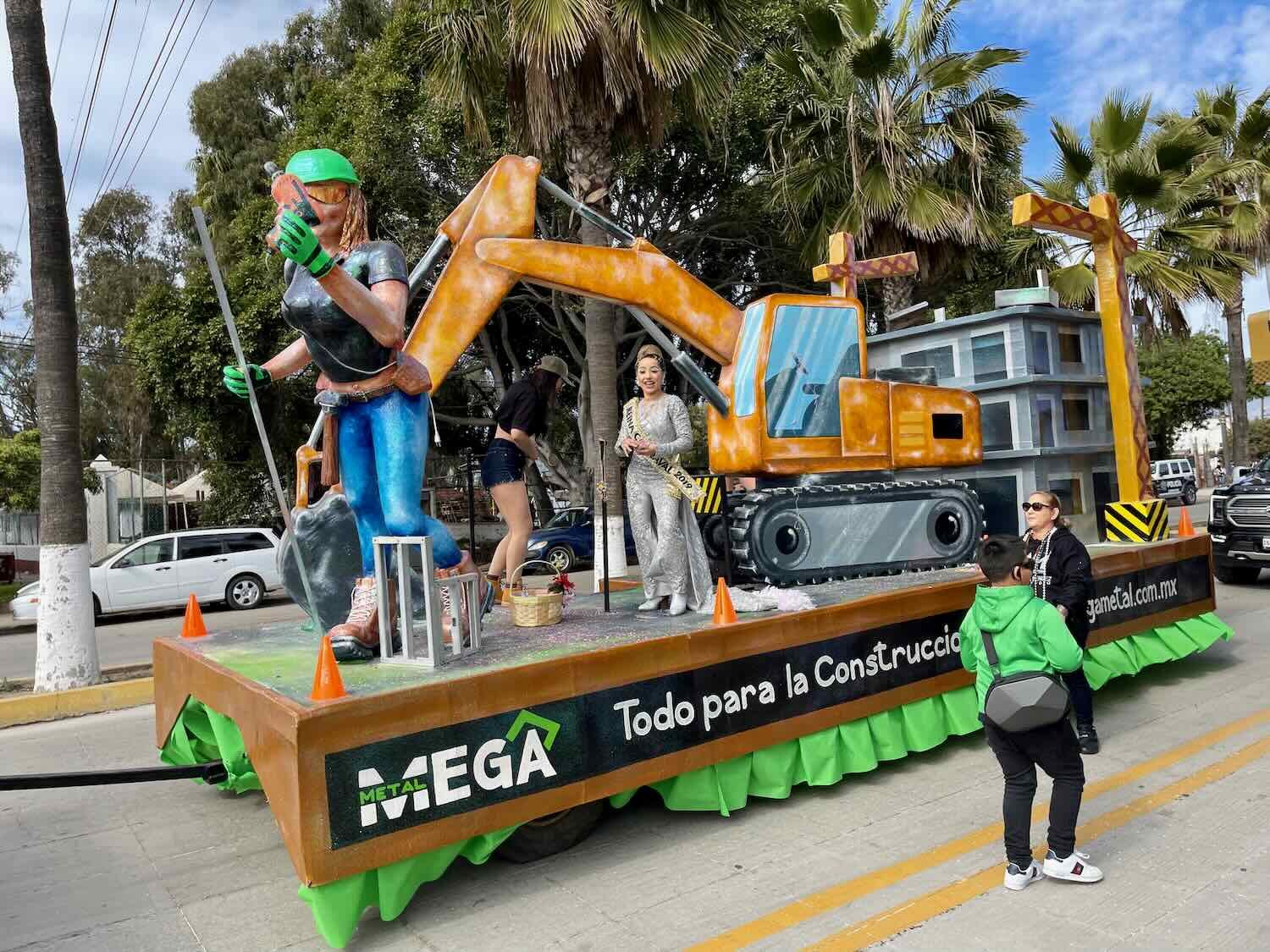
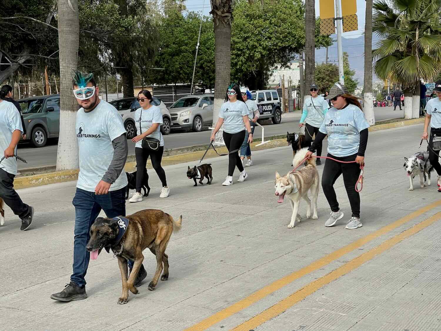
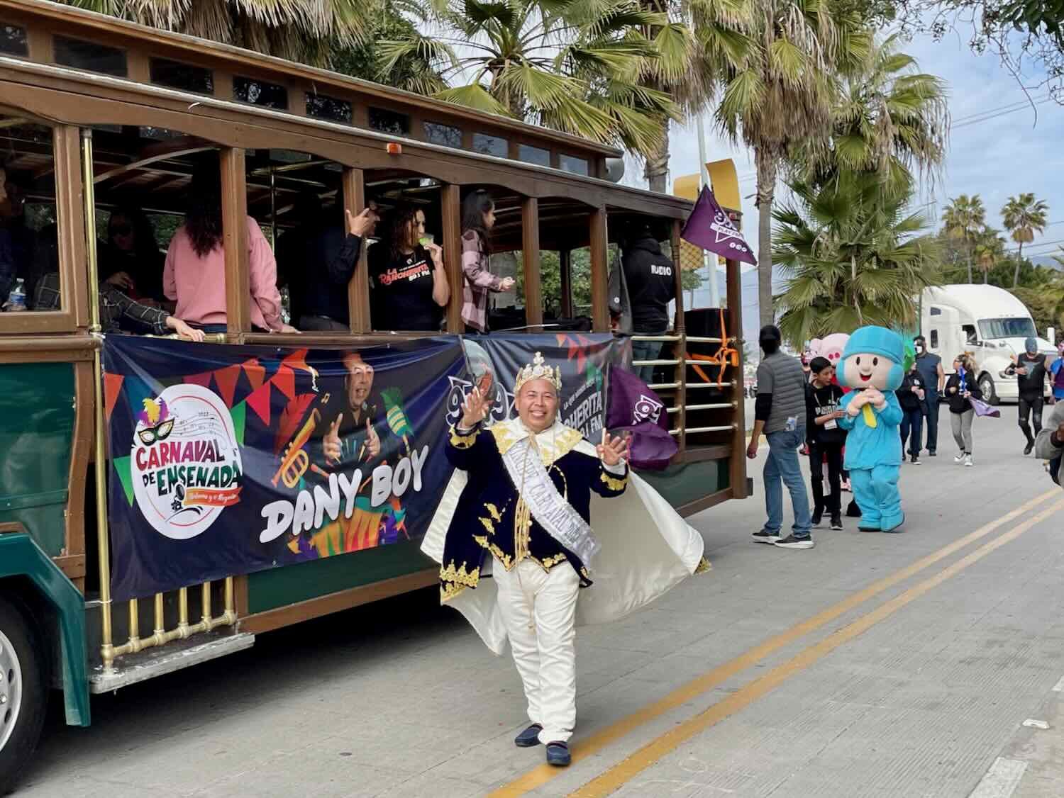
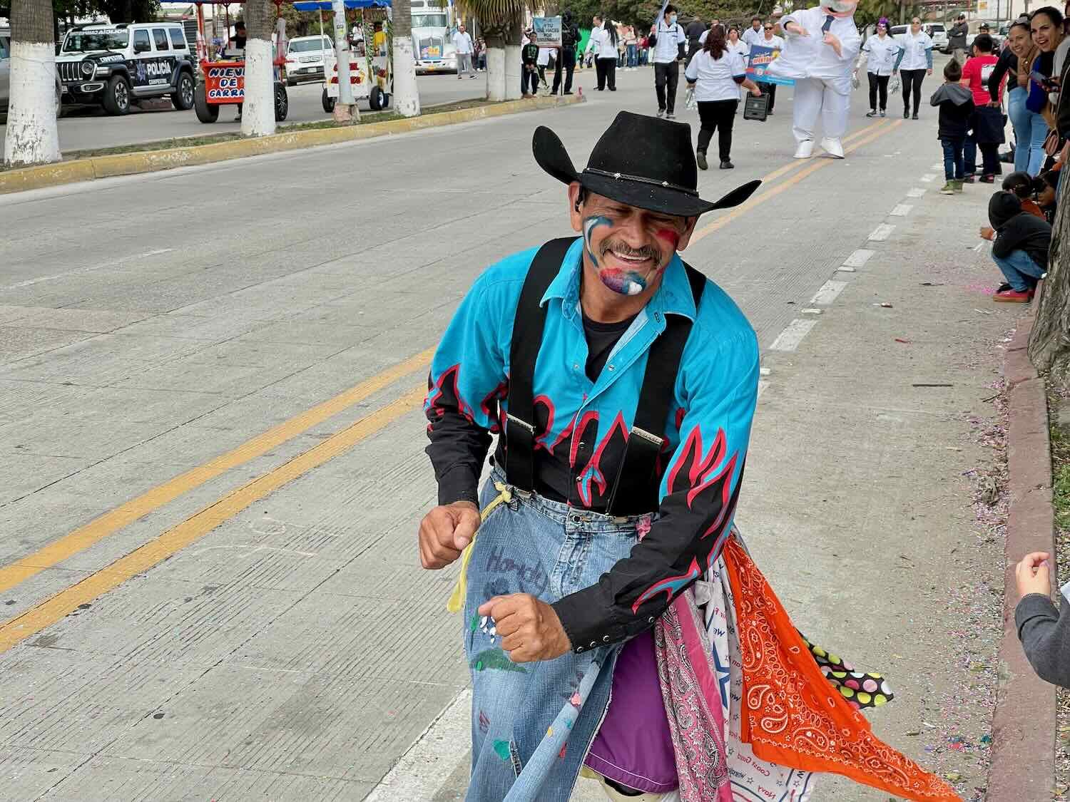
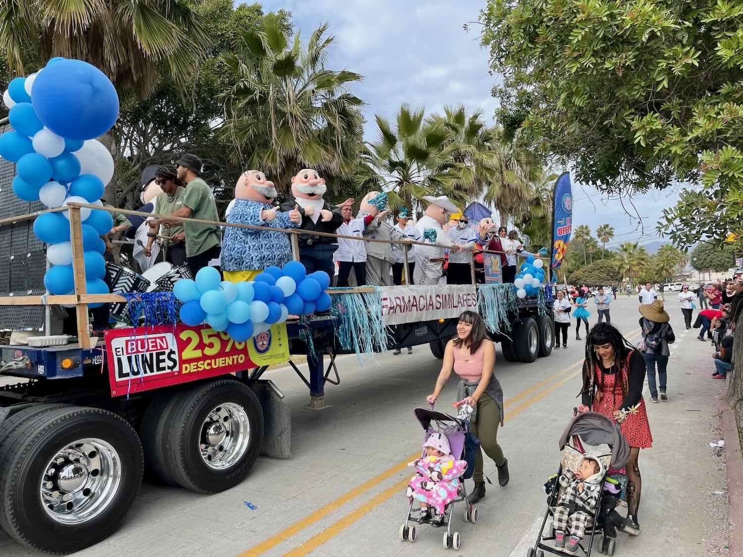
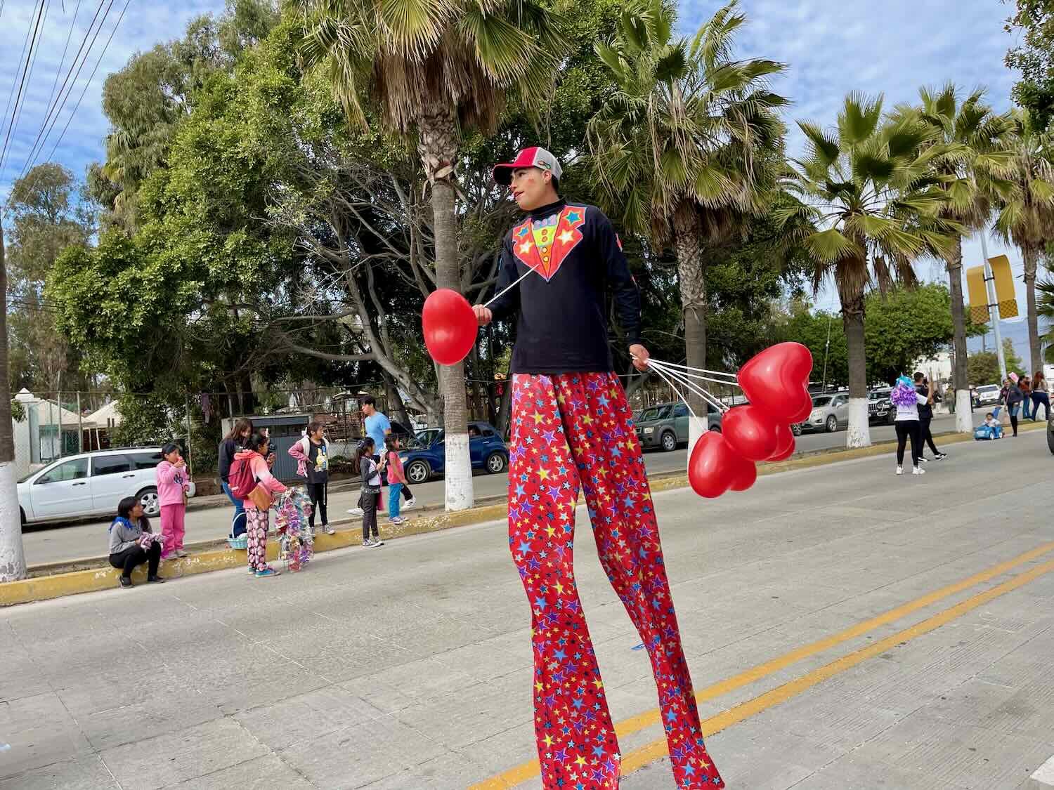
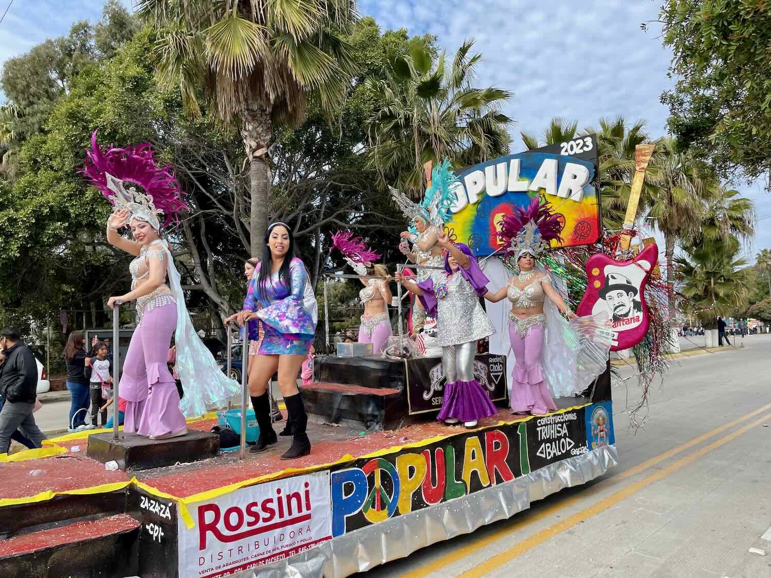
We were fortunate to be in Enseñada for the celebration of Carnaval. The city hosts a four-day celebration, with parades almost every day. We attended the big, final parade on Fat Tuesday, soaking up the party atmosphere. It wasn’t a wild and crazy party like you hear about in New Orleans or Rio de Janeiro. It was more like a big, family birthday party with colorful vendors, floats sponsored by local businesses (and populated with pretty girls), free trinkets thrown to the crowd, clowns and stilt-walkers, and some civic organizations - like a dog obedience school - all participating. Local families lined the sidewalks, buying snacks, and hoping to catch some candy or a necklace thrown from the parade.

Getting Back on Track
After enjoying Ensenada and finishing our dental visits it was time to get back to our bicycle trip. We wanted to pick up where we left off cycling, so we decided that taking a bus back to that point was the best option.
Taking a regional bus in Baja is always an adventure. At least on the return we would not be standing on the side of the highway trying to flag down a passing bus in the dark (as we did on our way up to Enseñada). We actually would have the luxury of boarding a bus at the main bus terminal in the city.
But there’s always a catch. Just like before, our bus would depart late at night, and arrive in the wee hours of the morning - including a queasily sleepless night in between. Fortunately, our Enseñada hotel graciously let us remain in our room until 3:30pm. But that still left us waiting for 5+ hours in the less-than-cozy bus terminal. Moreover, the bus was late (not really a surprise). So boarding didn’t begin until around 9pm.
But that turned out to be the least of our problems. The bus was carrying some kind of shipment. So most of the luggage compartments were already full of big, cardboard boxes when the bus arrived, even before boarding any passengers. As a result, all of the passengers’ luggage from the full-to-capacity bus had to be crammed into the wildly-insufficient remaining space. One look at us, and the bus driver told us flatly that our bikes could not be accommodated. Period. We’d have to wait for another bus, which wouldn’t leave until some time the next day.
This was bad news. We did not have a hotel room we could go back to for the night and Ensenada is a rather large city without any camping nearby. We did not look forward to spending the night in the bus station. Plus, it wasn’t clear we’d get our money back from the missed ride. We were determined to get on that bus.
Hope arrived in the form of a luggage handler at the station, who said that he could get our bikes onto the bus. He repeated this a couple of times, even though the bus driver continued to insist that he was not going to allow it. It was clear that the bus driver was the final word on such matters. But after much haggling, the bus driver agreed to let us work with the luggage handler to load our bikes onto the bus in exchange for an unseemly amount of “fees,” paid directly to the bus driver, of course.
We were well aware at the time that this may have been a well-practiced shake-down. But we also knew that the official policy of the bus company was to not allow unboxed bikes on board (even though it is often allowed informally). The full luggage compartment, combined with all the extra time and effort required to get the bikes loaded, was the perfect excuse for the extra fees whether they were legit or not. It was frustrating, but it still was worth the expense to keep our plans on track.
To make it work, we had to remove both the front and back wheels. Then, with considerable effort and shuffling of luggage, our bikes were crammed in on top of all the other bags. This was definitely one of those times when we were glad we had Rohloff internal gears, instead of standard derailleurs - which would have been at high risk of getting bent out of shape from all the rough handling. As it was, we spent a good bit of time on the bus worrying about which, and how many, components of our bikes or gear would be broken upon arrival. Adding to our fears, we noticed that not all of the latches on the luggage compartment doors were working properly. Some of the doors did not latch securely. So when the bus cornered, the doors would open a little and then slam shut, making us wonder if there was some chance a bike would dislodge and fall out.
After the chaos of loading all our stuff into the luggage compartments, we collapsed in our seats on the bus, ready to rest. But sleep was elusive for both of us. Maybe it was because the bus was so far behind schedule. It felt like the bus driver was sprinting down the highway, taking every turn and hill with the gusto of a Baja 1000 racer. Even though we were in the second row from the front, our seats swayed and rumbled, tossing our bodies from side-to-side as we tried to relax. We both felt ill, and just tried to survive the night while hoping that the bus driver would remember to stop at the spot in the desert where we wanted to get off. The additional complication of a driver shift change (including a new driver replacement) in the middle of the night did not reassure us.
Seven hours later, to our great relief, we were dropped off in the pre-dawn darkness at a road junction in the middle of the desert. After unloading two bikes, four tires, and two backpacks from the luggage compartments we checked, and double-checked to make sure we had all our stuff. Then the bus bounded off down the highway. We were alone, in the darkness at 4:30am in the morning, and the “24 hour” truck stop at the intersection was closed.
As we fumbled to put the tires back on our bikes in the dim light of our headlamps, we heard strange, screeching noises overhead. Looking up, we saw several large birds swooping through the air. A family of great-horned owls, including some screechy juveniles, seemed none too pleased that we were creating a disturbance in their quiet neighborhood. Several times the birds flew in an arc above our heads, checking us out and discussing among themselves what these strange humans might be up to.
Once we got the wheels on the bikes, we rolled them away from the edge of the highway and over to the patio in front of the truck stop. We were delighted to find that as we got close, a motion-sensor triggered a floodlight to come on and illuminate the patio. Light! It made the re-packing of our bikes a whole lot easier. Before the bus trip we had rearranged the contents of all of the panniers to better survive the ordeal. And now we had to basically unpack nearly every bag, and reload our gear for bike travel. The whole process took a couple of hours.
The truck stop finally opened at 7am, just as the sun was rising. It was one of numerous Pemex stations (the government run oil company) that aren’t fully operational. Some sell gas but the associated store is not open. Others are totally shuttered. This station did not have working gas pumps, but the store was open. Basically, there was one small cooler with drinks and a few shelves with snacks. We gratefully helped ourselves to some cookies and orange juice. Fuel for the road.
While we were savoring our calorie-rich breakfast on a bench outside the truck stop, a guy rolled up in a pickup truck with barrels of gasoline in the back. After setting up his mobile gas station by the highway, he came over to visit with us. We learned that he was from Punta Prieta (pop. 135) about eight miles away. He told us that he liked living in a small, remote town because there were fewer problems, mainly because there were less people. As far as he was concerned, cities were too crowded. He encouraged us to continue traveling through the backcountry, because that would be where we would find happiness.
When we finally shoved off down Hwy 12 toward Bahía de los Ángeles, we were blown away by the beauty of the central Baja desert. You could almost call it lush. The land was covered with a huge variety of robust, pale green cacti and shrubs. All of our favorite endemic plants including the wacky cirios, Baja yucca trees, cardón cactus, and Shaw’s agave were abundant. And we spotted half a dozen different kinds of cholla cactus. One, in particular, caught our eye. Its most striking feature was the length of its vicious-looking spines, which were about two inches long. It turned out to be aptly named the long-spine cholla, and it’s another species found only in Baja. We got close enough to take a photo, but not so close as to risk getting impaled on those fierce-looking spines.
An impressively diverse array of cacti line the highway to Bahía de los Ángeles. Near the junction of Hwy 1 and Hwy 12, Baja California, Mexico. Copyright © 2019-2023 Pedals and Puffins.
The 2-inch long spines of the long-spine cholla (Baja endemic) stand out as looking particularly fierce, even among the many thorn-covered plants found in the Baja desert. Near the junction of Hwy 1 and Hwy 12, Baja California, Mexico. Copyright © 2019-2023 Pedals and Puffins.
The desert was also full of birds. PedalingGal was transfixed by a huge flock of little birds that turned out to be lark buntings, visiting Baja for the winter. Near the junction of Hwy 1 and Hwy 12, Baja California, Mexico. Copyright © 2019-2023 Pedals and Puffins.
We were both feeling tired from the exhausting bus ride and not sleeping during the previous 24 hours. Even so, the road to Bahía de los Ángeles ended up being one of our favorite stretches of highway in Baja. The road surface was smooth and in great condition. Only a handful of cars passed us all day, so it was like having a wide, smooth bike path all to ourselves. We stopped often to admire the scenery and just soak up the beauty - without having to worry about even pulling off to the side of the road. And although we climbed over 1,300 ft (400 m), the gradients were very gentle most of the way. We cruised along at a brisk pace, through dense forests of cirios, with the rugged central peninsular mountains framing every view.
A thick forest of cirios and cordon cactus with Baja’s central mountains in the background. Hwy 12, Baja California, Mexico. Copyright © 2019-2023 Pedals and Puffins.
Along the way we spotted a herd of wild burros, believed to be descended in large part from the original donkeys imported by the Spanish missionaries in the 16th century. The little one is, of course, a burrito. Hwy 12, Baja California, Mexico. Copyright © 2019-2023 Pedals and Puffins.
About half-way through the ride we descended into an immense valley with almost no vegetation in its bowl. It appeared to be a huge, dry lake bed. Below the surface, a large aquifer provides most of the municipal water for Bahía de los Ángeles. Valle Agua Amarga, Baja California, Mexico. Copyright © 2019-2023 Pedals and Puffins.
As we descended from the ridge of the central mountains, we approached the Gulf of California for the first time on this trip. The landscape became drier and the vegetation got scruffier. We had entered the Gulf of California Xeric Scrub ecoregion. You might expect that a drier habitat would have more cacti, but it was just the opposite. The rich abundance of cactuses was replaced with patchy, tough-looking shrubs and a whole lot of bare sand.
With just under 10 miles (16 km) to go, we crested the last ridge and got our first view of the magnificent bay in the Sea of Cortez. The water seemed to glow a bright, royal blue, offset by the sandy whites and pale gray-green of the surrounding landscape. Looming on the horizon was the massive, uninhabited, Isla Angel de la Guarda (Archangel Island).
We barreled down the steep descent into Bahía de los Ángeles, eager to settle in and enjoy the laid back vibe of this decidedly off-the-beaten-track town.
With a gradient of 8%, the descent into Bahía de los Ángeles is fast and fun. In our eagerness to reach the town, we hit speeds of nearly 40mph (64kph). Bahía de los Ángeles, Baja California, Mexico. Copyright © 2019-2023 Pedals and Puffins.
Birds, Whales and Sea Lions
After a relaxing evening and catching up on our sleep, we were ready to explore the quaint and rustic town of Bahía de los Ángeles (pop. 781). It’s definitely off the beaten path. There are no other towns or services of any size along the entire 40+ mile (64 km) road from the Transpeninsular Highway (a.k.a., Hwy 1). And the nearest town of significance is more than 120 miles away (193 km). Electricity finally made it to Bahía de los Ángeles in 2007, and only the main street through town is paved - the rest are pretty rough dirt roads.
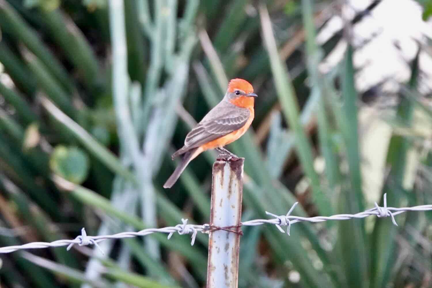
We began our visit with a leisurely walk along a few of the back-roads. Low-slung, sun-baked residences sprinkled the foothills of the mountains that rise out of the sea. Along the way, we spotted an impressive variety of birds and other animals among the cactus gardens. There were many signs that the villagers are proud of their natural heritage. In the heart of town, images of local wildlife appear everywhere. And the local natural/cultural history museum houses an impressive array of artifacts including a collection of more than 500 species of seashells found in the Gulf of California.
Our hotel was located in the mountain foothills, providing us with a gorgeous, panoramic view of the bay. Bahía de los Ángeles, Baja California, Mexico. Copyright © 2019-2023 Pedals and Puffins.
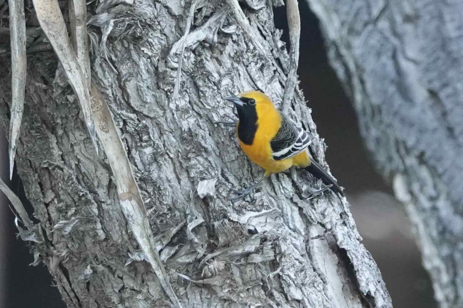
Images of local wildlife were common in the town. This mural of a blue-footed booby (bobo pastas azules) whetted our appetite for seeing some of these goofily charming seabirds for ourselves. Bahía de los Ángeles, Baja California, Mexico. Copyright © 2019-2023 Pedals and Puffins.
Skeleton of a whale at the town’s natural history museum. Bahía de los Ángeles, Baja California, Mexico. Copyright © 2019-2023 Pedals and Puffins.
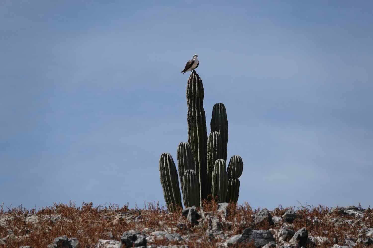
A turkey vulture atop a cardón cactus. Bahía de los Ángeles, Baja California, Mexico. Copyright © 2019-2023 Pedals and Puffins.


A very cool rendition of a whale shark. We liked how they used small stones to represent the spots on its body. Unfortunately, we visited at the wrong time of year to see this species. Whale sharks are only present here from August to November. Bahía de los Ángeles, Baja California, Mexico. Copyright © 2019-2023 Pedals and Puffins.
Perusing the menu at a taquería in town. There were only a couple of simple restaurants, but all the food we had was delicious. Bahía de los Ángeles, Baja California, Mexico. Copyright © 2019-2023 Pedals and Puffins.
All of the emphasis on nature and wildlife got us thinking about how we could see some more of it for ourselves. Our hotel host connected us with Sergio Navarro of Capitán Rojo Ecoturism, who is a certified boat tour guide. We arranged to stay another day so that we could go out with Sergio in his panga boat.
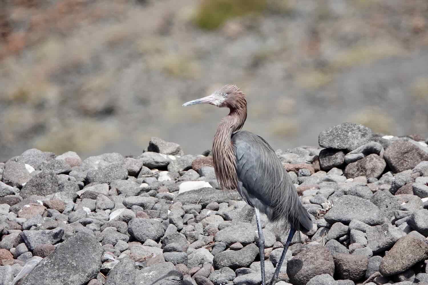
The next day we spent a fabulous four hours with Sergio, exploring the islands and waters out in the bay. Highlights included an extended visit with a young humpback whale, and stops at a couple of blue-footed booby colonies. But those were just the icing on the cake. We saw dozens of other species of birds, a few sea lions, and the stunning geology of the gulf islands. It was a wonderfully memorable day.
PedalingGal and Captain Sergio heading out to sea. Bahía de los Ángeles, Baja California, Mexico. Copyright © 2019-2023 Pedals and Puffins.
PedalingGuy ready to take some photos. Bahía de los Ángeles, Baja California, Mexico. Copyright © 2019-2023 Pedals and Puffins.
This young humpback whale fed in the deep waters of the bay as we floated in a panga nearby. Bahía de los Ángeles, Baja California, Mexico. Copyright © 2019-2023 Pedals and Puffins.
Most of the islands in the bay had very little vegetation. There were lots of exposed, rocky outcrops dotted with a few, hardy cacti, which grow even more slowly on these islands than on the mainland because of the very thin soils. Bahía de los Ángeles, Baja California, Mexico. Copyright © 2019-2023 Pedals and Puffins.
A blue-footed booby! These birds are a joy to see, with their striking, sky-blue feet. We saw hundreds of them circling above and resting on several rocky cliffs. Bahía de los Ángeles, Baja California, Mexico. Copyright © 2019-2023 Pedals and Puffins.


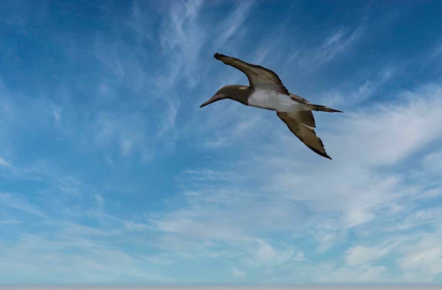
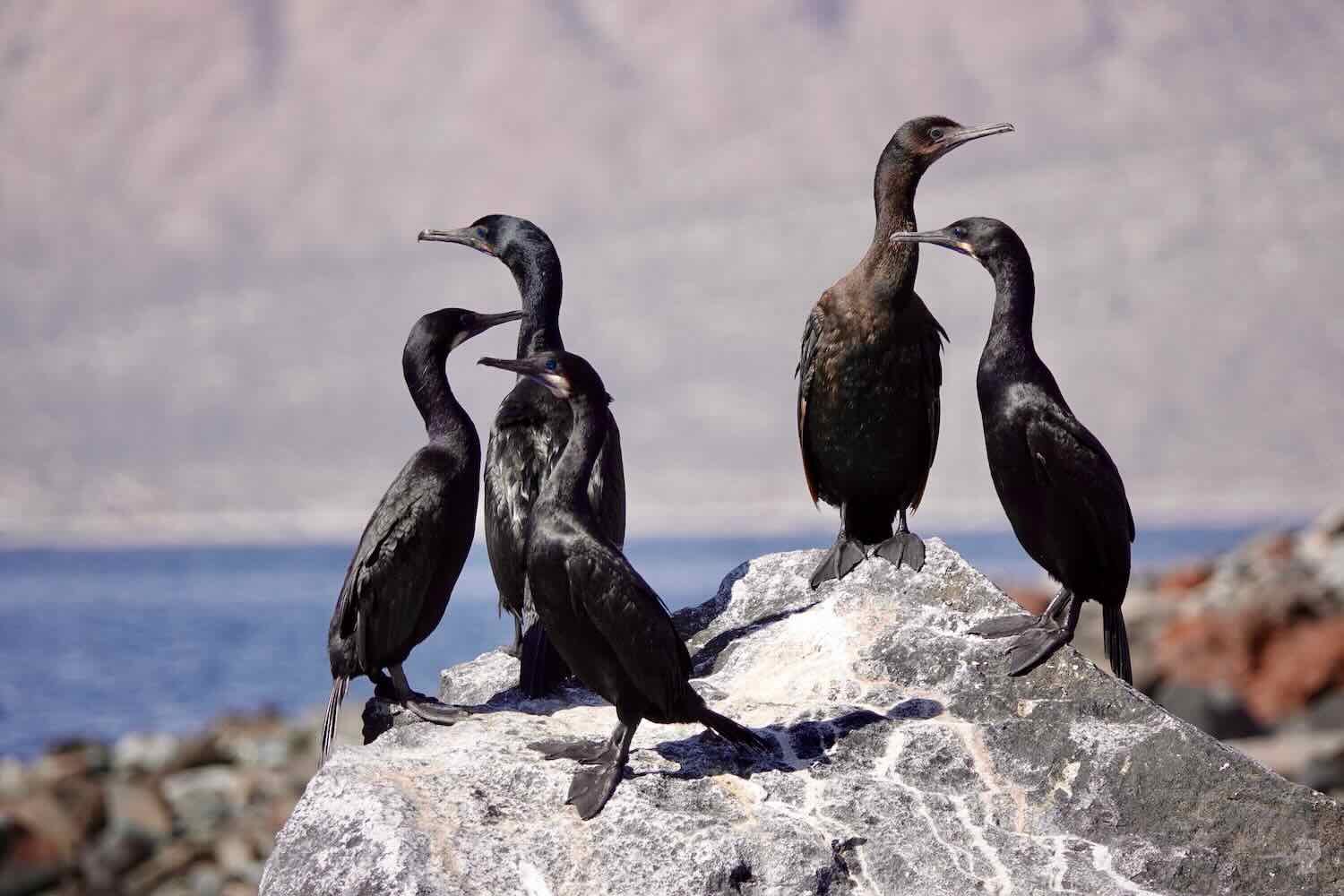
Click through this gallery of photos to see some of the other birds we encountered.
A small colony of great blue herons was a bit of a surprise. Several pairs had nested in some scruffy bushes growing on a cliff. They were still courting, giving us a chance to see a more intimate side of their behavior than unusual. Bahía de los Ángeles, Baja California, Mexico. Copyright © 2019-2023 Pedals and Puffins.
These California sea lions were huddled together, raising their flippers out of the water (possibly trying to warm themselves). It looked like they were waving to us. Bahía de los Ángeles, Baja California, Mexico. Copyright © 2019-2023 Pedals and Puffins.
Several of the islands had interesting stone formations. Window Rock (La Ventana), is one of the most famous. Bahía de los Ángeles, Baja California, Mexico. Copyright © 2019-2023 Pedals and Puffins.
Many of the islands in the bay also displayed striking, brightly-colored layers of rock. Bahía de los Ángeles, Baja California, Mexico. Copyright © 2019-2023 Pedals and Puffins.
Into the Land of Sand
The day after our boat trip we departed Bahía de los Ángeles.
Up to this point, most of the cycling we had done on the Baja Divide had been on rocks and gravelly surfaces. There had been some sections with sand. But those were relatively short, on hard-packed beaches, or had fairly shallow sand. That was about to change. The section of the Baja Divide south of Bahía de los Ángeles is famous for its long stretches of deep sand. Our three-inch wide tires were about to earn their keep.
Furthermore, we were now far enough south that the days were getting quite hot - especially in the afternoons - requiring us to carry more water. So although the distances between water refill spots was pretty reasonable (about 72 mi, or 116 km at the longest), we would be drinking a lot more water over that distance than we had further north, where it was cooler. Before heading out of town, we loaded up with 20 liters of water (10L each).
For the first five hours, we rode southward on a long, gentle, uphill climb on a wide and well-used dirt road. We took our time, enjoying the sensation of being out in the backcountry once again. On the first day out, we encountered quite a bit of sand, but it wasn’t too deep. We were able to ride through all of it without much trouble.
The change in vegetation from the central desert was really striking. Cacti were much less common. There were lots more ocotillos, palo verde, and creosote bushes. We were particularly happy that the palo verde trees grew big enough to provide shade along the side of the road - a huge bonus on hot afternoons. They became our new, favorite tree.
The Cucurbita cordata melon is another plant endemic to Baja. It’s closely related to the coyote melon found in the southwestern USA. South of Bahía de los Ángeles, Baja California, Mexico. Copyright © 2019-2023 Pedals and Puffins.
In the late 19th century, gold and silver were mined in the mountains around Bahía de los Ángeles. One of the most productive mines was about 11 miles south of town, with its headquarters at Las Flores - now a ghost town along our route. We stopped to check out the old jailhouse, which has survived the years because of its sturdy, stone construction.
PedalingGal in the jail. Las Flores, south of Bahía de los Ángeles, Baja California, Mexico. Copyright © 2019-2023 Pedals and Puffins.
Looking back at the wide and relatively well-maintained road through the desert. We climbed steadily uphill for five hours through the Valle de las Flores. South of Bahía de los Ángeles, Baja California, Mexico Copyright © 2019-2023 Pedals and Puffins.
Of all the sections of the Baja Divide that we have cycled so far, this one seemed to be the most popular with overlanders - almost certainly because the road was actually drivable by most 4x4 high-clearance vehicles. Early in the day we were passed by several travelers in truck campers and locals in work trucks. A couple of them stopped to ask if we needed water. But we had just left Bahía de los Ángeles fully loaded with water, and a layer of clouds kept things pleasantly cool in the morning. Since water is extremely heavy, and we didn’t want to carry any more weight at that point, we declined.
Approaching the top of the pass between Bahía de los Ángeles and San Rafael, with the San Juan Mountains ahead. South of Bahía de los Ángeles, Baja California, Mexico. Copyright © 2019-2023 Pedals and Puffins.
But later the clouds dissipated and it got really hot. We drank our full allotment of water for the day, and wondered aloud when someone might come along with a generous offer of water. Alas, it was not to be. We didn’t see anyone else for the rest of the day.
Just after cresting the pass and beginning our descent into the Valle Las Animas, we stopped for a break in the shade of a big palo verde tree. Cookies, gorp, and a salt tablet (to replace electrolytes lost through sweating) helped revive our strength. South of Bahía de los Ángeles, Baja California, Mexico. Copyright © 2019-2023 Pedals and Puffins.
After a couple more hours of cycling, we started looking for a place to camp. But the vegetation was pretty dense, and there weren’t a lot of options to choose from. In the end, we decided to camp on a sand bar within a dry arroyo. The bigger trees along the dry watercourse helped to hide our camp from the road. And the bare soil gave us enough space to avoid all the spines that the plants use to impale careless humans, or puncture holes in air mattresses. There didn’t seem to be any risk of rain, so we figured that camping in the arroyo was probably okay, even though we normally would avoid doing so given flash flood risks.
Our campsite in a sandy arroyo. South of Bahía de los Ángeles, Baja California, Mexico. Copyright © 2019-2023 Pedals and Puffins.
During the night we heard lots of soft, scuffling noises rustling around nearby. The stream banks were dotted with little holes and it sounded like the residents, probably mice, were out and about. The other noise in the night was the coyotes. Lots of them. They called off and on all night, sometimes quite close to the tent. We figured that they were annoyed at us for camping in their arroyo, and keeping them away from a mousey dinner.
Towards morning, we heard raindrops on the tent. It was a big surprise. And even though it was just a brief, light drizzle, it got both of us thinking about the fact that we had taken a chance by camping in the arroyo. A drizzle in the valley can be accompanied by stronger rains up in the mountains - and lead to rapidly rising water in dry, desert river beds. It was a friendly reminder by Mother Nature that we really should be more careful. Luckily, the drizzle passed quickly, and didn’t result in any flooding.
It had been a warm night, making it easy to get up and out on the road early - which also helped by giving us extra time to ride in the cooler morning hours.
At first the cycling remained pretty easy, with good road conditions over relatively flat terrain continuing for more than an hour. It was very scenic, with rocky hills surrounding the valley. Before long we spotted the Gulf of California in the distance as we headed back towards the sea.
Descending out of the hills, towards the sea. Northwest of San Rafael, Baja California, Mexico. Copyright © 2019-2023 Pedals and Puffins.
Circling back to the Gulf of California, just visible in the distance. On overcast days the water does not take on its deep blue color. West of San Rafael, Baja California, Mexico. Copyright © 2019-2023 Pedals and Puffins.
Mid-morning we were passed by a very large group of trucks traveling together - all Ford Raptors of various colors. The Raptor is one of Ford’s top off-road vehicles, and it appeared these guys were putting their equipment to the test. Baja has a long history of off road racing and has been a proving ground for testing new and better off-road vehicles. We had seen this group before, back in Bahía de los Ángeles. They all stayed at the same hotel, using it as a base for their backcountry adventures. All 11 of them zoomed past us very fast, kicking up a big cloud of dust.
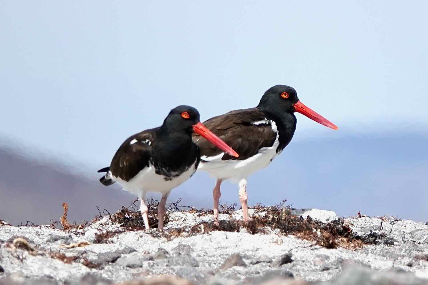
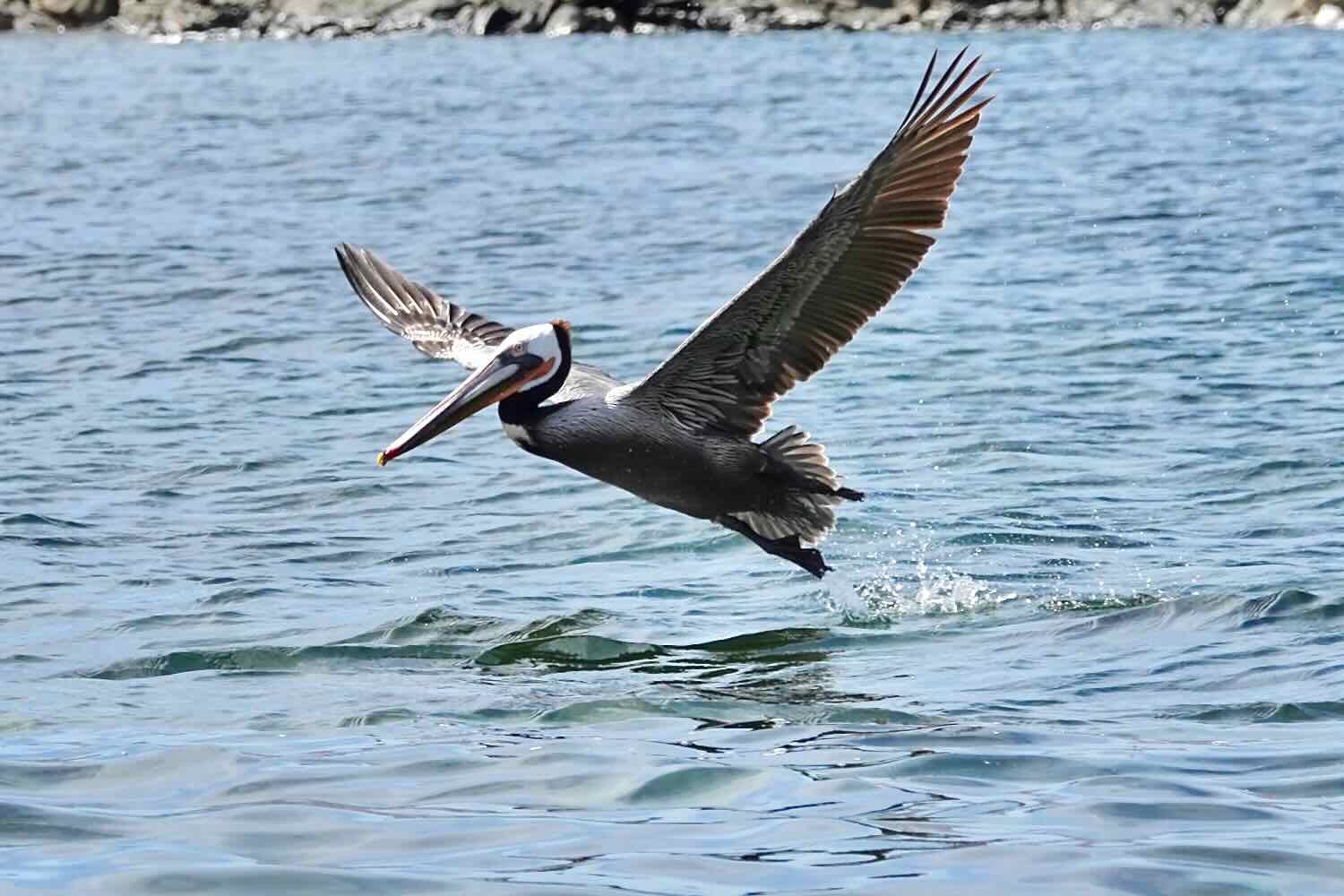
As we approached the tiny fishing village of San Rafael (pop. 3), we were surprised to see a big, wet, marshy area on both sides of the road. It was the mouth of the Arroyo El Alumbrado, where it empties into the sea. It seemed incongruous in the desert. But the birds obviously loved it. There were sandpipers, ducks and egrets poking around on the mud flats among the marsh grasses.
Western sandpipers feeding in the marsh. San Rafael, Baja California, Mexico. Copyright © 2019-2023 Pedals and Puffins.
We spotted the rainbow-colored line of Ford Raptors that had passed us earlier, perched on the beach. San Rafael, Baja California, Mexico. Copyright © 2019-2023 Pedals and Puffins.
Once we passed San Rafael, the cycling got harder. There were some steep, rocky hills that soon morphed into a long, steady climb with lots, and lots, and lots of sand - sometimes alternating with mushy gravel. Our pace slowed dramatically. There were no clouds, so it also got very hot. Cycling in the sun was incredibly tiring, so we took frequent breaks in whatever shade we could find.
Trying to cool off in a small but welcome patch of shade. South of San Rafael, Baja California, Mexico. Copyright © 2019-2023 Pedals and Puffins.
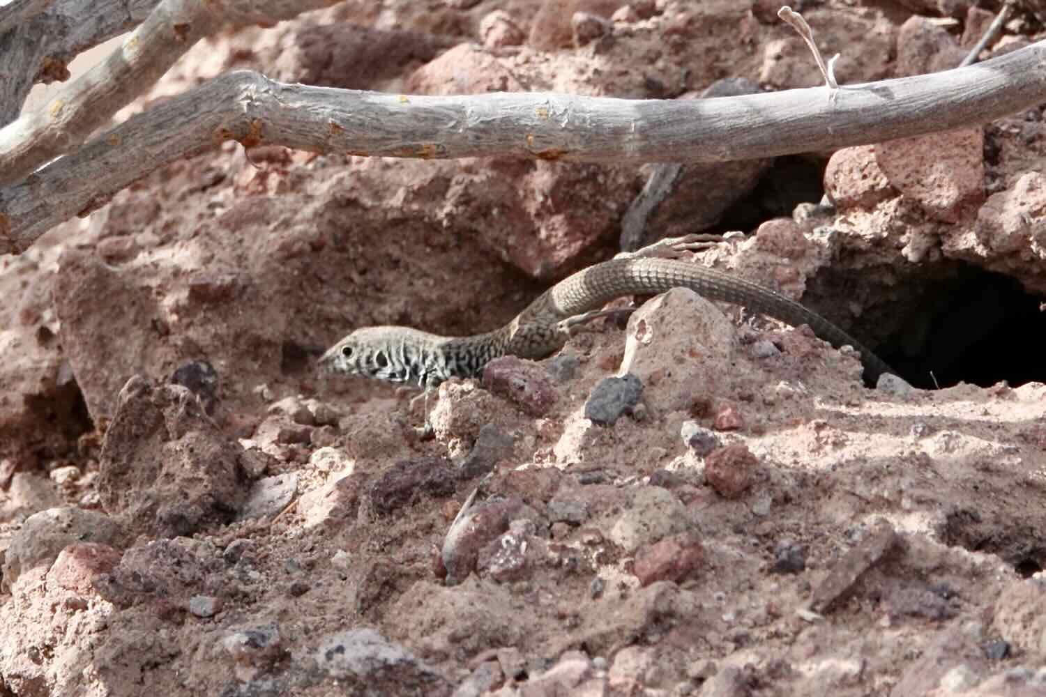
The heat didn’t seem to deter the wildlife, though. We saw several coveys of California quail. They’ve been fairly common at some points along the Baja Divide, but they’re extremely skittish. We rarely have gotten close enough to get any photos. This was our lucky day. We also spotted a western whiptail lizard lurking in the shade.

Cycling through the ever-deepening sand. South of San Rafael, Baja California, Mexico. Copyright © 2019-2023 Pedals and Puffins.
As we gained elevation, cacti once again became more common, and the shady palo verdes became more rare. Even with all the sand, we covered more miles for the day than we had originally planned, which was great. However, the last few miles were very, very hard in the hot sun and sand. Toward the end of the day we stopped every mile for a break in the shade. We also lamented the fact that once we passed San Rafael, we didn’t see a single car or truck. Yesterday, three different vehicles had stopped to offer us water. Today, none.
We set up camp in the desert with a sweeping view of the Sierra Giganta mountains to our west. From our campsite, the land sloped gently into a valley. In the distance, the ridges of mountains faded away in shades of blue.
From our campsite we could see the ridges of the Sierra Giganta fading away into the distance. South of San Rafael, Baja California, Mexico. Copyright © 2019-2023 Pedals and Puffins.
Two Ranches In the Desert
By the time we got rolling the next morning it was already quite warm. It wasn’t long before we were cycling in our short sleeves and shorts. All indications were that it was going to be a really hot day. For about an hour the conditions remained pretty much like the day before - tons of sand and washboards with a gentle uphill gradient.
Cycling through the bumpy sand. South of San Rafael, Baja California, Mexico. Copyright © 2019-2023 Pedals and Puffins.
But one thing you can count on while cycling the Baja Divide is that whatever the conditions are on the road at any given time, they will likely change radically before too long. In this case, the road started a serious climb toward the top of a pass through the mountains. The gradient kicked up significantly, and we had to contend with loose rocks on the climb. There were even a few switchbacks, which was an indicator of just how steep the ridge had become. The view back down the valley was impressive.
Our road, clinging to the side of a hill as it heads for the pass. We were unfortunately going in the upward direction. South of San Rafael, Baja California, Mexico. Copyright © 2019-2023 Pedals and Puffins.
Hike-a-bike up the final, rocky ascent to the top of the pass. South of San Rafael, Baja California, Mexico. Copyright © 2019-2023 Pedals and Puffins.
The first couple of miles of descent from the pass were treacherous, covered with loose rocks mixed with sand. But pretty soon the road leveled out again and we were able to relax. And before we knew it, we had reached the remote intersection with the road that headed to Rancho Escondido. We were actually surprised by how close we were, because the intersection came up about a mile before we expected it - always a nice surprise. At this rate we would arrive at the ranch before 11am, well before the worst heat of the day.
A welcome sign in the desert. Approaching Rancho Escondido, Baja California, Mexico. Copyright © 2019-2023 Pedals and Puffins.
With that happy thought, we rode quickly to the ranch. Along the way we stopped briefly to check out a new plant, that turned out to have the un-glamorous name of the Dog Poop Bush (whose idea was that?!). Authorities say that the name comes from the appearance of the shrub’s seed pods once they’ve fallen on the ground. You have to pity the poor plant for having a name like that.
The seed pods of the dog poop bush (yes, really), evoke the plant’s English name. It’s another plant found almost exclusively in Baja. Approaching Rancho Escondido, Baja California, Mexico. Copyright © 2019-2023 Pedals and Puffins.
Rancho Escondido is an oasis of human habitation in a very remote part of Baja. It’s actually a working ranch situated near a reliable source of fresh water, where the owner, Oscar, raises cattle while singing cowboy songs. The family has built a few cabins to host travelers. But what drew us in immediately was the huge, palapa-covered, patio restaurant. Sitting in the shade of the palapa, with a cool breeze blowing through, it was easy to forget how hot it was in the scorching sun.
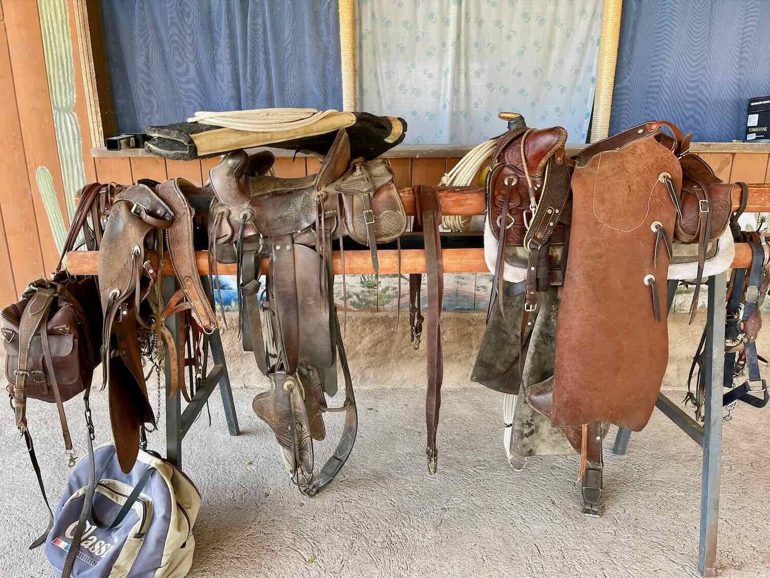
The entrance to Rancho Escondido, complete with a genuine, leather saddle draped over it. Rancho Escondido, Baja California, Mexico. Copyright © 2019-2023 Pedals and Puffins.
The small, but very well run restaurant under a big, shady palapa. Rancho Escondido, Baja California, Mexico. Copyright © 2019-2023 Pedals and Puffins.
We parked our bikes, quickly confirmed that we could order lunch, and plopped ourselves into some chairs in the shade. After a couple of drinks and plates of fried chicken, the life fully returned to our salt-depleted bodies. It was awesome to relax, hydrate, and feel protected from the heat of the day. We spent some time looking around the grounds. A courtyard garden with a trickling fountain created a cool oasis for the various dogs and cats that populated the farmhouse, as well as for guests like us.
Over dinner we were treated to a stunning, bright orange sunset. Rancho Escondido, Baja California, Mexico. Copyright © 2019-2023 Pedals and Puffins.
Being a working farm, there were lots of noises during the night. The world’s most vocal cat mewed loudly, and constantly until at least 10pm. The quiet then lasted until 3:30am, when the rooster decided it was time for everyone to wake up. That made for a short night.
In spite of our desire to start biking early, in the coolest part of the day, we decided to have a home-cooked breakfast before hitting the road. It was typical Baja style. Usually there’s no menu. They tell you what they have and you tell them which of those meals you would like, with prices about the same no matter what you order. In our experience, we often were the only guests at these remote ranches, and our meals were prepared fresh while we waited. The ladies who worked in the Rancho Escondido restaurant were excellent cooks, and our omelettes were delicious. They threw everything in - ham, cheese, tomatoes, onions and cilantro, plus sides of beans and tortillas. By the time we had finished breakfast, we were stuffed.
But that meant we didn’t get out on the road until after 8am. It was already very warm.
Now we know what the ranch hands do with their used boots. Rancho Escondido, Baja California, Mexico. Copyright © 2019-2023 Pedals and Puffins.
The day’s ride was all about the sand and washboards. The road surface was covered with deep, mushy sand for most of the way to Rancho Piedra Blanca. We decided to air-down our tires - for the first time on the Baja Divide. And it worked great. Lowering the pressure in our 3-inch tires to 12-14 psi made the difference between being able to ride our bikes or having to walk. We prefer riding our bikes, so it was definitely the right decision. For the rest of the day we made slow, but steady progress through the deep, shifting sand.
Slogging through the deep sand. At least we were able to ride through it, with very low pressure in our tires. Between Rancho Escondido and Rancho Piedra Blanca, Baja California, Mexico. Copyright © 2019-2023 Pedals and Puffins.
By 10am it was quite hot. And unfortunately, the big palo verde trees had become very scarce as we traveled inland and gained elevation. We occasionally found some relief in the shadow of a big cardón cactus, but mostly we just endured the heat.
About halfway through the day we came to a steep section, where the road launched over a ridge in the mountains. We were surprised to see that the ascent was paved with concrete for several hundred meters. That was completely unexpected. And it was an indication of just how steep the section of road was. Work vehicles from the ranches in the area probably needed the paved section in order to get up the steep hill. It was kind of a luxury for us, because in the northern mountains along the Baja Divide, remote roads were just allowed to deteriorate into rock-strewn death traps. They were never paved, and frequently became impassable for even skilled drivers with specialized 4x4 vehicles. We pedaled up as far as we could, but didn’t quite make it to the top. The road, even paved, was just too steep. Even so, pushing our bikes up the remainder of the hill was almost pleasant, compared to pushing up similar hills that were all rocks and gravel. We counted our blessings.
The view from the top of the concrete pass. It was the last time we would see the Gulf of California (in the distance) for a while. Between Rancho Escondido and Rancho Piedra Blanca, Baja California, Mexico. Copyright © 2019-2023 Pedals and Puffins.
After cresting the concrete hill, we were back in the Baja California Desert ecoregion, and back in the sand. The cirios and Baja yucca trees reappeared. We started to encounter more stones, and we began to wonder whether our tire pressure was too low - putting us at risk of damaging a tire or rim on the rocks. But pretty quickly we were back in the deep sand again. We ended up keeping our tire pressure low for the whole day.
A black-throated sparrow welcomed us back to the Baja California Desert ecoregion. Between Rancho Escondido and Rancho Piedra Blanca, Baja California, Mexico. Copyright © 2019-2023 Pedals and Puffins.
Descending from the pass back into the central desert, where the cardón cacti were abundant again. Between Rancho Escondido and Rancho Piedra Blanca, Baja California, Mexico. Copyright © 2019-2023 Pedals and Puffins.
Our road descended off the mountain through a narrow valley. And, although we didn’t see it, there must have been water at or near the surface in some of the low spots. There were places where the vegetation seemed to grow thicker and greener. We even had to swat away a few mosquitoes. In one small area, we rode through a swarm of very strange beetles. They were really big fellas - almost two inches (5 cm) long- with bright red heads and yellow wing covers. When they flew, their bodies hung down in a big, red teardrop below their wings. There appeared to be thousands of them on a nearby bush. They were fascinating, and a bit creepy. They turned out to be a species of iron-cross blister beetle that’s nearly endemic to Baja (with just a few populations around San Diego).
A swarm of these creepy-looking beetles was munching away on a low shrub by the road. They’re a species of iron-cross blister beetles (Tegrodera erosa). You don’t want to touch them. They secrete a chemical that causes blisters and a rash. Between Rancho Escondido and Rancho Piedra Blanca, Baja California, Mexico. Copyright © 2019-2023 Pedals and Puffins.
We didn’t quite make it to Rancho Piedra Blanca as early as we would have liked. Nonetheless we were happy to arrive in the mid-afternoon and to finally get out of the sun. A group of friendly Mexicans that had passed us earlier on side-by-side ATVs (and had offered us some water) was already there, sipping beers in the shade of the big palapa. They applauded as we pulled in.
Arriving at Rancho Piedra Blanca. Baja California, Mexico. Copyright © 2019-2023 Pedals and Puffins.
Much like the previous ranch, Rancho Piedra Blanca is a working homestead with cows, goats and chickens. But the similarities end there. Everything was a little bit more polished at Rancho Piedra Blanca. The cabins were newer, with 24-hr solar-powered electricity (at Rancho Escondido, power was only available from 6pm-9pm, from a gas-powered generator). The restaurant was indoors (a nice feature in the evening, when more insects were out). And they operated a little store with a pretty good selection of snacks and drinks.
As we headed up a hill toward the restaurant, we were greeted by the ranch’s four dogs. Two of the dogs were mixed-breed farm dogs, who probably were responsible for guarding the livestock. They were both very friendly. But one of them, in particular, was hungry for attention. If she thought, for an instant, that you were looking her way she would roll over on her back in hopes of receiving a belly rub. The other two dogs were not your typical farm dogs. Alvin and Bonnie were two high-energy, Pomeranian balls of fluff that looked like they wouldn’t stand a chance in a confrontation with a coyote (or even a big hawk). Even so, Alvin and Bonnie roamed freely around the grounds with the other two dogs, at least until night time. After dark, they got the luxury of staying in the ranch house.
This ranch dog was particularly friendly, and eager for attention. Whenever she was close to you, she would roll over on her back for a belly rub. Rancho Piedra Blanca, Baja California, Mexico. Copyright © 2019-2023 Pedals and Puffins.
Just before sunset we went for a walk with all four dogs in tow. They were excited to go exploring with us, and bounded down the dirt road with the confidence of dogs who know their way around the neighborhood. It was fun to have their company. But it did put a bit of a damper on the birdwatching. Instead, we focused on some of the trees and flowers along the road.
A giant Baja yucca tree. This was one of the biggest we’ve seen. Rancho Piedra Blanca, Baja California, Mexico. Copyright © 2019-2023 Pedals and Puffins.
Baja California Nightshade is another plant that is found almost exclusively in Baja. Rancho Piedra Blanca, Baja California, Mexico. Copyright © 2019-2023 Pedals and Puffins.
We returned to the ranch in the fading light, and had the pleasure of seeing several different species of birds hanging out near a large water well on the property. They were snatching bugs out of the air over the still surface of the water. And a pair of hooded orioles added a splash of color to the palms nearby.
Sunset over the cabins. Rancho Piedra Blanca, Baja California, Mexico. Copyright © 2019-2023 Pedals and Puffins.
We enjoyed a beautifully quiet night in the cabin. No barking dogs, no mewing cats, and no chickens. We slept great.
The next day we finally got the early start we had been threatening to do, but had so far failed to achieve. We were up before dawn, skipped breakfast, and were out on the road by sunrise around 6:30am. That was a record-early start for us on the Baja Divide, and nearly two hours earlier than the day before. As a result, we had a couple of extra fabulously-cool hours of cycling before the day got really hot.
Others had told us that this section of the Baja Divide promised even more deep sand - possibly even worse than what we had already ridden through. So we took note when some previous cyclists recommended using an alternate route that supposedly would have less sand. After having ridden the alternate route, it’s hard to say whether that was the right decision. We still ended up cycling through tons of sand.
More cycling through deep sand. South of Rancho Piedra Blanca, Baja California, Mexico. Copyright © 2019-2023 Pedals and Puffins.
The worst sand came very early in the day, almost immediately after we left the main Baja Divide route. Imagine our surprise when the road we were on descended right down into the wide, sandy channel of a huge, dry arroyo, and followed the river bed for a quarter mile. It was like wading across a giant, ankle-deep sandbox. There was no way to ride through it, we just pushed our bikes across.
Trekking across the wide, deep sand of the Arroyo Purificación. South of Rancho Piedra Blanca, Baja California, Mexico. Copyright © 2019-2023 Pedals and Puffins.
On the far side of the arroyo, we had some more fun. First, we had to shove our bikes up a 4-ft high sand bank to get out of the arroyo. From there, the road launched up a very steep, rocky embankment. It took two of us to push each bike up to the top of the hill. That was a very tiring way to start the day. On the bright side, we were pretty sure there wouldn’t be any vehicles coming through this section of impassable road. We looked forward to a nice, quiet day of cycling.
It took two of us to push each of our bikes up this steep hill. Climbing out of the Arroyo Purificación. Rancho Piedra Blanca, Baja California, Mexico. Copyright © 2019-2023 Pedals and Puffins.
Unlike the previous day, this road wasn’t covered in sand the whole way. We did have some long, easy stretches with a nice, hard-packed surface. But those were interspersed with a few rocky ridges, and several more extended sections of deep sand. Along the way, we spotted a couple of new species of lizards, plus a totally unexpected mushroom popping up out of he desert sand.
Although there were some nice, hard-packed sections of road, there was no way to completely avoid the sand. South of Rancho Piedra Blanca, Baja California, Mexico. Copyright © 2019-2023 Pedals and Puffins.
The Baja California spiny lizard only occurs on the Baja Peninsula. South of Rancho Piedra Blanca, Baja California, Mexico. Copyright © 2019-2023 Pedals and Puffins.


Halfway through the day we crossed the invisible line between the Mexican states of Baja California (to the north), and Baja California Sur. The most notable consequence was that we crossed over from Pacific Time into Mountain Time. It didn’t make much difference to us in the backcountry. But we found it interesting that both our phones and our watches adjusted almost instantly to the time change - even though our phones were in airplane mode. Using their GPS, the phones can tell exactly where they are, what time zone applies, and reset the time accordingly. Pretty cool.
Directional signs are rare out here. We stopped to check this one out, although it wasn’t very helpful. Good thing we have a GPS device. South of Rancho Piedra Blanca, Baja California Sur, Mexico. Copyright © 2019-2023 Pedals and Puffins.
This big, old cardón cactus collapsed into the road. Fortunately, there was still room to get around it. South of Rancho Piedra Blanca, Baja California Sur, Mexico. Copyright © 2019-2023 Pedals and Puffins.
Late in the day we ran into another pocket of really deep sand. To our surprise, we were entering an abandoned town, and the roads through town had been buried under sand drifts. There were nearly 30, pretty sturdy looking houses with no residents, a water tower, and a rusting playground. It was eerie, because many of the homes looked like they had been used up until fairly recently. What had made all those people leave? In actuality, the town wasn’t completely abandoned. At the very last house, on the far edge of town, there was a pickup truck and a guy taking a nap on the ground, looking down and out. The whole situation seemed odd, and our gut feeling was that it would be best to not stop and visit.
A forlorn playground bakes in the sun at a nearly-deserted town. Ejido Guillermo Prieto, Baja California Sur, Mexico. Copyright © 2019-2023 Pedals and Puffins.
Immediately after getting clear of Ejido Guillermo Prieto, the road turned and the riding surface became much better. It was wide and well graded (although there was still a fair amount of sand). We were able to cycle much more quickly, and started to think we might actually make it to a store in the next town before it got too late.
But we weren’t moving quite fast enough. So after a couple of miles, when we spotted a disused, sandy track leading back into the bush, we decided to stop for the night.
Back in Civilization
From our campsite, it was only about 10 miles (16 km) to the Transpeninsular Highway (a.k.a., Highway 1), and less than that from the highway junction to the next big town. With such a short day of cycling planned, we perhaps weren’t motivated enough to get up as early as we should have been. At the risk of having to cycle in the heat of the day, we didn’t start getting out of bed until the sun was already peeking over the horizon.
Once we were back on the road, it took us less than 15 minutes to reach Ejido Angel Cesar (pop. 31), where we hoped to purchase something for breakfast from the town’s small tienda. As we approached the first couple of houses, we were treated to an awesome sight. A gorgeous crested caracara was perched on top of a giant cardón cactus, looking resplendent in the morning light. We stopped to admire the handsome bird before cycling into town.
A handsome crested caracara prepares to take flight. Ejido Angel Cesar, Baja California Sur, Mexico. Copyright © 2019-2023 Pedals and Puffins.
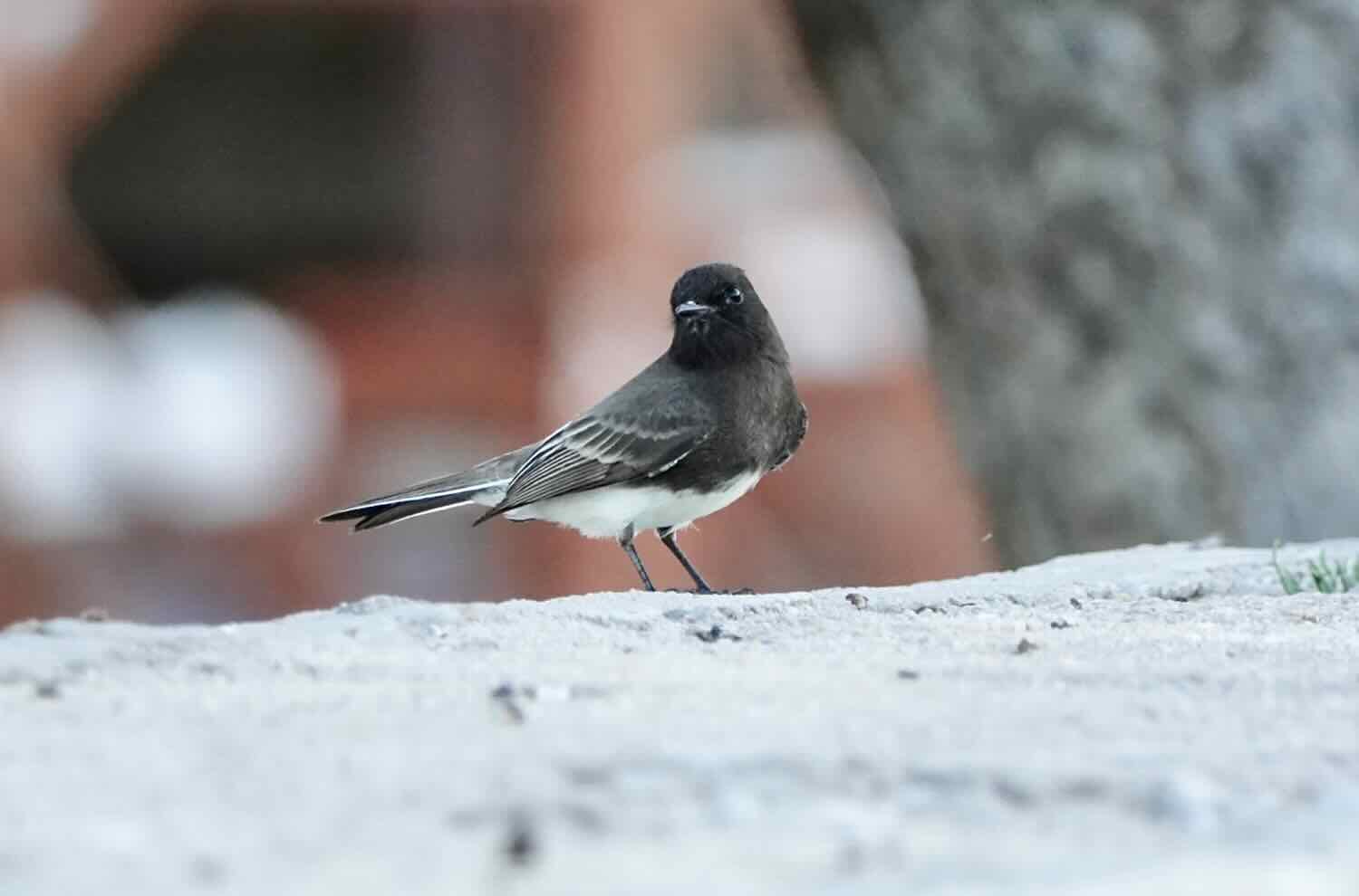
But when we rode down the dusty streets among the town’s 10 or so houses, we couldn’t find anything that resembled a store. That’s not to say that there wasn’t one, but often these small stores are not very well marked. And if they’re not open, it can be pretty hard to discern the difference between the store and the other houses. There was a blue building that looked like it could contain a store, but there weren’t any signs (there’s almost always a Tecate Beer sign), and it was clearly closed. We were out of luck. As a consolation, we finally saw a gray thrasher - one of a small handful of bird species that are endemic to Baja. It posed nicely for a photo.
Gray thrasher (endemic to Baja). Ejido Angel Cesar, Baja California Sur, Mexico. Copyright © 2019-2023 Pedals and Puffins.
An hour later we arrived at Hwy 1. There was no shoulder on this part of the highway, so at first we tried to cycle on the dirt service road. This had been a great strategy for us in the past. But this time, the service road was covered with sand burrs that lodged themselves firmly in our tires. They’re extremely sharp, and hard to pull out with your bare fingers. PedalingGuy got out our Leatherman tool, so we could use the needle-nosed pliers to pluck 5-10 sand burrs out of each of our tires.
Then luck smiled upon us. We had been cycling along the highway for about five minutes when we arrived at a small, roadside, snack stand. It was perfect. We each got a couple of cold drinks, complemented by a package of chocolate-chip muffins. The tienda even had a little bench in the shade, with a tarp to block the wind, where we could relax and enjoy our late breakfast. It was a lovely break.
This roadside snack stand was the perfect spot for a quick, satisfying breakfast. Francisco J. Mújica, Baja California Sur, Mexico. Copyright © 2019-2023 Pedals and Puffins.
As we departed the tienda, we kept having to stop to remove burrs from our tires. Pretty quickly, we decided it was too much trouble. So we pumped up our tires to their maximum psi, cleaned our chains, and rode onto the black top. It was a bit sketchy at first because of the lack of a decent shoulder to ride on. But before long we reached a section of road that had been newly resurfaced, and it had a paved shoulder. It wasn’t very wide, but it was enough to get us out of the main traffic lane. We sailed into the town of Vizcaíno, arriving around 11:30am.
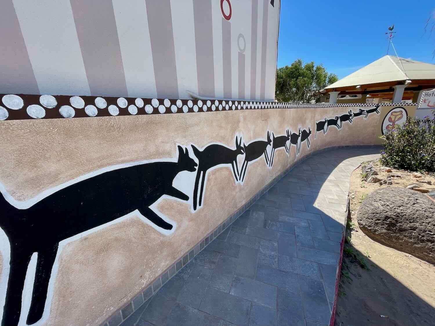
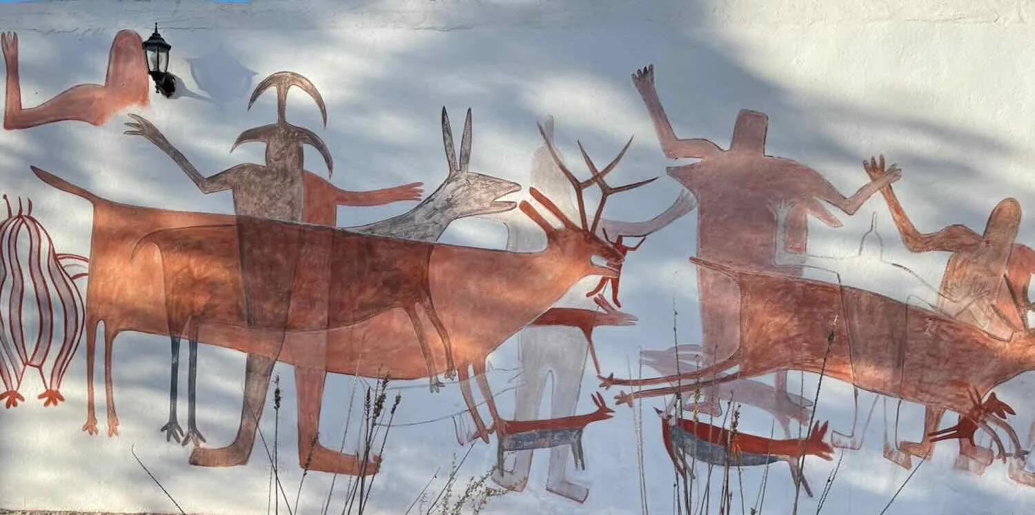
When we reached out target hotel, it seemed deserted. For some reason, there were no other guests. We checked into a nice, big room with everything we were looking for - AC, really strong and fast wifi, a hot and reliable shower, and even a refrigerator! (Refrigerators have been very hard to come by in Baja.) It was also across the street from a large supermarket, and not far from the bank with the ATM. The common areas of the hotel were decorated with images inspired by the ancient rock art found in some Baja caves. It was hard to fathom why the hotel was so empty. But we definitely enjoyed the peace and quiet of being the only people around.
Oasis in the Desert
After a relaxing rest day in Vizcaíno, we were back on the road. Like most Baja Divide cyclists, we decided to take the highway to the next town. The Baja Divide through this section is notorious for having more, deep sand and for not being very scenic. All of the other cyclists that we knew had taken the road.
As if to confirm our choice, we saw another crested caracara fly over the road just as we were leaving town. A good omen.
The scenery along this stretch of the route might have seemed interesting if we hadn’t already spent so much time in Baja. There were sections of the route where there were a lot of cardón cacti, and there were tons of the spikey Baja yucca trees. But by now we had seen quite a bit of this type of landscape. That made it easy for us to focus our ride on speed, rather than scenery. Clouds in the morning helped to keep the temperature cool, so we cycled hard, and covered the miles quickly.
Just outside of the town of San Ignacio there is a well-known, military checkpoint along the highway. We were a little bit apprehensive, because we had read stories online about people having some problems while going through the checkpoint. When we arrived, there was a big backup of cars because the soldiers were doing a very thorough search of a large delivery truck. We ended up waiting half an hour, while the line of cars behind us got quite long. But finally they finished their search, and the line started moving. In the end, we were just waived through. No hassles at all.
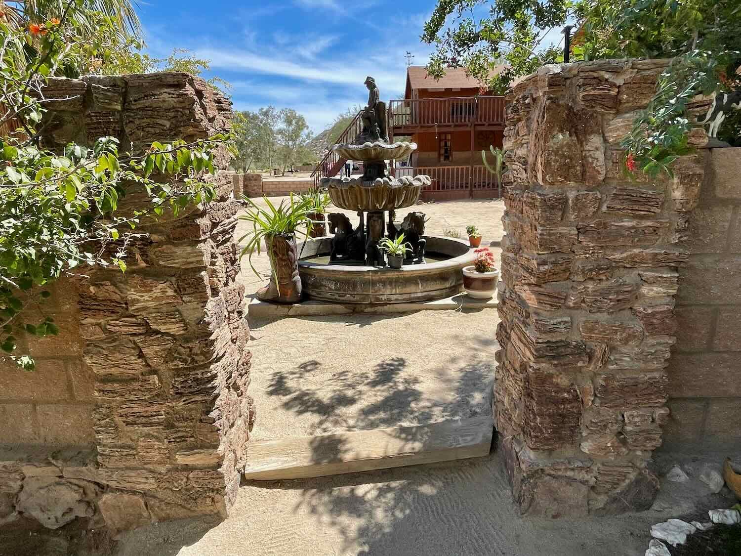
San Ignacio is a charming small town (pop. 521) that has much more of a colonial-era feel than anywhere we had visited in Baja to date. But the biggest thing you notice upon arrival is the huge number of tall palm trees. Date palms (imported by the early missionaries) and native fan palms grow in thick forests around the town. And as we pedaled into the village, we saw what makes this possible - a long, thin, shimmering, blue pool of water fed by the San Ignacio Spring. It’s a completely different world from the parched, surrounding landscape. Throughout town, you could be forgiven for forgetting that you are still within a desert. In the town’s central plaza, huge shade trees create a cool and breezy place to rest on benches in the shadow of the ancient mission church.
As we approached San Ignacio, we saw this low-key sign for the Casa del Cyclista, a free camping spot in town for cyclists. We didn’t stay there, though. We opted for the comfort of a hotel. San Ignacio, Baja California Sur, Mexico. Copyright © 2019-2023 Pedals and Puffins.
The impressively lush, palm-lined pool at the San Ignacio Oasis with the Cerro Colorado mountain in the distance. Water from this oasis made San Ignacio the most prosperous mission town in early Baja history. San Ignacio, Baja California Sur, Mexico. Copyright © 2019-2023 Pedals and Puffins.
When we arrived at our chosen hotel, the guy at the reception desk told us there were no rooms available. That wasn’t good, because we weren’t keen on camping just yet (there would be plenty of that in the days to come). But when he saw that we were traveling by bicycle, he said he would see what he could do. We’re not sure how he did it, but before long he offered us a room - even saying that we could have it for two nights. It was a little bit of Baja magic. We felt very lucky to get a room. This was high season for gray whale tours (something the town is well known for), and a couple of tour buses arrived later in the day, filling the hotel to capacity.
We wandered over to the town plaza, a lovely shaded square in the old-world style. But before we rested, we headed straight to the office of a gray whale tour company to figure out our options for seeing these famously friendly sea creatures. We didn’t fit the mold for your typical whale tourist. But the lady behind the desk was very patient, answered all of our questions and helped us formulate a plan. We decided to linger in San Ignacio one day, then bike the 42 miles (67 km) to the Laguna San Ignacio where we could camp and take a gray whale tour early the next morning. With our reservation in hand, we set out to explore the rest of the town.
The main attraction on the plaza is the old mission church. Built in the 1700s by Catholic missionaries, the old stone structure has survived the years well. The facade has a pleasing, geometric, almost Moorish design of earth-colored stone, highlighted by whitewashed walls in between. The interior is not that ornate for a Catholic church, but there are several statues and an impressive, gold-gilded, baroque-style altarpiece. It must have seemed like a magnificent building out on the frontier when it was first constructed.
The mission church. San Ignacio, Baja California Sur, Mexico. Copyright © 2019-2023 Pedals and Puffins.
The baroque altarpiece inside the mission church. San Ignacio, Baja California Sur, Mexico. Copyright © 2019-2023 Pedals and Puffins.
In the garden, tall palms sway over a cluster of orange and lime trees, which are surrounded by numerous flowering plants. We strolled along the garden paths, and over to a small museum housed in the church’s living quarters. In spite of its grandeur, the mission church was abandoned in 1840. And although the church itself remained a sacred place, the rest of the structure was converted into apartments for successive, non-church owners. The museum offers a glimpse into what life would have been like for those who occupied its rooms in the early 20th century.
Living quarters on display at the San Ignacio Mission Museum. The walls were almost a meter thick in places which helps explain why this building has lasted so long. San Ignacio, Baja California Sur, Mexico. Copyright © 2019-2023 Pedals and Puffins.
We spent the remainder of our time in San Ignacio relaxing in the plaza, ambling through the local markets, enjoying an afternoon date shake, and revisiting the shores of the lovely oasis. Reflecting back on this section of the Baja Divide, we’ve been amazed by the incredible variety of experiences - from seeing the Gulf of California for the first time, to boating among the desert islands, to plowing our bikes through ankle-deep sand, to sleeping in cabañas on remote, dry-land ranches, and finally landing among the palms in a classic desert oasis complete with a colonial-era mission. The many facets of Baja’s dramatic landscapes and rich cultural history have made this one of the most memorable segments of our journey yet. We can hardly wait to see what waits for us down the road.