TransMexico Norte Part 3: Cycling from Zacactecas to Guanajuato, Mexico
2-13 June 2023
2 June - Zacatecas to Wild Camp South of Genaro Codina (43.5 mi, 70.0 km)
3 June - Wild Camp South of Genaro Codina to Wild Camp Sierra Fría (30.8 mi, 49.6 km)
4 June - Wild Camp Sierra Fría to Calvillo (36.5 mi, 58.7 km)
5-6 June - Layover in Calvillo
7 June - Calvillo to Cotorina (37.9 mi, 61.0 km)
8 June - Cotorina to Lagos de Moreno (50.6 mi, 81.4 km)
9 June - Lagos de Moreno to León (22.8 mi, 36.7 km)
10-11 June - Layover in León
12 June - León to Guanajuato (45.5 mi, 73.2 km)
13 June - Layover in Guanajuato
Hot, Dry Canyonlands
We were out of bed before 6am, hoping to get an early start on the next segment of the TransMexico Norte bikepacking route. But fate had other plans for us. Instead of grabbing a quick breakfast at the convenience store around the corner, we ended up waiting for about an hour because the store didn’t open on time. (Opening times tend to be approximate in many of the places we have visited in Mexico.) By the time we finally hit the road, it was nearly 8am.
That meant we didn’t make it out before rush hour, and had to dodge the city traffic as we cycled across town. Worse, we had hardly any cycling time before the day started to heat up. Early June is the hottest time of the year in this part of Mexico, so it would be uncomfortably warm within a half hour.
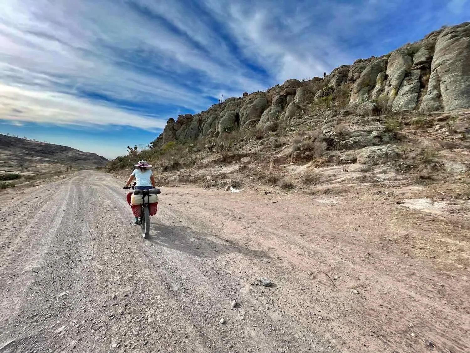
It took us just over an hour to escape the urban footprint of Zacatecas. After that we found ourselves cycling on dirt, parallel to a set of railroad tracks. The dusty road traversed everything from grassy meadows, to open fields that were just being plowed and planted, to grungy backroads that are typical of places where railroads pass through small towns.
Heading out of Zacatecas our route followed a dirt road through rural towns and just-plowed fields. North of San Jerónimo, State of Zacatecas, Mexico. Copyright © 2019-2023 Pedals and Puffins.
Once in a while you see a spectacular, old yucca tree that - from a distance - you might confuse with a big shade tree. This was one of the most impressive palm yucca trees we saw along our route. Trancosito, State of Zacatecas, Mexico. Copyright © 2019-2023 Pedals and Puffins.
After a brief interlude cycling on a busy highway, we entered canyon country. Our route immediately dropped 500 ft down into a V-shaped canyon that sliced through the landscape. At the bottom was the town of Genaro Codina (pop. 1,400). It would not be an exaggeration to say that every road in town went either up or down.
The road bottomed out where it crossed a small river on a bridge that was out of service. The bridge was closed to motorized vehicles, but because we were on bikes we were able to cross it with the foot traffic. Then we found ourselves grinding slowly up a big hill. It didn’t take us long to decide it was a good time for a break. After all, we needed to acquire some supplies for our upcoming night of camping.
All the stores in Genaro Codina were the typical, small town tiendas stocked with a limited range of Mexican staples - in other words, lots of cookies and some cold drinks, with a few other things thrown in. Even after hitting two different shops we barely managed to pull together a full meal. Dinner would be tuna on hotdog rolls, and ramen, again. A couple of old guys sitting outside one of the stores seemed to get a kick out of watching us as we hunted for food and refilled our water bottles.
Our bikes, parked on a corner near two small shops where we secured food for another night of camping. Every road in the town was on a steep hill. Genaro Codina, State of Zacatecas, Mexico. Copyright © 2019-2023 Pedals and Puffins.
Loaded up with food and water, our bikes were suddenly a lot heavier. Of course, we had to haul all that extra weight up the hill and out of the canyon. Furthermore, we had dawdled in the town for an hour, so it was now a quarter past noon on a mostly cloudless day. It was getting really hot.
We expected the road out of town to be pretty steep, but it was still a shock to our systems. At the edge of town our route rocketed up the side of the canyon for about a quarter mile, with a gradient hovering around 20%. This was clearly not a road meant for cars. Luckily, we didn’t have to push our bikes up the badly eroded dirt. There was an unusually nice, new smooth sidewalk that made the pushing much, much easier. As we labored up the hill, an older gentleman walking in the same direction easily passed us, and wished us a good day.
The slow ascent out of the canyon. Genaro Codina, State of Zacatecas, Mexico. Copyright © 2019-2023 Pedals and Puffins.
Right after cresting the rim of the canyon, we rolled into another little town. It was much smaller than Genaro Codina, with a population of only 65 residents. But to our surprise it had a brand new, much bigger store. Overheated from the big climb, we stopped for another break, and kicked ourselves for buying all that food and water down in the bottom of the canyon. If we had known this store was here, we would have waited to shop, and saved ourselves from hauling all that weight up the very steep hill.
By the time we were ready to continue the temperature exceeded 90F (32C), with a clear, blue, cloudless sky. We were about to head out into a virtually treeless landscape where there would be no real shade - just grasslands with prickly pear cactus and a few yucca trees. Even the guy who ran the store showed some concern for us, noting that it was hotter than usual for this time of year. But there were no hotels in town, and wild camping in the hills still seemed like the best option. Before heading out, we drank a bunch more fluids to give ourselves a boost of sugar and electrolytes.
Then we rode out onto the dirt and up another mountain. For the next two hours it was a suffer fest of heat and sweat. As expected there was no shade.
We had originally planned to go just a few miles outside of town, basically to the top of a big ridge, where we would look for a place to camp and get out of the afternoon heat. But the landscape at the top of the ridge was very exposed - still no trees, and basically nowhere to camp.
Fortunately, a couple of factors were now working in our favor. Some fluffy, white clouds started to roll in, and a pleasant breeze flowed across the hills. The temperature dropped noticeably each time one of the clouds passed over the sun (although it would go back up when the cloud moved on). Plus, even though the riding from here on would be hilly, we could look forward to an overall downward trend. We decided to keep going.
The ride up into the hills was hot, with no shade. Luckily, some clouds rolled in, which helped to cut the intensity of the afternoon sun. South of Genaro Codina, State of Zacatecas, Mexico. Copyright © 2019-2023 Pedals and Puffins.
But it was still very hot. Whenever the sun peeked through a gap in the cloud cover, we could feel the temperature rise significantly. Relief came only when the next cloud passed over the sun. Our strategy was to keep our pace moderate, but steady, to avoid serious overheating.
For the next three hours we cycled up and down an endless series of hills as the road plunged into, and climbed out of narrow canyons. South of Genaro Codina, State of Zacatecas, Mexico. Copyright © 2019-2023 Pedals and Puffins.
A makeshift road sign in the middle of nowhere. Every once in a while, these homemade signs will pop up at remote, backcountry intersections. South of Genaro Codina, State of Zacatecas, Mexico. Copyright © 2019-2023 Pedals and Puffins.
As the clock neared 5pm, we still hadn’t found anywhere suitable to camp. All of the terrain surrounding the road was either too open and exposed, or on too steep of a slope. We pushed on, hoping that we would eventually find someplace that would work as a campsite. Then, after another 40 minutes, we saw something that raised our hopes.
In the bottom of an arroyo that crossed the road there was something we hadn’t seen for the past five hours: a ribbon of fairly dense vegetation that included some pretty big trees and lots of tall shrubs. Shade! The road was lined with barbed wire, but right in the thickest part of the riparian forest there was an open gate. We could hardly believe our luck.
We passed through the gate and were quickly out of sight of the road, hidden among the trees. A survey of the site revealed a wonderful, flat area big enough for our tent. After cycling for hours over harsh and open terrain, we found perhaps the one and only spot that was perfect for camping. We pitched our tent, ate our ramen and tuna, and finally hit the sack a little after 9pm. It was a very quiet night, and we both slept great.
After five hours of cycling across open, treeless hills we found the perfect campsite, nestled among a ribbon of trees within a dry arroyo. South of Genaro Codina, State of Aguascalientes, Mexico. Copyright © 2019-2023 Pedals and Puffins.
During the night, it never really cooled down. For the first time in a long time we both slept in short sleeves, and didn’t use our sleeping bags until nearly sunrise. Fortunately, the warm morning made it easy to get going early.
In spite of a few early hills, we quickly descended out of the backcountry. As we lost altitude the cow pastures and badlands gave way to arid farmland. We passed row after row of cultivated prickly pear cactus (nopales), often perched along the edge of rough irrigation ditches.
Descending out of the rugged hills. Approaching La Camada, State of Aguascalientes, Mexico. Copyright © 2019-2023 Pedals and Puffins.
Rows of prickly pear cactus (nopales), the most popular crop in these arid farmlands. Approaching La Camada, State of Aguascalientes, Mexico. Copyright © 2019-2023 Pedals and Puffins.
A Friend on the Road
When the dirt road finally turned to pavement, we were surprised to see marks on the road indicating that we were on a local cycling route. There were a number of folks on bicycles, mostly riding gravel bikes. This was totally unexpected, since it felt like we were still pretty remote. We hadn’t seen anyone on recreational bikes for over a month. Now, all of the sudden, there were multiple cyclists passing by.
When we reached an intersection and stopped to get our bearings, a Mexican cyclists hailed us and came over to talk. That’s how we met Román, a really warm and friendly cyclist from a nearby town. Around 20 years ago he had lived in the USA. But now his English was a bit rusty, and he was eager to practice talking with us. He also was fascinated by our trip.
While we were chatting by the side of the road with Román (third from right), another cyclist (José, second from right) stopped to visit as well. La Canada, State of Aguascalientes, Mexico. Copyright © 2019-2023 Pedals and Puffins.
We learned that Román used to be a runner, but had taken up cycling after having problems with his knees. He said cycling had “saved his life,” and that he now often cycled 40 miles a day through the arid mountains around Aguascalientes. He dreamed about someday taking a long bike trip, and was very curious about how we chose our route and gear. He seemed surprised to hear that the TransMexico Norte route, which is only a few years old, went right through the area where he cycles a lot. And he was pleased about the prospect of encountering more long-distance cyclists in the future. After we’d been talking for a while, Román offered to ride with us. We were delighted.
For the next hour we rode through the rugged canyon lands with Román - sometimes on dirt and sometimes on pavement. He recommended a slight detour through an area known as the Túnel de Potrerillo, which he said was more scenic and remote than the main TransMexico route. It was gorgeous, passing interesting rock formations and a narrow slot canyon that cut into the hills.
The dry landscape along our detour, suggested by the Mexican cyclist Román. Túnel de Potrerillo, State of Aguascalientes, Mexico Copyright © 2019-2023 Pedals and Puffins.
Free range horses in the hills. Túnel de Potrerillo, State of Aguascalientes, Mexico. Copyright © 2019-2023 Pedals and Puffins.
But eventually Román had to head back home, while our route took us further into the mountains. We exchanged contact information so we could keep in touch, then parted ways.
Sharing contact details so we could stay in touch with our new friend, Román. Near San José de Gracia, State of Aguascalientes, Mexico. Copyright © 2019-2023 Pedals and Puffins.
We stopped at a well-stocked store in a town right at the base of the Sierra Fría mountains, to load up on food for the next couple of days. But although we were thirsty and downed a couple of cold drinks, we waited to fill up on water. We had learned our lesson from the day before when we took on a bunch of water at the bottom of a big hill, only to suffer as we lugged all the extra weight up the mountain side. We crossed our fingers, and hoped that we would be able to get all the water we needed in the last town before entering the Sierra Fría backcountry.
The festive town of San Antonio de los Ríos, where we stopped for supplies before ascending into the Sierra Fría mountains. State of Aguascalientes, Mexico. Copyright © 2019-2023 Pedals and Puffins.
While we were in the town, a pickup truck arrived at the store where we had stopped. A couple of guys got out wearing forestry uniforms, and came over to talk with us. They were forest rangers who worked up in the Sierra Fría mountains, and they seemed really pleased that we would be cycling up into their territory. If we needed any help, they said we should let them know. It wasn’t exactly clear how we would reach them if we did run into any trouble, but it was still very nice of them to offer to be of assistance.
Cycling Across the Sierra Fría
As soon as we left San Antonio de los Ríos, the road began its relentless ascent. For the next three hours, we slowly chugged our way up into the Sierra Fría mountains on one long, continuous climb. As we gained altitude, an expansive view opened up to our southeast. At the bottom of the basin we could see the large Presidente Calles Reservoir, the region’s primary source of water since the 1920s.
Presidente Calles Reservoir, seen from the climb into the Sierra Fría mountains. Just past San Antonio de los Ríos, State of Aguascalientes, Mexico. Copyright © 2019-2023 Pedals and Puffins.
A brief break from climbing uphill in the sun. West of San Antonio de los Ríos, State of Aguascalientes, Mexico. Copyright © 2019-2023 Pedals and Puffins.
Although there isn’t much vegetation here, wildfires can still burn through the dry brush, grasslands, and higher elevation forests. Savi, the Fire Brigade Squirrel, encourages people to prevent forest fires (just like his northern colleague, Smoky the Bear). West of San Antonio de los Ríos, State of Aguascalientes, Mexico. Copyright © 2019-2023 Pedals and Puffins.
We saw this white-tailed-deer walking through a hillside woodland, high on the slopes of the Sierra Fría mountains. It was pretty exciting, being only our second deer sighting since entering Mexico nearly five months ago. We later learned that this is one of the smallest subspecies of white-tailed deer. Approaching Congoja, State of Aguascalientes, Mexico. Copyright © 2019-2023 Pedals and Puffins.
When we finally arrived at the village of Congoja (last town before crossing the Sierra Fría) we were tired and thirsty. Luckily for us, there was a terrific market area where a sweet couple ran a small kiosk selling tamales. There were a few picnic tables in the shade, clean public bathrooms and even free wifi. We helped ourselves to the tamales and a ton of drinks. Everything was delicious. Plus, we were able to get all the water we needed at a little tienda nearby. It was the perfect way to end a long, hot climb.
Congoja sits on the edge of the Sierra Fría Natural Resource Protection Area, a mountainous region that was designated for protection nearly 75 years ago. Much of the reserve lies over 8,000 ft above sea level (2,440 m), and is cloaked in the high-altitude pine/oak forests of the Sierra Madre mountains. It is renowned for having relatively dense populations of central plateau white-tailed deer (one of the smallest subspecies of white-tails) and Gould’s turkeys (the biggest subspecies of wild turkey).
Like many natural areas in Mexico, the land within the protected area continues to be inhabited by people - particularly by ranchers. And with high concentrations of game species on their property, many of the landowners have developed hunting outfitter businesses. As we continued to climb on the gravel road that led out of the town of Congoja, we couldn’t help but notice that the gates for many of the ranches were adorned with images of turkeys and deer
Silhouettes of turkeys decorate this ranch gate in the Sierra Fría mountains. The area is home to the some of the largest wild turkeys in North America. State of Aguascalientes, Mexico. Copyright © 2019-2023 Pedals and Puffins.
We found a horseshoe lying in the road, and considered carrying it for good luck. But it was very heavy, and neither one of us wanted to carry the extra weight. So we left it there for someone else to find. Sierra Fría mountains, State of Aguascalientes, Mexico. Copyright © 2019-2023 Pedals and Puffins.
Our plan was to go only about five miles more, then find a place to camp. But the ranches, eager to control hunting access, had erected sturdy barbed-wire fences that ran continuously along both sides of the road. And the fences were posted with “private property” signs, suggesting the owners would not take too kindly to trespassers. Once again, it looked like we were going to have a hard time finding somewhere to camp. We kept pedaling up the hill, hoping for a break.
After passing us, a pickup truck pulled over on the side of the road. This always gets our attention, since you never really know what is going to happen next. We have heard of other cyclists who have been robbed at gunpoint in such situations, especially on remote stretches of road where other vehicles are unlikely to pass by. Mostly though, people either just want to talk, take pictures, offer water, or show some other form of kindness. Occasionally they even invite you to their home. In this case, we were happy to discover that it was the same truck we had encountered back in town - occupied by the friendly forest rangers.
They waved us down, indicating they’d like to talk again. After making sure we had enough water, they asked us where we planned to sleep for the night. We had to admit we didn’t know, but that we hoped to camp. That’s how we learned about a free, public camping area that was just three miles further down the road. That was almost exactly the distance we had hoped to go before calling it a night. So the universe was looking out for us after all. We didn’t need to worry about how to get in touch with the forest rangers when we needed help, they just appeared. (Or, maybe the horseshoe brought us luck after all.)
Getting the scoop on where we might be able to camp from forest rangers, Amilcar (left) and Jaime (right). Sierra Fría Natural Resource Protection Area, State of Aguascalientes, Mexico. Copyright © 2019-2023 Pedals and Puffins.
Eventually we arrived at Paraje Don Pepe, the very primitive campground that the rangers told us about. There wasn’t any camping infrastructure at the site, except for a couple of old, broken fire rings. And the ground wasn’t very level. But that didn’t matter. We were thrilled to have found a place where we knew it was okay to camp.
We were the only ones there, so we had our choice of spots. But making a quick decision on where to camp is not one of our strengths. We subsequently examined, discussed, and reexamined every spot. Luckily, we were pretty tired, which helps to focus the mind. We finally pitched our tent as far from the road as possible, back among some scrubby oaks. Once darkness fell, there was no more traffic on the road, and we enjoyed a very restful night.
Moonrise over the dry forest in the Sierra Fría mountains. Paraje Don Pepe, State of Aguascalientes, Mexico. Copyright © 2019-2023 Pedals and Puffins.
It was the beginning of June. So the Sierra Fría didn’t exactly live up to its name, which means “cold mountains.” Still, at 8,800 ft (2,680 m) in elevation, our campsite was pleasantly cooler than it had been the night before.
The next day’s ride started with a short, but quite steep climb to the highest point on our route through these mountains, just under 9,000 ft (2,750 M). At the top, we stopped for a celebratory moment - and to catch our breath - before heading down into a high basin between two mountain ridges. But the “descent” wasn’t all downhill. There were plenty of uphill stretches that had us chugging away in our lower gears.
Coming off the highest pass on our route through the Sierra Fría mountains. State of Aguascalientes, Mexico. Copyright © 2019-2023 Pedals and Puffins.
The high valley known as La Ciénega (“the wet meadow”) spread out below us. It was an idyllic setting, with dark green junipers scattered across a pale savanna. There were even a couple of wet areas, even though it was the end of the dry season. Everything about the valley was strikingly different from the dry, leafless oaks on the mountains that completely surrounded the basin. It seemed very inviting.
A lovely, high valley in the Sierra Fría mountains. La Ciénega de Gallardo, State of Aguascalientes, Mexico. Copyright © 2019-2023 Pedals and Puffins.
Just after we came over the top of the second pass, we were hailed by an older gentleman who was working by the side of the road. He introduced himself as José, and told us that he owned one of the ranches along the road.
José was a soft-spoken, proud, and incredibly generous person. He was deeply interested in learning what had brought a couple of Americans on bicycles onto this remote road. And he seemed genuinely glad that we thought the region was beautiful. Having lived in California many years ago, he spoke some English. But he told us that the whole time he lived in the USA he longed to return to the ranch here in Mexico, where he was born. According to him we were not seeing the Sierra Fría mountains at their best, because the summer rains hadn’t started yet. Once the rainy season began, everything would burst into a beautiful green.
Like other folks we had met, José said the rains were late. This was costing him a lot of money, because he had to truck in water and hay from the lowlands for his cows. So he was praying for rain. We learned that that he lived in a big ranch house just up the road that had 18 beds and a shower (probably for ranch hands). Generously, he offered us the chance to stay the night at his house. But it was still very early in the day, and we had hoped to cover a lot more ground before dark. Without a second thought, he said we were welcome come back and stay at his house if we ever returned in the future. He insisted we really should come back someday during the rainy season, when the landscape would be greener.
Reluctantly, we eventually said goodbye. It would have been wonderful to share his hospitality. But we needed to make tracks before the day got too hot.
Not long after our encounter with José, we reached a bend in the road that looked out over the lowlands to the north - back into the state of Zacatecas. It made us realize just how high in the mountains we still were. Sierra Fría Overlook, state line between Aguascalientes and Zacatecas, Mexico. Copyright © 2019-2023 Pedals and Puffins.
After that the descent began in earnest. Over the next two hours we plunged nearly 3,000 ft (915m). There were a couple of surprisingly long uphills thrown in that slowed us down. But mostly we were gripping our handlebars and flying down the gravel road through a long, scenic canyon. Along the way, a couple of more deer crossed the road in front of us.
Our route descended out of the heights of the Sierra Fría mountains on a gravel road through a steep canyon. Approaching Temazcal, State of Aguascalientes, Mexico. Copyright © 2019-2023 Pedals and Puffins.
Nearly five hours into the ride we finally hit the pavement on the far side of the mountains. At the end of the dirt road, forest rangers had set up a checkpoint. We stopped to chat with the two foresters guarding the exit. They asked how we were doing (very well), and whether we had enjoyed the mountain ride (yes, very much). In return, we asked them for suggestions on where we could spend the night. Like some other folks before them, they suggested the town of Calvillo, still 12.5 mi down the road (20 km). We had hoped there might be something a bit closer, but it was starting to look like we wouldn’t have a lot of options. So, we kept cycling.
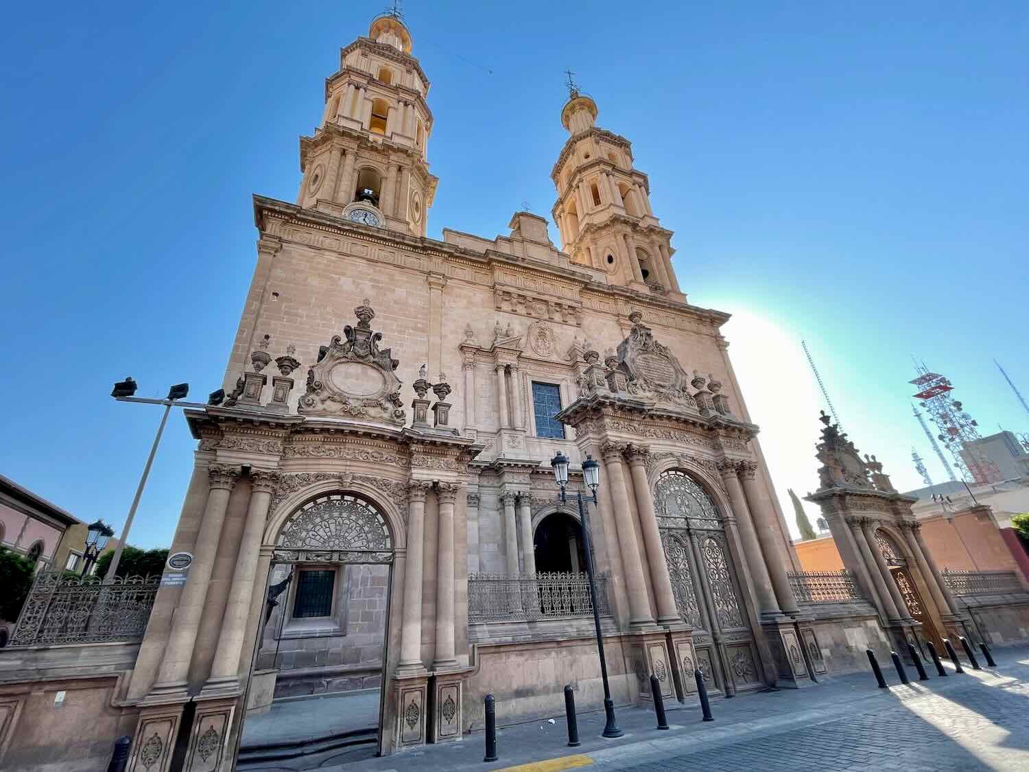
We passed this striking Catholic Church in the first town after leaving the Sierra Fría mountains. The construction of the main hall, with five pairs of concrete domes, was different than anything we’d ever seen before. Temazcal, State of Aguascalientes, Mexico. Copyright © 2019-2023 Pedals and Puffins.
Riding on the pavement, we were able to cover the final miles to Calvillo pretty quickly - arriving in town in the early afternoon. But by then it was a scorching 98F (37C) outside. So after locating a hotel with air conditioning (not as easy as you might expect), we hunkered down in our cool room and rested for the remainder of the day.
The Guava Capital of Mexico
We hadn’t realized it before our arrival, but Calvillo is one of Mexico’s Pueblos Mágicos (magical towns). To achieve this lyrical designation, a municipality is supposed to embody exceptional cultural qualities, or have a deep connection to Mexico’s historical identity. But with over 132 towns having already been christened as Pueblos Mágicos, we’ve started to notice that some of them have more “magic” than others. We ended up spending a couple of days in Calvillo, and it is definitely a nice town. But it’s not exceptionally scenic. And it didn’t quite rise to the level of places like Sombrerete or Loreto, where the historical and cultural details seemed to be more integral to the modern identity of the towns.
The ‘letras’ sign in the main plaza of Calvillo, one of Mexico’s Pueblos Mágicos. State of Aguascalientes, Mexico. Copyright © 2019-2023 Pedals and Puffins.
Calvillo earned its Pueblo Mágico title in large part because of its reputation as the Guava Capital of Mexico. So it comes as a bit of a surprise that the Calvillo region isn’t actually the biggest producer of guava in Mexico by volume (that distinction belongs to Michoacán). But guava aficionados seem to agree that the fruit produced in Calvillo is the best in terms of taste, fragrance, size and color.
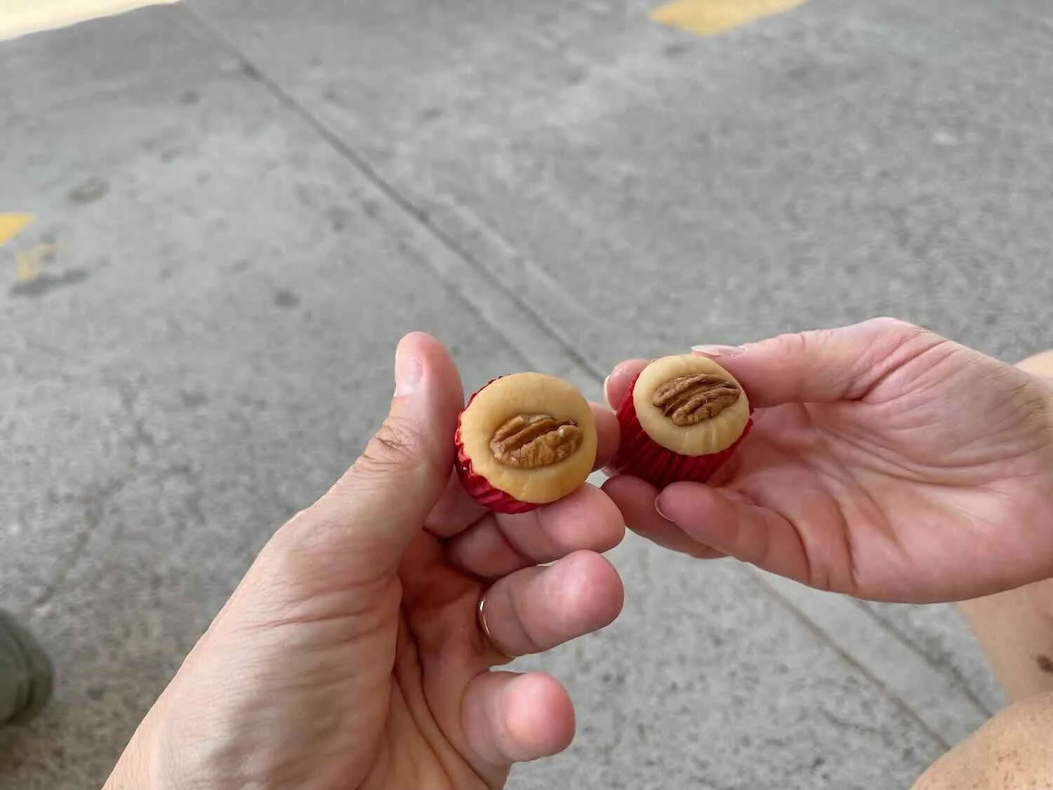
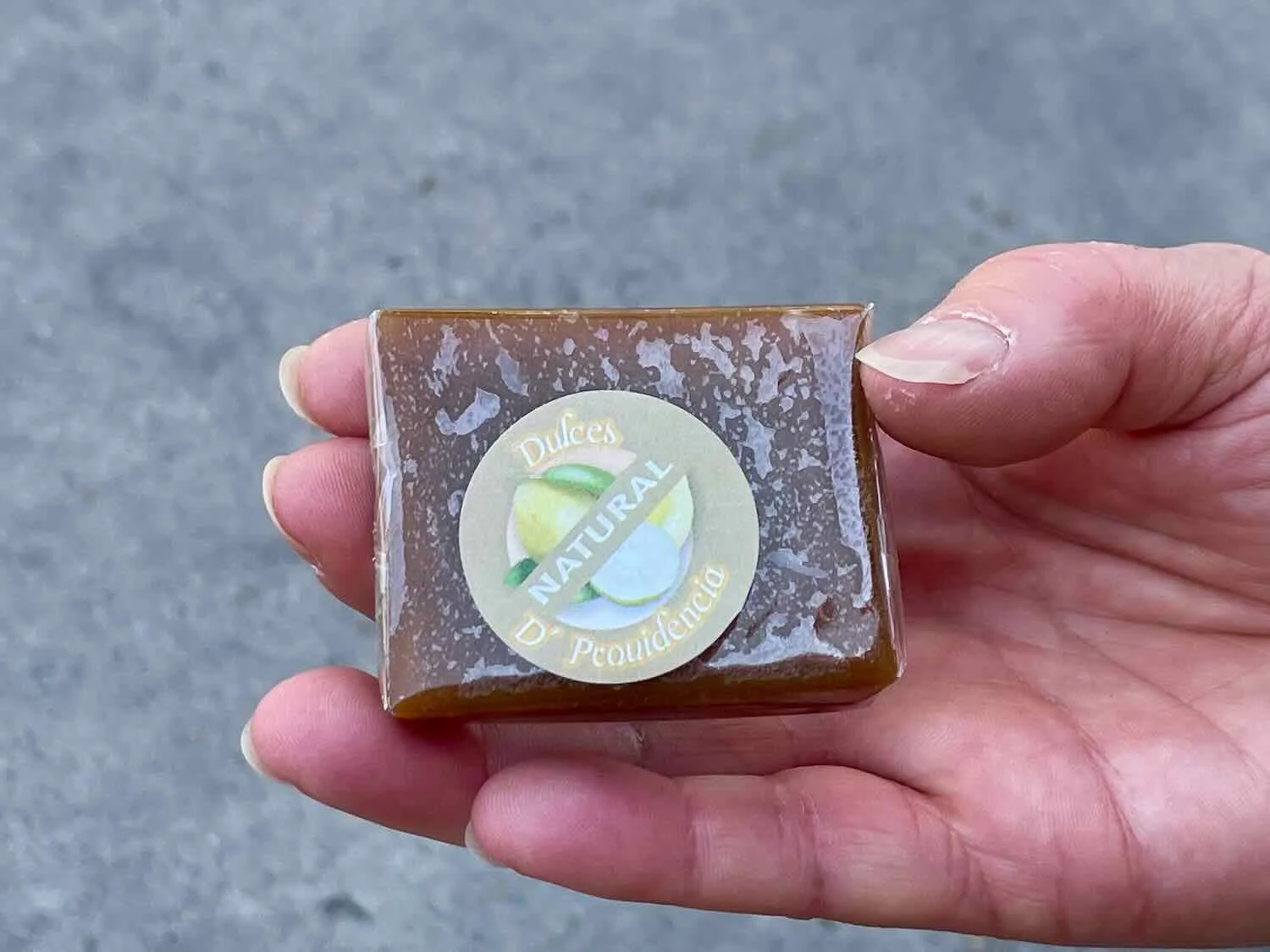
Thus, no visit to Calvillo is complete without a stop at the very modest, but renowned guava candy factory. The factory is so unassuming from the outside that we actually walked past it a couple of times before figuring out exactly where it was. And it turned out to be just a short distance down the street from where we were staying. But as you approach the factory, the sweet and perfumed scent of guava juice fills the air - so you know you’re getting close. They sell a wide variety of products including candies, jellies, syrups, juices, and even wines. Of course, once we found the factory we had to drop in and try a couple of the famous sweets. They were very, very tasty. We were hoping for a tour of the guava processing, as well. But the owner was not around and he was the only person allowed to give tours.
The modest storefront of Dulces D’ Providencia, the renowned producer of the finest guava candies in Mexico. They had an odd rule about not taking any photos inside the shop, so this is the best we could do. Calvillo, State of Aguascalientes, Mexico. Copyright © 2019-2023 Pedals and Puffins.
The town also has a reputation for maintaining authentic culinary traditions. Strolling along Calvillo’s narrow streets, we passed lots of shops catering to cooks looking for quality ingredients.
Special mixes of herbs and spices for sale, ready to meet all your culinary needs. Calvillo, State of Aguascalientes, Mexico. Copyright © 2019-2023 Pedals and Puffins.
Strips of pork simmer in a vat of bubbling lard near the entrance of a butcher shop. They’re preparing fresh carnitas, a very popular, savory and tender meat used in tacos, burritos and other Mexican specialties. Calvillo, State of Aguascalientes, Mexico. Copyright © 2019-2023 Pedals and Puffins.
Nestled against a tall mesa, Calvillo has many steep pedestrian alleys that rise directly up onto the foothills. Each alley is lined with colorful houses carved into the hillside, where the residents have to climb long stairways to access their homes. We climbed to the top of one of the more famous alleys, called Andador Matamoros, for a view back across the broad valley below.
Heading up the stairs on one of the scenic, mountainside alleys to check out the view. Andador Matamoros, Calvillo, State of Aguascalientes, Mexico. Copyright © 2019-2023 Pedals and Puffins.
Old town Calvillo, State of Aguascalientes, Mexico. Copyright © 2019-2023 Pedals and Puffins.
Harvesting the Sun
Our first day’s ride out of Calvillo was an uneventful, if not exactly relaxing sprint along highway margins to a nondescript suburb, just south of the city of Aguascalientes.
The next morning we turned almost immediately onto a lightly-traveled two lane road - leaving the incredibly busy highway behind. It was wonderful to finally have some peace and quiet again, after dealing with the roar of cars and trucks throughout the previous day.
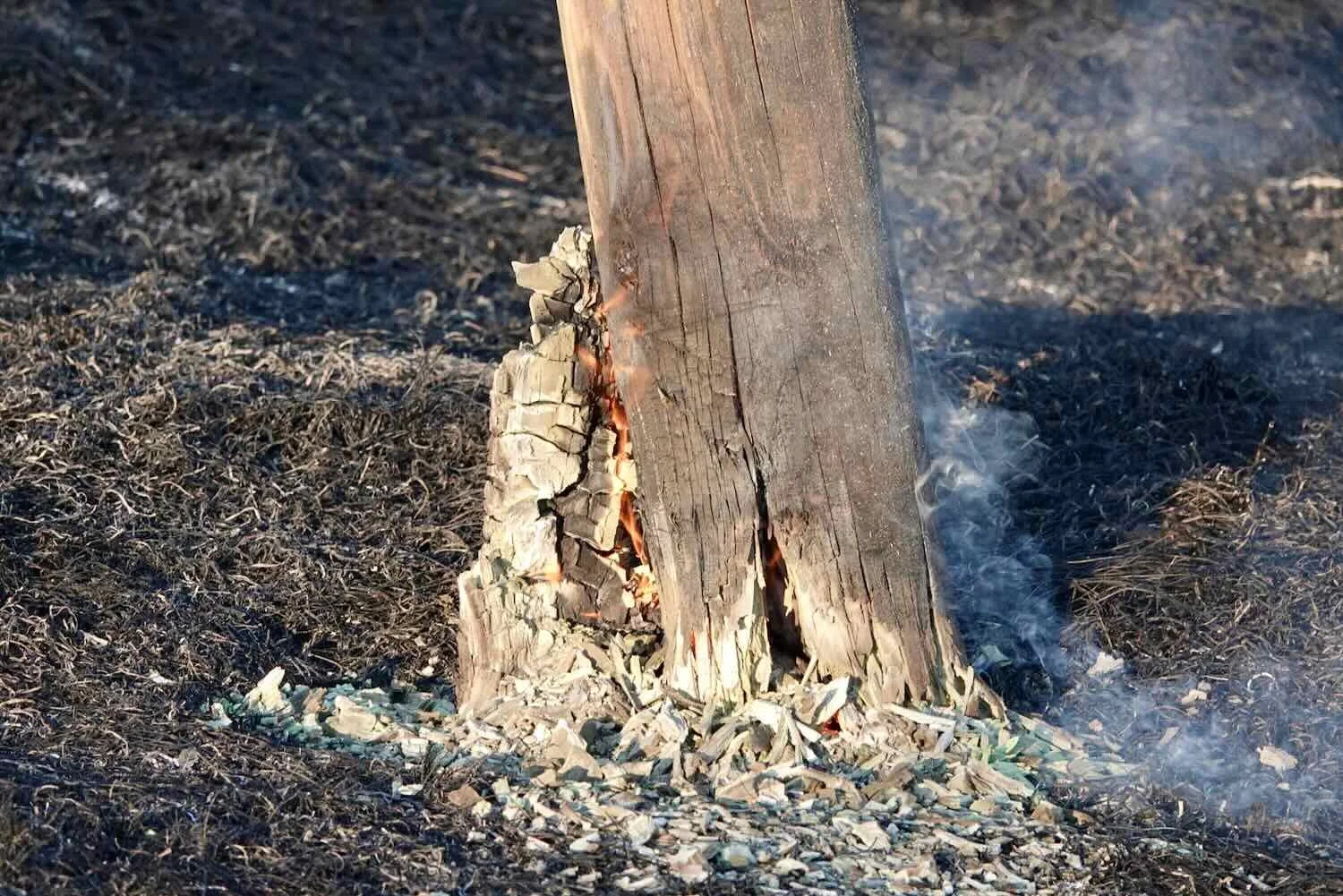
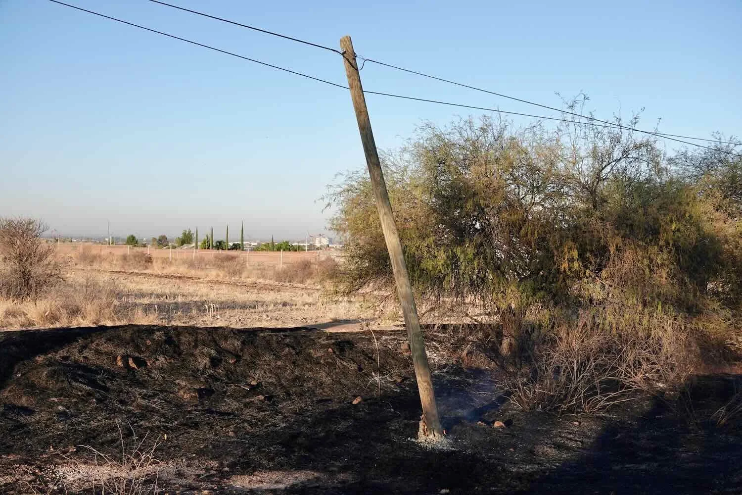
Our route quickly climbed several hundred feet up onto a broad ridge. For the next 2.5 hours we cycled along the undulating crest of the ridge, between two lowland valleys blanketed with farms. It had been pretty common to see charred vegetation along our route in Mexico, resulting from roadside brush fires. But at one point early in the day’s ride, we saw something that drove home the fact that it’s not a great idea to let those fires burn. A utility pole was burned completely through near its base, with wisps of smoke still rising from the charred wood. As far as we could tell, the only thing still holding the pole upright were the wires attached to the top. It seemed clear that it was only a matter of time before the pole would topple over, taking the power lines with it.
A little bit further up the road we cycled past an impressive sight: a massive field of photovoltaic solar panels. The Parque Solar Los Cuervos (named after a nearby town) sprawled across 1400 acres (566 ha) along the top of the ridge. That’s nearly twice the size of New York’s Central Park. And it was composed of a mind-boggling 800,000 individual solar panels.
It definitely was larger than any other solar array we’d ever seen. (Even so, it was not close to being the biggest in the world. There’s a solar array in India that’s ten times bigger.) Afterwards we wondered about the environmental impact of such industrial-scale solar fields. It seemed like it was taking up a lot of land that must have been used previously either for food production or natural areas. We couldn’t help but wonder if one reason giant solar farms are so fashionable is because people do not fully consider all the costs and impacts (e.g., mining rare metals, land use requirements, grid impacts, and disposal of toxic components, among others).
Rows and rows of solar panels covered the top of the ridge along our route. Parque Solar Los Cuervos, State of Aguascalientes, Mexico. Copyright © 2019-2023 Pedals and Puffins.
After passing the solar park, we cycled across rolling hills through farm country. Small towns that probably served as agricultural hubs were sprinkled along the route every five to seven miles. The smell of livestock permeated the “fresh” country air. And for the first time since entering Mexico we saw many big fields of corn. Given Mexico’s strong cultural connection to maize, we had been wondering when we might start to see corn fields. It turns out that the Mexican state of Jalisco, which we had just entered, is the country’s top producer of summer-grown corn. We had definitely entered Mexico’s heartland.
A crested caracara surveys its domain among the cornfields in Mexico’s heartland. State of Jalisco, Mexico. Copyright © 2019-2023 Pedals and Puffins.
After a refreshing break at a country store, we began the long ascent up and over the biggest climb of the day. The farms rapidly disappeared, and we found ourselves climbing through mesquite-dotted grasslands. The first hour or so of the climb was manageable. But the top was defined by three, quite steep ridges. The first one was the hardest. The sharp pitch upward was a killer, and PedalingGal ended up having to hike-a-bike some of it (PedalingGuy was able to ride all the way to the top, albeit very slowly.) We both managed to cycle up the remaining two ridges, but we were definitely happy to reach the top of the third ridge.
We glided swiftly down the far side, enjoying the break from pedaling. In the valley below, we encountered some of Jalisco’s world-famous blue agave farms. According to tradition, true tequila can only be made from blue agaves, mostly grown in the state of Jalisco. Any other liquors made from other types of agave are more properly called mezcal. And there, on the edge of an expansive plain, we cycled among long rows of the mythical source of tequila. Like the solar panels and the corn, it felt like another way that Mexico harvests its prolific sunshine, turning it into products that evoke the spirit of the nation.
Long rows of blue agave plants - the traditional source of nectar that is fermented into tequila. These are young plants. After eight to ten years, the central “cabeza” of the agaves can weigh up to 150 lbs (65 kg), of which 25%-30% is sugar. Near Lagos de Moreno, State of Jalisco, Mexico. Copyright © 2019-2023 Pedals and Puffins.
It wasn’t long before we approached the urban edge of the town of Lagos de Moreno, where the traffic became thicker and thicker. When we hit the intersection with the multi-lane highway that leads to the big city of León, it became a madhouse. There was no traffic signal or policeman stationed there to manage the flow of vehicles. As a result, the jockeying of cars, trucks and motorcycles became a free-for-all. Cars were backed up for more than a mile in all four directions. We got off our bikes, not daring to ride through the swarm. Finally, after a wait that seemed to last forever, we were able to dash across the highway when a truck stopped to let another car through.
The final mile that we cycled along Hwy 45 was very challenging, with bumper-to-bumper semi trucks and barely enough room for 2-way traffic. It was a relief to finally arrive at a hotel at the edge of the town of Lagos de Moreno.
To the City of Lions
The short, but harrowing ride on Hwy 45 did make us wonder if our current plan to cycle all the way to the city of León on that road would be wise. But a look at the street view on our phone maps showed that between Lagos de Moreno and León there would be a pretty good road shoulder for most of the trip. So after some discussion, we decided to stick with our original plan.
It was a day of mostly urban riding - almost all of it on a 4-6 lane highway. Fortunately, the intel we gleaned online was good and we were able to ride on a nice, wide shoulder most of the distance. But since the shoulder is often considered just another lane in much of Mexico, we were still tense and alert. The sketchiest sections tended to be on narrow bridges, where the shoulder would disappear. Whenever that happened, we hustled across as quickly as we could. Fortunately, with multiple traffic lanes, the passing cars usually gave us enough room.
Near the top of the ridge that separates Lagos de Moreno from León, a white van pulled over to the side of the road, right in front of us. The driver got out of the van with something in his hands. He was obviously waiting for us as we approached, so we stopped to see what was up.
And so we met León (yes, just like the name of the city we were heading for). He had been traveling for the past week on business among various cities in the region, but was now on his way home to Puebla, Mexico. He had some extra packages of cookies, which he wanted to give to us. We gratefully accepted two huge packs of cookies. As we chatted with León by the side of the road, he strongly encouraged us to visit his hometown of Puebla, which has a reputation for being one of the more beautiful cities in Mexico. We certainly do hope to get over to Puebla on our way south, and he was very pleased to hear that. After taking a couple of selfies, he drove away. We love these serendipitous encounters. Not only do they brighten our days, but they always add depth and insights to the places we travel.
Trail angel, León, who won our hearts with his kindness (and some cookies). Between Lagos de Moreno and León, State of Guanajuato, Mexico. Copyright © 2019-2023 Pedals and Puffins.
Right around the time we met León, as we came over the top of the ridge, we started noticing a lot of very fancy, gated communities along the route. They had high walls, security cameras, and they advertised amenities like gyms and clubhouses. It was much more upscale than anywhere else we had been so far in Mexico. With a population of more than 1.7 million people, León is the third largest city in Mexico (only Mexico City and Tijuana are bigger). We definitely got the impression that León is a prosperous city, where there is more wealth than in the smaller municipalities to the north.
The final, three mile run into the city included a really fun, super-fast descent on a nice, wide highway shoulder, where we reached top speeds of 30+ mph (48+ kph). But it didn’t last. The closing mile was touch-and-go, as we negotiated a maze of wide and busy roads in a northern suburb of the city. But we eventually arrived at a hotel, safe and sound.
We spent two days in León. Our first order of business was to take care of some dental work. For those keeping track, this would be the third dental visit for PedalingGuy since our departure from Alaska nearly a year ago. A few days earlier, he had noticed that one of his fillings had broken, and a piece fell out. Amazingly, we were able to schedule an appointment with a dentist just a couple of blocks away, at 9:30 the next morning. The tooth was cleaned and refilled before noon, for less than half of what we would have paid in the USA.
Keeping PedalingGuy’s dental infrastructure in working order. We scored a dental appointment on short notice, so he could get a chipped filling repaired. León, State of Guanajuato, Mexico. Copyright © 2019-2023 Pedals and Puffins.
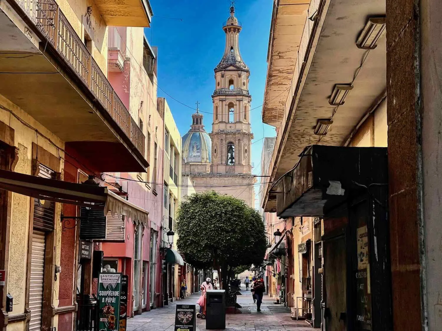
The next day we hiked four miles into the center of León’s old town. We had a great time wandering around the historic Centro, where we visited well known sites like the Plaza Principál, the fountain of lions, several beautiful churches, and the Arch on the Avenue of Heroes.
The tranquil central plaza, with its iconic, manicured, laurel trees. Plaza Principál, León, State of Guanajuato, Mexico. Copyright © 2019-2023 Pedals and Puffins.
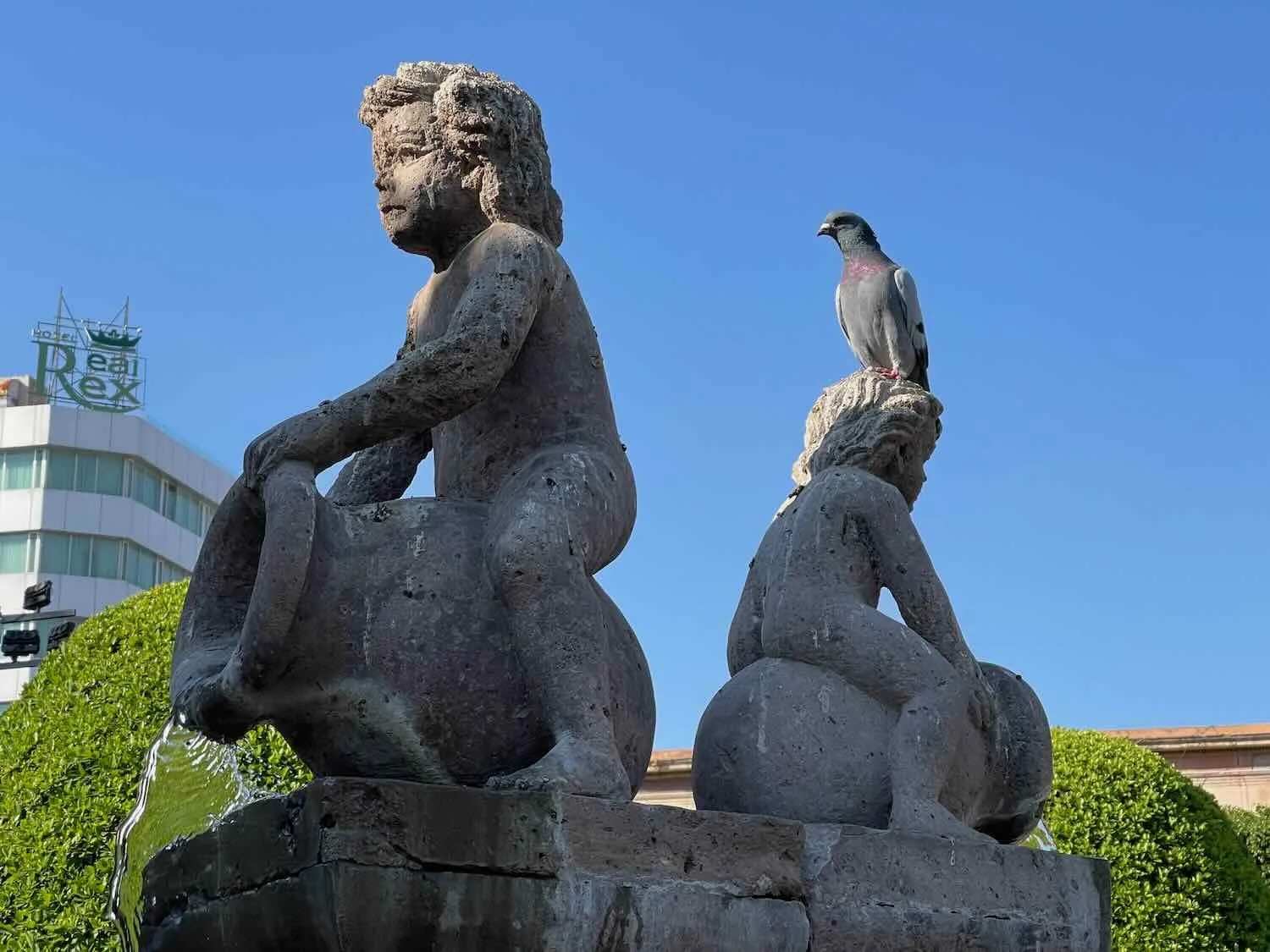
The Fuente de los Leones (fountain of the lions) is one of the city’s most recognizable landmarks. The fountain was erected in 1976 to commemorate the 400th year since the founding of the city, with each lion representing one of the centuries. Founder’s Plaza, León, Mexico. Copyright © 2019-2023 Pedals and Puffins.

We enjoyed big, refreshing cups of fresh-squeezed orange juice from this vendor. Near the Plaza Principál, León, State of Guanajuato, Mexico. Copyright © 2019-2023 Pedals and Puffins.
A stroll down the Avenue of the Héroes led us to León’s triumphal arch, erected to commemorate Mexico’s independence from Spain (seen here framing the Church of the Sacred Heart). The lion on top symbolizes the courage of the people of the city. León, State of Guanajuato, Mexico. Copyright © 2019-2023 Pedals and Puffins.
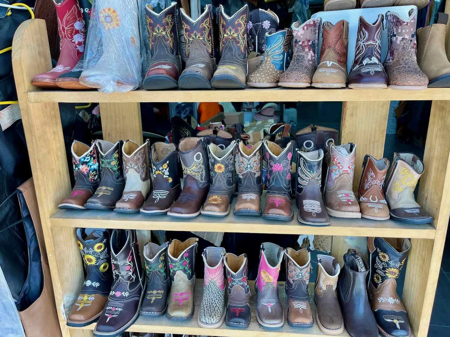
From the historical center, we walked over to the Zona Piel (the leather district). Known as the Shoe Capital of Mexico, León has an astounding 3,400 shoe manufacturers, who export their goods all over the world. But a stroll through the Zona Piel makes it clear that shoes are not the only leather products made here. Block after block of shops offer belts, wallets, purses, coats… and any other thing you can think of that might be made of leather. We spent an enjoyable hour or so window shopping, with the smell of tanned hides permeating the air.
Winging It on our Way to Guanajuato
The TransMexico route from León to the city of Guanajuato takes a fairly strenuous path over an 8,000 ft ridge (2,440m), with over 3,500 ft of climbing on many miles of cobblestone roads. Our plan was to go slowly, and take two days to reach Guanajuato, camping along the way. But that’s not quite how it worked out.
Anticipating some rough conditions, we got a nice early start and were out on the road just after 6am. The first part of the ride was going to be the easiest because we could take a dedicated bike path out of the city. Using the most common design we have seen in Mexico so far, the bike path was a paved strip that ran right down the center of a divided road. In this case it was a major, 12-lane highway. It was a bit squirrelly at first, due to some construction that forced us to abandon the central bike path to ride on the sidewalk. But once we were past the construction, we enjoyed hassle-free cycling. It was truly wonderful to have a safe path through the crazy city traffic.
A construction zone swallowed up our bike path as we attempted to cycle out of the city, as the sun rose over the mountains ahead. León, State of Guanajuato, Mexico. Copyright © 2019-2023 Pedals and Puffins.
Once we got past the construction zone, it was smooth sailing on the bike path. At first there were hardly any other people on the path, probably because it was pretty early in the morning. León, State of Guanajuato, Mexico. Copyright © 2019-2023 Pedals and Puffins.
As the morning progressed, we started to see quite a few other cyclists on the path who mostly appeared to be commuting to work. And there were even a few folks out running or walking. León, State of Guanajuato, Mexico. Copyright © 2019-2023 Pedals and Puffins.
A little over an hour into the ride we reached the spot where our route turned away from the main road, and onto a secondary byway. But the road we were supposed to turn onto didn’t appear to have a bike lane - or even a decent shoulder - and it looked like it had a lot of vehicle traffic. On the other hand, the very nice bike lane we had been using continued as far as the eye could see down the middle of the highway. It was just too tempting. After thinking it over, we decided to continue cycling on the bike path rather than turn down the side road. That decision sealed our fate for the rest of the day.
The bike path kept going and going, and we congratulated ourselves for the clever decision to stay on it. Along the way we encountered a couple of police vehicles parked at a major intersection, with a policeman standing guard holding a big gun. He waved for us to stop, so of course, we decided that would be a good idea.
As usually happens in these situations, he turned out to be very friendly - asking us about our trip and how we were enjoying Mexico. It was fun to see that he seemed pleased we were having a good time. When we told him we were heading for the city of Guanajuato, he proceeded to give us directions which were much too complicated for us to understand, especially since he was wearing a face mask. Perhaps we should have taken that as an indication of how challenging the route ahead might become. But, we didn’t. We just appreciated his eagerness to be helpful.
PedalingGal with a friendly officer who was guarding a big highway intersection, and who offered us detailed directions on how to get to the city of Guanajuato. León, State of Guanajuato, Mexico. Copyright © 2019-2023 Pedals and Puffins.
We ended up cycling on the bike path for a total of 19 miles (31 km). This was by far the longest dedicated bike lane we had found in Mexico. (The few others we encountered were typically only a couple of miles long.) And even after the bike path ended, we were able to ride on a nice, wide shoulder along the side of the highway for another 10+ miles. Before we knew it, we were well over halfway to the city of Guanajuato, and it was still before 10am. We started to think that not only might we make it there in one day instead of two, but we might be rolling into Guanajuato fairly early, without hardly breaking a sweat.
We were mistaken. Just after four hours into our ride, we found ourselves on a narrow, winding, and hilly road with no margin and only one traffic lane in each direction. Worse, there was way too much traffic for comfort. We actually regretted not getting onto a big, multi-lane toll road that we had crossed earlier, which looked like it had a nice, wide shoulder (and probably would have had more moderate hills). Our beautiful day suddenly turned into a tough and stressful ride.
We passed a big General Motors factory at the intersection where our route crossed over a major toll road. After that, our road became more narrow and perilous, making us wish we had gotten onto the toll road. Silao, State of Guanajuato, Mexico. Copyright © 2019-2023 Pedals and Puffins.
When we reached the bustling town of Santa Teresa, we stopped at a small grocery store for some refreshments, and to consider our options. We both were really fed up with the road we were on. Over a snack of bananas and cookies, we got out a map to look for a (hopefully) more tranquil road to the city of Guanajuato.
We stopped at this little tienda to take a break from riding on a hilly, narrow, busy road and to plot a route forward. Santa Teresa, State of Guanajuato, Mexico. Copyright © 2019-2023 Pedals and Puffins.
We settled on a route that looked pretty good on the map, but it was somewhat complicated - especially without having a GPS line to follow. Pretty quickly, we missed a turn and ended up having to backtrack. Not a particularly auspicious start.
The rest of the day was an adventure. Right away the route dove down through a series of small, dirt alleys in the town of Santa Teresa. Then we rode for several miles on rolling dirt roads past small towns, farms and fields. There was even a stream crossing that we had to wade across. Our progress slowed dramatically, but we did manage to find a route without any vehicles.
Slowly making our way towards the city of Guanajuato. San José de Cervera, State of Guanajuato, Mexico. Copyright © 2019-2023 Pedals and Puffins.
But then we hit a major roadblock. Our little street dead-ended at the side of a big, busy highway. Well, it wasn’t actually that big. It had just two lanes in each direction. But it was bisected by an impassable concrete island in the middle. The local authorities had clearly decided that this road was too dangerous for pedestrians (or cyclists) to cross. To protect us, they had erected a tall, chain-link fence that ran the full length of the median, so it was impossible to get across to the other side, where we had planned to go.
Looking at a map, we were dismayed to see that there were no cross streets for at least a half mile in either direction. To accommodate people on foot, they had built a series of pedestrian overpasses. But the first one we came to only had a very long set of difficult stairs (and a non-operational elevator). So, we pressed on. After going half a mile out of our way we reached a pedestrian bridge that had a ramp, and we finally were able to get up and over the road. Then we had to go another half mile back to pick up our trail.
Almost immediately after that, we began a steep climb into the mountains that surround the city of Guanajuato. For the next 45 minutes we crawled our way up to the top of a ridge. On the bright side, there was a sidewalk. So we were able to stay out of the traffic.
The city of Guanajuato is situated within a gorge that is almost completely surrounded by mountains. Our route to the city took us over this pass in the Cerro de San José. State of Guanajuato, Mexico. Copyright © 2019-2023 Pedals and Puffins.
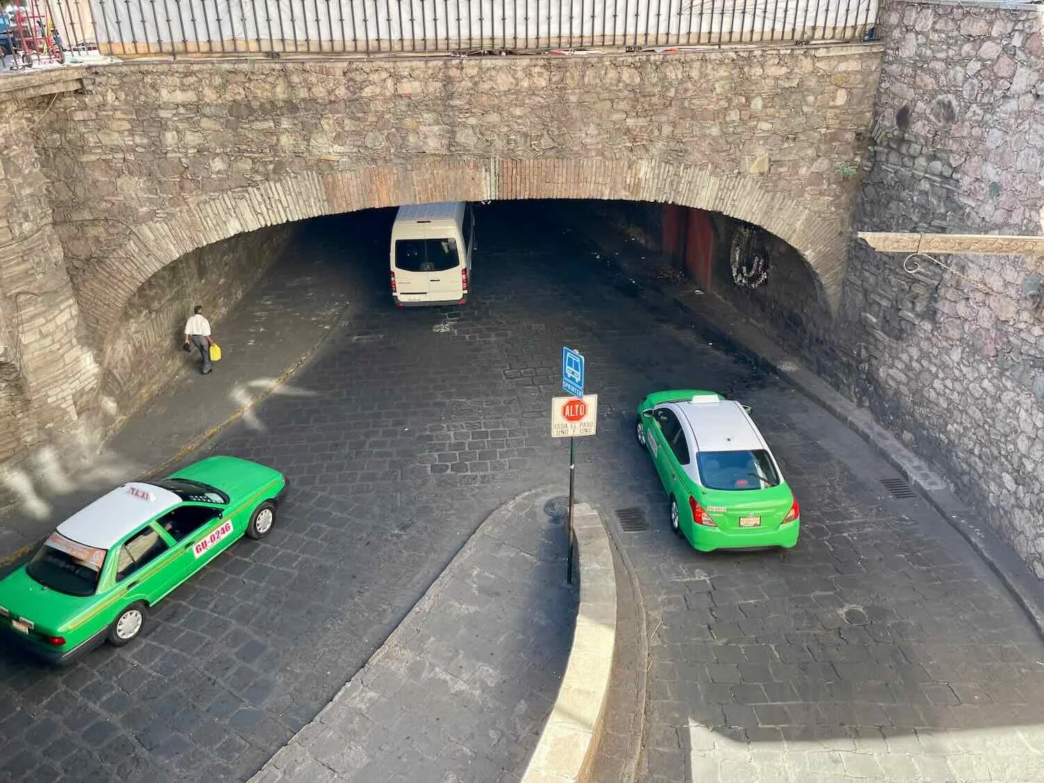
We crested the top of the pass with only three miles to go, and it was nearly all downhill from there. As we entered the city, we passed through one of Guanajuato’s famous traffic tunnels. Originally constructed during the 1800s to divert floodwaters away from the city during the rainy season, they were converted for use by vehicles in the 1960s. The tunnels are a key reason why Guanajuato has so many pedestrian-only alleys, and traffic in the cramped, colonial town center isn’t too bad. But the sidewalk within the tunnel was definitely designed for pedestrians, not cyclists. The curve of the tunnel’s arch forced us to ride closer to the edge of the sidewalk than we would have liked. So for about a quarter mile we rode just inches from the passing vehicles. But at least we didn’t have to ride out in the traffic.
Cycling through one of Guanajuato’s famous, underground traffic tunnels. Blvd. Diego Rivera, City of Guanajuato, Mexico. Copyright © 2019-2023 Pedals and Puffins.
Even after we exited the tunnel, our road continued through a narrow, brick-lined canyon hemmed in by tall buildings. Calle Padre Belauzarán, City of Guanajuato, Mexico. Copyright © 2019-2023 Pedals and Puffins.
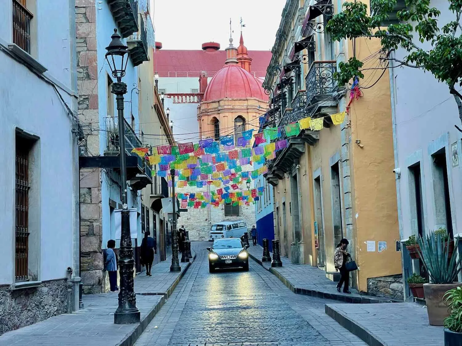
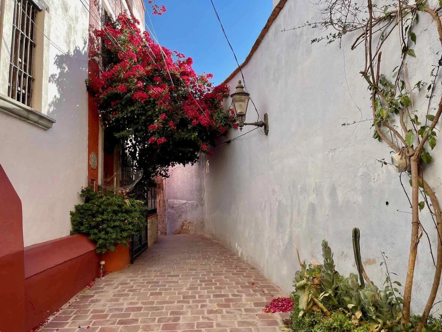
More than any other city we had yet visited in Mexico, Guanajuato (pop. 195,000) had the feel of a European mountain town. The streets were all paved with cobblestones. And once we got close to the oldest part of town, plazas and statues were everywhere. It felt very different from Durango or Zacatecas - more international and artsy. For the first time since leaving Mazatlán on the coast, we heard a few people speaking English on the streets.
When we arrived, our worst fears about finding lodging in this busy tourist town were realized. Our target hotel was full. The desk manager tried to be helpful, calling a couple of “sister” hotels nearby. But the ones that had rooms available didn’t have air conditioning. And we really wanted air conditioning.
A quick online search turned up another hotel just a block and a half away that had an available room with air conditioning. We hustled over and were able to book their very last room. The hotel was located in a lovely, colonial era mansion with really thick walls (a priceless feature in a noisy city) and plenty of space. As a special bonus, we had a balcony overlooking the Plaza de la Paz - a beautiful open space in the center of town, adjacent to the main cathedral. In the end, everything worked out just fine.
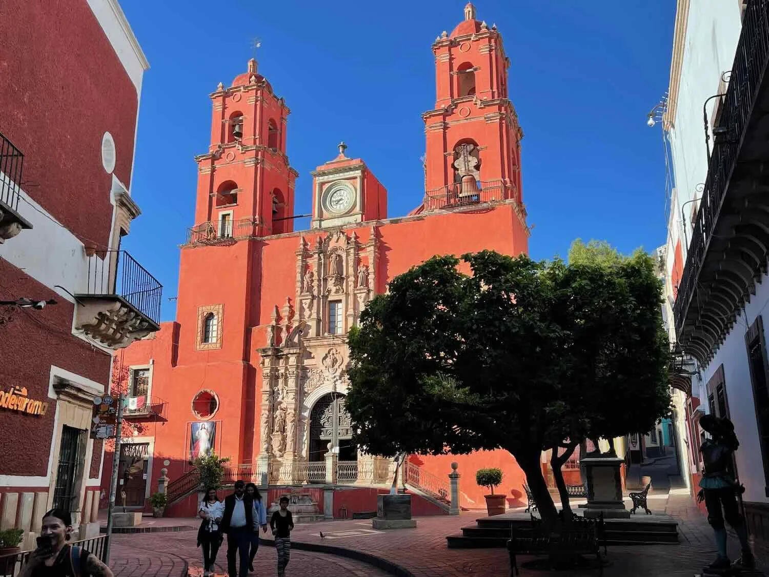
The colorful and elegant Cathedral of Guanajuato anchors one side of the central Plaza de la Paz. City of Guanajuato, Mexico. Copyright © 2019-2023 Pedals and Puffins.
The view of the Plaza de la Paz from our hotel balcony. Roaming mariachi bands filled the plaza with music in the evenings, but things would quiet down at night. City of Guanajuato, Mexico. Copyright © 2019-2023 Pedals and Puffins.
The Jewel of America
Many people consider Guanajuato to the most beautiful city in Mexico. Of course, there is quite a bit of competition for that title. But Guanajuato certainly provides a visual feast, earning it the nickname “The Jewel of America.” Several factors come together to provide a unique blend of characteristics that set Guanajuato apart from the others:
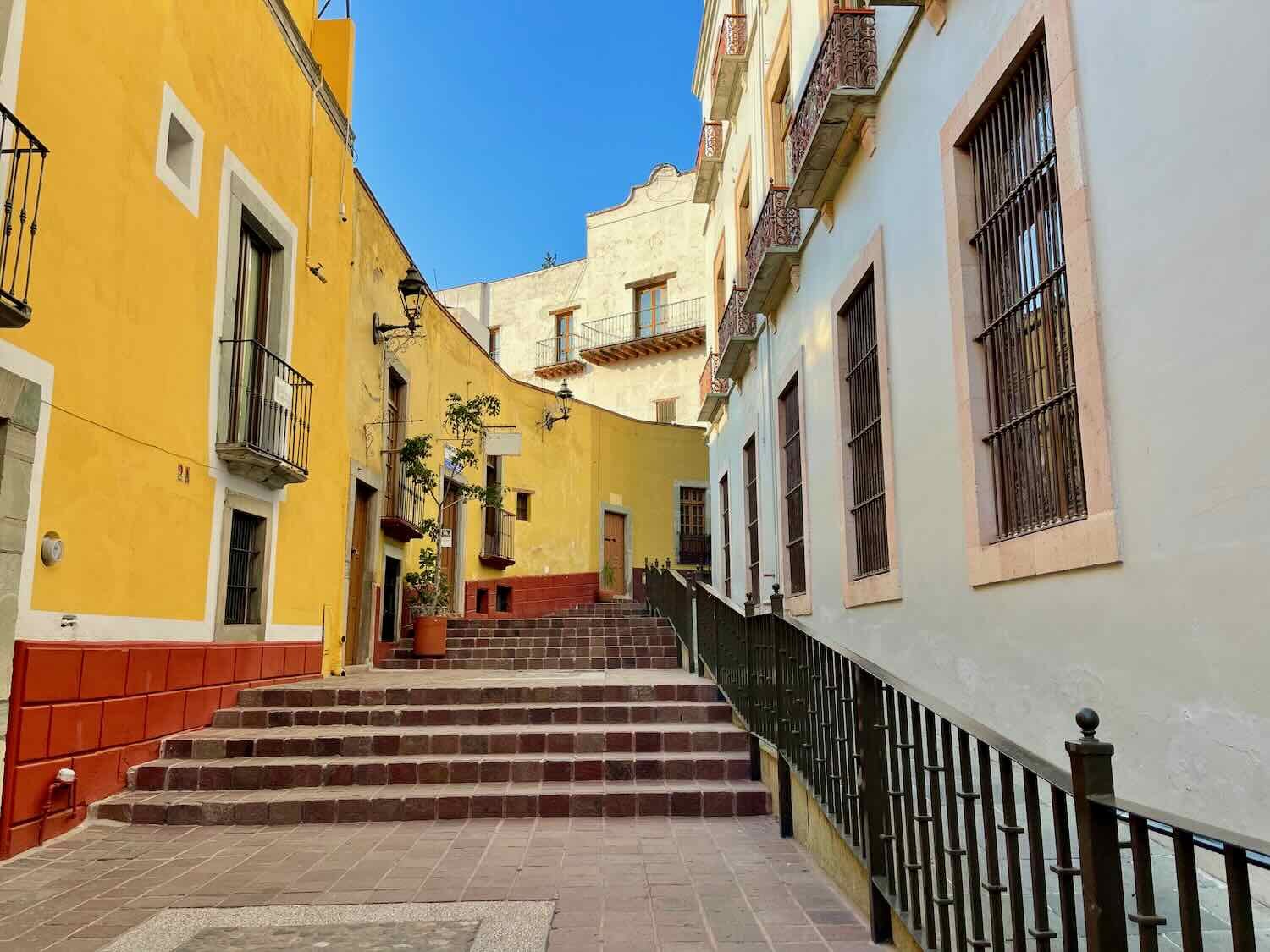
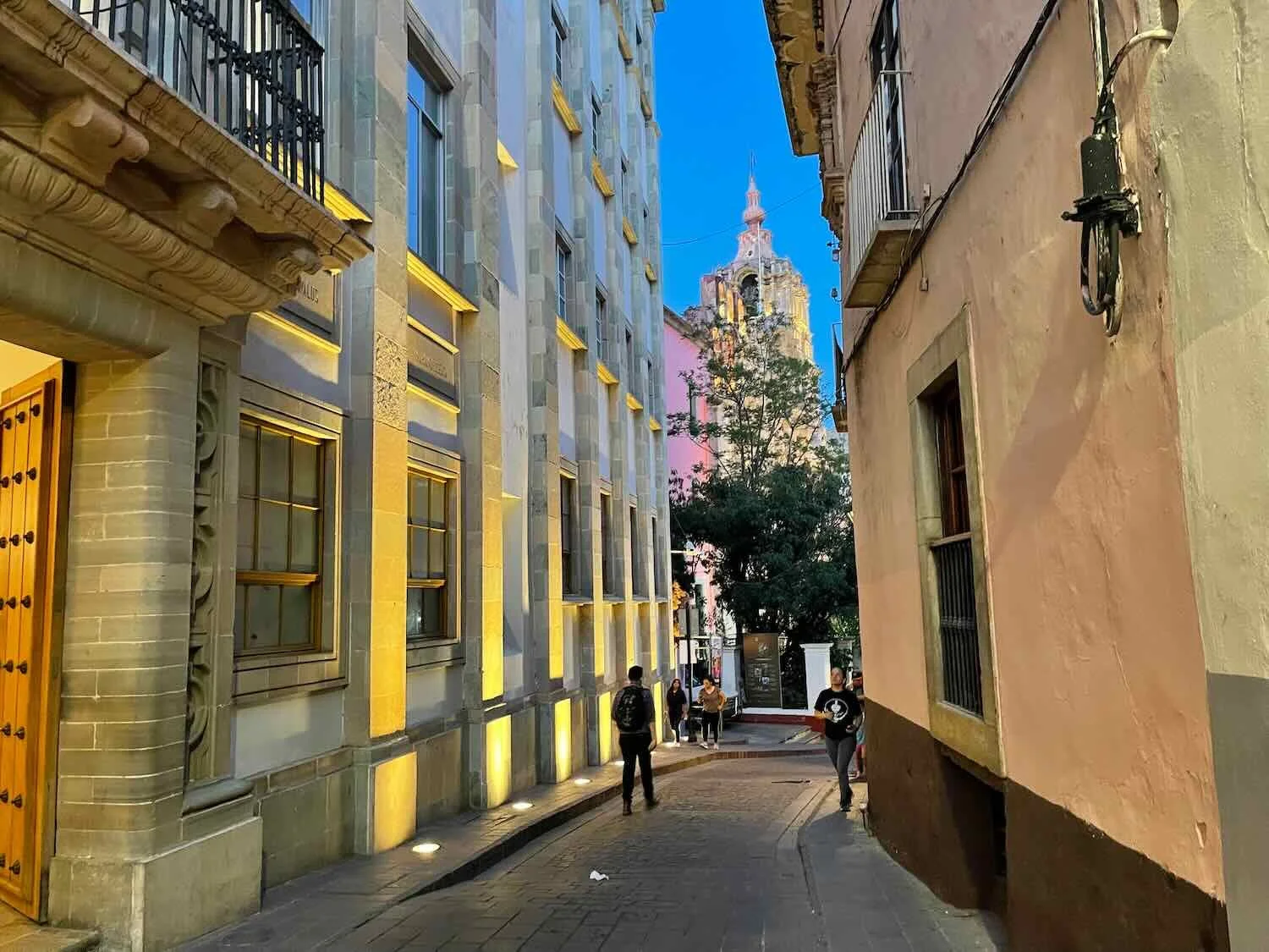
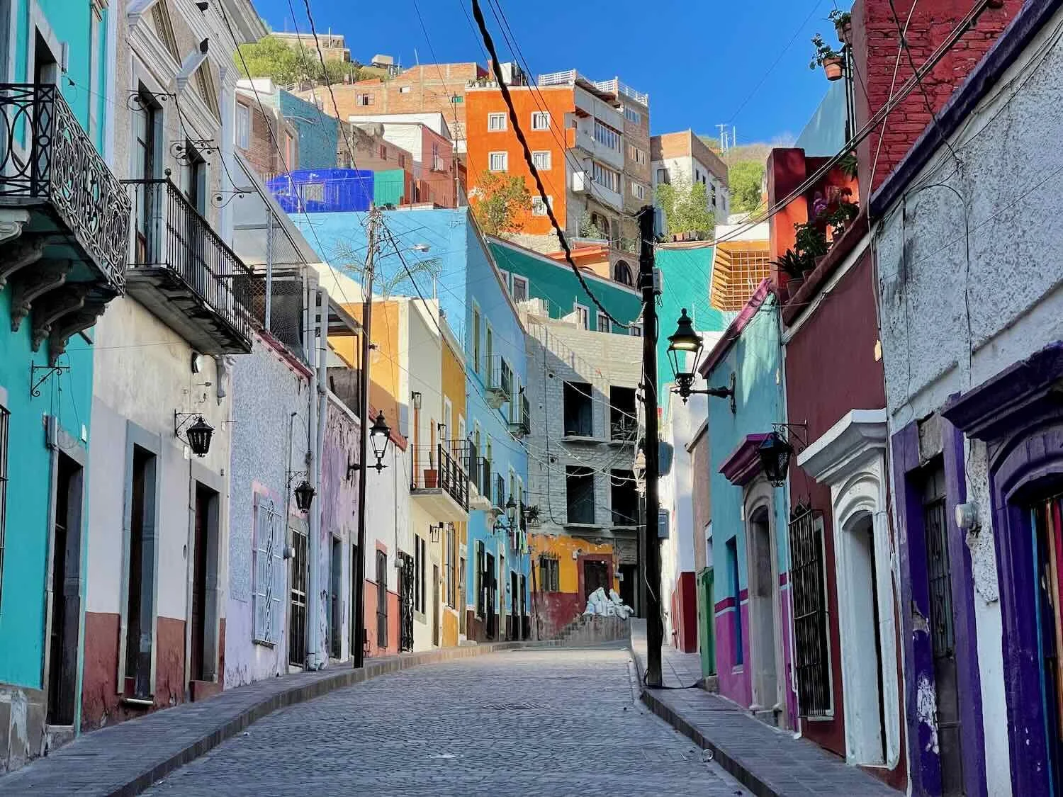
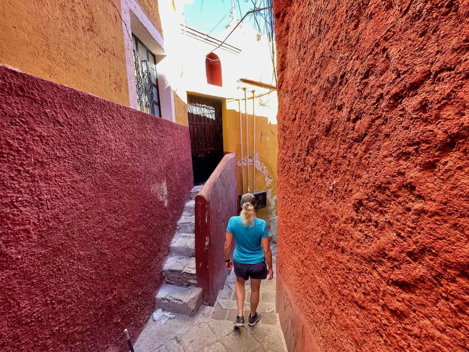
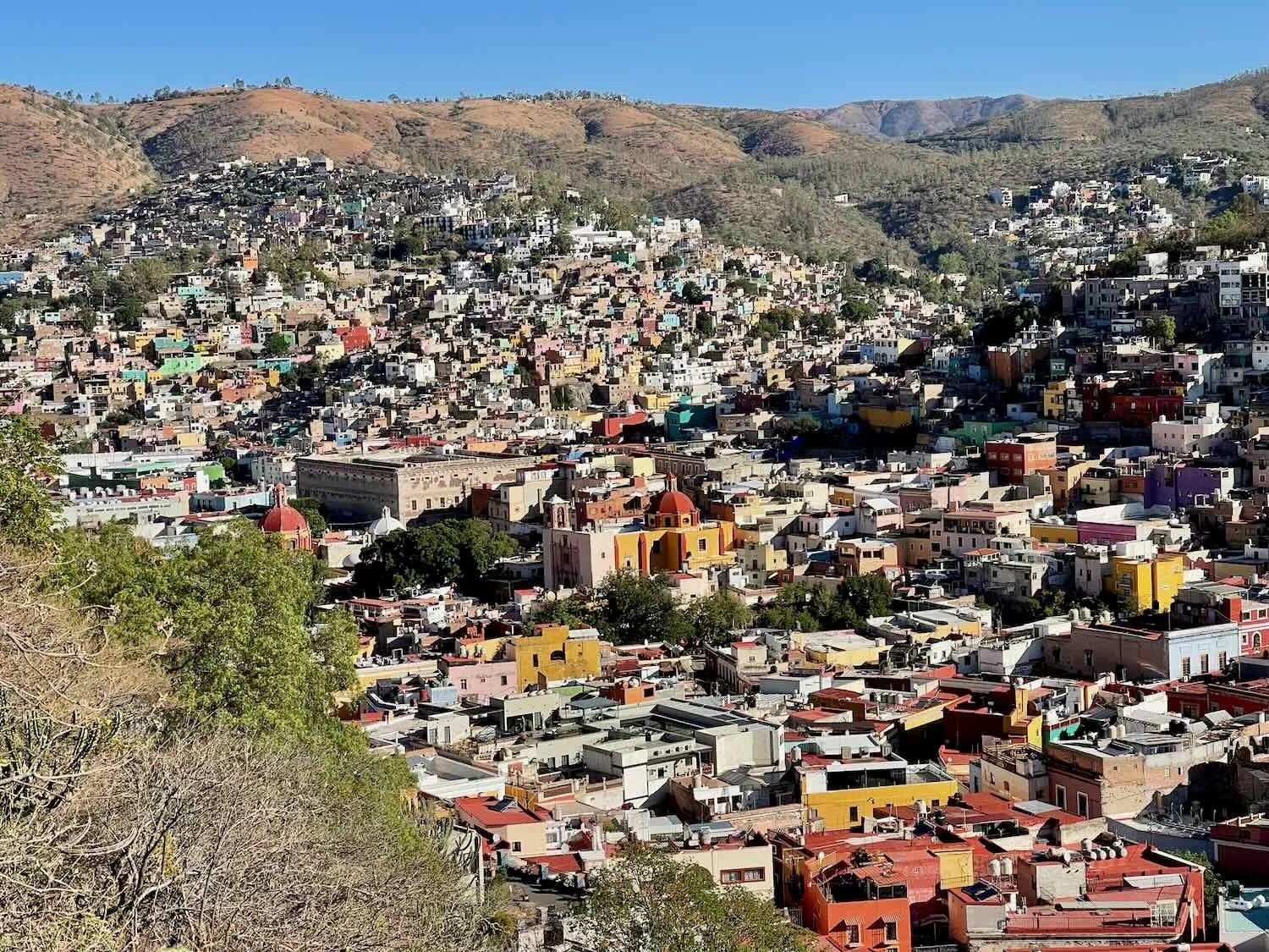
The whole city is beautiful. The “historical center” is not just a few blocks of colonial architecture surrounded by a large, more urban landscape. Instead, every corner of Guanajuato feels authentically timeless, with an old world charm. That’s partly a result of the fact that the city is almost completely encircled by steep hills, constraining its ability to sprawl.
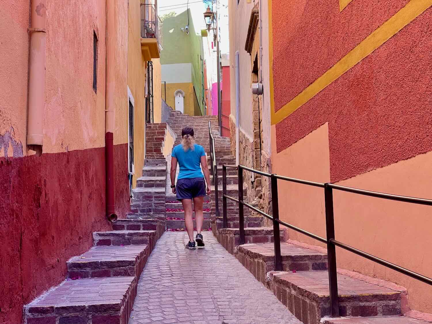
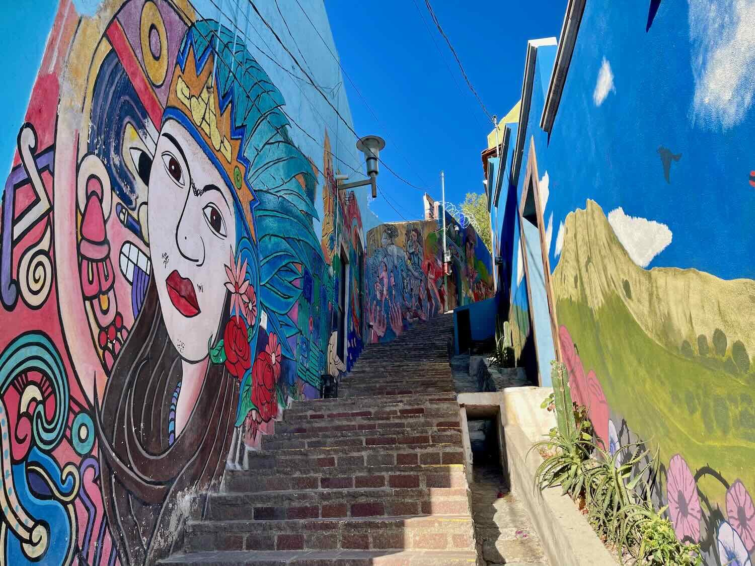
There are very few cars. The underground system of tunnels keeps many vehicles from ever surfacing onto the streets of the city. As a result, there hasn’t been a lot of pressure to create streets that cater to modern cars and trucks. The city remains a virtual honeycomb of narrow alleys - many of which have lots of steps for pedestrians to get up into the hills.
The landscape is stunning. And it’s easy to get up onto a hillside with a spectacular view of the multi-colored neighborhoods that blanket the Guanajuato valley.
It has a youthful energy. The presence of a prestigious university with nearly 15,000 students supports a vibrant intellectual and artistic scene. There is a sophisticated and cosmopolitan feel to the shops and restaurants, especially in the neighborhood surrounding the university.
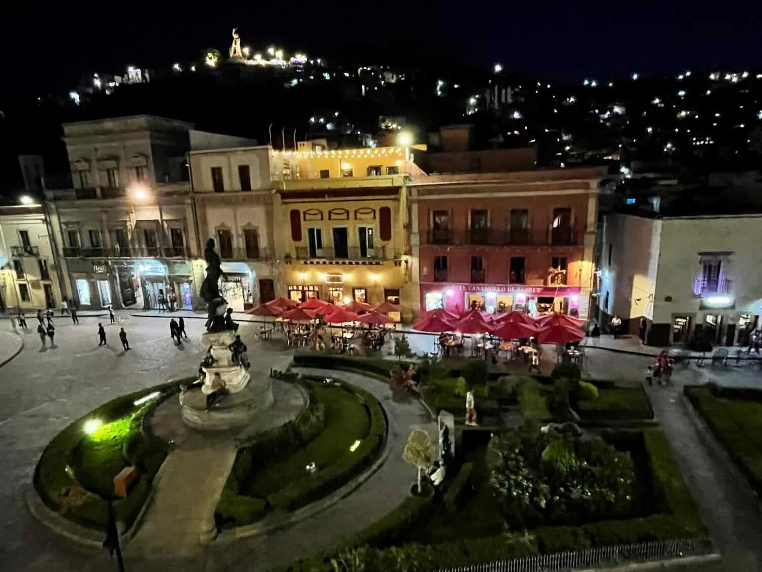
Here’s another view from our hotel balcony. The colorful neighborhoods that rise up onto the hills of Guanajuato are a feast for the eyes. City of Guanajuato, Mexico. Copyright © 2019-2023 Pedals and Puffins.
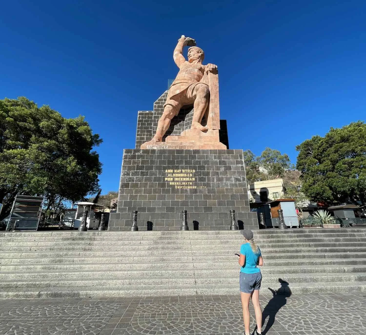
We spent a layover day exploring Guanajuato. Due to its compact size, it was relatively easy to visit most of the major sites. One of the first things we did, early in the morning, was walk uphill through Guanajuato’s picturesque alleys to see the El Pipila Monument. Each narrow passage had its own mood, but all were lovely and serene.
Although El Pipila is now a legendary hero, he was a classic underdog - not necessarily destined for greatness. The nickname actually translates as “The Turkey.” And although the exact reasons why he earned this nickname are in dispute, it was not a compliment. But the legend says that by working hard in the mines, he became very strong. And in a famous episode at the start of the Mexican War of Independence in 1810, El Pipila enabled the defeat of a group of Spanish overlords who had taken refuge inside a fortified granary in Guanajuato. In an act of great bravery and strength, he strapped a large, flat stone to his back to protect himself from the Spanish muskets, and managed to approach the wooden door of the granary - which he doused with tar and set on fire. When the door was breached, the revolutionaries burst into the granary and killed everyone inside. This episode is considered to be the first victorious battle for the Mexicans in their fight for independence. And it was made possible by El Pipila.
The El Pipila Monument sits high on a hill, with expansive views overlooking the city.
As we wound our way through alleys on our way down from Monument Hill, we came across a large gathering of people that filled several blocks along one of the narrow city streets. Folks were standing in the street, sitting on steps, socializing and sharing food and drinks. It seemed early in the morning for a party. But from some subtle cues we guessed that it might be a wake for someone who had died.
As we passed among the crowd, several people offered us food and drinks, even though it must have been obvious that we were not friends of the family. Unsure how to respond, we declined. But one gentleman who was serving horchata (a traditional drink of rice and milk) wouldn’t take “no” for an answer. He insisted we take a cup, so eventually we agreed. We sipped our horchata, sharing shy smiles and nods with some of the other guests before moving on. No one explained to us what the event was for, and we didn’t quite know how to ask. But we were moved by their generosity, and touched by their eagerness to include us in their tradition.
A crowd was gathered on one of the narrow streets, quietly sharing food and drinks on a cool morning. We were offered a cup of horchata (rice milk) from one of the folks serving drinks from a tray. City of Guanajuato, Mexico. City of Guanajuato, Mexico. Copyright © 2019-2023 Pedals and Puffins.
A toy vendor with her colorful merchandise. City of Guanajuato, Mexico. Copyright © 2019-2023 Pedals and Puffins.
Like many mountain towns in Mexico, Guanajuato’s colonial splendor was built on silver and gold. But for a period of time, the riches of Guanajuato dwarfed all other mining towns combined. Over the course of the 1700s, the Valencia Mine near Guanajuato produced fully two thirds of all the silver in the world. The legacy of those riches can be seen in the monumentally grand architecture of buildings like the Theater of Juárez, the University of Guanajuato, and many of the city’s majestic churches.
The spectacular Teatro Juárez was built for the entertainment of Guanajuato’s elite, who gained wealth from the area’s silver mines. City of Guanajuato, Mexico. Copyright © 2019-2023 Pedals and Puffins.
In the evening, the plaza in front of the Teatro Juárez is filled with the music of roaming mariachi bands. City of Guanajuato, Mexico. Copyright © 2019-2023 Pedals and Puffins.
A monumental staircase leads to the hallowed halls of the University of Guanajuato. The 15,000 students from the university bring a youthful sophistication to the town. City of Guanajuato, Mexico. Copyright © 2019-2023 Pedals and Puffins.
No matter where you go in Guanajuato, you’re likely to encounter a statue of Don Quixote. At first we were quite perplexed by this, since there didn’t seem to be any obvious connection between the city and the fictional character. But the backstory says that a young, revolutionary soldier fell in love with the novel Don Quixote while imprisoned during the Spanish Civil war of the 1930s. He later emigrated to Guanajuato, where he began collecting anything and everything related to Don Quixote. The collection is now a museum in Guanajuato. And the soldier’s adoration of Cervantes (the author of Don Quixote) has rubbed off on the populace. Each year the city now hosts a major, international festival featuring the performance of plays written by Cervantes, as well as a wide range of events intended to showcase music, theater, art and poetry in the Spanish language.
One of the many statues of Don Quixote that can be found throughout the city of Guanajuato, Mexico. Copyright © 2019-2023 Pedals and Puffins.
The remainder of our time in the city of Guanajuato was spent simply enjoying the beauty of the city.
Workers scrub the cobblestone streets each morning to prep the Plaza de la Paz for a new day. City of Guanajuato, Mexico. Copyright © 2019-2023 Pedals and Puffins.
Mexico’s Silver Cities
At this point we had visited four of Mexico’s most iconic mining towns: working-class Durango, charming Sombrerete, vibrant Zacatecas, and stunningly scenic Guanajuato. It’s been interesting to reflect on the characteristics that we have enjoyed in each one, as well as the different paths these cities have taken over the centuries. They are all unique, and appealing in their own way. We’ve cycled from one to the next, moving slowly across the landscape that lies in the transition between the Sierra Madre mountains and Mexico’s high, central plain. In the process we’ve had the chance to meet some local folks, and share an intimate appreciation for the places where they live. We’ve thoroughly enjoyed getting to know Mexico’s “silver cities.”