Cycling the Pan-American Highway in Peru, Part 4: Trujillo to Tumbes
22 February - 21 March 2026
22 Feb - Trujillo to Paiján (41.2 mi, 66.3 km)
23 Feb - Paiján to Pacasmayo (33.5 mi, 54.0 km)
24 Feb - Rest Day in Pacasmayo
25 Feb - Pacasmayo to Mocupe (41.0 mi, 66.0 km)
26 Feb - Mocupe to Chiclayo (24.2 mi, 39.0 km)
27 Feb-1 Mar - Layover in Chiclayo
2 Mar - Chiclayo to Jayanca (29.3 mi, 47.2 km)
3 Mar - Jayanca to Olmos (37.5 mi, 60.4 km)
4 Mar - Rest Day in Olmos
5 Mar - Olmos to Ñaupe (31.3 mi, 50.4 km)
6 Mar - Ñaupe to Cruce Km 50 (40.5 mi, 65.2 km)
7 Mar - Cruce Km 50 to Piura (32.9 mi, 53.0 km)
8-11 Mar - Layover in Piura
12 Mar - Piura to Mallaritos (26.1 mi, 42.0 km)
13 Mar - Mallaritos to Sacobsa (40.3 mi, 65.0 km)
14 Mar - Sacobsa to El Alto (31.5 mi, 50.7 km)
15 Mar - Rest Day in El Alto
16 Mar - El Alto to Canoas de Punta Sal (38.8 mi, 62.4 km)
17 Mar - Canoas de Punta Sal to Tumbes (45.4 mi, 73.0 km)
18-21 Mar Layover in Tumbes
Approaching the Northern Edge of the Great Peruvian Desert
There’s a good reason that coastal Peru is known for its deserts. More than 80% of the country’s coastline receives barely an inch of rain per year, which typically falls in very light, misty showers. We met one, local guy who claimed to have seen real rainfall just once in his whole life.
For well over 1,000 miles (1,600 km) we had been cycling through this interesting, unique, but unforgiving desert, mostly surrounded by barren, rocky hills and towering sand dunes. The emptiness was only occasionally interrupted by river valleys turned green by irrigation.
However, that was about to change in a fairly dramatic way. Departing from Peru’s third largest city (Trujillo), it would take just a few days to cycle to its fourth largest city (Chiclayo), which sits right at the northern edge of Peru’s coastal desert.
From Chiclayo, the sand and rocks would give way to a burst of life as we entered the Equatorial Dry Forest - a relatively small region falling almost entirely within the part of Peru that juts out into the Pacific (including the westernmost point in mainland South America).
As the shoreline curves westward, the coastal lowland zone gets a lot wider. At the same time, the cold ocean current that chills most of Peru’s coast veers out into the Pacific Ocean, so that the nearshore waters become much warmer - evaporating into clouds that produce more rain. All these factors conspire to hold the desert at bay, and allow a rich, arid-land forest to grow in the transition zone between Peru’s desert and Ecuador’s more verdant landscapes.
We had started to get some hints of the upcoming changes as we approached Trujillo - where sandy hummocks in low valleys were suddenly covered with scrubby vegetation that had been absent further south. But the transformation would become more striking as we now ventured further north.
In the area around Trujillo, the barren desert we had been traveling through started to show more life. Shrubby bushes began to appear on top of scattered, sandy hills. N of Paiján, Pan-American Highway, La Libertad Department, Peru. Copyright © 2019-2026 Pedals and Puffins.
An Early Morning Escape
For a mid-sized city, Trujillo had truly horrendous traffic. It’s so bad that the global traffic index ranks Trujillo as the 9th most congested city in the world, even though it is considerably smaller than the other cities in the top 10. We experienced this mayhem firsthand, back when we had cycled into the maelstrom of Trujillo’s traffic on a Friday afternoon. Having survived that adventure, we were determined not to repeat the ordeal on our way out of town.
A tactic that we have found to be particularly effective for getting out of big cities by bicycle is to depart on a Sunday morning. Throughout Latin America, Sunday mornings are reliably a time when the fewest people are out on the road. Given its problems with massive gridlock, Trujillo was definitely a city where employing this strategy made sense.
It worked like a charm. There were so few cars on the road Sunday morning that you could easily be forgiven for thinking you had somehow been transported to another, much more calm city. Before we knew it we had reached the edge of town and turned back onto the Pan-American Highway.
At this point we were just three weeks away from Peru’s upcoming presidential election. Consequently, nearly every flat surface was painted with a sign promoting one of the many (34!) candidates. N of Trujillo, Pan-American Highway, La Libertad Department, Peru. Copyright © 2019-2026 Pedals and Puffins.
Agricultural Abundance
After Trujillo our route turned away from the coast, heading up and over another high, dry, desert ridge. However, as we cycled over the top of the pass, we were in for a surprise. Less than halfway down the far side we suddenly were surrounded by giant fields of sugarcane, rustling in the wind.
We had reached the edge of the Chavimochic Special Project Zone - a huge irrigation system that brings water down from the high Andes via a network of reservoirs, canals and tunnels. The extra water supported the expansion of cropland far up onto the arid hills outside of the river valley - which was still a couple of hundred feet below us. It was startling to see so much greenery so high on the mountainside.
The Chicama River Valley is one of Peru’s top producers of sugarcane for export, sustained by abundant water piped in from the high Andes. Careaga, Pan-American Highway, La Libertad Department, Peru. Copyright © 2019-2026 Pedals and Puffins.
The Chicama River was churning with muddy water when we cycled by. However, it’s an ephemeral river that stops flowing in the dry season, limiting its usefulness for agriculture. A major irrigation project that brings year-round water from higher in the mountains has transformed the river valley into one of Peru’s most productive agricultural areas. Near Chiclín, Pan-American Highway, La Libertad Department, Peru. Copyright © 2019-2026 Pedals and Puffins.
A livestock feed distributor in the Chicama River Valley advertised its range of animal food products with illustrations of just about every domestic animal you could think of. As you can see in the upper left, guinea pigs were considered livestock here. Paiján, Pan-American Highway, La Libertad Department, Peru. Copyright © 2019-2026 Pedals and Puffins.
As the biggest community within the Chicama River Valley, the town of Paiján (pop. 22,000) serves as the primary commercial hub for the area. With agricultural roots that date back thousands of years, it exudes at rustic, rural vibe. There were several signs and murals suggesting that the town placed a lot of value in maintaining local traditions.
This prominent mural along the highway was labeled, “Paiján - Land of Traditions” - highlighting the town’s emphasis on maintaining its cultural heritage. Paiján, Pan-American Highway, La Libertad Department, Peru. Copyright © 2019-2026 Pedals and Puffins.
Unfortunately, Paiján also has a bad reputation among travelers with respect to crime. We had heard warnings before arriving to keep a close watch on our belongings because theft was a problem.
So we were rather alarmed when we rolled up to the main hotel in town and the owner told us that there were no rooms available! His first suggestion was that we should continue another 27 miles (44 km) down the road to the next town with a hotel. We explained to him that we were traveling by bicycle, and didn’t have the ability to travel that much further. Still, he didn’t seem to want to give us a room.
Yet as we talked with the owner, it gradually became evident that the hotel wasn’t actually full. The real problem was that the power was off in the entire town, so the rooms had no electricity or water (because the hotel’s water supply ran on an electric pump). Once we understood the situation we decided to press our case, and try to get a room anyway. We told him that we understood the problem, but that we really just needed a safe and clean bed. We had our own camping lights and water, so not having those things was not a problem for us.
Eventually the hotel owner took pity on us. He relented, and rented us a room for just $15 USD. It even had a large window that let in plenty of light, reducing the inconvenience of having no electricity. We were very relieved. Once inside, we both laid down and dozed for the remainder of the sweltering afternoon, happy to be safely indoors.
On the far side of Paiján the fields of sugarcane faded away. Within half an hour of departing the next day, we found ourselves cycling across more sandy hills.
However, the desert wouldn’t be able to maintain its grip there much longer. Several billboards proclaimed that this land was also part of the Chavimochic Special Project Zone (the big irrigation project). Apparently all of the desert land along this part of the highway was slated to receive additional irrigation water as part of “Phase 3” of the Chavimochic Project. At some point in the future, these sandy hills would probably be covered with sugarcane, too.
This land might look like arid desert now, but the sign implied that in the future it would be irrigated with water piped down from the high mountains (part of the Chavimochic Special Irrigation Project) - transforming the desert into fertile cropland. N of Paiján, Pan-American Highway, La Libertad Department, Peru. Copyright © 2019-2026 Pedals and Puffins.
Before long we were dazzled by another sign of life. The ever-increasing vegetation suddenly supported hoards of lizards - something that had been nearly absent for thousands of miles. At first there were just a few lizards, and we stopped to admire them. But before long they were literally everywhere - basking in groups of 10+ lizards along the road margin.
They were very, very fast - zipping across the sand at lightning speeds as we rolled towards them on our bicycles. Sadly though, they weren’t always fast enough to outrun the cars. More than a few lizards were flattened on the road surface, due to their tragic ending under the wheel of a passing vehicle.
Peru Desert Tegu lizards were extremely common on the sand fats north of Paiján, Peru. However, getting a photo wasn’t easy, because they would dash away at high speed whenever we tried to get close. Pan-American Highway, La Libertad Department, Peru. Copyright © 2019-2026 Pedals and Puffins.
Experiencing “Pacasmagic”
We returned to the coast at the laid-back town of Pacasmayo (pop. 33,150). It’s famous among surfers for having a “point break” wave that can be ridden for hundreds of meters along the edge of the bay. However, we were there a couple of months outside of the peak surfing season, so there were relatively few other travelers roaming the streets of town.
Everywhere we looked there were signs of Pacasmagic, the town’s playful catchword for the charm of its fishing heritage and visitor-friendly, historic center. Weather-beaten, wooden fishing boats cluttered the beach (no fiberglass boats here). Each one seemed old enough to have been handed down through several generations of Pacasmayo families. Just off the waterfront, quiet avenues were lined with murals depicting fishermen at work.
Yet perhaps the most striking landmark was the Pacasmayo Pier, a rickety, wooden structure jutting out 1,400 ft (425 m) into the bay. Built in 1874, it was originally nearly twice as long, transforming the town into a thriving export hub for tobacco, fish, and fertilizer. But less than 100 years later the rise of the Pan-American Highway brought Pacasmayo’s golden age to an end, as commerce shifted elsewhere.
By 2015 the pier had dwindled in size to its current (still impressive) length, and become so fragile that members of the general public were prohibited from walking very far onto it. The structure is now a protected historic monument, used solely by the local fishermen. When we were there, a steady stream of scruffy watermen pulled heavy loads out on the pier to reach their boats. Like the pier itself, their three-wheeled hand carts looked positively ancient - as if they were ready to fall apart at any moment. Maybe they were held together by that Pacasmagic.
A quiet, tree-lined walkway led from the town’s commercial center out to the beach. Pacasmayo, La Libertad Department, Peru. Copyright © 2019-2026 Pedals and Puffins.
Fresh-looking murals depicted idyllic scenes in the lives of fishermen. Pacasmayo, La Libertad Department, Peru. Copyright © 2019-2026 Pedals and Puffins.
Weather-beaten, wooden fishing boats crowded one section of the beach. Pacasmayo, La Libertad Department, Peru. Copyright © 2019-2026 Pedals and Puffins.
The general public was not allowed to go out on the rickety, old Pacasmayo Pier. But a steady stream of fishermen hauled gear out to their boats using ancient, 3-wheeled hand carts that looked just as dilapidated as the pier. Pacasmayo, La Libertad Department, Peru. Copyright © 2019-2026 Pedals and Puffins.
A gate with an alert guard kept folks like us from wandering out onto the historic Pacasmayo Pier. Judging from the haphazard repairs evident on the pier near shore, that was probably just as well. Pacasmayo, La Libertad Department, Peru. Copyright © 2019-2026 Pedals and Puffins.
This slowly-decaying building seemed to be tied up in some kind of legal dispute (based on the posted sign that read, “Terreno en Litigo”). Unfortunately, it was in the middle of one of the better parts of town, and that must have been frustrating for the neighbors. Pacasmayo, La Libertad Department, Peru. Copyright © 2019-2026 Pedals and Puffins.
The town’s main church, Our Lady of Guadalupe, sat prominently at the top of a hill. Historians believe the “hill” was actually a pre-Hispanic ceremonial pyramid (huaca), that is now buried underneath the church. Pacasmayo, La Libertad Department, Peru. Copyright © 2019-2026 Pedals and Puffins.
Fields of Rice
Heading north out of Pacasmayo, we continued to notice changes in the landscape. There was a ton of agriculture, which made the land look very green. But even outside the irrigated fields there now were clusters of thorny shrubs growing twice as tall as a person.
A wide variety of plants were in the fields, but by far the most common crop was rice. And similar to the sugarcane fields we had recently passed, these rice paddies were gigantic - stretching away towards the distant foothills of the Andes mountains. There was so much rice being produced that the area also hosted dozens of rice processing mills, each one proclaiming to sell top quality grains.
Vividly green fields of rice bordered the highway for many miles, and stretched far away towards the foothills of the Andes mountains. N of Ciudad de Dios, Pan-American Highway, La Libertad Department, Peru. Copyright © 2019-2026 Pedals and Puffins.
There were dozens of rice-processing mills bordering the highway. This one had sheets of rice seeds spread out on plastic right next to the road. San Martín de Porres, Pan-American Highway, La Libertad Department, Peru. Copyright © 2019-2026 Pedals and Puffins.
We got a kick out of the name of this town along the route, “City of God” (Ciudad de Dios). Of course, the city was on a hill. We wondered if border crossings were any easier for people from this town. Ciudad de Dios, Pan-American Highway, La Libertad Department, Peru. Copyright © 2019-2026 Pedals and Puffins.
This geoglyph looked strikingly similar to the images created by the Nazca people thousands of years ago, in southern Peru - and might have been made using similar techniques. However, it was a modern advertisement, promoting one of the political parties, with a candidate in the upcoming presidential election. Near Ciudad de Dios, Pan-American Highway, La Libertad Department, Peru. Copyright © 2019-2026 Pedals and Puffins.
In addition to all that rice, we cycled past numerous industrial-sized orchards of mangos, bananas, avocados and papayas. These were huge operations, often surrounded by perimeter fences with guarded gates. Fleets of full-sized buses were parked nearby, presumably to transport all of the workers. The orchards, in particular, seemed to be major employers in this area.
A field of papaya trees. Throughout our travels in South America papaya was one of the most common fruits on menus and in markets. But this was the first time we had seen large scale papaya farming. Near Pacanguilla, Pan-American Highway, La Libertad Department, Peru. Copyright © 2019-2026 Pedals and Puffins.
With a population of only about 5,000 people, Mocupe was the smallest village we had stayed in for a while. On paper it had three hotels. But no one answered the door at one of the hotels, and another one was right next to the highway - where each vehicle that roared past sounded like it was right inside your room. So from our point of view, there only was one hotel option.
The Hospedaje de Andrés was a very simple place, located on a dirt road about three blocks from the highway - with no hot water and no wifi. Adding to the challenge, the only rooms with decent ventilation were on the top floor.
Eager to have some airflow in the sweltering afternoon, we hauled our loaded bicycles up several flights of very narrow stairs with tight turns. It was a big effort, but worth it. We were the only ones occupying the top floor that evening. And since we were higher than the surrounding buildings, the breeze was strong and helped to cool us off. What’s more, the cold shower was actually rather refreshing, since we both were overheated from cycling.
The town itself didn’t seem very prosperous. There were surprisingly few businesses, and it took us a while to find a restaurant for dinner. We got the impression that most of the folks in town worked in the surrounding agricultural fields, and were just getting by. Looking out over the nearby homes from the top floor of the hospedaje, we could see that the facades facing the road looked pleasant, but the buildings behind the facades were mostly makeshift structures with crumbling walls and roofs.
At three stories high, the hospedaje where we stayed in the village of Mocupe was one of the tallest buildings in town. Unfortunately, we had to lug our bicycles up a long, narrow staircase to reach the top floor. Mocupe, Pan-American Highway, Lambayeque Department, Peru. Copyright © 2019-2026 Pedals and Puffins.
From our room on the third story of the hospedaje, the nearby homes did not give the impression that the town was prosperous. Mocupe, Pan-American Highway, Lambayeque Department, Peru. Copyright © 2019-2026 Pedals and Puffins.
Here Comes the Rain
A big rainstorm blew through during the night we stayed in Mocupe. The heavy rain banging against the sheet-metal roof of the hospedaje seemed to emphasize that we had truly reached the northern edge of Peru’s great coastal desert.
The next day we officially entered the Equatorial Dry Forest which, in spite of its name, seemed positively lush. The region is called a “dry forest” because it has a pronounced dry season that lasts for nine months of the year. Yet in the three-month wet season it can receive 10 or more inches of rain - and we were there right, smack in the middle of the rainy season (January to March). So rain was to be expected.
The previous night’s storm filled every pothole and roadside depression with water. And little by little a muddy fringe along the edge of the highway crept out into the road, squeezing our riding space ever smaller. We tried to avoid cycling directly in the mud, but eventually it became impossible - coating our bikes, shoes and legs in a layer of goo.
When we finally turned off the Pan-American Highway and onto the streets of Chiclayo (pop. 690,000), we faced an obstacle course of deep puddles in addition to the usual, city traffic. On the bright side, cycling through the puddles helped to wash away some of the mud from our tires. We try hard not to show up at a hotel looking too dirty. The cleaner we look, the less likely the hotel manager will resist letting us take our bicycles into the room. (It’s worth noting that throughout 3+ years of bicycle travel across the Americas, we’ve only had to leave the bicycles outside of our hotel room a handful of times.)
We cycled into Chiclayo, Peru’s fourth largest city, dodging puddles left behind after a night of heavy rain. Chiclayo, Pan-American Highway, Lambayeque Department, Peru. Copyright © 2019-2026 Pedals and Puffins.
We got a kick out of this mural which proclaimed, “It’s Better By Bike.” Chiclayo, Pan-American Highway, Lambayeque Department, Peru. Copyright © 2019-2026 Pedals and Puffins.
Floodlights lit the facade of the city’s Municipal Palace. Chiclayo, Pan-American Highway, Lambayeque Department, Peru. Copyright © 2019-2026 Pedals and Puffins.
The feeling of watery abundance continued as we cycled northward out of Chiclayo. The landscape became a nearly continuous series of rice fields, punctuated by modest towns. Most of the rice paddies were flooded, attracting flocks of egrets and shorebirds that congregated in the ankle-deep water. Waterlilies bloomed in roadside ditches. And a Harris’s Hawk (an arid-land raptor that prefers to nest near water sources), surveyed the marshy landscape from overhead.
Harris’s Hawk. N of Lambayeque, Lambayeque Department, Peru. Copyright © 2019-2026 Pedals and Puffins.
Black-necked Stilt. Túcume, Lambayeque Department, Peru. Copyright © 2019-2026 Pedals and Puffins.
This Dotleaf Waterlily (Nymphaea pulchella) brightened up a flooded, roadside ditch. Túcume, Pan-American Highway, Lambayeque Department, Peru. Copyright © 2019-2026 Pedals and Puffins.
About halfway through the ride we saw the ruins of the evocative Túcume Pyramids rising just beyond the rice fields. Built 1,000 years ago, they were in continual, ceremonial use by successive coastal cultures, until the arrival of the Spanish in the 1500s. The tallest of the weathered, adobe walls still reaches nearly 100 ft (30 m) high. Túcume, Pan-American Highway, Lambayeque Department, Peru. Copyright © 2019-2026 Pedals and Puffins.
The entrance to the town of Illimo displayed a statue of one of the most iconic artifacts associated with northern Peru, a “Golden Tumi.” These were ceremonial knives used for over 2,000 years as part of healings and religious sacrifices. The culture that built the Túcume Pyramids was particularly renowned for producing intricate tumi knives. They were crafted of gold, silver, and bronze, inlaid with gems and adorned with the figures of gods. Illimo, Pan-American Highway, Lambayeque Department, Peru. Copyright © 2019-2026 Pedals and Puffins.
The first night after departing Chiclayo we landed - almost by accident - in a brand new hotel room. We had been aiming for a different hotel, but saw this one along the side of the road as we approached the town of Jayanca (pop. 9,000), and decided to give it a look.
At first the young girl who was working at the reception desk (who looked like she was 12 years old) showed us a small, old, depressing room with no windows. We almost left, but PedalingGuy was convinced that there must be other options, so we started pressing the girl at the desk with questions about what else might be available.
Unsure of how to handle us, she called her father to come down and help. He ended up taking us over to the new building, and offering us a lovely room with a giant, sliding glass door that would let a wonderful breeze blow through. The room appeared to be brand new, as if we were the first guests to stay there (the towels even had their store tags still attached). We were settled in by the early afternoon.
Behind the hotel was a large pool, with picnic tables under a thatched-roof palapa. The pool was a rarity in the area, and looked like it was a big attraction. Local families visited for the day, just to swim and rest in the shade for the afternoon. We enjoyed a delicious dinner on the patio under the palapa. Everything seemed to be perfect.
Attack of the Blood Suckers
Screened doors or windows and air conditioning were rare in this part of Peru. But given the arid conditions, we had not yet had any problems leaving the doors and windows open. With the very hot temperatures, even at night, there wasn’t much choice. No air circulation, coupled with no air conditioning, usually meant no sleep.
With the sliding glass door fully open and a fan circulating the air, the temperature in our room was comfortable. We looked forward to a great night’s sleep. But after the lights were out for the night, an invasion began.
At times we sensed that there were some mosquitos in the room by the buzzing near our ears. We just figured that one or two mosquitos had made it into the room, and we went back to sleep. Neither one of us had any idea of how serious the mosquito attack would be.
In the morning we awoke to a room literally full of mosquitos. They were all over the walls, and perched en masse on our bikes and panniers. There was a pile of hundreds of dead mosquitos below the fan, where the unlucky ones had flown into the fan blade and not made it out alive. When PedalingGuy lifted the toilet seat, 50 mosquitos flew out from underneath it in a billowing cloud. Our bed sheets had blood stains where we must have accidentally smushed mosquitoes while they feasted during the night.
But the worst part of all was that we both were COVERED with mosquito bites. It was so bad that we looked like we had come down with a case of the measles. Perhaps we should have been more prepared for this. All that standing water in the rice fields and roadside ditches was a perfect breeding ground for mosquitos. Yet up until that point we had not encountered any serious mosquito problems in South America, so we had let our guard down.
Fortunately, malaria is not a serious concern in coastal Peru. Yet there were other mosquito-borne diseases (e.g., dengue and Zika) that were fairly common. We vowed to be more careful going forward, and crossed our fingers that we would not come down with an exotic, tropical disease. (Two weeks later we were still feeling fine, so we seemed to have escaped the worst.)
This is how PedalingGuy’s foot looked on the morning after the mosquito attack. The nights were warm, so we slept without sheets or blankets. That left us exposed to the hungry insects. Jayanca, Pan-American Highway, Lambayeque Department, Peru. Copyright © 2019-2026 Pedals and Puffins.
Farther up the road, we saw this sign urging residents to help stop the spread of dengue, a nasty, mosquito-borne disease. In 2023, Peru suffered a serious outbreak of dengue, affecting nearly 30,000 people in the area around Jayanca, and roughly 140,000 people nationwide. N of Olmos, Pan-American Highway, Lambayeque Department, Peru. Copyright © 2019-2026 Pedals and Puffins.
Cycling in the Land of Limes
By the time we left Jayanca, the land around us was positively lush. We both marveled at how, over the course of just a few days, the landscape had changed from being mostly sand-and-rocks to being mostly green forest. Even the hillsides that rose up beyond the verdant pastures were covered with vegetation. At one point we stopped for a rest break, and the air was filled with birdsong. After the silence of the desert, we both noticed the change.
What a difference a few days made! Even the hillsides were covered with a blanket of sumptuous, green shrubs and grasses. N of Motupe, Pan-American Highway, Lambayeque Department, Peru. Copyright © 2019-2026 Pedals and Puffins.
We spent a rest day in Olmos (pop. 15,200), which bills itself as the The Lime Capital of Peru. In 2014 the town was the beneficiary of another one of Peru’s mega-irrigation projects. At a cost of nearly US$580 million, this project involved boring ~40 km (25 miles) of tunnels and constructing three reservoirs to bring water from the eastern slope of the Andes to the Pacific slope. The additional water supply allowed farmers in the region to grow crops year-round, including during the dry season.
With the increase in jobs brought by the irrigation project, Olmos’s population doubled in just ten years. Yet it still had a small-town feel, and we got the impression that the town’s services weren’t quite keeping up with the growth. There were just a couple of supermarkets that were bigger than the typical, neighborhood tiendas. Luckily, there was one hotel in town that had air conditioning, and we were able to stay there. No mosquitos that night.
Arrival in Olmos, the Lime Capital of Peru. Olmos, Pan-American Highway, Lambayeque Department, Peru. Copyright © 2019-2026 Pedals and Puffins.
This supermarket was unusual. It was not very wide, with only four or five rows. But the rows were very long, perhaps over 100 meters in length. There was very little light, and it was very hot inside. All the drinks were warm, and the chocolate bars were melted. Maybe not so happy, if you ask us. Olmos, Lambayeque Department, Peru. Copyright © 2019-2026 Pedals and Puffins.
A big pile of black corn in the supermarket was ready to take home for making chicha morada, one of the most popular, traditional drinks in Peru - made by boiling the corn with pineapple rinds and spices. Olmos, Lambayeque Department, Peru. Copyright © 2019-2026 Pedals and Puffins.
Rural, Northern Peru
On our way out of town we had to dodge more potholes full of water, because another big rainstorm had blown through during the night. Fortunately, once we got back on the highway it was quite dry, saving us from the indignity of being splashed with dirty water by passing cars.
It would take us three days to travel from the city of Olmos to Peru’s fifth largest metropolitan area, Piura (rounding out our tour through Peru’s top five cities: Lima/Callao, Arequipa, Trujillo, Chiclayo and Piura). Yet the land in between would remain only sparsely populated.
Sunrise over the Andes mountains. Cattails in the marsh that bordered the road towered 9-10 ft high (~3 m), with coconut palms silhouetted against the mountains. N of Olmos, Pan-American Highway, Lambayeque Department, Peru. Copyright © 2019-2026 Pedals and Puffins.
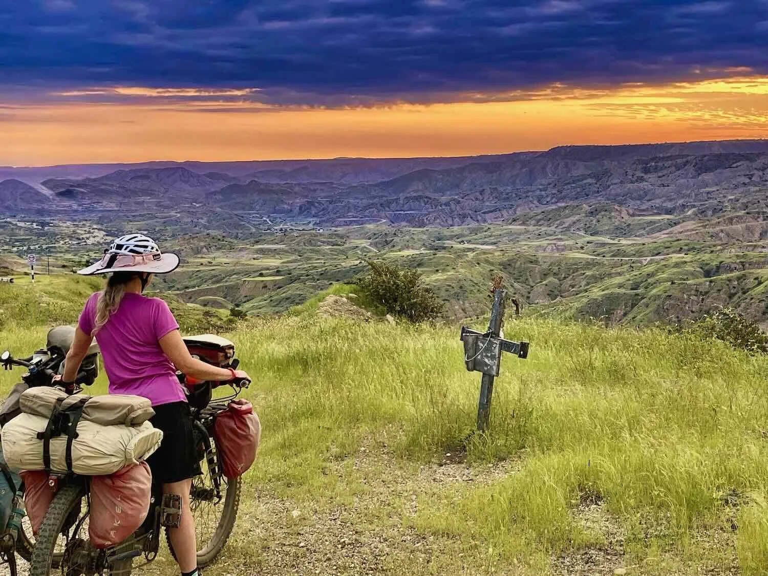
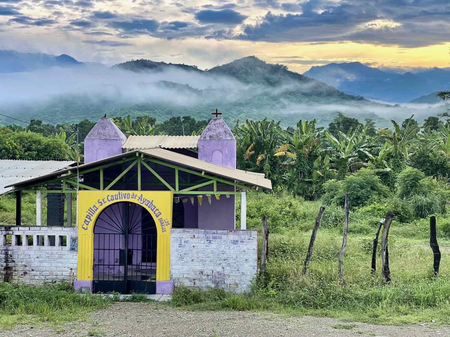
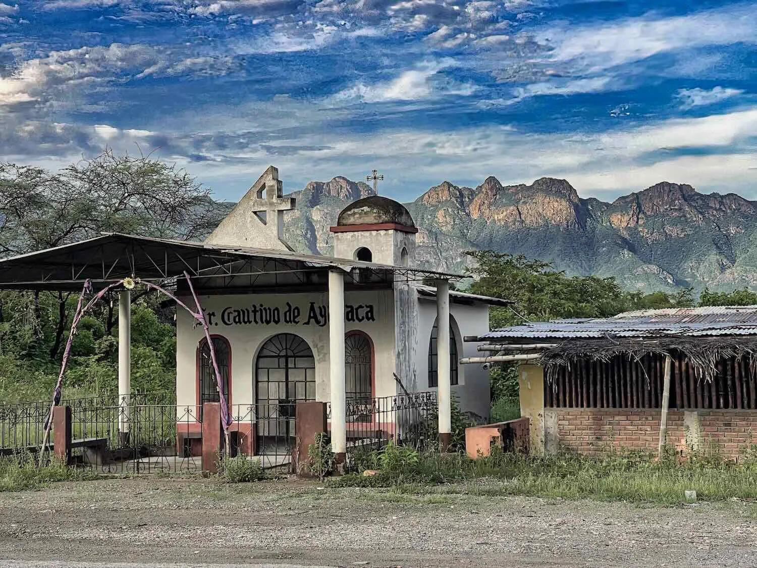
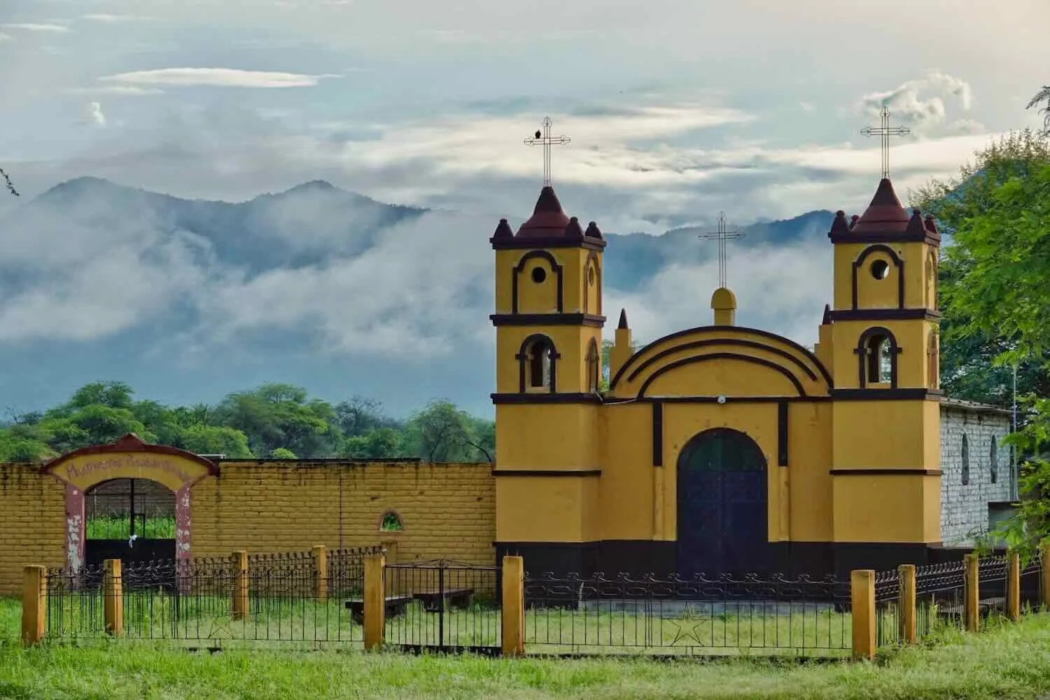
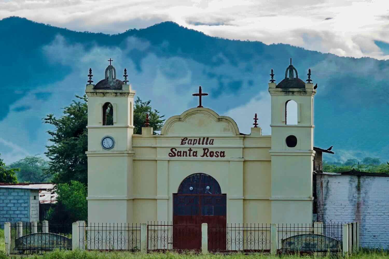
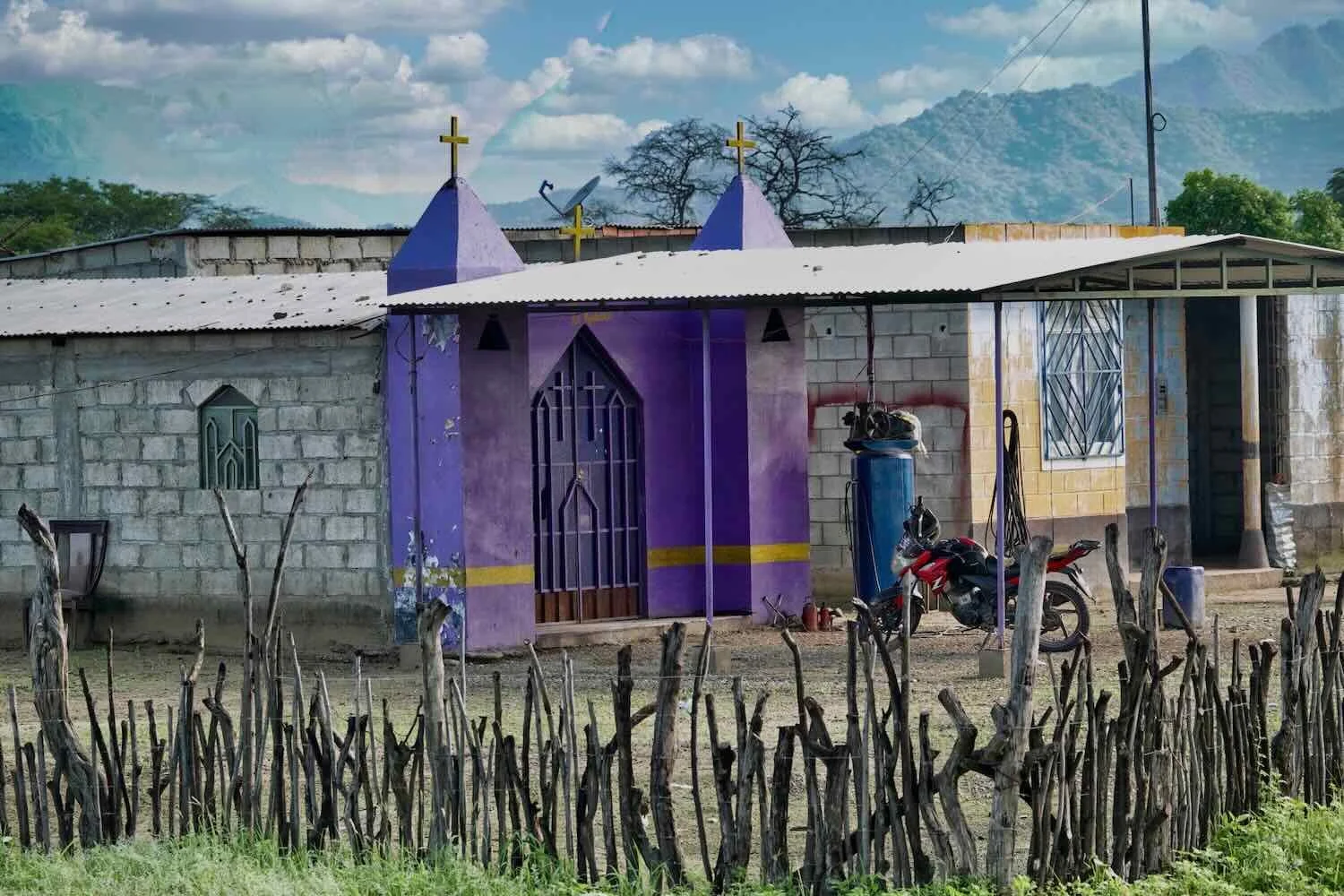
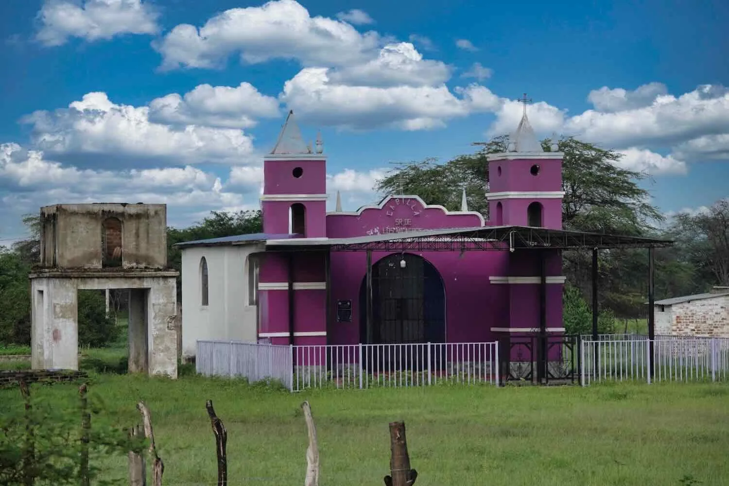
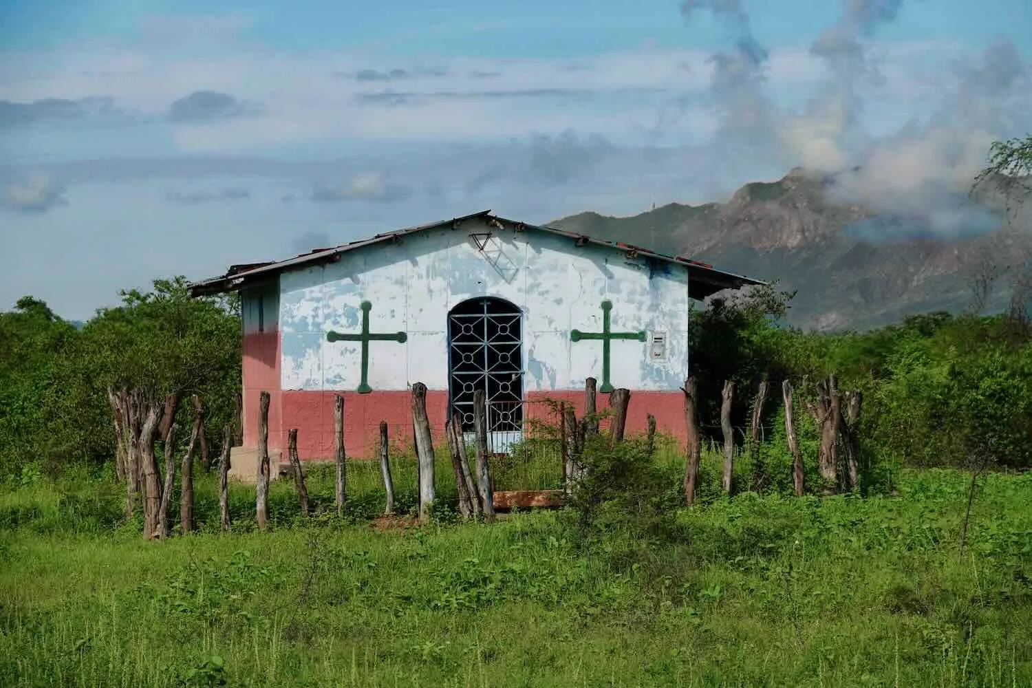
The stretch of highway leading north from Olmos seemed to run through an area of particularly intense religious devotion. There were dozens of small, family chapels and village churches - often in communities with only 5-10 homes. In some places we passed multiple, roadside chapels within a mile of each other. The profusion of these humble chapels was unlike anything we could recall seeing before.
Many of the chapels were dedicated to Señor Cautivo de Ayabaca (Lord Captive of Ayabaca). Later we learned that this refers to a 16th century statue of Jesus housed in a church in the village of Ayabaca, in far northern Peru. The statue depicts Jesus with his hands bound, after his capture by Roman soldiers. Many Peruvians believe that the statue can grant miracles, and each year thousands of pilgrims walk to the shrine where the statue is located to show their devotion.
The increasing amount of plant life supported an abundance of wildlife and domestic animals. The road margins hosted groups of free-range cows and goats, munching happily on the carpet of wet-season grass. Some of them looked a bit skinny, as if the bountiful forage hadn’t been available for that long. But they definitely were fattening up now.
Overhead, birds and squirrels filled the trees. We particularly enjoyed seeing more of the Pacific Horneros, a bird that builds sturdy, oven-like nests out of mud.
Pacific Hornero. Falla, Lambayeque Department, Peru. Copyright © 2019-2026 Pedals and Puffins.
Pacific Hornero Nest. Falla, Lambayeque Department, Peru. Copyright © 2019-2026 Pedals and Puffins.
White-naped squirrels have a small range, closely aligned with the Equatorial Dry Forest ecoregion. So it was fun to spot a few of them in the trees. N of Olmos, Pan-American Highway, Lambayeque Department, Peru. Copyright © 2019-2026 Pedals and Puffins.
A local cow took a rest after a busy morning of grazing by the road. N of Olmos, Pan-American Highway, Lambayeque Department, Peru. Copyright © 2019-2026 Pedals and Puffins.
Unlike the white-naped squirrel that has a very restricted range, Green Kingfishers can be found near water sources throughout the warmer regions of the Americas. N of Olmos, Pan-American Highway, Lambayeque Department, Peru. Copyright © 2019-2026 Pedals and Puffins.
One of the most iconic birds in this part of Peru is the White-Winged Guan - an impressive, turkey-sized bird with an extremely limited range. Unfortunately we didn’t see any wild guans. We suspected the Guans lived in the mountains you can see in the distance. However, we did pass this big statue of a White-Winged Guan at a recreational park. Ñaupe, Pan-American Highway, Lambayeque Department, Peru. Copyright © 2019-2026 Pedals and Puffins.
Options for indoor lodging were scarce along that section of highway, so the existence of a rustic hospedaje in the little village of Ñaupe (pop. ~250) was welcome. Although the hospedaje was fairly humble, it was clear that the owner cared about offering his guests a pleasant experience - checking in with us several times to make sure we had everything we needed.
We were particularly happy to discover that there were screens on the windows in our room - a rare luxury in rural South America - so we could have the windows open at night without fear of more mosquitos. In fact, the host even provided us with a complementary mosquito coil to burn in the room that night.
The hotel had a large, open-air restaurant out front that was the perfect place to hang out comfortably on a steamy afternoon. While we rested in the shade, the cooks were very busy. There were just a handful of other customers at the tables, all dressed in construction uniforms. But on top of that, the kitchen staff brought out a steady stream of boxed meals in tall stacks, and gave them to the driver of a big bus to be taken away.
They must have prepared 50-100 additional take-away, boxed meals that afternoon. During our ride earlier that day we had cycled past a big construction zone along a river channel. It looked like they were reworking the banks of the river, possibly as part of the Olmos mega-irrigation project. It was likely that all those boxed meals were for the workers who remained at the construction site - a real windfall for the hospedaje’s little restaurant.
The next day we stopped for a break in the little village of El Virrey. There weren’t any open shops or restaurants in town, so we just snacked on some fruit and nuts we were carrying, while resting on a park bench. El Virrey, Pan-American Highway, Piura Department, Peru. Copyright © 2019-2026 Pedals and Puffins.
Like many species in this area, the White-edged Oriole is only found in the dry forests of northwestern Peru and southwestern Ecuador. Near Hualtaco, Pan-American Highway, Piura Department, Peru. Copyright © 2019-2026 Pedals and Puffins.
This statue alerts travelers that they are near the Vicús Archaeological Site, a 2,000 year old administrative center for another one of Peru’s pre-Colombian cultures. The Vicús people were known for their distinctive pottery, which often depicted wild animals. Vicús, Pan-American Highway, Piura Department, Peru. Copyright © 2019-2026 Pedals and Puffins.
We arrived at the roadside town of Cruce Km 50 (pop. 2,126) in the heat of the afternoon, looking forward to getting out of the sun. As evidenced by the town’s name (“Km 50”) it was more of a regional services hub than a regular town - strategically located at a highway intersection leading inland from the city of Piura. Nearly all the businesses seemed to cater to truckers or farmers passing through, including several gas stations and a long row of simple restaurants, all serving exactly the same couple of dishes.
This warehouse was another indicator that Km 50 was primarily a service hub for the surrounding farms. The warehouse was a local distribution center for fertilizer made from the nutrient-rich droppings (a.k.a., guano) from Peru’s coastal seabirds. Peruvian small farms can buy big bags of the bird-dropping fertilizer at highly subsidized prices. In the 19th century, harvesting guano from the offshore islands was Peru’s largest and most significant industry. The guano was called “white gold,” because it was so valuable. In fact, some consider Peruvian guano to be one of the main drivers of the “green revolution” that helped to prevent mass starvation in Europe during the 19th century. Cruce Km 50, Pan-American Highway, Piura Department, Peru. Copyright © 2019-2026 Pedals and Puffins.
After checking in to the one, very rundown hospedaje in Cruce Km 50, we went looking for dinner. Unfortunately, that didn’t work out so well. The local specialty was carne frita - fried, thin, dry sheets of meat with rice and fried banana chips. The dish apparently has deep roots in the area, where traditional ranch hands ate it as a cheap and nutritious meal while out on the range. Supposedly it has a “bold” flavor.
Every single one of the 10-15 tiny restaurants in town was serving this dish, and often nothing else. As if to drive the point home, all the shops had several paper-thin slices of meat dangling overhead from a rope - like clothes drying on a clothesline. To us, that looked extremely unappealing.
We thought we were in luck when one of the restaurants told us that they also were serving gallita mechada (stewed hen). Although gallita is meat from mature hens and is expected to be tough, we had eaten plenty of it in our travels, and found it good enough.
Not this time. This hen had apparently led a long, hard working life. The meat was so tough it was like trying to eat a rubber chicken. After a few, unsuccessful attempts, PedalingGuy decided not to eat any of his dinner. PedalingGal gnawed away at hers and managed to get a few bites, but then gave up as well. The meat was essentially inedible. We headed back to our hotel room for a dinner of canned tuna and trail mix.
Ready for dinner at a little, roadside restaurant in northern Peru. The thin sheets of meat hanging on a line in the background were waiting to become the town’s signature dish, carne frita. PedalingGal is smiling because she has not yet tried to eat the chicken on her plate, which turned out to be so incredibly tough that it was inedible (like gnawing on a rubber chicken). Cruce Km 50, Pan-American Highway, Piura Department, Peru. Copyright © 2019-2026 Pedals and Puffins.
The ride into the city of Piura began with more rolling, green hills populated by herds of goats and a few cows.
The most notable event happened a couple of hours into the ride, when we were stopped by the side of the road for a rest break. A passing tuktuk blew out one of its tires with a loud bang, and pulled over just a few yards away from us for a tire change. To our surprise, a whole clan then piled out of the tiny vehicle onto the side of the road, including a mom and her three kids, plus a full-grown goat. (We’re always amazed at how many people can squeeze into a vehicle when they want to.) The driver then proceeded to tip the tuktuk up on its side, and change the tire. He was wise to have that spare tire with him, because they were at least 5-10 miles from the nearest help.
Usually goats are allowed to roam free, since they are practically impossible to keep behind a fence. The rustic, wooden fence that lined the highway here didn’t have much success containing these goats. In fact, we often saw goats on both sides any fence meant to keep them off the road. E of Piura, Pan-American Highway, Piura Department, Peru. Copyright © 2019-2026 Pedals and Puffins.
As we approached the city of Piura, the highway became crowded with thousands of these large, handsome caterpillars. There were so many of them we had to swerve back and forth to avoid crushing them (and getting their goo all over our tires). It was like an invasion. Yet the White-lined Sphinx Moth is found widely throughout the Americas, and is native to Peru. In arid regions it’s common to have an explosion of these caterpillars after heavy rains, and they will eat just about any plant - making them a nuisance for farmers. Can you tell which end of the caterpillar is the front? E of Piura, Pan-American Highway, Piura Department, Peru. Copyright © 2019-2026 Pedals and Puffins.
Arrival in the City of Eternal Heat
Once we reached the edge of the city of Piura (pop. 516,000), it became a typically chaotic adventure. It seems that all of Peru’s most populous cities have world-class, crazy traffic. In this case, the usual problems (no traffic lanes, lots of vehicles weaving back and forth, lack of traffic lights, and crazy tuktuk drivers) were made worse by gigantic puddles in the uneven road - left over from another overnight rainstorm. The only reason it wasn’t truly life-threatening was because the heavy traffic was inching along slowly (because there was so much of it). We were happy to finally arrive at our hotel.
Although Piura serves as a “gateway” to Peru’s northern beaches, the city itself isn’t much of a destination for visitors. It is basically a big, urban hub for the agricultural and fishing sectors of the north. Crime rates in the city had risen over the past five years, which gave it a more edgy feel. Even its nickname, The City of Eternal Heat (owing to it’s year-round high temperatures), wasn’t particularly inviting. As a result, we didn’t go out a lot during our stay, and focused instead on getting some important tasks done.
Given how crazy the traffic was in the city, we thought these two guys were pretty brave. Their job was to hold a big banner across the road in a busy intersection, in front of cars stopped for a traffic light. City of Piura, Piura Department, Peru. Copyright © 2019-2026 Pedals and Puffins.
Although Piura is one of the country’s oldest, colonial cities, most of its architecture is more recent. The cathedral was originally established in 1588. But it has been rebuilt several times, and the current facade is relatively new. City of Piura, Piura Department, Peru. Copyright © 2019-2026 Pedals and Puffins.
A Little Bit of Detective Work
Our biggest task in Piura was to decide, once and for all, which route we would take to approach Ecuador. Our original plan had been to stay inland and cross the border at La Tina-Macará. The advantage of that route was that we could stay in the cooler foothills (a big plus while cycling), and also avoid the coast of Ecuador, which was having its own, serious issues with organized crime. In fact, countries like the USA and UK advised against traveling pretty much anywhere along the coast of Ecuador. Needless to say, we preferred to avoid it.
There was just one, little problem. On Christmas Eve 2025 the government of Ecuador closed nearly all land border crossings with Peru “indefinitely,” with the only exception being the border crossing closest to the coast. The stated purpose was to curb organized crime, drug smuggling, and arms trafficking. Yikes.
Nearly three months had passed since the closing of our preferred border crossing in the mountains, so we were hopeful that it might have opened once again. However, various attempts to find out the current status of the La Tina-Macará border crossing online just yielded lots of conflicting information. It didn’t help that the Ecuadorian immigration website was silent on the matter after its initial announcement of closure in December 2025. There were no further bulletins either confirming that the other border crossings were now open, or remained closed.
Approaching Piura, we had made multiple attempts to gather current information from locals:
Town of Olmos Police Station - A police officer told us that he was unaware that the border had been closed at all. While we were chatting with him, another guy off the street came over to try to help, but he also had no recent news. He was only able to tell us that he had heard the border was closed in December, but he hadn’t heard any news about it since.
Town of Olmos Bus Station - We thought maybe some buses would go to the border regularly, and they might have news if they had been to the border recently. But that also was a bust. Neither the bus drivers on hand, nor the bus dispatch lady, had any idea of the status of the border.
Cruce Km 50 Gas Stations - We stopped at two different gas stations on the outskirts of Cruce Km 50 to ask drivers and the gas station attendants if they knew the status of the border. None of the gas station attendants had any information. However, one truck driver did tell us that he thought the only open border crossing was the one along the coast, and that all others were still closed.
Cruce Km 50 Police Station - Finally, a police officer at a station near a toll booth told us that he was certain that the La Tina-Macará border crossing was OPEN. However, since this happened just after the truck driver told us he thought it was closed, we remained just as confused as ever.
The good news was that there was an actual, national immigration office in Piura. Before committing to one route or the other, we decided to check with the guys at the immigration office. Surely they would have the latest news about the status of the border crossings.
So one morning we walked over to the immigration office in Piura to try our luck there. Then we hit another snag. The guard at the door of the immigration office told us that this was not a public office, and that we could not enter. When we explained our question to him, he proceeded to tell us that he was pretty sure the border at La Tina-Macará was open. That was wonderful, and we thought we had our answer…
But just as we were about to leave another guy, who actually worked inside the immigration office, arrived. The guard stopped him, and asked his opinion.
To our dismay, the immigration officer was adamant that the inland border crossings were still CLOSED. He insisted that we would have to cross the border on the coastal highway. We were back to square one. At this point we had gone back and forth so many times, between people who were sure it was open, and others who were certain it was closed, that our heads were spinning. As sometimes happens, the apparent certainty people expressed clearly out-distanced their actual knowledge.
In the end, we couldn’t be completely sure who was right. However, the fact that the actual immigration officer thought we would have to take the coastal route carried a lot of weight. And seeing as how we were traveling on bicycles, and that traveling an extra 100 miles to the La Tina-Macará border only to find it closed would be pretty awful, we resolved to take the more dangerous coastal route - and to keep our wits about us to stay safe. At least it was guaranteed to be open. We really didn’t have any other options if we wanted to continue our journey into Ecuador by land.
Return to the Coast
Having made our final decision, we set out towards the far northern coast. Piura is fairly far inland, so it would take several days to reach the ocean by bicycle. Due to heightened security concerns in the region surrounding Piura, we mostly just hustled through the first day - with the goal of reaching the more laid-back coastal towns as soon as we could.
Around three hours into the ride we spotted an inviting-looking convenience store on the far side of the road. Most gas station convenience stores in Peru were fairly simple affairs, but this one looked positively luxurious with a modern, indoor seating area. Ready for a break, we decided to make our way across the busy, 4-lane highway for a chance to sip drinks in the air-conditioned shop.
That’s when our day got more interesting.
While we were stopped on the median, halfway across the highway and waiting for a break in the traffic, two policemen on a motorbike pulled up and struck up a conversation. We were relieved when we realized that they weren’t there to tell us we shouldn’t be crossing the highway. Instead, they were very friendly, and mainly just asked us about our bicycle trip. Once we told them where we were headed, they did caution us to be careful and not to travel at night (which we had no plans to do). One of the policemen even gave us a WhatsApp number we could use to contact them if we had any trouble. That was nice of them.
Two, friendly policemen stopped to chat with us while we were crossing the highway. S of Sullana, Pan-American Highway, Piura Department, Peru. Copyright © 2019-2026 Pedals and Puffins.
While we were chatting with the policemen, we noticed two other cyclists pulling into the convenience store parking lot. It had been over three months since we had encountered another cyclist along the road, so we were eager to meet them, and hear their story.
Andrés and Jhon were both from Colombia, although they were from different parts of the country. Their other traveling companion was a little Chihuahua named Éneas (yes, another cyclist traveling with a dog). At least Chihuahuas don’t weigh very much. They were all heading for Ushuaia, Argentina with hopes to arrive there by Christmas. That would be the end of the trip for Andrés and Éneas, but Jhon hoped to continue cycling back northward to make a full circuit of South America.
We chatted with them for quite a while over cold drinks inside the store. Having just come from Ecuador, they gave us a list of suggestions for things to see along the route. In particular, they complained about the quality of the roads in Peru, and told us that it would get better in Ecuador. That sounded great, but we hadn’t thought the road quality was that bad in Peru. However, it wouldn’t be long before we found out what they were talking about.
Jhon, Andrés and Éneas with PedalingGal. S of Sullana, Pan-American Highway, Piura Department, Peru.. Copyright © 2019-2026 Pedals and Puffins.
Éneas, the Chihuahua, had his own, covered, riding compartment. One of his jobs seemed to be protecting the row of homemade bracelets mounted in front of him, which his owners would sell to raise extra income while they traveled. S of Sullana, Pan-American Highway, Piura Department, Peru. Copyright © 2019-2026 Pedals and Puffins.
The next day’s ride between the farming villages of Mallaritos (pop. 6,370) and Sacobsa (pop. 1,650) was relatively uneventful. Without much scenery to get our attention, we just pushed on through the day, trying to arrive at our destination before the temperature got too hot.
A line of tall, slender coconut palms marked the edge of a large rice field. Ever since our departure from Chiclayo, coconut palms had become much more common. Ventarrones, Pan-American Highway, Piura Department, Peru. Copyright © 2019-2026 Pedals and Puffins.
We stopped for a break in a roadside park inhabited by a golden Carbunclo - a mythical creature in Andean folklore that is said to guard hidden Inca riches in a nearby, enchanted hill. Ignacio Escuerdo, Pan-American Highway, Piura Department, Peru. Copyright © 2019-2026 Pedals and Puffins.
During the third day’s ride towards the coast the scenery started to get more interesting. We were out on the road just as the morning light began to creep across the sky. In the pre-dawn glow, we cycled past the Talara Wind Farm. It’s a relatively small operation compared to the much larger wind generation projects we passed in the south of Peru (just a quarter of the size of the Wayra Wind Farm). But it’s recognized as one of Peru’s first wind development efforts, which paved the way for the bigger projects further south.
Surveying the Talara Wind Farm around dawn. Near Sacobsa, Pan-American Highway, Piura Department, Peru. Copyright © 2019-2026 Pedals and Puffins.
A half hour later we reached the edge of a steep drop-off that tumbled 300 ft down into a broad, arid valley. There we got a glimpse into Peru’s more traditional energy generation. Known as the Pariñas Ravine, it cuts through one of Peru’s most important, historical oil fields. Fifty years ago there were thousands of oil wells across the region, although today there are just under 200 wells. Even so, as we flew down the face of the cliff into the valley we passed dozens of oil pump jacks. Near the mouth of the valley, towards the sea, we could see the giant power plant that still provides a large share of the electricity for northern Peru.
Scattered pump jacks were visible throughout the Pariñas Oil Field, historically one of Peru’s most important sources of energy. Near El Alto, Pan-American Highway, Piura Department, Peru. Copyright © 2019-2026 Pedals and Puffins.
By the time we reached the far side of the ravine, the morning clouds were gone and the temperature was rising fast. We had a hot, sweaty, 1.5 mile climb to get back out of the valley - stopping for a welcome drink when we reached the northern rim. Quebrada Pariñas, Pan-American Highway, Piura Department, Peru. Copyright © 2019-2026 Pedals and Puffins.
It was more arid near the coast than it had been further inland. Yet most of the sandy hills were covered with bright, green grass as a result of the recent rains. S of El Alto, Pan-American Highway, Piura Department, Peru. Copyright © 2019-2026 Pedals and Puffins.
The Town of Black Marlin and Oil
The previous night we had struggled to sleep in Sacobsa, where our hotel didn’t have air conditioning, nor screens on the windows. We had kept the windows closed at night, burning a mosquito coil provided by the hotel to keep the insects away. Needless to say, sleep was elusive in that smoky, stuffy room.
So you can imagine our happiness to learn that the humble hotel in El Alto (pop. 9,205) had air conditioning - our new, favorite amenity. As an added bonus, the rooms were all on the ground floor (no stairs to haul the bicycles up), and there was even hot water. It felt like a little bit of luxury.
But perhaps we had counted our chickens before they hatched.
As we wandered around town in the early evening, we happened upon the town’s central plaza. It hosted some impressive artwork celebrating the town’s heyday as a world-class sport fishing destination for big billfish (like 1,000 lb black marlins), and its modern role in the oil industry. In the 1950s and 60s, nearby Cabo Blanco attracted celebrities such as Marilyn Monroe, John Wayne, Humphrey Bogart, Doris Day, Spencer Tracy, and Paul Newman to its glamorous and exclusive fishing club. Yet its most famous visitor was Ernest Hemingway, who spent a month there in 1956, reportedly fishing every day.
The town of El Alto is the gateway to Cabo Blanco, once one of the world’s premier destinations for sport fishing of giant black marlin. But by 1970 the fishery had collapsed. These days it is more of a surfing spot, with only low-key sport fishing. El Alto, El Alto, Pan-American Highway, Piura Department, Peru. Copyright © 2019-2026 Pedals and Puffins.
A statue in the town’s main plaza celebrated the region’s sport-fishing history, and current prominence in Peru’s oil production sector. El Alto, Pan-American Highway, Piura Department, Peru. Copyright © 2019-2026 Pedals and Puffins.
Although Ernest Hemingway only visited Cabo Blanco once, his passion for pursuing giant, trophy fish, and the implicit link to his novel Old Man and the Sea, helped to raise the area’s international profile - fueling several decades of splendor. As a result, the town has embraced Hemingway as its literary icon. El Alto, Pan-American Highway, Piura Department, Peru. Copyright © 2019-2026 Pedals and Puffins.
While in the plaza, we also noticed that an event area had been set up. There was a temporary stage with a big screen, and rows of chairs arranged for an audience. A sign on the screen advertised an upcoming “Light, Sound, and Music Show.” This would come back to haunt us later.
Feeling somewhat sleep deprived, we were in bed around 8pm, and things seemed to be going very well.
But then, less than a half hour later, the “Light, Sound and Music Show” began over in the plaza. It was phenomenally loud, shaking the walls of the hotel even though it was several blocks away. Thinking back on it, we realized that the giant speakers that flanked the mobile stage had been aimed in our direction. The massive wall of noise lasted until midnight. Even after the show had ended, groups of people returned to the hotel for the next hour, ringing the doorbell to gain entry and banging around in their rooms. It was not a restful night.
The next morning we dutifully awoke at 5am for another day of cycling. However, we both were exhausted after two nights of poor sleep. It didn’t take long before we agreed that we needed more rest, and that we should spend another (hopefully more quiet) night in El Alto.
Cycling By The Sea
To our great relief, there were no loud events during our second night in El Alto, and we finally caught up on our sleep.
The final push to the town of Tumbes involved two days of cycling through a series of coastal fishing and surfing villages. However, the town of El Alto sat on a high plateau, so the first order of business was to descend nearly 1,000 ft from the heights of El Alto to the sea. Within 20 minutes of our departure we were flying down the face of the big escarpment, with gorgeous views across the lowlands in the sunrise.
Descent from El Alto to Ñuro with the sunrise. Pan-American Highway, Piura Department, Peru. Copyright © 2019-2026 Pedals and Puffins.
For the rest of the day we bounded over sandy, grass-covered hills between scruffy coastal towns.
Tall, sandy, grass-covered hills receded from the ocean. N of Máncora, Pan-American Highway, Tumbes Department, Peru. Copyright © 2019-2026 Pedals and Puffins.
A curious mule looked down on us from a hillside as we cycled by. N of Máncora, Pan-American Highway, Tumbes Department, Peru. Copyright © 2019-2026 Pedals and Puffins.
By this point the quality of the highway had completely deteriorated. The road shoulder, which had turned to gravel the day before, was now lumpy and rutted, slowing our progress. Even the main traffic lane was full of potholes - when it was paved. To our surprise, many stretches of the highway were not paved at all. It appeared as though parts of the road had been torn up by weather damage and never repaired. It was now abundantly clear to us why the Colombian cyclists we had met a few days earlier had complained about the road surfaces in Peru.
The very worst road conditions were found within the towns. Invariably, all the roads in the towns, including the main highway, consisted of nothing more than lumpy dirt - not even any gravel. The air was full of thick clouds of dust kicked up by cars and trucks, that reduced visibility and made the air feel unhealthy to breath.
In spite of the fact that tanker trucks sprayed the dirt roads with water to try and reduce the levels of dust in town, it didn’t seem to help. Yet it did create lots of standing mud that our tires would kick up onto us. Mud and dust at the same time is a rare combination (you usually just have one or the other). The roads through the towns were so dusty and muddy that we weren’t tempted to stop at all. This area definitely felt like it was neglected, at least by the highway department.
Cancas was one of northern Peru’s low-key beach towns, known for fishing, surfing, and whale watching. Cancas, Pan-American Highway, Tumbes Department, Peru. Copyright © 2019-2026 Pedals and Puffins.
We spent that night in an aging hotel right on the water’s edge, giving us a chance to take a long stroll on the beach as sunset approached. Although a continuous line of restaurants, rental apartments and small hotels crowded the edge of the narrow strip of sand, only a handful of other people were out on the beach with us - at least half of whom seemed to be locals. To our surprise, there were no seashells at all.
Just offshore, fishermen were setting nets in the surf, that would be left out over night. As soon as their nets were in place, the wooden boats sped back to the harbor at the town of Cancas, eager to drop anchor before the light faded away.
At the harbor itself, fishermen from multiple boats were returning to shore in small dinghies or atop paddle boards, while others jumped into the ocean for a quick swim before calling it a day. Yet while all the fishermen were wrapping up their work on the water, a sport fishing boat headed out to sea for some night fishing. It was the first fiberglass, recreational boat we had seen in all of Peru - all the others we had seen were wooden, working boats.
A continuous row of restaurants and hotels lined the sandy seashore. Yet since we were outside of the high season, few other people were out enjoying the beach. Canoas de Punta Sal, Pan-American Highway, Tumbes Department, Peru. Copyright © 2019-2026 Pedals and Puffins.
A couple of Peruvian Pelicans flew in low formation over the incoming waves. Canoas de Punta Sal, Pan-American Highway, Tumbes Department, Peru. Copyright © 2019-2026 Pedals and Puffins.
As the sun dipped towards the western horizon, fishermen sped their wooden boats back towards the safety of a nearby harbor. Canoas de Punta Sal, Pan-American Highway, Tumbes Department, Peru. Copyright © 2019-2026 Pedals and Puffins.
At the harbor, colorful fishing boats rested at anchor for the night. In the distance we could see a large wooden sailboat. Cancas, Pan-American Highway, Tumbes Department, Peru. Copyright © 2019-2026 Pedals and Puffins.
While the artisanal fishermen ended their workday in the harbor at dusk, a modern, sport fishing boat headed out of the harbor for a night of fishing for species like grouper, croaker, sea bass and flounder. Cancas, Pan-American Highway, Tumbes Department, Peru. Copyright © 2019-2026 Pedals and Puffins.
The final day’s ride into the city of Tumbes took us through more scattered, coastal villages that slowly became more touristy, including some noticeably upscale resorts. The closer we got to the city, the more coastal development we encountered.
We got a kick out of this hotel’s sign that read “Whalecome” - a reference to the area’s annual humpback whale migration. Eastern South Pacific humpback whales spend the austral summer in Antarctic and Patagonia waters, but head northward in the winter to breed off the coast of Colombia and Central America. Northern Peru is the place where their migration comes closest to the shore. Punta Mero, Pan-American Highway, Tumbes Department, Peru. Copyright © 2019-2026 Pedals and Puffins.
The entrance to a rural property, lush with grass in the rainy season. El Lavejal, Pan-American Highway, Tumbes Department, Peru. Copyright © 2019-2026 Pedals and Puffins.
The lazy village of Acapulco, Peru, was nothing like its Mexican namesake. For one thing, there weren’t any cliffs or cliff divers. Plus, Acapulco, Peru is roughly 300x smaller than Acapulco, Mexico! Even so, they say that Acapulco, Peru was named after the Mexican city in hopes of attracting beach-loving tourists. Pan-American Highway, Tumbes Department, Peru. Copyright © 2019-2026 Pedals and Puffins.
Even with its glamorous name, Acapulco, Peru remains mostly an artisanal fishing village. Pan-American Highway, Tumbes Department, Peru. Copyright © 2019-2026 Pedals and Puffins.
Eventually, we cycled across the broad Tumbes River and into the city. With all of the recent rain, the river was churning with mud and flowing very high on its banks. We saw lots of debris being swept downstream, including massive logs and entire banana trees.
A long, low bridge brought us across the churning Tumbes River and into the northern city of Tumbes. Pan-American Highway, Tumbes Department, Peru. Copyright © 2019-2026 Pedals and Puffins.
We spent our last couple of days in Peru hanging out in the steamy, lowland city of Tumbes (pop. 111,000). In addition to serving as a key gateway to Peru’s most northerly beaches, Tumbes’s economy is driven by fishing, and commerce supported by its location near the country’s busiest border crossing to Ecuador. However, even though the only land border with Ecuador that was open at the time was the one passing through Tumbes, the town did not seem to be thriving. Most of the buildings and roadways were rundown, and we didn’t sense a vibrant trade economy.
The city’s main plaza was the highlight of our visit. The large, tiled plaza was packed with African sausage trees, dangling hundreds of their 2-foot long, sausage-shaped fruits. Multiple, colorful works of art were placed throughout the plaza. And of course, the city’s main church gleamed on one side. Each morning we would walk over to the plaza and a nearby river overlook, enjoying the best that Tumbes had to offer. It was a relaxing way to spend our final few days in Peru before entering Ecuador!
On one side of the main square sat the Old Tumbes Council Building, a 17th century structure with large windows and an external gallery. The building holds historical significance, as the place where leaders of the town declared their independence from Spain in 1821. A statue nearby featured iconic Peruvian animals. City of Tumbes, Pan-American Highway, Tumbes Department, Peru. Copyright © 2019-2026 Pedals and Puffins.
The most impressive landmark in the main plaza was a massive, partial dome in a rainbow of vivid primary colors, featuring indigenous iconography, forest animals, and a man in fighting armor on horseback - representing the arrival of the Spanish and resistance by the local native people. You can get some idea of the size of this structure if you find the person standing in the picture. Tumbes, Pan-American Highway, Tumbes Department, Peru. Copyright © 2019-2026 Pedals and Puffins.
The most beautiful building in the city was the St. Nicholas of Tolentino Cathedral, which was renovated in 1985. Its sky-blue domes and earth-toned facade seemed to connect the earth and sky. Tumbes, Pan-American Highway, Tumbes Department, Peru. Copyright © 2019-2026 Pedals and Puffins.