Cycling the Pan-American Highway in Peru, Part 1: Arequipa to Nazca
30 November - 14 December 2025
30 Nov - Arequipa to La Joya (32.3 mi, 52.0 km)
1 Dec - La Joya to El Pedregal (31.1 mi, 50.1 km)
2 Dec - El Pedregal to Camaná (49.7 mi, 80.0 km)
3 Dec - Rest day in Camaná
4 Dec - Camaná to Ocoña (36.0 mi, 57.9 km)
5 Dec - Ocoña to La Planchada (14.4 mi, 23.2 km)
6 Dec - La Planchada to Atico (33.2 mi, 53.4 km)
7 Dec - Rest day in Atico
8 Dec - Atico to Chala (55.5 mi, 89.3 km)
9 Dec - Chala to Yauca (30.0 mi, 48.3 km)
10 Dec - Yauca to Puerto de Lomas (28.9 mi, 46.5 km)
11 Dec - Puerto de Lomas to Nazca (57.8 mi, 93.0 km)
12-14 Dec - Layover in Nazca
Life (or Lack of It) In The Desert
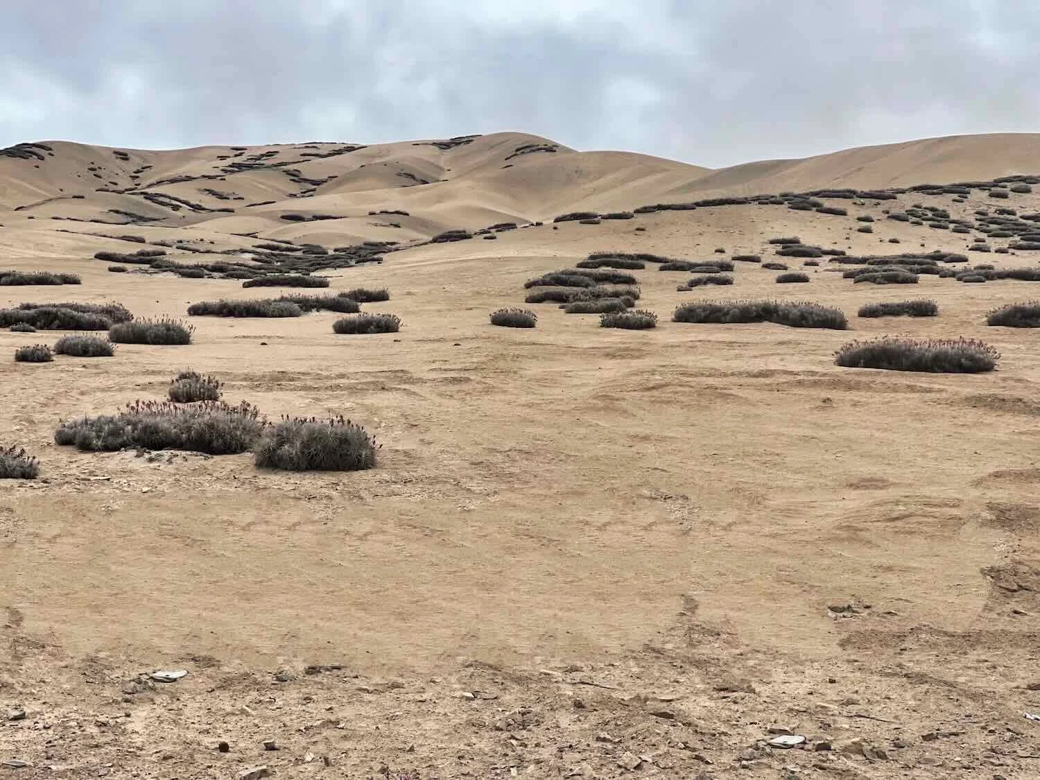
As we cycled out of Peru’s second largest city and back into the coastal desert, virtually all signs of life disappeared from the surrounding hillsides. Except for an occasional tuft of dried-up twigs, we were surrounded by just rocks and sand.
In fact, huge expanses of Peru’s coastal desert appeared to be completely devoid of life. On the highest, Andean ridges of the desert, there was enough moisture to support the cacti and flowering shrubs that we had seen on our descent into Arequipa. However, most of the region was much, much drier than that.
The amount of rainfall actually decreases with elevation. So cities like Lima, which sits on the coast, receive shockingly little rain (just 1.25 inches per year) - on par with some of the driest cities in the world. Large cities like Lima survive by using modern techniques to exploit multiple water sources like coastal rivers (fed by glacial runoff), underground aquifers, and seawater desalination to meet their needs.
However, in the no-man’s-land between Arequipa and the coast, the desert still prevails. For most of our remaining time in Peru, our journey would consist of cycling across barren, Sahara-like landscapes where nothing grew because of the lack of water. The few exceptions would be the occasional river valley with water running off the high mountains, or near towns where irrigation was possible.
At first glance the landscape seemed drab and empty. Since we are easily distracted by plants and animals that call out to be identified or photographed along the way, you would think that would allow us to make faster progress. Unfortunately, there were still significant mountains and steep ridges to slow us down.
Moreover, with each mile we became more aware of the subtle beauty of the rock and sand formations, and more amazed by the ability of humans to create oases of life in places where nature did so little to help.
The Water of Arequipa
One of the reasons the city of Arequipa has thrived is that it receives year-round water from the Chili River, which we followed on our way out of town. At the edge of the city the river banks were carpeted with agricultural fields, sporting an astonishing variety of crops such as potatoes, garlic, squash, onions, and watermelon. The lush green of the fields gave the feeling of abundance.
However, as we climbed out of the river valley, the verdant fields disappeared. We spent the rest of the morning winding our way up the side of a steep, desert canyon. Green was replaced with brown and gray.
In the distance we could see a gigantic, white pile of gravel that completely blocked the head of the canyon. At first it looked like a dam, and we half-expected to encounter a reservoir on the far side. But it was not a dam, even though its purpose was intimately linked to the region’s water supply.
As we got closer we could see big, earth-moving machines crawling slowly across the the face of the gravel pile - looking like tiny ants against the backdrop of the massive structure. It was actually an immense pile of mine tailings generated by the Cerro Verde Mine - Peru’s largest copper and molybdenum mine. The big machines were part of the system to contain the mine waste and avoid contaminating downstream water.
At the foot of the tailings pile, a series of giant water tanks and pipes filled the canyon floor. Initially we thought they might be treating the mine’s wastewater. But the truth was more intriguing.
Just 15 years ago, up to 90% of Arequipa’s municipal wastewater was discharged directly into the Chili River, untreated. Around that time, the mine sought to significantly expand the amount of water it was using. Unfortunately, clean water was in very short supply.
After considering a bunch of different options, the mining company and the city of Arequipa struck a deal where the company (at its own expense) would build and operate a water treatment plant to clean all of the municipal wastewater. In return, the mine would have the right to use a portion of the cleaned-up water, and discharge the rest back into the river. A win-win situation for the town and the mine.
In some places mines have a bad reputation for polluting the surface water but in this case, the result has been a major improvement in the water quality downstream from the city. And the authorities clearly wanted people to appreciate the results. All along the road near the mine there were billboards touting the benefits of the program.
As we cycled towards the Cerro Verde Mine, we could see the huge pile of mine tailings (white) at the head of the canyon, and La Enzolada Wastewater Treatment Plant in the valley below. La Enzolada treats more than 95% of Arequipa’s wastewater before it is either used by the mine, or discharged into the Chili River. Cerro Verde Mine, Near City of Arequipa, Peru. Copyright © 2019-2026 Pedals and Puffins.
Onto the Pan-American Highway
At the head of the canyon we were struck by the barren landscape around us. There were some signs urging motorists to watch out for animals like vicuñas, foxes and viscachas in the road, but it was hard to imagine any of those creatures actually surviving in that place, with almost no visible vegetation. It was more like cycling on the moon.
We spent the rest of the day plunging rapidly downhill. The first hour was nearly perfect, as we cycled down the lightly-used road that that led away from the mine towards the Pan-American Highway.
The mountains all around us were dusted with glistening, white sand that sometimes gathered into drifts. There even were a few, big sand dunes nestled against the hills. By that time the wind had picked up - blowing the sand into our eyes, noses, and even our ears. We both had flashbacks to when we had cycled across the Sahara Desert in Sudan, when fierce winds and blowing sand were a real nuisance.
The descent from the Cerro Verde Mine led back towards the Pan-American Highway (which we had last seen in Chile). Arequipa Department, Peru. Copyright © 2019-2026 Pedals and Puffins.
The wind-sculpted mountains were dusted with bright, white sand. What struck us the most was the nearly complete lack of vegetation. This place was bone dry. Near Cerro Verde Mine, Arequipa Department, Peru. Copyright © 2019-2026 Pedals and Puffins.
When we turned onto the Pan-American Highway, there was a lot more traffic - including a steady stream of big cargo trailers. Thankfully, we still had a wide road shoulder between towns. Yet whenever we cycled into a town, things became a lot more chaotic. The roadsides were then crammed full of little restaurants, convenience stores, tire-repair shops, oil-changing stations, and any other service a trucker or traveler might need.
As you might expect, they also were crowded, so we had to keep our wits about us to avoid colliding with all the weaving vehicles, pedestrians, dogs, and occasional chickens. The normal rules of the road were abandoned in such places, where travel lanes were jumbled. But people managed to adapt to the crazy conditions with an extra level of awareness, and accidents seemed to be rare.
The land around the towns was covered with big fields of cultivated, prickly pear cactus. The fruit and big, green pads of prickly pear cacti have been part of the Peruvian diet for centuries. La Joya, Pan-American Highway, Arequipa Department, Peru. Copyright © 2019-2026 Pedals and Puffins.
That evening, the hubbub from the street seemed to follow us into our hotel in the town of La Joya (pop. 9,950). We had specifically chosen that hotel because we could get a room that was set back from the busy highway, with its horde of roaring tuktuks and beeping cars.
Unfortunately, our room overlooked another street at the back of the hotel. The three closest buildings across the street all had balconies that were fiercely guarded by their resident dogs. Whenever another dog passed by on the street below (which was surprisingly often), the balcony dogs would all let loose with a chorus of barking and snarling, as if to prove they were ready to tear the intruder limb-from-limb (if they could just get at them). The dogs didn’t seem to like it very much when we approached our hotel window, either.
By itself, all that barking was enough to keep us awake. But there was another wrinkle. To our dismay our hotel room was located directly above the door for the hotel’s parking garage. Moreover, the garage door was controlled by an engine that would growl loudly each time the door was opened or closed.
Of course, many of the other hotel guests were truckers, who parked their rigs in the garage. Truckers are early risers, so most of them arrived late, and departed between 4:30-5:00am. Throughout the evening, night and following morning, we were serenaded by the grind of the door engine, accompanied by trucks with an ear piercing BEEP, BEEP, BEEP, BEEP, as they backed in or out of the garage - rather like a loud alarm clock going off all night next to our bed. In Peru, even many pickup trucks beep as they back up. Needless to say, we didn’t get much sleep that night.
Life Only In The Valleys
The next day’s ride began with an enjoyable, downhill romp through the desert. Initially the surrounding hills were completely barren. It was only when we reached the rim of a river valley that we saw, again, the life-giving power of water in the desert. The valley walls were nothing but dun-colored sand. Yet the valley floor was completely transformed by irrigation, into a patchwork of lush agricultural fields. There even were some trees scattered among the fields. It was a jarring contrast.
In the early morning, our route cut downward through a series of low, desert ridges. There were no signs of life, except for all the people using the highway. E of Vitor, Pan-American Highway, Arequipa Department, Peru. Copyright © 2019-2026 Pedals and Puffins.
When we reached the rim of the Vitor River Valley the landscape changed completely. Irrigated fields turned the sand into a carpet of green crops. Pan-American Highway, Arequipa Department, Peru. Copyright © 2019-2026 Pedals and Puffins.
The Vitor Valley has produced some of Peru’s most renowned wines since the 1500s. Popular varieties include blends using Malbec, Muscatel and Torontel grapes. Accordingly, the town’s motto is a play on an old, Spanish saying that means, “Whoever came to Vitor and didn’t drink wine… What did he come for?” Vitor, Pan-American Highway, Arequipa Department, Peru. Copyright © 2019-2026 Pedals and Puffins.
The climb out of the valley on on the far side was rough. It had some of the steepest gradients we’d endured in quite a while, forcing us into our lowest gear for long stretches. On the second half of the climb, we stopped often to catch our breath.
Stopping to take in the view of a desert canyon - and catch our breath - on the climb out of the Vitor River Valley. Pan-American Highway, Arequipa Department, Peru. Copyright © 2019-2026 Pedals and Puffins.
Passing through a tunnel on the climb out of the Vitor River Valley. W of Vitor, Pan-American Highway, Arequipa Department, Peru. Copyright © 2019-2026 Pedals and Puffins.
Happiness is making it to the top of a big, steep hill. Top of the climb out of the Vitor River Valley, Pan-American Highway, Arequipa Department, Peru. Copyright © 2019-2026 Pedals and Puffins.
Once we had hauled ourselves out of the river valley, we found ourselves cycling across a mostly flat, featureless plain of sand. We could just make out some mountains in the distance on our right, but they were shrouded by a thick, brown haze as the wind whipped the sand into the air. There was no vegetation, nor any sign of wildlife, nor any human structures to provide us with some shade.
We rolled into the town of El Pedregal (pop. 55,000) in the early afternoon. Up until 1981, this area had been uninhabited desert land. But in that year, the government began an irrigation project designed to create an agricultural center.
To say that the project achieved that goal is a huge understatement. The farming opportunities attracted people from all across the country, and El Pedregal’s population exploded - more than doubling in just the last 20 years. That has created major headaches related to unregulated growth. The urban core is fully surrounded by agricultural fields extending many miles in every direction. On our way into town we cycled past fields of onions, corn and grape vines.
We found our hotel in El Pedregal using an unorthodox method. After not being too enthused about the first hotel we had looked at, we were walking our bicycles down a crowded street at the edge of town. We were wondering what to do next, when the proprietor of a nearby hotel saw us and urged us to come inside. He was super friendly, and we quickly learned that he had driven by us out on the highway, and seen us laboring up the big hill out of the canyon. He was so genuinely friendly and kind that we gladly accepted his offer for a room.
That evening we had a chance to walk around the lively town center. There were several large, landscaped, and well-maintained plazas that were packed with families and young couples out enjoying the cool, evening air. Street vendors occupied every corner, as well as most of the walkways through the squares. Along one promenade, a collection of colorful statues representing a variety of festival characters seemed to march in a line, as if they were in a parade. We definitely got the impression that the town was economically prosperous.
Adding to the sense of affluence, El Pedregal had some of the most extravagant, souped-up tuktuks we had seen in a long time. There seemed to be a competition among the tuktuk drivers to see who could create the most wildly-decorative tuktuk in town. Most had shiny, well-waxed, custom paint jobs, colorful wheels, decorative skirts, and plush interiors (click on the photos below to enlarge the images). They totally put to shame the beat-up, old tuktuks we’d seen throughout most of Latin America.
El Pedregal, Arequipa Department, Peru. Copyright © 2019-2026 Pedals and Puffins.
El Pedregal, Arequipa Department, Peru. Copyright © 2019-2026 Pedals and Puffins.
Through the Clouds to the Coast
The following day’s ride began with a glorious, two hour descent. Although we dropped 1,500 ft (460m) in elevation, the slope was never too intense. In fact, the gradient was nearly perfect. We zipped along at a nice, brisk pace, but not so fast that we ever had to brake.
However, as we approached the edge of the escarpment that drops down to the ocean, the wind picked up, becoming cool enough that we pulled on our sweaters, and the air became noticeably damp. Before long we were enveloped by wisps of mist that swirled around us. Although it rarely rains along this part of Peru’s Coast, fog that comes off the Pacific Ocean is very common.
After leaving the oasis of El Pedregal behind, we found ourselves among the rocks and white sand fields once again. SW of El Pedregal, Pan-American Highway, Arequipa Department, Peru. Copyright © 2019-2026 Pedals and Puffins.
Near the edge of the escarpment, the road bounded over a series of short, steep hills that took us up into several large fog banks rolling off the Pacific Ocean. NE of Camaná, Pan-American Highway, Arequipa Department, Peru. Copyright © 2019-2026 Pedals and Puffins.
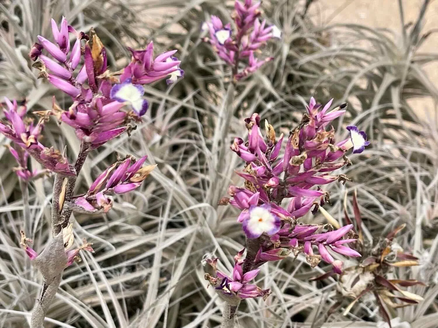
To our surprise, the highest ridges of sand were studded with clumps of hardy plants - the first living things we had seen that seemed thrive in this desert. They turned out to be air plants called Tillandsia purpurea, a species found almost exclusively in the Andean foothills of Peru.
Tillandsia plants get all of their water from the ocean fog. As one of the only plants that grows in abundance in that desert, they play a key role in stabilizing the dunes and providing habitat for insects and birds. They’re even prized components of xeriscape gardens, because their attractive, fragrant, purple flowers are said to smell rather like jasmine. They’re pretty much an all-around, amazing plant.
This sign said, “Warning, Fog Zone.” We didn’t really need a sign to tell us that. NE of Camaná, Pan-American Highway, Arequipa Department, Peru. Copyright © 2019-2026 Pedals and Puffins.
It was a great feeling to finally reach the edge of the escarpment, and begin the long, screaming descent to the Pacific Ocean. Over the course of 10 miles (16 km) we careened down the face of the mountain on a steep, sinuous road. We definitely had to use our brakes on this one - even stopping several times to let our brakes cool off. In the blink of an eye we dropped 3,000 ft (915 m), emerging onto Peru’s narrow coastal plain. With all of the mist, the ocean wasn’t visible until we were only a short distance away.
A sign at the bottom of the descent welcomed us to the coastal community of Camaná. The gray, Pacific Ocean was just barely visible, less than a quarter mile away. Camaná, Pan-American Highway, Arequipa Department, Peru. Copyright © 2019-2026 Pedals and Puffins.
Another sign, at the base of a steeply climbing path, reminded us that Peru’s entire coastline is subject to dangerous tsunamis caused by offshore earthquakes. The path was an escape route. Playa Cerrillos, Camanà, Pan-American Highway, Arequipa Department, Peru. Copyright © 2019-2026 Pedals and Puffins.
The Hunt for Lodging in Camaná
We had originally hoped to stay in a little beach village. But upon our arrival, we found it deserted. None of the hotels or restaurants were open. Apparently the summer season hadn’t quite started yet. Even if we could find somewhere to stay, it would have been pretty dreary. So we kept moving.
The hotels along the highway were pretty rundown, too. On the bright side, we were able to stop at a roadside fruit stand for a refreshing break. We each enjoyed a huge cup of fresh, fragrant honeydew, cantaloupe, and watermelon. That was an encouraging sign. Maybe we were finally getting back into a region where fresh, tropical fruit would be common. It did seem a little incongruous to start seeing fruit stands after passing through so much desert, but that’s the magic of irrigation.
A quick check of Google Maps appeared to show a wonderful hotel, just five miles down the road. Unfortunately, when we got to its location, we couldn’t find any hotels at all.
A municipal office a block away had a security guard, so we asked him if he knew where the hotel was. He had no idea. But as is common in Latin America, he really wanted to be helpful. So he started giving us lots of suggestions of where to look, which we quickly surmised were not based on any real knowledge. When we dug a bit deeper in Google, it appeared that the hotel might actually be in the city of Nazca, more than 100 miles away - its location had been marked erroneously on the map. Time to move on to Plan B.
As we backtracked into the town of Camaná (pop. 12,380), we passed a number of shabby-looking hospedajes before finally spotting one that looked good enough from the outside. At least it looked much better than all the others.
Once we were inside, it was clear that the Hostal América had some flaws, like being located at the intersection of two very busy noisy roads. However, the room was big enough to keep our bicycles inside, with a good shower and strong wifi. Since we were now tired and losing our enthusiasm for continuing the search, we decided to stay.
While walking around town after dinner, we were drawn to the colorful, flashing lights of this Ferris wheel. It was set up at a traveling carnival, in one of the town’s plazas. Camanà, Pan-American Highway, Arequipa Department, Peru. Copyright © 2019-2026 Pedals and Puffins.
Unfortunately, the Hostal América ended up being one of the noisiest hotels we had ever stayed in. Our room was near the stairwell. So all of the sounds from the lobby (ringing doorbell, loud television, customers coming and going…) were channeled up to us. Then there was the big family living downstairs, with screaming toddlers, crying babies and shouting adults. Those sounds were accompanied by the roaring engines and constant honking of cars and trucks on two, intersecting streets. There even was a rooster that began to crow at 3am, right in the midst of the city. With the hotel’s ultra-thin walls, every sound seemed to be right inside the room with us. That made two nights in a row without much sleep. On the bright side, we always look forward to how well we will sleep after a couple of nights like that.
It certainly would have been possible to continue down the road the next day, but it would not have been enjoyable. Our bodies were fatigued, and we both were very sleepy. After considering our options, we resolved to try to find another hotel in Camaná.
The hunt for a new hotel ended up taking most of the day. The problem was that even though there were LOTS of little hospedajes in town, nearly all of them were complete duds. It’s fair to say that Camaná was a particularly raucous town, even by Latin American standards. Furthermore, all the hotels were old, with virtually no sound insulation. Bizarrely, the hotels also seemed to prefer locating their guest rooms right on the road (to fully embrace the street noise). Only one, single hotel - on the edge of town - had reviews that indicated it was quiet. Sadly, they were full.
We ended up finding a hotel by just wandering around town. It had some rooms at the end of a hall, set back from the road. On the spur of the moment, we took it. Yet somehow we managed not to notice that it was right across the street from the central bus terminal, until after we had registered and paid for a room.
All afternoon there were colectivo barkers trying to round up customers by yelling “Arequipa, Arequipa, Arequipa, Arequipa!” (or whatever other destination they were offering) through bullhorns. No joke. It’s no wonder that most Peruvians have a very high tolerance for noise. We endured the constant cacophony from the barkers for the rest of the day, reassured by the knowledge that you can sleep though almost anything when you’ve gotten so little sleep the previous night.
But then something miraculous happened. Around 8:30pm, we sensed that the din from the terminal was - just ever so slightly - beginning to die down. By 9pm the yelling had stopped and it became surprisingly quiet. Colectivos apparently did not travel after dark, and were no longer trying to fill their vans. We rejoiced in the tranquility, then both promptly fell into a deep sleep until morning.
Rice and Sand
Peru’s coastal desert runs all the way down to the sea. Although the frigid, ocean currents that border western Peru generate a lot of fog, little of that moisture benefits life near the beaches (it has more impact at higher elevations, where it falls as rain or snow). As a result, the majority of the landscape on Peru’s coast remains bone-dry and barren.
The exception can be found wherever a perennial river flows from the Andean highlands down to the sea. Over millennia, rivers have carved out broad canyons that originally were covered with natural marshlands. But humans have lived in these valleys for thousands of years, and bent them to their will. Irrigation practiced by the first, indigenous farmers turned these valleys into urban centers, surrounded by fields cultivated to produce food for people and their livestock.
Following the shoreline, our journey consisted of long stretches of cycling across the sand-and-rock desert, punctuated by the occasional town nestled in a fertile valley bursting with green fields and orchards.
On our ride out of Camaná, we cycled through one of these urban/agricultural valleys. Between the highway and the Pacific Ocean, the land was mostly covered with expansive, flooded fields of rice. But to our right, away from the ocean, lay the endless rocks and sand. It reminded us of cycling in Egypt’s Nile Valley, where the land on the river banks was lush with agriculture, ending abruptly at the edge of the Sahara Desert.
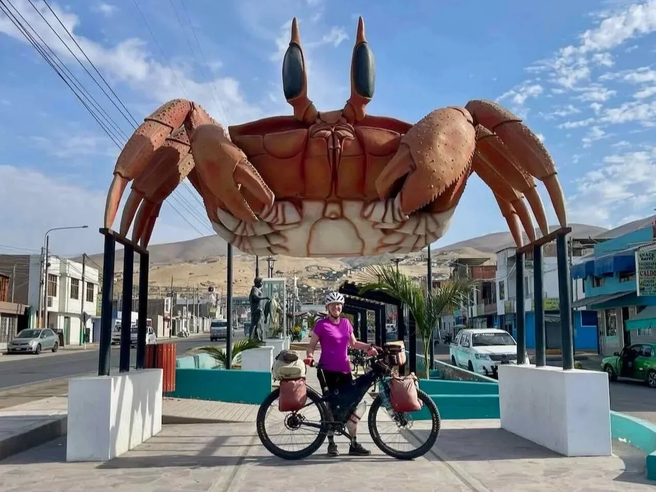
On our way out of town, we stopped for a photo with this statue of a Painted Ghost Crab (a resident of the local beaches). Camanà, Pan-American Highway, Arequipa Department, Peru. Copyright © 2019-2026 Pedals and Puffins.
Great swaths of land surrounding town were covered with a blanket of bright-green rice. Camanà River Valley, Pan-American Highway, Arequipa Department, Peru. Copyright © 2019-2026 Pedals and Puffins.
Near the edge of the fields, where the desert began, a Peregrine Falcon rested on a utility pole. Jaguey, Pan-American Highway, Arequipa Department, Peru. Copyright © 2019-2026 Pedals and Puffins.
As the rice fields faded away, we rode over a series of tall hills that offered sweeping views of the deserted beaches below. Each ridge formed a rocky headland that jutted into the ocean, creating beautiful views where the waves crashed ashore.
From the heights of a coastal ridge we looked down on long, deserted beaches. Every once in a while there would be an old, weather-beaten structure on the sand. Perhaps a fisherman’s shack that would likely wash away with the next major storm? Playa La Chira, Pan-American Highway, Arequipa Department, Peru. Copyright © 2019-2026 Pedals and Puffins.
The pale, desert headlands contrasted with the indigo blue ocean, painting a gorgeous landscape of subtle hues. Playa La Chira, Pan-American Highway, Arequipa Department, Peru. Copyright © 2019-2026 Pedals and Puffins.
Towards the end of the ride we crossed one particularly tall ridge, climbing 1,000 ft (305 m) above sea level. At the top we emerged onto a high, sandy plateau.
To our surprise, there were quite a few little buildings scattered across the plateau. Although the buildings were small, each one had a sizable yard enclosed by a 12-foot high (3.5 m) wind fence. The purpose of the buildings remained a mystery. But the presence of the wind fences made sense, because the afternoon wind could get pretty intense - typically gusting over 25 mph. Luckily for us, the winds along Peru’s coast usually blow from the south. For the first time in a very long time, we had the wind at our backs.
Emerging onto the top of a coastal headland plateau, we were surrounded by windswept sand dunes - their subtle colors further muted by the hazy air. Near Chira Cove, Pan-American Highway, Arequipa Department, Peru. Copyright © 2019-2026 Pedals and Puffins.
Up on the plateau the roadside was scattered with seemingly unused structures, surrounded by wind fences that were twice as tall as a person. There were no indications as to what these structures were used for. Near Caleta del Inca, Pan-American Highway, Arequipa Department, Peru. Copyright © 2019-2026 Pedals and Puffins.
Even more bizarre, there were large plots of land where people had planted TREES in the sand. The scrawny saplings were spaced out in large grids. Most of them appeared to be dead or dying - and any trees that were living looked like they didn’t want to be there. It was hard to imagine anyone thinking that it would be a good idea to plant trees on top of that dry, windy, vegetation-free plateau. Perhaps it was some kind of dune stabilization effort. Yet it didn’t seem to have much chance of success.
As we sailed down the far side of the ridge, we could see the big valley of Ocoña ahead. It was unmissable because (like Camaná) it was covered with bright, green rice paddies. Approaching Ocoña, Pan-American Highway, Arequipa Department, Peru. Copyright © 2019-2026 Pedals and Puffins.
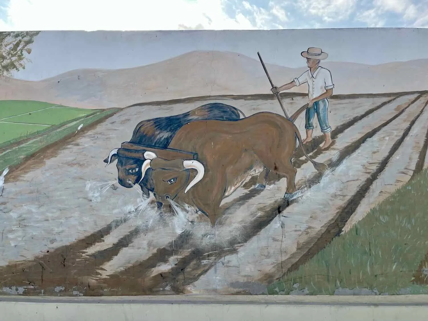
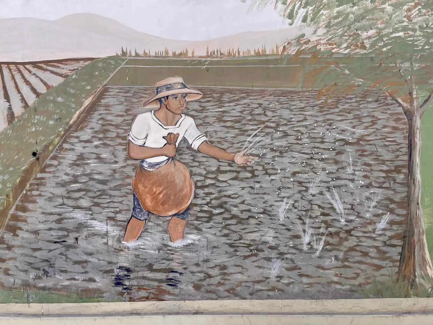
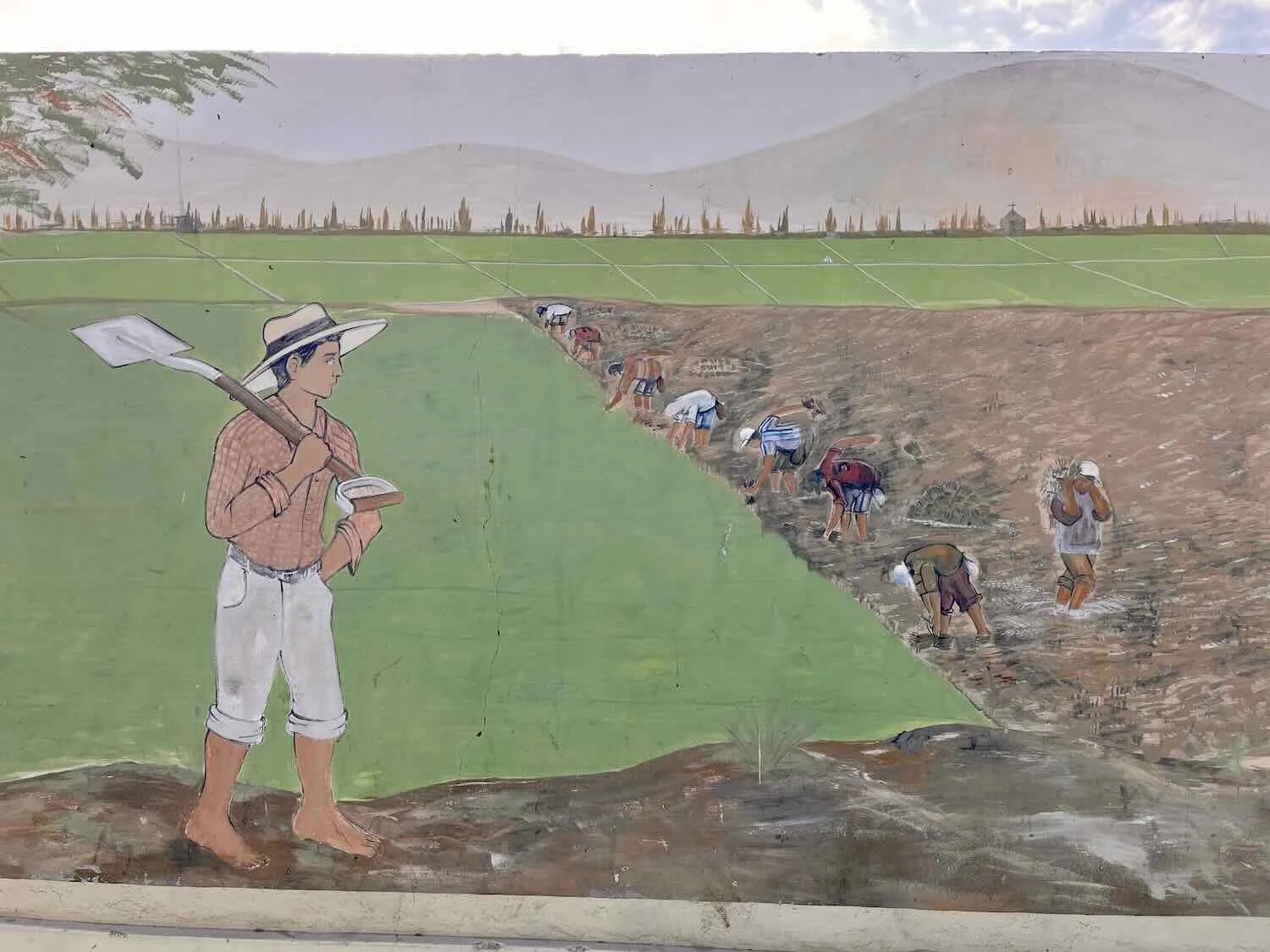
Like Camaná, the village of Ocoña (pop. 1,400) sat in a fertile river valley. As we rounded a bend in the highway, we were greeted with the sight of more, bright green fields of rice, glowing in the afternoon sun. A painted arch near the entrance to town framed a view of cultivated abundance. Nearby, a series of murals celebrated scenes related to rice farming including plowing, planting and harvesting. With so much rice, we were starting to appreciate how Peruvians managed to include a giant pile of rice on every plate of food, with every meal.
Expansive fields of rice formed a wall-to-wall carpet on the valley floor. Ocoña, Pan-American Highway, Arequipa Department, Peru. Copyright © 2019-2026 Pedals and Puffins.
Would We Be Stuck In Ocoña?
The other thing we saw as we approached town was a long line of stopped vehicles on the road. We also could see a line of cars and trucks backed up on the far side of the valley, where the highway descended towards the river. Clearly, something was obstructing the traffic in both directions up ahead.
Our hearts sank when we learned that a couple of miles away there was a road blockade set up by striking miners. No cars or trucks were getting through in either direction. We had previously heard that highways in Peru were subject to periodic roadblocks set up by protesters demanding government action. The standoffs could halt traffic for hours, or even multiple days, depending on the issue and the government’s response. Usually they would let cyclists through, but it wasn’t guaranteed.
Fortunately, we had planned to stop for the night in Ocoña, so we wouldn’t have to worry about the blockade that evening. But no one we asked could say whether the road would be open the next day, or whether or not cyclists would be able to get through.
After cycling past the long line of trucks into town, we ran into more trouble. No one answered the door at the hotel where we had planned to stay. Moreover, we did not get a response when we tried sending messages to them from our phone, which is something we often have to do when the owners are offsite.
Soon another guy came along who also was also looking for a room. He called the phone number posted on the hotel’s door and spoke to the owner, who told him that they were full! It sure didn’t look that way. Often the hotels in small towns only have one or two people who manage them. When they are out of town, sick, or need a day off for some reason, they sometimes claim to be full, even though no one is staying in the hotel. But whatever the reason, we would have to find somewhere else to spend the night.
That’s when we started to sweat. It was entirely possible that all the rooms in this small hamlet could fill up with other travelers stranded by the blockade. Feeling like we had no time to lose, we hustled half a mile across town to the only other hotel that looked any good.
To our great relief, they had a room for us. It wasn’t ideal, but at least we had a place to spend the night. One of the interesting things we noticed about the town was that there seemed to be roosters crowing at all times of the day. Normally the rooster activity is concentrated between 3am-9am. Yet in Ocoña, there seemed to be so many roosters crowing that they kept each other stirred up all day long.
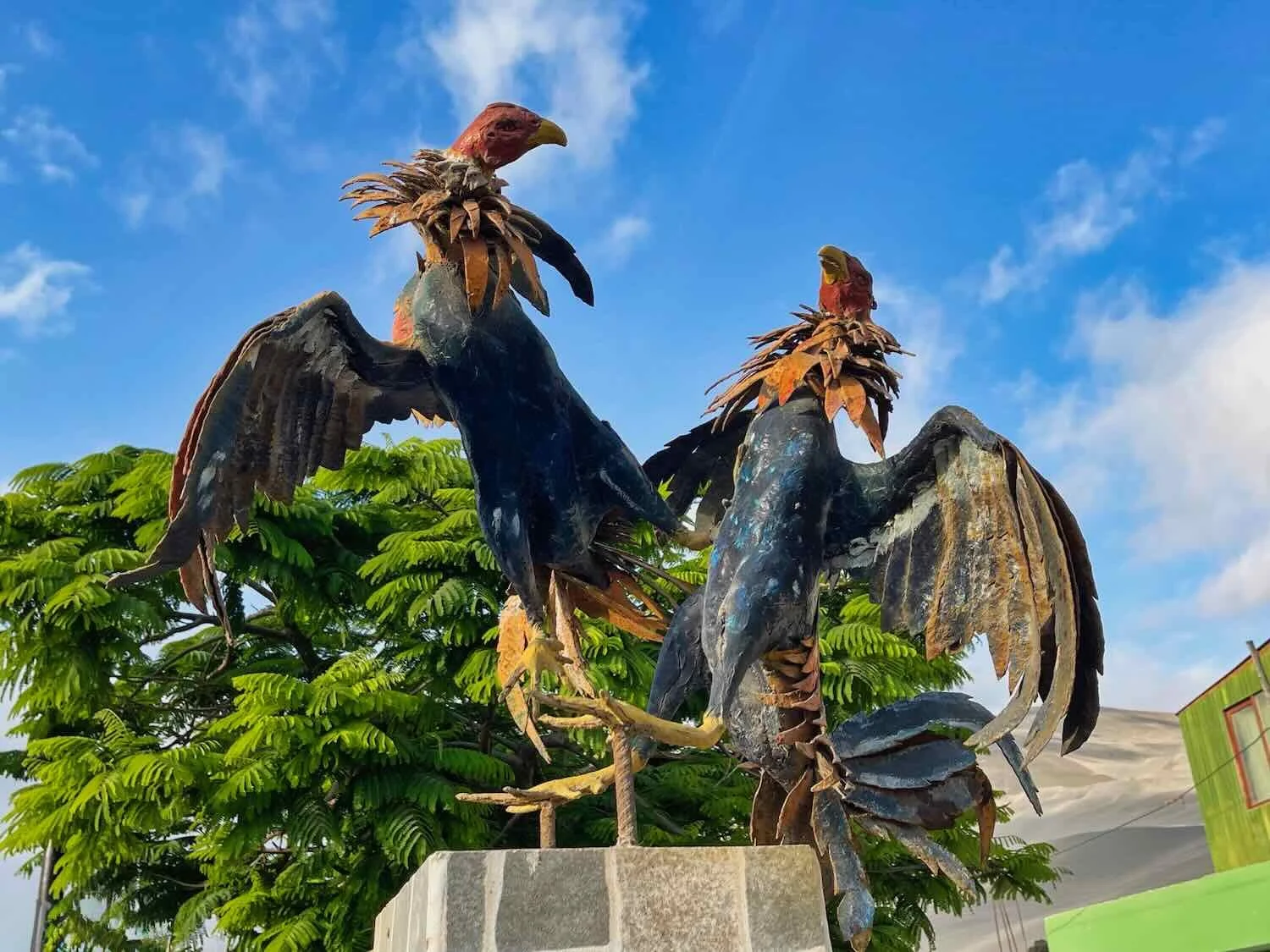
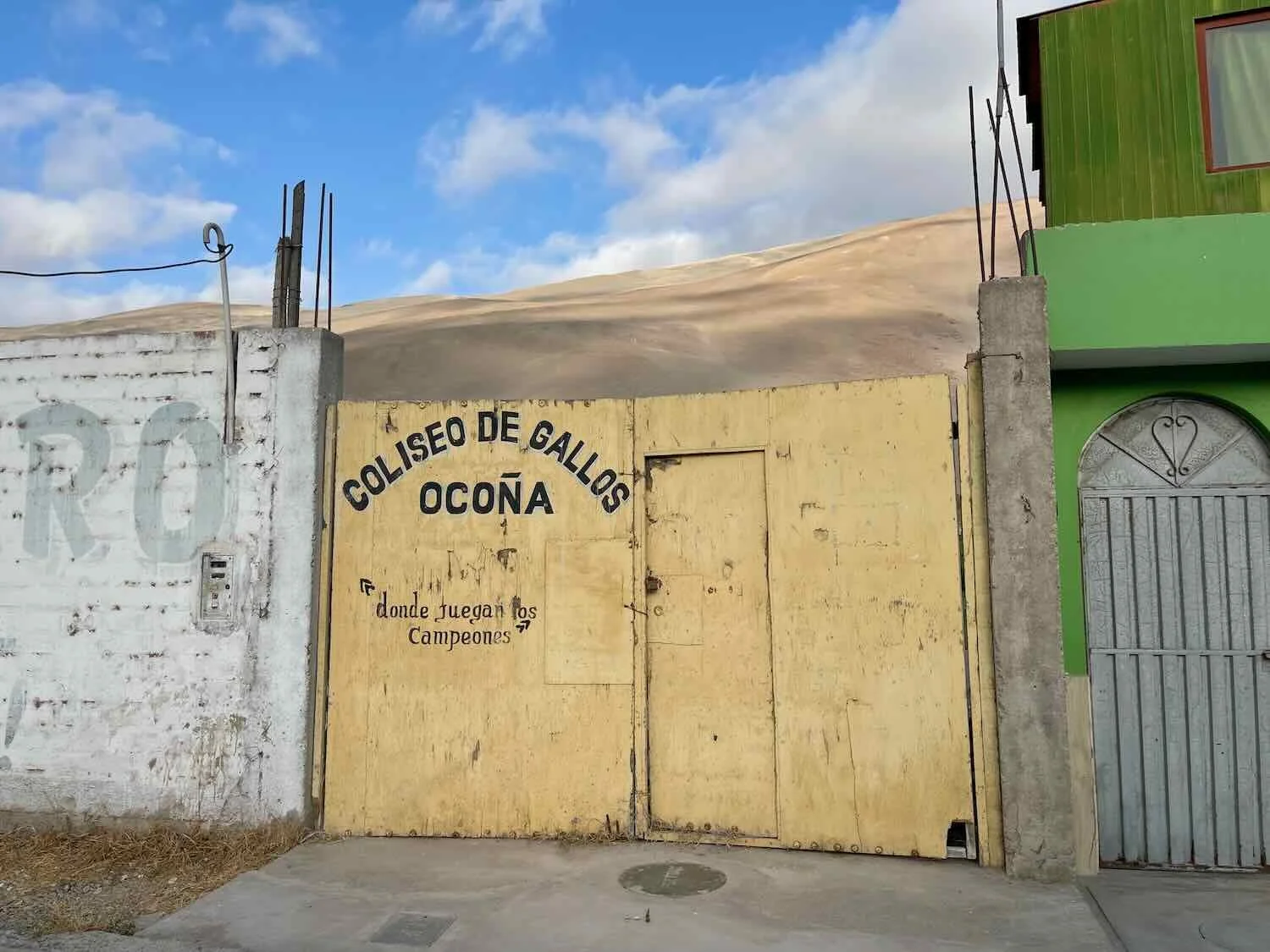
We later learned that cock-fighting was very popular (and legal) in Ocoña. In addition to all the crowing roosters, there was a statue of two roosters fighting in the town square, and we passed a Coliseo de Gallos (cock-fighting arena). In some towns, a majority of the men participate. So there probably were more roosters in Ocoña than egg-laying hens.
One thing we learned from the experience, though, was that hundreds of crowing roosters were not nearly as disruptive to sleep as a single crowing rooster (or just a couple of them). At some point, all of the individual calls blended together into a gently rising and falling hum, rather like white noise. Of all the nighttime noises, the chorus of roosters was the one that didn’t really bother us.
But back to our discussion about the roadblock.
The miners had been blocking the highway through Ocoña for the past four days, so our hotel hosts had some idea of the routine. According to them, the best time to try to pass the blockade site would be very early in the morning. Therefore, we resolved to get up and out the door as close to dawn as we could. Some of the truckers that spent the night in our hotel seemed to have the same idea, because around 3:30am we heard the roar of several diesel engines warming up in the darkness. Everyone wanted to get out of town before they were trapped for another day.
Around sunrise the hotel proprietors knocked on our door and urged us to hurry, since the road might close again. From the hotel window, we could see the road as it climbed up the far side of the valley. At 6:30am it was still clear of cars, so we had hope. We hurried out onto the road as fast as we could.
As we cycled past the town’s cluster of shops along the highway, we saw plenty of evidence of the previous road blocks. The sides of the road were literally covered with trash, like you might expect to find the day after a big carnival or outdoor concert. Roughly 50 policemen stood along the side of the road in several, large groups - presumably to keep public order, and perhaps to keep the miners from blocking the road again. In a couple of places there were burn marks on the ground, likely from protesters burning tires or trash piles as part of the blockade.
However, in the early morning light most people were just standing around, or going about their business. We cycled rapidly through the town, eager not to have anyone signal for us to stop. Fortunately, we didn’t have any problems or delays. We were on our way.
A Deadly Stretch of Road
The infamous stretch of the Pan-American Highway that ascends out of the valley on the far side of town is known as the Ocoña Cliffs. For four miles (6.5 km) the road winds up the face of a nearly vertical canyon wall. Tight, blind turns, an aggressive gradient, a sheer drop-off of around 660 ft (200 m), and heavy traffic all conspire to make this one of the most deadly sections of road in Peru.
In fact, just a couple of weeks before we cycled through, an inter-city, double-decker bus collided head on with a pickup truck there, sending the bus over the edge of the cliff and crashing into the valley below. Thirty-seven people were killed in the tragedy. As we made our way slowly up the mountain, we passed a cluster of recent, roadside memorials, dedicated to those who lost their lives there.
Large numbers of memorial shrines clustered along the edge of a curve, on the road up the Ocoña Cliffs. With heavy traffic, tight turns and a steep drop-off into the valley, this is one of the most deadly sections of road in Peru. Ocoña River Valley, Pan-American Highway, Arequipa Department, Peru. Copyright © 2019-2026 Pedals and Puffins.
As we gained elevation, we had a panoramic view of the valley below. Nearly every inch was covered with agricultural fields. On one side, the Ocoña River snaked its way through a series of stony channels. At the end a large, gravel berm blocked most of the river’s access to the sea - with just a narrow outlet channel. The berm looked man-made, perhaps to slow the river’s flow and increase the town’s freshwater supply, providing more water for irrigation.
View of the mouth of the Ocoña River Valley from the heights of the Ocoña Cliffs. Much of the river water is used to irrigate the rice fields, turning the brown desert into green agricultural fields. Pan-American Highway, Arequipa Department, Peru. Copyright © 2019-2026 Pedals and Puffins.
The climb out of the Ocoña River Valley took us up and over another 1000-ft high ridge. We were definitely getting the impression that there would be a lot of climbing involved in cycling along the Peruvian coast. The payoff was more fabulous views of the desert cliffs rising out of the sea. Often we could see a couple of fishing boats in the distance, At one stop we spotted a bottlenose dolphin swimming close to the shore.
The cliffs along this stretch of our route came in a pleasing array of colors. W of Ocoña, Pan-American Highway, Arequipa Department, Peru. Copyright © 2019-2026 Pedals and Puffins.
We spent time cycling adjacent to steep cliffs that rose up right next to the road. At least we were on the side of the road away from the drop-off into the sea. But sometimes the cliffs squeezed our road shoulder more than we liked. W of Ocoña, Pan-American Highway, Arequipa Department, Peru. Copyright © 2019-2026 Pedals and Puffins.
From one roadside overlook, we saw this lone, dolphin feeding near the shore. W of Ocoña, Pan-American Highway, Arequipa Department, Peru. Copyright © 2019-2026 Pedals and Puffins.
There weren’t many creatures for us to see in the open desert, but Turkey Vultures were sometimes present along the cliffs. We were struck by how bright pink their heads were in this part of South America. They were much more vivid than we could recall seeing elsewhere. W of Ocoña, Pan-American Highway, Arequipa Department, Peru. Copyright © 2019-2026 Pedals and Puffins.
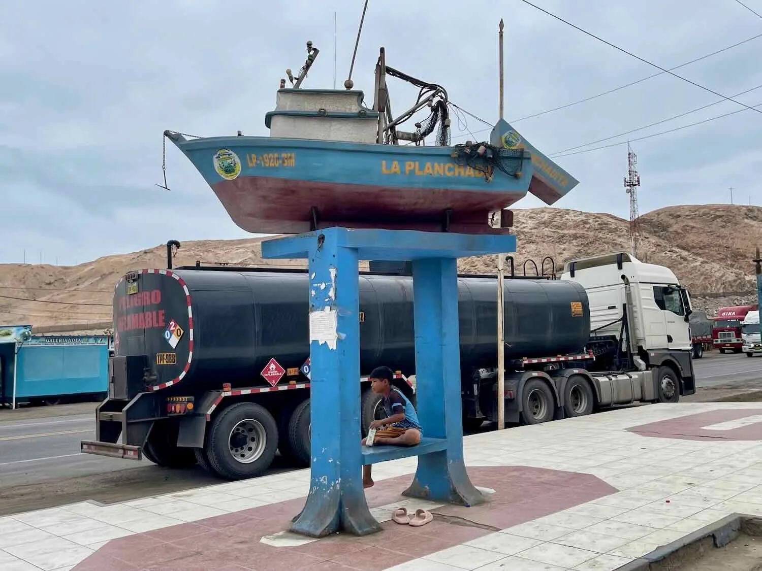
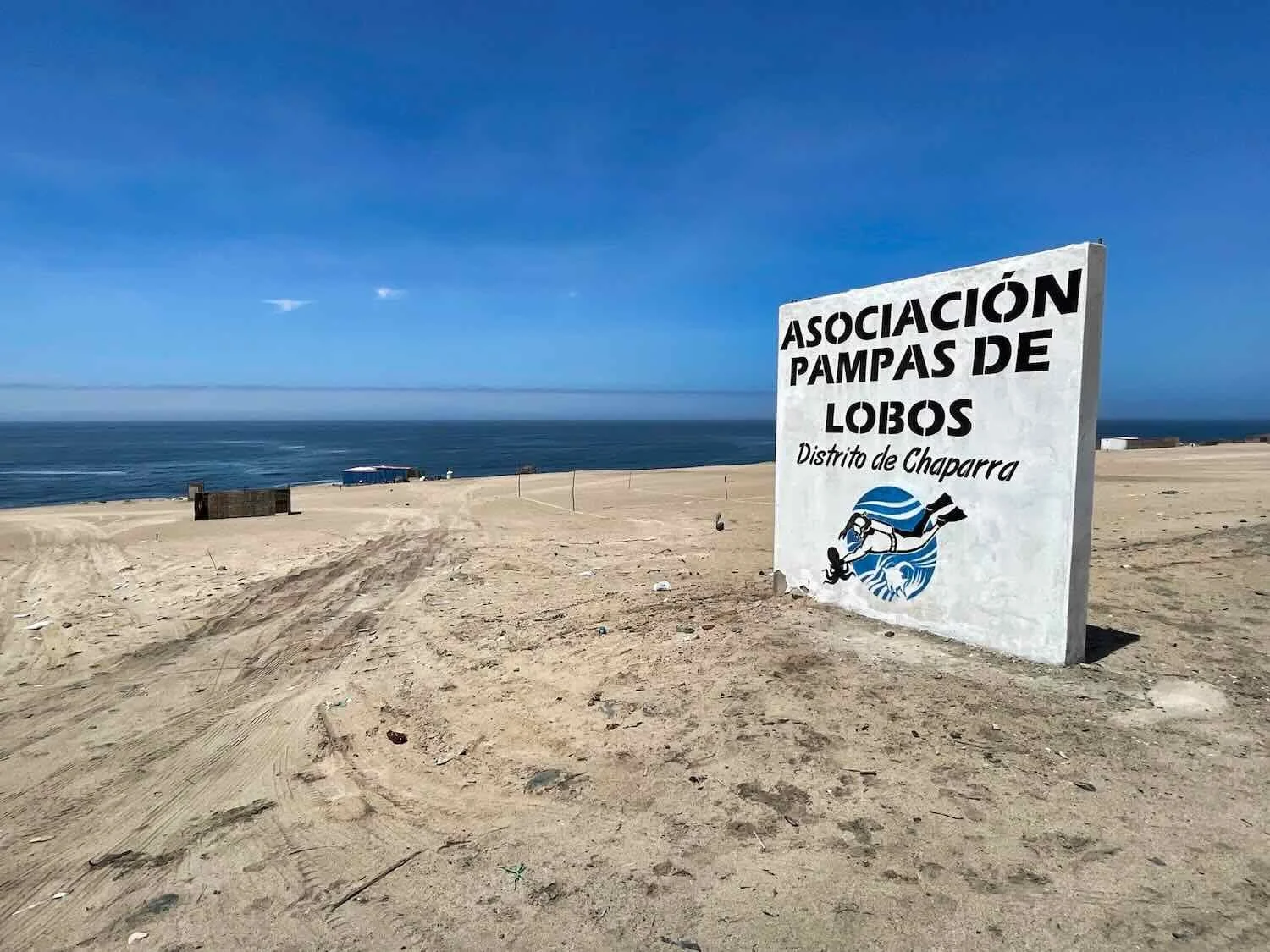
As we crested one more ridge we could see the small village of La Planchada (pop. 810) up ahead. Unlike the last two towns we pasted (Camaná and Ocoña), La Planchada was not situated in an agricultural valley. It was 100% a fishing village, nestled in a cove without any surrounding farmland. Furthermore, it had a harbor filled with fishing boats - something that was noticeably absent from the other towns. Later we learned that 90% of the catch in La Planchada is jumbo flying squid, which is exported primarily to China. In fact, half of the global catch of jumbo flying squid comes from Peru.
The harbor full of squid-fishing boats. The white buildings at the port were used for cold-storage and processing of the squid brought ashore. La Planchada, Pan-American Highway, Arequipa Department, Peru. Copyright © 2019-2026 Pedals and Puffins.
A Blackish Oystercatcher waded in the shallow surf near the port. That’s right. It’s not totally black, just blackish. La Planchada, Pan-American Highway, Arequipa Department, Peru. Copyright © 2019-2026 Pedals and Puffins.
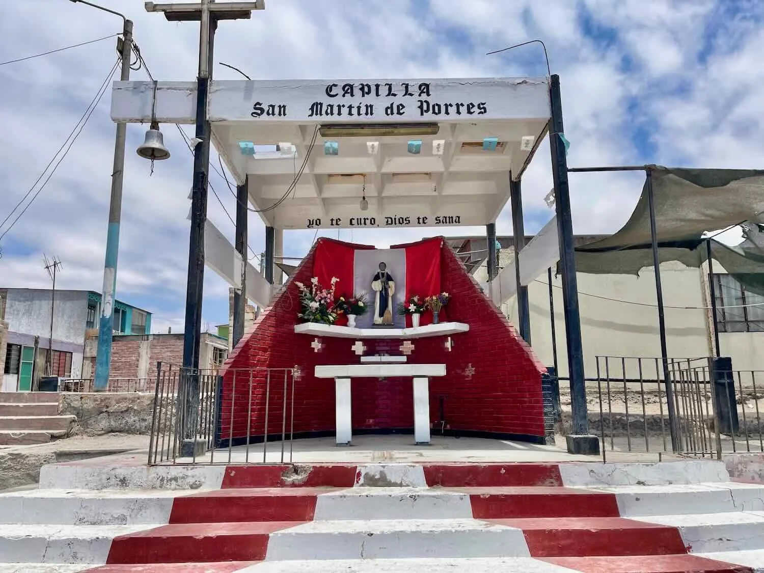
The following day we passed another symbol of death on the Pan-American Highway. At the top of the tallest ridge stood a small building known as La Capilla de Las Calaveritas (“the chapel of the little skulls”). Among the usual statues, religious symbols and offerings, this chapel houses three children’s skulls that were discovered in an unmarked grave during excavation of the road.
Legends say that the skulls belonged to child soldiers who died defending Peru in the War of the Pacific, but no one really knows. However, many Peruvian travelers (especially truckers) believe that if they make offerings and pray at the shrine, the spirits of the children will protect them from the dangers of traveling on the Pan-American Highway. When we passed by, there were 3-4 big rigs parked along the road, while their drivers visited the shrine.
The Capilla de Las Calaveritas (“chapel of the little skulls”) sits at the top of a headland overlooking the sea. A poster to the left of of the door (complete with images of the skulls) welcomes visitors, who come to pray or make offerings, seeking protection from the dangers of the highway. W of Pescadores, Pan-American Highway, Arequipa Department, Peru. Copyright © 2019-2026 Pedals and Puffins.
Mountains of Sand, Coves by the Sea and… Olives
During the next four days of cycling the Pan-American Highway, we stayed close to the ocean. The road alternately soared over 1,000 ft high ridges - where majestic, desert headlands tumbled down into the sea - then plunged back down into scenic coves occupied by fishing villages or farms.
Ocean mist settled in the coves along the rocky shoreline, offering breathtaking views. W of Las Calaveritas, Pan-American Highway, Arequipa Department, Peru. Copyright © 2019-2026 Pedals and Puffins.
As we approached the tiny settlement of Cerro de Arena (pop. <50), it became abundantly clear how the village got its name, which translates to “Sand Hill.” Rising up directly from the side of the road was a colossal sand dune. The slope was so unstable that for a couple of miles they had built a retaining wall to keep all that sand off the road.
In the places where there was no retaining wall, the sand crept across the road margin, eliminating the road margin as well as part of the road. For more than 10 miles (16 km) we actually rode on the left-hand shoulder (the side away from the big dune) facing the oncoming traffic, because that side was clear of sand and felt a lot safer.
It was no wonder a little village along this stretch of the road was named Cerro de Arena (“Sand Hill”). A wall of sand towered over the highway. Cerro de Arena, Pan-American Highway, Arequipa Department, Peru. Copyright © 2019-2026 Pedals and Puffins.
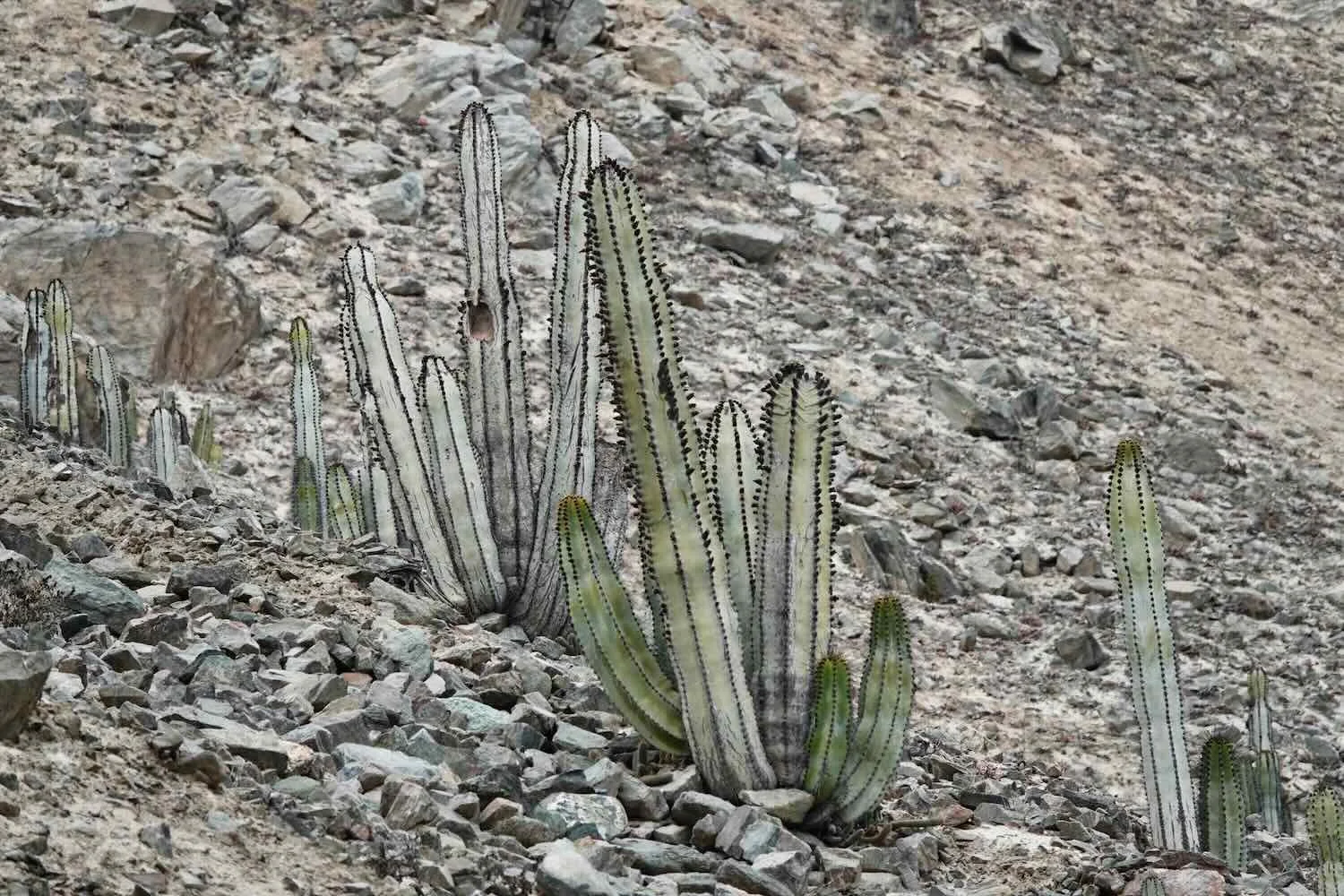
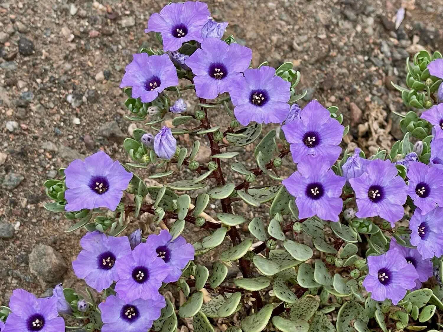
To our surprise, a couple of the hillsides past the big dune were covered with cacti and quite a few flowering plants. This was the only, significant vegetation we had seen outside of towns, since leaving the air-plant covered dunes on our descent towards the coast. Perhaps the rocky soil on these slopes held a bit more moisture. We also were treated to the sight of a large group of South American Sea Lions lounging on some rocky islands. That was fun, because we had seen relatively few pinnipeds along the South American coast - especially given the famed productivity of the ocean in this area.
These were the first South American Sea Lions that we had seen since reaching the Peruvian coast. Look closely, there were many Sea Lions (the darker, brown spots) lounging on those rocks. Some were almost on the top. We’re always surprised at how well Sea Lions can climb up nearly vertical rock faces. La Bodega Cove, Pan-American Highway, Arequipa Department, Peru. Copyright © 2019-2026 Pedals and Puffins.
This mural at a restaurant on the way into the town of Atico caught our eye, with its exuberant depiction of sea life - reflecting the region’s close ties to the sea. Outskirts of Atico, Pan-American Highway, Arequipa Department, Peru. Copyright © 2019-2026 Pedals and Puffins.
The place we stayed in the village of Atico (pop. 4,845) was just a couple of blocks from the ocean, so we headed over for a walk along the shore. However, Atico didn’t have a sandy beach. The shoreline was covered with a deep layer of loose rocks and pebbles worn smooth by the waves, that gave way under our feet and made walking difficult. The day we were there the surf was particularly high, and crashed onto the rock-strewn shore with frothy waves. Across roughly a mile of waterfront, there were only a couple of other people out for a stroll.
A big wave crashed ashore as we walked along the pebble-strewn beach. Atico, Pan-American Highway, Arequipa Department, Peru. Copyright © 2019-2026 Pedals and Puffins.
A dazzling Vermillion Flycatcher was hunting for lunch in the town plaza. Atico, Pan-American Highway, Arequipa Department, Peru. Copyright © 2019-2026 Pedals and Puffins.
Pelicans were often portrayed in Peruvian art, like this statue in Atico’s plaza. They have represented prosperity, abundance, and generosity since pre-Colombian times. Atico, Pan-American Highway, Arequipa Department, Peru. Copyright © 2019-2026 Pedals and Puffins.
Less than an hour outside of Atico, we passed another harbor filled with old fishing boats. La Punta, Pan-American Highway, Arequipa Department, Peru. Copyright © 2019-2026 Pedals and Puffins.
A lighthouse stood on top of a nearby headland, providing a splash of color in the sandy-brown desert. La Punta Lighthouse, Pan-American Highway, Arequipa Department, Peru. Copyright © 2019-2026 Pedals and Puffins.
Millions of years ago this desert was under the sea. In some places, the rocks showed evidence of being carved by ancient waves. Near Playa de Bandurrías, Pan-American Highway, Arequipa Department, Peru. Copyright © 2019-2026 Pedals and Puffins.
As we approached the town of Chala we passed several places with clusters of small, makeshift shacks. Often there wasn’t anything to indicate what the huts were for. However, on two occasions there were signs by the road suggesting that the structures were used by cooperative fishermen’s associations, harvesting things like octopus and kelp from the sea.
Big waves crashed against the rocks. Pan-American Highway, Arequipa Department, Peru. Copyright © 2019-2026 Pedals and Puffins.
Other times the sand dunes returned. Down in the coves, sea mist put everything into soft focus. Playa Arenosa, Pan-American Highway, Arequipa Department, Peru. Copyright © 2019-2026 Pedals and Puffins.
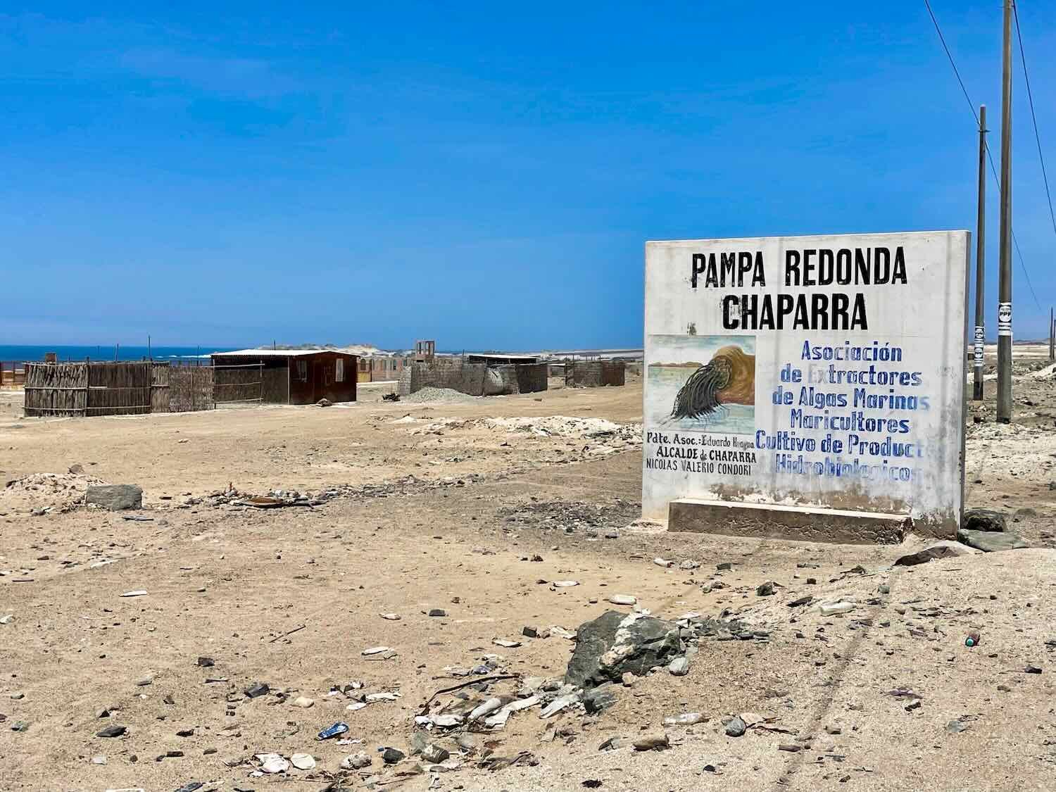
The welcome arch for the town of Chaparra honored three of the area’s prominent trades - fishing, agriculture, and mining. Chaparra, Pan-American Highway, Arequipa Department, Peru. Copyright © 2019-2026 Pedals and Puffins.
Chala (pop. 8,075) was another town that relied primarily on fishing - in this case anchovetas (small fish similar to anchovies). Processing anchovetas into fish meal or oil is a huge industry in Peru. A lone, abandoned fishing boat sat stranded on the town’s beach. Chala, Pan-American Highway, Arequipa Department, Peru. Copyright © 2019-2026 Pedals and Puffins.
As we climbed up out of the Chala Valley, we crossed paths with the first cyclist we had seen since the day we had entered Peru. Erich (from Germany) had begun his journey in Bogota (Colombia) and was planning to end his trip in Puno (Peru), near Lake Titicaca. You can tell from the way he was dressed that he was heading downhill and we were going up. Chala, Pan-American Highway, Arequipa Department, Peru. Copyright © 2019-2026 Pedals and Puffins.
A grandly decorated retaining wall bordered the highway in the village of Agua Salada. Pan-American Highway, Arequipa Department, Peru. Copyright © 2019-2026 Pedals and Puffins.
We passed another, massive sand dune that hugged the side of a mountain. The two little, black specks near the center of the photo are a couple of distant turkey vultures soaring through the air. Near Tanaka, Pan-American Highway, Arequipa Department, Peru. Copyright © 2019-2026 Pedals and Puffins.
Approaching the town of Yauca (pop. 2,090), we descended off of another high plateau into a broad valley covered with orchards. But the orchards were not for fruit or avocado trees. These orchards were comprised entirely of olives.
Although Yauca is not Peru’s top olive producing region by volume, it is famous for its longstanding “olive culture.” Planted by some of the earliest Spanish settlers, many of the individual trees in Yauca’s olive groves are at least 300 years old, with some reported to be as much as 500 years old.
These days Yauca’s farms remain small, artisanal, family businesses that grow top quality table olives, rather than mass-produced olives. This was evident as we rolled into town - where the Pan-American Highway was lined wall-to-wall with 30-50 little stalls, each selling homemade olive oil and jars full of olives in every color.
The line of wall-to-wall olive stalls stretched from one end of town to the other. Yauca, Pan-American Highway, Arequipa Department, Peru. Copyright © 2019-2026 Pedals and Puffins.
Each stall had shelves lined with locally-produced table olives, in every color imaginable. Yauca, Pan-American Highway, Arequipa Department, Peru. Copyright © 2019-2026 Pedals and Puffins.
And yes, in case you are wondering, the olives are delicious and very popular in Peruvian cuisine, especially… breakfast. Whole olives are often served along side bread, eggs and fruit in the morning.
The ride from Yauca to Puerto de Lomas began with a cruise along a low, flat, almost featureless plain. We were glad to cycle that stretch of road in the morning, before the wind picked up - which would have surely pelted us with sand. The Pacific Ocean is in the distance. Near Yauca, Pan-American Highway, Arequipa Department, Peru. Copyright © 2019-2026 Pedals and Puffins.
At the far end of the plain we launched upward, over another ridge. This road sign seemed to indicate that it would be a steep one. You can see the rocky debris that now littered the road margin, causing headaches for us. Near Chaviña, Pan-American Highway, Arequipa Department, Peru. Copyright © 2019-2026 Pedals and Puffins.
Whalebone fossils found near the village of Chaviña were another indicator that this desert was once under the ocean. The town celebrated this discovery by mounting a whale statue on top of its public restrooms. Chaviña, Pan-American Highway, Arequipa Department, Peru. Copyright © 2019-2026 Pedals and Puffins.
The great expanses of sand gave the feeling of a truly remote desert. In many places, Peru’s coastal desert reminded us of the Sahara. Near Las Tres Quebradas, Pan-American Highway, Arequipa Department, Peru. Copyright © 2019-2026 Pedals and Puffins.
Final Night By The Sea
Three and a half hours after departing Yauca, we made a left turn off the Pan-American Highway, and headed towards the coast. By that point, our route had drifted several miles inland, and the only settlement in the area that provided lodging was roughly five miles (8 km) away - back towards the sea. Unfortunately, the afternoon wind blew inland from the ocean at 25-30 mph (40-50 kph), which meant that we had to cycle directly into the wind. We plowed ahead, assisted by a helpful, downhill gradient.
The village of Puerto de Lomas (pop. 1,470) was perched on a rocky outcrop that jutted out into the ocean, creating a tranquil, protected harbor. Before the Pan-American Highway was built in the 1940s, Puerto de Lomas was an important, regional, shipping port. It handled cargos of local produce and manufactured goods that were sent up to Lima or southward to Chile.
These days it is primarily a fishing village. It also has a sandy beach that is popular among people from nearby towns, and even weekend travelers from Lima and Arequipa.
We enjoyed an afternoon of walking along the waterfront docks. The harbor was full of fishing boats, all of which were work boats (we hadn’t seen any leisure boats in Peru). And unlike many other places, the fishing boats in Peru were primarily old-school, wooden boats. They looked well cared for, but quite old.
The waterfront docks hosted several statues, including this mermaid. Puerto de Lomas, Arequipa Department, Peru. Copyright © 2019-2026 Pedals and Puffins.
The protected harbor was crammed full of little boats. All the boats, even the larger ones further out in the harbor, were old-school, wooden-planked boats. It was interesting that no one had transitioned to the more modern, fiberglass lanchas that were common in Mexico. We spent a fair amount of time watching the commotion as fishermen came and went from the dock, hollering to each other as they passed. Puerto de Lomas, Arequipa Department, Peru. Copyright © 2019-2026 Pedals and Puffins.
This statue in the central plaza honored the town’s fishing heritage. From roughly 1950-1970, Peru was famous for its big billfish sport fishery, attracting celebrities like Ernest Hemingway. Sadly, the fishery collapsed due to a combination of changes in ocean currents and overfishing, and no longer matches its past glory. Puerto de Lomas, Arequipa Department, Peru. Copyright © 2019-2026 Pedals and Puffins.
A richly-colored sunset over the Pacific Ocean. Puerto de Lomas, Arequipa Department, Peru. Copyright © 2019-2026 Pedals and Puffins.
The Journey Inland
The ride from Puerto de Lomas to the city of Nazca was a tough one. The first 45 minutes, were by far the best part of the day - as we made our way back to the highway on the blissfully quiet road out of town.
However, once we reached the Pan-American Highway, the conditions rapidly deteriorated. The route immediately launched up a long, steep hill. Making matters worse, there was a ton of traffic, with hoards of big trucks. And the final straw was that the paved road shoulder essentially disappeared. Instead, the smooth, paved road had a drop-off of several inches onto a mixture of soft sand, rough gravel and broken asphalt.
For the next two hours the cycling was really stressful. It was necessary to constantly monitor the traffic around us. We rode on the smooth, paved road surface as much as possible - but that wasn’t very much. Whenever we were overtaken by vehicles (either approaching from behind or barreling towards us from the opposite direction as cars and trucks passed each other), we had to bail off the road - over the steep drop-off. Then we would slog along in the sand until the road cleared and we could find a low spot in the drop-off to catapult ourselves back up onto the road. We were very grateful that our wide, 2.8 inch tires made cycling in the safer sandy road margin possible (but by no means easy).
As we headed uphill, away from the coast, there was a deep, scenic canyon cut through the sandy hills on our righthand side. N of Puerto de Lomas, Pan-American Highway, Arequipa Department, Peru. Copyright © 2019-2026 Pedals and Puffins.
Before long we wondered if our plan to cycle nearly 60 miles that day was a bit too ambitious. Then, at the two hour mark, our luck finally changed. To our great relief, the shoulder became rideable again. That is the thing about cycling: when conditions get bad, just persist. They always get better. Unfortunately, as we continued to crawl uphill the sun came out and it became stiflingly hot. We had left the ocean behind, and the breeze was no longer cool enough to offset the sun’s rays. We started to sweat.
With all of these setbacks, it took us six hours, in total, to finally reach the top of the ridge. We had climbed more than 2,000 ft (610 m) onto a high, mountain pass. Perched in the windy saddle between the peaks was a very big windmill farm. Although we had cycled through some pretty windy areas in Peru, this was the first, utility-scale wind farm we had seen. We were very glad that the stiff breeze spinning the blades was coming from behind.
The Wayra Wind Farm is one of the biggest wind-power projects in Peru. S of Nazca, Pan-American Highway, Ica Department, Peru. Copyright © 2019-2026 Pedals and Puffins.
And the wind farm is still growing. We saw these massive turbine blades being transported to the site. Each blade measures more than 230 ft (70 m) in length, which is longer than the wingspan of a Boeing 747 jet. Wayra Wind Farm, S of Nazca, Pan-American Highway, Ica Department, Peru. Copyright © 2019-2026 Pedals and Puffins.
Our pace picked up dramatically once we crested the top of the ridge, which was great because we still had about 25 miles (40 km) to go. There wasn’t a lot of downhill riding - we were now cycling on a high plateau. But at least the climbing was mostly behind us, and the wind was at our backs. It finally started to seem realistic to arrive in Nazca before dark. As we approached the city, we stopped at a roadside vendor to enjoy a big pile of fresh watermelon bursting with flavorful juice. That kept us from completely wilting in the heat.
We ended up spending a couple of days in the low-key city of Nazca (pop. 23,555). The central plaza was all decked-out for Christmas, and each evening there were fun events in the plaza like concerts and a Christmas Fair. As the afternoon temperatures dropped towards sunset, the park would fill up with kids running everywhere, parents chatting on benches, and vendors hoping to sell some brightly-colored toys or balloons. We enjoyed hanging out with the families, and feeling the holiday spirit.
A band of talented, young musicians played Christmas standards for the families gathered in the central plaza. Plaza de Armas, Nazca, Ica Department, Peru. Copyright © 2019-2026 Pedals and Puffins.