Cycling the Pan-American Highway in Peru, Part 2: Nazca to Lima

15 December 2025 - 10 January 2026
15 Dec - Nazca to Palpa (31.1 mi, 50.1 km)
16 Dec - Palpa to Ocucaje (41.6 mi, 66.9 km)
17 Dec - Ocucaje to Ica (19.7 mi, 31.7 km)
18 Dec - Rest day in Ica
19 Dec - Ica to Pisco (47.0 mi, 75.6 km)
20 Dec - Pisco to Herbay Bajo (48.5 mi, 78.1 km)
21 Dec - Herbay Bajo to Asia (32.3 mi, 52.0 km)
22 Dec - Asia to Punta Hermosa (37.1 mi, 59.7 km)
23 Dec - Punta Hermosa to Lima (22.0 mi, 35.4 km)
24 Dec 2025-10 Jan 2026 Holiday Layover in Lima (Miraflores)
The Nazca Lines
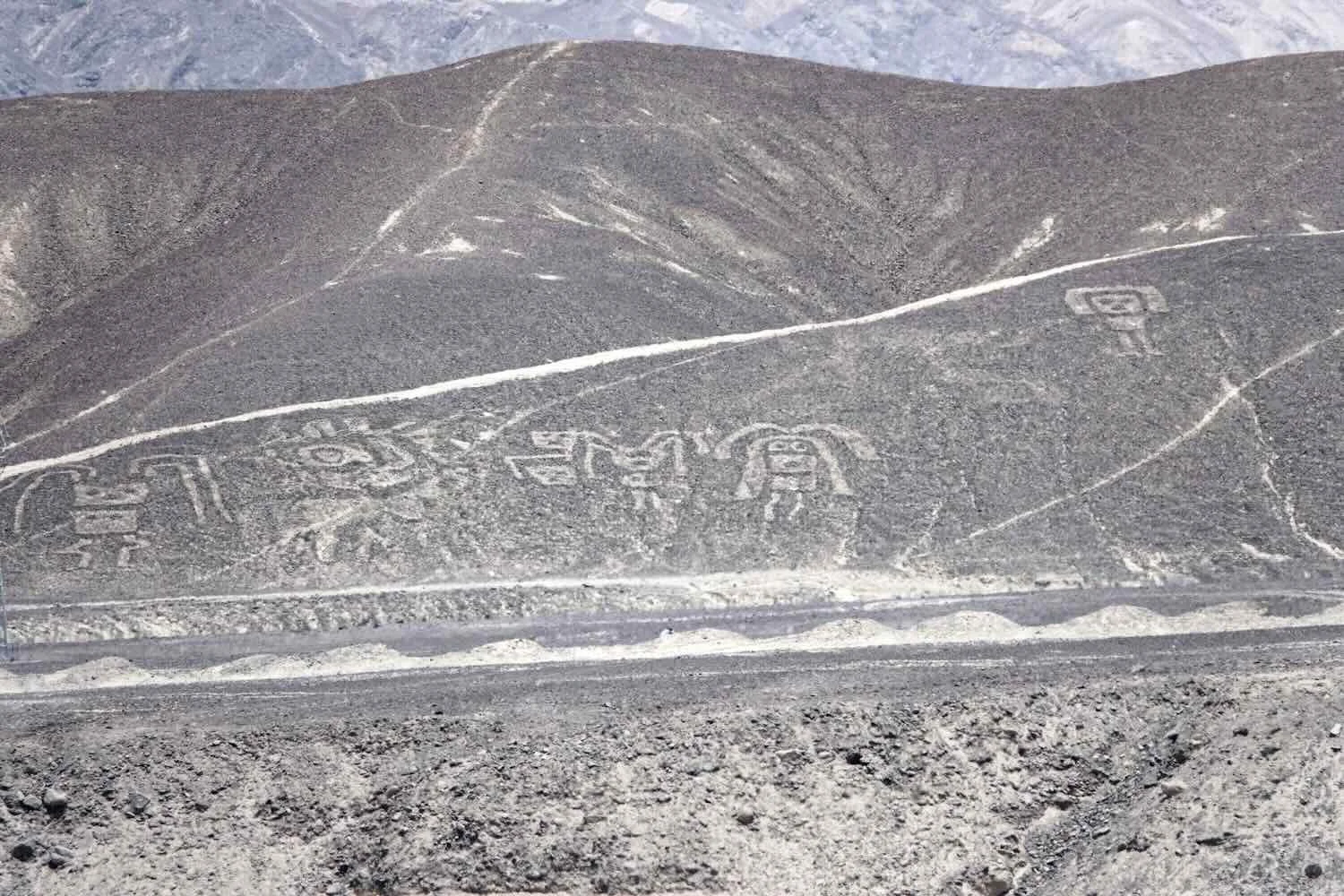
While cycling across a gravelly plain, a solitary hill appeared in the distance. As we drew closer, ivory-colored lines appeared - etched onto the darker, grey-brown slope. At first it just looked like a random collection of tracks. But we had been anticipating seeing something like this, and we suspected that there was more to those curvy lines than was apparent at first glance. We stopped along the side of the highway to look more carefully.
As our eyes sorted through the various designs, one particular group of lines quickly took shape. We realized we were looking at an ancient artist’s depiction of a cat (or so it is commonly thought). But, if you look closely you may also see what some say is a whale. It is a bit of a Rorschach Test. You decide.
Image of a cat (facing right). Nazca Lines Archaeological Site, Pan-American Highway, Ica Department, Peru. Copyright © 2019-2026 Pedals and Puffins.
The Incas of the highlands are Peru’s most famous, pre-Columbian civilization. However, the coast of Peru was home to other advanced civilizations for thousands of years before the Incas ever began their conquest of the continent. Prosperous, urban centers flourished in the fertile river deltas, where sophisticated irrigation systems supported intensive agriculture, and the sea provided a diet of fish, seaweed, and other seafood.
The Nazca people were the dominant civilization on Peru’s southern coast from about 100-800 AD. They were skilled craftsmen and engineers, known for their advanced, underground irrigation system, monumental ceremonial sites, ornate pottery, and intricate textiles. However, the innovation that really set them apart from other cultures was the creation of the Nazca Lines - a collection of very large images etched into the desert (i.e., ‘geoglyphs’), presumably for ceremonial purposes. And we had just encountered our first Nazca Lines.
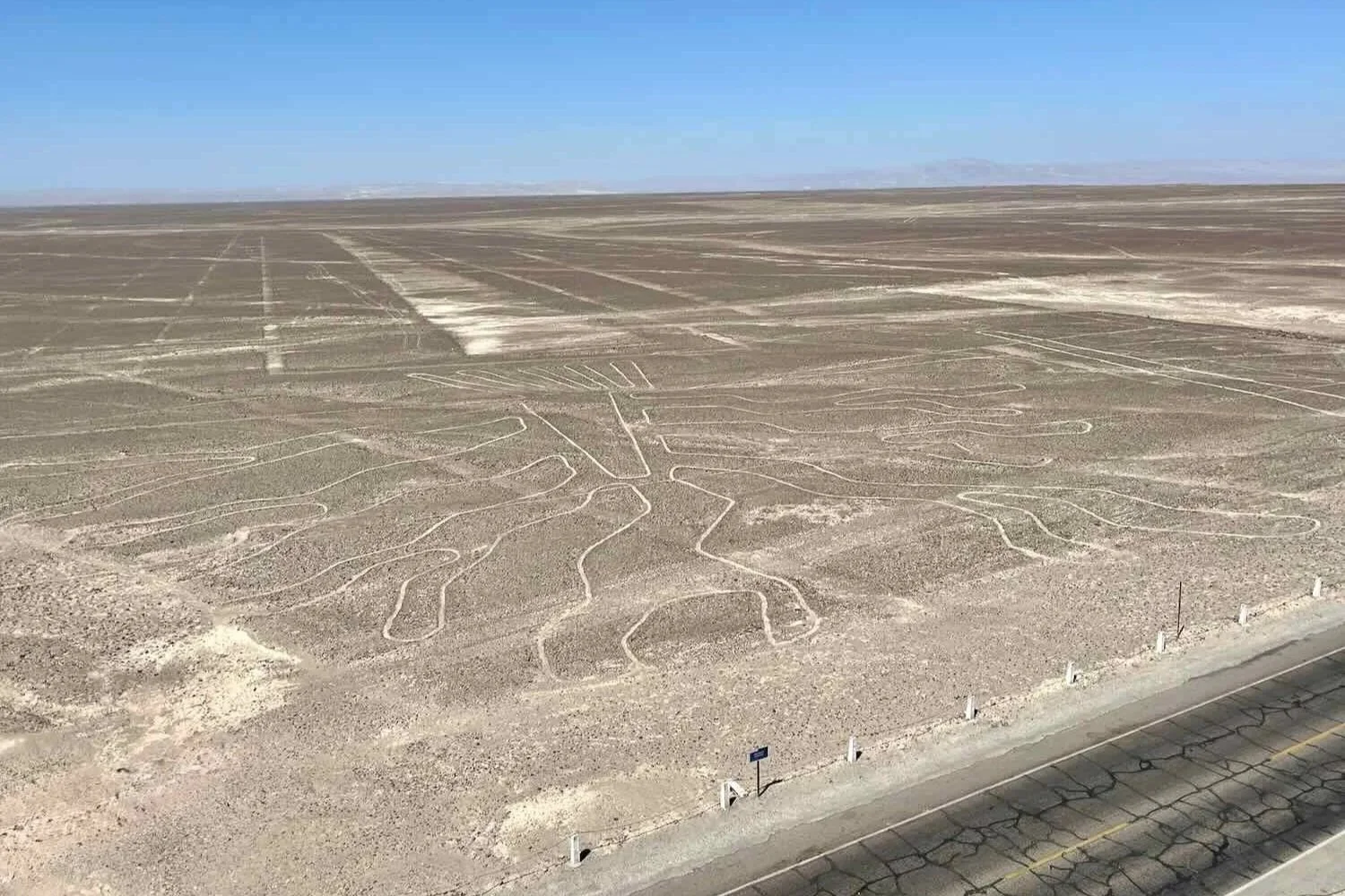
Part of the challenge involved in viewing these enigmatic works of art is that many of the images were created on the flat surface of the plateau (rather than on hillsides, like the cat). Given their humongous size, it’s hard to appreciate their shapes while standing on the ground. They are best seen from the air. Therefore, some people pay for stomach-churning, roller-coaster plane rides to get a bird’s eye view of the lines.
Fortunately, if you’re like us and aren’t keen on taking a sketchy flight, the authorities have built a 42 ft high (13 m) viewing tower right next to the highway. That way, travelers can climb the tower to get an aerial view of several images, without having to hire an airplane.
We stopped to have a look, and were treated to views of a stylized tree (upside down from our point of view), a frog, and a lizard. The lizard was so long (about 600 ft) that it was tough to get the whole thing in a single photo (PedalingGuy ascended the tower three times in an effort to get the perfect shot). The Pan-American Highway cut right through its tail. We also could see some of the mysterious, perfectly straight lines that headed towards the horizon, extending for many kilometers across the plain.
Viewing tower at the Nazca Lines overlook. N of Nazca, Pan-American Highway, Ica Department, Peru. Copyright © 2019-2026 Pedals and Puffins.
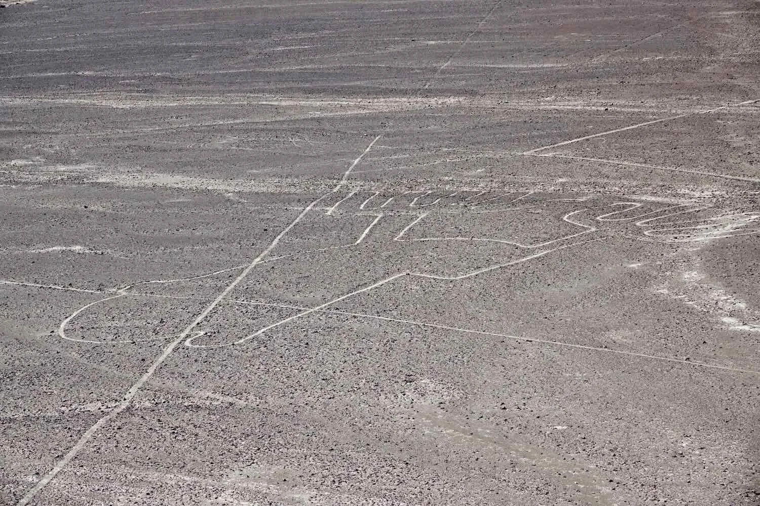
If you look very carefully in this photo (you may need to enlarge it), you can see the 600-ft-long image of a lizard. Its head and front legs face towards the right, and its tail (cut through by the highway) points to the left. Nazca Lines Archaeological Site, Pan-American Highway, Ica Department, Peru. Copyright © 2019-2026 Pedals and Puffins.
After leaving the tower our route descended off the high plateau, into a broad river valley planted in drought-tolerant crops like cactus and asparagus.
The presence of water supported a bit of agriculture, in this case, a newly-planted field of prickly pear cacti. Near Ingenio, N of Nazca, Pan-American Highway, Ica Department, Peru. Copyright © 2019-2026 Pedals and Puffins.
At the road crossing leading to the town of Changuillo, they built a surprisingly elaborate welcome arch, adorned with a gigantic statue of a freshwater shrimp. Shrimp do occur in the nearby river, but our guess was that this was a play on words. The town probably adopted this mascot because the Peruvian name for the freshwater shrimp is “changallo,” which sounds a lot like the town’s name.
Posing with the town mascot (a changallo shrimp). Changuillo, Pan-American Highway, Ica Department, Peru. Copyright © 2019-2026 Pedals and Puffins.
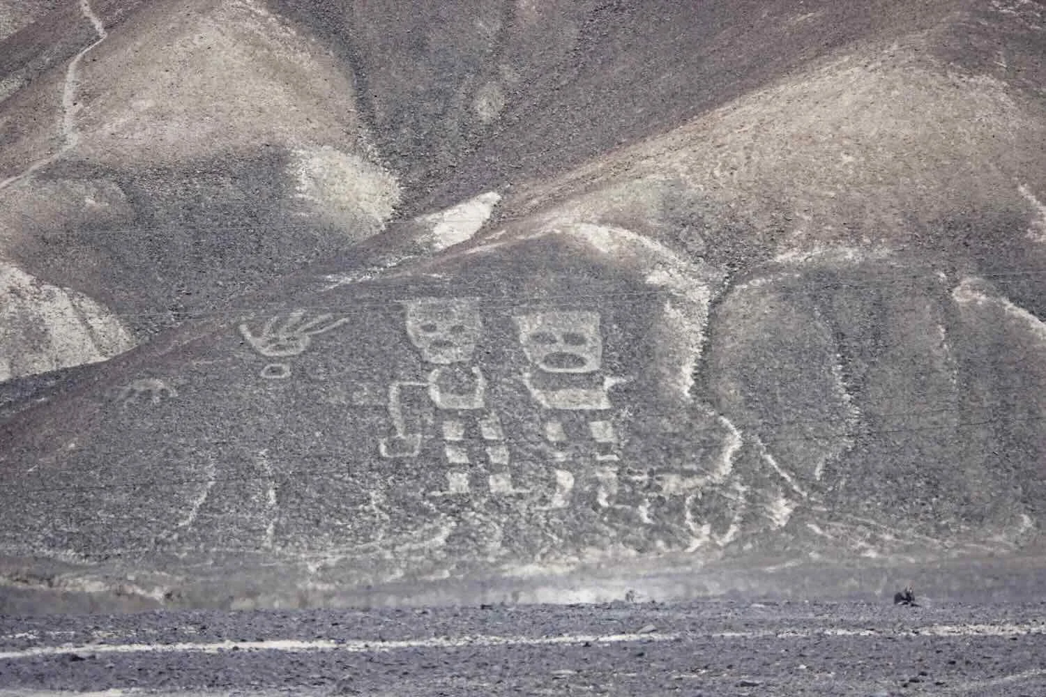
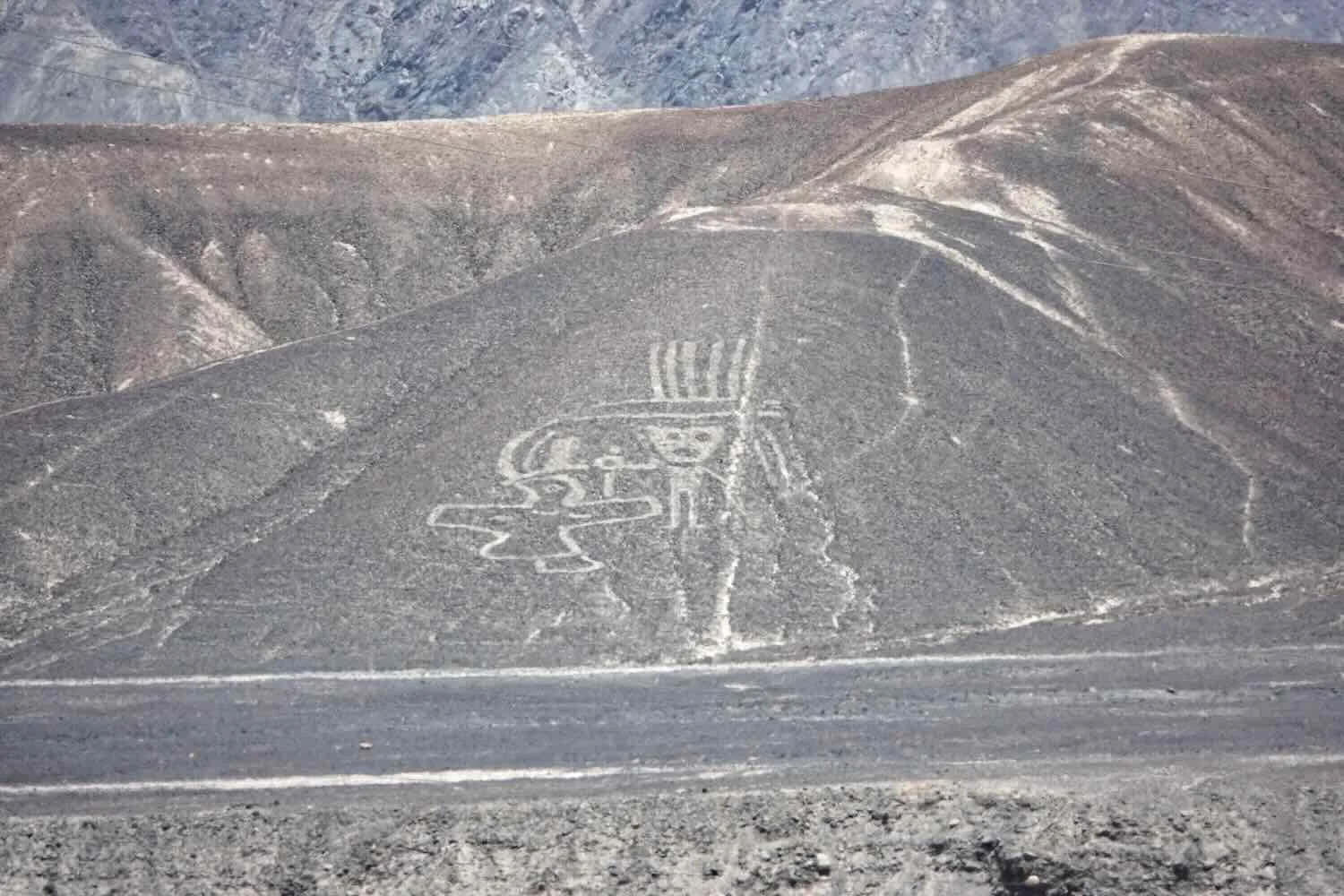
Beyond the river valley we entered another arid plain, surrounded by low, gray hills that were covered with an entirely different set of images known as the Palpa Geoglyphs. Although these shapes were constructed using a similar method to the Nazca Lines (e.g., removing the dark gravel, surface rocks to expose lighter, underlying sand), they actually were created by a completely discrete, much earlier civilization known as the Paracas Culture (800 BC - 200 AD).
There were some notable differences between the Paracas and Nazca images. The Palpa Geoglyphs typically depicted human forms (often with headdresses and weapons), while the Nazcas used single lines to depict stylized animals, geometric shapes (spirals, triangles and squares), and incredibly long, straight lines. Another distinction was that the Palpa Geoglyphs were all created on hillsides, making them easy for us to see from the ground. While the Nazca Lines were overwhelmingly created on the flat plain, making them hard to visualize without gaining significant height (like in the viewing tower).
Here Comes Santa Claus
That evening in the town of Palpa (pop. 5,200), we ended up walking through the main plaza on our way to dinner. Like most of the plazas in Peru during December, it was all decked out for Christmas. It also was absolutely packed with families - far beyond the typical, large number of families that are often present. There were kids running around everywhere. Something felt different. PedalingGuy actually remarked that he wondered if Santa Claus was scheduled to appear.
These Santas and their polar bears looked a bit out of place among the palm trees. Central Plaza, Palpa, Ica Department, Peru. Copyright © 2019-2026 Pedals and Puffins.
Then, just as we were about to leave the plaza, everyone - especially the kids - started running towards the municipal building. It was a stampede. Of course, we had to follow them and see what was happening.
Sure enough, Santa Claus had come to town. Apparently the reindeer were on break, because a large cargo truck pulled up that was loaded with presents. Boy, did that create excitement.
Luckily, Santa had a personal security detail, including a guy in an orange workman’s jumpsuit and another guy who was one one of the largest men we’d ever seen. He particularly stood out in a country like Peru, where most men are not especially tall.
When Santa Claus appeared, everyone who had been waiting in the town plaza rushed towards him in an excited crowd. Santa’s red cap is visible just to the right of the vehicle at the top center of the photo. Palpa, Ica Department, Peru. Copyright © 2019-2026 Pedals and Puffins.
The throng of people mobbed them, and didn’t pay much attention to instructions being yelled into a microphone by the big guy. The nervous-looking Santa and his crew slowly made their way through the crowd towards the large cargo truck, which was opened to reveal stacks of boxes full of toys. Santa was going to give gifts to all the children.
The guy with the mic then attempted to get the kids to line up by age group and gender. It was a losing battle, as kids pushed and shoved their way forward - clearly concerned that they would somehow miss out on getting a gift. Throughout the whole process, Santa continued to appear very worried about the chaotic situation, although he may have been just trying to hold his mask in place. (It’s not easy to find someone with white hair and a white beard in Peru, since almost everyone has jet black hair and no beard. Thus, Santa often uses a mask.)
Standing over by the gift truck, Santa looked rather worried about whether his helpers would be able to maintain control of all those eager children. The truck in back of Santa was full of presents for the kids. Palpa, Ica Department, Peru. Copyright © 2019-2026 Pedals and Puffins.
When we turned around to leave, it was as if someone had completely evacuated the plaza. Where there had been hundreds of people just a few minutes earlier, there now was just one guy sitting on a bench, calmly checking his phone. Everyone else had come just to see Santa, and now was bunched in the crowd surrounding the gift truck. It was surreal.
An eerie calm descended over the town plaza after Santa arrived. The people crowding the plaza just moments before had bolted over to the gift truck, leaving the walkways deserted. Palpa, Ica Department, Peru. Copyright © 2019-2026 Pedals and Puffins.
After dinner we walked back to the hotel through the plaza. It still was pretty busy - many kids sat in the walkways, playing with their new toys. Other families were drifting away down side streets, heading home, with all the kids happily carrying a gift from Santa.
What’s That Coming Down The Road?
Occasionally in Latin America you will see something on the road that catches your attention. A truck piled high with some unknown, local produce, a mule-cart trotting along the road margin, or some vehicle with a load piled three times higher than it should be.
However, every once in a while you’ll see something that stops you dead in your tracks, and makes you wipe your eyes to make sure you’re not imagining things. The day we rode out of Palpa, Peru was one of those days.
The ride started out like any other day, with the usual climb out of the agricultural valley where the town was located. As we worked our way uphill in the cool morning air, the valley floor spread out below us, covered with a patchwork of green crops.
A town hugged the foothills at the side of the river valley, leaving as much of the floodplain as possible for growing irrigated crops. Río Grande, Pan-American Highway, Ica Department, Peru. Copyright © 2019-2026 Pedals and Puffins.
On the side of the road away from the river valley, barren hills rose ever higher in waves of gravel. N of Río Grande, Pan-American Highway, Ica Department, Peru. Copyright © 2019-2026 Pedals and Puffins.
The road drew close to a banana plantation. Ever since arriving in Peru we had noticed how much better the bananas were than in Bolivia, and we guessed they must grow a lot of bananas somewhere in the country. But this was the first time we had seen any banana trees. It was another indicator that we were getting into the warmer tropics. N of Río Grande, Pan-American Highway, Ica Department, Peru. Copyright © 2019-2026 Pedals and Puffins.
Before long we left the plantations and fields behind. For the next hour we would work our way gradually up to another high pass in the desert. These hills were particularly steep. Fortunately for us, a series of switchbacks and hairpin turns made the climbing easier. We just took our time, winding back and forth among the gravelly hills.
Climbing slowly up and out of the river valley. N of Río Grande, Pan-American Highway, Ica Department, Peru. Copyright © 2019-2026 Pedals and Puffins.
We had stopped to take some photos of the valley below, when we turned around and saw something that made us do a double-take and ask, “What the heck is that?” Whatever it was, it was not something that we had ever seen before.
Inching toward us down the side of the mountain was an unusual truck with what looked like a gigantic, white needle sticking up into the air. After adjusting to the surprise, we realized that it was the blade for a massive wind turbine, stretching more than four times as long as the trailer that carried it. Instead of being laid flat and supported by an extension to the truck trailer (like we had always seen before), this one was tipped upward at an astonishing angle. There were no supports for the blade except at its base, where it connected to a massive hub near the front of the truck.
Transporting a blade like that was definitely something you wouldn’t want to do unless you really had no other choice. Clearly, the 230 ft (70 m) blade was too long to be maneuvered around the tight, hairpin turns if it were laid flat. It also had to be tilted upwards enough to swing over the height of the surrounding hills.
However, in that position the blade must have made the truck that was transporting it uncomfortably unstable. It looked incredibly precarious - as if one puff of wind would send the blade and its vehicle toppling into a ditch. Consequently, the truck crept down the hill at a snail’s pace. It was moving so slowly that a crew member literally ran backwards (on foot) beside the truck. He was keeping a careful eye on the blade, and communicating with the driver to make sure they would make it through the curvy ravines without crashing.
We stopped to watch this intricate operation, as the convoy slowly made its way past us down the hill.
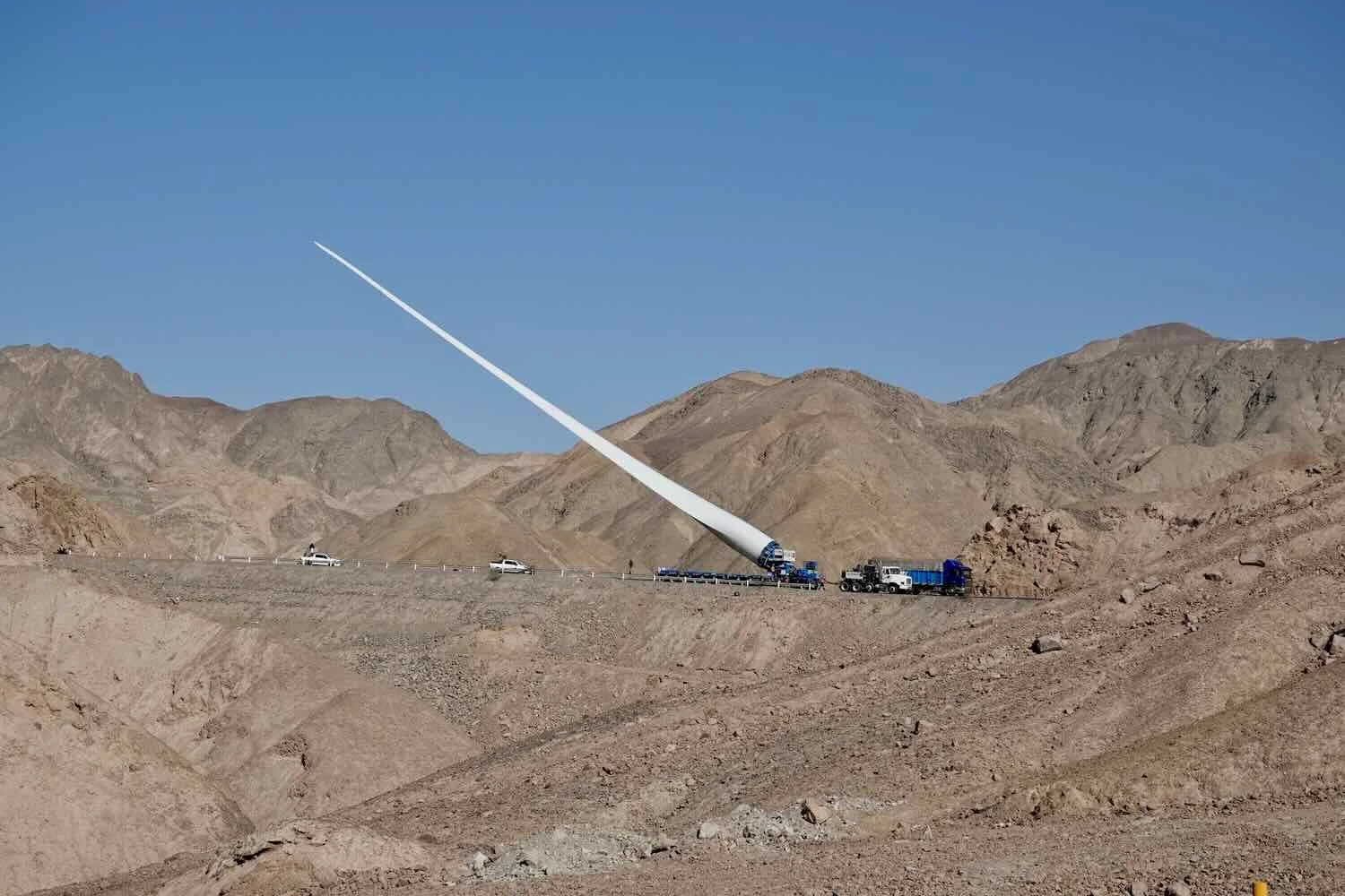
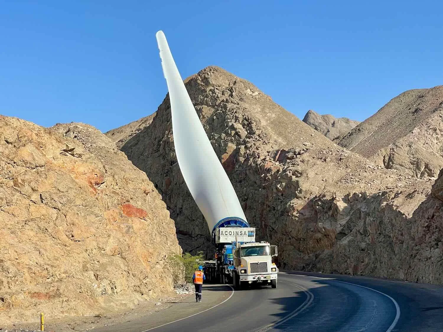
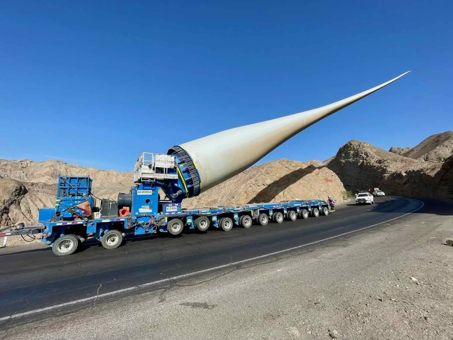
This is where we encountered the truck transporting the wind turbine blade. You can see a few of the tight, hairpin turns that the truck and blade had to maneuver around. The agricultural valley that we had ridden past in the early morning can be seen in the distance. N of Río Grande, Pan-American Highway, Ica Department, Peru. Copyright © 2019-2026 Pedals and Puffins.
After descending off of the pass, we cycled onto a sprawling plateau that extended for miles in every direction. There we saw where that big windmill blade had come from. We passed at least two holding areas were dozens of the giant blades were lined up in tidy rows in the sand, awaiting their turn to be carefully escorted through the mountains. Several more trucks were headed in the opposite direction as us, also transporting wind turbine blades - although these were set up in the “normal” way of having the blade lay flat on an elongated truck bed.
All of these encounters drove home for us how much this region of Peru has embraced wind power. In many places people are finding out that wind power is not as energy efficient as expected, since there are significant costs and energy requirements associated with shipping, installing, maintaining, and replacing worn out machinery. In addition the enormous, spinning blades can pose a serious hazard for migrating birds. Nonetheless, the Peru coast may be one of the places where wind power makes sense, given its large expanses of open plains with reliable coastal winds.
The Ica Department (where we were cycling) currently produces around 70% of the country’s wind power, and the industry is growing fast. Some estimates predict that Peru could increase its wind power generation by 10-fold over the next five years. From what we saw, they’re working on it.
This truck was just one of several that we saw transporting industrial turbine blades down the highway. The presence of multiple storage facilities for blades along the road suggested there was a lot of new wind power capacity being built in this part of the country. Pampa de Huayuri, Pan-American Highway, Ica Department, Peru. Copyright © 2019-2026 Pedals and Puffins.
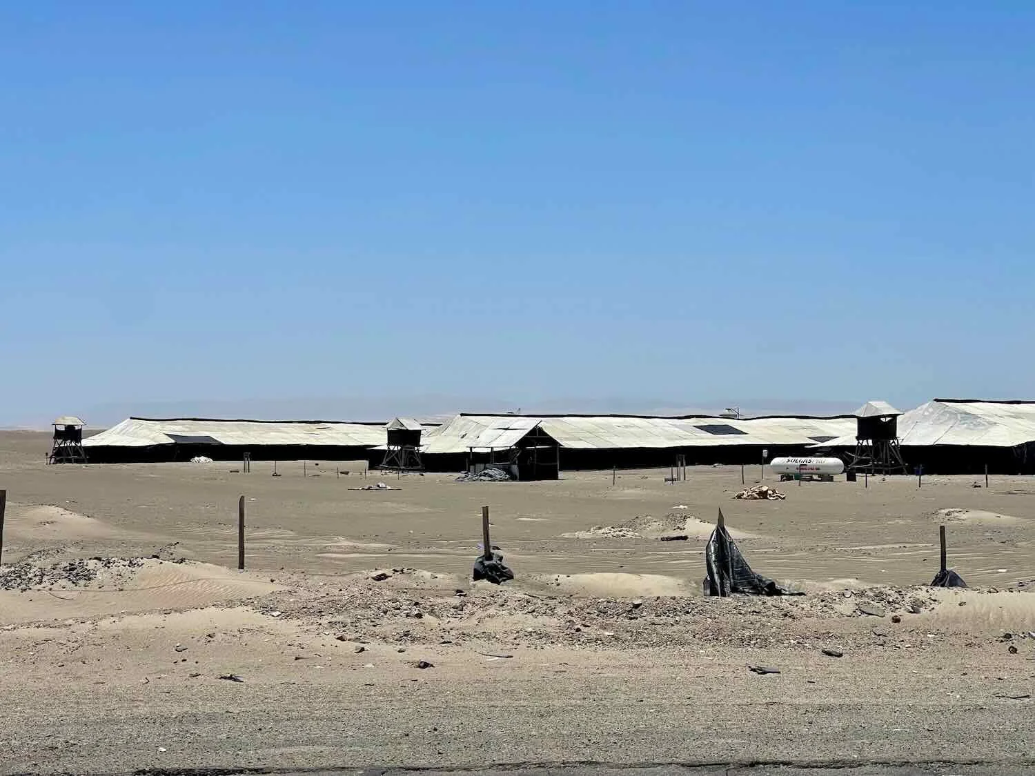
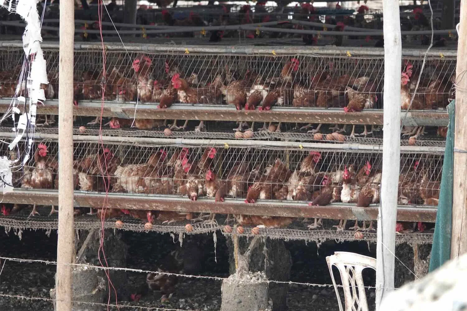
For the remainder of the day we cycled across the barren, sandy plateau. But wherever there was water, there was agriculture. In addition to the usual, drought-resistant crops, we started to see the long, low-slung sheds of the region’s giant chicken farms, which supply more than 40% of the country’s eggs - and Peruvians eat a lot of eggs. A single chicken farm in the Ica region could include up to 75,000 birds.
We cycled past more arid-land crops, like this cotton (which is native to Peru). San Francisco, Pan-American Highway, Ica Department, Peru. Copyright © 2019-2026 Pedals and Puffins.
Roadside Shrine. Pampa de Huayuri, Pan-American Highway, Ica Department, Peru. Copyright © 2019-2026 Pedals and Puffins.
Roadside Shrine. Pampa de Huayuri, Pan-American Highway, Ica Department, Peru. Copyright © 2019-2026 Pedals and Puffins.
Dodging Cars
By the time we reached the small town of Ocucaje (pop. 1,220) where we would spend the night, the traffic had become intense. And by mid-morning of the following day we found ourselves cycling through a series of interchangeable towns, accompanied by a steady stream of cargo trucks, cars and tuktuks.
Getting ready to depart from our hotel in Ocucaje. It was summer, and the royal poinciana trees were in full bloom. Ocucaje, Pan-American Highway, Ica Department, Peru. Copyright © 2019-2026 Pedals and Puffins.
We hadn’t previously realized that Santa played the violin. Plaza Mayor, Santiago, Pan-American Highway, Ica Department, Peru. Copyright © 2019-2026 Pedals and Puffins.
An ornament on the plaza’s Christmas tree showed the town’s coat of arms. We were struck by the choice of symbols, including a bean, grapes, cotton, and a pair of fighting cocks. Plaza Mayor, Santiago, Pan-American Highway, Ica Department, Peru. Copyright © 2019-2026 Pedals and Puffins.
When we entered the city of Ica (pop. 282,500) we suddenly were enveloped in chaos, as large numbers of cars and tuktuks started driving on the road margin to get around traffic jams. We could not count on the other vehicles to make much of an effort to avoid hitting us since Peruvian drivers seem to lose all sanity when they get trapped in bad traffic. So we bailed off the paved shoulder of the road (which was now being used as traffic lane) and found refuge on a dirt path that was too rough and potholed for the cars. We once again took solace in having good, off-road tires.
This was the second truck-in-a-ditch that we had seen since entering Peru. It was easy to understand how an accident like this could happen, if the truck tried to weave around stopped traffic by using the narrow road margin - which was something we witnessed a lot on this stretch of road. S of Ica, Pan-American Highway, Ica Department, Peru. Copyright © 2019-2026 Pedals and Puffins.
It was a relief when we finally reached the sanctuary of our hotel in Ica. We promptly decided to take a rest day - before tackling that awful traffic again on our way out of the city.
Cycling Into the Heartland of Pisco
After emerging from the mayhem of Ica, we began a long, gradual descent back to the coast of Peru. The mountains around us were still sandy and barren, but the area closest to the road started to show more life. In many places there were thorny desert shrubs. And in a big change from previous days, we passed a huge number of vineyards. These were really big operations, protected by tall walls and guarded entry gates. Full-sized buses sat outside, apparently used to transport crowds of farm hands back-and-forth from surrounding towns.
As we descended towards the coast, desert mountains rose on both sides of the highway wreathed in enormous sand dunes. It was nice to see some thorn trees start to appear along the road. The “California Desert”, W of Ica, Pan-American Highway, Ica Department, Peru. Copyright © 2019-2026 Pedals and Puffins.
We had entered the heartland of pisco, Peru’s official, national liquor. Although Chile has tried to lay claim to pisco (and Chileans actually consume more pisco per capita than Peruvians), most dispassionate authorities agree that pisco originated in Peru shortly after the Spanish arrived.
In fact, the spirit owes its name to the city of Pisco, which was our destination for the night. During colonial times, nearly all pisco was exported to Europe via the Port of Pisco, and Europeans simply adopted the name of the port for this new drink. These days the pisco sour cocktail is one of the top mixed drinks sold in bars throughout South America - and it is inescapable during happy hour throughout Peru, Chile and Argentina.
With just 5 miles (8 km) to go in the day’s ride, we turned off the Pan-American highway to take a rural shortcut into the town of Pisco.
Perhaps that wasn’t the smartest idea. We quickly found ourselves cycling on a very sandy road. With our wide, 2.8” tires it wasn’t too bad, but the sand did slow us down a lot. At first we rode past fields of asparagus, which was a pleasant change from the busy highway.
However, the asparagus fields didn’t last. Soon we were riding through what appeared to be the city dump. The road was bordered by hills of steaming garbage that didn’t smell very good under the afternoon sun. In addition, our path was littered with pieces of trash. Most of it was soft paper or fabric. But there definitely were shards of metal and glass half-buried in the sand that had the potential to tear a hole in our tires. We were very happy to make it through that section without getting any flats.
For entertainment, we got trapped behind a herd of goats and sheep being driven down the road. Their shepherd ignored us. He didn’t seem particularly concerned that his animals were fully blocking the way, and didn’t give us a second glance as we followed along behind them - at the pace of the slowest animals. We weren’t able to get through until a tuktuk approached from behind and forced the herd out of the way.
Stuck behind a herd of sheep and goats on the “shortcut” into the town of Pisco. Ica Department, Peru. Copyright © 2019-2026 Pedals and Puffins.
There also were a few cows wandering down the same road. S of Pisco, Ica Department, Peru. Copyright © 2019-2026 Pedals and Puffins.
When we finally arrived at the hotel in Pisco it took us a few minutes to rouse someone to let us in - a fairly common challenge at these small town hotels. It was normal for the doors to be locked while the receptionist was away cleaning rooms or running errands. At least Santa Claus (dressed for a beach holiday) was there to greet us. Pisco, Ica Department, Peru. Copyright © 2019-2026 Pedals and Puffins.
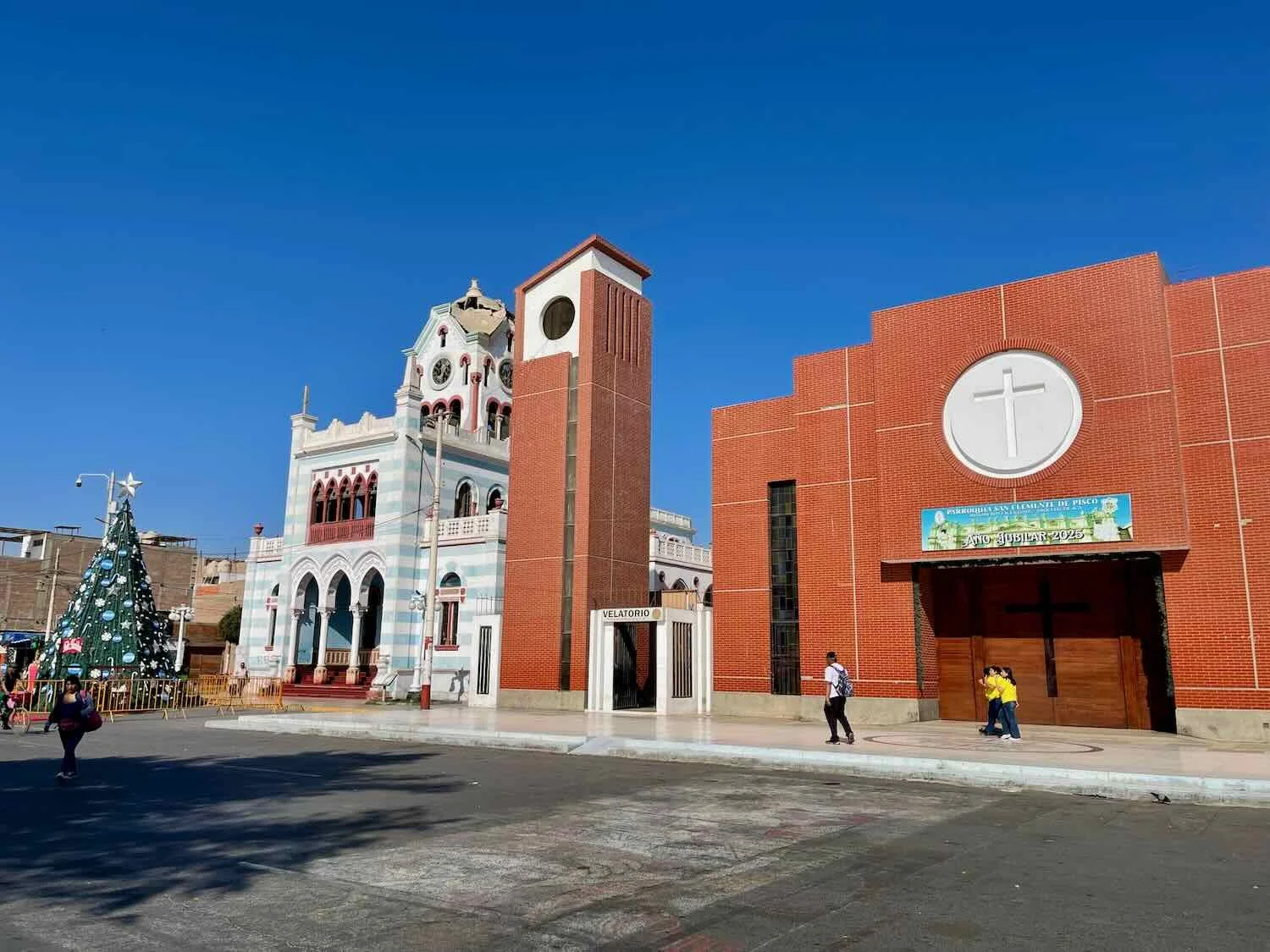
In 2007 the city of Pisco suffered a catastrophic, M8.0 earthquake that lasted a full two minutes. It destroyed or damaged 80% of the buildings in town, and killed over 500 people. On the town’s main plaza, two buildings sat next to each other that illustrated the city’s divergent efforts to deal with the aftermath of that earthquake.
The Church of San Clemente, whose roof collapsed during the earthquake, was completely rebuilt years ago in a modern, earthquake-resistant design. However right next to it, the eclectic, old municipal building remains damaged and vacant. Part of the problem was that the municipal building would be quite expensive to repair - especially the clock tower that was further damaged in a 2025 earthquake. Yet the local residents want to keep the very unique old structure, rather than replacing it with a new one. As a result, the aging gem is slowly falling into further disrepair, with no timeline for restoration in sight.

With all the chicken farms in the area, we were not surprised that Pisco hosted a whole lot of chicken restaurants. However, we were not prepared for the way they had responded to the heightened competition. All the chicken restaurants seemed to be in a cutthroat race to see which one could have the most dazzlingly colorful light display. This restaurant was in the running to take the prize. Pisco Ica Department, Peru. Copyright © 2019-2026 Pedals and Puffins.
As we cycled northward out of Pisco, our route rambled past long lines of liquor stands hawking locally-produced pisco. We were immediately struck by how cool and pleasant the weather was - so very different from up on the hot plateau where Ica and Nazca were located. Being closer to the ocean, we had the benefit of a nice, cool, ocean breeze.
We cycled past this fancy wall, probably surrounding a pisco distillery or bottling plant. Near Chincha, Pan-American Highway, Ica Department, Peru. Copyright © 2019-2026 Pedals and Puffins.
It was common to see dozens of roadside shops clustered together, all selling the same thing. In this case, it was no surprise that the main items for sale were gifts and drinks made from grapes - especially pisco, the national liquor. Near Chincha, Pan-American Highway, Ica Department, Peru. Copyright © 2019-2026 Pedals and Puffins.
Still Out In The Countryside
We were slowly making our way northward towards Lima, Peru’s mega-city on the coast. However, the stretch of road north of Pisco remained noticeably rural. There weren’t any appealing hotels for many miles, so we ended up spending a night at a quirky, farm-run campground overlooking the sea.
Among the fields of corn and squash, the owners had cleared a big lawn for tent camping, and built 6-8 geodesic domes to serve as cabins. We considered staying in one of the domes for the novelty. But they were surprisingly hot inside, so we decided to sleep in our tent instead. Fortunately, the campground manager kindly offered to let us pitch our tent on a small lawn next to one of the domes so that we could use the picnic table.
We set up our tent on the lawn next to one of the campground’s geodesic dome cabins. The site was perfect, even including a picnic table. Biosol Ecocamp, Herbay Bajo, Pan-American Highway, Lima Department, Peru. Copyright © 2019-2026 Pedals and Puffins.
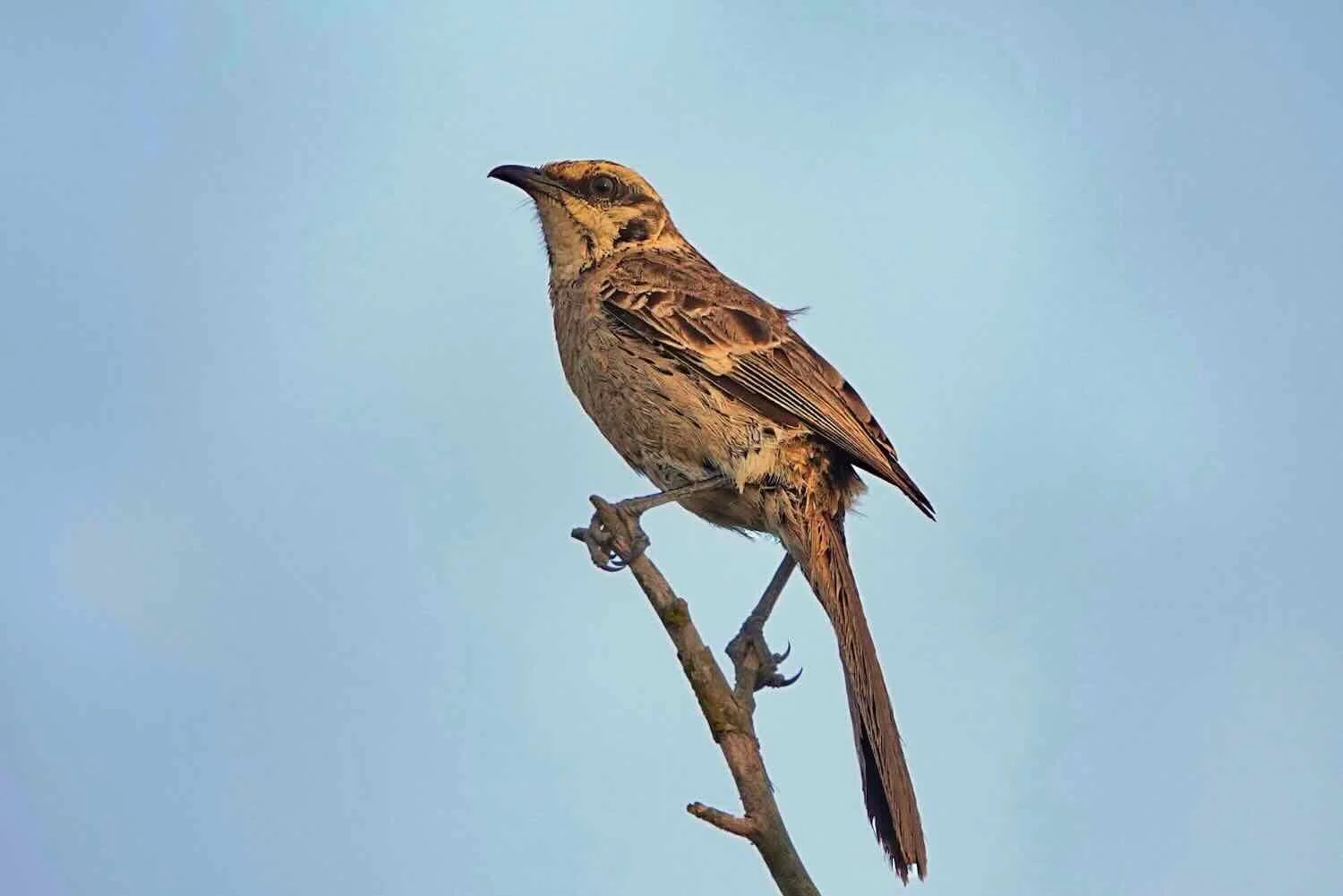
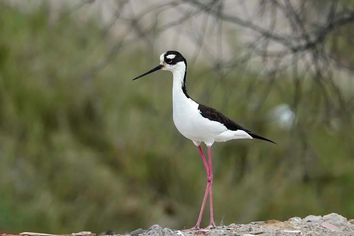
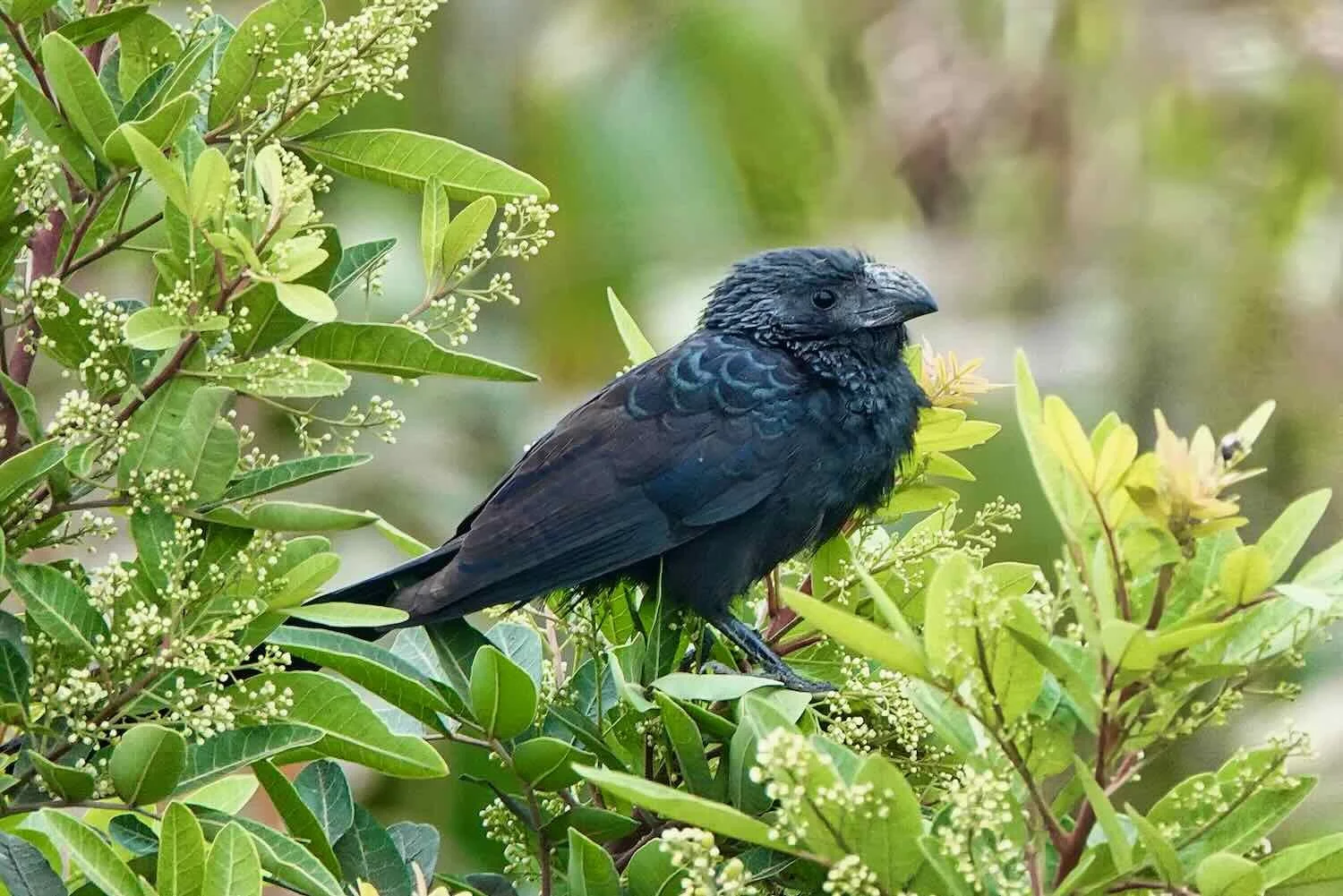
In a region that has little vegetation, the profusion of plants at the farm was a magnet for birds, treating us to more bird sightings than we had enjoyed in a long time. In addition, the farm was perched high on a cliff, right next to the ocean. The campground had an overlook that yielded stunning views of the coastline, especially as the sun sank towards the horizon.

Scanning the shoreline from the cliff-top overlook. Biosol Ecocamp, Herbay Bajo, Pan-American Highway, Lima Department, Peru. Copyright © 2019-2026 Pedals and Puffins.
Sunset over the Pacific Ocean, seen from the cliff-top overlook. Biosol Ecocamp, Herbay Bajo, Pan-American Highway, Lima Department, Peru. Copyright © 2019-2026 Pedals and Puffins.
Reaching The Edge of “The Octopus”
Throughout most of history, the great majority of Peru’s population lived high in the mountains. The endless grasslands of the altiplano were ideal for raising large herds of llamas, and for cultivating crops like quinoa and potatoes in terraced fields. Although the conditions on the altiplano could be harsh, they were quite a bit better than the parched desert along the coast.
Advanced civilizations did develop on the coast, for sure. But their populations were severely constrained by the availability of water - confining settlements to narrow, isolated river valleys and deltas. Even after the arrival of the Spanish, who built seaports for shipping silver to Europe, the majority of economic opportunities remained high in the mountains (e.g., working the mines).
It wasn’t until the late 20th century that this population distribution changed. From 1960-1990 Peru experienced a boom in industrial agriculture, commercial-scale fishing, and manufacturing that drew people from rural areas to the coast in search of jobs. These days 60% of the country’s population lives along the coast. Moreover, four out of Peru’s top five metropolitan areas are coastal ports.
Yet nothing in the country compares to The Octopus - as the Lima metropolitan area is known in Peru. Fully a third of the country’s population lives in Lima, or one of its sprawling suburbs. No wonder this giant city is said to resemble the tentacles of an octopus spreading out across the land.
From the campground where we had spent the night, it would take us three more days to reach the heart of Lima by bicycle. However, one of the tentacles of The Octopus reaches far down the coast, and we could already feel its presence, even at this great distance. At first the signals were subtle, with plenty of agricultural fields along the highway that attracted a variety of birds.
We gave this tuktuk with four horses in tow lots of space, since he seemed to have all he could handle. Cochahuasi, Pan-American Highway, Lima Department, Peru. Copyright © 2019-2026 Pedals and Puffins.
Yet now the strip of land closest to the beach (just a half-mile away on our left) was almost entirely covered by “resorts” and weekend-getaway homes targeting more affluent folks from the city. This was a stark contrast to the lonely beaches further south, with only the occasional fisherman’s shack.
Even along the highway, speculators were trying to get in on the development boom. Whereas the land between farms had formerly been open desert, now nearly every inch had been fenced and subdivided into thousands of little, empty lots.
It was almost funny how many lots were for sale. There seemed to be a huge amount of land speculation going on. Yet the lots typically were nothing more than tiny, rectangular patches of sand - with no visible signs of infrastructure (like water, sewage, power, or even proper access roads). Truthfully, these places looked pretty bleak.
However, that didn’t stop the owners from selling The Dream. You could almost hear the sales pitch: Buy now before the price goes up, the lots will never be less expensive! Since land is limited and you can’t make any more, it is one of the best investments! You can be the first to welcome all your neighbors! Even if you already own a house, this can be your home away from home, a great place to take the kids……etc, etc.
Despite the lack of any infrastructure, nearly all of these “developments” had one thing in common - a large, high-quality billboard next to the highway proclaiming the availability of lots for sale. The signs invariably included images of happy, prosperous-looking families (usually with a toddler) smiling for the camera in front of a 2-story, high-end home. In a particularly bold form of advertising, the signs would often assert that new owners could “move in immediately.”
This is what land platted for new home development looked like along the highway, several hours drive south of Lima. If you look carefully, you may be able pick out the lot markers in a line, on the sandy hillside (upper left). Valdivia, Pan-American Highway, Lima Department, Peru. Copyright © 2019-2026 Pedals and Puffins.
Apparently a majority of these developments are “informal,” with no municipal oversight. And while the communities near the beach target the country’s well-to-do with better planing and infrastructure - the ones along the highway target middle-class families or retirees on a limited budget. New lot owners would mostly be left to their own devices to figure out how to get water (trucked in or from a well) and power (solar or a generator). Plus, from what we saw, the homes that do get built on these lots can be pretty makeshift structures.
There was one other change that we noticed. About 3/4 of the way through the ride we stopped for a break at a gas station convenience store. To our delight the shop had an indoor seating area, with table and chairs. There even was a touch of air conditioning - the first we had encountered at a highway store in a very long time. This was clearly a side effect of getting closer to a large, cosmopolitan, urban area like Lima. We savored our drinks while sitting in the cool space, out of the wind.
A roadside tire repair shop had its own way of decorating for the upcoming Christmas holiday. Cerro Azul, Pan-American Highway, Lima Department, Peru. Copyright © 2019-2026 Pedals and Puffins.
After spending a night in a small hotel across the highway from an upscale shopping mall (another sign that we were approaching a city), we pushed further into Lima’s sprawling urban zone.
The theme for that day was ice cream. There were many dozens of little roadside stalls, one after another, all hawking the same brand. It was called E.T. Ice Cream, with a little alien toddler named Salim for a mascot. Little did we know that the nearby town of Chilca, where the ice cream brand got its start, is internationally famous for UFO sightings - hence the alien theme.
It’s considered an “artisanal” brand of ice cream because it’s produced daily, in small batches, with fresh fruit and without preservatives. Special flavors like fig and lúcuma (an Andean native fruit primarily grown in Peru) add to the brand’s local appeal. Although E.T. Ice Cream is now sold throughout most of Peru, this stretch of the Pan-American Highway was clearly the epicenter of its popularity.
On this stretch of the highway leading into Lima there were easily a hundred little stalls, all selling E.T. Ice Cream - with the image of the little alien mascot plastered everywhere. Unfortunately, none of the shops were open when we passed. It was unfortunately too early in the morning for the stands to be open. Chilca, Pan-American Highway, Lima Department, Peru. Copyright © 2019-2026 Pedals and Puffins.
The shoreline just south of Lima was crowded with resorts and waterfront condos. Punta Hermosa, Pan-American Highway, Lima Department, Peru. Copyright © 2019-2026 Pedals and Puffins.
An Unwelcome Surprise On the Way Into Lima
Our final day’s ride into Lima, the capital of Peru (pop. 11+ million), was a mixture of the good, the bad, and the ugly.
The day before we had been able to bail off the intensely-busy, Pan-American Highway onto a quiet bike path in the seaside enclave of Punta Hermosa. Unfortunately, the bike path only lasted for about 10 minutes of cycling the next day. Then, it dead ended just as we approached a massive intersection.
From there, we negotiated our way through a hair-raising maze, across multiple lanes of traffic, with vehicles zipping past us in multiple directions - before being unceremoniously dumped back onto the Pan-American Highway. This was not a welcome development. Ah, well… the chaos of entering a large city is always a challenge. Lima did not disappoint.
On our way into Lima we cycled for more than an hour through sprawling, commercial areas on the shoulder of a big highway. The sight of several guys working way up high, on the top of a roadside billboard frame (small black spots in this photo), stopped us in our tracks. It looked like a pretty dangerous job. Lurín, Pan-American Highway, Lima Department, Peru. Copyright © 2019-2026 Pedals and Puffins.
Lima’s Jewel: The Costa Verde
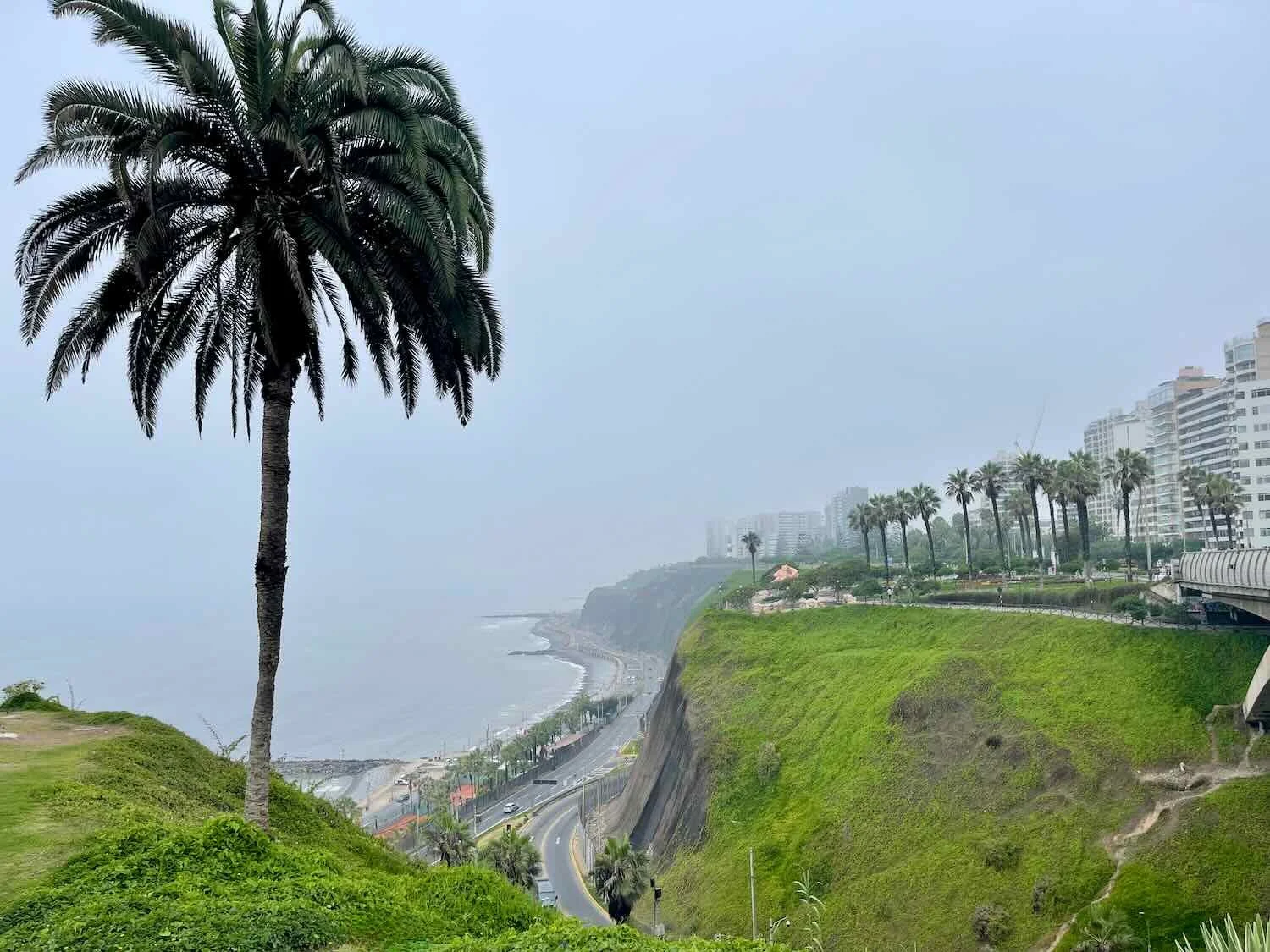
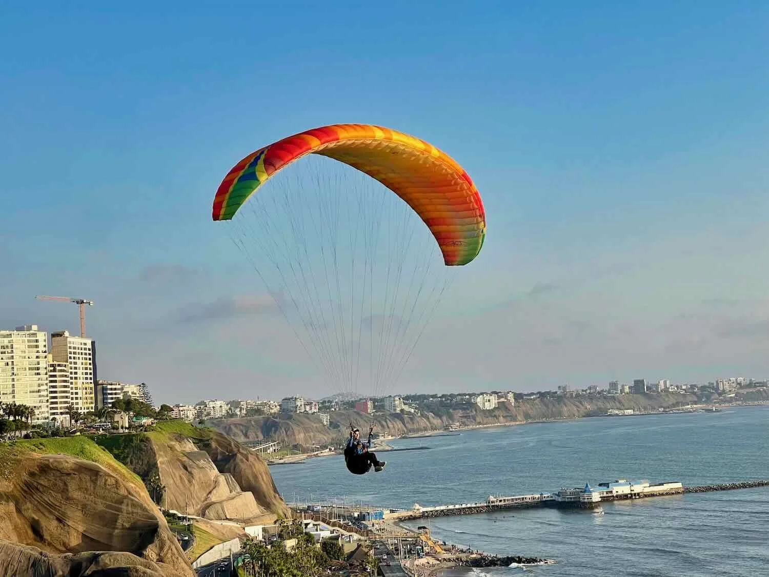
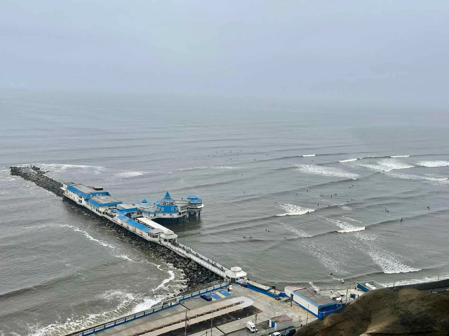
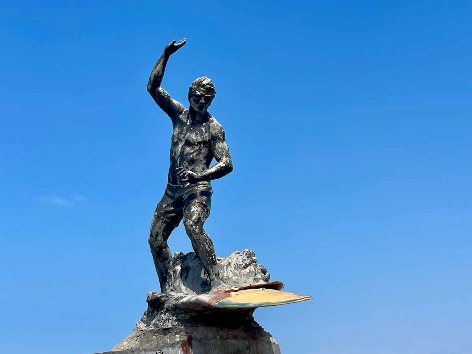
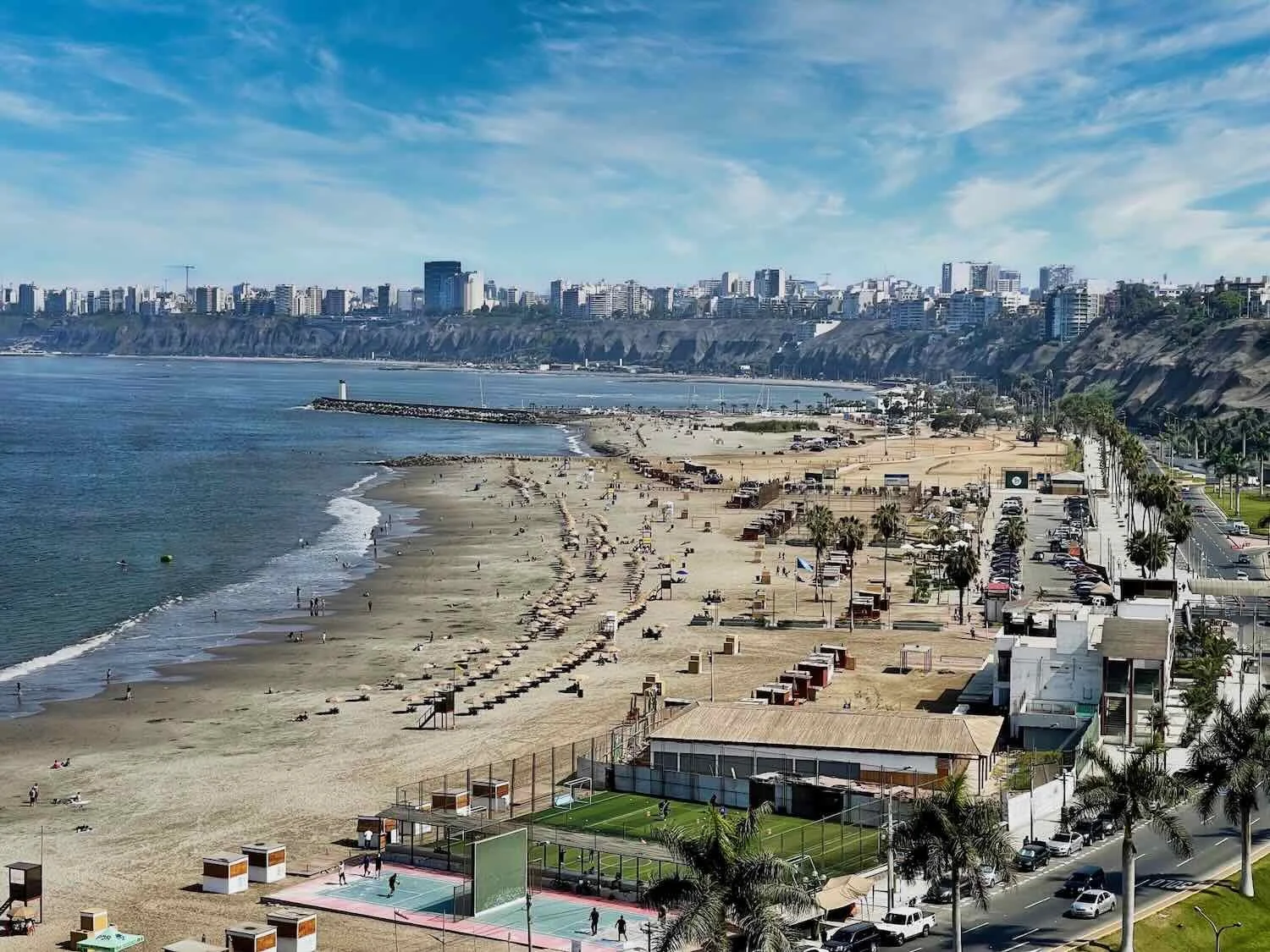
If you’ve never been to Lima, you may not know that the city sits atop a breathtaking, 200 ft high cliff overlooking the Pacific Ocean, known as the Costa Verde. Even better, much of the coast is accessible by the Cliff Boardwalk (Malecón), which extends for roughly six miles (10 km) along the top of the bluffs. First built 30-40 years ago, the Cliff Boardwalk is composed of a series of interconnecting pathways and welcoming parks that are constantly being enhanced and expanded. It’s surprising how little credit Lima receives for its truly stunning location.
When we were finally inside the city of Lima the cycling improved dramatically. We turned onto the bike path that follows the Cliff Boardwalk, and were blown away by the gorgeous ocean views and charming parks. The suburban malls faded away as we cycled past quiet residential areas hosting smaller shops and hotels. In another change for the better, the bicycle path was now mostly used by cyclists, rather than tuktuks, cars, motorcycles, and pedestrians as is typical.
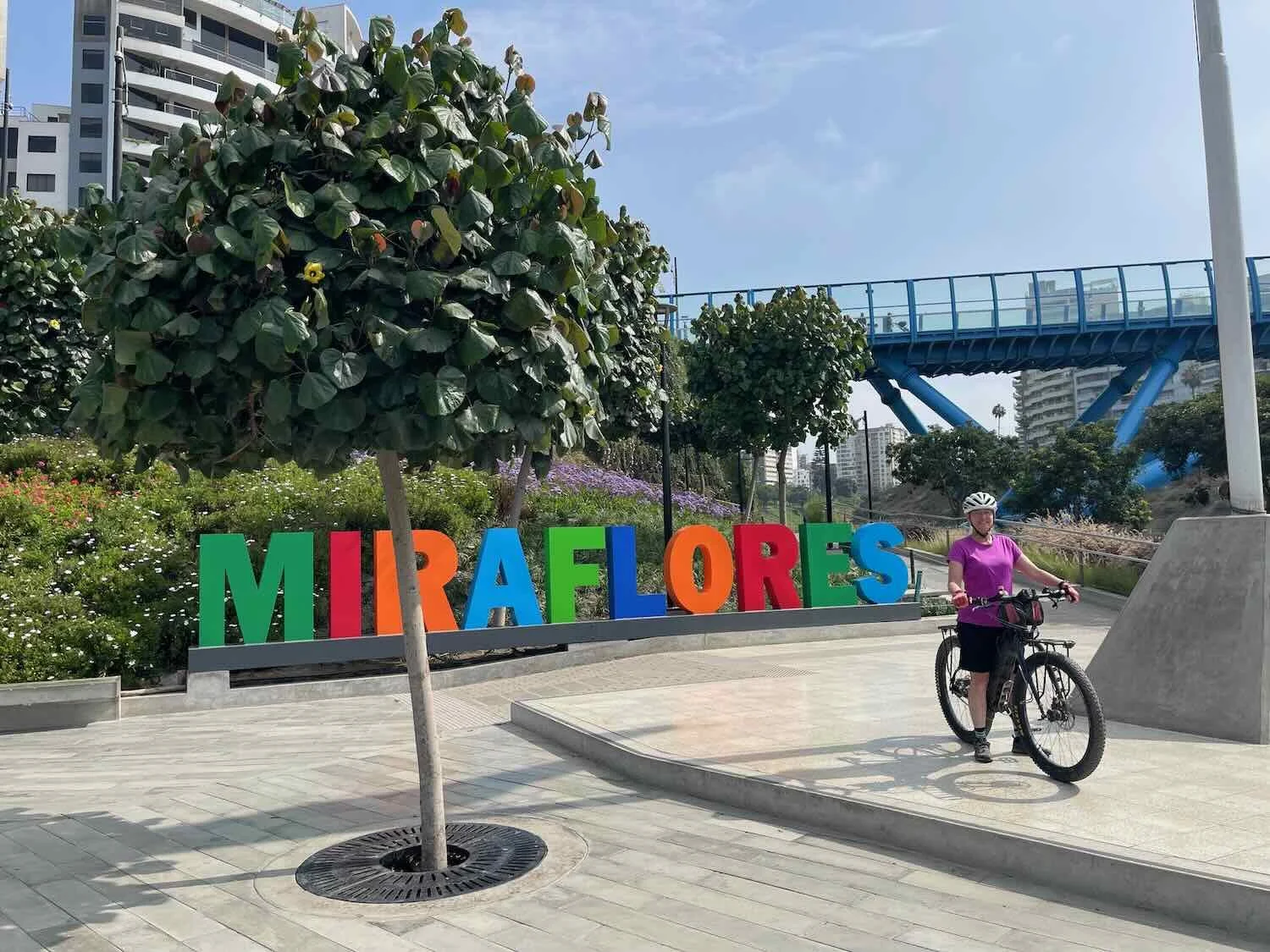
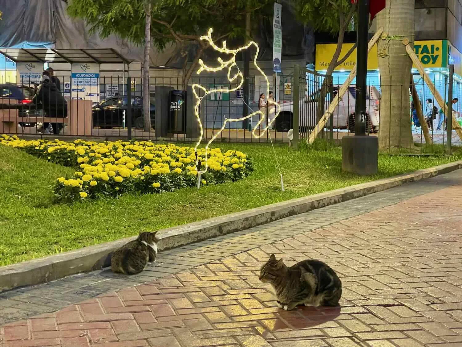
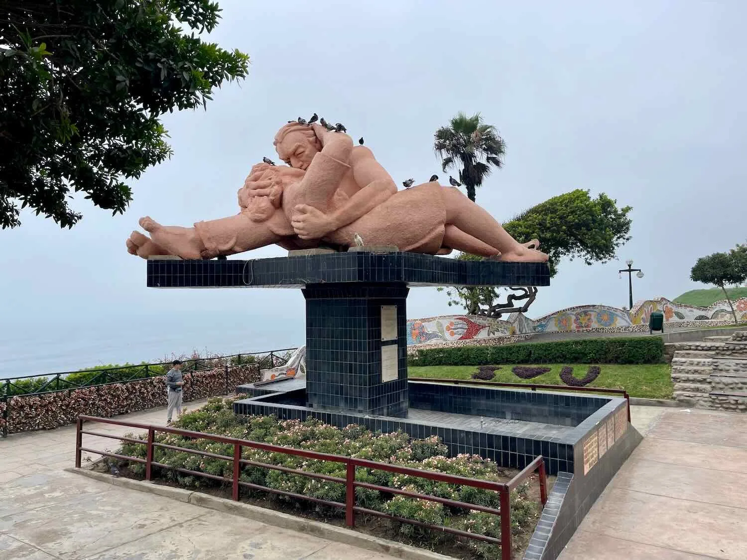
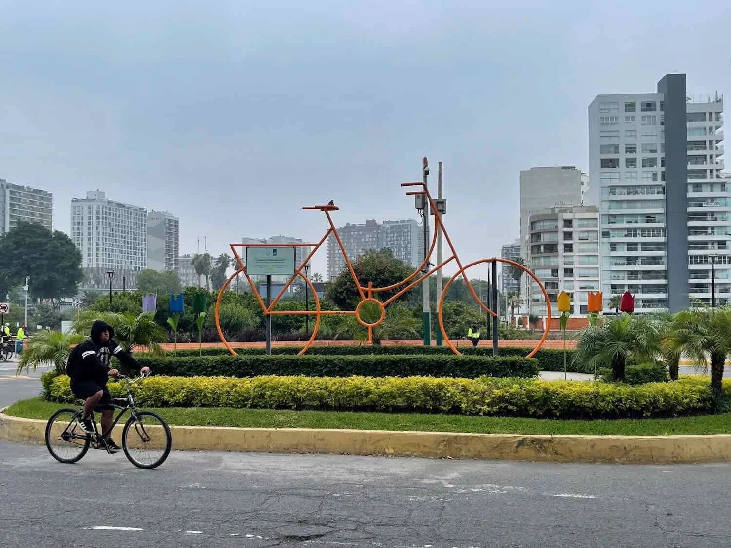
We spent the next couple of weeks enjoying the summer holidays (Christmas and New Year’s Eve) in the Miraflores district of Lima. (We are still getting used to the fact that Christmas and New Year’s are summer holidays in the Southern Hemisphere.) One of our favorite activities was to go out walking or cycling along the Cliff Boardwalk. In addition to the spectacular views, there always seemed to be something happening.


One of our favorite discoveries along the Cliff Boardwalk was a free, outdoor gym called the Parque de la Juventud (“Park of Youth”). It was, by far, one of the best outdoor gyms we had ever seen, including sweeping views of the coast from high on the cliff. PedalingGuy got in the habit of going over to the park every morning around sunrise, and PedalingGal regularly joined him. It was a great way to maintain a little fitness during our long holiday layover.
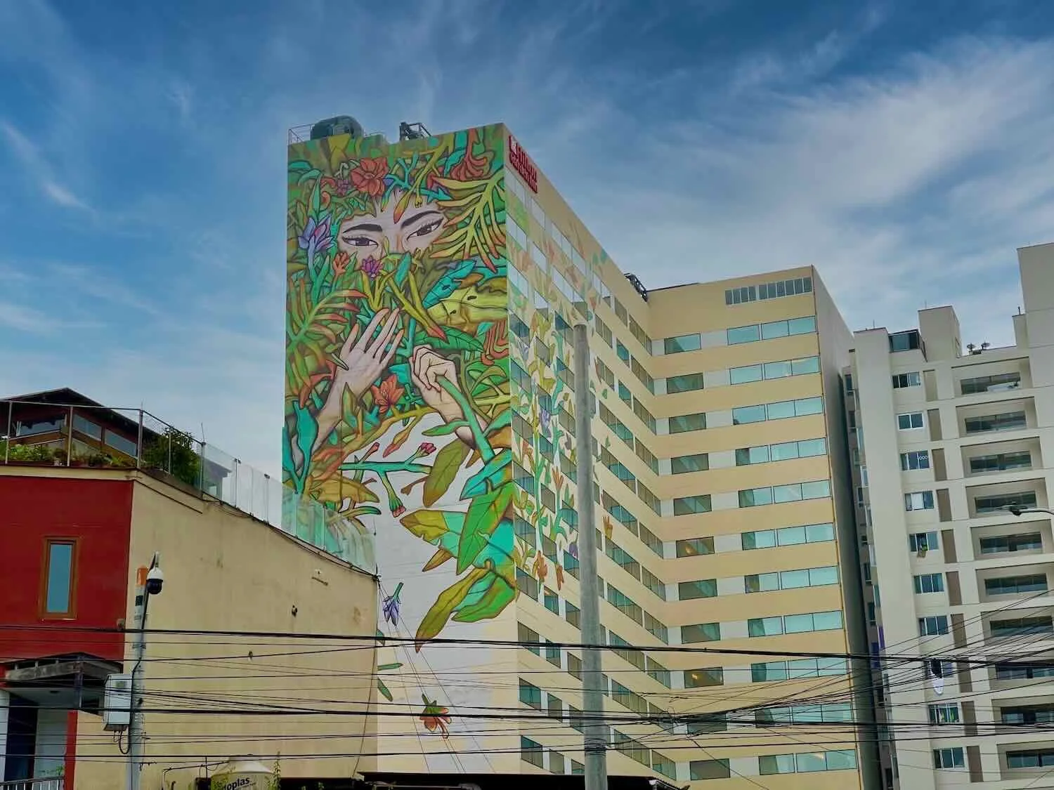
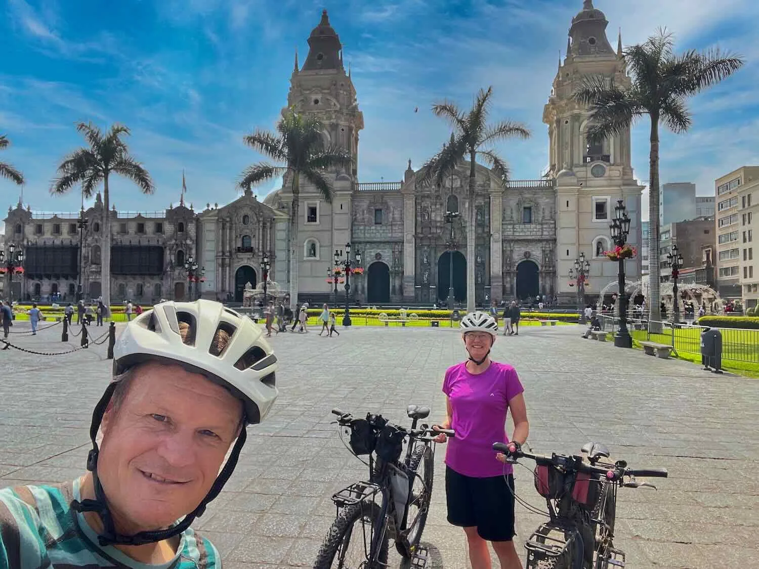
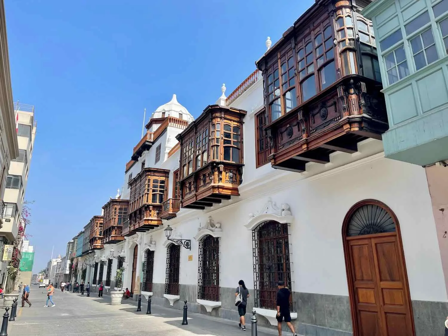
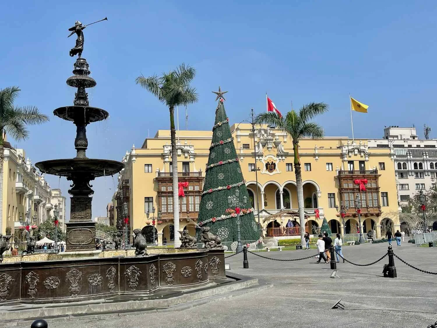
One day we cycled from Miraflores into Lima’s historic center. Lima’s old town is tucked into a very dense, urban area. It that doesn’t have quite the same colonial charm as places like Arequipa, but we still enjoyed seeing the big, central plaza, flanked by the big cathedral, the presidential palace, and other government buildings.
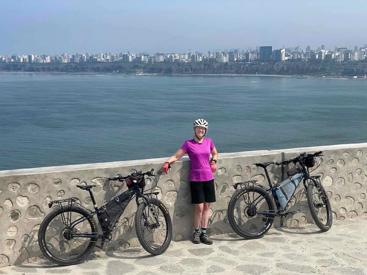
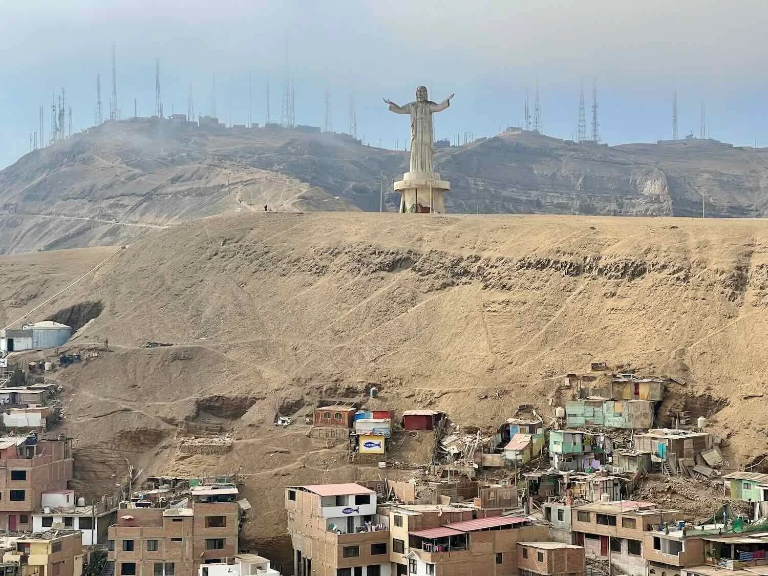
A favorite bike ride was to head south along the Cliff Boardwalk, and up onto a 400 ft high hill that dominated the southern skyline of the city. The climb up the mountainside was steep enough to provide a challenge. There were several monuments on top, including a towering statue of Christ and a giant cross constructed of metal beams. The mountain had once played a pivotal role in the defense of Lima, including when Chile invaded during the War of the Pacific. These days, a row of iron cannons commemorates the battle.
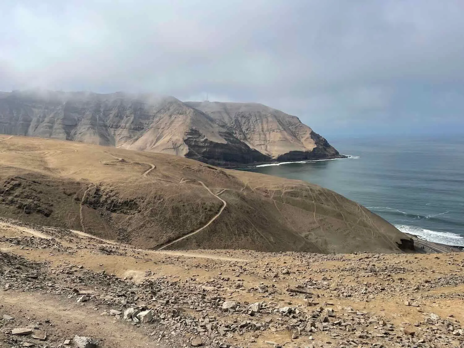
The paved road only goes part way up the hill, though. On the higher slopes, dirt and rock paths are the domain of Lima’s mountain bikers. The terrain was difficult and in many cases treacherous, with steep drop-offs down to the water below. The paths were so steep that many locals invested in electric mountain bikes. Others would catch a ride to the top in cars that would drop off cyclists, who would then torpedo down the mountainside.
Christmas ended up being a fun time to stay in Lima. All of the public spaces were cheerfully decorated for the holiday. We even saw Santa Claus out for a spin on some roller blades, wishing everyone a Merry Christmas with his very loud boombox.


We even got some bicycle maintenance done while we were in Lima, including replacing PedalingGuy’s back tire, which always seems to wear out faster than all the others. Yet we couldn’t stay forever. Eventually, we set our sights towards the northern coast of Peru, and then onward to Ecuador.
Sunset over the Pacific Ocean. Miraflores Cliff Boardwalk, City of Lima, Peru. Copyright © 2019-2026 Pedals and Puffins.