Cycling from Coast to Highlands in Ecuador: Tumbes (Peru) to Cuenca (Ecuador)
22 March - 11 April 2026
22 March - Tumbes, Peru to Huaquillas, Ecuador (21.6 mi, 34.8 km)
23 March - Huaquillas to Santa Rosa (28.7 mi, 46.2 km)
24 March - Santa Rosa to Casacay (26.0 mi, 41.8 km)
25 March - Rest day in Casacay
26 March - Casacay to Tendales (20.6 mi, 33.2 km)
27 March - Tendales to Santa Isabel (19.4 mi, 31.2 km)
28 March - Rest day in Santa Isabel
29 March - Santa Isabel to Girón (19.0 mi, 30.6 km)
30 March - Rest day in Girón
31 March - Girón to Cuenca (28.0 mi, 45.1 km)
1-11 April - Layover in Cuenca
Ecuador: Land of Bananas and Cocoa
When people hear the name Ecuador, one of the first things they think of is bananas. That’s no surprise, given that the country has been the world’s largest exporter of the long, yellow fruit since the 1980s. Not only that, the biggest importers of Ecuadorian bananas are temperate giants like the European Union and the USA. If you’re from any of those countries and you eat bananas (as most cyclists do), you’ve probably consumed a lot of bananas from Ecuador.
Bananas may be God’s gift to cyclists. They come in an easy to open package, they are nutritious, inexpensive, taste good, they are easily digested when on the move, and they are packed with energy and electrolytes. We’ve eaten a lot of bananas on all our cycling trips.
However, there’s another sweet crop that exceeds the export value of bananas in Ecuador that is also a cyclist favorite, and that’s cocoa. Since the 1800s Ecuador has been the top exporter of premium cocoa in the world. The country is especially renowned for its “arriba” cocoa beans, which have a more aromatic and less bitter taste than other varieties, and are the preferred raw ingredient for making top-tier dark chocolates worldwide. Yet Ecuador primarily exports un-processed cocoa products, rather than finished chocolates. So you’re more likely to taste Ecuadorian cocoa in your Lindt or Godiva chocolate treats, than to encounter a chocolate bar made in Ecuador.
Bananas and cocoa would feature prominently on the first leg of our cycling journey through Ecuador. Our route started near the coast, then launched up a narrow valley that took us back into the Andean highlands. Along the way, we would cycle through a rapid progression of elevation zones and climates, from the steamy banana lowlands through the ancient, cocoa-farming foothills - eventually emerging onto the steep upper slopes, where the temperature was much cooler and the air thinner.
Near the top the land was too steep for farming, and crops were replaced by pastures for grazing. We’re always amazed by how fast things change in the Andes, where in a short distance you can climb through many habitats and different types of farming communities, as you go up the mountains from the lowlands to the highlands.
Crossing Into Ecuador
The road from Tumbes (Peru) to the border crossing with Ecuador was surprisingly quiet. It was Sunday morning, so that might have had an impact on the traffic. Yet we were very surprised that just a handful of cars, and no trucks passed us. For being the only open land border between Peru and Ecuador, it was startlingly calm - and quite unlike other international borders we had crossed in Latin America. We had expected it to be crowded with truckers and travelers, but it was not. We got the impression that there wasn’t much trade going on between Peru and Ecuador at the moment.
Of course, the absence of traffic made for stress-free cycling, which was fantastic for us. We cycled past big rice fields that looked as though they had been recently planted, and hadn’t yet grown into a thick, green mat. We could see the standing water between the plants, which attracted flocks of herons and egrets.
A Pacific Hornero bird sat atop its oven-like, mud nest - with the marshy grassland as a backdrop. Near City of Tumbes, Pan-American Highway, Tumbes Department, Peru. Copyright © 2019-2026 Pedals and Puffins.
Just before the border, the road entered a broad floodplain and the bananas appeared. On cue, as if by magic, the landscape around us transformed into a thick plantation of banana trees that stretched as far as the eye could see. There was no mistaking the fact that we were about to enter Ecuador.
We had the road to ourselves as we cycled into Ecuador. We wondered where everyone was? But it made for great, stress-free cycling. Tumbes-Huaquillas Border Crossing. Pan-American Highway, Peru-Ecuador Border. Copyright © 2019-2026 Pedals and Puffins.
The immigration offices for both Peru and Ecuador were located within the same building, on the far side of the border (inside Ecuador). As we expected, based on the lack of traffic on the road, there were no lines or crowds of people. We were able to walk right up to the windows for both Peru and Ecuador without any wait. The border officials were friendly, and we had cleared immigration for both countries in just over 10 minutes. It hardly gets any easier than that.
However, things were so quiet at the border crossing that money changers apparently didn’t think it was worth their while to hang out there. There weren’t any of the usual guys walking around waving wads of cash, offering to change our remaining Peruvian soles to US dollars - the official currency of Ecuador. Even the little on-site tienda couldn’t be bothered to change money for us. We were told we’d have to take care of that in Huaquillas, the first town in Ecuador. So that got added to our list of things to take care of once we arrived in town.
Wait… What Happened to the Pan-American Highway?
From the border office, we had just one mile of cycling left to reach the city of Huaquillas (pop. 56,020). But along the way something happened to the road we were on. We hadn’t made any turns. For all practical purposes we were still on the same road, but it was no longer the Pan-American Highway. Ecuadorians call this road the Coastal Highway. For them, the Pan-American Highway runs along the crest of the Andes, which was now about 120 miles (193 km) away from us.
In truth, the “Pan-American Highway” is not one, continuous road across the continents. Each country has designated parts of its own, national highway system with the “Pan-American” label, and they don’t always align to form a continuous road. The Peru-Ecuador border is one of those places where neighboring countries have taken different views about which of their major thoroughfares to designate as the Pan-American Highway.
As it turned out, we didn’t really want to cycle along the coast of Ecuador for safety reasons. At the time of our arrival in Ecuador, the coastal lowlands were the part of the country that was having the most problems with narcotics-related, gang violence. This made us want to return to the mountains. So from the city of Huaquillas most of the way to the city of Cuenca, we would follow what Ecuadorians call a “connector highway” ascending into the mountains along deep river valleys - and ultimately re-connecting with the Pan-American Highway in the high sierras.
With all this talk of “highways” it is important to point out that unlike in the United States and Europe where highways are usually multilane, high-speed roads, highways in many other parts of the world simply indicate important roads. An “important road” in a place that does not have any other roads can be dirt, or a narrow, treacherous, winding, high mountain route that is the only way though the mountains.
Arrival in Huaquillas, Ecuador
At the entrance to town we were greeted by the Peace Monument, with its towering statue of Jesus (reminiscent of the famous statue in Río de Janeiro), with outstretched arms, a white dove and clasped hands at its feet. The monument celebrates a peace treaty signed between Ecuador and Peru in 1998, that ended many years of conflict driven by territorial disputes.
And just after that we were greeted by a friendly Ecuadorian cyclist. Rafael worked on a farm near Huaquillas, and was clearly passionate about cycling. He mentioned several cycling groups that he was involved with, including one from Tumbes, Peru, where we had begun our ride for the day. He even was wearing a biking jersey from the Tumbes cycling club. We had a pleasant conversation with him before pressing on.
The Monument of Peace greets travelers arriving in the city of Huaquillas. The landmark commemorates the 1998 signing of a peace treaty between Ecuador and Peru, ending more than 50 years of border skirmishes. Huaquillas, El Oro Province, Ecuador. Copyright © 2019-2026 Pedals and Puffins.
Just past the monument we met Rafael, a local cyclist, who also gave us a warm welcome to the city. Huaquillas, El Oro Province, Ecuador. Copyright © 2019-2026 Pedals and Puffins.
After saying, “good-bye,” to Rafael, it was still fairly early in the day. So we stopped to clean our bikes and chains in a small park, in the shade of a lovely Golden Shower Tree. Our bikes looked much better once we wiped off some of the oil, mud and dust. Huaquillas, El Oro Province, Ecuador. Copyright © 2019-2026 Pedals and Puffins.
After checking into a hotel, we spent the rest of our time in Huaquillas taking care of travel business.
The first task was to find a way to change our Peruvian soles to dollars. Fortunately, our hosts at the hotel were super friendly, and offered to take PedalingGuy to a place near the town plaza where there were several money changers. The only vehicle available was a scooter, so the hotel owner saddled up with PedalingGuy riding on the back, and drove him into town. In fact, he drove the scooter right up to the desk of the money changer who was sitting on a street corner. PedalingGuy didn’t even have to get off the back of the scooter to change his Peruvian pesos to US dollars. That made the whole ordeal of getting our money changed a lot easier.
Over lunch, we decided we should probably get more cash before departing Huaquillas, because we might not be able to get more until our arrival in Cuenca. That’s when things got a bit more complicated.
We weren’t sure about the ATM situation in Huaquillas. However, PedalingGuy had noticed several Western Union offices when he had gone to the town center to change our cash. We had used Western Union quite a bit in South America, and always found them reliable (although a bit pricey). Since there were so many Western Union offices in town, that seemed like an easier way to solve our money shortage than trying to figure out the ins-and-outs of the ATMs in a new country.
Unfortunately it was a Sunday, and that is definitely not the best time to be looking for an open Western Union office. Once the online part of the transaction was complete, we set off on the hunt for a physical Western Union office, to get physical cash.
We didn’t worry too much when the first several Western Union offices we passed were closed. But when the number of closed Western Union offices we encountered climbed up to five, we started to get concerned. Eventually, after nearly an hour of searching, we found an open office. Although we don’t transfer much cash at one time, the small Western Union offices surprisingly often don’t have much cash on hand. But this office was busy, and was able to handle our transfer. We were finally all set for departure.
Crossing the Coastal Plain
After a breakfast of bananas (of course) in the room, we set off across the coastal plain of Ecuador just as light began to creep across the sky.
Hitting the road at first light. Huaquillas, El Oro Province, Ecuador. Copyright © 2019-2026 Pedals and Puffins.
On the way out of town, we passed this utility shed, disguised as a “rock” and painted with a colorful mural. With over 130 species, it’s no surprise that hummingbirds are incredibly popular in Ecuador, and are frequently depicted in the country’s art. Huaquillas, El Oro Province, Ecuador. Copyright © 2019-2026 Pedals and Puffins.
As we rolled towards the edge of town we saw another guy on a bike, heading in the other direction. When we waved to him, he crossed the street and started riding with us.
We had a lively conversation with Edward that lasted for nearly 10 miles of cycling. He was from Scotland, so he spoke English (more or less), making it easy to chat casually as we rode. He even mentioned how he appreciated being able to converse in English for a change, since there were no other English speakers in the area.
For the past 20 years he had been spending summers in Scotland and winters in Ecuador. Although he rented a room in Huaquillas, he claimed that he was sleeping in a tent in the yard because the room was too hot at night - something we could relate to. Yet despite the inconveniences, he clearly enjoyed the laid-back lifestyle of Ecuador.
As we approached a police check point, Edward turned around so that he would not have to deal with the inevitable questions and delays. We had a good chat with the police, which we enjoyed despite the fact that it was one of those interrogations disguised as a friendly conversation.
Our temporary cycling companion, Edward. Near Huaquillas, Coastal Highway, El Oro Province, Ecuador. Copyright © 2019-2026 Pedals and Puffins.
Along the road between Huaquillas and Santa Rosa there was quite a bit less agriculture than we had seen in Peru, although there were still many acres of banana plantations. However, in between the plantations the route was now lined with thick, broadleaf forests. A particularly impressive species was a giant tree with a massive, green trunk and huge, spreading crown. Known as the three-spined kapok tree, it’s one of those species only found naturally in the Equatorial Dry Forests of western Ecuador and far northwestern Peru. Although we didn’t get any photos, we did admire these majestic trees where they appeared along our route.
The birdlife on the coastal plain was very tropical, reminding us more of Central America. Flocks of herons and egrets appeared wherever there was standing water. We saw several Wood Storks and Swallow-tailed Kites soaring overhead.
Swallow-tailed Kite. San Vicente del Jobo, Pan-American Highway, El Oro Department, Ecuador. Copyright © 2019-2026 Pedals and Puffins.
Roseate Spoonbill. Near Bellavista, Pan-American Highway, El Oro Department, Ecuador. Copyright © 2019-2026 Pedals and Puffins.
We arrived in the city of Santa Rosa (pop. 56,840) early in the day. It was a rather rundown town, but it did have a couple of lovely plazas with impressive artwork. After a walk around the town center, we just hunkered down in our very rare, air-conditioned hotel room for the rest of the day, to escape the 97F (36C) degree heat.
The lovely Santa Rosa de Lima Church reflected its patron saint’s name by being painted a soft pink. Santa Rosa, El Oro Province, Ecuador. Copyright © 2019-2026 Pedals and Puffins.
Perhaps the most unique park was the Motonave Jambeli Park. The entire park was a memorial, honoring more than 500 people who died in a terrible, maritime tragedy in December 1973 - when an overloaded ferry boat sank in a storm off the coast nearby. The centerpiece was a replica of the ship, surrounded by statues and 3-D murals depicting ocean creatures that inhabit the waters where the ship sank. Santa Rosa, El Oro Province, Ecuador. Copyright © 2019-2026 Pedals and Puffins.
The next day the route continued across the flat, coastal plain for the first 3.5 hours. There were a few open, grassy areas that looked like they had been cleared of forest, but not yet converted to agriculture. Everywhere else, the land was covered with a blanket of banana trees that stretched as far as the eye could see.
A striking feature was that every single bunch of bananas was wrapped in a translucent, blue bag. It looked like a pretty labor-intensive job to wrap all those bananas, but apparently it is standard practice in the commercial banana industry. The bags serve multiple purposes, the most obvious of which is to keep insect pests and diseases from infecting the fruit. However, the blue color also shades the bananas, helping all the fruit in a bunch to ripen evenly and increasing the sugar content in each banana.
Every single bunch of bananas hanging on the trees was wrapped in a blue, plastic bag to protect the fruit and help it ripen evenly. Those bags can remain on the trees for nine months, until the bananas are fully ripe. Near Pasaje, El Oro Province, Ecuador. Copyright © 2019-2026 Pedals and Puffins.
The banana plantations in this area seemed to be getting a lot of attention. We saw numerous, low-flying, crop-duster planes spraying the trees from above. But the most intriguing sight was two guys perched on a scaffold, on top of a truck, who were piloting an industrial-sized drone. The drone, which was hovering over the banana trees, was about the size of a midsized car, and bristled with instruments. We wondered what they were measuring or analyzing from the air.
These two guys were piloting a drone, which hovered over a banana plantation. The drone was as big as a car, and bristling with sensory instruments. The pilots had to be particularly careful, with all the electrical wires in the area. Near El Retiro, El Oro Province, Ecuador. Copyright © 2019-2026 Pedals and Puffins.
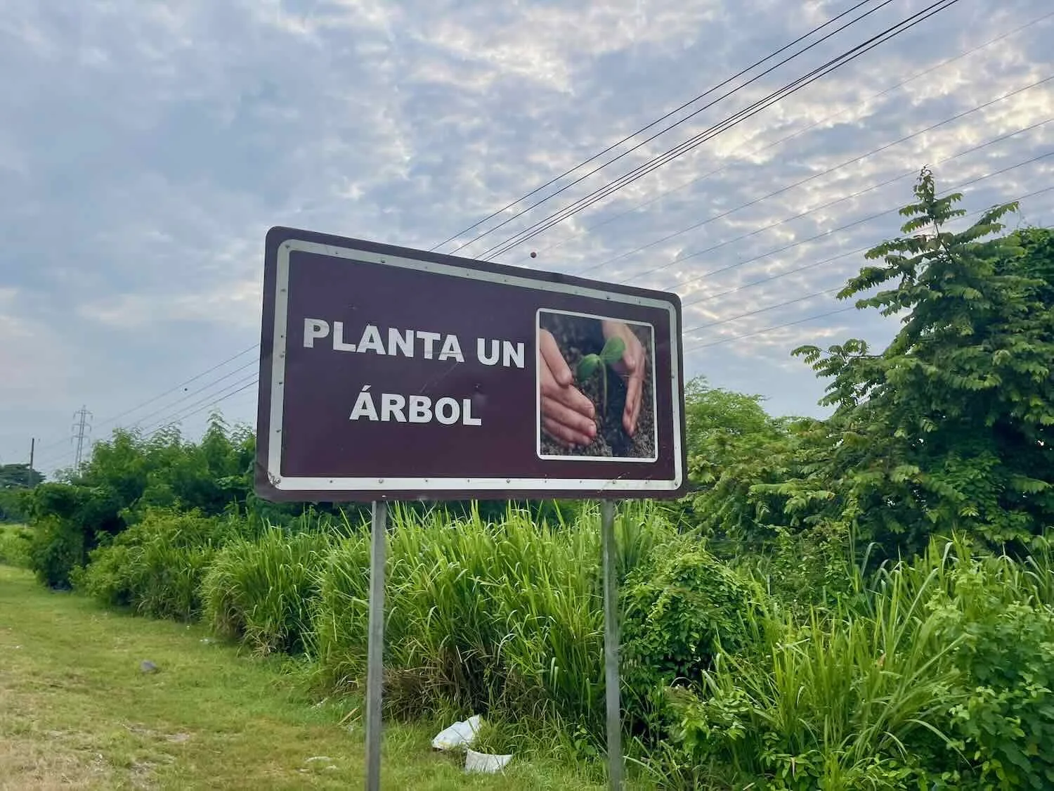
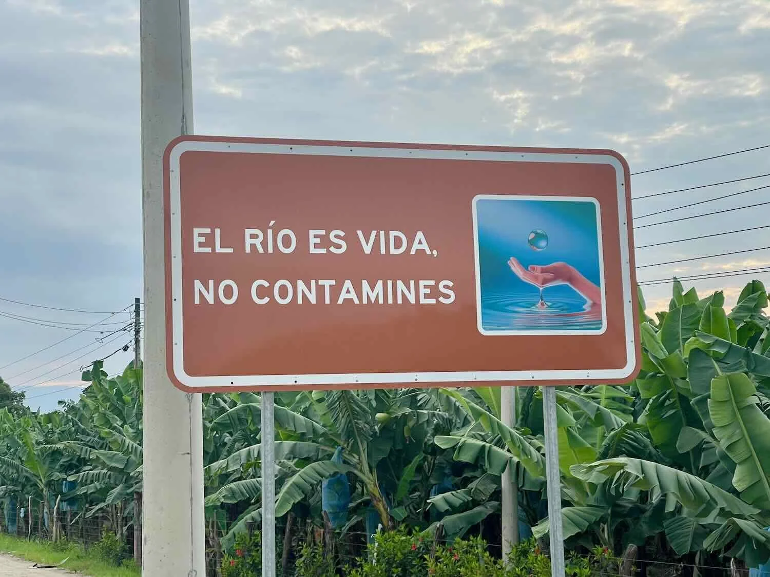
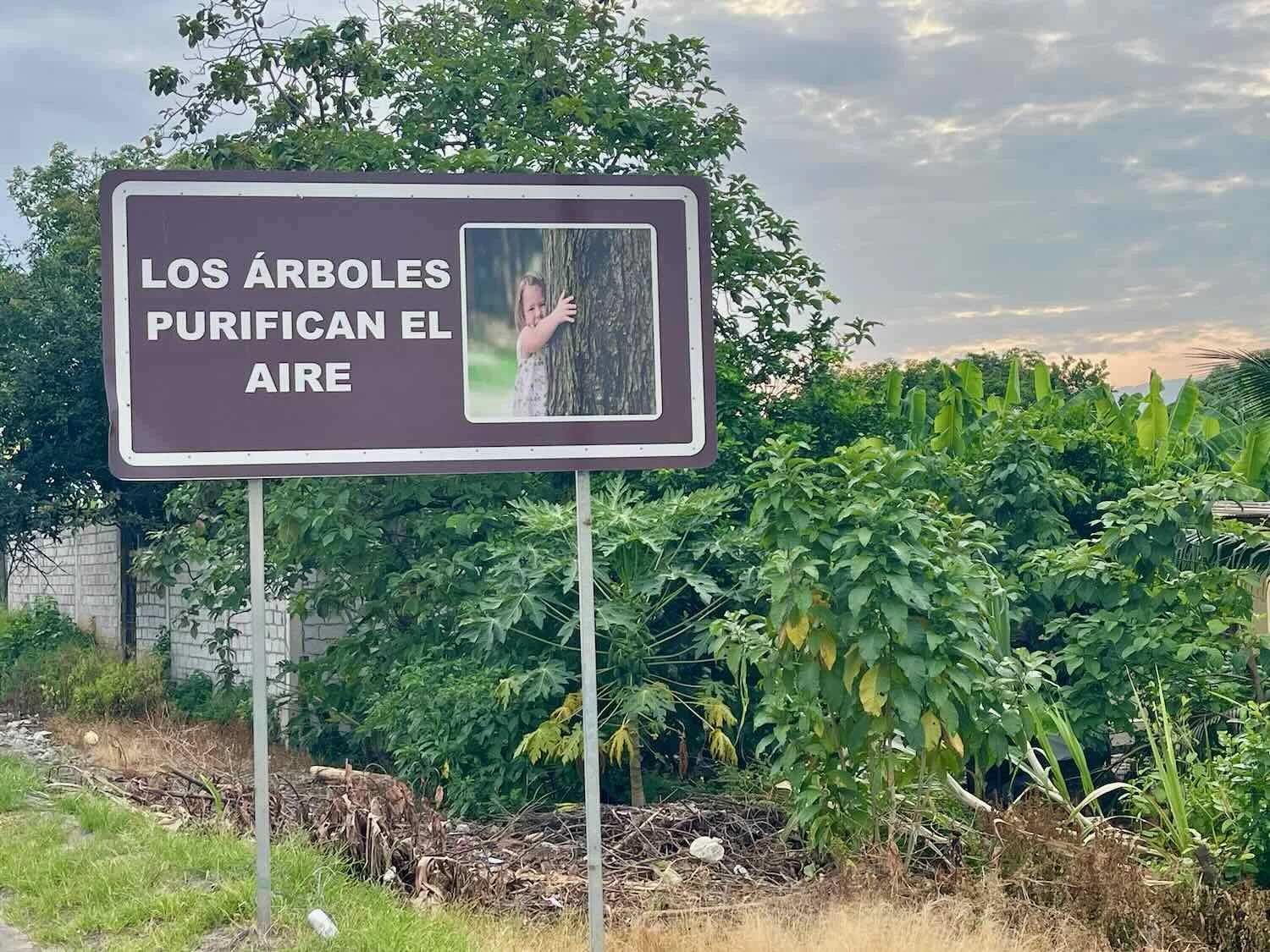
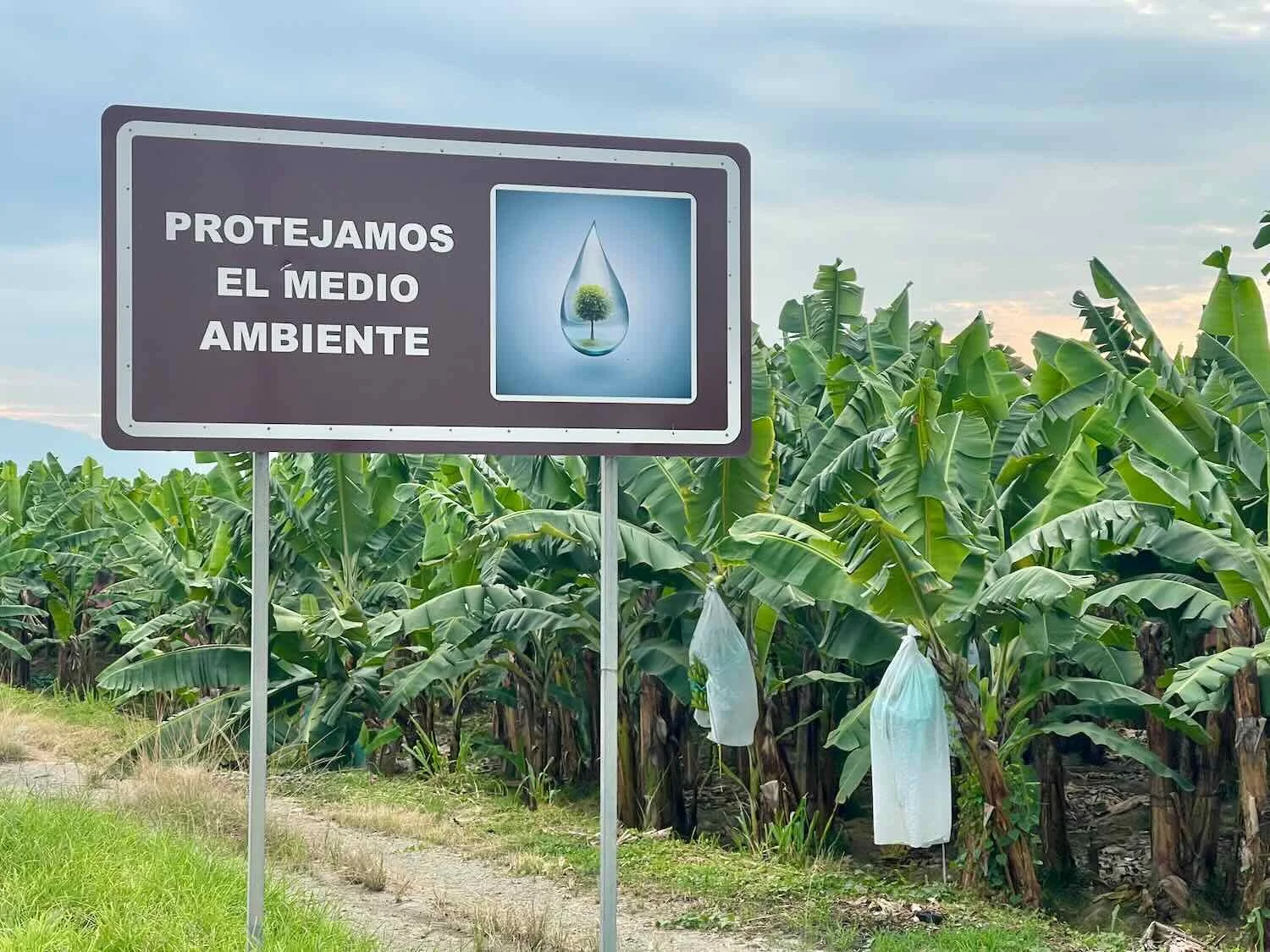
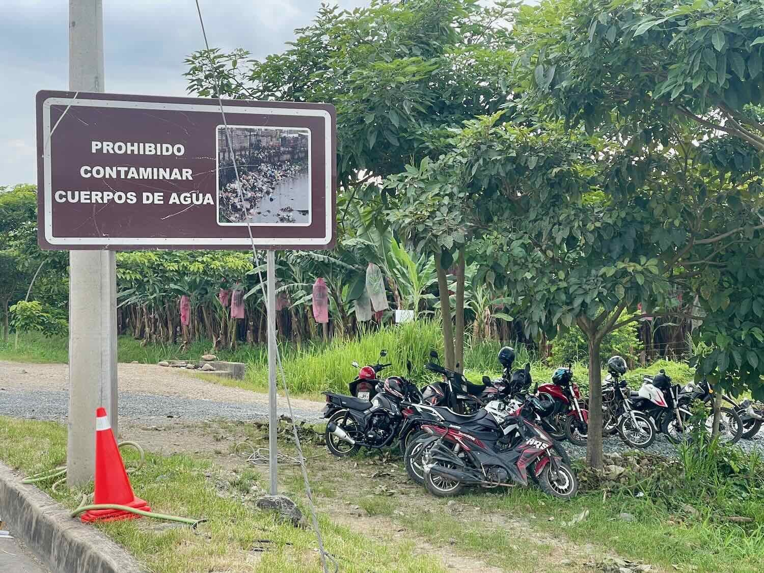
A series of signs along the highway carried a bunch of messages about the importance of protecting the environment. We got the impression that the commercial plantation operators wanted to send a signal to the public that they were being good stewards of the land and water resources.
As we neared the city of Pasaje, a cargo truck driver pulled over on the side of the road, and waved to us, urging us to stop.
We went over to see what was up, and it turned out that he wanted to give each of us a fluorescent, reflective safety vest. We have seen quite a few long-distance cyclists wear these vests to increase their visibility with drivers, and we have always been curious about them. However, we had never tried using them, choosing instead to rely on bright, rear lights and colorful clothing.
Yet the truck driver was quite insistent that we wear them to be safe, so we did. Our only reluctance was that putting on an extra layer of clothing in the very hot, humid afternoon was not ideal. But since the driver was so thoughtful and generous to donate them to us, we decided to give them a try, for at least a day.
The vests soon turned out to be fairly useful. Because when we started climbing into the mountains towards the end of the day, the road shoulder disappeared. Fortunately, the traffic was quite light, so we didn’t feel crowded by passing cars. But it’s not pleasant to be cycling slowly uphill, around many curves, without a road shoulder. The fluorescent safety vests gave us an added dimension of visibility - alerting oncoming vehicles to our presence.
Shortly after beginning the climb into the mountains we stopped for a refreshing drink of pipa fría (cold coconut water) - wearing our new gift of fluorescent safety vests. The coconuts are pulled out of a refrigerator, before having the top chopped off with a machete and a straw inserted. Simple but delicious. Pasaje, El Oro Province, Ecuador. Copyright © 2019-2026 Pedals and Puffins.
Return to the Andes Mountains
And boy, was the route steep. During the final 1.5 hours of the ride, rolling hills were replaced with relentless climbs. As the road pitched upwards, we once again found ourselves grinding along in our lowest gear. It was a hot, sweaty, and humid way to end the day.
Over the course of the next week we would cycle from sea level up to the top of a high, Andean pass, crossing through a series of fascinating and distinct ecological zones, from steamy lowlands to craggy mountain peaks. With all of the ups and downs, the total climbing would add up to nearly 13,000 ft (3,960 m) - like cycling all the way back up onto the altiplano. It was time to regain our climbing legs.
Our first stop along the way was in the foothills hamlet of Casacay (pop. 1,566). Nestled in a valley on the banks of a rushing stream, the town’s big attraction was a series of informal, natural swimming holes where the whitewater slowed enough to make diving and wading in the cool water possible. We still were at an elevation just a couple of hundred feet above sea level, so the afternoon temperatures were really hot. And it seemed that everyone from the village - and probably the surrounding area - would flock to the river to cool off in the water.
There was just one, simple hotel in the village, but it was perfect for us. Our room was huge (plenty of room for the bicycles) and had much-desired air conditioning, which was pretty much all we needed. And although it was situated right next to a road intersection where vehicles would roar their engines to power up a steep hill, there was virtually no traffic at night. So it was very quiet. It was a delightful place to spend a rest day, gearing up for the next couple of days of rigorous climbing into the mountains.
A rushing stream bounded down out of the nearby mountains, and right through the center of town. The pink building along the left side of the river in the distance was the hotel where we stayed. Casacay, El Oro Province, Ecuador. Copyright © 2019-2026 Pedals and Puffins.
Each day, crowds of both kids and adults would gather on the banks of the river for a swim. The cold water was the best antidote for the heat of the afternoons. La Cocha Beach, Casacay, El Oro Province, Ecuador. Copyright © 2019-2026 Pedals and Puffins.
Since Casacay was located in the bottom of a ravine, getting out of town presented a challenge. The road we took into town was so steep you could barely cycle down it without losing control. Going back up that road would take a supreme effort - even to push the bikes - and cycling up it would be impossible. Therefore, on our rest day we scouted the area in an attempt to discover a better way out of the ravine that cradled the town.
There was a relatively flat, dirt route that circled through some farmland, which seemed promising at first. However, we ended up rejecting that idea because the road was haunted by a very large number of feisty farm dogs. They were pretty aggressive even when we just walked by, so we shuddered to think of how they would react if they got the opportunity to chase a person moving slowly on a bicycle.
All other routes out of town involved dragging ourselves (and our fully loaded bikes) up roads that were too steep to ride. In the end, we decided to skip the roads altogether, and push our bikes, one at a time, up several long flights of stairs, onto the bridge over the river. Fortunately, we were feeling fresh in the morning, so it wasn’t that rough. And it was definitely easier than all the other options.
Eying the challenge ahead. We pushed each of our bikes up those stairs to get back onto the highway (the bridge can be seen just behind PedalingGal). Casacay, El Oro Province, Ecuador. Copyright © 2019-2026 Pedals and Puffins.
As we cycled upwards, the hillsides around us were blanketed with thick, broadleaf forests and the air was heavy with humidity. In the morning hours, we were surrounded by the loud, repetitive, croaking calls of Rufous-headed Chachalacas - a big, chicken-like bird hiding in the trees. And wherever there was a house, there were banana and cocoa plantations.
A Rufous-headed Chachalaca sat high in a cecropia tree, early in the morning. These chicken-like birds are found almost exclusively in Ecuador. Near La Maravilla, Azuay Province, Ecuador. Copyright © 2019-2026 Pedals and Puffins.
A brightly-colored community church for one of the small, mountain villages served as a nice backdrop for one of our rest breaks. Pitahuiña, El Oro Province, Ecuador. Copyright © 2019-2026 Pedals and Puffins.
For much of the day we cycled past cocoa trees laden with fruit, destined to become chocolate someday. Near Galayacu, El Oro Province, Ecuador. Copyright © 2019-2026 Pedals and Puffins.
Individual farms often would have a roadside stand for selling their produce - especially cacao and bananas. This one advertised that they sold “national, fine-aroma cacao” - the high quality cocoa that Ecuador is famous for. Pitahuiña, El Oro Province, Ecuador. Copyright © 2019-2026 Pedals and Puffins.
There were many small sheds full of bananas along the side of the road. Hanging the bananas in sheds protected them from the sun and weather before they were packaged and shipped onward for sale. However, on these small farms we didn’t see any of the plastic bags that were so common on the big, commercial plantations near the coast. El Pindo, Azuay Province, Ecuador. Copyright © 2019-2026 Pedals and Puffins.
On its way into the mountains, the road followed the path of the Jubones River - hugging the side of the rugged, valley walls. Because the terrain was so steep, there were only a few communities along the route that had more than a handful of buildings. Most of the homes were perched very precariously on the nearly-vertical hillsides, vulnerable to the constant threat of landslides. Yet every once in a while the valley would open up, allowing the development of towns whose economies were tied to local agriculture.
Most of the land in the Jubones River Valley was too steep to support much community development. But every so often the valley would open up, and a town would magically appear. We liked the sculpture of a bicycle mounted near the entrance to this town. Galayacu, El Oro Province, Ecuador. Copyright © 2019-2026 Pedals and Puffins.
Most of the steep valley walls were composed of loose dirt and rocks, making them dangerously susceptible to landslides during the rainy season. We saw many sections of road that were only partially open (single lane), where the side of the mountain had slumped down onto the roadway. Near La Maravilla, Azuay Province, Ecuador. Copyright © 2019-2026 Pedals and Puffins.
The fast-flowing Jubones River and its feeder streams are crowded with small dams. Unfortunately, the excessive erosion of the soft slopes above the river creates ongoing maintenance challenges, as silt and rocks fill in the channel behind the dams. We saw this backhoe digging sand and gravel out from behind a small dam. Vivar River, Near La Maravilla, Azuay Province, Ecuador. Copyright © 2019-2026 Pedals and Puffins.
Although the valley walls were steep, they still were covered with a thick, green forest. Near Tendales, Azuay Province, Ecuador. Copyright © 2019-2026 Pedals and Puffins.
By the time we reached the rustic, little comedor (small place to eat) in the village of Tendales (pop. <50) we were ready for a rest. The comedor had two tables where simple meals were served to travelers. Yet only one other man and his son stopped to eat while we were there.
There was no formal lodging along this section of the climb, but the owner of the comedor is well-known among cyclists for offering a place to spend the night - part way up the arduous climb. So it was with high hopes that we rolled up to the front of the little building and asked the owner if she knew where we could spend the night.
María Susana was incredibly sweet, and welcomed us with open arms. She prepared dinner for us, which was particularly delicious - better than the typical chicken asado we have had so many times. She also offered us a very simple room in her basement for just $5, and encouraged us to spend the afternoon just hanging out at one of the picnic tables on her front porch. That proved to be ideal, because the bedroom was rather dank and dark. In fact, we left the bedroom door open all night because of the musty smell, and used a mosquito coil to keep the bugs away.
Although Susana lived there alone, there was plenty of activity. Several neighbors stopped by to visit with her, sitting in the kitchen and chatting for hours. In addition, the patio was the domain of a couple of chickens, cats and dogs. She also took the time to tell us about her coffee business (she sells her own coffee), and showed us the recently harvested coffee beans in various stages of preparation.
María Susana, owner of the Tendales Comedor, with PedalingGal. The home sat right on the edge of the road, at the top of a steep cliff that plunged towards the Jubones River. Tendales, Azuay Province, Ecuador. Copyright © 2019-2026 Pedals and Puffins.
One of the local residents at the comedor, where we spent the night. He walked across the dining room floor as we were eating our chicken dinner, as if to keep an eye on us. We figured no alarm clock would be necessary in the morning with this healthy rooster roaming about. Tendales, Azuay Province, Ecuador. Copyright © 2019-2026 Pedals and Puffins.
Fresh coffee beans. Tendales, Ecuador. Copyright © 2019-2026 Pedals and Puffins.
Dried coffee beans. Tendales, Ecuador. Copyright © 2019-2026 Pedals and Puffins.
Hulled coffee beans. Tendales, Ecuador. Copyright © 2019-2026 Pedals and Puffins.
Later in the afternoon we walked down to the Jubones River from the Tendales Comedor. Susana told us that people actually drive cars across this rickety, swinging bridge, but we found that hard to believe. It seemed pretty risky. Tendales, Azuay Province, Ecuador. Copyright © 2019-2026 Pedals and Puffins.
The next day we spent the first half of the ride continuing upstream along the Jubones River Valley. The highway never actually descended down to the level of the river. Instead, it hugged the valley wall, often a couple of hundred feet above the watercourse. We enjoyed impressive views of the green mountains rising up out of the churning brown river, far below.
Just upstream from Tendales we passed the big San Francisco Hydroelectric Dam, which supplies power to more than a million people daily. Given the high level of silt on the upstream side, we guessed it would soon be inoperable, or need some major maintenance work to continue supplying electricity. Jubones River, Azuay Province, Ecuador. Copyright © 2019-2026 Pedals and Puffins.
A little farther up the river we saw the Las Juntas Pedestrian Bridge. A sign on the bridge indicated that it was built by the utility that operates the San Francisco Hydroelectric Dam, suggesting it was a community development project associated with the dam. Jubones River, Azuay Province, Ecuador. Copyright © 2019-2026 Pedals and Puffins.
In many places the green mountains rose sharply upward from the rushing brown river, below. Jubones River, Azuay Province, Ecuador. Copyright © 2019-2026 Pedals and Puffins.
Boulders In the Road
Ecuador’s rainy climate, steep topography and unstable soil present endless challenges for road maintenance. The country has always been subject to heavy rains for much of the year. But Susana told us that the past year had been particularly wet. Just two weeks before our arrival, the president of Ecuador declared a national state of emergency due to flooding and infrastructure damage from a particularly destructive rainy season.
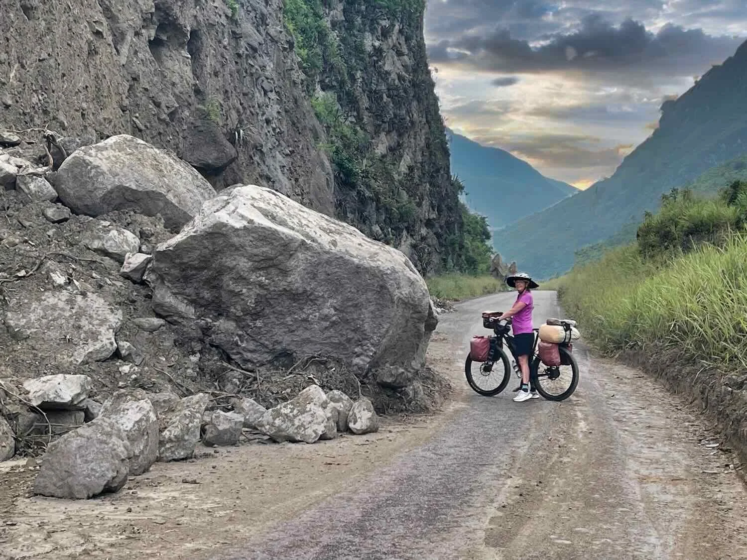
The region we were now cycling through had been heavily impacted, and as we headed into the mountains we saw more and more of the rain’s effects. After leaving Tendales, we encountered dozens of recent landslides where gravel debris was spread across the entire road. In addition, there were many places where boulders and vegetation that had fallen from the hillsides blocked at least half the road - shrinking the roadway down to a single lane. Some of the boulders were bigger than a car.
It seemed like we passed a landslide every quarter mile. There were so many of them that the overwhelmed transportation department could do little more than just chip away at the problem. The road had only opened to traffic a couple weeks before our arrival, after the highway crew had cleared single-lane paths around some of the recent landslides.
We only passed one spot where a maintenance crew was actively clearing the road with heavy machinery. There were no road workers managing the traffic flow through the bottlenecks caused by the landslides. Vehicles just slowed down and took turns driving through.
The winding, mountain roads in Ecuador can be quite dangerous. This roadside shrine offered a place for drivers to pray for divine assistance in making it home safely. Near Las Juntas Pedestrian Bridge, Azuay Province, Ecuador. Copyright © 2019-2026 Pedals and Puffins.
Landslides that partially blocked the highway were common as we road into the mountains of southern Ecuador. Sometimes there were huge chunks of rock that had slid down from the mountainside. This is the type of road that qualifies as a “highway” in the mountains. Jubones River Valley, Near Tendales, Azuay Province, Ecuador. Copyright © 2019-2026 Pedals and Puffins.
Above each landslide we could see the scar where a chunk of the mountain had fallen away, into a pile of rubble on the road. You can see how big this landslide was by the small figure of PedalingGal at the bottom. Near Las Juntas Pedestrian Bridge, Azuay Province, Ecuador. Copyright © 2019-2026 Pedals and Puffins.
This was the only time we passed a road crew working to clean up the debris from a landslide. It looked like a relatively small, recent one. Jubones River Valley, E of Tendales, Azuay Province, Ecuador. Copyright © 2019-2026 Pedals and Puffins.
As we gained elevation, we entered an arid valley with more exposed sand and rocks. Jubones River Valley, E of Tendales, Azuay Province, Ecuador. Copyright © 2019-2026 Pedals and Puffins.
Occasionally the highway would cut through the rocky core of the mountains, with sheer cliffs rising overhead. Jubones River Valley, Near Huascachaca Mine, Azuay Province, Ecuador. Copyright © 2019-2026 Pedals and Puffins.
After roughly three hours of climbing we reached the top of a sharp incline, and saw a broad valley spread out ahead of us. While the higher slopes of the surrounding mountains were still covered with dense vegetation, the rippling hills down in the valley looked much drier - with sparse plant cover and lots of exposed soil.
Perched atop several of the hills was a small cluster of wind turbines, the first (and only) wind farm we would see in Ecuador. When we first spied them in mid-morning the air was still, and the turbines sat motionless. But an hour later, after we had labored around a massive hairpin turn that brought us back to an overlook of the valley, the wind was brisk and the windmills were spinning in the breeze.
This was our second view of the Huascachaca Wind Farm, after cycling around a 2-mile long hairpin turn. You can just see the highway where it entered the big curve, far below us (lower right of the photo). The hills in the valley were drier than most of the landscape, as if the surrounding mountains wrung all the moisture out of the air before it could reach the valley. Jubones River Valley, Azuay Province, Ecuador. Copyright © 2019-2026 Pedals and Puffins.
Santa Isabel, The City on a Hill
It took us seven hours to cycle just over 19 miles (31 km) that day, including all the rest breaks. We were wiped out by the time we reached the town of Santa Isabel (pop. 6,200).
We ended up landing in a hotel that was situated right along the highway. We thought the room they gave us would be reasonably quiet, since it was set back from the main road, behind some other rooms. However, as we were slowly learning, hotel rooms in Ecuador are almost all noisy. You don’t have the epidemic of honking cars that was such a scourge in Peru. Yet there always seemed to be plenty of other sounds.
In this case we could still hear the vehicles out on the road, as they roared their engines to climb the steep hill. Plus, the on-site restaurant played loud music, there was construction under way on the building next door (hammering, power tools, etc.), a barking dog, and a few roosters that crowed every once in a while. The good news was that we were tired enough from the effort to get there that we slept reasonably well, even with all the racket outside.
Furthermore, with all of the climbing we had reached an elevation of 4,800 ft (1,460 m), so the night was much cooler and more comfortable for sleeping.
That is how it is in the Andes. In the lowlands it is often too hot. But after going along the road a relatively short distance, and climbing thousands of feet upward, you find yourself in a place where the temperatures are much cooler. The altitude is a larger determinant of the environment than latitude. And the mountains are so steep that you climb rapidly through different climate zones. Forget looking at weather apps, since one side of the mountain can have completely different conditions than the other side, just a short distance away. As one local told us, the best way to predict the weather is by going outside and looking at the sky.
To give our legs a break, we spent the next day exploring the town of Santa Isabel. However, it’s not like our legs got that much rest. It turned out that the center of town was located high on the peak of a hill about 1.5 miles (2.5 km) from the highway - and 500 ft (150 m) further up. The road to get there launched straight up the side of the mountain.
Yet it was worth the effort to walk up the hill. As crazy as it seemed to have the heart of the community in such a hard-to-reach location, we found a bustling town center at the top of the climb. Santa Isabel is the main urban center for a thriving agricultural region that spreads across the Yunguilla Valley, renowned for its fertile soil (probably a result of historical volcanic activity). The steep terrain seemed like a tough place to grow crops, but the slopes were covered in corn fields and fruit plantations.
Perched on top of the hill was the lovely, central plaza, which was full of trees and flowers in bloom. On one side stood the Virgin of Mercy Church, with a historic-looking, stone facade flanked by gleaming, white adobe palisades. The two bell towers were topped with luminous, pale-blue domes that seemed to blend into the sky.
The central plaza was lovingly landscaped and well maintained. Santa Isabel, Azuay Province, Ecuador. Copyright © 2019-2026 Pedals and Puffins.
On one side of the plaza stood the small, but elegant Virgin of Mercy Church. Santa Isabel, Azuay Province, Ecuador. Copyright © 2019-2026 Pedals and Puffins.
On our way back down the hillside, we stopped to check out the municipal market, which was just getting rolling around 8am. As might be expected in a region known for its agricultural abundance, many of the stalls displayed an eye-catching, colorful array of fruits and vegetables.
Looking out over the throng of produce vendors at the town’s municipal market. It was early morning, and not all of the vendors had opened for business yet. Santa Isabel, Azuay Province, Ecuador. Copyright © 2019-2026 Pedals and Puffins.
All of the produce in the market looked fresh and inviting. Municipal Market, Santa Isabel, Azuay Province, Ecuador. Copyright © 2019-2026 Pedals and Puffins.
We were particularly impressed with the giant size of the cabbages for sale. Most of them were as big as a beach ball. Municipal Market, Santa Isabel, Azuay Province, Ecuador. Copyright © 2019-2026 Pedals and Puffins.
Yet something else stood out that we hadn’t expected. A number of restaurants and butcher shops surrounding the main market had whole pigs mounted on spits, displayed prominently on the sidewalk out front. The meat had been roasted so that it was already cooked. But in many cases there was a guy with a blow torch blowing a flame onto the pig’s skin, to give it that special, crispy texture.
Patrons would walk up to the guy with the torch to place their order, and he would then use a big knife to cut off the appropriate amount of pork. This very specific approach to preparing and selling pork seemed to be the preferred method in Santa Isabel. (We would later learn that it is popular in many regions of Ecuador, and can be found in numerous municipal markets throughout the country.) As we cycled out of town the next day we would see 6-7 more places selling sliced pork from whole roast pigs on a spit, by the side of the road.
The most unique item for sale - which could be purchased from a dozen different vendors near the market - was roasted pork that would be cut straight from the pig, according to your needs. The blowtorch used to crisp the outer skin is resting on the bench in back of the pig. Santa Isabel, Azuay Province, Ecuador. Copyright © 2019-2026 Pedals and Puffins.
Celebrating Highway 59 on the Road to Girón
The next morning we were ready to depart at first light, but decided we should wait until the sun provided just a little bit more light before going out on the road. While we waited, we wandered towards the back of the hotel property, which overlooked the endless Yunguilla Valley. Lights from houses twinkled in the predawn, shadow-filled valley below. And the dull roar of hundreds of roosters crowing at the same time rose up from the depths. Suddenly we were glad that we hadn’t been able to hear all those roosters from our room.
We were were on our bicycles heading back up the mountain about 10 minutes before sunrise. The air was blissfully cool - so different from the stifling heat of the coast a few days ago. We both reveled in the change.
About halfway through the ride we stopped for a break at a minimart that looked like a rest stop designed to attract intercity buses - with a theme mimicking the fabled Route 66 that crosses the United States. The shop had a big sign outside proclaiming, “Route 59 Yunguilla,” with images of vintage cars. Inside, the decor featured memorabilia romanticizing road travel, that referenced both US Route 66 and Ecuador Route 59.
We had seen similar places back when we cycled up the famous Route 40 in Argentina. It’s amazing how widespread the cultural impact of US Route 66 has been. Signage from Route 66 is so widely recognized and easily available that it is often mixed in with other route signage, in order to celebrate a beloved, local route.
Outside the Route 59 Rest Area was a big sign, painted with images of vintage automobiles. E of Santa Isabel, Azuay Province, Ecuador. Copyright © 2019-2026 Pedals and Puffins.
Inside the Route 59 Rest Area, the walls were decorated with memorabilia romanticizing road travel on Route 66 in the USA. E of Santa Isabel, Azuay Province, Ecuador. Copyright © 2019-2026 Pedals and Puffins.
The route from Santa Isabel to Girón ended up being our biggest climbing day yet in Ecuador, with 3,450 ft (1,050 m) of ascent in just 16.5 miles (27 km). The mountain ridges continued to tower above us, with tall, rocky outcrops and sheer cliffs. As we gained elevation, the land around us became greener again, and the broadleaf forests returned. However, the height of the trees at this altitude was considerably shorter than they had been on the lower slopes, just a couple of days ago.
Of course, the road conditions continued to be pretty sketchy. Multiple landslides had flooded the road with rocks and sand. And in other spots the surface was damaged (where crews had scraped away fallen debris). It was tough cycling, but the views were spectacular.
As we reached elevations over 6,000 ft (1,825 m) the leafy, green forest returned, with towering, rocky cliffs now peeking through the clouds. The Caledoneas Hills, S of Girón, Azuay Province, Ecuador. Copyright © 2019-2026 Pedals and Puffins.
This statue of an oversized bird bath (complete with concrete birds) seemed like a random find, set next to a road intersection far from any towns or other human structures. Near Caledoneas, S of Girón, Azuay Province, Ecuador. Copyright © 2019-2026 Pedals and Puffins.
Since we weren’t in a hurry and it had been another tough day, we rested again in the low-key town of Girón (pop. 8,450). As one of the earliest Spanish settlements in the area, the town is known for its colonial-style architecture and cobblestone streets. There were several stores in town selling ranching and farm supplies, and even a few horses parked among the cars outside local businesses. Horses are still a very appropriate form of transportation for people who live on some of the high mountain slopes, where access by car is difficult.
Someone rode their horse to town, and parked it on the street among the other vehicles. Girón, Azuay Provnce, Ecuador. Copyright © 2019-2026 Pedals and Puffins.
Ecuador’s Highlands - Back on the Pan-American Highway
The departure from Girón included one last, giant climb that topped out at around 9,000 ft in elevation (2,750 m). Whenever possible, we took our rest stops where there was a view - and the views were awesome. We had reached the Ecuadorian Highlands, with huge, sweeping vistas of enormous, deep, green valleys. Almost every inch of land was divided into patches of crop land and cow pastures, surrounding scattered, rural settlements.
The morning mist surrounded a rocky outcrop. Near Girón, Azuay Province, Ecuador. Copyright © 2019-2026 Pedals and Puffins.
Landslides continued to be a challenge, where debris had slid down onto the roadway. From a distance, we could see where chunks of the mountainside had broken away in previous landslides. N of Girón, Azuay Province, Ecuador. Copyright © 2019-2026 Pedals and Puffins.
As we ascended the last, big climb, the Yunguilla Valley spread out below us - covered with wall-to-wall highland farms. The distances in these vistas were so vast, that it was hard to fully appreciate the humongous size of the valley and surrounding mountains. N of Girón, Azuay Province, Ecuador. Copyright © 2019-2026 Pedals and Puffins.
We had already gained another 1,000 ft (305 m) by the time we had this view back towards the town of Girón, where we had spent the night. N of Girón, Azuay Province, Ecuador. Copyright © 2019-2026 Pedals and Puffins.
The higher we climbed, the more likely the land around us would be converted to pasture rather than row crops. Dairy cows became a common sight on the steep grassy slopes. S of Portete, Azuay Province, Ecuador. Copyright © 2019-2026 Pedals and Puffins.
After a short descent from the high pass, our route merged back onto the Pan-American Highway and the roadsides rapidly became more urban.
As we got closer to the big city of Cuenca, the amount of bananas in the roadside sheds multiplied. Instead of just a few bunches, there now were piles of bananas - both loose and stacked in crates. Near Tarquí, Pan-American Highway, Azuay Province, Ecuador. Copyright © 2019-2026 Pedals and Puffins.
Cycling Into Cuenca
Although the traffic became pretty heavy, cycling into the City of Cuenca (pop. 600,000) was a lot less stressful than what we had endured in Peru’s big cities. However, as is often the case, the last little bit of cycling was the hardest. When we were literally within a couple of blocks of our Airbnb, our route tried to send us up a very long set of stairs. That wouldn’t work. Eventually we found a road that would get us up the steep river bank that stood in our way. At least the sidewalk was wide and smooth, so it was better than tackling those stairs.
Holy Week In Cuenca, Ecuador
A highlight of our stay in Cuenca was that we arrived during Holy Week (the week before Easter). On the very first evening we were able to attend the Procesión de los Pasos - a solemn, religious procession through the city’s colonial streets. Seventeen elaborate floats depicting scenes from the final days of Jesus’s life were the centerpiece of the procession. In addition to the sculpted images, the floats were decorated with hundreds of fresh flowers and candles. Some of the floats also had live “actors” (usually children) dressed as angels, Roman soldiers, or shepherds, alongside the statues.
Yet the floats were just a small part of the overall procession. Hundreds of people marched with the floats, dressed as penitents, acolytes, and mourners. It was a moving display of religious devotion, lasting nearly two hours as the various pasos moved slowly through the narrow streets.
A float depicting the last supper was one of the more elaborate scenes included in the Procesión de los Pasos. Semana Santa (Holy Week). Cuenca, Azuay Province, Ecuador. Copyright © 2019-2026 Pedals and Puffins.
Several groups of people in the Procesión de los Pasos marched in medieval robes of penitence. Semana Santa (Holy Week). Cuenca, Azuay Province, Ecuador. Copyright © 2019-2026 Pedals and Puffins.
Many church groups in the Procesión de los Pasos marched in the robes of priests or acolytes, carrying candles. Semana Santa (Holy Week). Cuenca, Azuay Province, Ecuador. Copyright © 2019-2026 Pedals and Puffins.
Mourning was a theme for many of the women marching in the Procesión de los Pasos. These women sang religious songs as they marched, dressed all in black. Semana Santa (Holy Week). Cuenca, Azuay Province, Ecuador. Copyright © 2019-2026 Pedals and Puffins.
This group of girls had choreographed a routine whose moves all expressed sorrow and mourning. Procesión de los Pasos, Semana Santa (Holy Week). Cuenca, Azuay Province, Ecuador. Copyright © 2019-2026 Pedals and Puffins.
In a nod to modern convenience, almost all of the religious floats were carried on flat-bed trailers pulled by trucks. However, one of the floats was carried by bearers in the traditional way. They moved very slowly, and it looked extremely heavy. Procesión de los Pasos, Semana Santa (Holy Week). Cuenca, Azuay Province, Ecuador. Copyright © 2019-2026 Pedals and Puffins.
Several of the floats had girls dressed as angels riding with the statues. This angel walked among the crowd. Procesión de los Pasos, Semana Santa (Holy Week). Cuenca, Azuay Province, Ecuador. Copyright © 2019-2026 Pedals and Puffins.
Exploring Cuenca, The City of Four Rivers
Given its combined latitude and altitude, Cuenca has a nearly perfect climate: not too hot and not too cold, with lots of sunshine all year around. Hardly anyone - including hotels and hostels - has or needs either air-conditioning or heaters in the buildings. It’s no wonder that the city is a magnet for visitors, including both Ecuadorians and expats.
Overall, the city was pretty low-key - with mostly small, family-run shops rather than big malls or international department stores. That gave it a “small town” feel, even though it is Ecuador’s third largest city. However, “low-key” did not translate into “quiet.” Cuenca was actually a very noisy city - with loud traffic and booming music at all hours. It seemed like there always was some kind of fiesta going on.
The center of Cuenca is a designated World Heritage Site, full of colonial buildings on narrow, cobblestone streets. We enjoyed exploring the city’s historic churches, markets, and festivals, taking daily walks through various neighborhoods, and even joining a free city tour. Here are some photos from our time in the City of Four Rivers:
Construction of the Cathedral of the Immaculate Conception (a.k.a., the New Cathedral) was started more than a century ago, but it wasn’t completed until 1975. It is a visually stunning structure with graceful, brick towers and arches. The sky blue domes are meant to evoke the Virgin Mary, and to connect the earthly structure to heaven. It’s also massive, accommodating 9,000 people (the entire population of Cuenca at the time that construction began in 1885). Cuenca, Azuay Province, Ecuador. Copyright © 2019-2026 Pedals and Puffins.
A narrow alley on one side of the New Cathedral is dedicated to Saint Anne (mother of the Virgin Mary). According to historical records, this road has ancient roots. It was such an important pathway for the native people that when the Spanish arrived, they incorporated the original route into their official grid for the city. Cuenca, Azuay Province, Ecuador. Copyright © 2019-2026 Pedals and Puffins.
With the exception of the New Cathedral (which was constructed of exposed, red brick), nearly all the other churches in Cuenca were painted entirely in white. San Sebastián Church, Cuenca, Azuay Province, Ecuador. Copyright © 2019-2026 Pedals and Puffins.
This guy in the main plaza had a herd of hobby horses, ready for families looking for that special photo of their child. Plaza Calderón, Cuenca, Azuay Province, Ecuador. Copyright © 2019-2026 Pedals and Puffins.
Just down the block from the main plaza, a rock and roll puppet show provided more entertainment for passing children. Cuenca, Azuay Province, Ecuador. Copyright © 2019-2026 Pedals and Puffins.
Cuenca was a city brimming with art. All the plazas and marketplaces had at least a few artists at work, selling colorful paintings. Cuenca, Azuay Province, Ecuador. Copyright © 2019-2026 Pedals and Puffins.
Many of the city’s murals had nature themes. Cuenca, Azuay Province, Ecuador. Copyright © 2019-2026 Pedals and Puffins.
This anonymous artist borrowed from the Matrix movie trilogy. Do you choose the blue pill or the red one? (We couldn’t figure out why the artist was wearing a cube over his head.) Cuenca, Azuay Province, Ecuador. Copyright © 2019-2026 Pedals and Puffins.
There were no actual windows or doors on this blank wall. Yet a mural created the illusion of depth and domestic activity. Cuenca, Azuay Province, Ecuador. Copyright © 2019-2026 Pedals and Puffins.
Although it was Holy Week, not all of the public events were strictly devoted to religion. On Holy Saturday, the city celebrated its annual Trout Festival. Introduced to the Andes in the early 20th century, trout rapidly became a critical source of dietary protein and essential nutrients. Over the past 100 years the fish has become an integral and beloved part of the highland cuisine. And since some Catholics abstain from eating animal meat during Holy Week, it was a good time to celebrate with a nice, fish dinner.
In addition to the variety of trout dishes for sale, the festival included performances by dancers dressed in patterned ponchos and brightly colored skirts. While we were there, a troupe performed the Capishca, a high-energy, highland dance that incorporated playful displays of courtship among the smiling couples.
Capishca Dancers at the Trout Festival. Cuenca, Azuay Province, Ecuador. Copyright © 2019-2026 Pedals and Puffins.
The troupe of Capishca dancers posed for a photo at the Trout Festival. Cuenca, Azuay Province, Ecuador. Copyright © 2019-2026 Pedals and Puffins.
Trout dishes were artfully displayed at the various booths of the Trout Festival. Cuenca, Azuay Province, Ecuador. Copyright © 2019-2026 Pedals and Puffins.
In the Ecuadorian highlands, there is no escaping the ubiquitous guinea pig. A critical source of dietary protein for thousands of years, guinea pig imagery is absolutely everywhere. Smiling guinea pigs adorn street murals, stuffed animals, kids’ backpacks, t-shirts, mugs… pretty much everything. You can even rent full-sized guinea pig costumes for your next family gathering.
The dark side of this, of course, is that these adorable animals are still widely eaten. The rodents could be found on many restaurant menus. However, according to the guide of our city tour, these days they are quite expensive and generally only eaten on special occasions. He also told us that he had only eaten guinea pig twice in his life, and that he didn’t like it very much. As former guinea pig pet owners, we were not even slightly tempted to try a taste of “cuy.”
At several shops in the city you could rent a full-sized guinea pig costume. Cuenca, Azuay Province, Ecuador. Copyright © 2019-2026 Pedals and Puffins.
One of the city plazas featured guinea pig statues with colorful designs. Cuenca, Azuay Province, Ecuador. Copyright © 2019-2026 Pedals and Puffins.
Our free city tour took us to Cuenca’s primary municipal market. One thing we noticed right away was how CLEAN the market was compared to similar venues in other countries. There also was a section devoted to Limpias (“cleansings”), where a spiritual healer would rub your body with herbs, a raw egg, or even a live guinea pig to absorb bad spells and clear negative energy - mixing ancient indigenous traditions with Catholic prayers. (Our guide actually admitted that he used to perform these rituals at the market, even though he didn’t believe in the magic.) 10 de Agosto Market, Cuenca, Azuay Province, Ecuador. Copyright © 2019-2026 Pedals and Puffins.
Back when we cycled across Panama, we learned that Panama Hats are actually made in Ecuador. However, we saw surprisingly few shops selling Panama Hats like these in Cuenca. Apparently the local market for these relatively-pricey hats is not that great. Most of the Panama Hats made in Ecuador are exported to tourist hotspots like Panama, or fine hat stores in wealthier countries. Cuenca, Azuay Province, Ecuador. Copyright © 2019-2026 Pedals and Puffins.
The Plaza de las Flores, adjacent to the New Cathedral, was bursting with big, colorful, bunches of flowers for sale. Ranked as one of the top 10 flower markets in the world by National Geographic, the Plaza de las Flores benefits from Ecuador’s world-class, flower-growing industry. In fact, Ecuador is the third largest exporter of premium flowers in the world - especially roses and orchids. Most of those blooms are grown in highland greenhouses, not far from the city. Cuenca, Azuay Province, Ecuador. Copyright © 2019-2026 Pedals and Puffins.