Cycling Argentina’s Route 40, Part 4: Chilecito to Salta
3 July - 12 August 2025
3 July - Chilecito to Wild Camp (31.8 mi, 51.2 km)
4 July - Wild Camp to Cuipán (36.1 mi, 58.1 km)
5 July - Cuipán to Wild Camp (40.3 mi, 64.9 km)
6 July - Wild Camp to Belén (29.7 mi, 47.8 km)
7-8 July - Rest days in Belén
9 July - Belén to El Eje (33.0 mi, 53.1 km)
10 July - El Eje to Campo Arenal Wild Camp (43.5 mi, 70.0 km)
11 July - Campo Arenal Wild Camp to Santa María (32.9 mi, 53.0 km)
12 July - Santa María to Cafayate (49.2 mi, 79.2 km)
13-14 July - Rest days in Cafayate
15 July - Cafayate to Río Las Conchas Wild Camp (41.5 mi, 66.8 km)
16 July - Río Las Conchas Wild Camp to La Viña (26.5 mi, 42.7 km)
17 July - La Viña to El Carril (30.6 mi, 49.3 km)
18 July - El Carril to Salta (24.6 mi, 39.6 km)
19 July-12 Aug - Layover in Salta
Threading Our Way Among Mountains
From Tierra del Fuego in the far south all the way to Chilecito (Argentina), the Andes mountains form a fairly narrow ridge. However, right around Chilecito the landscape goes crazy. Various tendrils of the Andes fan out into northwestern Argentina, creating a maze of interweaving ridges separated by high deserts. In this region, the fabled Route 40 tries to take the path of least resistance, charting a course through longitudinal valleys flanked by isolated ridges. When its progress is blocked, the highway soars over mountain passes within steep-walled canyons, following tracks that were used by indigenous travelers long before recorded history.
It was through this maze of ridges and canyons that we cycled onward from Chilecito. On our righthand side marched the Sierra de Velasco. Just beyond that ridge, the Argentinian pampas were giving way to the semi-arid forests and savannas of the Gran Chaco - South America’s vast, central lowland. Meanwhile on our left rose the heights of the Sierra de Famatina, Argentina’s highest mountains outside of the main Andean backbone - where many legendary gold and silver mines were located. Between the arms of these giants, we continued cycling among the cacti and thorn bushes of the high desert.
A highlight on our first day out from Chilecito was spotting this sleepy Andean Condor sitting on a rocky outcrop, not far from the road (it’s letting out a big yawn). Of the many Andean Condors we had seen during our time in South America, this was easily the closest we had come to one of them. (The Andean Condor is one of the largest birds in the world by wingspan.) Route 40, Near Famatina, La Rioja Province, Argentina. Copyright © 2019-2025 Pedals and Puffins.
About three hours into our ride, far from any towns, we were amazed to see two cyclists coming towards us, heading south. It had been several months since our last encounter with a touring cyclist, so this was a fun surprise. Of course we pulled over to the side of the road - and ended up spending 45 minutes getting to know them and swapping tales from our travels.
Jean-Marc and Leigh were from South Africa, and they turned out to be very seasoned Latin American cyclists - having completed previous trips on the Carretera Austral down to Ushuaia, as well as crossing Peru, Brazil, Uruguay and northern Argentina. On their current trip they had started in Peru, and already came down through Bolivia.
Leigh and Jean-Marc were the first touring cyclists we had encountered in months. Of course, we stopped to say, “hello.” Route 40, North of Chilecito, La Rioja Province, Argentina. Copyright © 2019-2025 Pedals and Puffins.
They told us about their crazy adventure trying to get home from South America when the Covid-19 pandemic struck in 2020. They were cycling in Uruguay when international advisories started recommending that people return home because of rapidly expanding travel restrictions. However, their only option for a flight back to South Africa was through São Paulo, Brazil, via Buenos Aires. Yet by the time they reached Buenos Aires, Brazil had closed its borders. After much haggling, they were finally granted permission to fly to São Paulo - only because they were not from Europe. Even then, by the time they arrived in Brazil there were no more commercial flights to South Africa. It took two more weeks before the South African government arranged an evacuation flight to get them home. They definitely had a harder time than we did evacuating from Ethiopia, where we were cycling when the pandemic hit.
After our roadside visit we cycled for a couple more hours, before turning off the highway onto a lightly-used dirt road to look for a campsite. The gravel surface was in excellent shape for cycling, so we were able to get a good distance from the main road. We found an open, flat area with few cacti nearby (always a plus). The large number of guanaco tracks nearby gave us confidence that this area wasn’t frequented by people, and would make a nice, peaceful place to camp.
We followed a lightly-used, but good quality dirt road away from the highway to a wonderful, secluded campsite with the Sierra de Famatina mountains in the background. Route 40, S of Pituil, La Rioja Province, Argentina. Copyright © 2019-2025 Pedals and Puffins.
The next day vehicle traffic remained very light, making for a peaceful bike ride through the desert.
After about an hour of cycling we stopped for breakfast under a big mesquite tree. Our meal included boiled eggs that we had brought with us from Chilecito. Two of the eggs were MUCH bigger than the others (see photo above). We suspect that the egg on the left was a duck egg, rather than a chicken egg (on the right, for comparison). The larger egg had two yolks. Route 40, S of Pituil, La Rioja Province, Argentina. Copyright © 2019-2025 Pedals and Puffins.
This impressive statue of Santo Domingo de Guzmán guarded the turnoff for the road to the town of Pituil. Route 40, Pituil, La Rioja Province, Argentina. Copyright © 2019-2025 Pedals and Puffins.
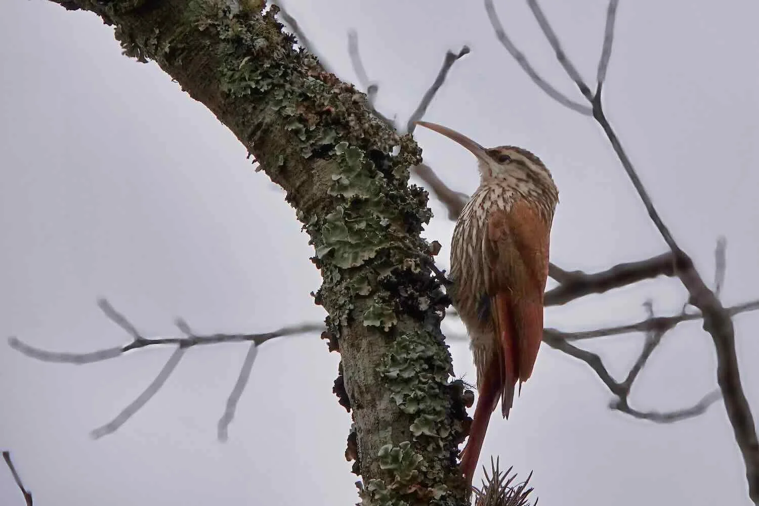
Deserts are often quiet places. You can cycle for many miles without seeing (or hearing) many animals. Yet for some reason, near the end of that day we started to see quite a bit of wildlife. Within just a few minutes a fox crossed the road in front of us, more Andean Condors flew overhead, and we saw several other interesting birds. We both found the abundance of wildlife just west of Cuipán surprising, and thoroughly enjoyed the chance to view and photograph some of the animals that are often hidden in the desert.
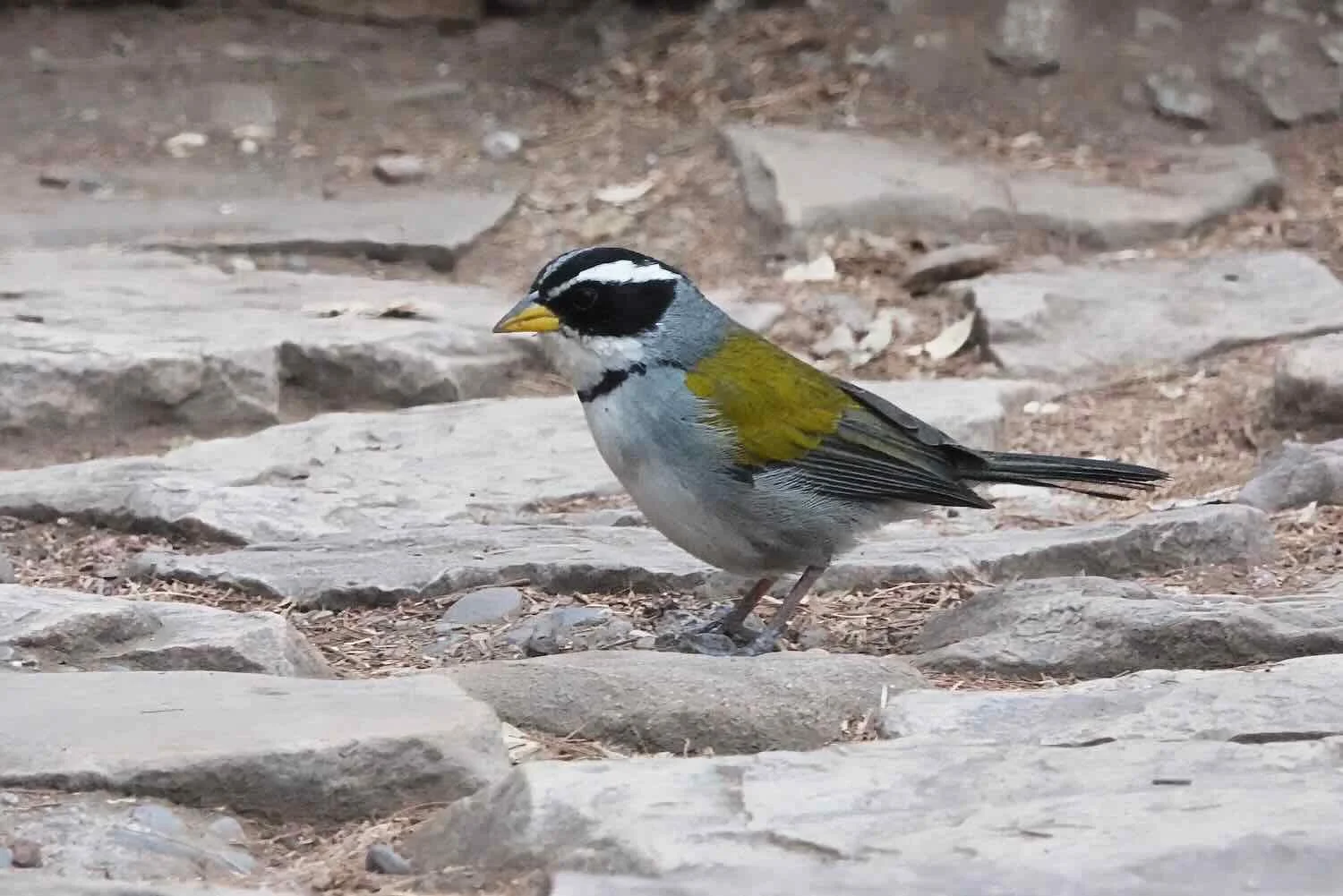
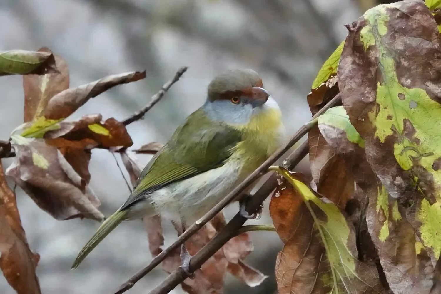
One of the more striking birds in the region was the White Monjita, a dazzlingly bright, white flycatcher. Route 40, W of Cuipán, La Rioja Province, Argentina. Copyright © 2019-2025 Pedals and Puffins.
Black-legged Seriemas are long-legged, ground predators. Seriemas are believed to be the only living descendants of South America’s fearsome ‘terror birds’ that stood up to 10 ft high, and were the apex predators of their habitats during the Pleistocene era. At roughly 3 ft (84 cm) tall, these Seriemas weren’t nearly that scary. Like the somewhat similar, ground-dwelling Road Runners found in North America, you can get a quick glimpse of them before they run off, but the few additional seconds required for a photograph are rarely given. Route 40, W of Cuipán, La Rioja Province, Argentina. Copyright © 2019-2025 Pedals and Puffins.
Stopped by the side of the road to check out some wildlife (with the Sierra de Velasco in the background). Route 40, W of Cuipán, La Rioja Province, Argentina. Copyright © 2019-2025 Pedals and Puffins.
A Valley Oasis
By mid-afternoon we had crested a low ridge, then plunged 700 ft (215 m) into the Los Sauces River valley, which hugged the western edge of the Sierra de Velasco mountain range.
Los Sauces means ‘the willows’, and we could immediately see why the river had earned that name. For several hundred yards on either side of the water course, an oasis of green growth covered the landscape. An almost continuous series of small, agricultural communities lined Route 40 in the valley, embraced by olive orchards, vineyards, walnut trees, rows of stately palms, and of course, thickets of willows.
Down in the valley of the Los Sauces River, Route 40 passed through a series of small towns. This sign along the way read, “I Love Route 40.” Cuipán, La Rioja Province, Argentina. Copyright © 2019-2025 Pedals and Puffins.
Nurtured by river water, the towns in the valley were full of trees like these grand Caranday Palms. Route 40, San Blas de los Sauces, La Rioja Province, Argentina. Copyright © 2019-2025 Pedals and Puffins.
We arrived in one of those communities, the village of Cuipán (pop. ~500), and checked into a modest, roadside hospedaje. However, tracking down something to eat for dinner turned out to be much more of an adventure than we had anticipated.
We walked southward along the highway (the direction we had come from), because we thought there must be some food in one of the villages we had cycled through. But we were mistaken. The first small deli/bakery we passed had a few sandwiches, but we were looking for something more substantial, so we decided to keep walking. In the next tiny shop, the elderly gentleman behind the counter told us we could find a restaurant on the plaza of the next town. Since we were already halfway there, we kept going.
Yet after 1.5 miles of walking, our hopes were crushed when we discovered that there was not, in fact, any restaurant. We ended up buying some canned tuna and chips at a small shop on the plaza. Then as we made our way back to the hospedaje, we picked up some fruit at a produce stand and even bought a couple of the sandwiches at the little deli/bakery not far from where we had started. It made for a filling meal, but we would have preferred a fresh-cooked dinner at a restaurant.
Back at the hospedaje, the owner came by to talk with us. Pretty soon she was adamantly telling us that we should not leave the miniature space heater inside our room on while we slept. She kept telling us that it would “make the air bad,” as if she thought it would give off some poisonous gas. That struck us as odd, since it was just a small, electric heater with a fan (not a gas or kerosene heater) - which seemed harmless to us. Even so, the owner made us promise not to leave the heater on. Unfortunately, since that was the only heat in the room, we were in for a chilly night. Towards morning we’re pretty sure it was below freezing.
The Road to Belén
As we cycled out of Cuipán, our route continued to pass through the small, agricultural villages that lined the banks of the Los Sauces River for two more hours. After that it was back into the desert.
Nearly all the buildings in the Los Sauces River valley were adobe structures - mud bricks that were coated with a layer of plaster. Many were old and weathered, with their mud bricks exposed to the elements. Route 40, Las Talas, La Rioja Province, Argentina. Copyright © 2019-2025 Pedals and Puffins.
As we rounded a bend in the road, a rosy-beige outcrop appeared on our left. About a hundred, squawking, Burrowing Parakeets were checking out the many burrows in the face of the cliff, perhaps looking for that perfect nesting spot for the coming spring. Although we had seen lots of these birds since arriving in Argentina, this felt special because it was the first time we had seen them on an actual nesting cliff with burrows. Route 40, N of Salicas, La Rioja Province, Argentina. Copyright © 2019-2025 Pedals and Puffins.
After about two hours, we crossed the wide, shallow, muddy channel of the Salado River. From there onward, we were back in the high desert. Route 40, Salado River, Catamarca Province, Argentina. Copyright © 2019-2025 Pedals and Puffins.
Far from town, we were surprised to see two more cyclists coming towards us. These were the second cyclists we had seen in just three days! Francesco and Manuela were Italians, now living in Canada. They also were very experienced cyclists, who had begun their ride in Los Angeles and were aiming to end in Chile. Route 40, S of Londres, Catamarca Province, Argentina. Copyright © 2019-2025 Pedals and Puffins.
That day we passed the sign or Km 4040 on Route 40. It’s a classic ‘photo op’ spot along the legendary highway. Many people apparently commemorated their passing by building little stone cairns by the side of the road. Route 40, Km 4040, S of Londres, Catamarca Province, Argentina. Copyright © 2019-2025 Pedals and Puffins.
In the late afternoon we started looking for a place to camp for the night. Near a bend in the otherwise very straight highway, we spotted a dirt road with a rustic gate across it, and decided to see if the gate was open. Although it was held shut with a couple of wires, it seemed like the main purpose of the fence was to keep animals off the road, rather than to keep people out.
We passed through the gate. There was a well-used horse path close to the fence, but further down the dirt road we found a very good campsite. One of its best features was that it was free of goatheads, those spikey seed pods that were so common in this area - and which could easily kill one of our air mattresses. We had put in a fairly long day, so by the time we finished dinner the sun had already set. Luckily it was a warm evening, with hardly any wind.
This rustic gate - adorned with a few dead branches - led to a lovely, secluded area perfect for a night of camping. Route 40, S of Londres, Catamarca Province, Argentina. Copyright © 2019-2025 Pedals and Puffins.
Morning light on our wild camp. It had been another peaceful night in the high desert. Route 40, S of Londres, Catamarca Province, Argentina. Copyright © 2019-2025 Pedals and Puffins.
The next morning we cycled northward on the long, straight highway with the Sierra de Fiambalá in the distance. Route 40, S of Londres, Catamarca Province, Argentina. Copyright © 2019-2025 Pedals and Puffins.
As we cycled northward the next day, we found ourselves low on water. Our plan had been to refill in the town of Londres (pop. 3,000), just 20 miles (32 km) up the road. But after several stops along the way that slowed us down, we started to fret that we might not arrive in town before siesta time, when all the little shops would be closed.
With about 5 miles (8 km) to go, we started to hustle. Driven by the memory of our disaster after running out of water in Costa Rica, we were highly motivated not to let that happen again. Fortunately we didn’t run into any problems, and we rolled into Londres with time to spare. After successfully procuring additional liquids, we rested on a pleasant park bench and each polished off a liter of drinks. We were thirsty. Before long, we were both feeling strong again.
The main road through town was decorated with lively ribbons (perhaps for the approaching Independence Day celebrations). The festive ribbons matched our happy mood, since we arrived in town before we ran out of water. Route 40, Londres, Catamarca Province, Argentina. Copyright © 2019-2025 Pedals and Puffins.
This lovely Mexican Fritillary butterfly perfectly matched the orange petals of a potted plant. Route 40, Londres, Catamarca Province, Argentina. Copyright © 2019-2025 Pedals and Puffins.
We stopped briefly at this Gruta de los Ciclistas (“Grotto of the Cyclists”) on the side of the road as we approached the town of Belén. It was created as both a physical and spiritual resting place for cyclists, especially for people participating by bicycle in the annual pilgrimage to the Sanctuary of the Virgin of the Valley. Route 40, S of Belén, Catamarca Province, Argentina. Copyright © 2019-2025 Pedals and Puffins.
Things took a turn for the worse once we entered the town of Belén (pop. 15,100). When we arrived at our reserved cabin, there was no one around. Worse, a message sent to the owners wasn’t even opened for several hours. On the bright side, we used the extra time to grab a proper lunch. This was our first real meal since leaving Chilecito, and it was SO GOOD to eat something besides ham and cheese or a tuna sandwich. At least we were now well fed.
Yet by the time we had finished our meal we still hadn’t heard back from the cabin folks. Reluctantly, we moved on to Plan B, sending out messages to some of the other lodging options in town. First we tried contacting a couple of other cabins that had previously told us they were full, to see if any of them had cancellations. None did. Strike one. Next we reached out to another cabin owner, but we did not get a reply. Strike two. It was time to take serious measures.
At this point we figured that our best chance of getting a room would be to go to one of the bigger hotels in town. There were a couple to choose from. So first we cycled over to the biggest, most touristy one - the Hotel Belén.
When we got there, it looked like they were very busy (we started to wonder if there was some kind of event in town, filling all the hotels). The parking lot was almost full, and there was a line of people waiting for assistance at the reception desk. Plus, after a quick look around we determined that the hotel elevator was way too small to accommodate our bikes, and the stairway to the rooms was very narrow. It was not a bike-friendly place. Plus, it was fancy enough that they might not allow us to take our bikes into the room. Strike three. We decided to move on.
Our luck finally changed at a place with the decidedly odd name, WISZ-V Hotel. It was a more simple and functional hotel than the first one, which suited us fine. The room even had a refrigerator (a rare amenity in these parts), and the wifi was way faster than we expected. Most importantly, they had an available room that had plenty of space for the bikes. We were thrilled that our odyssey was finally over.
The town of Belén was a bit of an enigma. There were relatively few restaurants or grocery stores, especially for a town of 15,000 people. Each day we went for walks around town, exploring neighborhoods and the area down by the Belén River. But for most of that time the streets were practically deserted, with hardly any other people out and about. Belén seemed prosperous enough, but there was surprisingly little going on.
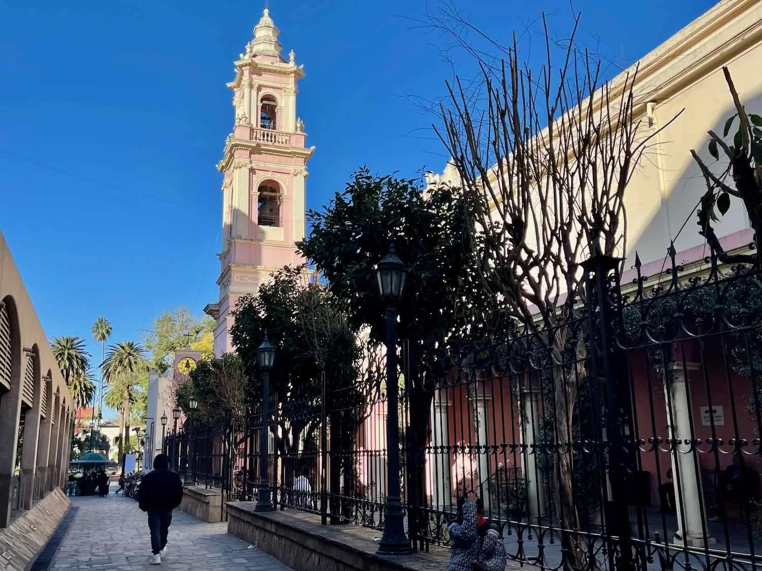
The grand facade of the Municipal Church of Belén faced the central square. Built with adobe bricks in a neoclassical style, had an air of simple elegance. Belén, Catamarca Province, Argentina. Copyright © 2019-2025 Pedals and Puffins.
The text on this mural read, “Each family is a brick that builds societies.” Belén, Catamarca Province, Argentina. Copyright © 2019-2025 Pedals and Puffins.
Passing Through St. Joseph’s Door
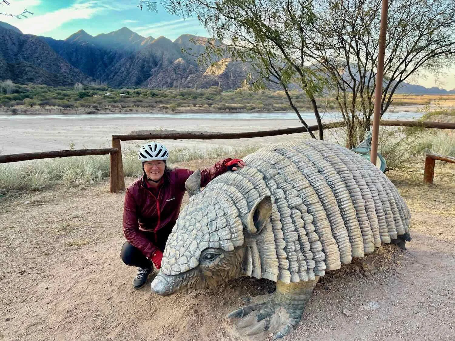
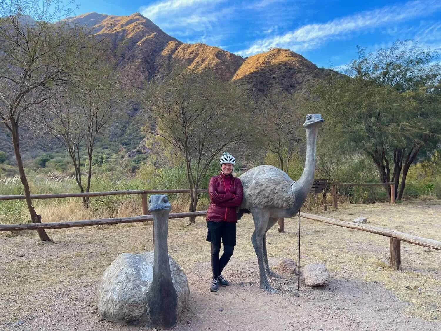
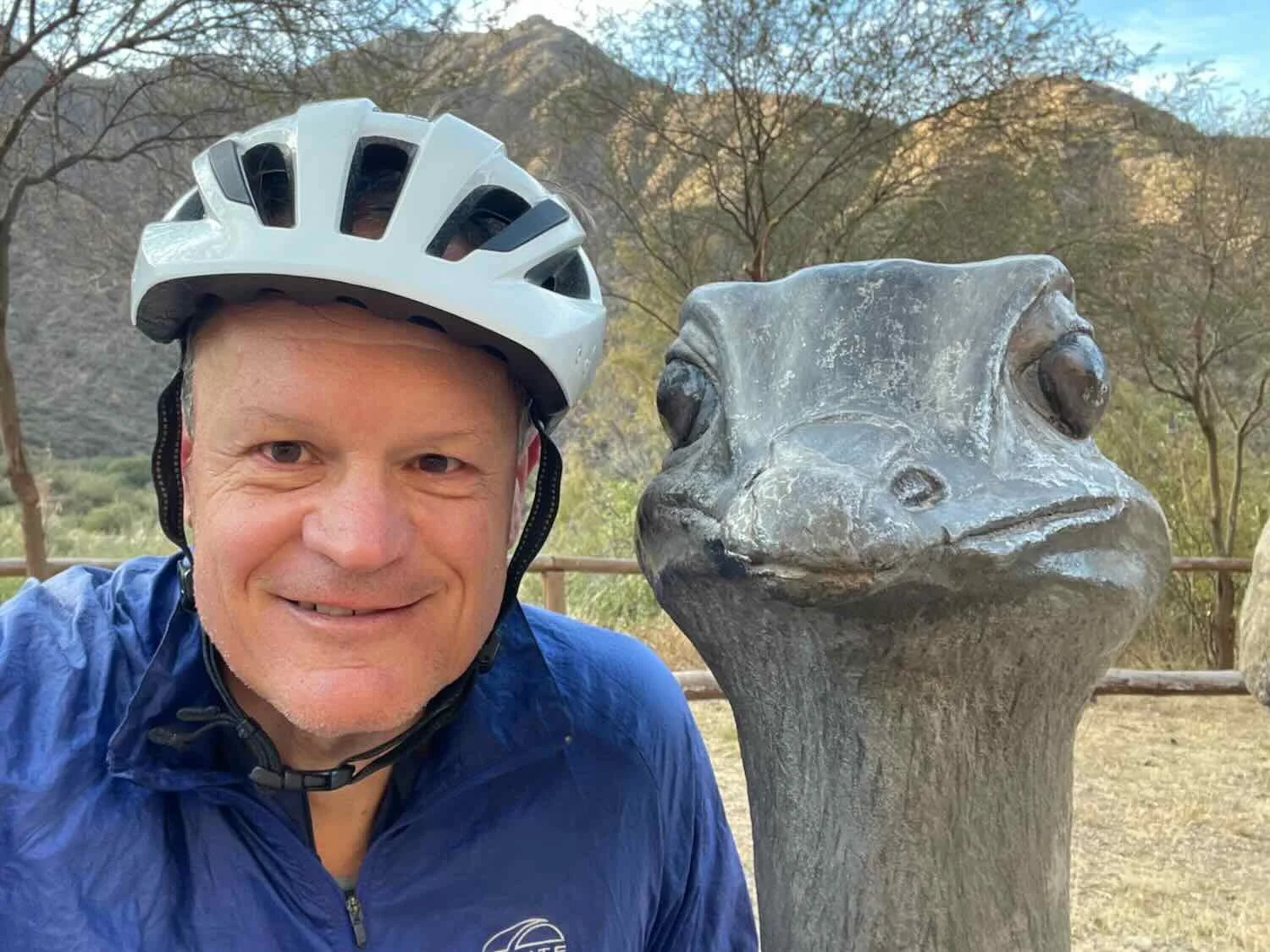
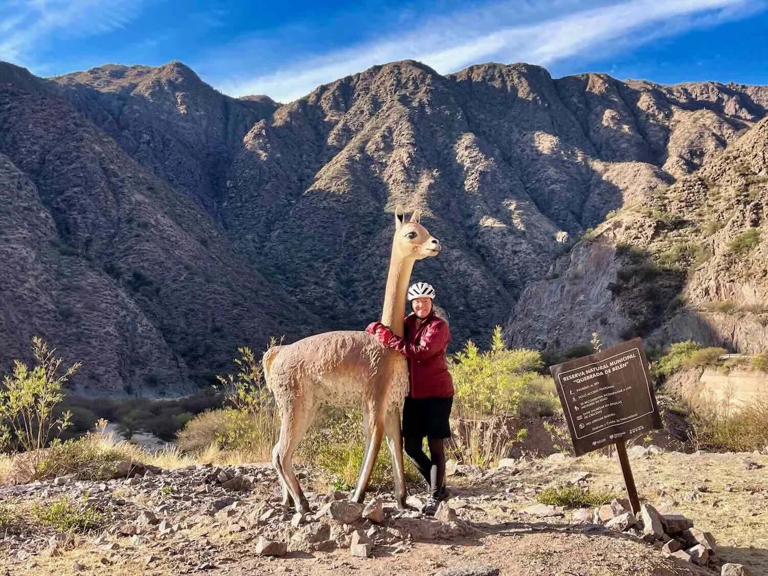
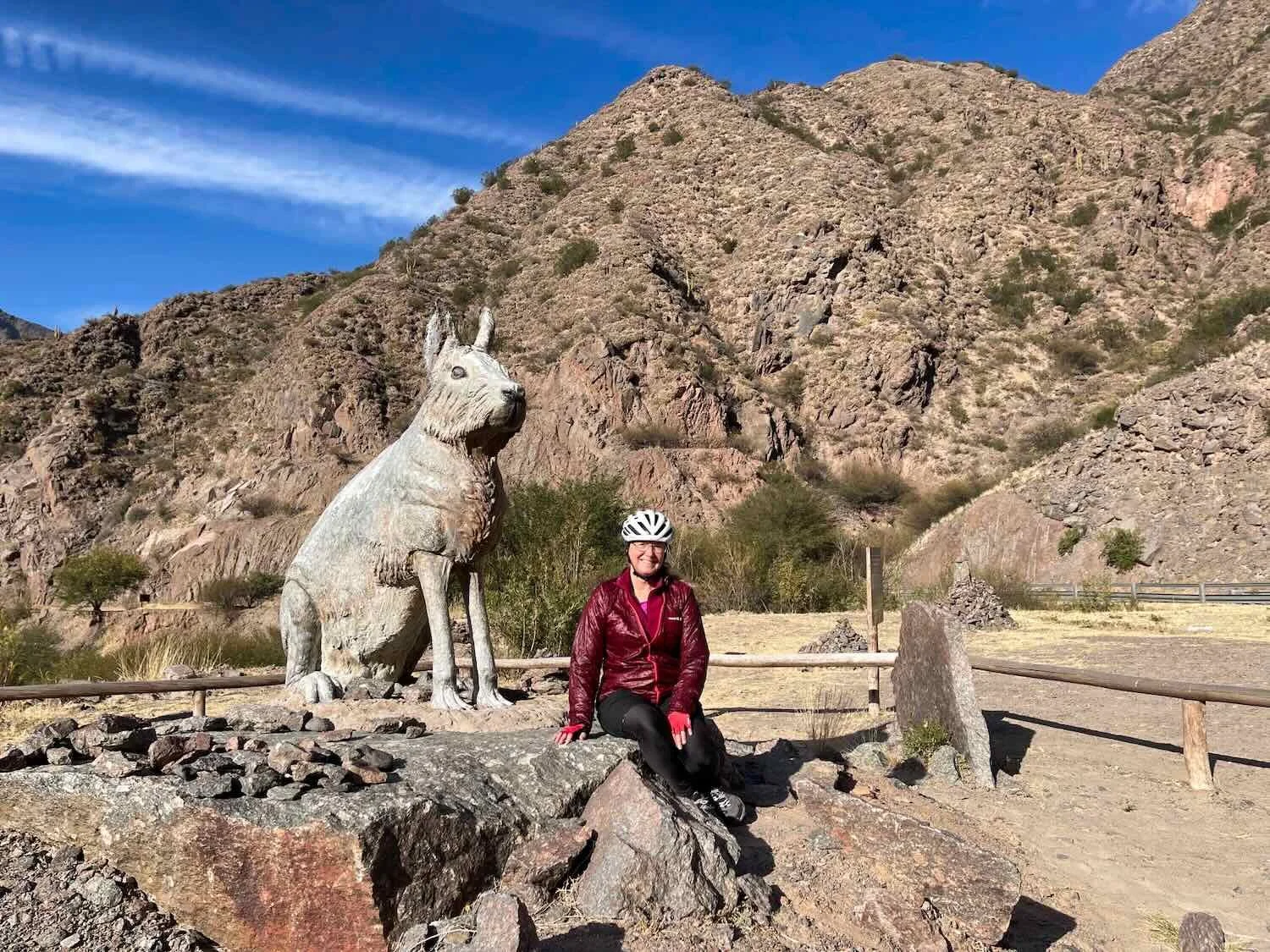
Just north of the town of Belén, Route 40 climbs over one of the mountain ridges that blocks its path. It rapidly ascends more than 3,400 ft (1,035 m), following the Belén River through a narrow, picturesque canyon. The valley itself is actually a nature reserve with larger-than-life statues of iconic, local animals situated along the highway. So although the climb up the first section of the canyon was strenuous, we never got tired because we could stop every couple of miles to visit with the animal statues.
Beautiful mountains lined our ride up the Belén River valley. Route 40, Quebrada de Belén Nature Reserve, Catamarca Province, Argentina. Copyright © 2019-2025 Pedals and Puffins.

Rocky outcrops towered over the highway through the Belén River valley. Route 40, Quebrada de Belén Nature Reserve, Catamarca Province, Argentina. Copyright © 2019-2025 Pedals and Puffins.
A majestic view, looking up the Belén River Valley. Route 40, Quebrada de Belén Nature Reserve, Catamarca Province, Argentina. Copyright © 2019-2025 Pedals and Puffins.
Two hours into our ride we emerged from the narrow, winding canyon through a gap known as the Puerta de San José (St. Joseph’s Door). The steep walls of the valley fell away on both sides, receding into the distance.
We then found ourselves cycling onto a high plateau covered with low, sparsely vegetated hills. Although we were still ascending over the sierras, the terrain became much more mellow and the headwind (which had been whipping through the canyon as if it were a wind tunnel) died way down. To top it all off, we were treated to a wide, smooth, paved road shoulder - a very rare occurrence in Argentina. It was perfect for cycling. Finally we had the chance to look around and really enjoy the scenery.
The second half of the day’s ride went much faster, as we cycled on a smooth, paved shoulder of the highway across a high plateau. Route 40, S of San Fernando, Catamarca Province, Argentina. Copyright © 2019-2025 Pedals and Puffins.
A bus shelter near the turnoff to a small village on the plateau was decorated with a vivid image of a fox, gazing towards the town. It seemed like they were trying to entice people to visit. Route 40, Junction to San Fernando, Catamarca Province, Argentina. Copyright © 2019-2025 Pedals and Puffins.
A Series of Unfortunate Events
In the early afternoon we reached a busy highway intersection near the small community of El Eje (pop. 152). The promise of a convenience store, and maybe even a restaurant, had lured us this far with hopes of scoring a warm meal. Imagine our delight when we spotted a large, modern-looking building that housed a gas station, a bus terminal, and presumably some other services inside. It looked like the rest stop from heaven.
However, looks can be deceiving. We ran into more than a few hiccups trying to acquire what we needed at that service center.
Our first snag was that when we arrived, the convenience store was closed. We chatted with the guy pumping gas, and he told us the store would open at 3pm, just 15 minutes away. That sounded great. Then, even better, he told us that there was a restaurant upstairs. That was just what we wanted to hear. We immediately headed upstairs and enjoyed a very satisfying meal.
Unfortunately, when we went back downstairs an hour later, the convenience store was still closed. If we were to cycle any further, we both needed water or other drinks, so we waited.
As time ticked by, multiple buses stopped at the gas station to pick up and drop off passengers. One young man waiting for the bus had a tiny, baby goat traveling with him. Route 40, El Eje Service Station, Catamarca Province, Argentina. Copyright © 2019-2025 Pedals and Puffins.
About half a dozen other guys who had arrived by bus also seemed to think that the convenience store should have been open by that time, and milled around in the parking lot with us. We were just about to give up and cycle away, when the girl who managed the store showed up - over an hour late. As is often the case in small communities, things open when they open.
By that time it was after 4:30pm - a bit late to continue our ride. So we decided to spend the night in a hotel across the street, which also was run by the service center (you check in at the convenience store). The room we were given was cavernous. It had six beds.
Unfortunately, the most important thing - a heater - was missing. Seeing our distress, they gave us a space heater. It probably would not have been strong enough to warm the giant, frigid room even if it was working - but it promptly sparked, shorted out, and died immediately after we plugged it into the wall.
The girl at the convenience store called a handy man to come and try to fix it. He spent more than a half hour working on the heater inside our room, without success. Then, without a word, he took it away. We waited for nearly an hour, expecting him to return (hopefully with a working heater). He did not. We asked the lady at the convenience store for a different heater, but there apparently were no other working heaters in the hotel.
We next discovered that there was no hot water. With the temperatures in the 30’sF (1.5C) and no heat in the room, we were not enthused about taking cold showers. We got some help (again, across the street at the convenience store) and were relieved to find that there indeed was hot water. It just had been turned off since there were no other guests in the hotel. Hot showers were in our future after all.
The Heights of Campo Arenal
Shivering as we got dressed the next morning, we came to the quick conclusion that another stop at the (heated) convenience store across the street would do us some good. As we had hoped, it was nice and warm. A small pack of cookies and mugs of hot chocolate set us up with plenty of much needed warmth and energy to continue the previous day’s climb up the mountain.
Morning clouds obscured the scenery on most of the climb to Campo Arenal pass. However, when the light struck a ridge of red rocks, it was quite beautiful. Route 40, Near Hualfín, Catamarca Province, Argentina. Copyright © 2019-2025 Pedals and Puffins.
It took us 4.5 hours of upward cycling to reach the top of of the pass. As we crested the ridge, a broad, nearly flat plateau known as Campo Arenal (a.k.a., Sandy Field) opened up before us.
Much to our surprise, there was an ‘airport’ (well, really just a paved air strip with some buildings) right at the top. There were hardly any other manmade structures up on the plateau, so the airport seemed a bit out of place. We later learned that it had been built by an international mining company in the 1990’s to ferry workers and equipment to a nearby, open pit mine (not visible from the highway). In its heyday, the mine employed around 2,400 workers and produced globally significant quantities of gold, copper and molybdenum. But the mine is now past its peak, and is in the ‘shutdown and environmental remediation’ phase.
Our bikes taking a rest, after reaching the high plateau of Campo Arenal. Route 40, N of Hualfín, Catamarca Province, Argentina. Copyright © 2019-2025 Pedals and Puffins.
As we rode out onto the high plain, we spotted another cyclist heading our way. We could hardly believe it. This was the third cyclist encounter we’d had in a week - after going several months without seeing anyone else out on touring bikes.
David was a native of Argentina, and another seasoned bicycle traveler. (Perhaps the cold weather kept the less experienced - and smarter - cyclists indoors this time of year.) On a previous journey David had cycled through Colombia, Ecuador, Peru and Brazil. Now he was heading down to Ushuaia (Tierra del Fuego). He’d taken a bus up to Bolivia five months ago, bought his bicycle there, and strapped all his stuff on the back of the bike in a crate (no panniers). He was traveling slowly and stopping a lot, with no pre-determined schedule. For him, it was “about the journey, not the destination.” A good motto to live by.
By then the afternoon was lengthening. So shortly after we bade farewell to David we started looking for somewhere to camp. But the wide open expanses of Campo Arenal didn’t offer many options.
After more than seven hours of cycling we finally spotted a very old, disused dirt road that looked like it led over the top of a hill. PedalingGuy went to investigate, and sure enough the dirt track led to a secluded bowl, hidden among some tall, sandy hills. We could hardly believe our luck. The spot was a good distance from the road, and there were even a few trees to help block the wind. We knew we had found our campsite. The wind shifted a couple times playing havoc with our tent. But before long the wind died down for the evening, as the temperature dropped towards freezing.
A cold, southerly wind blew in a thick layer of gloomy clouds that enveloped the high plain where we camped. Although it looked very ominous, we were lucky that it didn’t rain. Route 40, Campo Arenal, Catamarca Province, Argentina. Copyright © 2019-2025 Pedals and Puffins.
Llamas and the Echos of Incas
The next day remained cloudy and cold as we made our way down off of the high plateau. Even without rain, the air was surprisingly damp, adding to the chill. Pedaling vigorously to keep the cold at bay, we left the open plain behind and cycled into a narrower river valley, populated by a series of small, bland towns.
In the early morning, sunbeams broke through the thick clouds that obscured the tops of surrounding mountains. Route 40, E of Pie de Médano, Catamarca Province, Argentina. Copyright © 2019-2025 Pedals and Puffins.
Don Quixote never seems too far away in Spanish-speaking countries. We spotted this mural, linking the eccentric nobleman to the journey along Route 40. In the image he proclaims, “Follow your road, even if the dogs bark” (good advice for cyclists). Route 40, Palo Seco, Catamarca Province, Argentina. Copyright © 2019-2025 Pedals and Puffins.
About halfway down the valley we stopped for the night in the bustling, working town of Santa María (pop. 16,400). Buoyed by the income from surrounding mines and a strong agricultural base, the town had a distinctly un-touristy feel, which we enjoyed. One thing in particular that got our attention was the surprising number of sports-oriented shops all around town. It seemed as if every commercial street had at least one sportswear store. We couldn’t quite put our finger on what the connection was, but it certainly seemed as though the people of Santa María must enjoy a sporty lifestyle.
Another theme that started to emerge in Santa María was a strong link to indigenous, Andean cultures. Near the town of Belén we had passed into the southern reaches of the former Inca Empire. From Santa María onward, we would be seeing more and more references to those pre-Colombian cultures, through art and handicrafts.
A mural in the Plaza of Indigenous Peoples, depicted traditional imagery for some of the region’s native species. Route 40, Santa María, Catamarca Province, Argentina. Copyright © 2019-2025 Pedals and Puffins.
A statue honoring the cultural icon Margarita Palacios marked the northern entrance to town. A resident of Santa María, she became famous in the mid-1900s as a folk singer and author of a cookbook featuring traditional recipes of the Catamarca region. Route 40, Las Mojarras, Catamarca Province, Argentina. Copyright © 2019-2025 Pedals and Puffins.
The next day we passed the road turn-off towards the archaeological ruins of Quilmes, one of Argentina’s largest and most significant pre-Hispanic settlements. Continuously occupied for more than 800 years by the Quilmes people (who were conquered by the Incas in the 1400s), it housed 4,000-5,000 residents at its peak. The site was inhabited until the mid-1600s, when it was eventually conquered by the Spanish after 130 years of resistance. We didn’t make the trek out to the ruins, but they could be seen from the highway (on mountain slopes, roughly three miles away).
As might be expected given Quilmes’s status as a top attraction, the highway near the turn-off was sprinkled with businesses selling crafts, souvenirs, and even photo opportunities with domestic llamas to the steady stream of tourists who would pass by. In spite of the fact that we had seen tons of llama-focused crafts and souvenirs throughout our travels in Argentina, we hadn’t encountered any real, live llamas before this. However, from this point on towards Bolivia, llamas would slowly become more and more ubiquitous.
A community center located near the turn-off to the ruins was decorated with artwork evoking the style of the native Quilmes people. Route 40, Tucumán Province, Argentina. Copyright © 2019-2025 Pedals and Puffins.
Just down the road, a couple of llamas rested in a pen near an artisan’s market called Corral de Piedra. For a fee, kids could go in and pet the llamas, or even go for a gentle llama ride. Route 40, Tafí del Valle, Tucumán Province, Argentina. Copyright © 2019-2025 Pedals and Puffins.
In addition to the usual clay pottery and woven souvenirs, we were struck by the presence of items created from the woody cores of the tree-like cacti that grow throughout the region. Route 40, Corral de Piedra, Tafí del Valle, Tucumán Province, Argentina. Copyright © 2019-2025 Pedals and Puffins.
A serene wood carved statue depicting the Pachamama (the Mother Earth deity of the indigenous Andean people), stood at the corner of a small town plaza with her arms full of the Earth’s bounty. Route 40, Colalao del Valle, Tucumán Province, Argentina. Copyright © 2019-2025 Pedals and Puffins.
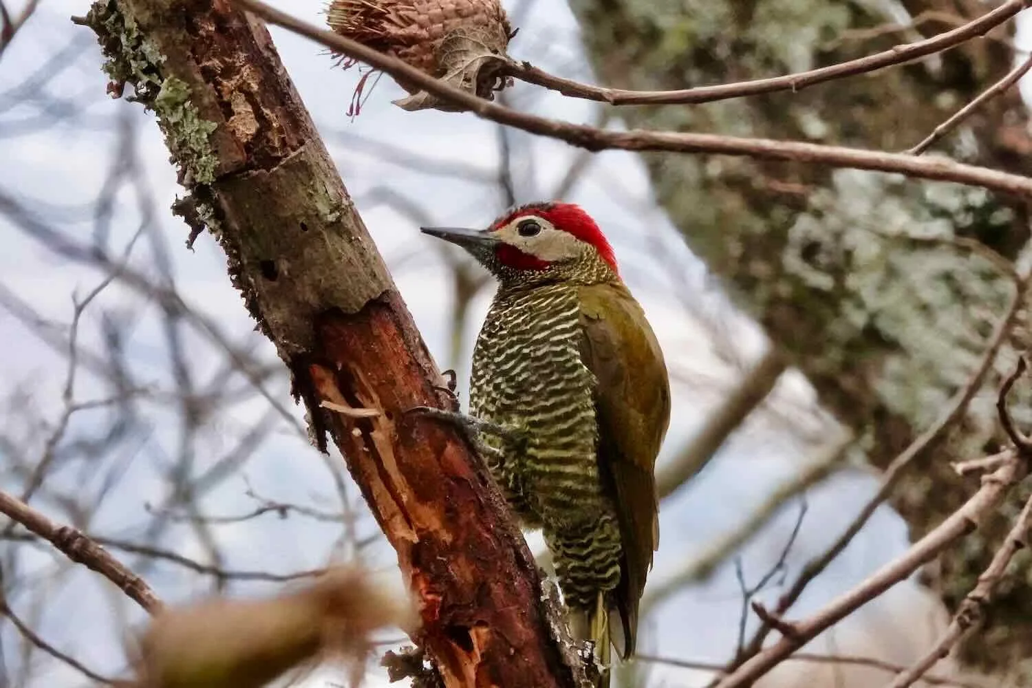
We had many miles to cover that day, so we didn’t stop to look at many birds. But this Güira Cuckoo stopped us in our tracks. We had to agree with our birding app, which called this species “charismatic and eccentric looking.” Route 40, El Molino, Salta Province, Argentina. Copyright © 2019-2025 Pedals and Puffins.
Back in Wine Country
As we approached the town of Cafayate, we found ourselves back in vineyard country. In fact Cafayate is famous for being one of the highest elevation, wine-producing regions in the world (over 5,500 ft in elevation). Local vintners have developed the area’s white, Torrontés grapes to take advantage of the region’s distinctive climate and soil conditions. We have been told that the Torrentés grapes are a cross between several varieties, one of which is found only in Argentina. The popularity of these wines was evident in the endless acres of grape vines and dozens of bodegas surrounding the town (much more than we had seen near Mendoza, which is more famous internationally).
On our way into Cafayate we passed many miles of vineyards - by far the largest area of grape production that we had seen anywhere in Argentina. Route 40, Loro Huasi, Salta Province, Argentina. Copyright © 2019-2025 Pedals and Puffins.
Every so often we also passed the handsome bodegas (winemaking facilities), where the wine producing magic happens. Route 40, Loro Huasi, Salta Province, Argentina. Copyright © 2019-2025 Pedals and Puffins.
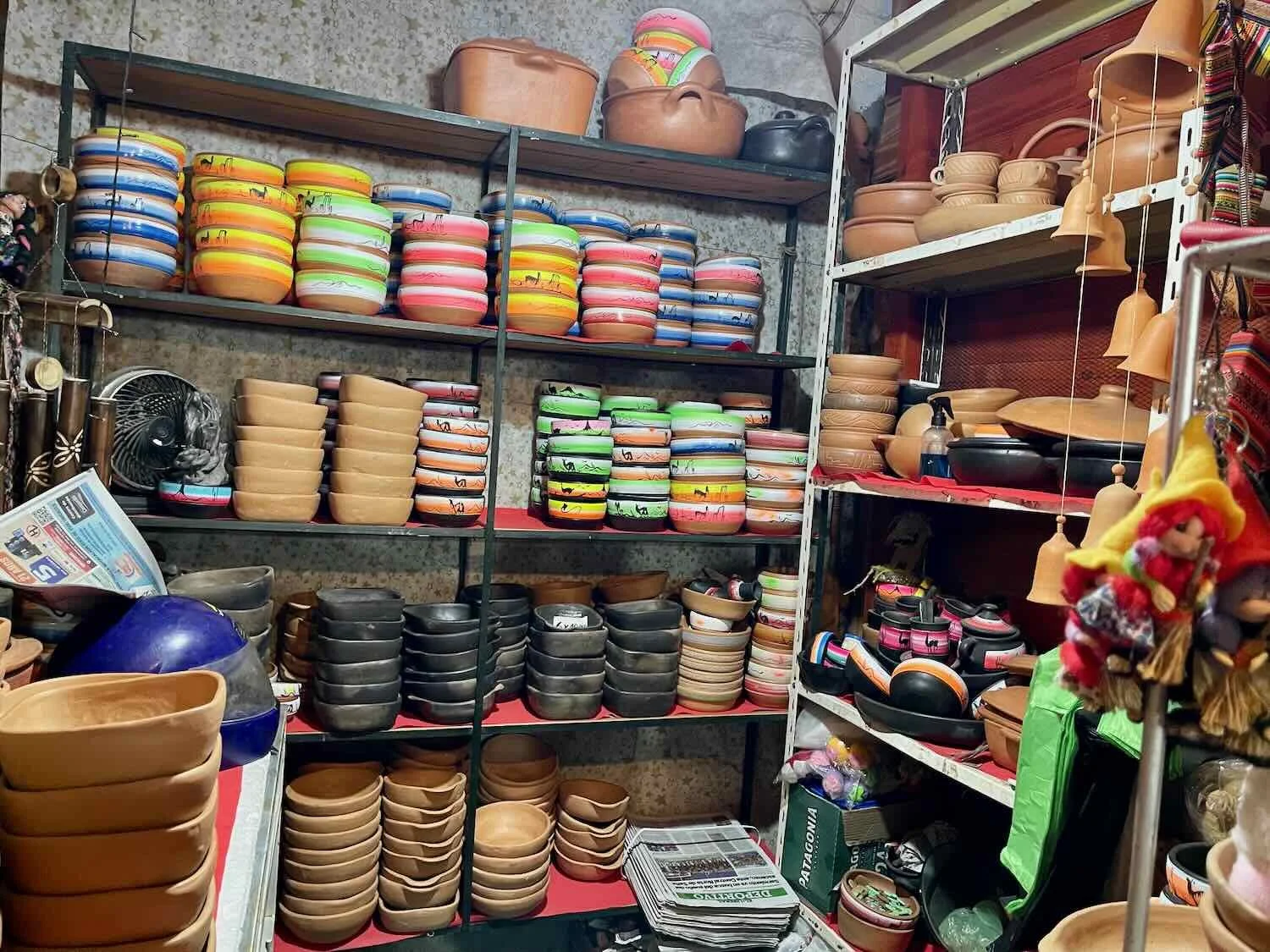
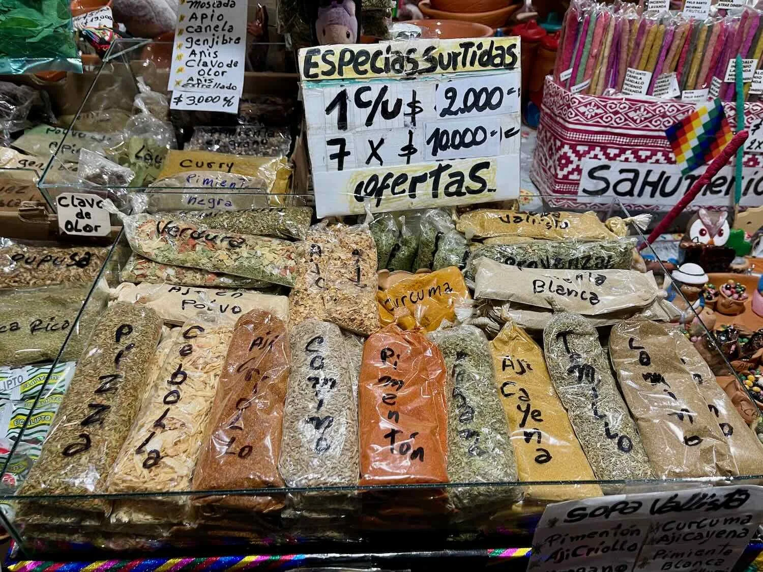
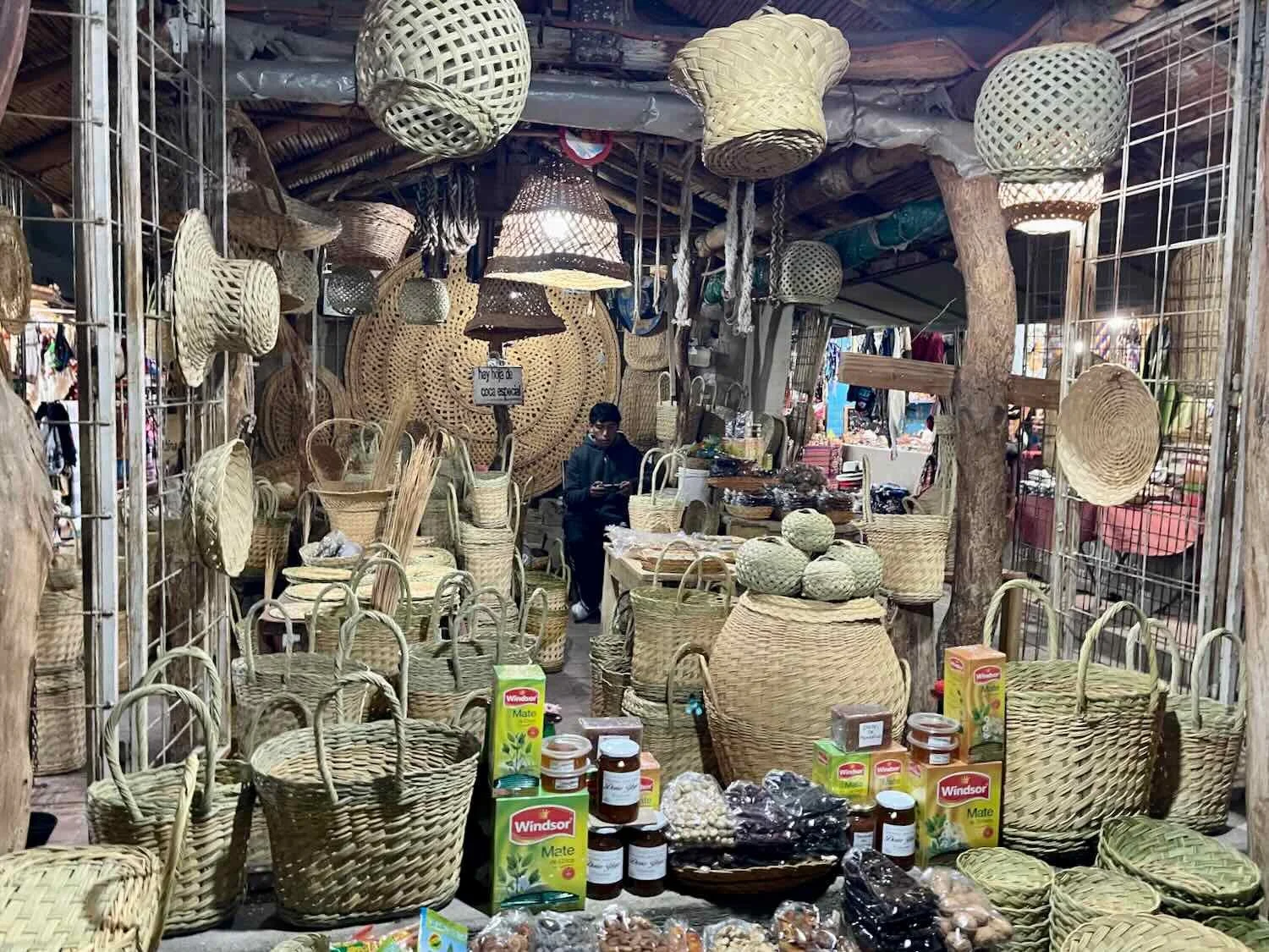
Unlike Santa María, Cafayate (pop. 16,800) came across as primarily a tourist town. There were dozens of hotels and short-term rentals - many, many more than in Santa María which was a similar-sized town. In addition, there were ‘artisan’s markets’ on nearly every street, as well as several warrens of craft stalls situated around the central plaza. Many of the markets had quality crafts. But the sheer volume and repetitive nature of the souvenirs on offer felt somewhat less authentic than what we’d found in smaller villages. Still, we enjoyed walking along the colonial-style streets and browsing through the many craft shops.
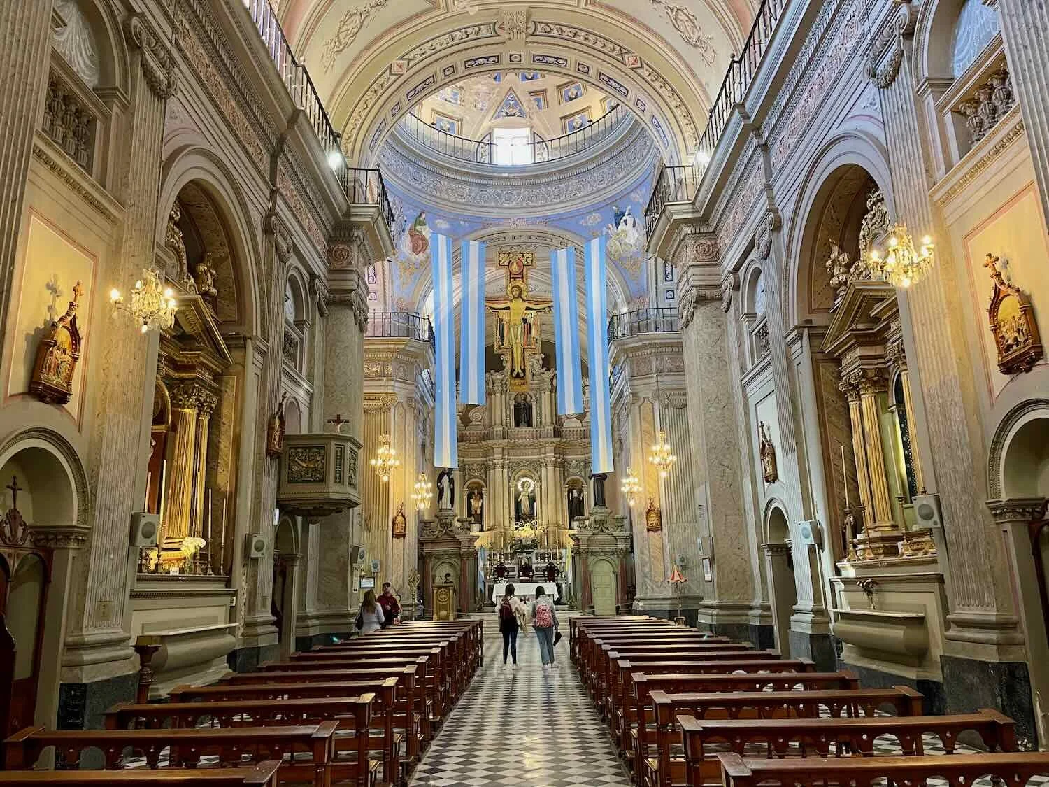
The cathedral on the main plaza glowed with a gentle beauty after dark. Cafayate, Salta Province, Argentina. Copyright © 2019-2025 Pedals and Puffins.
A mural in town honored the city’s long, winemaking tradition. Cafayate, Salta Province, Argentina. Copyright © 2019-2025 Pedals and Puffins.
Known as ‘The Llama House,’ this eclectic building formerly hosted a souvenir shop. But it seemed to be closed when we were there. Cafayate, Salta Province, Argentina. Copyright © 2019-2025 Pedals and Puffins.
The Red Valley of the Seashells
Besides wine and handicrafts, one of Cafayate’s biggest draws is its location near the mouth of the Quebrada de Las Conchas - one of Argentina’s most breathtaking and scenic stretches of highway. The name refers to the many fossilized seashells found within the layers of rock, indicating that the area was once submerged under an ocean.
However, it is not the fossil shells that draw many thousands of visitors to the canyon. Rather it is the spectacular rock shapes and stunning cliffs that line the highway. In keeping with its status as a playground for visitors, many of the rock formations had evocative names, parking spaces for cars, viewing areas, and information signs.
Less than 10 minutes after departing Cafayate, we finally turned off of Route 40 - after nearly four months of traveling along that legendary highway. A different set of roads would now carry us through the Quebrada de Las Conchas, and onward towards Bolivia.
Cycling into the Quebrada de Las Conchas. N of Cafayate, Salta Province, Argentina. Copyright © 2019-2025 Pedals and Puffins.
Los Colorados formation. Quebrada de Las Conchas, N of Cafayate, Salta Province, Argentina. Copyright © 2019-2025 Pedals and Puffins.
The Castles (Los Castillos). Quebrada de Las Conchas, N of Cafayate, Salta Province, Argentina. Copyright © 2019-2025 Pedals and Puffins.
To our delight, the canyon was full of Andean Condors. We saw quite a few of them soaring overhead, usually in pairs. PedalingGuy wondered if they were following us, maybe hoping for one of us to perish in the afternoon heat. Quebrada de Las Conchas, N of Cafayate, Salta Province, Argentina. Copyright © 2019-2025 Pedals and Puffins.
The Windows (Las Ventanas). Quebrada de Las Conchas, N of Cafayate, Salta Province, Argentina. Copyright © 2019-2025 Pedals and Puffins.
The Layers (Los Estratos). Quebrada de Las Conchas, N of Cafayate, Salta Province, Argentina. Copyright © 2019-2025 Pedals and Puffins.
One of the many gorgeous, un-named peaks along the route. Quebrada de Las Conchas, N of Cafayate, Salta Province, Argentina. Copyright © 2019-2025 Pedals and Puffins.
We had originally planned to cycle only 26.5 miles (42.5 km) and camp among the red rocks in the valley. Unfortunately, when we checked out the side canyon where we had heard that camping was possible, we didn’t find any flat ground. None at all. Everything was on a pretty steep slope.
We sat down and ate some bananas and gorp while we decided what to do. Truthfully, the decision was pretty easy to make, even though we weren’t too happy about it. We just didn’t relish the idea of trying to sleep on the side of a sloping hill, with the likelihood that we would be awake half the night trying not to roll over each other. So after we were fed, we got back on our bikes and headed down the road.
It was still relatively early in the afternoon, but the next camping opportunity that we knew about was another 13.5 miles (22 km) further ahead. As a result, we were now in a bit of a hurry and we rode with more purpose, stopping much less often for photos. Fortunately, the most spectacular scenery was now behind us, so we didn’t have to suffer the angst of missing any amazing views.
Our efforts paid off, and we arrived at the next informal camping area before 5pm. This site was much, much better for tents than the one on the mountainside. It was a large, flat area among a grove of trees, right next to the Las Conchas River. There was a rustic, stone table with benches, and even some fire pits indicating that we weren’t the first people to camp there. Even so, no one else showed up that evening, and we had the whole place to ourselves (it probably helped that it was a Tuesday).
To our surprise it was actually WARM that evening. Dressed in our long johns for sleeping, we didn’t even have to get inside our sleeping bags. That seemed outrageous. The last time we had used the tent, up on the Campo Arenal high plateau, we practically froze. The lower elevation, combined with moving northward, was finally starting to have an effect. Winter’s bite was not so strong anymore. We both slept very well.
Our campsite along the bank of the Las Conchas River, among the trees. Quebrada de Las Conchas, N of Cafayate, Salta Province, Argentina. Copyright © 2019-2025 Pedals and Puffins.
The next morning we continued cycling down the Las Conchas River valley. After just half an hour we stopped at the Parador Las Abritas for breakfast. A few empanadas and 1.5 liters of drinks made for a delicious and relaxing way to start the day.
The tasty empanadas at the Parador Las Abritas were cooked in an outdoor, wood-fired oven. (The sign says, “Enjoy empanadas from the oven.”) Quebrada de Las Conchas, N of Cafayate, Salta Province, Argentina. Copyright © 2019-2025 Pedals and Puffins.
The dog at the Parador Las Abritas was very relaxed. Quebrada de Las Conchas, N of Cafayate, Salta Province, Argentina. Copyright © 2019-2025 Pedals and Puffins.
Oven-baked empanadas were a great way to start the day. Quebrada de Las Conchas, N of Cafayate, Salta Province, Argentina. Copyright © 2019-2025 Pedals and Puffins.
By mid-morning dark clouds rolled in, and a headwind slowed our progress through the Las Conchas River canyon. Quebrada de Las Conchas, N of Cafayate, Salta Province, Argentina. Copyright © 2019-2025 Pedals and Puffins.
These quirky air plants (Tillandsia duratii) were common along the lower reaches of the canyon. We liked their long, fiddlehead-shaped leaves. Quebrada de Las Conchas, N of Cafayate, Salta Province, Argentina. Copyright © 2019-2025 Pedals and Puffins.
Into the Lowlands of Northern Argentina
Soon we were cycling through a broad, agricultural valley where most of the land was plowed and planted. There also seemed to be new species of birds everywhere we looked. We enjoyed the feeling that we were entering a new ecoregion, with lots of new plants and animals to discover.
We guessed that this big building was some kind of storage facility, given all the agriculture along the highway. Near Talapampa, Salta Province, Argentina. Copyright © 2019-2025 Pedals and Puffins.
A flock of Blue-crowned Parakeets, a new species for us. Near La Viña, Salta Province, Argentina. Copyright © 2019-2025 Pedals and Puffins.
Blue-crowned Parakeet. Near La Viña, Salta Province, Argentina. Copyright © 2019-2025 Pedals and Puffins.
Red-crested Finch. Near La Viña, Salta Province, Argentina. Copyright © 2019-2025 Pedals and Puffins.
That night we were the only guests in a small, travelers’ hostal in the countryside. With no other restaurants nearby, we were fortunate that the hostal owner was willing to make dinner for us in the otherwise empty cafe on site. He took our dinner order in the afternoon, and had it ready for us at 8pm (an early dinner in Argentina). These days it no longer felt strange to be the only patrons in a restaurant. It seemed to happen on a regular basis. There weren’t a lot of travelers in many of the areas where we cycled, and people tended to not eat out much in parts of Argentina. This meant that often there were relatively few restaurants, and the ones that existed had few, if any, customers.
As we left the high desert behind, the natural vegetation became much more varied. This region - although still quite dry - received much more rain than the deserts. As a result, there were dense thickets of lowland forest. We even cycled past several farm ponds - the first standing water we had seen in a very long time. And off to our east lay a huge reservoir, which provided hydroelectric power and water to irrigate about 1,000 sq km (385 sq mi) of land.
Virtually all of the landscape was converted to agriculture. At first it seemed as if all the fields were planted for hay. But as we progressed we started to see other crops, especially fields full of paprika chilis. Trucks rumbled by us, loaded with piles of dried, leafless paprika plants that still had the chilis attached. Occasionally we would see the wrinkled, red peppers scattered along the side of the road, where they had landed after falling off a passing truck.
Dried paprika chilis littered the side of the road, where they had fallen off of passing trucks. N of Ampascachi, Salta Province, Argentina. Copyright © 2019-2025 Pedals and Puffins.
The red haze in the background of this photo comes from one of the fields of paprika peppers we passed on the way to El Carril. S of Osma, Salta Province, Argentina. Copyright © 2019-2025 Pedals and Puffins.
The fields of hay fed herds of cows - an unlucky few of whom ended up as cowhides drying in the sun. Coronel Moldes, Salta Province, Argentina. Copyright © 2019-2025 Pedals and Puffins.
Our big event for the day was a lunch stop at Parilla D’mi Tata, a semi-famous empanada restaurant along the highway. It’s worth mentioning that even though empanadas could be found commonly throughout most of the areas we had traveled in Argentina and Chile, they are considered icons of the Northern Argentina cuisine. Popular surveys consistently rank the small, juicy empanadas of the north as some of the most beloved in the country. They say that the special mix of spices (including paprika) is part of the appeal.
The Parilla D’mi Tata consistently receives rave reviews, and is frequently said to have some of the best Salteña-style empanadas in the province. To celebrate this gastronomic delicacy, we polished off 10 empanadas between us (Argentinian empanadas are some of the smallest in Latin America), while sitting at an outdoor table under a big mesquite tree. They certainly were delicious.
A happy customer at the Parilla D’mi Tata - a well-known empanada stop for travelers along Route 68. S of El Carril, Salta Province, Argentina. Copyright © 2019-2025 Pedals and Puffins.
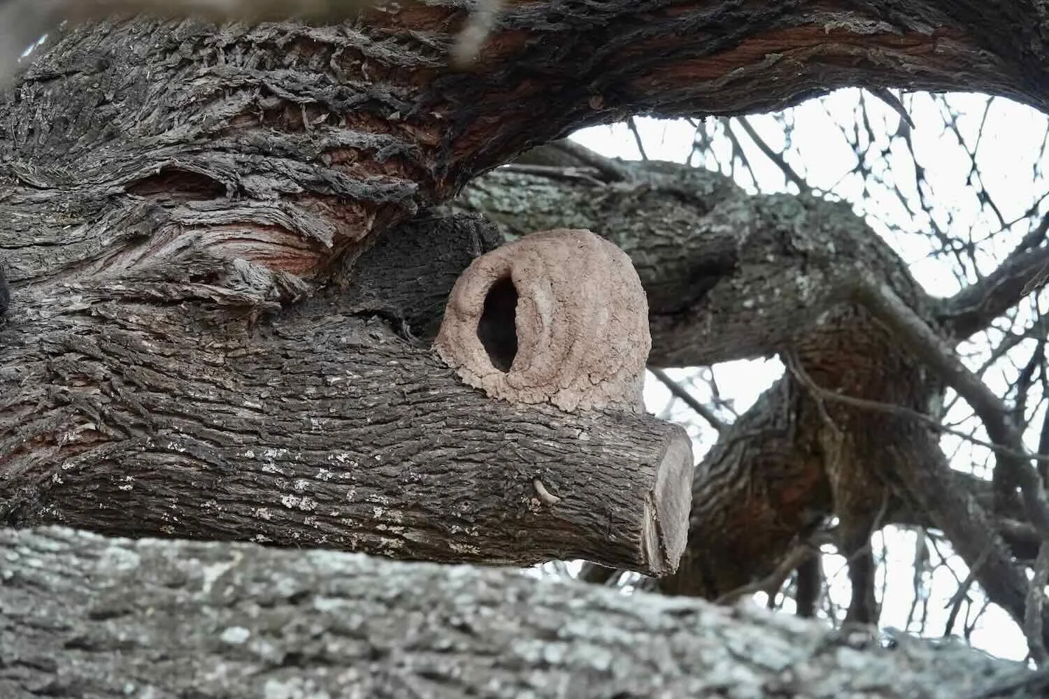
After a restful night in the town of El Carril (pop. 13,125), we made the final push to the big city of Salta. As expected, the vehicle traffic became busier and busier as we approached the city. Yet the road didn’t get any wider. It remained incredibly narrow, without a paved shoulder. For much of the day we had to cycle on the gravel shoulder to stay safely away from the crowded traffic lane. We did take one rest break in the village of La Merced, where we got a kick out of a mural depicting a beloved bird in Argentina called the Rufous Hornero. It has a distinctive nest, that is said to look like a clay oven.
The ride into the city of Salta (pop. 627,700) is infamous among cyclists for being a chaotic mess, and we can confirm that the reputation is well deserved. We first entered the city on a 4-lane avenue. It should have been spacious enough for cars to give us a wide berth, but many still passed quite close to us.
Then, with 3.5 miles to go (5.5 km) we turned onto a busy, narrow, urban street. The next 20 minutes were the most hair-raising part of the day. The one-way road was absolutely packed with two lanes of tumultuous traffic. Crowds of cars, buses, motorbikes and other bicycles all weaved in-and-out, somehow managing to avoid crashing into each other (and the many cars that were parked in one of the traffic lanes), with no clear rules regarding who had the right of way. We really had to concentrate to stay out of trouble. Those 20 minutes seemed to take forever.
Yet finally we reached the center of town, and a miracle occurred. We were able to turn onto a wide avenue that had a protected bike lane. In fact, we were able to cycle on dedicated bike paths nearly all the rest of the way to our destination. It was awesome to ride in a space away from the wild traffic.
Exploring Salta La Linda (a.k.a., Salta the Beautiful)
Established in 1852 to serve as a trade and communications outpost between Lima, Peru and Buenos Aires, Salta is one of Argentina’s oldest, colonial-era cities. The unique mix of well-preserved colonial buildings, strong folkloric traditions, and access to stunning natural landscapes (like the Quebrada de Las Conchas we had just cycled through), has elevated Salta as a top tourist destination, with the nickname Salta La Linda (the Beautiful).
There were two key tasks we had to take care of while in Salta, that resulted in our spending some extra time there.
First, we had to visit the Bolivian Consulate to obtain travel visas for the next country on our itinerary. The United States is one of the countries whose citizens cannot get a visitor’s permit at the Bolivian border, but must apply for an entry visa in advance. The process is magnificently cumbersome, and it took us four days of effort to finally secure our visas - including the gathering and printing of nearly 50 pages of documentation with multiple visits to photocopy shops, plus a trip to the bank to pay the visa fee.
For some reason the National Bank insisted they could not take our payment required for the visa - even though the Bolivian Consulate made it clear that this was the only way to pay. Even after escalating to a bank manager we were told they could not take our payment.
Since there was only one National Bank in town that was allowed to take our payment (according to the Bolivian Consulate), we were at an impasse. Not being inclined to give up easily, we decided to get in another line and ask someone else (kind of like a second opinion). While waiting, we found another bank employee in the rear of the bank who seemed sympathetic to our plight. He was willing to take our money and give us a receipt, which was what we required for the visa.
Fortunately, we eventually succeeded in jumping through all the hoops, and we should be able to enter Bolivia after all. Clearly there are not many Americans crossing the land border between Argentina and Bolivia, or they would need a better process.
The second big task we needed to complete in Salta was to replace all the tires on our bicycles. Our hope was that this final set of tires would get us all the way to Colombia. However, the 27.5 inch, plus-sized tires required for our bikes are absolutely not available for purchase inside Argentina. We had been to many bike shops, and had yet to see a single one in Argentina.
As a result, we had to have them shipped to us from the USA. This ended up taking 2.5 weeks (just for shipping and clearing customs), which was a bit longer than we had originally expected. Yet once again we were lucky, and our four, Maxxis Rekon+ 27.5 inch tires finally did arrive. With the help of the guys at ProBike bicycle shop - and their compressed-air chamber bike pump - we were able to get our new, tubeless tires seated on our rims. Now we’re (hopefully) ready to tackle Bolivia, Peru and Ecuador.
While waiting for our new tires to arrive, we took the time to explore the lovely city. Here are some photos from our time in Salta La Linda.
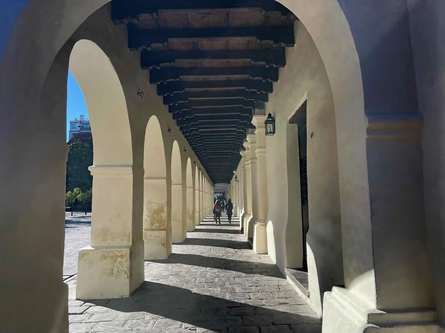
Many of the streets in Salta’s sprawling, historical center are narrow and paved with cobblestones, evoking the city’s colonial past. City of Salta, Salta Province, Argentina. Copyright © 2019-2025 Pedals and Puffins.
Checking out the latest blooms at a curbside flower shop. City of Salta, Salta Province, Argentina. Copyright © 2019-2025 Pedals and Puffins.
This dog found the perfect spot to recover from a long night of defending its territory, on the sunlit, tile floor of a small shop. City of Salta, Salta Province, Argentina. Copyright © 2019-2025 Pedals and Puffins.
As with many places in Argentina, the influence of Italian immigrants was strong in Salta. We admired the colorful mosaic mural on the outside of the Italian Society Headquarters. City of Salta, Salta Province, Argentina. Copyright © 2019-2025 Pedals and Puffins.
Salta is widely considered to have the best-preserved colonial architecture in all of Argentina. Other big cities (like Buenos Aires and Córdoba) were largely redeveloped in the late 1800s in a European neoclassical style, which gives them a more cosmopolitan feel. By contrast, Salta retains many structures from the early colonial period that are still in use, and maintain their authentic, historical charm.
Salta didn’t have a huge, urban park in the manner of Buenos Aires or Mendoza. Even so, General San Martín Park, located in the heart of the city, included many of the same features like landscaped gardens, winding pathways, and a picturesque lake. City of Salta, Salta Province, Argentina. Copyright © 2019-2025 Pedals and Puffins.
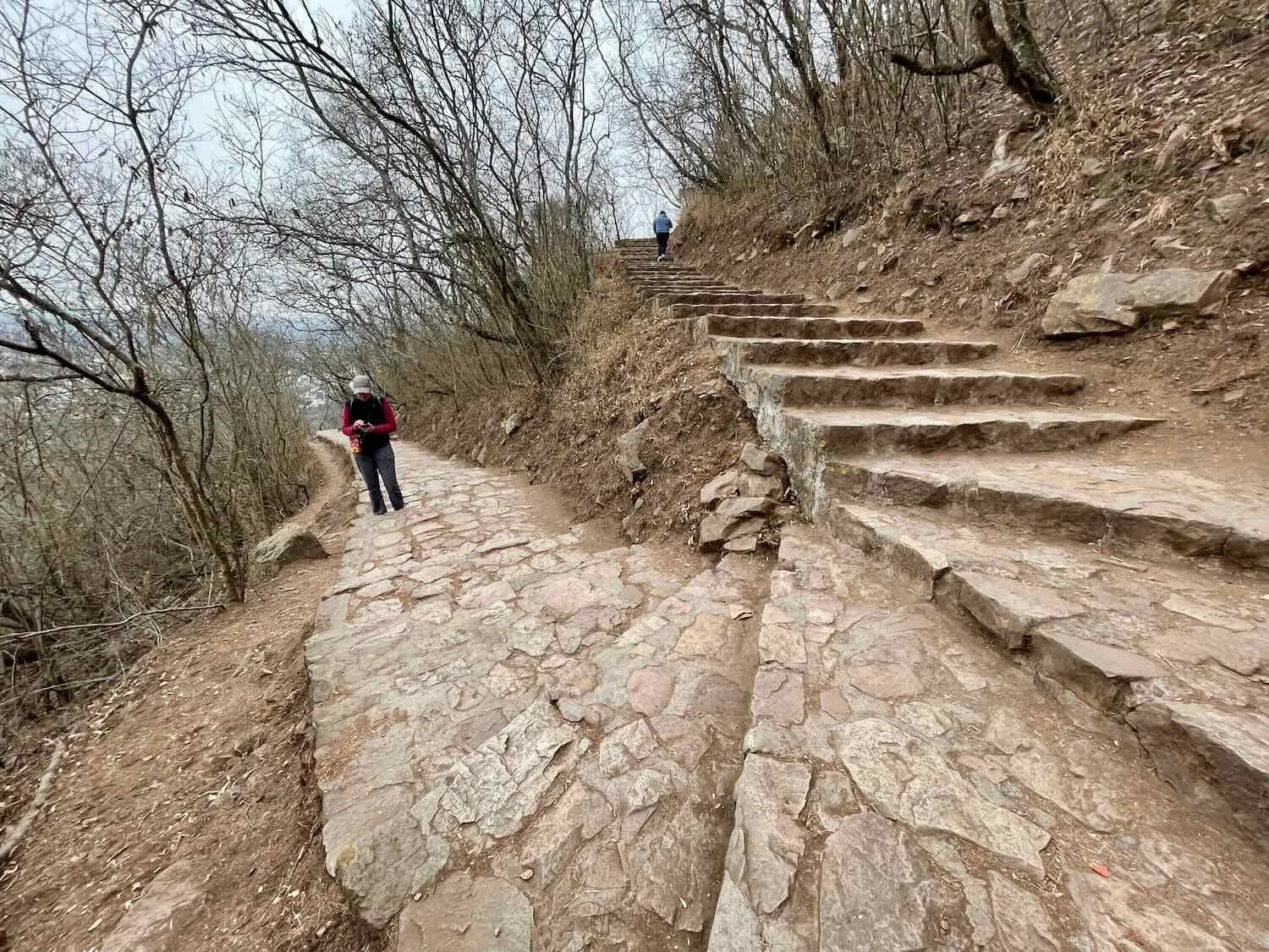
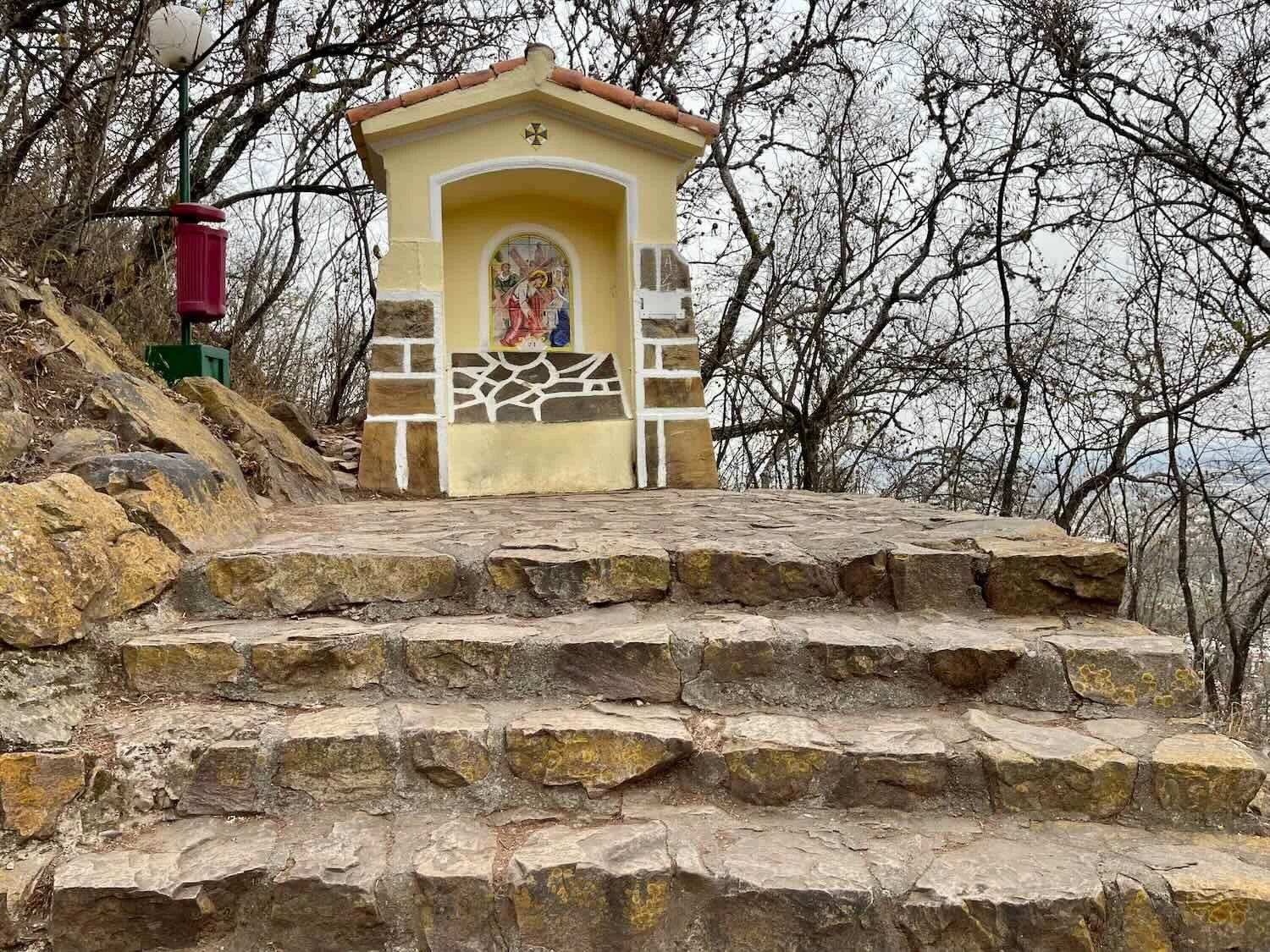
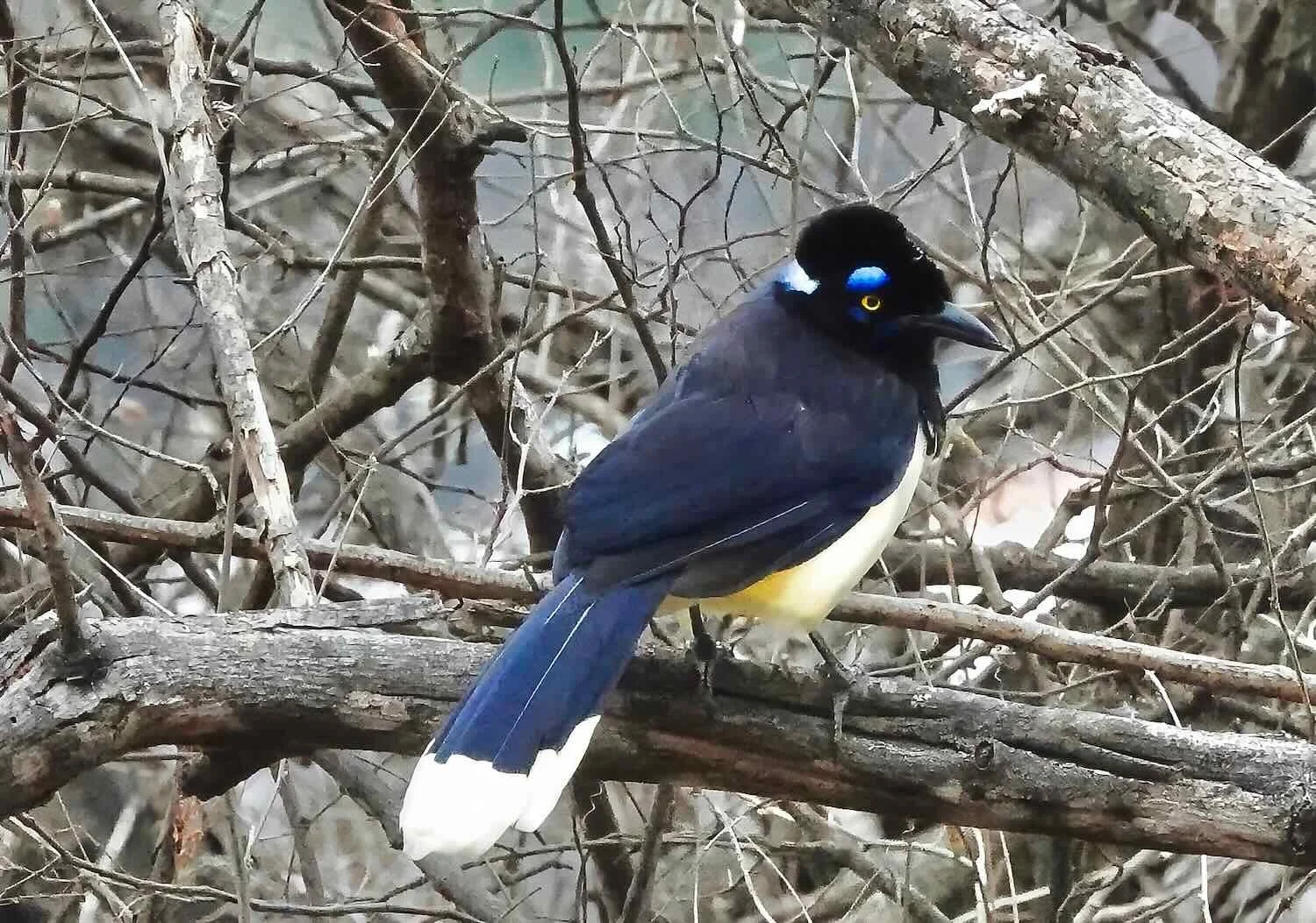
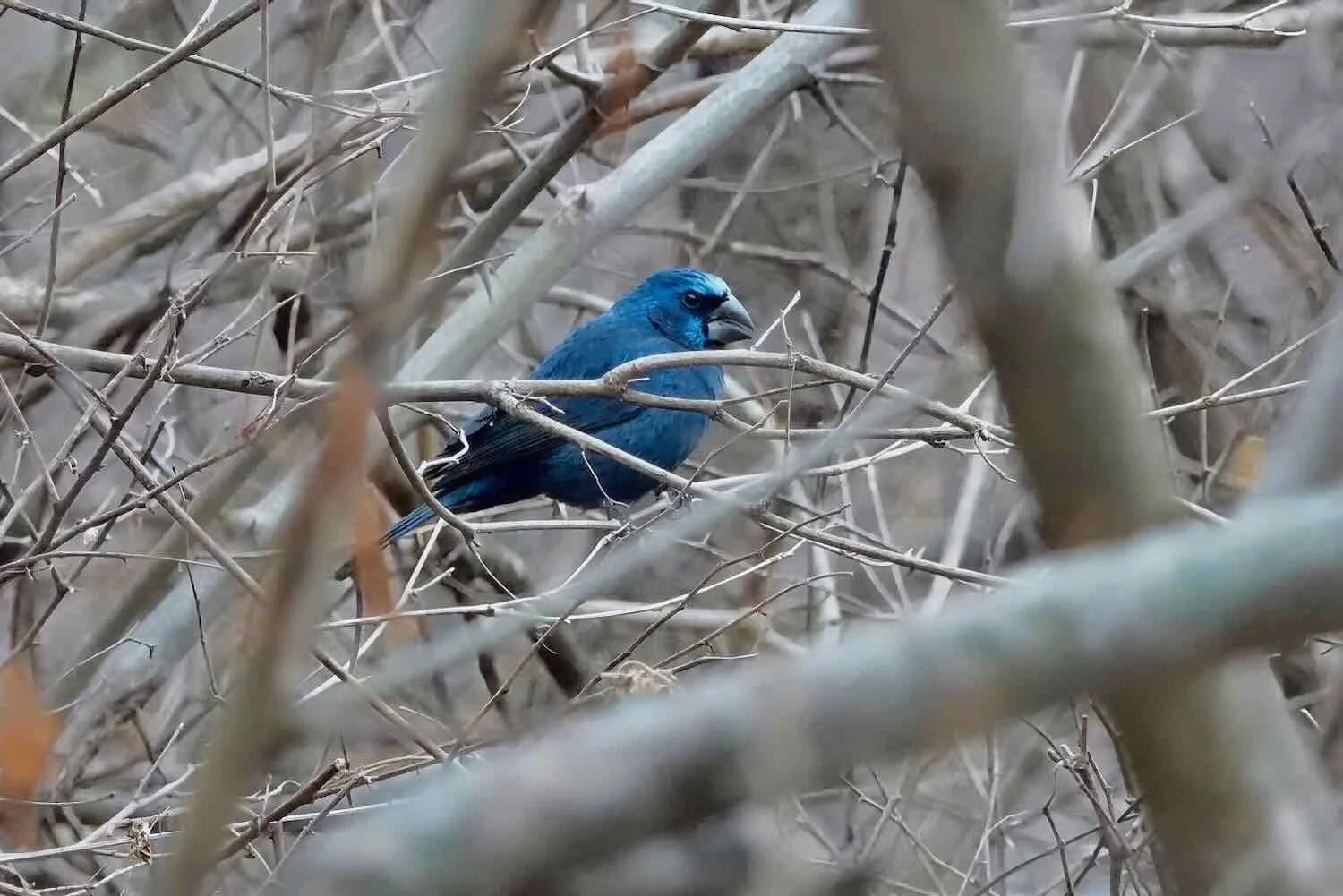
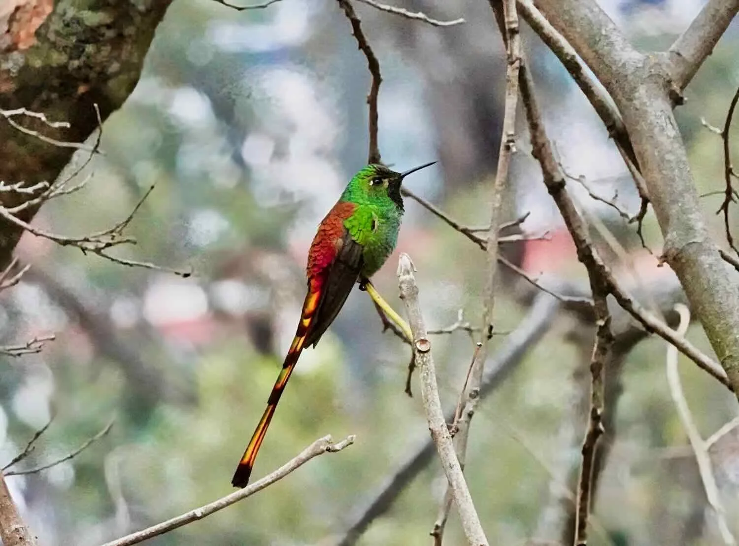
One of Salta’s most iconic attractions is San Bernardo Hill, which rises nearly 1,000 ft (300 m) right on the eastern edge of the city. Most people ascend the hill via cable car, to take in the sweeping views. However, there is a ~1 mi (1.6 km) walking trail to the top, that is lined with the Stations of the Cross. We preferred to take the path for the exercise, and for the outstanding birding along the route. On one occasion we tried cycling up the steep mountain on the main road, but found the traffic around to base of the mountain too crazy for our taste. Thus, we preferred to contain our routine (every other day) cycling trips to the outskirts of the city.
Many people take a cable car ride up to the top of the San Bernardo Hill, to soak up the panoramic views of the city. City of Salta, Salta Province, Argentina. Copyright © 2019-2025 Pedals and Puffins.
The top of San Bernardo Hill was developed with parks, playgrounds and vendors. One surprising feature was a gushing series of manmade water falls. The water was pumped up from the base of the mountain (1,000 ft below). Given the massive effort it took to pump all that water up the hill, we thought it might have some practical use - like cooling the machinery that runs the cable car. However, research suggests that the water is actually pumped up the mountain primarily for aesthetic reasons, to create a pleasant environment for visitors. City of Salta, Salta Province, Argentina. Copyright © 2019-2025 Pedals and Puffins.
Of course, one of the vendors at the top of San Bernardo Hill was a ‘wine truck.’ This was Argentina, after all. City of Salta, Salta Province, Argentina. Copyright © 2019-2025 Pedals and Puffins.