Cycling Northern Argentina: Salta to La Quiaca
13 August - 6 September 2025
13 Aug - Salta to La Caldera (22.4 mi, 36.0 km)
14 Aug - La Caldera to San Salvador de Jujuy (35.1 mi, 56.5 km)
15 Aug - Rest Day in San Salvador de Jujuy
16 Aug - San Salvador de Jujuy to Bárcena (22.2 mi, 35.7 km)
17 Aug - Bárcena to Tilcara (31.7 mi, 51.0 km)
18-19 Aug - Wind Days in Tilcara
20 Aug - Tilcara to Humahuaca (28.1 mi, 45.2 km)
21-24 Aug - Wind Days in Humahuaca
25 Aug - Humahuaca to Azul Pampa (21.9 mi, 35.2 km)
26 Aug - Azul Pampa to Abra Pampa (32.0 mi, 51.5 km)
27 Aug - Rest Day in Abra Pampa
28 Aug - Abra Pampa to La Quiaca (44.9 mi, 72.3 km)
29 Aug-5 Sep - Wind and Sick Days in La Quiaca
An Abundance of Life
Most of Argentina is covered with arid grasslands and deserts. But in the far north, there are a few places where accidents of wind and topography create pockets of wetter weather. The area north and slightly east of the city of Salta is one of those places. Known as the Yungas, these mountain slopes receive upwards of 100 inches (2,500 mm) of rain each year, even though they are sandwiched between other, much-drier regions. As we rode north from Salta, we would have the luxury of cycling through these forests for a couple of days.
The morning of our departure, spring was in the air. Over the course of the previous week, quite a few trees throughout the city had come into bloom. In particular, the tubular flowers of Pink Trumpet Trees burst onto the scene. Now, our spirits were lifted as we rode out of town along protected bicycle paths lined with trees smothered in pink blossoms.
After crossing a huge, gravelly river bed we began a long, winding ascent on a very narrow road. In fact, this section of highway is famous for being so slender that cargo trucks and long buses are prohibited from using it. Although it was billed as a 2-lane road, it was barely more than the width of one normal traffic lane. We were fortunate that vehicle traffic was light, because we invariably had to bail out onto the gravel shoulder whenever a car overtook us from behind - there just wasn’t enough room on the road to safely pass.
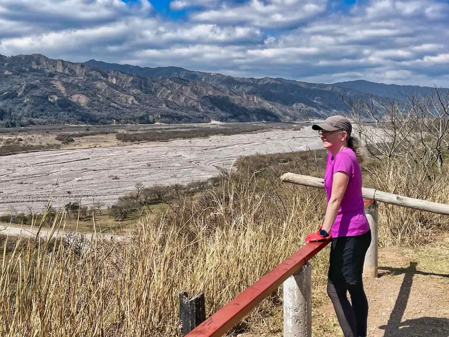
As the road ascended into the mountains, we had a sweeping view of the broad, gravelly floodplain below. Several bulldozers were pushing gravel from the river bed into piles, and loading them into dump trucks. La Caldera River, N of Vaqueros, Salta Province, Argentina. Copyright © 2019-2025 Pedals and Puffins.
We could feel the change in vegetation as we left the arid lowlands behind and entered the humid mountain forest. Of particular note were the lakes. There’s so much water in the yungas that Argentina has built several large reservoirs to capture it. Within half a day of cycling we saw much more water than we had seen over the past several months.
Fortunately for us, a fishing club next to one of the reservoirs allows cyclists and other travelers to camp on its property. The afternoon that we arrived we were the only campers, so we had the place to ourselves. We had our choice of campsites, each with a concrete picnic table, nestled within a grove of thorn trees. (We actually had to trim some low-hanging branches from one of the trees to avoid having a 2-inch spike poke a hole in the top of our tent).
As an added bonus, we were able to check out the wildlife at the reservoir. The diversity birds was impressive - we counted nearly 30 species, including five that we had not seen before. We took several long walks along the shore, enjoying the sheer abundance of life.
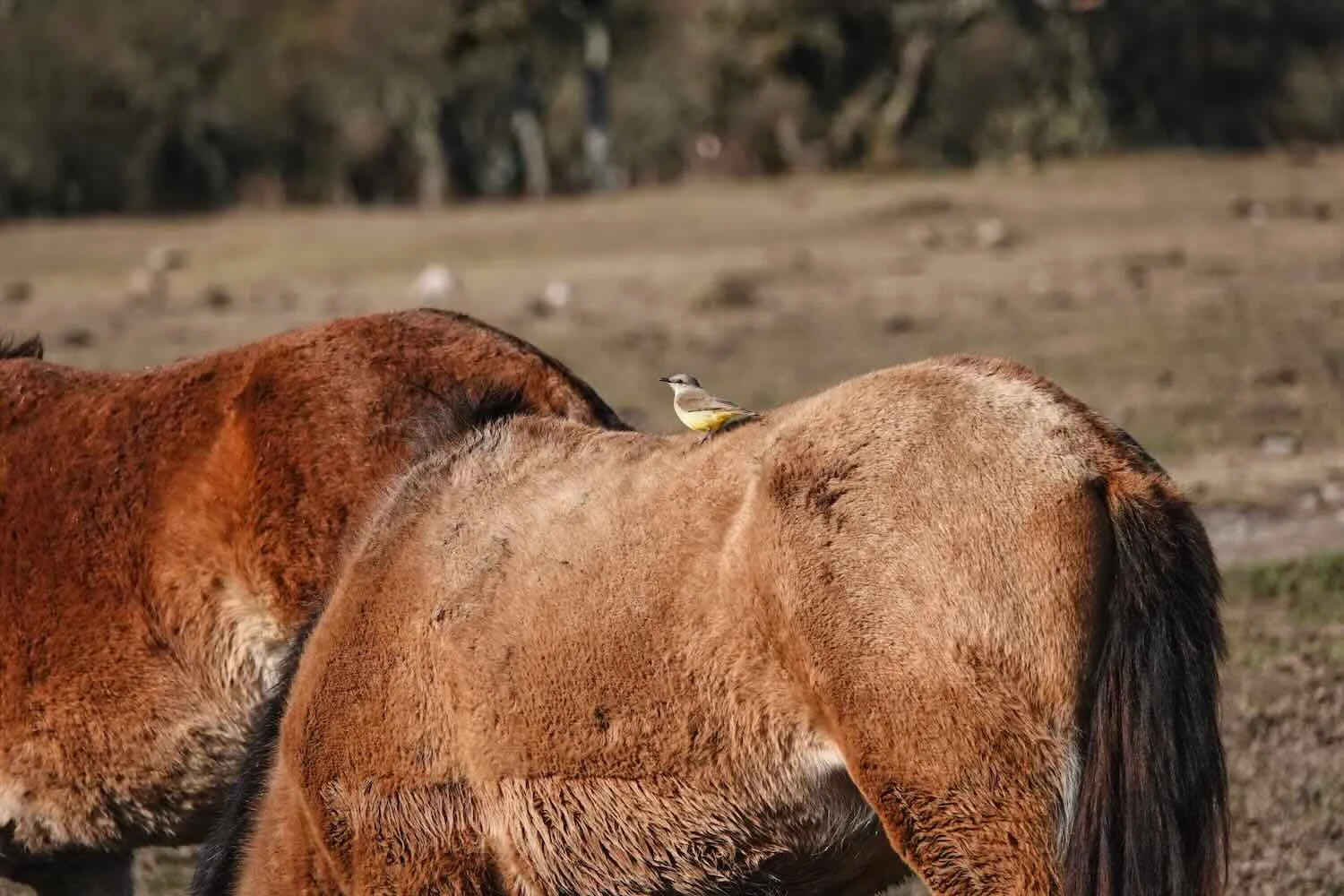
A herd of local horses seemed to enjoy the taste of the pond weeds growing in the shallow water. Campo Alegre Reservoir, La Caldera, Salta Province, Argentina. Copyright © 2019-2025 Pedals and Puffins.
The sun set behind a distant ridge of mountains as we walked along the shore. La Caldera Hunting and Fishing Club, Campo Alegre Reservoir, Salta Province, Argentina. Copyright © 2019-2025 Pedals and Puffins.
The next day we cycled even higher into the hills. As we rose above the human disturbance that surrounded the reservoir, the yungas forest enveloped us. Before long we were cycling among towering trees with big, spreading canopies - many of which were covered in green leaves (a big change from the wintry lowlands). The long, hefty branches were crowded with air plants, adding to the feeling that we were cycling through a lush, montane forest.
A couple of Crested Caracaras scavenged for breakfast by the side of the road. Finca El Hueco, N of La Caldera, Salta Province, Argentina. Copyright © 2019-2025 Pedals and Puffins.
Stopping to admire the heavy load of air plants crowding the branches of a big, roadside tree. Camino de Cornisa (Cornice Way), N of La Caldera, Salta Province, Argentina. Copyright © 2019-2025 Pedals and Puffins.
The bright, magenta blossoms of Pink Trumpet Trees drew our eyes to the far side of a valley. Camino de Cornisa (Cornice Way), N of La Caldera, Salta Province, Argentina. Copyright © 2019-2025 Pedals and Puffins.
Near the top of the ridge we caught sight of another one of the region’s sprawling reservoirs, in the valley below. Las Maderas Reservoir, Yungas of Jujuy Natural Reserve, Camino de Cornisa (Cornice Way), S of El Carmen, Jujuy Province, Argentina. Copyright © 2019-2025 Pedals and Puffins.
After plunging down the far side of the mountain ridge, we passed another big reservoir, known as La Ciénaga. S of El Carmen, Jujuy Province, Argentina. Copyright © 2019-2025 Pedals and Puffins.
We spotted this Yungas Guan sneaking down to the water’s edge for a drink. La Ciénaga Dam, S of El Carmen, Jujuy Province, Argentina. Copyright © 2019-2025 Pedals and Puffins.
After descending off the forested mountain the terrain mellowed considerably, and we found ourselves cycling past a string of farms and small towns. This Pauista Bumble Bee was attracted to the bright thistle flowers blanketing the margins of the road. N of Alisos, Jujuy Province, Argentina. Copyright © 2019-2025 Pedals and Puffins.
A Brief Stop in San Salvador de Jujuy
Towards the end of the day the farms and fields gave way to the urban sprawl of San Salvador de Jujuy (pop. 309,000). The final hour of cycling into the city was so crowded and hectic that we were glad to finally arrive at a functional, easy to access hotel along the highway where we could spend the night.
However, the next day we did take time to visit the charming, historic center of Jujuy (pronounced hoo-hooey). We lucked out, because our hotel was not far from the start of a long, urban greenway that followed an old railroad grade, giving us a safe and enjoyable walking path into the heart of the city.
We ended up walking nearly seven miles (11 km), all the way to the central plaza - a colonial gem landscaped with ornamental palm trees and a baroque central fountain. The impressive Government Palace - one of the city’s well-preserved colonial buildings - sat grandly on one side.
The central fountain in Plaza Belgrano, Jujuy’s central square. The colonial Government Palace can be seen in the background. San Salvador de Jujuy, Jujuy Province, Argentina. Copyright © 2019-2025 Pedals and Puffins.
One thing that made an impression on us was that nearly everyone in Jujuy seemed to order a glass of orange juice plus a separate glass of seltzer water with their meals. It was striking to see this, with lots of little orange and fizzy glasses perched on every table. This was not something we had noticed in other places we visited in Argentina. What’s more, our hotel even served this combination of drinks to us with our breakfast, although though we didn’t request it. Apparently a lot of oranges are grown in the region, which has led to the popularity of this beverage combo, known as ‘naranjado.’
Return to the High Desert
The city of Jujuy sits in a relatively low, mountain valley. At “just” 4,000 ft (1,220 m) above sea level, it would end up being the lowest point on our journey for the next several months. From there, we climbed steadily away from the humid yungas, and back into the high desert landscapes that had become so familiar in northern Argentina. Slowly the forested mountain slopes gave way, replaced once again by low shrubs and cacti.
However, it took nearly two hours of cycling to escape the urban sprawl of Jujuy’s northern suburbs. The traffic on the highway was heavy and fast, forcing us to cycle almost exclusively on the unpaved, gravel shoulder and slowing our progress. But eventually we emerged into a more rural landscape.
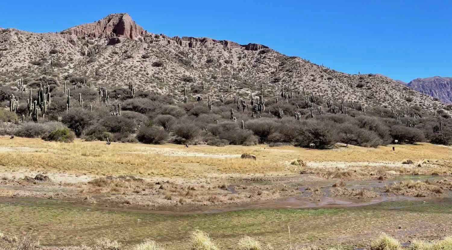
For the remainder of the day our route paralleled the wide, flat, gravelly valley of the Río Grande (yes, another one… they’re not very creative with river names). The cobblestone river bed was full of braided channels, most of which were dry. Even so, the river often was split into narrow rivulets that ran through 2-3 of the channels. We could only imagine how the water must pore down this valley during the rainy season. At the edge of the floodplain, the mountains rose abruptly into steep ridges. Our road hugged one of the ridges, offering expansive views of the valley below.
Admiring the panorama of the Río Grande river valley, spread out below a roadside overlook. S of León, Jujuy Province, Argentina. Copyright © 2019-2025 Pedals and Puffins.
We spent the next night in the little village of Bárcena (pop. 270). There was only one lodging option, so that’s where we went. However, when we arrived in mid-afternoon, the place looked deserted. The doors were locked and no one seemed to be around. Worried that we might be out of luck - and without any other viable options - we called out and knocked on the door, hoping to get someone’s attention. But there was no response. Even the two, lazy dogs in the yard barely paid any attention to us.
We even asked a guy in a passing car whether the hospedaje was still open (he said he thought it was…) and which door we should knock on.
Just as we were starting to give up hope, an older gentleman came out of the attached house to greet us. His name was Rubén. And although it had taken him quite a while to respond to our calls, he turned out to be quite friendly. In short order we were settling into one of the tiny, simple rooms, with a shared bathroom down the hall.
Perhaps the best feature of the hospedaje was that it had an enclosed courtyard with a table and chairs where we could eat our dinner (procured at a tiny shop in town). By the time we had arrived the wind was blowing hard, so we appreciated the protection afforded by the courtyard walls. The late afternoon sun provided just the right amount of warmth, especially since inside our room it was freezing cold.
Entering the courtyard at the Hospedaje Casa Piedra. The walled courtyard provided the ideal spot for our dinner that evening. Bárcena, Jujuy Province, Argentina. Copyright © 2019-2025 Pedals and Puffins.
Unfortunately, the hospedaje did not have any heat. What’s more, the stone and adobe construction really held the cold. So once we had finished dinner and were back in our room, it didn’t take long for us to snuggle into our bed under multiple blankets in an effort to stay warm. There was just enough of a wifi signal that we could get a few things done. But we still had lights out before 10pm.
The next day we took Rubén’s advice and made a 2-mile detour off the main highway just north of town. According to him, ‘Old Route 9’ was better for cycling because it shortened the ride by about a mile, and it cut out a couple hundred feet of steep climbing. The detour was all gravel. But truthfully that didn’t make much difference. We probably would have had to cycle on the gravel shoulder of the highway if we had gone the other way.
Cycling on the gravel along ‘Old Route 9’. N of Bárcena, Jujuy Province, Argentina. Copyright © 2019-2025 Pedals and Puffins.
Towards the end of the detour there were several, really big mines operating atop precariously steep slopes, on the far side of the Río Grande valley. In one spot it looked like a landslide had obliterated part of a road that hugged the steep slope, leading to the mines. It all looked quite risky, and not very safe.
We cycled back onto the highway, and immediately passed through the mining/industrial town of Volcán. In addition to its significance as a major producer of lime, the town marks the entrance to a picturesque, 100-mile (160 km) stretch of highway known as the Humahuaca Ravine (a.k.a., Quebrada de Humahuaca).
A Rainbow-Colored Ravine
Renowned for both its geologic and cultural features, the Humahuaca Ravine is bordered by multi-colored mountains that often feature alternating bands of rusty, tan and greenish-gray stone. An abundance of archaeological sites in the valley reflects its importance as a transportation and trade route dating back at least 1,500 years. The Inca, in particular, used the valley as a major caravan route after they conquered the local people in the 1400s.
As if to highlight the area’s importance as a tourist destination, we encountered a large, roadside shop and cafe on the far side of town. It looked like it was supposed to be a fancy rest stop for tourists, and several, big buses were parked outside. We pulled over, optimistic about finding something for breakfast. Unfortunately the big, impressive building had little inside. It was a bit of a let down. The cafe wasn’t serving anything but pastries, and all the staff seemed to be very preoccupied staring at their phones. We ended up buying a couple of grilled, ham and cheese tortillas from an independent vendor out in the parking lot.
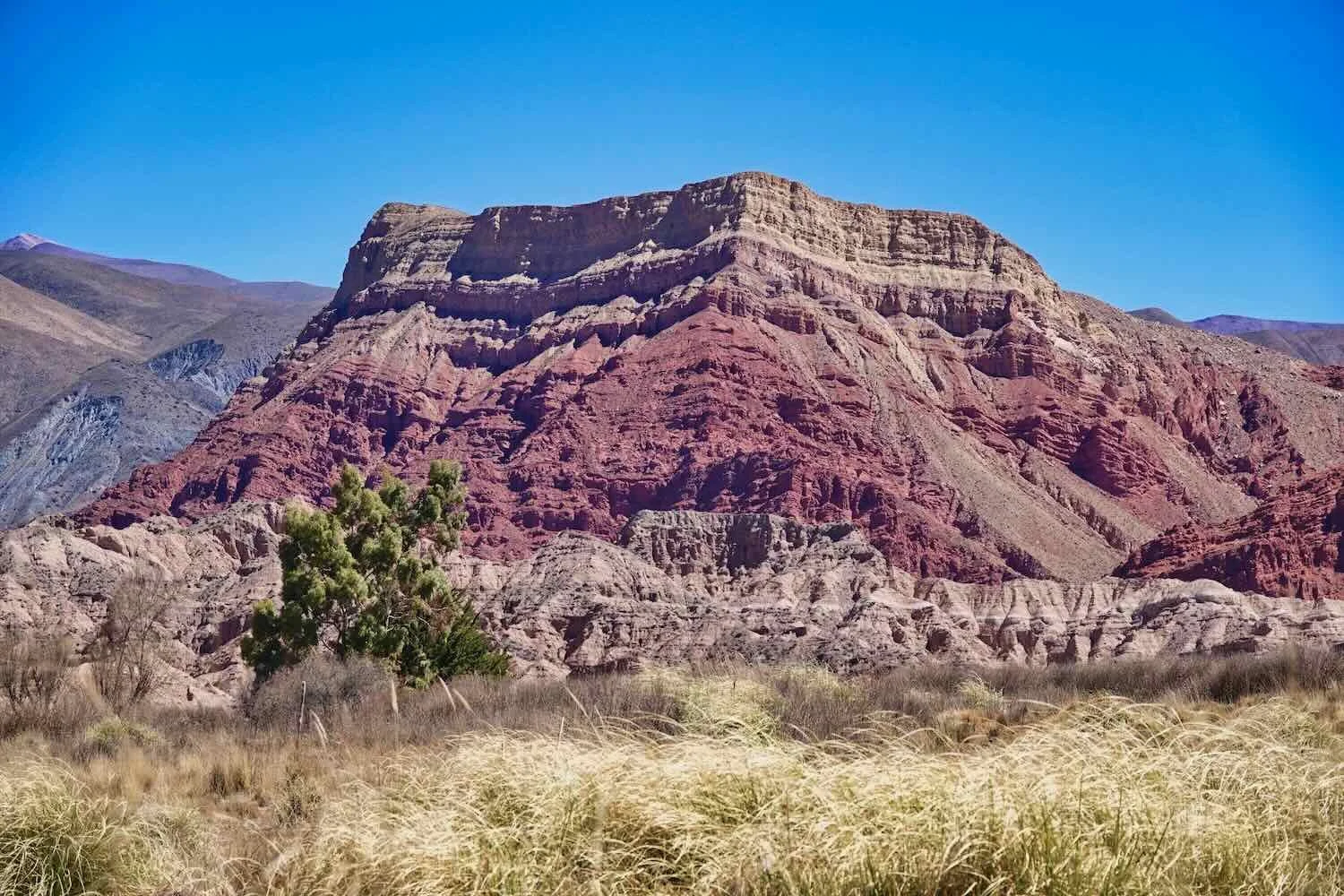
As we gained altitude after that, the scenery became more beautiful and impressive. In some places the rock faces were rippled with ribbons of stone. In others, there were rose-colored cliffs, and smooth slopes splashed with a rainbow of colors.
Cycling among the multi-hued hills that lined the Humahuaca Ravine. S of Purmamarca, Jujuy Province, Argentina. Copyright © 2019-2025 Pedals and Puffins.
A couple of roadside shrines, with the backdrop of colorful mountains in the Humahuaca Ravine. N of Purmamarca, Jujuy Province, Argentina. Copyright © 2019-2025 Pedals and Puffins.
By the time we reached the turn-off towards the town of Tilcara (pop. 5,140) we were really worn out from all the climbing. We had ascended more than 5,000 ft (1,525 m) since departing from San Salvador de Jujuy, and our energy levels were running low. We were happy to check in to a cozy, little cabin at the end of the day.
One quirky aspect of the place we stayed in Tilcara was that there were two big, fluffy llamas that would wander over from a neighboring property to snack on the lawn. Tilcara, Jujuy Province, Argentina. Copyright © 2019-2025 Pedals and Puffins.
Since cycling through Chile and Argentina, we had become big fans of staying in cabins where we could prepare our own meals. Here’s a glimpse into our cabin kitchen in Tilcara, Jujuy Province, Argentina. Copyright © 2019-2025 Pedals and Puffins.
The fiery sunset over the multi-colored mountains of the Humahuaca Ravine. Tilcara, Jujuy Province, Argentina. Copyright © 2019-2025 Pedals and Puffins.
Waiting Out the Wind in Tilcara
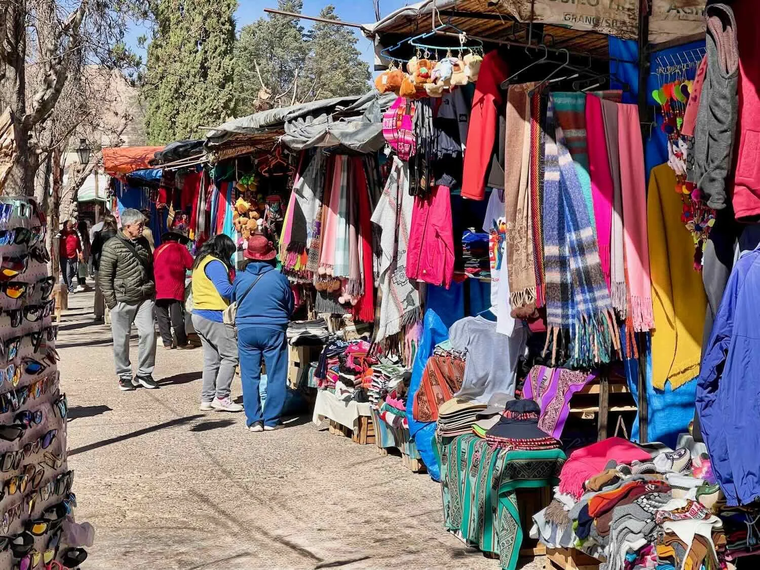
Located about halfway along the length of the Humahuaca Ravine, Tilcara has become a hub of activity for tourists, mostly from Argentina, visiting the region. As a result, it has a more upscale feel than a lot of the other towns in the valley, plus a very well-developed restaurant and souvenir economy.
We had already planned to take a rest day there. However, a check of the weather revealed that the next two days were going to be very windy, with wind speeds reaching 55 mph (90 kph) - which would be blowing directly into our faces if we were out on the road. Being of the mind that it’s not much fun cycling in a dust storm, we decided to extend our stay in Tilcara one more day. By that time the winds were supposed to calm down again.
Each morning we went for a walk as early as possible, with the goal of being back in our cabin before the gales and resulting dust storm began. This also gave us a chance to enjoy the quiet, cobblestone streets before they became clogged with other people.
A quiet morning in Tilcara. By 11am the streets would be packed with cars and the sidewalks teeming with visitors. But before that the village was quite tranquil. Tilcara, Jujuy Province, Argentina. Copyright © 2019-2025 Pedals and Puffins.
There were always a few, free range roosters around. They took their job of waking everyone up at 4am very seriously. Tilcara, Jujuy Province, Argentina. Copyright © 2019-2025 Pedals and Puffins.
This vintage car, parked in an alley, had seen better days. Tilcara, Jujuy Province, Argentina. Copyright © 2019-2025 Pedals and Puffins.
Our Lady of the Rosary Church. Tilcara, Jujuy Province, Argentina. Copyright © 2019-2025 Pedals and Puffins.
The mountains south of town, where the Río Grande and Huasamayo Rivers come together. Tilcara, Jujuy Province, Argentina. Copyright © 2019-2025 Pedals and Puffins.
A picturesque iron bridge crossed the Huasamayo River. By the time we were returning to our cabin across the bridge, the wind was howling and the air had started to fill with wind-blown dust. Tilcara, Jujuy Province, Argentina. Copyright © 2019-2025 Pedals and Puffins.
Returning to the Tropics
Departing Tilcara we continued our steady ascent through the Humahuaca Ravine. The canyon continued to offer up beautiful scenery, highlighted by the colorful layers of rock. The weather was clear and the sun was bright. Yet even though we had waited for the fierce wind storm to pass… it was still windy (15-20 mph). Interestingly, the canyon played tricks with the wind, so its speed and direction varied a lot. Sometimes we cycled into fierce headwinds, sometimes a crosswind, and occasionally there was even a lull.
Multi-colored cliffs lined our route through the Humahuaca Ravine. El Perchel, Jujuy Province, Argentina. Copyright © 2019-2025 Pedals and Puffins.
The mountains continued to rise steeply on both sides of the Humahuaca Ravine, which we followed uphill for most of the day. El Perchel, Jujuy Province, Argentina. Copyright © 2019-2025 Pedals and Puffins.
A big milestone for the day came when we crossed the Tropic of Capricorn - officially leaving the southern temperate zone and returning to the tropics. Of course, August is still very much winter time in the Southern Hemisphere, and at an altitude of 8,660 ft (2,640 m) it was still rather cold especially at night when it could dip below freezing. But it felt wonderful to have made roughly 3,000 miles of progress (4,800 km) since leaving the cold shores of the Beagle Channel in Tierra del Fuego.
A stone marker and large sundial (in the background) marked our crossing of the Tropic of Capricorn. We were officially now back in the tropics but with the cold temperatures it didn’t feel like it. Huacalera, Jujuy Province, Argentina. Copyright © 2019-2025 Pedals and Puffins.
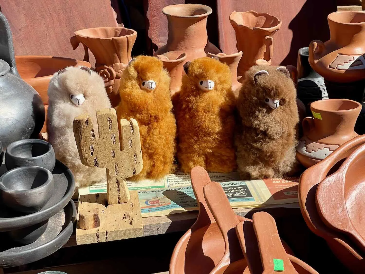
Unsurprisingly, the section of highway nearest to the Tropic of Capricorn monument was lined with vendors’ stalls, crammed full of souvenir items for passing travelers.

Roughly halfway through the day’s ride we stopped to grab some drinks at this colorful, roadside market. Uquía, Jujuy Province, Argentina. Copyright © 2019-2025 Pedals and Puffins.
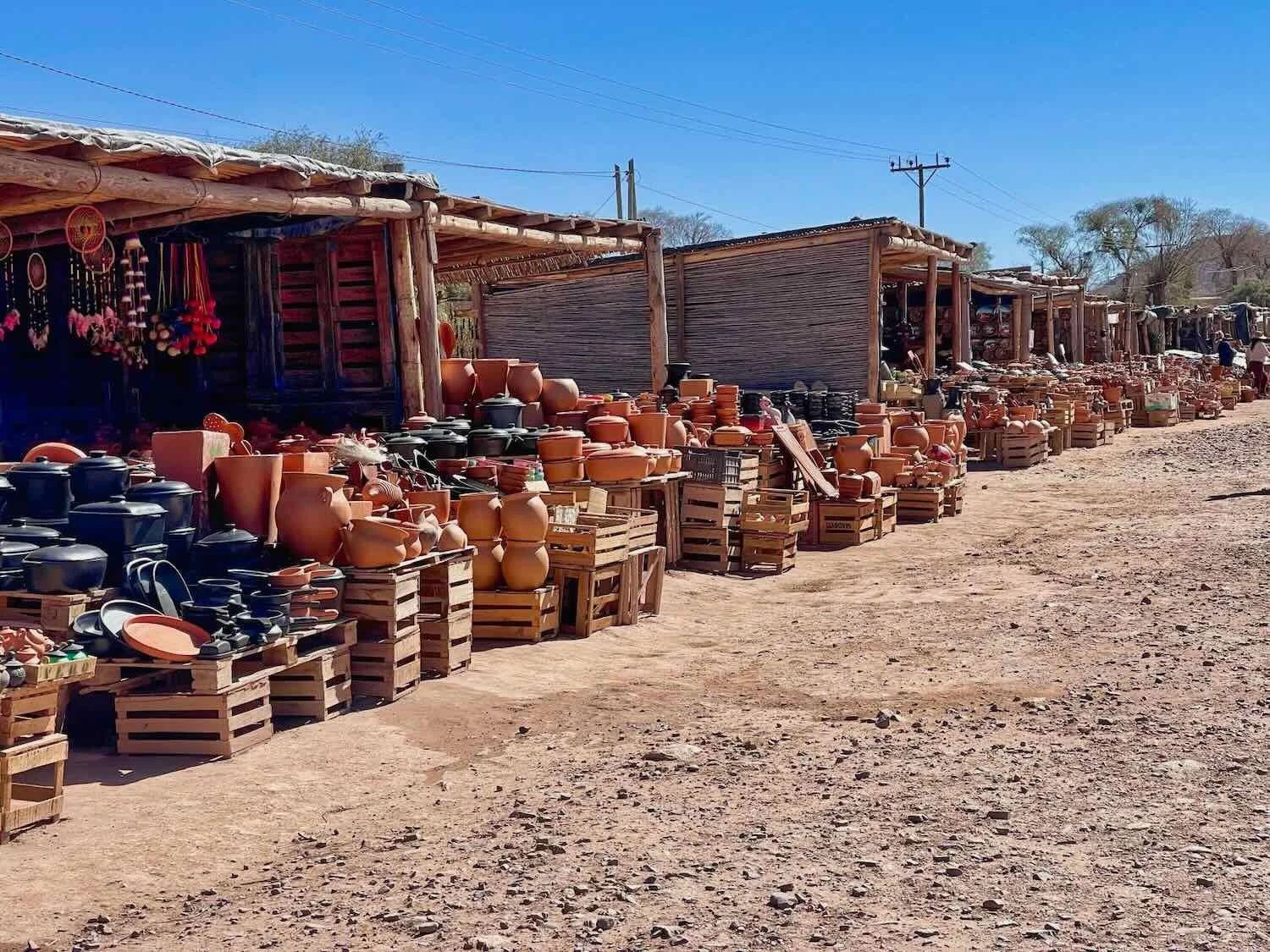
A bit further up the road we passed another tourist-focused business, with a giant statue of a llama outside to lure people in. Artisanal Pottery Market, N of Uquía, Jujuy Province, Argentina. Copyright © 2019-2025 Pedals and Puffins.
The Artisanal Pottery Market even had a few, live llamas on hand to encourage motorists to stop for a photo or two. N of Uquía, Jujuy Province, Argentina. Copyright © 2019-2025 Pedals and Puffins.
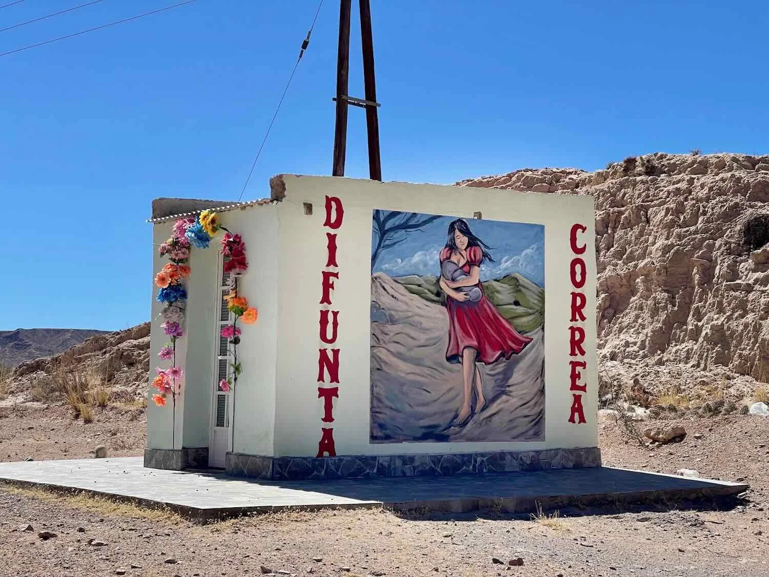
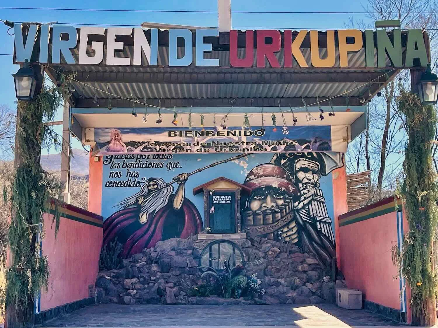
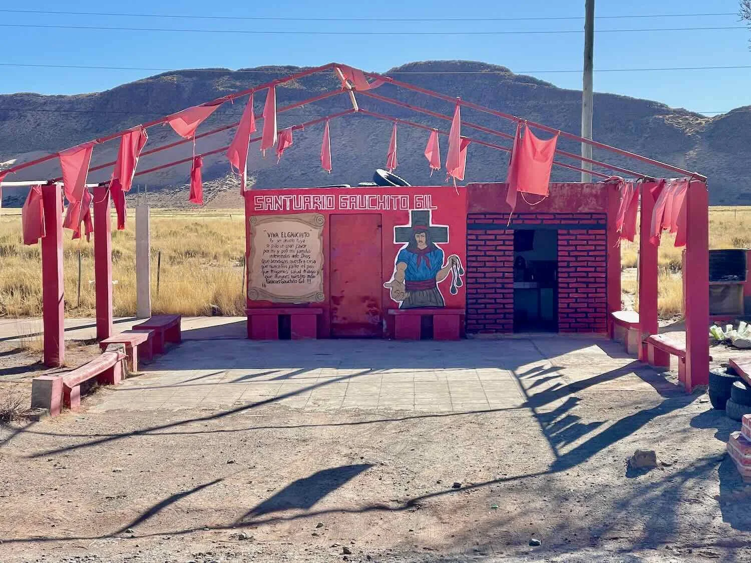
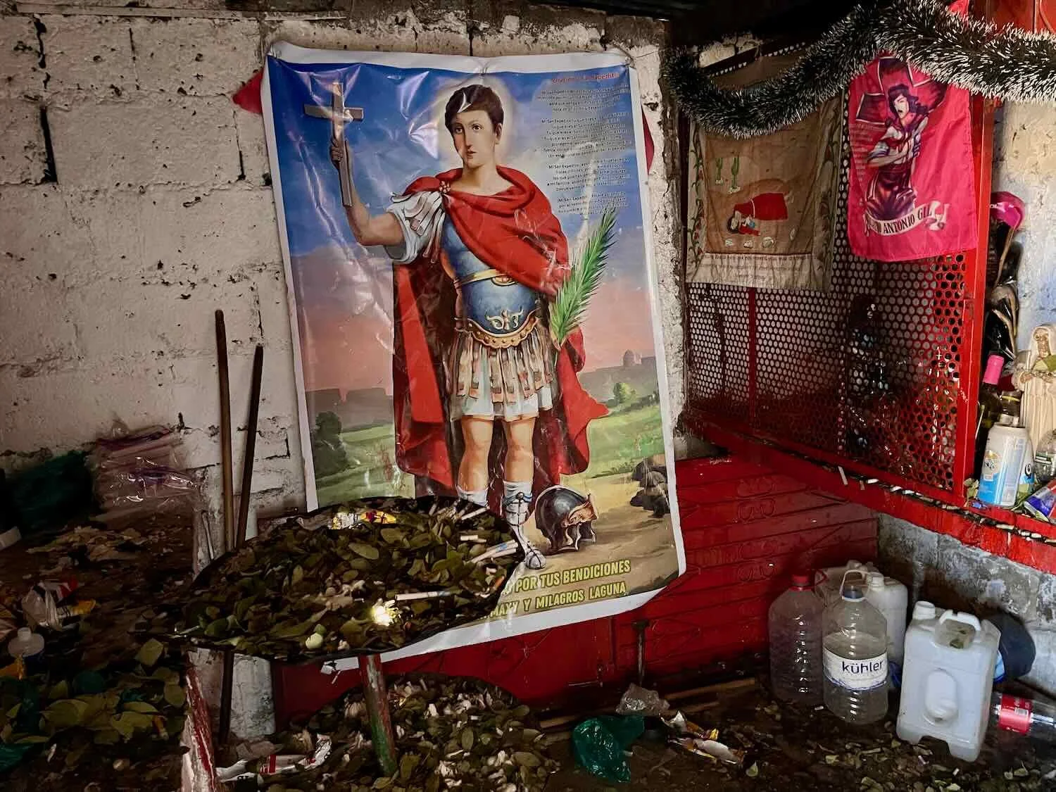
Throughout our travels in South America we had become accustomed to seeing many roadside shrines dedicated to folk saints. However, up to this point they had been, for the most part, modest structures just large enough for a miniature statue, some candles, and a few offerings. So it came as a bit of a surprise when we passed a handful of very large shrines along this stretch of the highway. All of them were big enough to serve as chapels, with room for devotees to go inside and offer prayers. These shrines were dedicated to a variety of different folk saints, and we wondered if there was some sense of competition among the faithful to build the most elaborate shrine for their preferred folk saint.
More Wind in Humahuaca
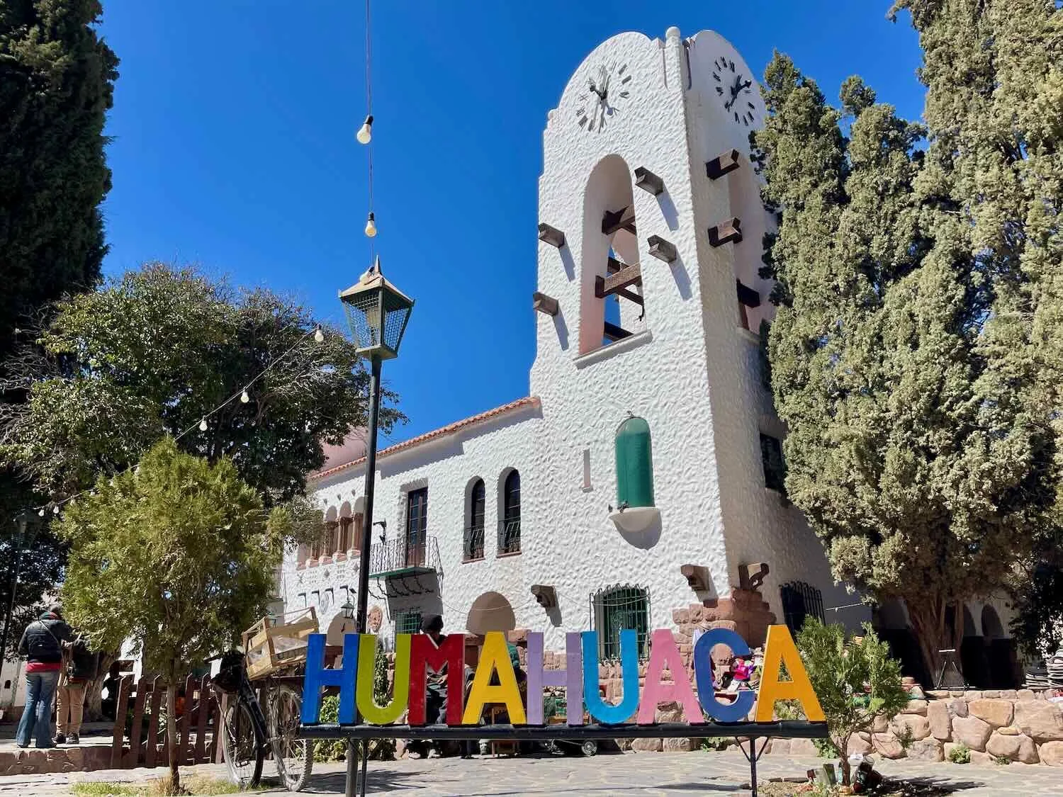
We arrived in the town of Humahuaca (pop. 10,500) in the late afternoon, and didn’t get fully settled into our cabin until after 5pm. Since leaving Tilcara we had gained another 2,000 ft (610 m) in elevation - bringing us up to 9,900 ft above sea level (3,000 m). With such a rapid ascent, PedalingGal was starting to feel the effects of the altitude, so we decided to take another rest day to give ourselves time to acclimate before climbing any further.
Our arrival in Humahuaca, a historically important trading town resting at an altitude of nearly 10,000 ft above sea level. Humahuaca, Jujuy Province, Argentina. Copyright © 2019-2025 Pedals and Puffins.
However, the next morning when we checked the weather we were in for a rude surprise. Another set of very windy days was approaching, with speeds up to 50 mph (80 kph). With nearly 3,000 ft (915 ft) of additional climbing just ahead of us, the prospect of vicious headwinds was not appealing. By 10:30am we had extended our stay in Humahuaca. That would keep us from killing ourselves.
Established in 1591, Humahuaca was for centuries one of the largest and most vibrant cities in northern Argentina due to its strategic location on the route between Peru and Buenos Aires. To this day its historic center retains a network of narrow, cobblestone streets and its culture is deeply rooted in indigenous traditions that have more in common with Bolivia than other parts of Argentina.
We spent the next four days enjoying the laid-back rhythms of this charming, colonial town. Each morning we went for a walk. But in the afternoons we hunkered down in our cabin, while the wind whistled and howled outside.
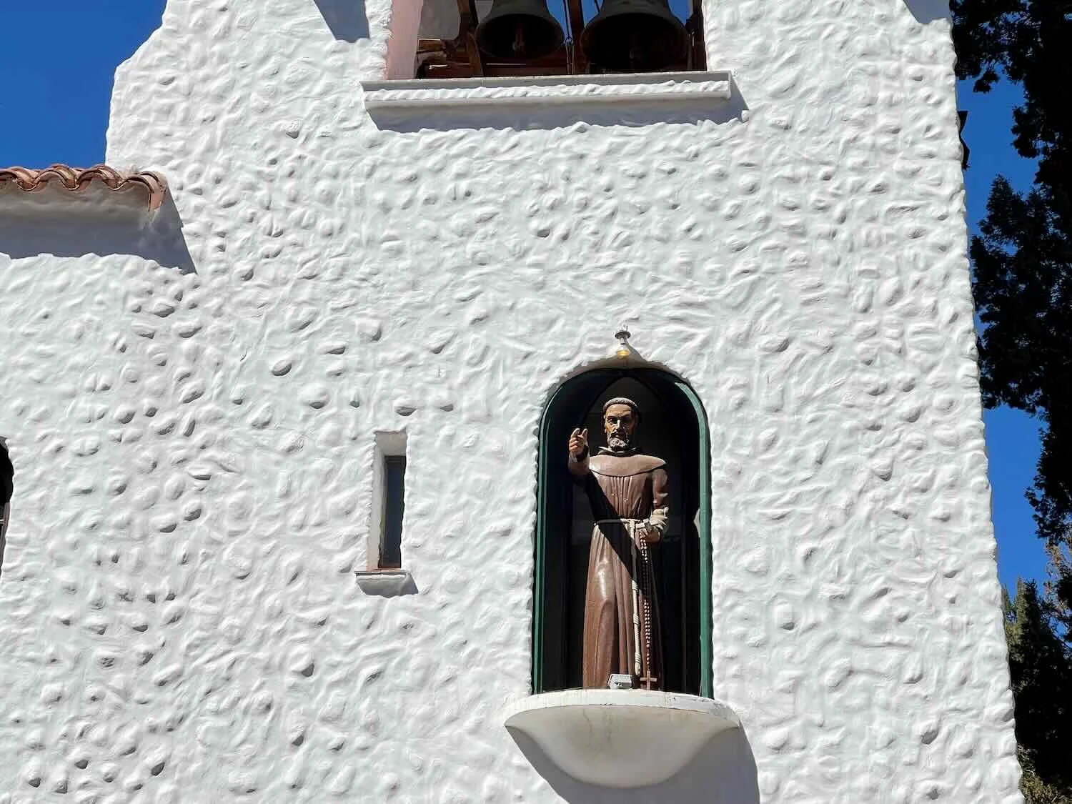
The town’s municipal council building dominated one side of the intimate central plaza, with an iconic bell tower that drew crowds each day at noon. At that moment, the bells chime, a couple of copper doors swing open, and a life-sized, animatronic statue of St. Francis emerges and makes a sign of the cross, blessing the witnesses in the plaza below.
There were lots of dogs in Humahuaca. This one kept a watchful eye on the street below his perch atop a store. Humahuaca, Jujuy Province, Argentina. Copyright © 2019-2025 Pedals and Puffins.
Some of the town’s free-roaming dogs wore jackets. We guessed that this was a way for the people who cared for the dogs to signify that they were affiliated with a human family, rather than one of the many free-roaming street dogs. Humahuaca, Jujuy Province, Argentina. Copyright © 2019-2025 Pedals and Puffins.
An artistic display honored corn’s role in Humahuaca’s cuisine. As in most of the Americas, corn has a long history as a staple food in this region. Corn-based soups, and corn-paste humitas (similar to tamales) are traditional meals that are still very popular. Humahuaca, Jujuy Province, Argentina. Copyright © 2019-2025 Pedals and Puffins.
The narrow, cobblestone alleys in the town’s historic center were lit with overhead lights at night. One could easily imagine it looking much the same hundreds of years ago. Humahuaca, Jujuy Province, Argentina. Copyright © 2019-2025 Pedals and Puffins.
The impressive Monument to the Heroes of Independence soars over the central plaza, from the top of a nearby hill. It honors the pivotal role the town played in several decisive battles for Argentina’s independence from Spain. Humahuaca, Jujuy Province, Argentina. Copyright © 2019-2025 Pedals and Puffins.
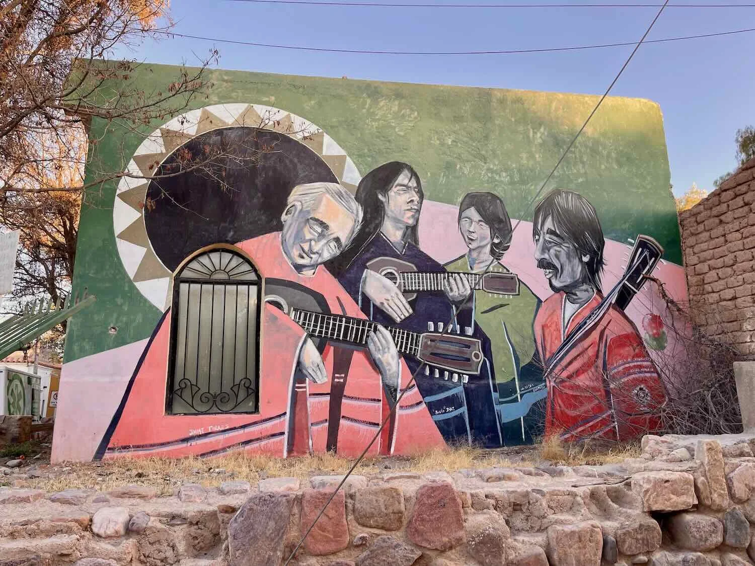
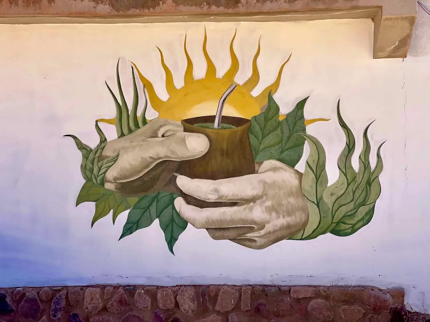
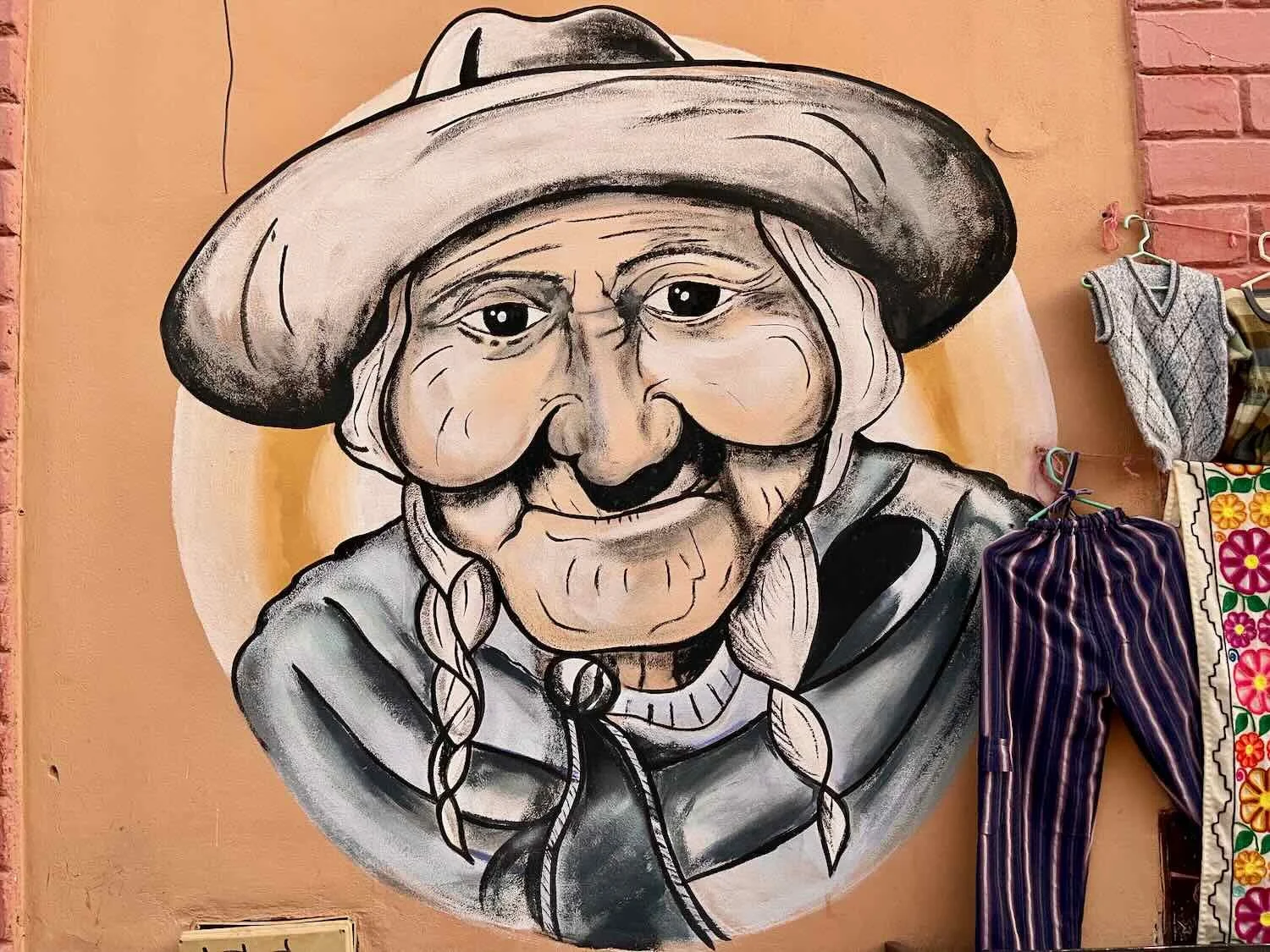
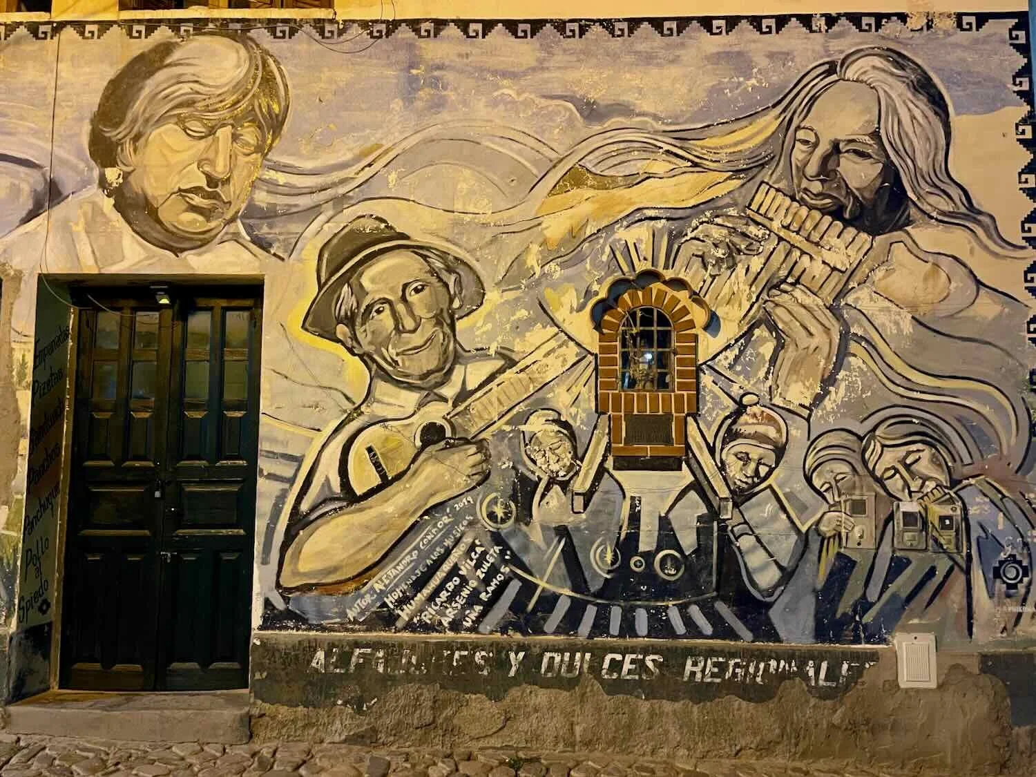
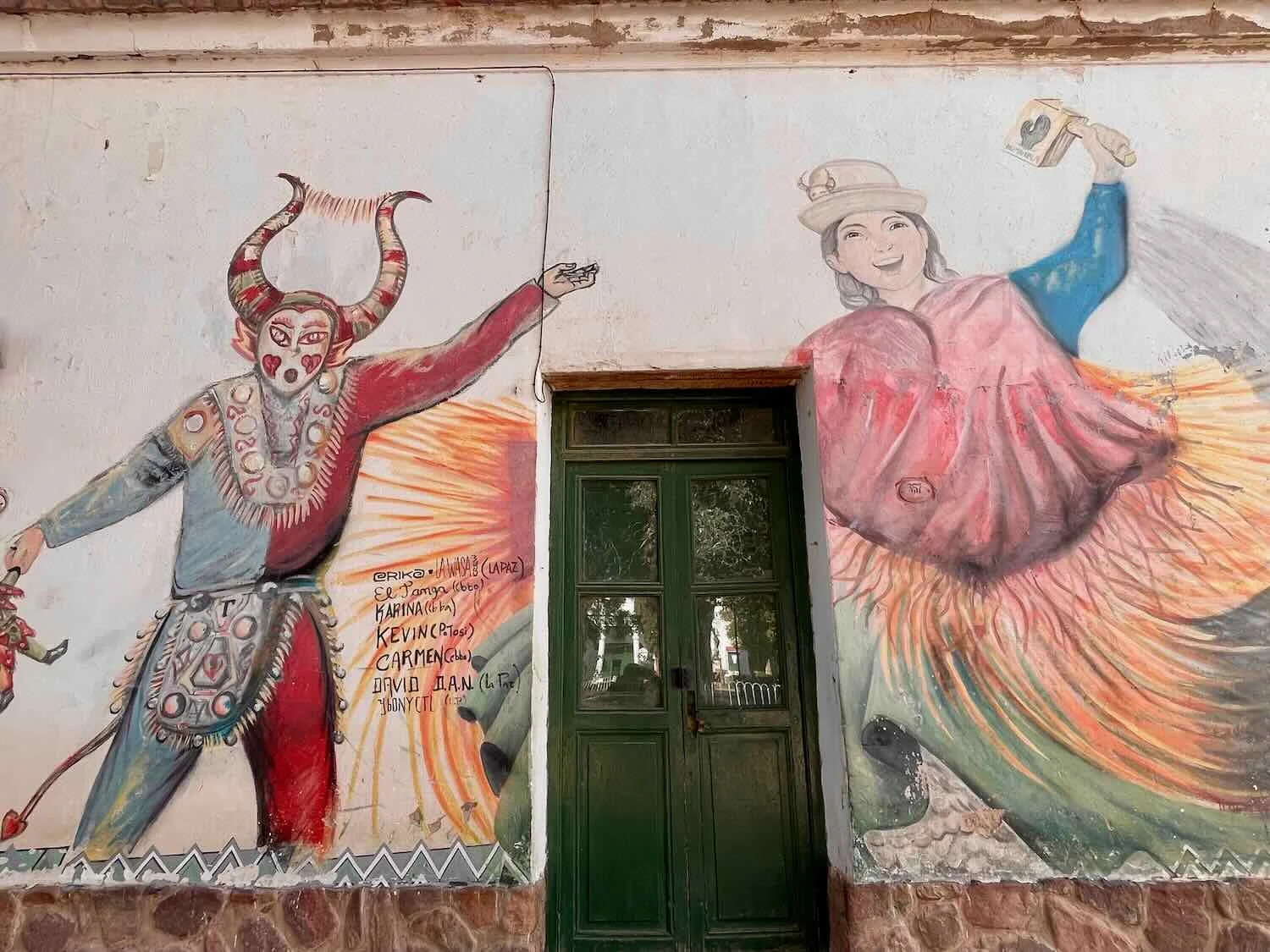
Murals scattered throughout the town paid homage to traditional music and local customs.
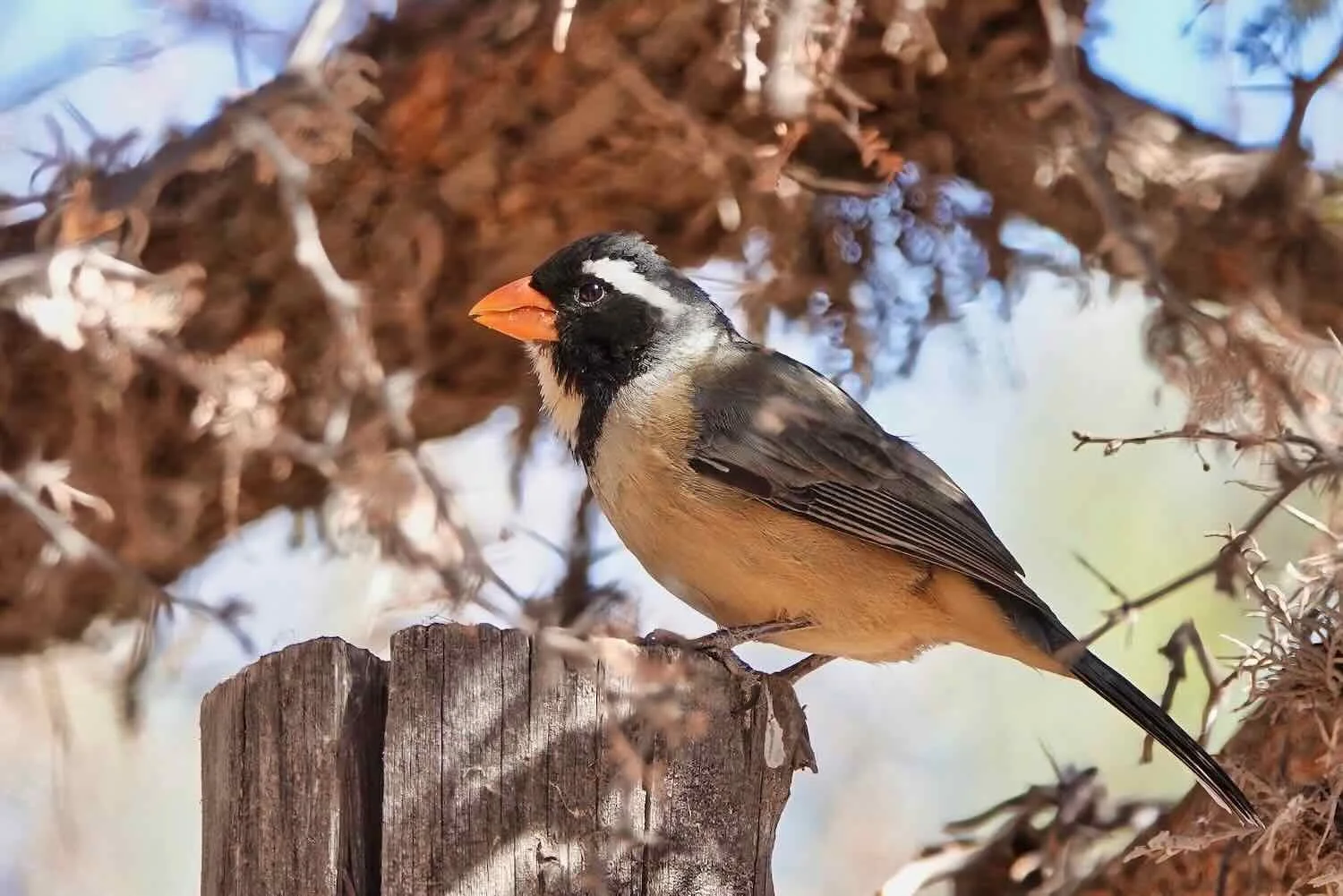
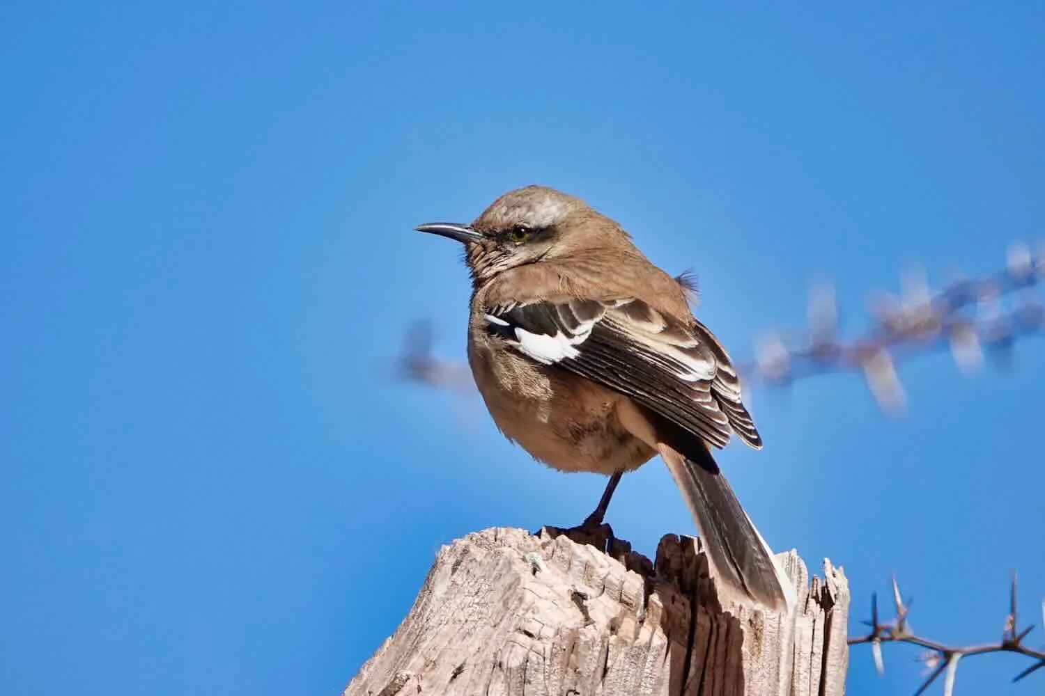
Just outside of town a trail led through the Peñas Blancas rock formation. On several mornings we enjoyed a walk among the white cliffs, checking out the local birds. Humahuaca, Jujuy Province, Argentina. Copyright © 2019-2025 Pedals and Puffins.
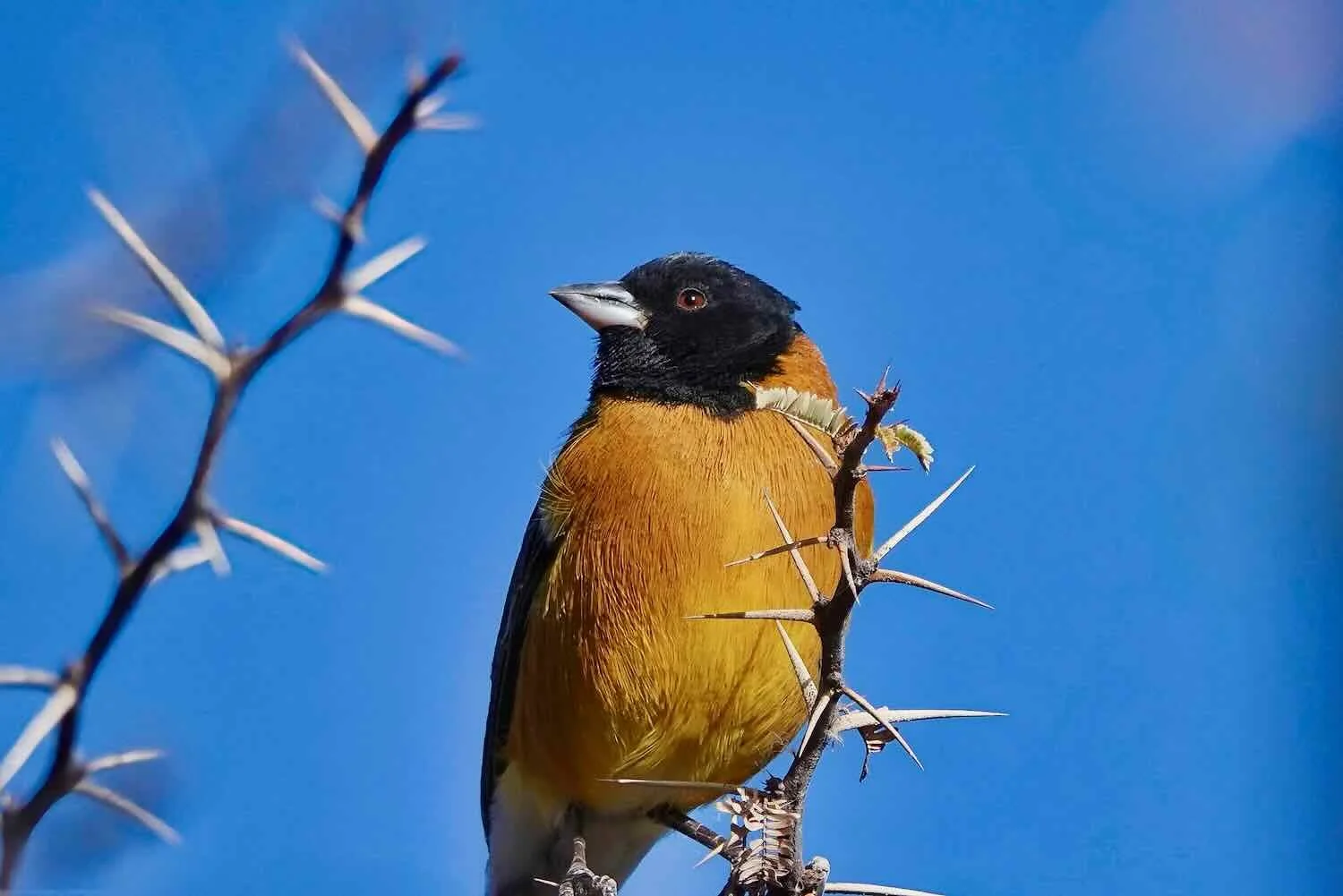
As the colorful mountains of the Humahuaca Ravine erode, they fill the valleys with an assortment of rainbow-colored pebbles. These multi-hued stones lined the bottom of a drainage gully near where we stayed. Humahuaca, Jujuy Province, Argentina. Copyright © 2019-2025 Pedals and Puffins.
The Final Climb Onto South America’s Altiplano
Since departing San Salvador de Jujuy we had climbed steadily up the Humahuaca Ravine, towards the headwaters of the Río Grande. The river is born on one of the most unique geological features in the Americas - the great South American Altiplano. And that was where we headed on our bicycles after departing Humahuaca.
The altiplano is the second largest, high-altitude plateau in the world (after the Tibetan Plateau). Daily temperature variations can be extreme, often characterized as “summer by day, winter by night.” Most of the landscape is covered with arid, montane grasslands known as puna, that are populated by llamas and their wild cousins, the vicuñas. The southern sections of the altiplano are the driest, with extensive salt flats marking the remnants of ancient, inland seas. Farther north there is enough rainfall to grow hardy crops like quinoa, potatoes, beets, drought-resistant varieties of corn, and other root crops that can grow despite the cold evenings and relatively little water.
But the biggest challenge for cyclists crossing the altiplano is the thin air. With an average elevation of 12,300 ft (3,750 m), there would be 40% less oxygen available than at sea level - making it that much more difficult to power our muscles. Over time our bodies would compensate by increasing respiration and heart rates to bring in more oxygen, and eventually would even increase the production of red blood cells. But even with acclimatization, the amount of oxygen available for strenuous exercise never quite seemed to be enough. Like any athletes operating at this altitude, we would have to adjust our expectations about how much we would be able to accomplish on any given day.
The day we left Humahuaca dawned very cold, with ice crystals encrusted on the little stream that ran down the road near our cabin. We bundled up in most of our clothes against the chill, morning air. But as luck would have it, our ride began with a steep climb out of town. That warmed us up quickly, and soon we were shedding layers of clothing in the bright, morning, sunshine.
Stopping to appreciate the view from the top of the first, big hill on our departure from Humahuaca, Jujuy Province, Argentina. Copyright © 2019-2025 Pedals and Puffins.
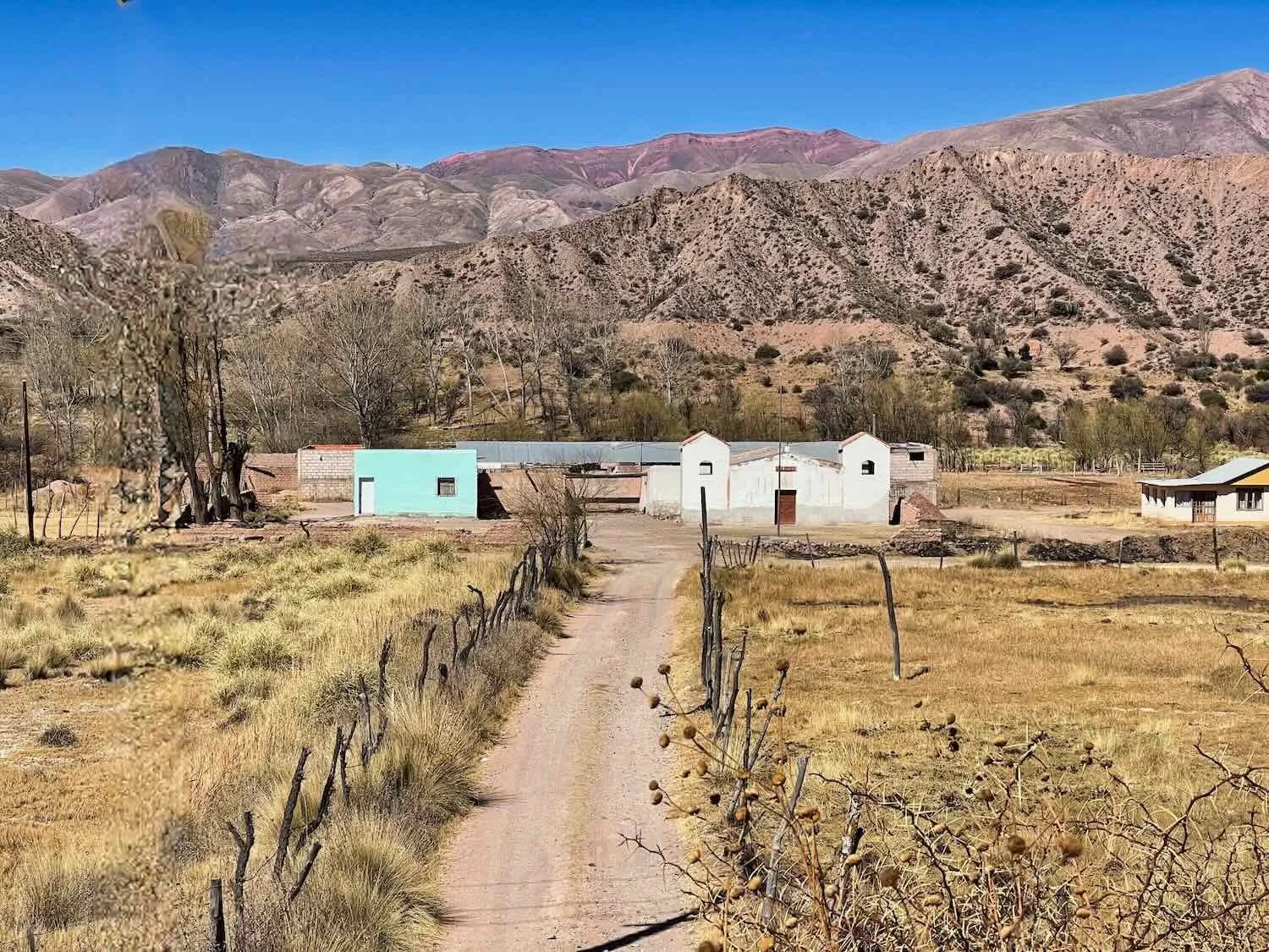
Over the course of the day the vegetation gradually shifted away from desert scrub to the puna grasslands. Soon the ground was covered with clumps of last year’s brown grasses and herbs, with occasional small herds of donkeys or horses.
For the first time in a while, the road traffic was very light and it was extremely quiet. Every so often we would pass a lone house among the hills. It seemed like a remote, lonely place to live. But the inhabitants probably appreciated the peace and quiet.
A family of donkeys kept an eye on us as we cycled by. N of Humahuaca, Jujuy Province, Argentina. Copyright © 2019-2025 Pedals and Puffins.
Looking back down the valley, toward the road that we had ridden below - as we slowly climbed the last few, thousand feet onto the altiplano. E of Azul Pampa, Jujuy Province, Argentina. Copyright © 2019-2025 Pedals and Puffins.
After about 5.5 hours of steady climbing, the Río Grande had become a small stream flowing swiftly through a narrow canyon. We found a nice camping spot within the canyon, tucked inside a nook within a high, gravel bank. It was protected from the wind on three sides, which was fantastic. Before pitching our tent we rested on some rocks in the sun, and out of the wind.
Up on the altiplano, the Río Grande ran through a narrow canyon. E of Azul Pampa, Jujuy Province, Argentina. Copyright © 2019-2025 Pedals and Puffins.
We found a lovely, protected spot to pitch our tent, among some red, gravel hills. Río Grande Canyon, E of Azul Pampa, Jujuy Province, Argentina. E of Azul Pampa, Jujuy Province, Argentina. Copyright © 2019-2025 Pedals and Puffins.
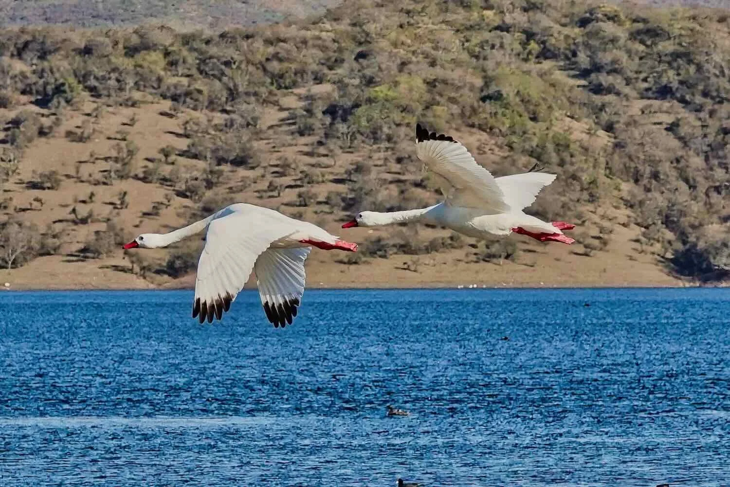
Down on the stream, a pair of Yellow-Billed Teal swam against the strong current. Río Grande Canyon, E of Azul Pampa, Jujuy Province, Argentina. Copyright © 2019-2025 Pedals and Puffins.
Towering, layered bluffs rose over the canyon not far from our campsite. Río Grande Canyon, E of Azul Pampa, Jujuy Province, Argentina. Copyright © 2019-2025 Pedals and Puffins.
That evening the sun went down early, dipping behind a nearby ridge by 6:30pm. It didn’t take long for the temperature to plummet to wintry levels. With temperatures expected to dip to around 12-13 degrees Fahrenheit (-10 to -11C) we bundled up and turned in early.
The next morning, all of our drinks were frozen solid. We had been warm enough when we went to bed. But some time in the darkness each of us woke up cold, and had trouble sleeping for the rest of the night. In truth, given how cold it was outside, it’s remarkable how warm we were. Although we felt chilled, we were never in any danger bundled in our warm sleeping bags.
However, getting out of bed in the morning was a pretty big challenge. The sky grew light, but the sun remained behind the lip of the canyon until 9:45am. Without the direct rays of the sun, the air in the canyon stayed bone-chillingly cold. We remained huddled in our sleeping bags until the sun finally rose high enough to shine on our tent and begin to spread its warmth. When we got out of the tent we noticed that the fast flowing stream we had camped next to was now frozen solid.
A 1.5L bottle of apple juice froze solid over night. Río Grande Canyon, E of Azul Pampa, Jujuy Province, Argentina. Copyright © 2019-2025 Pedals and Puffins.
Water seeping from the surrounding cliffs froze in lovely, icy cascades. Río Grande Canyon, W of Azul Pampa, Jujuy Province, Argentina. Copyright © 2019-2025 Pedals and Puffins.
Tired and thirsty (we were unable to drink any of our frozen fluids), we cycled just a half hour up the road to arrive at a tiny shop in the village of Azul Pampa (pop. <50). Fortunately, the man who ran the store was there when we arrived (he later left), so we were able to purchase some un-frozen drinks. We promptly settled in at a table in the sunshine for a breakfast of mostly-frozen, hardboiled eggs and protein bars - perfect for restoring our energy. But with all the delays, we didn’t really get our cycling under way until almost noon.
For the rest of the day we rode through wild, open country inhabited by llamas, goats and the occasional wild vicuña. Although we were officially out of the Humahuaca Ravine, there continued to be an abundance of colorful mountains.
One of the local llamas, crossing the road. W of Azul Pampa, Jujuy Province, Argentina. Copyright © 2019-2025 Pedals and Puffins.
The colorful hills surrounding our route. W of Azul Pampa, Jujuy Province, Argentina. Copyright © 2019-2025 Pedals and Puffins.
We knew we were on the altiplano when our altimeter told us we’d reached an elevation of over 12,300 ft (3,750 m). This was the highest we had cycled since the start of our journey across the Americas three years ago. W of Tres Cruces, Jujuy Province, Argentina. Copyright © 2019-2025 Pedals and Puffins.
As we neared the town of Abra Pampa, we were delighted by our first few sightings of wild vicuñas - the high-Andean ancestors of alpacas. S of Abra Pampa, Jujuy Province, Argentina. Copyright © 2019-2025 Pedals and Puffins.
Just south of the town of Abra Pampa was an interesting sight - a large patch of sand dunes covered the face of one of the mountain ranges. With a vertical drop of more than 800 ft (250 m), the Huancar Dunes apparently are a big draw for surfboarders. S of Abra Pampa, Jujuy Province, Argentina. Copyright © 2019-2025 Pedals and Puffins.
Layover in “The Siberia of Argentina”
With a nickname like The Siberia of Argentina, the town of Abra Pampa (pop. 10,900) doesn’t stand out as a prime tourist destination. But since we were still getting used to the altitude, we decided to take an another rest day there, anyway.
Located less than an hour’s drive from the Bolivian border, Abra Pampa had the feel of a working-class town that catered to truckers and shipping companies, surrounded by llama ranches. By and large the buildings were simple, and the aesthetic was utilitarian.
In the central square, the most prominent images represented two of the town’s economic drivers - llama herding (left) and shipping (right). Abra Pampa, Jujuy Province, Argentina. Copyright © 2019-2025 Pedals and Puffins.
Nearly all the buildings in town were simple, brick structures. Abra Pampa, Jujuy Province, Argentina. Copyright © 2019-2025 Pedals and Puffins.
Solar panels sat on top of one building (among an impressive jumble of wires). Abra Pampa, Jujuy Province, Argentina. Copyright © 2019-2025 Pedals and Puffins.
A statue in the main plaza depicting a bullfight seemed a bit out of place. Perhaps the image was meant to honor the virtues of bravery and confrontation with death - cultural touchstones in this harsh, somewhat remote landscape. Abra Pampa, Jujuy Province, Argentina. Copyright © 2019-2025 Pedals and Puffins.
A school group performed a cultural demonstration in the main plaza to honor the Pachamama (indigenous Earth goddess). Abra Pampa, Jujuy Province, Argentina. Copyright © 2019-2025 Pedals and Puffins.
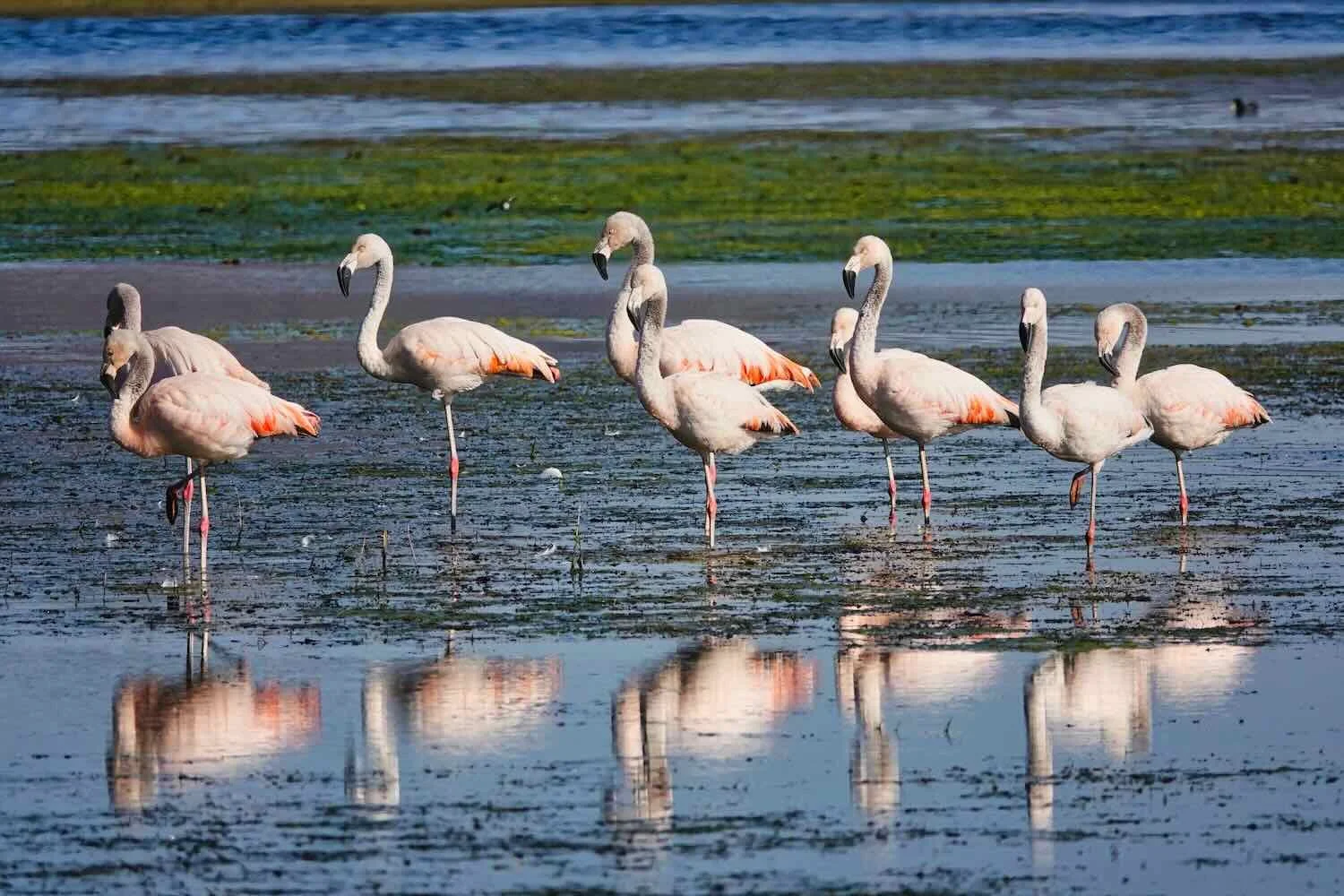
Just outside of town a small lagoon was full of altiplano water birds, including this James’s Flamingo. Abra Pampa, Jujuy Province, Argentina. Copyright © 2019-2025 Pedals and Puffins.
The Artisanal Cheese Capital
The next morning we were up and ready to go around 8:20am. But then we were stopped in our tracks. The temperature outside was still a brisk 26F (-3.5C) - a little too chilly to be appealing for cycling. Within a minute we decided to delay our departure. It was a good adjustment. When we hit the road 45 minutes later, the sun’s rays made it warm enough to be comfortable.
Before long we reached the village of Puesto del Marqués (pop. 330) - grandly (self) designated as the Artisanal Cheese Capital of Jujuy. Of course, we had to stop and try the cheese.
This sign declared the town of Puesto del Marqués to be the Artisanal Cheese Capital of Jujuy. Puesto del Marqués, Jujuy Province, Argentina. Copyright © 2019-2025 Pedals and Puffins.
Across the highway from the sign that declared this auspicious title was a little tienda advertising artisanal cheese for sale. Margarita, the woman who ran the store, turned out to be one of the sweetest, kindest people we had met. Many people in this region are relatively reserved but Margarita was very outgoing. She asked us where we were from - which is a pretty typical question. But when she learned we were from the United States she revealed that she really liked the way English sounds - and that she had always wished she could speak it better. Pretty soon she was charming us with the few phrases she knew, like Hello, Good-bye, and How are you? With each expression, she would beam with delight when we understood what she was saying and she could understand our replies.
Since we were purchasing cheese, she then asked us how to say “queso” in English. When we explained that “say, cheese” is also used in English to get people to smile for a photo, she got a big kick out of that. Before we left she gifted us with two, beautiful apples, and we got several photos together, with everyone saying, “Cheese!”
Our new friend, Margarita, saying, “cheese!” for the camera. Puesto del Marqués, Jujuy Province, Argentina. Copyright © 2019-2025 Pedals and Puffins.
For the remainder of the day we cycled through huge pastures populated by herds of cows, llamas, sheep and goats. N of La Intermedia, Jujuy Province, Argentina. Copyright © 2019-2025 Pedals and Puffins.
This chapel marked one of the few human settlements along the way. La Intermedia, Jujuy Province, Argentina. Copyright © 2019-2025 Pedals and Puffins.
In Sight of Bolivia - La Quiaca, Argentina
By mid-afternoon we arrived in the bustling town of La Quiaca (pop. 22,080) which is on the border of Bolivia and Argentina. We were pleasantly surprised to discover that La Quiaca had much more vibrant feel than we had expected. In our experience, border towns often have a somewhat transient and seedy feel - not the kind of place you would want to spend much time. But if you didn’t know you were near an international border, La Quiaca would come across as a fairly normal town with lively shops and pretty good infrastructure.
We had originally planned to spend just one night in La Quiaca, but several factors conspired against us. Once again, the wind was whipping up to crazy levels. On top of that, we both came down with a nasty cold that plugged our sinuses and made breathing difficult (not a great development given we were still adjusting to the thin, high-altitude air). It helped that we had a comfortable, spacious hotel room where we could wait for a better weather window and recover our strength. Before we knew it, we ended up spending a week in La Quiaca. Here are some photos from our time in this welcoming border town.
As the northernmost town on two iconic Argentinian highways (Route 40 and Route 9), La Quiaca occupies a fabled spot in the national imagination - much the same way that Ushuaia is regarded as the southernmost city. As if to drive home that point, La Quiaca had its own share of “distance marker” signs, listing the kilometers from here to well-known destinations - including Ushuaia (Argentina) and Alaska (USA). La Quiaca, Jujuy Province, Argentina. Copyright © 2019-2025 Pedals and Puffins.
Perhaps the town’s most striking building was the Our Lady of Perpetual Help church, built entirely of stone, with red-brick details. La Quiaca, Jujuy Province, Argentina. Copyright © 2019-2025 Pedals and Puffins.
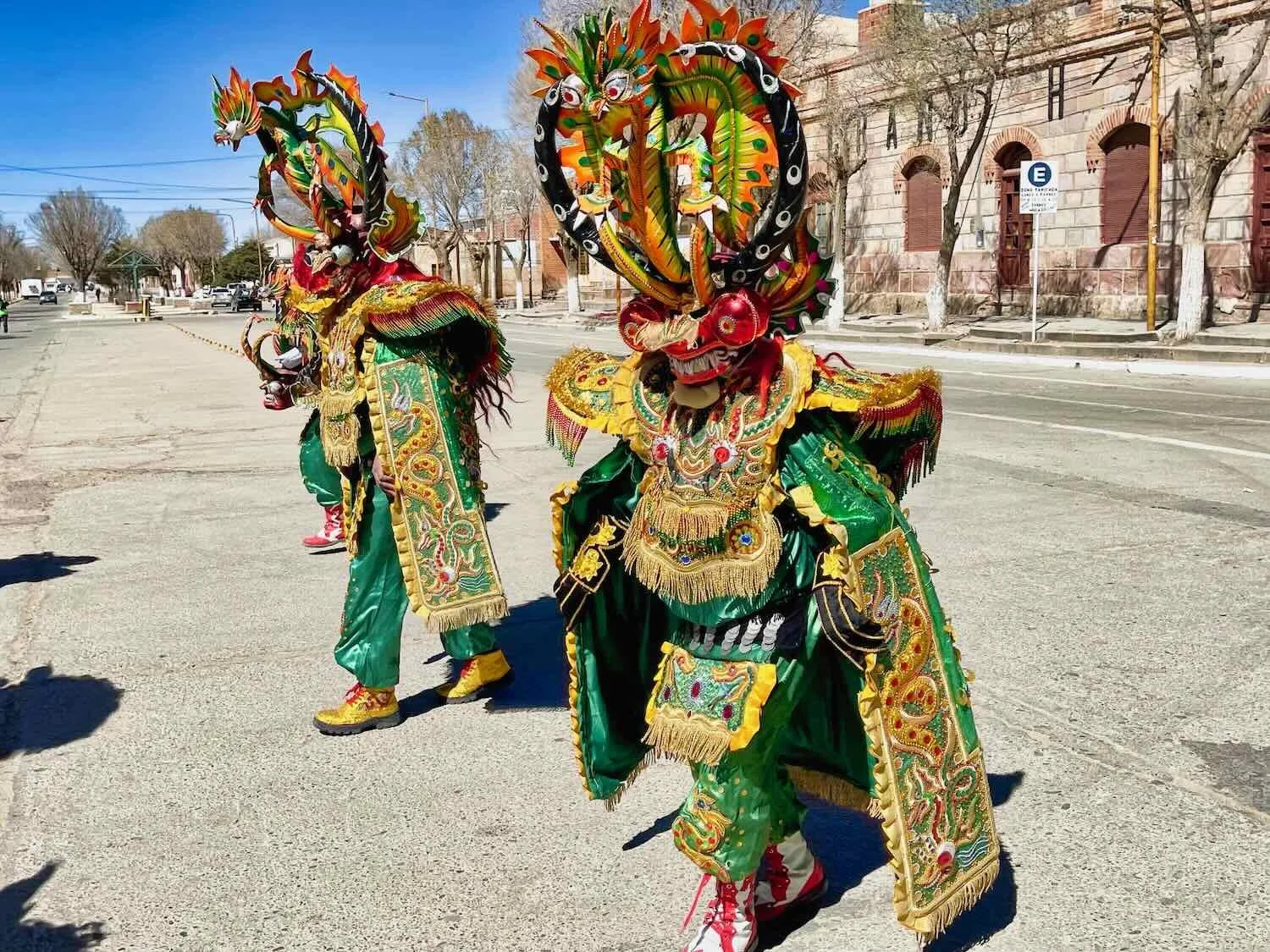
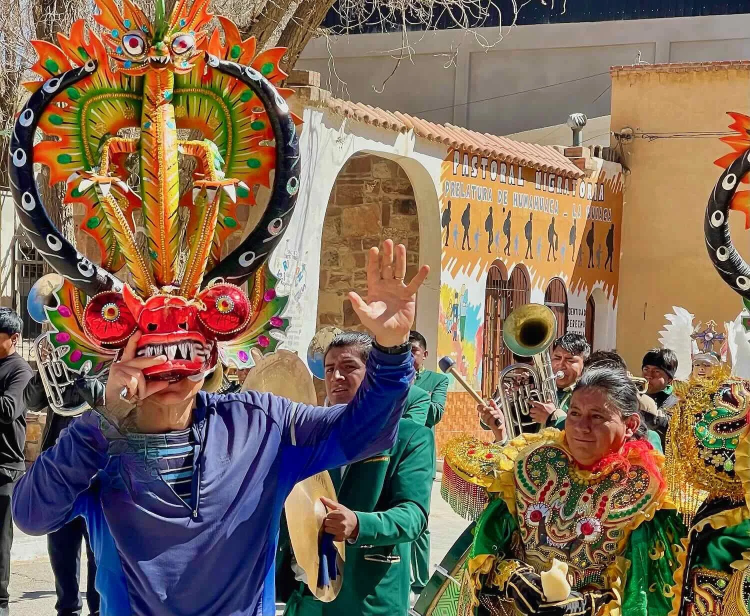
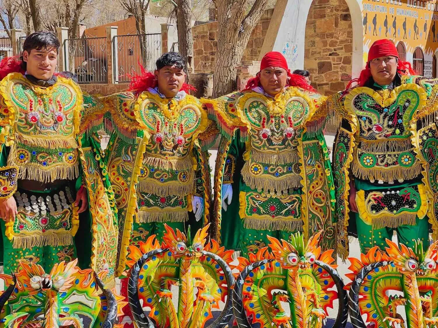
The day after we arrived in town, the Church hosted a celebration for the Virgin of Copacabana. Her image was displayed outside the church, then carried through the streets followed by a small, but colorful parade. Here, a troupe of traditional gaucho dancers stands guard over the Virgin’s image. La Quiaca, Jujuy Province, Argentina. Copyright © 2019-2025 Pedals and Puffins.
A band from the town of Villazon, Bolivia, had come across the border to participate in the Virgin of Copacabana’s procession. La Quiaca, Jujuy Province, Argentina. Copyright © 2019-2025 Pedals and Puffins.
Traditional Bolivian dancers in the procession for the Virgin of Copacabana. La Quiaca, Jujuy Province, Argentina. Copyright © 2019-2025 Pedals and Puffins.
Trade with Bolivia was a big part of the economy in La Quiaca. However, the exporters could apparently avoid taxes by not using motorized trucks - leading to a system where nearly all goods were carried across the border by people pushing hand carts. In this photo the hand-cart operators were waiting in a staging area to load up their carts, for delivery across the border. La Quiaca, Jujuy Province, Argentina. Copyright © 2019-2025 Pedals and Puffins.
There was even a special bridge across the border that was reserved for use only by the hand-cart operators. A steady stream of people raced (often running) across the bridge with fully-loaded carts, then hurried back with empty carts to get another load. We’d never seen anything quite like it in all our international travels. La Quiaca, Jujuy Province, Argentina. Copyright © 2019-2025 Pedals and Puffins.
A mural in town celebrated some of the wildlife native to the altiplano. La Quiaca, Jujuy Province, Argentina. Copyright © 2019-2025 Pedals and Puffins.
Farewell to Argentina
As of our final day in La Quiaca, we had spent a total of nine months in Argentina - more than we had spent in any other country on our 3-year cycling odyssey that began on the shores of the Arctic Ocean. (Mexico came close, with just seven fewer days than our time in Argentina.) Part of the time we were recovering from a bicycle accident in Buenos Aires, but it’s also a testament to the country’s impressive length. For those readers from North America or Europe, it can come as a bit of a surprise just how enormous Argentina really is, especially running south to north.
Argentina (in pink overlay on the maps) is one of the longest countries in the world, measured from south to north (see comparisons to North America and Europe, above). No wonder it took us a long time to bicycle from Tierra del Fuego (in the south) to the northern border. Images created with thetruesize.com. © 2022 The True Size.
Along the way we enjoyed high culture and world-class wine in metropolises like Buenos Aires and Mendoza, visited the frigid, southernmost city of the world (Ushuaia), battled raging headwinds on the remote pampas, and explored the red-rock canyons of the country’s high deserts. With each mile we grew more enchanted by this rugged land, whose warm-hearted residents welcomed us at every stop - eager to share their culture and traditions. It’s fair to say that we had fully adapted to the rhythms of life in Argentina. Many things that had once seemed unusual now felt familiar.
Yet from this out-of-the-way corner on the altiplano, our bicycle journey would now take us onward into Bolivia, with a fresh set of customs, challenges and adventures. As we rode deeper into the land of the llama, we relished the opportunity to explore a new and different region of the Americas.
A massive statue at the entrance to a municipal park was a reminder that we were now deep within the altiplano - the land of the llama. La Quiaca, Jujuy Province, Argentina. Copyright © 2019-2025 Pedals and Puffins.