Cycling the Pan-American Highway in Ecuador, Part 2: Quito to Tulcán
31 May- 11 June 2026
31 May - Quito to Tababela (23.4 mi, 37.7 km)
1 June - Tababela to Guachalá (27.2 mi, 43.8 km)
2 June - Guachalá to Otavalo (23.3 mi, 37.5 km)
3-4 June - Layover in Otavalo
5 June - Otavalo to Ambuquí (38.7 mi, 62.3 km)
6 June - Ambuquí to Bolívar (19.8 mi, 31.9 km)
7 June - Bolívar to San Pedro de Huaca (18.8 mi, 30.3 km)
8-9 June - Rain Days in Huaca
10 June - San Pedro de Huaca to Tulcán (17.4 mi, 28 km)
11 June - Layover in Tulcán
The Best Bike Route Out Of (or Into) Quito
Prior to our arrival in Quito, we had heard that there was a good bike path into the city from the east. According to the rumors, it offered more than 20 miles (32 km) of traffic-free cycling across much of the urban chaos. Given how stressful our bike ride into Quito from the south had been, we were eager to find this route and use it for our departure from the city. Furthermore, some have claimed that it is one of the most beautiful urban trails in South America. No traffic and lots of scenery. We were all in.
Known as the Chaquiñán Ecological Route, the trail actually starts in an eastern suburb of Quito, rather than in the city center. Consequently, we did have to ride through roughly six miles (9.5 km) of city roads to get there. But since we left on a Sunday morning, the traffic wasn’t bad.
Before setting out, we were a bit nervous about a mile-long, highway tunnel that we would have to pass through before reaching the trail. Yet even that turned out to be easy enough. A full lane of traffic had been blocked off inside the tunnel, giving us our own lane for cycling, protected from the speeding cars. From the tunnel, our route plunged 1,200 ft (365 m) into the suburb of Cumbayá, where the trail began.
A giant sculpture of an Andean Condor greeted us as we exited from the Guayasamín Tunnel, ready to soar across the valley below. Quito, Pichincha Province, Ecuador. Copyright © 2019-2026 Pedals and Puffins.
After 45 min we arrived at the entrance to the Chaquiñán Trail, and were immediately impressed. A sturdy “portal” marked the entrance, complete with a water fountain, restroom, and guard house. The guard on duty greeted us warmly and chatted with us about the trail, wishing us safe travels as we rode away.
A sign near the start of the Chaquiñán Ecological Route in Cumbayá Parish. Quito, Pichincha Province, Ecuador. Copyright © 2019-2026 Pedals and Puffins.
The Chaquiñán Ecological Route follows an old railroad grade that once connected northern Ecuador to Quito. It is a dirt trail now, with the sections near Quito being “good dirt” suitable for narrow tires. But it becomes increasing rough, and not as suitable for road bikes, the further from Quito you ride. Luckily, there are plenty of bailout points along the way in case the terrain becomes too rugged for whatever bike you may be riding.
Rolling through a mix of small towns, residential gardens, and natural areas, the trail is very popular with local families, runners and cyclists, especially on weekends. That Sunday, we encountered lots of other people on the parts of the trail closest to Quito, although it thinned out noticeably after a couple of hours, as we got farther from the city.
Our path from the La Carolina neighborhood of Quito along the Chaquiñán Ecological Route, which followed an old railroad grade to provide a peaceful, (mostly) car-free exit from the city. Pichincha Province, Ecuador. (Map by Pedals and Puffins, using Ride with GPS)
Along the trail we passed this historic train station, complete with a mural of an old-fashioned, steam train. Chaquiñán Ecological Route, Tumbaco Parish, Quito, Pichincha Province, Ecuador. Copyright © 2019-2026 Pedals and Puffins.
Between suburbs the trail passed a couple of big river valleys, with hardly any human development. These are the views that lead people to claim that the Chaquiñan Ecological Route is one of the prettiest urban trails in South America. Río Chiche Canyon Overlook. Puembo Parish, Quito, Pichincha Province, Ecuador. Copyright © 2019-2026 Pedals and Puffins.
In several places we cycled through the old railroad tunnels. For the most part, they were short enough to ride through without a light. The well-maintained surface of the trail was so smooth that we didn’t have to worry about hitting any potholes or rocks, even in the dark tunnels. Chaquiñán Ecological Route, Puembo Parish, Quito, Pichincha Province, Ecuador. Copyright © 2019-2026 Pedals and Puffins.
One section of trail descended into a steep-walled river valley. The trees along the route provided plenty of shade, which kept the afternoon cycling comfortable. Río Chiche Canyon. Chaquiñán Ecological Route, Puembo Parish, Quito, Pichincha Province, Ecuador. Copyright © 2019-2026 Pedals and Puffins.
Even on the more remote sections of the trail, each road crossing was framed by a well-maintained “portal”, with a water fountain, benches, a bathroom and guard house. La Lomita Gate. Chaquiñán Ecological Route, Puembo Parish, Quito, Pichincha Province, Ecuador. Copyright © 2019-2026 Pedals and Puffins.
Around four hours into the ride, the trail surface became more rugged. Instead of a wide, well-groomed path there were sections of double-track with grass between the ruts. At that point, nearly all the other cyclists disappeared, and we had the trail mostly to ourselves (plus a few, local walkers). Even then, the riding wasn’t difficult, especially since that section of the trail was fairy flat.
With just a half mile to go before reaching the highway, we came upon a tunnel that was long enough that we couldn’t see the end. We tried cycling into the tunnel without our headlights, because we didn’t feel like digging them out of our panniers at that point. However, we quickly found ourselves in total darkness and could not see each other, our bikes, or any light in front or behind us. We quickly backtracked to the entrance to consider our options.
As we stood near the tunnel entrance pondering how best to proceed, two guys on mountain bikes zoomed towards us. However, just before the tunnel they ducked off the main trail onto a single-track that descended precipitously down a steep hill into the valley. Not knowing how long the tunnel was, and too lazy to get out our headlights, we decided to follow them.
That proved to be a bit of a challenge. The path cut sharply downhill, with vegetation crowding in on both sides, scraping our legs. Then we had to climb back out of the ravine and over the mountain that the tunnel went through. The path was so steep that the only way forward was to get in our absolute lowest gear - in other words, dismounting our bikes and pushing them up and over the mountain. It was slow, hard work during which our determination to not get out our lights and go through the tunnel was reevaluated many times. The decision looked increasingly foolish the more pushing and out of breath we became.
Once we reached the Pan-American Highway it was just a short, five minute ride to our lodging for the night. Looking back, we were astonished at how much better the Chaquiñan Trail was than our previous route into the city. The ability to ride on a quiet, protected path nearly all the way across Quito’s sprawling metropolitan footprint was fantastic. Cyclists going to or from Quito should definitely make it a priority to find their way onto the Chaquiñan Ecological Route. Just be sure to have your headlight handy so you can ride through the long tunnel.
Arrival at the Equator (Finally)
Just shy of two years ago we were in Colombia, cycling southward towards the equator. However, with roughly a month of cycling to go before reaching that imaginary line around the waistline of the earth, disaster struck when PedalingGal had a serious bicycle accident. Our southward progress ended in Colombia.
After a couple months of recovery in Colombia and Argentina we restarted cycling, this time going north from Ushuaia, Argentina. Fast forward two years of cycling northward, and finally we were approaching the equator again - this time from the south.
Early in the day we passed several interesting statues marking the entrance to towns. And on one particularly notable billboard, a shaman advertised his repertoire of spiritual services - not something you see often. The diverse list included everything from curing illnesses (both known and unknown), to love rituals, good luck cleansings, and fortune telling - something for everyone.
This statue of an Andean Condor marked the entrance to the town of Yaruquí. Throughout the Andes condors are symbols of strength, protection, and a connection between the earthly and spiritual worlds. Yaruquí, Pan-American Highway, Pichincha Province, Ecuador. Copyright © 2019-2026 Pedals and Puffins.
One of the most important pilgrimages in northern Ecuador leads roughly 800,000 people to walk from northern Quito to the Sanctuary of the Virgin of El Quinche each November. This cross with the image of a shepherd and his flock greets arrivals to the town of El Quinche. Pan-American Highway, Pichincha Province, Ecuador. Copyright © 2019-2026 Pedals and Puffins.
Throughout the Andes, local communities easily mix both modern practices and indigenous traditions. This highway billboard advertised the services of a shaman, offering traditional cures for a wide range of ailments. Yaruquí, Pan-American Highway, Pichincha Province, Ecuador. Copyright © 2019-2026 Pedals and Puffins.
In some areas the roadside was brimming with the tall stalks of Lion’s Ear flowers in bloom. Native to tropical Africa and India, the plant is considered invasive in Ecuador, often colonizing roadsides and river banks. N of El Quinche, Pan-American Highway, Pichincha Province, Ecuador. Copyright © 2019-2026 Pedals and Puffins.
By the time we rolled into the village of Guachalá (pop. <500) we had actually cycled across the equator twice already. That’s because the road we were on weaved back and forth while heading eastward, briefly curving north of the equator before heading back to the south. But there weren’t any markers along the side of the road to commemorate those crossings. And despite the fact that the equator seems hugely significant in concept, you really don’t feel that different on one side of “the line” vs the other. So it wasn’t until we reached Guachalá that our “crossing of the equator” became official.
Although the village where we stayed was known as Guachalá, it’s not an officially-recognized town in Ecuador. It’s actually the site of a former hacienda of the same name, which was the first (and one of the biggest) colonial haciendas in the country. The town’s welcome sign referred instead to Cangahua, the name of the parish that surrounds Guachalá. Pan-American Highway, Pichincha Province, Ecuador. Copyright © 2019-2026 Pedals and Puffins.
However, once we reached Guachalá, there were numerous reminders that we had made it to the dividing line between the southern and northern hemispheres. There were references to the equator everywhere. The centerpiece was a low-key monument, right in the center of town, that had a line in the ground marking the equator. Unlike other, more famous monuments which are actually situated pretty far off of the true equator, they say that this one was positioned using GPS and actually sits within 5-10 meters of the true equatorial line.
References to the equator were everywhere in town. The sign on this building includes a reference to 0°0’0” - the zero latitude line - and calls Guachalá “The Center of the World.” Guachalá, Pan-American Highway, Pichincha Province, Ecuador. Copyright © 2019-2026 Pedals and Puffins.
PedalingGal even had the chance to straddle the hemispheres, with one foot on each side of the equator line. Guachalá, Pan-American Highway, Pichincha Province, Ecuador. Copyright © 2019-2026 Pedals and Puffins.
While we were visiting the Equator Monument, we noticed a couple of bicycles parked outside a nearby cafe with big touring bags attached. So after we had taken the memorial photos, we went over to introduce ourselves to the cyclists.
Jojo and Johann (from Germany) were just starting their tour of South America, and had only been on the road for about a week. We chatted for quite a while, sharing information about the road ahead. They were planning to cycle all the way to Tierra del Fuego (Argentina), so they had a lot of questions. Interestingly, after we mentioned the recent dog bite that PedalingGal’s pannier received, they showed us how one of their panniers also had to be patched because of a dog bite before they entered South America. Apparently there are crazy dogs in Eurasia, too.
They were sweet and congenial, and we really enjoyed meeting them. But they were not going to spend the night in Guachalá, so eventually we said good-bye, and they pedaled away.
Biscuits for Breakfast
About an hour into the next day’s ride, we rolled into a mountain town that was all about biscuits. It seemed like every other business along this part of the Pan-American Highway advertised that they sold Cayambe Biscuits (Bizcochos de Cayambe), a regional specialty which takes its name from the town. Although virtually unknown outside of Ecuador, the biscuits are a genuine culinary icon within the country. For anyone traveling northward from Quito, stopping to pick up some biscuits in Cayambe is a time-honored tradition.
It was approaching breakfast time, so the obvious choice for us was to stop and sample these local legends. In addition to eggs and juice, our breakfast included a classic Cayambe spread of some biscuits, local cheese, and hot chocolate (for dipping). Descriptions of the biscuits emphasize their buttery flavor and light, crunchy texture, and our bizcochos met both criteria - staying crunchy even after dunking in the hot chocolate. To be honest, they strongly reminded us of the taste and consistency of Goldfish crackers, minus the cheesy flavor.
Well over half of the shops in Cayambe were involved in the biscuit business. This one’s sign proclaimed that it was a Biscuit Factory - complete with a smiling biscuit mascot. A place that size would be able to produce a lot of biscuits for passing travelers. Cayambe, Pan-American Highway, Pichincha Province, Ecuador. Copyright © 2019-2026 Pedals and Puffins.
Our traditional Bizcochos de Cayambe breakfast included four biscuits, fresh local cheese, and hot chocolate (for dipping). Cayambe, Pan-American Highway, Pichincha Province, Ecuador. Copyright © 2019-2026 Pedals and Puffins.
Hide-and-Seek With Volcanos
Another of Cayambe’s claims to fame is that it shares its name with Ecuador’s third-tallest volcano. Sitting just 10 miles (16 km) to the east of town, the snow-covered peak of the Cayambe Volcano can often be seen from the highway. Yet although it was a lovely, clear day, the volcano remained stubbornly hidden behind a layer of clouds. We could just make out its shape, but never got a clear look.
We got a kick out of this exuberant slide in a city playground. Hidden behind the bank of clouds to the left of the “cap” was the snow-capped peak of the Cayambe Volcano, which never revealed itself to us that day. Yaznan Park, Cayambe, Pan-American Highway, Pichincha Province, Ecuador. Copyright © 2019-2026 Pedals and Puffins.
After a long, rocket-fast descent off of the day’s high pass, our luck with the volcanos improved. Looming ahead of us was the dual-cone profile of the Imbabura Volcano - the protector spirit of the region.
At “just” 15,212 ft (4,609 m) in elevation, the mountain is considerably lower than giants like Cotopaxi or Cayambe, and it doesn’t support year-round snow. However, it was still one of the more impressive massifs we encountered along Ecuador’s Avenue of the Volcanos, because it rose steeply from the surrounding lowlands, just across a big lake from the Pan-American Highway. Although it has been around 7,500 years since Imbabura last erupted, it is considered dormant rather than fully extinct, because geologists have evidence that it could “wake up” again in the future.
The giant, double-cone profile of the Imbabura Volcano towered over the landscape ahead of us, as we zoomed towards it on a rapid descent. S of San Pablo Lake, Pan-American Highway, Imbabura Province, Ecuador. Copyright © 2019-2026 Pedals and Puffins.
The iconic visage of the Imbabura Volcano even appeared on a billboard advertising internet service in town, with the famous mountain itself, looming in the background. San Pablo Lake, Pan-American Highway, Imbabura Province, Ecuador. Copyright © 2019-2026 Pedals and Puffins.
A Kichwa City
Soon after spotting the volcano we pedaled into the indigenous city of Otavalo (pop. 41,720). Right away we could feel that there was something subtly different. Notably, a very high proportion of people walking the streets looked like they had mostly indigenous heritage (because of their very short stature and traditional clothing), which made it feel a bit more like Bolivia or Guatemala than Ecuador. Yet they also appeared quite prosperous, which is not often the case for majority-indigenous communities. Many of the women, in particular, wore multiple strands of gold chains around their necks.
All of this is linked to the particular history of the region. Dating back to before the arrival of the Incas, the Otavalo people were renowned weavers of textiles (ponchos, rugs, blankets and clothing) with a strong merchant class. When they were conquered by the Incas in the 15th century, they were forced to adopt the Kichwa language, but otherwise seem to have resisted the cultural assimilation that the Incas typically imposed - maintaining their own trading networks and weaving traditions.
Following Ecuador’s independence from Spain, the Otavalo people re-emerged as a commercial force in northern Ecuador. In particular, they have built on their weaving heritage to create a world-class textile industry with global trade networks and international reach. As a result, the Otavalo people are more well-to-do than other indigenous groups in Ecuador, and even more affluent than the non-indigenous population in the north of the country. Yet they still maintain a strong cultural identity, speaking Kichwa, wearing traditional clothes, and preserving many pre-Inca traditions.
The “Dancer’s Monument” at one entrance to the city highlighted the traditional clothing of the Otavalo people, including dark skirts and embroidered blouses for the women, plus a poncho and hat for the man. If you look closely at the female dancer on the left, you can see her multi-strand gold necklace. Many women walking around the city wore those gold necklaces. Otavalo, Imbabura Province, Ecuador. Copyright © 2019-2026 Pedals and Puffins.
The prominence of the textile industry in Otavalo was hard to miss. In the commercial area, it seemed like every block had 3-4 shops selling rolls of uncut fabric, as well as blankets, rugs, ponchos and sweaters. In fact, our hotel almost seemed like an afterthought, attached to a fabric store. The hotel staff were very scarce, only showing up for a couple of hours in the afternoon. Most of the time the main door of the hotel was locked, and we were instructed to enter and exit the hotel through a side door from inside the adjacent fabric store. Both the fabric shop and the hotel appeared to have the same owners. Clearly the fabric shop was the main money maker, and the hotel seemed like where they invested their excess profits.
We were told to come and go from our hotel by walking through this fabric store (they kept the main door to the hotel locked). It seemed like the family’s primary business was the fabric store, and the hotel was more of an afterthought. Otavalo, Imbabura Province, Ecuador. Copyright © 2019-2026 Pedals and Puffins.
Otavalo’s other claim to fame is that it hosts one of the biggest indigenous craft markets in South America. The “indigenous craft” part is important. There are definitely larger markets in South America (e.g., the Sunday market in El Alto, Bolivia), but they tend to have a more urban and utilitarian identity, focused on food or household goods rather than crafts and locally produced clothing.
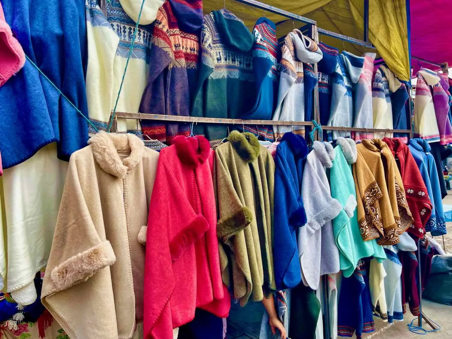
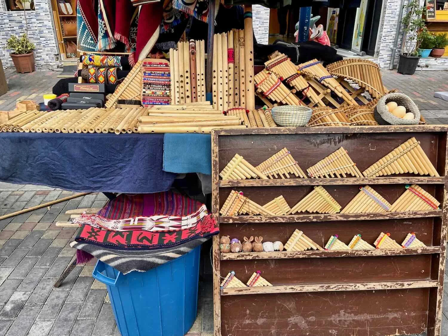
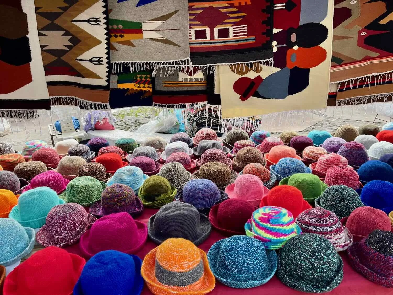
Unfortunately we were not in Otavalo on the big market day (Saturday), when they say that the market stalls can cover a third of the city streets. However, the Plaza de Ponchos (in the heart of the market district) was still packed with vendors on a weekday. In addition to tons of rugs, ponchos, sweaters and blankets for sale, we saw vendors from surrounding towns that specialize in musical instruments, leatherwork, and other traditional crafts. These days most of the textiles are made in factories, but there are still a few artisans in the market that weave hand-made designs.
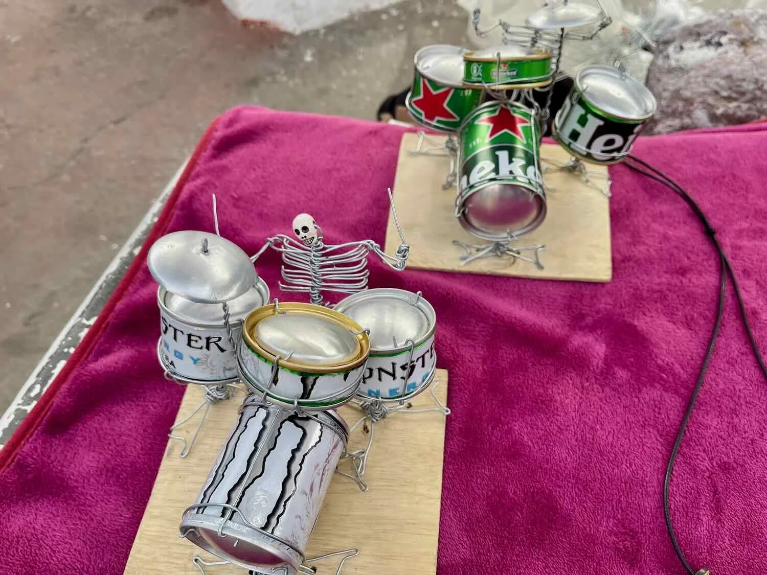
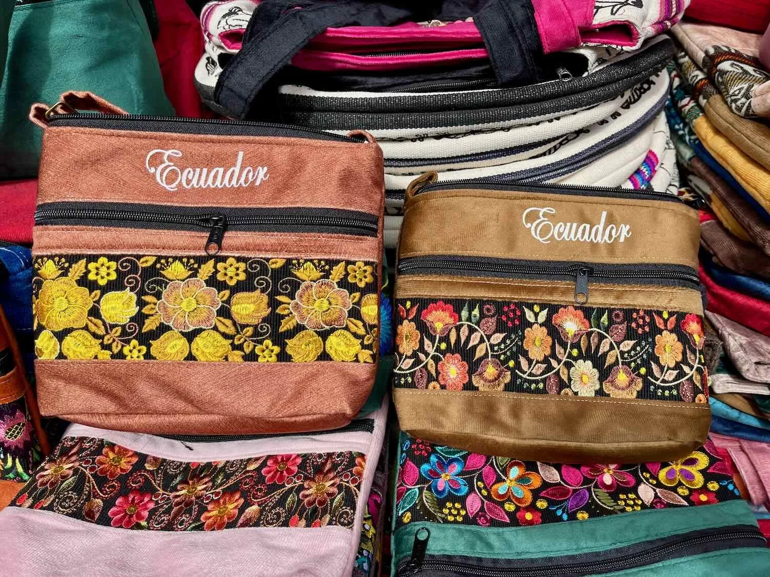
One of the most distinctive features of the women’s traditional dress in Otavalo was necklaces made of multiple strands of gold-plated beads. We saw many women in town wearing these. Supposedly the number of strands in the necklace reflects the woman’s age and wisdom. Otavalo, Imbabura Province, Ecuador. Copyright © 2019-2026 Pedals and Puffins.
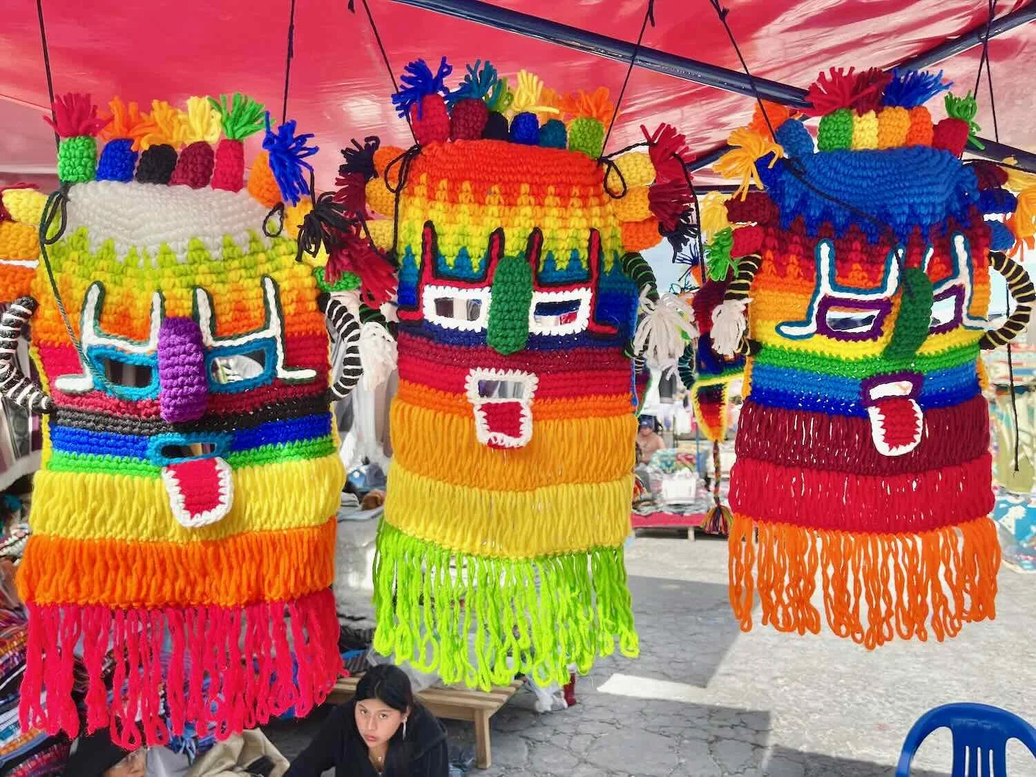
Besides the Saturday indigenous market, Otavalo is perhaps best known for its lively celebration of the Andean solstice festival (called Inti Raymi) towards the end of June. We were in town just a few weeks before the big party, so we saw quite a few traditional festival outfits on sale at the market. In particular, there were vibrant, knitted “spirit head” masks and long-tasseled ceremonial hats - both popular costumes during the festival’s parades and dances.
Aya Huma (“spirit head”) masks for sale in the Otavalo market. These masks have two faces (one looking forward, and the other looking to the back). The Aya Huma represents a spiritual warrior or protector, carrying a ritual whip to chase away evil spirits. Plaza de Ponchos Market, Otavalo, Imbabura Province, Ecuador. Otavalo, Imbabura Province, Ecuador. Copyright © 2019-2026 Pedals and Puffins.
In the Inti Raymi festival of the sun, Aruchicos are characters that celebrate the harvest. In Otavalo they often wear hats with colorful, streaming ribbons that help obscure the dancer’s face - representing rainbows, wind and water. The dancers move in a circle, stomping their feet to “wake up” the earth and give thanks to Pachamama (Mother Earth). Plaza de Ponchos Market, Otavalo, Imbabura Province, Ecuador. Copyright © 2019-2026 Pedals and Puffins.
A mural in the city included images from the Inti Raymi festival of the sun, including the Aruchico character (on the far right), whose face is hidden by gold beads instead of ribbons. Otavalo, Imbabura Province, Ecuador. Copyright © 2019-2026 Pedals and Puffins.
Cycling Into the Valley of Soccer (Fútbol)
Altitude is important in the Andes. It results in major changes in climate, ecosystems, wildlife, agriculture and cultures all tied together. North of Otavalo a colossal, deep valley lay across our path. Over the course of the next day’s ride we would drop ~4,000 ft (1,220 m) from the humid uplands into a dry canyon, quite different from the surrounding region - both culturally and ecologically.
Although the valley bottom receives as little as 4 inches (100 mm) of rain annually, the Chota River has enough year-round water flow that agriculture remains the major economic driver. During the colonial period, Jesuits used slave labor to grow sugar cane in irrigated fields. As a result, the valley’s modern inhabitants make up Ecuador’s second largest region of African descent with their own, unique, creole identity.
Besides its unique cultural traditions, this community has one other well-known trait - it is a powerhouse for soccer talent. Despite its tiny population numbers and high levels of poverty, the Chota Valley has produced some of the country’s most legendary fútbol stars. In 2002, when Ecuador first qualified for the World Cup, a third of the national team’s players were born and raised in the Chota Valley. Maybe there’s something in the water.
Just a half hour after departing Otavalo, we reached the high point of our ride for the day. From there, it was nearly all downhill into the Chota Valley. Illumán, Pan-American Highway, Imbabura Province, Ecuador. Copyright © 2019-2026 Pedals and Puffins.
Along the way we passed through Ibarra, the largest highland city in northern Ecuador. Pan-American Highway, Imbabura Province, Ecuador. Copyright © 2019-2026 Pedals and Puffins.
This grand statue in a small, city park was dedicated to freedom of expression. Periodismo Park, Ibarra, Pan-American Highway, Imbabura Province, Ecuador. Copyright © 2019-2026 Pedals and Puffins.
As we descended into the Chota River Valley, the landscape became steadily more arid and the temperature rose. But the valley bottom was covered with lush, green, fields supported by irrigation. N of Ibarra, Pan-American Highway, Imbabura Province, Ecuador. Copyright © 2019-2026 Pedals and Puffins.
Down in the valley, it was quite a bit warmer. An unfortunate consequence of the heat was that the roadside became infested with sand flies. We’d gotten bitten pretty badly by the sand flies on our initial climb from the coast up to Cuenca, Ecuador, so we immediately reached for our insect repellant and slathered our legs for protection. Sand flies in this area can carry a nasty, tropical disease called Leishmaniasis which we would rather avoid.
When we arrived in the village of Ambuqí (pop. 87), down in the valley bottom, we made a rookie mistake by checking into the first hotel we came to, even though there was another hotel right next door.
The room we got was okay, but it was pretty rundown. The strangest thing of all was something we had never encountered before: there was no drain in the shower. For real. Who would build a shower without a drain? We searched and searched for a hidden drain, but there was none. When we took our showers the basin just filled up with water, and it remained as a small pool until we checked out the next morning. They must come by and scoop out the water by hand after every guest. At least the water was warm, and there was good water pressure.
When the restaurant at our hotel ran out of food, we ended up going to the hotel next door for dinner. That’s when we discovered that the next-door-hotel was quite a bit more pleasant than the one where we were staying. Next time we will look around a little more carefully.
What Comes Down Must Go Back Up
Of course, having descended 4,000 ft (1,220 m) into the Chota Valley, we had to ascend 4,000 ft to get back into the highlands. All of that climbing would happen over the course of just 20 miles (32 km). By any measure it was a big climbing day, so we got up early and hit the road just after sunrise to give ourselves plenty of time to get up the mountain.
Pink and red flowers brightened the side of the road, as we passed a small nursery on the way out of town. Ambuquí, Pan-American Highway, Imbabura Province, Ecuador. Copyright © 2019-2026 Pedals and Puffins.
Rolling through the final town before the big climb out of the Chota Valley. Piquiucho, Pan-American Highway, Carchi Province, Ecuador. Copyright © 2019-2026 Pedals and Puffins.
Fortunately, the weather cooperated by staying cool and cloudy - greatly facilitating our ride out of the sweltering valley. By taking it slowly, we were able to enjoy the sweeping views of the desert-like landscape. Before long we were gazing across giant valleys, dropping hundreds of feet into the canyons below.
View of the arid Chota Valley from a hairpin bend in the road. You can see the road we cycled up near the bottom of the photo, and the town of Juncal far below us in the distance (center, left). Pan-American Highway, Carchi Province, Ecuador. Copyright © 2019-2026 Pedals and Puffins.
Someone tried to carve out a bit of farmland on a bench, on the far side of the canyon and high above the valley floor. It looked surprisingly isolated, and we wondered where they would get their water from? Near Cunquer, Pan-American Highway, Carchi Province, Ecuador. Copyright © 2019-2026 Pedals and Puffins.
After a couple thousand feet of ascent, the surrounding hills became greener - indicating that we were approaching the wetter highlands. Dozens of greenhouses were soon scattered among the agricultural fields - filled with top quality roses for shipping to international flower markets. Near San Francisco de Villacís, Pan-American Highway, Carchi Province, Ecuador. Copyright © 2019-2026 Pedals and Puffins.
Chaza - The Game of Giants
That evening, as we wandered around the low-key town of Bolívar (pop. 3,377) looking for dinner, we were in for a real treat. Down a quiet, residential street we came upon a sports complex, with a statue out front depicting a man playing a game we had never seen before. The man in the image had a strange-looking paddle strapped to one hand, and appeared to be getting ready to hit a ball that he held in his other hand. We were definitely intrigued.
What sport was the man in this statue playing? It turned out to be Chaza, the National Ballgame of Ecuador. Bolívar, Carchi Province, Ecuador. Copyright © 2019-2026 Pedals and Puffins.
But we did not have to just imagine what that game might be. By a great stroke of luck, it was Saturday evening and there was an actual game being played on a large, dirt field behind the sports complex. We walked over to the field to watch.
The game under way was called Chaza (a.k.a., “paddle ball”), an ancient, fascinating sport that was invented in the northern Andes as far back as the 1400’s - before the area was conquered by the Incas. As we watched, men with over-sized, wooden paddles strapped to their forearms smashed a heavy, rubber ball back and forth across a dirt playing field that was as long as a USA football field (100 yards).
The fast-paced action was reminiscent of a heavy-duty tennis match. However, the equipment they were using would have had the typical tennis pro begging for mercy. The big, wooden paddles weighed anywhere from 9-13 lbs (4-6 kg) and were often strapped to the player’s forearm to keep them from flying off. They were covered on one side with long, conical, rubber spikes that helped launch the 2-pound ball across the massive field. Requiring tremendous raw strength and endurance, this was not a sport for lightweights. In fact, the play is so physically demanding that players become very muscular, earning Chaza the nickname “The Game of Giants.”
A Chaza player with his paddle and ball. Both pieces of equipment are shockingly heavy, with the ball weighing ~2 lbs, and the paddle weighing 9+ lbs. Bolívar, Carchi Province, Ecuador. Copyright © 2019-2026 Pedals and Puffins.
We watched as men from the town played a weekend match of Chaza, a 600-year old game reminiscent of tennis. The teams smashed a 2-pound rubber ball back and forth on a 100-yard long, dirt court, using wooden paddles covered with rubber spikes. Bolívar, Carchi Province, Ecuador. Copyright © 2019-2026 Pedals and Puffins.
For hundreds of years Chaza was immensely popular and widely played throughout the northern Andean highlands. The game reached its peak popularity in the early 20th century, when every major village from southern Colombia to central Ecuador featured weekend matches that would draw huge, roaring crowds. It wasn’t until the 1970s, with the rise of soccer, that Chaza was de-throned as the king of Ecuadorian sports.
These days it is definitely a niche sport, played mostly by older men in rural communities or city clubs. However, the Ecuadorian Ministry of Culture and Heritage has officially designated Chaza as the National Ballgame, in an effort to keep this culturally significant sport alive. We felt incredibly fortunate to have encountered Chaza in its most authentic, small-town form.
The next day, as we cycled out of Bolívar, we passed the Megafauna Park - an outdoor set of sculptures depicting Ice Age mammals whose fossils have been found throughout the region. A nearby paleontological museum houses the remains of more than 200 different animals that were excavated from the surrounding area in the 1980s-1990s. It was fun to see the life-sized statues, and imagine those mastodons, giant sloths, and saber-toothed cats roaming among the hills.
We were surprised to see a mastodon strolling along the median near a highway intersection. But it was really just a sculpture in the Megafauna Park. Bolívar, Pan-American Highway, Carchi Province, Ecuador. Copyright © 2019-2026 Pedals and Puffins.
The Cycling Heartland of Ecuador
Although professional cycling does not enjoy widespread popularity in South America, Ecuador and its neighbor Colombia are notable exceptions. Both these countries have produced top-tier, professional cyclists that have inspired huge numbers of people to take up cycling for recreation and/or exercise. And as we approached the mountain town of San Gabriel, it became clear that we had entered the heartland of cycling.
These days cycling is easily the second most popular sport in Ecuador (after soccer). Tons of people hit the road on their bicycles on a regular basis, especially on weekends. And since we departed Bolívar on a Sunday, we saw a truly impressive number cyclists out for a ride through the mountains, including a couple of large groups that resembled racing pelotons. All of them were on lightweight road bikes, so they easily zipped past us without too much effort.
It is worth noting that although cycling is popular in Ecuador, bicycle touring (i.e., someone going on multi-day trips with gear) does not appear to be popular. In all our years riding around the world, we have never encountered a touring cyclist from Ecuador. This includes inside Ecuador. Mountain biking, riding lightweight road bikes, and getting around town on bicycles are all popular, but for some reason bicycle touring has not caught on. They must be too smart to want to tackle the massive hills in Ecuador with heavy touring bikes!
Cycling is especially popular in Ecuador’s northern provinces because they are the home turf of several elite, professional cyclists that have become national celebrities. As we cycled through the town of San Gabriel, we passed multiple murals and monuments honoring the achievements of the country’s top cycling legends.
Special adoration is reserved for the international superstar, Richard Carapaz (shown in this mural). He is the only cyclist ever (from any country) to win an Olympic gold medal, plus podium finishes and multiple stage wins in all three of cycling’s Grand Tours. Born and raised in a small town on Ecuador’s border with Colombia, Richard Carapaz is an undisputed national hero. San Gabriel, Pan-American Highway, Carchi Province, Ecuador. Copyright © 2019-2026 Pedals and Puffins.
This monument by the side of the road depicted cyclists racing over a hill. The guy, out front looked like the winner. San Gabriel, Pan-American Highway, Carchi Province, Ecuador. Copyright © 2019-2026 Pedals and Puffins.
One of the reasons this region produces so many elite cyclists its terrain. Not only is the elevation generally very high, but the mountain slopes can be particularly daunting. Even just walking home from town to the houses on this hillside looked like a major, physical effort. San Gabriel, Pan-American Highway, Carchi Province, Ecuador. Copyright © 2019-2026 Pedals and Puffins.
Staying With A Cyclist in San Pedro de Huaca
As if to drive home the prominence of cycling in northern Ecuador, we were tickled to discover that the owner of the hotel where we stayed in San Pedro de Huaca was an avid cyclist. In fact, Miguel was out cycling when we arrived, but arrived back home soon after. He had ridden 30 miles (50 km) that day, heading towards the town of Bolívar, and we had actually seen each other in passing, out on the road. He wasn’t a lifelong cyclist, though. He took up cycling six years ago (during the Covid-19 pandemic), because it was something he could do outside, by himself, to stay in shape.
The hotel had an interesting history, as well. It was a large, wooden structure with multiple rooms surrounding the central courtyard that now serves as the restaurant. Miguel had spent his childhood there, one of 10 children of a dairy farmer. He later moved to Quito for his studies and early career, but came back to Huaca when the house became available, and now runs it as a boutique hotel. The rooms were updated, but the main structure was still made of aesthetic, antique wood and exposed brick. With a crackling fire in the evenings, it was a cosy place to spend a couple of rainy days in the highlands.
Staying warm by the fire in the restaurant. San Pedro de Huaca, Carchi Province, Ecuador. Copyright © 2019-2026 Pedals and Puffins.
The hotel even had a vintage Chaza paddle and ball on display. Huaca, Carchi Province, Ecuador. Copyright © 2019-2026 Pedals and Puffins.
Like many small towns in the Ecuadorian highlands, San Pedro de Huaca (pop. 4,640) was built right on the side of a steep hill. The main road through town ran along the top of a ridge, with rapid drop-offs on either side that offered grand views of the surrounding farmland and dairy pastures. It turned out that the wood-and-brick architecture of our hotel was fairly typical of the buildings in Huaca - contrasting sharply with the colonial, adobe structures that were so dominant in towns further south. It gave the town’s streets a distinctive, alpine feel.
Across the street from our hotel, the land dropped away quickly from the ridge line. At the bottom of the hill sat a shiny new soccer field. On any given evening, there were local teams playing a match. And there were always a few spectators sitting on the ridge, getting a bird’s-eye view of the game. San Pedro de Huaca, Carchi Province, Ecuador. Copyright © 2019-2026 Pedals and Puffins.
A tidy, green arch in the town plaza offered a shady spot for one of the local dogs to take a nap. San Pedro de Huaca, Carchi Province, Ecuador. Copyright © 2019-2026 Pedals and Puffins.
The town’s main church holds a 400+ year old statue of the Virgin known as Our Lady of Purification, that is deeply revered throughout the region. Perhaps her most unique attribute is that she has a wardrobe of more than 300 dresses, many donated by faithful to express devotion or offer thanks. While most of the outfits are traditional, elegant gowns, a few stand out for incorporating military and police cuts, representing diverse indigenous ethnicities, and even custom dresses bearing the logos of major national sports clubs. San Pedro de Huaca, Carchi Province, Ecuador. Copyright © 2019-2026 Pedals and Puffins.
Buildings throughout town were built with a combination of brick and wood - a style that was quite distinct from the typical adobe structures in other towns. It gave the neighborhoods a more alpine feel. San Pedro de Huaca, Carchi Province, Ecuador. Copyright © 2019-2026 Pedals and Puffins.
There were multiple, irresistible fruit and ice cream shops in town. We made a point of sampling the products in several of them. San Pedro de Huaca, Carchi Province, Ecuador. Copyright © 2019-2026 Pedals and Puffins.
The town was on a ridge, offering scenic views across the surrounding countryside from several overlooks along the main road. San Pedro de Huaca, Carchi Province, Ecuador. Copyright © 2019-2026 Pedals and Puffins.
On the Edge of the Incan Empire
Our final destination in Ecuador was the border city of Tulcán (pop. 56,720). Today Tulcán hosts the most important land crossing between Ecuador and Colombia. However, its status as a frontier community dates back well before the arrival of the Spanish. Roughly 500 years ago, it served as the northernmost outpost of the Inca Empire. There’s evidence that even then the local indigenous people were never fully conquered, but the Incas claimed authority over the area anyway. In modern times, one of the city’s claims to fame is that it is the highest provincial capital in Ecuador. At 9,730 ft (2,966 m) above sea level, it is even higher in the mountains than Quito.
Just on the other side of the border, the Colombian city of Ipiales has a reputation for being kind of a rough town. So like many cyclists passing through, we decided that we would rather spend the night in Tulcán Ecuador, which is typically more stable and calm.
At the top of the pass between San Pedro de Huaca and Tulcán, we stopped to admire a towering, white cliff overlooking the valley. S of Tulcán, Pan-American Highway, Carchi Province, Ecuador. Copyright © 2019-2026 Pedals and Puffins.
As the capital of the province most devoted to cycling, it was no wonder that we saw this sign at the entrance to the city (“Capital of Cycling”). Of course, there were plenty of local cyclists pedaling by us for most of the day. Tulcán, Pan-American Highway, Carchi Province, Ecuador. Copyright © 2019-2026 Pedals and Puffins.
We had originally planned to stay at a hotel right in the center of town. But the area around the plaza was crowded and noisy. Plus, the hotels were either old, with small, expensive rooms or were already full. After checking 4-5 hotels, we discovered a very nice option just outside of the city center, in a quieter neighborhood and at a more reasonable price. In fact, it ended up being nice enough that we decided to spend an extra day in town before crossing the border, since we would be staying in scruffier accommodations for a few days in Colombia.
Our main task in Tulcán was to change some US dollars (Ecuador’s official currency) to Colombian pesos, so we wouldn’t have to deal with the sketchy money changers that loiter right at the border. Luckily, our hotel receptionist directed us to a nearby plaza that had lots of slightly-less-sketchy money changers sitting on the street corners, waving cash in the universal signal that they had money to exchange.
Exchanging money on the street corner always seems rather dicey, but we have done it enough times, in so many countries, it has become rather routine. It is usually most chaotic and risky right at the border crossings. On the other hand, if you get too far away from the border it is often more difficult to exchange currency and the rates are not as good. So finding a place to exchange money inside a nearby town, just before or after you get to the border, tends to be the better move.
After exchanging money we noticed that everyone in the city seemed to be focused on the 2026 World Cup. The group stage of the tournament had just begun, and hopes were running high for Ecuador’s national team, which came in second in the America’s Cup competition a couple of years ago.
Every television seemed to be permanently tuned to 24-hr World Cup coverage. What’s more, all the shops in town were brimming with national team merchandise (including quite a few ‘pop-up’ vendors selling jerseys and flags out of the back of parked vehicles). And half the population was wearing the national team’s jersey as they went about their daily business.
It was easy to get caught up in the collective excitement, which added a fun splash of color and energy to our final days in Ecuador.
The Chiles Volcano, which sits right on the border between Ecuador and Colombia, is easily visible from Tulcán on a clear day. It marks the northern end of Ecuador’s Avenue of the Volcanos. Tulcán, Pan-American Highway, Carchi Province, Ecuador. Copyright © 2019-2026 Pedals and Puffins.
We arrived in Tulcán just in time for the start of the 2026 World Cup tournament. People are wild about soccer in Ecuador, and everyone was rooting for the national team. You could buy team merchandise anywhere, including from temporary, ‘pop-up’ vendors on the side of the road. Tulcán, Pan-American Highway, Carchi Province, Ecuador. Copyright © 2019-2026 Pedals and Puffins.
Tulcán was a pleasant place to end our journey across Ecuador. From our hotel window, we could almost see the next country (Colombia) just a couple of miles away. Tulcán, Pan-American Highway, Carchi Province, Ecuador. Copyright © 2019-2026 Pedals and Puffins.