Cycling Southern Colombia: Tulcán (Ecuador) to Pitalito (Colombia)
(Including the Trampolín de la Muerte)
12 June - 8 July 2026
12 June - Tulcán Ecuador to San Juan Colombia (16.0 mi, 25.7 km)
13 June - San Juan to Tangua (24.7 mi, 39.8 km)
14 June - Tangua to Pasto (16.4 mi, 26.4 km)
15-16 June - Rest Days in Pasto
17 June - Pasto to El Encano (13.4 mi, 21.6 km)
18 June - El Encano to Sibundoy (25.5 mi, 41.0 km)
19-21 June - Layover in Sibundoy
22 June - Sibundoy to Trampolín de la Muerte (12.9 mi, 20.8 km)
23 June - Trampolín de la Muerte to Mocoa (38.2 mi, 61.5 km)
24-25 June - Rest Days in Mocoa
26 June - Mocoa to Finca Discosura (23.5 mi, 37.8 km)
27 June - Finca Discosura to San Juan de Villalobos (19.5 mi, 31.4 km)
28-29 June - Sick Days in San Juan de Villalobos
30 June - San Juan de Villalobos to Pitalito (41.3 mi, 66.5 km)
1-8 July - Pitalito and the End of our 4 year (!) cycling trip from Alaska to Colombia and Patagonia back to Colombia
Return to Colombia
We spent our final night in Ecuador just a couple of miles from Colombia. The next day it didn’t take long for us to reach the border.
Unlike the crossing between Peru and Ecuador where the immigration desks for both countries had been in the same building, Colombia and Ecuador had separate facilities on either side of this border. Even so, we easily exited Ecuador and entered Colombia in just half an hour. It helped that we had already changed some cash back at the Ayora Plaza in Tulcán, so all we had to do was complete the exit and entry procedures at the border offices.
However, there were a lot more people using this border crossing than than the one where we had entered southern Ecuador from Peru (where we had been the only people at the crossing). To keep things moving, the Ecuador border agent at this stop didn’t ask us any questions at all. For Colombia, the officer just asked us where we were going and where we would be staying. We didn’t have to show any documents besides our passports, and there was no customs check. It all was very simple.
Before we knew it, we were cycling back into Colombia - the final country on our journey across the Americas. From the border, we had just 10 more days of cycling to reach the spot where our southbound journey had ended two years earlier. It felt almost surreal, but once we reached Pitalito, we would complete the full route from Deadhorse (Alaska) to Ushuaia (Argentina).
Crossing from Ecuador into Colombia, the final country on our cycling journey across the Americas. There were quite a few money changers hanging out near the border (most of the people standing on the right side of the road), and they all tried to get our attention. But we happily ignored them, having already procured some Colombian pesos back in Tulcán, Ecuador. Near Ipiales, Pan-American Highway, Nariño Department, Colombia. Copyright © 2019-2026 Pedals and Puffins.
It was a big milestone, but we weren’t done with the cycling just yet. A lofty ridge of the Andes stood between us and our ultimate destination. Ominously, the road we would take through the mountains had the sinister nickname of El Trampolín de la Muerte (The Trampoline of Death) - a narrow, cliffside route with sheer drop-offs, heavy fog, and frequent landslides that has claimed hundreds of lives. Needless to say, we would get to test our mettle at least one more time before reaching the end of the road.
Avoiding Ipiales
The first city we passed in Colombia was Ipiales (pop. 80,000), but we didn’t stop there. As one of Colombia’s top overland hubs for trade (both legal and illegal), Ipiales is a magnet for smugglers of everything from gasoline to drugs, making it one of the rougher border towns along the Pan-American route.
Therefore, like many travelers through the area, we decided to play it safe by taking a highway bypass around Ipiales. After crossing the border we headed directly for a quieter town farther up the road.
Just a few miles past Ipiales we reached the edge of the Guáitara River Gorge - a dramatic, 100 m (330 ft) deep gash that cuts across southwestern Colombia. Soon we were plunging down the steep canyon wall, surrounded by lush, Andean jungle. For the rest of the day’s ride we barely had to pedal at all as we cruised downhill into the village of San Juan.
A Refuge in the Canyon
Compared with the edgy hubbub of Ipiales, the village of San Juan was an oasis of tranquility. With only 838 inhabitants, the town’s footprint extended just a few blocks away from the central plaza in each direction before fading into tropical forest dotted with small, mixed-crop agricultural plots. Several flocks of parrots flew overhead, reminding us that we hadn’t seen (or heard) a single parrot in months. With so much forest on the hillsides, this region seemed more hospitable for birds like parrots than the endless farms along the Pan-American Highway in Ecuador.
The community itself is the seat of a self-governing, indigenous reserve with deep cultural ties to the land. It has a long history of serving travelers, who used the canyon to traverse the mountains. You wouldn’t say San Juan is particularly well-known. Yet within the scope of southwestern Colombia, the village has a long-standing reputation for quality regional food (particularly guinea pig, which isn’t really our thing), and artisanal ice cream (which is much more to our liking). From what we heard, it is traditional for travelers to stop for a break in San Juan when heading to or from Ipiales.
The well-maintained, community church stood on one side of the central plaza. On the other three sides of the plaza, rows of shaded food stalls served traditional, local meals to highway travelers passing through. San Juan, Nariño Department, Colombia. Copyright © 2019-2026 Pedals and Puffins.
While walking through the plaza, we saw two women with touring bikes resting on the grass just outside one of the village ice cream shops. They turned out to be two cyclists from the UK who had already ridden from La Paz (Bolivia) to Ushuaia (at the southern tip of Argentina). When they completed that journey, they decided that they weren’t ready to stop cycling just yet. So they flew to Bogotá (Colombia) and were now making their way back to La Paz - doing a “flip-flop” crossing of South America.
We talked for quite a while, reminiscing about route highlights (like the Uyuni Salt Flats), challenges (like the wind in Patagonia), and sharing tips regarding the road ahead. Livvy and Eleanor had recently crossed the Andes on the Trampolín de la Muerte route, which we also were planning to take. So we peppered them with questions about road conditions and tried to get an idea of what to expect on that sinister-sounding road. One thing we learned was that they encountered quite a bit of rain in the mountains. We crossed our fingers, hoping the conditions would improve for us.
We met Eleanor and Livvy, two friendly cyclists from the UK, just outside an ice cream shop in SW Colombia. They were headed south, and we chatted for a long time about the routes ahead of us. San Juan, Nariño Department, Colombia. Copyright © 2019-2026 Pedals and Puffins.
We finished the afternoon with a visit to the ice cream shop. The town is famous for home-made ice cream, crafted with all-natural, local ingredients. We can confirm that the ice cream was delicious. San Juan, Nariño Department, Colombia. Copyright © 2019-2026 Pedals and Puffins.
To our surprise the village was exceptionally noisy until roughly 9:30pm, with roaring truck engines as they revved to get up the steep hills surrounding town, people yelling in the streets, loud music, barking dogs, and a swirling blend of knocking and banging noises. Yet, miraculously, just after that it became very quiet. With the chilly night air, it was actually great for sleeping - until about 5am.
Then the roosters began to crow, the dogs began to bark, and several vehicles using loud speakers to advertise their products rolled slowly past our window (not too unlike many small to medium sized towns in South America). Once sleep became impossible, we were up and out the door.
The Guáitara River Gorge
For the first two hours we enjoyed stunning scenery as our route hugged the mountainside, deep within the Guáitara River Gorge. The road was carved into the cliff face, high above the rushing river yet well below the rim of the canyon. The surrounding mountains rose above us, framing the blue sky. It gave us the feeling of cycling in a more rural area, with minimal human development.
The Guaítara River Gorge provided breathtaking scenery as our road hugged the canyon wall. Many parts of the valley looked like they had been cleared for pasture. Yet there still were quite a few pockets of forest. People were scarce, with few homes clinging to the slopes (unlike Ecuador, which seemed much more populated). N of San Juan, Pan-American Highway, Nariño Department, Colombia. Copyright © 2019-2026 Pedals and Puffins.
This sign advertised a farm that had “Big Chickens for Sale.” We wondered just how big the chickens could get? From our experience, “Gallinas Grandes” could sometimes be old and tough, and not particularly great for eating. Guáitara River Gorge, Near La Josefina, Pan-American Highway, Nariño Department, Colombia. Copyright © 2019-2026 Pedals and Puffins.
One of the things this region is known for is its waterfalls. Naturally, the Guáitara River Gorge provided the perfect backdrop for some lovely ribbons of water that tumbled hundreds of feet down the canyon walls. Humeadora Waterfall, Pan-American Highway, Nariño Department, Colombia. Copyright © 2019-2026 Pedals and Puffins.
This town in the Guáitara River Gorge presented a colorful facade along the highway. Pedregal, Pan-American Highway, Nariño Department, Colombia. Copyright © 2019-2026 Pedals and Puffins.
During periods of heavy rain, the steep slopes that border Colombia’s Andean roads are subject to landslides. This road crew, clinging to the steep slope, was busy reinforcing a high embankment, hoping to protect the highway below. Guáitara River Gorge, Near Pedregal, Pan-American Highway, Nariño Department, Colombia. Copyright © 2019-2026 Pedals and Puffins.
Our ride for the day bottomed out where a soaring viaduct crossed the Guáitara River. On the far side of this bridge our route ascended steeply out of the river gorge. Near Pedregal, Pan-American Highway, Nariño Department, Colombia. Copyright © 2019-2026 Pedals and Puffins.
The climb to the town of Tangua (pop. 4,263) was a three hour grind with a gain of more than 2,200 ft (670 m). On the way up we were treated to more sweeping views of Andean valleys. However, right around noon it began to rain. At first it was a light rain, and we didn’t even need our jackets. But for the last mile or so, the rain started falling steadily and we were soaked by the time we pushed our bikes up the final hill into town.
As far as we could tell, there was only one hotel in Tangua. It looked pretty good online, and still looked nice as we pulled up to the door. But the reality turned out to be rather different. It probably had been a nice hotel at one time, but a noticeable lack of maintenance had left it in bad condition.
Most of the rooms were tiny and had just one, small, one-person bed, so we required two rooms. Fortunately the hotel charged per person, rather than per room. So two rooms were the same price as one.
Yet even though the hotel was large (with four stories and 40-50 rooms) and we didn’t see any other guests, the poor guy on duty had a very hard time finding us two rooms we could use. It appeared as though most of the rooms in the hotel were out of service for one reason or another (e.g., the first one we were given had a toilet that didn’t function). Clearly the strategy in this hotel was that when something broke, rather than fix it they would move people to a different room. However, eventually you run out of rooms. It seemed like our arrival was at that very moment.
We ended up on the top floor, in a couple of rundown, adjoining rooms. Even then, there were no shower heads, the door handles were broken, and one of the showers leaked - creating a puddle that flowed out into the main bedroom. But by that point none of it mattered to us. There was no chance we were going to cycle for another four hours in the rain to reach the next town with a hotel. So even with its flaws, we were glad to have somewhere safe and dry to spend the night.
One of the best things about the rundown hotel in Tangua was the view from the top floor in the evening (after the rain had stopped). Beyond the plaza, the land fell away into a deep valley. Tangua, Nariño Department, Colombia. Copyright © 2019-2026 Pedals and Puffins.
Around sunset, some guys were playing a heated game of volleyball in the central plaza. We were impressed with their level of skill. Tangua, Nariño Department, Colombia. Copyright © 2019-2026 Pedals and Puffins.
Yet Tangua was only about halfway up the big climb out of the valley. So the next day began with another 2,300 ft (700 m) ascent to the top of a pass. Not only that, but the first half mile - just to get back to the highway - had a leg-busting 13% gradient.
Making our way up the steep hill to exit town. Tangua, Nariño Department, Colombia. Copyright © 2019-2026 Pedals and Puffins.
After taking a breather at the edge of town, we began the long trek to the top of the pass. At first we were grateful for the low, thick, layer of clouds because it kept us from overheating from the hard, uphill pedaling.
However, as soon as it started to drizzle our appreciation faded away. The moisture seeped into our clothes, chilling us to the bone. We pushed ourselves hard on the long ascent, stopping just briefly to eat some high-energy snacks. We were too worried about getting cold to enjoy a long break.
The views were gorgeous, even under a thick layer of clouds. We wondered if the bowl in the center of this photo was an old volcano crater. Bobo River Valley, Near Tangua, Pan-American Highway, Nariño Department, Colombia. Copyright © 2019-2026 Pedals and Puffins.
Yet despite the nasty weather, there were TONS of Colombian cyclists out on the road, tackling the mountain in the rain and living up to their reputation of being a country of cycling enthusiasts. Perhaps they were used to rain in this area. On the other hand it also was a Sunday, which is always a big cycling day.
An interesting coincidence was that as we were going up the mountain, we encountered two different cyclists with broken derailleur hangers. This is a mechanical issue that happens relatively infrequently, so we were surprised to see it twice in one day. We wondered whether the steep climb and the massive force some of the cyclists were applying to their pedals could have contributed. A broken derailleur hanger pretty much means you have to walk. But unfortunately we didn’t have any spares, so there was nothing we could do to help.
It was an amazing feeling when we finally reached the top of the climb at 10,250 ft (3,125 m). We donned a couple more layers of clothing, then happily plunged onto the long, chilly descent. The road was wet, so we did not go downhill as fast as we would have otherwise, but it still was a pleasure to fly across the miles without pedaling.
Rain Days in Pasto
As we entered the edge of the city of Pasto (pop. 404,775), we came to a bike lane. At first we were thrilled, but then we tried to cycle on it. Unfortunately, the bike lanes in Pasto were crowded with pedestrians. Pretty quickly we noticed that all the other cyclists just rode out in the street, so we did that, too.
It turned out that the rain that had soaked us over the last two days of cycling was not an anomaly. The day we arrived in Pasto it rained steadily for the remainder of the afternoon. Not only that, but the forecast was bleak for the foreseeable future. That did not bode well for our upcoming crossing of the Andes mountain ridge.
However, we were not in a hurry, so we took a couple of days to dry off in Pasto, while it continued to rain outside.
One nickname for Pasto is The Theology City, because of its impressive number of churches. We could see ~10 churches from the top floor of our hotel. The Church of St. James the Apostle (shown here) stood out, situated on a hill overlooking the city center. Pasto, Nariño Department, Colombia. Copyright © 2019-2026 Pedals and Puffins.
We spotted several colorful Chiva buses on the city streets. Often built from old school buses, these workhorses typically run rural routes, with capacity to haul cargo on the roof. In a pinch, the canvas can be removed allowing baggage, products on the way to market, and other assorted items to be stacked high. Pasto, Nariño Department, Colombia. Copyright © 2019-2026 Pedals and Puffins.
Into the Wet Mountains
However, we were eager not to spend too much time off our bikes because we wanted to have strong climbing legs for the next few days of cycling over the Andean ridge. So by the third day in Pasto we were ready to get back on the road, even though the forecast was still gloomy for the remainder of the week.
The morning sky was dark with low clouds. And wouldn’t you know it, as we were saddling up our bicycles it started to rain. So we parked our bikes under an awning, and went back inside the hotel to wait. The rain came down pretty hard for a while, but around 8:30am we convinced ourselves that the sky was starting to get lighter. We decided to go.
To be honest, we were pretty lucky that day. It never rained very hard while we were out on the road. But it still was a very wet day, with a constant drizzle and intermittent fog. We plugged along, making our way up another 2,200 ft (670 m) ridge. Once again, we didn’t stop much because of the cold wind and rain. On the bright side, once we got past the outskirts of the city the traffic became fairly light, which we really appreciated.
Even so, the climb was surprisingly draining. About 3/4 of a mile from the top, PedalingGal ran out of gas. She got off her bike and started pushing.
She was tired, cold, and soaked, and must have looked pathetic because two policemen on motorbikes who were traveling in the opposite direction turned around and came back to ask her how she was doing. They seemed pretty concerned - maybe they were worried about having to rescue a hypothermic cyclist off the mountain later in the day.
It took some effort, but eventually she was able to convince her two would-be rescuers that she was fine, and that she might actually be able to make it. It helped that we were less than a half mile from the top of the pass at that point. So after reminding her to be careful, the police rode off down the mountain.
A soggy PedalingGal was thrilled to reach the top of the pass between Pasto and El Encano. E of Pasto, Hwy 10, Nariño Department, Colombia. Copyright © 2019-2026 Pedals and Puffins.
On the way down the far side of the pass, we stopped at an overlook with a view of La Cocha Lake. It’s the second-largest, natural lake in the country. We wouldn’t get to its shores, but we would get close. La Cocha Lake Overlook, W of El Encano, Hwy 10, Nariño Department, Colombia. Copyright © 2019-2026 Pedals and Puffins.
The descent into the village of El Encano (pop. 817) was freezing. By the time we arrived at our target hotel, we both were exhausted and cold. Of course, there was no one at the hotel, so we had to use our numb fingers to send out a couple of text messages to phone numbers posted on the door. As we waited under the eaves on the front porch, it started to rain harder.
It seemed like an eternity, but after what was really just a couple of minutes a woman came over from across the street to help us. Once again, the rooms had small beds with barely enough room to squeeze one bike inside, so we got two rooms.
Unfortunately, with 100% humidity and at 9,200 ft (2,805 m) in elevation, the rooms were also cold and damp, with no heat. By this point the cold had seeped into our bones. After changing into dry clothes, PedalingGal burrowed under the pile of blankets on her bed to try and warm up. It took about 20 minutes before her hands and feet were no longer numb.
The area was pretty rural in character. While cycling, we saw these guys re-shoeing a horse right by the side of the road. The farrier (i.e., someone whose job it is to put horseshoes on horses) had all his equipment loaded on a motorcycle, so he could provide door-to-door horseshoeing. El Encano, Nariño Department, Colombia. Copyright © 2019-2026 Pedals and Puffins.
The Páramo in the Mist
It rained all night and into the morning. Around 6:30am, we huddled to assess our situation.
The cloud layer was thick and low, looking like it would continue raining for quite a while. Of course, the weather apps were no help at all. They each provided a strikingly different forecast about how much rain we could expect during the rest of the day. (As is typical in the Andes, the best way to predict the weather was to look outside.) Yet we were not eager to spend another night in those dark, damp rooms. We decided to wait a little while, hoping for the rain to ease up.
To be honest, by 7:45am the weather hadn’t improved very much. The dense clouds still hung low on the mountains, and it was still raining. However, we managed to convince ourselves that the rain was just a little bit lighter than it had been earlier. We took that as a sign that the day might get better, and decided to go for it.
The mountainsides were covered with a thick cloud forest, with no signs of human habitation. E of El Encano, Hwy 10, Nariño Department, Colombia. Copyright © 2019-2026 Pedals and Puffins.
As we chugged our way up to the top of another 10,500 ft (3,200 m) pass, we got very wet. Then something magical happened.
Near the top of the pass we cycled into the Bordoncillo Páramo, a patch of true, tropical alpine tundra. This felt really special, because although we had cycled at elevations high enough to support páramo many times in Ecuador, all those landscapes bordering the Pan-American Highway had been completely converted to pasture or eucalyptus plantations. There was no natural páramo vegetation left to see.
Now we were surrounded by this truly rare and other-worldly ecosystem. Through the cold, wet mist, we could see the large rosettes of the frailejón plants - weird, palm-like shrubs that have evolved to endure the harsh conditions of life on the páramo. The frailejóns (“big monks”) have hairs on their leaves to trap moisture from the fog, playing a crucial role in capturing water that nurtures the rest of the high-altitude vegetation and replenishes the water table. PedalingGuy had trouble getting his camera to work in the wet conditions, but luckily he managed to take a few photos.
A “forest” of endangered frailejón plants (Espeletia pycnophylla), surrounded by alpine bunch grasses in the Bordoncillo Páramo. The rosettes of the frailejón plants looked other-worldly through a cloud of mist. E of El Encano, Hwy 10, Putumayo Department, Colombia. Copyright © 2019-2026 Pedals and Puffins.
Twenty minutes into the descent from the páramo, we reached an open air restaurant by the side of the road that gave us a chance to get out of the rain.
True to the restaurant’s name, Coma Cuy (“eat guinea pig”), the little hut had a big, open, fire pit with two guinea pigs roasting on spinning spits over the coals. We used the fire to warm our hands as we watched the guinea pigs spin. However, since these small places often only have a couple things on the the menu, we were very pleased to hear that they also had chicken soup, which was just what we wanted. After we made a remark about the wet weather, our hostess revealed that it had been raining nonstop for the past nine days! While we waited for our soup, we stripped off our wet gear and stood by the open fire pit, soaking up the heat.
When the steaming soup arrived, it was paradise - a delicious broth filled with greens, chunks of chicken, potatoes, and yuca. We hadn’t enjoyed soup that much in a long time. By the time we were finished, we both felt renewed.
There’s nothing like a steaming bowl of soup to warm up a cold, wet cyclist. Coma Cuy Restaurant, Hwy 10, Putumayo Department, Colombia. Copyright © 2019-2026 Pedals and Puffins.
As we were finishing our meal, two other touring cyclists pulled up to the door, heading in the opposite direction. It was a couple from Germany who had started their journey just five days ago, in Bogotá. Because of possible political turmoil, they had decided that they wanted to be out of Colombia before the upcoming presidential election, which was just 2.5 days away. Adding to the pressure, the border crossing between Colombia and Ecuador would be closed for election day beginning at 6am on Saturday. They had a lot of miles to cover in just 1.5 days. We didn’t envy them.
As we continued our descent from the restaurant, the weather slowly began to improve. Within an hour we finally emerged out of the clouds. Eventually it stopped raining, and the road surface even became dry. It was fantastic to feel the warmth creeping back into our bones.
The mountains were laced with rushing streams, fed by the water gathered by the plants up on the alpine páramo. Putumayo River, Hwy 10, Putumayo Department, Colombia. Copyright © 2019-2026 Pedals and Puffins.
In the Valley of the Shamans
Shortly after noon we left the mountains and entered the high Sibundoy Valley, at the town of Santiago. The valley is fairly unique in southern Colombia, as a large (85 square km), high-elevation, fertile, and relatively flat-bottomed bowl nestled within the Andes. As such, it has been a cradle of human settlement for millennia, and remains an important agricultural and spiritual center for several indigenous communities.
This colorful sign welcomed us to the town of Santiago, as we entered the fertile Sibundoy Valley after crossing a ridge of the Andes mountains. Santiago, Hwy 10, Putumayo Department, Colombia. Copyright © 2019-2026 Pedals and Puffins.
For us, the valley offered a welcome break from the rugged, cloud-covered, higher slopes. Almost immediately the terrain was much more mellow, and it seemed like the miles flew by as we cycled through a patchwork of typical farms, mixed-crop gardens and pockets of forest.
This sign let us know how many more kilometers we had to go to reach Pitalito, the final town on our journey across the Americas (211 km=131 mi). Sibundoy Valley, Hwy 10, Putumayo Department, Colombia. Copyright © 2019-2026 Pedals and Puffins.
We had expected to spend a day or two in the town of Sibundoy (pop. 15,475) because it was the largest commercial hub in the valley, and we wanted to gather our strength for the crossing of the infamous Trampolín de la Muerte (“Trampoline of Death”) road - which would include several days of remote, gravel cycling through some of the steepest parts of the Andes mountains.
Yet with a contentious presidential election just two days away, we had to decide how to time our travel around that event as well. Of course, no one really knew whether there would be civil unrest. Yet given that the two candidates were political opposites, and the country was fairly polarized, the potential for trouble did exist. After consulting numerous sources, both online and in person, we came to the conclusion that it would be best not to travel on Election Day. That meant spending a total of three days hanging out in Sibundoy. We did get out to enjoy the town some, but unfortunately, it rained most to the time we were there.
The mountains surrounding the Sibundoy Valley were nearly always covered with clouds. Any cyclists up in those mountains were getting soaked by mist. Sibundoy, Putumayo Department, Colombia. Copyright © 2019-2026 Pedals and Puffins.
The role of the Cathedral of St. Paul the Apostle (built in the 1960s) in the town of Sibundoy is complicated. The valley is a stronghold of shamanic beliefs, and many people who live there weave both Catholic and indigenous traditions together. Sibundoy, Putumayo Department, Colombia.. Copyright © 2019-2026 Pedals and Puffins.
The central plaza had several monuments carved from the trunks of fallen trees, depicting images from ancestral mythology and of cultural significance to the local indigenous communities. Intercultural Plaza, Sibundoy, Putumayo Department, Colombia. Copyright © 2019-2026 Pedals and Puffins.
One of Sibundoy’s most famous artistic traditions is the creation of colorful, ceremonial masks. This mural of a shamanic mask is full of symbolism in both its colors and designs. Intercultural Plaza, Sibundoy, Putumayo Department, Colombia. Copyright © 2019-2026 Pedals and Puffins.
In the end, Election Day came and went without any major incidents. The conservative candidate won, and in the evening his supporters filled the streets of Sibundoy to celebrate - honking, playing loud music, and waving flags. Around dinner time the town was pulsing with energy. Some people were already getting drunk and a little bit rowdy. After eating, we headed back to our hotel for the night.
A group of supporters celebrated their candidate’s victory in Colombia’s presidential election by parading through town with national flags. Sibundoy, Putumayo Department, Colombia. Copyright © 2019-2026 Pedals and Puffins.
Surviving the Trampolín de la Muerte
Between the high Sibundoy valley in the west and the lowland city of Mocoa in the east, lies a road with the ominous nickname of the Trampoline of Death (trampolín de la muerte). Ever since the road’s construction in the 1930s, it has earned a reputation as one of the more dangerous routes across the Andes.
Carved out of sheer, unstable mountain slopes, the road remains unpaved to this day. Modern hazards are much the same as they were decades ago - loose road surfaces, landslides, no guardrails, blind turns, sections that are just wide enough for a single car, and dense fog/unpredictable weather. The name itself refers to the fact that a vehicle can easily hit a bump or pothole in the road that launches it, like a trampoline, over the cliff and hundreds of feet into the chasm below.
It doesn’t help that this treacherous road is one of the only reliable ways to get over the Andes in the area. The other options pass through remote regions that are used as smuggling routes by organized crime, and suffer periodic outbreaks of armed conflict. The Trampolín, on the other hand, has remained calm. If you are on a cycling trip, this road is the safest option for crossing the Andes south of the Bogota region.
So the day after the election, we saddled up our bikes and headed for the mountains. The first few miles we were still on pavement, passing through agricultural fields and one more, small town. A handful of local cyclists rode past us heading towards the mountain, and waved to us as they cruised by.
At the foot of the Andes, there were fields with some of the tallest stalks of corn we had ever seen. Some of the stems looked like they were 12 ft (3.7 m) tall. Between Sibundoy and San Francisco, Hwy 10, Putumayo Department, Colombia. Copyright © 2019-2026 Pedals and Puffins.
In fields where the corn had been harvested, the farmers left 5-ft high stalks standing in the ground, possibly to protect the soil from erosion. In polyculture systems, the old corn stalks can also serve as support for climbing plants, like beans, that are planted between the rows in alternating seasons. Between Sibundoy and San Francisco, Hwy 10, Putumayo Department, Colombia. Copyright © 2019-2026 Pedals and Puffins.
It’s always a surprise to see (domestic) water buffalo grazing in Colombia, but apparently they are gaining popularity. These guys do well in wet, swampy areas where other cattle struggle. And apparently the mozzarella made from water buffalo milk is delicious. Near San Francisco, Hwy 10, Putumayo Department, Colombia. Copyright © 2019-2026 Pedals and Puffins.
Mural of a campesina with her cows and guinea pig. San Francisco, Hwy 10, Putumayo Department, Colombia. Copyright © 2019-2026 Pedals and Puffins.
Just an hour into the ride, we reached the end of the pavement and the serious climbing began. We were grateful that although the sky was overcast, it was not raining. In truth, the weather that morning was better than we had seen in quite a while.
Another positive development was that the road surface was pretty good for cycling. It was hard-packed, sandy soil inlaid with medium-sized rocks. The soil drained well, so there weren’t many mushy spots or puddles that would splash us when cars passed. And the stones weren’t even that bumpy. Overall, the conditions were better than we expected.
In addition to pickup trucks filled with people in the bed of the truck, a surprising number of police cars passed us during the day. We guessed that there was a lot of police repositioning going on due to the recent election. Fortunately, nearly everyone was driving very slowly, and they gave us enough room whenever they passed.
Once we hit the dirt road the climbing began. Luckily, the road was well maintained, and the hard-packed surface was good for cycling. Trampolín de la Muerte, E of San Francisco, Putumayo Department, Colombia. Copyright © 2019-2026 Pedals and Puffins.
A group of cows savored the profuse vegetation growing near the road. Trampolín de la Muerte, Putumayo Department, Colombia. Copyright © 2019-2026 Pedals and Puffins.
Part of the way up the mountain we stopped at a very basic, roadside comedor for breakfast. Eating in these mountain restaurants was a very Andean experience. The parking lot was attended by a couple of aggressive dogs that quickly transitioned into overly-friendly dogs after they got to know us. There also were some chickens, and at least a dozen chicks that freely wandered around and into the restaurant, checking for scraps between the tables. The platters were so huge we couldn’t finish all the food. It was perfect for fueling the rest of our climb to the top of the pass.
Stopping for breakfast at Los Laureles Restaurant. We had a great meal, once we got past the crowd of dogs and chickens “guarding” the entrance. Trampolín de la Muerte, Putumayo Department, Colombia. Copyright © 2019-2026 Pedals and Puffins.
As we ascended towards the high pass, the scenery seemed to become more and more beautiful. There were countless waterfalls streaming down the mountainsides. And the vegetation blanketing the slopes came in a thousand shades of green - from intense chartreuse to dark pine green.
The view back towards the Sibundoy Valley as we climbed into the Andes. Trampolín de la Muerte, Putumayo Department, Colombia. Copyright © 2019-2026 Pedals and Puffins.
A quiet moment between mother and calf. Trampolín de la Muerte, Putumayo Department, Colombia. Copyright © 2019-2026 Pedals and Puffins.
This Peruvian Lilly plant (Bomarea setacea) had soccer-ball sized flower heads, full of bright red, drooping flowers. They seemed irresistible to the local hummingbirds, that zipped in-and-out for a quick drink of nectar. Trampolín de la Muerte, Putumayo Department, Colombia. Copyright © 2019-2026 Pedals and Puffins.
The good weather held for most of the morning. But as we reached the summit of the pass the clouds enveloped us, and a light drizzle moved in. Before long the drizzle became a steady rain.
The fair weather didn’t last. As we reached the summit of the pass, the clouds lowered and the rain began again. Trampolín de la Muerte, Putumayo Department, Colombia. Copyright © 2019-2026 Pedals and Puffins.
One creature that didn’t mind the rain was this White-capped Dipper that we spotted searching for a meal among the stones in a rushing stream. Dippers often walk along the bottom of mountain streams, completely submerged while looking for insects to eat. Trampolín de la Muerte, Putumayo Department, Colombia. Copyright © 2019-2026 Pedals and Puffins.
In spite of the fact that quite a few adventure seekers make the crossing each year, the only businesses that endure along this route are small, very rustic restaurants where drivers can stop for a coffee and quick bite to eat (and perhaps to rest their nerves or let their brakes cool), before hitting the road again to reach civilization as soon as possible.
It’s only cyclists who need accommodation along the way, since it usually takes 2-4 days to traverse the Trampoline de la Muerte by bicycle. Fortunately, Colombians are generally very fond of bicycle travelers. All the little restaurants along the route are welcoming, and many are used to offering cyclists a place to sleep - either in a storage room or a sheltered place to camp. Conditions are very basic, but the combination of a safe, sort-of-dry place to sleep and nearby food is all cyclists really need.
By the time we reached La Cabaña Restaurant, we were soaking wet and ready to stop for the day. The girl minding the shop told us we were welcome to spend the night in the old school building across the road, which was just the offer we had been hoping for. We rested in a couple of chairs on the restaurant’s front porch until the steady rain finally eased up, then pushed our bikes up a sloppy wet, muddy dirt driveway to the school.
The little school had three rooms: a small kitchen, a storage room and a classroom. The classroom didn’t look like it got much use. We were told that the door of the storage room was broken, but that we should reach our hand inside the broken window to open the door and make ourselves at home.
Against the back wall there was a pile of old chairs, tables, boxes of miscellaneous stuff, an old tire, a gas canister, etc. It looked like the place hadn’t been swept in a while, with a layer of dust on the surfaces and muddy footprints on the floor. Several windows had no glass, allowing the wind to blow through. Our biggest concern was a small leak in the roof.
Although it was a very basic and humble place, it still felt like a generous gift to us. With all the rain we had been having, spending the night in our tent would have been very cold and wet. Even the best of tents can only handle so much rain, and our heavily used tent was becoming less waterproof than is ideal.
There was enough space in the school’s storage room to bring both bikes indoors, out of the rain, and still have room for two adults to sleep comfortably on the floor. With a ground cloth to keep our things clean, it was like having a little cabin in the Andes. It looked like the community’s wifi receiver was right there in the storage room with us, so we even had a bit of internet access - a luxury for such an isolated location.
Setting up “camp” inside the school storage room. There was just enough space for two people and their bikes to spend a comfortably-dry night in the mountains. Near La Cabaña Restaurant, Trampolín de la Muerte, Putumayo Department, Colombia. Copyright © 2019-2026 Pedals and Puffins.
After a late afternoon dinner that included deliciously hot soup and super-sweet chamomile tea, the weather had cleared a bit, so we decided to take a short walk. The community near the restaurant included just two or three tiny homes, probably housing less than 20 people in a fabulously lush and green landscape.
A cluster of alpine wax palms was silhouetted against the ever-present mist in the late afternoon. It always strikes us as odd to see palm trees in the high mountains. These palms have adapted to a life in the clouds, surviving high humidity, intense UV exposure, and cold, near-freezing mountain temperatures. Near La Cabaña Restaurant, Trampolín de la Muerte, Putumayo Department, Colombia. Copyright © 2019-2026 Pedals and Puffins.
It rained throughout the night, coming down quite hard at times. A bit of water managed to find its way inside through the small hole in the roof, so by morning there was a thin slick of moisture on the floor, just beyond our feet. Luckily, our gear was good enough to keep us toasty and dry.
As much as we appreciated the ability to sleep inside the school, there was zero chance that we would spend another night at this location. Whatever the weather, we were eager to move on. So even though it was still raining in the morning, and the air was thick with mist, we roused ourselves out of our sleeping bags and slowly packed our things - hoping the weather would clear a little bit by the time we were ready to depart.
Sadly, it did not. We hit the road around 8:15am in the rain.
The school where we spent the night was perched on an embankment overlooking the road. As we rode away in the morning, we were startled to see that the embankment appeared to be eroding away beneath the school. The night’s heavy rainfall must have caused a bit of a landslide, because a couple of guys were there, clearing the rocky debris from the road. A black plastic tarp draped over the embankment seemed to be the only thing keeping it from washing away from under the building.
A road crew was busy clearing away debris that had washed down this embankment during the overnight rain. The building on the top-right of the photo was the school where we spent the night. After seeing the condition of the embankment, we were glad we didn’t have to stay there another night. Near La Cabaña Restaurant, Trampolín de la Muerte, Putumayo Department, Colombia Copyright © 2019-2026 Pedals and Puffins.
The guys clearing the road in the photo above were typical of the road maintenance crews we saw throughout the day’s ride. They would simply travel on motorcycles in crews of 1-4, typically with just shovels and heavy duty raincoats. As needed, they would stop to fill wash outs and holes with dirt and stones gathered from the margin of the road. There was only one location where the road had washed out so much that they had to bring in heavy equipment.
The road conditions varied a lot throughout the course of the day. At times the surface was well-groomed and wide enough for vehicles to pass each other, heading in opposite directions. However, there also were long stretches where the roadway was just a narrow ledge, cut into the bedrock on a nearly vertical cliff. Often the road was only wide enough for a single lane of traffic heading in one direction, with a sudden drop-off on one side into the deep valley below.
On those sections there were occasional pull-outs that allowed cars heading in one direction to get out of the way, and let cars pass in the opposite direction. Most of the time that worked. We used the pull-outs often when approached by vehicles, because there wasn’t even enough room for a car to safely pass a bicycle. But at least once, on a long downhill stretch, we did see a pickup truck come face-to-face with a cargo truck in a “Mexican standoff.” In the end, the pickup truck had to back up, uphill, to find a pull-out and let the cargo truck pass. It looked like a pretty risky maneuver.
On some sections of the Trampolín de la Muerte the road was well-groomed, and wide enough for vehicles to pass each other, heading in opposite directions. Trampolín de la Muerte, Putumayo Department, Colombia. Copyright © 2019-2026 Pedals and Puffins.
Other long stretches of the road were very narrow, just wide enough for one lane of vehicle traffic with no room to pass - usually with a fern-covered wall rising on one side, and a steep drop-off into a valley on the other side. Trampolín de la Muerte, Putumayo Department, Colombia. Copyright © 2019-2026 Pedals and Puffins.
We passed a huge number of waterfalls right next to the road. Some were astonishingly high, tumbling in a thin stream from the heights of the tallest ridges. Trampolín de la Muerte, Putumayo Department, Colombia. Copyright © 2019-2026 Pedals and Puffins.
The road was chiseled into the mountainside, undulating in wide curves around deep ravines. Often a thick layer of clouds settled into the valleys, obscuring what probably were magnificent views. In this photo you can see the road we had just cycled, on the far side of a canyon. You might even be able to spot a pickup truck on the distant road, giving some perspective regarding the massive distance. Trampolín de la Muerte, Putumayo Department, Colombia. Copyright © 2019-2026 Pedals and Puffins.
We cycled for 8+ hours through a mix of drizzle and steady rain. Most of the time there was nowhere to hide. However, this sturdy, roadside shrine provided a welcome shelter during a period of heavier rain. Trampolín de la Muerte, Putumayo Department, Colombia. Copyright © 2019-2026 Pedals and Puffins.
In the mid-afternoon the clouds were so dense that it became really dark, as if it were twilight. It was difficult to see very far, helping us understand why fog is considered one of the more deadly dangers along this route. We were grateful to have bike lights to help cars see us. Trampolín de la Muerte, Putumayo Department, Colombia. Copyright © 2019-2026 Pedals and Puffins.
In many places there were rushing streams. Most passed under the roadway. Yet quite a few of them escaped their channels and flowed across the surface of the road. Luckily, the stream crossings were generally easy to cycle through, with concrete spillways and just a few inches of water. However, there were two stream crossings with bottoms composed of chunky rocks, and with 12-18 inches of water rapidly rushing across the road. One of the crossings was nearly 30 ft (9 m) wide.
These can be tricky, because you never know how strong the current will be or whether the surface will be slick. We know of one cyclist who had to have hip surgery after his wheels went out from under him on a stream crossing, because the super-slippery surface was covered with slime.
Both of the big water crossings looked quite treacherous, and PedalingGal squealed with fear as she forged across them. But by following in PedalingGuy’s track, she made it across both without tumbling into the cold water.
With so much precipitation, all of the mountain streams were coursing with water. Quite a few of them were so full that they burst out of their channels and flowed across the road, creating exciting water crossings for cyclists. Trampolín de la Muerte, Putumayo Department, Colombia. Copyright © 2019-2026 Pedals and Puffins.
We reached the top of the final pass shortly after 2pm. At the summit, there was a military checkpoint where the guards seemed more serious than at a typical checkpoint. Several groups of policemen were stopping and inspecting all the vehicles. There also were half a dozen guys with machine guns guarding the approaches on both sides of the pass.
Fortunately, they did not seem interested in cyclists and we were able to ride through without stopping. Our usual strategy is to be very quiet and unobtrusive when passing through these checkpoints. The number one rule is to only stop if someone tells you to stop. The number two rule is to not take any photos. We have never had any problem. In some ways traveling by bicycle is much less troublesome than by motorized vehicle.
A sign at the top of the pass teased tired and hungry cyclists with the sales pitch, “I summited the hill at the Edge of Hunger” (the name of a restaurant at the top of the pass), “Are we there yet?” Trampolín de la Muerte, Putumayo Department, Colombia. Copyright © 2019-2026 Pedals and Puffins.
From the top of that pass, our route plunged an eye-watering 5,250 ft (1,600 m) - from the cloud forests of the Andes to the edge of the Amazon Basin - in just 16 miles (25 km). For the first 1.5 hours we bounced along the bumpy, gravel road, still enveloped by the damp clouds.
Then, just after the second, rocky river crossing, we were stopped in our tracks. A section of the road was being cleared by heavy machinery, perhaps because of a recent mudslide. We tried to sweet-talk our way through (a tactic that works surprisingly well south of Mexico) because we still had quite a ways to go, and the afternoon was getting away from us. But the lady who had stopped the traffic was all business and wouldn’t let us pass.
The 15 minutes that we had to wait there in the drizzling rain seemed like an eternity. But eventually they opened the road. Suddenly we started to feel lucky, especially once we noticed that they let the downhill traffic (our side) go first. There was a long line of cars waiting on the other side to go uphill. Given how little traffic was on the road, and how many cars had accumulated, they must have been waiting a long time.
Even better, right after the construction zone we started to encounter short sections of road that were paved with concrete - mostly on steep areas that might have been difficult for vehicles to get up if they had been dirt. And as if by a miracle, we finally descended below the clouds. Soon there were patches of blue sky. People point to heaven as being in the clouds, but in this case it felt like heaven to get below the clouds where we could dry out, at least a little bit.
A patch of blue sky! As the clouds parted on our descent towards the city of Mocoa, we finally began to dry out. Trampolín de la Muerte, Putumayo Department, Colombia. Copyright © 2019-2026 Pedals and Puffins.
With one hour of cycling to go, we reached the full-time pavement. It was so smooth, it felt like we were gliding on air. Before we knew it, we were on the outskirts of the city of Mocoa.
Gateway to the Amazon
It had been a long day of cycling, and the sun was close to the horizon as we neared the city of Mocoa (pop. 38,460). We hadn’t made a reservation for accommodations in advance, so we found ourselves in a bit of a bind when the first two places we stopped to ask about rooms turned out to be either closed or full.
As daylight faded we rolled up to the Hotel Suma Wasi, and were greatly relieved when they told us there was a room available. It wasn’t the most economical option, but there was an on-site restaurant (no searching for dinner!), the wifi was super fast, and our room faced a quiet, wooded area. We were thrilled.
Best of all, the room had excellent air conditioning - which was a real blessing now that we were back in the steamy lowlands. (We had not had air conditioning in a very long time.) You could feel the drop in humidity the moment you stepped inside the room.
Since pretty much everything we owned was drenched or damp the air conditioning could not have come at a better time. Our camera had become so waterlogged it no longer turned on. We hoped the lower humidity of an air conditioned room would bring it back to life (eventually, it did). We laid out our clothes, sleeping bags and pads, electronics, and the contents of our panniers on every flat surface, to start the process of drying. It ultimately took two full days to rotate through laying out all of our things to dry.
Mocoa was a 180° contrast from the chilly highlands where we had spent the past three months. Known as The Gateway to the Amazon, it sits in the transition zone right where the Andean mountain forests give way to the lowland jungles of the Amazon basin. In fact, our short stay in Mocoa would be the closest that we would come to the Amazon jungle on our entire cycling trip across the Americas.
Suddenly we were walking around in short sleeves, and avoiding the hot afternoon sun. However, it was the local wildlife that provided the most entertaining evidence that we were on the edge of the jungle.
From our hotel window, we spotted an adorable group of tamarins (a type of miniature monkey) passing by, jumping from branch to branch in the towering trees. After most of the group had moved on, one adult lingered behind on a branch where we watched it for quite a while. By the way it was looking around, it seemed likely that it was on guard duty, ready to warn the others if it sensed any danger. Later we saw a couple more of the diminutive tamarins stealing chunks of banana that had been left out for them by the hotel staff.
After a group of little tamarins leapt through the trees near our hotel window, this guy remained behind. He seemed to be a scout, keeping an eye out for danger. Lesson’s Saddle-back Tamarins are only found in the central Amazon, along Colombia’s southern border. Mocoa, Putumayo Department, Colombia. Copyright © 2019-2026 Pedals and Puffins.
Lesson’s Saddle-back Tamarin. Mocoa, Putumayo Department, Colombia. Copyright © 2019-2026 Pedals and Puffins.
Lesson’s Saddle-back Tamarin. Mocoa, Putumayo Department, Colombia. Copyright © 2019-2026 Pedals and Puffins.
Lesson’s Saddle-back Tamarin. Mocoa, Putumayo Department, Colombia. Copyright © 2019-2026 Pedals and Puffins.
Lesson’s Saddle-back Tamarin. Mocoa, Putumayo Department, Colombia. Copyright © 2019-2026 Pedals and Puffins.
Adding to the tropical atmosphere, the trees in front of the hotel hosted a colony of Russet-backed Oropendolas, a type of large blackbird (related to orioles) mostly restricted to the central Amazon lowlands. The palm trees near the hotel were packed with the eye-catching, large, woven, hanging nests of the oropendolas. And the air was filled with their loud, bubbling songs as the males performed their courtship dance for the females.
Russet-backed Oropendola. Mocoa, Putumayo Department, Colombia. Copyright © 2019-2026 Pedals and Puffins.
A colony of oropendola nests. Mocoa, Putumayo Department, Colombia. Copyright © 2019-2026 Pedals and Puffins.
The male Russet-backed Oropendola performs a fancy courtship dance that involves a deep, forward bow while fluttering its wings and emitting a loud, bubbly song. Mocoa, Putumayo Department, Colombia. Copyright © 2019-2026 Pedals and Puffins.
While walking from our hotel into the center of town, we were astonished at the number of motorbikes on the road. They were clearly the preferred mode of transportation. In many towns in Colombia it was fairly common for motorcycles to outnumber cars. This pack of motos was waiting for a light to change. Mocoa, Putumayo Department, Colombia. Copyright © 2019-2026 Pedals and Puffins.
A Very Social Evening
On our final evening in Mocoa, we went down to the hotel restaurant for dinner, expecting a quiet meal.
However, when we arrived there was a guy at one of the tables who just had that look, like he might be another cyclist. Earlier in the day we had noticed a muddy bicycle with some camping equipment strapped to it, parked near the hotel’s main entrance. It definitely looked like it belonged to someone doing a bicycle tour, but the owner was nowhere in sight, and we didn’t necessarily expect to run into him/her.
At first he was on his phone. But once he hung up, we introduced ourselves. That’s how we met Ibaad. He was from Zambia, but most recently lived in the USA. Ironically, just the day before he had corresponded with PedalingGal via WhatsApp, asking about conditions along the Trampolín de la Muerte (he was heading south). We learned that he had begun cycling in Medellín and been on the road for just a month, hoping eventually to make it all the way to Ushuaia (Argentina). He was fun to talk with, and we spent a long time sharing tips about the route ahead.
We had a great time meeting Ibaad, another cyclist, at our hotel restaurant. He had recently ridden the route southward from Medellín that we had cycled two years ago. Mocoa, Putumayo Department, Colombia. Copyright © 2019-2026 Pedals and Puffins.
After a while, another guest came over to introduce himself. That’s how we met Derek, who was originally from Canada. He worked in the mining industry and had lived in half a dozen countries including the USA, Canada, Bolivia, Chile, Peru and Spain. We learned that he hoped to do a long distance bicycle tour someday, and had recently bought a gravel bike to set up for touring. We chatted for quite a while about cycling in Spain (especially the Camino de Santiago) and other parts of Europe. He had lots of questions about the route we took, and was very familiar with most of the places we had been in Patagonia, Bolivia and Peru.
It was a lively evening. We kind of took over the restaurant with all our excited conversations. Fortunately, there were few other patrons to be bothered by a crowd of enthusiastic cyclists.
Out of the Amazon Basin
The next morning we had breakfast with Ibaad and enjoyed another, wonderful conversation. We wished him well, hoping he would have better weather on the Trampolín de la Muerte than we did. It was a beautiful, clear morning, so his chances were pretty good. Derek was at a nearby table, so we even had a chance to say goodbye to him, too.
It took about 40 minutes to escape the bustling urban footprint of Mocoa, but after that the traffic calmed down and we had a fantastic ride. We had to tackle 2,900 ft (885 m) of climbing to lift ourselves out of the Amazon basin, so we did a lot of huffing and puffing. But the forested hills made for lovely scenery, and we were surrounded by birdsong. It was striking how little agriculture there was, especially when compared to Ecuador.
Getting closer to Pitalito (the end of our trip). Only 125 km (78 mi) to go! N of Mocoa, Putumayo Department, Colombia. Copyright © 2019-2026 Pedals and Puffins.
For part of the day we cycled through the Piedra Lisa Ravine indigenous protected area. There were multiple wooden signs along the road, each one describing a specific forest species. This one highlighted the spectacled bear, a species we had little hope of seeing so close to the road. Santa Rosa, Cauca Department, Colombia. Copyright © 2019-2026 Pedals and Puffins.
Part way through the day we saw another touring cyclist coming downhill towards us, and we stopped to say, ‘hello.’ Cesár was from Colombia and was just starting his trip, hoping to eventually reach Ushuaia.
Looking back, we were impressed by how many long-distance bicycle travelers we have met from Colombia (at least 10, we lost count) - especially since we met so few from other South American countries. Even in countries like Ecuador that have a big cycling culture, most people just go for day rides. But Colombian cyclists can be encountered almost anywhere, often on multi-month journeys.
With just a mile to go, we passed an open-air, roadside restaurant that had quite a few patrons and seemed popular. So we decided to stop and have lunch under the palapa. It was a relaxing break. But just as we were pushing our bicycles towards the road to leave, it started to rain (yes, more rain, it’s hard to believe).
We were pretty tired of being wet, so we decided to wait it out. After 20 minutes the rain stopped, and decided to get rolling again. Ironically, we had only cycled about 100 yds when the road surface became completely dry. Clearly it had been a very localized downpour. Still, we were happy to have a dry road surface for the rest of the day’s ride.
Of course, the final mile to the Finca Discosura was nearly all uphill, and it was as steep as anything we had ridden that day. To make things worse we could see that the sky was still dark, and we could feel the approach of another rainstorm on the wind. We pushed as hard as we could up that last mile, driving our legs and lungs into a deficit.
But the good news is that we made it. At the entrance to Finca Discosura, two teens (Carla and Johan) ran to meet us and directed us to our room. It was just in the nick of time, because moments after we pulled our bicycles onto the covered porch it began to rain, hard. We were very grateful to have arrived.
Colombian Forest Hummingbirds
Sadly, it poured rain for the rest of the day. That was a bummer because the place where we were staying was supposed to be great for seeing some unusual montane forest birds - especially an outlandishly costumed hummingbird called the Wire-crested Thorntail. But we wouldn’t be seeing any birds that evening with the hard rain.
We spent a night at a small, montane farm that offered rustic accommodation to travelers. They seemed to have only a couple rooms, but they were in the process of building several more. Its big draw was the chance to see some unusual montane birds. Finca Discosura, Cauca Department, Colombia. Copyright © 2019-2026 Pedals and Puffins.
The prize bird at Finca Discosura is an eye-catching hummingbird called the Wire-crested Thorntail. Unfortunately, it rained the whole evening that we arrived. So the only hummingbird we saw was the one painted on the wall. Finca Discosura, Cauca Department, Colombia. Copyright © 2019-2026 Pedals and Puffins.
The next morning the weather had cleared. What’s more the owner’s son, who was a birding guide, had returned to the house after being away on a tour the day before - dramatically improving our prospects for seeing some birds.
Pretty quickly he was pointing out birds in the garden to us. To our delight, we finally did see a female Wire-crested Thorntail. She wasn’t quite as spectacular as the males. But with her white whiskers, bold white belt, and orange bloomers, she was still a fun and somewhat peculiar hummingbird. It was the highlight of our morning.
Wire-crested Thorntail (female). Finca Discosura, Cauca Department, Colombia. Copyright © 2019-2026 Pedals and Puffins.
Blue-tailed Emerald. Finca Discosura, Cauca Department, Colombia. Copyright © 2019-2026 Pedals and Puffins.
Once we were back on the road, it felt as if we had returned to the cloud forest. Our route climbed another 2,800 ft (855 m). So we were back up in the clouds, cycling through mist and fog.
This sculpted mural faced the road in the Rigcharikuna Indigenous Community. Cauca Department, Colombia. Copyright © 2019-2026 Pedals and Puffins.
As we gained elevation, we found ourselves back in the moss-covered cloud forest. Santa Barbara Ravine, Cauca Department, Colombia. Copyright © 2019-2026 Pedals and Puffins.
The ever-present clouds hugged the hillsides and filled the valleys. Near Rigcharikuna Indigenous Community, Cauca Department, Colombia. Copyright © 2019-2026 Pedals and Puffins.
The large trees on the left side of this road were not palms, but a type of prehistoric fern called tree ferns. They provided a very tropical look to the roadside. Near Rigcharikuna Indigenous Community, Cauca Department, Colombia. Copyright © 2019-2026 Pedals and Puffins.
Resting on the way to the top of the ridge. Santa Barbara Ravine, Cauca Department, Colombia. Copyright © 2019-2026 Pedals and Puffins.
Late in the morning we stopped for a break at a tiny, roadside tienda. It was run by a lovely, 72-year old woman who seemed to take a liking to us. After we bought a couple of drinks and snacks, the owner chatted with us continuously while we ate.
She wanted to know what we thought of Colombia, and was tickled that we were enjoying our visit to her country. It was good, she said, that we were traveling by bicycle and could visit small towns. However, she made it clear that car travel was more to her liking. As we prepared to depart, she assured us that we were getting close to the top of the ridge, and the road would soon get less steep. She even gave PedalingGal a hug before we left. She was very sweet.
An Unexpected Delay in San Juan de Villalobos
Upon arrival in San Juan de Villalobos (pop. 350), we hit a snag. At the lovely hotel where we had planned to stay, the proprietor apologized and told us that the hotel had no water! There was some kind of maintenance problem with the hotel’s water source. He hoped it would be fixed by sunset, but he wasn’t sure - and he didn’t make any promises. In fact, he recommended that we consider staying at another hotel across the street.
The hotel across the street was a very big step down in quality. The rooms were tiny, rundown, and frankly pretty dreary. It’s biggest selling point was that it did have water (although only cold), and it had a restaurant on site. The restaurant was particularly appealing because, of course, a heavy rain began to fall soon after our arrival. We rather liked the idea of not having to go outside to find dinner.
Perhaps unwisely, we decided that the second, rundown hotel would serve its purpose for one night - since we planned to depart for Pitalito in the morning.
When we went to the restaurant around 5pm, the owner seemed surprised that we would want to eat at that hour. Apparently, dinner wouldn’t begin until later. She said we could still have lunch, but they only had one item - leftover from lunch, which had officially ended a couple of hours ago. That was fine with us.
The food tasted good, but we later learned that eating those leftovers was a big mistake.
Around 8:30 in the evening we both came down with seriously bad stomach trouble. Before long, we were each running to the bathroom every 15 minutes. Then, to make matters worse, the power went out. We went to bed.
It was a terrible night, visiting the bathroom 3-4 times an hour in the pitch dark. We both felt freezing cold in the damp room, probably suffering from a low-grade fever. Neither one of us got any sleep.
In the morning we briefly considered trying to ride to Pitalito that day, mostly because we had a hotel reservation there, and we hated the room we were in. The room might have been tolerable if we were healthy, but it was depressing and uncomfortable since we were ill. Yet “briefly” is the key word. We both were still sick, and completely sleep deprived. Taking a rest day was the only sensible course of action.
However, we absolutely had to change hotels. There was a modest hospedaje down the road which was a big improvement over where we had spent the night. But the rooms had no windows, no heat, no hot water, and their power was still out.
Then we went back to Hotel Casa Torres, the place where we had first tried to check in the day before. You can imagine our happiness when we learned that the water was now working, and that we could check in right away.
It was a phenomenal upgrade. The proprietor even offered us a suite with two bedrooms, so we each could recuperate in peace. The rooms were full of natural light, the wifi was strong and fast, we had hot water(!), and everything was very clean and new. It was as comfortable as anywhere we had stayed in quite a while. Soon we were both in back in bed, and slept for the rest of the afternoon. In fact, we ended up staying there two nights to be sure to regain our strength for the final ride to Pitalito.
The Hotel Casa Torres in San Juan de Villalobos turned out to be a gift from heaven. The rooms were spacious, and everything seemed like it was brand new. San Juan de Villalobos, Cauca Department, Colombia. Copyright © 2019-2026 Pedals and Puffins.
Overcoming Bad Luck
We had just one more day of cycling to reach Pitalito - the end of our full journey across the Americas from Alaska to Patagonia. It should have been smooth sailing. We certainly were experienced cyclists by that point, and one day of cycling was no big deal.
However, the Universe seemed to have other plans, and we had an astonishing run of bad luck that seemed intent on delaying the completion of our journey.
There was, of course, the fact that we both came down with a raging stomach bug that delayed our final ride by two days. It was weird, because we were usually very careful and had almost completely avoided serious gastrointestinal issues during four years of cycling throughout North, Central and South America.
On the day before our departure from San Juan de Villalobos, PedalingGal slipped on some wet pavement and took a big fall. She scuffed up her palms, tore a big hole in one leg of her only pair of pants, and cut a big, bloody abrasion/bruise on her knee - all while just walking down the road to get dinner. She spent the final evening resting her leg and sewing her pants back together again.
An eyelet on one of PedalingGal’s shoes broke, making it hard to maintain tension on her shoelace. Not great for cycling.
On the morning of our departure, one of our rear bike lights wouldn’t turn on. We had broken that light seven months earlier, back in the highlands of Peru. But we had patched it up, and until that day it seemed like the light was working fine. Yet for whatever reason, it decided to die just one day before the end of our trip. We had to cycle the final day with just one rear light.
We couldn’t believe how many things seemed to be going wrong right at the last moment. Crossing our fingers, we headed out onto the road hoping that nothing more serious would break. We just needed everything to hold together for 42 more miles (67 km).
The Road to Pitalito
Throughout the last day’s ride we both focused pretty carefully on staying safe. It didn’t help that we would pass the very spot where PedalingGal had a terrible cycling accident two years ago, which brought an end to the southward leg of our journey. (Not that we’re superstitious…)
The conditions at the start of the day were pretty good - overcast but no rain. As a result, we gained confidence as we slowly made our way up to the top of another mountain pass. At the higher elevations, colorful butterflies gathered to feed on roadside flowers.
We had sweeping views of the surrounding valleys as we began our climb up to the final pass. N of San Juan de Villalobos, Cauca Department, Colombia. Copyright © 2019-2026 Pedals and Puffins.
Broad-banded Beauty. (Crocomela colorata). Hwy 45, Cauca Department, Colombia. Copyright © 2019-2026 Pedals and Puffins.
Red-banded Altinote (Actinote dicaeus). S of Bruselas, Huila Department, Colombia. Copyright © 2019-2026 Pedals and Puffins.
Around 10 am we decided to stop at a roadside restaurant to have some breakfast and rest our legs. Unfortunately, they took forever to serve us. By the time we had finished our meal almost an hour had passed - an eternity when you’re in a hurry. The length of the break would come back later to haunt us.
Then, just 3.5 miles (5.6 km) before reaching the top of the pass, we arrived at The Spot - that is, the place where PedalingGal crashed off her bicycle while speeding downhill off the top of the pass in July 2024.
We knew right where The Spot was because the route track that we had recorded in Ride With GPS abruptly stopped there, and reversed course (via ambulance) to Pitalito. But in truth, PedalingGuy probably would have recognized it anyway, without the help of the GPS. He remembered the curve in the road, and a nearby house where someone emerged to help after the crash. PedalingGal didn’t remember anything.
However, the primary emotion that we both felt on arrival was victory. We had survived the crash, got back in the saddle, overcame adversity, and had the ride of our lives finishing the journey we had started. We savored the moment before continuing up the road to the top of the pass.
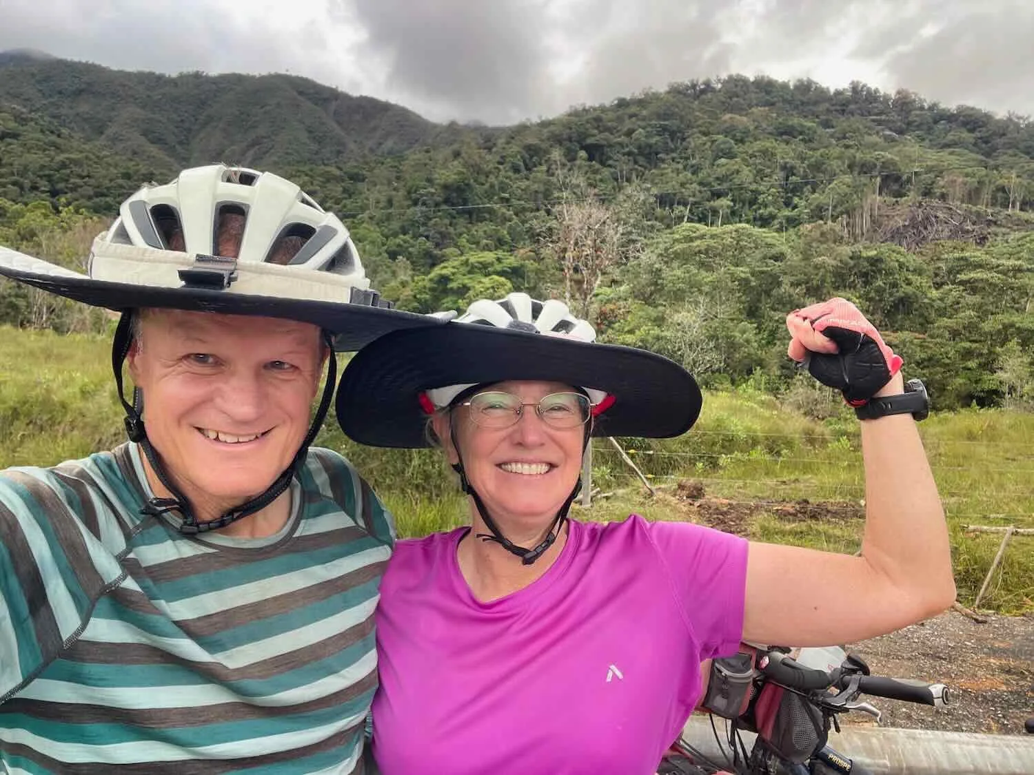
We made it!! By cycling from the tip of South America all the way back north to the place where our southward journey had ended with a bicycle crash, we completed our “flip-flop” odyssey of the Americas. We went southward from Alaska to Colombia, then northward from Patagonia (Ushuaia) back to where we left off in Colombia. In this photo, we are standing on the spot where the southward and northward journey’s came together. N of La Esmeralda, Huila Department, Colombia. Copyright © 2019-2026 Pedals and Puffins.
Of course, there was still the small matter of making it to town before we could actually call our tour of the full length of the Americas done. So after a brief celebration, we got back on our bikes and continued pedaling towards Pitalito. By that time the sky had turned gray, and ominously cloudy.
By the time we crossed the summit of the pass, we were cycling in a steady rain. With less than two hours to go before reaching Pitalito, we regretted losing so much time over breakfast.
At one point we ducked into a roadside tienda for about 15 minutes to wait out a particularly heavy shower. A guy riding a motorbike was already inside, busy pulling on a plastic jacket and pair of rain pants over his other clothes, before taking off again. The owner of the little shop didn’t seem to mind any of the commotion.
Not long after that we saw another cyclist taking refuge under an awning that covered a big gate leading to a dirt road. Following his cue, we also pulled into the shadow of the awning to get another break from the rain.
We learned that Mauricio was from Medellín, and was cycling to Ecuador where he hoped to make it as far as Cotopaxi National Park. The Trampolín de la Muerte was part of his itinerary, so we gave him some tips for tackling the mountain road. He also knew a lot about Colombia, giving us advice about Pitalito and raving about Bogotá, which he said was one of his favorite cities in the country (because of its culture and extensive network of cycling paths). He had such a great attitude, it almost made us forget the rain.
Hanging out with Mauricio, a cyclist from Medellín, under an awning over a gate to escape the rain. You can tell who was going uphill (generating lots of heat) and who was going downhill (getting chilled) by how Mauricio was dressed and how we were all bundled up. S of Bruselas, Huila Department, Colombia. Copyright © 2019-2026 Pedals and Puffins.
As if Mauricio’s positive energy had an effect on the weather, conditions improved as we descended towards Pitalito. The sky became lighter, the rain became a mist, the road dried out, and the air felt warmer. We finally seemed to have escaped the streak of bad luck that had stalked us over the past few days. Our spirits were high as we rolled into town.
Rolling into Pitalito, the final city on our multi-continent bicycle tour. Huila Department, Colombia. Copyright © 2019-2026 Pedals and Puffins.
When we finally arrived at the Hostal Ullumbe - two days later than originally planned - Yoli, the housekeeper, greeted us with an enthusiastic hug, and Floralba, the owner, warmly welcomed us to what she called ‘our home in Colombia.’ Both Yoli and Floralba, remembered us from our long stay at the hostal in 2024, when PedalingGal was recuperating from the bicycle accident. Back then, they both had been incredibly kind and took good care of us when we needed it. It was a very happy homecoming.
The owner of the Hostal Ullumbe loves orchids and has turned the hotel’s courtyards into lush gardens. It was great to see the orchids still thriving. Hostal Ullumbe, Pitalito, Huila Department, Colombia. Copyright © 2019-2026 Pedals and Puffins.
One of the orchid plants in bloom. Hostal Ullumbe, Pitalito, Huila Department, Colombia. Copyright © 2019-2026 Pedals and Puffins.
Over the next few days we enjoyed visiting some of the businesses we remembered fondly from our last stay in Pitalito, including our favorite breakfast place and Danny’s fruit and ice cream shop (mmmmm, delicious!).
However, our top priority was to prepare for a flight from Pitalito to Bogotá. Fortunately, we had done all this before back in 2024, when we had made our way by plane from Pitalito to Ushuaia (via Bogotá) to start our northward bicycle journey back to this very spot. So, we reached out to some of the same folks who had helped us the last time. We bought our airline tickets from the same travel agent. We had our bicycles boxed by the same bike shop. And we knew just where to look to purchase a couple of lightweight travel bags to pack up our gear.
The only connection that didn’t quite work out was for our transportation. The guy that had helped us move our boxed-up bicycles two years ago was out of town, but the bike shop was able to find a moto-truck for us (see picture below) to get our bikes to the hotel. We then talked to a local taxi driver who put us in touch with a local truck driver for our transportation to the airport.
This moto-truck setup worked fine for transporting our boxed bicycles from the bike shop to our hotel, a distance of just half a mile. Pitalito, Huila Department, Colombia. Copyright © 2019-2026 Pedals and Puffins.
There wasn’t room for our boxed bicycles in our hotel room, so they stayed in the hallway just outside our room for a couple of days. Hostal Ullumbe, Pitalito, Huila Department, Colombia. Copyright © 2019-2026 Pedals and Puffins.
Just a week after arriving in Pitalito, we were heading out on an airplane to Bogotá. In this photo, you can see our boxed bicycles, laying on their sides, on top of the luggage trolley. Unlike bigger planes, the cargo area on the Satena airplane was in front - between the pilots and the passengers. Pitalito Airport, Huila Department, Colombia. Copyright © 2019-2026 Pedals and Puffins.
Before we knew it, we had landed in Bogotá and our big adventure of cycling across the Americas had ended. It had been a fabulous four years, but now it was time for a new chapter. Bogotá, Capital District, Colombia. Copyright © 2019-2026 Pedals and Puffins.