Cycling Bolivia’s Altiplano, Part 2: Uyuni to La Paz
24 September - 31 October 2025
24 Sept - Uyuni to Colchani (14.2 mi, 22.9 km)
25 Sept - Colchani to Sand Storm Wild Camp (36.7 mi, 59.0 km)
26 Sept - Sand Storm Wild Camp to Quinoa Field Wild Camp (34.0 mi, 54.7 km)
27 Sept - Quinoa Field Wild Camp to Challapata (42.5 mi, 68.4 km)
28 Sept - Rest Day in Challapata
29 Sept - Challapata to Pazña (23.2 mi, 37.3 km)
30 Sept - Pazña to Machacamarca (31.0 mi, 49.9 km)
1 Oct - Machacamarca to Oruro (21.4 mi, 34.4 km)
2-4 Oct - Layover in Oruro
5 Oct - Oruro to Caracollo (23.4 mi, 37.7 km)
6 Oct - Caracollo to Lahuachaca (36.8 mi, 59.2 km)
7 Oct - Lahuachaca to Patacamaya (18.3 mi, 29.5 km)
8 Oct - Patacamaya to Tolar (20.3 mi, 32.7 km)
9 Oct - Tolar to El Alto (29.7 mi, 47.8 km)
10 Oct - El Alto to La Paz (11.2 mi, 18.0 km)
11-31 Oct - Layover in La Paz (including Death Road)
Immersed in the Altiplano
Since ancient times, the altiplano has been the heartland of Bolivia’s most powerful and influential civilizations. While the people of the lowlands to the east remained isolated in as many as 30 distinct groups, the Tiwanaku, Aymara and Inca people of the highlands built cities with monumental architecture, specialized social classes, and cohesive political systems.
Given the undeniably harsh conditions of a land that averages 12,300 ft (3,750 m) above sea level (e.g., thin air, temperature extremes, limited supplies of water, poor soil for agriculture, and virtually no access to wood) it seems improbable that humans would flourish there. But through the years people have adapted to the tough conditions, in part because the extensive grasslands are ideal for raising animals adapted to the high altitude, like llamas and alpacas.
And despite the hardships of the high altitude, the passage through the altiplano is easier than the alternative deserts and tropical lowland forests. As a result, transportation routes were created on the altiplano which have been used for hundreds of years by traders, invading and defending armies, and others - including occasional cyclists moving between the southern and northern parts of the South American continent.
Most of the altiplano has vast, open spaces with only a few, small towns that help to supply travelers and the scattered llama, sheep and quinoa farmers. However, there also are a few very large cities like La Paz, one of the highest altitude cities in the world, which have thrived in part because of the major mining operations that have been an important part of Bolivia’s economy for many years.
Cycling Among the Vicuñas
Our first two days of cycling out of Uyuni, Bolivia, took us across broad, flat plains surrounding the famous Uyuni Salt Flats. There was not quite as much salt along the highway as there was out on the salt flats, but the mud flats were still dusted with a thin crust of white salt.
Amazingly, this seemed to be the perfect habitat for vicuñas - the sweet-faced, wild ancestors of alpacas. Large herds of the tawny-colored animals could be seen traversing the mud flats in many places along our route - often where the land looked particularly inhospitable. It made us wonder if the vicuñas had special adaptations for living in salty environments. But apparently this is not the case. Without access to fresh water, there would be no vicuñas. So there must have been a freshwater spring somewhere in the area.
A large herd of wild vicuñas (the wild relatives of alpacas) made its way across the salty mud flats north of Uyuni, Potosí Department, Bolivia. Copyright © 2019-2025 Pedals and Puffins.
With their big eyes and gentle “smile”, vicuñas look as sweet as their domestic descendants - the alpacas. S of Colchani, Potosí Department, Bolivia. Copyright © 2019-2025 Pedals and Puffins.
We spent our first night in the town of Colchani (pop. 12,000), also known as the Salt City for its central role in mining and processing salt from the Uyuni Salt Flats. It’s a very sleepy town, with much less tourist infrastructure than the bustling hub of Uyuni just to the south. An afternoon walk through town in an attempt to find a meal proved completely hopeless. There were no open restaurants or cafes during the siesta time in Colchani. (We were fortunate that our hotel room included both dinner and breakfast, given the dearth of dining options in town.)
However, the salt theme was completely inescapable. We spent the night in a hotel that was built, in part, with bricks of solid salt. While wandering around town, we saw large piles of salt packaged for retail sale.
We were also the lone visitors to the Museum of Llamas and Salt (yes, that’s really its name), where a speed-talking guide gave us a personal, whirlwind tour of dioramas depicting aspects of llama husbandry, indigenous rituals related to llamas, and textiles made with llama wool. With respect to salt, there were explanations of how the salt is mined and processed. It was interesting, but would have been a lot more informative with a guide that spoke Spanish more slowly. As it was, we understood less than a quarter of what she said.
The lower half of the walls in our hotel room were made of solid-salt bricks, and the beds were constructed from mattresses set on platforms made of salt. Our most vivid memory of the room is that it was COLD (salt bricks provide poor insulation). We spent much of our time in the room buried under a pile of blankets. Colchani, Potosí Department, Bolivia. Copyright © 2019-2025 Pedals and Puffins.
A view of the spotless, new-looking Central Plaza. It was oddly deserted on a Wednesday afternoon (when most town plazas would be humming with vendors and people enjoying a moment of relaxation). Colchani, Potosí Department, Bolivia. Copyright © 2019-2025 Pedals and Puffins.
The sign outside the Museum of Llamas and Salt fit the theme, with a depiction of some llamas standing on the salt flats. Colchani, Potosí Department, Bolivia. Copyright © 2019-2025 Pedals and Puffins.
After departing Colchani, we continued cycling through the salty mud flats, nearly devoid of vegetation. Mirador de Chita, Potosí Department, Bolivia. Copyright © 2019-2025 Pedals and Puffins.
At this time of year, even the rivers were largely dry - with salt encrusted river beds. However, a distant bank of clouds looked like it might be dropping some rain in the mountains to our east. Maybe the water would return soon. Mirador de Chita, Potosí Department, Bolivia. Copyright © 2019-2025 Pedals and Puffins.
Despite the harsh conditions, large groups of vicuñas continued to appear along our route. Mirador de Chita, Potosí Department, Bolivia. Copyright © 2019-2025 Pedals and Puffins.
Overtaken by a Wall of Sand
But the flatlands around the Uyuni Salt Flats couldn’t last forever. About three hours after we departed Colchani, the climbing began. For the remainder of the day we slowly worked our way back into the mountains, to an altitude of around 13,000 ft (3,960 m). Most of the landscape was covered by the dry, puna grasslands. But whenever we passed even the smallest of human settlements, the earth had been plowed into dusty fields - ready for planting quinoa in the spring. The altiplano is famous for its production of quinoa, but this was the first time we had seen any evidence of agriculture along our route.
We had planned to camp on top of a high mesa, and were delighted that it was still before 3pm when we arrived. A relaxing afternoon at camp seemed like a just reward for climbing up the mountain in the thin air. But it was not to be.
After following a dirt road that led up onto a secluded ridge, we were shocked by what we saw: just to our north a huge, dense, seething, brown wall of sand towered hundreds of meters high. And it was blowing towards us.
At first it looked like the sand cloud was just to our east. Watching it with dread, we talked ourselves into believing that it might stay far enough to the east to bypass us. But as we scouted the ridge for a camping spot, the wind whipped up even more and the sand storm grew in size. By 2:45 the brown cloud was bearing down on us, and we reached the inescapable conclusion that we needed to take evasive action.
This is something you hope never to see. A massive sand storm blew towards us as we searched for a campsite on a high ridge in southwestern Bolivia. The barren, recently plowed quinoa fields throughout the area probably created the perfect conditions for a sand storm when the fierce, afternoon winds began to blow. S of Huacoma, Potosí Department, Bolivia. Copyright © 2019-2025 Pedals and Puffins.
Grabbing our bicycles, we hustled quickly to our west, trying to find a way to get out of the storm’s path. But it soon was apparent that we would not be able to outrun the storm. We looked around for shelter, but there was nothing - no trees, no bushes, no buildings - nothing except flat, rolling grasslands as far as we could see.
By that time there was a fierce wind whipping and the sand storm was bearing down on us fast. Out of options, we decided to put on our face masks, lay our bikes on their sides, sit on the ground and wait for the storm to pass. As the dense, brown cloud swept over us we closed our eyes to avoid the sand. The storm roared around us for nearly an hour, with the wind speed easily reaching 60 mph (100 kph) or more. There wasn’t much we could do other than wait it out.
When we were unable to out-run a fast moving wall of sand, we donned face masks, laid down our bikes, and waited. There was nowhere to take shelter in the area, not even a bush to hide behind, so we just sat on the ground. This photo was taken after the worst of the storm had already passed. S of Huacoma, Potosí Department, Bolivia. Copyright © 2019-2025 Pedals and Puffins.
Eventually the wind speed subsided and most of the sand-filled air had dissipated. That’s not to say that the air was calm - far from it. The wind was still blowing at around 30 mph (50 kph). But by now it was approaching 4pm, and we felt the pressure to find a campsite before it got dark.
In the blustery air, we pushed our bicycles back up the hill to the top of the ridge. Yet now we were acutely aware of how exposed we were up on top of the ridge, given the recent wind storm. PedalingGuy ended up hiking way down into a dry canyon in hopes of finding a flat spot for our tent that would be protected from the wind. Unfortunately, all he discovered was that it also was windy down in the arroyo. Plus, it would have been horrendously difficult to get our bikes down to the bottom, and back out. We nixed that idea.
Unsure of what to do, we decided to eat (yes, when in doubt, eat dinner). At least we would be able to have dinner while it was still light. Eating also would give us a chance to pause and consider all our options (and perhaps think more clearly on a full stomach). Much like after the eye of a hurricane passes, the wind had already shifted 180 degrees, and now was blowing hard from the south. In a best case scenario, we hoped that the wind might actually die down by the time we were finished with dinner.
Finally, it felt like our luck began to improve. To our great relief the wind did, in fact, die down while we ate. It was still a bit breezy, but not much worse than a normal evening on the altiplano. Things were definitely looking up. By some miracle, we managed to set up our tent on the ridge top, and settle into the tent before it was fully dark.
After being battered by the wind for hours, we finally managed to pitch our tent on a sandy ridge top, high on the altiplano. Although the bulk of the sand storm had passed, the air remained a hazy brown color throughout the evening. S of Huacoma, Potosí Department, Bolivia. Copyright © 2019-2025 Pedals and Puffins.
The Road Through Río Mulato
The next day we continued our journey across Bolivia’s sparsely populated southwest. Over the course of the day we passed only one town of note. Río Mulato (pop. 780) was a rather scruffy, frontier settlement. Although we arrived before 11am, none of the restaurants in town were open, dashing our hopes for getting a decent breakfast. (In truth, the few restaurants looked pretty unclean, so maybe it was just as well that we didn’t end up patronizing any of them.)
There was, however, a big, open-air market under way. To satisfy our hunger, we bought a couple of big wedges of watermelon at the market, and supplemented that with some ice cream and potato chips from a tiny shop that seemed to sell only junk food.
Before reaching Río Mulato we crossed paths with four cyclists from Colombia. (From left: Jairo, Carolina, Diana and Dídier). They were all heading south, with hopes of making it to Ushuaia, at the southern tip of Argentina. N of Huacoma, Potosí Department, Bolivia. Copyright © 2019-2025 Pedals and Puffins.
To our amazement, Dídier was carrying a dog in his bicycle trailer - the fourth person we had seen traveling by bicycle with a dog since entering Bolivia! The dog was pretty big, and might have seemed heavy for bicycle travel. However, given the sizable load of other gear that Dídier was hauling in that trailer, perhaps the dog’s weight wasn’t that much of a factor. N of Huacoma, Potosí Department, Bolivia. Copyright © 2019-2025 Pedals and Puffins.
On the outskirts of Río Mulato, a herd of llamas grazed along a set of railroad tracks. Río Mulato, Potosí Department, Bolivia. Copyright © 2019-2025 Pedals and Puffins.
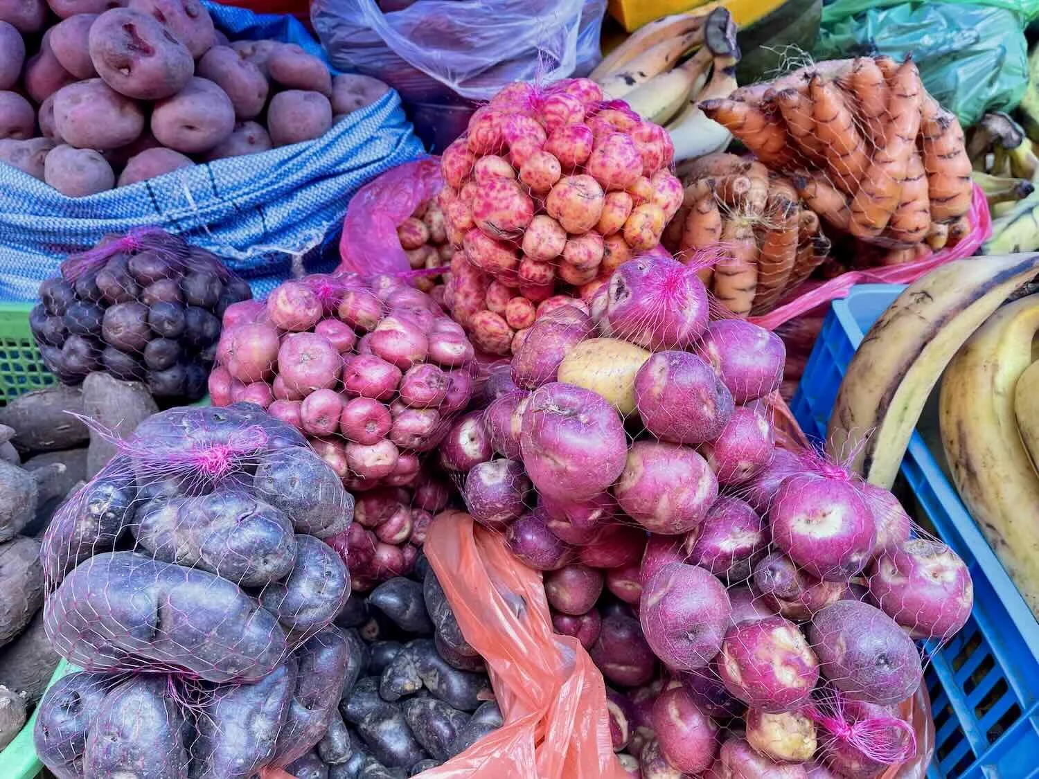
This vendor in the open-air market was selling at least ten different varieties of potatoes. Río Mulato, Potosí Department, Bolivia. Copyright © 2019-2025 Pedals and Puffins.
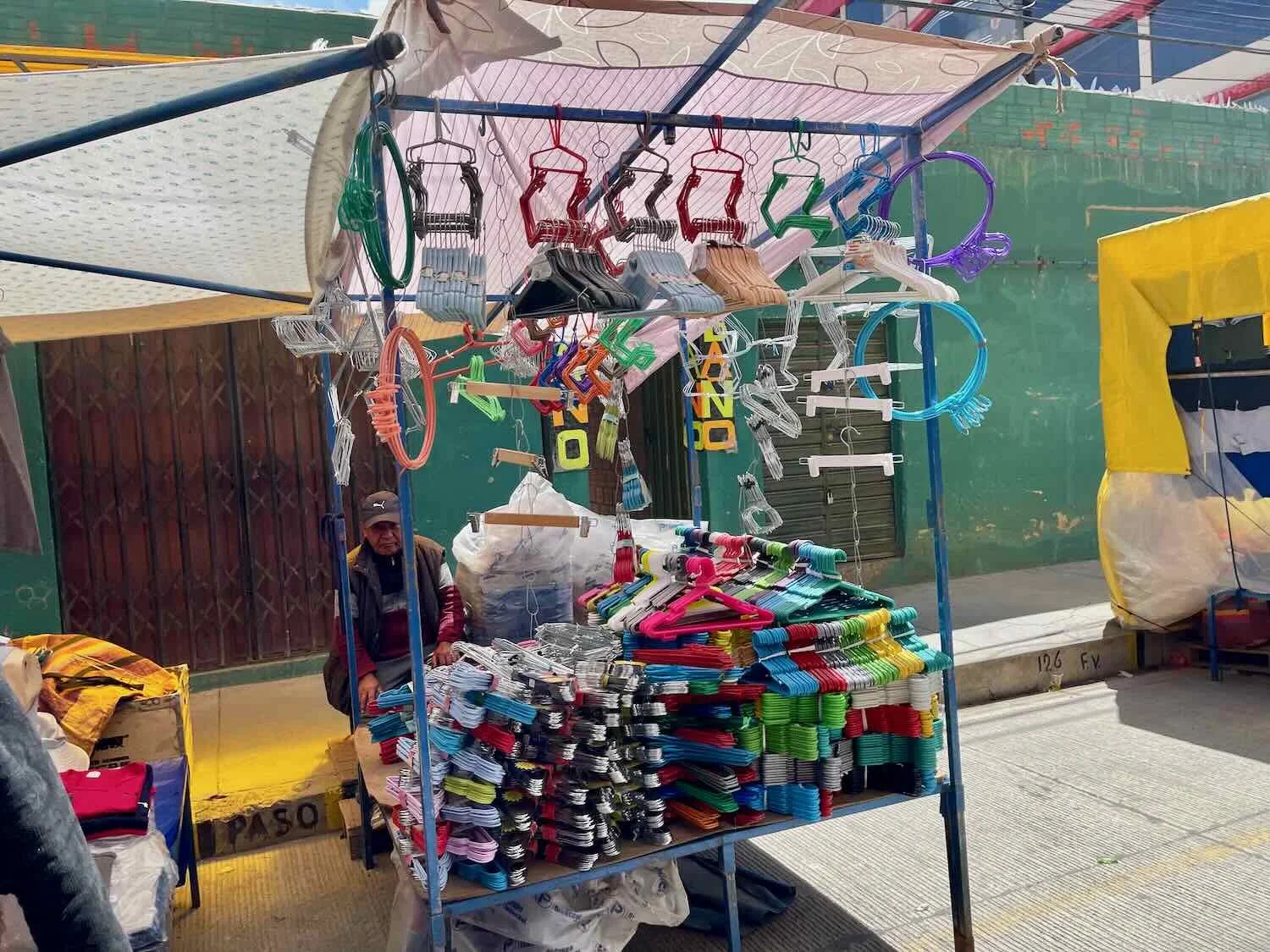
This was the first time we saw one of Bolivia’s ‘mobile shops’ - in this case, a hardware store run out of a truck. They turned out to be a pretty common sight on the roadsides of villages throughout the country, selling all manner of items that might otherwise be hard to come by in small, rural towns. The owners would drive the trucks from town to town, setting up shop for a day before moving on down the road. Río Mulato, Potosí Department, Bolivia. Copyright © 2019-2025 Pedals and Puffins.
After passing through Río Mulato we continued cycling through open farmland. Often the wind would swirl the sand into dust devils that would send brown columns climbing hundreds of feet into the sky. N of Rio Mulato, Potosí Department, Bolivia. Copyright © 2019-2025 Pedals and Puffins.
A couple of hours north of Río Mulato the flat grasslands were interrupted by an outcrop called the City of Rocks. It was a nice change of pace to see the impressive cliffs and swirling rock shapes, sculpted over the centuries by the constant winds. N of Río Mulato, Potosí Department, Bolivia. Copyright © 2019-2025 Pedals and Puffins.
We didn’t have a specific camping spot that we were aiming for that evening. So as the afternoon lengthened, we started looking for a suitable place to pitch our tent. Unfortunately, by that point we had entered a region that was very flat, and blanketed with plowed fields destined to be planted with quinoa. Before long it was clear that we would have a very hard time finding a spot for our tent.
Eventually we saw a sandy track leading away from the highway, past a row of quinoa fields, towards a distant ridge. We decided to head down that path and see where it would lead us.
About a quarter mile from the highway we left the quinoa fields behind and entered the scrubby grasslands. There we found a very nice, flat spot that didn’t have any thorn bushes (a huge bonus), and was far enough from the road to be inconspicuous. We decided that would be the best we could hope for, and settled in to wait for the light to fade before pitching our tent. As an added bonus, the headwind that had pounded us all day finally died down while we ate our dinner. So by the time we set up our tent, the air was nearly calm. It was wonderful to finally have a night without drama.
Sunset over the altiplano grasslands, as seen from our campsite near the quinoa fields. N of Río Mulato, Potosí Department, Bolivia. Copyright © 2019-2025 Pedals and Puffins.
The Dusty Towns of Rural Oruro
The campsite near the quinoa fields ended up being the last time we would wild camp on our route to La Paz, Bolivia. Behind us lay the driest and least-populated regions of the altiplano, where the long distances between towns, scattered llama ranches, and wide-open grasslands had offered few opportunities for indoor lodging.
But as we cycled northward, the landscape mellowed. Within a half hour of packing up and departing from our campsite, we crossed the border into Bolivia’s Oruro Department - where roadside villages would be much more frequent, and fertile soils supported more agriculture - yielding a landscape largely converted into quinoa fields, and even a few dairy farms.
The typical farmer had a very small herd of only 2-5 cows - each of which was looked after closely. There were no fences to corral the livestock. Instead, either a shepherd was present to watch over the animals, or each animal was individually tied to a rope anchored to the ground, so that they would not wander off.
Our journey evolved into daily rides from one dusty, rural town to another. On the endless, flat landscape the distances were really deceiving. Often we could see a town ahead, yet it would still be 5-6 miles (8-10 km) away.
The stretch from our campsite to the town of Challapata was easily the most enjoyable day of cycling since we had left the town of Uyuni. The terrain was pretty flat, and for the first 1.5 hours we actually had a very rare tailwind. It was glorious. We reveled in the feeling of sailing down the highway, without each pedal stroke becoming a fight against the elements.
For much of the day we cycled past dusty fields that had been plowed in preparation for the quinoa planting season (September to October). PedalingGuy remarked that the world seemed to have been taken over by quinoa. N of Sevaruyo, Oruro Department, Bolivia. Copyright © 2019-2025 Pedals and Puffins.
Some of the fields were being prepped for planting. The fields in this area were large and fairly flat, allowing the farmers to use tractors. Up to this point, tractors had been an uncommon sight on our trip. On the small fields (which were more common in other parts of Bolivia), hand tools and oxen were typically used to work the soil. North of Sevaruyo, Oruro Department, Bolivia. Copyright © 2019-2025 Pedals and Puffins.
Natural landscapes became much more scarce among the quinoa fields. But where there was native vegetation, there was wildlife. We spotted this Andean Fox (a.k.a., a culpeo) slinking among the patchy vegetation. N of Sevaruyo, Oruro Department, Bolivia. Copyright © 2019-2025 Pedals and Puffins.
Like a mirage, the expansive Poopó Lake shimmered just to the west of our route. Bolivia’s second biggest lake by surface area, it is saltier than the ocean and reaches a maximum depth of only about 10 ft (3 m). Several times in the last century, the lake dried up completely. Near Santiago de Huari, Oruro Department, Bolivia. Copyright © 2019-2025 Pedals and Puffins.
With the flat terrain and favorable winds, we rolled into the village of Santiago de Huari (pop. 4,330) by 1pm. We were very excited by our early arrival, and were looking forward to resting out of the sun and wind in a hotel room - even a humble one.
The sign at the entrance to Santiago de Huari was particularly grand, complete with an Andean Condor statue on top and cactus garden at the base - raising our hopes for a pleasant night’s rest in the town. Santiago de Huari, Oruro Department, Bolivia. Copyright © 2019-2025 Pedals and Puffins.
Ever since we had left the town of Colchani - a major producer of salt in Bolivia - we had occasionally been passed on the highway by cargo trucks overflowing with salt. Often the side of the highway was dusted with chunks of salt that fell from the trucks. In Santiago de Huari, we got a close-up look at one of the salt trucks parked near the plaza. Santiago de Huari, Oruro Department, Bolivia. Copyright © 2019-2025 Pedals and Puffins.
But when we reached the doorstep of the basic hospedaje where we had hoped to stay, there was no one around. That’s not particularly unusual in places where the people who run the hotels often have other jobs, or take a break from work during the afternoon siesta. So we set about trying to locate the manager. We rang the doorbell several times, but got no response. There was a phone number written (in magic marker) on the wall near the door, so we tried sending a message to that number. After waiting another 10 minutes, we still got no response.
So as usual when we are not sure what to do, we started looking for something to eat. We went over to the town plaza which was just a couple of blocks away, where street venders were grilling various meat and rice dishes, and where we could wait for either a response to our message, or for someone to show up at the hotel.
Yet by the time we had finished our meal, we still had not received an answer from the hotel. There appeared to be another hospedaje close by, so we went over to check it out. But again, there wasn’t anyone around. The man who ran a small shop next door told us that the owners were away, because they ran another store over in the center of town. Worse, he said they wouldn’t come back to the hospedaje until around 5pm. That would be an awfully long wait.
Hoping for a change of luck, we went back to the first place, and sent one more message. Then finally, we got a response. But it was not good news. The host wrote back to tell us that he wasn’t at the hospedaje because he was ill, and he would not be taking guests that night. In small Bolivian towns most businesses are run by the owners - they don’t have employees who can step in when the owner is sick. Instead, the business just stays closed. Things were looking grim.
However, all was not lost. It was only about 8 more miles (13 km) to another town that actually had additional lodging options. With just a light side wind and gentle terrain, we knew we could make it there pretty quickly, even though the afternoon shadows were lengthening. Sitting on the hospedaje’s doorstep, we contacted a hotel in Challapata and secured a room reservation. Then we just had to cycle the final miles to find refuge.
The town of Challapata (pop. 12,700) turned out to be a lively place to spend a rest day. We were there on a weekend, when a plaza on the edge of town transformed into a large, open-air market - which just happened to be the biggest and most influential quinoa trading market in the country. In fact, the majority of quinoa in Bolivia is grown in the Oruro Department, and the Challapata Weekly Fair is the place where producers come to sell their quinoa. The market is so fundamental that the prices negotiated between buyers and sellers in Challapata are used to set quinoa prices throughout the country.
With quinoa trading driving local commerce, the rest of the market has also become a hive of commercial activity. Instead of being laid out neatly along the city streets, the whole market was crammed into a large, dirt plaza at the edge of town. Most of the plaza had become a parking lot, as it appeared that everyone from the surrounding countryside had driven to town for the market. Cars streamed in from side streets, parking side to side, and bumper to bumper, covering a whole city block. Market stalls selling all manner of clothes, home goods, hardware and street food formed a wreath of shops for several blocks surrounding the plaza. It was one of the most crowded and chaotic markets we had seen during our travels.
To our surprise, the cars in this town had an interesting mix of steering wheel placement. About a third had the steering wheel on the right and the rest had the steering wheel on the left. Bolivia was the first country we could remember where residents had such a mix of of cars. Obviously, the cars were being imported from a wide range of countries, and steering wheel standards were not a priority.
An avenue approaching the Challapata Weekend Market was lined with ladies minding clusters of brightly colored containers. This was the black market for fuel (diesel is a different color than gasoline so they don’t get mixed up). Shortages meant that drivers could wait in line for days to buy gasoline or diesel at normal gas stations. So paying a lady for some gas out of a plastic container probably seemed like a reasonable alternative. In Bolivia women do most of the selling in the markets, in stores and on the streets. We were told that men don’t like all the chit chat and gossip involved, so they work on construction, in mines and on farms instead. Challapata, Oruro Department, Bolivia. Copyright © 2019-2025 Pedals and Puffins.
With all the people crowding the market, food vendors did a brisk business. This guy was cooking up a mountain of meat in anticipation of the afternoon rush. This was another division of labor by gender - grilling was almost exclusively a job for men (while women served the tables and/or cooked over a stove). Challapata, Oruro Department, Bolivia. Copyright © 2019-2025 Pedals and Puffins.
On Sunday morning, a food stall at the market was just about the only place in town to find breakfast. We ended up buying fried eggs from one vendor, even though we were not completely convinced that the conditions were sanitary (plates were simply rinsed in a bucket of water before being re-used, and it looked like it had been a while since they had bothered to change the oil in which the eggs were fried). Luckily, we didn’t get sick. Challapata, Oruro Department, Bolivia. Copyright © 2019-2025 Pedals and Puffins.
Three Very Different Days
The next three days of cycling could hardly have been more different from each other.
The first day (from Challapata to Pazña) was a relatively short and easy ride through dairy country, with blissfully light winds. We both enjoyed having plenty of time to stop and enjoy the scenery without feeling rushed. And even though we arrived in Pazña (pop. 4,250) in the early afternoon we were able to check into a quirky, little hostel right away.
The hostel was known by word of mouth only. There were no signs indicating that it was a hostel, but we had heard that when you get to town you look for a building that has three big stars on it. We found the building but then we were not sure which door to knock on to ask for a room. From past experience we realized that doesn’t really matter much, since if you get it wrong people are more than willing to point you in the correct direction.
A characteristic bird in this part of the altiplano was the handsome Mountain Caracara - with its bold, black and white feathers and bright red/orange patch on its face. N of Challapata, Oruro Department, Bolivia. Copyright © 2019-2025 Pedals and Puffins.
A notable change on this day was the presence of dairy cows. We saw lots of small herds of cows along the way. One village even had this statue of a Holstein cow and calf. Huacané, Oruro Department, Bolivia. Copyright © 2019-2025 Pedals and Puffins.
The hospedaje in Pazña didn’t have a name or sign. We had heard by word of mouth that if you knock on the door near the three stars you can ask for a place to sleep. There were several doors, but luckily we picked the correct one. Pazña, Oruro Department, Bolivia. Copyright © 2019-2025 Pedals and Puffins.
The hospedaje in Pazña had a lot of interesting quirks. One of the first things that really stood out was the presence of multiple lines hung throughout the inner courtyard. But instead of holding drying laundry, the lines were crammed with super-thin slices of air-drying meat. The pieces were hanging so low that we had to duck under them each time we entered or exited the hospedaje, to avoid hitting our heads on the meat. Refrigeration is often missing in many homes, so drying meat for preservation is still important here. Pazña, Oruro Department, Bolivia. Copyright © 2019-2025 Pedals and Puffins.
Another quirk of the hospedaje was that the door to our room was incredibly short. PedalingGuy stands about 5’10” (178 cm), but the top of the door frame was at least a couple of inches lower than that. So he also had to duck low, just to get in and out of our room. Pazña, Oruro Department, Bolivia. Copyright © 2019-2025 Pedals and Puffins.
The village of Pazña had a rough time when nearby Lake Poopó dried up completely in 2015 - creating challenges for access to clean water. The population of the village had fallen nearly 30% since then. As a result, whole neighborhoods seemed to be abandoned, with slowly crumbling buildings. Pazña, Oruro Department, Bolivia. Copyright © 2019-2025 Pedals and Puffins.
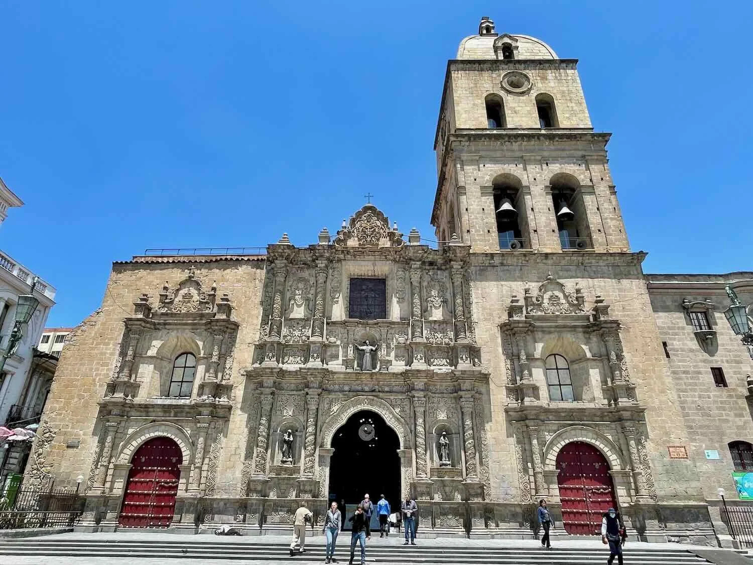
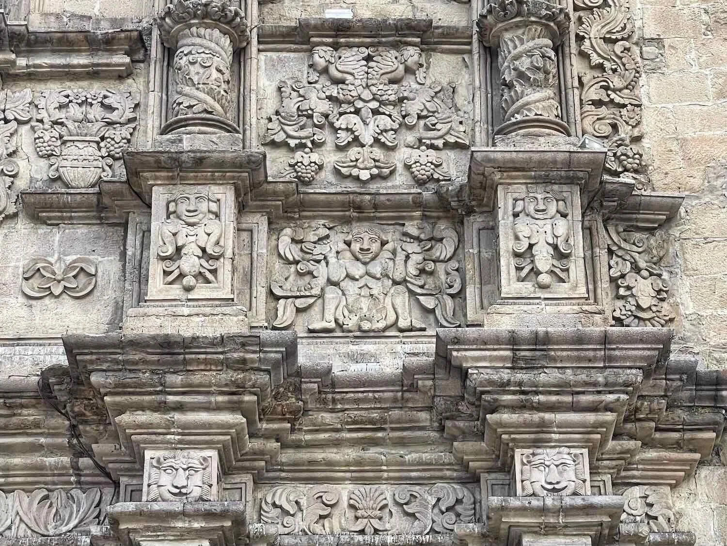
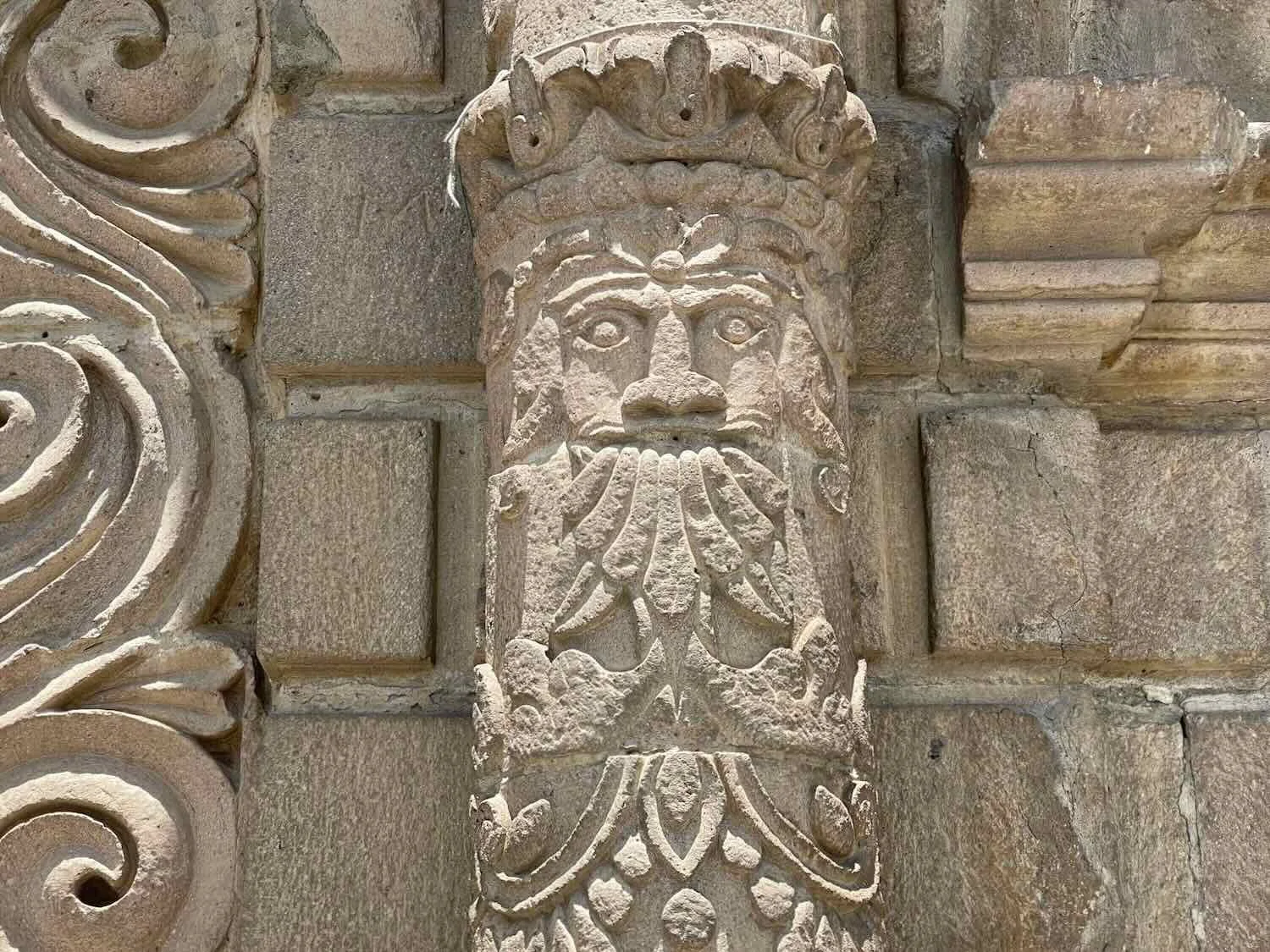
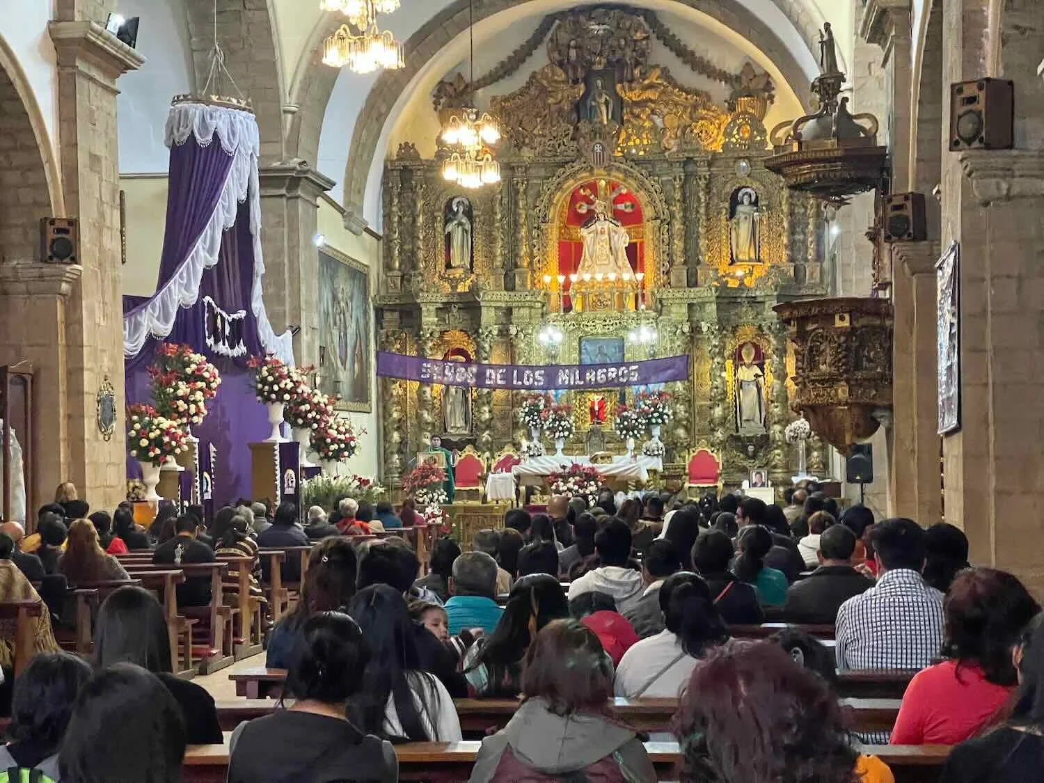
On the southern edge of town, nestled against a towering cliff stood the Church of Pazña. Although nearly all of the surrounding buildings appeared to be abandoned and falling apart, the church itself looked vibrant and well-maintained. The church holds a stone image known as the Christ of the Great Power, the patron saint of Pazña. In fact, just two weeks prior to our arrival the village had celebrated the Feast of the Lord of the Great Power, including pilgrimages to the venerated church. Pazña, Oruro Department, Bolivia. Copyright © 2019-2025 Pedals and Puffins.
The second day of cycling (Pazña to Machacamarca) was still very enjoyable for the first hour or so. But by 10am the wind was blowing 20 mph (32 kph), directly into our faces. And it kept getting stronger. The final 1.5 hours of cycling into Machacamarca were very, very challenging, with a direct headwind over 35 mph (55 mph). When we finally turned into town and escaped some of the wind, it felt magical.
We spotted this Andean Flicker on top of a telephone pole along our route. N of Pazña, Oruro Department, Bolivia. Copyright © 2019-2025 Pedals and Puffins.
A woman carried a heavy load near the edge of a tilled agricultural field. Andean women are known to be very stout and strong. We were told that that a ladies calves are considered the sexiest part of the female body - perhaps it is an evolutionary proxy for how heavy a load she can carry. More likely it is because the calves are the only patch of skin other than the face and hands that is ever exposed in the cold climate of the Andes. Llokeza Catavi, Oruro Department, Bolivia. Copyright © 2019-2025 Pedals and Puffins.
With a presidential runoff election rapidly approaching, there were many roadside signs promoting the candidates. Tuto (the nickname of one of the candidates) appeared to be particularly popular in this region. S of Poopó, Oruro Department, Bolivia. Copyright © 2019-2025 Pedals and Puffins.
The entry arch for the village of Poopó was more grand than most. The town is an important center for mining silver and tin. Poopó, Oruro Department, Bolivia. Copyright © 2019-2025 Pedals and Puffins.
The entry arch for the town of Machacamarca was not nearly as fancy as the one for Poopó. We were still very glad to see it - since we planned to end our day’s ride there. Machacamarca, Oruro Department, Bolivia. Copyright © 2019-2025 Pedals and Puffins.
We arrived at the gradually decaying Hotel Albergue Turístico in Machacamarca (pop. 2,044) around 2pm, ready to rest from battling the wind. Of course, no one was at the hotel so we had to call the phone number on the door in order to try and get someone to come help us. It took some time, but eventually we saw a woman walking down the street, and she let us in.
But it was a strange place. The hotel was built in 2020 using a grant from a national social investment fund, with the goal of supporting tourism related to the village’s mining and railroad heritage. However, it had been 100 years since the town’s heyday, and there was not enough tourism interest to sustain the hotel over time. In this case, the saying, “build it and they will come,” did not apply.
It was clearly meant to be a quality hotel - with nice furniture, spacious rooms, and an inner courtyard landscaped with live plants. But just five years after the hotel was completed, it was literally falling apart due to lack of maintenance.
Although the hotel had three floors of rooms, we were the only guests that night. Just one woman ran the reception, and also “cleaned” the rooms. Things that broke seemed to never get fixed. Once we were checked in, we encountered leaking pipes (dripping from the ceiling), damaged furniture, cracked and missing floor tiles, out-of-alignment doors, a non-functioning shower, and out-of-service light fixtures. Nothing in the hotel appeared to have had a good cleaning in quite some time.
On the bright side, it was still a big step up from our previous night in the quirky hospedaje (which also wasn’t particularly clean, and didn’t have a private bathroom). The bedroom was really big, with lots of space for our bicycles, the beds didn’t squeak (much), and we had access to decent wifi. At just 100 bolivianos (less than US$9) it felt like a good value despite the issues.
After settling in, we went looking for dinner. When we finally encountered what appeared to be the only open restaurant in town, we were thrilled to see that they had several signs outside advertising a range of 4-5 meal options. Unfortunately, when we went inside the waiter informed us that, in fact, they only had one menu item that evening - Charquekan. It’s a traditional dish of the Oruro region, containing sun-dried, salted and shredded llama meat, boiled eggs, potatoes, hominy, fresh cheese, and fried banana. Since we hadn’t yet eaten this dish (and we really didn’t have any other options), we decided to try it.
The Charquekan turned out to be surprisingly good. The portions were huge, so we both ended up taking the three boiled eggs plus some other leftovers back to the hotel with us - tomorrow’s breakfast as a bonus.
A view of the exterior of the Hotel Albergue Turístico. The futuristic architecture evoked a train from the town’s mining heyday - which was clearly a long time ago. Too bad the structure was falling apart from lack of maintenance. Machacamarca, Oruro Department, Bolivia. Copyright © 2019-2025 Pedals and Puffins.
A grand plate of Charquekan, made with dried/salted llama meat, fresh cheese, potatoes, hominy, fried bananas and boiled eggs. It was a tasty and filling dinner after a tough day of cycling. This traditional meal has the same exact ingredients everywhere it is served. Machacamarca, Oruro Department, Bolivia. Copyright © 2019-2025 Pedals and Puffins.
The third day of cycling (from Machacamarca to Oruro) was totally different, and even more challenging than the day before. It actually started perfectly, with smooth sailing for the first 20 minutes. But then we were completely blindsided by a major road construction project that lasted for the rest of the day - all the way to the outskirts of the city of Oruro.
All of the traffic in both directions was diverted onto a very rough, washboard-laden dirt track with no lane markings - and apparently no rules. Cars and trucks weaved back and forth, with lots of dangerous passing in both directions. It was utter chaos. We cycled as far to the right as possible. But the edge of the road was soft dirt, so we could not really get off the road very far, or get a safe distance from the chaotic traffic. For the next hour, it was a stressful and bone-rattling ride.
Then, we saw a guy on a motorbike riding on the newly laid, but still closed road - which was up on top of a dirt embankment. That gave us hope. We pushed our bikes up the dirt slope, and were thrilled to encounter fresh, smooth, virgin asphalt. Given the choice of riding on the new, still-unopened road and potentially getting yelled at, or continuing to risk our lives on the dirt road with all the traffic, we decided to pick the new asphalt.
Unfortunately our happiness didn’t last. In less than a mile we hit an active construction zone where they were still laying down the road we were on, and we had to abandon the pavement. However, there was now a dirt track to our right which was used exclusively by the construction guys - away from the main (dirt) highway with all of the crazy traffic. For the next 1.5 hours we cycled on the rough, dirt track, weaving back and forth among the construction trucks. It was not relaxing, but at least it wasn’t overly dangerous.
When the construction zone ended, we entered the outskirts of the city of Oruro (pop. 346,000). The streets were narrow and the traffic was dense. Vehicles were weaving in and out, and around other, double-parked cars. Lots of pedestrians were in the mix - as well as ad hoc vendors taking up room along the streets. There was little to no traffic enforcement, just lots more chaos. We had to remain very alert until we finally arrived at our target hotel, wiped out and ready to relax.
But not so fast… The hotel we had aimed for was a bust. We checked out five more hotels before landing at one that would be comfortable enough for a layover of a couple of days. Finally our odyssey was over.
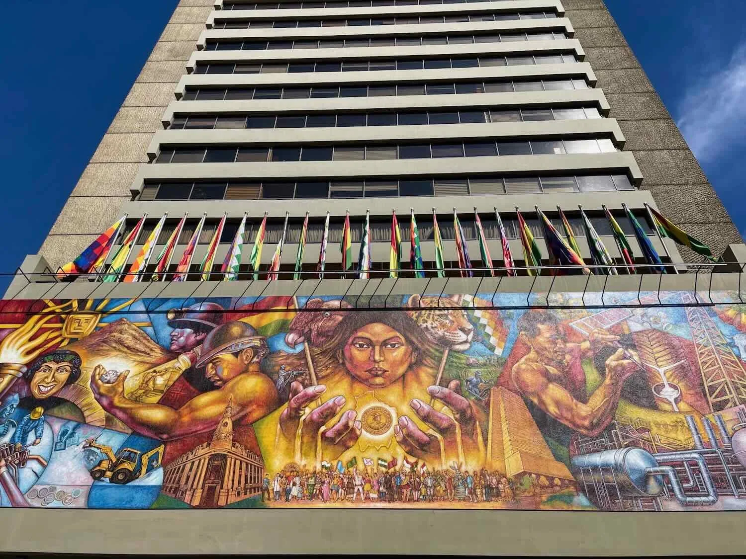
Oruro City - Mining and Trade
With our arrival in the city of Oruro, we were now solidly within one of the most populated parts of Bolivia. Oruro is, after all, the country’s fifth largest city.
For centuries Oruro depended on the boom-and-bust cycles of hard-rock mining, with the population expanding or shrinking based on the value of silver and tin on international markets. When the most lucrative local mines became less profitable in the early 20th century the future of Oruro looked bleak.
However, in the 21st century the city has reinvented itself as a major transportation hub for goods flowing between Bolivia’s other major population centers and key shipping ports along the Pacific coast of Peru and Chile. The economy is still heavily dependent on mining, and thus vulnerable to swings in commodity prices. But economic diversification as a regional trading hub has driven steady growth in the city over the past 25 years.
As a working class city, Oruro didn’t have a lot of tourist infrastructure. However, it definitely had an easygoing charm that won us over during our stay.
We caught sight of Herbie, the Love Bug, cruising down a street in the city. We hadn’t realized that Herbie retired to Bolivia. City of Oruro, Bolivia. Copyright © 2019-2025 Pedals and Puffins.
This sidewalk juice vendor became our favored source for fresh-squeezed orange or grapefruit juice, just a couple of blocks from our hotel. Her only fault was that she, like many street vendors, was very picky about the money she would accept. If your bill was too old, had any tears, or didn’t meet her high standards for some other reason, she would look at you with sad eyes and tell you how sorry she was that she could not accept your money (at which point you’d better pray that you had another, better bill in your wallet). City of Oruro, Bolivia. Copyright © 2019-2025 Pedals and Puffins.
The central plaza wasn’t particularly big, but it had lovely landscaping, a baroque, central fountain, and plenty of benches that encouraged people to stop and relax. City of Oruro, Bolivia. Copyright © 2019-2025 Pedals and Puffins.
A giant, brass armadillo seemed to be emerging from its burrow on one side of the central plaza. City of Oruro, Bolivia. Copyright © 2019-2025 Pedals and Puffins.
This mural offered a glimpse into a prehistoric world on the far side of the wall. City of Oruro, Bolivia. Copyright © 2019-2025 Pedals and Puffins.
On a hill just west of the city center stood the Virgin of Socavón Monument, honoring the city’s patron saint. Socavón translates roughly to “mine shaft,” evoking the Virgin’s role as the protector of miners. City of Oruro, Bolivia. Copyright © 2019-2025 Pedals and Puffins.
A cable car system was built to take tourists from the city center up onto the hill of the Virgin of Socavón. The exterior of the cable car station was decorated with larger than life figures drawn from Oruro’s large cast of Carnaval characters. City of Oruro, Bolivia. Copyright © 2019-2025 Pedals and Puffins.
Oruro to El Alto - A Village Every Five Miles
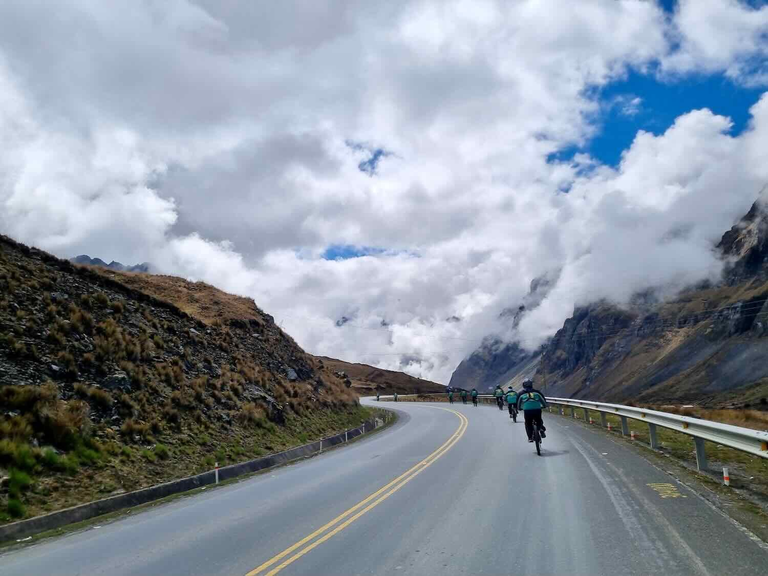
We took five days to cycle from Oruro (Bolivia’s fifth largest city) to El Alto (the second largest city). This ended up being one of the best sections of highway for stress-free cycling - with a huge, wide, smooth shoulder that kept us safely out of the main traffic lanes. That was important, because there also was a ton of fast moving traffic, including rumbling cargo trucks, hulking buses, and speeding colectivos. In addition, the terrain remained relatively mellow, with long, low hills.
However, the scenery was unremarkable - very flat, wind-swept, degraded grasslands sprinkled with scattered houses, decaying industrial buildings, and frequent settlements that provided few, if any services. It seemed like there was a farming village every five miles or so, but most of them were pretty small.
A row of smoke stacks marked one industrial site along our route, which produced the terracotta bricks used for many homes and other buildings in the area. N of Oruro, Oruro Department, Bolivia. Copyright © 2019-2025 Pedals and Puffins.
This ceramic factory was named for the Virgin of Copacabana, the patron saint of Bolivia - complete with a prominent shrine dedicated to the Virgin near the entrance. N of Oruro, Oruro Department, Bolivia. Copyright © 2019-2025 Pedals and Puffins.
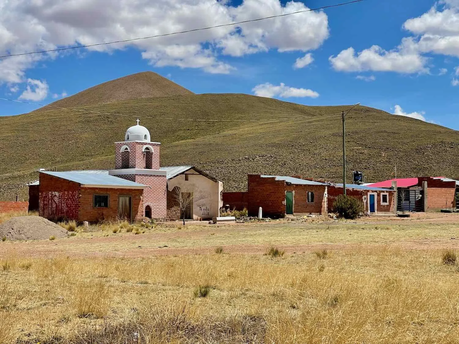
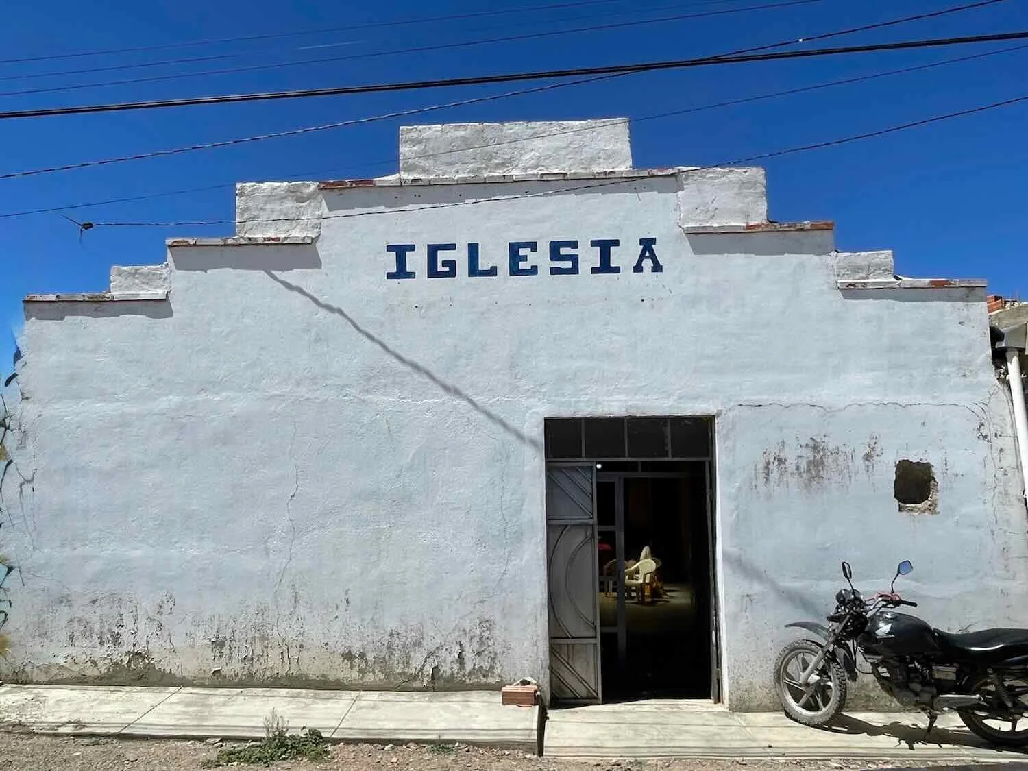
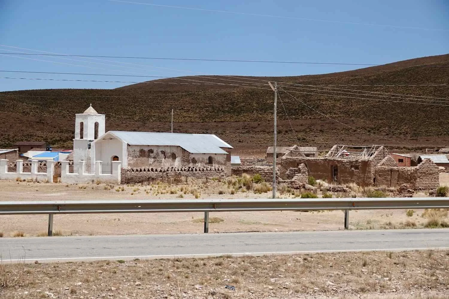
Once a village reached the size of having around 10 houses, it also tended to have a church. We were struck by the great variety of building styles found in these little, community churches. Unlike other regions which tended to have very consistent designs, these places seemed to build their village churches using whatever materials and architectural skill sets were readily available.
Over the course of the previous week it had begun to rain each night - sometimes with big storms that included thunder, lightning, and heavy downpours. As a result, we began to see more patches of standing water (attractive to birds like these Puna Ibis), and even some patches of green grass in low-lying areas. Lequepampa, La Paz Department, Bolivia. Copyright © 2019-2025 Pedals and Puffins.
Away from the villages, scattered homes and farm buildings were often still built from traditional materials like mud bricks and thatched roofs. Near Konani, La Paz Department, Bolivia. Copyright © 2019-2025 Pedals and Puffins.
Along this part of the route, llamas were largely replaced by herds of sheep - nearly always attended by a shepherd who spent his/her day following the flock, and making sure it didn’t get too close to the highway. Fenced pastures were very rare. Near Lahuachaca, La Paz Department, Bolivia. Copyright © 2019-2025 Pedals and Puffins.
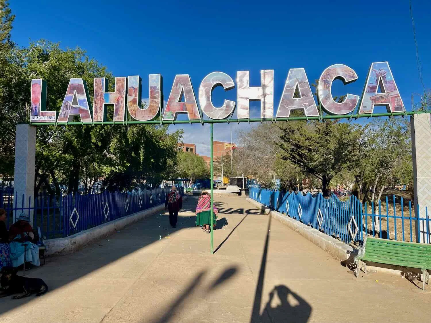
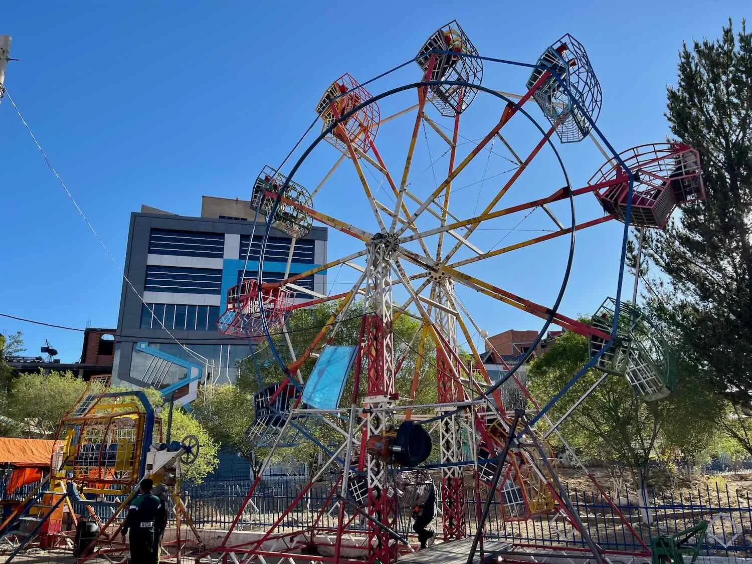
We spent one night at a very basic hostel in the town of Lahuachaca (pop. 5,875), one of the larger settlements along the way. Lahuachaca actually had a spacious, landscaped plaza, complete with a miniature amusement park comprised of a Ferris wheel, merry-go-round, blow-up slide, and some foosball tables. The Ferris wheel was especially popular, and was full of kids who screamed with delight each time their seats spun through the air.
A sign along the highway commemorated the site of the Battle of Aroma (1810), one of the earliest victories in Bolivia’s war of independence - and considered the birth of the country’s new army. Near Sica Sica, La Paz Department, Bolivia. Copyright © 2019-2025 Pedals and Puffins.
Ever since we had entered the Department of Oruro, we had passed through numerous towns whose names were a combination of the same, two, short words. For example, there was Sica Sica, Sora Sora, Cala Cala, Uyu Uyu, Vila Vila, and Ayo Ayo. Even some other names that are no longer strictly double words are derived from original place names that were (e.g., Oruro was originally named Uru Uru). This is a legacy from the native Quechua language, which used repetition of words as a form of emphasis.
On the third day we stopped for lunch at the delightful plaza in the village of Sica Sica (pop. 3,085) - which proudly proclaimed itself to be the capital of Quinoa Dulce (sweet quinoa). “Sweet” varieties of quinoa (usually white or golden varieties) have lower concentrations of bitter compounds, making them more popular for human consumption. Sica Sica, La Paz Department, Bolivia. Copyright © 2019-2025 Pedals and Puffins.
A look at our typical, “on-the-go” lunch of easy to source bread, tuna and bananas. Sica Sica, La Paz Department, Bolivia. Copyright © 2019-2025 Pedals and Puffins.
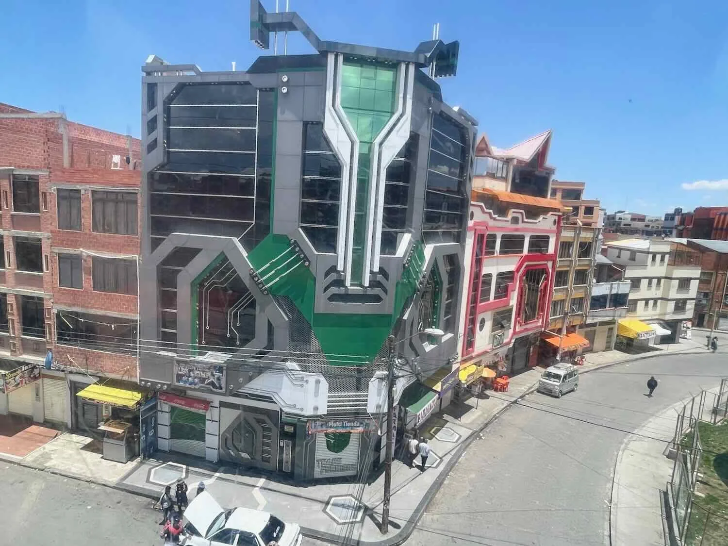
We spent one night in the town of Patacamaya. It was there that we saw our first “cholet” - a uniquely Bolivian style of architecture that bends a cultural preference for bold colors and designs with futuristic motifs (e.g., from the Transformer movies). Cholets turned out to be quite common on the altiplano around La Paz (we saw dozens of them). Patacamaya, La Paz Department, Bolivia. Copyright © 2019-2025 Pedals and Puffins.
A view of Patacamaya from a highway overpass. It was a big, one-street town. Patacamaya, La Paz Department, Bolivia. Copyright © 2019-2025 Pedals and Puffins.
As we got closer to El Alto, there were a couple of places where we saw extensive networks of stone walls that divided the hillsides into dozens of small plots. The practice of using stone walls to organize family and community lands dates back to pre-Columbian times. Near Ayo Ayo, La Paz Department, Bolivia. Copyright © 2019-2025 Pedals and Puffins.
We had become used to seeing fancy, new stadiums in small Bolivian towns - like this one in the town of Ayo Ayo (pop. 8,000). The MAS party that was in power in Bolivia for nearly 20 years constructed these stadiums as a way to build local support through investment in rural communities. Ayo Ayo, La Paz Department, Bolivia. Copyright © 2019-2025 Pedals and Puffins.
Approaching the Urban Jungle - The Chaos of El Alto
Bolivia’s third-largest city, La Paz, is partially enveloped by its second-largest city, El Alto. For all practical purposes, El Alto and La Paz form one, enormous metropolitan area that is home to nearly a quarter of the country’s population. Like many Latin American metropolises, these two cities have grown at a breakneck pace over the past century, with little planning and a lot of improvisation. Needless to say, cycling into this urban jungle was an adventure on a whole other level.
Making matters more interesting, on the morning of our departure for El Alto, we awoke to a pouring rain. We hadn’t expected this, but the weather forecast had worsened considerably over night. Complicating matters, we had a reservation at an Airbnb in La Paz in just two nights, so there was definitely pressure to keep cycling. As usual on a bike trip, when in doubt about what to do, go eat. We decided to go get breakfast, and hope that the weather would clear by the time we were finished.
No such luck. At 8am (after breakfast) it still was raining steadily.
In a futile attempt to gain some clarity, we checked the weather forecast - not just one, but five different forecasts - which yielded conflicting results. Two forecasts said the weather would clear up in the afternoon. Two others said it would rain all day. And the fifth said at first that the rain would end by 10am - but later it updated to say showers would continue through 1pm. This was not particularly helpful.
It was cold, damp, and we would be cycling into an urban area with lots of traffic, so we were not enthusiastic about heading out into the rain. Furthermore, there tends to be a lot of complicated navigating in cities. Since we navigate with our phones - which go crazy when hit with rain drops - urban areas are particularly challenging in the rain.
We therefore continued to be stumped about what to do - and it continued raining outside.
We told ourselves that as long as we could get rolling by noon, we would go. Then around 10:30am, much to our surprise, the rain began to dissipate. We jumped into action and got out the door as fast as we could.
There still was a light drizzle when we left. But before long even that had stopped and we had intermittent sunshine. We congratulated ourselves on our timing, feeling very glad about the way things worked out.
Another monument to the Battle of Aroma (mentioned above) stood boldly in the center of the highway. Calamarca, La Paz Department, Bolivia. Copyright © 2019-2025 Pedals and Puffins.
As we got closer to La Paz the lines at gasoline stations became shockingly long. We later heard that drivers could spend 24 hrs or more in these lines, waiting for the chance to fill up their tank. The fuel shortage was a consequence of the national government’s inability to continue paying for massive fuel subsidies that had been in place for nearly 30 years. This line was about 1.5 miles (2.4 km) long. Entering El Alto, La Paz Department, Bolivia. Copyright © 2019-2025 Pedals and Puffins.
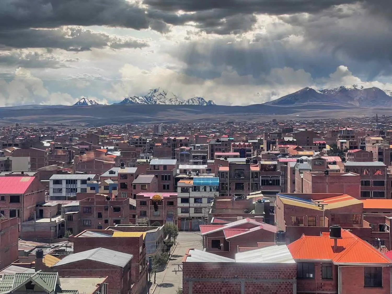
As we approached the outskirts of El Alto the density of houses steadily increased. Soon the landscape became fully urban, with a continuous line of buildings on both sides of the highway.
Then, after we had been cycling for a little more than four hours, and with only three miles (5 km) to go, we entered construction hell. All of the highway traffic was routed onto a rutted dirt road that was studded with rocks. Because of the morning’s rain, there were lots of slick, muddy sections and puddles. Worse, there was hardly any room on the side for us to cycle. As we dodged the crowds of pedestrians and dogs, the weaving cars and trucks often came a little too close for comfort.
At least all of the traffic was moving slowly.
It took us another half an hour to cycle those final three miles, but it felt like forever. When we finally checked into a simple hotel room, the peace and quiet enveloped us. It was heaven.
The Plunge Into La Paz
We were not particularly eager to get back on the road for the final push into La Paz. However, with more thunderstorms predicted to begin around noon, we were motivated to get out early - and hopefully make it to our Airbnb before the weather turned bad again. With all the construction, there was no telling what other snags we might encounter.
For the first 1.5 hours we continued our odyssey through the chaos of construction. Additional overnight rain had enhanced the slippery mud and increased the number of puddles that had formed between the bumpy rocks. Our bicycles, legs and shoes soon were covered with a sheen of mud.
About 20 minutes into the ride a bicycle path appeared. It was paved and offset from the highway. What a surprise! This may have been the only bicycle path we encountered in Bolivia. On a dry day it might have been perfect. But on this day it was full of deep, long puddles and quite a few pedestrians. Still, we were quite happy with the upgrade (vs. cycling among the cars in the mud and construction). On the bright side, the puddles provided a free tire cleaning. We always hate arriving at a hotel with muddy tires, since that can make it more difficult to convince reluctant hotel managers to let us take our bikes into the room. Unfortunately, the bike lane was soon taken over by vendors, forcing us to walk our bikes.
Our dream come true - a bicycle path that paralleled the muddy (under construction) highway through El Alto. It was such an improvement over cycling in the traffic that we didn’t really mind the puddles. El Alto, La Paz Department, Bolivia. Copyright © 2019-2025 Pedals and Puffins.
Unfortunately, it wasn’t long before the bicycle path ran smack into a local market, where many of the vendors had set up their stalls right in the path (presumably to avoid the mud). That sent us, and some other local cyclists, back onto the mud. El Alto, La Paz Department, Bolivia. Copyright © 2019-2025 Pedals and Puffins.
Eventually we turned off the main highway that was under construction, and onto a broad, divided and paved (!) avenue that led to one of La Paz’s famous cable car stations. Traffic was fairly light, which was incredibly welcome. And it seemed as if you could see the shops along the way becoming more prosperous as we approached La Paz.
As we got closer to La Paz, we saw even more of the eclectic, cholet-style buildings with their bold colors and Transformer-themed designs. This building even had a replica of one of the Autobots mounted on the front. El Alto, La Paz Department, Bolivia. Copyright © 2019-2025 Pedals and Puffins.
If you are unfamiliar with La Paz, Bolivia, it is important to point out the city’s unusual geography - which poses some very real challenges for cyclists. La Paz is situated within a canyon formed by the Choqueyapu River, lying in a very deep, bowl-like depression within the Andes Mountains. Unless you see it in person, it is hard to grasp just how much of a drop off there is from the canyon rim in El Alto to the canyon floor of La Paz - but from the top of the canyon to our Airbnb, there was a drop of 1,500 ft (460 m) in just about two miles (3.2 km).
Frankly, that is a very steep hill for cycling. However, we had heard that it was possible to ride the public cable car system (a.k.a., the Teleférico) with bicycles, as a way to descend safely into the canyon (kind of like riding a ski gondola with your bike). As a result, we had cycled to one of the cable car stations, with the hope of gliding down effortlessly into La Paz.
Our bikes parked outside the Purple Line cable car station in El Alto, La Paz Department, Bolivia. Copyright © 2019-2025 Pedals and Puffins.
Unfortunately, when we investigated the cable car station we decided that trying to ride it with bicycles would be too much trouble. The loading area for the cable cars at this station was up five, long flights of stairs and the security guard told us that we were not allowed to take the bicycles up in the elevator (which was reserved for people with disabilities). There were lots of other details we were not familiar with - like how to buy tickets, where to get off, how to load bikes on the cable cars, any special rules for bikes, etc. So instead of spending the time to try and figure all that out, we decided to ride down the very steep roads leading into La Paz.
When you get to the edge of the canyon cliff that leads down into La Paz, it practically takes your breath away. The first thing that occurs to you is how beautiful it is to see such a large city way down in the bottom of the canyon. The next thing you wonder is whether it will be safe riding on the very steep roads. To give you some idea of the slope, we saw vehicles get stuck going up the roads leaving La Paz because their tires started spinning from the steepness of the gradient. The vehicles would then back up down the hill until they reached a location less steep, where they could build additional momentum to make it up the worst parts.
What a ride it was! This was one of the steepest descents we had ever attempted. On the way down we stopped at least four times to let our brakes cool. Meanwhile, the view into the valley - crammed full of buildings on even the most improbable slopes - was stunning.
This was our first view of La Paz from the canyon rim in El Alto. Nearly every inch of the Choqueyapu Valley was packed with buildings or other city infrastructure. The road down into La Paz was one of the steepest we had ever been on. El Alto, La Paz Department, Bolivia. Copyright © 2019-2025 Pedals and Puffins.
Geronimo! A view of our route down the side of the canyon from El Alto into La Paz. Pictures always make roads seem less steep than reality. (Note the dark clouds gathering over the valley.) La Paz Department, Bolivia. Copyright © 2019-2025 Pedals and Puffins.
Amazingly, all went well, and we arrived at our lodging by 11:30am - just in time to be safely indoors before the rain began (around noon). We certainly didn’t want to be skidding down the mountainside on wet pavement.
The Colors and Rhythms of La Paz
We spent the next several weeks enjoying La Paz - a metropolis pulsing with a vibrant mix of stylish commercialism, ancient mysticism, traditional practices, and modern aspirations. Despite being in a canyon, the elevation of the city is about 12,000 ft (3,650 m) above sea level. It is often referred to as the highest capital city in the world. That title is a little bit complicated, because Bolivia technically has two capitals (La Paz and Sucre). However, since La Paz is the home of the President and National Legislative Assembly, as well as being a major cultural and economic center, it seems to have earned the distinction.
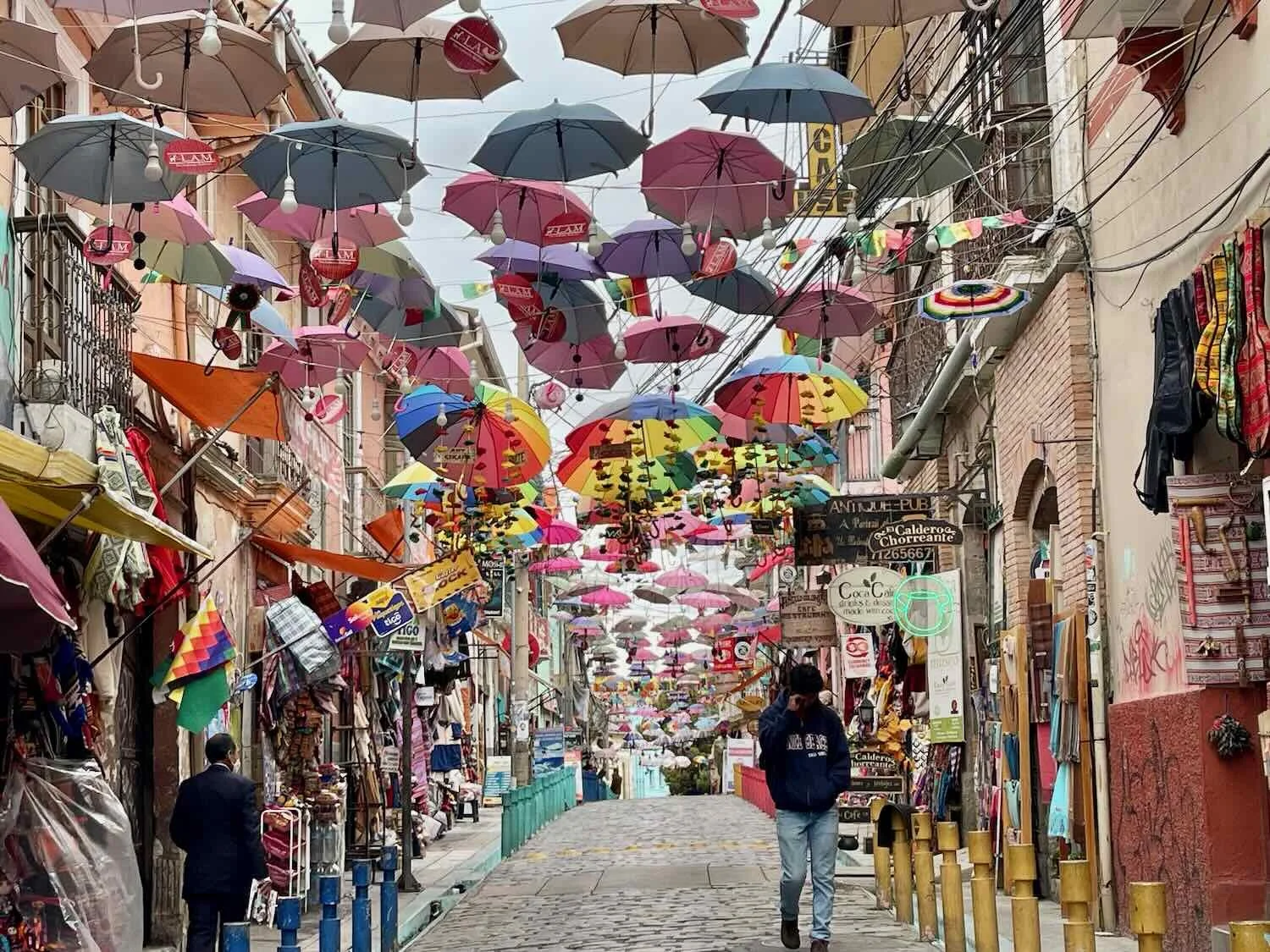
In addition to the daily markets and vendor lined alleys, it seemed as though every weekend brought out a full-blown festival that would shut down several kilometers of the main thoroughfare through the city for most of the day, and sometimes the evening. These events would include long rows of vendors’ stalls, performance stages, game tables, and a dizzying array of street foods. We never tired of going out to explore what was happening on the streets of La Paz. Here are some images from our stay in The Wonder City.


Stone mosaics decorated the Avenue 16 de Julio, the city’s main thoroughfare. City Center, La Paz, Bolivia. Copyright © 2019-2025 Pedals and Puffins.
Another one of the stone mosaics depicted some busy bees. City Center, La Paz, Bolivia. Copyright © 2019-2025 Pedals and Puffins.
One section of the city’s main thoroughfare was often set up with chess tables, and there were always a few games under way. City Center, La Paz, Bolivia. Copyright © 2019-2025 Pedals and Puffins.
Some tangles of electrical and communications wires were truly impressive. City Center, La Paz, Bolivia. Copyright © 2019-2025 Pedals and Puffins.
How the heck do they know which of the many wires need service? City Center, La Paz, Bolivia. Copyright © 2019-2025 Pedals and Puffins.
Every city block had large numbers of sidewalk vendors, whose stalls were typically crammed full of colorful snack and drink options. This lady was resident just outside of our apartment. She had almost every drink available, but forget it if you needed anymore than one or two bottles of the same thing. City Center, La Paz, Bolivia. Copyright © 2019-2025 Pedals and Puffins.

A traditional offering to Pachamama (Earth Mother). This one asked for health, work, business success, and love. To be effective, the offering had to include a range of sweets, and a bottle of alcohol (Pachamama’s favorites). Witch’s Market, City Center, La Paz, Bolivia. Witch’s Market, City Center, La Paz, Bolivia. Copyright © 2019-2025 Pedals and Puffins.
Bolivians love music and parades. There even was a musical parade inside the supermarket as a weekend promotion. Sopocachi, La Paz, Bolivia. Copyright © 2019-2025 Pedals and Puffins.
One of the most innovative parts of La Paz’s infrastructure is the cable car transit system known as Mi Teleférico. It’s basically a ski gondola that instead of carrying people up and down steep ski slopes takes people up and down the steep slopes in and around La Paz. Begun in 2014 and continuously expanded since then, the system now includes more than 17 miles (27 km) of cables in 10 different lines. It’s a perfect solution for moving people quickly and efficiently through the city’s insanely steep terrain. With government subsidies, it’s also stunningly affordable - costing less than US$0.30 per ride.
Although their primary purpose is public transportation, the cable cars have also become a favorite way for visitors to enjoy a bird’s-eye view of the city. We rode the cable cars at least a dozen times, traveling to different parts of the city to run errands. The sweeping vistas of La Paz from the air never got old.
One Sunday we rode the Teleférico Blue Line back up to El Alto to visit the weekly market. El Alto, La Paz Department, Bolivia. Copyright © 2019-2025 Pedals and Puffins.
It was always interesting to see who else would be riding in the cable car with us. People of all walks of life used the Teleférico for routine transportation. El Alto, La Paz Department, Bolivia. Copyright © 2019-2025 Pedals and Puffins.
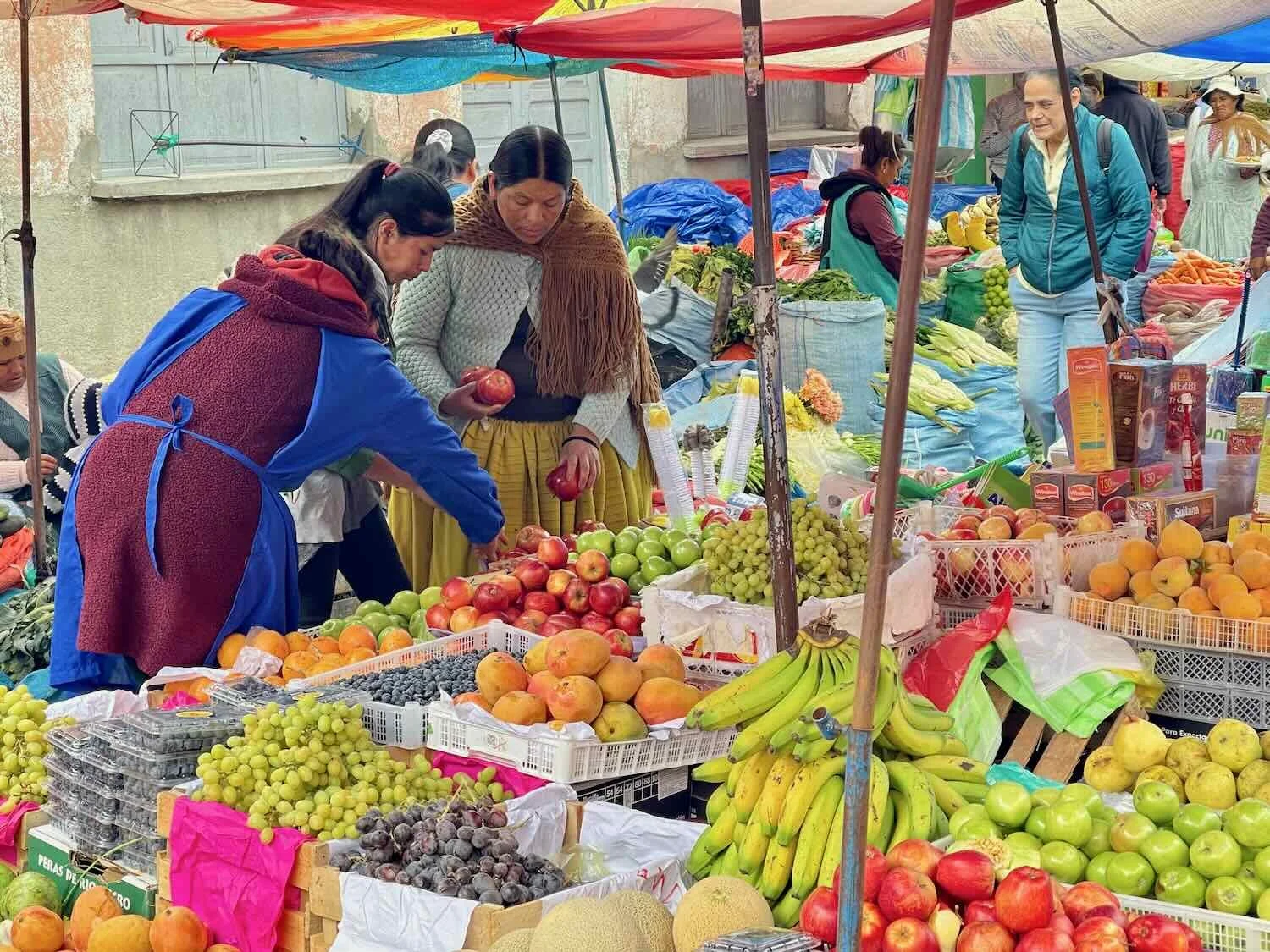
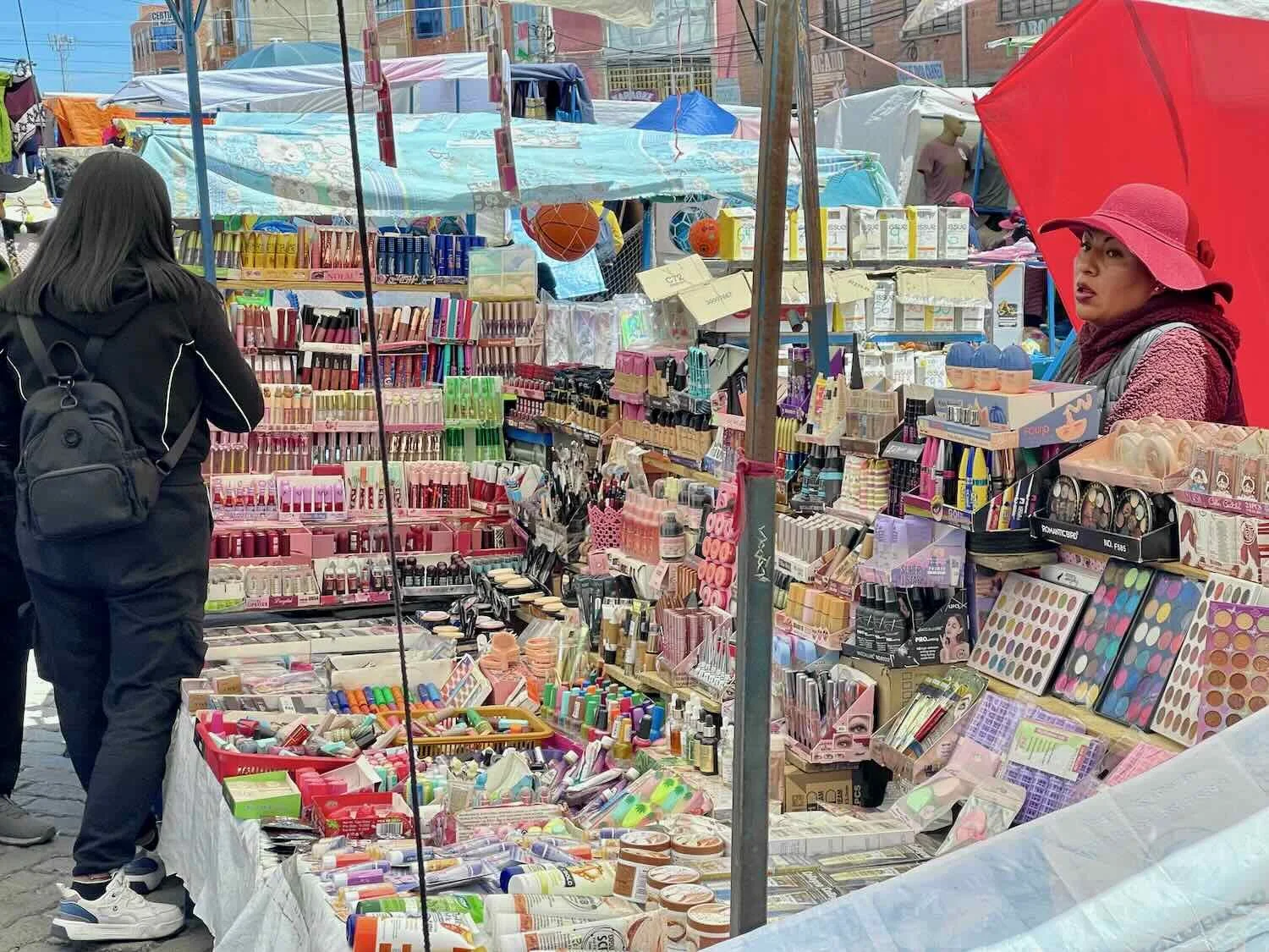
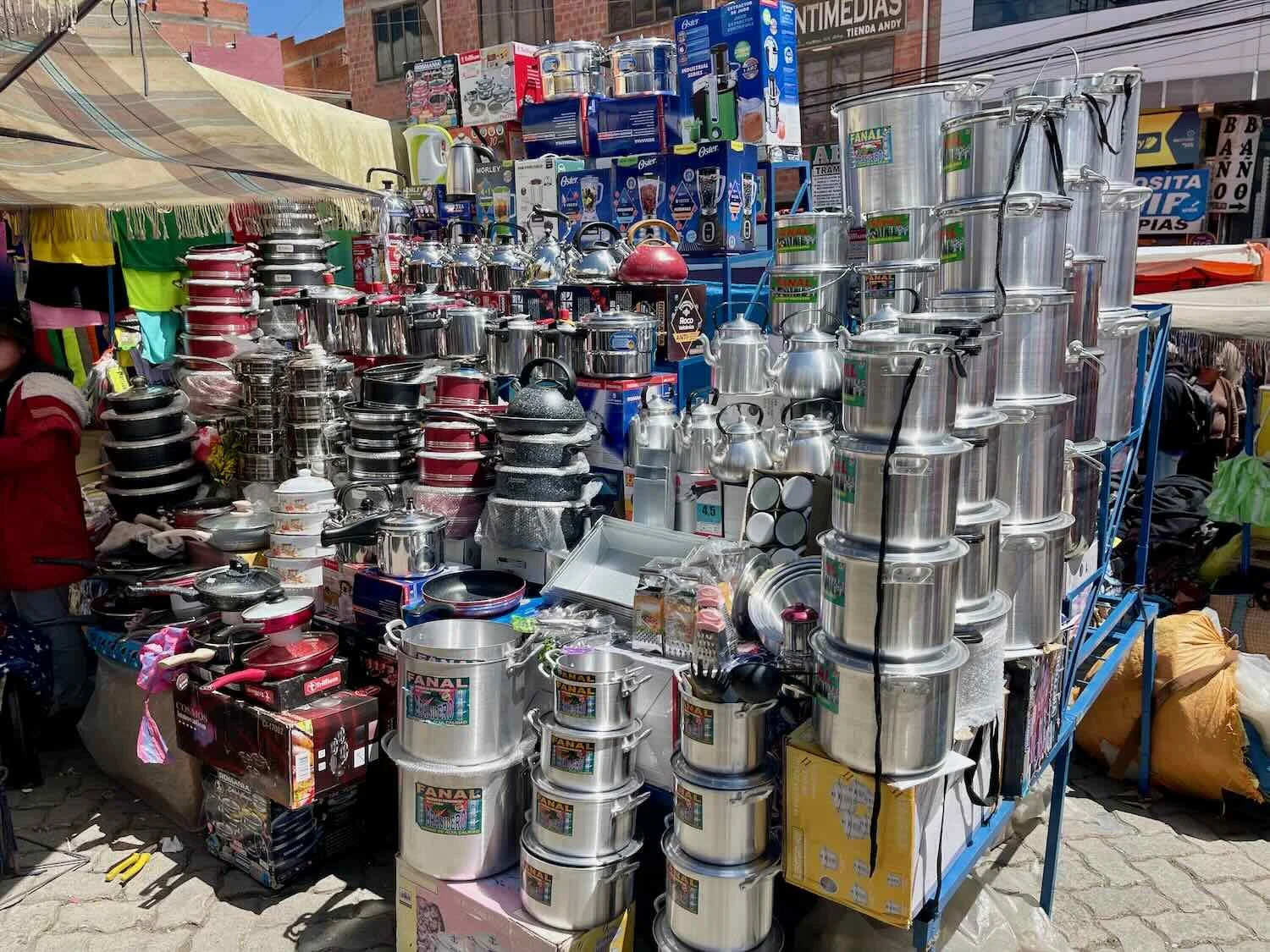
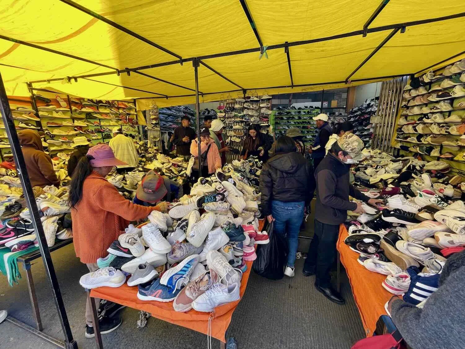
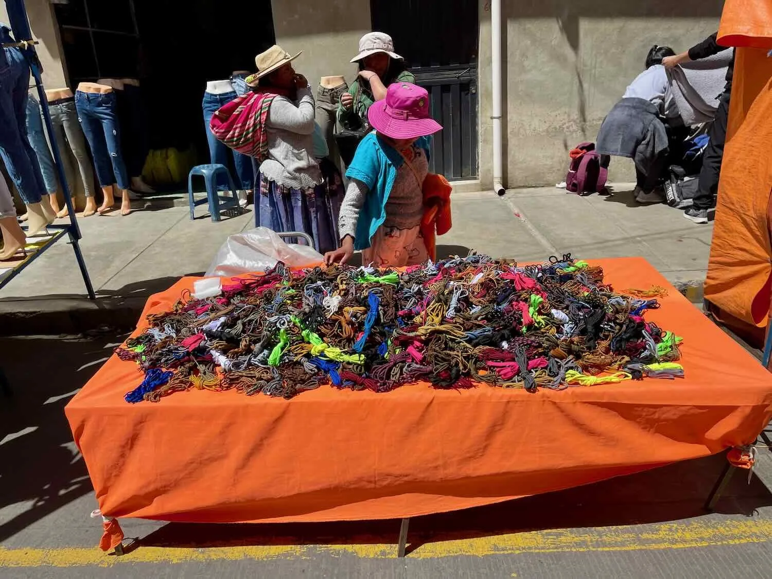
From the heights of the cable cars, the view of the El Alto weekly market was impressive as it totally engulfed the streets below. In fact, it is considered by some to be the largest open-air market in the world, or at least in all of Bolivia, sprawling over 2 square miles (5 square km). When we later wandered the corridors of the El Alto market, we were amazed at the sheer breadth and volume of items for sale.
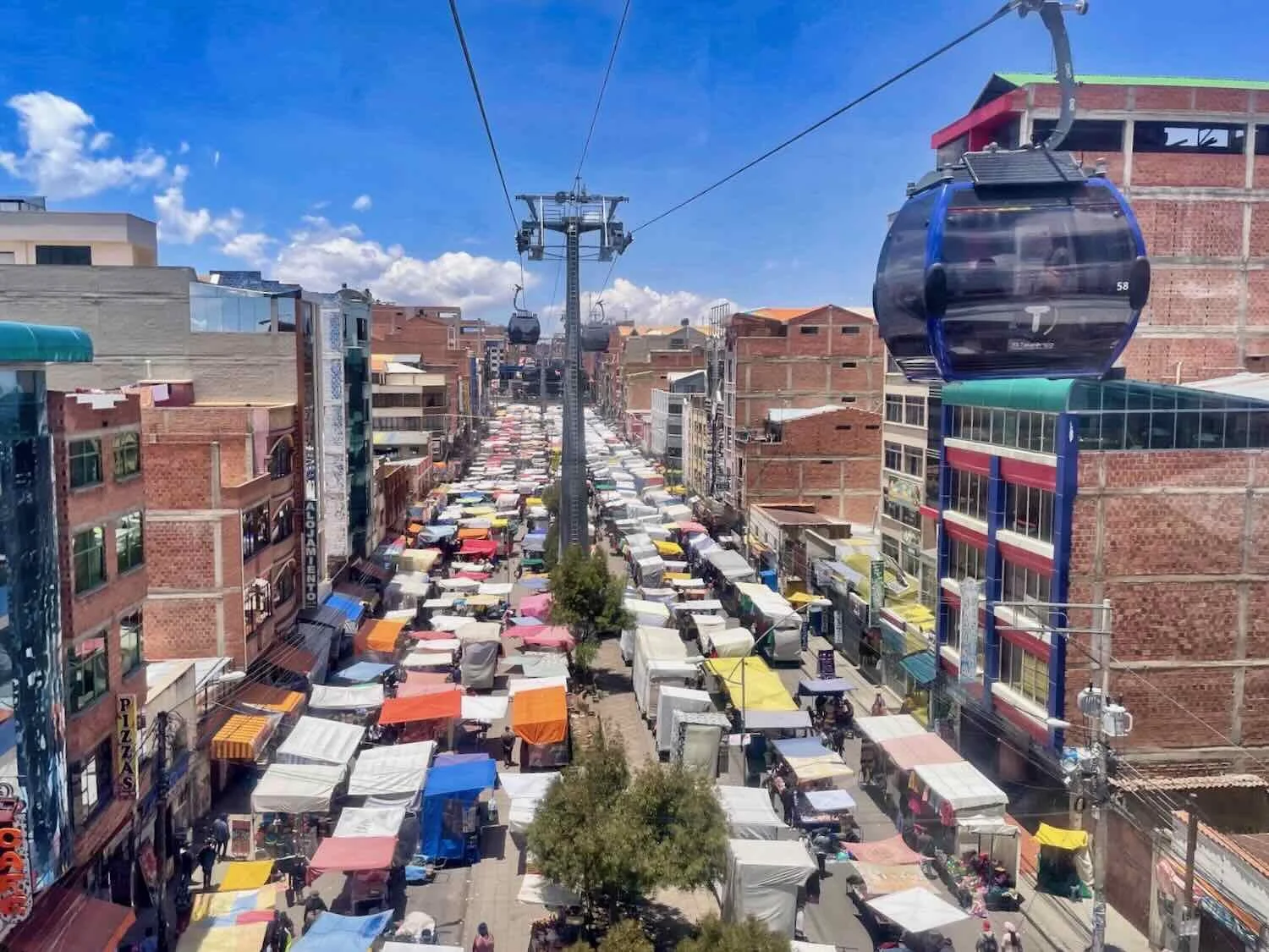
Descending back into La Paz via the Teleférico, after spending an afternoon at the El Alto weekly market. El Alto, La Paz Department, Bolivia. Copyright © 2019-2025 Pedals and Puffins.
A view of the famous Illimani Mountain - an iconic symbol of La Paz. City Center, La Paz, Bolivia. Copyright © 2019-2025 Pedals and Puffins.
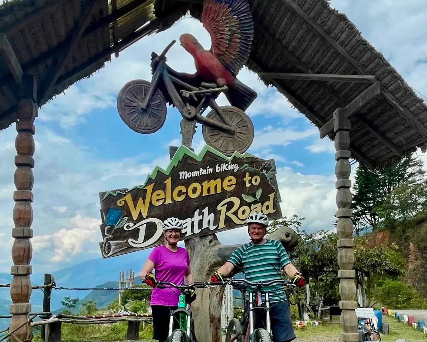
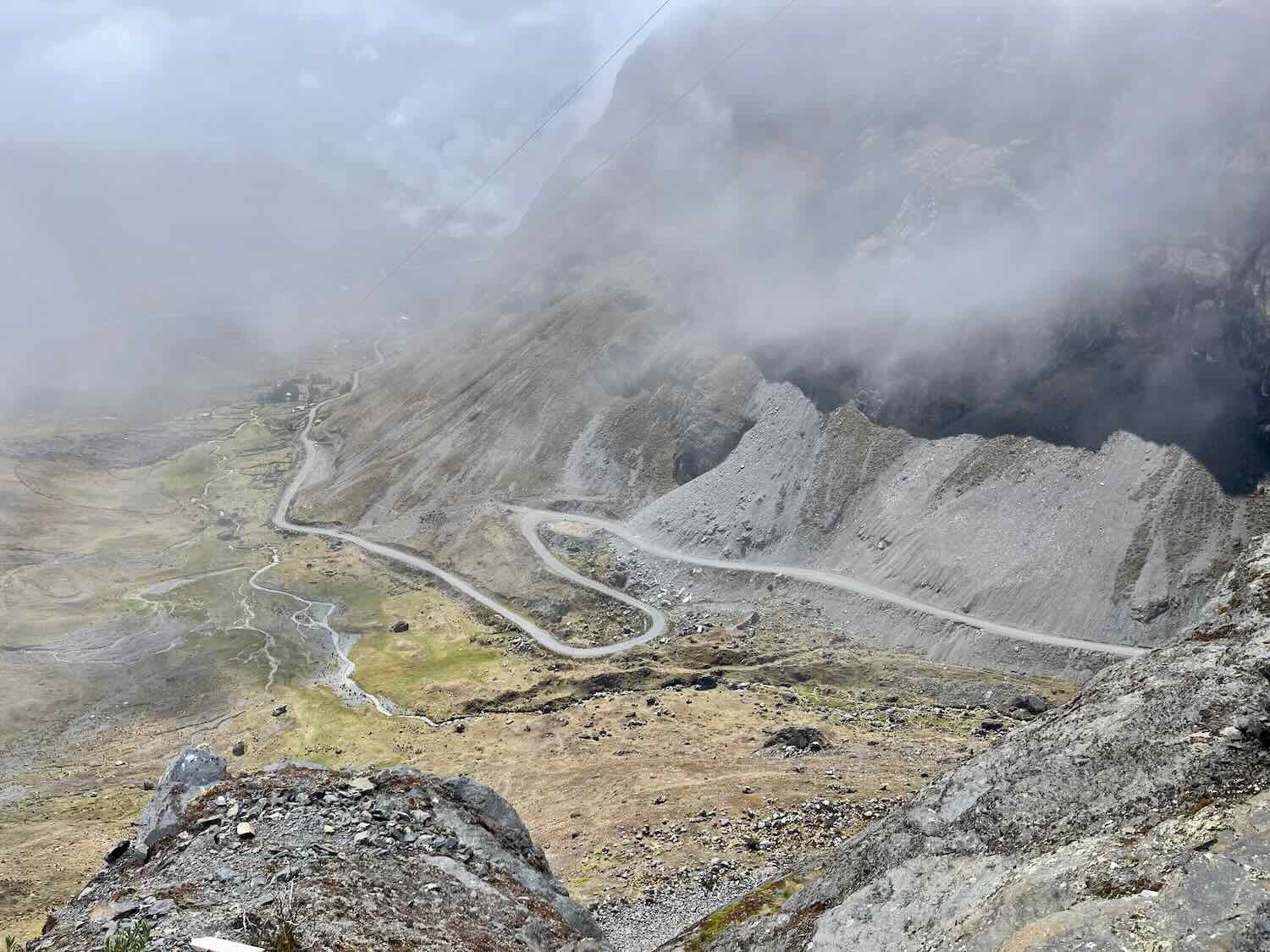
Defying Death on Bolivia’s Infamous Death Road
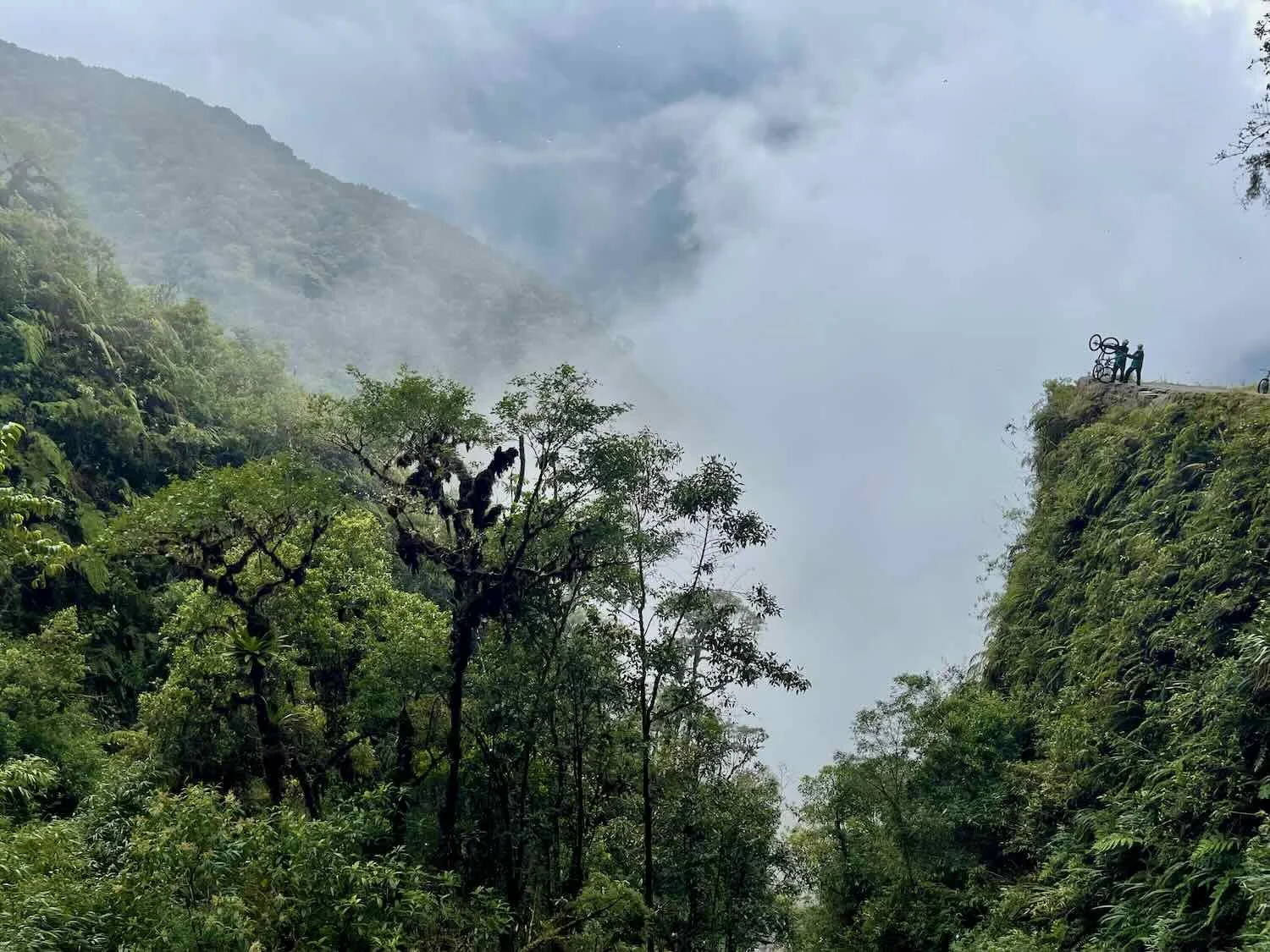
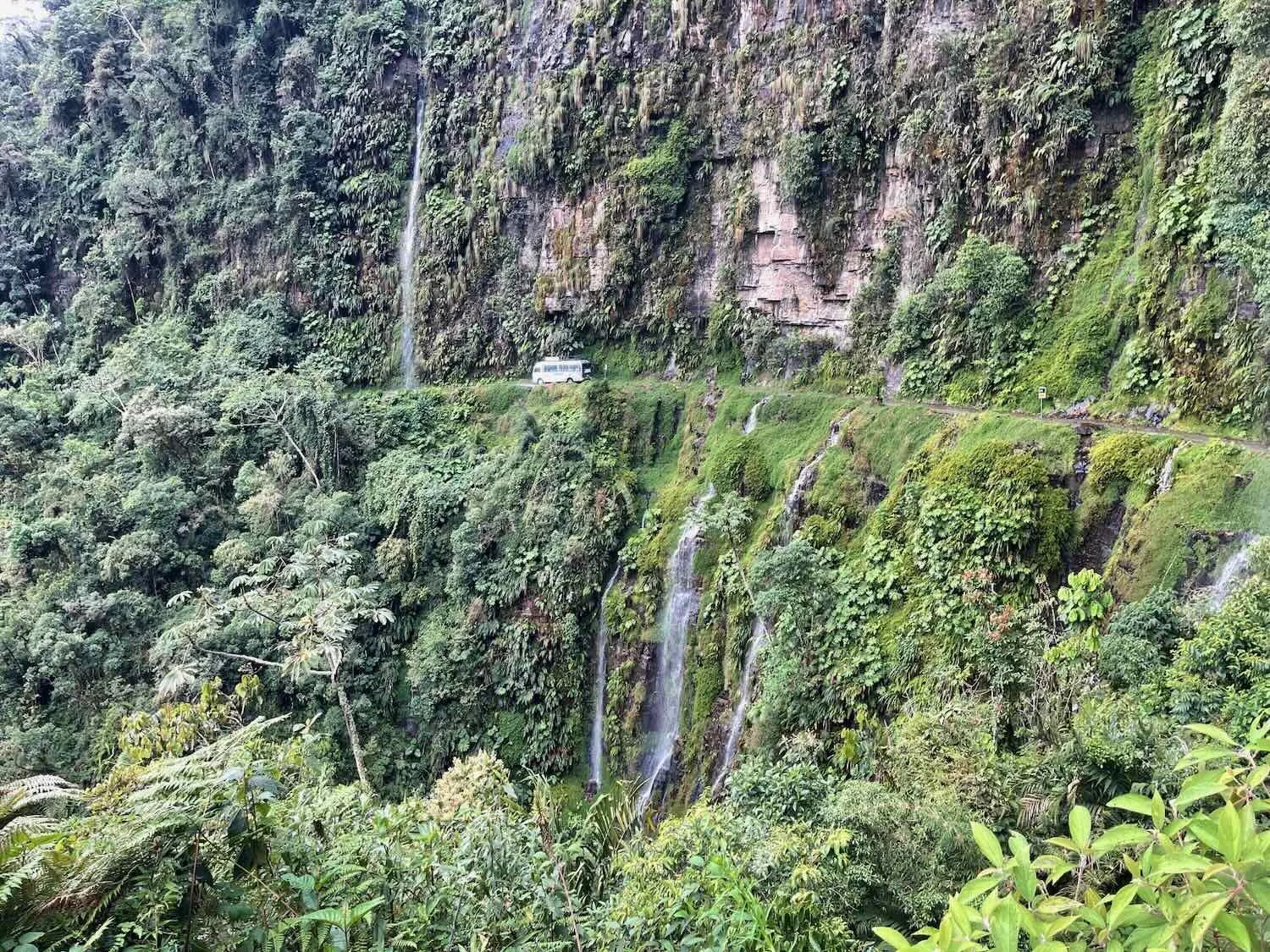
For adventure travelers, one of the most daring excursions from La Paz is a bicycle journey down Bolivia’s notorious Death Road. From the 1930s until 2006 the Death Road was the only direct connection between La Paz and the lowland jungles to the east. Unfortunately, it was an extremely narrow, winding, slippery, dirt road that was bordered by sheer cliffs, with no guard rails, and frequently beset by dense fog, rain and landslides. During its peak usage as a transportation corridor, an estimated 200-300 people were killed on the road each year - hence its sinister name.
Vehicles now take a different (safer) route, leaving the Death Road to cyclists and a few locals. Several companies offer mountain bike tours that include guides, full suspension bicycles, helmets, and other gear for a day spent plummeting down the 40-mile (64 km) route that drops more than 10,000 ft (3,000 m) from La Cumbre Pass into the yungas jungles below. Because of the huge drop in elevation, the changes in the vegetation along the route are amazing - from high alpine puna to lowland tropical forest all in one day. You start out very cold, with many layers of clothing, and end with shorts and t-shirt as the temperature dramatically rises with decreasing altitude.
It was cloudy, misty, and rainy when we departed from La Cumbre Pass. With the start of the ride being over 15,400 feet in elevation (4,700 m), the ride often begins in the clouds. We did, however, get some glimpses of the surrounding mountains and valleys below when there were breaks in the mist.
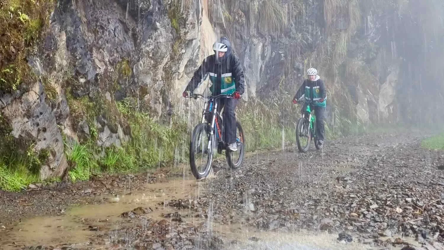
Eventually the clouds lifted and we began to dry out. By that time we had descended out of the alpine grasslands and into the jungle, with tons of tree ferns and cecropia trees.
We spent 3.5 hours barreling down the rough dirt road - squeaking through tight curves, splashing through puddles, getting drenched by water cascading off the slopes from above, soaking up stunning views of the valley below, and fording mountain streams.
When we signed up for the tour, we figured the name of the Death Road was a historical anachronism. But after finishing we were told that two cyclists had died on the Death Road last year. Seeing how fast people ride downhill on the rough road, it’s not hard to imagine people losing control or overcooking a corner and plummeting off the cliff. Now instead of cars driving off the road, they have cyclists doing the same thing. The Death Road appears to be continuing to live up to its reputation. Here are some photos from our Death Road adventure.
Our tour included about 12 people (all from Europe except us), plus two guides, a driver and a mechanic. A fleet of mountain bikes was brought along on top of the van - with extra bikes in case anyone had fitting problems or mechanical issues that couldn’t be solved along the way. Death Road Bike Tour, La Paz Department, Bolivia. Copyright © 2019-2025 Pedals and Puffins.
The cycling began at the summit of La Cumbre Pass,15,420 ft (4,700 m) above sea level. We wore coats and insulated pants provided by the tour company as protection from the high altitude chill and mud. The hand signals are the sign of the llama - similar to “thumbs up” in Bolivia. La Cumbre Pass, Death Road Bike Tour, La Paz Department, Bolivia. Copyright © 2019-2025 Pedals and Puffins.
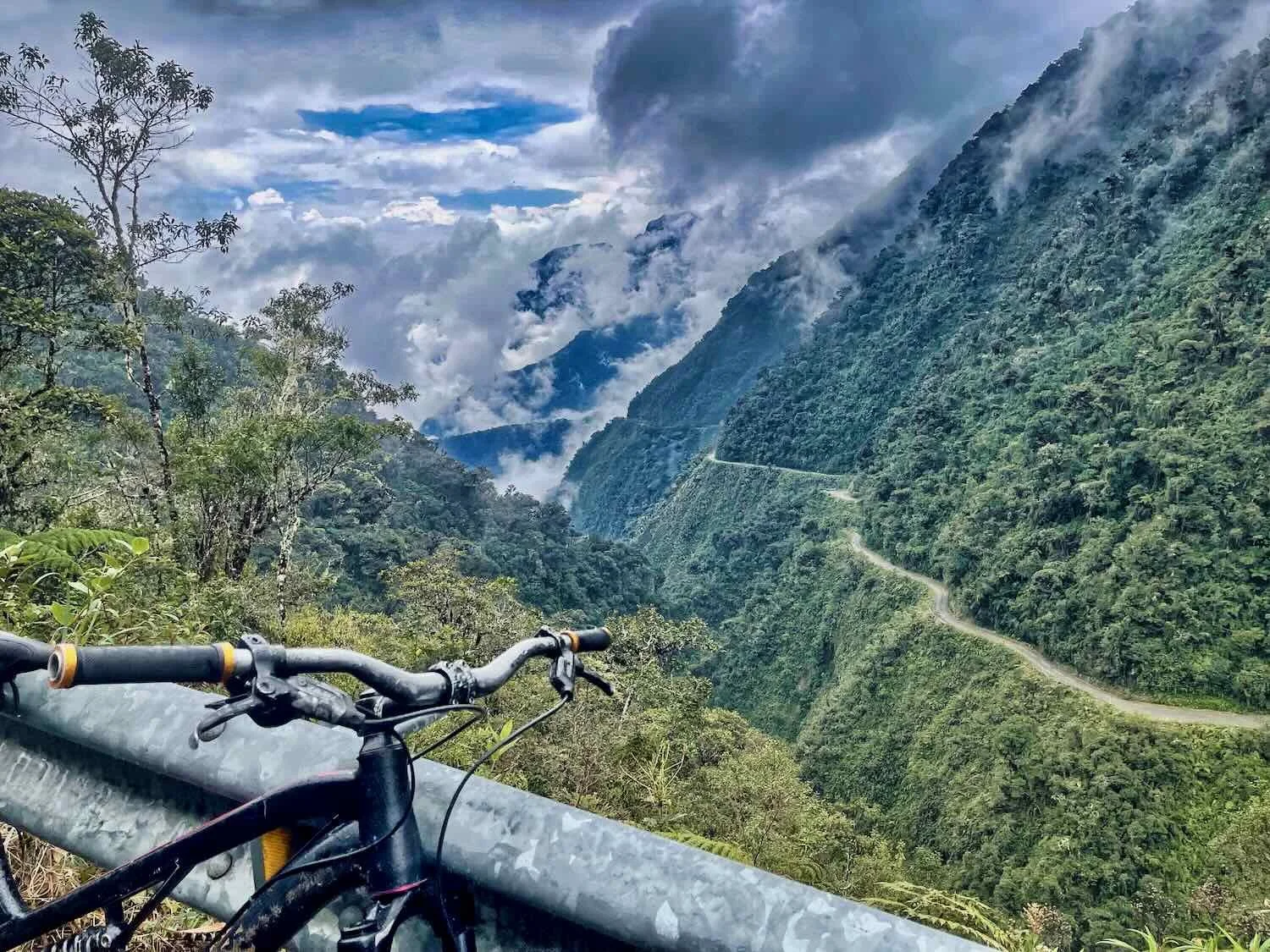
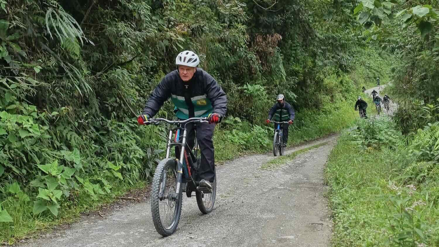
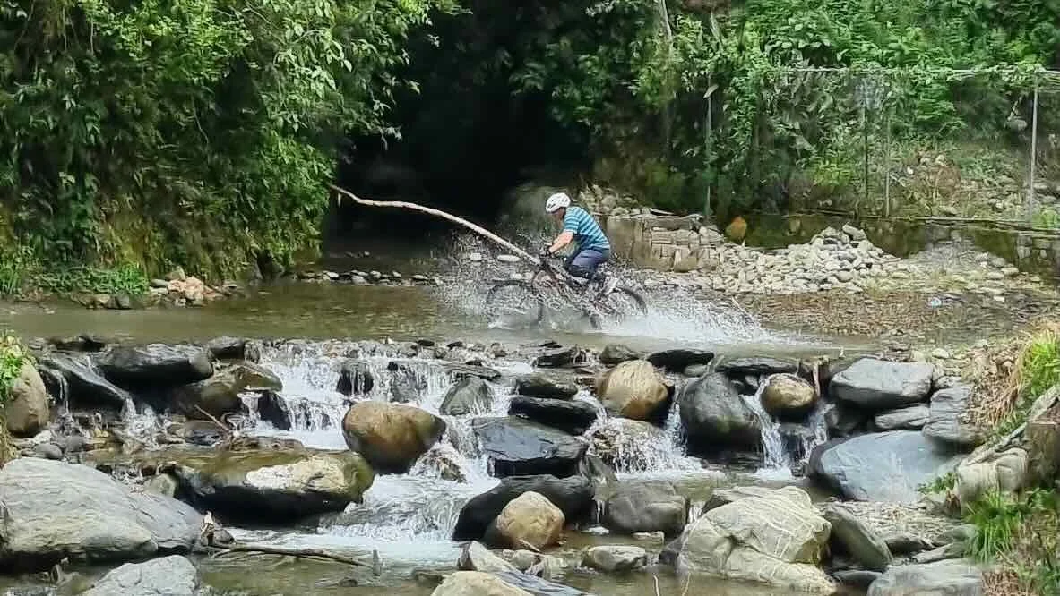
We had a great time cycling down the Death Road - and thankfully no one in our tour group got injured (apparently people get scuffed up fairly often). In addition to the thrilling ride, we enjoyed seeing a bit of the jungles of Bolivia, which were totally different from the altiplano where we spent most of our time. Comunidad de San José Chicalulu, Death Road Bike Tour, La Paz Department, Bolivia Copyright © 2019-2025 Pedals and Puffins.
Halloween in La Paz
Our final night in La Paz was 31 October - Halloween.
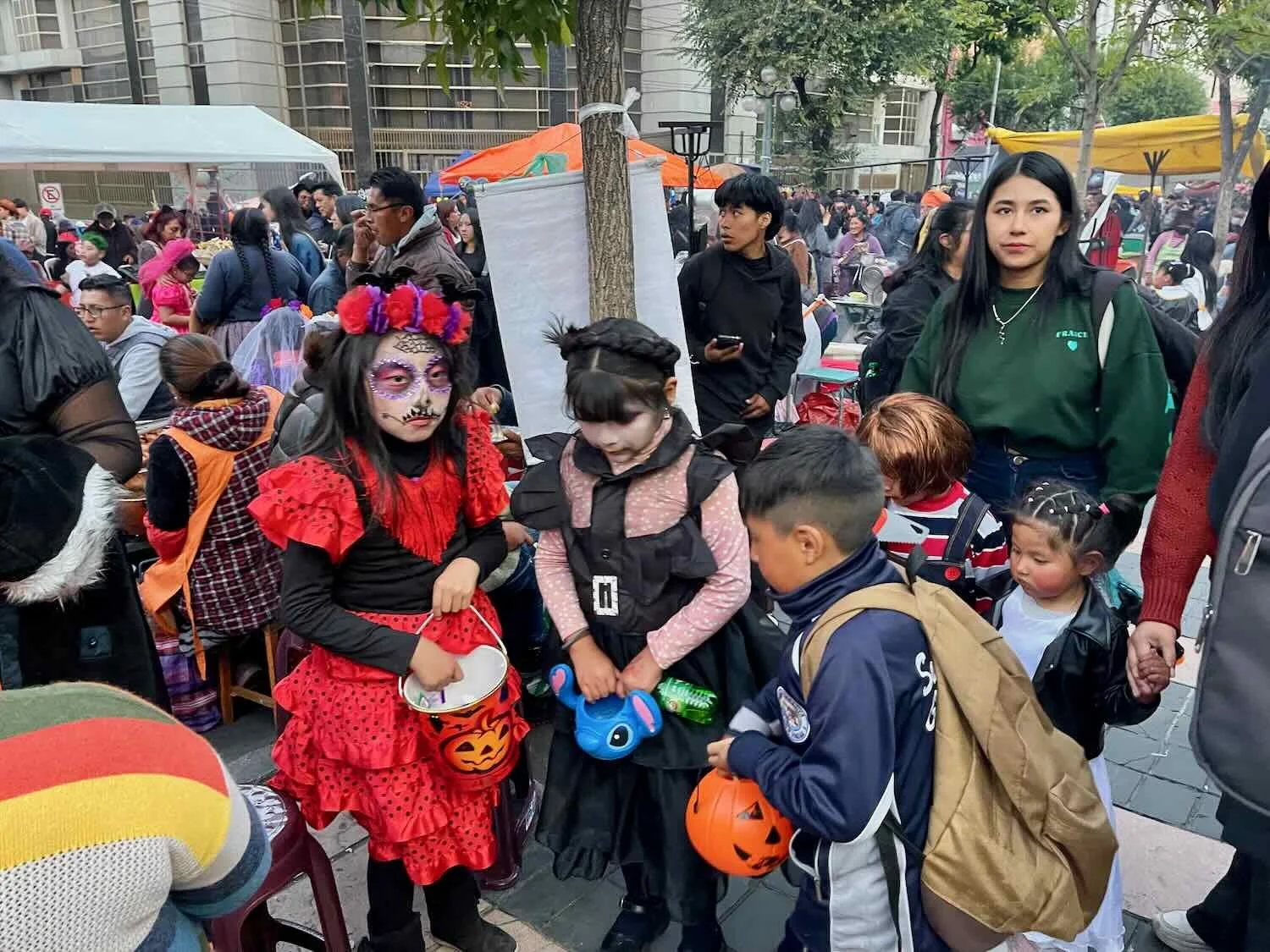
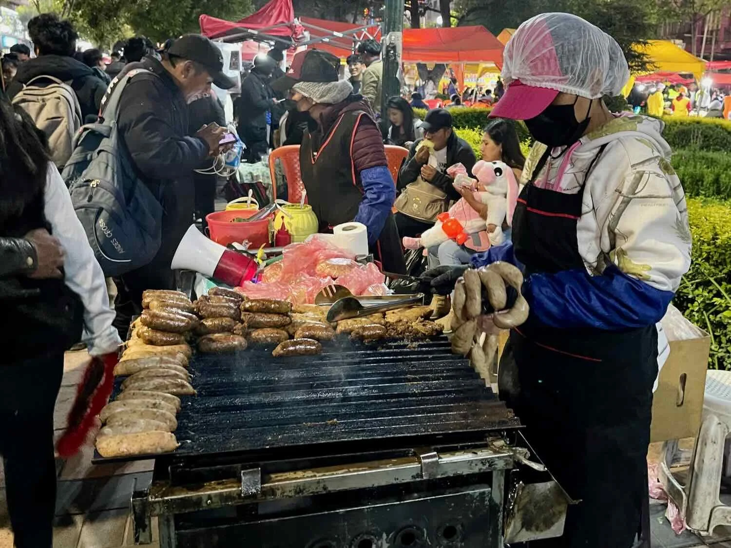
While most Latin American cultures celebrate the Day of the Dead with more traditional, family-centered activities, Bolivians (at least in La Paz) have fully embraced the commercial and social dimensions of Halloween. As evening approached, the main avenue through the city was closed to traffic, and transformed into a gigantic, crowded, street party. Around 6pm, with sunset approaching, we went out to join the fun.
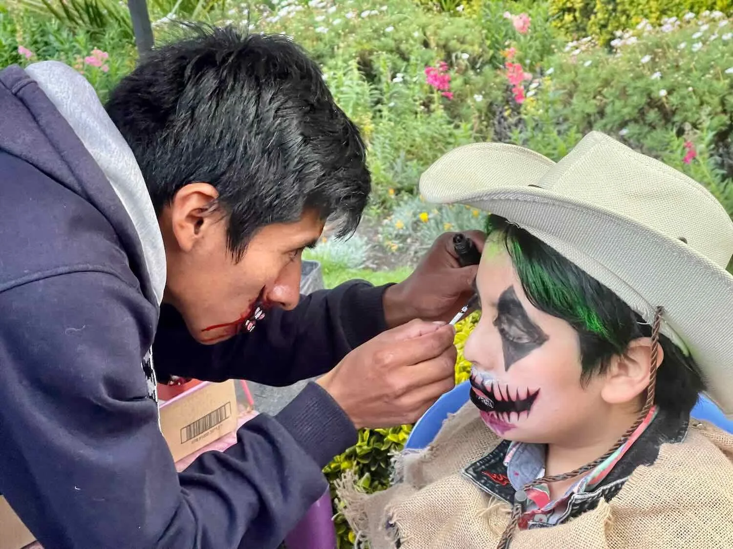
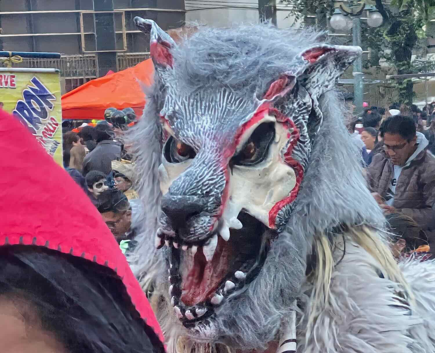
It seemed as if every business along the route was fully decked-out in Halloween decorations. Everyone was getting into the spirit. Vendors’ stalls lined the street selling bags of candy, last-minute costumes, Halloween-themed trinkets, street food (mostly grilled chorizo), and booths offering face-painting (the most popular motif being a skull).
As the evening wore on, the street became more and more crowded. Nearly all the children under 10 years old were dressed in costumes. Most of the teens were as well. And many adults wore some pretty elaborate costumes, too. Zombies, ghosts, devils, skeletons and monsters were the most popular themes. There were relatively few princesses or superheroes. Instead of knocking on doors to get candy, parents with kids carried bags of candy to hand out to other children as they encountered them walking down the street. We even saw some youngsters exchanging candy with each other from their pumpkin-shaped buckets.


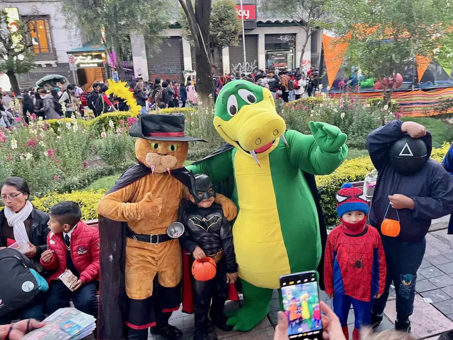

By nightfall the main avenue through the city was jam-packed with Halloween revelers, making it hard to even walk around. The street party lasted late into the night. City Center, La Paz, Bolivia. Copyright © 2019-2025 Pedals and Puffins.
Winding Down in Bolivia
With the end of our stay in La Paz, we were nearing the end of our time in Bolivia. From there it would be just a couple of additional days of cycling to reach the famous Lake Titicaca, on the border with Peru. But our journey across the high altitude altiplano would not end in Bolivia. Mountains and high altitude plains do not recognize country borders, and the altiplano would extend beyond Lake Titicaca, as we continued to cycle through the land of the llamas into Peru.