Cycling Coldfoot to Fairbanks, Alaska: Crossing the Arctic Circle

27 June - 7 July 2022
27 June - Layover in Coldfoot, Alaska
28 June - Coldfoot to Wild Camp near Prospect Creek (38.3 mi, 61.6 km)
29 June - Prospect Creek to Wild Camp, near Finger Mountain (41.5 mi, 66.8 km)
30 June - Finger Mountain to Yukon River Camp (40.4 mi, 65.0 km)
1 July - Yukon River Camp to Wild Camp near Hess Creek (33.1 mi, 53.3 km)
2 July - Hess Creek to Wild Camp at Tolovana Creek Wayside (38.6 mi, 62.1 km)
3 July - Tolovana Creek Wayside to Wild Camp at gravel mine (47.0 mi, 75.6 km)
4 July - Gravel mine to Fairbanks, Alaska (21.0 mi, 33.8 km)
5-7 July - Layover in Fairbanks, Alaska
It’s hard to overstate the sense of anticipation we felt as we cycled the last few miles into Coldfoot, Alaska. We had conquered the northern half of the Dalton Highway, the most northerly and remote road in North America. In five days of cycling, we lived entirely off of our bicycles, subsisting on freeze-dried food, energy bars and trail mix (except, of course, for that miraculous gift of food from the trail angel, Reggie).
Now we looked forward to a rest day in relative comfort. With a year-round population of only 13, there is not a lot to Coldfoot. But its few services are exactly what travelers like us needed. While there, we would devour several trucker-sized meals at the Coldfoot Cafe, wash away the trail dust with a hot shower, launder our over-used cycling clothes, and generally rest up for the next leg of the trip.
The Coldfoot Cafe (above) serves huge portions of comfort food (think hamburgers and fries), as well as all-you-can-eat buffets for breakfast and dinner. Their primary clients are truck drivers using the Haul Road to deliver supplies to Prudhoe Bay. But stopping here to refuel your body is obviously appealing to the passing cyclist, as well. Coldfoot, Alaska, USA. Copyright © 2019-2022 Pedals and Puffins.
Alaskan architecture at its finest. This rustic cabin is the only one left in Coldfoot, Alaska that dates from the gold rush period (around 1900). Coldfoot, Alaska, USA. Copyright © 2019-2022 Pedals and Puffins.
Rather than stay in the bunkhouse, we opted to camp on an open patch of ground next to a nearby lake. It’s conveniently separated from the main traffic area at the Coldfoot truck stop by a narrow strip of forest. The trees provided an extra bit of privacy, as well as protection from the dust kicked up by trucks pulling in for fuel. As a bonus, our closest neighbors were a mother moose and her twin calves.
A mother moose and her twins were our neighbors at the pond in Coldfoot. Alaska, USA. Copyright © 2019-2022 Pedals and Puffins.
And although the mosquitoes could be annoying at times, they really weren’t too bad. Often, they were outnumbered by the harmless, miniature mayflies that seemed to enjoy landing on us and our gear.
Two tiny mayflies have landed on PedalingGal’s shoulder, hoping for a ride. Coldfoot, Alaska, USA. Copyright © 2019-2022 Pedals and Puffins.
Sending Food to Yourself in Coldfoot, Alaska
One of our more important tasks in Coldfoot was to retrieve two boxes of food that we had mailed to ourselves from Anchorage. In long-distance cycling, food is one item that can get very bulky and heavy. With 10-12 days of no-supply travel between Deadhorse and Fairbanks, carrying all the food you need is a challenge.
We had heard that other cyclists had mailed food to themselves for pickup in Coldfoot - thus cutting the amount of food they have to carry for each leg of the trip in half. But it turned out to be somewhat mysterious as to how we should address the packages. If you look online, the Coldfoot “contract postal unit” does not list general delivery as a service provided. Moreover, you will find several, completely different variations of the address for Coldfoot’s post office. To make matters worse, when we went to the post office in Anchorage, we were given incorrect, outdated information there as well. So, how do you send mail to yourself in Coldfoot?
We were lucky enough to speak with a woman who “helps out at the post office” in Coldfoot (when she isn’t working in the cafe kitchen) and here’s what we learned. As of July 2022, the correct address to mail a package to yourself is:
Your Name, General Delivery, 9000 Dalton Highway, Coldfoot, AK 99709
It’s also helpful to ship your boxes via priority mail. That gives you the ability to track the packages, and peace of mind in knowing when they have arrived safely in Coldfoot. (Just be sure to leave plenty of time. We were told that 3-day priority mail packages can take up to 2 weeks for delivery, because Coldfoot is not on a regular mail route.)
When you arrive in Coldfoot, you will discover that the post office does not, in fact, maintain regular hours (in spite of what you may read online). It’s basically just a storage room on the side of the Coldfoot Cafe. When you want to retrieve your package(s), you let the person on duty at the cafe’s cash register know. They then notify someone who can let you into the post office. You wait a few minutes, someone shows up with a key to the storage room, and they find your package(s) on the shelves inside.
It all went smoothly enough for us. The food for the next leg of our trip was there on the shelf, waiting for our arrival.
The minimalist post office in Coldfoot, Alaska. Sending food to yourself in Coldfoot is a great way to reduce the weight and bulk of your supplies when cycling the Dalton Highway. You just need to know the right address to use (see text above). Coldfoot, Alaska, USA. Copyright © 2019-2022 Pedals and Puffins.
Scoping Out the Road Ahead
Coldfoot does have one tourist attraction, the Arctic Interagency Visitor Center. The cumbersome name derives from the fact that three different US federal agencies - the National Park Service, the Bureau of Land Management, and the Fish and Wildlife Service - all have land holdings in the area. It’s a great place to learn about arctic ecosystems, as well as recreational opportunities in the Arctic National Wildlife Refuge and the Gates of the Arctic National Park. We took a lovely, if mosquito infested, hike to the visitor center through the boreal forest.
We found this map of Alaska at the Arctic Interagency Visitor Center. Look how far we’ve come! Coldfoot, Alaska, USA. Copyright © 2019-2022 Pedals and Puffins.
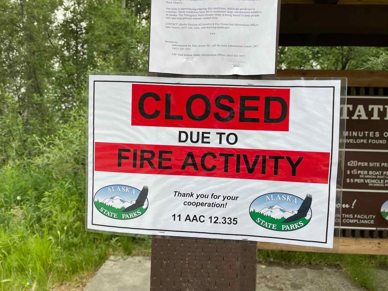
While at the visitor center, we got the scoop on several forest fires that were burning close to our route. We had heard that the Arctic Circle campground and wayside were closed because of the fires. But the staff at the visitor center let us know that although the campground was still closed, the wayside was open and we should not have any problems traveling or camping along the highway. That was good news.
Periodically a helicopter would land on the lawn in Coldfoot, Alaska. It was monitoring the status of several forest fires burning in the area. Coldfoot, Alaska, USA. Copyright © 2019-2022 Pedals and Puffins.
Taking Time to Savor the Adventure
The road from Coldfoot to Fairbanks, Alaska, is 259 miles - just 10 miles longer than the section from Deadhorse to Coldfoot. But conventional wisdom says that the Coldfoot-to-Fairbanks segment is considerably more challenging. The biggest factor is the hills. This leg of our route would cross multiple mountain ridges with steep gradients. Most days would involve 3,000+ ft (915 m) of climbing, and three of the days would exceed 4,000 ft of climbing (1,220 m). That’s a lot. We decided to slow down and take seven days to make the trip to Fairbanks. That way, the daily rides would be more manageable, and we would have time to enjoy this extraordinary journey.
We left Coldfoot on another beautiful day for cycling. The wind had shifted, blowing the smoke from nearby forest fires away from the Dalton Highway. Once again we had clear air, improving both our breathing and our ability to enjoy the scenic landscape. We often found ourselves cycling along high ridgelines with expansive views of lake-studded valleys.
The region south of Coldfoot falls within the interior Alaska upland taiga ecoregion. We noticed that the spruce trees here were taller, and grew more densely than they did farther north. The variety of other trees, like balsam poplar and quaking aspen increased, creating a pleasing mosaic of different shades of green that contrasted with the grassy marshes and wetland lakes. Only the highest mountains in this region have any tundra on their peaks, and there is less each day as we head south.
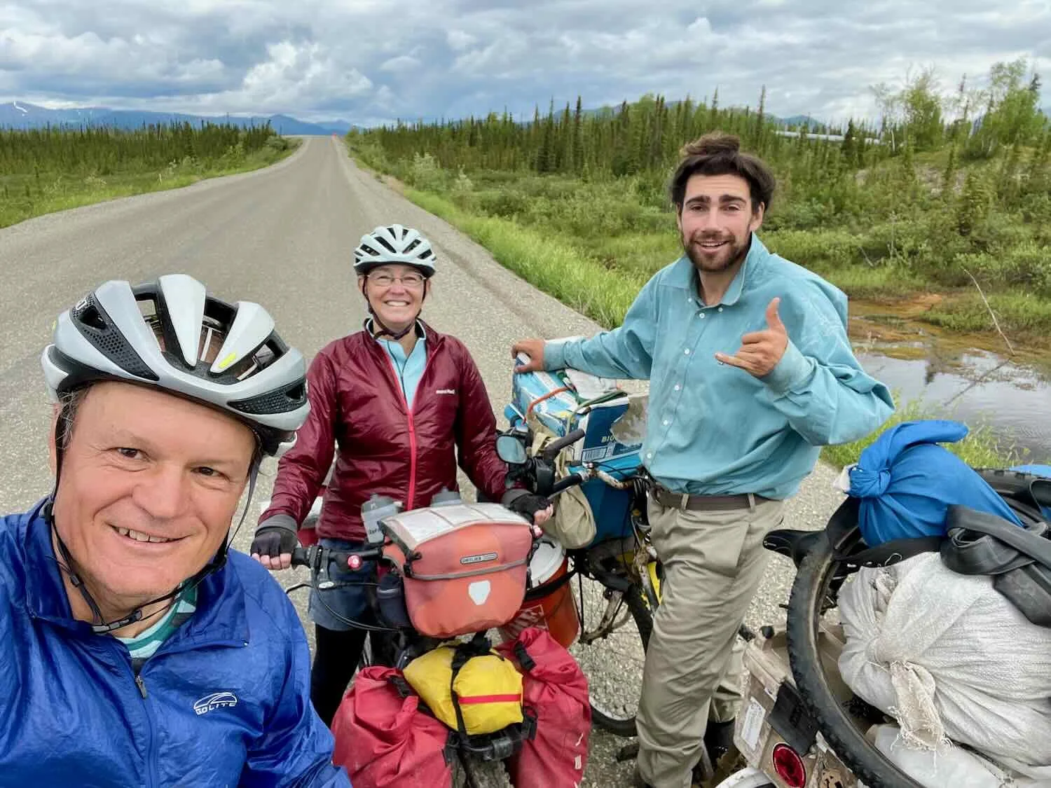
On our first day out from Coldfoot, we encountered a cyclist heading north. Ross was the epitome of the low-budget, long-distance cyclist. He’s been on the road for three years, “not counting breaks,” cycling the reverse of our intended route (he started in Ushuaia, Argentina, and was near the end of his odyssey in Deadhorse, Alaska). He was packing a heavy load, but clearly enjoying the adventure. We can only hope to feel as healthy and positive in our outlook as he seemed to be when we arrive in Ushuaia… someday.

As the first day cycling from Coldfoot was drawing to a close, we caught a glimpse of the fires that had been plaguing the Dalton Highway for the past couple of weeks. We descended into a broad valley along the Jim River, where we could see for several miles on both sides of the road.
A short distance away, the individual plumes of smoke began to take shape along a ridgeline on our left. Soon we could see where each plume originated among the trees. It’s hard to judge the distance - it was probably farther than it looked - but it seemed like the fire was no more than a couple of miles away. Fortunately, the wind was blowing away from us. Moreover, the oil pipeline was between us and the fire. So we figured that if the fire started heading in our direction, firefighters would work hard to keep the flames away from the pipeline (even though it is supposedly fireproof). That gave us some comfort.
Forest fires from lightning are a regular occurrence in Alaska’s interior during the summer. As we rode south on the Dalton Highway, we could see plumes of smoke rising from a fire on a nearby ridge. Alaska, USA. Copyright © 2019-2022 Pedals and Puffins.
The Most Vicious Predators of the North
The mosquitos are definitely coming out in force now. Any time we would stop along the road, a hoard of the little vampires would swarm around us. We quickly learned why Alaskans like to say that the most vicious predators in the state are not bears, but mosquitos. These skeeters are tough. They’re used to the wind, so you need to have a pretty stiff breeze to keep them at bay. Our bug jackets, head-nets, and bug repellant soon became indispensable supplies.
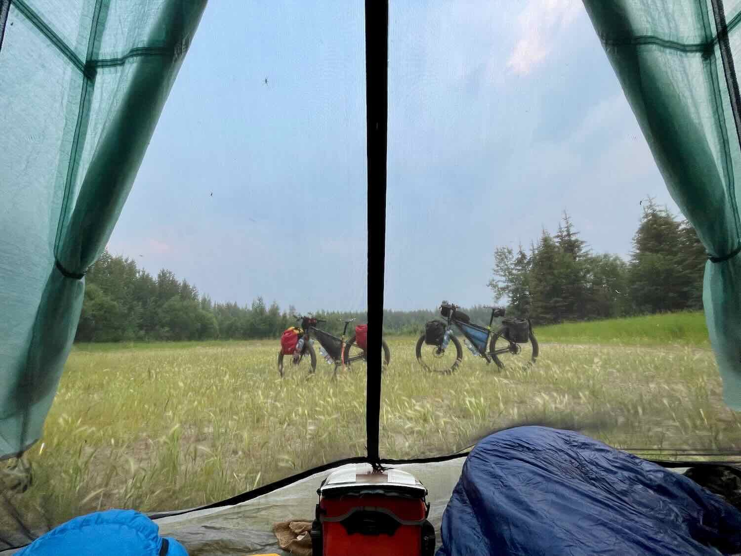
We stopped for dinner on top of a tall hill with a strong breeze. It was the perfect spot for enjoying our meal without being bothered by too many bugs.
After dinner we considered whether it was worth it to continue to our planned campsite, by a creek. On the one hand, it’s good practice in bear country not to eat and camp in the same spot. Stopping now would also add about three miles to the next day’s ride, which was already shaping up to be a pretty tough day.
But our desire to camp in a place without mosquitos was overwhelming. Finding a campsite like this one that was free of the marauding hoards was almost a miracle. Besides, a site by a creek (as we had planned) seemed like it would be infested with them. We decided to stay.
But the perfect campsite is truly a rare thing. This time, we had a few challenges pitching the tent. The ground along the Dalton Highway tends to be comprised of hard-packed gravel, and it was particularly difficult to drive our tent stakes into the concrete-like soil at this site (a requirement, since the Taj Majal is not a free-standing tent). The stiff wind pulled up one of our stakes before we even had the Taj Mahal fully set up, almost collapsing the tent. PedalingGal held on to one of the guy-lines to keep the tent from sailing away, while PedalingGuy worked to get the stakes reset. We ended up putting big rocks on all 4 corners and mid-lines to help secure the tent. Plus, we used 3 extra lines to stake it down. In the end, it was a nice, secure pitch.
Sadly, the wind eventually died down during the night as it typically does. So we had to contend with the mosquitos in the morning. C’est la vie.
The Dalton Highway Hits Us With its Best Shot
Among the trucker’s lore regarding the Dalton Highway, there are a series of big, bad hills. Each hill has a name, and is famous for being long and steep. Anyone who drives the Haul Road regularly knows them all by heart. We had heard from multiple sources that these hills are challenging on bicycles. And we can confirm, without a doubt, that this is true.
On our second day out from Coldfoot, we tackled three of the biggest, baddest hills on the entire Dalton Highway. Over the course of 41.5 mi (67 km), we would claw our way up more than 4,600 ft (1,400 m) in gravelly, dusty hills.
The first big climb was Gobbler’s Knob (3.5 mi/5.6 km, with extended sections of 8%-10% gradient). We hit this one early in the day, while we were still fresh, and were rewarded with an exciting animal encounter. PedalingGal had pulled out ahead, and opened up a gap between herself and PedalingGuy (a rare thing, actually). About halfway up the hill, she heard a noise in the bushes. Glancing over, she didn’t see anything in the dense willows, and figured it was just the rustling of a red squirrel.
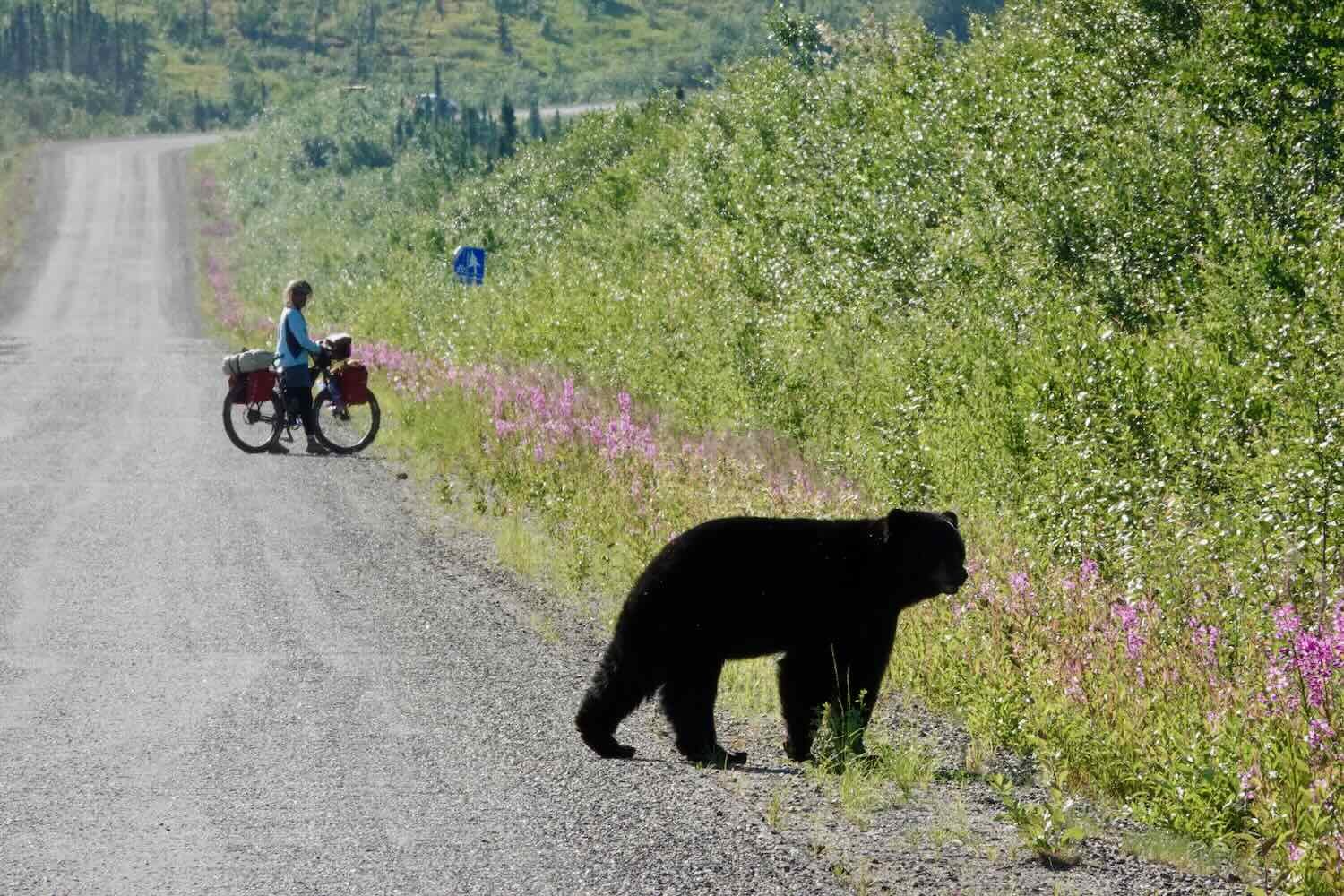
But about a minute later, she looked in her rear view mirror and realized that PedalingGuy was way back down the hill, and had apparently stopped. Concerned, she also stopped. When she looked back over her shoulder, she was surprised to see a big, black bear strolling across the road between herself and PedalingGuy, who already had his camera out.
Bear spray at the ready, we watched as the bear reached the side of the road. Sensing PedalingGuy snapping photos, the bear turned and started to walk up the road towards PedalingGal. But it only took a few steps before catching a whiff of her as well (PedalingGal was upwind - a headwind, of course). The bear seemed more unsure about what to do than aggressive. After taking another moment to consider its options, the bear turned and walked away, into the brush on the side of the road where it had been headed in the first place.
At this point, PedalingGal was still blissfully unaware of the black bear crossing the road behind her. Dalton Highway, Alaska, USA. Copyright © 2019-2022 Pedals and Puffins.

The situation was still a little dicey though, since PedalingGuy had to cycle past the bear to continue up the hill. Eventually he passed the place where the bear had made its exit, and reached PedalingGal. It had been quite an encounter, lasting more than 15 minutes. It’s something we’ll never forget.
At the top of Gobbler’s Knob is a platform where we got our last views of the Brooks Range as it receded beyond the skyline to the north. We stopped to enjoy one last look at those fabled mountains. Dalton Highway, Alaska, USA. Copyright © 2019-2022 Pedals and Puffins.
After the descent off of Gobbler’s Knob, we had several hours of pleasant riding under clear blue skies. Before long, we arrived at the first major celestial milestone we will pass as we pedal our way southward on the big globe of earth. At 66º30’N, we reached the Arctic Circle - the tipping point where the sun will start to set (albeit briefly) each night.
Since the Arctic Circle is really a celestial milestone, there’s not that much to see of it on the ground. But the state has helpfully created a parking area for tourists to stop, with a handsome sign marking the spot. Dalton Highway, Alaska, USA. Copyright © 2019-2022 Pedals and Puffins.
Gobbler’s Knob is a big hill. But nothing can compare to the truly sadistic Beaver Slide (2 miles/3.2 km, mostly at gradients of 10%-12%), which we hit about five hours into our ride. The engineers who designed this part of the Dalton Highway seemed to have no appreciation for contour grading or switchbacks. Instead, the road just launches straight up a steep mountain.
We only made it up about a halfway before having to get off our bicycles and walk the rest. The hill seemed to go on forever, and it was exhausting. The Beaver Slide was a killer, and made the rest of the day that much harder.
In a bit of self-inflicted planning pain, we had decided to climb one more of the big hills at the end of the day. The idea was that we could camp on top of Finger Mountain (and hopefully have a stiff wind to keep away the mosquitos). Adding to the fun, there was no water available up on the mountain. So we had to load ourselves up with extra water at a creek just before the final climb.
Finger Mountain (2 miles/3.2 km, mostly at gradients of 8%-11%) seemed extra steep and long because we were both tired after a full day of cycling. We were thrilled to finally reach the top. From its heights we could see the smoke from more forest fires burning nearby. But once again, the wind was blowing them away from the road. We selected a camping spot on a side road, very close to the oil pipeline. The Dalton Highway had hit us with its best shot, but we had prevailed.
A Roller-Coaster Ride
The next day began with a 17 mile (27.4 km) descent off of Finger Mountain. As we made our way down towards the mighty Yukon River, the forests around us changed to the interior taiga lowlands. There was a noticeable increase in lakes and open, boggy areas that were covered with grasses and sedges. Here, the spruce trees were more stunted, as they labored to grow in the soggy earth.
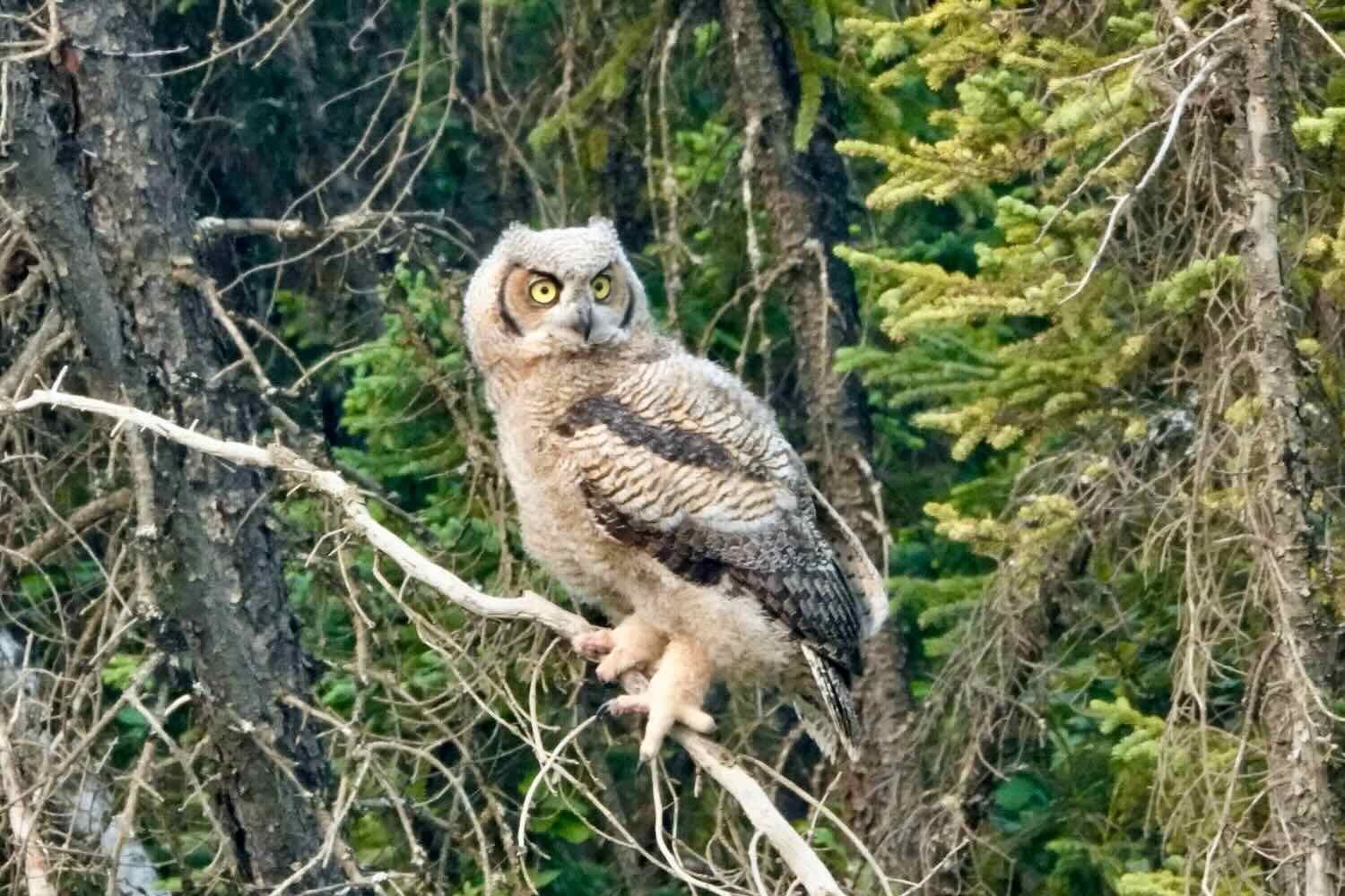
Every day on the Dalton Highway has included new and interesting wildlife sightings. On this day, we passed by a small pond right next to the road, edged with dead spruce trees. Among the scraggly branches we spotted a regal family of great-horned owls. A very stern-looking adult owl glared at us, while the two fluffy owlets viewed us with apparent curiosity. We were impressed with how huge and handsome these birds were. They seemed much bigger than the great-horned owls we have seen in the lower 48.

But the cycling for the day was not going to be all downhill. At the base of Finger Mountain, we entered what the truckers call the Roller Coaster - 20 miles of relentless, short-but-steep hills. It was reminiscent of cycling through the Ozarks in Missouri.
Riding the Dalton Highway Roller Coaster, headed for the Yukon River. Alaska, USA. Copyright © 2019-2022 Pedals and Puffins.
It was a wonderful feeling to finally reach the Yukon River Camp (run by the same company as the camp in Coldfoot). The hot, private showers were a luxurious treat. And after downing another trucker-sized meal accompanied by several liters of cold drinks, we started to feel like ourselves again. We camped on the lawn behind the cafe.
The Yukon River Camp provides another humble oasis of food and shelter along the Dalton Highway. Alaska, USA. Copyright © 2019-2022 Pedals and Puffins.
Crossing the Mighty Yukon River
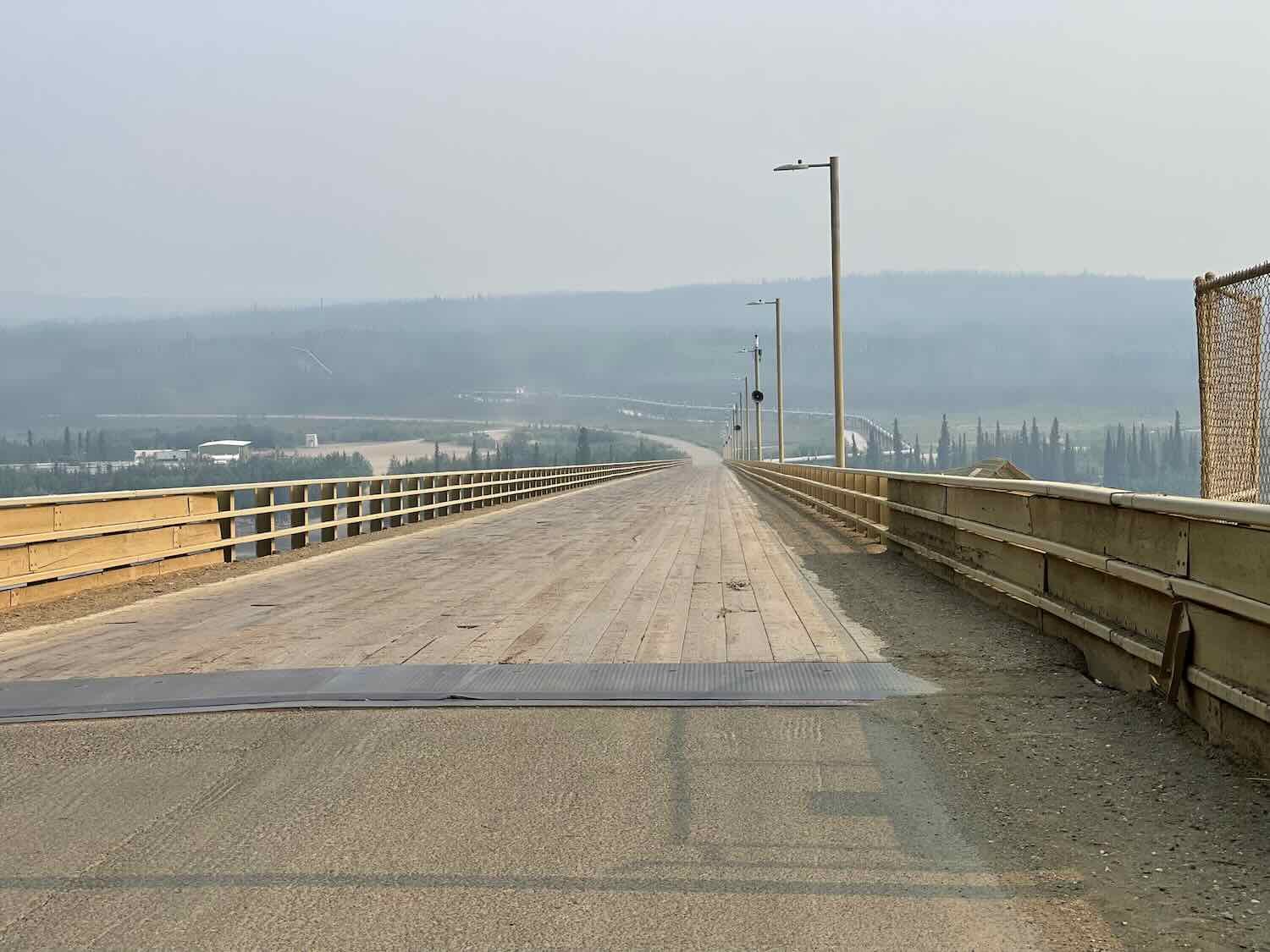
Immediately after departing the Yukon River Camp, we reached the famous E.L. Patton Bridge across the Yukon River. It was one of the more memorable river crossings in all our travels.
The Patton Bridge spans the Yukon River more than 800 miles (1,304 km) from its mouth at the Bearing Sea. Yet even here, the river is huge. It’s roughly a half mile wide. And when we crossed over, it was a churning, rushing, muddy waterway that looked like it would sweep away anything in its path. The mood was suitably dark, because shifting winds had brought a return of the dense smoke from forest fires. Under the yellow-gray haze that hung in the sky, the river coursed quietly towards its rendezvous with the ocean.
Adding to the exotic air of the moment, the Patton Bridge itself is something of an enigma. It has the distinction of being the only bridge in Alaska that crosses the Yukon River (an astonishing fact, given that the river runs for more than 1,150 miles across the state). Furthermore, it’s built on a slant, with a gradient of 6% as it rises from the lower, northern riverbank to a point higher up on the southern cliffs. Its steel foundations are anchored in bedrock below the river, but its driving surface is made of wooden planks that have to be replaced roughly every 10 years. We’ve never seen a bridge this long covered with wood. Crossing the bridge, it almost feels as if you’re riding out onto a very long fishing pier.

It was another day of big hills (we climbed nearly 2,000 ft just to get out of the Yukon River valley), followed by smaller-but-steep rolling hills. We were pretty tired by the time we reached Hess Creek, where we planned to camp.
Part of the reason to camp near a creek is, of course, to have access to water. But Hess Creek was packed with beavers. We certainly enjoyed seeing these normally elusive creatures. And these beavers were very bold. At least five of them went about their business, hauling branches through the water while stopping occasionally to munch on the leaves, as we watched in amusement.
Unfortunately, that meant we had to be extra cautious about using the water. Beavers can transmit several diseases to humans, including tularemia and giardiasis (also known as “beaver fever”). And the primary mode of transmission is through the water where they live. But we didn’t have much choice - Hess Creek was our only option for water that night. So after filtering several bottles of water, we gave them a secondary treatment with chlorine tablets just to be safe.

More Water Woes
On our fifth day out from Coldfoot, we cycled across three more big mountain ridges before finally reaching the end of the road. Still wrapped in our mosquito repellant jackets, we posed for a victory photo near the sign that welcomes northbound travelers onto the Dalton Highway.
The sign welcoming northbound travelers marked the end of the Dalton Highway for us. Alaska, USA. Copyright © 2019-2022 Pedals and Puffins.
But we still had 85 miles (137 km) to go before reaching Fairbanks, Alaska, on the Elliott Highway. Theoretically, the Dalton Highway is unpaved, and the Elliott Highway is paved. However, there are sections of paved road on the Dalton Highway, and long sections of gravel on the Elliott Highway. In reality, it was kind of hard to tell exactly what the distinction was.
But pavement was not our primary concern. From previous cyclists’ online reports, we knew that good water sources would be scarce along the Elliott Highway, and that we should be sure to stop at the Dept of Transportation’s Livengood Camp to fill up on water. Unfortunately, the DOT Camp was not where we had marked it on the map. And with mobile phone service being nonexistent in this part of the world, we had no way of figuring out where it was.
That was bad. We were not out of water yet, but we were very low and certainly didn’t have enough to camp for the night. So we cycled another eight miles to a supposed campground along a river. However, when we got there we found out that the campground no longer exists (there even was a sign saying that the parking area was closed).
By this point we were tired and it was getting late in the evening. We rode our bikes into the “closed” parking lot, and pitched our tent. But once again, we saw several beavers swimming in the creek (we’re getting the feeling that beavers are doing quite well around here). So a double treatment of filtering and chlorine tablets seemed like the only sensible option. At least we would have water for our dinner.
We were awakened in the morning by a raucously noisy family of ravens. They caw’d constantly for more than an hour, taking up various positions in the trees surrounding the parking lot where we had camped. It seemed as if the presence of our tent had riled them up, causing them to have an extended discussion about what this big, new object in their territory might be.
The ride profile for the day was particularly tough, with three large ridges to cross, and more than 4,300 ft (1,310 m) of climbing. Of course, the biggest mountain would come at the end of the day.
When filling up our water bottles at the creek, we estimated our daily water need based on the previous day’s consumption. But that was a mistake. The day before had been cloudy with some rain, and was relatively cool. This day quickly got much hotter (in fact, it was the start of a heat wave in Fairbanks that would last for more than a week). The warm temperature, combined with the three big mountain ridges, had us gulping water faster than expected. We started to worry that we had underestimated our water needs again, and would be fretting about water for the second day in a row.
But the universe has a way of making sure everything works out okay. We had stopped for a rest break after descending off of the first mountain ridge. Pretty soon, an RV pulled into the parking area where we were sitting. Inside was a friendly couple that we had met in Deadhorse, Alaska nearly two weeks earlier, when the four of us were in the same group that went to the Arctic Ocean. We ended up visiting with them by the side of the road for almost an hour, learning about their RV and their travels. When they asked if there was anything we needed, we said, “water!” They kindly gave us a gallon of deliciously cold water, obtained from a mountain spring. It was perfect.
The final climb of the day, over the massive Wickersham Dome, was a challenge. The mosquitos seem to have learned that cyclists are especially vulnerable when slowly slogging up big hills. They swarmed us in dark clouds of buzzing wings. Plus, there was still a lot of smoke in the air, obscuring any mountain views and making us cough. On the bright side, when moving that slowly one can sometimes spot wildlife that would otherwise not be seen. We finally were able to get some photos of Bohemian waxwings.
We had been seeing and hearing Bohemian waxwings for several days, but had not yet gotten a satisfying look. We finally spotted this elegant bird while slowly inching up the mountainside of Wickersham Dome. Alaska, USA. Copyright © 2019-2022 Pedals and Puffins.
Signs of civilization started to appear as we got closer to Fairbanks. Lots of folks have built homes up in the hills, but apparently the postal service does not deliver mail to all of the scattered residences. Instead, each side road has a cluster of mail boxes at its entrance. Sometimes there were just 2-3 boxes. But once in a while we passed large racks crammed with mail boxes - as if an entire community had banded together to establish their own “P.O. Box” system.
A couple of shelves, a notice board and a simple roof, and voilà! you have an Alaskan post office, complete with P.O. Boxes for everyone in the area. Alaska, USA. Copyright © 2019-2022 Pedals and Puffins.
After more than eight hours of cycling, we arrived at the Whitefish Campground where we had hoped to stay the night. But no, it was not to be. The campground was closed as a precaution due to nearby forest fires.
This was a huge disappointment, in part because we were nearly out of water, again. We had planned to fill up at the campground’s water pump. Luckily, there was no gate across the road, just a sign declaring that the campground was closed. So after a bit of deliberation, we decided to go into the campground, at least to fill our water bottles.
We were not the only ones there. A number of other folks were fishing in the creek that flowed through the campground. That gave us some comfort that it would be okay to use the facilities, as long as we didn’t stay for the night.
We found the water pump - an ancient, rusty-looking, hand pump. It was right next to a covered picnic shelter, so we settled in to have dinner before heading down the road. But when we went to use the water, we discovered that it was filled with grungy, orange-brown debris. Rust from the pump was settling out of the water. A quick sip confirmed that it tasted awful. Discouraged, we dumped out all of the water bottles that we had just filled.
Fortunately, the creek that flowed through the campground looked clear. So we headed down to the river bank and filtered 7.5 L of water.
After dinner, we headed out not knowing how far we might have to go to find a place to camp. But just across the river from the campground, a small road led into an old gravel mining site. The gravel pits had filled with water, and there was a family kayaking in the small lakes that had formed. One of the guys in that group assured us it would be okay to camp there, and by 10 pm we had the place to ourselves, except for the company of a local semipalmated plover that kept a close watch on our camp.

Cycling Into Fairbanks
The final cruise into Fairbanks was pretty enjoyable. There was only one sizable hill, but it had a delightful cafe and store at the top. We stopped there for an extended break, reveling in the novelty of sitting at a table and chairs to enjoy a few drinks and snacks.
Just outside of town, we checked out some roadside exhibits about the Trans-Alaska Oil Pipeline. It was fun to learn a few new facts about its construction and maintenance (like how they use giant, mechanical “pigs” to clean the inside of the pipes). And it gave us a chance to get one more, up-close look at the massive structure that had been our constant companion for the past two weeks.
Information panels at the roadside viewing area gave us a better feel for how the Trans-Alaska Oil Pipeline was constructed and maintained. Fairbanks, Alaska, USA. Copyright © 2019-2022 Pedals and Puffins.


Our journey from Deadhorse to Fairbanks had been packed with extraordinary experiences. From the frozen, brown tundra to the deep-green spruce forests, we saw fascinating wildlife, gorgeous vistas, and even a few up-close wildfires. Each day we faced the challenges of the road, including mud, dust, wind, smoke, mosquitos, and more than a couple of “who’s idea was this…” hills. All-in-all, the ride produced an incredible number of memorable moments. The Dalton Highway embodies the spirit of adventure cycling.
The next couple of days we took time off in Fairbanks to regroup, before cycling the rest of the way across Alaska. Bicycle maintenance was a top priority, as we cleaned off the mud from the Dalton Highway and checked that everything was still in working order.
After accumulating a coating of mud and dust along the Dalton Highway, our bikes had earned a thorough cleaning at a car wash in Fairbanks, Alaska. Copyright © 2019-2022 Pedals and Puffins.
We also had to reevaluate the plans for the next leg of our journey. Record warm temperatures, low humidity, lightning and high winds were causing forest fires to grow rapidly throughout Alaska’s interior. As a result, several fires had led to evacuations, road closures and air health advisories along routes we had planned to take (like the Parks Highway south to Denali National Park). Flexibility is key when bicycle touring, so we decided to head down a different path out of Fairbanks. In the end, all roads will lead to Ushuaia, Argentina.