Pacific Coast Route, Part 4: Cycling from Marina to Encinitas, California
4 December 2022 - 10 January 2023
4 December - Marina to Big Sur, CA (41.6 mi, 67.0 km)
5 December - Road Closure Delay in Big Sur, CA (5.7 mi, 9.2 km)
6 December - Big Sur to Carmel, CA (29.2 mi, 47.0 km)
7 December - Drying out in Carmel, CA
8 December - Carmel to Big Sur, CA (32.4 mi, 52.1 km)
9 December - Big Sur to San Simeon, CA (67.8 mi, 109.1 km)
10 December - Rain Day in San Simeon, CA
11 December - Elephant Seal Viewpoint, CA (17.0 mi, 27.4 km)
12 December - San Simeon to San Luis Obispo, CA (44.8 mi, 72.1 km)
13 December - San Luis Obispo to Lompoc, CA (55.6 mi, 89.5 km)
14 December - Lompoc to Refugio State Park, CA (32.7 mi, 52.6 km)
15 December - Refugio State Park to Carpentaria, CA (38.8 mi, 62.4 km)
16 December - Carpentaria to Point Mugu State Park, CA (43.7 mi, 70.3 km)
17 December - Point Mugu State Park to Los Angeles, CA (45.3 mi, 72.9 km)
18 December - Los Angeles to Huntington Beach, CA (35.9 mi, 57.8 km)
19 December - Huntington Beach to San Clemente, CA (41.3 mi, 66.5 km)
20 December - San Clemente to Encinitas, CA (31.7 mi, 51.0 km)
20 Dec-10 Jan - Encinitas, CA
Ignorance is Bliss
We had been enjoying the milder temperatures and drier conditions we encountered south of San Francisco very much. Rain and cold had been the norm farther north. But now we had started to think that - just maybe - the weather would be more conducive to cycling going forward. We were aware that just south of Marina we would enter a new ecoregion. But the names of the two ecoregions sounded pretty similar (they are both versions of California chaparral), so we figured things would continue to warm up and dry out. We were in for a surprise.
But let’s not get ahead of ourselves. We cycled out of Marina, California on a beautiful, sun-dappled morning. The vegetation covering the ground at Fort Ord Dunes State Park shone in colors of bright yellow and gold. Rock squirrels scampered away as we approached, and iridescent western bluebirds flitted about among the bushes. The California Interior Chaparral and Woodlands ecoregion had been very good to us.
A blanket of iceplants, glowing golden in the morning light, gave some fall color to the coastal dunes. Fort Ord Dunes State Park, California, USA. Copyright © 2019-2023 Pedals and Puffins.
As we approached the community of Monterey, we transitioned into a new ecoregion - the California Montane Chaparral and Woodlands. Of course, these transitions happen gradually on the ground. Plus, we were in a fairly urban area without a lot of natural habitat. So we didn’t notice much of a change at first.
For about an hour we cycled on gentle bike paths past oceanfront beaches and through urban/suburban commercial areas. Then our route took a turn inland, and put the “mountain” into our montane ecoregion. Almost immediately we were cycling up the steep slopes of Jack’s Peak, the tall headland that forms the scenic backdrop to the city. We didn’t realize it at the time, but this big hill was just our first taste of the Santa Lucia Mountains, whose ridges run right down to the ocean for nearly 100 miles in the region known as the Big Sur.
It seemed to take forever to get to the top of the pass. When we finally topped out in a patch of woods called Skyline Forest, PedalingGal was worn out. We took a couple of minutes to catch our breath before tackling the long and very fast descent on the other side.
PedalingGal took a moment to gather herself after the long push up Jack’s Peak. Monterey, California, USA. Copyright © 2019-2023 Pedals and Puffins.
Clouds on the Horizon
When we had returned to sea level, we saw a sign along the side of Hwy 1 that gave us pause. It was one of those temporary, electronic signs that highway departments put up to warn about hazards in the road. And it said that Hwy 1 was closed just beyond the town of Big Sur, with no detour. The “no detour” part was especially notable. Hwy 1 was our route, and this was the first indication that things might not go according to plan. Without any other information, we tried to comfort ourselves by hoping that maybe they would let bicycles through. But this was definitely a situation we needed to get sorted.
We stopped at the next store on our route, to see what we could learn. The woman at the cash register did not have much information. She did confirm that the recent rain had caused a rockslide that was blocking the highway. She wasn’t sure if the road was still closed or not. But she was pretty pessimistic about our chances of getting through. She gave us a phone number for the highway department and recommended that we call them. But it wasn’t much use because this was Sunday, and they only answer the phone on weekdays, during business hours.
We stopped at this cute little store to inquire about a road closure up ahead. Carmel Highlands, California, USA. Copyright © 2019-2023 Pedals and Puffins.
Back out in the parking lot, PedalingGuy approached a guy who had just arrived by car from the south, and asked if he knew anything about the road closure. The guy confirmed that the road was still closed. Plus, he provided us with some very useful advice on how to check the status of the road online. Chatting with him, we started to realize that crossing the Big Sur coast on Hwy 1 was not going to be as easy as we thought. He told us that the highway would often close due to mudslides, and that in 2107-2018 the route had been closed for 14 months when a big landslide demolished part of the highway. This rockslide was reported to be a lot less severe, but we still started to worry.
We talked about possible detours, but there just aren’t many alternatives. Cars could head east to State Hwy 101, but that was a rotten option for us. It would add about 50 miles (80 km) to our trip, involve 130+ miles (210+ km) of cycling on one of the busiest highways in the state, pass through mostly industrial farmland, and we would completely miss the Big Sur - one of the highlights of the Pacific Coast Bike Route.
After discussing our situation, the guy in the parking lot encouraged us to keep going, rather than take the detour. If we had to wait for the road to open, at least we could stay at a lovely campground, and we would have access to food in the town nearby.
So we kept going. The scenery was very beautiful. The chaparral-covered mountains marched right up to the ocean. The road swooped up and down as it ascended to the top of each ridge, then plunged into the steep-sided ravines in between. There were many scenic pull-outs where we could stop to admire the view. From outlooks high above the water, we could see the progression of rocky headlands where each ridge jutted out into the sea, with the elegant lines of historic bridges across the intervening valleys. It was a Sunday, so the road traffic was pretty heavy. Every parking area was packed with cars. But people were driving pretty slowly most of the time, so it was not too bad.
The treeless hills of the montane chaparral descended rapidly towards the road by the sea. Hwy 1 north of Big Sur, California, USA. Copyright © 2019-2023 Pedals and Puffins.
Each mountain ridge sent out a tall headland into the ocean, creating an endless procession of rocky cliffs separated by scenic coves. Hurricane Point Overlook, California, USA. Copyright © 2019-2023 Pedals and Puffins.
Coastal prairies are a feature of the Montane Chaparral region. Recent rains had turned the grass in the prairies a pleasing color of green. Point Sur State Historic Park, California, USA. Copyright © 2019-2023 Pedals and Puffins.
Upon arriving in the town of Big Sur, we stopped at the Fernwood Restaurant for dinner. They are known for letting guests use their wifi, plus we could charge our devices while we ate. As we waited for our order, we checked the weather and the road status. The forecast called for rain. And unfortunately, the road was still closed. It would remain closed over night. Beyond that we could not be sure what might happen.
We hustled over to the Pfeiffer Big Sur Campground after dinner, and discovered that we would be camping in a grove of redwoods again. The southernmost redwoods occur in a few, small patches along the Big Sur coast. And we were in one of them. Predictably, it was very wet and cold. The wooden picnic tables were completely waterlogged, and looked like they had just been pulled out of a lake. We were glad we had already eaten.
The hiker/biker campsites were off by themselves, away from the main campground. So we thought we might have a peaceful night’s sleep. But that was not to be, because there was a group campground next door. And it was filled to the brim with participants in a conservation work camp. They were a jolly group, laughing and visiting with each other long into the night. They weren’t particularly loud, but there were so many of them (50+ people), that the overall noise level was still pretty high. It would be a restless night.
Stuck in a Holding Pattern in Big Sur
When we awoke, we used the faint, almost-one-bar of cell signal in the campground to check the internet. Unfortunately, there were no updates on the road closure. We came up with a plan to head over to a lodge near the campground, to see if they had wifi. We imagined ourselves sitting in a comfortable lobby, warm and dry, periodically checking for updates on the road. That sounded pretty appealing.
On our way to the Big Sur Lodge we caught sight of a spotted towhee. Pfeiffer Big Sur State Park, California, USA. Copyright © 2019-2023 Pedals and Puffins.
But several things busted up that plan. The lodge didn’t have wifi, and there was not even a cell phone signal. Also, it wasn’t particularly warm. However, as we approached the lodge a light rain started to fall. So we parked our bikes under an awning and went inside to stay dry. In the lobby we nibbled on some snacks, wrapped in our down coats to stay warm, and waited for the rain to stop.
When the sky cleared we went looking for any news about the road. There was a patrol ranger at the park entrance who seemed to be well informed. He had heard that they would be opening an additional 15 miles of the road heading southbound. But the highway was still blocked beyond that, where 7 inches (17.5 cm) of rain had caused a major rockslide. He suggested that we hang out at a nearby bakery that had wifi, and wait there for more news.
By the time we reached the bakery, which was up a very big hill, time was running out. We wanted to get on the road by noon to be able to make it past the landslide and to the next campground. But there were no updates online. Desperate for information, we started calling different offices of the state highway department in hopes of finding out some actionable intel. We finally connected with a guy who told us that the road was still closed, but that they might have it open in two days.
That pretty much ended our hopes of cycling southward for the next couple of days. We decided to go back to the Pfeiffer Big Sur Campground for another night, and assess the situation in the morning.
Luckily, the park staff let us use one of the regular campsites, while only charging us the hiker/biker fee (which is substantially less than the regular fee). That way we wouldn’t have to camp next to the large youth group again. We were ready for a good night’s sleep. But the park staff were adamant that it could only be for one night.
Our new campsite didn’t have any close neighbors. It was also in a clearing, away from the redwood grove, so it was a lot warmer in the afternoon sun. Our only real issue was that there was no food storage box nearby. We would have to haul our food a mile back to the hiker/biker campsites for storage.
We planned to charge our electronic devices over dinner. But PedalingGal soon realized that her bag of charge cords was missing. Unfortunately, her best guess of where they might be was at the bakery we had visited earlier, at the top of the killer hill. She was crushed. She had lost an important piece of kit. But the only possible chance of finding it was uphill in the wrong direction. And of course, it was about to start raining. But we had to go look.
When we reached the top of the hill, fortune smiled upon us. The folks who ran the bakery were still there, closing up shop. And beyond all hope, they had the bag of cords. They had found it on the entrance ramp to the parking lot, and put it in their office for safe keeping. It was a huge relief - both because we got the cords back, and because that made the hard ride up the big hill worth it. It’s such a wonderful feeling when everything works out okay.
We cruised back down the hill for dinner in town (composed of a few widely scattered buildings). The Fernwood restaurant was becoming our go-to base camp because of the public wifi, and the good, hearty meals. As we arrived, we encountered another cyclist. Brent was from Ventura, California. He also was wondering what to do about the road closure, and hadn’t made up his mind yet. He could afford to wait a day or two for the road to open. But he was also considering just biking north, the direction he had come, and taking the train home. We parted ways as he headed back to camp.
The Fernwood restaurant became our base camp in Big Sur, as we tried to figure out how to deal with a road closure on Hwy 1. Big Sur, California, USA. Copyright © 2019-2023 Pedals and Puffins.
Over dinner, we saw an online update that Hwy 1 was now open except for a 2-mile stretch right in the middle. Unfortunately, the closure was still between us and our next planned campground. Plus, the website projected that the final section of road would not open for another three days. Talking it over, we decided that if the news hadn’t changed by the next morning, we would backtrack, always a last resort. Cycling north in the direction we had just come from, we would get a hotel to wait out the next set of rainstorms.
The Retreat to Carmel-by-the-Sea
At some point during the night it started to rain. It was coming down hard enough that shallow puddles formed around the tent, even though we were on a slope where the water should have drained away. The ground was just so saturated that none of the water could sink in. The runoff from our tent roof poured into the puddles, splashing both water and gritty dirt up onto the inside mesh. Our stuff, including our down sleeping bags, started to get wet, too. It was a rough night.
Around 7:30am the sound of rainfall stopped, so we quickly started packing our gear inside the tent, in hopes of making a break for it. But the gap in the rain lasted less than a half hour. Just as we were getting ready to exit the tent, it began raining again. And the rain just kept coming, for hours, sometimes quite hard. At first we just sat in the tent hoping it would stop. But the temperature dropped and we started to get cold. So we pulled out our sleeping bags and settled back to wait it out.
As 11am approached, the storm finally started to abate. It was still raining, but just a little bit. We packed up our things and got on our bikes. We had to find out what was going on with the road closure, and make a decision about whether to try to get through or abandon ship. We also needed to dry out. Miraculously, once we started cycling the rain finally stopped.
PedalingGuy called the department of transportation’s dispatch office to ask about a detour. The person there confirmed that the road was still closed, and made it clear that bicycles would not be let through. But he also discouraged us from cycling on Hwy 101 (the alternate route), for safety reasons. That wasn’t very helpful, given that it was really the only other option. That settled it. We decided to make a hotel reservation and bike back north, to Carmel-by-the-Sea.
As if to tempt us to change our minds, the sun came out as we rode north. The scenery was gorgeous. The sunshine lit up everything, and the clear sky turned the ocean a lovely, shade of blue.
Cycling north. Backtracking along the route we had ridden a couple days ago. Great Sur Overlook, California, USA. Copyright © 2019-2023 Pedals and Puffins.
One of the historic bridges along Hwy 1 in the Big Sur region. Castle Rock Overlook, California, USA.. Copyright © 2019-2023 Pedals and Puffins.
Blue skies over the montane chaparral. Sarbanes Point, California, USA. Copyright © 2019-2023 Pedals and Puffins.
We were just about half way to Carmel when we saw two cyclists approaching from the opposite direction. Marty and Anna were great. They were in an upbeat mood, clearly enjoying their ride. Marty was carrying a long baguette strapped to the top of his back bike rack, which was an interesting sight. Traveling relatively light, they were in the middle of a 2-week ride from San Francisco to San Diego, and had already planned to spend two nights in the campground at Pfeiffer Big Sur State Park. We gave them some tips about dining and wifi access in Big Sur. Then we parted ways, wishing them luck on getting through the road closure.
We met these two cyclists heading south along the Big Sur coast as we headed back north to wait out a road closure on Hwy 1. They were in an upbeat mood, and the encounter brightened our day. Hwy 1 south of Carmel Highlands, California, USA. Copyright © 2019-2023 Pedals and Puffins.
Our layover in Carmel-by-the-Sea lasted two nights, so we had time to enjoy the town. We went for a walk along the waterfront, where we spotted quite a few hummingbirds. One male was more cooperative than most hummingbirds, sitting still for a long time on a branch, in the open. Too bad the sunlight wasn’t shining at the right angle to highlight the bird’s beautiful, magenta throat. Still, we enjoyed watching the little bird defend his territory.
A male Anna’s hummingbird posed for the camera. Carmel-by-the-Sea, California, USA. Copyright © 2019-2023 Pedals and Puffins.


We also saw quite a few Townsend’s warblers on the cypress trees near the beach. Carmel-by-the-Sea, California, USA. Copyright © 2019-2023 Pedals and Puffins.
Walking back from the beach, we were struck by how big Carmel’s shopping district is. There were tons of trendy and quirky, independent shops. And all of them seemed to be doing well. We didn’t see any vacant storefronts. The town is probably a very big tourist attraction in the summer since there weren’t many people there during our visit.
Making a Run for It - San Simeon, or Bust
At the end of our rest day in Carmel-by-the-Sea we learned that they were re-opening Hwy 1. So we would be able to cycle down the Big Sur Coast after all. It was a big relief.
We once again headed back toward Big Sur cycling the same 30 mile section of coastline for the third time because of the road closure. This time we stopped at the point Lobos State Natural Reserve along the way. It is one of the best places to see sea otters.
View from the loop road. This is where people go to look for sea otters. Point Lobos State Natural Reserve. Copyright © 2019-2023 Pedals and Puffins.
We spotted this sea otter floating in the canopy of a kelp forest. Point Lobos State Natural Reserve, California, USA. Copyright © 2019-2023 Pedals and Puffins.
We also were impressed by the thick layer of lace lichen (a.k.a., “old man’s beard”) draped all over the trees. Point Lobos State Natural Reserve, California, USA. Copyright © 2019-2023 Pedals and Puffins.
A sign near the entrance to the campground celebrates wildlife of the Northern California forests. Pfeiffer Big Sur State Park, California, USA. Copyright © 2019-2023 Pedals and Puffins.
We arrived back at the now very familiar Pfeiffer Big Sur campground. While we were pitching our tent, another cyclist arrived. He was in the process of trying to fix a broken pedal. Since there were no bike shops within a day’s ride, he was hoping to get a pedal delivered via express mail to a local address. Sometimes one has to get creative in these situations, but he sounded like he was up to the challenge.
The next day, as we cycled up the big hill out of the Pfeiffer Big Sur campground, we rode into a cloud. At first it was just misty. Then it was a drizzle. And before long it was raining. It rained for the rest of the morning, not stopping until after noon.
The gorgeous Big Sur Coast was shrouded in mist when we cycled through. Julia Pfeiffer Burns State Park, California, USA. Copyright © 2019-2023 Pedals and Puffins.
Unfortunately, that nixed any chance we had of seeing California condors. With wingspans of 9.5 ft (3 m), and weighing 20 lbs (9 kg), California condors are the largest birds in North America, and we really wanted to see one. There are only a couple hundred of these colossal birds left in the wild, so seeing them isn’t easy. But the Big Sur Coast is one of the better places to spot them, as long as the weather is good. However, they won’t fly unless they can soar along thermal updrafts that only occur on sunny days. Plus, the thick mist that enveloped us would make it pretty hard to spot any condors roosting up in the hills. It just wasn’t going to happen. (We had actually seen some condors in Arizona when we cycled the Western Wildlands Bikepacking Route, but it would have been awesome to see them again.)
The only California condor we saw along the Big Sur Coast was this mosaic at a seaside overlook. Julia Pfeiffer Burns State Park, California, USA. Copyright © 2019-2023 Pedals and Puffins.
Several hours into our ride we passed a guy who was waving around what looked like a big TV antenna. We recognized it as a telemetry antenna, which is used to locate animals that have been fitted with radio transmitters. We stopped to ask him what he was tracking.
It turned out that he was tracking the California condors. He told us that he had already located four of them. They were roosting in trees, high up in the canyons that lined the stretch of road that we had just cycled through. But none of them were visible from the road, even for the guy with the antenna. He confirmed that they were hunkered down because of the rain. And as we were talking, he detected another one just up ahead. That meant we would cycle past a minimum of five condors! But we would see none of them.
A dense fog shrouded the hills along our route, foiling any chance we had of spotting California condors. Big Sur Coast, California, USA. Copyright © 2019-2023 Pedals and Puffins.
By now we had seen quite a few palm trees planted in people’s yards. But these California fan palms, growing along the base of the cliffs, might have been the first native palms we had seen. (Of course, we couldn’t be completely sure that these had not been planted, as well). Gambia Point Beach, California, USA. Copyright © 2019-2023 Pedals and Puffins.
We cycled through the area that had been closed due to the rockslide without incident. Piles of rocks had been pushed over to the side of the road, but the main thoroughfare was completely clear.
Although there are few services along the 100+ miles of the Big Sur Coast, there is one food truck. Parked just outside of the tiny town of Lucia, it offers the perfect oasis for hungry cyclists. Lucia, California, USA. Copyright © 2019-2023 Pedals and Puffins.
A hermitage up in the mountains offers art and gifts, including “Holy Granola.” Sounds delicious. Unfortunately, it was way up in the hills, so we didn’t go there. Lucia, California, USA. Copyright © 2019-2023 Pedals and Puffins.
Entering the “Rock Shed,” a tunnel-like structure built on a stretch of Hwy 1 that is plagued by landslides. The sloped roof of the rock shed sends debris that slides down from the mountains out onto the sea cliffs below - protecting the road from damage. Pitkins Curve, California, USA. Copyright © 2019-2023 Pedals and Puffins.
As we descended out of the mountains that lined the Big Sur Coast, the sun dipped below the horizon of the Pacific Ocean. Near Ragged Point, California, USA. Copyright © 2019-2023 Pedals and Puffins.
As we cycled along the coast darkness overtook us. But we needed to press on to San Simeon, because another storm was brewing that would lash the Big Sur Coast tomorrow. We got out our headlights as dusk turned into pitch darkness. As we focused on the narrow beams of light created by our headlights, we heard loud, unusual noises coming from the the direction of the ocean. The beach was too far to see, but we were curious about what could possibly create those weird sounds.
We rarely cycle in the dark. But we decided it would be worth it to make it to a hotel in San Simeon, rather than camp on the exposed coastline in a storm. Arroyo Laguna Beach, California, USA. Copyright © 2019-2023 Pedals and Puffins.
Huge Beasts on the Beach
The next day a massive storm blew in. Two inches of rain fell on San Simeon, with gale-force winds that blew throughout the day (25 mph sustained winds, with gusts to 50 mph). We later learned that five inches of rain fell where we had considered camping the previous day, and rockslides had closed the highway, again. Whenever we looked out the window and saw the wind and rain pummeling the town, we marveled at our good fortune - happy that we weren’t stranded, trying to stay dry in a tent, and unable to proceed south because of yet another landslide.
The rain day gave us a chance to take care of some chores. A high priority was cleaning the tent. We filled the bathtub with water and rinsed both the inner and outer tents 3-4 times each. Eventually, all of the grit was gone and the zippers functioned almost like they were new. We were very happy about that, because a tent with a failing zipper is toward the top of the list of “most undesirable equipment failures.”
We had planned to take only one day in San Simeon to wait out the rain. But while we were there, we discovered the source of those strange sounds we had heard in the night. A large colony of elephant seals makes its home just north of town. And the huge creatures had already started to haul out on the beaches for the winter mating season. We could not possibly leave San Simeon without going to see the elephant seals.
So we extended our stay one more day, and hopped on our bikes to head back north to the seal viewing point. Along the way we spied the famous Hearst Castle on a distant hilltop, and cycled through fields that once belonged to the Hearst Ranch. Publisher William Randolph Hearst built the opulent residence in the years 1919-1947. But the cost of construction (among other bad decisions), brought Hearst to financial ruin. A few years after his death, the mansion was donated to the state of California, and is now a state park.


Seeing the elephant seals was a highlight of our trip. A nonprofit organization has built a boardwalk that runs along the length of the colony, allowing astonishingly close viewing of the seals.
Within a few minutes of arrival, we watched a big bull seal bellowing to establish his dominance over a section of the beach. We recognized that sound - it was what we had heard in the dark of night. The gigantic animal (they can weigh 4,500 lbs, more than most passenger cars or as much as a rhinoceros) would lay still on the sand for a while, then suddenly arch its back, open its mouth wide to display its tusks, and let out a series of deep-bass roars. It was truly impressive to behold. Later, we would see one of the bigger bulls chase another one off the beach and out into the surf. Although they spend most of their time laying still in the sand, they can be surprisingly fast when motivated.
A huge, male elephant seal bellows to establish his territory. Elephant Seal Overlook, California, USA. Copyright © 2019-2023 Pedals and Puffins.
When fighting for dominance, the male elephant seals will gash each other in the neck with their tusks during combat. They have thick skin and blubber there, which helps to protect them from life-threatening injuries. But the older males all have lots of scars on their necks. Elephant Seal Overlook, California, USA. Copyright © 2019-2023 Pedals and Puffins.
Elsewhere on the beach there were groups of female and immature elephant seals huddled together in groups. We were told that the seals have spent the last few months at sea feeding, but that once they come ashore for the breeding season they won’t eat again for another couple of months. So they mostly lay around conserving energy, moving only when necessary to take care of the business of breeding - or to let out an occasional yawn.
One bull out in the water lifted its head in a kind of yawn, much like what a hippopotamus might do to show off its tusks.
In several pockets along the beach, females and immature seals huddled for warmth as they snoozed in the afternoon sun. Elephant Seal Overlook, California, USA. Copyright © 2019-2023 Pedals and Puffins.


A view of the cliffs overlooking the elephant seal colony, on the beach below. Elephant Seal Overlook, California, USA. Copyright © 2019-2023 Pedals and Puffins.
Elephant seals weren’t the only animals we spotted there. Large numbers of california rock squirrels, plus a few brush rabbits, rustled around in the heather that lined the dunes.


We stayed at the Elephant Seal overlook for quite a while, only leaving when the sun started to set at the end of the day. San Simeon, California, USA. Copyright © 2019-2023 Pedals and Puffins.
Farms, Ranches and Butterflies
The three day run from San Simeon to Refugio State Park was a transitional time. In Big Sur we had crossed more than 100 miles (160 km) of near-wilderness with few services. But over the next few days, natural areas became smaller, farms and ranches became dominant, and urban areas became both bigger and more densely settled. We could feel the approach of Southern California.
We departed San Simeon on a sunny, breezy morning. Now that we were back in the interior chaparral, the terrain was much more moderate and we were able to move along at a rapid pace.
The next day we cycled past Pismo Beach State Park. From the signs, it was pretty obvious that there was a Monarch butterfly overwintering area here (similar to what we had seen in Monterey). We stopped to check it out. There were even more Monarchs here than we had seen at Pacific Beach. They were huddled together on branches of both pine and eucalyptus trees. It was warming up quickly when we arrived, so many of the butterflies had started to take flight. It was a lovely break from our ride.
Visiting the Monarch butterfly sanctuary at Pismo Beach State Park, California, USA. Copyright © 2019-2023 Pedals and Puffins.
Clusters of overwintering Monarchs huddled together among the eucalyptus leaves. Pismo Beach State Park, California, USA. Copyright © 2019-2023 Pedals and Puffins.
We cycled through the urban streets surrounding the state park, then out into an agricultural area surrounded by chaparral-covered hills. Celery, cabbage, strawberries and orange trees lined our route. The grasslands in the foothills were covered with green grass from the recent rains, and they looked particularly lush. On our way over one of the ridges, we caught sight of a high line of sand dunes off to the west.
Farm fields blanketed the valley floor along our route, while chaparral covered hills surrounded the valleys. South of Arroyo Grande, California, USA. Copyright © 2019-2023 Pedals and Puffins.
The Oceano Dunes rose prominently between us and the sea. South of Arroyo Grande, California, USA. Copyright © 2019-2023 Pedals and Puffins.
Toward the end of the day we cycled over the biggest ridge of the day. From the top of the pass we had a great view out into the Lompoc Valley, where we were headed for the night.
View of the Lompoc Valley, seen from the summit of Harris Grade Road. California, USA. Copyright © 2019-2023 Pedals and Puffins.
The four mile (6.4 km) ride down the far side of the mountain was a blast. The gradient was steep and the road surface was smooth, so we were able to cruise down with minimal trouble. It was over too quickly.
The final push from Lompoc to Refugio State Beach was the most rural landscape on this stretch of our route. It was a gorgeous day for cycling with a bright, blue sky. And although it was brisk in the morning, the day warmed up fast. With a high temperature of 60F (15.5C), it felt really warm to us.
The day’s route profile was very different from anything we had ridden for a while. We spent the first half of the ride climbing steadily up and over the 1,000 ft ( 304 m) Gaviota Pass. It was uphill for 17 miles (27 km) straight. But it never got too steep, and there were long sections where we could pedal along pretty quickly. When we stopped, it was mostly to break up the monotony of the climb, rather than to rest. Even so, it took us a couple of hours to reach the top.
The landscape on the way up Gaviota Pass was covered by lush grasslands, populated by cows. South of Lompoc, California, USA. Copyright © 2019-2023 Pedals and Puffins.
Even the chaparral hills had a green hue from the recent rain. Gaviota Pass, California, USA. Copyright © 2019-2023 Pedals and Puffins.
On the far side of the pass, the descent was much steeper than the ascent had been, and we plummeted downward for just a couple of miles before the road leveled out. At the bottom of the big descent there was a rest area, but it was closed to cars. However, we noticed a gap in the barrier wide enough for our bikes. Feeling ready for a break, we figured it couldn’t hurt for us to go around the barrier and have a snack at one of the picnic tables.
It wasn’t clear why the rest area was closed. But we started to get an eerie feeling when we noticed that there were multiple signs warning that the site was infested with rattlesnakes. We carefully checked the area around our picnic table before sitting down. It wouldn’t be good to have a close encounter with a rattlesnake. We started to wonder if the rest area was closed because there had been too many incidents between tourists and snakes. (It wasn’t. We later learned that the state planned to install a new wastewater treatment system for the restrooms).


To our delight, a little canyon wren was searching for bugs along the eaves of the restroom building. Gaviota State Park Rest Area, California, USA. Copyright © 2019-2023 Pedals and Puffins.
Soon after that we stopped at a vista point to look out over the ocean. While we were there, we struck up a conversation with a truck driver named Marcus who also had stopped for a break. When we first saw him, we were intrigued. Unlike most people you see at a highway overlook, he alternated between lifting weights in the parking lot and looking out over the water with binoculars. He seemed like an interesting guy. We ended up talking with him for a long time. We learned that he was the father of five daughters. But mostly we talked about driving trucks. He explained some of the finer points about how to handle a tractor trailer (how they balance the loads, how the shifting works, how to manage the truck’s speed using low gears, gas mileage, etc.). It was fun and fascinating, and we learned a ton.
On the way into the campground we spotted this mission bell along the road. It’s part of a series of bells that mark the route of the Camino Real, a historic route that connected the Spanish Missions in colonial California. Refugio State Beach, California, USA. Copyright © 2019-2023 Pedals and Puffins.
We arrived at Refugio State Beach early enough to clean our bicycle chains and take a leisurely walk around the grounds. Palm trees of various types were planted throughout the campground, giving it a distinctly tropical feel. The shadow of the Channel Islands could be seen on the horizon.
Mexican fan palms tower above the campground. Refugio State Beach, California, USA. Copyright © 2019-2023 Pedals and Puffins.
A stately line of date palms frames the waterfront at Refugio State Beach, California, USA. Copyright © 2019-2023 Pedals and Puffins.
Out in the ocean, there were multiple oil drilling platforms silhouetted against the sunset. We were surprised at how many platforms there were, but apparently they have been drilling offshore here for quite a long time. California’s history is rooted in the gold and oil booms over 100 years ago. In 1969, and then again in 2015 there were big oil spills here that soiled many miles of beach and did a lot of damage to the local marine life. The oil platforms seemed out of sync with California’s current, highly regulated image.
An oil drilling platform stands silhouetted against the sky, in the waters off of Refugio State Beach, California, USA. Copyright © 2019-2023 Pedals and Puffins.
Los Angeles on the Horizon
At this point we were only two days of cycling away from Los Angeles, and human developments were beginning to dominate the landscape. We still had some natural areas to traverse - most notably the Santa Monica Mountains. But urban corridors like Santa Barbara and Ventura/Oxnard occupied the majority of our cycling time.
This sign warned us that a steep hill was just ahead. A 20% grade just isn’t very nice. Only two miles later, the route got back onto the modestly graded Hwy 101 anyway. It figured. Goleta, California, USA. Copyright © 2019-2023 Pedals and Puffins.
About an hour and a half into the ride we reached the edge of civilization, and cycled across the campus of UC Santa Barbara. There is so much bike traffic, and there are so many dedicated bike trails on campus, that they even have bike circles in a few places where three or more bike trails come together. Perhaps it’s better than red lights or stop signs.
We stopped to view an old, past-its-prime, but formerly elegant gas station at the side of the highway. While we were there, a local cyclist noticed us and came over to chat. He told us that it was the first gas station along the highway in this part of California. Apparently William Randolph Hearst (of Hearst Castle fame) used to stop to buy gas here when traveling between his ranch (near San Simeon) and Los Angeles. The building has also featured in some movies. As the conversation evolved, we learned that he had cycled across the USA on the TransAmerica Bike Route last year, with his wife supporting him from an RV. (We cycled that route in 2018). This year he had cycled from San Francisco to Santa Barbara during the summer. He recently moved from Philadelphia to Santa Barbara, and seemed to be very happy in his new home.
The Barnsdall Rio Grande Service Station was the first of its kind on this section of highway in California. Even in its current, somewhat neglected state, it exuded a quiet air of dignity. Goleta, California, USA. Copyright © 2019-2023 Pedals and Puffins.
Santa Barbara and its suburbs sprawl for many miles along the waterfront, and it seemed to take forever to cycle across. For nearly 3.5 hours we wound our way through low density commercial areas, residential suburbs and urban parks. We appreciated that the route avoided the most congested parts of the city, sticking to back streets and paths along greenways. Toward the end of the day, there was even a stretch along the waterfront where we cycled past trendy shops and a bustling pier.
We spotted Elvis strumming his guitar on a porch in the suburbs of Santa Barbara. Rancho Goleta, California, USA. Copyright © 2019-2023 Pedals and Puffins.
As we departed Santa Barbara, we entered a new ecoregion, the California Coastal Sage and Chaparral. Although the terrain seemed pretty similar to the interior chaparral to the north, this region receives even less annual rainfall - on average just under a foot of rain (30 cm) per year. As a result, other shrubs give way to a variety of sagebrush species. But we could hardly have known by looking around us. There wasn’t any natural vegetation to be seen. PedalingGuy joked that a better name would be the Suburb and Shopping Mall ecoregion. And he was right. The coastal area from here to the Mexican border is the most highly-urbanized part of California, with less than 10% of the landscape harboring native vegetation.
Our destination for the night was the campground at Carpentaria State Beach. But unlike other state parks and beaches where we had stayed, this one was not tucked away in a natural area. The campground is surrounded on all sides by the town of Carpentaria, and theft was a serious concern. Signs posted at the campground entrance warned visitors to monitor or lock up their belongings at all times. We decided that it would be best not to leave our things unattended in the campground. Instead, we grabbed an early dinner in town before heading over to the beach to set up our tent.
Arriving at the campground we were struck by how busy it was. The last few campgrounds we’d stayed in had a lot of vacant sites, often with some sections of the campground closed for the winter. But here, most of the campsites were occupied, and no areas were closed. In fact, there were rows of ocean-view “campsites” for RVs that were no more than narrow, paved parking spots. Each RV was crammed in just a couple of feet apart from the next. And, surprisingly to us, all of those sites were occupied. If you have an RV that you can retreat into, perhaps it doesn’t matter so much if you’re parked right next to someone else. But we thought it looked claustrophobic. We were happy to stay in the more spacious hiker/biker site on the far side of the campground.
After pitching our tent we went for a short walk on the beach in the twilight. The Channel Islands are even closer now, with Santa Cruz Island dominating the horizon. As the sky grew dark, the lights from multiple oil platforms twinkled out in the bay.
A statue of a sea lion and her pup. Carpinteria State Beach, California, USA. Copyright © 2019-2023 Pedals and Puffins.
Lights from the oil drilling platforms twinkled offshore as twilight set in. Carpinteria State Beach, California, USA. Copyright © 2019-2023 Pedals and Puffins.
Overnight the tide must have come in. At one point, the sound of the waves crashing ashore, just on the other side of a line of sand dunes, was really loud. It sounded like the ocean was a lot closer to us than it really was.
The next day we had been on the road for about an hour, when we stopped at a cyclists’ oasis that has been set up by a local fire station. There is a small garden with benches, and cyclists are allowed to use a restroom on site. They even provide a bicycle repair station. While we were there, an older couple parked in the little lot. The guy got on a bike and rode away. Meanwhile, his wife started tending the garden.
Curious about some of the plants, we struck up a conversation with her. She was a really lovely lady. She told us that she wasn’t officially supposed to care for the plants, but that she tends the garden just to have something to do while her husband is out cycling. She taught school for 50 years, including in the summers. But now she just likes to take it easy. She was very impressed with how far we planned to cycle, but she cautioned us to be careful going through Los Angeles. She thought it might be dangerous. Of course, there are probably dangerous sections of the city, but we will be hopefully be avoiding the worst ones. She said she’d pray for us, and wished us a safe journey.
We were excited to see this Cooper’s hawk resting on a highway lamppost. It’s rare to see them out in the open like that. Rincon Beach Park, California, USA. Copyright © 2019-2023 Pedals and Puffins.
We saw a new species of palm tree along the route: the cell tower palm. It looked like they might be related to the date palms. Faria Beach Park, California, USA. Copyright © 2019-2023 Pedals and Puffins.
At Ventura Beach we cycled along a wide promenade that followed the waterfront. There were lots and lots of surfers in the water there. It was the most surfers we’d seen since leaving Santa Cruz. The afternoon was pretty warm, and there were crowds of people along the waterfront, enjoying a gorgeous Southern California day.
A surfer catches a wave. Surfers Point at Seaside Beach, Ventura, California, USA. Copyright © 2019-2023 Pedals and Puffins.
We stopped for lunch in Oxnard, California. There was a long stretch of road with lots of strip malls, and every type of fast food that you can imagine. We decided to try something new, and opted for Kung Fu Noodles. We both got a stir-fry noodle dish with beef. It was very good, and a nice change of pace from our usual fare.
Kabuki masks adorned the wall in Kung Fu Noodles, a fast food, noodle shop where we stopped for lunch. Oxnard, California, USA. Copyright © 2019-2023 Pedals and Puffins.
Just outside of Oxnard we passed a well known fruit stand called Teto’s. They offer a variety of locally-grown produce at very reasonable prices. Oxnard, California, USA. Copyright © 2019-2023 Pedals and Puffins.
As we cycled out of Oxnard, we discovered that the wind had really picked up. This region is famous for its Santa Ana winds, which blow down out of the mountains and can easily exceed 40 mph (64 kph). These winds are best known for the problems they cause for firefighters battling wildfires. But they are no picnic for cyclists, either. We rode into a stiff headwind for much of the remainder of the day. It didn’t help that we were now cycling across wide open strawberry fields. Our consolation was that we could still smell the strawberries that had recently been harvested - giving the air a slightly sweet and pleasant fragrance.
During the last hour of our ride we cycled on the highway margin, sandwiched between the foothills of the Santa Monica Mountains and the sea. The mountains were very dry, with lots of bare soil, clumps of low bushes, and sage. There was no more green grass.
Cycling the final few miles, at the toe of the Santa Monica Mountains. Point Mugu State Park, California, USA. Copyright © 2019-2023 Pedals and Puffins.
The Sycamore Canyon Campground in the state park lived up to its name. It’s a very narrow ravine. In fact, you can’t even see it coming while you’re on the coastal highway. It seems to appear out of nowhere. But inside the canyon there is a riparian area crowded with big, old sycamore trees, and a surprising number of campsites. The surrounding mountain ridges blocked the sun in both the morning and the afternoon. It must be a lovely, cool and shady place to hang out in the summer.
Standing next to a big, old sycamore tree in the Sycamore Creek Campground. Point Mugu State Park, California, USA. Copyright © 2019-2023 Pedals and Puffins.
As we were busy pitching our tent, another cyclist arrived in the hiker/biker site. But he avoided us completely, and moved away to pitch his tent behind some bushes where we couldn’t see him. He didn’t seem interested in having any interaction, so we left him alone. (During the night, we could hear him coughing quite a bit. He probably was ill, so we were happy to avoid him in the morning.)
By the time we finished our picnic dinner the light was fading, so we kept our walk around the campground pretty short. At the far end of the canyon a dirt fire road led back into the mountains. While we were there, two mountain bikers came down the dirt road and into the campground. A sign by the road listed a number of trails and the distances to their intersections. It looked like there was quite an extensive trail system up in the Santa Monica Mountains. We lamented that we didn’t have more time to explore.
Cycling Across Greater Los Angeles
Over the next few days we would cycle through some of the state’s most iconic oceanfront communities. Once we got past the Santa Monica Mountains, we would travel along one of the longest stretches of white-sand, public beaches in the world. The beaches continue, nearly unbroken, for over 150 miles from Santa Monica to San Diego. Hardly any of it remains in a natural state, though. This is the Southern California of The Beach Boys. It’s all about having fun in the sun.
Unfortunately, the first part of the ride was rather stressful. Soon after leaving Point Mugu State Park we entered the town of Malibu. Yes, that’s the Malibu famous for super-posh celebrity homes. But one thing we can say about Malibu (besides the fact that there are a lot of fancy homes) is that they have lousy cycling infrastructure. For the first 2.5 hours of our ride we dodged traffic along Hwy 1 (or busy parallel roads). Most of the time there was no shoulder or sidewalk, and cars were constantly pulling in and out of parking lots for the businesses along the way. We had to be on high alert at all times. After about an hour and a half, we had to take a break. So we stopped at a mini mart for some breakfast and drinks. But things didn’t improve until we left Malibu.
Finally, we were back on a bike path in Santa Monica. Instantly the trip became much more relaxing. We stopped often to soak up that Southern California vibe.
A guy rides a hoverboard being pulled by a unique motorized board out in the surf. Never have we seen such a thing. Pacific Palisades, Santa Monica, California, USA. Copyright © 2019-2023 Pedals and Puffins.
This is the start of an almost endless ribbon of public beaches. The wide, sandy coastline runs almost unbroken from Santa Monica to San Diego. Pacific Palisades, Santa Monica, California, USA. Copyright © 2019-2023 Pedals and Puffins.
We felt like we’d landed in the heartland of beach volleyball. In many places there were a large number of beach volleyball courts set up. And often they were being used. Santa Monica State Beach, California, USA. Copyright © 2019-2023 Pedals and Puffins.
A view of the iconic Santa Monica Pier. California, USA. Copyright © 2019-2023 Pedals and Puffins.
Around 1pm we arrived at Venice Beach, which is famous for its vibrant, seaside culture. Almost immediately we spotted a skatepark, where some pretty talented folks were showing off their skateboarding skills. We rolled our bikes up to the edge of the park with a bunch of other spectators, to watch the skaters do their tricks. Some of them were quite fearless.


This very young girl was learning to get some air. She didn’t seem to mind wiping out most of the time. The guy and lady watching her were helping her learn. Venice Beach Skatepark, California, USA. Copyright © 2019-2023 Pedals and Puffins.
This skater was heckling the guy in the gray sweater for sitting at the edge of the ramp. When he refused to move, the skater proceeded to perform tricks by jumping over him, until he got up and left. It was fun to see a bit of drama. Venice Beach Skatepark, California, USA. Copyright © 2019-2023 Pedals and Puffins.
There’s lots of graffiti at Venice Beach. Some of it looks like it’s officially part of the local artwork. Venice Beach, California, USA. Copyright © 2019-2023 Pedals and Puffins.
The entire length of the road that faces Venice Beach was lined with kitschy shops, sporting gaudy signs and selling stuff totally aimed at tourists.


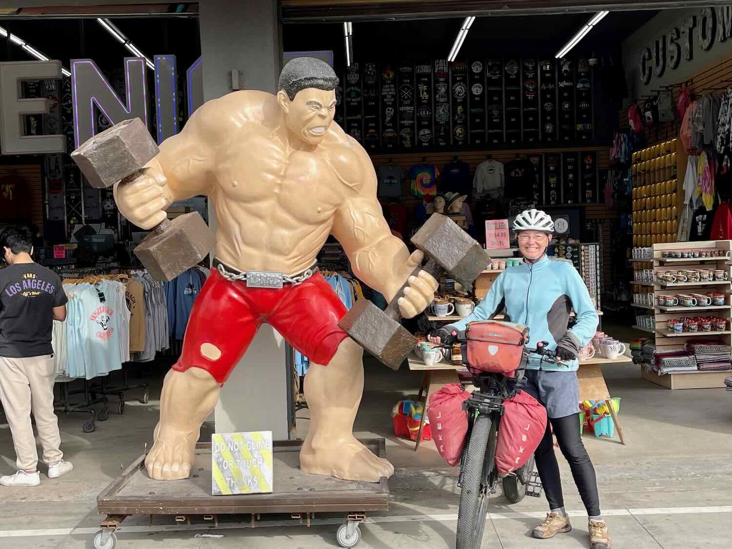
Another iconic location we passed was the Muscle Beach outdoor gym. Dubbed “the home of bodybuilding,” muscle beach has been attracting bodybuilding enthusiasts since 1963. Lou Ferrigno, Arnold Schwarzenegger and Frank Zane have all worked out here. We didn’t recognize any famous faces when we cycled by, but you never know. Maybe the next Mr. Universe was lifting weights that day.
Muscle Beach Gym is an outdoor workout space that has a storied history in the bodybuilding world. Venice Beach, California, USA. Copyright © 2019-2023 Pedals and Puffins.
Hanging out with the locals at Muscle Beach outdoor gym. Venice Beach, California, USA. Copyright © 2019-2023 Pedals and Puffins.
The San Gabriel Mountains on the far side of Los Angeles were dusted with snow. Marina Del Rey, Los Angeles, California, USA. Copyright © 2019-2023 Pedals and Puffins.
Evening light filtered through a bank of offshore mist. Playa Del Rey, Los Angeles, California, USA. Copyright © 2019-2023 Pedals and Puffins.
We had a hard time figuring out a good place to stay in this area. All of the waterfront accommodations were a little too pricey for our taste. Cyclists that come through often will stay in one of the many hostels near the water. But when we looked into those options, we discovered that all of them were located upstairs from noisy nightclubs - not our speed, and not really conducive to a good night’s sleep. So we opted for a hotel a couple of miles off the route, near LAX Airport. It was a much better value, and quite a bit more peaceful.
South of Venice Beach, the waterfront developments changed from touristy shops, to residential and vacation houses. Many of the houses had a lot of glass facing the ocean. They looked like the kinds of houses you would see in TV shows. We joked that most of them were probably AirBNB rentals.
The endless beaches are periodically interrupted by long piers that jut out into the water. Manhattan Beach Pier, The Strand, California, USA. Copyright © 2019-2023 Pedals and Puffins.
A little over an hour into the ride our route turned away from the beach and headed straight inland, across the LA neighborhoods of Torrence and Carson. At first we couldn’t figure out why that was needed, especially since it resulted in some less-than-ideal urban riding through commercial areas and residential neighborhoods with densely packed houses. But after a while we saw what had been in our way. The massive Port of Los Angeles occupies a section of the coast, and we had to get around it.
So for 12 miles (19 km) we knuckled down and cycled through the city until we reached the “Los Angeles River.” It was once a free flowing river. But after a series of floods in the early 20th century, it was confined to a concrete channel known as the Los Angeles Aqueduct. Furthermore, the concrete channel is often bone dry - although it still channels water away from the city when heavy rains would otherwise cause flooding. The Aqueduct has been featured in more than 40 movies, often as the site of high-speed car chases.
Cycling along the banks of the Los Angeles River as it heads, nearly empty, toward the sea. Wrigley Greenbelt, Los Angeles River, California, USA. Copyright © 2019-2023 Pedals and Puffins.
As we got closer to the ocean, we entered the community of Long Beach. California, USA. Copyright © 2019-2023 Pedals and Puffins.
We spent the next night near the waterfront in Seaside. As the name implies, everything seems to revolve around beach life in town. After checking in to our hotel, we took a stroll down the main road and out onto Sunset Beach. The most striking building in town is actually an AirBNB/vacation rental property inside an old water tower. The original water tower was built in the 1890s by the railroad to provide water for its steam engines. Later the tank held water for the growing, local community. A plaque on the front of the building says that by the 1980s the water tower had become dilapidated, and the city was going to tear it down. But local citizens thought the tower was an iconic part of the town’s skyline, so they raised money to purchase and restore it. You can now spend the night in the water tower, with luxury furnishings and awesome views of the beach.
A colorful mural at our hotel in Surfside. Huntington Beach, California, USA. Copyright © 2019-2023 Pedals and Puffins.
The landmark Sunset Beach Water Tower is now a vacation rental. Surfside, Huntington Beach, California, USA. Copyright © 2019-2023 Pedals and Puffins.
The sunset, over Sunset Beach. Huntington Beach, California, USA.. Copyright © 2019-2023 Pedals and Puffins.
The Golden Coast, Los Angeles to San Diego
We both were in high spirits for our departure from Seaside. The entire ride would hug the coast, with many miles of car-free bike paths. Even the pedestrians used a separate path, so that bicycles had a lane all to themselves. The sun was shining, and the afternoon was warm. It hardly gets any better.
We liked the slogan on this truck. “Live Happy. Cycle More,” could be our motto. Bolsa Chica State Beach, California, USA. Copyright © 2019-2023 Pedals and Puffins.
These polished-stone “surf boards” were painted to depict the flags of countries that have a big surfing culture. Pacific City, California, USA. Copyright © 2019-2023 Pedals and Puffins.
A highlight of the day was our lunch at the Shake Shack, a little burger joint perched on the edge of a cliff high above the ocean. The shakes were delicious. But the real draw was sitting at the bench along the restaurant’s railing, overlooking the beach and ocean far below. Some of the Mexican fan palms planted down on the beach were incredibly tall. They looked like they were easily over 100 ft in height (30.5 m). Unlike the giant redwoods with their huge bulk, these palms have toothpick-thin trunks which can be less than a foot in diameter - even on the tallest trees. It just seems so improbable that such a skinny tree could grow that tall.
Sipping our shakes with an ocean view. Crystal Cove, Corona Del Mar, California, USA. Copyright © 2019-2023 Pedals and Puffins.
Elephants on parade. One of them’s even dressed up for Christmas. Dana Point, Harbor, California, USA. Copyright © 2019-2023 Pedals and Puffins.
We arrived at our campground only to be told that there was no on-site registration for campsites. San Clemente State Beach doesn’t have hiker/biker sites, which are always available upon arrival. But most campgrounds also have on-site staff that can register other campers as well. Not here. The park employee on duty told us that the only way to secure a campsite was to go online and register. Fortunately, this campground was in a pretty urban area, so there was a strong cell signal. Plus, most of the campsites were vacant. So we cycled around the campground to choose a site, then sat at a park bench to complete our online registration on a smartphone. It was cumbersome, but we were able to get it done. A family of brush rabbits lived in the bushes near our campsite, and kept us company while they nibbled on the lawn throughout the evening.
Our final day’s ride to Encinitas, California (a suburb of San Diego) was pleasantly short and hassle free. We started the day on a good note, enjoying a fresh fruit salad that we had purchased in town the day before. The brush rabbits were out and about. And we saw quite a few birds around our camp in the morning including sparrows, hummingbirds, and warblers.
The first 1.5 hours of cycling were great, staying on a bike path that paralleled the ocean. The surf must have been up. Because even though it was a Tuesday, we were passed by dozens of people on e-bikes, with a surf board slung on the side. They were all heading for the same, small stretch of beach. From a high point on the trail we saw a crowd of them out in the ocean, in a spot where the waves were bigger, and breaking a bit further offshore. We couldn’t help but think that there must be a surfing hotline that helps to create these swarms of surfers all heading to the same location.
For several miles the bike path crossed a beachhead that was jointly managed by the state of California and the military at Camp Pendleton. Most of the landscape was covered with open dunes. But we did pass a large landing pad where a military helicopter was practicing maneuvers. It hovered low over the ground for a long time, looking quite impressive.
We had stopped for a break in the shade near a beachside building when we saw another bikepacker coming the other way. Tabaré had cycled all the way from Uruguay, and was heading for Alaska. He wasn’t in a hurry - he and his riding partner had already been on the road for six years!! He was still working on learning English, and we’re still working on our Spanish, but we were able to get acquainted and share our online profiles, nonetheless. We hope they have a safe journey. At the pace their traveling, we might arrive in Ushuaia around the same time they arrive in Alaska.
Taking a break in the shade with long-distance cyclist Tabaré. He and his partner were pedaling from Uruguay to Alaska. Copyright © 2019-2023 Pedals and Puffins.
After leaving the bike path, we had to ride for 7+ miles (11+ km) on the shoulders of interstate I-5. Although the shoulder was nice and wide, the cycling wasn’t very pleasant. We just put our heads down and pushed thought it. The traffic was intense, and we were glad to finally cycle down the off-ramp into Oceanside.
The final stretch of cycling on the Coastal Highway had a good bike lane the whole way. Along the road, a few of the leafless trees had been decorated with Christmas ornaments. We later learned that this tradition started small, with just a couple of ornaments in 2015. Now it has grown into a community project, where lots of people participate in hanging ornaments each year. It was very festive.
Folks have embraced the tradition of decorating some of the leafless trees along the Coastal Highway with Christmas ornaments. It added a bit of holiday cheer to our ride. Carlsbad, California, USA. Copyright © 2019-2023 Pedals and Puffins.
We arrived at our hotel in Encinitas early enough to head over to the US Post Office and retrieve a bunch of packages that we had shipped to ourselves via general delivery. The packages contained new and replacement gear for the next leg of our journey into Mexico. There was a lot to carry, so we unloaded everything from our panniers before cycling over to the post office. We were delighted (and relieved) that all of our packages had been delivered, and were ready for pick-up.
Retrieving our packages from the US Post Office. Encinitas, California, USA. Copyright © 2019-2023 Pedals and Puffins.
Back at our hotel, we sorted through the packages to make sure that all of the items we had ordered were inside. Almost all of it was there. (One, small item didn’t make it). It was like having an early Christmas, as we opened the packages and admired all of the new gear. Fortunately, the missing item (a tool for working on our pedals) was not a critical piece of equipment. So we can worry about replacing it later.
A pile of packages for us - just like an early Christmas. Encinitas, California, USA. Copyright © 2019-2023 Pedals and Puffins.
Layover in Encinitas
We would soon be in Mexico and a large portion of our time there would be cycling off road. This required some gear changes and bike maintenance which would be harder for us to make after leaving the USA. Much of our layover in Encinitas was spent prepping our new gear and getting ready for leaving the USA and entering Mexico. In addition to the packages we had picked up at the US Post Office, we had even more items for in-store pickup at the local REI store. Of course, we did a bit of extra shopping at the REI as well. There seemed to be a million things to do, like changing our tires, replacing our chains, installing new brake pads, changing the oil in our Rohloff hubs, repairing a few items that had been damaged or worn out, making component adjustments, completing some route planning for Baja, getting caught up on this blog, etc. Each day we chipped away at our to-do list, until we felt pretty confident that we had taken care of (almost) everything.
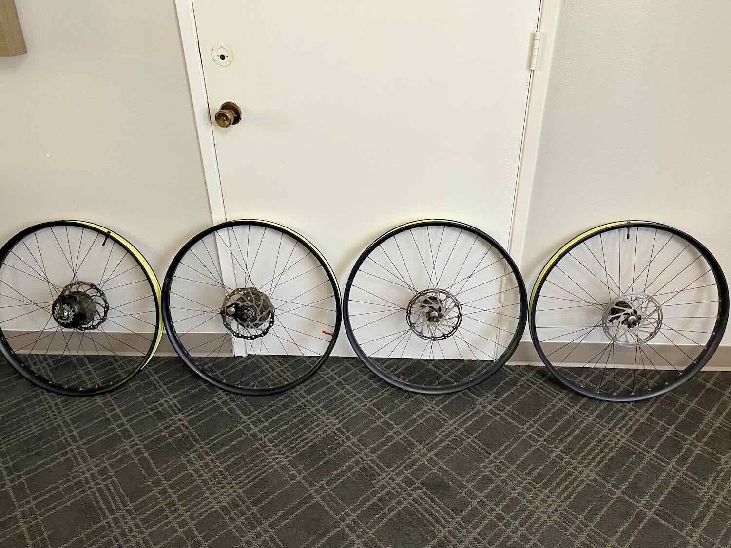

A bike on its back, ready to change the brake pads. Encinitas, California, USA. Copyright © 2019-2023 Pedals and Puffins.
We also had a few days to get out and about, and enjoy our time in Encinitas. The city has a “main street” area along the Coastal Highway, with lots of shops, restaurants, and public art. Whenever we walked through this downtown area, we saw something new.
Welcome to Encinitas! California, USA. Copyright © 2019-2023 Pedals and Puffins.


“The Surfing Madonna.” This mosaic was originally installed anonymously, without permission from the city. It was taken down by authorities. But then, in the “Miracle of the Madonna,” this small courtyard was donated, and the now-beloved mosaic found a permanent home. Encinitas, California, USA. Copyright © 2019-2023 Pedals and Puffins.
World class surfing is found at Swami’s Beach near Encinitas. The beach is named after a spiritual leader who founded a meditation center on the cliffs above the beach in 1937. The ashram still has a big presence, where white columned spaces topped with golden onion domes create a unique skyline. Apparently the surfing here is so good, professional surfers will often drop by when the waves are up. When we were there, the waves were crowded with surfers.


One thing that has really stood out about Encinitas is the number of electric bicycles. The terrain is pretty hilly as soon as you get away from the waterfront. So everyone seems to have given up on pedaling around under their own power. Easily 90% of the cyclists we have seen here are on e-bikes, especially the kids. Everyone in the 10-18 age range was on an e-bike. It struck us as a bit sad, because e-bikes actually seem to be replacing regular bikes, not cars - hardly a climate-friendly development. It’s also not the best for kids, who generally need more exercise rather than less.
Even the public bike-sharing system uses e-bikes. Encinitas, California, USA. Copyright © 2019-2023 Pedals and Puffins.
On one sunny day, we took the train into San Diego. PedalingGuy had been itching to try out a Onewheel - those skateboard-like devices with a big center wheel and an electric motor. So we rented a couple of them for a half day, and scooted around Liberty Station Park and the San Diego waterfront. It was a blast. We took a few tumbles during the learning process, but pretty soon we were both gliding along the park paths at 12+ mph (19+ kph). They might not be very practical, but they sure were fun. We rode about 13 miles in total. And based on how sore our leg muscles were the next day, they gave us some good exercise as well.
Crushing a turn on a Onewheel. Liberty Station Park, San Diego, California, USA. Copyright © 2019-2023 Pedals and Puffins.
The final leg of our journey through Southern California had a completely different flavor from the first five months of our bike trip from Alaska. Each day the landscape became increasingly more urban, and we were immersed in the local “beach culture.” Endless miles of wide, white-sand beaches bordered by touristy shops or glass-plated homes became the dominant scenery. And a whole new class of locals, the beach-loving surfers and volleyball players, emerged. It was a fascinating contrast to the sparsely populated, wild open spaces of the north. We’ve thoroughly enjoyed our fun in the sun (and even our rainy days in Big Sur).