Cycling Darby, MT, to Bellevue, ID: Smoke, Fire and Sage

16-24 July 2021
Segment 3 of the Western Wildlands Bikepacking Route (303 mi, 487 km)
Check out our interactive route map to see where we stayed each night
A Fire in Our Path
Having ridden within a few miles of the Dixie Fire at the start of the Magruder Corridor, we were now paying close attention to several other forest fires that were burning near the Western Wildlands Bikepacking Route (WWR). We frequently checked our go-to website, InciWeb, for updates. So, we knew that there was a big one burning just to the west of the WWR in the Salmon National Forest. Known as the Mud Lick Fire, it was 0% contained and growing fast.
Then, it happened. The evening before our departure from Darby, Montana, the US Forest Service announced that they were closing Panther Creek Road, right where the WWR passes through the forest. It was a preemptive closure, because the crews were going to use the road to create a fire break on the east side of the fire. Beginning immediately, they would be felling trees along the road, and setting up a sprinkler system using the water from Panther Creek. All unauthorized access to the area was prohibited through at least September 1, 2021.
It was a bummer, but at least we found out with enough time to plan a detour. The detour would take us 60 miles out of our way, a full days ride on a bicycle. But it could have been much worse, so we were thankful.
Valley of the Painted Rocks
As we headed south out of Darby, there was one site we planned to look for. It turns out that the location used to shoot the ranch scenes in the TV series Yellowstone is just two miles south of town. We spotted the “Yellowstone Dutton Ranch” sign, but there were no sightings of Kevin Costner (the marquee star of the program), unfortunately.
All’s quiet at the Dutton Ranch. It’s not too close to Yellowstone, though. It’s actually at Chief Joseph Ranch, just south of Darby, Montana. USA. Copyright © 2019-2021 Pedals and Puffins.
The Bitterroot Valley was filled with smoke from the nearby forest fires, shrouding the surrounding mountains and dimming the sun.
Multiple road closures from two different forest fires were creating headaches for local residents, as well as touring cyclists. Copyright © 2019-2021 Pedals and Puffins.
A couple of hours into the ride, we entered an impressive canyon formed by the West Fork of the Bitterroot River. The towering cliffs have striking bands of dark gray and tan rock, splashed with patches of green, yellow and orange - colors created by lichens growing on the rocky outcrops. We stopped several times to admire the scenery, and ponder why these cliffs were so different from the surrounding mountains.
Our bikes are admiring the scenery at Painted Rocks Lake. The colorful cliffs are dimmed somewhat by the smoky haze from nearby forest fires. Painted Rocks State Park, Montana, USA. Copyright © 2019-2021 Pedals and Puffins.
Our morning progress (on paved roads) had been so swift that we reached the Alta Campground, our original destination, well before noon. It was way too early to stop for the day, so we decided to continue on, into the unpaved roads of the Bitterroot National Forest.
Rufous Hummingbirds often seem curious about us, and will buzz in close to our bikes to check us out. This little bird was keeping a close eye on us. Copyright © 2019-2021 Pedals and Puffins.
A closed mine shaft sits near the trail in the Bitterroot National Forest. But don’t think about going in to find gold or silver. Signs warn that the shaft is unsafe. Copyright © 2019-2021 Pedals and Puffins.
The first 4-5 miles into the National Forest passed through lush conifer forests. Copyright © 2019-2021 Pedals and Puffins.
But before long we entered another area where forest fires had burned recently. As we ascended towards Horse Creek Saddle, all the older trees were dead. In many places there were young trees starting to grow again. But at times we could look out across the valley and see no mature, living forest at all. Copyright © 2019-2021 Pedals and Puffins.
A deepening haze of smoke blowing through the valley from the Mud Lick forest fire helped to emphasize the ongoing power of fires over this landscape. We didn’t see any tall, green trees again for many miles of climbing up and over a long pass.
Throughout this trip, managing our water supply has been a constant focus. We always need to have enough water to stay hydrated. But we also want to avoid carrying any more water than we need, because water weighs 8.33 lbs per gallon (1 kg/liter). That’s really heavy when you’re pedaling uphill. So, we had decided to wait on refilling our water bottles until the final water source on our map - a small creek just before Horse Creek Saddle.
That turned out to be a bad idea. When we got there, what we found was barely a trickle. And by this point we were totally out of water. We managed to locate two spots on the hillside where the water had formed tiny pools. Since the little pools were only filling with a small drip, drip, drip of water from above, by the time we had taken 4 liters the water level was too low to get any more. But that would barely be enough. We still needed drinking water for cycling the rest of the day and to camp (camping was our only option since we were too far from any towns). It seemed likely we would be rationing our water until some time the next day.
When you’re out of water, a small puddle on the hillside will have to do. We suddenly regretted not filling our water bottles at the previous creek. Copyright © 2019-2021 Pedals and Puffins.
Then we got lucky. After cresting Horse Creek Saddle, patches of green trees returned, and we came to a stream flowing with clear, cold water - a stream that wasn’t on our map. We had already drunk 2+ liters since the last fill up, so this was a real blessing. We filled our bottles with another six liters of fresh, spring water. Now we were ready to camp.
But then another challenge emerged. A thunderstorm was brewing over a nearby mountain peak, and a dark rain cloud was approaching. We wanted to find a place to camp before the rain started to fall, because we were very exposed in this area. All the trees were just charred skeletons that wouldn’t provide any shelter, and that could easily fall over in high winds. PedalingGuy set a really hard pace up the mountainside to try to find a campsite before the rain came, which wore us both out.
Unfortunately, the terrain all around the road was very steep and there wasn’t any level ground for camping that was (a) far enough from the trees that had been killed by previous forest fires (which could topple over and crush a tent, and its inhabitants), and (b) big enough to accommodate our tent. We had seen or heard several of the fire-burned trees fall in the forest that day - so “widow maker” trees were a real concern, and they were everywhere. It looked like we would get wet before making camp.
Fortunately, once the rain actually started, it ended up being short duration. We didn’t find anywhere to camp until near the very top of Spring Creek Saddle, more than 50 miles from where we started the day.
Finally, we settled for a spot right on the Montana/Idaho border that was basically a vehicle pull-out on the side of the dirt road. It wasn’t fully level, and there were some menacing, dead trees nearby, but we were able to situate the tent in a way that seemed reasonably safe.
More-or-less flat, check. Not in the path of a potential falling tree, check. This campsite met our key criteria. Bitterroot National Forest, Montana/Idaho border, USA. Copyright © 2019-2021 Pedals and Puffins.
As the day’s light was fading and we settled down for dinner, exhausted and ready to rest, we were surprised to hear an approaching vehicle - the first we had seen on our rough mountain road all day. The engine roared as a very unusual truck came careening over the top of Spring Creek Saddle.
Rattling as if it were in imminent danger of falling apart, a vintage farm truck sped over the rocky dirt road. It looked like something from the 1940s. All the paint had worn off through the years. And 3-4 people were crammed into the front cab, laughing and shouting to each other over the din of the engine. The cargo area of the truck didn’t have a back door, so we could see a couple of coolers strapped in the back when the truck turned away from us. And perhaps most oddly, there was a 30-40 ft rope attached to the back of the truck that was dragging along behind on the road - presumably unknown to the truck’s occupants. It was a wacky, fleeting glimpse into a completely different way of enjoying the national forest than what we had chosen. Given the condition of both the road and truck, it seemed like they were risking their lives in such a remote area. But soon the silence of the forest enveloped us again.
Strangers in the Night
During the night as we lay in our tent, we heard someone approaching our bicycles. But they quickly went away. We were puzzled by the encounter, and wondered what they were up to.
In the morning we were surprised to see bicycle tire tracks in the road that didn’t belong to us, and that weren’t there the night before. Someone had passed by bicycle at night, and that is what we had heard in the darkness.
We also saw fresh elk tracks walking right by our campsite. It was a pretty busy place.
The descent from Spring Creek Saddle was incredibly steep and often quite rocky and/or rutted. Over night, the wind must have shifted because there was even more smoke from the nearby fires hanging in the air. The smoke was heaviest along the ridge tops, but the air in the valley grew increasingly clear, the lower we rode.
Smoky clouds continued to add depth and an air of mystery to the views as we descended into the Spring Creek Valley. Salmon National Forest, Idaho, USA. Copyright © 2019-2021 Pedals and Puffins.

Another road across Spring Creek Valley (on the side of the mountain in the picture) looked just as steep and treacherous as the one we were on. Loose gravel, tight switchbacks and steep cliff edges made for a tricky descent. Salmon National Forest, Idaho, USA. Copyright © 2019-2021 Pedals and Puffins.
At the bottom of the hill, we stopped at the Spring Creek Campground to catch our breath and fill up on water. But we were out of luck. The campground water pump was broken.
This was at least the third or fourth time we had tried to get water at a US Forest Service campground, only to find that the pumps were out of order. So far that hasn’t been a big problem for us because surface water has been abundant. But it’s tough to plan ahead when you can’t count on campgrounds that are supposed to have a potable water source.
Fortunately, a very nice guy in the campground offered us some of his water supply, so we were able to top off our handlebar bottles. He told us that he lives out of his car, spending winters in Arizona.
As we were getting ready to leave the campground, we were hailed down by another cyclist. He had ridden down Panther Creek Road only to discover that it was closed because of the forest fire. That required him to turn around and backtrack to where we were. He wanted to alert us to the closure, and was surprised to find out we already knew about it.
His name was Jose, from the UK, living in Texas. He was an elite bicycle racer, having participated in the Tour Divide, RAM (Ride Across America), and some other long distance races. In case you are not familiar with those races, the participants will often bike almost all day and night, sleeping only a couple hours a night. They are all about covering as much distance as possible, in as short a time as possible, as they race from one point to the next. Needless to say, he was moving light and fast.
We learned that it was his bicycle tracks we saw at the top of the pass. He had cycled past us at 11pm, in the dark, on those treacherous, rocky roads. He mentioned that he was trying to avoid the daytime heat by cycling at night. Not such a bad idea, since the heat made everything more difficult. His bike was equipped with a very nice, high-lumen light for night riding. After chatting with us he took off like a rocket, hoping to make it to Challis, Idaho - almost 100 miles away - before calling it a night.
We headed down the road after him, at a much more relaxed pace. We were now on the detour around the fire, which would require us to travel on paved roads for the next 1.5 days.
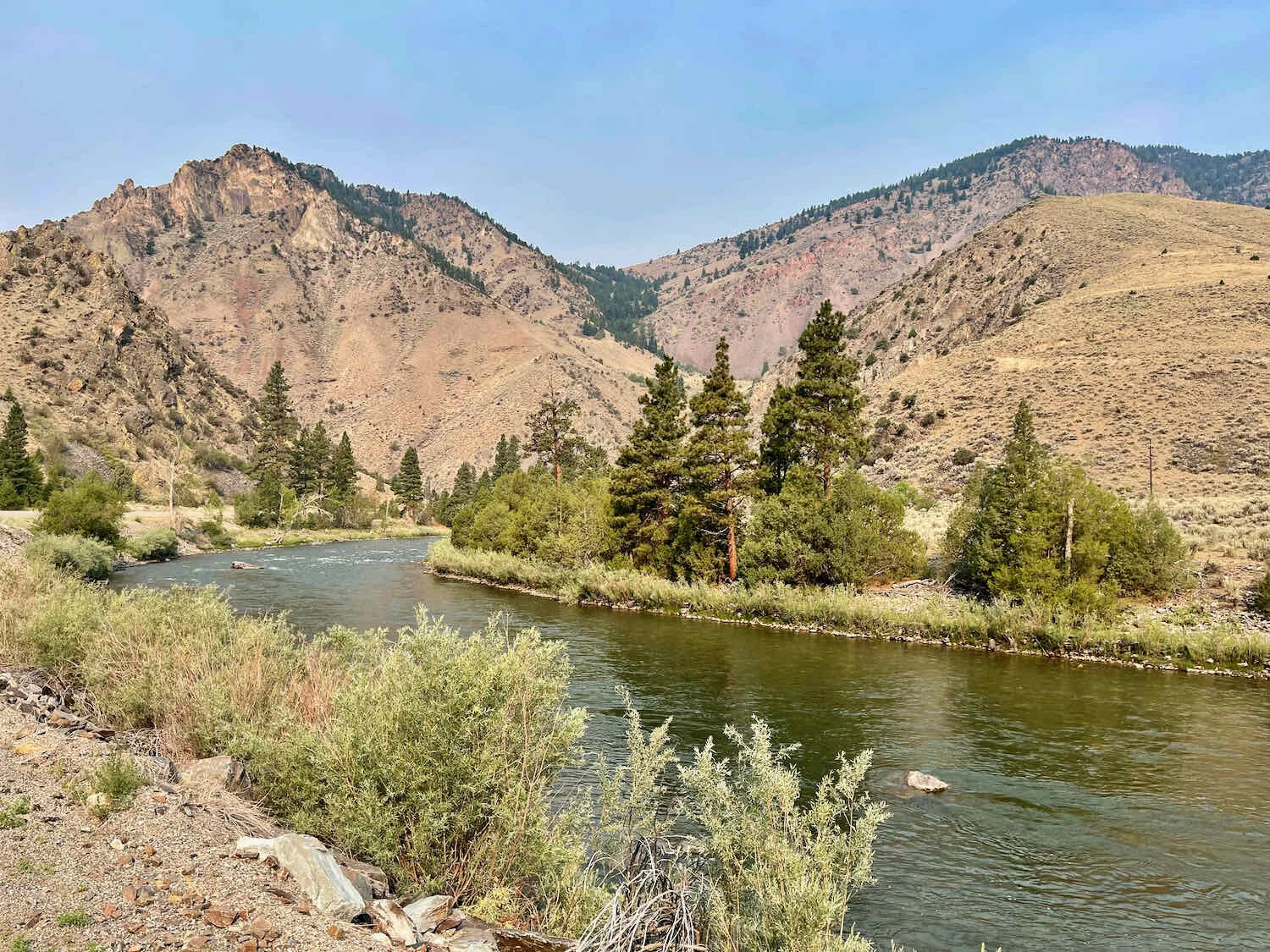
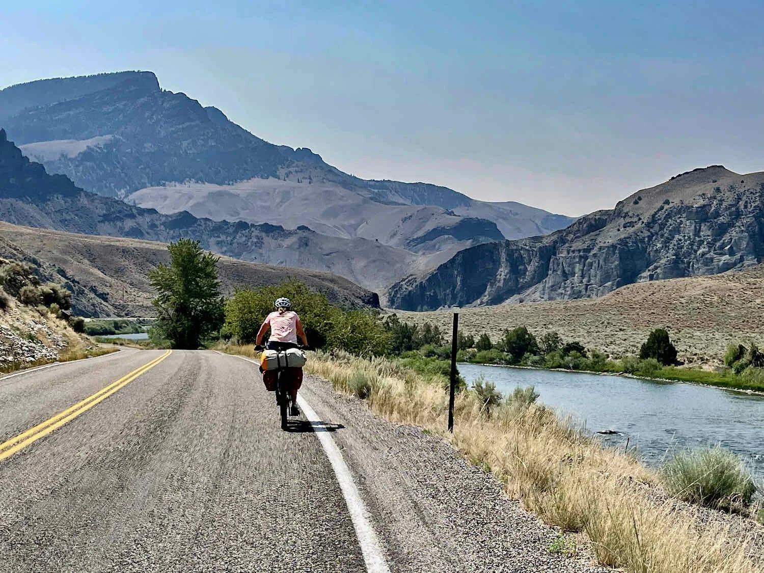
The Salmon River Road to North Fork, Idaho, was beautiful. Supposedly there are a lot of bighorn sheep in the area, but we didn’t see any - although the cliffs looked perfect for them. We did see a lot of other wildlife, including dozens of Lewis’s Woodpeckers, which seemed to inhabit every patch of trees along the floor of the canyon.
It wasn’t long before we left the shelter of the forests and found ourselves cycling through wide, open, sagebrush country. The transition happens quickly. And before you know it, shade has become a very precious resource.
We’ve entered a new world of sagebrush, rocks and sunshine. Salmon River Road, Idaho, USA. Copyright © 2019-2021 Pedals and Puffins.
When we finally reached the convenience store, 15 miles or so up the road in North Fork, Idaho, Jose was still there - packing up for his ride to Challis. He complained that the ride would be a “death march” because of the heat (pushing 100 F), highway traffic, and scorching pavement. His assessment was probably accurate, and we had no plans to try cycling that far today. We wished him well.
From our point of view, a bit of air conditioning would be nice. We considered our options as we sipped cold drinks and lapped up huckleberry ice cream on the shady porch of the store. Unfortunately, there weren’t any hotel rooms available in North Fork. We called a few hotels in Salmon, Idaho, only to be disappointed on that front as well. None of them had any rooms available. We are discovering that when there is a forest fire nearby, many of the limited hotel rooms in the small towns we pass get scooped up by fire crews.
In the end, we decided to cycle to Salmon, where we could have dinner (hopefully in an air conditioned restaurant). Then we’d depart as the evening cooled down, and find a a place to sleep at one of the Bureau of Land Management (BLM) campgrounds on the way to Challis. We weren’t terribly enthused by this option since the BLM campgrounds are very basic - no water, no shade, hot, dusty and close to the road. They are really more suited to RV’s than tents. But we didn’t have any other options at the moment.
We had just one more stop to make. On the outskirts of North Fork was a natural, roadside spring. A friendly couple that we met at the convenience store had told us about it. The spring was tapped, with a faucet ready for filling jugs and thirsty cyclist’s water bottles. The water was cool and delicious.
We cycled hard to reach Salmon by 5pm. It was still really hot. Then, on the way into town we saw a sign advertising rooms at a Texaco station. Could we have happened upon a secret gem (like we did in Noxon)? Well, it’s best not to get your hopes up too much. The Texaco has since changed into a Sinclair gas station. And when we asked, they said they no longer rent rooms. But just down the road we could see the sign for another hotel that hadn’t shown up in Google - which helps to reduce demand and improve the opportunity for a last minute rental. Might we get lucky?
We went there. The LED sign out front said the current temperature was 104 F. No one was in the lobby. So PedalingGuy walked around the property to track down the receptionist and, lo and be hold, she had an available room!!! It turned out that a group of six had just canceled their reservation because of the nearby fires. One of the rooms had air conditioning, ground floor, facing the Salmon River. Nirvana. We scooped it up, and promptly went to cool down in the AC. It could hardly have worked out better.
Eagles in the Shade
The next morning we had high ambitions of getting on the road early to cycle as much as possible in the cooler morning air.
But before leaving the hotel, we decided to check the pressure in our tires. And then we decided to add air for the 60 miles ahead on pavement. Low air pressure is best for dirt roads and trails, but you roll faster with high air pressure on pavement. While putting air in one of the tires, PedalingGuy accidentally removed one of the valve cores when he was disengaging the tire pump, losing most of the air. That required a major pump up of his back tire. Given the width of our tires (2.8 inches, made for off-pavement cycling), putting in a few pounds of pressure is no big deal. But pumping them up from zero requires at least 500-600 pumps from our small hand pump. It was a time consuming and tiring process.
At that point you might expect that we would be itching to get out the door. But, no. We decided that cleaning the dust and grit off our bike chains and adding lubricant would make the pedaling easier. So out came the cleaning cloth and lube. All this helped us roll better on pavement, but delayed our departure on a hot day. Hopefully it was worth it.
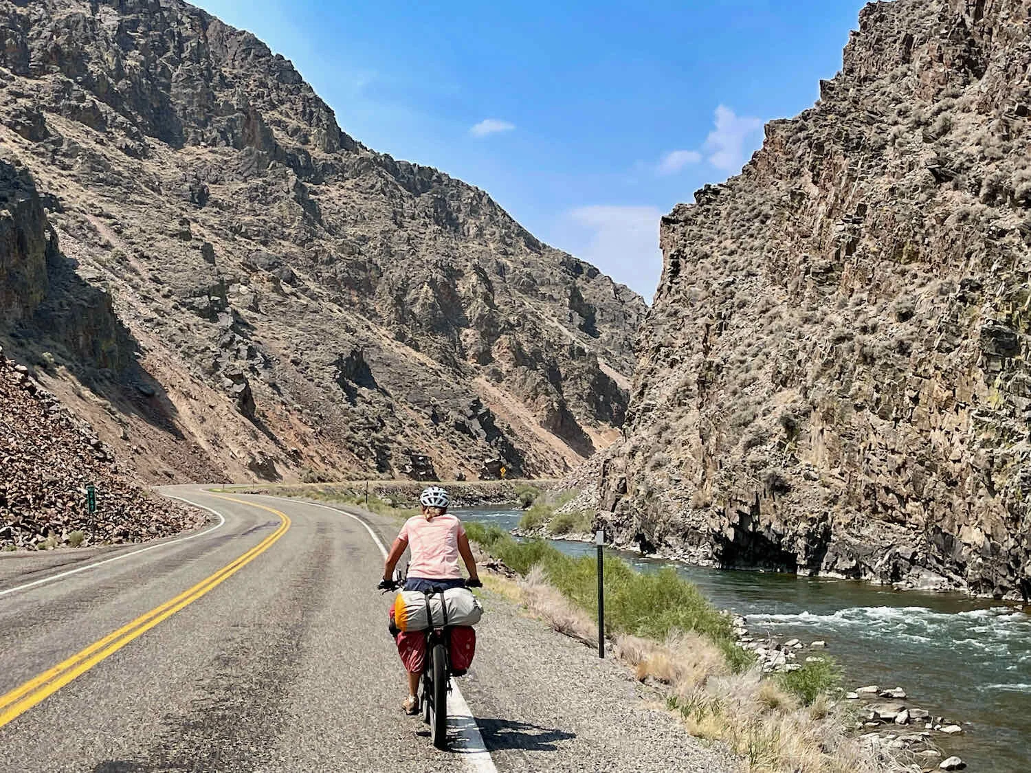
Cycling in the Salmon River Canyon was a real treat. The scenery was increasingly beautiful all day. In several places the canyon narrowed and was bordered by dramatic cliffs. The rest of the time there were picturesque, sagebrush-covered mountains in the background. (Click on any of the images below to view them in full screen.)
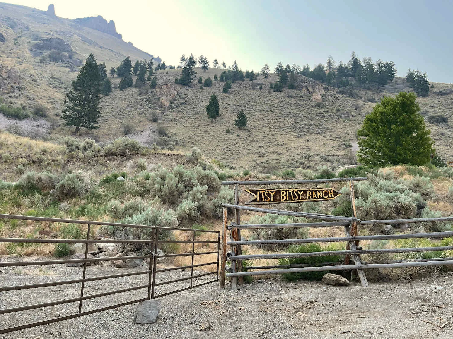
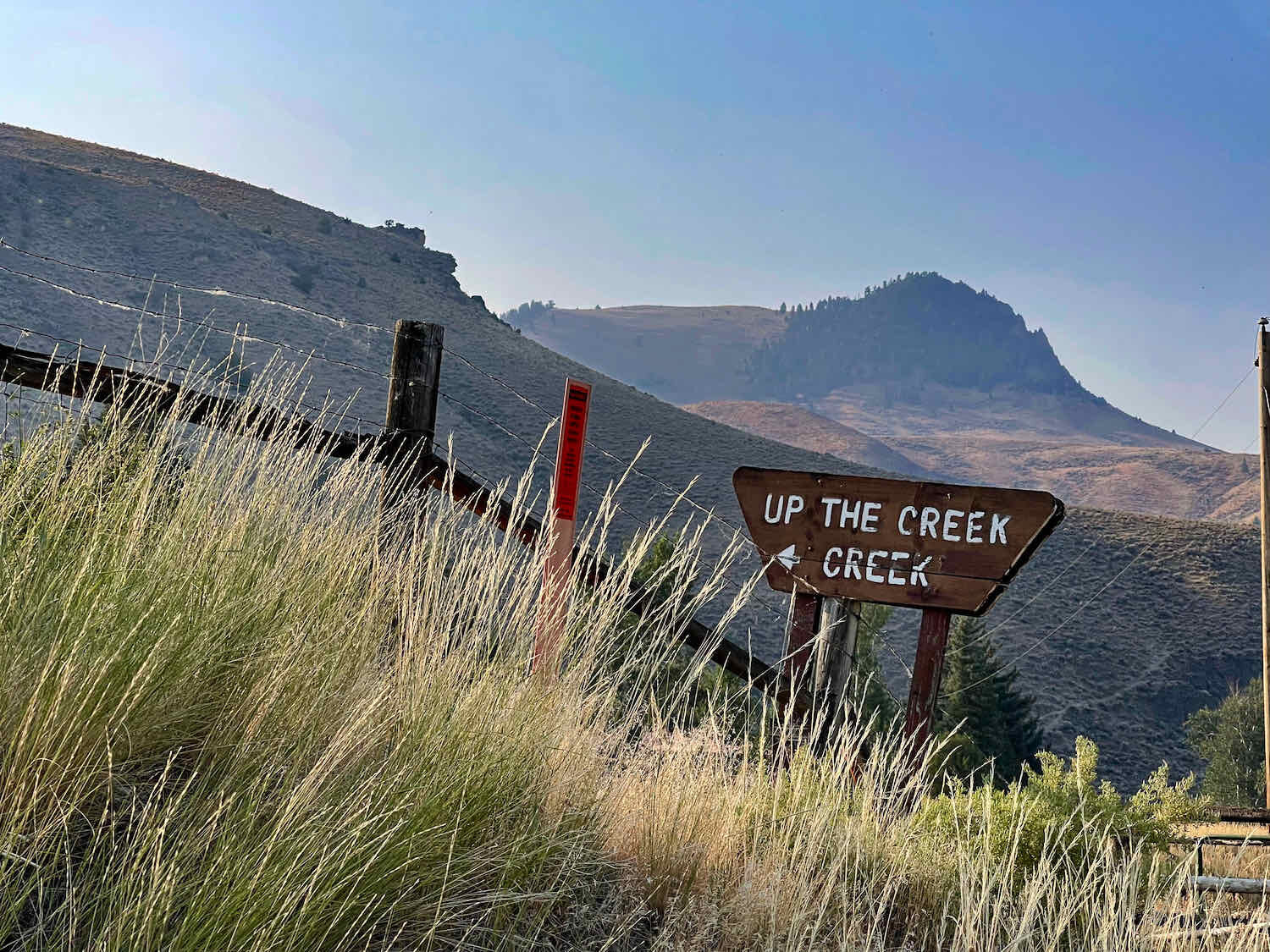
The folks in this part of Idaho have a quirky sense of humor. We were entertained by the names of some of the ranches along the way.
Although the forest fires were starting to feel a bit more distant now, there were still occasional reminders that the fight to contain them was not over yet. The sight of a massive helicopter hauling a water bucket was impressive enough to halt us in our tracks, as we watched it disappear over a mountain ridge.
A reminder that the forest fires aren’t that far away. Although the bucket being hauled by this helicopter looks small from a distance, it probably holds over 1,000 gallons of water. South of Salmon, Idaho, USA. Copyright © 2019-2021 Pedals and Puffins.
Even though the natural landscape here is very dry, there are a number of farms using the river water to grow crops or lush grass for cattle.
We even spotted one of our favorite breeds of cow - the Oreo cow (more properly known as a Belted Galloway). South of Salmon, Idaho, USA. Copyright © 2019-2021 Pedals and Puffins.
But it did get very, very hot. It was already toasty by 11am. We stopped every 12 miles or so for a food/drink break - and more often than that after noon.
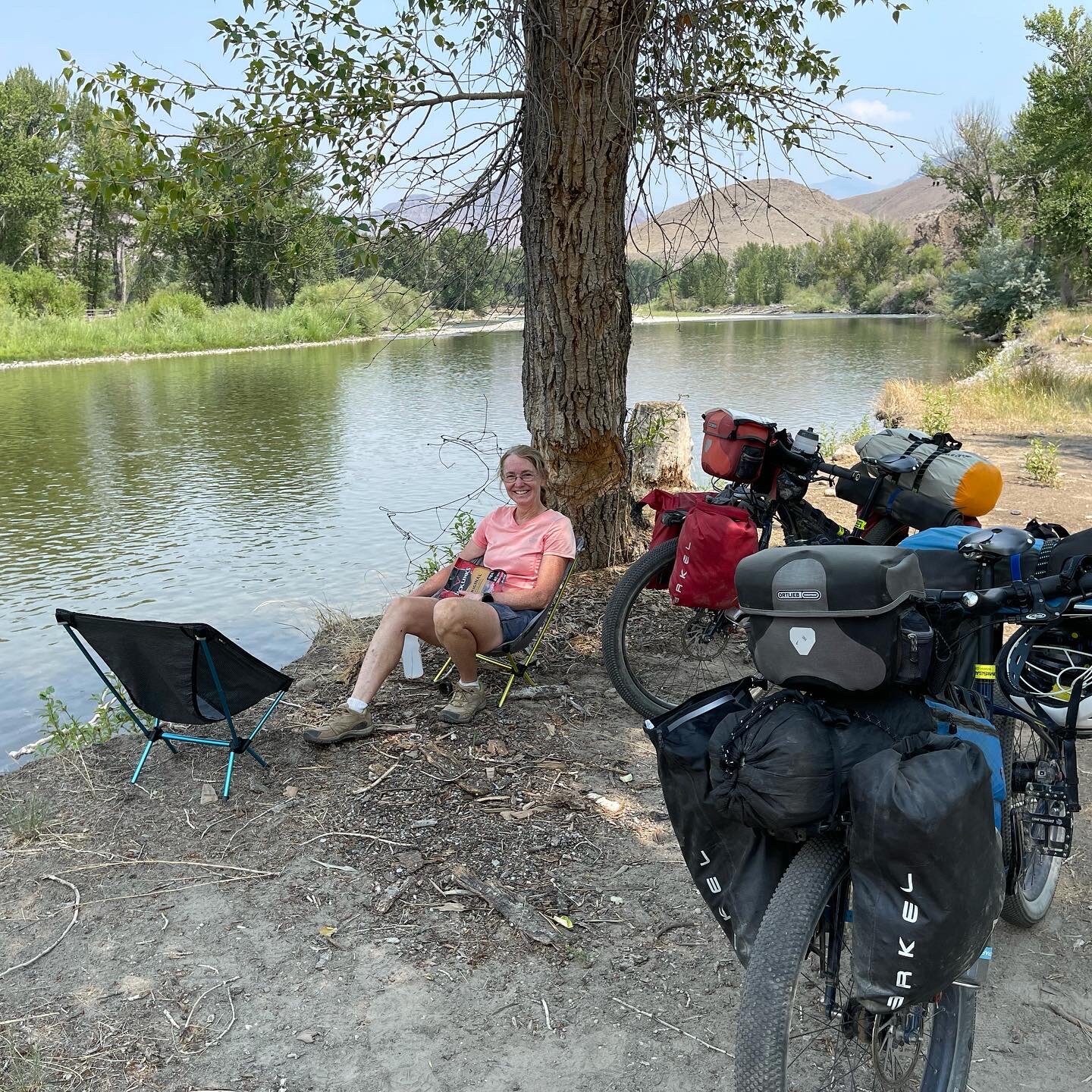
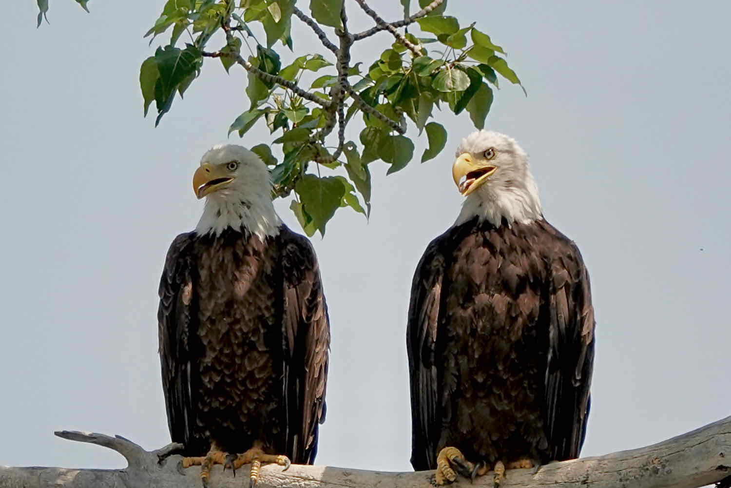
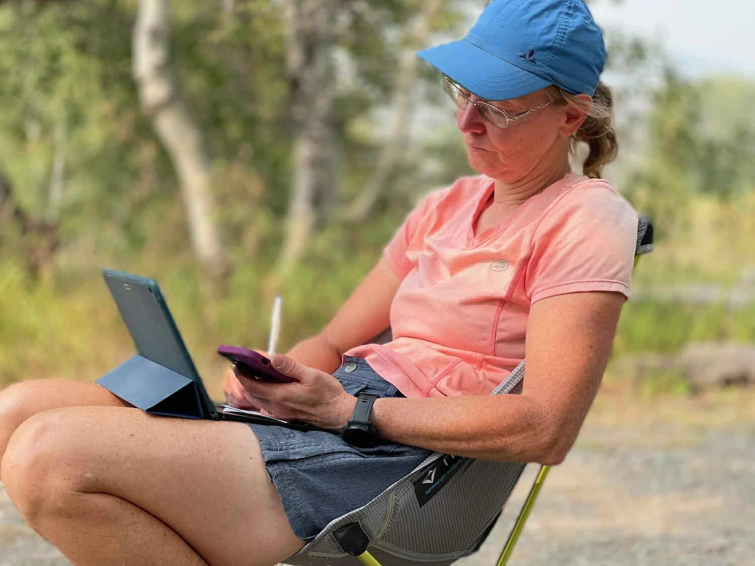
During one extended break in the heat of the day, we got out our folding chairs to rest by the river. As we settled down in the shade, PedalingGuy spotted two adult bald eagles, sitting on a branch over the river, panting in the shade of a cottonwood tree. They looked like we felt.
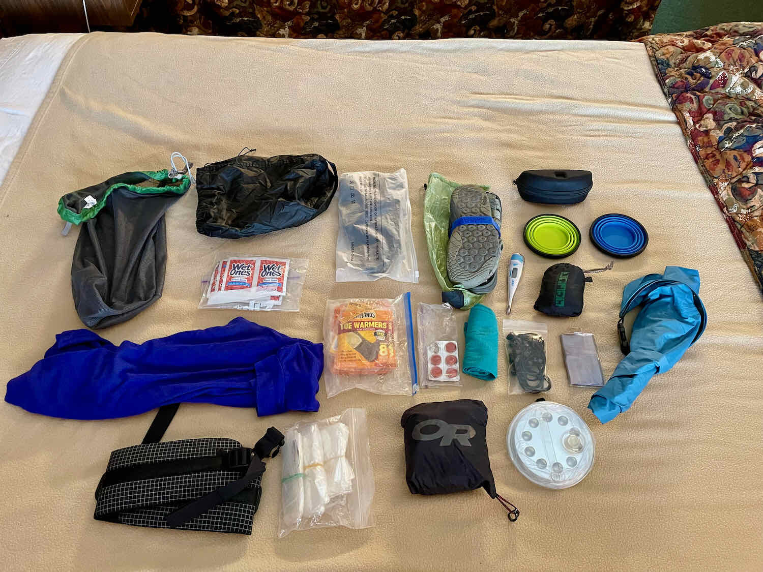
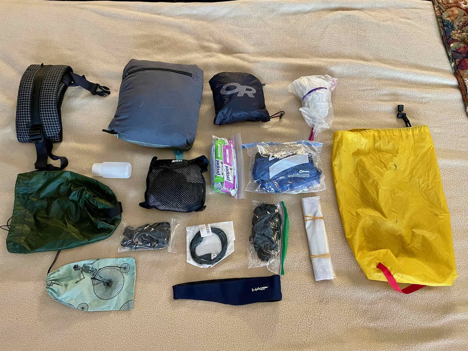
After making it to Challis, Idaho, we finally decided it was time to bite the bullet and shed some weight. We’d been taking note of various items that we weren’t using, and that seemed ripe for shipping home. We each filled a stuff bag, shedding everything from our rain pants, to some electronics cords and our foldable camp lantern. Between the two of us, we lightened our load by 7 lbs. Not bad. We feel lighter already.
Ghost Towns and Gold
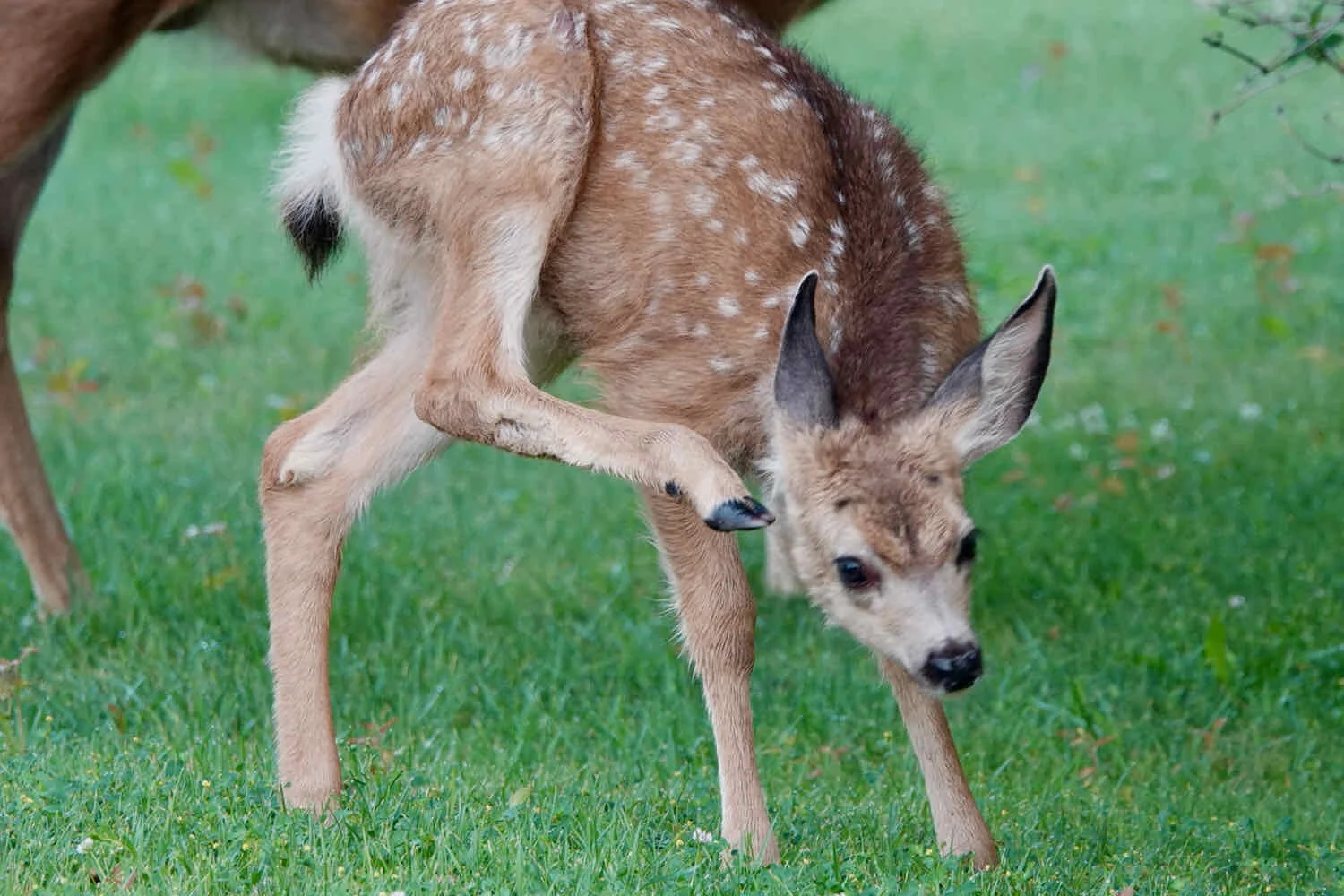
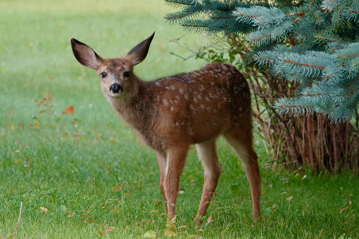
Gardeners in Challis must have a hard time growing flowers. It’s common to see mule deer lounging around on people’s lawns. As we rode out of town in the morning, we were charmed by a mama deer with two fawns.
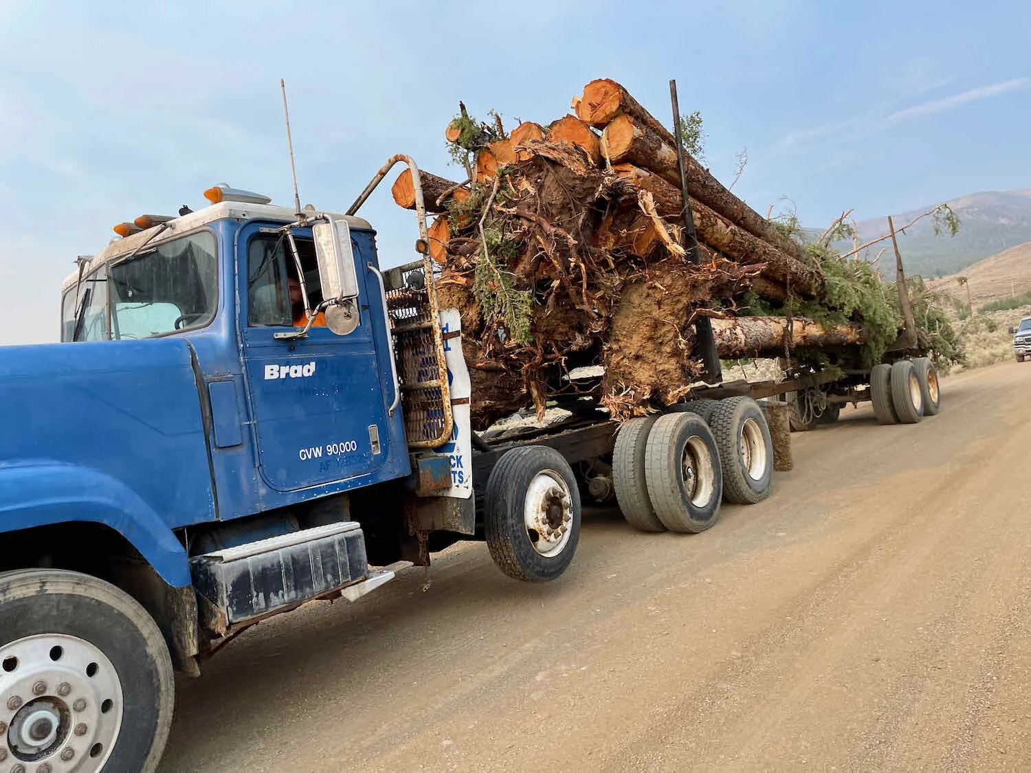
Our route climbed steadily out of Challis, heading for the treeless, sage-covered mountains to the west. It seemed like wishful thinking when we passed a sign warning us to watch out for logging trucks, given the marked lack of trees in the foothills. But sure enough, a truck soon came lumbering by, laden with freshly cut logs. There must be trees out there somewhere.

The gravel road from Challis to Stanley, Idaho follows the route of the Custer Motorway. It was a toll road built in the late 1800’s to connect mining communities along the Yankee Fork of the Salmon River to Challis - providing a lifeline for supplies and an economically feasible route to ship out the minerals. The name of the road is really deceiving since although it was once an important road into the mining communities in the area, it is now not much more than a rough dirt road that requires a 4x4, or ATV, or bicycle to traverse. It goes up a couple of steep mountain passes, and was washed out in several places from recent rains. This would have made it difficult for even 4x4 vehicles to pass when we were there.
After several miles of climbing through open sagebrush, we descended into the cottonwood-lined Mill Creek Canyon. Copyright © 2019-2021 Pedals and Puffins.
Eventually, as we gained elevation we rode back into the forest. It was a wonderful pleasure to have the cover of live trees, once again. We won’t be taking shade for granted anymore.
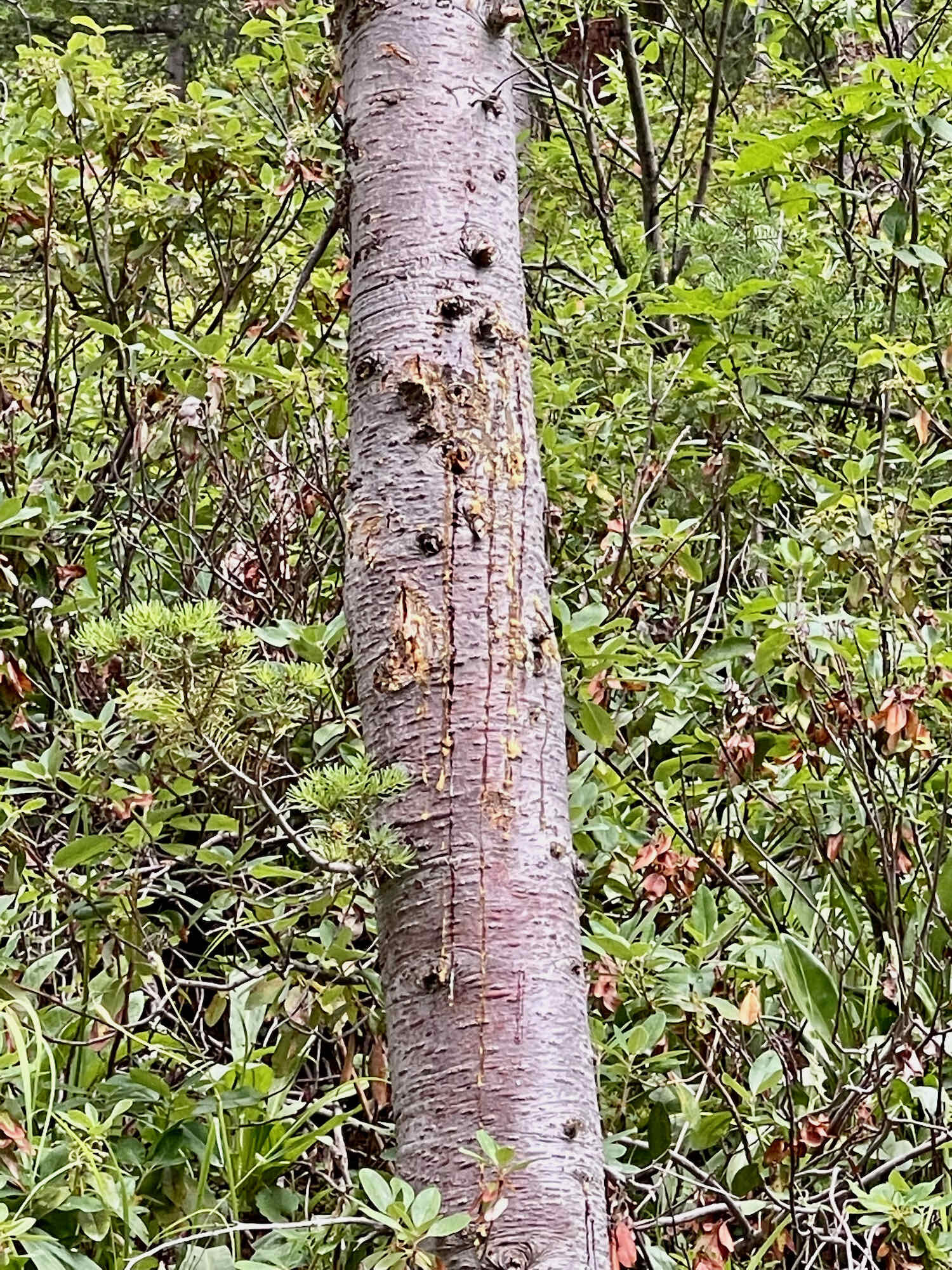
One tree in particular caught our attention. We’ve seen quite a bit of bear sign on this trip, including turned over rocks, torn-up fallen logs, and bear scat in the road. But this was different - an animal left straight, thin scratches that were several feet long on the side of a tree. After some investigation, we think the scratches were probably made by a Mountain Lion. That’s pretty cool.
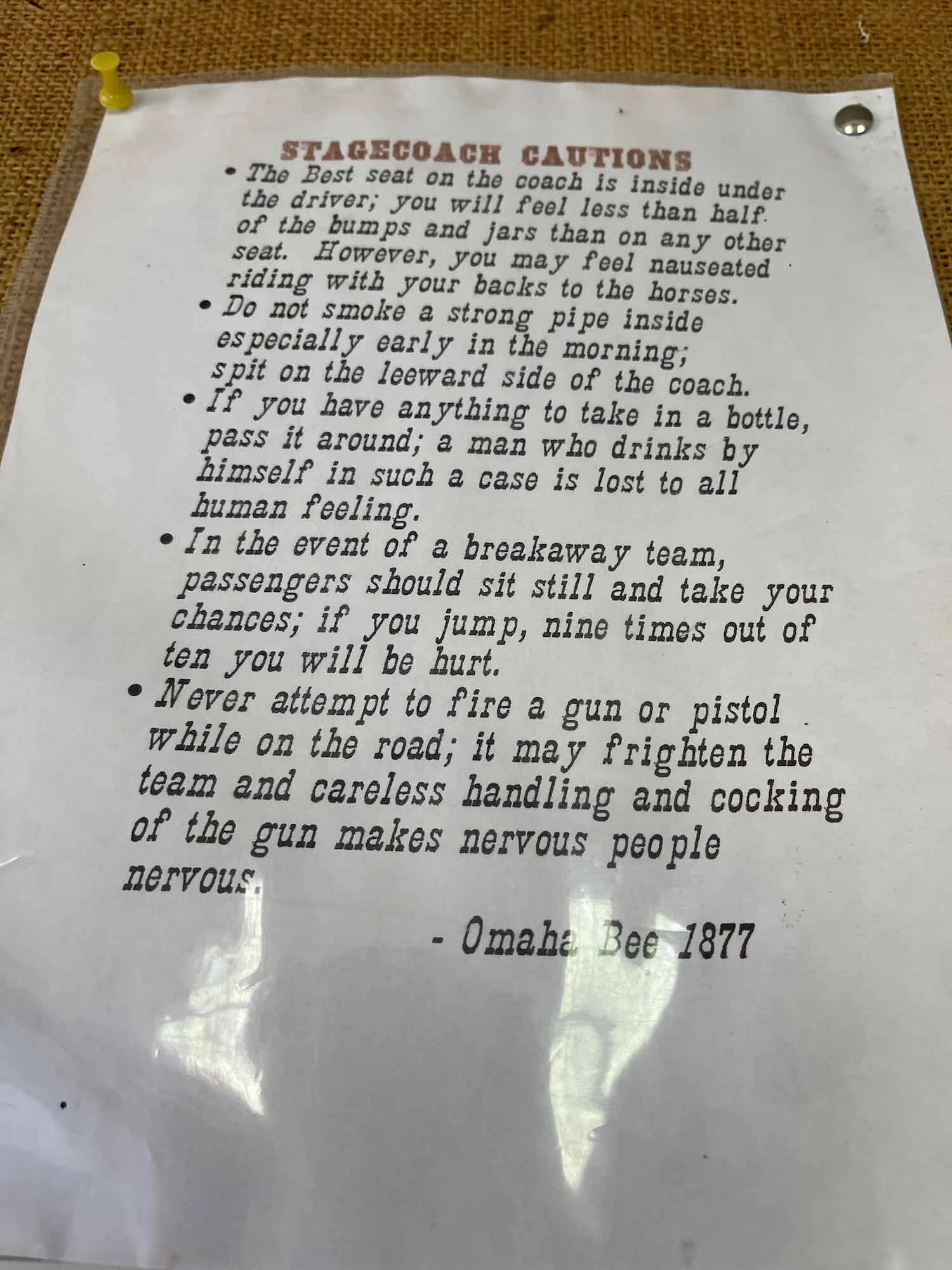
The road is sprinkled with relics from the Custer Motorway’s heyday - mostly station stops for the freight and stagecoach lines.
Remains of a station stop along the Custer Motorway. Challis National Forest, Idaho, USA. Copyright © 2019-2021 Pedals and Puffins.
After passing the Mill Creek Campground, the climb became very steep and rocky. The road was washed out in a number of spots from heavy rains the night before. We did some hike-a-bike, especially near the top. We finally reached Mill Creek Summit in the early afternoon.
Made it to the top of another big pass. Mill Creek Summit, Challis National Forest, Idaho, USA. Copyright © 2019-2021 Pedals and Puffins.
After having had completely dry weather for the first month of our trip, we’re now encountering afternoon rain on a regular basis. And this day fit the pattern. We arrived at the ghost town of Custer City just as a big storm unleashed a torrent of rain. We dashed with our bikes onto the porch of an old miner’s cabin to wait out the storm. Fortunately, the roof didn’t leak. But it wasn’t quite big enough, and the rain tickled our legs as the wind blew it in from the sides. Still, it was way better than being caught out on the trail in a thunderstorm.
A historic miner’s cabin offered just the protection we needed from an afternoon thunderstorm. Custer City, Idaho, USA. Copyright © 2019-2021 Pedals and Puffins.
After the rain, we strolled around the ghost town, learning about the different buildings and some of the mining history.
Yankee Fork Gold Dredge, which we saw from the road, has limited hours for tours. But it was closed when we passed. It is sill impressive to view from the outside. At 4-stories tall and 112 ft long, it is so gigantic that it’s hard to imagine such a contraption floating down the Yankee Fork River. But for 12 years, from 1940-1952, the dredge chomped its way through many miles of river, using 72 1-ton buckets to sift the remaining gold out of the gravel river bed. The gravel tailings piled high along the river as a result of all that dredging are also a testament to the passion that drives people to dig for gold wherever they can find it.

By this time we were a bit low on water to attempt a dry camp, so we focused on finding a campground with water. Flat Rock Campground had some sites available, but clearly had a rodent problem, as evidenced by hoards of chipmunks casing out the campsites. We were worried about holes being chewed in our panniers and/or tent, so we kept going. With evening shadows starting to grow long, we finally chose a site at Blind Creek Campground.
US Forest Service campgrounds sometimes have water pumps. But even when they’re working, they typically require some muscle power to use. Blind Creek Campground, Challis National Forest, Idaho, USA. Copyright © 2019-2021 Pedals and Puffins.
Scenic Sawtooth Valley
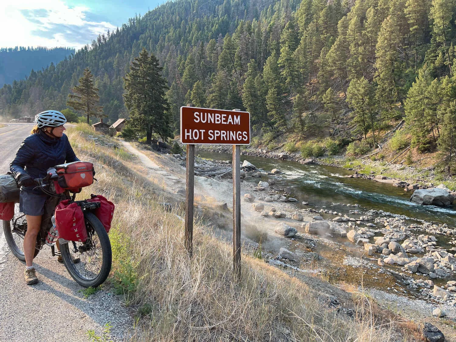
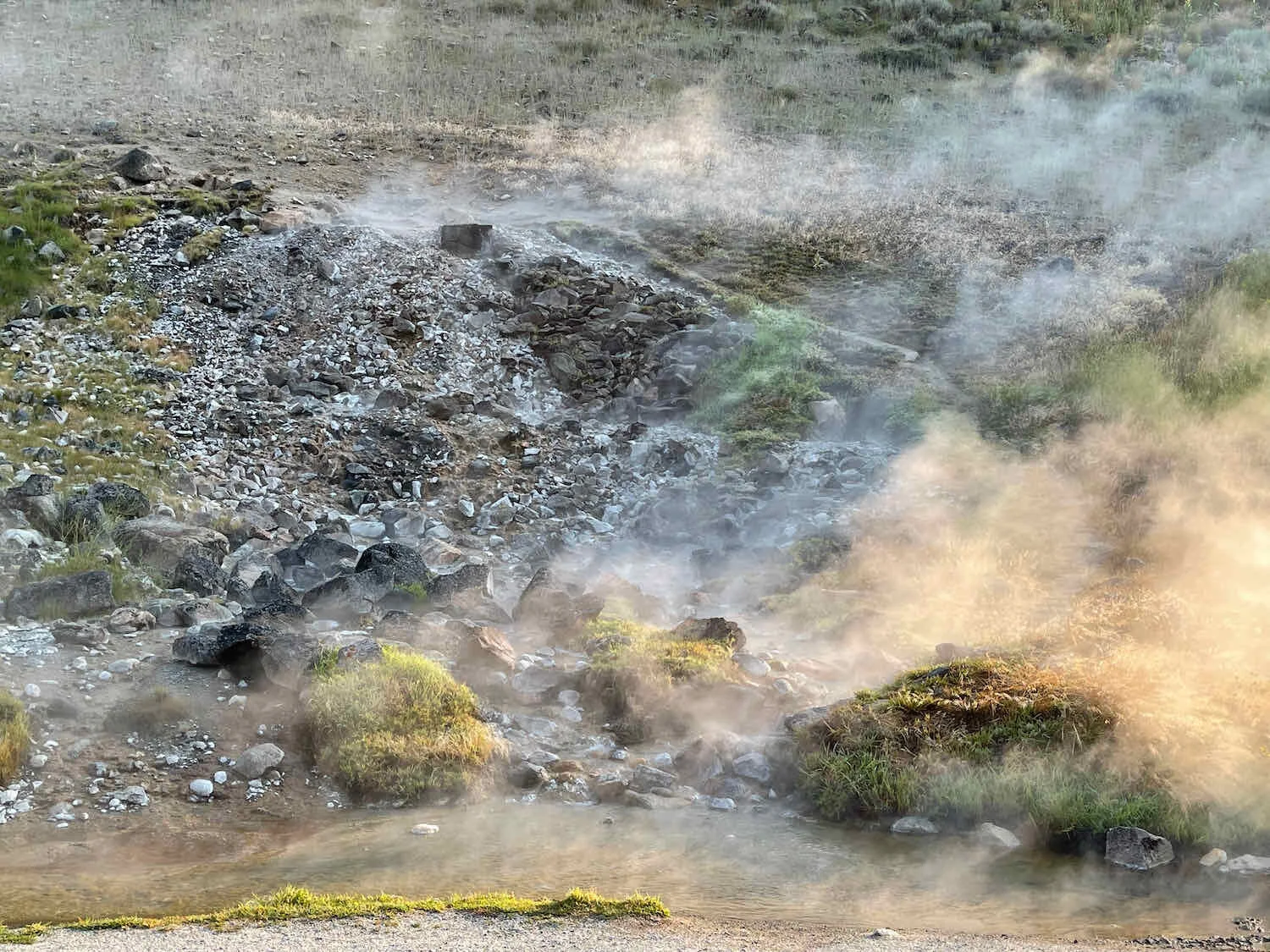
The Sawtooth Valley has a number of thermal hot springs, and we had previously thought we might take a dip along the way. But overnight the temperature got down into the 40s F. When we reached the hot springs the next morning, it was still very cold. We were reluctant to get in the water, which would mean having to ride in wet clothing when we were already quite chilly. So we just walked down to the edge of the springs and enjoyed the warmth radiating from the earth.
As we neared the mountain hamlet of Stanley, Idaho, we were blown away by the impressive vistas of the Sawtooth Mountains. Their jagged line of peaks rise steeply from the river valley. Created by ancient glaciers, they are quite dramatic compared to other mountain ranges in the U.S. Rockies.
The Sawtooth Mountains creat a stunning backdrop for the approach to Stanley, Idaho, USA. Copyright © 2019-2021 Pedals and Puffins.
On our way into town we visited the Stanley Historical Museum, housed in an old US Forest Service Ranger Station. It was interesting to see the various buildings (especially the ice house and tool shed), and to read about the frontier life of a ranger. Prior to the 1970s, the ranger was on call, day and night, to help the community with all manner of events. According to one former ranger, “If somebody got shot, call the ranger. Somebody was having a baby, call the ranger. Somebody turned their truckload of cows over, call the ranger. I was plum wore out by the end of my first summer here.” You have to feel for the guy.
The US Forest Service Ranger’s office/house was an important center of activity in the early days. Stanley, Idaho, USA. Copyright © 2019-2021 Pedals and Puffins.
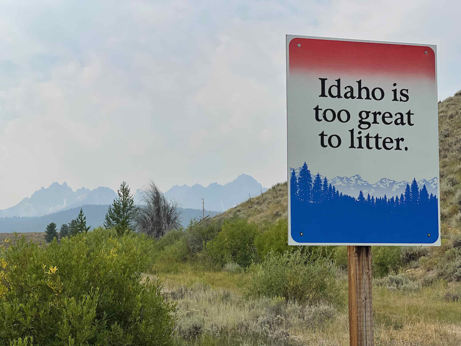
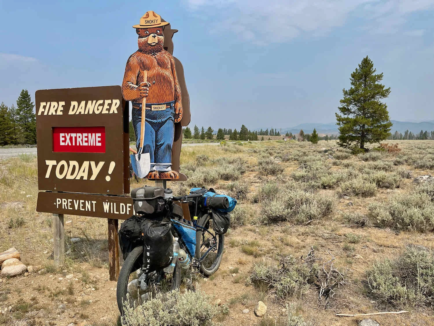
From there, we headed towards Galena Pass, one of the highest highway passes in the country. A sign by the highway reminded us that even in sagebrush country, the risk of wildfires remains.
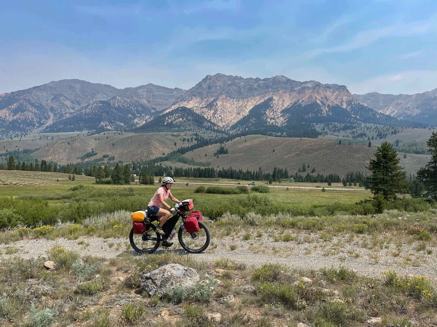
The route up to Galena Pass stays in the Sawtooth Valley for many miles, ensuring that we had the picturesque Sawtooth Mountains as a backdrop for most of the day. We were fortunate, for a change, that the smoke from nearby fires wasn’t bad enough to obscure our view. Idaho, USA. Copyright © 2019-2021 Pedals and Puffins.
Once again, we felt like we didn’t have enough water in the afternoon to wild camp. We had planned to get water at the Mel Cafe along Hwy 75, but when we got there it appeared to be permanently closed. We headed for Smiley Creek Lodge, hoping it hadn’t met the same fate as Mel’s.
About 4 miles before we reached the lodge, we encountered two guys bicycle touring, heading the other direction. One of them was riding the TransAm route (which we had completed in 2018) all the way from Atlantic to Pacific. His friend had joined him on the ride for 10 days. They had detoured off the TransAm route to avoid breathing all the forest fire smoke in the Bitterroot Valley (bypassing Missoula). They had just come from Smiley Creek Lodge, and assured us that it was open, and that we’d be able to get food and water.
Encouraged, we pushed on.
When we got to the lodge and found out that they offered tent camping sites, it was a no-brainer to call it a day. We had a leisurely dinner in the cafe, with huckleberry/Oreo milkshakes for dessert, then set up camp. It was a lovely evening, as we watched the sun set over the Sawtooth Mountains. For entertainment, two red foxes passed by, very close to our campsite.
Our neighbors at the Smiley Creek Campground were a couple of red foxes. They were shy, but we were lucky enough to get a couple pictures. Near Galena Pass, Idaho, USA. Copyright © 2019-2021 Pedals and Puffins.
Sunset over the Sawtooth Mountains. Near Galena Pass, Idaho, USA. Copyright © 2019-2021 Pedals and Puffins.
Heading to Ketchum on the Harriman Trail
The next morning, on our way up to the top of Galena Pass, we were treated to the sight of some Evening Grosbeaks hanging out with the local Cassin’s Finches. It’s been ages since we’ve seen Evening Grosbeaks, one of our favorite birds. Their vibrant yellow and gold plumage, as lovely as a sunset, brightened our morning.


Near the top of the pass, we stopped to celebrate the birthplace of the Salmon River, which had been our companion, off and on, for the better part of seven days.
The birthplace of the Salmon River, high in the Boulder Range of Idaho. Near Galena Pass, Idaho, USA. Copyright © 2019-2021 Pedals and Puffins.
Shortly after cresting the summit of the pass, we hopped onto the Harriman Trail, a full-on, mountain-biking trail of winding, single-track gravel. Even though there’s a pretty big drop in elevation from Galena Lodge to Ketchum, the Harriman Trail manages to throw in lots of steep uphills, as well as spots with deep, loose gravel. It was quite a roller coaster ride.

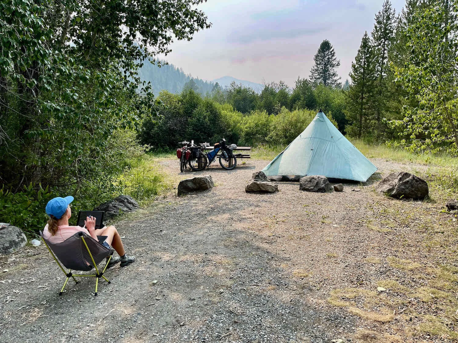
Given the pricey accommodations in Ketchum and Hailey, Idaho, we decided to camp outside of town. We rode into Easley Campground around 1:30pm. It was a nice change to have a choice of several pleasant campsites because of our early arrival. Within a few hours, all of the sites in the campground were occupied.
Having some afternoon relaxation time also allowed us to squeeze in some route planning, and a trip up to the Easley Hot Springs.
The hot springs at Easley have several developed pools, and a modest convenience store/bath house. We happily savored some ice cold drinks and snacks from the store, before taking a dip in the pools. We settled into the warmest of the pools. It wasn’t really that hot, but we had the little pool to ourselves and enjoyed the soothing waters.
Nothing like a warm soak after a day on the bike. Easley Hot Springs, Idaho, USA. Copyright © 2019-2021 Pedals and Puffins.
As we were getting ready for bed, a cheeky ruffed grouse wandered through our camp, even stopping to peck at the gravel under our bikes.
A ruffed grouse makes herself comfortable under PedalingGuy’s bike. Easley Campground, Idaho, USA. Copyright © 2019-2021 Pedals and Puffins.
Very late in the evening, as the sun was setting, the wind picked up and it finally seemed like the smoke that had blanketed the valley all day was blowing away. We took a short walk on the campground road, and admired the sunset on the Boulder Mountains as the smoke cleared. It was the perfect end to a great day.
The final rays of sunlight catch the peaks in the Boulder Mountains. Easley Campground, Idaho, USA. Copyright © 2019-2021 Pedals and Puffins.
The Final Push to Bellevue
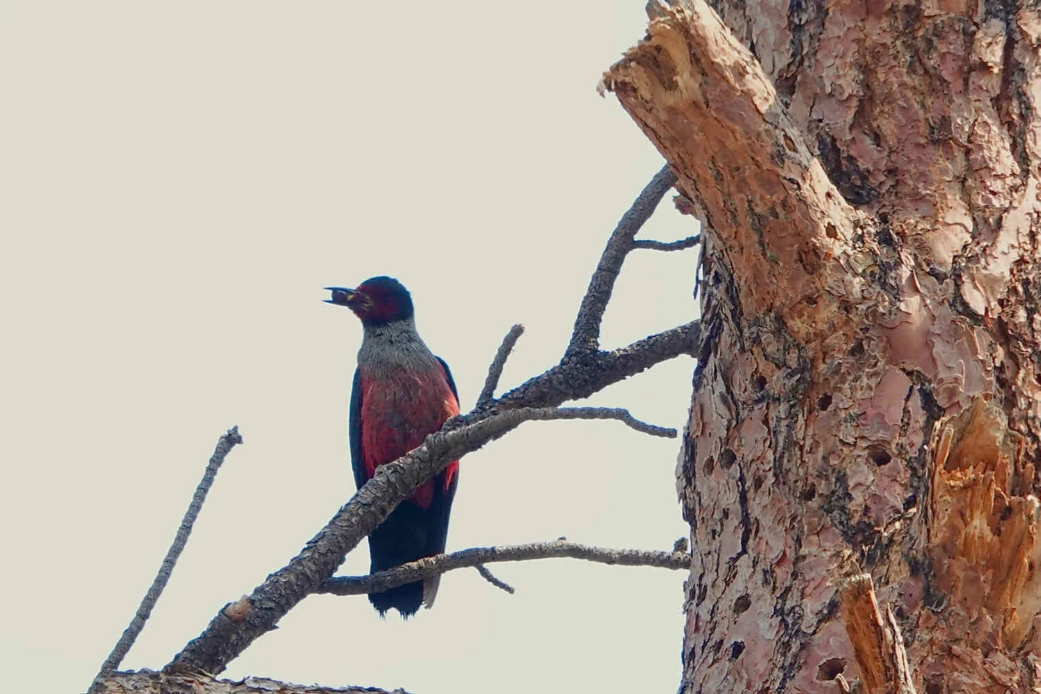
Leaving the campground the next day, we stopped to watch the antics of two Red-naped Sapsuckers going about their morning business in a nearby pine tree.
Red-naped Sapsucker. Easley Campground, Sawtooth National Forest, Idaho, USA. Copyright © 2019-2021 Pedals and Puffins.
As we rode the final stretch of the Harriman Trail towards Ketchum, we were intrigued to see small crowds of people gathering along the edges of Hwy 75. Most of them had folding chairs, and many also brought tarps to provide shade - as if they were settling in for a long sit. There didn’t seem to be any obvious reason for this behavior, and we wondered, what might be going on?
When the trail brought us close to a family that had set themselves up under a shaded canopy, with lawn chairs and a cooler of drinks, we stopped to inquire about their purpose. “Tour de Force,” they replied, as if that would explain everything. But seeing our puzzled looks, they went on to say that the highway would be closed at 8am so that multi-million dollar, souped-up, street legal sports cars could drive across the pass without a speed limit. It would be the crowning event of a multi-day, car-lovers festival. The previous speed record for the event was 235 mph.
Hearing that, a light bulb went off for us. The Tour de Force explained a caravan of sporty and expensive-looking cars that had sped by us on Hwy 75 the day before. They must have been practicing out on the road.
But today, these cars could present a problem. The highway would be closed starting at 8am, and we had two road crossings to make before reaching Ketchum. Fortunately, this section of the Harriman Trail was not nearly as challenging as yesterday’s. We moved along considerably faster, and squeaked through the road crossings within a few minutes before they were closed. We treated ourselves to some omelets for breakfast in Ketchum.
After that, we headed down the Wood River Trail, a gentle, downhill rail-trail that couldn’t have been more different from the roller coaster hills of the Harriman Trail. Progress was very quick on the smooth, paved surface. That was a blessing, because we were back in sagebrush country. So there was virtually no shade along the trail between the towns of Ketchum, Hailey and Bellevue.
The Riverside RV Park and Campground in Bellevue, Idaho wasn’t the most enticing setting for spending the night. It was already pretty crowded with tents when we arrived. We deliberated for a while about whether to continue on to a US Forest Service campsite (with no water, and 15 more miles), or stay and make do. But in the end, the opportunity to shower, enjoy a hearty meal in town, and not carry extra water for a dry camp won the day. Eventually, we decided to stay.
It all worked out for the best. We spent the bulk of the afternoon dining and charging our electronics at Mahoney’s, a fun, Irish pub in town with very warm and friendly staff.
Checking out the historic, original city hall in Bellevue, Idaho, USA. Copyright © 2019-2021 Pedals and Puffins.
This section of the WWR (segment 3) has been a wild ride. It has been fascinating to watch the vegetation change from the dense, moist northern forests to the wide-open, dry sagebrush steppe. While not quite as physically demanding as the Magruder Corridor, the route still threw some big hills and long days our way. Plus, the complications posed by forest fires in our path, and treeless summer heat in the sagebrush landscape, ensured that we had to continue be on top of our game.