Cycling Superior to Darby, MT: Remote Riding through Gold Rush Territory

2-12 July 2021
Segment 2 of the Western Wildlands Bikepacking Route (320.7 mi, 516 km)
Check out our interactive route map to see where we stayed each night
There’s Gold in Them Hills
The second leg of our journey on the Western Wildlands Bikepacking Route (WWR) took us through more of the Northern Rockies. Many of these remote paths were originally blazed by Native Americans as travel corridors between seasonal resources. More recently, they carried gold rush prospectors seeking their fortunes among the rugged and remote mountains.
The quaint, small towns that served as our waypoints - Pierce, Lowell, and Elk City - all got their start as mining camps in the late 1800s. Later on, logging was a major economic driver in the region. But most recently, services supporting outdoor adventures (especially off-road-vehicle riding, hunting, fishing and river-running) appear to keep these towns going.
Mountains and Avalanches
Heading out of Superior, Montana, we quickly entered Lolo National Forest. A road sign reminded us that is was more than 100 miles (160 km) until our next encounter with civilization, in the town of Pierce, Idaho. (Click on any photo to view in full screen.)
Luckily, gasoline isn’t something we need on this trip. But it would still be more than 100 miles before we could refuel with food and other supplies! Road to Hoodoo Pass, Lolo National Forest, Montana, USA. Copyright © 2019-2021 Pedals and Puffins.
Having learned our lesson about leaving early, we were pumping our way up to Hoodoo Pass in the Bitterroot Mountains by 6am. Even though we cycled pretty hard to reach the pass before noon, we couldn’t help but soak up the beauty of the landscape along the way. The road wound through the lush Trout River valley, which became increasingly steep and narrow as we ascended the mountain.

The forest here was thick and green, with few of the insect-killed snags that are often seen in the Rockies. Road to Hoodoo Pass, Lolo National Forest, Montana, USA. Copyright © 2019-2021 Pedals and Puffins.
While preparing for this trip, we frequently heard that there could be snow in the mountain passes, even into July. We brought plenty of warm clothes along with us, expecting frigid nights. But this year the region has endured record-high temperatures since mid-June. So snow has not been a factor. We saw our first snow along the trail as we approached Hoodoo Pass - just a little, remnant, icy patch in the deep shade. We’ll likely ditch some of our cold-weather gear by the time we reach southern Idaho.
We weren’t too impressed with this tiny patch of snow. Predictions about snow covered passes in June/July along the WWR failed to materialize - in part because of a heat wave that has baked the region since mid-June. Road to Hoodoo Pass, Lolo National Forest, Montana, USA. Copyright © 2019-2021 Pedals and Puffins.
The approach to the top of the pass was lined with treeless meadows, willow thickets, and wetlands, which added a pleasant dimension to the scenery. A sign at the top of the pass said there were mountain goats in the area, but we didn’t see any.
A welcome rest at the top of Hoodoo Pass (elev. 6,000 ft/1,800 m). We’d covered 25 miles, and climbed 3,800 ft. Hoodoo Pass, Montana/Idaho, USA. Copyright © 2019-2021 Pedals and Puffins.
At the pass, we crossed into Idaho and a new national forest. The steepest part of the descent was paved, starting near the top of the pass and extending for about 10 miles. We flew down this section, slowing only when we transitioned back onto gravel.
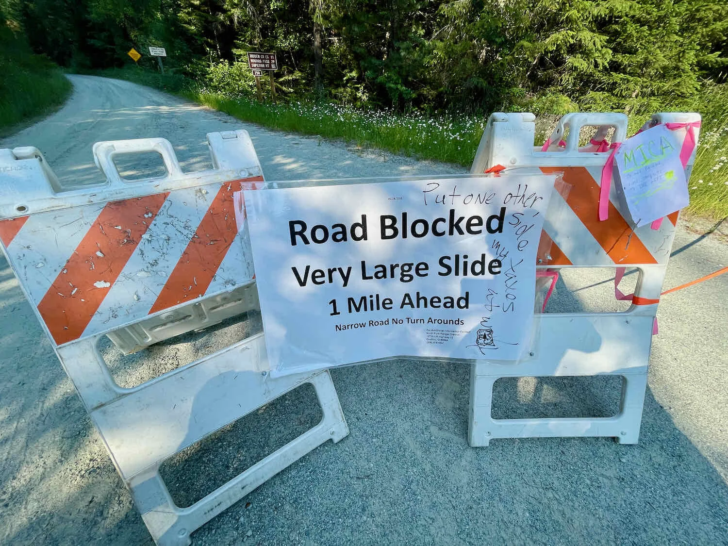
Based on the well-maintained pavement higher on the mountain, it came as a bit of a surprise when we ran smack into a giant avalanche debris pile about 4 miles before reaching the Kelly Forks Campground. We had read about two major avalanches in this area on the Bikepackingroots.com website that provides updates on the WWR trail conditions. But the June 2021 posting suggested that the road might be cleared before long, so we had headed down the road, hoping for the best. Perhaps we should have checked with the US Forest Service first…
But once we were there, in the middle of the forest, the only way out was through. So we unloaded the bikes and set about the task of hauling all our stuff, plus the bikes, across the debris field. It was “passable,” but just barely. The rocks and fine, dusty soil underneath the fallen trees was very unstable, and we had to carefully pick our way through the rubble with each pass. The most navigable line ran along the edge of the rubble, on soft dirt that plunged steeply over a cliff and down into the river below. It took us about an hour to get all our gear to the other side of the first avalanche.
Whoops, that’s a bit of a problem. The road to Pierce just disappeared under a wall of rocks, dirt, and fallen trees. Clearwater National Forest, Idaho, USA. Copyright © 2019-2021 Pedals and Puffins.
Tired, but happy to be safely across the first avalanche, we headed down the road - knowing that there would probably be another debris pile to cross, but hoping it wasn’t so. Two miles later, our hopeful bubble was burst by the sight of the road disappearing once again. This time, the debris pile was mostly comprised of trees and other vegetation. But it all sat on top of a rapidly-melting, ice floe. In fact, at the heart of the debris pile was a yawning ice cave, dripping with frigid water, rapidly melting in the afternoon sun - and barely holding back another crush of fallen trees.
There goes our road! It disappeared under a rapidly-melting pile of ice, tree trunks, broken limbs, and pine needles. Clearwater National Forest, Idaho, USA. Copyright © 2019-2021 Pedals and Puffins.
It was definitely risky, but we decided to hustle our bikes across as fast as we could, before the ice gave way and let loose another bunch of debris. In addition to hauling our stuff across the fallen logs, we had to contend with the running water of the stream as well. It felt like the ice could give way at any moment. So, this time we didn’t fully unpack the bikes. We just removed the backpacks and handlebar bags. Then PedalingGuy did most of the work in pushing, lifting, dragging, and heaving each bike all the way through the soaking wet piles of tree parts. It was dirty, exhausting work. But after another hour, we were finally through the worst.
One last big tree trunk to go… PedalingGuy managed to get both of our bikes across a treacherous, soggy, rapidly-melting avalanche pile. It was a heroic effort. Clearwater National Forest, Idaho, USA. Copyright © 2019-2021 Pedals and Puffins.
As we loaded up our bikes after crossing the second avalanche, a friendly couple who were fly-fishing in the North Fork of the Clearwater River approached us to chat. They were from the area, and visited this part of the national forest often. According to them, the US Forest Service has no plans to clear the avalanches from the road this summer. Maybe next year. Hopefully as the ice melts, the debris settles, and paths get worn into the dirt it will be easier to get across these obstacles for cyclists who come through later.
Needless to say, we were both totally wiped out by the effort. When we finally reached the Kelly Forks Campground, there was a road block with a sign announcing that the road was closed due to the rockslide. We were glad that was all behind us.
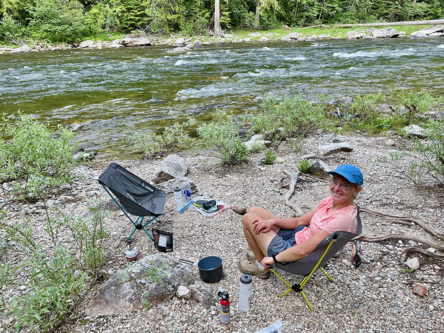
We headed downhill for another seven miles, and finally found a place to camp along the North Fork. It was a lovely spot, with the sound of rushing water and the occasional deep-bass percussion of large rocks churning their way downstream. After a quick dinner and washing up in the river, we settled into our sleeping bags and promptly fell asleep.
Another day, another big mountain pass, and another early start to get over the mountain before the afternoon heat made cycling uphill a chore. Before we had gone five miles, we made a fun discovery. It was July 3, and we passed the “4th of July Packbridge,” a lovely, wooden suspension bridge. We couldn’t find any information about how the bridge got its name, but it seemed like a good omen.
Visiting the 4th of July Packbridge on July 3. Clearwater National Forest, Idaho, USA. Copyright © 2019-2021 Pedals and Puffins.
We made it to the top of the ridge just a bit past noon, looking forward to a speedy descent into Pierce, Idaho. Clearwater National Forest, Idaho, USA. Copyright © 2019-2021 Pedals and Puffins.
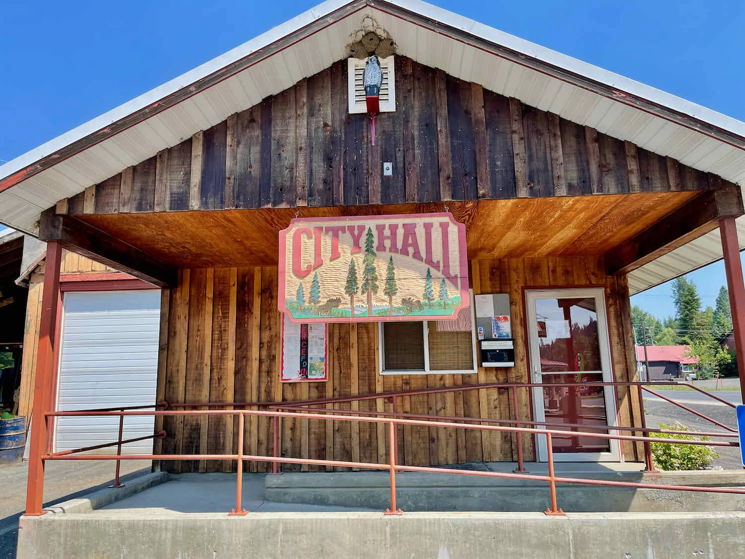
Like many of the towns around here, Pierce, Idaho (pop. 508), began as a mining town. Gold was discovered nearby in 1860, making it the first gold rush town in Idaho. But the boom times lasted for only a few years, and then the prospectors moved on to find their fortunes elsewhere. For most of the 20th century, logging was the major local industry.
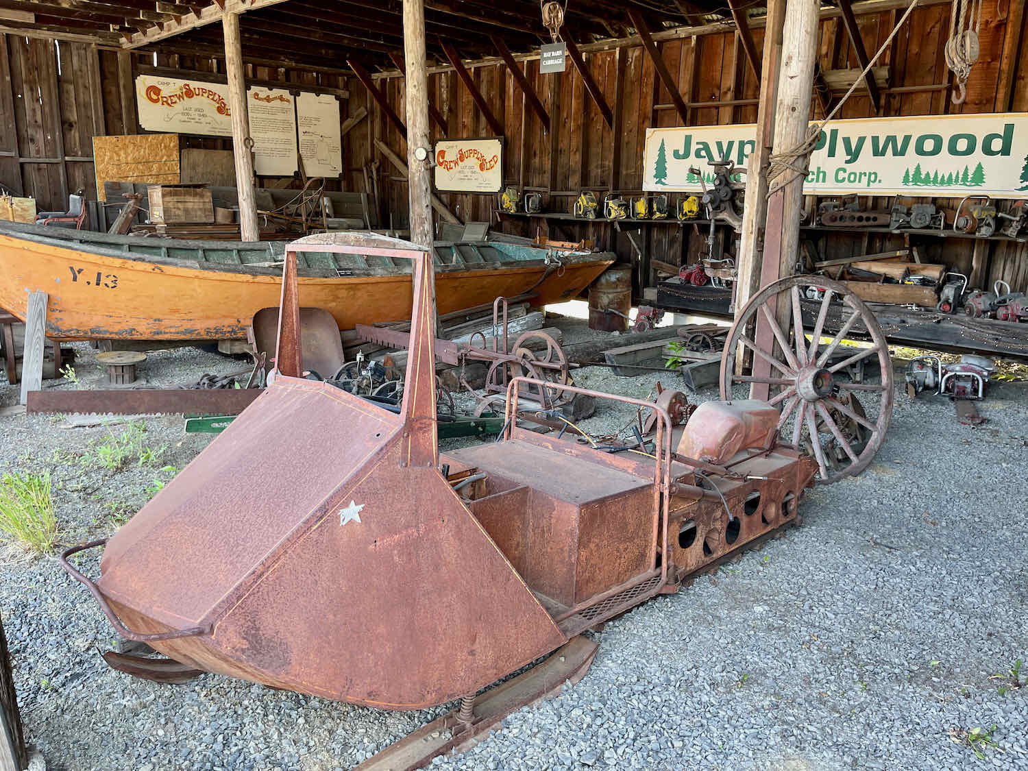
We were charmed by the wooden city hall. Unfortunately, the J.H. Bradbury Logging Museum in town was closed for the 4th of July holiday. But the museum has many artifacts displayed outside, so we browsed through the exhibits of old logging and mining machinery. In the evening, we each devoured one of the famous, 3/4 lb Timber Burgers (delicious) and played a 25¢ game of pool at the Timber Inn.

The road to Lowell, Idaho, was a bit easier than the cycling had been for the previous few days. It began with 25+ miles of modestly graded, rolling hills through private lands and another section of the Clearwater National Forest.
We’ve seen some creative vehicles rusting away on rural back roads. This one looks like an old delivery truck converted into a camper. Or, maybe just an early model RV, you decide. Wouldn’t it be fun to cruise the road in that? South of Pierce, Idaho, USA. Copyright © 2019-2021 Pedals and Puffins.
Only a couple of days earlier we had been commenting to each other about the scarcity of cows along the WWR route. Western forests are often home to lots of cattle whose owners lease the right to graze them on public land. But so far we hadn’t seen any. Now we found ourselves cycling through groups of cows on both private and national forest land - and swerving our bikes back and forth to avoid running over fresh cow pies in the road.
This young bull had his eye on us. Fortunately, he wasn’t very bold. He took off running when we got too close. South of Pierce, Idaho, USA. Copyright © 2019-2021 Pedals and Puffins.
The toughest part of the day was a 1.5 mile, steep ascent onto the top of Smith Saddle. With an average gradient over 12%, it’s a lung-buster. But the gravel road didn’t have any cars, so the ride to the top was very peaceful. We enjoyed a break in our folding chairs at the top of the climb.
The long descent into the Clearwater River Valley passed a number of avalanche chutes that looked like they had recently covered the road. We were lucky that crews had come through and cleared the way. The day became quite hot as we sped down the side of the mountain, and it would have been a sweaty job to have to climb over more debris.


Bringing Back Memories in the Clearwater River Valley
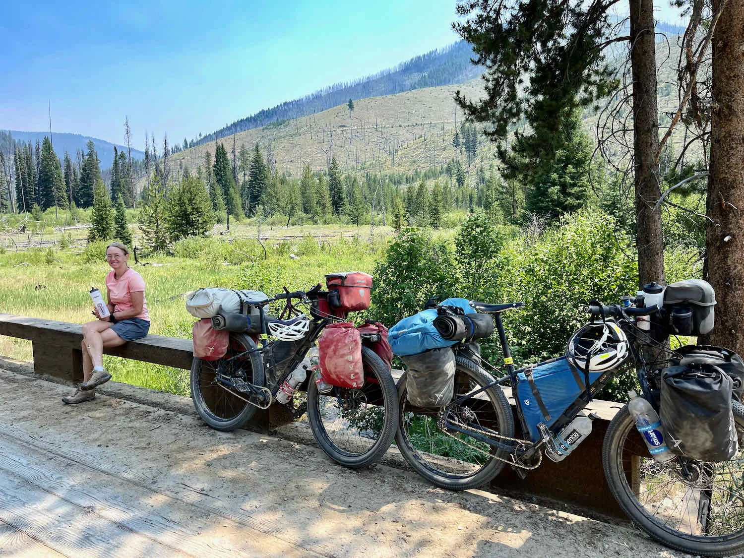
Reaching the Clearwater River Valley brought back a lot of memories. We had ridden the full length of the valley back in 2018, when we rode across America on the TransAm Cycling Route. The river is sparklingly beautiful. As we cycled through, we passed quite a few groups of people floating down the river in tubes or kayaks. After a sweaty, 8-mile ride to Lowell, we stayed in a motel attached to a cafe where we had eaten dinner back in 2018. The waitress recommended the pork loin sandwich, their specialty. She told us the cafe serves it “Iowa style,” which makes it the best pork loin sandwich in Idaho. They were huge, and very tasty. Of course, we also treated ourselves to huckleberry ice cream cones.
Apparently the population of Lowell had steadied in the last few years. It had been 23 back in 2018, the last time we passed through. Lowell, Idaho, USA. Copyright © 2019-2021 Pedals and Puffins.
When we stopped here in 2018, we had taken a walk along the Selway River - designated as a Wild and Scenic River for its un-dammed, natural beauty. Back then, the road had been dirt. But now the road is paved, and lined with quite a few homes.

The big climb between Lowell and Elk City, Idaho, is up and over Iron Mountain Pass. It’s a long haul: 28 miles with 4,800 ft of climbing. Early in the day we were passed by a family from Boise, Idaho, cycling together for vacation on the WWR. First we were overtaken by a father-son duo. They were followed by the mom and two girls. They were traveling very light because they had a support vehicle, and were only carrying their water and a few snacks. As a result, they were zipping right along, and passed us almost as if we were standing still. To be honest, we were a little bit jealous of their speed. They had been out cycling for a couple of weeks, but their vacation was coming to an end later that week. So we are really the lucky ones, because we’ll be biking for a few more months.
We had originally planned to break up the ride to Elk City into two days. But when we stopped at a lovely wild camp near a stream to get water, we were swarmed by biting flies. There were no less than four species, ranging from giant horse flies, to big green-heads, and even the smaller deer flies. It seemed like every bug in the woods wanted to suck some of our blood. After filtering a few liters of water, we decided to push on.
Trying to outrun the biting flies on Iron Mountain Pass. There were at least four varieties of flies with a taste for human blood. They swarmed us as we slowly ground our way uphill. Nez Perce National Forest, Idaho, USA. Copyright © 2019-2021 Pedals and Puffins.
It was an awesome feeling when we made it to the top of the ridge. We descended about five miles, and saw an area that looked good for camping. By this time it was getting late in the day, and we figured that the shops and restaurants in Elk City would probably be closed by the time we reached town - so we might as well camp and rest. Besides, there weren’t as many biting bugs here.
As we were casing the area for a good place to put our tent, a guy came up the trail on an ATV. He was from Kooskia, but staying in Elk City for a few days. We asked him about the services in Elk City, and he assured us that the cafe would be open late. He also thought there would be room at the small hotel in town. When we heard that news, we decided it was worth it to make a run for it. We hopped back on our bikes, and sped downhill to Elk City.
We arrived in town a bit bedraggled, dehydrated, and ready for rest. But instead of going straight for some cold drinks - which would have been wise - we headed for the hotel in hopes of getting a room and a shower. It became abundantly clear that we needed some fluids when PedalingGuy got dizzy and had to lay down on the floor during hotel check-in. After grabbing a big drink of Gatorade from the shop across the street, we finally had a chance to rest. We didn’t have the energy to do much that evening besides eat and unwind in our room.
Elk City is another former gold rush town. In fact, gold was discovered here by a couple of prospectors who had migrated from Pierce, Idaho, where we had stayed not long ago. Gold was mined in the area as late as WWII, before all the mines were finally closed.
Elk City has it all. The little signs at the Sinclair gas station note a number of local services. Elk City, Idaho, USA. Copyright © 2019-2021 Pedals and Puffins.
The next leg of the journey would be over the very remote and difficult Magruder Corridor. So we decided a couple of rest days would be in order. We moved from the hotel into a tidy little cabin at the Rider’s Rest Campground.
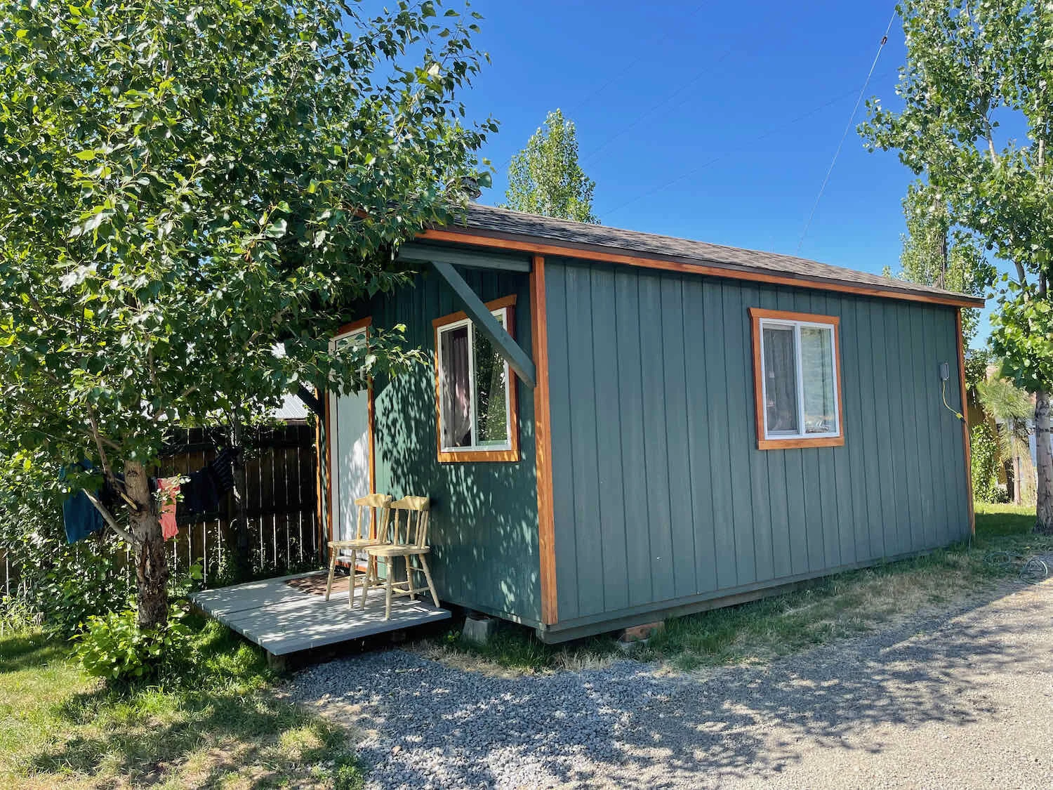
Our little sanctuary at the Rider’s Rest Campground. There’s only one cabin, and we were lucky enough to snag it for a few days. Elk City, Idaho, USA. Copyright © 2019-2021 Pedals and Puffins.
Making Friends in Elk City
That turned out to be a great decision. The campground is a gathering place for adventurers in the area, and our stay was enlivened by the company of the hosts, as well as other travelers.
Joshua, the campground’s owner really embraced us as guests. He invited us to join his good friends Bruce and Melina for a chicken stir-fry lunch, whipped up in a wok on the deck of the main campground building. We had a blast learning about Joshua’s background as a lawyer, as well as his years farming in central Kentucky with Melina before moving to Idaho. Bruce revealed that he is an experienced bear hunter (black bears), and that bear is his favorite meat. When we mentioned we had never tasted bear meat, that led to an offer for a bear chili dinner the next day. What incredible generosity and hospitality! We easily wiled away the hours visiting with them.
The first evening, two other campers arrived. One rolled into town and stopped at the cafe where we were having dinner. An avid adventure cyclist and geologist from Austin, Texas, she started her ride in Kalispell, just like us. But she hopes to make it to Mexico a month ahead of us! She has a super-lightweight titanium bicycle with carbon fork and carbon wheels. We guessed that her bike alone weighed 10+ less pounds than ours. She is the only other cyclist we have seen attempting to travel the full length of the Western Wildlands Route.
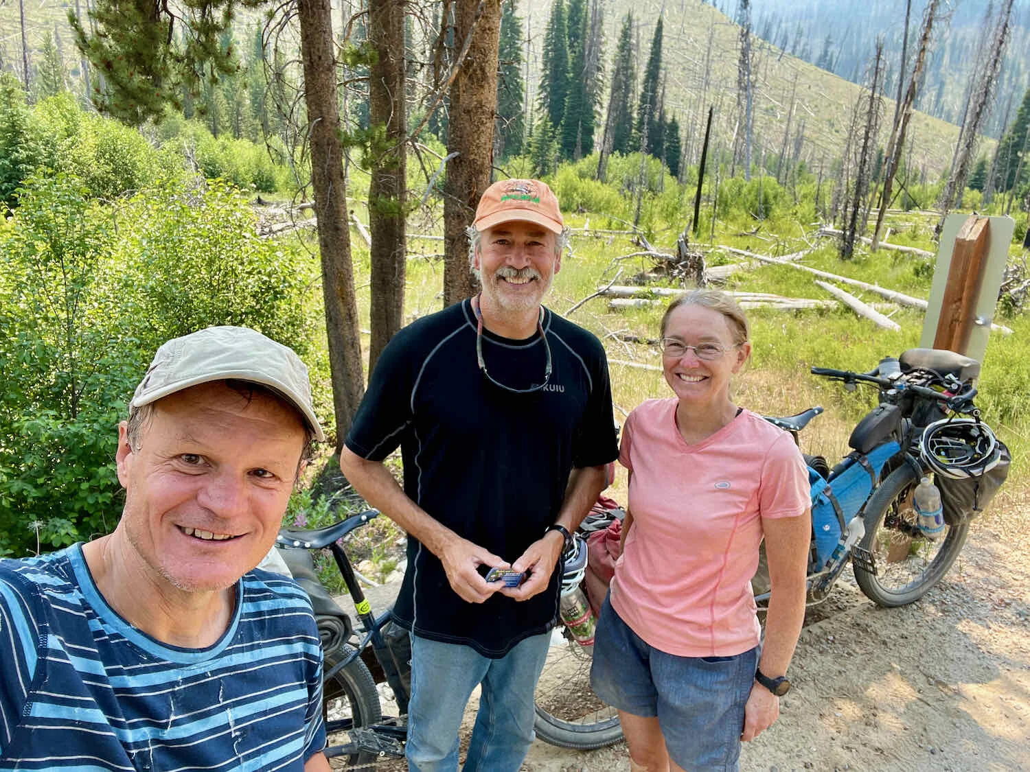
We also got to know a motorcycle tourer from a town near Ogden, Utah. Years ago he did some mission work in Brazil, so he and PedalingGuy enjoyed reminiscing about living in Brazil when they were young and willing to try just about anything. In addition to motorbikes, he is an experienced mountain bike rider. We had fun talking about bikes and touring with him. He’d just come across the Magruder Corridor on his motorbike, and was able to give us some insights (and show us some photos) of the ride ahead.
Sharing some two-wheeled camaraderie with a fellow traveler who stayed at the Rider’s Rest campground. Elk City, Idaho, USA. Copyright © 2019-2021 Pedals and Puffins.
The next day the motorbiker had to leave. But three more cyclists arrived at the camp. One was an experienced thru-hiker who has conquered the three major long-distance trails in the USA. He recently switched to bikepacking, and was traveling on several of the iconic, western routes. The other two were a recently-married couple riding a section of the WWR for their honeymoon. They started at the Canadian border, and were heading south to Salt Lake City. We seemed to have a lot in common with them, and got a kick out of hearing about their experiences along the trails we had just ridden.
By the time the evening rolled around, there was a crowd on-hand for the bear chili feast. Joshua, the host, graciously invited everyone to join in the fun. He’s an outstanding cook, so the food was as delicious as the company was engaging. Rider’s Rest Campground, Elk City, Idaho, USA. Copyright © 2019-2021 Pedals and Puffins.
The Infamous Magruder Corridor
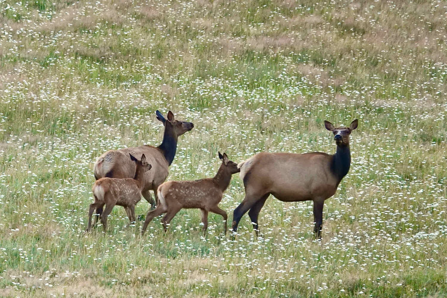
But we couldn’t stay in Elk City forever. The next morning we finally saddled up and rode out of town in the morning chill. As if to see us off, a herd of about 50 actual elk strode across a field of wildflowers on the edge of town. It was a magical way to start the day.

After a short but steep climb out of the valley, we followed relatively mellow roads for about 13 miles - giving us a chance to spot some wildlife and soak up the scenery along the Red River.
Fall will bee here pretty soon, and this white-tailed deer is growing his new set of antlers for the fall rut. Red River Valley, Idaho, USA. Copyright © 2019-2021 Pedals and Puffins.
An old miner’s camp along the Red River. Idaho, USA. Copyright © 2019-2021 Pedals and Puffins.
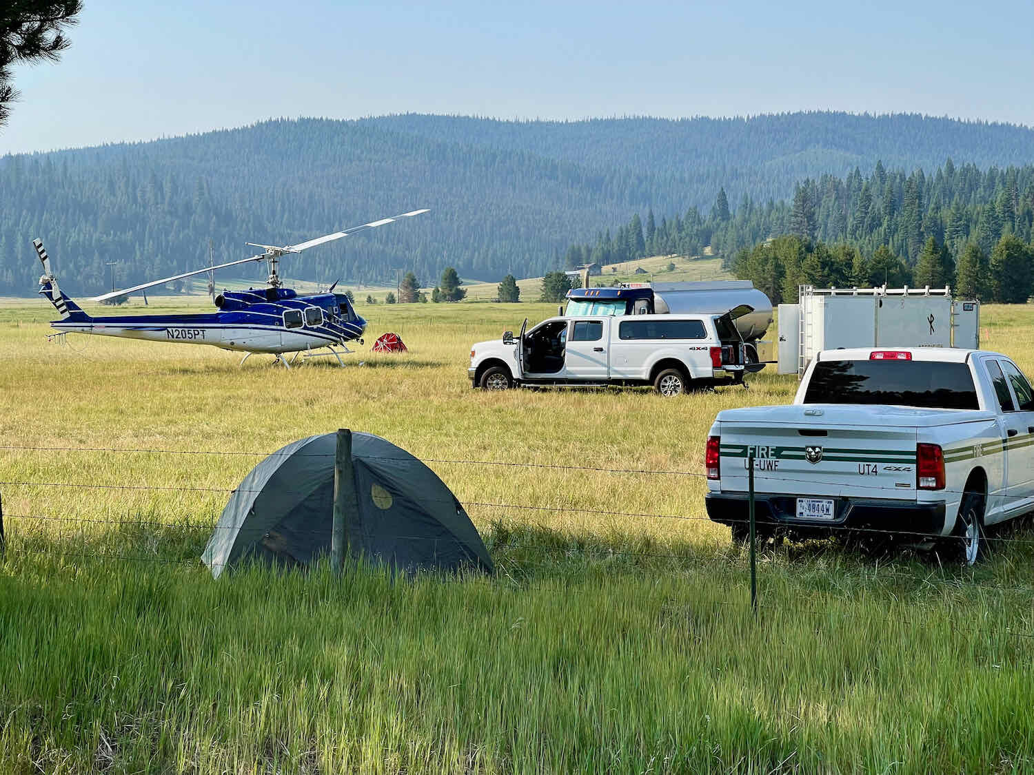
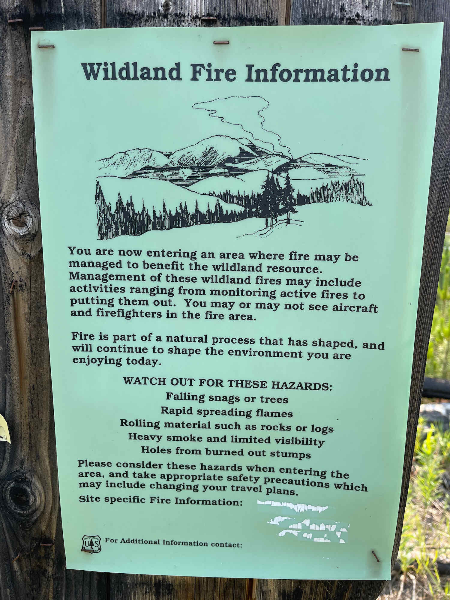
We felt some pressure to make tracks out of Elk City to stay a step ahead of the Dixie forest fire, which had already burned 11,000 acres (4,450 ha) in the area. The Dixie fire was only 15 miles south of Elk City, which meant it was burning within 5 miles of our cycling route. The road we were taking was open, but it formed the northern edge of the fire closure zone.
Just past the Red River Forest Service Compound, we came upon a firefighter base camp. As we were cycling by, a helicopter pilot flagged down PedalingGuy. Uh-oh. Was he going to tell us the road was closed? We were relieved when it turned out that he was an aspiring bikepacker. He was preparing for his first multi-day ride, and wanted some feedback on bikepacking gear. We had fun chatting with him for about 20 minutes before finally moving on.
Then we arrived at the official start of the Magruder Corridor Road. For the next 90+ miles we would cycle along a steep and unmaintained backroad sandwiched between two of the largest wilderness areas in the continental USA. This is considered the hardest segment of the Western Wildlands Bikepacking Route, and PedalingGal had quite a bit of trepidation - mixed with excitement - about the road ahead.
She’s smiling, but it’s a nervous smile. The Magruder Corridor would be the hardest cycling route we have ever attempted. Nez Perce National Forest, Idaho, USA. Copyright © 2019-2021 Pedals and Puffins.
We purposely kept the first day’s riding manageable by planning to cover only 38 miles to the Poet Creek Campground. That still involved more than 4,200 ft of elevation gain as we ground our way for 15 miles to the top of Elk Mountain, then negotiated the rapid and rocky descent to Poet Creek.
That’s not so bad, is it? The Magruder Corridor road started out like many others we had ridden, with reasonably well-graded gravel and plenty of shade from the trees. Nez Perce National Forest, Idaho, USA. Copyright © 2019-2021 Pedals and Puffins.
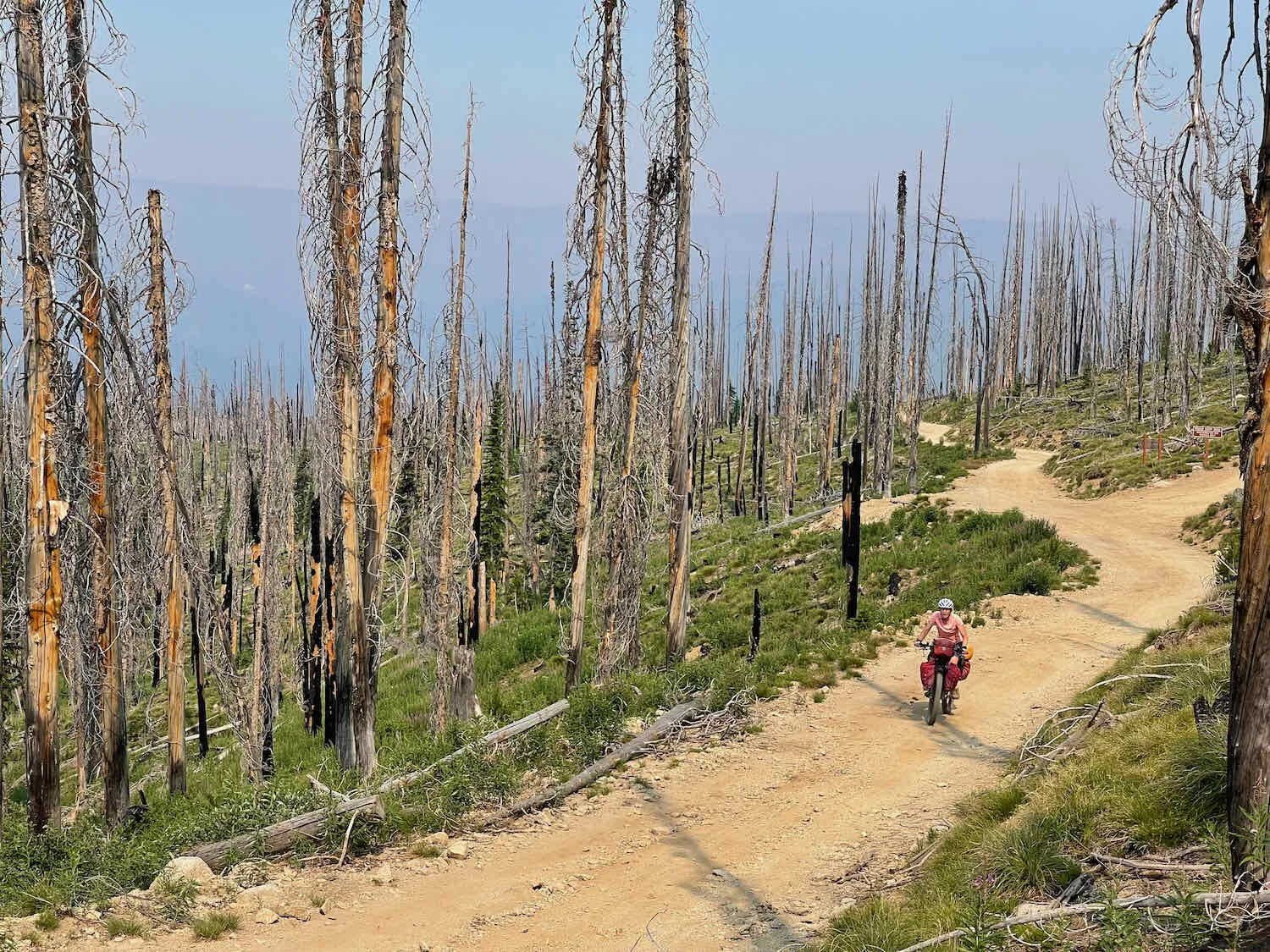
At the top of Elk Mountain Pass, the lush forest was replaced with an eerily beautiful landscape created by wildfires that burned through the area over the past 30 years. Unfortunately, no shade for the overheated cyclist. Nez Perce National Forest, Idaho, USA. Copyright © 2019-2021 Pedals and Puffins.
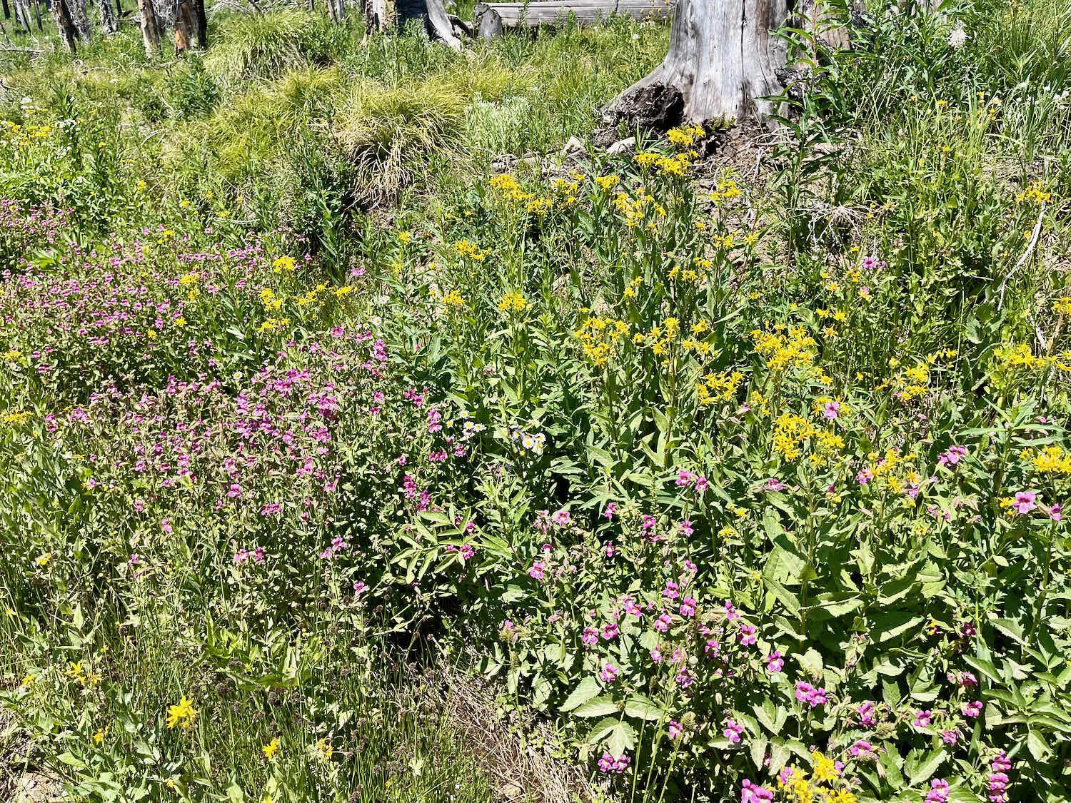
We’ve heard a lot of people complain that the burned areas aren’t as pretty as the forests used to be along the corridor. But we were impressed with the vigorous growth of meadows among the ghostly tree snags. Wildflowers were abundant in the burn areas, and the forest was slowly regenerating in many others.
We arrived at the campground in early afternoon, and selected a lovely campsite by the creek. Smoke from the Dixie Fire had been getting thicker in the air all afternoon, and by evening it was beginning to obscure views of the more distant mountains. We even noticed small flecks of ash falling on out tent. We were glad to be well past the fire, and heading away from it from now on.
The next morning we awoke to a hazy dawn, set into soft focus by the smoke from the Dixie Fire.
The sun glowed an eerie, muted, smoke-shrouded orange as it rose over the skeletons of dead trees along the Magruder Corridor. The flowers are the aptly-named fireweed. Nez Perce National Forest, Idaho, USA. Copyright © 2019-2021 Pedals and Puffins.
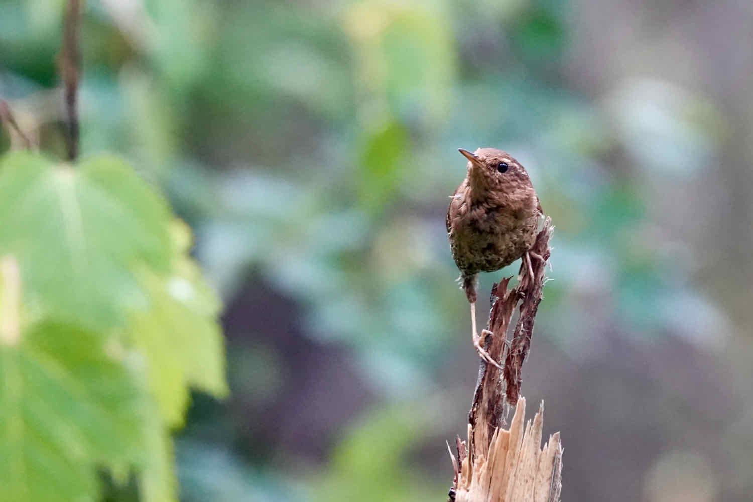
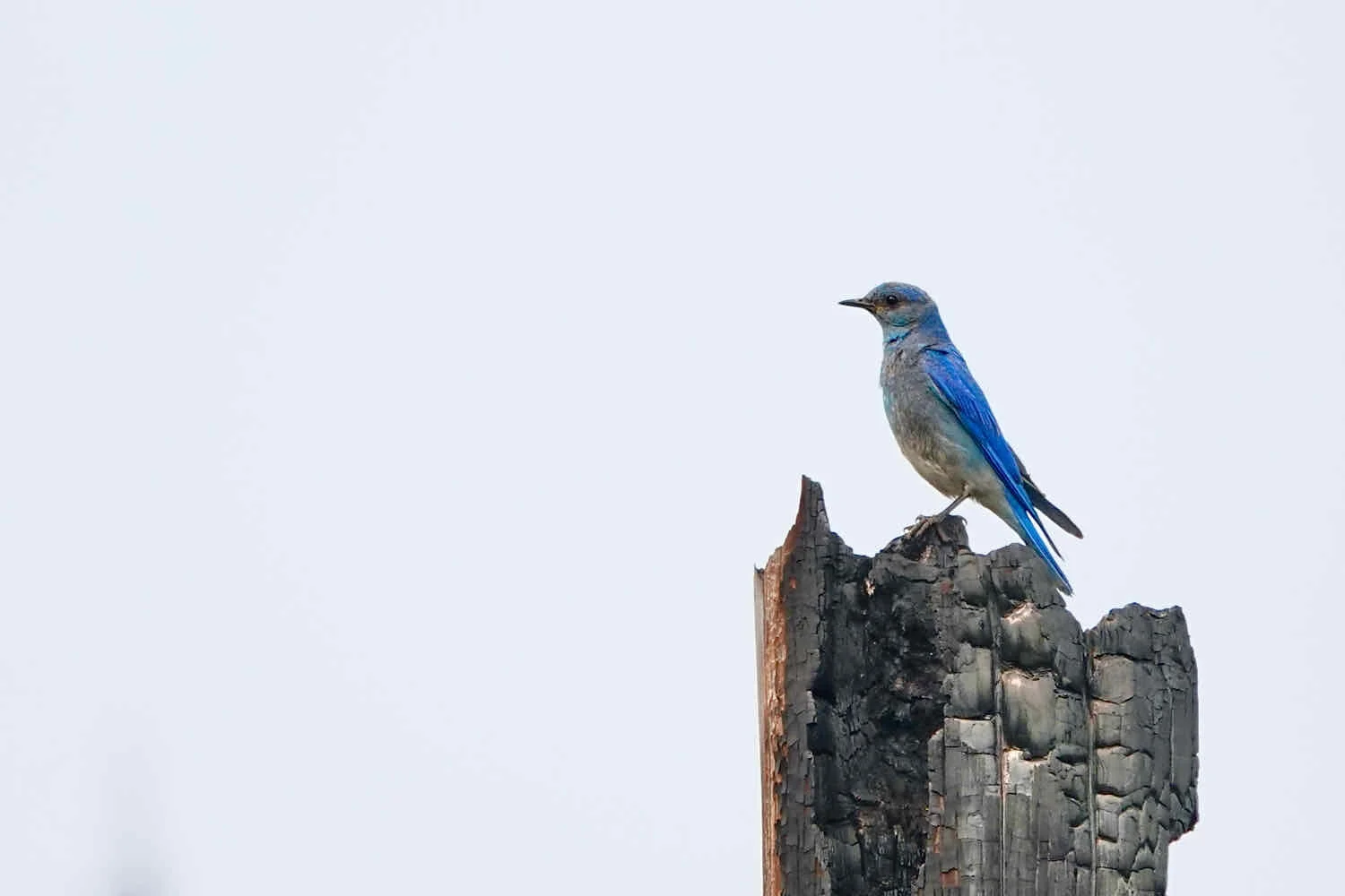
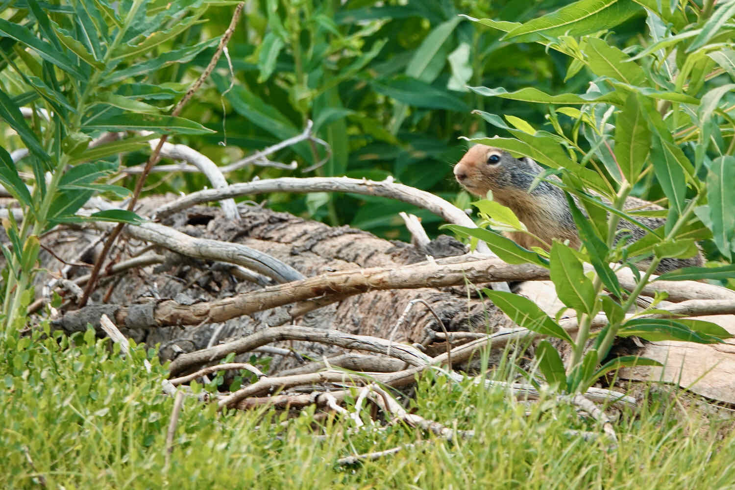
We knew this would be our toughest riding day. We planned to cover only 35 miles. But those miles included three, viciously steep and rocky ridge crossings. The day started with the longest and steepest climb, up to Dry Saddle. It was eight miles of grueling cycling, as we alternately pedaled - usually in our lowest gear - and pushed our bikes up the steep hill. Mountain bluebirds, lazuli buntings, and Colombian ground squirrels kept a close eye on us as we rode by.
The slippery, rutted road kept us on our toes as we weaved back and forth to find the best track through. That is, when we were able to ride at all. Sometimes we had to get off and push the bikes. Magruder Corridor, Nez Perce National Forest, Idaho, USA. Copyright © 2019-2021 Pedals and Puffins.
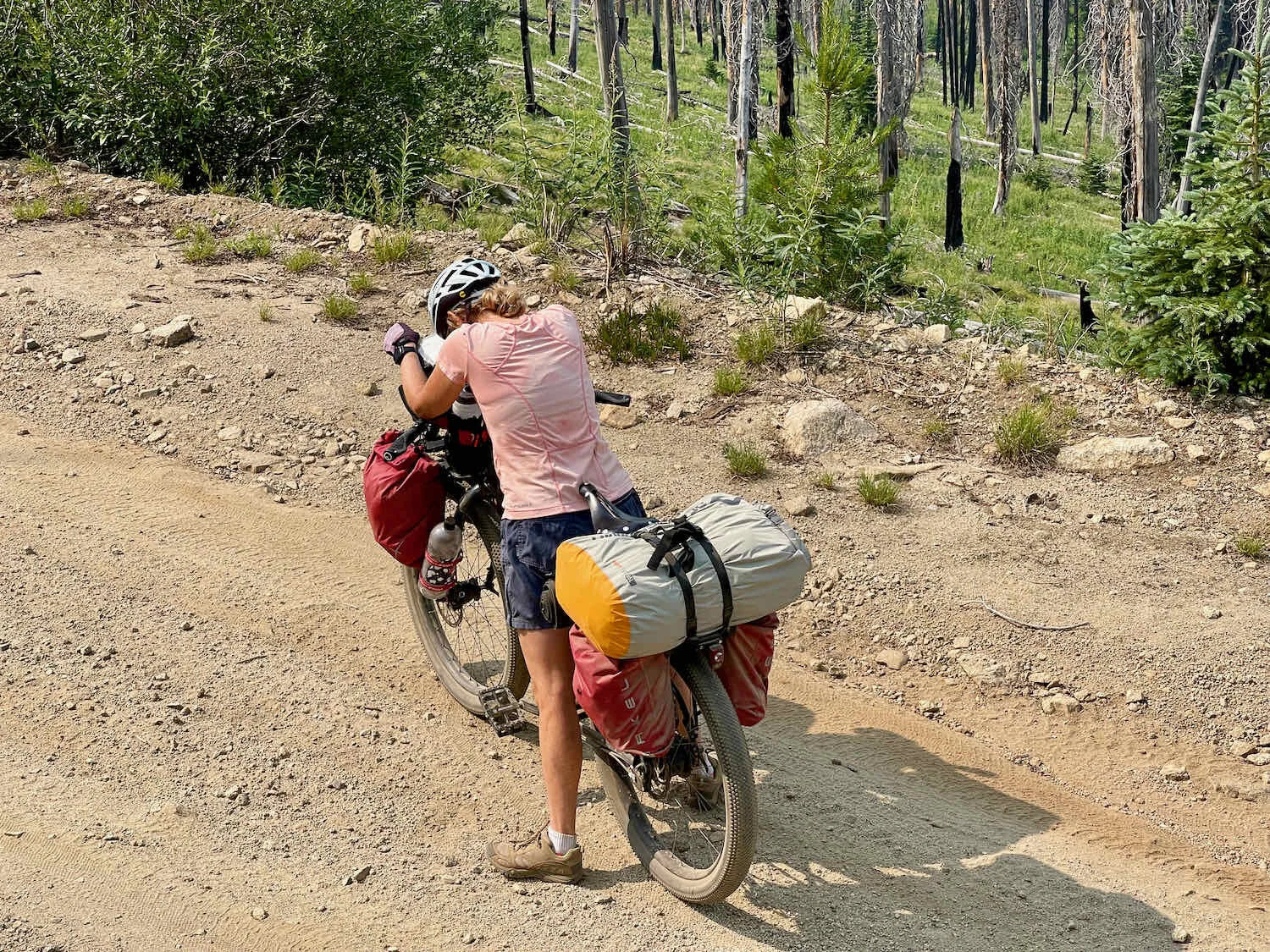
After a very rocky and treacherous descent to Sabe Saddle, we launched into the second climb of the day. It was half the elevation gain of the first climb, but just as steep and slippery. By this time, the biting flies were out in force, pestering us as we inched our way up the mountain. PedalingGal finally couldn’t take it anymore, and applied some bug repellant. That helped restore (some of) her sanity.
Part way up the second climb, a Trail Angel named Brian stopped to offer us a ride to the top of the ridge in his pickup truck. We could have easily thrown our bikes in the back and left the hill behind us. But, being stubborn, and knowing that we were getting close to the top, we declined. He then offered to fill our water bottles, which we gladly accepted. The water from his jug was deliciously cool and refreshing - unlike the warm water that had been roasting in our bottles all day. We were very grateful for his kindness.
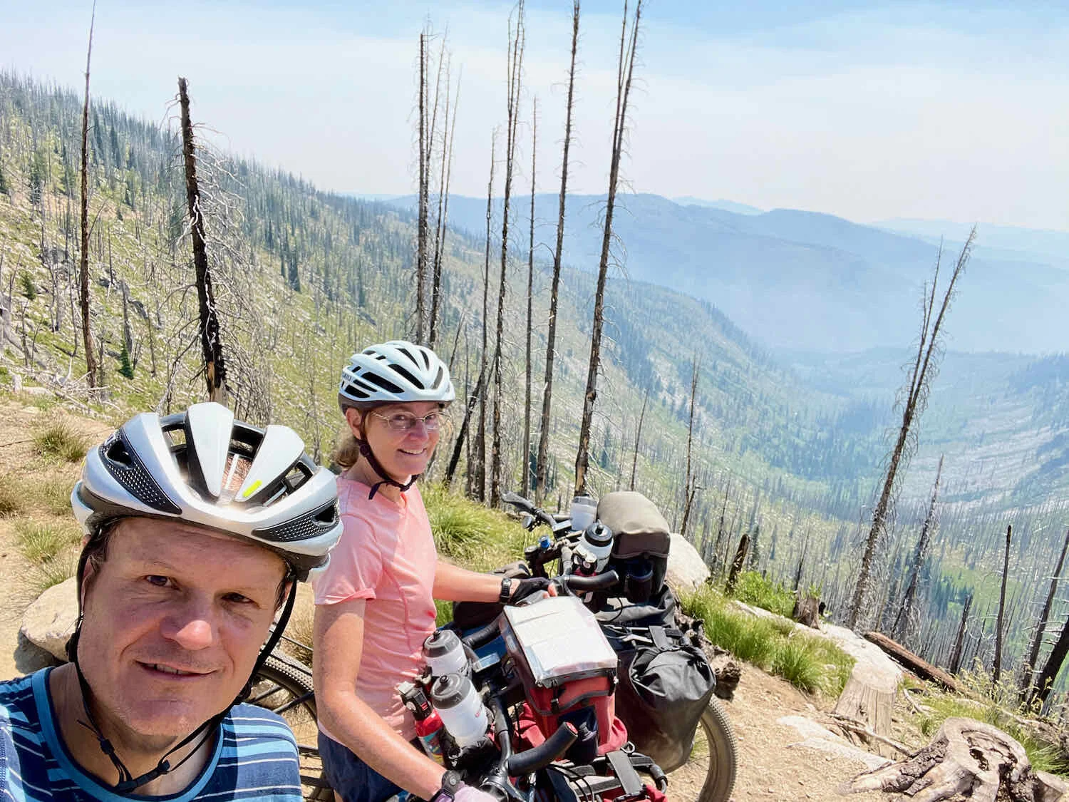
Nearing the top of the second big ridge. Other than the road, there are no signs of human infrastructure as far as the eye can see. By this point, the burnt-over forest was very thin, and the rocky bones of the mountains were on full display. Smoke from the nearby Dixie Fire blanketed the valleys. Magruder Corridor, Nez Perce National Forest, Idaho, USA. Copyright © 2019-2021 Pedals and Puffins.
Looking back across a valley, we could see the road on which we descended from the second ridge. It was just as steep and rocky as the first. Magruder Corridor, Nez Perce National Forest, Idaho, USA. Copyright © 2019-2021 Pedals and Puffins.
PedalingGal was getting tired, and took a spill when she hit some loose gravel on the way down the second ridge - scuffing her knee. After washing off the dust, and cleansing the cuts with alcohol, she was patched up and ready to keep riding. Magruder Corridor, Nez Perce National Forest, Idaho, USA. Copyright © 2019-2021 Pedals and Puffins.
By the time we reached Horse Heaven Saddle, at the bottom of the second ridge, we were both exhausted. PedalingGuy had been heroic in helping get his wife through the toughest parts of the ride. But that effort had worn him out as well. Even though we had only ridden 19.5 miles (31.5 km), we realized we would not make it to Magruder Crossing Campground, which had been our goal for the day. We still had another big hill to climb before we could get there.
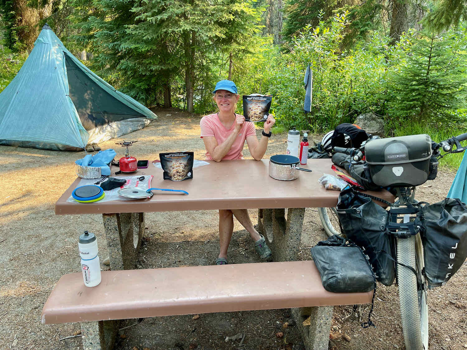
We filtered about six liters of water at the first creek past Horse Heaven Saddle, then stopped at the first reasonably flat campsite we could find. It had a bit of a slope to it, but a small creek nearby provided a bit of water for washing the dust and sweat of the day away. We slept soundly that night.
Long Push Into Darby
We awoke to another smoky morning. If anything, the smoke in the air was getting thicker by the day.
Haze from the Dixie Fire’s smoke dimmed the morning sun. Magruder Corridor, Nez Perce National Forest, Idaho, USA. Copyright © 2019-2021 Pedals and Puffins.
Our short ride the day before left us facing a very long ride into Darby, Montana, where we had a hotel reservation for the night. At 72 miles (116 km) it would be our longest ride of the trip so far. Fortunately, the route profile wasn’t too onerous. If we could just make it five more difficult miles, over the top of the third, steep ridge, the remaining miles would either be downhill, or on a long, gently-graded climb over Nez Perce Pass. We hopped on our bikes to attack the last, tough climb over Salmon Mountain.
Finishing that climb was a strenuous way to start the day. But when we finally made it to the top of Salmon Mountain, it was an amazing feeling.
A head net helped to keep the mosquitos at bay as we powered up another steep climb on the Magruder Corridor. Nez Perce National Forest, Idaho, USA. Copyright © 2019-2021 Pedals and Puffins.

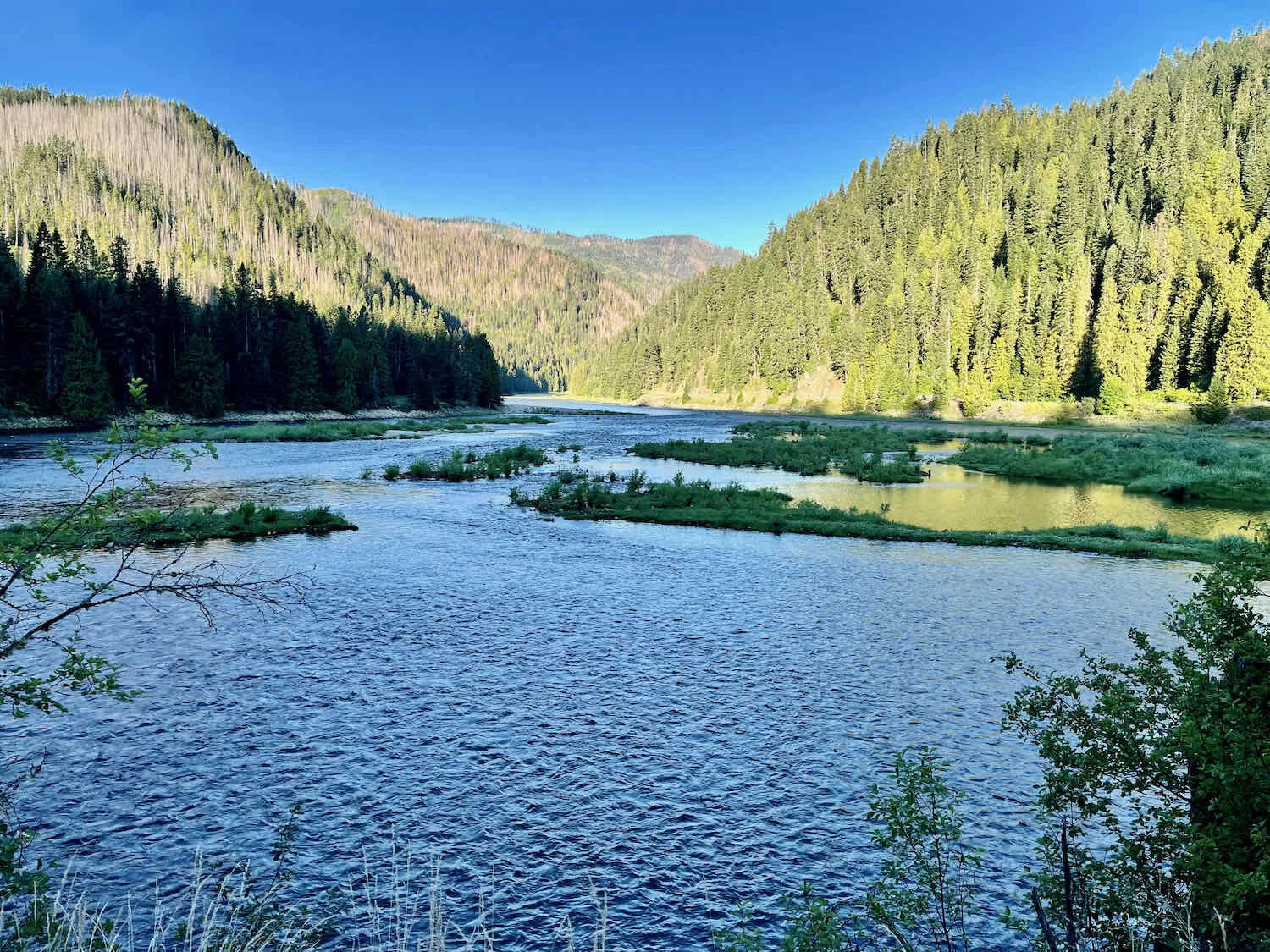
When we finally reached the Magruder Crossing Campground, we found ourselves riding along the Selway River once again. After following this river for about 7 miles out of Lowell, Idaho, we had cycled in a big loop heading south, while the river wound away from us to the east. Now, 120 miles later, we reunited with the much smaller river flowing through a deep, rocky canyon.
Our old friend, the Selway River - nearing its headwaters in the Bitterroot Mountains. Nez Perce National Forest, Idaho, USA. Copyright © 2019-2021 Pedals and Puffins.
Rocky cliffs border the Selway River along the Magruder Corridor Road. Nez Perce National Forest, Idaho, USA. Copyright © 2019-2021 Pedals and Puffins.
The final climb over Nez Perce Pass was long, at 19 miles, but had much more gentle slopes. We found our rhythm, working our way up the side of the mountain to the steady beat of our pedal strokes.
Mid-morning we stopped for a break on a bridge. We had just settled in when, whoosh! A gust of wind sent our little bag of beef jerky sailing over the edge and into the creek below. We watched in a moment of shock and uncertainty as the bag started to float downstream. But we were not about to lose our precious food.
We sprung into action and raced down to the water’s edge. Fortunately, the bag floated easily. It snagged on a willow branch, which kept it from floating too far. With a bit of teamwork, PedalingGuy was able to dislodge the bag by throwing stones at it, while PedalingGal waited for it just downstream. She was able to grab the bag as it floated by. That was a close call.
As we clambered back onto the bridge, a 4WD van that we had seen several times over the past few days pulled up along side the bridge, and the driver hopped out. “Can I offer you a beer?” he asked. And so we met Steve, a former US Forest Service firefighter who was out enjoying the wilderness with his pet dog. We had a blast getting to know Steve as we sipped the deliciously cold beers on the shady bridge.
Refreshed and rested, we made the final push to the top of Nez Perce Pass. It took us a while, but we finally reached the summit around 5pm. We still had 35 miles to go before reaching Darby, Montana, but it would be almost all downhill, with most of it paved. It looked like we’d get to our hotel room that night, after all.
Delighted to reach the top of the pass, and cross back into Montana. Nez Perce Pass, Montana/Idaho border, USA. Copyright © 2019-2021 Pedals and Puffins.
We barreled down the mountain as fast as we could, and finally reached our destination in the fading, evening light. The shower was a welcome treat, as we washed away the dust from the past three days.
The next day in Darby, we ran into several of the cyclists that we’d first met in Elk City. We ended a wonderfully relaxing day in town by sharing a pizza dinner with a charming cycling couple from Seattle. They were great company, and before we knew it three hours flew by. They would be heading south on the WWR the next morning, while we planned to take another rest day. We hope they have a fabulous trip.


And so ends our ride of the most difficult segment of the Western Wildlands Bikepacking Route. It pushed us to our limits, but we made it through. We will never forget the haunting beauty of the endless stands of charred tree snags, the abundant wildflowers, and the rugged, rocky mountainsides.