Cycling Whitefish to Superior, MT: Flatlanders Getting Used to the Mountains

18-28 June 2021
18-20 June, Whitefish Extension of the Western Wildlands Bikepacking Route (73.3 mi, 118 km)
20-28 June, Segment 1 of the Western Wildlands Bikepacking Route (305 mi, 491 km)
Check out our interactive route map to see where we stayed each night
Getting to the Starting Line
For some reason, the official “start” of many cycling routes is not in a city where a cyclist might logically get off an airplane or drop off a rental car. Where would be the fun in that? Instead, the routes typically start in remote, small towns that require an extra level of logistics to get there. This rule applies to the Western Wildlands Bikepacking Route (WWR). The closest city to the start of the WWR is Whitefish, Montana, which is still more than 70 miles away. If you don’t have a friend or relative to ferry you to the start, your choices are to pay for an expensive shuttle, or to cycle up to the Canadian border.
The folks at Bikepackingroots.org have helpfully provided a GPS track called the Whitefish Extension to guide people like us who decide to ride their bikes to the start. What we didn’t realize was that just getting to the starting line would include some very steep and rough riding. For flatlanders like us (we haven’t had the chance to tackle many hills over the last year while in covid lockdown), this was a bit of a wake-up call for the conditioning we would need to conquer the WWR. (Click on any photo to view in full screen.)
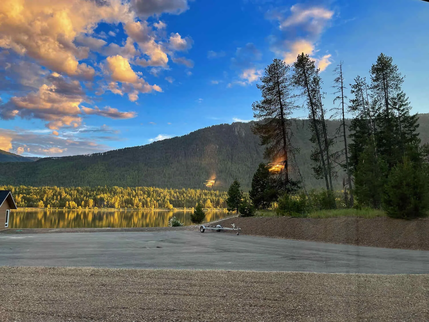
Having left our rented minivan at the Glacier International Airport, we headed out from Baker Park with high expectations for cycling adventures. Whitefish, Montana, USA. Copyright © 2019-2021 Pedals and Puffins.
Once we left the bustle and traffic of the city behind, the first 26 miles (42 km) were serene and relatively easy. We crested a 1,000 foot ridge on a well-maintained gravel road along Whitefish Lake, then followed the lovely Swift Creek through quiet conifer forests. We saw numerous signs warning travelers about bears in the area, but we didn’t see any bears other than the ones on the signs.
Lively mountain streams followed our path as we headed north to the border with Canada. Flathead County, Montana, USA. Copyright © 2019-2021 Pedals and Puffins.
Based on signage, you’d think that there were bears behind every tree in the forest. But the only bears we saw were on the signs. Flathead County, Montana, USA. Copyright © 2019-2021 Pedals and Puffins.
But things got more complicated after we passed the town of Olney. The final six miles to our camp for the night turned into an arduous slog. The road deteriorated into a loose, rocky and rutted obstacle course. A seemingly endless series of short, very steep undulations in the road contained deep puddles of muck from recent rains. And with tired leg muscles at the end of the day, each climb out of the dips felt like cycling up a vertical wall of rocks. Yet when we reached the top of the final ridge around Upper Stillwater Lake, the expansive views lifted our spirits.
Puddles along the route were wide enough to cover the trail, and often more than a foot deep. Flathead County, Montana, USA. Copyright © 2019-2021 Pedals and Puffins.
Beautiful views of Upper Stillwater Lake lifted our spirits during the final approach to our campground. Radnor, Montana, USA. Cycling along Upper Stillwater Lake. Copyright © 2019-2021 Pedals and Puffins.
Arriving at the U.S. Forest Service (USFS) Upper Stillwater Lake Campground, we were initially dismayed to find that all of the campsites appeared to be occupied. Although we were prepared to wild camp if needed, we were tired from the day’s ride and didn’t really feel like striking off in search of another place to camp.
If you are not familiar with USFS campgrounds in the Western United States, they tend to be very modest and primitive, often in remote areas, and unlike what people normally think of as campgrounds in most parts of the world. It is common for them to have only 5-10 places to camp, with pit toilets, no showers, no potable water, no staff on site and very little annual maintenance. Some are very popular and others see few people.
Since it was a holiday weekend, we were’t actually surprised to find all the sites full. So PedalingGuy approached one of the campers, and asked him if he had any ideas for where to go. He told us that there might be some walk-in campsites down by Stillwater Creek, which fed into the lake. But he warned us that it could be buggy there.
The guy’s advice to look down by the creek was spot on. It didn’t take us long to find a beautiful campsite right next to the rushing water. Even better, there was a “bear pole” nearby where we could hang our food out of reach of any hungry bears. We looked forward to a restful night’s sleep.
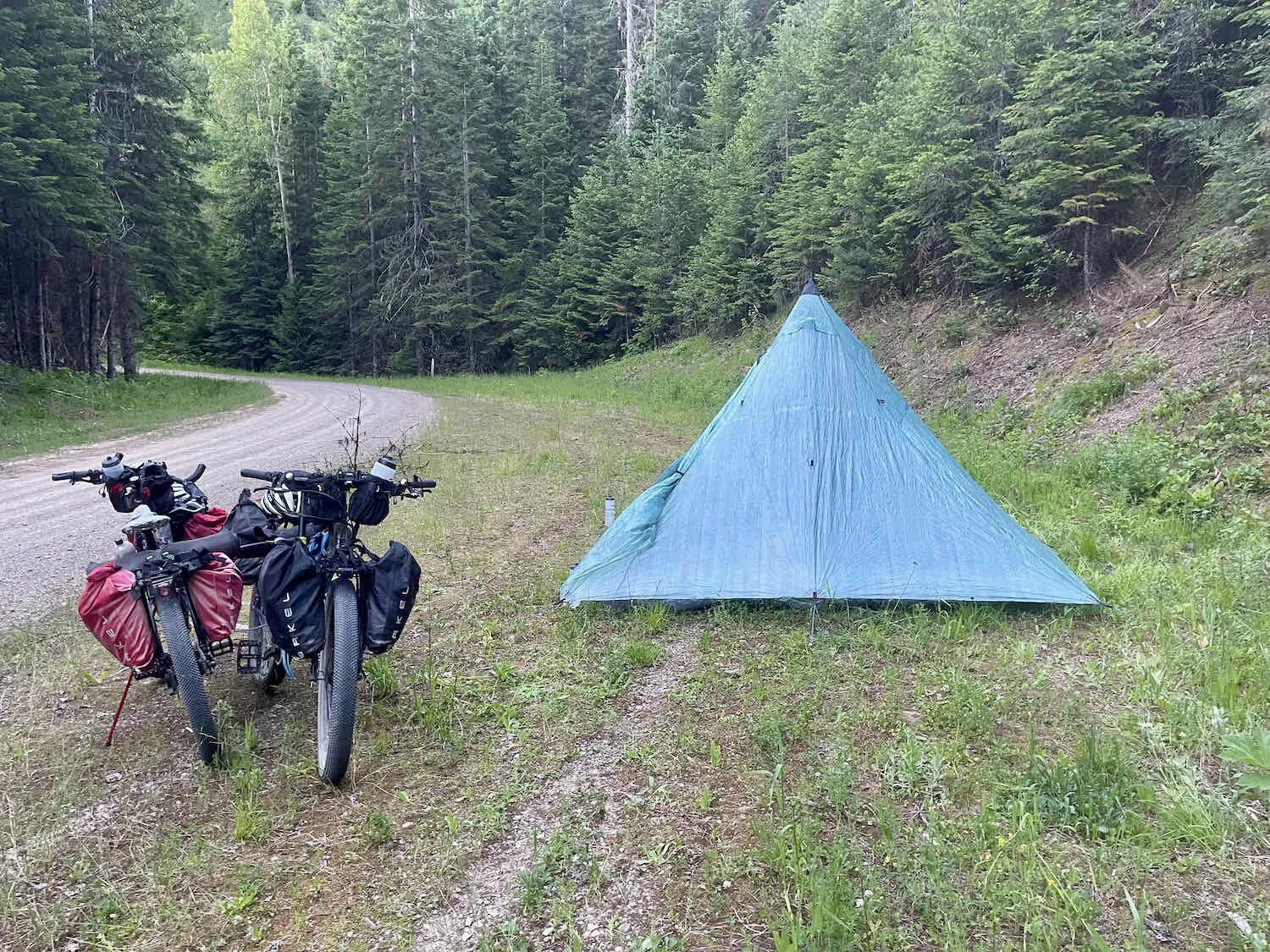
The Taj, overlooking the rushing Stillwater Creek. Copyright © 2019-2021 Pedals and Puffins.
Unfortunately, it was also VERY buggy. The mosquitos were quite hungry when we arrived. So after setting up our tent, we headed back to the lake to see if we could find a more bug-free spot to have dinner. We ate on a bench overlooking Upper Stillwater Lake, with a pleasant breeze keeping the mosquitos away. There was a lot of wildlife activity to entertain us. A pair of Trumpeter Swans glided silently out on the lake. Numerous ducks flew by, two Bald Eagles flew over while belting out their wild calls, and a beaver swam by twice, fetching branches for its construction work. It was a fantastic way to end the day.
The perfect, mosquito-free place to enjoy our dinner. Upper Stillwater Lake, Montana, USA. Copyright © 2019-2021 Pedals and Puffins.
The next day’s cycling continued to challenge our not-yet-mountain-ready legs. Loose rocks ranging in size from golf balls to softballs covered the trail, making the downhills as treacherous as the uphills. Although we had yet to begin our planned route on the WWR, we started to seriously wonder how similar the route would be to the trails we were encountering just to reach the start.
This is Dixie Ridge, on the WWR Whitefish Extension. PedalingGal’s legs weren’t quite ready for the steep, loose-surfaced trail. This picture was from one of the easy sections. We didn’t take pictures on the more difficult sections since we were too busy staying upright. Copyright © 2019-2021 Pedals and Puffins.
When we reached the town of Stryker, we decided that we would give ourselves a break and take the paved Hwy 93 for a bit. We could get back on the recommended route after about a mile, when it crossed the highway again.
We discovered that Hwy 93 had a wide shoulder that was in good condition, and very light traffic. When we reached the next crossroads with the off-road route, it took about 10 seconds to decide that we would take Hwy 93 all the way to the town of Eureka, where we hoped to spend the night. It would be fast, not-too-taxing, and give us a chance to start the WWR refreshed - rather than worn out. With that, we sailed the last 22 miles into town, and booked a room at the Silverado Motel. It turned out to be a very nice hotel room, and we enjoyed a delicious salmon dinner in the hotel restaurant. Now we’re rested and ready to start the WWR.
Salmon for dinner put the spring back in our tired legs. Eureka, Montana, USA. Copyright © 2019-2021 Pedals and Puffins.
And…They’re Off!
A quick, six mile ride north on Hwy 93 brought us to the Canadian border in Roosville, Montana which was the official end of the Whitefish extension we had been on for a couple days and the start of the Western Wildlands Bikepacking Route. It had taken us a couple weeks of driving and then a few days of cycling to reach the border and the true start of our journey.
Because the border is still closed to all but essential traffic due to COVID-19, it was eerily quite. Not a single car crossed the border while we were there, taking photos of the signs and savoring the moment when we would finally start our Western Wildlands adventure.
Canada’s closed today. So we’ll turn around and head south towards Mexico on the Western Wildlands Route. Roosville, Montana, USA. Copyright © 2019-2021 Pedals and Puffins.
As we finally started our ride south on the WWR, we rode along beautiful backroads in the Tobacco Valley. This area got its name when early European explorers met native people here cultivating a local variety of tobacco. This was possible because the valley has a much milder climate than the surrounding region. We enjoyed a pleasant morning as the sun danced across the mountains that encircle the broad, green valley.
The broad and scenic Tobacco Valley has mountains on all sides. But the valley itself has a mild climate. Roosville, Montana, USA. Copyright © 2019-2021 Pedals and Puffins.
White-tailed deer were common in this area. Copyright © 2019-2021 Pedals and Puffins.
The route was much easier to ride than the Whitefish Extension had been, but it still threw us a few challenges. One was the ascent of Kiowa Hill, a heart-pumping, steep climb. But it was a breeze compared to what we’d experienced over the past few days.
Made it to the top of the steep, Kiowa Hill - no walking required! Copyright © 2019-2021 Pedals and Puffins.
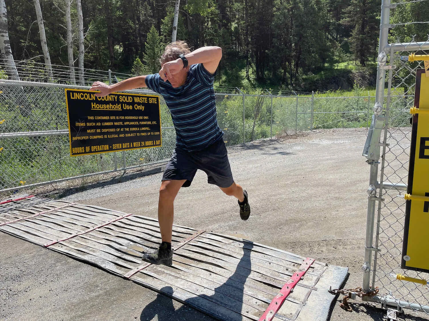
Around mile 22, we came across a municipal garbage station comprised of a group of dumpsters surrounded by an electrified, barbed-wire-topped fence, with an electrified mat covering the entrance - all in the name of keeping out the bears. We decided it would be a good time to have lunch, so we could throw out our trash on the spot. We had some salmon packets that we’d brought from home, but were having second thoughts about eating the salmon out in the woods. It might be too much of a bear attractant. So we settled down on some nearby rocks for salmon on bagels, then tossed our trash at the site. PedalingGuy took on the challenge of jumping the electric mat to get our garbage inside the fence, and into a dumpster.

The Koocanusa Bridge - tallest and longest in Montana - took us across beautiful Lake Koocanusa, and farther away from civilization. Although the bridge claims to be the tallest in Montana, it doesn’t look that tall, because the water that fills Lake Koocanusa reservoir rises very high on the legs of the bridge, hiding most of the bridge’s height underwater.
Leaving civilization behind, we cycled across Koocanusa Bridge, the longest (and reportedly highest) bridge in the state. Lake Koocanusa, Montana, USA. Copyright © 2019-2021 Pedals and Puffins.
We ate dinner atop a rocky outcrop with a stupendous view of Lake Koocanusa. Life’s pretty good. Lake Koocanusa, Montana, USA. Copyright © 2019-2021 Pedals and Puffins.
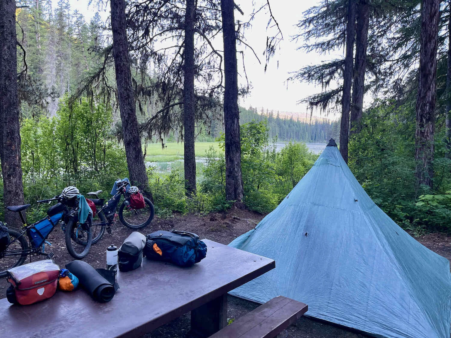
After a dinner atop a rock outcrop with stunning views of the lake, we biked for a couple hours as the route turned up into the Purcell Mountains. As late afternoon turned into evening, we pitched our tent in the woods near a fire ring where someone had camped previously. Much of the land in the Western United States is owned by the Federal Government and camping is allowed pretty much anywhere, as long as you minimize your impact. We hung our food in a tree out of reach of bears and enjoyed a wonderfully quiet night.
First wild camp of the WWR. Purcell Mountains, Montana, USA. Copyright © 2019-2021 Pedals and Puffins.
The next morning we tackled our first big climb of the ride: 1,700 ft up to the Pipe Divide. Fortunately, the gradient was manageable for most of the ascent. And the scenery was gorgeous. The route bordered a series of streams, so we were pedaling along with the sound of rushing water for most of the day.
The deep, moist forests on the way up to the Pipe Divide. Purcell Mountains, Montana, USA. Copyright © 2019-2021 Pedals and Puffins.
Additional excitement was provided by a long series of very big puddles in the road. These are Western style puddles where the water is so muddy you have no idea how deep they are until you are in them. And they often block the road without a way around. We were able to squeeze around the edge of some of them, but had to ride through others. You have to ask yourself if you are feeling lucky before plunging in, with the hopes of making it to the other side before you stall out and have to put your foot down to prevent tipping over. One puddle ended up being really deep - well over our hubs. We both stalled out and got wet feet - but fortunately didn’t end up tipping over in the mucky water. Submerging the hubs is not particularly good for our Rohloff Speedhubs. We’ve got our fingers crossed that no water got inside them.
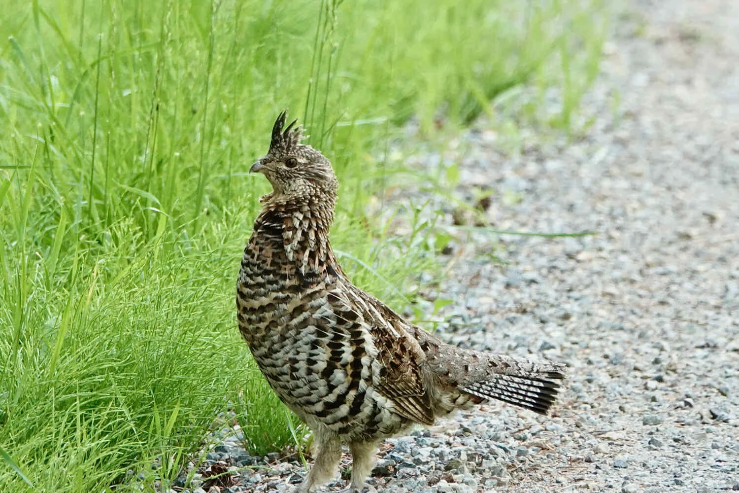
White-tailed deer were common along the route, stopping to stare at us briefly before bounding away, waving their fluffy white tails in the air. And it seemed like almost every time we stopped for a drink, we’d spot a grouse along the trail. The first was a male Ruffed Grouse in full battle mode. He charged at PedalingGuy, squawking and fluffing up his bulging neck ruff to look as big as possible. Sadly, we weren’t quick enough to get a photo. A Spruce Grouse that we spotted later in a tree was much more cooperative.
Spruce Grouse, quietly hoping we don’t see her. Purcell Mountains, Montana, USA. Copyright © 2019-2021 Pedals and Puffins.
The last few miles of the day, up to the Loon Lake Campground, were the toughest. The road was very steep for several miles, and we labored uphill with the hot sun beating down. It’s always harder to make it up these climbs when they come at the end of the day.
When we arrived at the US Forest Service Loon Lake Campground, it was completely empty - the opposite of the Upper Stillwater Lake campground which we found completely full a few days ago. As we leisurely set up our tent, several cars came through the campground to briefly use the boat launch or to look around. But none of them stayed the night. In the quiet evening, we spotted several more deer around the lake.
Idyllic evening at Loon Lake Campground. Purcell Mountains, Montana, USA. Copyright © 2019-2021 Pedals and Puffins.
In addition to the deer there were a whole lot of mosquitos, but unfortunately, no loons.
We had decided not to carry lots of water up the mountains. So now we got to use our water filter for the first time. We ended up filtering 6 liters of water from the lake, in order to have enough for the next day’s ride. Just to be safe, since the water was from the lake and not a flowing stream, we decided to treat the water with water purification tablets after filtering.
The edge of the lake was populated by lots of Colombian Spotted Frogs, that were surprisingly unafraid of people. They only decided to hop away if you got within about eight inches of them. We surmised that they didn’t have many land-based predators to worry about, or they would have been a lot more skittish.

Our night’s big event happened soon after we went to bed. Suddenly we heard a big animal start splashing around in the lake. Of course, with all the talk of bears, we pictured in our minds a big grizzly chasing fish in the lake. But when we went to have a peek, it turned out to be just another white-tailed deer that decided to go for a swim. That’s probably for the best.
Our Odyssey to Troy
The descent out of the Purcell Mountains and into the town of Troy continued to offer up stunning views.
High above Seventeen Mile Creek. Purcell Mountains, Montana, USA. Copyright © 2019-2021 Pedals and Puffins.
Along the way, we stopped to enjoy a treat left out for WWR riders by a Trail Angel. This generous soul keeps snack bars, cookies and water in a cooler by the road, free for hungry cyclists. Shortly after that we briefly followed the Yaak River Valley, now widely recognized because somewhere upriver is the homestead of one of the Discovery Channel’s “mountain men.”
Sign announcing a snack stop maintained by a WWR Trail Angel. The treats don’t just fill the belly, they lift spirits, too. Thank you! Copyright © 2019-2021 Pedals and Puffins.
A pair of loons with a chick greeted us as we passed Kilbrennen Lake. One of the adults tried to give a fish to the little one, but it didn’t seem hungry. When one of the loons let out a plaintive wail, it echoed off of the surrounding mountains. The eerie cry sent a chill down our spines. Loons truly capture the essence of wild northern country.
Adult loon tries to feed a fish to it’s youngster, who is apparently not hungry at the moment. Copyright © 2019-2021 Pedals and Puffins.
Later, we spotted another Ruffed Grouse. This female strolled stealthily across the road, seeming hoping that no one would notice.

We arrived in Troy via the Roosevelt Memorial Bridge - a graceful, one-lane, metal truss bridge with wooden tire lanes that hasn’t changed much since it was built in 1912. It’s a busy span. We had one car trailing us while another waited at the other end for its turn to go across.
No time to stop for a look at the Kootenai River while crossing the Roosevelt Memorial Bridge. This 1-lane span is quite busy with traffic. Please admire the skill of the photograher who managed to take this shot behind his back while cycling one handed on this rough bridge, as his wife excitedly yells to hurry up because there is a car coming and a car waiting on the other end. Troy, Montana, USA. Copyright © 2019-2021 Pedals and Puffins.
We took a rest day in Troy to refresh our tired legs. The Troy Museum was worth a visit. It has well-curated displays with lots of local artifacts. We were entertained to see that they had an episode of the Discovery Channel’s “Mountain Men” playing on a video screen. The host said it was a way for people who were familiar with the TV show to make a connection with the region. He also talked with us about how the town had been threatened by big forest fires in the past, which has led to an ongoing program of thinning the forests around town. We had seen evidence of the cutting along our route. It seems like a smart move, given how difficult to control the fires can become when there’s a lot of dried wood to fuel the infernos.
The local Troy Museum is well worth a visit. Troy, Montana, USA. Copyright © 2019-2021 Pedals and Puffins.
This being Montana, we weren’t surprised to see trophy animal heads on display in the supermarket. Copyright © 2019-2021 Pedals and Puffins.
Snakes and Porcupines - Passes That Is
For the first 20+ miles out of Troy we rode mostly through private lands. A lot of the time these lands are posted for no trespassing. But one landowner along the way clearly took his/her privacy very seriously.
Don’t even think about turning up this road. You have been warned. Lincoln County, Montana, USA. Copyright © 2019-2021 Pedals and Puffins.
Around 9 miles into the ride, along Spar Lake Road we hit a snag. Keeler Creek cuts across the road, with no bridge. It’s probably easy enough to ford the creek later in the year when the water is lower. But when we arrived, the water was high enough to be up to our knees. Rather than unpack our bikes, get our shoes wet, and carry everything across, we decided to detour to the east on Lower Lake Creek Road, which had a bridge. The detour worked well, and we were soon back on the route.
Instead of giving you exciting photos of us fording Keeler Creek with our bikes on our backs, we decided to detour around this fast-moving stream. So, all you get is a photo of Keeler Creek where it crosses the Western Wildlands Route. Sorry. Lincoln County, Montana, USA. Copyright © 2019-2021 Pedals and Puffins.
After cruising along for 23 miles, we stopped to check out the Dorr Skeels Campground (USFS) on Bull Lake. We thought it might be nice to put in a few easy days, and briefly considered stopping here before tackling Snake Creek Pass across the Cabinet Mountains. But it was not yet noon, so we decided to press on. The generous campground host let us top off our bottles with about 8L, from a cooler he had filled with ice-cold well water. He said it was better quality than what we’d get from the campground water pump. We really appreciated the offer.
The scenery as we pedaled up Snake Creek Pass was gorgeous.
The Cabinet Mountains framed our ride up Snake Creek Pass. Cabinet Mountains, Montana, USA. Copyright © 2019-2021 Pedals and Puffins.
The only downside of the climb was the dusty trail. We were passed by several 4-wheel drive trucks and ATVs (all-terrain vehicles). Even when they slowed down to pass, they left us unpleasantly dusted with fine, light-brown grit.
View of the ride up Snake Creek Pass, from PedalingGuy’s saddle. Cabinet Mountains, Montana, USA. Copyright © 2019-2021 Pedals and Puffins.
Coming down off of Snake Creek Pass we had an encounter with the first bikepacker we had seen along the Western Wildlands Route. He had cycled northward on the WWR from what sounded like a few hundred miles south. When he hits the Canadian border, he plans to turn around and head back to Salida, Colorado (his hometown) via the Great Divide Mountain Bike Route. We compared bikes. He had a pretty lightweight looking setup compared to us.
At the bottom of the descent off of the pass, we accidentally turned too soon. We ended up on a road that took us to the historic Bull River Ranger Station, a small cabin that served as the regional ranger station from 1908-1920, surviving the great fires of 1910. We got a kick out of reading the history of the cabin, which made our little detour worth the effort. Then we headed back to the main route.
The historic Bull River Ranger Station, a piece of National Forest history. The modest cabin can be rented for a fee. Cabinet Mountains, Montana, USA. Copyright © 2019-2021 Pedals and Puffins.
When we finally reached civilization we hit a series of unfortunate snags. First, we arrived about 0.5 hr after the small, local grocery had closed - crushing our hopes of getting a cold drink to take the edge off of the very hot afternoon sun. Some folks in a pickup truck at the store suggested that we could head 5 miles up the road to the town of Noxon for camping at the local park, and access to a restaurant. But we were tired, and preferred to camp at one of the sites closer to our current location.
We headed over to the Twin Rivers RV Campground only to discover that it was closed, and would not be opening at all this summer. So we would have to check out our next option - the USFS Bull River Campground 0.5 miles up the road. When we arrived there, we weren’t that impressed. It was really close to Hwy 200, which was very busy with a lot of big, noisy trucks. It also didn’t have a shower or any food close by. The suggestion to camp at the Noxon City Park was looking better all the time.
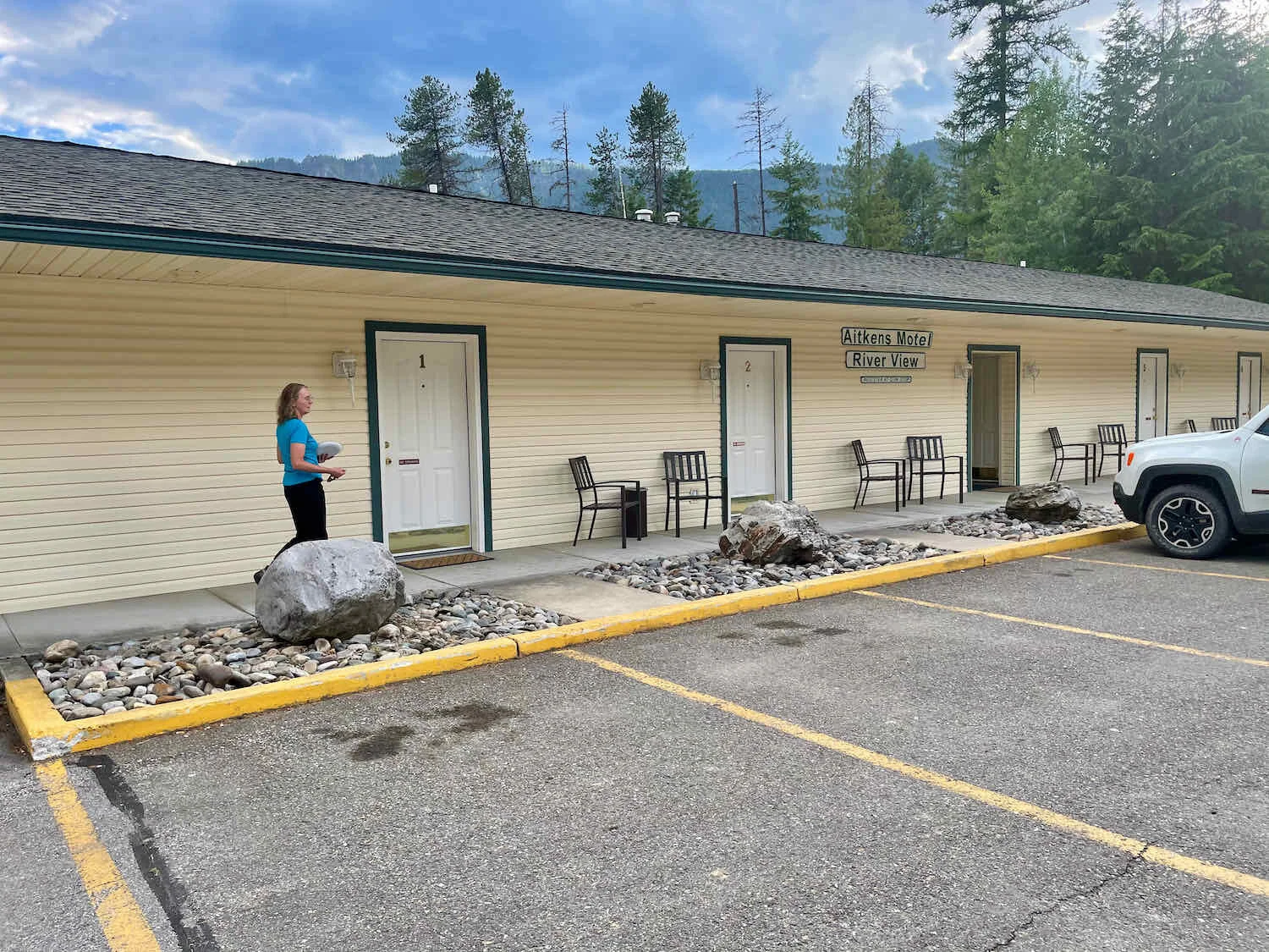
So we headed up the road another three miles, and finally arrived at an open convenience store. Yay!!! A couple of cold chocolate milks and bottles of pop would do us a lot of good. At 58 miles, we had just completed our longest day on the WWR so far.
But wait… it suddenly got even better. Unknown to us, the Quik Stop convenience store actually ran the tiny, 6-room, Aitkens Motel (in addition to a car wash, and a gas station, quite the entrepreneurs). We decided to check it out, and wow, were we pleasantly surprised. The rooms were new and very comfortable, with full soundproofing against the highway noise, and a picture-window view across Bull River to the mountains. What a gem. We booked a room and promptly soaked up the air conditioning as we slowly regained our energy. We spent a wonderfully relaxing night at the hotel, and would recommend it to any cyclist passing through.
The Aitkens Motel was so nice, we considered taking a rest day. But the news was full of dire predictions about an impending heat wave that would push afternoon temperatures over 100+ degrees, and we wanted to cover more miles before possibly having to hole up for a few days to avoid riding in dangerous heat.
Today we would tackle our biggest climb yet, with 4,700 ft of elevation gain, including Porcupine Pass. This pass would take us over the Bitterroot Mountains and into Idaho.
The first 20 miles involved pleasant riding, with only a few steep pitches and a well-groomed gravel road. When it became clear we would potentially have a dry camp that night, we stopped to filter some water from Marten Creek, which had paralleled the route most of the way up to the pass.
With a dry camp in our future, we filtered water from Marten Creek. Bitterroot Mountains, Montana, USA. Copyright © 2019-2021 Pedals and Puffins.
It was the last eight miles to the top of Porcupine Pass that gave us a run for our money. After the junction with North Branch Road (NF Rd 2213), the surface became very rough dirt with lots of loose gravel and frequent, very steep, dips/ascents that required red-zone pedaling in first gear. And of course, the afternoon sun was very hot. Topping it off, we were passed by a large number of ATVs, including a group of 10 traveling as a group. Even when they slowed down to pass us, they sent up plumes of gritty dust. It was especially annoying since we were laboring uphill.
The beautifully scenic ride up Porcupine Pass. If only the ATVs didn’t kick up dust as they rode by. Bitterroot Mountains, Montana, USA. Copyright © 2019-2021 Pedals and Puffins.
Around 5pm we finally made it to the top of Porcupine Pass, and entered Idaho. We stopped to celebrate the moment, including photos with the less-than-impressive (and hard to read) signage at the summit.
Ta-da! We made it to the top of our highest climb of the trip so far. The sign really does say Porcupine Pass. Another sign says 5093 feet and a third says state line. Bitterroot Mountains, Montana/Idaho border, USA. Copyright © 2019-2021 Pedals and Puffins.
Then we careened down the still-very-rough and rocky trail looking for a reasonably level place to camp. When we start out looking for a place to camp we are very choosy. As it gets later and later we become more accepting of campsite imperfections. In this case it had gotten quite late and we hadn’t seen any vehicles on our dirt road for hours, so we decided to just set up our tent on a roadside pullout.
Timing is Everything - You Need to Beat the Heat
We gained an hour when we rode into northern Idaho, where they use Pacific Time. As a result, the sun rose at 4:45am this morning. We weren’t quite ready to get up that early, even when an early-bird pickup drove past and dusted our campsite around 5:00am. But when a second vehicle with an ATV in tow showed up a bit later, we finally emerged from our tent into the chilly morning.
A 15-mile long, pleasant, low-gradient downhill on pavement got us off to a great start. The route followed the North Fork of the sparkling Coeur d’Alene River, where we spotted an American Dipper resting on the rocks.
American Dippers are one of our favorite birds. Who can resist this chubby bird’s antics as they bounce along streams, often walking under water searching for insects? Coeur d’Alene River, Idaho, USA. Copyright © 2019-2021 Pedals and Puffins.
By mid-morning we rolled into the parking lot of a convenience store at the crossroads just south of the hamlet of Prichard. We grabbed a couple of cold drinks, then hit on the idea of getting a couple of breakfast burritos. Great idea, right? Well, the burritos (which were delicious) were made from scratch, and were huge. That meant a few things: (1) it took quite a while to make them, (2) it took another while to eat them, and (3) we felt heavy and full after consuming them. Not the perfect scenario before tackling a particularly steep and arduous climb.
It was nearly 11am by the time we set off for the ascent over Dobson Pass, timing we were about to regret. At first the gradients weren’t too bad.
Picturesque old barn on the way up Dobson Pass. South of Prichard, Idaho, USA. Copyright © 2019-2021 Pedals and Puffins.
But before long we were heading up a steady slope of appx 12%, with virtually no leveling off spots to catch our breath. Riding on smooth pavement helped, but as the afternoon heat set in, the pavement just made us hotter and hotter. The last six miles to the pass were brutal, as we stopped every 0.5-1.0 mile to rest by the side of the road in the shade, and take a drink.
In cycling, timing is everything. And we momentarily forgot to observe one of the most important rules: tackle big hills early in the day, when you’re fresh and the temperatures are cooler. We won’t be making that mistake again.
When we reached the summit of Dobson Pass, we were in for another surprise. Instead of heading downhill on the paved road - where the miles would fly by - the WWR route headed off to the right on a dirt road that went UP the side of the mountain. What?! This caught us off guard. We debated whether to just ride down the paved road or follow the trail in the blazing afternoon sun. But for some reason, all rational decision making failed us, and we decided to follow the WWR uphill. Perhaps our judgment was impaired by the heat.
We found ourselves riding on chewed-up logging roads, following the rim of a stupendously beautiful valley. On the descent, we had to contend with loose rocks and gravel on steep, slippery slopes, not to mention major ruts caused by gullies of spring runoff water that used the road as a temporary stream bed. But as taxing as it was, we both agreed we were glad that weren’t heading uphill. Take note if you’re traveling on the WWR northbound - this section will be really tough.
Spring runoff from the mountains flowed in gullies down the trail, and filled the low spots with water. Dobson Pass, Idaho, USA. Copyright © 2019-2021 Pedals and Puffins.
In the end, we eventually found ourselves back on pavement for a swift descent into Wallace, Idaho. It was blazingly hot, and we were ready to find shelter that included air conditioning. We stopped in at the lovely Wallace Depot Museum and a helpful docent gave us the lowdown on places to stay in Wallace.
We got some help figuring out where we might find shelter from a friendly docent at the Northern Pacific Railroad Depot Museum. Wallace, Idaho, USA. Copyright © 2019-2021 Pedals and Puffins.
In summary, there wasn’t not much to choose from in Wallace. The less expensive options in town were both fully booked. And the other two hotels were charging ridiculously high, weekend rates. It seems that the whole town of Wallace is formally designated as a historic city, which makes makes it very busy on weekends.
We sat miserably on a bench outside a hamburger place, wondering what we should do. In the end, we knew we had to get out of the heat, which by this time was over 100 degrees. We reluctantly decided to pay for one of the last available rooms in town, which was a vastly overpriced room at the Stardust Motel. The air conditioning was a blessing, and we had a hearty dinner at a restaurant in town. But we’re going to do our best going forward to keep from finding ourselves in the position of having to get a hotel room on the weekend, at the last minute, in a tourist town.
Route of the Hiawatha and the Olympian - Historic Rail Trails
By this point we had ridden over four major mountain passes, not to mention multiple, substantial ridges and hills. We were feeling less like flatlanders, and more like genuine mountain bikers. Even so, the next day’s climb over Moon Pass had intimidated PedalingGal in particular. It promised to be one of the toughest climbs. Success would come down to both strategy and a bit of luck.
First the strategy. We got out on the road nice and early, to tackle the climb in the coolest part of the day. Then the luck. As it turned out, the gravel road to the top of Moon Pass was well maintained, making riding up the steeper parts quite manageable.
Just outside of the town of Wallace, we stopped to read about the Pulaski Tunnel. During the great fire of 1910, which burned nearly 3 million acres of forest land in Montana and Idaho, a 45-man firefighting crew led by Edward Pulaski became trapped near here by the fire. They found shelter in a mining tunnel up on the hillside, where all but six of the crew survived. It’s a story of immense heroism and sacrifice.
Our early departure paid off. We crested Moon Pass around 10am, and had a celebratory breakfast at the top. The day was already heating up, but we were cooled by the breeze as we coasted down the back side of the mountain. A quick stop at Roughin Creek to filter some water was another welcome break. The cool, crisp, stream water tasted soooo good.
Pouring right from the water filter gets you the coldest, most refreshing drink. It’s sooo good. Bitterroot Mountains, Idaho, USA. Copyright © 2019-2021 Pedals and Puffins.
Along the route the relatively young forest of small trees was occasionally pierced by the remnants of massive trees that perished in the 1910 fire. Many of the old, twisted tree trunks are enormous, giving a sense of how majestic the ancient forests must have been before the fire burned them all to the ground.
The giant old trunk of a tree that perished in the great fire of 1910. It takes your breath away to think about how big those trees must have been. Bitterroot Mountains, Idaho, USA. Copyright © 2019-2021 Pedals and Puffins.
At the bottom of the descent from Moon Pass we crossed Loop Creek, and had to claw our way up a short section of viciously steep climbs to reach the start of the Route of the Hiawatha Trail. This is another famous rail trail, following the bed of a railroad that ran from Milwaukee to Seattle from 1909-1980. Hiawatha was the name of the railroad’s workhorse electric engines, that were strong enough to haul loads over the Bitterroot Mountains.
It’s quite a popular trail, with tour companies offering shuttle service to a hilltop where visitors can cycle downhill along the railroad bed for 15 miles. Of course, we arrived at the bottom of the hill, and would be cycling uphill against the traffic for the next 15 miles. It wasn’t a big deal, though. The railroad grades are exceedingly gentle, so the ascent wouldn’t be any trouble for us now. However, our unorthodox choice to ride uphill, loaded up with gear, did draw quite a few curious stares from the other cyclists out for the day on rented bikes.
Ready to tackle the next hill - riding east on the Route of the Hiawatha Trail. Bitterroot Mountains, Idaho, USA. Copyright © 2019-2021 Pedals and Puffins.
Before hitting the trail, we were delighted to find a concession stand at the trailhead, serving thirsty tourists who had just coasted downhill for 15 miles. We eagerly bought several cold drinks to quench our thirst, and prepare for the next leg of the ride. We had to keep a close eye on our bikes, because the local ground squirrels were very bold, approaching us and our bikes within inches looking for handouts. We didn’t want any little critters chewing holes in our panniers in search of some tail mix.
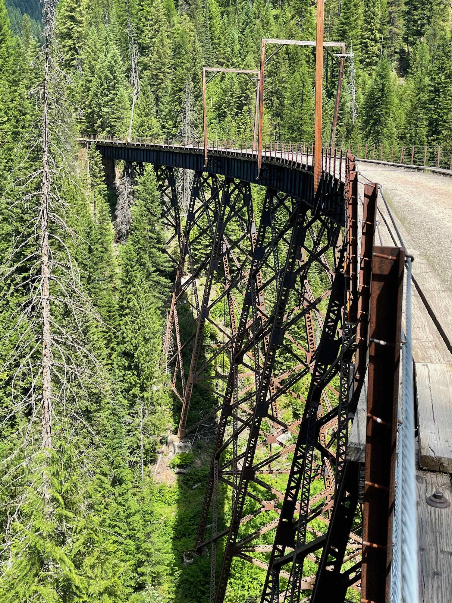
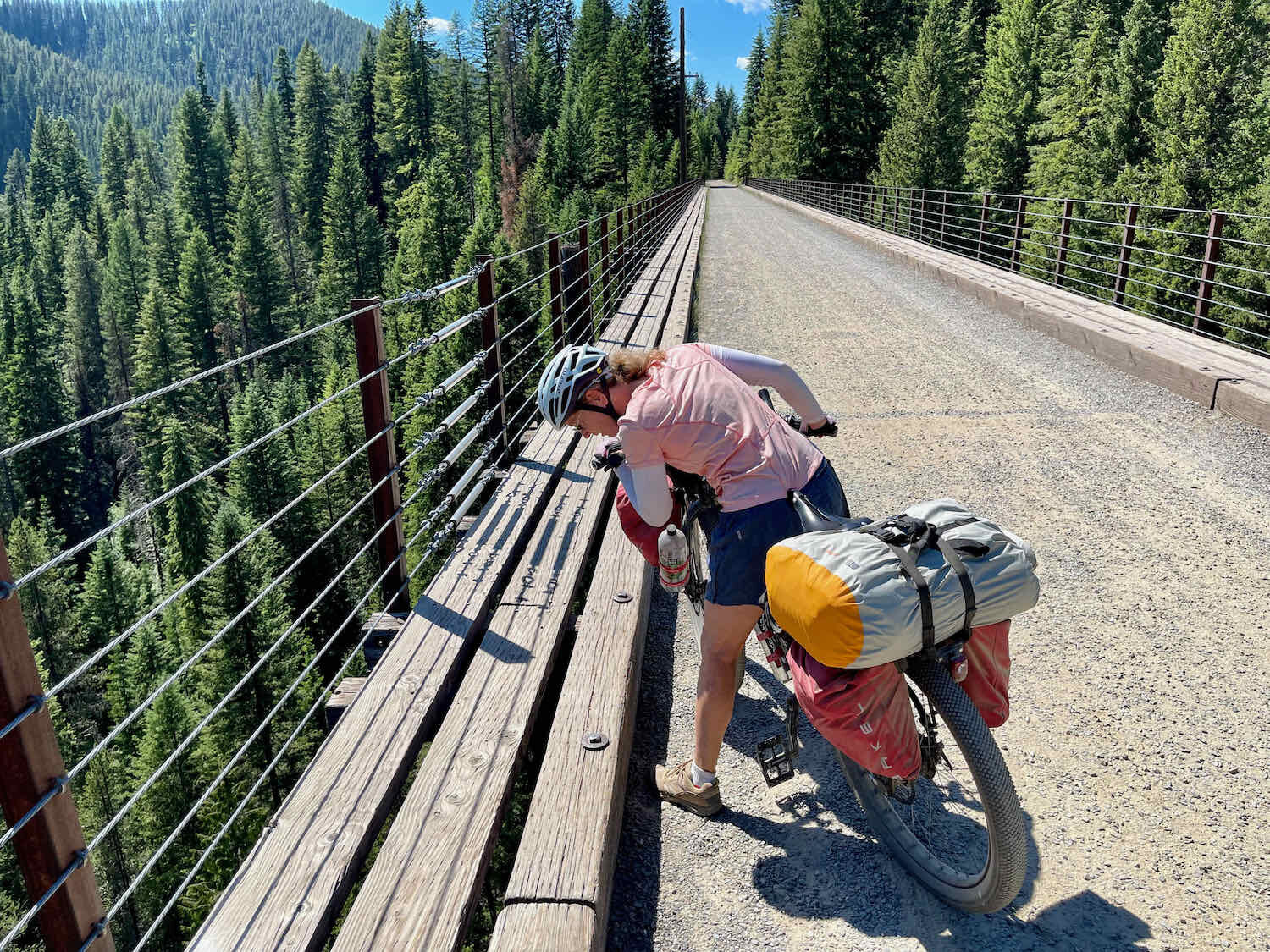
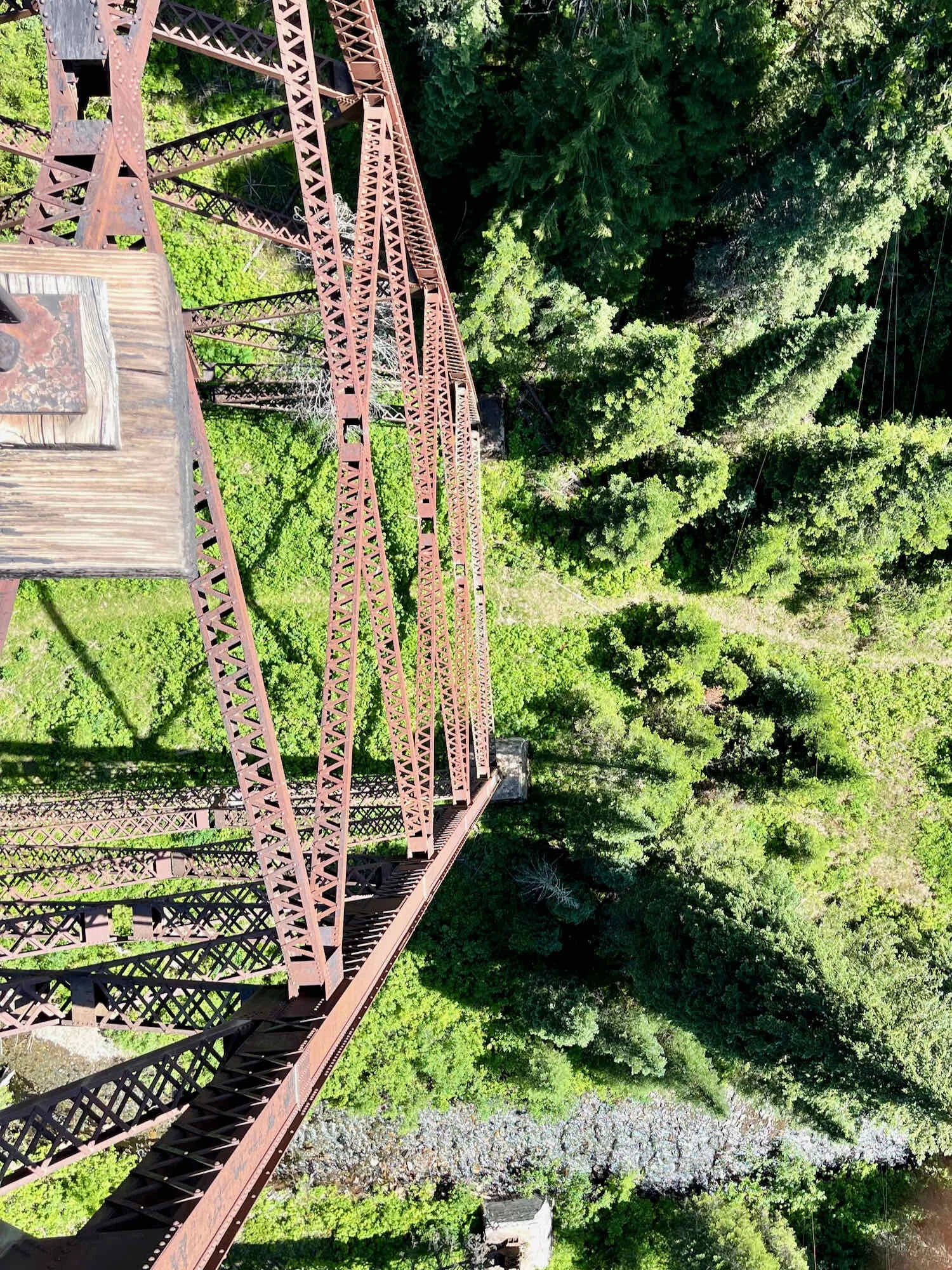
Given the rugged terrain that it crosses, the Hiawatha Trail is studded with multiple tunnels, and astonishingly high bridges that span deep, forested canyons - all in the service of ensuring that railroad trains didn’t have to contend with any difficult hills.
About halfway up the trail, we stopped for a snack. Of course, a couple of bold chipmunks were immediately circling our bench and our bikes. It’s pretty clear that these little guys are getting fed by people who pass through. They have almost no fear.
Least Chipmunk on the Hiawatha Trail. They show no fear in approaching humans, hoping for a handout, or to snap up any food that might accidentally get dropped on the ground. Copyright © 2019-2021 Pedals and Puffins.
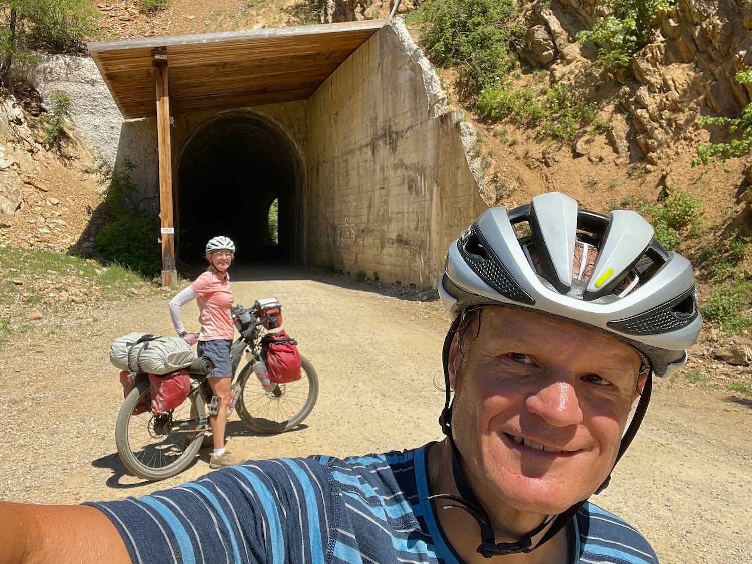
Just as we neared the top of the ridge, we entered the famous St. Paul Pass Tunnel. It’s astonishingly long for a bicycle tunnel, running for 1.7 miles (2.7 km) through the side of the mountains. It takes between 10-15 minutes to cycle all the way through. In spite of the blisteringly hot afternoon sun, inside the tunnel it was a bracingly cool 42 degrees. The temperature drops enough to give you whiplash. And by the time you exit back onto the surface of the earth, a bit of warm sun can feel welcome on chilly hands and feet.
Perhaps the tunnel never ends? You start to wonder what you’ve gotten yourself into when cycling through the 1.7 mile St. Paul Pass Tunnel. Hiawatha Trail, Bitterroot Mountains, Idaho/Montana border, USA. Copyright © 2019-2021 Pedals and Puffins.
We finally emerged back into the sunlight, having crossed the crest of the Bitterroot Mountains back into Montana. To celebrate, we treated ourselves to another cold drink from a concession stand at the top of the pass. Then it was downhill on another, forgotten section of the Hiawatha Trail. Surprisingly, we did not see a single person along this stretch, probably because it would involve cycling uphill if you were heading in the other direction, the way most visitors do.
As we got close to the bottom of the hill, we selected another, lovely, roadside spot for a peaceful night’s sleep in our tent, the Taj. In contrast to the previous roadside campsite, we were not passed by a single vehicle or person all evening, night and the next morning. In fact, we never saw anyone along this section of trail as we cycled down the mountain the next morning.
On the last leg of our journey to Superior, Montana, we cruised down the final four miles of the Hiawatha Trail into the tiny town of Saltese. It was early morning, and nothing was open. We did take a few moments to appreciate some of the humorous signs that decorated the facade of the general store.
As if worrying about grizzly bears wasn’t enough… We didn’t see many bigfoots along the WWR route. Saltese, Montana, USA. Copyright © 2019-2021 Pedals and Puffins.
We had anticipated a relatively flat ride through the Clark’s Fork River Valley after reaching Saltese. But the WWR folks had other plans for us. The eight miles from Saltese to Haugan follow a rough forest road over some achingly steep hills on the slopes of Meadow Mountain. We pulled into the truck stop at Haugan, and enjoyed a short break. Just the thing to get us ready for the final push.
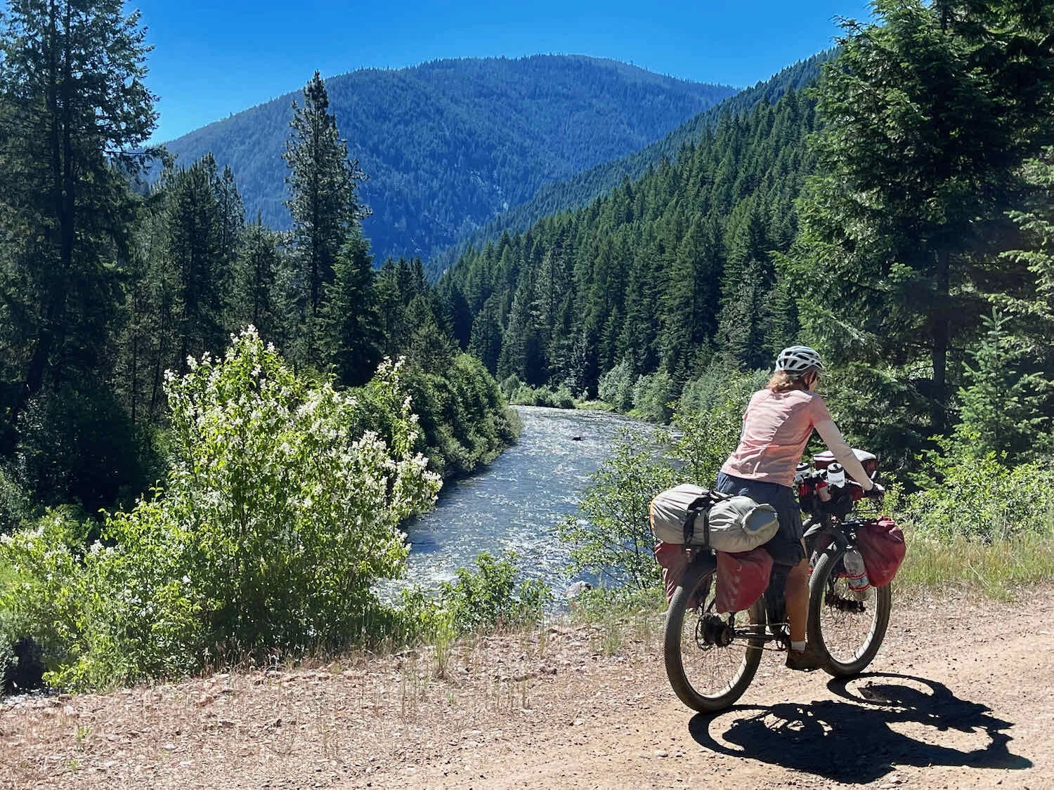
Most of the rest of the day was spent cruising slowly downhill on the equally rough, but not hilly, Route of the Olympian - another rail trail that runs parallel to the Clark’s Fork River. The I-90 interstate highway was never too far away, but we were treated to a forested journey beside the river. We were particularly happy that we didn’t encounter a single car or ATV on this part of the route.
In the last few miles to Superior, we were back on roads that we shared with cars, and ended up getting a light coating of road dust kicked up by the few that passed us. After nearly 50 miles of cycling, we rolled into Superior before the day got too hot.
The next few days are forecast to have record-hot, 100+ degree weather. So our plan is to hunker down in a hotel, to wait for a break in the heat. It’s been a wild and wonderful ride so far.