Golden, British Columbia to Libby, Montana: Cycling the Rocky Mountain Trench
18 - 30 September 2022
18 September - Golden to Radium Hot Springs, BC (65.4 mi, 105.3 km)
19 September - Layover in Radium Hot Springs, BC
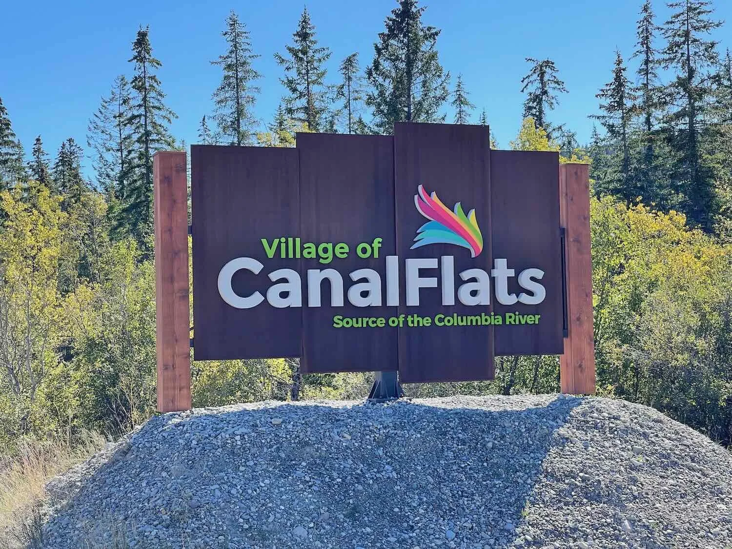
20 September - Radium Hot Springs to Canal Flats, BC (55.6 mi, 89.5 km)
21 September - Canal Flats to Norbury Provincial Park, BC (39.2 mi, 63.1 km)
22 September - Norbury Provincial Park to Kikomun Creek Provincial Park, BC (27.5 mi, 44.3 km)
23 September - Kikomun Creek Provincial Park, BC to Eureka, MT (29.0 mi, 46.7 km)
24 September - Eureka to Koocanusa Resort and Marina, MT (44.3 mi, 71.3 km)
25 September - Koocanusa Resort and Marina to Libby, MT (25.7 mi, 41.4 km)
26-30 September - Layover in Libby, MT
North America’s Great Rift Valley
During the era when dinosaurs had reached their greatest size and diversity, around 100 million years ago, the North American tectonic plate drifted westward. In the process, it forced the Pacific plate downward, driving it deep below the earth’s surface. The force of this collision was so intense that further inland, great slabs of rock were thrust upwards to form the Rocky Mountains.
Fifty-five million years later, after the extinction of the dinosaurs and the rise of mammals, an extraordinary reversal took place. The two tectonic plates began to pull away from each other. As the giant folds of rock were torn apart a massive fault line formed, and the land in between collapsed. The resulting rift valley - a nearly-straight, 1,000 mile long gash that separates the Rockies from the Columbia Mountains - is clearly visible from space. It is so big and conspicuous that it has long been used by aviators as a visual guide when heading north or south across the Canadian wilderness.
On the ground, it is also a “path of least resistance” between two of the the big mountain ranges of British Columbia. As a result, several of the region’s notable rivers flow along the valley floor. Heading southward from Golden, BC, we cycled along terraces overlooking one of the most famous of those waterways, the Columbia River.
Views Across the Valley
We needed to get an early start out of Golden, BC because the bike ride to Radium Hot Springs would cover 65+ miles (105+ km). Physically that was not a problem. But the September days were rapidly getting shorter, and we were starting to feel the pinch of more limited daylight. We try hard not to cycle after dark, mostly for safety reasons. So 65 miles was now about as far as we would have time to comfortably cycle, while the sun was still up in the sky.
What we hadn’t anticipated was the fog. Apparently it’s common for heavy mists to settle into this part of the Columbia River Valley, creating low-visibility conditions that can last for hours. And when we pedaled out of Golden, it was very foggy.
Fortunately, our route climbed steadily out of the lowlands and up onto the foothills that line the eastern edge of the valley. As we gained altitude, we broke through the clouds and into the sunshine. To our right, we could see the mountains on the far side of the trench poking through the fog that still blanketed the valley, with snow-dusted peaks catching the morning sun.
Peaks of the Dogtooth Range pierce the veil of fog that lies over the Rocky Mountain Trench. Columbia River Valley, British Columbia, Canada. Copyright © 2019-2022 Pedals and Puffins.
As the day wore on, the fog slowly dissipated, revealing beautiful vistas of the Columbia River below. The wide, flat valley floor was a mosaic of oxbow lakes, grassy marshes, open fields, and channels lined with poplars. On the far side, the Columbia Mountains provided a majestic backdrop against the cobalt-blue sky.
The headwaters of the Columbia River meander back and forth across scenic marshlands in the broad valley of the Rocky Mountain Trench. Columbia River Valley, British Columbia, Canada. Copyright © 2019-2022 Pedals and Puffins.
Although there were quite a few homesteads along the highway, much of the surrounding landscape remained in a relatively natural state. The names of many landmarks, roads and businesses included the word ‘bear’, hinting that we were still very much in bear country. And we were not disappointed. As we cycled past a field of tall hay, we were startled by the sudden sound of a large animal bounding out of a ditch beside the road. We stopped to see a black bear dashing across the field away from us. It seemed quite unnerved by the sight of two cyclists, and it didn’t stop running until it reached the relative safety of the trees on the far side of the field, about 100 yards (100 m) away. Then it stopped and turned to have a look back in our direction. Apparently satisfied that the immediate danger had passed, it then slowly ambled away into the forest.
Moments earlier, we startled this black bear as it fed beside the road. It took off running across an open field, covering nearly 100 yds (100m) in a matter of seconds. Once it felt safe near the trees on the far side of the field, it stopped and turned around to check us out. Columbia River Valley, British Columbia, Canada. Copyright © 2019-2022 Pedals and Puffins.
We also spotted our first wild turkeys of the trip - a small flock of four, very large birds. Later we learned that these turkeys were literally at the very northern end of the species’s range in British Columbia. In fact, the spot where we saw the turkeys (north of the town of Edgewater) was just a bit farther north than any others reported in an online database of sightings. We thought that was interesting. Wild turkeys were not originally native to British Columbia, but their numbers have increased as birds from Montana expanded their range northward to merge with a small population of turkeys that was introduced to the province in the 1960s.
These two wild turkeys looked like we caught them hatching a secret plot. Perhaps it was because we spotted them farther north in the Rocky Mountain Trench than any other reported sightings (iNaturalist). Their stealthy expansion northward has been exposed. Columbia River Valley, British Columbia, Canada. Copyright © 2019-2022 Pedals and Puffins.
The cycling from Golden to Radium Hot Springs was pleasant, with mostly gentle hills. And the weather was perfectly cool with scattered clouds. We couldn’t have asked for a more enjoyable ride, and the miles flew by.
As we rolled into town, one thing was abundantly clear: Radium Hot Springs loves its bighorn sheep. Even before you arrive in town, signs along the highway ask drivers to be cautious in case any of the sheep are in the road. Then, a sculpture of two giant, curling horns towers over the roundabout where the highway enters town. Lots of the local businesses display bighorn sheep motifs. And a bronze statue of the animals graces the lawn of the visitors center. All of this raises a visitor’s expectations of seeing a few, regal sheep strolling through town. But, alas, we saw none. They come down from the mountains later in the fall.
Radium Hot Springs has made bighorn sheep a major element of the town’s identity. Images of, and references to, bighorn sheep are everywhere - including this statue outside the town’s visitor center. Radium Hot Springs, British Columbia, Canada. Copyright © 2019-2022 Pedals and Puffins.
The Logistics of Dental Work on a Bike Tour
We spent an extra day in Radium Hot Springs finalizing appointments related to a dental procedure required by PedalingGuy (which we had been unable to complete over the previous weekend). This was not a simple matter. It was touch-and-go at first. But after calling a couple of different root canal specialists, PedalingGuy was able to secure an appointment in Kalispell, Montana, that coordinated well with another appointment to see a tooth crown specialist in Libby, Montana. We also reserved a rental car to make the trip from Libby to Kalispell and back in a single day. It looked like things were finally falling into place, and PedalingGuy’s tooth problems might soon be over.
We celebrated our success in organizing a multi-city dentistry tour with bowls of ice cream doused in Saskatoon berry syrup. Radium Hot Springs, British Columbia, Canada. Copyright © 2019-2022 Pedals and Puffins.
Cycling Past the Source of the Columbia River
On our departure from Radium Hot Springs, the morning fog was expected. This time we weren’t too concerned, because we knew that our route would climb several hundred feet out of the valley, and onto the terraces that line the Rocky Mountain Trench. From there, we enjoyed more panoramic views across the Columbia Valley wetlands. Picturesque white cliffs rose steeply from the valley floor.
White cliffs add scenic beauty to the Columbia River Valley near Radium Hot Springs, British Columbia, Canada. Copyright © 2019-2022 Pedals and Puffins.
After a quick snack break in the upscale and pleasant town of Invermere, we rode up onto the western slopes of the Rocky Mountain Trench. Just outside of town, we found ourselves cycling on the Westside Legacy Trail, a brand new, multi-use path that parallels a road linking Invermere with Fairmont Hot Springs, BC. The surface of the trail was very smooth, new pavement, making cycling a pleasure. But the terrain that it covered was much hillier than the road - and some of the hills were very, very steep. Furthermore, the traffic on the road was light. So we alternated between riding on the road and on the path, giving ourselves a break from some of the steeper climbs.
Slowly crawling through a hairpin turn on one of the steep hills. Westside Legacy Trail, Invermere, British Columbia, Canada. Copyright © 2019-2022 Pedals and Puffins.
This artwork, called “The Last Spoke” commemorated the opening of the Westside Legacy Trail in 2020. It plays on the phrase “the last spike” that is associated with the completion of the TransCanada Railway. Fairmont Hot Springs, British Columbia, Canada. Copyright © 2019-2022 Pedals and Puffins.
There were very few other cyclists out on the Westside Legacy Trail, possibly because it was a weekday. We also noticed that most of the other cyclists were on e-bikes, which were able to power up the steeper hills with a lot less effort. In some ways it’s nice that the e-bikes get people outdoors, who otherwise might stay away from the big hills. But we can’t help but think that it’s a shame that folks aren’t getting that much exercise on their e-bikes, and that by replacing push-bikes with e-bikes, they’re probably increasing the use of fossil fuels rather than reducing it.
Back on the highway, we stopped at the Hoodoo Mountain Resort for a break. Right where the highway crosses a creek, one of the white clay cliffs has eroded into wavy pillars of stone called hoodoos. The formation runs only a short distance along the road, but it’s quite impressive, especially since it’s so dramatically different from the surrounding landscape. The hoodoos reminded us of our time in Bryce Canyon, last year when we cycled the Western Wildlands off-road bike route. (Bryce Canyon is one of the best places to see large numbers of hoodoos.)
British Columbia’s version of Hoodoos. Fairmont Hot Springs, British Columbia, Canada. Copyright © 2019-2022 Pedals and Puffins.
For most of the remainder of the day we cycled along a terrace on the western side of the beautiful Columbia Lake, which is considered to be the source of the Columbia River. It was fun to visit the headwaters of this great river, especially since is wasn’t that long ago that we stood at the mouth of the river in Astoria, Oregon (after completing the TransAmerica cycling trail in 2018). The setting is lovely, with the aqua-blue water surrounded by mountains.
We followed the shoreline of Columbia Lake for nine miles, admiring the vibrant blue color of the water contrasting with the sandy hues of dried grass, decorated with the occasional deep green of a pine, spruce or fir tree. Columbia River Valley, British Columbia, Canada. Copyright © 2019-2022 Pedals and Puffins.
After a picnic dinner in Canal Flats, BC, we cycled across the short gap between the Columbia River, and the Kootenay River. At first glance this might not seem like a remarkable thing to do, especially since the terrain here is pretty mellow. But it actually represents a remarkable fluke of geography. The Kootenay River is considered to be a tributary of the Columbia River - flowing into the Columbia hundreds of miles downstream from here. Yet just south of Canal Flats, the two rivers flow within several thousand feet of each other. From here, the Kootenay River flows in a giant loop southward through the Rocky Mountain Trench. It enters the USA, only to turn back north again to empty into the Columbia River back in Canada. Meanwhile, the Columbia river flows northward through the trench for hundreds of miles, then makes a U-turn to come back and receive the waters of the Kootenay. If the two rivers were joined here at Canal Flats, then the area between them would be a gigantic island of more than 10 million acres (4 million ha). (In fact, Canal Flats got its name because in 1889 a canal was dug to connect the two waterways. But it was never commercially viable, and has slowly disappeared since one of the locks was destroyed by a boat attempting to pass through in 1902.)
We followed the Kootenay River southward, and quickly arrived in the area where we had planned to camp. But we had trouble finding a suitable spot to pitch our tent. We headed down a gravel road, but the soil was all lumpy and covered with debris from recent logging activity. We hunted around for quite a while, looking for a reasonably flat and level patch of ground. Ultimately we settled on a nice, grassy spot on the edge of an uncut section of forest. The surrounding mountains put on a dazzling display as the last rays of sunlight illuminated their peaks. After the endless daylight of the far north, it seems like night sets in early, now. It’s completely dark by 8pm.
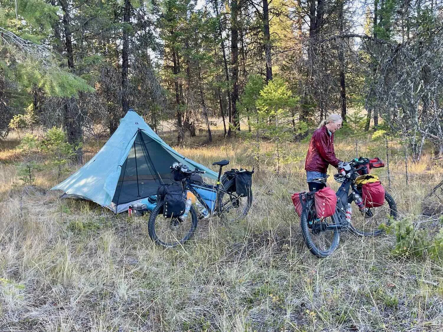
The last rays of sun striking the peaks of the Kootney Range, east of our wild camp. Kootenay River Valley, British Columbia, Canada. Copyright © 2019-2022 Pedals and Puffins.
But the darkness does not necessarily bring peace and quiet. There are definitely some animals that make their biggest ruckus during the night. At this camp, we heard a pack of coyotes carrying on quite loudly as they came down the road near our tent. But as they got close, one of them gave a sharp yelp, and they shut up for good after that. It seemed as though they were not pleased to encounter us within their space.
A Pocket of Prairie in the Forest
We awoke to a very cold morning. Winter is definitely coming, so it feels good to be heading southward. Although there wasn’t any frost on the tent, the temperature had to be near freezing. As we packed up our gear everything was extremely cold to the touch, leaving our fingers numb.
About 20 minutes into our ride we entered a special area known as Skookumchuck Prairie. It’s a 30,000 acre (12,500 ha) patch of native grasslands in the Rocky Mountain Trench, within an otherwise forested region. There were quite a few ponderosa pines (one of our favorite western trees) in some areas, as fire suppression has allowed the forest to slowly move in. But the overall landscape was very open, and covered with tall, golden grasses. Signs along the highway informed us that the area was actively managed for deer and elk, and that the prairie had been designated an “Important Bird Area” of national significance (primarily because of its healthy breeding population of long-billed curlews).
The lovely open fields of Skookumchuck Prairie provide important habitat for grassland birds, as well as deer and elk. Skookumchuck, British Columbia, Canada. Copyright © 2019-2022 Pedals and Puffins.
An antique tractor left resting in a field. Skookumchuck, British Columbia, Canada. Copyright © 2019-2022 Pedals and Puffins.
There’s something inherently pleasing about these open landscapes, especially when there are a few, stately ponderosa pines. Both of us decided years ago that this was one of our favorite habitat types. So it’s not surprising that we stopped a number of times along the road. The grasslands and savannas looked very healthy, so we kept a keen eye out hoping to see some wildlife. Unfortunately, the curlews and other breeding birds seemed to have already headed south for the winter. But we did see a small herd of deer resting in the shade.
A mule deer doe rests in the shade. Wasa, British Columbia, Canada. Copyright © 2019-2022 Pedals and Puffins.
At the Fort Steele junction, our route left the main highway and headed down a scenic, and very hilly back road. With the Kootney Range mountains drawing ever closer on our left, we set our sights on camping at Norbury Lake Provincial Park.
Heading down the road, with the Kootney Range mountains dead ahead. Fort Steele, British Columbia, Canada. Copyright © 2019-2022 Pedals and Puffins.
Upon our arrival in the park, it was abundantly clear that the summer tourism season has truly come to an end. There were lots of campsites available, and very few other campers. With so many sites to choose from, it actually took us quite a while to settle on one. But we finally pitched our tent in an area far from any other campers. We were the only ones who spent the night in a tent. Everyone else was in an RV.
One slightly unnerving element was that there were signs posted all over the campground announcing that there had been a bear seen in the area. A park employee told us that a grizzly bear had been spotted nearby. But there were no bear boxes in this campground, and she didn’t have any helpful ideas about how we could secure our food. So we ended up eating our dinner and hanging our food supplies several campsites away from our tent, just to be on the safe side.
Signs in the campground informed us that there was a “Bear in Area.” It would have been nice if the campground had bear-proof boxes, but it didn’t. So we hung up our food several campsites away. Norbury Lake Provincial Park, British Columbia, Canada. Copyright © 2019-2022 Pedals and Puffins.
While preparing our campsite for the night, we were surrounded by the calls of red-breasted nuthatches. There are flocks of them everywhere. For the past few days, the forest has been filled with the sound of their cheery little voices. We can’t recall ever hearing so many of them before.
After dinner we walked over to Norbury Lake. We were surprised to see that it had quite a few vacation cabins along the shore. We’ve spent so much time in areas that don’t have any development that the sight of so many buildings surrounding the lake really made an impression on us. It’s another sign that we’re getting closer to the more populated parts of the country.
Sunset illuminates the Kootney Range mountains to our east. Norbury Lake Provincial Park Campground, British Columbia, Canada. Copyright © 2019-2022 Pedals and Puffins.
After darkness fell, the real excitement began. It would be hard to convey just how noisy it was. It seemed like every living thing in the forest was eager to cause a disturbance. Of course, the coyotes got things started. Several groups of them, some near and some farther away, began yapping and calling to each other. That got the local dogs going. Folks in RVs often travel with dogs, and the campground lit up with the barking of dogs riled up by the coyotes. Pretty soon we heard some elk bugling, which encouraged a nearby herd of cows to start bellowing. Sprinkled in between were some snorting deer, a northern pygmy owl tooting, a barred owl hooting, and a few other unidentified noises. This went on all night. It was a veritable chorus of animal noises. Mix in some traffic noise from the highway, and it was a symphony. For much of the night, sleep was hard to find.
Return of the Rain
We don’t have any photos of our ride from the Norbury Lake campground to Kikumon Creek Provincial Park because there was no escaping the rain that day.
It wasn’t supposed to start raining before 10am, but it did. We heard the patter of raindrops well before dawn. Hunkered down in our tent, we scanned the weather reports for some good news. We were disappointed. From the previous day we had expected the rain to end by noon. But it didn’t. The forecast kept pushing the end of the rain out until it was 4pm.
This presented us with a problem. We debated back and forth whether to call it a day and to spend another night at Norbury Lake, or to try and make a break for it. In the end we decided to go. We finally crawled out of the tent around noon and packed up our stuff in a light rain. Then we cycled down the road, cold and wet.
Interestingly, the dim light under a thick layer of clouds seemed to bring out the wildlife. We saw a very large flock of turkeys (20-30 birds), and a distant herd of elk (probably some of the guys that carried on so loudly last night).
About an hour into the ride we found ourselves back on Hwy 93. There was quite a bit of traffic. So even though there was a pretty wide shoulder to ride on, we got splashed and thoroughly drenched by passing vehicles. We were grateful that some road construction we were worried about appeared to be completed, and the new pavement made for smooth, fast cycling. That made the riding a bit more pleasant.
Heaven arrived in the form of the small market in Jaffray, BC. We had been cycling in the cold rain for two hours, and were in need of a break. And the little store delivered. They had a pretty good selection of food for a convenience store, including some hot items and hot chocolate. They also had a completely covered area outside with picnic tables, so both our bodies and our bikes could stay dry. And finally, while we were eating, the rain stopped. Things were looking up.
From there it was a quick, 10-mile ride (16 km) to Kikumon Creek. Everything we own was now covered with a sheen of moisture. We were looking forward to drying out our stuff in Eureka, Montana.
Return to America
We enjoyed a nice, quiet night in the Kikumon Creek campground. Some campgrounds have already shut down for the winter. But although this one was still open, very few of the sites were occupied. Furthermore, only one of the shower/bath houses was still open, so all the other campers clustered in that part of the campground. As a result, we were able to secure a campsite without any neighbors nearby. It was almost as good as wild camping, with a picnic table.
The local animals were pretty quiet, too. The only noise during the night was a long series of calls by a northern pygmy owl.
And then there was the dripping. The moisture from the previous day’s rain hung in the air, condensing on everything, including the ponderosa pine limbs stretching over our tent. All night we could hear the steady tap, tap, tap of the water drops falling off the pine needles, and onto our tent. The drops were especially large, and splattered with a loud thud when they hit the tent. Much louder than regular raindrops. In the morning, everything was still fully soaked.
With temperatures again near freezing, it was very cold. The damp chill clung to our clothes and settled in our bones for the first two hours of our ride.
Gray clouds and fog darkened the morning sky, keeping the air cold and damp. Kikumon Creek Provincial Park, British Columbia, Canada. Copyright © 2019-2022 Pedals and Puffins.
Along the way we spotted a few more mule deer. British Columbia, Canada. Copyright © 2019-2022 Pedals and Puffins.
We stopped to watch a pileated woodpecker chipping away the bark of a pine tree. British Columbia, Canada. Copyright © 2019-2022 Pedals and Puffins.
We finally arrived at the much-anticipated Grasmere General Store, lest than 10 miles (16 km) from Canada’s southern border. But our hopes of a warm brunch were dashed. The store was tiny, and did not offer much other than snack food. We nibbled on some chips, then we were back on the road.
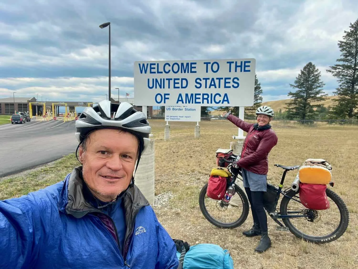
At the US Border, we presented our driver’s licenses, fully expecting them to provide sufficient identification to re-enter the country. Our home state has been increasingly enhancing the security of its driver’s licenses, and we have the most recent versions. But we were mistaken. Apparently only five states have implemented the fully enhanced licenses that are now accepted for land border crossings into the USA - and ours is not one of them. We were surprised when the border agent insisted that our driver’s licenses did not provide sufficient identification, and asked to see our passports - especially since we had been able to enter Canada using just our driver’s licenses.
Luckily, we had our passports with us. We dug into our panniers and handed them over. That did the trick. Once the border agent saw our passports, it took him just a moment to check us through. We’re not sure what would have happened if we had not brought our passports with us to Canada, but fortunately we did not have to find out.
Happy to be back in the United States. Canada-USA Border. Copyright © 2019-2022 Pedals and Puffins.
It was fun to cycle back through the Tobacco Valley, where we had started our journey on the Western Wildlands Route (WWR) last year. This part of the Rocky Mountain Trench seems quite similar to the Skookumchuck Prairie that we had passed through a couple of days before. Expansive grasslands blanket the valley floor, providing forage for herds of cows and mule deer. The valley gets its name from the fact that Native Americans were able to grow tobacco here due to the valley’s moderate climate.
Back in the Tobacco Valley, where we started the Western Wildlands Route (WWR) in 2021. Eureka, Montana, USA. Copyright © 2019-2022 Pedals and Puffins.
Two white-tailed deer kept an eye on us from a hilltop. Eureka, Montana, USA. Copyright © 2019-2022 Pedals and Puffins.
Upon arrival at the Silverado Motel, our first priority was to start the process of drying our stuff. We spread out our sleeping bags and draped our soggy clothes on every piece of furniture in the room. It felt wonderful to be warm and dry.
By a lucky chance we arrived at the Silverado Motel on a Saturday. The motel serves wonderful, reasonably priced, 4-course dinners - but only on Fridays and Saturdays. We remembered the salmon dinner fondly from our visit in 2021, so we didn’t hesitate to make a reservation for the same meal on this visit. As we expected, it was delicious and relaxing. What a great way to end the day.
Retracing our Steps from 2021
The landscape we rode through after departing Eureka was pleasingly familiar. We cycled into the brisk morning air, under a nearly cloudless sky. For the first hour, we traversed grassy lowlands and hills blanketed with ponderosa pines. Then we arrived on the eastern shore of the 90-mile long (145 km) Lake Koocanusa. And officially, we left the Rocky Mountain Trench behind. Here, the Kootenay River cuts through several mountain ranges on its big loop southward. The tall cliffs to our east blocked the sun until nearly noon, keeping us refreshingly cool all morning.
We stopped along the way to admire the big bridge across Lake Koocanusa that we had crossed on the WWR last year. From there, the WWR takes a challenging, off-road path over the Purcell Mountains. But on this day we would stay on the paved road, on the east side of the lake. It was fun to reminisce about the highlights of that previous ride, and the challenges we had faced in the mountains. Although it was hilly, the pavement made this ride quite a bit easier and faster.
The Lake Koocanusa Bridge, as seen from a rest stop on the east side of the lake. In 2021 we crossed that bridge and headed into the Purcell Mountains on the WWR. Montana, USA. Copyright © 2019-2022 Pedals and Puffins.
Views of the lake provided a gorgeous backdrop for the rest of the day. Lake Koocanusa had a lovely, blue-green glow under the clear, blue sky. Montana, USA. Copyright © 2019-2022 Pedals and Puffins.
With our quick progress, we arrived at the Kookanusa Marina nice and early. A sign near the entrance proclaimed “Welcome back, Canadian neighbors! We missed you,” reminding us of how much things have changed with respect to travel over the past year.
Tourist spots like the Koocanusa Marina are clearly happy that international travel has resumed. Lake Koocanusa, Montana, USA. Copyright © 2019-2022 Pedals and Puffins.
We ate dinner in the marina’s cozy restaurant. There were about 10 wooden tables, and a wood-burning stove in the corner. Picture windows and an outdoor deck overlooked the marina and lake. But what really held our attention was all of the photos posted along the walls. Each year the marina hosts a trout fishing derby, and the photos showed the winners going back for many years - each holding their enormous fish. The biggest rainbow trout weighed over 13 lbs (6 kg). In another room there were photos of people holding even bigger trout that had been caught outside of the derby. Other decorations included an unusual collection of stuffed animals like a cougar, a beaver, several raccoon and coyote pelts, and various mounted fish.
Photos of the Rainbow Trout Derby winners over the years were posted on the wall in the restaurant. Koocanusa Marina Campground, Montana, USA. Copyright © 2019-2022 Pedals and Puffins.
In the marina campground, there were five tent sites located far from the RVs. We were the only tent campers there, so we looked forward to a nice, quiet stay. A short path from where we pitched our tent led to an overlook of the lake and marina. We strolled out to the edge of the sandy cliff to watch the sunset over the lake.
Sunset over Lake Koocanusa. Montana, USA. Copyright © 2019-2022 Pedals and Puffins.
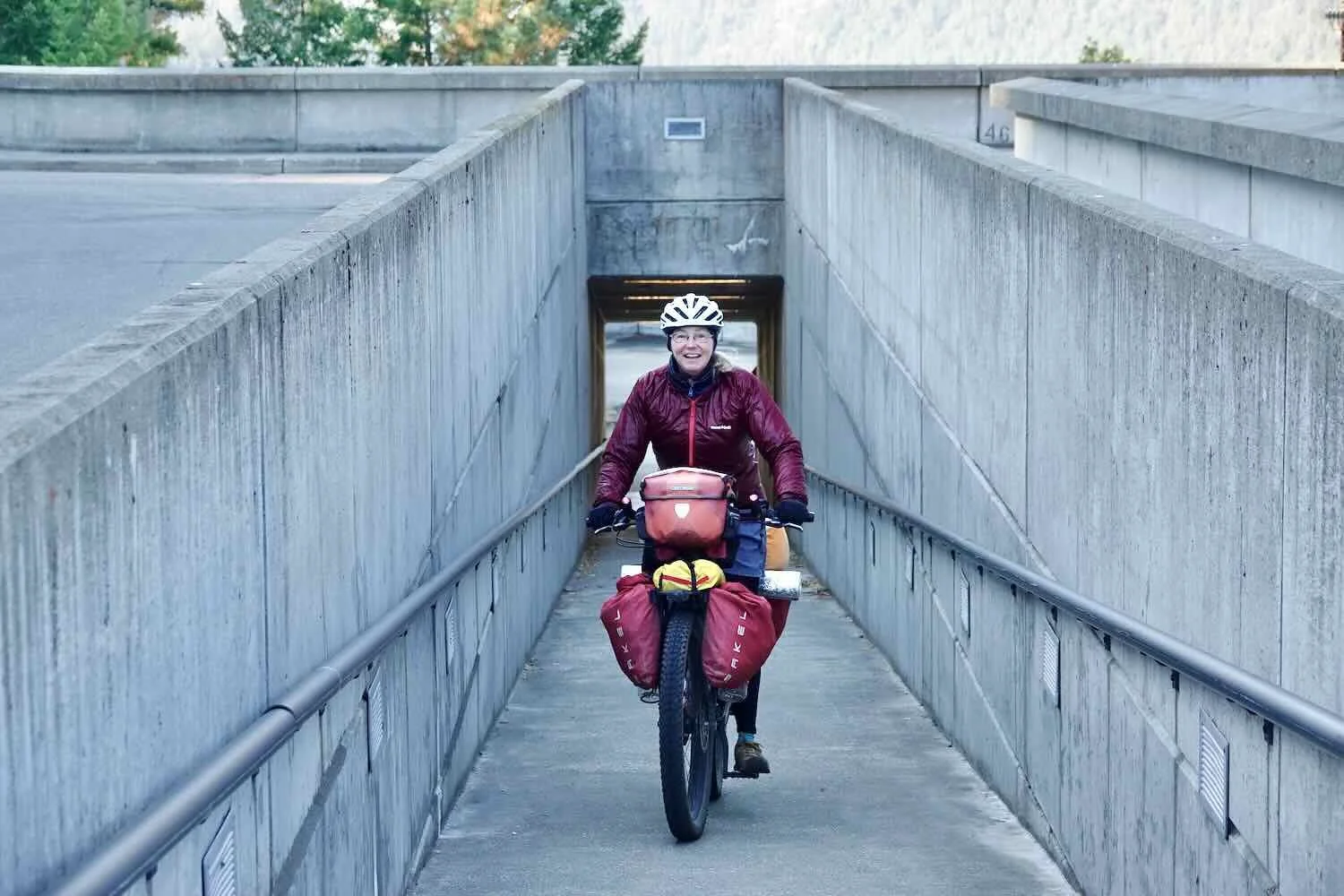
Arrival in Libby, Montana
We had a short, pleasant ride into Libby, Montana. There were lots of hills, but the gradients were gentle.
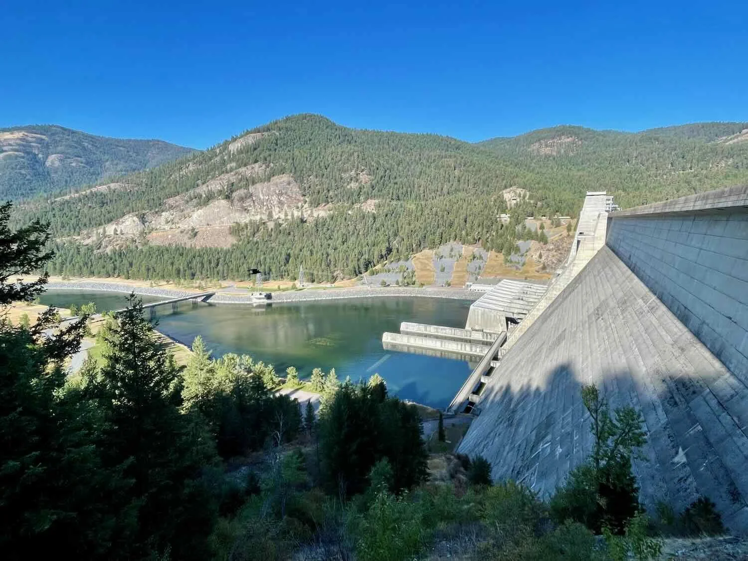
About an hour into the ride we stopped to have a look at Libby Dam, the structure that created Lake Koocanusa. There’s a concrete platform that provides views of the dam from both the lake side and the downstream side. Like most big dams, it’s quite an impressive structure. The concrete facade rises 422 feet (129 m), and spans more than 3,000 ft (930 m) across the valley.
PedalingGal surveying the Kootenay River below the viewing platform at Libby Dam. Lake Koocanusa, Montana, USA. Copyright © 2019-2022 Pedals and Puffins.
Below the dam, our route took us on a secondary road that paralleled the highway. We enjoyed the reduced traffic. But the serenity was occasionally disrupted by passing freight trains.
PedalingGal races a freight train through northwestern Montana. Kootenai River Valley, Montana, USA. Copyright © 2019-2022 Pedals and Puffins.
We spent the next five days in Libby, Montana, taking care of PedalingGuy’s tooth and prepping for the next leg of our journey. We had shipped a total of six different packages to ourselves at the hotel, including new, more pavement-friendly tires (Schwalbe G-One Allround, tubeless tires), some Rohloff hub oil change kits, and an assortment of other gear. We had a bit of a scare when two of the packages failed to show up in time for our arrival. But they both were eventually delivered, so everything worked out fine.
Libby is known as the “City of Eagles.” A local sculptor created 99 eagle images, many of which are displayed in public spaces and at businesses all over town. The eagle statues range in size from a wingspan of 6 ft (1.8m) to over 40 ft (12 m), so it’s easy to spot them. The entrance to the city’s main street, Mineral Avenue, has a particularly striking statue of an eagle soaring overhead.
A portal over the town’s main street makes it clear that you are entering the City of Eagles. Libby, Montana, USA. Copyright © 2019-2022 Pedals and Puffins.
Chain saw carvings are also prominently displayed all over town. In fact, since 2016 Libby has hosted the “Kootenai Country Montana International Chain Saw Carving Championship.” It sounds pretty impressive. Competitors from around the world come here to participate.
These chainsaw carvings were on display outside a restaurant near our hotel in Libby, Montana, USA. Copyright © 2019-2022 Pedals and Puffins.
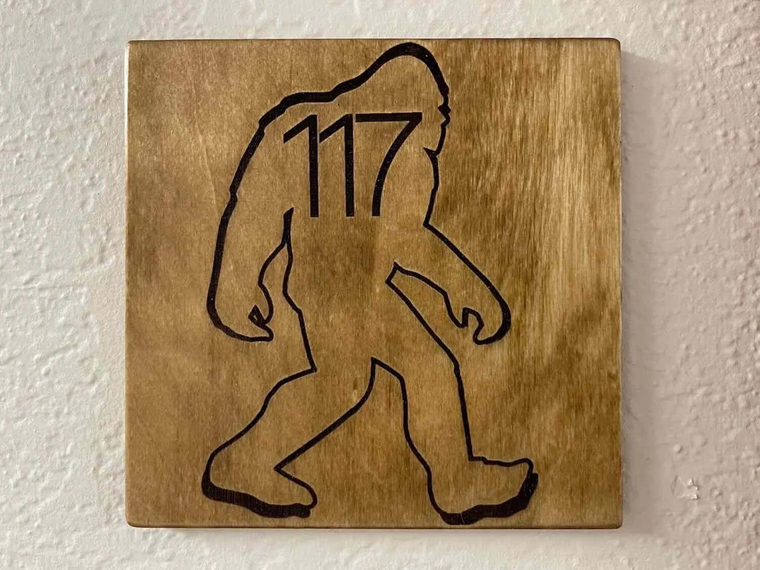
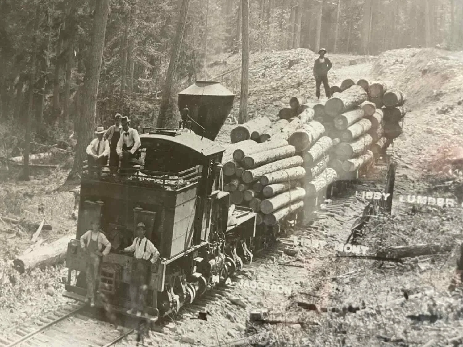
Besides eagles, the other big motif in Libby is Sasquatch (a.k.a., Bigfoot). His slightly-hunched, hairy form can be seen everywhere. Sasquatch is pretty much a celebrity in this part of Montana. In our hotel, all of the room numbers were etched inside a silhouette of the big guy. The hallways were also decorated with historic photos from Libby’s past, commemorating the town’s logging and mining history.
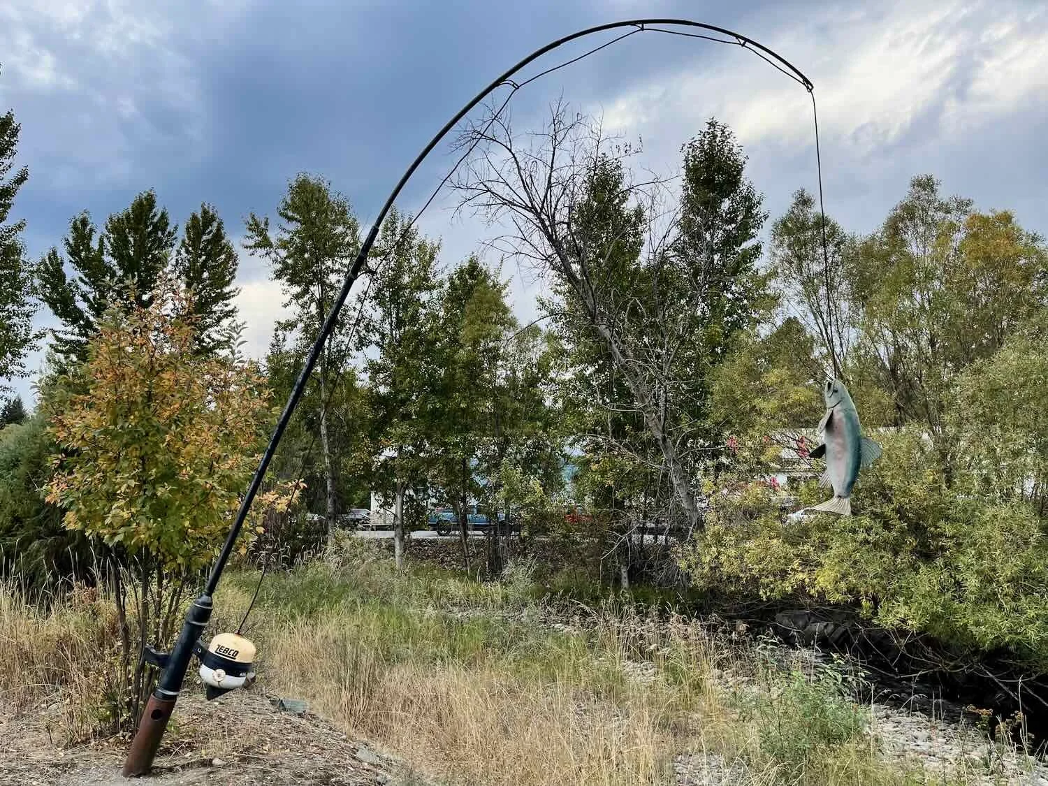
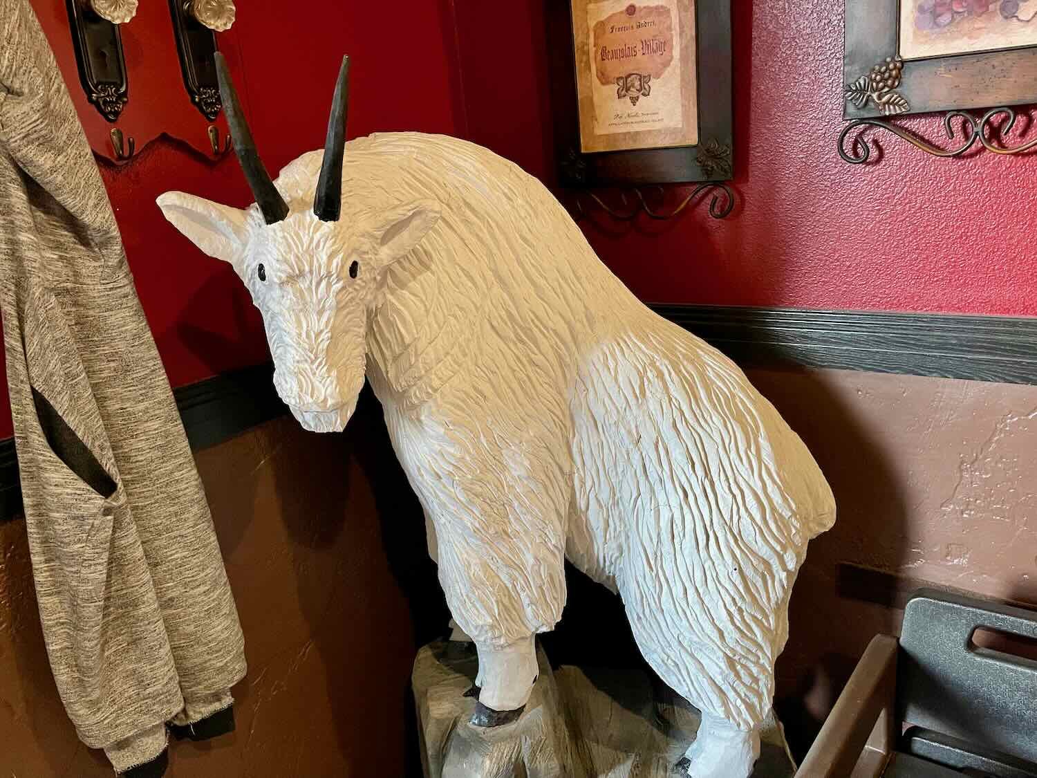
Here are a few other images of the sights around town:
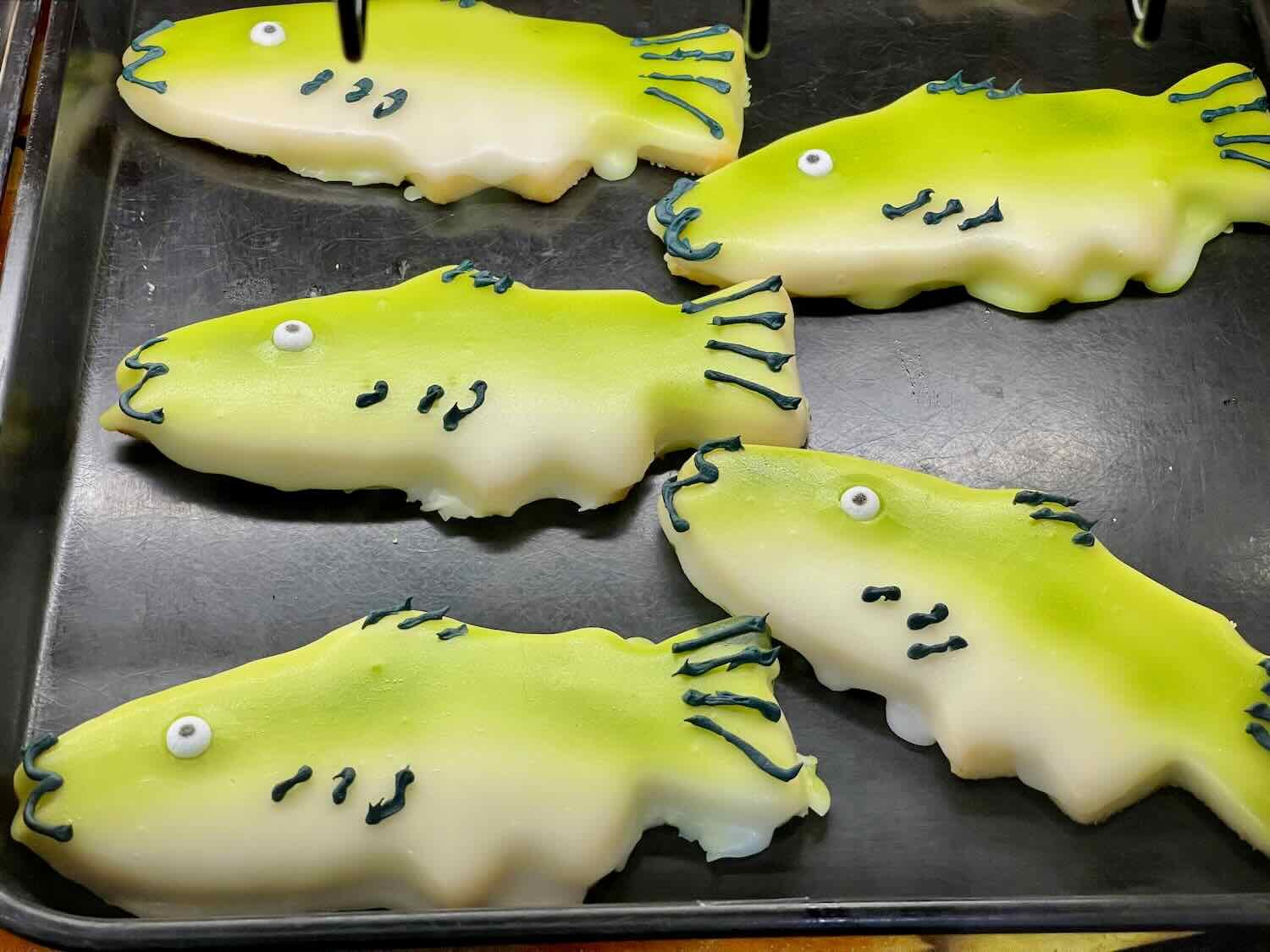
We spotted this handsome white-tailed deer buck in an industrial yard. Libby, Montana, USA. Copyright © 2019-2022 Pedals and Puffins.
Dental Adventures While on a Bike Tour
But this blog would not be complete without a brief description of our dental adventures. By the time we arrived in Libby, it had been 20 days since PedalingGuy had first felt the toothache, and nine days since the failed root-canal attempt in Golden, BC. But his tooth luck was about to improve.
On Monday after our arrival, we picked up a rental car in Libby, and drove to Kalispell, Montana for PedalingGuy’s appointment with an endodontist (root-canal specialist). Everything went smoothly, and we arrived in Kalispell early enough to visit the local REI store. The lady at the bicycle service desk was very nice, and she let us use the store’s compressor to mount our new tubeless tires (which we had brought with us, just in case). She had never seen Fillmore tire valves before, so she watched us add the sealant through the Fillmore valves, and thought that was pretty cool. Luckily, everything went smoothly and we didn’t make a mess.
From there we headed over to the endodontist. To sum it up, the operation went great. After about two hours in the chair, PedalingGuy had a fully infection-free tooth. That was a huge relief.
As we drove back to Libby, we were both struck by how much more yellow we saw on the leaves of the trees. Fall is coming on fast.
The next morning, PedalingGuy had a quick appointment with the dentist in Libby who specializes in same-day tooth crowns. This appointment was just so that the dentist could assess the situation. Fortunately it went well, and PedalingGuy was scheduled to get his new crown the next day.
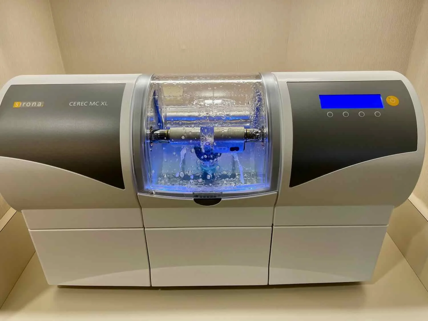
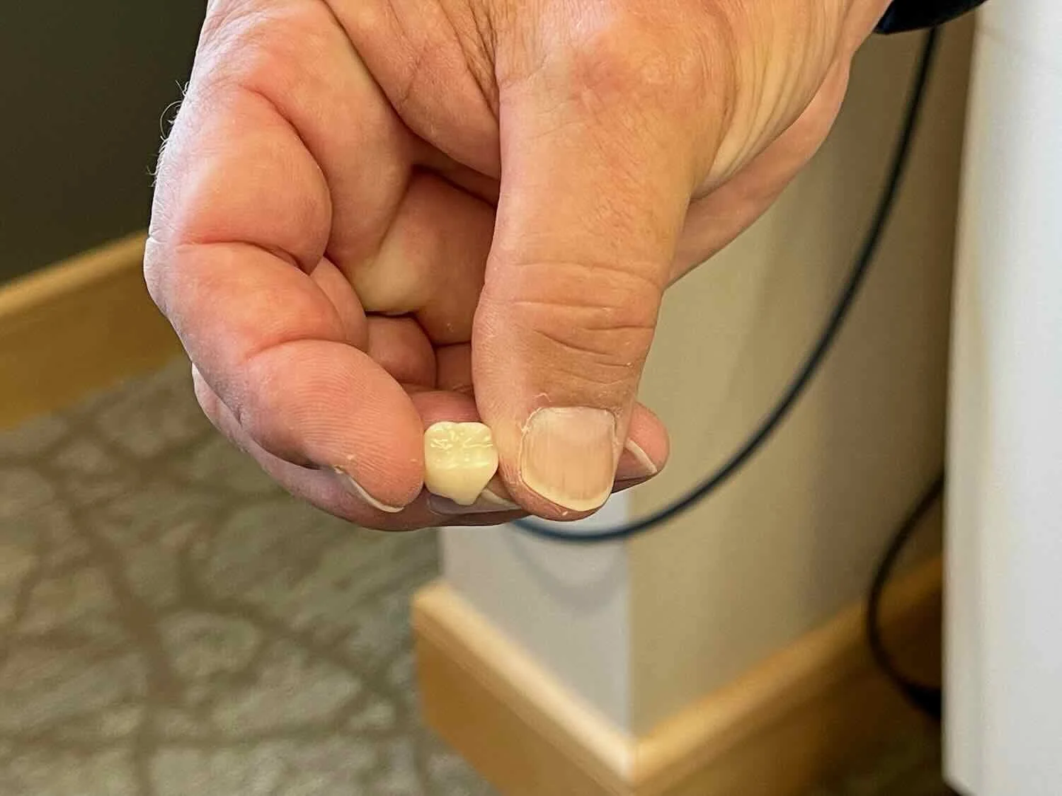
Finally, on Wednesday, PedalingGuy got a new crown fitted on his tooth, and all of the procedures were complete. He even got a few photos, which included a high-tech CAD/CAM design and manufacturing process.
Computer-Aided Design (CAD) helped shape PedalingGuy’s new crown. Libby, Montana, USA. Copyright © 2019-2022 Pedals and Puffins.
With the tooth taken care of, our new tires mounted, and new oil in our Rohloff hubs, we were ready to hit the road again. On this leg of our journey, we had traversed the incredibly scenic Rocky Mountain Trench, cycled past the source of the Columbia River, and enjoyed more wildlife sightings as we headed southward with cool fall temperatures bearing down on us. From here we would turn west, in hopes of making it over the Cascades before the full onset of winter in the mountains.