Cycling Deadhorse to Coldfoot, Alaska: Land of the Midnight Sun

22 - 26 June 2022
22 June - Deadhorse to Wild Camp at Last Chance Wayside (63.7 mi, 102.5 km)
23 June - Last Chance Wayside to Wild Camp near Sag River (43.0 mi, 69.2 km)
24 June - Sag River to Galbraith Lake Campground (44.3 mi, 71.3 km)
25 June - Galbraith Lake Campground to Wild Camp near Dietrich River (50.4 mi, 81.1 km)
26 June - Dietrich River to Coldfoot Camp (56.8 mi, 91.4 km)
A Road Not Built for Bicycles
We’ve begun the long journey southward. For the next 425 miles we will ride our bikes along the Dalton Highway, a road that was not created with cycling in mind. In fact, it was built in the early 1970s to facilitate construction of the Trans-Alaskan Oil Pipeline. Since then it has provided a lifeline for supplies to be trucked up to the very remote, industrial town of Deadhorse, Alaska. And because it parallels the Trans-Alaskan Oil Pipeline, it also provides maintenance access for pipeline workers.
But a key fact is that the road was built in a hurry (approximately five months). As a result, some of the finer points of highway planning and design were, shall we say, not strictly observed. The road is now famous for having some very treacherous, muddy sections and startlingly steep gradients (as much as 16% for several miles). The route barrels straight up mountainsides, without so much as the whiff of a switchback. This should be fun.
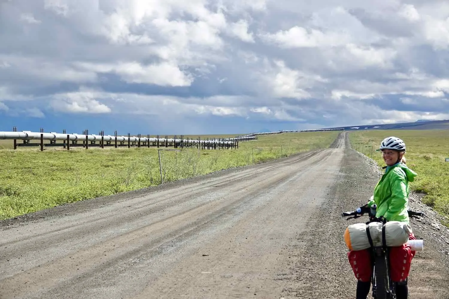
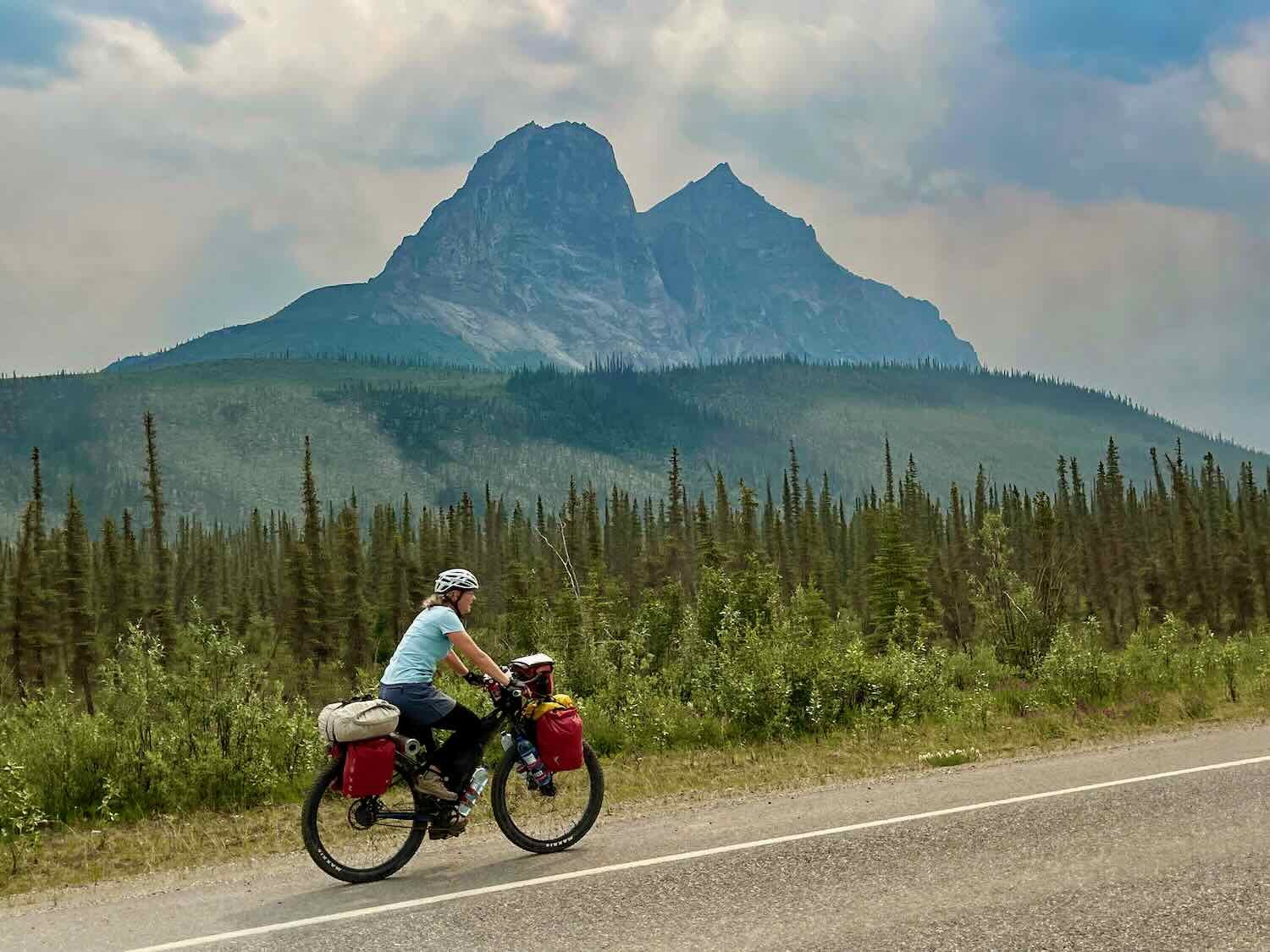
Honoring cycling tradition, we began our journey by posing for the iconic photo with our bicycles in front of the “Welcome to Deadhorse” sign, hung outside the Prudhoe Bay General Store.
It’s a cycling tradition: posing with the Deadhorse, Alaska sign before striking out on the Dalton Highway. Looks like you’re supposed to bring a sticker as well. Maybe next time. Alaska, USA. Copyright © 2019-2022 Pedals and Puffins.
And then we were off, cycling south under moody skies that sprinkled us with intermittent rain showers. Pretty quickly, we were reminded that it would be a while before we’d encounter much civilization. There would be no traveler-oriented services until we reached Coldfoot, Alaska, 240 miles down the road. But even Coldfoot (population 13), is little more than a cafe, gas station, and small bunkhouse in the wilderness. The next city of any size, Fairbanks, was nearly 500 miles away.
Our next warm shower looks like it will be pretty far down the road. Copyright © 2019-2022 Pedals and Puffins.
Soggy Brown Tundra, as Far as You Can See
For the rest of the day we cycled across the North Alaskan coastal plain, an almost totally flat region of tundra supported by a thick, solid layer of permafrost. The perpetually-frozen soil keeps any water that melts on the surface from seeping into the ground. The result is a vast, boggy domain dotted with thaw lakes. Polygonal mounds of soggy grasses, moss and lichens are separated by watery channels where ice wedges have pried the land apart.
To keep the road from melting the permafrost, it is built up on a gravel berm that rises 7-10 ft (2-3 m) above the surrounding tundra. So for the first 50+ miles of cycling out of Deadhorse, we rode along on a gravel ridge that gave us an expansive view of the wintery-brown grasses and sedges, stretching all the way to the horizon.
Cycling on the raised road-bed of the Dalton Highway, with the marshy tundra below. Alaska, USA. Copyright © 2019-2022 Pedals and Puffins.
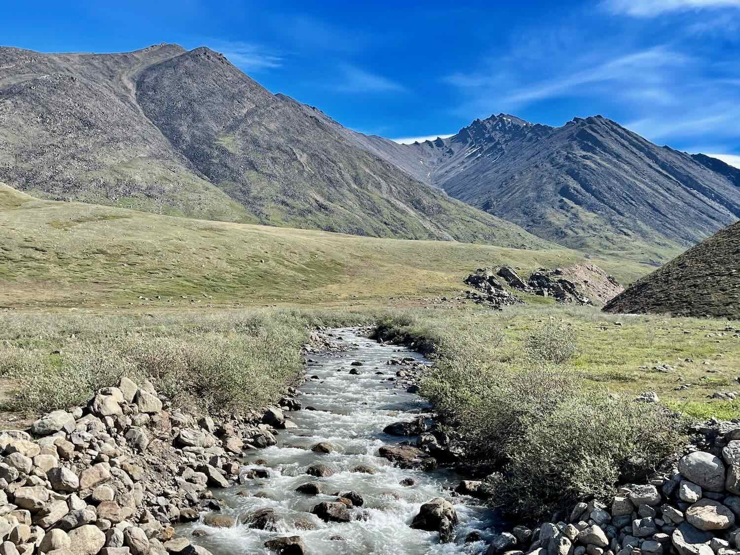
On our left, our constant companion was the wide, braided, and meandering Sag River.
The mighty Sag River arises high in the Brooks Range mountains. By the time it reaches Deadhorse, Alaska, it spreads out into a wide, braided river that meanders across the flat coastal plain. Alaska, USA. Copyright © 2019-2022 Pedals and Puffins.
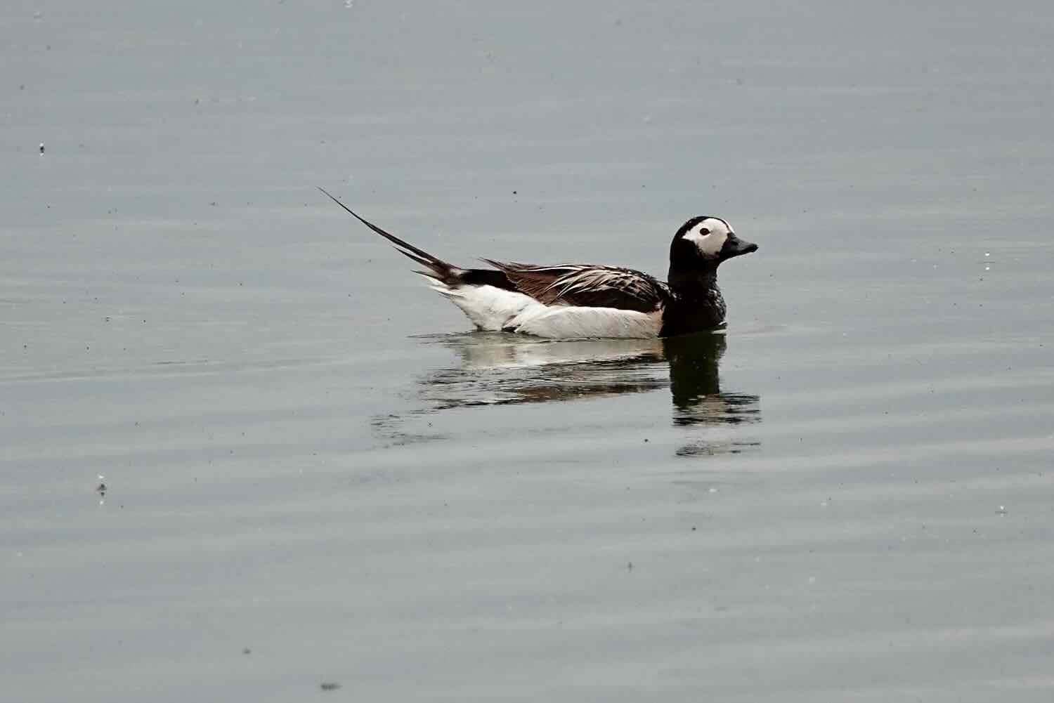
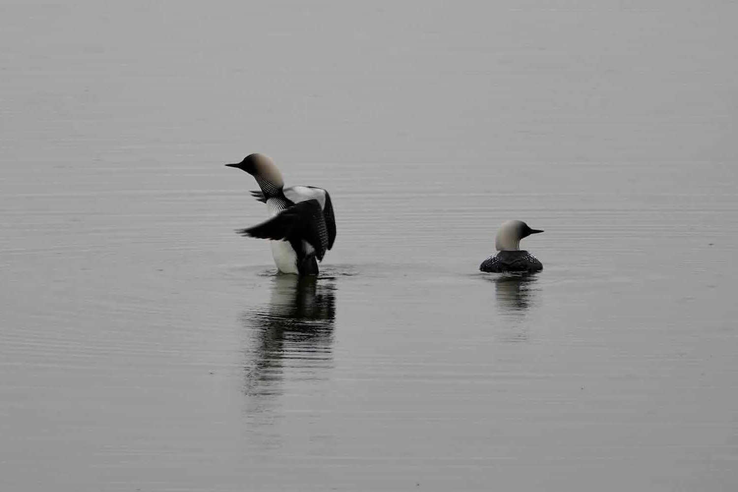
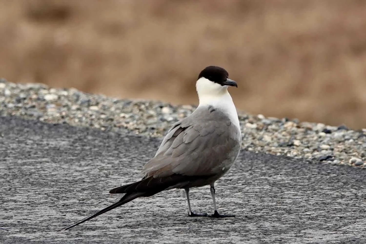
It was along this stretch of road, on our first day out from Deadhorse, that we saw the greatest abundance and variety of wildlife. The watery landscape is home to a tremendous diversity of ducks, geese and other waterfowl. We stopped often to enjoy close-up encounters with Arctic bird species that we rarely get a chance to see, especially in their luxurious summer plumages.
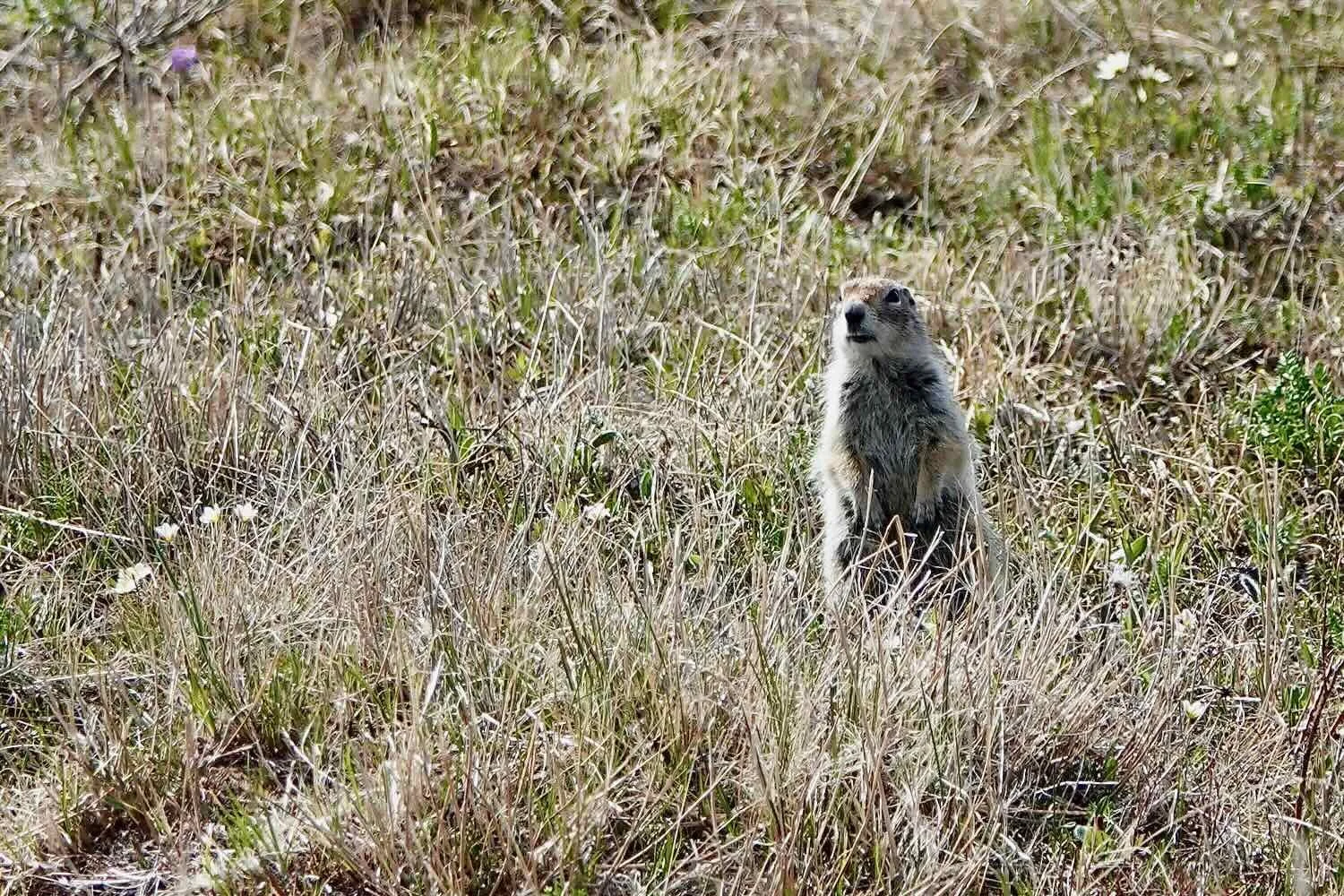
We also saw quite a few Arctic ground squirrels, an iconic species of the far north. Amazingly, these rodents hibernate 8-9 months of the year, losing a third of their body weight while they rest. Apparently Arctic ground squirrels have discovered that gravel road beds make pretty good places to dig burrows, so they’re actually more common near roads than away from them. We got used to hearing their chirping alarm calls, and seeing them scamper away as we rode by.
The greater white-fronted geese were especially noteworthy. They breed only in the far north, almost exclusively on the Arctic coastal plain. And they were everywhere. Their loud, cackling call could be heard almost any time of day or night (which is really just extended daytime, since the sun doesn’t set this time of year). Pairs of the geese were constantly hassling each other, squabbling over patches of grass, and flying around proclaiming their presence. From now on, the calls of greater white-fronted geese will always remind us of the tundra.
Big and loud, the greater white-fronted geese were a constant presence, calling to each other as they socialized on the tundra. Copyright © 2019-2022 Pedals and Puffins.
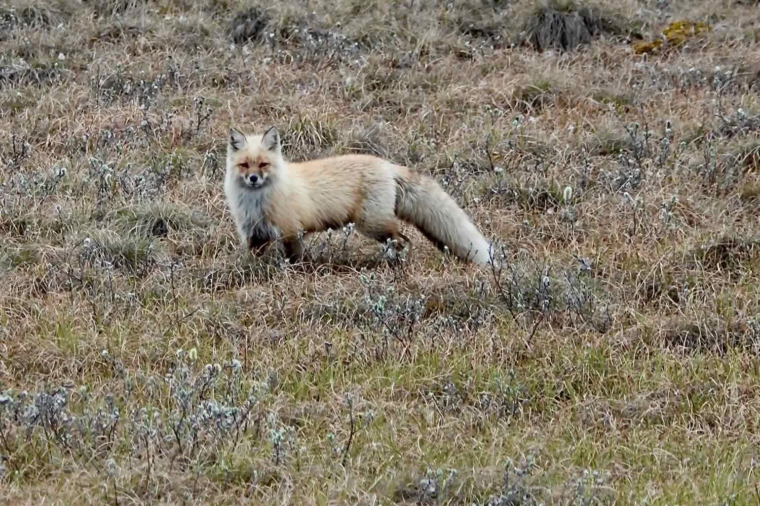
Without anywhere for them to hide, it was easy to spot many of the other local animals as well. We were captivated by the sight of the fluffiest red fox we had ever seen. And to our delight, we spotted quite a few groups of caribou grazing or resting among the tundra grasses.
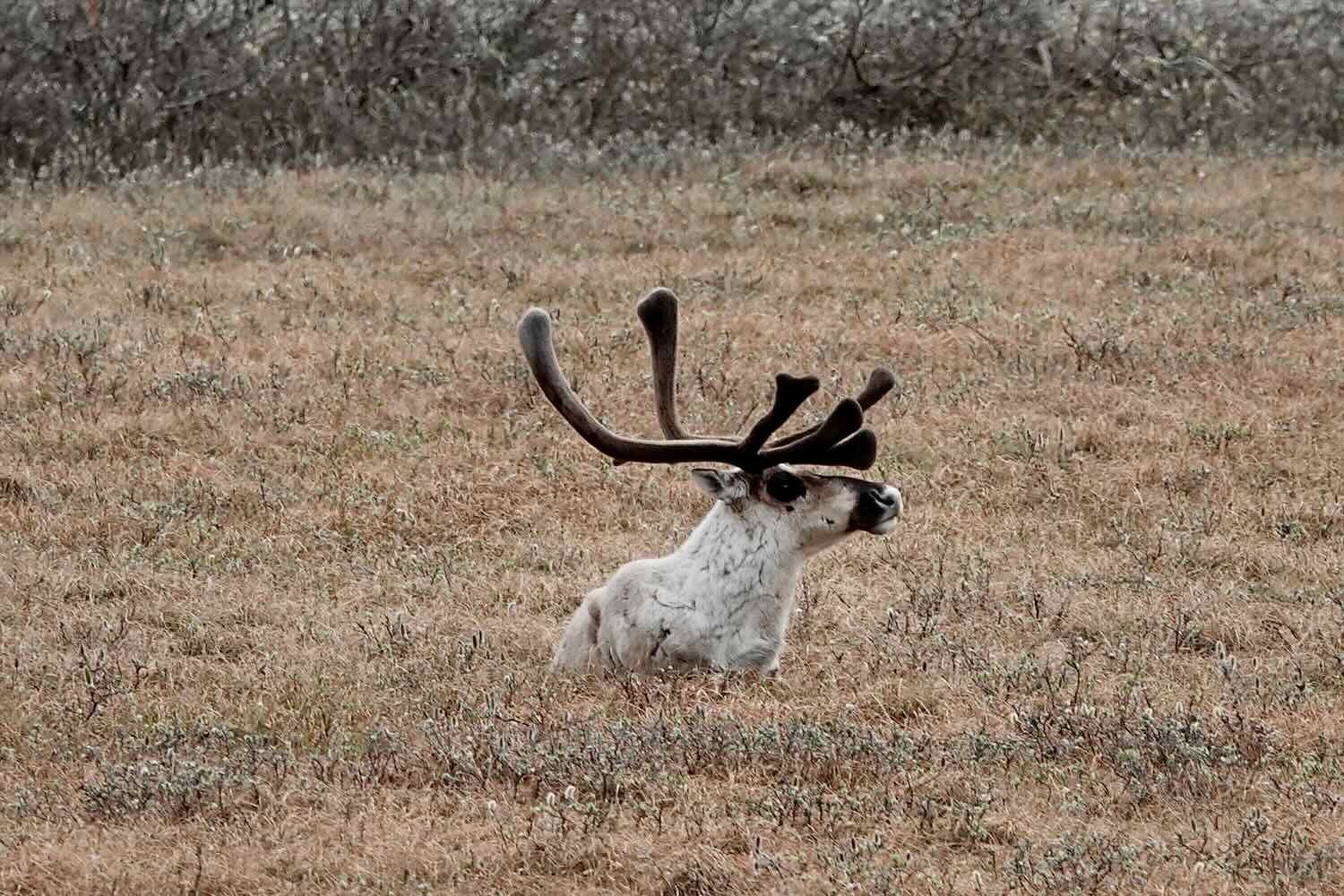
At one point, a large group of 30+ caribou was coming towards us, approaching from the south. As they got closer, a handful of the caribou climbed up onto the road, and headed straight towards us. We stopped, and watched as they trotted casually along the road as if they couldn’t see us. We had been cycling into a headwind, so it seemed likely that they wouldn’t pick up our scent, either. They were single-mindedly focused on staying in contact with their group. They seemed quite startled when, within about 20 m of colliding with us, they suddenly sensed that there was something blocking their path. They hesitated for a moment, trying to discern what sort of threat we might pose, before hustling off the road and re-joining their herd. It was an amazing experience.
Avoiding a near collision, these caribou finally noticed we were standing in the road. After pondering our presence for a moment, they decided to exit the road and re-join their herd. Alaska, USA. Copyright © 2019-2022 Pedals and Puffins.
But the big star of the show was a lone male muskox grazing not far from the road. Most of the muskox stay very close to the far shores of the Sag River, where they appear more like small, dark dots on the landscape. So, we were absolutely thrilled to see this big guy in all his glory - with those heavy horns, massive shoulders, and a gently-swaying skirt of impossibly long hair. He kept his eye on us while he grazed, seeming fairly unconcerned about our presence on the road. But then something spooked him. He turned-tail and galloped away with the long strands of his shaggy coat swaying gracefully back-and-forth with every stride.
Such an amazing creature. We were captivated by a close encounter with this lone muskox. Alaska, USA. Copyright © 2019-2022 Pedals and Puffins.
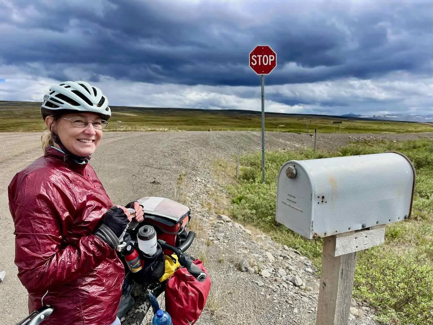
On a more melancholy note, there were regular reminders of how dangerous the Dalton Highway can be. Periodically, we would pass roadside memorials indicating the site of a crash. At one point we even passed a small sedan that had slipped off the road and flipped over, left lying on its hood in the moist earth. One memorial particularly caught our attention because it was larger and more elaborate than the others. It marked the site of a trucking accident that took the life of a haul-road truck driver in 2018.
The Dalton Highway is a dangerous road, even for the experienced truckers that haul essential goods up to Deadhorse. Every so often, we saw memorials honoring those who lost their lives along the way. Alaska, USA. Copyright © 2019-2022 Pedals and Puffins.
Within the past two years, the state of Alaska has paved the first 50 miles of the Dalton Highway heading south out of Deadhorse. Massive flooding of the Sag River in 2015 had damaged multiple sections of the highway, triggering the reconstruction project. Now the pavement is new and smooth, which allowed us to travel at a much faster pace than we could previously have hoped. Towards the end of the day, we got our first glimpse of the distant Brooks Range mountains. We’d be climbing their slopes in a couple of days.
Our first glimpse of the Brooks Range mountains, under a dark and restless sky. Our road, which follows the route of the Trans-Alaska Oil Pipeline, would reach the mountains in a couple of days. Alaska, USA. Copyright © 2019-2022 Pedals and Puffins.
Surprisingly, the Trans-Alaska Pipeline was frequently not visible, even though it closely follows the Dalton Highway’s route. It turns out that for long stretches, the pipeline is buried in an insulated corridor of gravel, and is hidden from view. A little more than half of the pipeline is raised above the ground, in areas where the soil and permafrost conditions are not suitable for burial. Consequently, our sightings of the pipeline would come and go. And frequently we would have an unobstructed view of the vast tundra rolling away from the road.
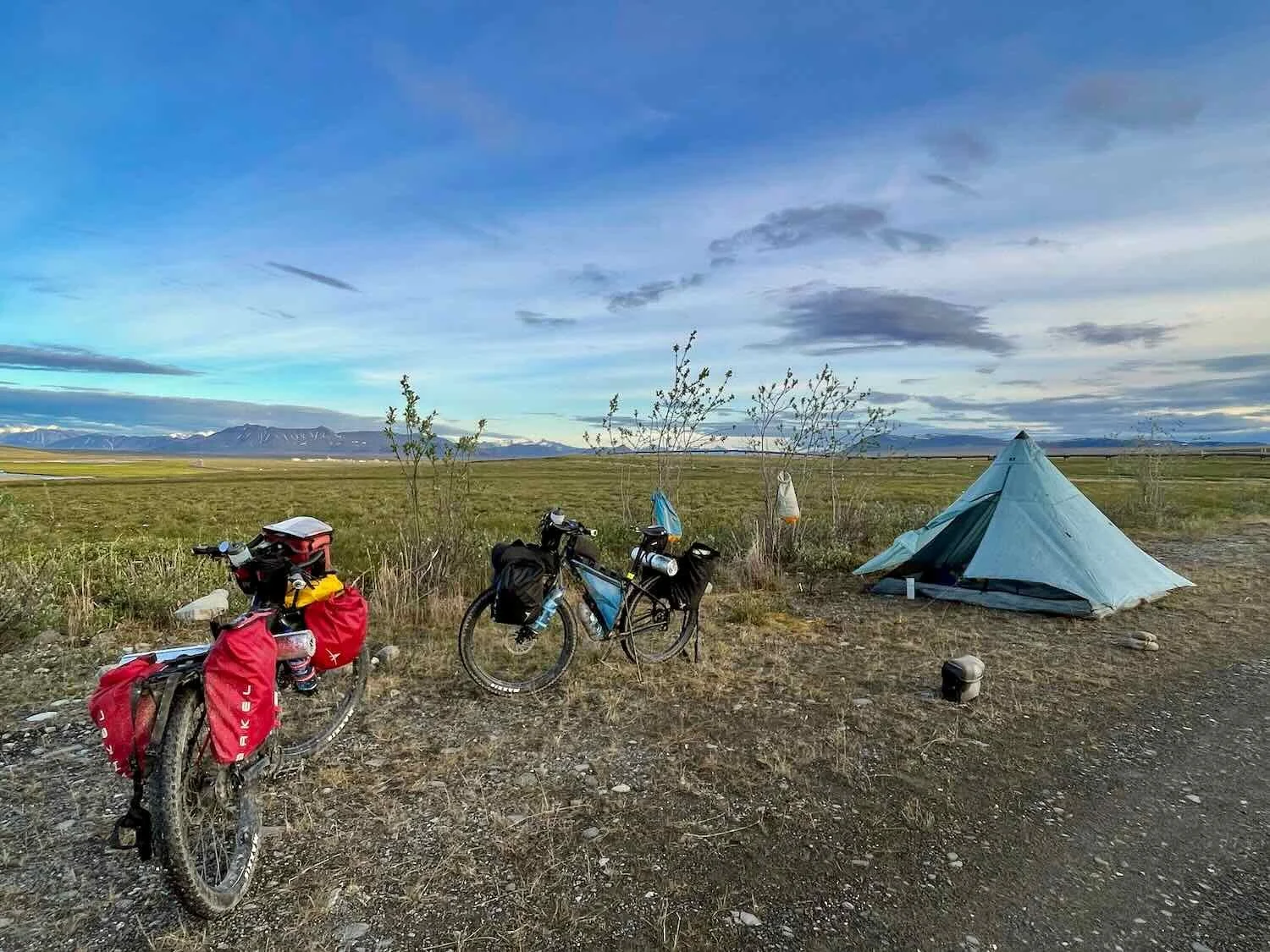
We set up our first camp at the Last Chance Wayside. Amenities included a pit toilet and bear-proof garbage containers. It’s primary shortcoming was that, being on the tundra, there were no trees to which we could secure our food bags. The bear bags containing our food ended up just resting on the ground about 100 m from our tent. Not very secure… but it’s not like we had other options. We were happy to find our food untouched in the morning.
We did have one moment of trepidation on our first day. We had stopped to have dinner near a lovely pond. The first order of business was to filter some water. But, much to our dismay, we could barely force any water through our trusty BeFree water filter. PedalingGal had tested the filter before departing from home and had noticed that the flow was slowing down. But with a thorough cleaning, she had gotten it working again.
Now, in the field, it was clear that there was more of a problem with the filter than we had guessed. After nearly 20 minutes of frustration in attempting to force water through, we reached the unpleasant conclusion that our water filter had gone kaput. Fortunately, we had a backup water filter of the same type that had never been used. And within a few minutes of firing up the new filter, we had water flowing again. The new filter should get us all the way to Fairbanks. But we’ll need to purchase a new backup filter. You just can’t leave the matter of having potable water to chance.
Rolling Along the Ridges of the Arctic Foothills Tundra
To reach the Last Chance Wayside, we labored up an incline for nearly 800 ft (90 m). That was the first hill of any size we encountered on the Dalton Highway. It signified our transition from the flat, coastal plain onto the foothills tundra of the Brooks Range. We wouldn’t hit the real mountains for another 60 miles, but our climbing legs would still get a workout.
The Arctic Foothills Tundra is nearly as treeless as the coastal plain. But water runs off the rounded hills and plateaus of this region, so the ground isn’t as boggy, and there are a lot fewer lakes. What’s more, we started to see more willows and other shrubs growing in the protected gulches between the hills. And counter to what you might expect given the reduction in surface water, we immediately noticed that the vegetation in the foothills was much greener and more spring-like than the wintery coastal plain.
The rolling hills of the Arctic Foothills Tundra were drier and greener than the coastal plain we had traversed the day before. Alaska, USA. Copyright © 2019-2022 Pedals and Puffins.
It was in one such patch of low-lying bushes, shortly after leaving the Last Chance Wayside, that we stopped to look for a special bird. Tim, our guide on the Arctic Ocean tour, had given us a tip that this was a good spot to look for Bluethroat, an incredibly rare bird in North America. They are relatively common in Asia. But only a small handful of Bluethroats migrate annually across the Bearing Sea to breed in Alaska. Then, in the fall, they head back to Asia for the winter.
Adding to their allure, Bluethroats are secretive birds that are very hard to spot when the males are not singing. We were quite determined to see one, however. And after nearly an hour of scouring the area with our binoculars, including a few tantalizing glimpses, we both finally got a brief, but satisfying look at the singing male with his decadently colorful, blue-and-orange throat. Unfortunately, he didn’t linger long enough for us to get a photo. But it was a thrill, nonetheless.
Other than that, we saw a lot less wildlife in these hills than we had seen out on the coastal plain. Without the profusion of lakes, there were far fewer ducks and geese. Caribou were completely absent.
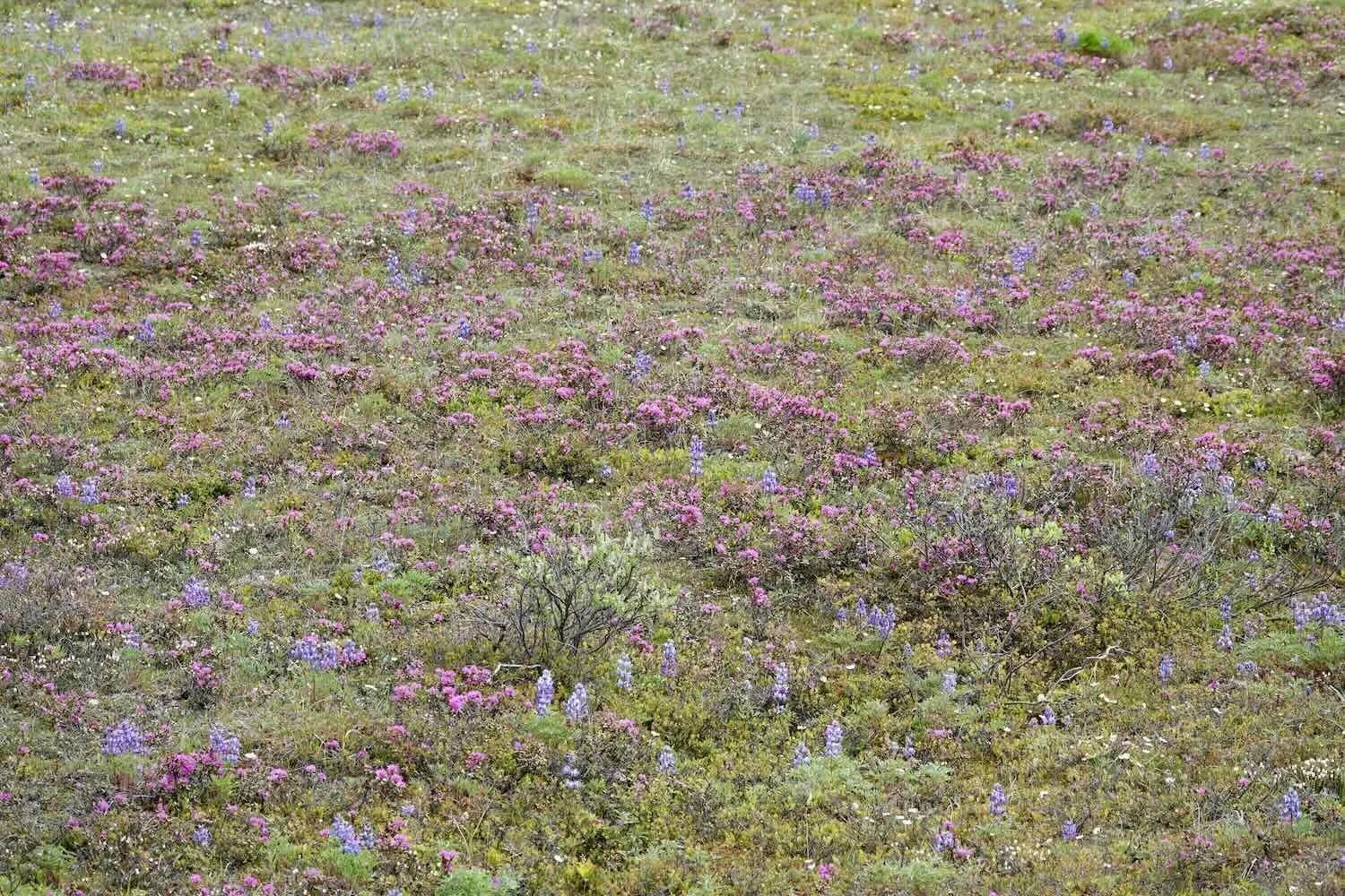
Throughout the day the highway rose and fell as it traversed the ridges and valleys of the foothills. Sometimes, from the heights, we could see long distances with views that extended far up and down the Sag River valley. At other times, the road would head down towards the river, clinging to its edge along the broad floodplain. And as the day progressed, we noticed an explosion of wildflowers, decorating the hills with swaths of white, pink, purple and blue.
Around 2pm we spotted the small camp of Happy Valley down near the water’s edge. We pulled into the large parking area, hoping to be able to fill our water bottles. The owner of the camp was very friendly, and let us fill our bottles from the sink in the camp’s common room. While we were there, dark clouds that had been building all afternoon finally overtook us, and a torrential thunder storm ensued. We marveled at our luck in being able to wait out the rainstorm in the shelter of Happy Camp’s common room. We hoped that would be the last of the rain for the day, but boy were we wrong.
Happy Valley Camp, on the banks of the Sag River, provided a refuge during one particularly heavy rainstorm. Alaska, USA. Copyright © 2019-2022 Pedals and Puffins.
Towards the end of the day we had one more, wonderful wildlife encounter. While we were descending off of a hill that had a great view of the Sag river, we spotted a group of muskox crossing the channel closest to the road.
When we drew close to the spot where we thought the muskox might be, we couldn’t see the river because the banks were lined with a dense growth of willows. We decided to head down a gravel side road that led to the river to see if we could get a closer look. As we reached the edge of the willow thicket, we were thrilled to see the adult muskox who had already crossed the channel encouraging three small calves to cross the swift-flowing river. The adults were able to wade across, but the calves had to swim, and they didn’t seem very eager to try. Some of the other animals made soft, cow-like sounds of encouragement, while one big female stayed with the calves until they were ready to take the plunge. Finally, the little ones jumped in and they all made it across. Once they reached the shore closest to us, we hurried away, so as not to spook them.
A family of muskox takes the plunge to cross a swift-moving channel of the Sag River. Eventually, they all made it across. Alaska, USA. Copyright © 2019-2022 Pedals and Puffins.
Much like on the first day, the oil pipeline was often, but not always visible. Sometimes it was quite close to the road. In the vast northern landscapes, the pipeline can appear small from a distance. But up close, you realize that it’s actually a really big pipe. It currently carries about 500,000 barrels of oil per day. (Although that’s an incredible amount of oil, it’s just a fraction of the 2.1 million barrels of oil per day that flowed through the pipe in the 1980s.)
The giant Trans-Alaska Pipeline delivers half a million barrels of oil per day to a port on the southern coast of Alaska. Up close, you get a sense of just how big the pipe really is. Alaska, USA. Copyright © 2019-2022 Pedals and Puffins.
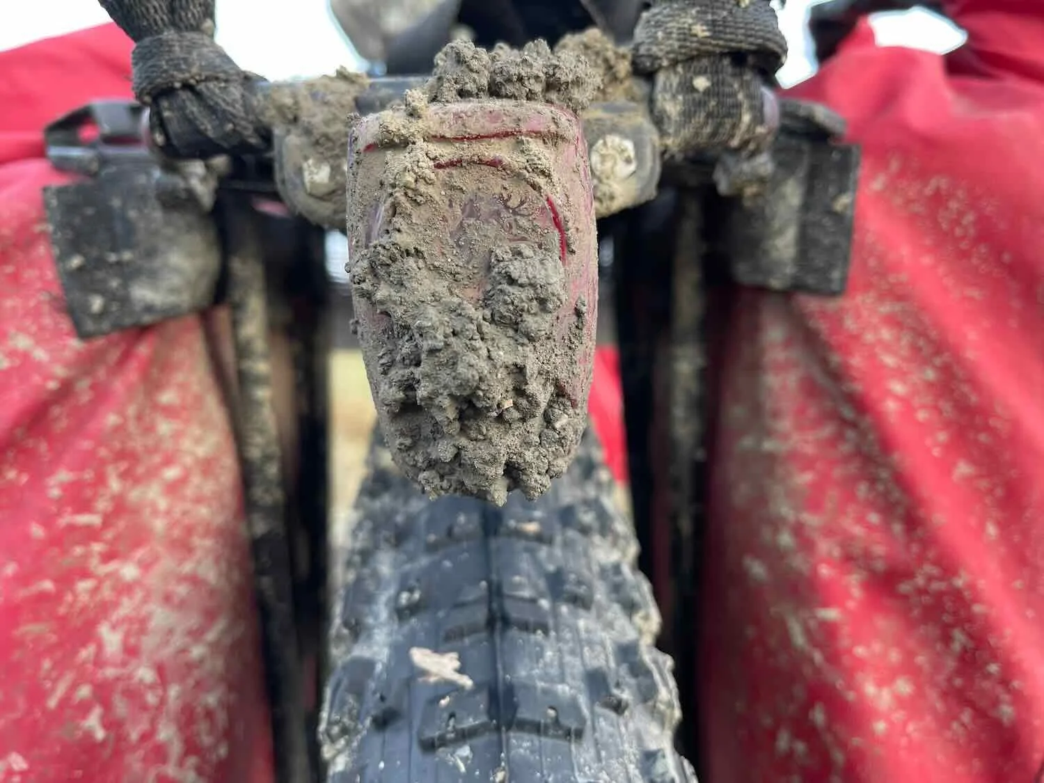
About an hour before we reached our planned camping spot, another storm blew across our path. We were pounded by heavy rain drops, accompanied by an unpleasantly cold, stiff headwind. We put our heads down and slogged on, getting soaked to the bone. On the bright side, our fat, knobby tires performed really well. For many cyclists, mud on the Dalton Highway is a sticky, slippery nightmare. But our tires gripped the gravel and shed the mud like it was just another day at work. We were truly grateful for that.
Then our luck improved. The rain broke long enough for us to pitch our tent in a lovely spot near the Sag River, and relax over a hot dinner of freeze-dried food and steaming cup-of-soup (100 yds from camp, of course). It was just the thing to warm us up a bit before bedtime.
Just as we were packing up our dinner it started raining again, and it rained steadily all night.
The next morning we awoke to the sound of raindrops on the tent. Needless to say, we stayed snuggled in our sleeping bags until the rain stopped. The damp air meant that none of our clothes dried over night, so it took a lot of will power to finally pull on our wet gear in the morning.
Once we ventured out of the tent, we were greeted with the sight of a brooding, overcast sky. Low clouds shrouded the Brooks Range mountains ahead of us. It was a gorgeous view, but also a bit ominous. Although we did end up cycling through some rain showers, the weather finally started to clear up by mid-day. That was a big boost to our spirits.
Ominous clouds shrouded the Brooks Range on our second day of cycling the Dalton Highway. We contended with cold rain off-and-on throughout the first couple of days on the road. Alaska, USA. Copyright © 2019-2022 Pedals and Puffins.
A Few Bumps in the Road
It seems that every year there’s at least one, major road construction project going on. This year, the state Department of Transportation started a two-year project on a 16-mile section of road between miles 289-305. About an hour into our third day of riding, we arrived at the start of the construction zone. The crewmen were adamant that it would be too dangerous for us to bicycle through, and insisted that we ride the 16 miles in a pilot car.
That is never a great option with bicycles, but this ride would end up being particularly wild. For anyone who has never ridden in the back of a pilot car, here is how it has always gone for us. First, it is like a race. The driver knows that there are people waiting on the opposite end of the construction zone for the pilot car to return, so there is no time to lose.
Second, the drivers of pilot cars really don’t want to deal with cyclists. It means they have to get out of their truck, take down the back gate of the truck, remove the pilot car sign, and help lift heavy bikes into the truck. Not much fun, especially if you are in a hurry. The bed of the truck often has gear and other loose items already taking up space. We have two bikes, and typically the bikes barely fit. The end result is that the bikes never get carefully placed in the truck and then adjusted to make sure everything is safe. Instead, the bikes are thrown in the back in whatever way they fit and then you hope for the best.
In this case we heaved our fully-loaded bikes into the back of the pickup truck. PedalingGal got easy duty, riding in the cab of the pilot car with the driver. PedalingGuy took on the arduous task of riding in the back with the bikes. It turned out to be a good thing he did, because our driver tore through those 16 miles of rough, rocky and rutted road at about 35 miles per hour. Our bikes and equipment were flying in all directions as the vehicle swerved and bounced from one obstacle and pothole to another. PedalingGuy immediately started removing items like bear spray and water bottles from the bikes, as they were about to take flight and find someplace safer to land.
But the bikes were also banging around, and PedalingGal was genuinely worried that he would end up getting pinned by one of the heavy bikes as it lodged itself tighter and tighter into the small bed of the pick-up truck. He had to keep finding new places for his legs, since whatever gap he was using at any given moment closed up as the bikes shifted. At one point PedalingGuy was successful in getting the driver to stop so he could reposition the bikes. But things were still pretty dicey until the end.
The driver of our pilot car through 16 miles of road construction on the Dalton Highway (right). She was friendly, but definitely in a hurry. It was a minor miracle that we all arrived at the other end in one piece. Alaska, USA. Copyright © 2019-2022 Pedals and Puffins.
When we got to the end, it was a minor miracle that PedalingGuy and the bikes all survived. We were glad to get out of the car, and back on the bikes. It all seemed ironic that we were not allowed to ride our bikes through the construction zone because it was dangerous, but instead we had to ride in the bed of the pilot car which was clearly much less safe than riding the construction zone would have been.
Taking a moment to recover from the trauma of riding in a pilot car thorough a construction zone on the Dalton Highway. Alaska, USA. Copyright © 2019-2022 Pedals and Puffins.
At the Foot of the Mountains
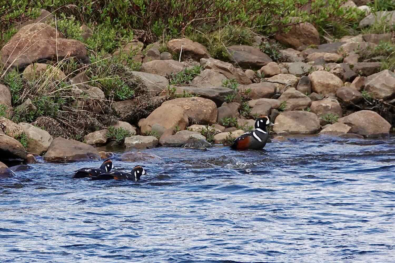
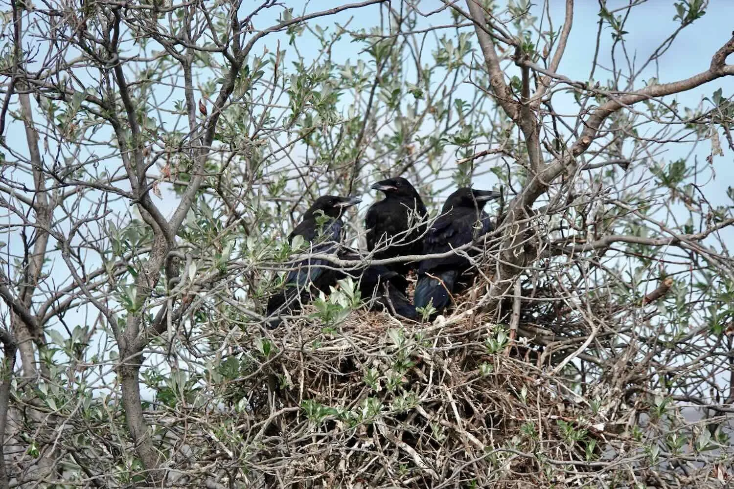
Although wildlife has been less abundant since we left the coastal plain behind, we did have a couple of fun sightings. A group of striking, male Harlequin ducks enchanted us as they floated down a fast-moving mountain stream. And we spotted a nest full of young ravens in a stubby willow bush, looking like they were nearly old enough to take flight.
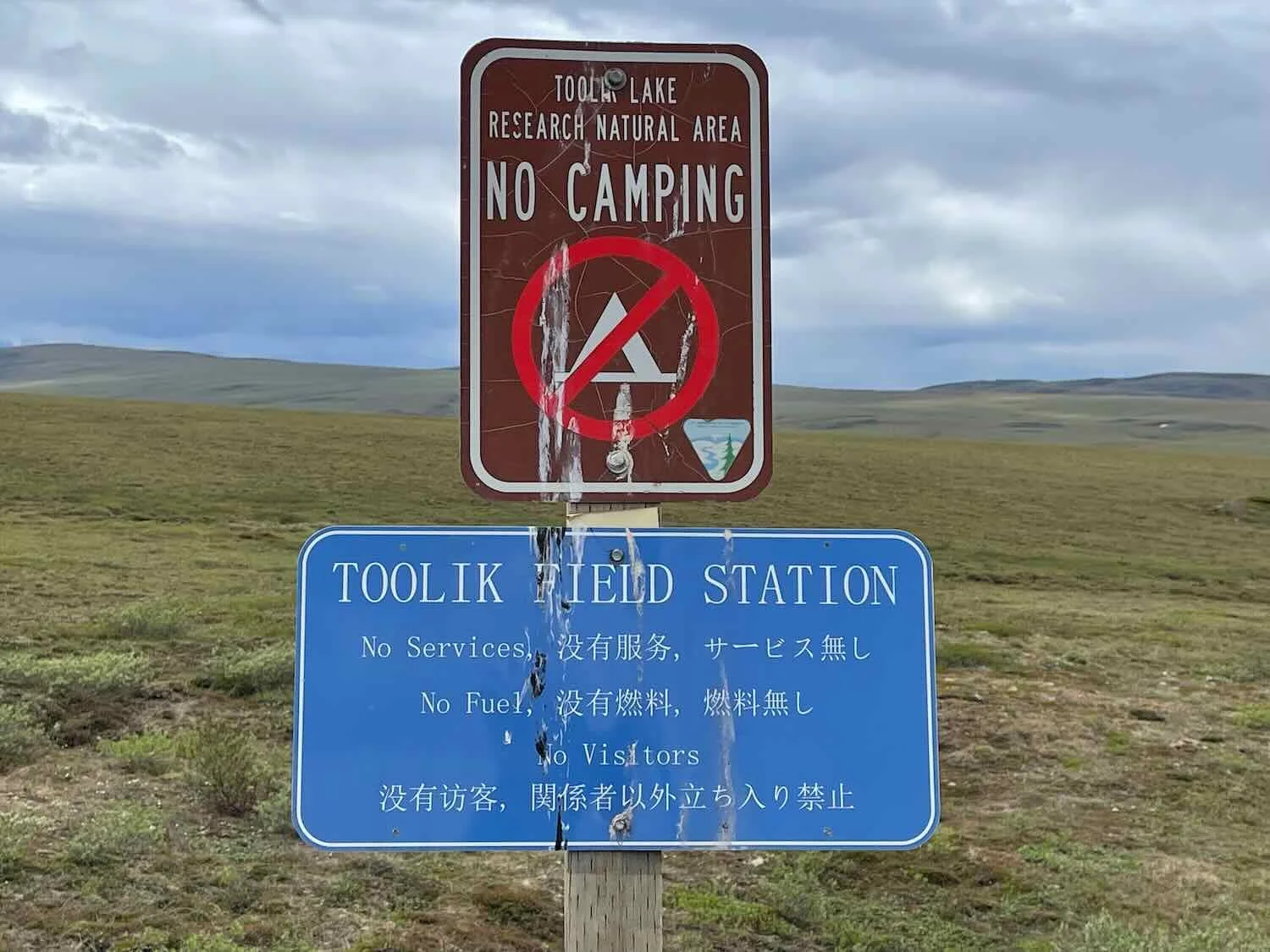
One of the pleasures of long-distance cycling is the small gestures of kindness that you encounter along the way. We had heard that the folks at the University of Alaska Toolik Field Station, a remote ecological research center, leave candy in their mailbox for passers-by. You can’t visit the field station itself, that’s off limits due to Covid-19 protocols. But we did help ourselves to a piece of caramel taffy from the mailbox, which brought a smile to our faces.
We set our sights on camping at the free, but primitive, Galbraith Lake BLM Campground. Although it’s a bit off-route, it was worth the ride to have a picnic table and a bear-proof storage locker (there still aren’t any trees for hanging a bear bag). As we neared the campground, a rainbow emerged as the sun cast its low light on a receding rain shower.
This rainbow brought the promise of fairer weather. Brooks Range, Alaska, USA. Copyright © 2019-2022 Pedals and Puffins.
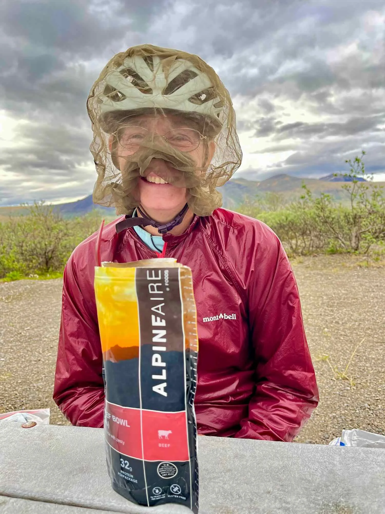
The Galbraith Lake Campground is a beautiful place to spend an evening. It’s right near the beginning of the ascent up the Atigun River valley, towards the crest of the Brooks Range. Consequently, it’s surrounded on three sides by rugged, picturesque mountains. We did, however, need to perfect our technique for eating dinner with a mosquito head-net on.

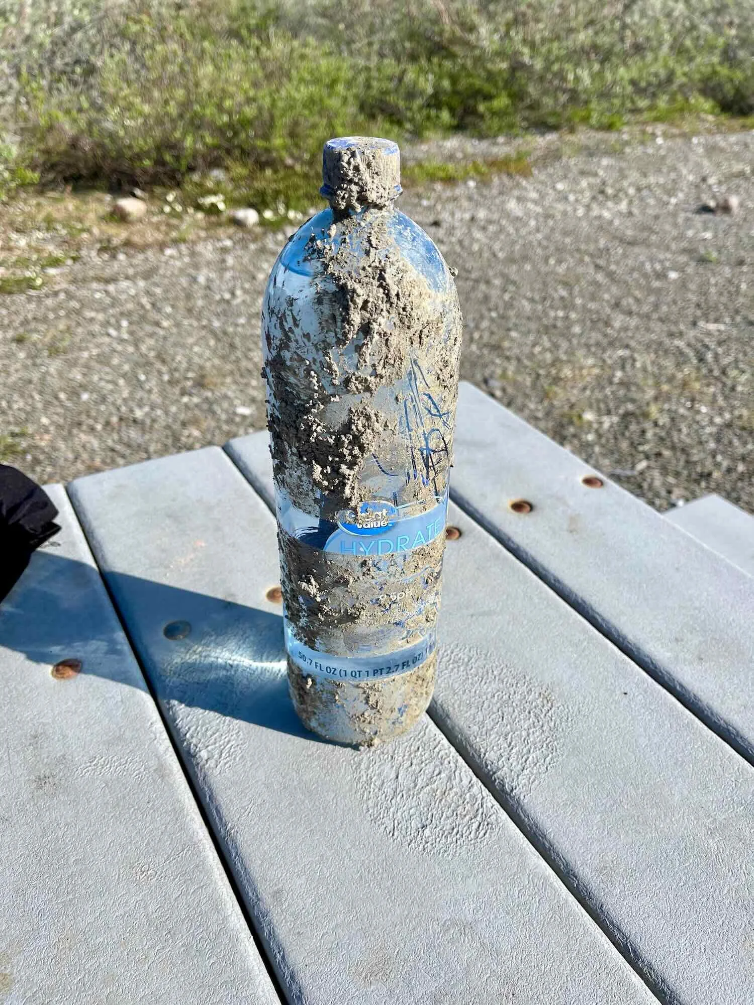
We also spent time scraping away some of the mud that had accumulated on our bikes, and anything else that was exposed to the muck that covers the Dalton Highway during a rainstorm. Even though our tires shed the mud well, the same could not be said for all of our gear.
Thankfully, we had a clear night at Galbraith Lake, so all of our gear was finally starting to dry out. It felt great. We also looked forward to a clear day for our ride up and into the Brooks Range. It was absolutely gorgeous.
Nothing but clear skies ahead. A perfect day to ride up and over Atigun Pass in the Brooks Range. It’s the highest highway pass in Alaska. USA. Copyright © 2019-2022 Pedals and Puffins.
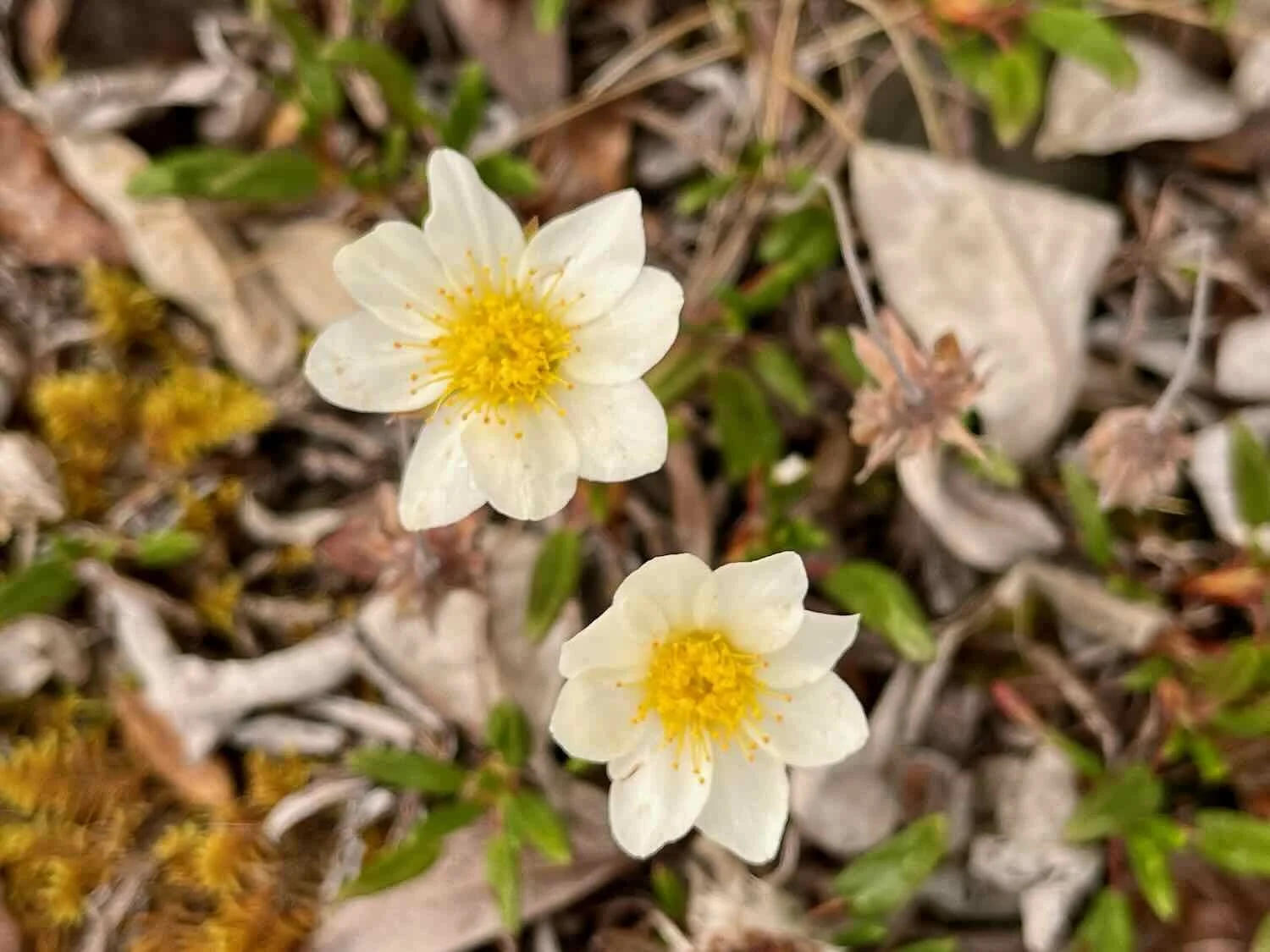
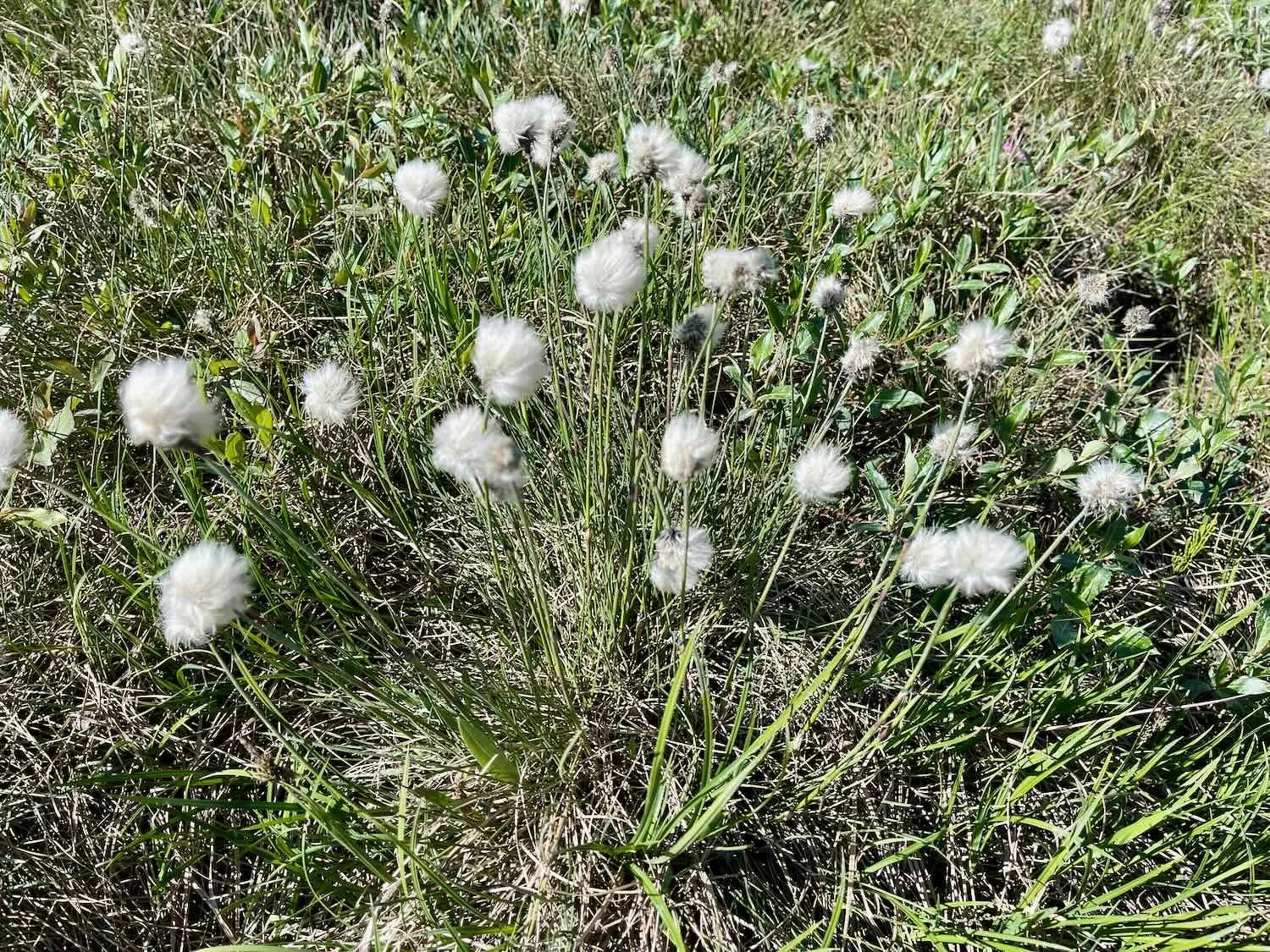
Wildlife was scarce on the road up to Atigun Pass. Instead we savored the multitude of wildflowers now bursting forth. Two of the most iconic species of the arctic tundra blanketed the landscape: mountain avens and cottongrass. Mountain avens is so characteristic of arctic and alpine tundras that paleo-ecologists use the presence of its pollen as an indicator of the expansion and contraction of tundra during the various ice ages. Cottongrass is also abundant on the tundra, especially in boggy areas. They say that the cottony heads help absorb solar radiation, increasing heat (and growth) in the plant’s flowers (which are buried inside).
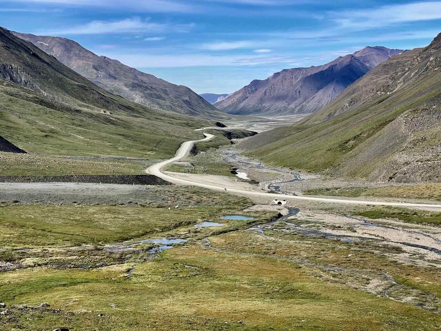
Snow capped peaks of the Brooks Range are reflected in Galbraith Lake, as we head down the Dalton Highway towards Atigun Pass. Alaska, USA. Copyright © 2019-2022 Pedals and Puffins.
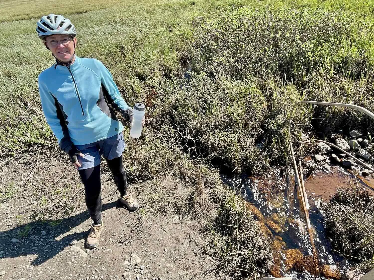
We were lucky that water sources were abundant along the northern sections of the Dalton Highway. Clear meltwater ponds and swiftly-flowing, glacier-fed streams were never far away when we felt the need to filter more water.
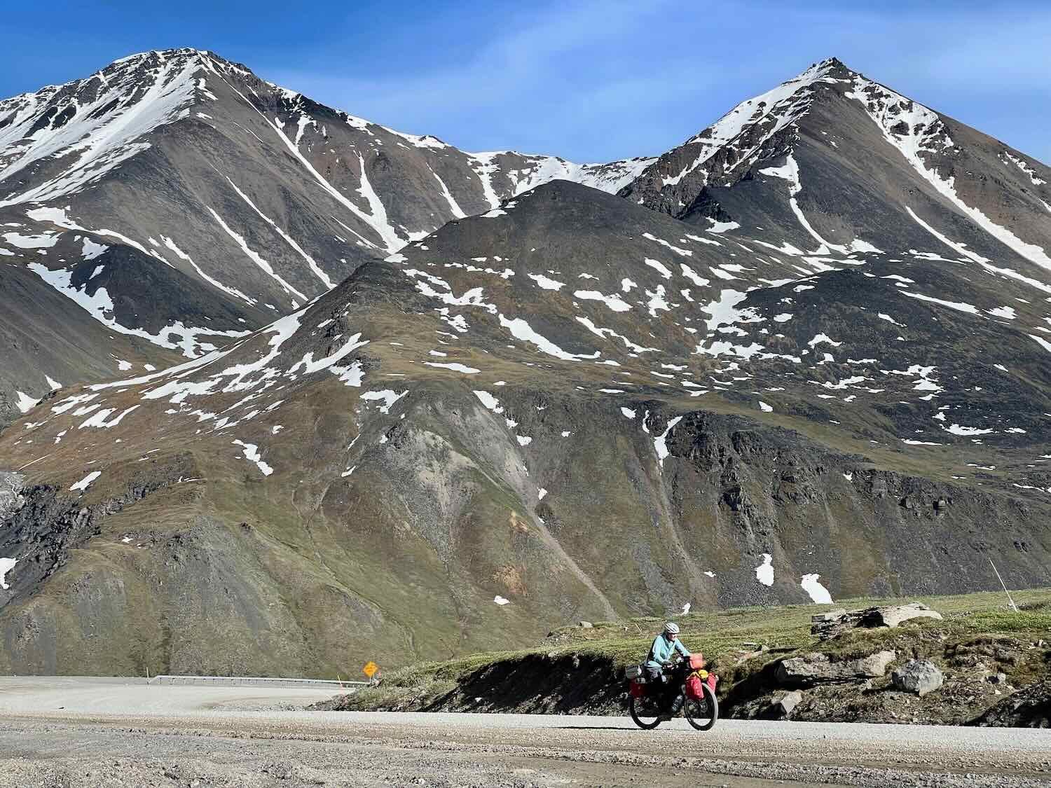
Inching Our Way Up Atigun Pass
This was a big climbing day for us. Our goal was to completely cross the main spine of the Brooks Range in a single day. That meant ascending more than 3,500 ft (1060 m) to the top of Atigun Pass. The scenery was absolutely spectacular the whole way. We were surrounded by barren mountains of dark basaltic rock, accented with sparkling white snow. And the lower reaches of the slopes were blanketed with a carpet of treeless green tundra.
Soaking up the views in the spectacular Brooks Range. The road up to Atigun Pass is in the background. Alaska, USA. Copyright © 2019-2022 Pedals and Puffins.
The last two miles to the top of the pass are much steeper than the rest of the route. A sign warns that in the winter, this area is particularly prone to avalanches. They have even installed two mounts for giant cannons that they use to initiate controlled avalanches, when the risk to the road is high. Apparently these military-style cannons can trigger an avalanche up to three miles away, helping to keep the snow load from becoming too dangerous.
The avalanche sign indicates we’re approaching the steepest gradients on the ascent to Atigun Pass. Alaska, USA. Copyright © 2019-2022 Pedals and Puffins.
Of course, we had a headwind while heading up the pass. Inching our way up the mountain was hard work. But each time we stopped for a rest, we were rewarded with glorious views back down the valley.
After forcing our way through a particularly intense headwind that nearly knocked us off our bikes, we finally reached the top of the pass. There, we were greeted by two Alaskan ladies who had driven up from the south. We chatted with them a bit about cycling, and they offered to take our victory photo at the summit.
At the top of Atigun Pass, those headwinds are just a memory. Now we can savor the victory. Alaska, USA. Copyright © 2019-2022 Pedals and Puffins.
From the top of the pass, we still had another 15+ miles to go to get down off of the exposed mountainsides. Luckily, it was nearly all downhill. The first couple of miles flew by as we plummeted off of the ridge, averaging about 30 mph (50 kph) until we reached the mellower incline of the Chandalar Shelf. We pulled over on a gravel ledge to have our dinner, with a stunning view of the valley below.
We chose a dinner table with a mountain view. Chandalar Shelf, Alaska, USA. Copyright © 2019-2022 Pedals and Puffins.
Goodbye Tundra, Hello Taiga
A few miles later, the end of the tundra was in sight. It wasn’t long before we passed a few scruffy-looking spruce trees - the first real trees we had seen since before the start of our ride at the Arctic Ocean. Initially there were just small clumps of trees. But soon, the lower slopes were blanketed in a dark, pine green, as a long finger of the boreal forest reached up the valley between the mountains. The banks of the Dietrich River were soon lined with cottonwoods and paper birches. We left the treeless world of the far north behind.
After so much time on the tundra, it was exciting to see the first few spruce trees of the taiga forest. Alaska, USA. Copyright © 2019-2022 Pedals and Puffins.
After another 10 miles, we selected a campsite across the road from the river, on an old, overgrown gravel road. As we scouted a good spot to put the tent, we noticed a number of animal tracks in the sandy soil. This was clearly a route used regularly by moose. But the more exciting prints looked like those of a wolf, perhaps following the moose. Sadly, we neither saw nor heard any wolves in our time along the Dalton Highway.
By morning we reached the conclusion (somewhat obvious in hindsight) that camping in an area close to the brush was not such a great idea. Tons of mosquitos pestered us the entire time we spent setting up and taking down our tent. Lesson learned.
We also discovered a fact that is well known to Alaskans: that the interior of the state becomes a smoky cauldron of wildfires in the summer (started by lighting strikes). For the most part, the fires are allowed to burn as they have since the beginning of time, unless they threaten human habitation. The fires are a natural part of these ecosystems.
The river valley we were biking through was blanketed with a smoky haze, obscuring our view of the surrounding mountains. More distant peaks were often barely visible.
Each summer, interior Alaska is blanketed by the smoke of naturally-occurring forest fires. The fires are allowed to burn unless they threaten human infrastructure. Alaska, USA. Copyright © 2019-2022 Pedals and Puffins.
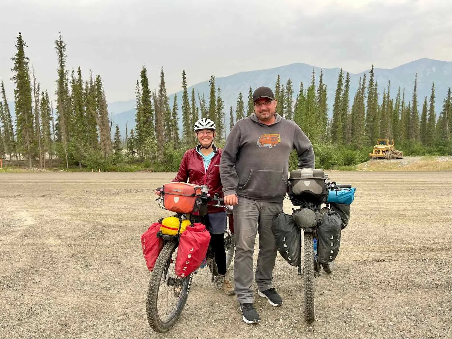
Not long into the day’s ride we had a wonderful surprise. A pickup truck pulled up next to PedalingGuy, and the driver asked us to stop and visit when he pulled off the road up ahead. When we arrived, the driver offered us an extraordinary gift - a big bag chock full of delicious, real food. Items included deli sandwiches, cookies, fruit, boiled eggs, fresh vegetables, and more. We were blown away by his warmth and generosity. And all those goodies made the rest of the 50+ miles to Coldfoot a pleasure.
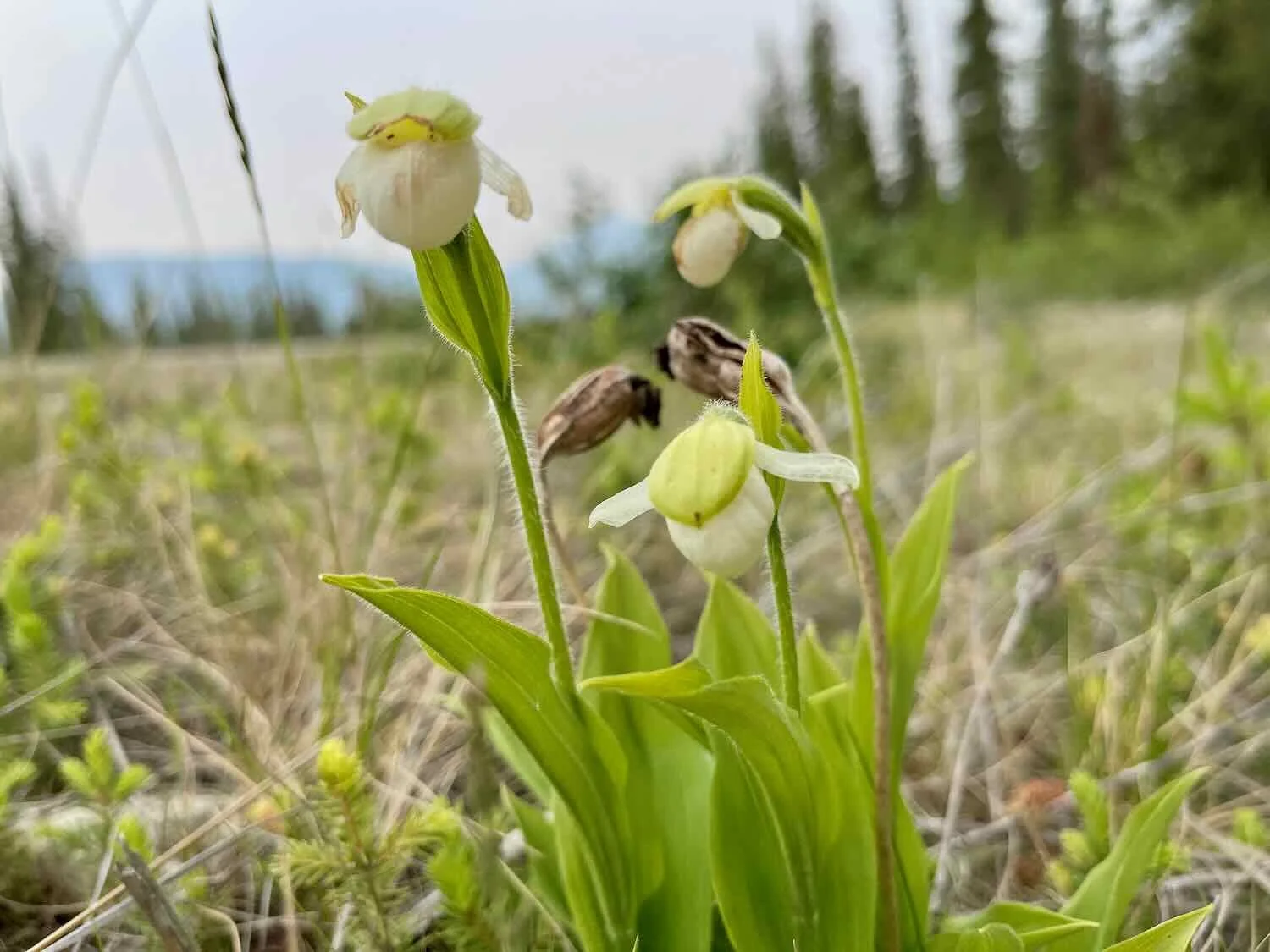
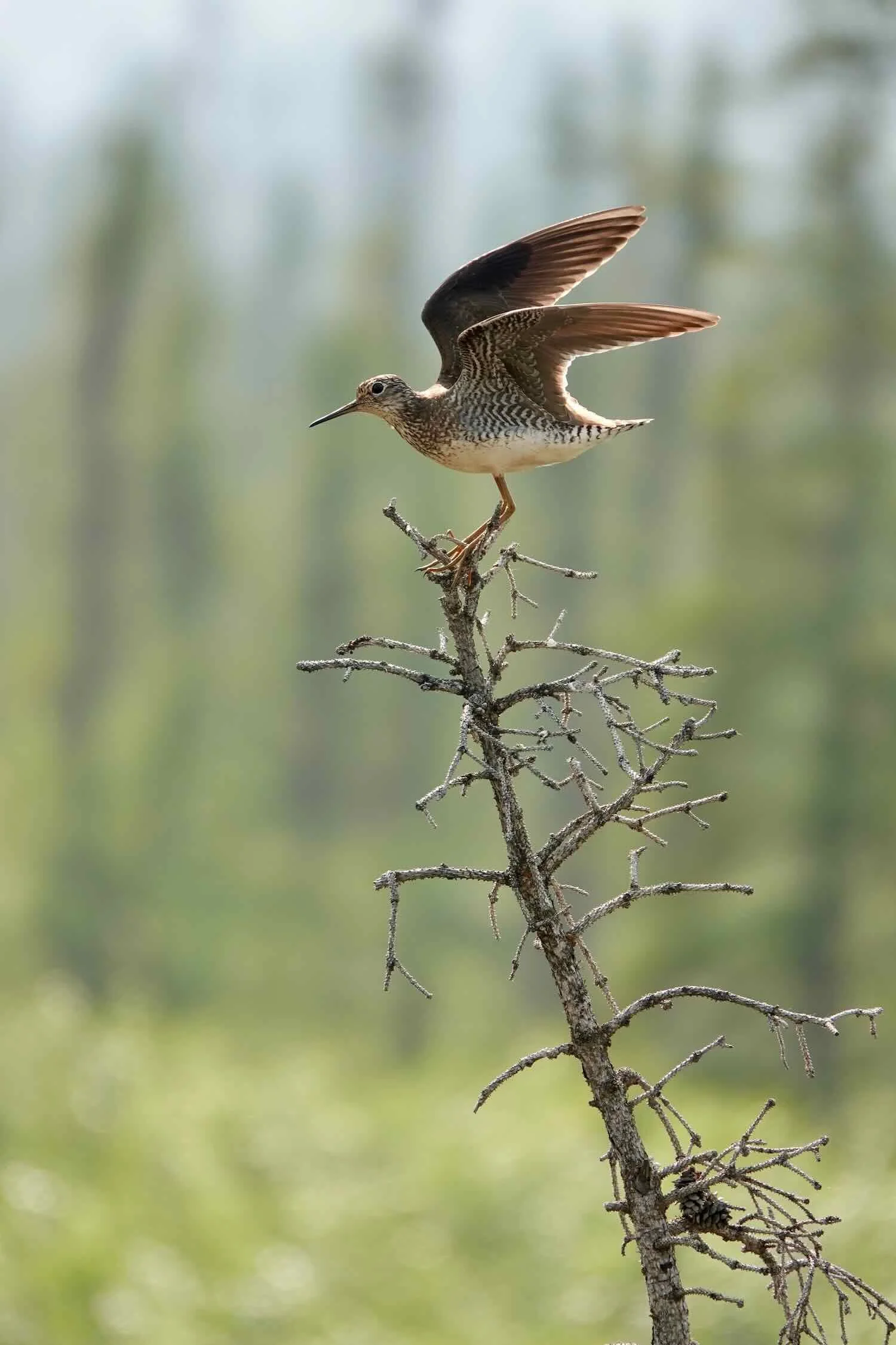
With each passing mile, there seems to be something new and interesting to see. It’s always a delight to see orchids in the field, so we were excited to see a cluster of sparrow’s egg lady’s slippers growing near the road. No other lady’s slipper grows as far north as this hardy, bog-loving orchid. We also enjoyed the attention of an agitated lesser yellowlegs that whistled energetically at us as we rode by. It must have had a nest in the area. We’re used to seeing these birds knee deep in water along the coast. But watching it land at the apex of a dead spruce tree reminded us of similar images we saw nearly 30 years ago, when we visited the tundra in northern Manitoba. It brought back pleasant memories.
By early evening we finally made it to the Coldfoot Camp. We’d traveled nearly 250 miles across the Arctic wilderness, and we were in the mood for some modern conveniences. A hot shower, and hearty dinner from the Coldfoot Cafe set us up for a peaceful night’s sleep camping on the banks of the nearby pond.
A place of comfort in the wilderness - the Coldfoot Cafe. Alaska, USA. Copyright © 2019-2022 Pedals and Puffins.