Cycling Fairbanks, Alaska to the Canadian Border: Fire and Rain

9 - 16 July 2022
9 July - Fairbanks to C Lazy Moose Campground (51.1 mi, 82.2 km)
10 July - C Lazy Moose Campground to Delta Junction (47.2 mi, 76.0 km)
11 July - Rain day in Delta Junction
12 July - Delta Junction to Wild Camp near Robertson River (73.6 mi, 118.5 km)
13 July - Wild Camp near Robertson River to Tok, Alaska (33.2 mi, 53.4 km)
14 July - Layover in Tok, Alaska
15 July - Tok to Teslin National Wildlife Refuge (56.8 mi, 91.4 km)
16 July - Teslin National Wildlife Refuge to Border City Lodge, Alaska (30.2 mi, 48.6 km)
Most people have heard that Santa Claus lives at the North Pole. However, there is some confusion about the true location of Santa’s home. For most of our lives, we thought Santa literally lived at the North Pole that sits at very top of the globe, where all directions point south. Well, now we know better. Santa’s House is in North Pole, Alaska - just 15 miles (24 km) down the road from Fairbanks. And anyone can visit.
We had originally planned to cycle southward out of Fairbanks on the Parks Highway. But a massive and fast-moving forest fire (incongruously called the “Clear Fire”), was burning close to the road. Several communities along the Parks Highway had been evacuated, health advisories were at their highest level due to smoke, and a road closure seemed imminent. Reluctantly, we acknowledged that we probably shouldn’t cycle that way. With smoke from the fires heavy in the air, we instead headed down the Richardson Highway, towards North Pole.
A Visit With Santa and His Reindeer
The town of North Pole has fully embraced its status as Santa’s hometown. The Christmas-themed welcome sign sets the tone. Street lamp posts are painted like candy canes. And the post office accepts mail addressed to Santa Claus.
Nearly everything in the small town of North Pole (pop. 3,000) is infused with Christmas spirit. The town’s welcome sign sets the tone. Alaska, USA. Copyright © 2019-2022 Pedals and Puffins.
Of course, once we knew that we’d be passing Santa Claus’s house, we had to stop by for a visit. Down a quiet street sits a large candy-red-and-white building where, apparently, the Christmas magic happens. Colorful, festive murals adorn several of the outside walls. We didn’t go inside to meet Santa (he was probably very busy). But we did stop to admire the artwork, and appreciate the town’s enthusiasm for its jolly old patron.
Our mode of transportation, juxtaposed with Santa’s. North Pole, Alaska, USA. Copyright © 2019-2022 Pedals and Puffins.
Next door to Santa Claus’s House is the Antler Academy. According to Christmas lore, reindeer that want to join Santa’s sleigh team need to learn special skills (like how to fly) and pass a rigorous evaluation. The Antler Academy is where the top reindeer reside. We wandered over to see Dasher and Dancer, etc. They must have been on break, though. All of the reindeer were lounging on the ground, chewing their cud. They didn’t quite have that spark in their eye that you might expect from top-performing steeds (or that the wild caribou have).
One of Santa’s reindeer at the North Pole Antler Academy. He’s taking a break from his rigorous training schedule. Alaska, USA. Copyright © 2019-2022 Pedals and Puffins.
As we departed North Pole (and indeed, from the moment we left Fairbanks), the world around us was shrouded in a deep, gloomy haze from the forest fires. It was some of the worst smoke we’ve had to ride through in a very long time. Often, we could actually smell the smoke, which isn’t a good sign. Little-by-little, the smoke lessened the farther we got from Fairbanks. But it remained quite thick for nearly a week.
Another fun stop along the road out of Fairbanks was The Knotty Shop. Riding up to the front door, it’s immediately apparent where this gift shop/cafe gets its name. Most of the building is adorned with wood that is covered with knots and burls, giving it a uniquely lumpy appearance. And the front lawn is populated with fantastical creatures carved from the same, knotty wood.
The Knotty Shop is aptly named, given the profusion of knotted and burly wood used in its construction. Richardson Highway, Alaska, USA. Copyright © 2019-2022 Pedals and Puffins.
Fortunately, this giant, knotty mosquito doesn’t bite. Richardson Highway, Alaska, USA. Copyright © 2019-2022 Pedals and Puffins.
Inside The Knotty Shop is a veritable stuffed animal museum. The entire back wall is festooned with mounts of every conceivable Alaskan animal. And throughout the store, smaller stuffed animals appear perched atop the shelves of merchandise. Richardson Highway, Alaska, USA. Copyright © 2019-2022 Pedals and Puffins.
And then It Started to Rain
The rest of the day’s ride was uneventful except for one thing: the rain. Much to our chagrin, this would become a regular feature in our cycling for more than a month. It rained the entire afternoon and throughout the night, thoroughly soaking our cycling clothes, and ensuring that nothing would be dry by morning.
Our camp by the Tanana River. The head-net was needed because, surprisingly, mosquitos can fly around just fine in a light rain. Richardson Highway, Alaska, USA. Copyright © 2019-2022 Pedals and Puffins.
Many of the sites at the C Lazy Moose Campground are numbered on moose antler posts. Richardson Highway, Alaska, USA. Copyright © 2019-2022 Pedals and Puffins.
The Tanana River (pronounced Taa-nuh-NAW), which flowed by our campsite, was running high. Water was creeping up over the river bank, into the grasses that lined the channel. It wasn’t swollen from the rain, though. There hadn’t been enough rain yet to cause any flooding. Instead, the high water resulted from a recent heat wave. The warm weather caused upstream glaciers to melt faster than normal, raising the level of many rivers in the area.
The Tanana River near our campsite was running fast, and a little high. Luckily, our tent was high on a hill without any risk of getting flooded. Richardson Highway, Alaska, USA. Copyright © 2019-2022 Pedals and Puffins.
With all our riding clothes wet, we had a hard time motivating ourselves to get started the next morning. To make matters worse, as we were packing up, we discovered that we both had been a bit careless in closing our panniers the previous evening. We each had several bags where the rain managed to seep in and water had collected in the bottom, wetting everything inside. We used a rag to dry the insides as best we could, but the wetness had now seeped through even more of our stuff.
But there’s always a silver lining. The rain had started to clear the air, and there was quite a bit less smoke. Even so, everything was still in soft-focus. The sky-high humidity clung to whatever smoke particles remained in the air, shrouding the landscape in a damp fog.
With less smoke in the air, we could now see the distant mountains. But a damp fog kept everything in soft focus. Beach-head iris on the shore of Birch Lake. Richardson Highway, Alaska, USA. Copyright © 2019-2022 Pedals and Puffins.
Right out of camp, the road launched into a series of hills. We also passed several roadside stops that had historical information signs. Together, these factors slowed our cycling progress somewhat for the first couple of hours.
Checking out the roadside signs along the highway. Most contained historical information about the gold rush era, or about Native American traditions. Richardson Highway, Alaska, USA. Copyright © 2019-2022 Pedals and Puffins.
Suddenly, Many Moose
But eventually the highway settled down close to the banks of the Tanana River. The hills melted away as we cycled through a low, boggy area covered with lakes and ponds. The thought occurred to both of us that this looked like good moose habitat. And literally within a few minutes after that, a motorist heading the other way slowed down and shouted out her window, “Moose ahead, be careful!”
Sure enough, just up ahead was a fine looking, lone moose munching on grass not far from the road. In case you haven’t heard, moose are considered very dangerous, especially in the spring with young ones to protect, and in the fall when the males are in rut. That’s why the lady in the car warned us about the upcoming moose.
We spotted this moose feeding close to the road, in a marshy area near the Tanana River. Richardson Highway, Alaska, USA. Copyright © 2019-2022 Pedals and Puffins.
Then, only a few miles down the road, we saw a mama moose and her calf cross in front of us, headed toward the far side of the road. We slowed our pace, and kept a lookout as we approached the location where they had crossed. By the time we reached them, the moose were a couple of dozen yards down a dirt road. We decided not to stop, because we didn’t want to contend with a protective mother moose. But we still got a pretty good look at her.
Then a few moments later, we spotted another moose crossing the road in the distance ahead of us. That one was headed from left to right, entering the bushes on our side of the road. So we crossed over to the left side, and rode against the traffic until we were pretty sure we had passed the spot where the moose might be. We never saw that moose again, but that was okay. It was simply exciting to see so many of the huge, awkwardly-majestic animals in such a short amount of time.
The rest of the ride went smoothly, and our spirits were high as we approached the town of Delta Junction. But dark clouds had been massing on the horizon. And when we were only three miles (5 km) away from town, the rain finally started to fall. It was a steady, soaking rain, and we were completely drenched by the time we reached the Delta State Recreation Site campground.
As the rain continued to fall, we selected a camping spot and paid the overnight camping fee. But we decided not to set up the tent until after we had gone into town to get dinner. We imagined going to a nice, warm, dry restaurant where we could shake off the damp cold that had sunk into our bones. With any luck, the rain would stop before we headed back to camp.
But that was not to be. It was Sunday, and nearly all of the restaurants in Delta Junction are closed on Sundays. After checking out a couple of options that were closed, we started to worry. We asked a local woman if she could suggest a restaurant that might be open, and she recommended a burger place that only had covered, outdoor seating or the Trophy Lodge, which was a couple of miles away. We opted for the burger place.
The restaurant was bustling with people, the food was hearty, and we were glad to be out of the rain - which continued to pelt down. But by the time we had finished eating, we were chilled to the core. PedalingGal was shivering and unable to warm up. The idea of going back to the campground, setting up a damp tent, and not being able to dry out our clothes or other belongings (which were still wet from yesterday’s rain) was not very appealing.
We started calling local hotels. But no rooms were available. It looked like we would be camping after all.
Then we decided to try the Trophy Lodge. They were located a couple of miles out of town, but they did have an on-site restaurant. And they had a room available. We took it. On reflection, it was too bad we hadn’t gone there for dinner in the first place, and not already paid for camping, but nonetheless we were very thankful in the end to get out of the cold rain. Within a short time after checking in, our stuff was noticeably drier. A warm shower helped, too.
A place to dry out ourselves and our waterlogged gear. Delta Junction, Alaska, USA. Copyright © 2019-2022 Pedals and Puffins.
The next day produced another series of passing rainstorms, some with thunder and torrential rain. We decided to hunker down for a day to stay warm and dry. While we were there, we heard the news that the Top of the World Highway, which we had planned to ride, was blanketed in dense smoke. A check online confirmed that a long section of road south of Dawson City was under a low-visibility advisory. Given that a key reason we had planned to cycle that way was to enjoy the views, we decided to skip it and take the Alaska Highway all the way to Whitehorse in the Yukon.
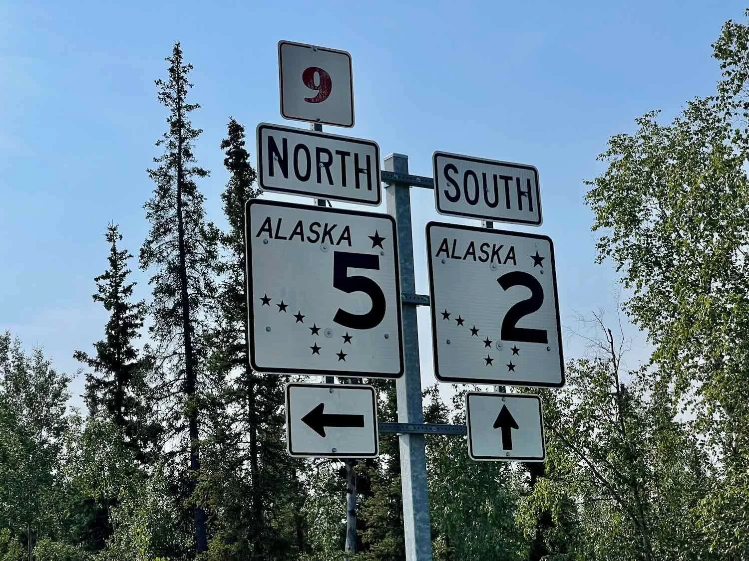
The Alaska Highway, Backwards
Officially, the Alaska Highway does not go all the way to Fairbanks, Alaska. That’s because the Richardson Highway between Delta Junction and Fairbanks already existed when the Alaska Highway was built. So the modest town of Delta Junction (pop. 1,200) gets to claim the illustrious title of End of the Alaska Highway. Several monuments and signs around town proclaim the town’s special status.
As with the Dalton Highway, we are starting our journey on the Alaska Highway at its end, in Delta Junction. By heading south, we’re basically riding the highway backwards. Alaska, USA. Copyright © 2019-2022 Pedals and Puffins.
A light morning drizzle ended by 9am, allowing us to ride most of the day without any rain. A lingering dampness and fog continued to obscure our views for the third day in a row. But we reveled in the pleasure of riding without being soaked.
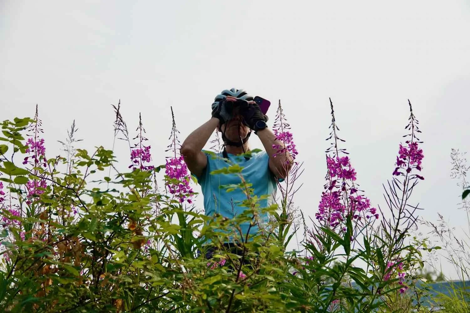
The recent rains seem to have caused fireweed to burst forth in bloom. The roadsides, hillsides and just about every open space was blanketed with the exuberant, purple flowers. Each patch of fireweed that we passed seemed to be even more dense and brightly colored than the last. PedalingGuy couldn’t help himself, and we kept stopping so that he could take photos of each new patch of flowers.
In the early part of the day, our progress was slowed considerably by the gorgeous blankets of fireweed along the road. PedalingGuy just had to keep stopping to photograph each new patch of the brightly-colored flowers. Alaska Highway, USA. Copyright © 2019-2022 Pedals and Puffins.
Before setting out each day, we try to make sure we know if there are any potential resupply or stores along our route, since there are so few opportunities to get food and water. But every so often, we come upon a small store that was not on our radar. When these places appear along extended stretches of wilderness riding, they are especially welcome. About two hours after departing from Delta Junction, we had one of those nice surprises when we arrived at the Silver Fox roadhouse and hunter’s camp.
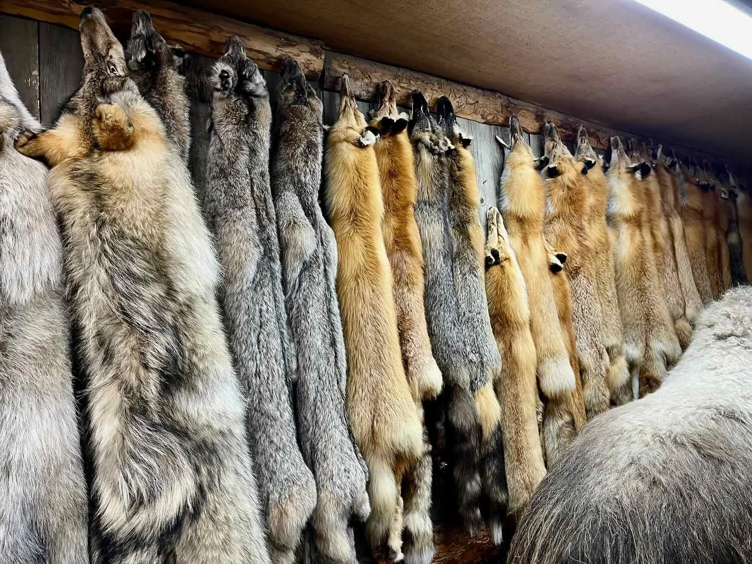
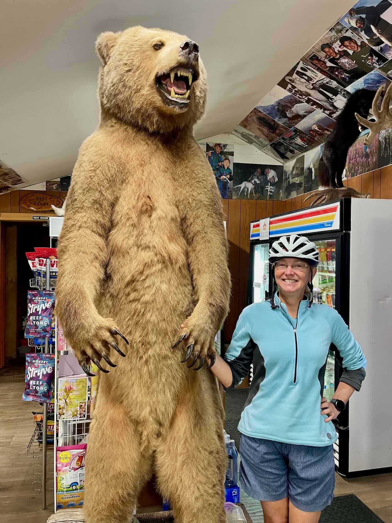
Upon entering, it was clear that this was not just a regular, roadside convenience store. One wall was lined with coyote, fox, wolf, beaver, and other pelts. There were quite a few mounted animals, including caribou, moose, bison, and a giant grizzly bear. Another wall was a mini museum, with photos honoring the hunters and trappers that stayed at the lodge or provided furs for sale.
We were surprised to learn that in addition to moose, caribou and bison are also hunted in the area around Delta Junction. Bison were introduced in the 1920s, into an area along the Delta River that had been inhabited by the animals until a few hundred years ago. And there are three different caribou herds found in the mountains surrounding the town. As we ate a second breakfast, we chatted with the proprietor and his friend, getting a feel for the local hunting and trapping culture. It was a thoroughly enjoyable stop, that set us up for a great day of cycling.
Even the Rivers are Bigger in Alaska
A highlight of the ride was the crossing of three massive rivers: the Gerstle River, the Johnson River and the Robertson River. As glacier-fed waterways, they were all running high, which made them especially impressive. Each one spanned a quarter mile, covered by a dizzying maze of sand bars and channels that were filled with churning, latte-colored water. Twisted piles of deadwood were snagged on the sand bars, often reaching out ominously into the river channels. We didn’t see a single boat on these rivers. They appear to be unnavigable, at least while the water is running this high.
The murky, brown water of the Johnson River churned below us as we gazed towards shadowy mountains from a bridge on the Alaska Highway. Alaska, USA. Copyright © 2019-2022 Pedals and Puffins.
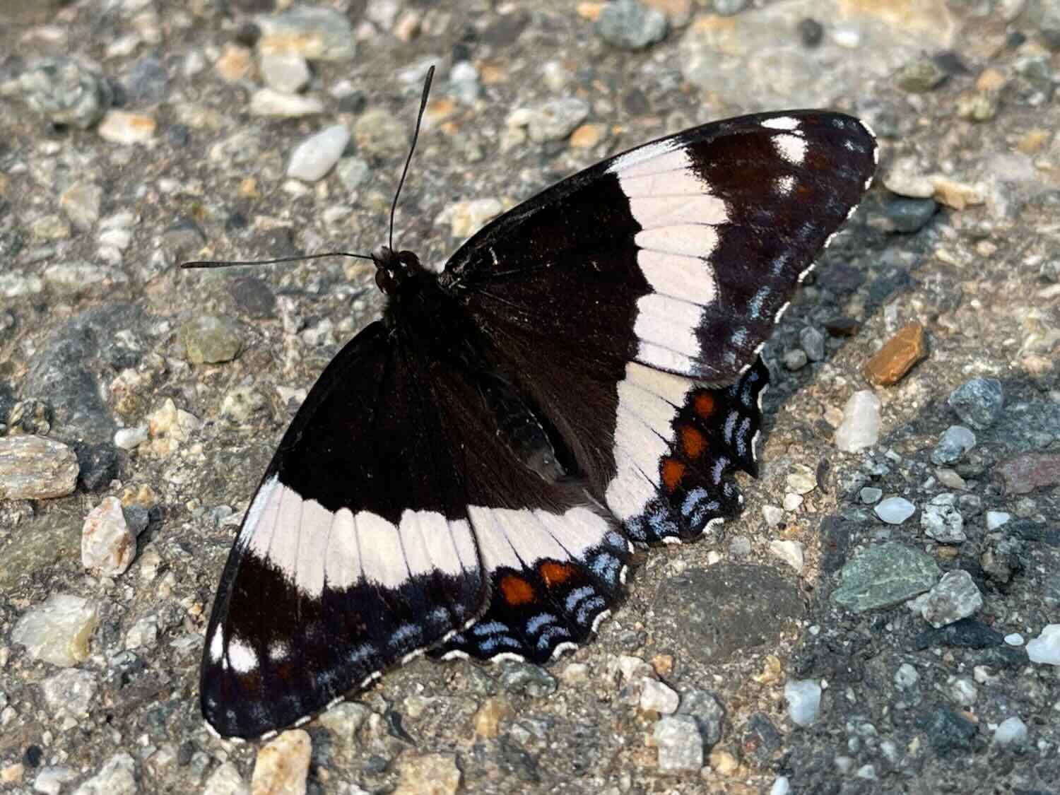
When we startled a covey of birds by the side of the road, we were surprised to discover that they were sharp-tailed grouse. We’ve always thought of these as prairie birds. But it turns out that there’s a disjunct population of sharp-tailed grouse that live in the open-canopied spruce bogs along the Yukon and Tanana Rivers. It’s always exciting to come across something unexpected while out in the wild, like sharp-tailed grouse in a spruce bog. Some beautiful butterflies rounded out our wildlife sightings for the day.
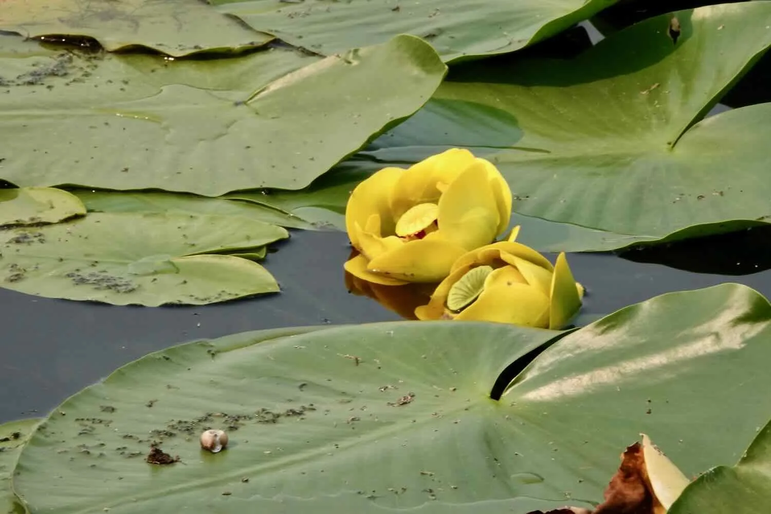
Late in the day we passed the tiny community of Dot Lake (pop. 21). At the rest stop along the lake shore, we scoped out the distant ducks, photographed the water lilies, and were charmed by the small, wooden community chapel. The chapel was constructed by volunteers in 1949 at a different site, and moved on skids during winter to its present site. Services are still held each Sunday.
The Dot Lake Community Chapel (c. 1949) still serves the small, local community. Alaska Highway, USA. Copyright © 2019-2022 Pedals and Puffins.
Towards the end of the day the a stiff headwind kicked up. We ducked onto a tree-lined side road near the Robertson River to cook dinner. The trees provided some protection from the wind.
We approached the bridge over the broad, Robertson River still shrouded in a haze of smoke and fog. A tree-lined side road near the river sheltered us from the wind while we cooked and ate our dinner. Alaska Highway, USA. Copyright © 2019-2022 Pedals and Puffins.
Like the other big rivers in this region, the Robertson River was comprised of multiple, swiftly-flowing channels of water, snaking their way among a maze of sand bars. Alaska Highway, USA. Copyright © 2019-2022 Pedals and Puffins.
Looking for a place to camp, we pulled off the road into an old gravel pit that was covered with the fluffy white heads of cottongrass. The pit was larger and deeper than others we’ve camped near on this trip. With the carpet of cottongrass, it was rather pretty. We chose a spot near the rim with the best air circulation, and the least mosquitos.
A carpet of cottongrass blanketed an old gravel pit where we spent the night. Alaska Highway, USA. Copyright © 2019-2022 Pedals and Puffins.
An Abundance of Cyclists
Since our departure from Deadhorse, we’d seen only one other long-distance cyclist during nearly a month of travel. It had started to seem like there weren’t many touring cyclists around. But that notion was put to rest on our relatively short ride into Tok, Alaska. We crossed paths with six cyclists, mostly heading north to Deadhorse, starting from various points in Canada and the United States.
We were only about 2.5 miles (4 km) into our ride when we stopped to have breakfast at some picnic tables by the road. Within a few minutes, up rode Michael. He had started cycling from Deadhorse, Alaska ahead of us, but then he caught Covid-19 in Fairbanks. He ended up quarantining for two weeks in Delta Junction with a family of folks that also had Covid (they apparently didn’t mind adding him to the mix). This was his second day back on the road after testing negative for the virus.
Michael was a dual Australia/US citizen from Oregon, and his plan was to cycle back home. While we were chatting about bikes another cyclist arrived, heading northward. Brent was from Idaho. He told us he had basically started cycling right from his front door, and he was headed to Deadhorse as the end of his ride. He had two cycling companions who were behind him, but he left us before they arrived.
Once we were back on the road we passed Michael again, where he had stopped to visit with two other cyclists heading north. They were probably Brent’s companions. We were eager to get to Tok, so we didn’t stop. We just waved as we rode by.
Finally, about an hour outside of Tok, we saw two women cyclists stopped by the side of the road. They were also heading north. Concerned that they might need some help, we pulled over to make sure everything was okay. They were fine, but said they didn’t like cycling in the heavy smoke which still hung in the air. They had heard that the smoke only got worse closer to Fairbanks, and they were discouraged about that. They had decided to try to hitch a ride up to Fairbanks, rather than breathe all the smoke. We couldn’t really blame them. Hopefully they were able to get a lift.
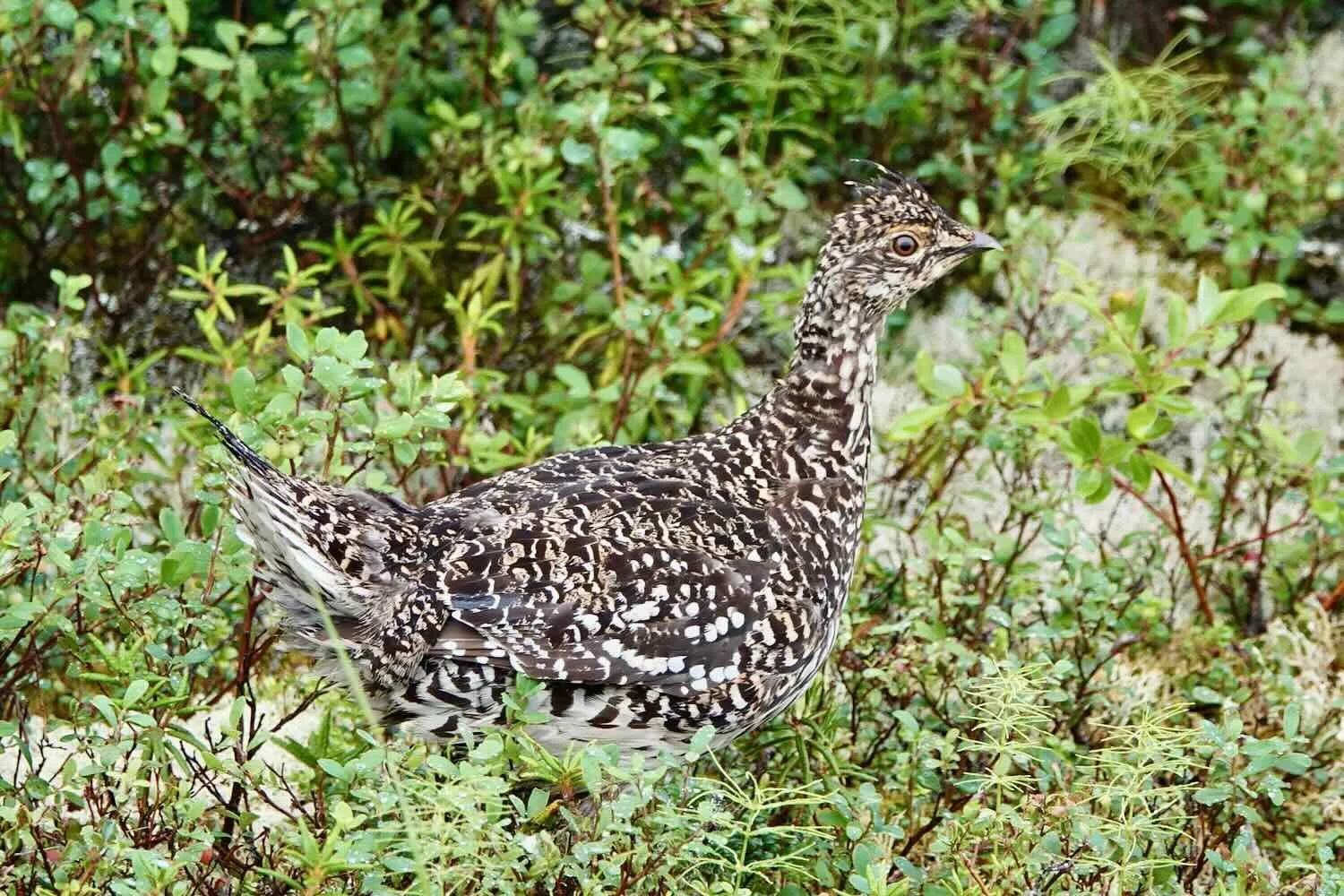
Our wildlife highlight for the day was a covey of spruce grouse. And even though there was still smoke in the air, we were able to consistently see the mountains of the Alaska Range to our south.
A spruce grouse along the Alaska Highway. The spruce forests of Alaska are the perfect habitat for these birds. Alaska Highway, USA. Copyright © 2019-2022 Pedals and Puffins.
We’re starting to see the mountains. The shadows of the Alaska Range were now consistently visible to the south. Alaska Highway, USA. Copyright © 2019-2022 Pedals and Puffins.
There was a good bike path for the last 12 miles (19 km) into Tok, making the arrival into this frontier town really easy. We were lucky to get an early check-in at the motel where we could plot our strategy for cycling to Whitehorse, Yukon (now that we had decided to stay on the Alaska Highway). The town supermarket was next door, so we were able to enjoy some hearty, fresh food in our room.
Homemade dinner in Tok, Alaska, USA. Copyright © 2019-2022 Pedals and Puffins.
Clear Skies Ahead
We had heard from the other cyclists who were heading north that the smoke from forest fires that had plagued us for the past week would finally start to dissipate once we passed Tok, Alaska. And to our great delight, this prediction came true. After departing Tok, we could finally see the forested tree slopes on the surrounding mountains, instead of just seeing hazy gray shapes in the distance.
Unfortunately, the road surface past Tok deteriorated rapidly. There were quite a few sections that were riddled with tar patches, loose gravel and potholes. Then, a little over an hour into our ride, we came up to some road construction. The construction zone only lasted about a mile, but they were still using a pilot car. Unfortunately for us, they insisted that we ride in the pilot car even though the distance was short.
PedalingGuy did his best to try to persuade them to let us bicycle through, but to no avail. He did emphasize that our recent experience with a pilot car on the Dalton Highway was traumatic, and that may have encouraged this pilot car driver to be more patient. She promised to give us a good experience, and she delivered. We were allowed time to remove some items from the bikes (backpacks, bottles, bear spray) and stow them separately. And we were both able to ride in the back of the pickup truck so that we each could keep an eye our bikes. Finally, she drove more slowly, and the road was smooth pavement for most of the way. In the end, it wasn’t such a bad ride.
But it certainly didn’t save us any time. In fact, it probably took 2-3 times as long to load and unload the bikes and ride in the pilot vehicle as it would have taken to cycle through.
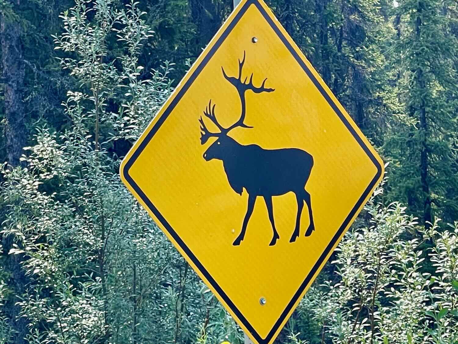
As we continued southeastward, we entered the Tetlin National Wildlife Refuge - a land of lake-studded spruce forests. We stopped periodically to read the signs along the highway with information about the Refuge. We learned that there was another, local caribou herd that lives there and migrates from the lowland lakes up to the alpine meadows in the summer. Sometimes that route takes them across the highway. There were several places with “caribou crossing” signs, to alert motorists to the danger. But there were no caribou to be seen near the road when we passed through.
Midway Lake is one of the bigger lakes we’ve seen. A wildlife refuge sign tells about how the caribou migrate from these lowlands up to alpine meadows of the Alaska Range in the summer. Alaska Highway, USA. Copyright © 2019-2022 Pedals and Puffins.
The wilderness of the Tetlin National Wildlife Refuge stretches as far as the eye can see, including the summer range of caribou in the distant mountains. Alaska Highway, USA. Copyright © 2019-2022 Pedals and Puffins.
A quick dinner at the convenience store in Northway Junction set us up for the final push to the Lakeview Campground, where we spent the night. Alaska Highway, USA. Copyright © 2019-2022 Pedals and Puffins.
A Day Cut Short
That night, the rain started to fall again. And when we woke up, it was still raining. Except for running out for a quick bathroom break, we didn’t get out of our tent until noon when the rain finally subsided. Needless to say, we did not get an early start to our cycling.
As a result, our day was cut pretty short. But this rainstorm finally washed away most of the smoke from the forest fires. Each day since we left Fairbanks, a bit more of the landscape has been revealed to us. Now, for the first time, we caught glimpses of the distant Wrangell Mountains, wrapped in low-hanging clouds. These are some of the highest mountains in North America, and they were suitably impressive. The big peaks still had quite a bit of snow and ice on them, even in mid-July.
Our first glimpses of the majestic Wrangell Mountains. Many of the peaks still had snow and ice fields, even in mid-July. Alaska Highway, USA. Copyright © 2019-2022 Pedals and Puffins.
A couple of hours into our ride we had only covered about 18 miles (29 km), and we came to the conclusion that we weren’t going to make it all the way to Beaver Creek in Canada before 8pm, when the office at the campground we were heading for would close. On the fly, we decided to stop to get some extra water at the National Wildlife Refuge’s Visitor Center so that we could wild camp before reaching the port of entry for Canada.
Even that was pushing our time constraints. The visitor center would close at 4:30pm, and we barely had enough time to get there. We careened into the parking lot of the visitor center at 4:15pm, only to find that it was already closed, with no explanation (the hours posted on the door clearly said it would be open to 4:30). Strike one. Sadly, this wasn’t a big surprise. It’s not the first time we’ve arrived at a federal facility that was closed when it was supposed to be open. It’s disappointing that these centers are not run with a bit more care.
We had hoped to visit the Tetlin National Wildlife Refuge Visitor Center, to learn about the refuge and get some water. But even though we arrived with 15 minutes to spare, the center was closed. Alaska Highway, USA. Copyright © 2019-2022 Pedals and Puffins.
Since we were there, we took some time to view a couple of the outdoor exhibits. They had a truly impressive reproduction of an Alaskan food cache on stilts. It was more than double the size of other caches we have seen, and looked particularly bear-proof.
This Alaskan food cache, outside the Tetlin NWR Visitor Center, looked big enough to serve a whole community. Alaska Highway, USA. Copyright © 2019-2022 Pedals and Puffins.
Anyway, there were public washrooms that had an external entrance, so we thought we’d get some water there. No luck. the washrooms had no water, only hand sanitizer. Strike two.
Then it started raining again. Strike three.
Without any other options, we headed down the road towards the US border station, hoping we had enough water to avoid too much discomfort over night.
Then a small miracle happened. A couple of miles down the road, we spotted the Border City Lodge through the rain. Much like the Silver Fox, this place wasn’t on our radar. We later found out that it had been closed for the past six years, and just reopened. It didn’t even appear on Google Maps.
Yet there it was, just when we needed a break. Truthfully, they are still working out the kinks. They only took cash, and the water in the shower wasn’t quite hot. But it was perfect for us. We were the only guests, so it was peaceful and quiet. The room was dry and warm. And we were able to eat heated dinners in the dining room while chatting with the on-site manager, who really made us feel at home. We could hardly have asked for a better surprise. We stayed the night, and dried out before heading down the road into Canada.