Cycling Loa to Kanab, Utah: Descending the Grand Staircase
25-31 August 2021
Segment 6 of the Western Wildlands Bikepacking Route - Part 2 (153 mi, 246 km)
The Stage of Aquarius
By now we have gotten used to the fact that on any given day, the Western Wildlands Bikepacking Route (WWR) will send us over the highest possible obstacle in our path. So of course, the road out of Loa, Utah led us across the Aquarius Plateau. It’s the highest timbered plateau in North America, with more than 50,000 acres lying above 11,000 ft in elevation (20,250 ha above 3,350 m). But Loa is roughly 3,500 ft (1,050 m) lower than the top of the plateau. So we knew our day would include a lot of climbing.
Right out of town the road headed uphill. We spent the next nine hours cycling our way towards the top of the plateau, nestled in the Escalante Mountains.
As we headed towards the Aquarius Plateau, this sign had us a bit concerned. We like to think we have some common sense, but following the WWR GPS track was our only means of navigation. Luckily, it all worked out okay. Loa, Utah, USA. Copyright © 2019-2021 Pedals and Puffins.
For most of the day, we pedaled through a windy, treeless landscape. Nothing grew any higher than our knees. Even so, we were impressed by the many different kinds of plants that we saw. Recent rains gave the land a pleasingly green hue, and a lot of the plants were in bloom. We were dazzled by the diversity of tiny yellow, orange, pink and purple flowers all around us.
As we gained altitude, the giant wall of Capitol Reef National Park emerged to dominate our view to the east. Even though it was quite far away, we could see the massive stone cliffs in vivid detail. Eye-catching bands of bright white and russet red were offset by the deep green of trees, shrouding the slopes between the cliffs. Every time we stopped to rest, we would gaze back at the Capitol Reef mountain, and the colors would seem even more radiant than before.
The vivid hues of the mountain in Capitol Reef National Park dominated our view to the east. South of Loa, Utah, USA. Copyright © 2019-2021 Pedals and Puffins.
The vast, treeless, northern slopes of the Aquarius Plateau were both stark and quietly serene. South of Loa, Utah, USA. Copyright © 2019-2021 Pedals and Puffins.
Often these sagebrush prairies can seem unsettlingly empty, with few animals visible to those who pass through. But on this day, there were bursts of activity. There were flocks of horned larks, solitary rock wrens, skittish ground-squirrels, a small herd of pronghorn antelope, and we even saw three hummingbirds jousting with each other over a patch of wild bergamot.


Without the cover of trees, we found ourselves at the mercy of the wind. Instead of waiting until the afternoon, the wind began blowing around 9am. Pretty soon we were cycling into a headwind of at least 25-30 mph (40-50 km/hr) that lasted for the rest of the day. We were probably overdue for a windy day - we’ve been really lucky that wind hasn’t been too much of a factor so far on this trip. But it certainly made the day’s ride substantially more tiring than it otherwise would have been, because - for a change - the gradients weren’t that steep and the road surface was okay. Perhaps the cycling gods just wanted to be sure we didn’t get soft.
In the last 3-4 miles of our ride we finally reached the tree line, and cycled back into dense stands of aspens and spruce. That’s when the weather took a dramatic change for the worse. It had been threatening to rain for about an hour, and the skies finally let loose. We were still churning our way uphill when we were caught in a short but seriously heavy rainstorm, which soaked us to the skin.
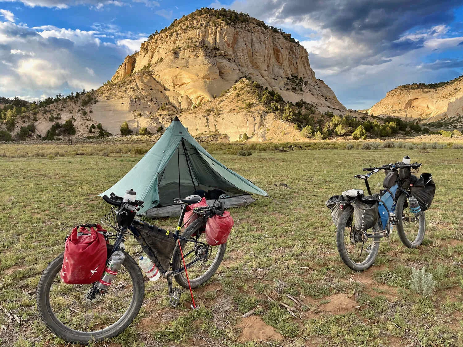
When the rain abated, we agreed that it was time to start looking for a campsite. At that point, we were pretty close to our mileage goal for the day. So we decided to take the first spot that would provide a good night’s sleep. The forests were quite healthy, and there weren’t a lot of dead trees. But there were a few big, old, dead aspens. And with the weather still unsettled (with the potential for high winds), we didn’t want to camp near any of them.
We finally chose a spot in a forest clearing, surrounded by a grove of blue spruce. The air carried the fragrance of the pines and damp earth. And we had to watch our step in the clearing, to avoid crushing the gorgeous Amanita muscaria mushrooms springing up after the rain. Fortunately, the storms held off during our dinner and the setup of our camp. But by 7:20pm a light rain was falling, with thunder in the distance. We retired to the tent early, and snuggled into our sleeping bags as the chill of night set in.


Our patch of forest turned out to be a very busy neighborhood during the night. The first noisy neighbors were a pair of great horned owls, hooting back and forth after sunset. There were several coyotes nearby that got excited about something in the dark, yapping loudly for quite a while. And, for the first time on this trip, we heard the primeval sounds of a group of elk bugling throughout the night. It seemed like they were quite close by, and we wondered if we were near to an elk gathering place. But, perhaps fortunately, no elk wandered through our camp.
Since we had camped at just over 10,000 ft (3,050 m), the morning air was very brisk. There wasn’t any frost, but the temperature had to be close to freezing. That made it hard to leave the comfort of our sleeping bags and start our day. Even after we got rolling on our bikes, we couldn’t get warm. It didn’t help that the first four miles of our ride were all downhill. Pretty soon we were shivering, and adding extra layers to try to retain some body heat. But the high-altitude sun, and the switch to riding uphill soon changed all that. Within a half-hour, we were peeling the layers back off as the day heated up.
All day we rode across the top of the Aquarius Plateau, through forests of aspen and spruce on the hills, with expansive open meadows in between. Given all the noise throughout the night, we thought we would have had a good chance of spotting an elk or deer in the meadows. But we never did see any - just a few cows enjoying the high-altitude grasses.
The big drama for the day surrounded our need to find water. To keep our load reasonably light for the climb onto the plateau, we gambled on the fact that there were supposed to be several reliable springs along the route. So we had to acquire more water to be able to make it through the next night of camping.
Early in the day we passed a stock tank without filling up, because we would rather have water from a fresh spring than share it with livestock. But the first spring we came to (Iron Spring) was a complete bust. It was comprised of just a few, still pools of water in a meadow that was overrun by cattle. There was no protective fence, and the cows had trampled all through the muddy shallows. We couldn’t stomach the thought of taking that water, even with a filter. So we decided to take our chances by going to the next spring. But we both started to feel a bit nervous, because it could mean trouble if the next spring didn’t produce some drinkable water.
You can imagine our relief when we approached the second spring (Griffin Spring), and we could see that it was fenced off from the surrounding herd of cattle. But we weren’t out of the woods yet - it was impossible to tell from a distance whether the spring was flowing. We strained our necks as we approached, trying to catch a glimpse of sun sparkling on a wet surface. In the end there wasn’t much water, but it was enough. The spring had very minimal flow. And we could see some droppings near the pools, from deer and elk that had jumped the fence. So we decided to both filter the water and treat it with chlorine pills. It took a lot of effort in the hot sun to scoop and filter 6 liters from one of the little pools, in part because our water filter was starting to get a bit clogged from the silty water. But we got the job done. We would have to give the filter a good cleaning when we got back to civilization.


We reached the southern edge of the Aquarius Plateau in the early afternoon. And wow, it couldn’t have been more different than the open, treeless ascent from the north. We cycled downward along a narrow ridge that gave us spectacular views into forest-covered valleys both to the east (towards the town of Escalante) and the west (towards Bryce Canyon National Park). Suddenly we were seeing more sandstone cliffs emerging from the dense spruce forests that blanketed the slopes. Each outcrop had its own distinct character, sculpted by the wind and weather.
To our west, sandstone cliffs began to peer through the forest. Each outcrop had its own, unique colors and shapes. Escalante Mountains, Utah, USA. Copyright © 2019-2021 Pedals and Puffins.
To the east the ridge line quickly fell away into a broad, mountain valley. Escalante Mountains, Utah, USA. Copyright © 2019-2021 Pedals and Puffins.
The descent down Escalante Canyon was pretty steep, with many spots that had gradients in excess of 10%. We took our time, with regular breaks to rest our hands from constant braking ,and to scope out potential campsites.
Our bikes, resting on the descent from the Aquarius Plateau. Escalante Canyon, Utah, USA. Copyright © 2019-2021 Pedals and Puffins.
But most of the slopes were way too steep for camping. And there were signs of flash flooding everywhere. Deeply eroded channels cut between the trees. Rainwater runoff had flattened the vegetation on wide swaths of the forest floor while depositing sand and grit on any piece of level ground. We actually stopped at one site hoping to camp there, only to realize after looking around for nearly an hour that there were no safe places to put the tent. All of the areas that looked reasonably level turned out to have signs of significant rainwater over wash. Since it had rained the previous night, we had to be concerned about that possibility of flooding. We finally decided to continue down the road and try our luck elsewhere.
We ended up descending nearly 2,000 ft (600 m) from the top of the plateau before we finally found a campsite that looked like it might have a prayer of staying reasonably dry in a rainstorm. Fortunately, it didn’t rain that night, so we didn’t have to find out whether we picked a flood-free campsite or not. At dawn, we were serenaded by the hoots of a northern pygmy-owl, echoing down the canyon.
Happy we weren’t washed away during the night. Escalante Canyon, Utah, USA. Copyright © 2019-2021 Pedals and Puffins.
Down Into Canyon Country
It was another very cold morning. There wasn’t any frost, but the air was still frigid. We both bundled up for the ride out of Escalante Canyon. Even so, we were very cold as we cycled the first couple of miles downhill. The sunlight creeping into the canyon was lovely as it illuminated the spooky shapes of hoodoos (rock pillars) on the cliffs. It was also welcome because it helped to warm us up.
Our first sighting of hoodoos! We welcomed the sunlight as it crept into the canyon. Escalante Canyon, Utah, USA. Copyright © 2019-2021 Pedals and Puffins.
At the mouth of the canyon, we cycled out from between the cliffs and into a broad mountain valley. And for the first time in days, we cycled onto a paved road. We saw several groups of pronghorn antelope in the valley fields. One lone male seemed to have an excess of energy. We watched as he thrashed some bushes with his antlers and rubbed his face on the stems. Fall is the mating season for deer, elk and antelope, so this guy was probably marking his territory and letting other males know he’s the boss around here.
This frisky pronghorn antelope was busy attacking bushes with his antlers. Johns Valley, Utah, USA. Copyright © 2019-2021 Pedals and Puffins.
The paved road through the valley was smooth, and there was very little traffic. So when the WWR route turned back onto gravel after only two miles, we were faced with the usual dilemma. Should we follow the WWR as it churned its way over another rocky ridge? PedalingGuy took a look at the map and realized that the paved road would take us directly into Bryce Canyon City, cutting six miles off of the trip. After several days on the dirt, it was a pretty easy decision. We took the paved road into town.
Along the way, we took a break for breakfast in the shade of a juniper tree, hidden from the main road. It was pleasant to sit in our folding chairs, and look out across the valley towards the distant ridge that we wouldn’t have to cycle over. We were both quite happy.
The broad valley was bordered on all sides by forested hills and rocky cliffs. By taking the paved road into Bryce Canyon City, we saved ourselves the trouble of cycling over this one. Johns Valley, Utah, USA. Copyright © 2019-2021 Pedals and Puffins.
From there, we sailed into Bryce Canyon City. For the final two miles we cycled on a new, paved bike path that parallels the main road. It was great.
Looking forward to a shower and rest break. Bryce Canyon City, Utah, USA. Copyright © 2019-2021 Pedals and Puffins.
Even better, we were able to check into our hotel room, and settle in by 11am. That gave us the rest of the day to get cleaned up, do laundry, and basically take care of the usual layover chores. We gave our water filter a good rinsing as well, and the flow-through rate was greatly improved. We’re counting on that filter to get us through the rest of the trip, so keeping it clean is a priority.
A Night at the Rodeo
Although there has been a hotel in Bryce Canyon City for more than 100 years, the town itself was only established in 2007. That makes it a baby, even by western North American standards. Even now, Bryce Canyon City exists primarily to serve tourists visiting the area’s big canyons. You can’t escape the constant reminders of the various activities and events - like horseback rides, ATV tours, and dinner concerts - that can all be enjoyed for a fee.
One of the more unique events hosted by Ruby’s Inn is a rodeo held every Wednesday through Saturday night, throughout the summer. As it turned out, the final rodeo of the season would take place while we were in town. It would be a “jackpot rodeo,” where participants pay a fee and the winners take home prize money. They only hold eight jackpot rodeos from May through August, and the promotional materials suggested that these rodeos draw in the better talent. We decided to go, and check it out.
Cowboys and cowgirls lined up to pay the jackpot rodeo entrance fee, which would be used to award prize money to the night’s winning competitors. Bryce Canyon City, Utah, USA. Copyright © 2019-2021 Pedals and Puffins.
We’ve been to other rodeos before, and this one had a very different vibe. Overall, it was more informal. And it was clear that the competitors came mostly from the local area. A lot of them seemed to have friends and family in the bleachers, cheering them on. And although there was plenty of serious bronco and bull riding, quite a bit of the rodeo was devoted to competitions for children, riding a assortment of domestic animals from sheep to steers.
In the end, the level of competition here was not as high as what we’d seen at other rodeos that attract more professional-level cowboy talent. This was particularly obvious to us during the barrel racing competition, where the skill of the riders fell far below what we had recently seen at the Southwestern Desert Classic competition in Salina, Utah. The Bryce Canyon City competitors appeared to be mostly local girls, still working out the kinks in their racing.
But the local, hometown feel of this rodeo was a fun change of pace. Folks sitting near us knew a lot of the competitors by name - laughing and joking with each other as a succession of riders failed to stay on their steeds for the minimum eight seconds, or shouting encouragement to the kids.
A local cowboy tries his hand at bronco riding in the rodeo. Bryce Canyon City, Utah, USA. Copyright © 2019-2021 Pedals and Puffins.
Some of the most endearing moments came when little kids rode around the rodeo ring on sheep. This guy clearly knew how to work a crowd. Bryce Canyon City, Utah, USA. Copyright © 2019-2021 Pedals and Puffins.


The most dangerous event in any rodeo is the bull riding. It was the last event of the evening, and we didn’t stay all the way until the end. But, from what we saw, very few of the competitors were able to remain on their bulls for the minimum of eight seconds, which meant that they didn’t even earn a score. And a handful of them appeared to walk away with painful injuries to their arms, or in a daze from hitting their heads. It was a reminder that the rodeo is a very perilous sport.
It’s not easy staying glued to 1,200-2,000 lbs of bucking bull. Many of the competitors in the Bryce Canyon City Rodeo were unable to ride for the required minimum of eight seconds. Bryce Canyon City, Utah, USA. Copyright © 2019-2021 Pedals and Puffins.
The Beauty of Bryce Canyon
Bryce Canyon National Park was definitely one of our “bucket list” places to visit along the WWR route. Neither one of us had ever been there. Yet the photos we’d seen of endless rows of towering, rose-colored hoodoos (rock pillars) beckoned us to the canyon.
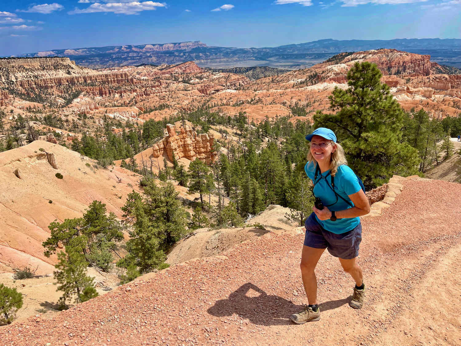
We decided to spend a day hiking in the national park. Our first hike was a 2.5 mile (4 km), one-way walk along the Rim Trail. Starting at Bryce Point, we took our time wandering along the lip of the canyon - soaking up the stupendous views below. To our surprise, the trail was not crowded at all. For most of our walk, we were alone with our surroundings, and very few people passed by. It was wonderful. Many national parks have become seriously crowded, so we felt lucky to have this amazing experience in relative solitude.
We had arrived very early in the morning. And, as expected, the rising sun cast a lovely glow on the amazing shapes of the rock formations below. But we also were thrilled to discover that as the sun rose throughout the day, the colors didn’t fade. If anything, the play of light and shadows became even more vivid as time passed.
Soaking up the glorious view. Bryce Canyon National Park, Utah, USA. Copyright © 2019-2021 Pedals and Puffins.
Instead of becoming washed out, the colors of the rock formations seemed to grow even more vivid as the sun rose throughout the the day. Bryce Canyon National Park, Utah, USA. Copyright © 2019-2021 Pedals and Puffins.
The endlessly changing scenery was enough to keep PedalingGuy and his camera very busy. Just don’t get any closer to the edge of that cliff. Bryce Canyon National Park, Utah, USA. Copyright © 2019-2021 Pedals and Puffins.


The trees that live along the edge of the canyon lead a precarious life. Wind and water are constantly eroding the soft, sandstone cliffs. As a result, many trees that started life on solid ground end up clinging to the precipice with most of their roots exposed - creating starkly beautiful images with their twisted shapes.
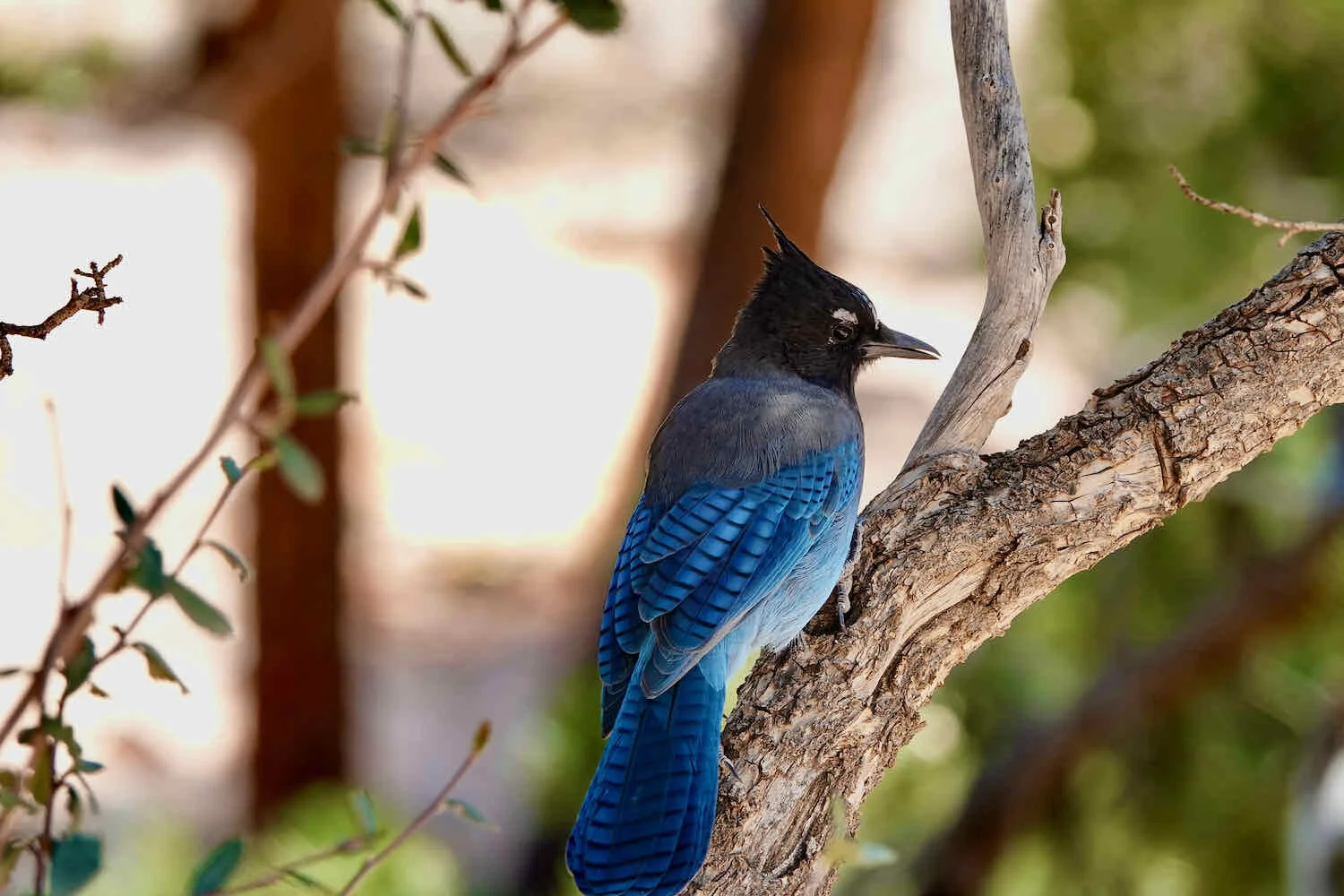
With so few people around, we easily spotted a lot of wildlife along the rim of the canyon, including a variety of birds and lizards.


As we approached Sunset Point, we encountered one of the park rangers giving a presentation about the geology of the area. He talked about how Bryce Canyon is situated along the Pink Cliffs - giving the rocks their distinctive, salmon hue. Surprisingly, the endless rows of rock towers - affectionately known as hoodoos - were not formed by running water. The area receives less than a foot of precipitation each year, most of which falls as snow. So running surface water is relatively rare. Instead, the hoodoos are created by the freezing and thawing of small amounts of moisture that seep into cracks in the rocks. Because of the high altitude and arid atmosphere, there are hundreds of days each year where temperatures fall below freezing at night, then rise more than 40 F degrees warmer during the day. Through this daily freezing and thawing, expanding ice within the cracks slowly pushes the rocks further and further apart, growing the size of the cracks until the surrounding stones fall away - leaving the rocky spires we see today.
A park ranger explains what led to the formation of hoodoos (rock pillars) in the canyon. Bryce Canyon National Park, Utah, USA. Copyright © 2019-2021 Pedals and Puffins.
From Sunset Point we hiked down into the canyon itself along the park’s most popular loop trail. The initial descent involved a dizzying, back-and-forth scramble down a long series of switchbacks along the Navajo Trail. For this walk, we were definitely not alone. A constant stream of intrepid hikers works their way around this loop, in the hope of getting close to the other-worldly hoodoos.
Descending into Bryce Canyon via the Navajo Trail involves negotiating a seemingly endless series of steep switchbacks. Bryce Canyon National Park, Utah, USA. Copyright © 2019-2021 Pedals and Puffins.
It was a whole different experience to get down among the hoodoos, as opposed to viewing them from the canyon rim. You lose the sense of a vast expanse of rock, and find yourself focusing on the shapes and colors of individual formations.


The wildlife on the canyon floor was clearly used to seeing throngs of people. Instead of running away, the squirrels and jays lingered near places where people would stop to rest, hoping to score a few morsels of food dropped by careless hikers.

The climb out of the canyon was steep, but overall not that hard. There were many places to stop in the shade of a cliff or a pine tree, to catch your breath while admiring the canyon views.

After all that hiking in the heat, we retired to the cool shelter of our hotel room. We spent the rest of the afternoon and evening relaxing, and prepping for the next leg of the WWR.
Descending the Grand Staircase
You have to think really big to get your mind around the Grand Staircase. The sheer enormity of it means that it’s almost impossible to see all the pieces at once.
So what is the Grand Staircase? It’s a series of colorful cliffs that fall away from each other across nearly 100 miles (160 km) from Bryce Canyon in the north to the Grand Canyon in the south. What makes these formations particularly unique is that they expose over 600 million years of the earth’s history in nearly un-interrupted layers of sandstone. And that sandstone is chock-full of fossils, providing the most continuous record of life on earth that is exposed anywhere in the world. Descending the Grand Staircase is literally a trip back into the deep past of our planet Earth.
Top of the Staircase - The Pink Cliffs of Bryce Canyon
Our departure from Bryce Canyon City took us through the National Park one more time. As we cycled past the entrance sign, we celebrated our arrival at the Pink Cliffs, the first step in the Grand Staircase.
Savoring the moment at the top of the Grand Staircase. The Pink Cliffs of Bryce Canyon represent the first step, going back in geological time. Bryce Canyon National Park, Utah, USA. Copyright © 2019-2021 Pedals and Puffins.
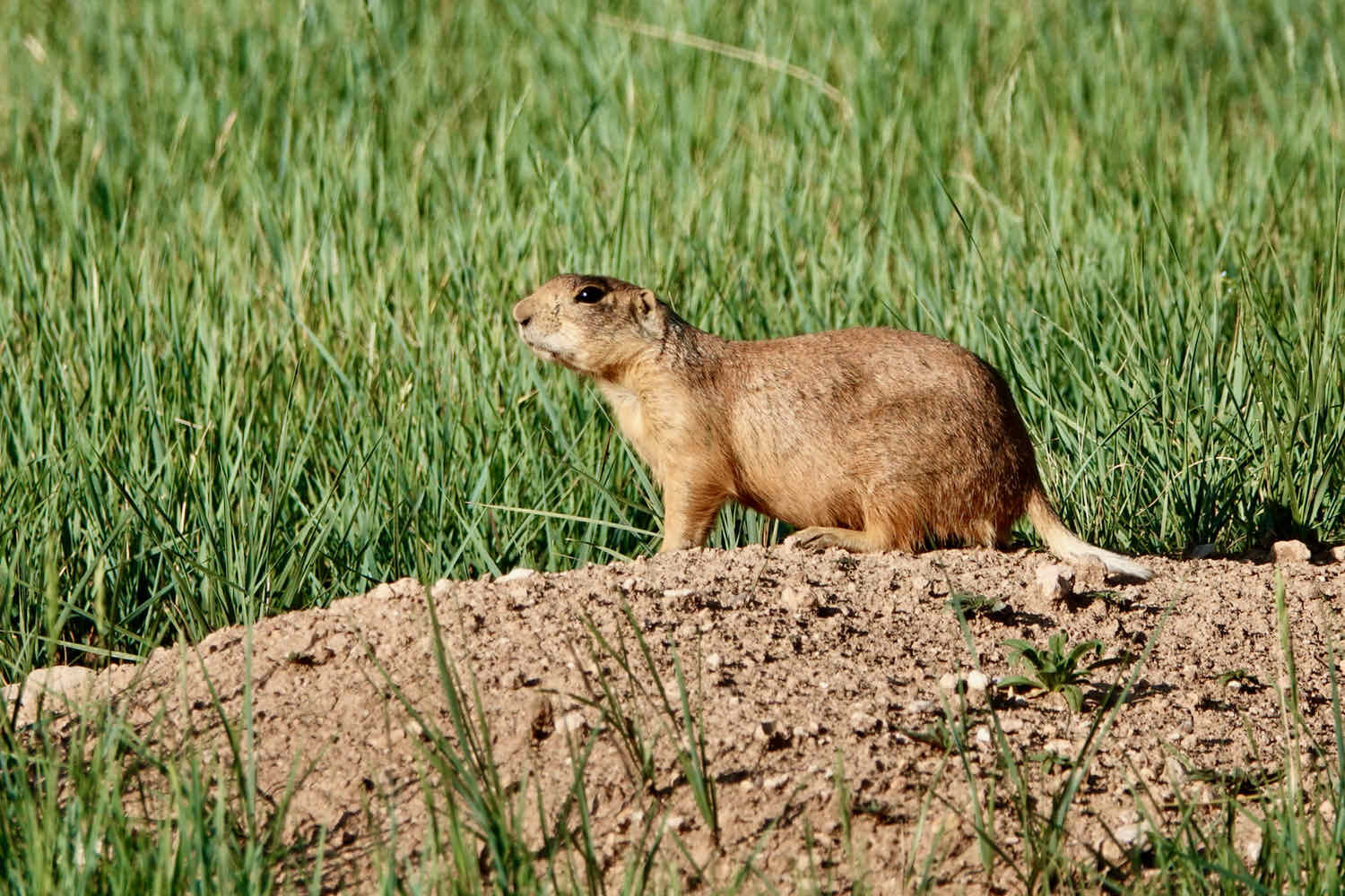
On our short ride through the National Park, the route stayed within the forested areas. As a result, we had the chance to spot a whole different set of wild creatures than we had seen during our walk along the rim of the canyon. Of special note was a colony of Utah Prairie Dogs, a threatened species that occurs only in a few areas in southwestern Utah.
This regal mule deer is all decked out for the fall mating season. Bryce Canyon National Park, Utah, USA. Copyright © 2019-2021 Pedals and Puffins.

Unfortunately, we ran into a snag when we tried to leave the national park. According to the materials published by the WWR organizers, cyclists have permission to use an administrative road within the park that leads into the neighboring national forest. But apparently not all park staff have gotten the memo.
When we arrived at the park boundary, the road was blocked by a locked gate. As we considered options on how to get through, a park employee approached in a pickup truck. But when PedalingGuy walked over to speak with her about the possibility of opening the gate, she verbally attacked him, screaming and yelling at him before he had a chance to say anything. She insisted that we were trespassing, and that she would call the park police if we didn’t immediately leave. To be clear, we weren’t trying to sneak into a National Park. We just wanted to leave through a gate that the Park Service had previously granted cyclists permission to use, through the organization that established the route we were following.
We didn’t want to escalate the situation, so we cycled back into the park and debated what we should do. A detour out through the main park entrance - which the park employee said was our only option - would have added 14 miles (23 km), and nearly two hours to our ride for the day. We double checked our written materials to make sure we had permission to use the exit from the park. There were no signs suggesting that we could not use the gate. We assumed that the park service employee was simply out of the loop with whomever at the park service had granted permission to use the gate.
In the end, we decided to just wait until the coast was clear, then lifted our bikes over the fence, thereby entering into Dixie National Forest. Hopefully the folks who administer the WWR will get things sorted out with the park before any future altercations between cyclists and park staff turn sour.
Because of the delay with the park employee, it was now 10:30 in the morning and we had only covered 7 miles (11.25 km) of the route. We needed to ride hard for the rest of the day to make up for lost time.
On the bright side, a few rough miles of trail led us to a wide and well-maintained gravel road where we were able to move along quickly. We cycled past Tropic Reservoir, a popular fishing spot in the region, and then through a wide, grassy valley with a stream running through it.
As we pedaled towards the headwaters of the stream, the gentle uphill we had enjoyed got steeper. The final approach to Crawford Pass wove through a lush pine forest, and the road got pretty rocky and rough in places. But that was nothing compared to what we were in for, once we crossed the top of the pass.
Taking the First Step Down the Staircase
That’s because the south side of the ridge was basically a cliff - a Pink Cliff. This was our first step down on the Grand Staircase. For the next hour, we would cycle on a “road” that headed down the escarpment, with grades exceeding 16% - gripping our brakes the whole way to avoid careening out of control. On the surface of the road, the sandstone was crushed into a thick layer of the finest-powdered, dust that you can imagine. Under the dust was a base of hard, slick rock.
Cycling down this road was like riding through pink confectioner’s sugar spread over a polished, marble floor. The dust kicked up by our tires billowed into hazy clouds that hung in the air as we passed. And to keep things interesting, the steeper parts of the trail were also strewn with sharp rocks and gravel that bounced our wheels around, while the dust dragged at them and coated everything in sight. For long stretches, the plants growing on both sides of the trail were smothered with pink dust, like an especially thick coating of sugar on a powdered donut.
We did have some fun looking at all the animal tracks in the dust. From the tracks we could see, the surrounding forest seemed to be teeming with deer, rabbits, chipmunks and birds. But one set of prints really caught our attention. Some very large paw prints followed the road for a short distance. We took some photos, and tried to identify them later. They certainly could have been mountain lion tracks - but we couldn’t be sure (the distinguishing features just were’t clear enough). In the moment, PedalingGal was not comforted by the ambiguity. Mountain lions have attacked mountain bikers on the west coast. And although these attacks are very rare, PedalingGal was cycling pretty slowly down the hill - easy pickings for a hungry lion. Fortunately, the local mountain lions must not have been too hungry that day. We both made it to the bottom of the hill without having to fend off any wild animals.
On our way down the mountain we entered a private ranch with public access called Deer Springs. Finally, as the steep slope started to moderate a bit, we cycled into a grassy valley. There, we passed a herd of longhorn cattle, with some of the most massive horns we have ever seen. After a little bit of research, we later learned that these are celebrity cows. This herd is famous in the cattle world for winning more “Bronze Horn” awards than any other ranch.
Longhorn cattle are often judged by the spread of their horns. In national competitions, cows from this herd have won more “bronze horn” awards than any others. Deer Springs Ranch, Utah, USA. Copyright © 2019-2021 Pedals and Puffins.
White Cliffs in the Sunset
Our slow start that morning not withstanding, we really wanted to cover as many miles as possible by the end of the day. Rain was in the forecast for the next few days. And we wanted to make it to the town of Kanab, Utah before the bad weather hit, because the WWR trails here are notoriously impassable when wet. So, we cycled onward, hoping to make it at least 45 miles (73 km), to reach a paved road.
As we pedaled our way across the Deer Springs Ranch, the Pink Cliffs receded behind us with the salmon-colored dust of that crazy descent. And now, to our south, loomed the massive, pale bluffs of the White Cliffs - the second step in the Grand Staircase.
Heading south, we descended towards the White Cliffs - the next level in the Grand Staircase. Deer Springs Ranch, Utah, USA. Copyright © 2019-2021 Pedals and Puffins.
Color isn’t the only thing that differentiates the pink cliffs from the white ones. Gone were the orderly, horizontal layers of rock and the hoodoos that seemed to pop up along every stretch of the Pink Cliffs. Instead, the White Cliffs looked like someone took hundreds of piles of papers, and threw them together in a big, chaotic jumble - with some piles knocking each other over, and getting inter-mingled in a big, interwoven heap. Up close, this was especially noticeable, as the strata of rock zigged and zagged back and forth across the faces of the cliffs. We stopped several times to gaze at the rocks in astonishment, thinking about the extreme geologic forces that would have deformed the layers so dramatically.
Late in the day, we were elated to finally reach the pavement as we entered the Grand Staircase-Escalante National Monument. With the shadows getting long, we cycled just two more miles before spotting a good place to stop. Down a rough, dirt side road, our campsite was on a flat area surrounded by the beautiful white cliffs and bordered by a deep ravine.


As tired as we were, we just managed to get our tent set up and dinner prepared before a light rain began to fall. We scrambled to put our things away so they wouldn’t get wet. Then, as if by magic, the setting sun illuminated a stunning, full-arch rainbow. And all around it, the golden rays of sunlight bounced off the raindrops. We watched in awe as the rainbow grew brighter, its colors became more vivid, and a shimmering gold curtain framed the arch. It’s spectacles like this that stop you in your tracks and make you see the world differently, if just for a little while. As the gentle rain drifted away, we set up our folding chairs in the valley and sat together, admiring the cliffs, as the last rays of sun disappeared behind us.
A stunning display of light and color, courtesy of a gentle rain shower in the setting sun. It was one of the most magnificent rainbows we have ever seen. Grand Staircase-Escalante National Monument, Utah, USA. Copyright © 2019-2021 Pedals and Puffins.
The next day we had an easy ride into Kanab, Utah. For the first half hour we continued to cycle through a valley bordered by the White Cliffs. Then suddenly, the canyon walls dropped away, and we entered an open valley of private ranch land.
As we headed back to the main road in the morning, the White Cliffs surrounding our campsite were just as lovely as they had been the night before. Grand Staircase-Escalante National Monument, Utah, USA. Copyright © 2019-2021 Pedals and Puffins.
The White Cliffs came to an abrupt end when we reached the border of the national monument. Copyright © 2019-2021 Pedals and Puffins.
The Vermillion Cliffs of Kanab
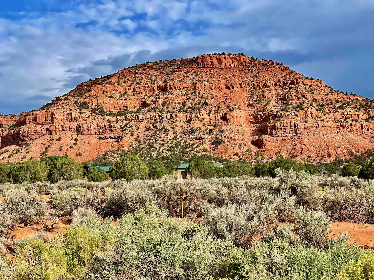
Ten more fast, downhill miles on pavement brought us into a new valley, bordered on the north by the Vermillion Cliffs - the next step in the Grand Staircase. We stopped often to admire the red rock formations as we rode through the valley on our way to Kanab, Utah.
Although the color of these mountains was similar to the Pink Cliffs of Bryce Canyon, they didn’t seem to have the same tendency to form hoodoos. Kanab lies more than 3,000 ft (915 m) below the elevation of Bryce Canyon, so perhaps this area doesn’t have the same, intense freezing-and-thawing pressures that chip away at the rocks in Bryce Canyon - and create the hoodoos. Whatever the reason, these mountains were more uniformly rounded, with unbroken cliff faces that stretched on for miles.

Even without hurrying, we arrived in Kanab way too early to check in to our hotel. A second breakfast (yes, cyclists are allowed to eat multiple breakfasts) at a fast food restaurant on the edge of town helped to pass the time, but we still ended up waiting in the hotel lobby for a room to become available. We were delighted when we were finally able to settle in and wash away the dust from the road.
It had been a fascinating journey from the heights of the Aquarius Plateau to the lower reaches of the Grand Staircase. And we were eager to continue following the WWR into the mountains, deserts and canyons of Arizona.