Cycling Kanab, Utah to Grand Canyon, Arizona: Canyons and Condors

4 - 12 September 2021
Segment 7 of the Western Wildlands Bikepacking Route (220 mi, 355 km)
Utah’s ‘Little Hollywood’
Westerns. The term is so iconic that it immediately brings to mind images of stoic, gritty, big-hearted cowboys fighting for truth and justice - set against a backdrop of stunning, desert scenery. For a long time, Westerns were one of the most popular forms of entertainment made in Hollywood. Roughly 2,700 Western movies were produced between 1930-1954. And an additional 200+ TV series were Westerns, peaking during the 1960s.
Those were the glory days in Kanab, Utah. Over a 60-year period, more than 100 Westerns were filmed in the town, earning it the nickname Utah’s Little Hollywood. And the town’s popularity as a film location was no accident. Of course, the town’s proximity to stunning cliffs, spooky slot canyons, and endless rolling sagebrush hills was a factor. But there also was a cadre of citizens who worked together as promoters, set designers, prop suppliers, casting assistants, caterers, and hoteliers to lure Hollywood production crews to the area.
The legacy of that era is celebrated along the Little Hollywood Walk of Fame, where sidewalks are lined with signs remembering more than 80 movie stars, directors and other dignitaries who worked in Kanab. We took and afternoon to stroll around town along the Walk of Fame, and were impressed by the number of famous names (e.g., John Wayne, Charlton Heston, Clint Eastwood, Dale Evans, Ronald Reagan, and Sidney Poitier) of folks who had spent time here, especially given the small size of the town (population 4-5K). Many of the signs included warm remembrances for the stars that took extra time to get to know the local residents, or who spent additional time in Kanab after their filming work was done. It was a pleasant way to spend the day.
One of the more famous faces appearing along the Little Hollywood Walk of Fame. Kanab, Utah, USA. Copyright © 2019-2021 Pedals and Puffins.
Our time in Kanab wasn’t all R&R though. We attended to some important bicycle maintenance as well. PedalingGuy’s chain was sagging a bit. To fix it, he adjusted the Tumbleweed’s eccentric bottom bracket insert to tighten it up. Hopefully that set him up for finishing our tour without having to replace the chain a second time.
After more than 2,500 miles of travel (4,000 km), we decided it was time to change the oil in our Rohloff Speedhubs. In theory we could have gone another 500 miles before an oil change. But since we had been riding over some pretty hot, rough and dusty terrain, and had ridden through a few streams that submerged our hubs under water, we decided it was better to be safe than sorry.
We’ve also heard that cycling in Arizona can be pretty hard on bike tires. In addition to the usual sharp rocks, Arizona trails are notorious for being lined with plants that have all kinds of spines, thorns, spikes and sharp edges that cause tires to lose air. Our tires had already seen a lot of action, so they needed all the help they could get. It seemed like a good time to add some more sealant to all four tires, before heading down that road.
Better safe than sorry. The parking lot of our hotel served as our workshop for changing the oil in our Rohloff Speedhubs, and adding more sealant to our tires. Kanab, Utah, USA. Copyright © 2019-2021 Pedals and Puffins.
Cycling into Arizona
Now we were ready to continue into Arizona, the next and final state on our WWR journey.
But before we got to the border, we were distracted by some very strange objects flying overhead. They looked a lot like the little spaceships that The Jestons used to fly around in the comic strip. They were surprisingly small, seating just two people under a glass dome, with no proper tail. Instead there were vertical winglets on the end of each long wing, and a canard (two small wings sticking out of the nose of the airplane). To our untrained eyes, they looked like something out of a science fiction movie.
What the heck is that? An odd looking aircraft lands at the airport. Kanab, Utah, USA. Copyright © 2019-2021 Pedals and Puffins.
It turns out that Kanab is a Mecca for people who fly Rutan Airplanes. They are built by their owners from kits based on designs created by Burt Rutan - a legend in the home-built-aircraft business. And for the past 30+ years, the Kanab Airport has hosted a national Rutan Fly-In, where enthusiasts from all over the world come to show their airplanes, share knowledge, and participate in timed flight competitions. The official date of the Fly-In had been one day before we passed by. But a group of five Rutan airplanes were still on hand, flying in formation in the skies above the airport. It was pretty cool to see them in action.
The Kanab airport sits right on the border. So within moments of leaving the Rutan aviators behind, we finally crossed into Arizona.
Every crossing of a state line feels like a big milestone on a bicycle tour. Arizona was the next and final state on our WWR bikepacking tour. Utah/Arizona border, USA. Copyright © 2019-2021 Pedals and Puffins.
Land of No Water
Even though water along the route has been scarce for a while now, Arizona would present a whole new level of challenge. On this segment of the WWR we would tackle two different stretches of the route that would each involve 3 days of riding across hot, open landscapes with no shade, and absolutely no access to water. In the 185 miles between Fredonia and Cameron, Arizona, there would be only one town, with no sources of water in between.
The first stretch, from Fredonia to Marble Canyon, Arizona was the shorter of the two, at roughly 80 miles. We decided to break it up into three days of riding because of the rough terrain, and because we wanted to hit a steep climb (onto the Kaibab Plateau) early in the morning of the second day when the temperature would be cooler (rather than late on the first day, when the heat would be too oppressive).
As a result, the first day’s ride was a bit shorter than usual. So we took it easy in the morning, and didn’t hit the road until shortly after noon.
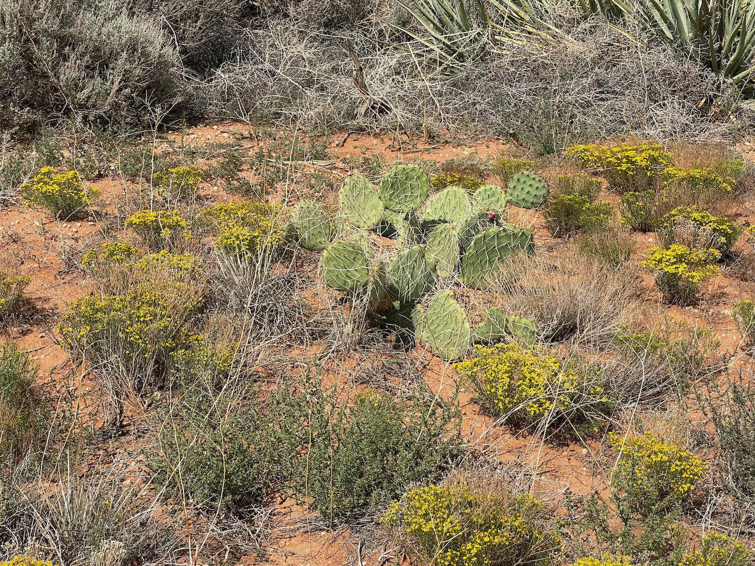
Of course, that meant we would be cycling throughout the warmest part of the day. Just past Fredonia, Arizona we were glad to turn off of the busy, paved highway onto a gravel road. But the gravel surface got rougher and rockier as we went along, slowing us down as the day became very, very hot. As if to remind us that this really was the desert, different kinds of cactus plants started to appear with increasing frequency. Each time we pulled off the road to take a rest under the occasional juniper tree, we had to be extra careful not to puncture either our feet our our tires on the thorny plants now lining the road.

We stopped for the day on a low ridge, and pitched our tent in a grove of pinyon pines and juniper trees. Just beyond the trees, the foothills of the Kaibab Plateau rolled away to the south forming a gentle, undulating ridge. From here, the climb up onto the plateau didn’t look that difficult. But it was hard to get much perspective on the height of the slopes because they had so few trees.
Our campsite at the foot of the Kaibab Plateau. Arizona, USA. Copyright © 2019-2021 Pedals and Puffins.
Fading sunlight on the rounded foothills of the Kaibab Plateau. They don’t look so scary in the sunset. Arizona, USA. Copyright © 2019-2021 Pedals and Puffins.
That night we were awakened by a Mexican Spotted Owl calling repeatedly in our little grove of trees. Hoop hoo-hoo, hooooo. We listened to the distinctive cadence of that call, over and over again, for nearly an hour. It was exciting to think that a bird this rare was lingering so close to our campsite.
In the morning we had to face the music, and make the ascent up onto the Kaibab Plateau. Right out of camp, our route launched up a series of switchbacks that seemed to climb right into the sky, with nearly half a mile of loose rocks on slopes that exceeded a 12% grade. It was a grueling way to start the day, but we were glad to get it over with in the cool, early morning air. And when we reached the top, the view back towards the Grand Staircase was phenomenal. The Vermillion Cliffs and White Cliffs shimmered in the morning light, with the shadows of more distant ridges in the background.
Leaving the Kanab plains behind, we ascended the slopes of the Kaibab Plateau. The Vermillion Cliffs shimmer in the distance. Kaibab Plateau, Arizona, USA. Copyright © 2019-2021 Pedals and Puffins.
From the top of the plateau, the first few steps of the Grand Staircase can be seen receding to the north. Kaibab Plateau, Arizona, USA. Copyright © 2019-2021 Pedals and Puffins.
Once we caught our breath, we enjoyed a pleasant ride across the plateau. The road careened over rolling hills through surprisingly dense forests of pinyon pine and juniper. And the cooler temperatures on the highlands were perfect for cycling. Flocks of scrub-jays sounded the alarm and scattered as we pedaled by.
But we were only crossing a small arm of the plateau. After about six miles in the highlands, we approached the far rim. There, the WWR route crossed the famous Arizona Trail for the first time. We stopped at the trailhead to read some signs and were surprised to see a mountain biker there, sitting on a rock eating an apple. And that’s how we met Steve. We hadn’t expected to encounter anyone out in the middle of that forest, because we hadn’t seen a single other person since leaving the paved road the previous day.
While chatting with Steve, we learned that he was cycling the Arizona Trail in segments. He was traveling light, with just the things he would need for a day’s ride. Later, his wife would meet him at a trailhead with their car, and they would be heading home to Phoenix. After completing this segment, he would have only about 100 more miles of the Arizona Trail to go (out of a total of more than 800 miles). When we asked him if it was a tough trail, he laughed and said that people either love it or hate it - but that he was mostly enjoying it. (We would later discover just how difficult the Arizona Trail can be on a bike, so hats off to Steve for his endurance!)
Our first crossing of the Arizona Trail, on top of the Kaibab Plateau, Arizona, USA. Photo by Steve, the mountain biker.
We said our good-byes, and wished each other safe travels. Then we gingerly negotiated our way down the far side of the plateau.
At the bottom of the steep descent we found ourselves on a wide gravel road, sandwiched between the Kaibab Platau and another stretch of the Vermillion Cliffs. House Rock Road, as it’s called, looked like it should be an easier ride. It definitely had much more gentle grades than the road over the plateau - so we didn’t have any difficulty with the hills. But just to keep things interesting, the road was one, continuous ribbon of washboards. It was literally impossible to find a smooth path for more than a couple of yards. Throughout the rest of the afternoon, we weaved back and forth, trying to keep from vibrating our bones out of their sockets, and our bikes into pieces.
Then, the trail magic started to happen. As we were riding along, a pickup truck pulled up along side of us, and offered us some water. Aim had been out camping with his family in Capitol Reef National Park, and they were on their way home. They still had several gallons of fresh water that they hadn’t used, and he wanted to share it with us because someone had once helped him when he was running low on water during a cycling trip. We were really grateful for the offer because we had actually started to worry about whether we had brought enough water. The heat in the valley was so intense that we were using our water faster than expected. Aim filled up two of our 1.5 L bottles, before wishing us well and heading down the road.
Negotiating the washboards as we cycled in a valley bordered by the Kaibab Plateau on one side, and the Vermillion Cliffs on the other. Vermillion Cliffs National Monument, Arizona, USA. Copyright © 2019-2021 Pedals and Puffins.
Land of the Giant Condors
In this valley, we also entered into the domain of one of the rarest creatures in the world, the California Condor. These extraordinary, prehistoric-looking birds were much more common during the Pleistocene Epoch, when megafauna like mammoths, giant sloths, and wooly rhinos roamed North America. But as these massive animals died out, the super-sized condors also disappeared from most of the continent. By the time Europeans reached North America, condors were already confined to a few strongholds in the west.
These smaller populations declined further in the 20th century when people killed off the big herds of bison and persecuted the condors, which they thought were preying on domestic animals. California Condors almost went extinct in the mid-1980’s when only nine individuals remained in the wild. All of the wild birds were captured, and together with 22 other birds that were already in captivity, they formed the basis of an emergency breeding program to rebuild the population, and return condors to the wild.
California condors can live to be 60 years old. Like many large and long-lived animals, they reproduce very slowly. They don’t even begin breeding until they’re at least six years old. But as birds born in the captive breeding program were released, California Condors finally started to make a comeback. There are now nearly 330 individual condors in the wild, with about 80 of them flying free in Arizona. It’s an amazing recovery story, even if there’s still a long way to go.
The Vermillion Cliffs National Monument is where condors have been released into the wild in Arizona. Here, they can find the caves high on cliffs where they prefer to make their nests. We stopped to check out the Condor Release Site, where there are outdoor exhibits about the recovery program and a covered picnic bench where people can scan the cliffs for condors. We didn’t see any of the giant birds in this location, but we did spot a few places on the cliff where they clearly like to hang out - as evidenced by the white bird droppings coating the rocks below the ledges.
Wow, that’s big. California condors have the widest wingspan of any bird in North America (9.5 ft or 3 m). California Condor Release Site, Arizona, USA. Copyright © 2019-2021 Pedals and Puffins.


Our disappointment in not seeing any condors was offset by the fact that the Release Site had something that was much more important to us at the time - shade. It was after 2pm when we reached the Release Site, and very, very hot. And the canopy over the picnic table was literally the only shade that we would see for the rest of the day. We repositioned the picnic table under the canopy for maximum shade, then settled in to wait out the heat. We figured we could still make our mileage goal even if we waited until the temperature started to go down in the evening.
While we sat at the table, enjoying the shade, an interesting thing happened. Several cars stopped by the Release Site to look at the informational signs and scan the cliffs for condors. And a couple of them, once they noticed that we didn’t have a car, asked us if we needed any water. Because we had filled up some bottles when we met Aim, we thanked them but didn’t take any water. We now had plenty - and it doesn’t really pay to carry too much water because it’s so heavy. But it was an interesting phenomenon. We’re not sure most of those folks would have stopped to offer us water if they saw us out on the road. But it was really nice to see how many of them were genuinely eager to help if we needed anything.
Then more magic happened. A white SUV pulled up in the parking lot, and out hopped Steve, the guy who we had met mountain biking on the Arizona Trail. With him were his wife and son, and they were heading back to Phoenix. As a fellow cyclist, Steve knew just what we needed. He offered us a couple of bottles of water frozen into ice, some ice-cold orange juice, and a large bag of potato chips (salt-and-vinegar, PedalingGuy’s favorite flavor). They were truly a family of trail angels, and we are deeply grateful for their generosity. The cold drinks helped revive our energy, and the salty chips replaced electrolytes we had lost from sweating out on the trail. It was magical. After they drove off, we sat in the shade savoring their gifts.


Two hours after arriving, we finally decided we’d better get moving. We hopped back on our bikes and headed down the road.
After about an hour of cycling, we turned onto a dirt side road to look for a place to camp. The sign at the entrance to the road read “House Rock Wildlife Area,” which seemed promising. But finding a good place for the tent was a bigger challenge than expected. Although the ground looks flat from a distance, it was actually very lumpy. Plus, we were now in cactus country. So it was not necessarily wise to wander too far from the road with puncture-prone bike tires. And you have to be very careful about where you pitch your tent so that you don’t get spines poking through the floor, putting a hole in the tent fabric or your air mattress.
In the end, we decided to camp in a dirt pull-out, right next to the gravel road and about a mile from a busy highway. Fortunately, no cars came down the dirt road that evening or during the night, so we had a quiet camp. In fact, for the first time in a while it was totally silent throughout the night. We didn’t even hear any animals or other sounds. We both slept peacefully.
Sunrise at camp. House Rock Valley, Arizona, USA. Copyright © 2019-2021 Pedals and Puffins.
Although we’re used to getting up at dawn, that strategy isn’t resulting in as much time riding in cool morning air as it used to. It was already feeling warm by 7am.
The road to Marble Canyon was bordered on one side by the still-spectacular Vermillion Cliffs. House Rock Valley, Arizona, USA. Copyright © 2019-2021 Pedals and Puffins.
Along the way we were amused to see a sign that listed potential hazards. Presumably the goal was to help motorists avoid coming to a tragic end if they’re not careful to avoid the menacing items on the list. Rolling rocks and flash flooding certainly seemed like hazards you might encounter around here. There was plenty of evidence that flash flooding had occurred recently in the area. And rubble at the base of the cliffs suggested rocks could fall on unsuspecting tourists. But, falling trees? Really? We hadn’t seen a plant over two feet high for quite some time, so trees didn’t strike us as something to worry about.


On the other hand, some of the rocks didn’t seem to be all that inclined to fall, either. In several places along the route, giant boulders perched delicately on top of surprisingly narrow pillars. The balancing act seems like it would be nearly impossible to sustain. And yet the rocks don’t fall. They’re so stable, in fact, that at one time people built their homes in the shadow of these beautiful, other-worldly formations.
Just helping to keep a few rocks from rolling. Marble Canyon, Arizona, USA. Copyright © 2019-2021 Pedals and Puffins.
Most of this area is comprised of uninhabited land. But there was one spot along the way whose evocative structures caught our attention. Nestled against some of the giant, overhanging boulders is a cluster of stone ruins known as the Cliff Dweller’s Stone House. To our amazement, the buildings all incorporated the huge, balanced boulders as part of the roof. That meant the occupants would be living right underneath a multi-ton rock that looks like it could topple off its pedestal at any time. It didn’t strike us as particularly wise, but hey, the rocks haven’t fallen yet.
The story behind these crumbling structures seems like something right out of a fiction novel. Apparently, a Zigfield Follies dancer named Blanche Russel and her husband, Bill, moved to the southwest during the Great Depression in hopes of helping to ease his tuberculosis symptoms. After crossing the Colorado River, their car broke down right at this spot. Unable to go further, they set up camp to wait for help to come by. But before assistance arrived, they fell in love with the surrounding landscape and decided to live here permanently. In the beginning, Blanche would serve meals to travelers passing by in return for help building a stone shelter. They incorporated the balanced rocks into the walls and ceilings. Before long, they had opened a roadside restaurant and gas station, and were serving tourists headed for the Grand Canyon, as well as newlyweds following the Honeymoon Trail to St. George, to have their marriages blessed at a Mormon Temple.
But the story doesn’t last long. The Russels only stayed here for 10 years before leaving for the comforts that can only be found in a bigger community. The property changed hands a couple of times, but by the mid-1940s it had been abandoned. Today, the stone walls are still in surprisingly good condition, but most other elements of the house are gone.


Even though we took our time along the route, stopping frequently to admire and photograph the cliffs, we still covered the 21 miles to the small community of Marble Canyon quickly. To pass the time after arriving, we treated ourselves to a hearty breakfast in the lodge’s restaurant, before checking into the motel for a rest.
The next morning, we headed over to the actual Marble Canyon, along the Colorado River. Technically, Marble Canyon is part of the very upper reaches of the Grand Canyon (which begins about five miles upstream from here, at Lee’s Ferry). The walls of the canyon are sheer cliffs, reaching a height of “only” 470 ft (compared to 5,000+ ft for the lower reaches of the Grand Canyon). But because it’s not so huge, you feel much closer to the Colorado River here. And the golden, smoothly polished cliffs are absolutely gorgeous.
Marble Canyon is stunningly scenic, winding its way north towards the Glen Canyon Dam. Marble Canyon, Arizona, USA. Copyright © 2019-2021 Pedals and Puffins.
Just a short walk from the Marble Canyon Lodge, two lovely bridges cross the Colorado River. Together they are known as the Navajo Bridge. The first span was completed in 1929, and it revolutionized travel between Arizona and Utah, which had previously required a perilous ferry crossing of the Colorado River, or an 800 mile detour. But by the 1990s it was too narrow for modern traffic, and not strong enough to support the weight of many commercial vehicles. So in 1995, a new, bigger, stronger bridge was built. Fortunately for us, the original bridge remains as a pedestrian walkway and viewing platform for Marble Canyon.
The bridges’ other claim to fame is that California Condors released in the nearby Vermillion Cliffs have embraced them as the perfect roosting site. We had heard that you can reliably see condors at Navajo Bridge, especially first thing in the morning. That was motivation enough for us to make the hike over to the canyon at dawn.


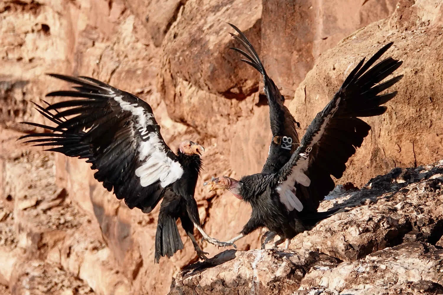
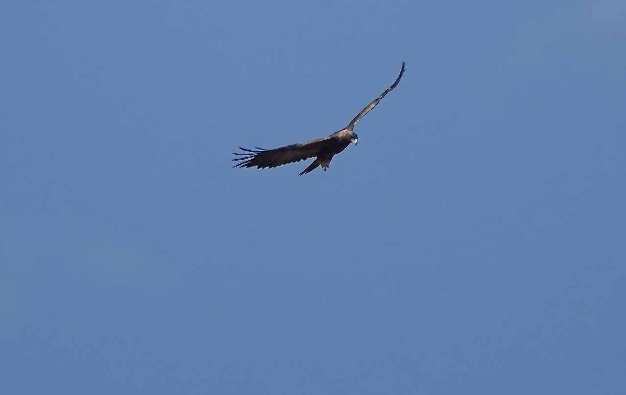
We were not disappointed. Within just a few minutes of arriving at the Navajo Bridge, we had spotted four California Condors. It was especially exciting to see them, because we hadn’t seen any at the Condor Release Site in Vermillion Cliffs National Monument. All California Condors in the wild are fitted with numbered wing tags (for identification) and radio transmitters (for tracking). With the wing tag information, you can even look up some basic data about each bird online. The birds we saw were:
#54, a 17-year old male born in captivity in Idaho
#N1, an 8-year old male born in captivity in Idaho
#R5 and #R8, a 6-year old female and male, both born in captivity in Oregon
When we first arrived, all of the birds were just hanging out on the beams supporting the bridges, and not doing much. But soon, they started waking up, and they became pretty active. It was fascinating to watch them as they soared back and forth beneath us, sunned themselves on the nearby cliffs, and even squabbled over who got to use the prime resting spots on the cliff. Condor R8 was particularly charming to watch as he clambered around on the trusses beneath the bridges, seeming to use the beams as a playground. We stayed and watched their comings-and-goings for more than an hour.
California Condors spend a whole lot of time preening and sunning themselves. This young male was particularly active, clambering around on the trusses of the bridges, soaring back and forth, and sunning himself on the cliffs. Marble Canyon, Arizona, USA. Copyright © 2019-2021 Pedals and Puffins.


On our way back to the lodge, we took the time to look at some of the memorials and monuments at the Navajo Bridge Interpretive Center. There are quite a few plaques commemorating notable individuals from the area, including the people who ran Lee’s Ferry in the years before the bridge was built. One memorial stands out, with the bronze image of a woman rowing a river boat. It’s dedicated to a river guide who died tragically in 1994, in a car accident with her husband. She was only 35 years old.
Memorial to Karen Kazan, Colorado River boat guide. Marble Canyon, Arizona, USA. Copyright © 2019-2021 Pedals and Puffins.
Cycling Across the Navajo Nation
Since our departure from Kanab, Utah, afternoon temperatures had been rising into the low 100’s F (38 C). But now, the weather was going to moderate a little bit, with high temperatures in the upper 90s F. And given that we would be gaining about 2,000 ft in elevation (610 m) as we cycled into the Navajo Nation backcountry, we hoped that the heat would be manageable as we rode across some of the most remote and unforgiving lands in the Western United States. It was time to get back on the road.
The next three days of cycling would also provide the ultimate test of our water management skills. There would be no sources of water for 105 miles, longer than any other stretch on the WWR. And since we had started to get a little low on water during our ride between Kanab and Marble Canyon, we weren’t going to take any chances. We loaded up our bikes, sharing a cargo of 32 L (8.5 gallons) of water between us. That’s a whopping 70.5 lbs of water. But as PedalingGuy likes to say… luckily(?) it would get lighter fast.
Our day started with the big climb out of the Marble Canyon valley. After about 2.5 hrs of cycling uphill, we saw a small cluster of wooden vendor’s stalls by the side of the road. Hoping to buy one last cold drink, we pulled over to check it out. When we asked the proprietor if she had cold drinks, she said, “Sure, I have cold water and some Gatorade. Which would you like?” We said both sounded good, so she went over to her car and started to reach into a small, personal cooler. That’s when we realized she was about to give us the drinks she had brought for herself for the day.
“Oh, thank you very much. But you don’t have to give us your drinks. We were just wondering if you would sell us some cold water,” we said. But she was undeterred. She said that she didn’t sell drinks at her stand. Besides, we looked like we could use the drinks more than her, anyway. And she lived just up the road, so she could go home and get some more if she needed to. We offered to pay her for the drinks, but she refused to take our money. She was so generous and sweet, we were really touched.
As we finished the drinks, we took the time to browse through her jewelry selection. She had a lot of beautifully designed items made from silver, and she told us that her husband had made them. He was a very talented silversmith. She also had a nice selection of beaded bracelets that her granddaughter had made. We bought one of the bracelets as a keepsake. Then we hopped back on our bikes and headed up the rest of the hill.
An unexpected, but very welcome, rest in the shade. The proprietor of this jewelry stand gave each of us a cold drink, before we purchased a bracelet as a keepsake. Copyright © 2019-2021 Pedals and Puffins.
We rode only two more miles on the pavement before turning onto a rocky, gravel road that led into the remote heart of the Navajo Nation. From a practical standpoint, the entire area is private land. The tribal government requires non-members to purchase a backcountry permit to even set foot out here. Our permit gave us three days to cross the largely unoccupied lands, with authorization to camp only in specially designated places. These campsites are not marked by any visible signs on the ground. Instead, you navigate to them using GPS coordinates, for a truly primitive camping experience.
Once we turned onto the dirt backroads, we did not see a single person for the rest of the day. Instead we were surrounded by miles of dry lands and rocky ridges where even the sagebrush seemed to struggle to hang on. Occasionally we would cycle past a deep, dry ravine. There was a small band of horses that may or may not have been wild. And every once in a while we would spot a small homestead or hogan (traditional Navajo building) out in the distance. They all appeared to be unoccupied - perhaps this wasn’t the right season for their use.
The land here was so dry that there were large areas of open dirt separating the small clumps of sagebrush, with very little grass growing in between. Navajo Nation, Arizona, USA. Copyright © 2019-2021 Pedals and Puffins.


Unfortunately, the wind had shifted to blow from the northwest, and the smoke from California’s fires hung in the air once again. Because of the haze, we could just barely see the shadow of the Vermillion Cliffs to our west, and the Kaibab Plateau to our south - even though they weren’t that far away. Having that veil over the distant views created an even more intense sense of isolation, as our attention was focused on the sparsely-vegetated lands that surrounded us.
These wide-open lands can make you feel very small. Navajo Nation, Arizona, USA. Copyright © 2019-2021 Pedals and Puffins.
Navigating on these roads was a particularly interesting challenge for PedalingGuy. The problem was that very few of the roads we encountered were on our map. And often, we would come to a junction where two or three roads would separate from each other, but still run in basically the same direction - at least for a little while. Typically, our map would show only one road - or none at all. It took some guesswork to decide which of the various roads might be the one that would get us to our destination. PedalingGuy did a great job figuring things out, with only a couple of minor course corrections required throughout the day.


The condition of the dirt roads varied a lot, but for the most part they were in pretty ragged shape. We cycled through long stretches of loose rocks and gravel, with plenty of short, steep hills, and endless miles of washboards.
Even so, we made it to the Marble Canyon campsite in the early afternoon. And wow, it was spectacular. The WWR route took us right to the rim of Marble Canyon. At this point it was nearly 2,500 ft deep (760 m) - much deeper than back at the Navajo Bridge. As we stood at the edge of the steep drop-off, the milky, blue-green water of the Colorado River seemed very far away as it coursed through the canyon down below. The delicate orange, pink, white and gray colors of the nearby rock layers faded into deeper blues and purples in the distance. And a prominent bend in the river right where we camped gave us a glorious view of the canyon receding to the west. Best of all, we were completely alone. There were no signs of humans as far as the eye could see. We would spend the rest of the day and night in total solitude - except for the company of two Peregrine Falcons that stopped to play on the cliffs nearby.
Unfortunately, the afternoon was scorchingly hot. So we scouted out the area along the rim of the canyon, and selected a spot for our tent. Then we pitched just the outer part of the tent, and set up our folding chairs inside in an attempt to get some rest in the shade. It provided some relief, but our tent fabric actually lets a lot of light through. So it wasn’t as much of a break from the sun as we had hoped.
Most spectacular campsite, ever. We pitched our tent near the rim of Marble Canyon, with no signs of other people as far as the eye could see. We didn’t even see any distant lights at night. Navajo Nation, Arizona, USA. Copyright © 2019-2021 Pedals and Puffins.

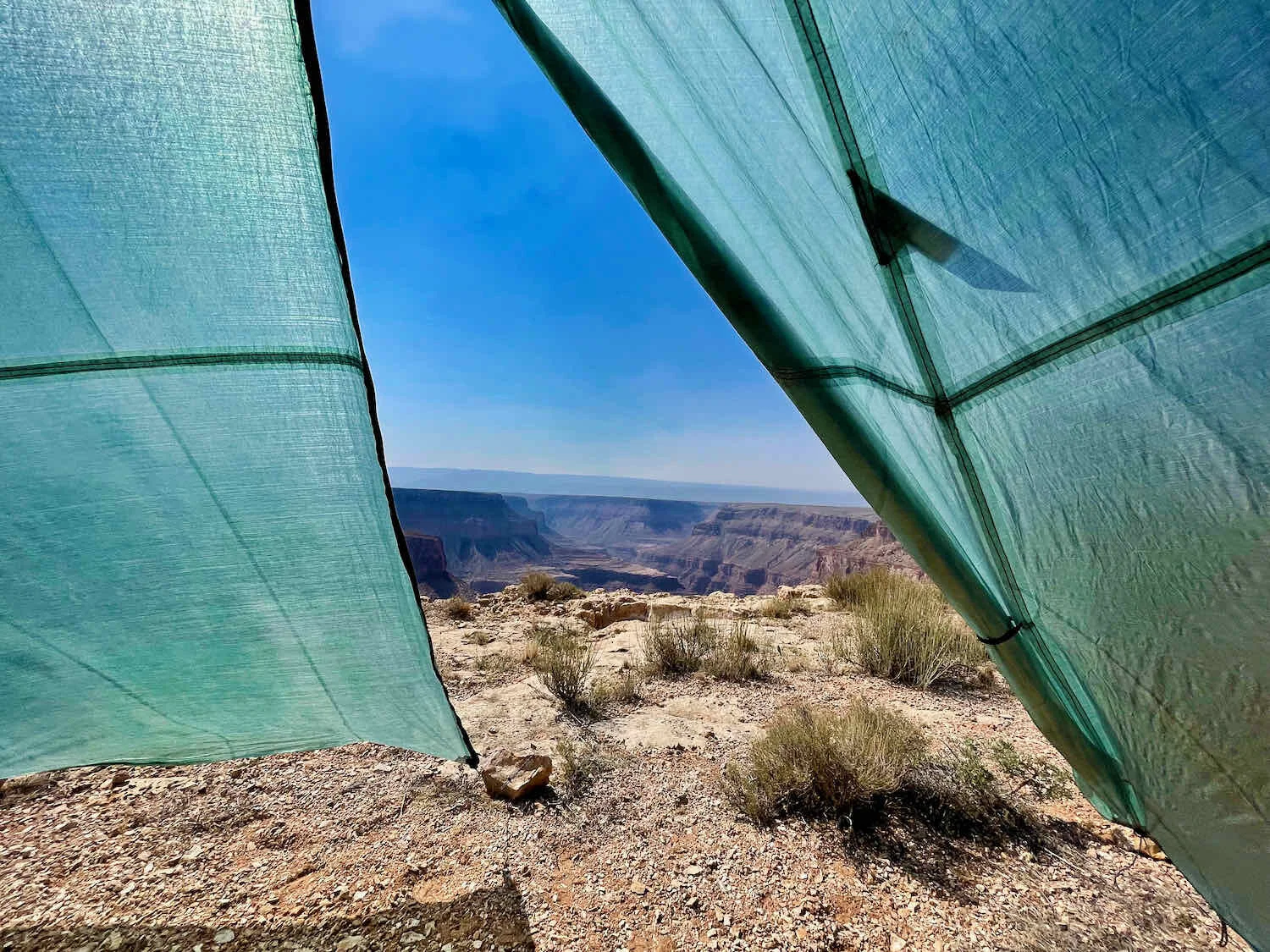
This bend in the Colorado River began to evoke the same sense of awe as the Grand Canyon that most people only see from within the National Park. Here at Marble Canyon, we had it all to ourselves. Navajo Nation, Arizona, USA. Copyright © 2019-2021 Pedals and Puffins.
By 6pm the intense heat finally started to abate, so we were able to finish setting up camp and prepare dinner without melting. But it remained warm well past sunset. The night was very dark, with just a sliver of a moon and no sources of man-made light. As we lay in the tent waiting for things to cool down, we were able to peek outside at the night sky. Unsurprisingly, the stars were dazzling, and the Milky Way splashed a bright path all the way across the sky. A slight breeze kicked up now and then, rattling the tent fabric throughout the night.
The best part about the next day was that the wind had shifted during the night. That meant the smoke in the air had blown away, and we had a crystal-clear view of the Kaibab Plateau to our south. It seemed much closer, and was much more interesting to look at than it had been the day before, when it was just a big shadow in the background. Now we could see the cliffs and forests of the plateau in exquisite detail.
We spent the entire day on rough dirt roads, rattling along on chunky rocks and merciless washboards. And it was another day of quiet solitude. We didn’t see any other people, except for a couple of cars that passed near one remote intersection.
We rattled along on rock-strewn roads, through out-of-the-way landscapes that few people (especially non-Navajos) ever see. Navajo Nation, Arizona, USA. Copyright © 2019-2021 Pedals and Puffins.
Late in the previous day, the vegetation had started to increase. Grasses began filling in some of the open dirt areas, and the lands around us began to take on a slightly greener hue. Perhaps this area had a bit less grazing pressure, or there had been more recent rains. Whatever the reason, the land felt more alive today, and we spotted more creatures along the way.


But there still wasn’t any shade. Then, about halfway through our ride for the day we approached some tall buttes, rising out of the plain. And even from a couple of miles away we could see that they had trees! We were ready for a break, but decided that it was worth it to ride the last few miles to the buttes, for the luxury of some rest in the shadow of a juniper or pine.
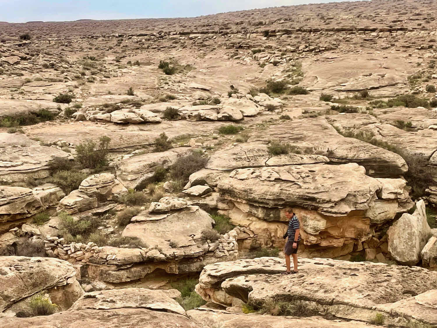
When we finally reached the buttes, PedalingGuy spotted something even better - a pile of giant boulders casting a cool shadow underneath. As we set up our chairs under the overhang, we could see that we were not the first ones to use this spot as a shelter. We wondered how often, and by whom these rocks had been used over the centuries as travelers sought relief from the scorching sun.
It was so pleasant sitting in the cool shade of those rocks that it was pretty hard to motivate ourselves to get back on our bicycles. But we couldn’t linger forever, so we moved on.
A rare and precious spot in the shade. After resting in the shadow of these boulders, it was hard to get back out on our bikes and face the sun again. Navajo Nation, Arizona, USA. Copyright © 2019-2021 Pedals and Puffins.
After that, we started to see more dark red mesas and buttes rising out of the light-colored sands on the valley floor. We were entering the Painted Desert, known for its colorful rock formations. But none of these hills had any trees. We had left the only shade behind.
Cycling into the Painted Desert, we saw more and more colorful rock formations, like these red-rock buttes. Navajo Nation, Arizona, USA. Copyright © 2019-2021 Pedals and Puffins.
Just like the previous day, we arrived at our designated camping area (at Big Canyon) in the early afternoon. But this time we were spared from the intensity of the afternoon heat. A bank of storm clouds had formed over the Kaibab Plateau to the west, blocking the sun. Although there were a couple of times when rain seemed imminent, we were lucky. The raindrops never fell on our camp. The rain almost seemed to evaporate before it hit the ground in the distance. We got to enjoy the benefits of a cloudy afternoon, without the hassle of getting wet.
Rain clouds over the Kaibab Plateau seemed threatening for a while. But we were lucky the storm never reached our campsite on the rim of Big Canyon. Navajo Nation, Arizona, USA. Copyright © 2019-2021 Pedals and Puffins.
We did have some trouble with the wind. Strong gusts blew across the open land all afternoon. Again, we had pitched just the outer, waterproof part of our tent. But soon the force of the wind started pulling the stakes out of the ground, and the tent was in danger of blowing away. We rushed over to re-stake the tent, then reinforced the stakes with heavy rocks. We also decided it would be wise to put up the inner part of the tent - both to have it ready in case of rain, and to help reduce the air pressure on the inside of the tent (which was catching the wind like a sail). Once we got the inner set up, it seemed to help stabilize the tent.
Our Dyneema pyramid tent usually does pretty well in the wind. But the sandy soil at this campsite didn’t hold the stakes very well against the strong gusts that blew across the open landscape. We had to reinforce the stakes with big rocks. Navajo Nation, Arizona, USA. Copyright © 2019-2021 Pedals and Puffins.
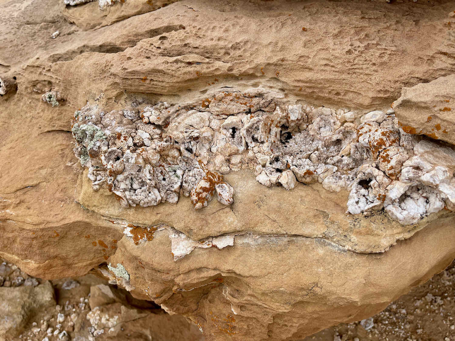
Despite its name, Big Canyon was quite a bit smaller than Marble Canyon where we had camped the previous night. But the smaller canyon was also more accessible, making it easier to explore the plants and rocks along its rim. We had fun studying the rock formations and speculating about their origins. Many of the surfaces looked like fossilized mud flats that had been sculpted by water and waves.
The evening passed pleasantly as we rested in our folding chairs, strolled along the canyon rim, and recovered from the ride.
But after dark, we had another adventure. It was another warm night, so we went to bed with both flaps of our outer tent tied open. The wind had calmed down around bedtime, and we anticipated a quiet night.
Then suddenly, without warning, in the middle of the night, a strong gale began to blow. From the force of it, the wind might have been blowing 50+ mph (80 kph). It was coming right in through the open doors, and threatening to rip our tent stakes out of the ground - toppling the tent with us in it. We scrambled to close the doors on the outer tent, but ran into trouble. The zipper had been getting “sticky,” and wouldn’t close properly if there was more than a tiny bit of tension on the fabric. We struggled with the zipper, as the ferocious wind buffeted our faces. One person tried to hold the sides of the zipper together while the other tried to close it shut. But the fabric kept pulling the zipper apart, and we were in serious jeopardy of permanently damaging the zipper teeth. We loosened the guy lines to the stakes on the sides of the tent to relieve some tension, and finally managed to cajole the zipper closed. Then we re-tightened the guy lines as best we could from inside the closed-up tent - all while the tempest continued to thrash our campsite.
Then, as if it were a joke, the wind died down completely - less than a minute after we had finally stabilized the tent. The whole ordeal probably lasted less than ten minutes (although it seemed like an eternity in the moment). All we could do was laugh at the absurdity of it. We left the tent closed for the rest of the night, but the wind never attacked us again. It was all good in the end, though, because we both slept better without the fabric rattling in the wind.
When we peered out of the tent in the morning, we discovered that the nighttime wind storm had toppled both of our bicycles. Even though they were pretty close to the tent, we never heard them fall. At the time, the roar of the wind had been too loud.
Our bikes spent the night lying down, blown over by a freak windstorm that raced across our campsite during the night. Navajo Nation, Arizona, USA. Copyright © 2019-2021 Pedals and Puffins.
The morning light on the nearby hills was lovely. The clouds of the previous evening had been a blessing by helping to reduce the heat. But they also dulled the colors of the Painted Desert. Now we could see the hills glowing in the morning sunlight.
Red sandstone formations of the Painted Desert were radiant in the morning light. Navajo Nation, Arizona, USA. Copyright © 2019-2021 Pedals and Puffins.
Road conditions were considerably easier today, and we were able to travel a lot faster than before.
A black-tailed jackrabbit nervously watched our approach. When we got too close, he leaped high into the air, bounding over plants twice his height before heading off into the sagebrush. Navajo Nation, Arizona, USA. Copyright © 2019-2021 Pedals and Puffins.
Making tracks on a wide, gravel road. The Kaibab Plateau is still visible in the background. Navajo Nation, Arizona, USA. Copyright © 2019-2021 Pedals and Puffins.
We reached the end of the dirt road by mid-morning, somewhat reluctant to leave the starkly beautiful backcountry. We took the time while still on the dirt to refill our drinking bottles with water from our panniers, in preparation for the final push to the town of Cameron. A sign at the road entrance alerted travelers that entering the backcountry requires a permit, and reminded us that we had just cycled through a unique and rarely-visited landscape. As if to say good-bye, two Golden Eagles flew lazily overhead, looking down at us as they passed by.

While we were watching the eagles soar away, a guy in a white van pulled off the highway and stopped next to us. And so we met Dominic, a traveler heading to Utah. He had his mountain bike with him, and was curious about cycling in the Navajo backcountry. But when we told him about the permit system, he decided to pass. He was just looking for a place to get out of his van and bike for a bit, and driving back to Cameron for a permit would be too much trouble.
Dominic asked to make sure we didn’t need anything, like water - but we were good. It wouldn’t be long before we were back in civilization, so we didn’t need to carry any extra water at this point. We chatted with him some more, and learned that he had family not that far from where we live.
Then we hit the pavement, heading for Cameron, Arizona. The rock formations along the paved road were totally different from the red-rock buttes we had been seeing since the previous day. Even though we were still in the Painted Desert, we had descended nearly 800 ft in elevation after leaving our campsite - landing us among a totally different set of geological features. Here, the hills and buttes were painted with muted pastels ranging from off-white to luxurious purple and olive-colored bands. It was a delightful change of scenery.
Another face of the Painted Desert. Here, the hills and buttes were painted in pastels. Navajo Nation, Arizona, USA. Copyright © 2019-2021 Pedals and Puffins.
Before long we reached the crossing of the Little Colorado River, and eagerly pedaled into the large parking lot at the Cameron Trading Post. We had planned a rest day in Cameron, to enjoy the pleasures of a shower, air conditioning, and something besides freeze-dried food.


The Trading Post is an interesting place, if a bit touristy. It has its roots as an actual trading post that was set up more than 100 years ago, to help Navajo craftsmen reach a wider market with their goods. Even back then, they had lodging available for the traders that would come through town. Now you can stay in a modern hotel, shop in a huge craft store, and dine in a restaurant decorated with high-end Navajo art.
Made it to the Cameron Trading Post, after three days of cycling across the Navajo backcountry. Cameron, Arizona, USA. Copyright © 2019-2021 Pedals and Puffins.
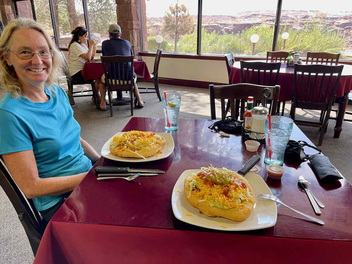
We treated ourselves to a couple of Navajo Tacos - basically a taco salad on top of Navajo fry-bread. They are very big, and the waiter actually asked us if we would prefer to get one to share when we placed our order. But when he heard we were cyclists he relented. He laughed and told us that only cyclists and hikers who’ve been in the backcountry eat the whole thing. Of course, we had no trouble finishing our meals.

The Grandest Canyon of All
Cameron is a “gateway community” for the Grand Canyon. So from there, it was a pretty straight shot to the National Park. But the official WWR route doesn’t stay on the pavement. Instead, it follows several gravel roads that parallel the main route. But when we turned onto the dirt, there were signs warning travelers that a backcountry permit was needed, or you could be fined for trespassing. We were pretty sure the WWR route didn’t require a permit for this section. But since our backcountry permit had expired, we decided not to take any chances. We stayed on the paved road, and enjoyed the benefits of a smooth, fast ride. Unfortunately, the debris on the side of some paved roads can be harder on bike tires than the rough terrain in the backcountry. PedalingGuy ran over something sharp that punctured his back tire, splattering PedalingGal with sealant. When we stopped to have a look, the sealant seemed to do its job and it appeared that the puncture had stopped leaking air. We were back in the saddle in less than a minute without even having to patch the hole.
We cycled on a wide highway shoulder that rose gently uphill all day. For the first 20 miles, we followed the Little Colorado River Canyon as it wound towards its rendezvous with the Grand Canyon. The last 12 miles before we reached the national park crossed a section of the Kaibab National Forest. All the while, hawks, eagles and vultures soared lazily above the canyons, riding the thermal air currents.


We thought it was nice that the Grand Canyon Mules had adopted a section of the highway for clean-up. It did make us wonder how the mules handle the necessary equipment…Copyright © 2019-2021 Pedals and Puffins.
Excited to arrive at Grand Canyon National Park. We had visited the canyon many years ago, but it never loses its allure. Arizona, USA. Copyright © 2019-2021 Pedals and Puffins.
Shortly after noon we arrived at the eastern entrance to Grand Canyon. We were thrilled, because that gave us plenty of time to check in at the Desert View Campground, and then spend the rest of the day sightseeing.
But first, we headed over to the park’s general store for our traditional, post-ride cold beverage. Our arrival at the store, with our fully-loaded bicycles, caused quite a stir. There were several groups of park visitors snacking at picnic tables on a patio out front. And they were very intrigued by the prospect of two slightly crazy people cycling into a National Park. Once they heard that we had ridden all the way from the Canadian border, they were astounded. We were peppered with questions about how long it took, was it hard, how much did we camp, etc., etc. One fellow in particular wanted to chat a bit longer. He was nearing retirement, and an extended bike tour was something he’d been thinking about. We visited with him and answered his questions for a little while. But soon our thirst took over, and we excused ourselves to go and get those beverages.
At check-in, the campground host told us about a “secret” spot for viewing the canyon, that could only be reached via a trail from the campground. We took the path out to the rim, and enjoyed a gorgeous panoramic view of the canyon. It did feel like we were off the beaten path, because we were the only ones there - except for some tiny yellow rafts we could see working their way through the rapids in the Colorado River, far below.
Our first view of the Grand Canyon, from a secluded viewpoint near the Desert View Campground. We had the spot all to ourselves. Grand Canyon National Park, Arizona, USA. Copyright © 2019-2021 Pedals and Puffins.
The Grand Canyon is well known for its many, interesting rock formations. This one is near the Desert View campground. Grand Canyon National Park, Arizona, USA. Copyright © 2019-2021 Pedals and Puffins.
From there we walked along the canyon’s south rim, taking our time to enjoy the scenery and wildlife along the way.


Before long we approached the Desert View Watch Tower. It’s an enigmatic structure. When you first see it, you think that something this substantial must have had an important purpose - perhaps serving as a fire watchtower. It also looks very old. But, in fact, it was built in the 1930s specifically as an attraction for tourists, to provide spectacular views of the canyon from the comfort of a building. The architect drew inspiration from Native American ruins at places like Mesa Verde and Hovenweep, and designed the tower to look much older than it is.
This evocative tower was built on the rim of the Grand Canyon to offer visitors a way to gain a different perspective on the canyon, or to enjoy panoramic views from inside a building during inclement weather. Copyright © 2019-2021 Pedals and Puffins.
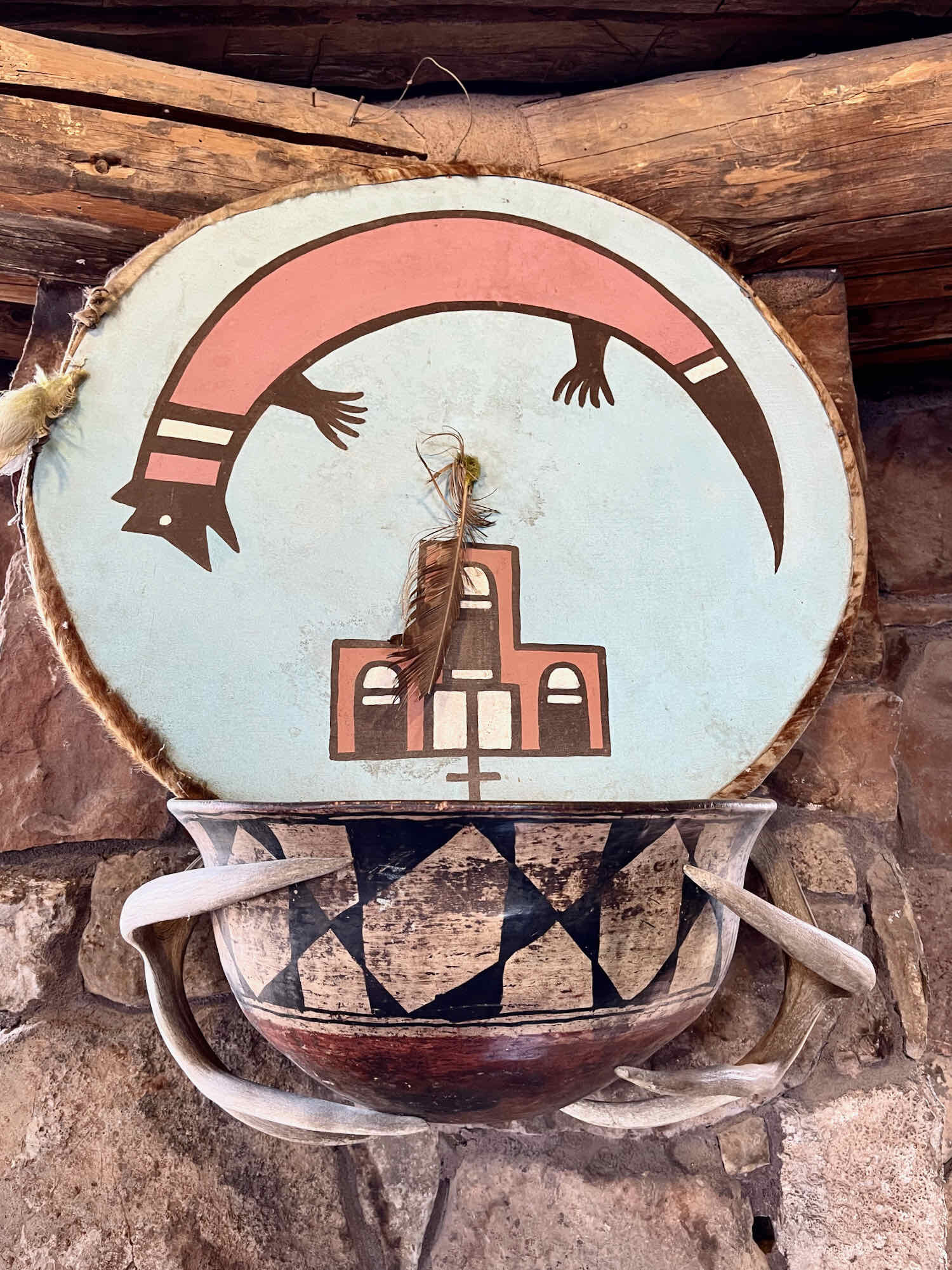
When we visited, the tower itself unfortunately was closed. The ground level was open, though. So we were able to go inside the Kiva Room, a circular space inspired by the ceremonial rooms used by Pueblo Indians. Lined with large, glass windows, the room provides a pleasant, cool environment for viewing the canyon on a hot afternoon. Representations of Native American ceremonial headdresses and shields offered a splash of color on the otherwise somber, stone walls.


To finish off the day, we walked along the rim to the west of the Desert View Watch Tower, as far as Navajo Point.
The evening sun cast long shadows across the canyon near Navajo Point. Grand Canyon National Park, Arizona, USA. Copyright © 2019-2021 Pedals and Puffins.
In the end, we only were able to get a brief glimpse of the wonders of the Grand Canyon. To fully appreciate it would take a much longer visit. A multi-day hike down into the canyon would provide a chance to experience the vastness of its depth in a more tangible way. But we didn’t have the time for that on this trip. Perhaps we’ll have the good fortune to return again, someday.