Cycling Grand Canyon to Globe, AZ: The Many Faces of Arizona

13 - 22 September 2021
Segment 8 of the Western Wildlands Bikepacking Route (300 mi, 483 km)
Arizona’s Amazing Variety
When most people think of Arizona, they probably picture either the Grand Canyon or quiet deserts with Saguaro cacti silhouetted against the sky. There’s nothing wrong with that. Both of those places are iconic of parts of the state. But what about cool, shady, ponderosa pine forests? Or grassy plains dotted with volcanic cones? Or even a 200-mile long (320 km) cliff that reaches heights of 2,000 ft (610 m)? On this segment of the Western Wildlands Bikepacking Route (WWR), we would experience all of these, and more. In fact, this stretch of the route is the one that is most likely to have riders exclaiming, “I didn’t know Arizona was like this!”
Goodbye to the Big Canyons
It wasn’t easy to pull ourselves away from the Grand Canyon. Before heading south, our route ran along the South Rim of the canyon. But even though the riding was on pavement, it took us more than two hours to cover those 11 miles (18 km). That’s because we couldn’t help stopping at the many viewpoints along the way. When you know there’s a chance you might never see the Grand Canyon again, it’s hard to resist the urge to gaze out over its rocky cliffs for as long as possible. We wanted to savor the feeling that comes from viewing something so… grand. And to commit that feeling to memory so that we could recall it again in the future.
When we saw the sign indicating a turnoff for Moran Point, we knew that was one viewpoint we wouldn’t want to miss. It’s named for Thomas Moran, the famous and prolific painter of Western landscapes. We’ve seen a number of Moran’s paintings in art museums, and his colorful, dramatic scenes always stand out - making him one of our favorite artists of American western landscapes.
When we spotted the sign for Moran Point (named for artist Thomas Moran), we knew we had to go and have a look. Grand Canyon, Arizona, USA. Copyright © 2019-2021 Pedals and Puffins.
The view from Moran Point was, of course, spectacular. In the morning light, the canyon walls were almost as vibrant as they appear in Thomas Moran’s gloriously colored paintings.
At Moran Point, you can compare your view of the Grand Canyon with one of Moran’s illustrations. In the morning light, the colors of the rocks start to approach the glow of the artist’s imagination. Grand Canyon, Arizona, USA. Copyright © 2019-2021 Pedals and Puffins.
We found it hard to pull ourselves away from the lure of the canyon’s awesome scenery. Moran Point, Grand Canyon, Arizona, USA. Copyright © 2019-2021 Pedals and Puffins.
Shadowing the Arizona Trail
But eventually our ride along the canyon rim came to an end. Our route turned south on a well-maintained gravel road. Soon we had left the National Park behind, and were pedaling through a beautiful forest of tall ponderosa pines. Here, in the Kaibab National Forest, the trees were big and numerous enough to cover the trail with their shade. Reaching heights well over 7,000 ft above sea level (2,150 m), this plateau is cool and moist enough to feel more like the slopes of the Rocky Mountains, much further to the north. It was wonderful to be back in the shadowy, green forest, once again.
We cycled barely over a mile on the gravel before crossing the Arizona Trail (AZT) at the Grandview Trailhead. For the next two days, the AZT would be our constant companion - often not more than a quarter mile (0.5 km) away. We would shadow the trail for nearly 55 miles, crossing it several times, and even having the chance to test our mountain biking skills on a few rugged stretches.
In northern Arizona, the WWR shadows the Arizona Trail for nearly 55 miles. Kaibab National Forest, Arizona, USA. Copyright © 2019-2021 Pedals and Puffins.
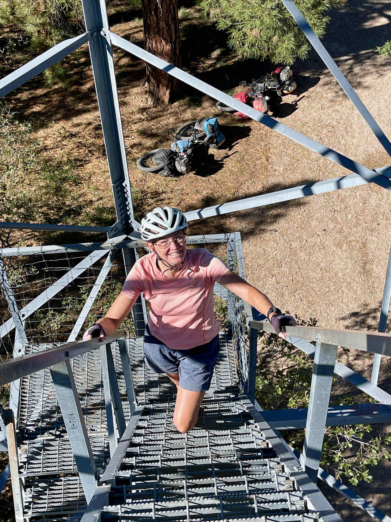
But first, we climbed the tower that gives the Grandview Trailhead its name. Built in 1936 as a platform for spotting forest fires, the Grandview Lookout Tower is still in great shape (compared to some rustier lookout towers we’ve climbed in the past). The sturdy, iron structure rises 80 ft into the sky - considerably higher than the treetops in the forest below. Looking to the north, we had a unique view towards the Grand Canyon, which was only about a mile away. From this angle, we could really see how much higher the North Rim of the canyon is than the South Rim, as it rose above the trees in the distance.

The route through the Kaibab National Forest yielded some of the most pleasant backcountry cycling we’ve had in a while. The shade, the good condition of the gravel road, and a general downhill trend made for fast and hassle-free riding. An active habitat management program by the national forest has created a lovely woodland of mature trees with a grassy understory, that grades into open savanna in places. The forest carpet was blushed with yellow from autumn flowers and red from grasses that were going to seed. Along the way, a “mountain lion crossing” sign took us by surprise. It was hard to imagine that mountain lions would be common enough to warrant a crossing sign, but we kept an eye out for them, anyway. Too bad we didn’t see any.


Descending on the forest road, the pine forests eventually gave way to pinyon-juniper shrub lands. Then, at the national forest boundary, the trees disappeared completely and we were back in sagebrush grasslands. A series of five gates across the road let us know when we were passing from public land to private ranches, and even a short stretch of land belonging to the Navajo Nation.
As we exited the Navajo lands, we emerged from a narrow valley onto an open, treeless plain. That’s when we encountered a very strong headwind - and the easy cycling was over for the day. The wind felt like it was blowing around 30 mph (48 km/h), making us really work hard to pedal our way back into the hills on the far side of the prairie.
Pedaling towards the foothills of the San Francisco Peaks. A strong headwind slowed our progress as we cycled across the plain. Antelope Flat, Arizona, USA. Copyright © 2019-2021 Pedals and Puffins.
When we arrived at the foothills of the San Francisco Peaks, it was not yet 1:00 in the afternoon. There, the Arizona Trail joined our route, and followed the gravel road on which we had been riding. With just under 10 miles (16 km) to go before reaching our goal of 54 miles (87 km) for the day, it seemed like we were going to be relaxing at our campsite for much of the afternoon. Since we were making great time, we stopped in the shade of a juniper tree, and rested for about half an hour - guzzling Gatorade and recovering from the ride into the wind.
But once we were back on our bikes, the WWR had different plans for us. Just before we hit 50 miles (80 km), the Arizona Trail took a turn to the left, leaving the gravel road behind.
We passed through a big iron gate, took one look at the road ahead, and our hearts sank. The conditions deteriorated completely. What was probably once a road, had become a rutted jumble of rocks across a hilly cow pasture. Recent rains had turned the clay soil into deep, sloppy mud. The cattle had trampled their way through the mud leaving deep pits in their footprints, and some off-road vehicles had driven through the muck, creating narrow, deep ruts. In the baking sun that followed, these pits, ruts, and gullies from the rain had all hardened into something like plaster, strewn with gravel and stones. Needless to say, we were in for a technical and bumpy ride.
With this gate, we passed from pleasant, well-groomed gravel onto one of the most challenging road surfaces we had encountered so far on the WWR. San Francisco Volcanic Field, Arizona, USA. Copyright © 2019-2021 Pedals and Puffins.
Also, we entered the San Francisco Volcanic Field and now were riding on sharp-edged volcanic rocks. The most prominent geologic feature in the area is Humphrey’s Peak, an extinct volcano that rises more than 12,600 ft (3,850 m) above sea level, and is the highest point in Arizona. But the volcanic field covers a much bigger area, and encompasses nearly 600 volcanic cones. Our route wound its way slowly uphill, threading a path between the ancient hills of lava and ash.
Riding became difficult and slow as we navigated through the rock fields and trenches of the AZT. It took us more than three hours to cover the final 7.5 miles for the day. That included several miles of hike-a-bike. We also worried that the sharp-edged lava rocks would shred our tires. But once again we were very grateful that our tires withstood the abuse.


Finally, after about 11 hours of cycling, we settled on a spot to camp a little before darkness set in. We had found a lovely grove of pinyon pines and juniper trees that provided protection from the wind. The stress from the afternoon’s hard effort melted away as we ate dinner while listening to the wind rustle through the branches of the nearby trees.
A cozy, private campsite in a lovely pinyon-juniper woodland. Coconino National Forest, Arizona, USA. Copyright © 2019-2021 Pedals and Puffins.
We were glad to have the privacy afforded by our little woodland. Even though we hadn’t seen a single car since turning off the pavement back at Grand Canyon National Park, multiple off-road vehicles passed by our campsite right at dusk and into the early nighttime hours. Given the hazardous condition of the road, they creeped along slowly as the drivers carefully chose a path over the rocky, rutted terrain. We later learned that archery season for elk had opened a couple of days earlier. So those probably were hunters, heading home after a day in the field.
After the noise from passing ORVs died down, the elk came out to party. Throughout the night we heard elk bugling in the distance - calling out invitations and challenges to each other in the heat of the rut. Even though they kept us awake, we were grateful for the experience. We both love the wild, primitive sound of those calls.
Conquering More of the AZT
The next morning we were back on the Arizona Trail. After a couple of more miles on the dirt road, the trail took off up the mountainside, on a stretch of pleasant single-track. Happily, we had gained enough elevation that we were back in the ponderosa pine forest. The combination of shade and relatively smooth riding put a smile on our faces.
This is the life. We found ourselves on a smooth and shady single-track through a beautiful ponderosa pine forest. Arizona Trail, Coconino National Forest, Arizona, USA. Copyright © 2019-2021 Pedals and Puffins.
The forest was teeming with wildlife. We stopped along the trail to check out flocks of birds, and admire the brightly-colored, woodland flowers.


But the warm and fuzzy feelings didn’t last. About 3.5 miles (5.5 km) into the ride we were supposed to take a side-path onto another gravel road. Somehow we missed the turn, and ended up remaining on the Arizona Trail as it paralleled what appeared to be a very nicely maintained gravel road.
And at this point our lovely, smooth trail fell apart. It became a sandy, rocky, steep uphill slog. Adding insult to injury, there was a barbed wire fence between us and the gravel road. Try as we might, we could not figure out how we could get over, under, or through that fence without getting hurt. The fence appeared to be quite new, and it was in excellent condition. There weren’t any weak spots with sagging or missing wire where we could squeeze through to the other side.
You might ask why we didn’t turn back to the path that originally should have taken us onto the gravel. But the truth is, we simply hadn’t seen a break in the fence from the beginning. We suspect that the barbed wire fence is new, and that it now blocks the access to the road where the WWR was supposed to cross. Anyway, we ended up trapped on the rapidly-deteriorating AZT, pining for the gravel road, and exhausting ourselves as we hike-a-biked up the hill. It was not fun.
Instead of riding comfortably up the very appealing gravel road on the left, we were trapped on the rough Arizona Trail by a barbed-wire fence. Coconino National Forest, Arizona, USA. Copyright © 2019-2021 Pedals and Puffins.
In the end, the rough section of the AZT that paralleled that gravel road only lasted for two miles - but it took us nearly two hours to cover that distance. What’s more, the mental aspect of struggling up that hill, with our feet slipping in the gravel and sand, our legs getting scratched up by the sharp-edged plants on the overgrown trail, and the discomfort of getting burrs from those plants lodged in our shoes - all while plodding along within a few feet of a nice-looking road - was as hard as almost anything else we had survived along the WWR. PedalingGuy handles those mental challenges much better than PedalingGal, who really suffered. It was a huge relief when we finally reached a gate in the fence, where the AZT crossed the gravel road.
Nothing could have made us happier in the moment, than seeing this gate in the barbed wire fence that bordered the Arizona Trail. It was like being set free. Coconino National Forest, Arizona, USA. Copyright © 2019-2021 Pedals and Puffins.
We found some big, comfortable rocks in the shade of a pine tree and sat down to recover from the effort. Some trail side snacks and deep drinks of water helped considerably in restoring both our energy and our mood. We didn’t know at that point how difficult or easy the rest of the day would be. But we did know that we had three more miles to go on the Arizona Trail, and we’d only covered 5.5 miles so far that day. Before setting off again, we gave ourselves a pep talk, and braced for some more hard work.
Fortunately, the uphill gradient moderated just enough at that point to make the trek more manageable. We still did a fair amount of walking, but the really steep parts became shorter, and there were even some flattish sections. Things were definitely looking up.
This relatively flat section of the Arizona Trail was a welcome change of pace. We paused here to soak up the view. San Francisco Volcanic Field, Coconino National Forest. Arizona, USA. Copyright © 2019-2021 Pedals and Puffins.
After nearly five hours of riding, we reached a gravel road and turned off of the Arizona Trail. By that point, we had cycled only 8.5 miles. It gave us a tremendous appreciation for how challenging the AZT can be on a bicycle. Yes, it would be a bit easier without the weight of fully loaded panniers. But really, the trail surface in places is much more suited to hiking than biking.
We had covered so few miles by that point, we decided it would be smarter for us to skip the steep ascent over a shoulder of Humphrey’s Peak, and to aim for taking paved roads into Flagstaff. We had left the Grand Canyon with only two days supply of water, and didn’t want to push our luck at not being able to reach Flagstaff by the end of the day.
Cycling on the gravel road seemed incredibly simple after the tough conditions on the AZT. Even though the gravel was rough in places, and the uphill section had gradients over 8%, we charged up and down the slopes with ease. The ponderosa pine forests once again seemed welcoming, and before long we reached the paved road.
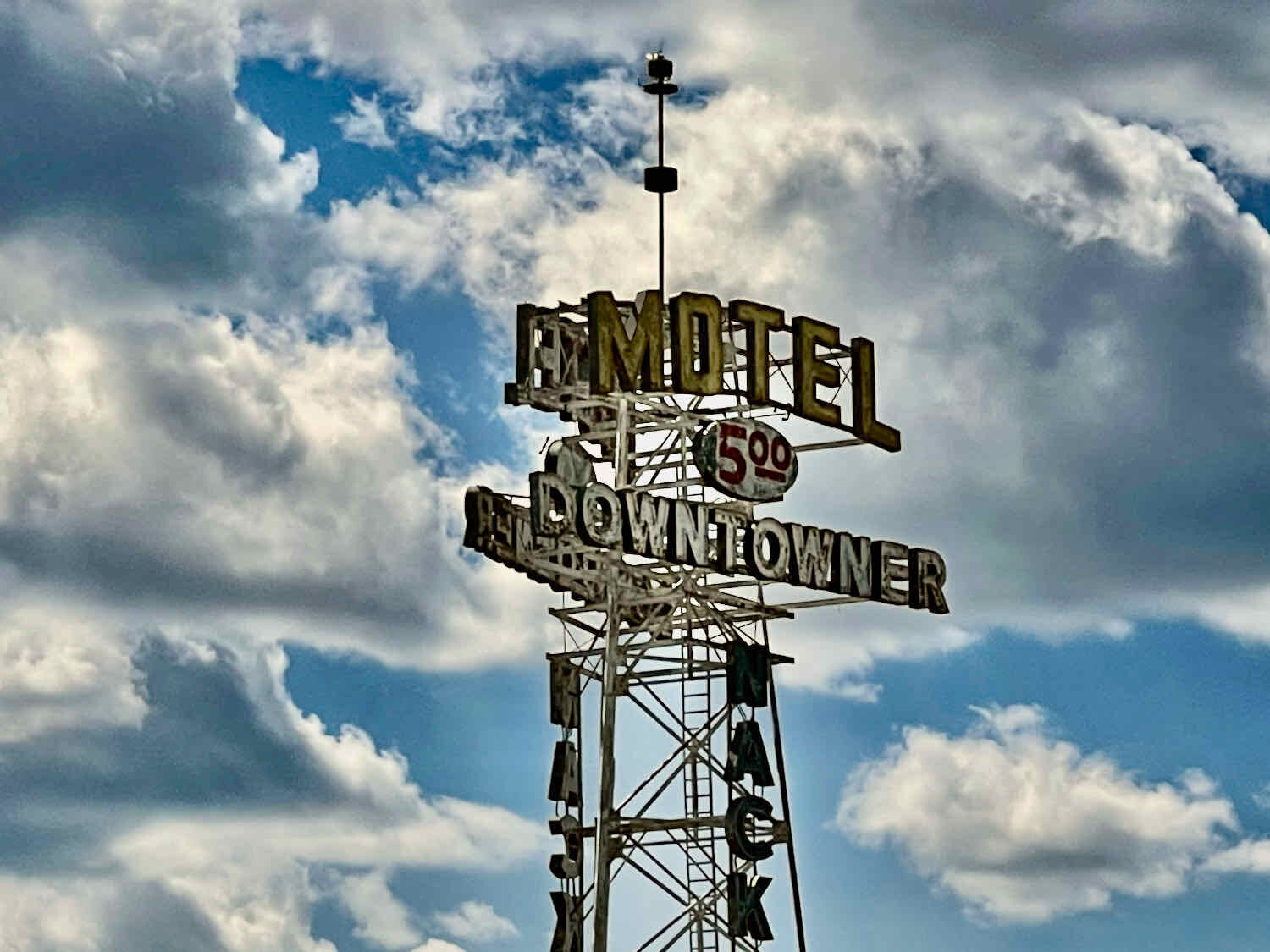
The ride into Flagstaff on pavement ended up being even more enjoyable than we expected. For five miles we found ourselves cycling along historic Route 66, where we soaked up the ambiance of 1950’s era diners and motels that evoke the early days of American car-based tourism. And our route took us through the heart of Northern Arizona University during what seemed like rush hour, on bicycle paths crowded with students. After a hearty dinner and some rest, we were ready to take on the world again.
We made it to Flagstaff! Riding into town on historic Route 66 took us down memory lane. Flagstaff, Arizona, USA. Copyright © 2019-2021 Pedals and Puffins.
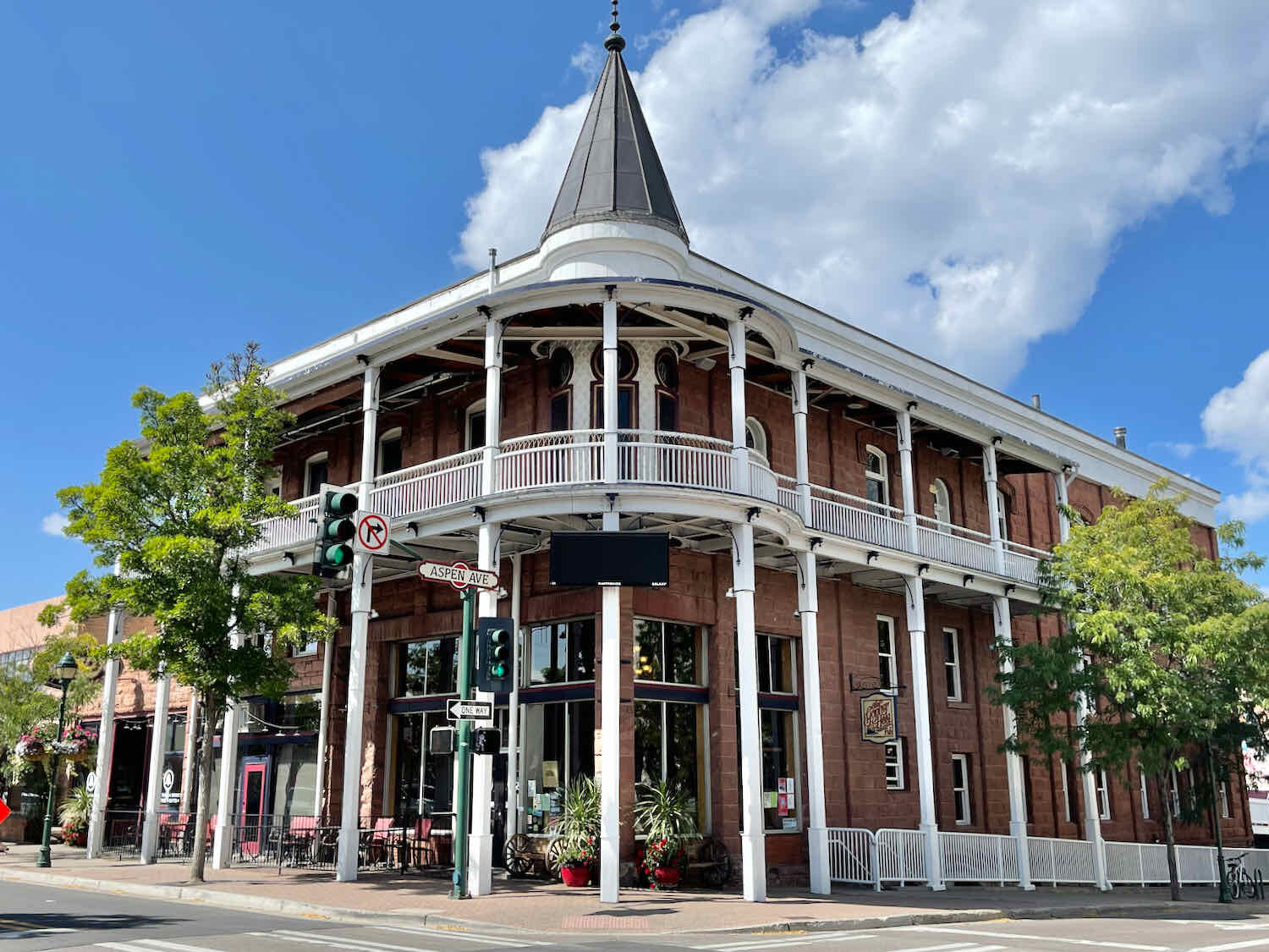
We took a morning to wander around historic, downtown Flagstaff. The area has undergone a renaissance over the past 30 years, and boasts some handsome, restored buildings as well as pleasant public spaces to hang out. Centered around the main railroad depot (which is now a visitors center), the buildings evoke a range of eras, including the early 1900s (like the elegant Weatherford Hotel with its wrap-around balcony), through the kitschy, 1950s heyday of Route 66. The downtown streets were pretty quiet when we were there, but that probably had to do with the time of day. We timed our walk to take advantage of cooler, morning temperatures.
Monument to the railroad workers who helped bring prosperity to early Flagstaff. Depot Square, Flagstaff, Arizona, USA. Copyright © 2019-2021 Pedals and Puffins.
An Adjustment to the Route
The official notes for the Western Wildlands Bikepacking Route between Flagstaff and Sedona refer to one section as being “incredibly rocky 4x4 track.” What’s more, other cyclists who have written about this stretch say that long sections are unrideable. Since we prefer to ride our bikes rather than walk beside them, it made sense to avoid that trail and high-priced Sedona. So after some consideration, we decided to cycle on Lake Mary Road from Flagstaff directly to Happy Jack, Arizona.
Elk in a Lake
The cycling on Lake Mary Road was fantastic. The pavement was new and smooth, the vehicle traffic was very light, and there was a wide shoulder all the way from Flagstaff to Happy Jack. As a result, the road turned out to be very popular among cyclists and runners from Flagstaff. For the first 15 miles out of town it seemed like we were constantly waving greetings to other cyclists out for day rides. We also played leap-frog with a group of three elite runners. They were training for the Boston Marathon. And a crew of guys from a high-end training company was filming their workout.
The road passes several lakes, many of them dry. The most impressive of these was Mormon Lake, which fills a large, shallow depression. In wet years, Mormon Lake is the biggest natural lake in Arizona, by area. It can cover 12 square miles (3,100 ha). But it’s maximum depth is only about 10 ft, so it dries up easily. When we rode by, Mormon Lake appeared to be completely dry, and looked more like a big, open prairie.
As we approached, the road climbed 350 ft up onto a ridge bordering the expansive grasslands. We pulled off the road at a scenic overlook, and were treated to a wonderful sight. Off in the distance a very large herd of elk had gathered on the dry lakebed. They were so far away that at first we weren’t sure what they were. But looking though binoculars, it was clear they were elk. There were hundreds of them. We watched them for a while. But eventually a couple of people on horseback rode out onto the prairie towards the elk, and spooked them. The herd moved away, and we headed off down the road.
At first we weren’t sure what these dark creatures were. They turned out to be elk, in a giant herd out on a dried-up lakebed. Mormon Lake, Arizona, USA. Copyright © 2019-2021 Pedals and Puffins.
At higher elevations, thick blankets of yellow flowers covered the ground among the pines. Lake Mary Road, Arizona, USA. Copyright © 2019-2021 Pedals and Puffins.
Around noon, clouds rolled in and we were caught in a brief rainstorm out on the road. Fortunately it passed quickly, and we were soon dry again. But the downpour was on the front edge of a bigger storm system, with the threat of rain possible throughout the rest of the afternoon and night. At least the rain would help to keep the fire danger low. We hustled down the road, eager to set up camp before things got too wet.
We covered the 54 miles to the US Forest Service campground quickly, arriving before 2:00 in the afternoon. The Clint’s Well Campground is pretty small, with just six campsites. It’s also pretty close to Lake Mary Road, which had gotten busier with traffic as we approached Happy Jack. On the bright side, there is no camping fee, and we were able to snag the campsite farthest from the road (only one of the other sites was occupied).
We wasted no time in setting up camp, which turned out to be a good thing. As soon as we had the tent pitched, it started raining again. We dashed inside, and used the time during the rainstorm to get our mattresses and sleeping bags set up for the night. Pretty soon, the rain was coming down really hard. This was easily the most rain that had fallen on the tent for our entire trip. And to our dismay, we discovered that all four corner seams of the tent started to leak. It was just a few drips, but they fell onto the insect netting of the inner tent, splashing little droplets inside. This was a bit of a disappointment, because we bought the tent new for this trip, and the seams are supposed to be fully sealed. We were lucky our things didn’t get too wet.
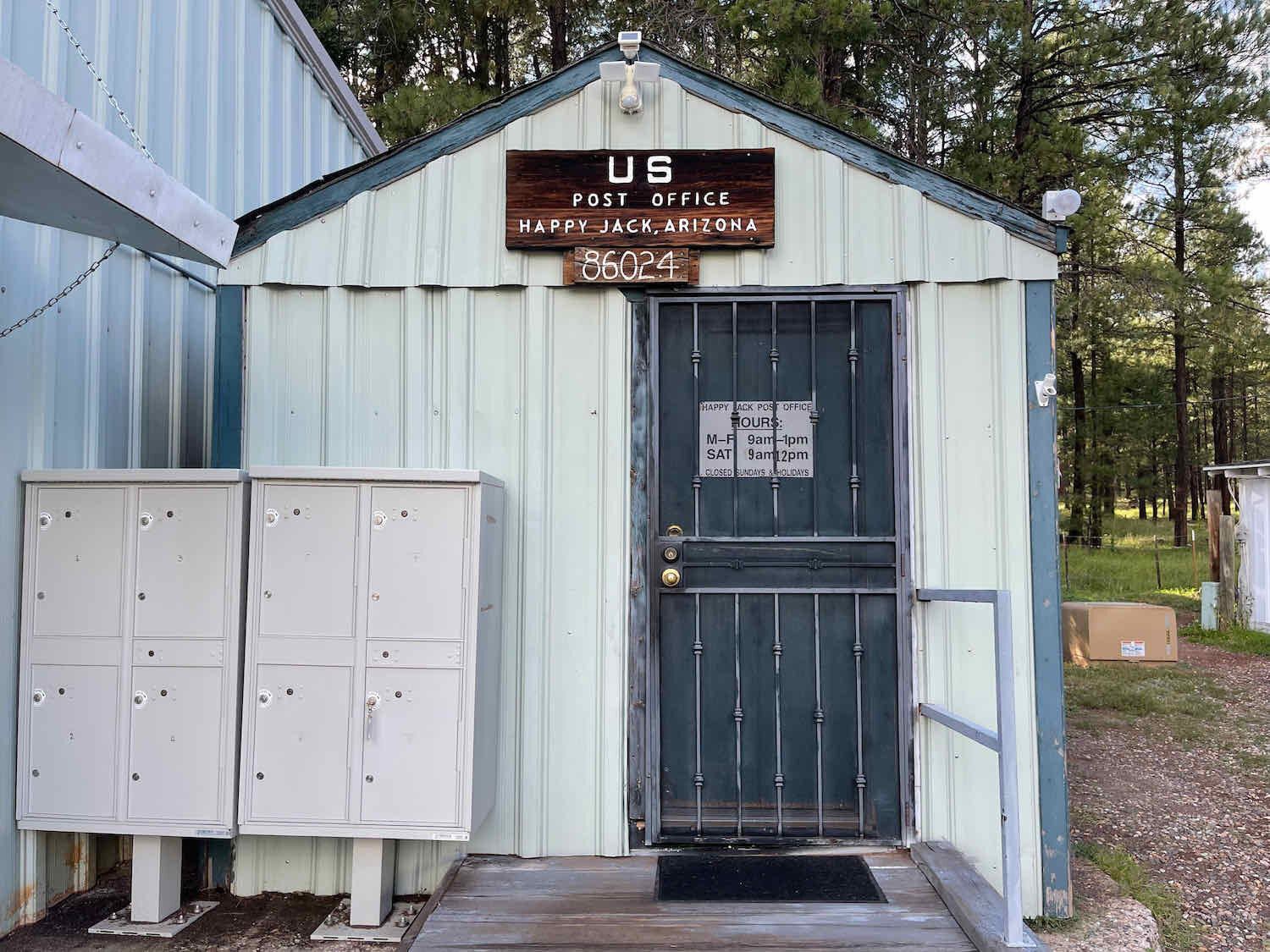
During a break in the storms, we were able to walk to a convenience store about a mile away, and pick up some stuff for dinner. Next to the convenience store was the tiny, local post office. They say that Happy Jack has a population of about 600 people, but it was hard to picture that. We didn’t see anything resembling a town along our route. It seemed like all the residents of Happy Jack were dispersed throughout the forested lands surrounding the post office, rather than living in anything that would look like a village.

Back at camp, we had barely finished eating dinner and cleaning up when the rain started again. We dashed for the tent, and that set off a series of unfortunate events. In her rush to get inside, PedalingGal dislodged the stake that was holding the front door of the outer tent in place. That needed to be fixed.
So during a break in the rain, PedalingGuy went outside to re-set the stake. But we had pitched the tent on the gravel parking area of the campsite, because that was the most level piece of ground. It was later that we realized that there was a layer of hard rock under the gravel, which kept us from being able to pound the stakes very far into the ground. As PedalingGuy tried to re-set the stake, he pounded on it too hard, and it snapped in two. By then, it had also started raining again.
Fortunately, we did have one extra stake. So he quickly ran to fetch the spare from the panniers still on his bike. As fast as he could, he repositioned the new stake, and managed to get it secure enough to hold the door of the tent. Then he got back inside the tent, with the hope of drying off.
That’s when he noticed that the middle stake at the back of the tent had also pulled loose. We’re not sure how that one came out of the ground. But given that the stakes weren’t that secure to begin with, even the wind could have yanked it up. Anyway, PedalingGuy went back out into the rain and and re-secured the back side of the tent. When that was done he was finally able to get back in the tent for good, and change into some dry clothes.
We remained in the tent for the rest of the night. We were lucky that the rain showers remained fairly light, so we didn’t have any further problems with the tent leaking. And just after sunset, we briefly enjoyed the song of an elk bugling in the distance.
The Mogollon Rim - Edge of the Colorado Plateau
The next morning we started our climb onto the Mogollon Rim. Before researching the WWR route, we had never heard of this fascinating geological wonder. It came as something of a surprise that for roughly 200 miles (320 km) along its southwestern border, the Colorado Plateau (in Arizonia) ends in an abrupt escarpment. There, the earth tumbles as much as 2,000 ft (610 m) over steep, rocky outcrops. Even though we had both traveled extensively in Arizona and New Mexico (and had some familiarity with the Colorado Plateau), somehow we had overlooked the existence of this extraordinary ribbon of cliffs.
As we headed out of Happy Jack around sunrise, we realized why there had been so few people at the forest service campground where we had stayed the night before. All along the gravel road, campers and RVs were tucked back in the woods in dispersed campsites (a.k.a., wild camping). Compared to where we had spent the night - near a busy, somewhat noisy road - these campsites would have been much more quiet and peaceful. As we rode by, campers were just starting to stir, and smoke from their campfires hung thickly in the air.
On well-maintained forest roads, we ascended more than 1,000 ft (305 m) to reach the rim. Hardly any vehicles passed us during those first 11 miles, and we reveled in the tranquility of the forest around us. At the top of the climb, the land tumbled away in front of us and we got our first look at the spectacular cliffs. Below the precipice, an expansive, forested valley spread out like a thick, green carpet, fading away into multiple layers of shadowy mountains in the distance. We sat on the edge of the rocks, savoring the moment.
The view off the edge of the Colorado Plateau, as it drops away steeply at the Mogollon Rim. Arizona, USA. Copyright © 2019-2021 Pedals and Puffins.
For the rest of the day the Mogollon Rim Road stayed close to the escarpment, yielding a series of awesome views. Arizona, USA. Copyright © 2019-2021 Pedals and Puffins.
But the good quality of the gravel roads meant that even low-clearance cars could easily drive up to the Mogollon Rim Road. By the time we reached the escarpment, it was mid-morning. And regular folks were now out-and-about in their cars, pickups, SUVs and ORVs. The online information about the WWR warns that this road “can be busy and dusty with traffic on weekends.” We had hoped that since school was back in session, we might be spared. But it was a lovely Sunday, and the ease with which people could drive up to the rim apparently made this route a popular choice when going out for a ‘Sunday drive.’
Before long we were being passed by cars every few minutes, often with multiple cars in a row. At first it was pretty dusty, and we started to fret that maybe we should have waited until a weekday to ride this section. Then we got lucky. Pretty soon the wind had picked up, and strong updrafts were racing across the edge of the plateau. The gusts reached 30 mph or more (48+ km/h), quickly clearing away any dust thrown up by passing cars. For a change, we were saved by the wind.
We started looking for a campsite relatively early, and ended up taking a couple of hours to locate one that suited us. This is an extremely popular forest for outdoor recreation, and there were tons of cleared areas close to the road that had been heavily used by campers. But that didn’t make it any easier for us to find a good spot. Many of the sites were too exposed to the wind. Others had some left over food items that could attract animals. (This forest is back in bear country. According to the US Forest Service, black bear density is very high on the Mogollon Rim, with one bear per square mile. That’s a lot of bears.)
We ended up rejecting a number of possible campsites before finally locating one, near the end of a dirt road that led into the forest. Surrounded by a dense stand of ponderosa pines, it was the perfect spot for a peaceful night. We were glad to find a place protected from the wind. Usually the wind will die down once the sun sets. But up here on the rim, it gusted and shook the tops of the trees all night long.
After a lengthy search, we found the perfect camping spot. Mogollon Rim, Arizona, USA. Copyright © 2019-2021 Pedals and Puffins.
The next morning we were in for a treat. Ever since we had entered the San Francisco Mountains near Flagstaff, we had been getting glimpses of a large species of squirrel that would scurry away and hide whenever we approached. We never seemed to be able to get a good look at it, but we were convinced it must be something interesting.
As we cycled away from our camp, it happened again. A large squirrel scampered across the road. But when we stopped to look for it in the forest, it was gone. Then, as we were pedaling up a gentle hill, PedalingGuy suddenly stopped and motioned for PedalingGal to stop as well. A squirrel had darted into the woods just ahead of him. He got out his camera, and we both dismounted to search the forest edge. And there it was. We were rewarded with excellent views of an Abert’s squirrel (also called the tassel-eared squirrel) eyeing us warily from the branch of a tree. It had the classic grey body, white-fringed tail, and rusty spot on its back, plus a pair of really big ears. We were a little bit disappointed that it didn’t have the famous tasseled fringe on its ears, but we later learned that most of the squirrels lose their tassel ears in the summer. We enjoyed watching the little guy clamber around in the tree, before we headed down the road.
Finally caught on camera. This Abert’s squirrel graciously posed for a photo, after many of his fellow squirrels had evaded our lens. Mogollon Rim, Arizona, USA. Copyright © 2019-2021 Pedals and Puffins.
The first couple miles of riding included quite a bit of climbing. But in less than an hour the route started to trend downhill.

We had expected the traffic to be lighter, given that it was now Monday. But that was not the case. There was a regular drumbeat of cars, trucks, and recreational vehicles descending off the rim, presumably after spending the weekend camping. Added to that, we had to contend with a steady stream of commercial vehicles - gravel trucks, logging trucks, and flatbeds hauling heavy machinery - heading uphill for work. Most of the commercial vehicles were traveling very fast, and didn’t slow down as they rattled by. All of this made the first 10.5 miles (17 km) of cycling a lot less pleasant. We were very happy when we were finally able to turn onto quieter roads near Woods Canyon.
The next hour yielded some of the best, most enjoyable riding of the day as we made our way through the forest along quiet gravel roads and some very pleasant, 2-track trails. Once again, we were dazzled by the beauty and serenity of Arizona’s pine forests. We stopped at the Mogollon Rim Visitors Center. Although it was closed, we were able to take in the view from the center’s balcony. An informational sign helped us identify some of the distant mountain peaks.
Checking out the view from the Mogollon Rim Visitors Center. Sitgreaves National Forest, Arizona, USA. Copyright © 2019-2021 Pedals and Puffins.
The final stretch into Young, Arizona, was a ride to remember. For 15 miles (24 km), the WWR follows the “Young Highway” as it descends 1,500 ft (457 m) from the edge of the Colorado Plateau down into Pleasant Valley.
It’s not your typical state highway, most notably because it’s not paved. Let’s just say that the town of Young sells post cards that read, “I survived the Young Highway.” Fortunately, traffic is very light. That’s because we needed every inch of the width of that road to careen back and forth in an often hopeless attempt to minimize the impact of 15 miles of washboards, with numerous rocky sections that ride like cobblestones. We had to stop a number of times on the way down to get a rest from the constant, mind-numbing vibrations. We were delighted to finally reach the quiet, picturesque town of Young.
The town of Young lies within the aptly named Pleasant Valley. Grassy fields are surrounded by gently rolling, forested hills. Copyright © 2019-2021 Pedals and Puffins.
We only stayed one night at the Pleasant Valley Inn, but the owner did her best to make sure we had everything we needed. She offered to make dinner for us in the hotel restaurant, even though it was closed on Mondays. That was a big benefit for us, since we’re not able to just pop over to the next town for a meal, and there were no other restaurants in Young. We took her up on the offer, and ordered two cheeseburgers and a pizza, which we ate in our very spacious room. Some of the pizza was saved for breakfast the next morning (we were ready to have something besides energy bars, which we’d eaten for several days in a row). It worked out great.
A Visitor in the Night
The ride up into the Sierra Ancha mountains, south of Young, was much easier than expected. The paved road out of Young lasted for a few miles longer than indicated on our map, which was nice. But the game-changer was the fact that the gravel road, which took us all the way to the summit, was in excellent condition. Gone were the rocks and washboards. Here we rode on hard-packed dirt with manageable gradients for most of the day. There were even places where the road cut through some of the ridges, instead of launching skyward to get over them. We really appreciated that.
And the views from the road were wonderful. For most of the morning, the mountainside dropped off into a series of canyons on our right. On the far side of the valley, multiple layers of forest-covered hills faded into the distance.
Ascent into the Sierra Ancha Mountains. South of Young, Arizona, USA. Copyright © 2019-2021 Pedals and Puffins.
We gained elevation quickly, and pretty soon the pinyon-juniper woodlands of the foothills had given way, and we were back in the ponderosa pines. We savored the cool mountain air with bittersweet emotions. The Sierra Ancha Mountains sit on the transition zone between the extensive pine forests to the north, and the Sonoran desert to the south. This would be our last full day in the pines. As if to accentuate the change in habitats, we had our first sightings of Acorn Woodpeckers, a species more characteristic of southern Arizona. In fact, they were quite common - chasing each other through the trees in large, noisy flocks.


The road surface was so good that we neared the summit of the ridge over the Sierra Ancha Mountains well before noon. Around 11am we decided to slow down and take a break, setting up our folding chairs in the shade, by the side of the road. For the next hour we relaxed and snacked, enjoying a cool mountain breeze. With only 5 miles to go before reaching the campground at the summit, we debated whether we should continue on and camp closer to the next town - shortening the next day’s ride.
But we knew that once we crested the pass in the Sierra Ancha Mountains, we would descend into the hot, treeless Sonoran Desert. It would be so much more pleasant to camp one more time in the pine forests. We decided to just make this a short day, and spend the afternoon appreciating the shaded campground.
We arrived at the Sawmill Flats Campground shortly after noon and took our time deciding on a campsite. Then, we pitched just the inner, mesh portion of our tent. Surprisingly, this would be the first time on this trip that we would sleep without the outer, waterproof cover. Every other night there had been some reason to put up the outer tent, such as having other people nearby, a chance of rain, forecast of cold temperatures, wind that would blow sand and dirt into the tent, probability of a lot of dew (getting our gear wet), etc. There weren’t any other people at the campground, so we finally felt like all the conditions were right to try sleeping with just the mesh.
After three months of bikepacking, we finally decided to try sleeping under just our mesh inner tent. A warm, dry night with no other campers nearby made it possible. Tonto National Forest, Arizona, USA. Copyright © 2019-2021 Pedals and Puffins.
We thoroughly enjoyed our lazy afternoon at the campground. There was a big group of acorn woodpeckers nearby, who entertained us with their noisy chatter. Other than that, we had the place to ourselves… except for one visitor after dark.
We’d been in bed for a while, and were sleeping soundly, when PedalingGal woke up to the sound of something scratching the fabric on her side of the tent. She opened her eyes to see a small black snout and two eyes with a bright, white stripe running down from its forehead to its nose, only inches from her face. She sat up with a loud, startled squeal, which woke up PedalingGuy and sent the intruder running. In the bright moonlight, she could clearly see a black-and-white striped tail held high in the air as the critter bolted for the underbrush. Luckily for everyone, the skunk did not squirt us with his musk, and the rest of the night passed without incident.
Goodbye Pines, Hello Desert!
Before sunrise, we pedaled the very short (less than a mile) climb to the top of the pass, and rolled through a gap between tall cliffs. What followed was an incredibly beautiful descent along the Desert to Pines Scenic Road. Over the next 18 miles, the route would drop more than 3,600 ft (1,100 m) on a smooth, paved surface. On these southern-facing slopes, the ponderosa pine forests were quickly replaced by pinyon pine and juniper shublands. As the sun rose over the Sierra Ancha Mountains, it illuminated the stunningly picturesque valley. We stopped at least a dozen times, to admire and take photos of the cliffs, canyons, and constantly changing vegetation.
As we headed downhill at sunrise, the chilly pine forests were quickly replaced by pinyon pine and juniper shublands. Desert to Pines Scenic Road, Arizona, USA. Copyright © 2019-2021 Pedals and Puffins.
On our right, the full moon made one last appearance before setting behind cliffs on the far side of the canyon. Desert to Pines Scenic Road, Arizona, USA. Copyright © 2019-2021 Pedals and Puffins.
Before long we were peeling off layers of clothing, and the junipers were replaced by a dazzling assortment of cacti. Most impressive of these were the stately saguaros. At first we saw just a few of them, clinging precariously along the face of the cliffs. But by 8:00 am, saguaros covered entire hillsides. We had entered the Sonoran Desert, and left the pines behind.
A stately saguaro cactus halts PedalingGal in her tracks. We stopped at least a dozen times that morning, to admire and photograph these majestic giants. Desert to Pines Scenic Road, Arizona, USA. Copyright © 2019-2021 Pedals and Puffins.


How many different kinds of cactus can you spot in this photo? As we entered the Sonoran Desert, there was an explosion in the variety cacti along the road. Desert to Pines Scenic Road, Arizona, USA. Copyright © 2019-2021 Pedals and Puffins.
After taking nearly two hours to come down off of the mountain, we stopped for breakfast at a picnic area near the Salt River. There we found some tables in a shady grove of mesquite trees. It was heavenly to be able to rest in the shade, which by now had become very scarce.
The rest of the ride to the town of Globe was relatively easy, except for the heat and wind. We had a big climb out of the Salt River valley. And by the time we reached the summit, the temperature had reached 95 F (35 C), with a 20 mph headwind. We stopped frequently to drink, and keep ourselves hydrated. But the lack of shade kept us from stopping too long in any one spot.


The surrounding mountains were all topped with a fringe of steep cliffs. Tonto National Forest, Arizona, USA. Copyright © 2019-2021 Pedals and Puffins.


At the edge of the town of Globe, we stopped at a market. A couple of cold drinks in the shade helped to restore our strength and motivation. That turned out to be a good thing, because the WWR route was about to throw us a doozy.
We had a reservation at a hotel on the far side of town, which meant we still had five miles of cycling to go. Unfortunately, the main, paved road through Globe is a very congested highway with no shoulder, and only an intermittent sidewalk. So the WWR takes some back roads through residential areas to get to the far side of town. No big deal. We even knew in advance that some of the surfaces would not be paved. But in our naïveté, we thought those might be quiet bike paths, or something similar.
Not quite. As we discovered, Globe is a mining town carved into the sides of very steep mountains. The roads aren’t just hilly, they are practically vertical as they claw their way up and down. The closest thing we’ve ever seen to this are some of the mountain villages in Spain, where pedestrian walkways often include stairs in the sidewalks, and cobblestone alleys charge directly up the side of the mountain. Homes sat precariously on small ledges cut into the improbably steep slopes. Occasionally a car would crawl by, grinding up or down a ridge in low gear. And we knew that we were getting near the top when we first passed the town’s water tanks, followed by a radio tower rising from the highest of the heights.
But these dirt roads, coming as they did at the end of a long day, totally wore us out. It took us 1.5 hrs to cover the final five miles across Globe, including a fair amount of walking. We lost a lot of electrolytes through sweat on that ride - creating a crust of white salt that coated our clothes and hair.
Not quite there yet. The final push to get across the town of Globe involved some pretty steep and slippery terrain. Globe, Arizona, USA. Copyright © 2019-2021 Pedals and Puffins.
This is what cycling in the desert will do to you. PedalingGuy’s shirt was crusted with salt after a hot, windy, hilly ride across the Sonoran Desert. Globe, Arizona, USA. Copyright © 2019-2021 Pedals and Puffins.
It just goes to show you should never take anything for granted on the Western Wildlands Bikepacking Route. As we leave the northern highlands behind, the desert will be our constant companion until we reach the Mexican border. We already love seeing the saguaros and the rugged beauty of the desert. But we will miss the shade.