Cycling Soldier Summit to Loa, Utah: Riding to the Sky

15-24 August 2021
Segment 6 of the Western Wildlands Bikepacking Route - Part 1 (180 mi, 290 km)
Check out our interactive route map to see where we stayed each night
4,000 Feet into the Sky
The morning dawned in a haze of orange, as forest fires in California continued to blanket northern Utah with thick smoke. At the end of the previous day, we had managed to climb into the foothills of the towering Wasatch Plateau. We were now poised to ascend onto Skyline Drive - the Western Wildlands Bikepacking Route’s (WWR) longest stretch of high-elevation cycling with nearly 100 miles of trail above 9,000 ft (2,750 m).
A technicolor sunrise at the base of the mighty Wasatch Plateau. Spanish Fork Canyon, Utah, USA. Copyright © 2019-2021 Pedals and Puffins.
Our route would follow the western edge of the plateau, where a towering ridge - known as The Spine - forms a divide between the highlands of the Colorado Plateau and the lowlands of the Great Basin.
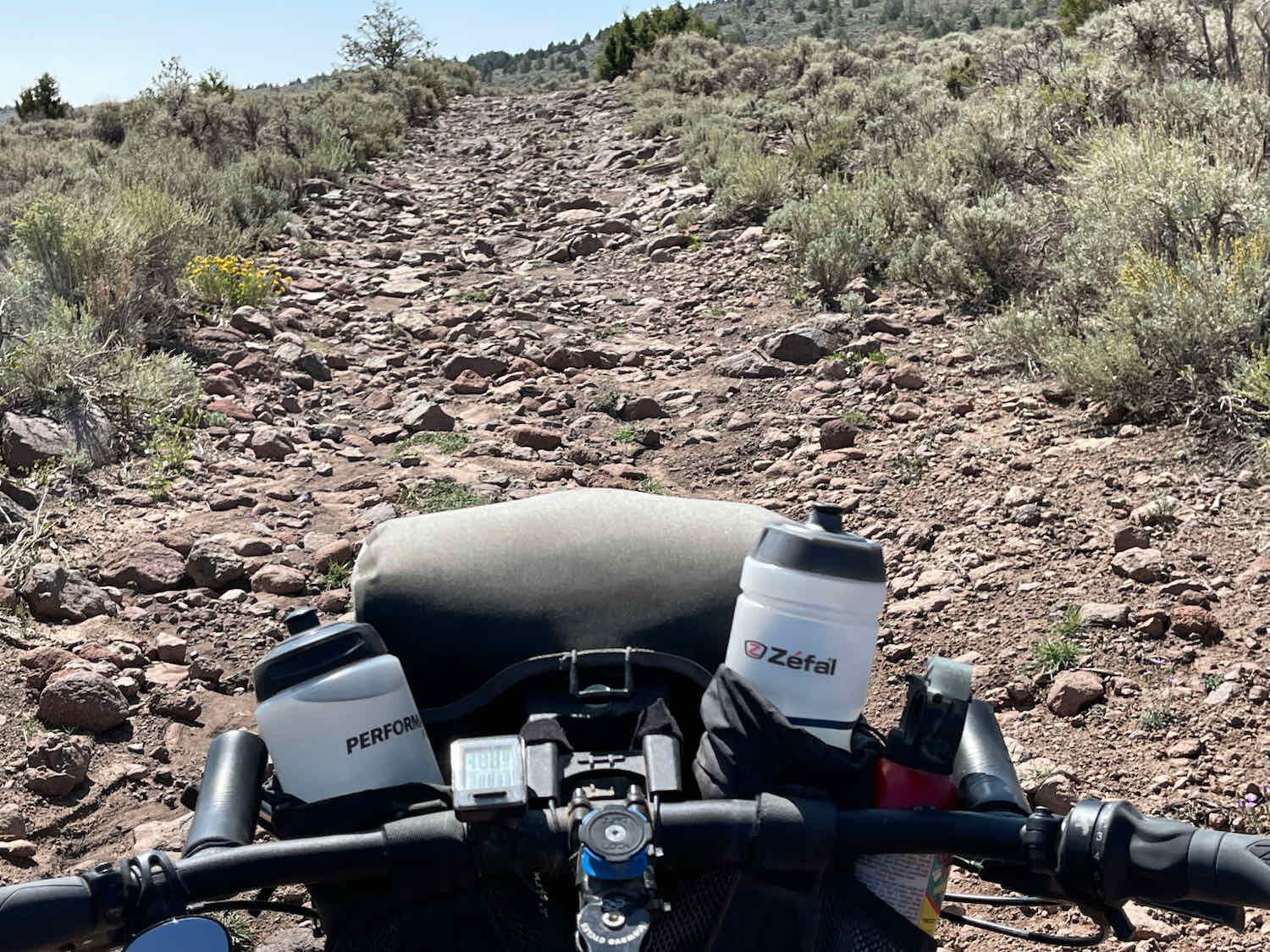
But before we could reach the top, we would have to ascend nearly 4,000 ft (1,220 m). On these steep slopes, the road had eroded into a rocky and slippery trail, which was often impossible to ride, requiring some hike-a-biking.
Fortunately, as the morning began to heat up, we left the open, scrubby, juniper woodlands behind and ascended into beautiful, thick stands of quaking aspens. The trees provided wonderful shade that helped keep us cool as we labored up the hills. We were delighted by all of the wildlife we saw. It seems the other animals were also drawn to the shelter of the trees.
Two mule deer fawns seemed to appreciate the shade and cover provided by the aspen groves, just as much as we did. Skyline Drive, Wasatch Plateau, USA, Utah. Copyright © 2019-2021 Pedals and Puffins.
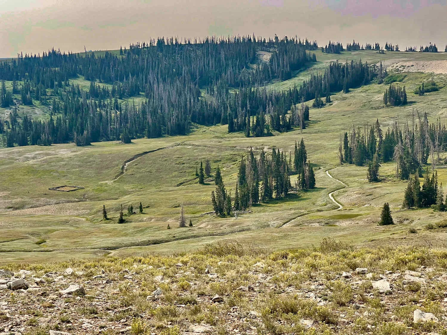
When we finally broke out onto the top of The Spine, the trees fell away. We found ourselves riding along a narrow, exposed, ridge-top, with expansive vistas into the valleys on both sides. For a while, the air was relatively smoke-free, so we could see for long distances. On our right the slopes dropped quickly into a fertile, agricultural valley. And on our left, more gentle slopes and canyons led down to the highlands of the Wasatch Plateau. It was fabulous to have such a clear view from these heights.
Leaving the trees behind as we climbed past 9,000 ft above sea level. Skyline Drive, Wasatch Plateau, Utah, USA. Copyright © 2019-2021 Pedals and Puffins.
For 15 miles, we enjoyed a pleasant ride along the ridge top where the gravel road was in pretty good condition and the hills were all manageable. Our finale for the day included a sizzling descent of 500 ft on a paved section of road, where summer cabins dotted the landscape. And, of course, we ended with a rugged and steep climb back up onto the ridge. Once we had passed the paved section, the road once again degraded into a badly eroded and rutted mess. It looked as if water had streamed down the road, creating gullies and ridges of soft, loose rocks.
We cycled only two miles up this slope before deciding to make camp. We were both tired. Plus, if we went much further we would have emerged above the aspen tree line again, onto the exposed ridge. We preferred to camp among the aspens, where we could get some shelter from the wind. We found a lovely spot among some mature trees and called it a night. Shortly after sunset, a Great-Horned Owl settled into the trees above our camp and hooted a duet with his partner, who was farther away.
Taking shelter in a grove of quaking aspens. Skyline Drive, Wasatch Plateau, Utah, USA. Copyright © 2019-2021 Pedals and Puffins.
In the brisk morning air, we renewed our ascent out of the high valley. We had a long and challenging climb back onto the top of The Spine. The road surface was basically dust, with quite a few large rocks strewn about. It was very hard on our tires, but they’ve held up remarkably well. We’re still impressed with how much of a pounding they can take.
There isn’t much evidence of civilization up here. But we did cross a state highway a couple of miles into our ride that featured some information about the area. Skyline Drive crossing State Hwy 31, Wasatch Plateau, Utah, USA. Copyright © 2019-2021 Pedals and Puffins.
We enjoyed 20 miles of ridge-top riding. The views were gorgeous, especially in the morning. Skyline Drive, Wasatch Plateau, Utah, USA. Copyright © 2019-2021 Pedals and Puffins.
But unlike the previous day, once we reached the top of the plateau the riding didn’t get any easier. The terrain was a constant up-and-down, with the slopes typically being quite steep on both the ascents and descents.
One of the many-ups-and-downs along the road. Skyline Drive, Wasatch Plateau, Utah, USA. Copyright © 2019-2021 Pedals and Puffins.
At this elevation - nearly 11,000 ft (3,350 m) - the aspens were replaced by ever-larger groves of Engelmann’s spruce trees. Quite a few of the trees were dead from a beetle infestation that occurred in the early 2000’s. But well over half were still alive. As a result of recent rains, the meadows were all lush and green.
Verdant mountain meadows fade away into dense stands of Englemann’s spruce trees. Skyline Drive, Wasatch Plateau, Utah, USA. Copyright © 2019-2021 Pedals and Puffins.
A Uinta Ground Squirrel, surveying his lush, green meadow. Skyline Drive, Wasatch Plateau, Utah, USA. Copyright © 2019-2021 Pedals and Puffins.
We caught up with this Dusky Grouse in one of the many spruce groves. Skyline Drive, Wasatch Plateau, Utah, USA. Copyright © 2019-2021 Pedals and Puffins.
We had decided to delay breakfast, and rode a bit over eight miles before stopping. It took us a while to find a location with some protection from the wind. But we lucked out at this spot, and cooked up a hearty meal with spectacular views. Skyline Drive, Wasatch Plateau, Utah, USA. Copyright © 2019-2021 Pedals and Puffins.
What It’s Like to Own a Herd of Sheep
After a hearty breakfast with skyline views, we were back on the road. But suddenly a car came careening around a sharp corner. He was skidding downhill pretty fast, and we were huffing-and-puffing our way up in the opposite direction. The driver ran off the road and hit a dirt bank when he saw us, scattering dust, but nothing serious. We didn’t stop pedaling because the grade was too steep, and we wouldn’t be able to easily get started again.
Then, to our surprise, the driver hopped out of his car and started running after us on foot. And since we were going up a steep grade, he was running much faster than we were biking. At first we thought he might be mad at us. But there was no getting away, even if we had thought escape was necessary. When he drew even with us, we could tell he just wanted to talk. He said he had never seen anyone on bikes on top of the mountain, and he was wondering what the heck we were doing.
And so we met Billy, from Minnesota, who’s now a sheep herder in the mountains of Utah. He had been up tending his sheep for the spring and summer, and was now heading back into town to buy some supplies.
We had fun visiting with Billy for the next half hour or so. He asked us a lot of questions about our ride. But we also had the chance to learn a few things about his life as a sheep herder. In fact, it was his first season in this business, and it was turning out to be a really hard job. He’d wanted to try raising sheep for some time, and was finally able to purchase a herd last fall. But his timing wasn’t great. This year’s high cost of hay and fuel were eating away at any profit. He figured he’d probably just break even, and have to sell his herd after this year.
Yet he clearly was glad that he’d taken the risk to try his hand at raising sheep. He talked about how much he had enjoyed living in the mountains. During the first part of the year, he was able to have his family with him and it had been a great experience for all of them. But after a while, his wife and six kids decided to go back down to the valley where life is a little easier. Being away from his family was difficult for all of them.
Billy’s herd produced premium wool, which helped to offset the losses he was taking on the cost of hay. He had two sheep dogs to help herd the sheep, plus two Great Pyrenees dogs to protect the sheep during the summer up in the mountains. But even with the dogs, he’d lost some lambs to predation - probably from coyotes. That was a challenge, because his biggest source of income would be from the sale of the lambs for meat in the fall. The revenue from the wool was apparently very minor compared to the proceeds he’d earn from the sale of the lambs.
We talked about our challenges on the road, one of which was finding enough water, especially now that we were traveling in more arid parts of the country. It was a relief when he told us that the springs on this ridge that he knew about were producing water. In fact, his camp was close to a well-known spring in the area. He tried to explain to us where it was located. But we weren’t completely sure we had the directions right. And since it would have required a detour of a mile or so, we didn’t try to find it. We would stick with the spring that was shown on our map, and which was closer to the road.
Billy was one of many people grazing sheep on the Wasatch Plateau for the summer. Starting early in the morning, we saw several, very large herds comprised of hundreds of sheep. Periodically we’d pass the distinctive, round-topped, mobile cabins used by the shepherds in the field. And there were signs along the road touting the work of the US Forest Service to restore land that had been degraded by over-grazing from sheep as much as 70 years ago. By terracing and planting grasses on the hillsides, they reduced erosion and flooding downstream.
One of several, huge herds of sheep we saw out in the national forest. You always hear them before you see them, because sheep just like to keep in touch by constantly calling to each other. Skyline Drive, Wasatch Plateau, Utah, USA. Copyright © 2019-2021 Pedals and Puffins.
A typical shepherd’s camp - a bit of shelter from the weather and a horse for getting around in the back country. Skyline Drive, Wasatch Plateau, Utah, USA. Copyright © 2019-2021 Pedals and Puffins.
Over-grazing by sheep had been a major problem in the past. We saw several areas where the hillsides were terraced and planted with grass to help restore the vegetation and reduce erosion. These days, the US forest service works with sheep owners to keep sheep numbers within a limit that the landscape can sustain. Skyline Drive. Copyright © 2019-2021 Pedals and Puffins.
When we finally reached the spring, we discovered that it was barely a trickle. But at least it had water. This was our first fill-up in 1.5 days, and we needed to replenish our supply. We had to scoop water out of a very shallow pool with a muddy bottom. Each scoop caused a cloud of mud to fill the pool. Fortunately, most of the mud would settle out while we were filtering a bottle of water. But in the final few passes, the water started to take on a brownish tinge.
The water quality was also a bit questionable. The mud around the pool was covered with hoof prints, as if someone had brought their horse here to drink. But at least the water was flowing - albeit slowly. And the water source was coming directly out of the ground. The filtered water also tasted very good - and did not have any weird odors. So, we filled up our bottles and hoped for the best.
Another sketchy water source along the Western Wildlands Bikepacking Route. Skyline Drive, Wasatch Plateau, Utah, USA. Copyright © 2019-2021 Pedals and Puffins.
Worrying About the Weather
As the end of the day drew near, we decided to try to find a campsite at a high point along the ridge in hopes of getting a cell phone signal. When we had left Soldier Summit a couple of days ago, the weather forecast had predicted a chance of rain in the coming days. And one of the things our information about the route made abundantly clear was that you don’t want to be up on Skyline Drive in bad weather. The dusty, rocky road becomes impassable even to 4WD vehicles when wet. Our bikes didn’t have a chance. So we were feeling some pressure to check the weather forecast, so we could plan accordingly.
Luckily, we did find a place where we could get a cell phone signal. Unfortunately, the forecast hadn’t changed. Rain was still predicted to start on the afternoon of the next day, and the storms would last through the following day. We realized it would probably be smart to get off the mountain before the rain started. In the morning we would head for a side rode that could take us down off the mountain, to a town in the valley.
But now that we were up on the ridge top, there were no good places to camp. There were no trees, so everything was exposed to the wind. In addition, the ground was strewn with large rocks - not a particularly good surface for sleeping.
Eventually, the road descended a bit, and the terrain improved. We opted to take a rough side road for approximately 0.25 miles, which led to an outcrop overlooking a western valley. There was a wonderful-looking, level area that would serve as a great campsite on the outcrop - if we could only get to it.
The campsite was protected by a stunningly steep descent that led to a panoramic view of the valley below. For about 30 yards, the path to the campsite was nothing more than a little cliff, strewn with large, loose rocks. As we tried to walk our bikes down the slope, attempting to hold the handlebars and apply the brakes while not losing our balance, the back end of the bikes started to move down the hill faster than the front (which we were holding on to). Pretty soon the bikes would be going down the hill sideways, and we were rapidly losing control.
That wasn’t going to work. So we quickly decided to take an alternative path, pushing our bikes through the brush on the side of the road. The vegetation helped by getting tangled in the bikes, slowing them down enough for us to conquer gravity. And that’s how we arrived at the intended campsite in front of our bikes, rather than chasing them from behind as they careened down the path.
Our campsite on the rocky outcrop had gorgeous views of the western valleys. Smoke from California forest fires had moved in, obscuring some of the more distant mountains. But after sunset, we could clearly see the twinkling lights of a town in the valley below. Skyline Drive, Wasatch Plateau, Utah, USA. Copyright © 2019-2021 Pedals and Puffins.
It was a bit of a rough night. We were in an exposed location, as you can see in the picture above. The wind had died down in the evening, so we hadn’t secured the tent as much as we might have done otherwise. But then the wind picked up again during the night. The noise from the wind rattling the Dyneema fabric of our tent kept us both awake. When our alarm went off at 6am, we decided we could sleep in for at least another hour because we had a short day ahead of us - descending off of the plateau to avoid the coming storms.
When we finally got up, the wind was still blowing pretty hard. You could just feel the weather starting to turn.
Packing up our large, Dyneema tent in the strong wind was an adventure. Fun fact: Dyneema was originally invented to be used as fabric for sails on ships. And our tent seemed to want to become a sail as well. It was all we could do to hold onto the tent as it did its best to billow out and capture the wind. But we finally wrestled it into submission, and got the tent packed away in a pannier.
After that, we still had to get back up the cliff and onto Skyline Drive. We double-teamed our bikes, taking one bike at a time up the slope. One of us would push from behind the back wheel, while the other person pushed on the handlebars. It was tiring, but eventually we got the bikes up the steep slope.
Ephraim - The Friendliest Town
We had about four miles of ridge line riding before we reached the cutoff road to the town of Ephraim, Utah. Along the way, a guy in a pickup truck stopped to say, “hello,” and to make sure we were alright. When he heard we were going to Ephraim, he introduced himself. He lived in town, and told us to look him up if there was anything we needed. That was really nice.
At the junction of Skyline Drive and the road to Ephraim, a sign informed us that we were in the geographic center of Utah. We thought that was pretty cool. Skyline Drive, Wasatch Plateau, Utah, USA. Copyright © 2019-2021 Pedals and Puffins.
The road down to Ephraim dropped 4,000 ft over 14 miles - so it was steep and fast. The first 11 miles were on gravel, which was deep and squishy in spots. That made it a bit tricky, as we tried to maintain speed without fishtailing too much in the loose debris.
Signs along the way highlighted a nearby US Forest Service research station, and talked about the extensive rangeland and watershed research conducted here. For more than a century, they have been studying how different types of vegetation, and various grazing regimes, can influence erosion, flooding, and water quality. Apparently, quite a bit of what we know about the effects of grazing in mountains came from research done nearby.
We were soon to realize that our encounter with the gentleman up on the ridge was indicative of how friendly the folks of Ephraim can be. When we arrived at the edge of town, a guy on a 4-wheeler stopped in his tracks and swerved to the side of the road to have a chat with us. He had worked for the US Forest Service in fire management for many years, but had been retired for quite some time. He took up cycling after a knee injury, and was now an avid cyclist - telling us that he can’t relax during the day unless he can get out for a bike ride. We shared touring stories, and learned that he had once tried to ride a horse from the Mexican border to the Canadian border (although he only made it as far as Utah).
When we got to the only hotel in town, PedalingGuy went inside to secure a room while PedalingGal waited outside with the bikes. While he was away, a man pulled up in a car to chat with PedalingGal. He had seen us out on the road, and wanted to know all about our ride. After a friendly visit, he parked and went inside the hotel. Only later did we learn from the hotel receptionist that the gentleman had pre-paid a part of our bill. We were deeply moved by his generosity - especially since we are unlikely to ever see him again. Without a doubt, Ephraim Utah is one of the kindest and most generous towns we have ever visited.
Taking the Easy Road
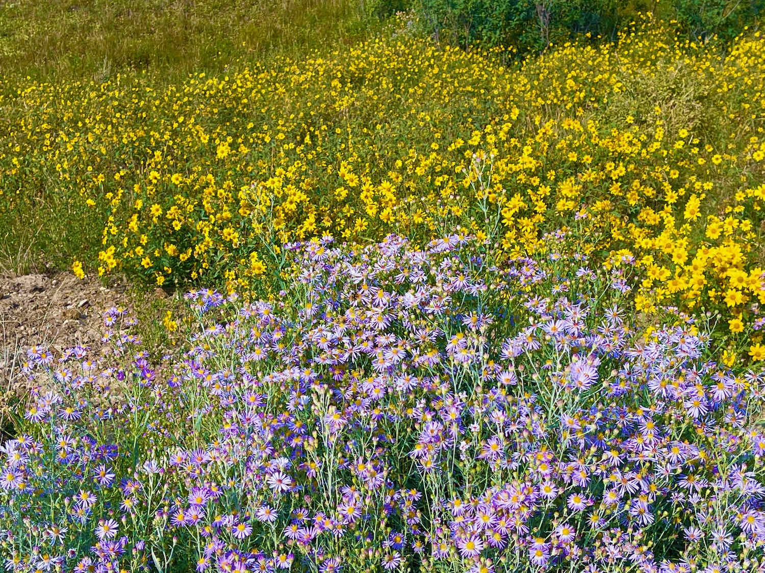
After waiting out several days of rainstorms, we were ready to get back on the road. The ride took us on a smooth, paved road through the lovely Sanpete Valley - a fertile agricultural region in Utah. It’s very scenic, since the valley is bordered by the Wasatch Plateau on the east, and the San Pitch Mountains on the west. And the riding was wonderfully pleasant.
This LDS (Mormon) Temple was one of the more striking sights we saw along the route between Ephraim and Salina. Manti, Utah, USA. Copyright © 2019-2021 Pedals and Puffins.
Cliffs of white sandstone provided dramatic scenery. Sanpete Valley, Utah, USA. Copyright © 2019-2021 Pedals and Puffins.
Picturesque old farm buildings. Sanpete Valley, Utah, USA. Copyright © 2019-2021 Pedals and Puffins.
The littlest and most quaint post office we’ve ever seen. Axtell, Utah, USA.. Copyright © 2019-2021 Pedals and Puffins.
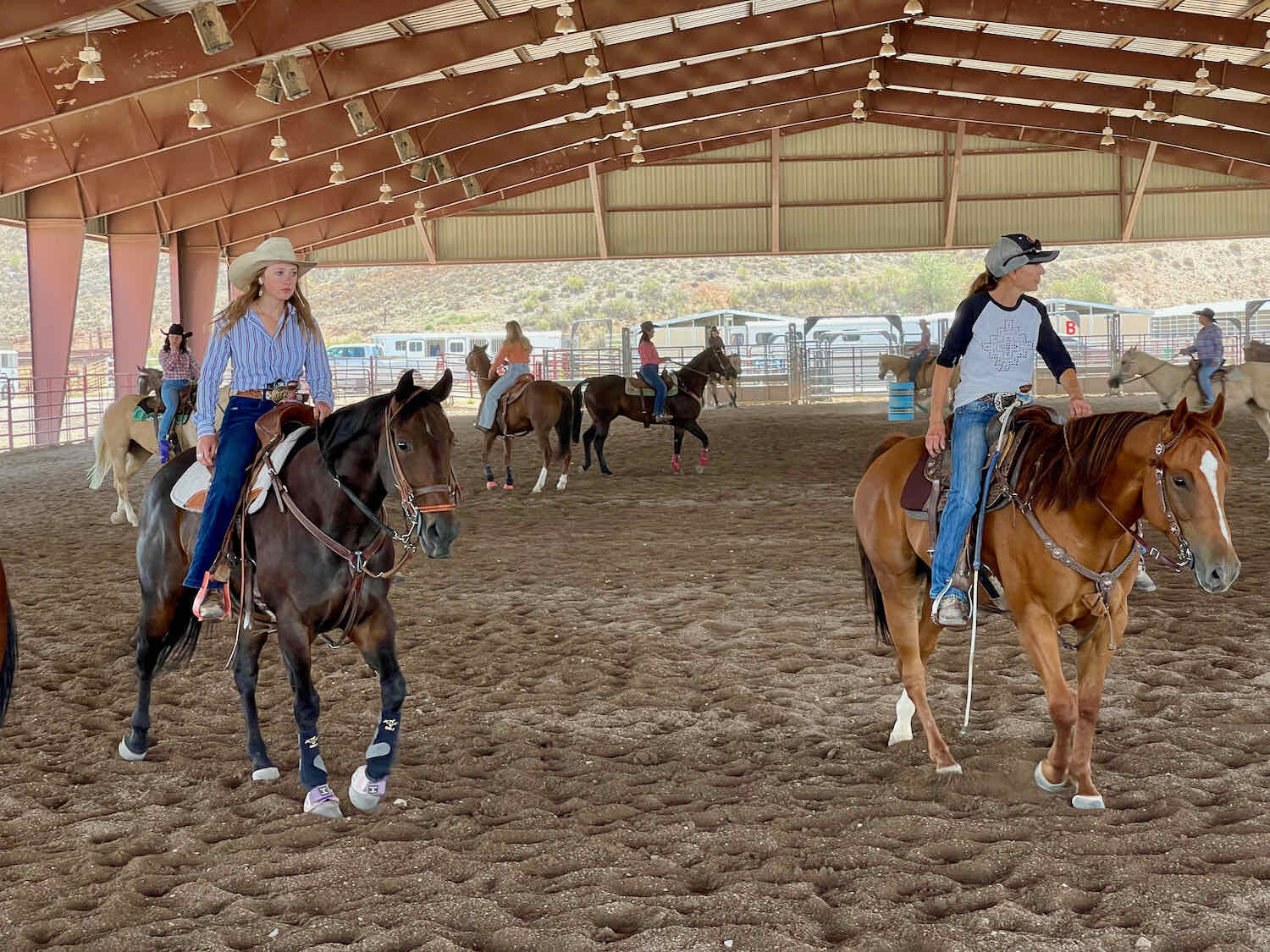
We arrived in Salina before noon, and were thrilled when the hotel let us check in early. We were lucky, because the wind really picked up in the afternoon. On a walk in search of food, we stopped in at the Blackhawk Arena, just outside of town. They were hosting the Southwest Desert Classic barrel racing competition - a regional, sanctioned rodeo event. We wandered into the stadium, and had the chance to watch some very talented cowgirls race their horses around a set of three barrels. Some of them were really fast, completing the race course in just over 15 seconds. It was a fun way to pass the afternoon.
Those horses really lean into the turns. Salina, Utah, USA. Copyright © 2019-2021 Pedals and Puffins.

The Canyon of Golden Eagles
Our next day’s ride was a big one - more than 4,300 ft of climbing over 42 miles, up to a high-altitude lake. We’ve had some bigger days of climbing earlier on this trip, but for some reason this one was particularly tough - partly because of the wind and heat.
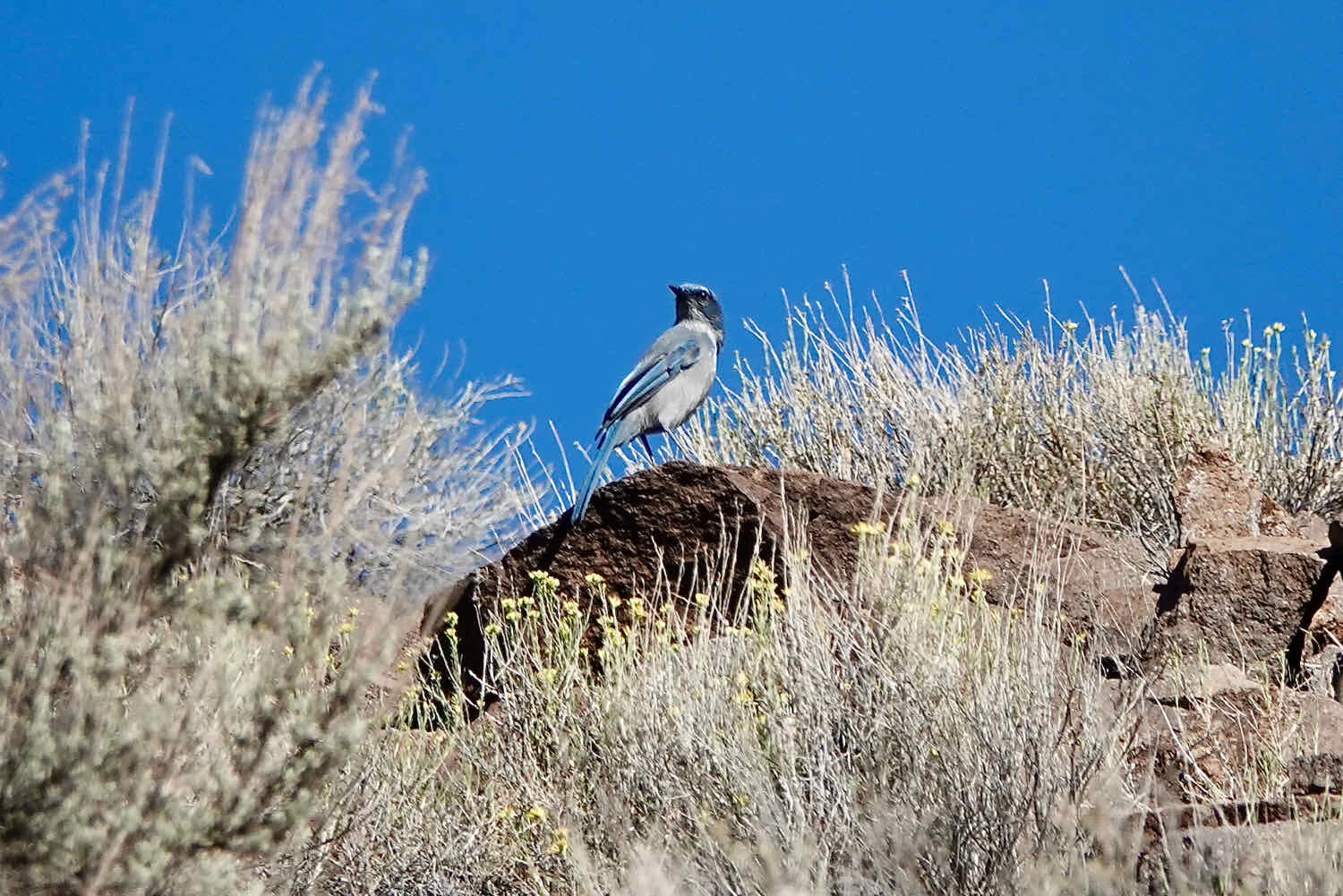
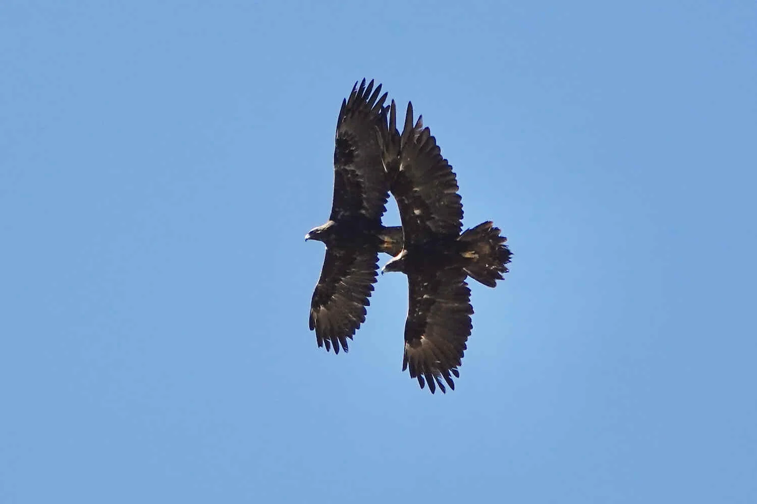
Heading out of Salina, we were soon ascending up a beautiful canyon following Lost Creek. The creek had running water - unlike many dry washes we had seen lately. As a result, there were a lot of trees growing in the narrow valley, which provided welcome shade. The canyon walls were quite tall in some places, and had an endless variety of rocky shapes and colors. Golden eagles were common here. We saw them soaring overhead, as well as perching on the rocky cliffs.
Heading out of Salina, we rode along a creek into canyon country. Salina, Utah, USA. Copyright © 2019-2021 Pedals and Puffins.
The canyon walls of were lined with beautiful, rocky cliffs and outcrops. Lost Creek Canyon, Utah, USA. Copyright © 2019-2021 Pedals and Puffins.
Checking out the bird life along the route. Lost Creek Canyon, Utah, USA. Copyright © 2019-2021 Pedals and Puffins.
For most of the ride through the canyon, the road surface was covered with well-packed gravel, and the gradients were mostly rideable. To spice things up, Lost Creek meandered back and forth across the road a number of times. The crossings were all pretty deep, lined with rocks and sticky mud. Fortunately, we managed to cycle our way across most of them. And even when a foot got wet, it dried quickly in the Utah dry heat.
Stay focused and keep pedaling. That’s the best way to keep your feet dry. Lost Creek Canyon, Utah, USA. Copyright © 2019-2021 Pedals and Puffins.
After about 20 miles of climbing, we reached the top of Lost Creek Canyon, and found ourselves in a high, mountain valley. While the canyon and surrounding mountains are all public land, Plateau Valley is private ranch land, with parts owned by the Paiute Native Tribe. Large herds of cattle browsed among the sagebrush, and we passed a number of ranch houses along the road. Most surprisingly, the low-lying areas of the valley were covered with wetlands. We even spotted a few ducks and geese among the reeds.
Emerald wetlands surrounded by high, arid hills. Plateau Valley, Utah, USA. Copyright © 2019-2021 Pedals and Puffins.
But we still had more than 2,000 ft of climbing to make it to our destination for the day. And before long, we were heading uphill again.
By this time, we were both starting to feel a bit fatigued. We told ourselves that we could stop for the day as soon as we found a suitable campsite - but that was not possible. The route was a thin ribbon of road clinging to the side of an escarpment, with steep slopes heading up or down on either side of the road. There were no flat places to camp.
Nowhere to camp here. So we just kept on pedaling up the hill. Road to Fish Lake, Utah, USA. Copyright © 2019-2021 Pedals and Puffins.
Along this stretch, shade also was hard to come by. We stopped every 1-2 miles to rest, usually in the meager shade of a juniper or a scrubby pine tree.
Then, as we approached 8,000 ft above sea level, we re-entered the zone of aspens. The shade from those trees provided wonderful relief from the sun. But there still wasn’t any level ground, and so nowhere to camp.
When we crested the top of the ridge at 39.5 miles, the route took us onto a paved road. The final 2.5 miles whizzed by as we coasted downhill towards a large lake. It was glorious. There’s nothing like flying through the last few miles to lift your spirits at the end of a long day.
Pando - The Largest Organism in the World
Just before we reached the campground, we passed through a truly fascinating grove of aspens known as the Pando Aspen Clone. The name “Pando” means “I Spread” in Latin, and captures the essence of this extraordinary being. Besides growing from seeds, aspen trees form groves by growing new trees (the “clones”) from the root systems of an existing tree. Because of this, the Pando grove is believed to be the largest organism in the world - covering 106 acres and comprised of more than 40,000 individual stems, weighing more than 13 million lbs. - all connected to each other by a single root system. Genetics have confirmed that this aspen grove is a single organism. And it’s ancient. Scientists believe Pando started growing from a seed at the end of the last ice age, more than 11,000 years ago. That’s really cool.
By entering Pando, we cycled through the largest - and one of the oldest - organisms in the world. Fish lake, Utah, USA. Copyright © 2019-2021 Pedals and Puffins.
We settled into a spot at the US Forest Service campground near Fish Lake as the evening light was already starting to fade. We had been on the road for more than 11 hours. By the time we had finished dinner and were inside our tent, it was totally dark outside. Fortunately, this was a particularly quiet and peaceful campground, and we both enjoyed a deep night’s sleep.
Given how strenuous the previous day’s ride had been, we decided to take it easy the next day. We would cycle only 16 miles, to the town of Loa, Utah. That meant we could sleep in, which we did. It was a very cold morning - near freezing at this high altitude - so staying snuggled in our warm sleeping bags was particularly appealing.
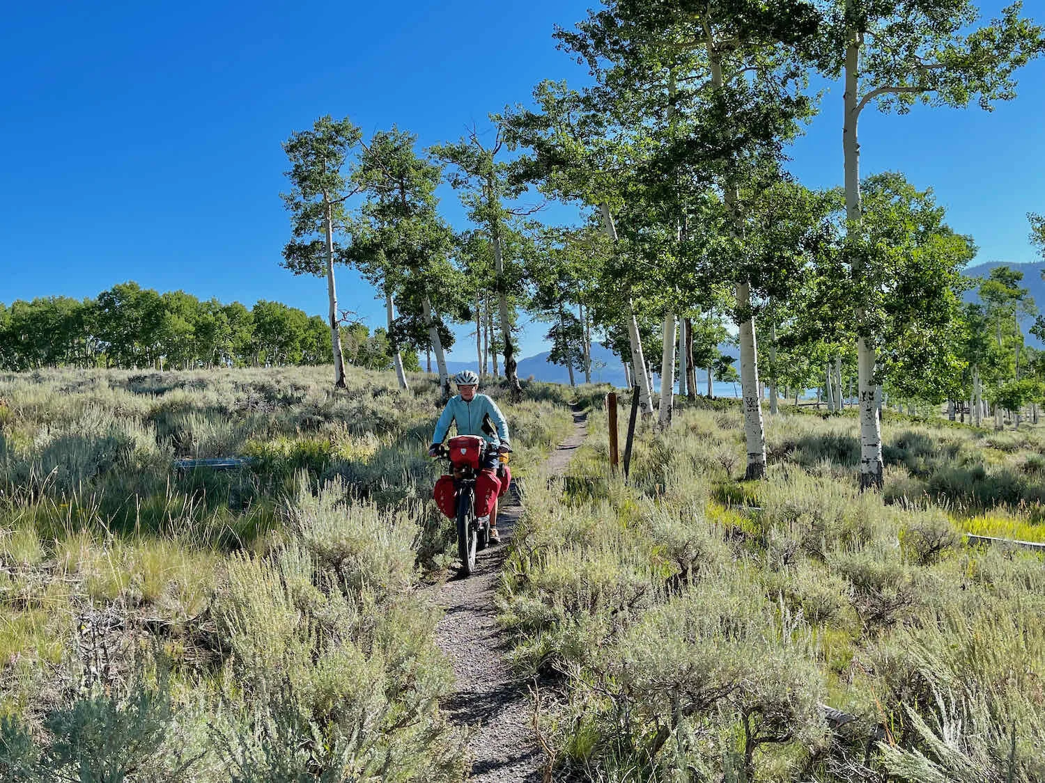
We finally hit the road around 9:30am. The ride began on a narrow, winding, single-track through the Pando Aspen Clone. At the trailhead, we learned that this path was part of the “Great Spanish Trail,” a commercial route used in the mid-1800s to carry goods between Santa Fe, New Mexico and Los Angeles, California. It seemed like a long distance out of the way between those two end-points, to come this far up into Utah. But apparently Fish Lake and its wetlands were a key reason for the detour. Other routes had scarcely any water.
Ghosts of traders and their mules, on the Great Spanish Trail. Fish Lake, Utah, USA. Copyright © 2019-2021 Pedals and Puffins.
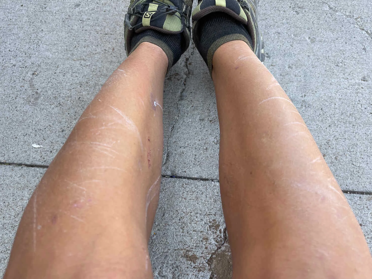
The single track through the aspen grove wasn’t that technical, but it was narrow. And the sagebrush on both sides of the trail scratched at our legs. Afterwards, we both had extensive, light, scrape marks all over our shins.
Downhill, Slowly
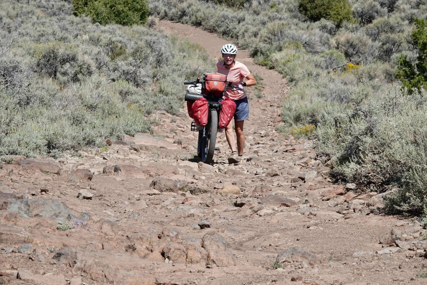
The single-track only lasted for about a mile. Then we found ourselves on one of the absolutely roughest sections of road we had encountered so far. For 11.5 miles we bounced along on breathtakingly rocky terrain. Not only did we both have to hike-a-bike through some very rough uphills, but PedalingGal even had to walk on some rocky downhill sections. As a result, our progress was incredibly slow. It took us more than three hours to travel those 11.5 miles. So our average speed was only 4 mph, going mostly downhill. Our decision to stop for the night in Loa started to look even better.
Our ride was brightened by a wonderful interaction with a long-tailed weasel, who had apparently made its home under a cattle grate. He peeked out to investigate when he heard us approach, and kept popping up in different spots among the bars to see what we were up to when we stopped. We were completely charmed. Cabin Springs, Utah, USA. Copyright © 2019-2021 Pedals and Puffins.
We cruised into Loa around 1pm, and headed straight for the convenience store near the edge of town. Cold drinks in hand, we settled in to our portable chairs in the shade, and started scoping out the hotel situation. In the end, there wasn’t much to research - Loa has only one hotel.
Fully hydrated, PedalingGal starts the search for a hotel. Loa, Utah, USA. Copyright © 2019-2021 Pedals and Puffins.
We headed over to the hotel, and discovered that we were lucky to get their last room - they were full for the night. The proprietor told PedalingGuy that they had been filling up every night of the week. We’ve encountered this phenomenon in other small towns on this trip. It’s amazing how many people, like us, are out on the road this summer. We feel fortunate that the shortage of hotel rooms hasn’t been too big of a problem so far.