Cycling Bear Lake to Soldier Summit, Utah: Half-way to Mexico on the WWR

5-14 August 2021
Segment 5 of the Western Wildlands Bikepacking Route (235 mi, 378 km)
Check out our interactive route map to see where we stayed each night
Utah / Wyoming Borderlands
Our campsite, on the shores of Bear Lake, was barely two miles from the Utah border. Pretty soon we would leave Idaho behind, and enter a new chapter on our journey. As we cycled south on the smooth, paved road, the sun rose over the eastern hills.
Over night, most of the smoke from California’s forest fires had cleared out, revealing distant hills that had been just shadows the previous evening. With the clear, blue morning sky reflecting off the still surface of the lake, we started to appreciate why people find the area so appealing. The lake had taken on a pearly blue color, and the waters looked cool and inviting.
Bear Lake was a lovely, pearly blue in the morning light. Idaho, USA. Copyright © 2019-2021 Pedals and Puffins.
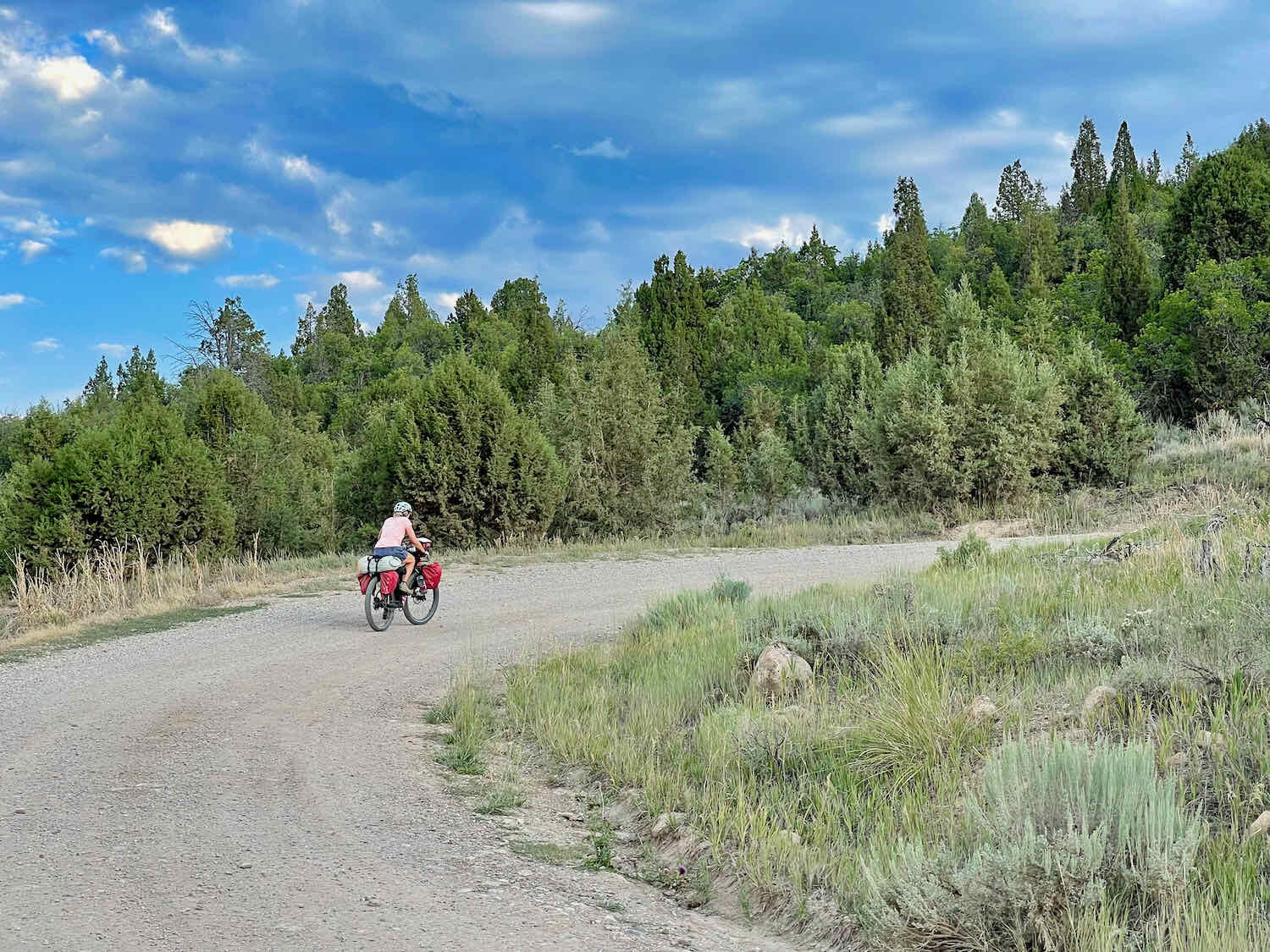
After crossing into Utah, we pedaled an easy 15 miles over rolling hills to the small outpost of Laketown. For all the activity along the shoreline, the eastern side of Bear Lake has surprisingly few services. As a result, the convenience store in Laketown was humming with business. We watched the procession of customers come and go, while we ate a hearty breakfast on the bench outside.
The energy we got from that breakfast proved useful, because from Laketown the route headed straight onto a 1,200 ft climb into a canyon, on a busy state highway. The road shoulder was a bit narrow for comfort. But with the smooth pavement, we were able to make it to the top of the ridge pretty quickly.
At the head of the canyon, the highway headed down the other side of the ridge. But the Western Wildlands Route (WWR) headed back into the wilderness. We turned onto a dirt road that followed the crest of the ridge for several miles. This was cattle country, where small herds of cows eke out an existence on a vast, treeless landscape. But aside from the cows, things were pretty quiet. We didn’t see a lot of wildlife.
A friendly sign from the Bureau of Land Management welcomed us to this sagebrush wilderness. Near Laketown, Utah, USA. Copyright © 2019-2021 Pedals and Puffins.
There were no trees, as far as the eye could see. Near Laketown, Utah, USA. Copyright © 2019-2021 Pedals and Puffins.
A Swainson’s Hawk on a nest was one of the few wild creatures we saw out on the range. Near Laketown, Utah, USA. Copyright © 2019-2021 Pedals and Puffins.
As we traversed the ridge on a ribbon of red dirt, storm clouds were building, and we could see rain falling both ahead and to our sides. Fortunately, there wasn’t any lightning to make us nervous. And the fact that the clouds blocked the sun made for a cooler, more pleasant ride.
To keep our load light while ascending the road though the canyon, we had carried less water that morning with the intention of filling up our bottles along the route. Just over six miles into the rangeland, our maps indicated that there was a natural spring where we could get water.
When we got close to the spring, we encountered a small field crew from an organization called Working Lands Conservation. They told us they had been monitoring the water quality in nearby springs, and that the water would be safe to drink as long as we filtered it. We were glad to hear that.
To our surprise, there were actually multiple springs flowing out of one hillside, within a small area. We were comforted to see that the headwaters of each spring was fenced off, to keep out the cattle. We went to the one indicated on the WWR map, and filtered 9-10 L of water to get us through the night and part of the next day. The water was clear and cold. It was amazing to see so many springs coming out of one hillside - it was an oasis in this very parched, open landscape of mostly dry sagebrush.
Filling up our bottles at a remote, rangeland spring - an oasis among the dry sagebrush. Otter Creek headwaters, Utah, USA. Copyright © 2019-2021 Pedals and Puffins.
By the time we finished filtering all the water, it had started to rain. But once again, the storm dissipated quickly and we barely got wet.
Up until this point in the day we had been riding on well-groomed roads. But the short road from the spring back to the main dirt road was a disaster. It was badly damaged from water erosion, with several sections of the road completely washed away. We had to carefully pick our way along the rutted tracks and across big gullies. It was a relief to get back on the main dirt road. Looking at the map afterwards, it seemed like we could have just headed up a better gravel road from near the spring and avoided all the drama. But we didn’t know that at the time.
One false move and you’re toast. Picking our way carefully back to the main road from the Otter Creek springs. Utah, USA. Copyright © 2019-2021 Pedals and Puffins.
Not long after we left the spring, the rain clouds broke up and we found ourselves riding in full sun. It was hot, and we missed the clouds.
A quick jaunt on Hwy 16 took us to the broad, flat, Big Creek valley. The spring-fed rivers flowing through here are clearly the lifeblood of these valleys, which are all being used for agriculture.
But directly ahead of us, on the far side of the valley, we could see that we were in for some more climbing. The WWR route headed directly for the Crawford Mountains on the border of Utah and Wyoming. Our route never seems to stay in the lowlands for very long.
Don’t get used to the flat terrain. The Crawford Mountains, dead ahead, are next on the agenda. Big Creek Valley, Utah, USA. Copyright © 2019-2021 Pedals and Puffins.
But we could not have imagined what a difficult road lay ahead. When we hit the foot of the Crawford Mountains, things immediately got dicey.
This sign, at the entrance to the Crawford Mountains, should have given us pause. Utah, USA. Copyright © 2019-2021 Pedals and Puffins.
Right from the start, the road was completely chewed up from big trucks that had been churning through the muddy soil. We discovered that large sections of the road up to the pass had been washed out by recent, heavy rains. And there was evidence that there had been a significant (flash?) flood. Gullies of soft mud, 1-3 feet deep, were interspersed with slippery piles of rocky debris all throughout the road bed. And we could see where sections of the cliffs had collapsed and washed across the canyon floor, flattening all the vegetation in their path. A maintenance crew was busy using heavy machinery to try to level out the debris, and restore some semblance of a usable road. The sections of the road that they had completed were smooth on the surface, but the dirt was not compacted at all. It was loose and deep. Our tires would sink into the loose dirt and barely move.
Our route up into the Crawford Mountains. Really, this used to be a road, not a stream bed. Utah, USA. Copyright © 2019-2021 Pedals and Puffins.
We managed to cycle past the first crew, but as we approached another tractor, the road became completely unrideable: it was deep, muddy clay littered with stones. At that point, we actually decided it might be better to abandon ship, and we turned around to head back down the mountain.
But then, looking back up the road towards the tractor, we thought that maybe we could see the end of the construction zone. So… we turned around once more, and continued up the mountain.
We couldn’t ride through the ankle-deep dirt in the foreground… but maybe it gets better beyond the tractor? We decided to give it a try. Crawford Mountains, Utah, USA. Copyright © 2019-2021 Pedals and Puffins.
It was a tough slog for about 100 yards to get through the part of the road that was being repaired. PedalingGuy had to help PedalingGal drag her bike through. But then the road became rideable again, and we were glad we had continued. For about half a mile.
Then the quality of the road deteriorated completely, even as the gradient of the climb became pretty steep. We were exhausted, and unable to ride any further. Without any other options, we pushed our bikes most of the final two miles up the hill, in the hottest part of the day, with no clouds. We took rest brakes in the shade of the juniper trees about every half mile. Good thing the pass wasn’t any higher.
We finally made it to the top. We had been fresh and energetic at the bottom of the climb, but now we were totally spent. The only thing on our minds was to find a place to camp.
Unfortunately, any place that had juniper trees (for shade) was on a slope, unsuitable for setting up the tent. And anywhere that had level space for our tent was all sage and grass, with no shade. So, we kept on cycling - trying to find the ideal campsite. Along the way, a beat-up, old post let us know that we’d passed into Wyoming.
This is how you know you’ve crossed into Wyoming in the middle of nowhere. If you look very closely, the post actually says “State Line.” Crawford Mountains, Utah/Wyoming border, USA. Copyright © 2019-2021 Pedals and Puffins.
Out of energy, we finally stopped and had dinner in the shade of a juniper tree. It was the smart move.
We had thought we might set up the tent on a lumpy, exposed knoll nearby. But once we had eaten and rested, we felt much better. Also, the evening had finally started to cool down, so shade wasn’t as much of a priority. That gave us the option of continuing on, and finding a campsite optimized for the tent (and not requiring shade). It didn’t take us long to find a nice, open, grassy spot to pitch the tent and call it a night.
By the time we went to bed, the area was silent. You can see a long way in this open sagebrush wilderness, but there was no sign of human presence as far as the eye could see.
Our campsite, far away from the civilized world. There were no trees, so we could see for many miles in all directions. There were no signs of human presence. Crawford Mountains, Wyoming, USA. Copyright © 2019-2021 Pedals and Puffins.
But it was not really a quiet night. Periodically the wind would whip up and rattle the tent. It also rained 3-4 times, and raindrops are loud on Dyneema fabric. One storm even brought some lightning and thunder close to our camp.
But the biggest racket came from the coyotes. There were lots of them. Twice during the night they approached our campsite, and at times it seemed as if we were surrounded by 10 or more coyotes all yapping and howling their confusion? annoyance? amusement? at our presence. They woke us up, and disturbed our sleep. But we felt lucky to be able to have that experience. After all, this was their home and we were the visitors.
Half Way to Mexico
The morning dawned in utter silence. We packed up camp as the sun rose, providing us with stunning views of the endless sagebrush. The coyotes, of course, were long gone.
As we rode southward in Wyoming, the road surface slowly improved.
You can almost count on seeing pronghorn antelope in Wyoming. These three ran off to a safe distance, before turning and watching us pass by. Crawford Mountains, Wyoming, USA. Copyright © 2019-2021 Pedals and Puffins.
We crossed the state line back into Utah. And after 15 miles we arrived at the modest convenience store in Woodruff where we relaxed over breakfast. We were amused to see that the town’s mascot appeared to be a mosquito. We’d heard that mosquitos could be bad in the area, but fortunately we didn’t have to deal with that. Maybe it was the time of year.
In the interest of making good time, we opted not to take a longish, gravel loop in the WWR, and to stay on Hwy 16. This reduced the length of the ride by couple of miles, and let us speed along on the paved road. But the shoulder was very narrow, and traffic was traveling way too fast. Twice we had to bail off the road because of oncoming, passing cars. It was not fun (and kind of reminded us of cycling in Romania). When the WWR route rejoined us on the highway, we decided we would stay on the route the next time it turned off onto a gravel road.
We’d already seen some pronghorn antelope on the back roads in Wyoming. Woodruff, Utah, USA. Copyright © 2019-2021 Pedals and Puffins.
After two more miles, we reached the Wyoming border, where there was a friendly welcome sign. This crossing marked the half-way point of our ride from Canada to Mexico on the WWR. So, we stopped for a little celebration.
Now that’s a nice welcome sign. We were doubly excited to reach the Wyoming border because it marks the halfway point from Canada to Mexico on the WWR. Copyright © 2019-2021 Pedals and Puffins.
As a bonus, the shoulder on the highway in Wyoming was much wider and safer. There was even a rumble strip between the traffic lanes and the shoulder. We could have stayed on the highway for the rest of the ride. But it was noisy. So when we reached the next turn off onto gravel, we took it.
That led to a very pleasant ride on a good-surfaced, gravel road, followed by a lightly used paved road. It was a good choice. The ride on the back roads was much more relaxing than on the busy roads.
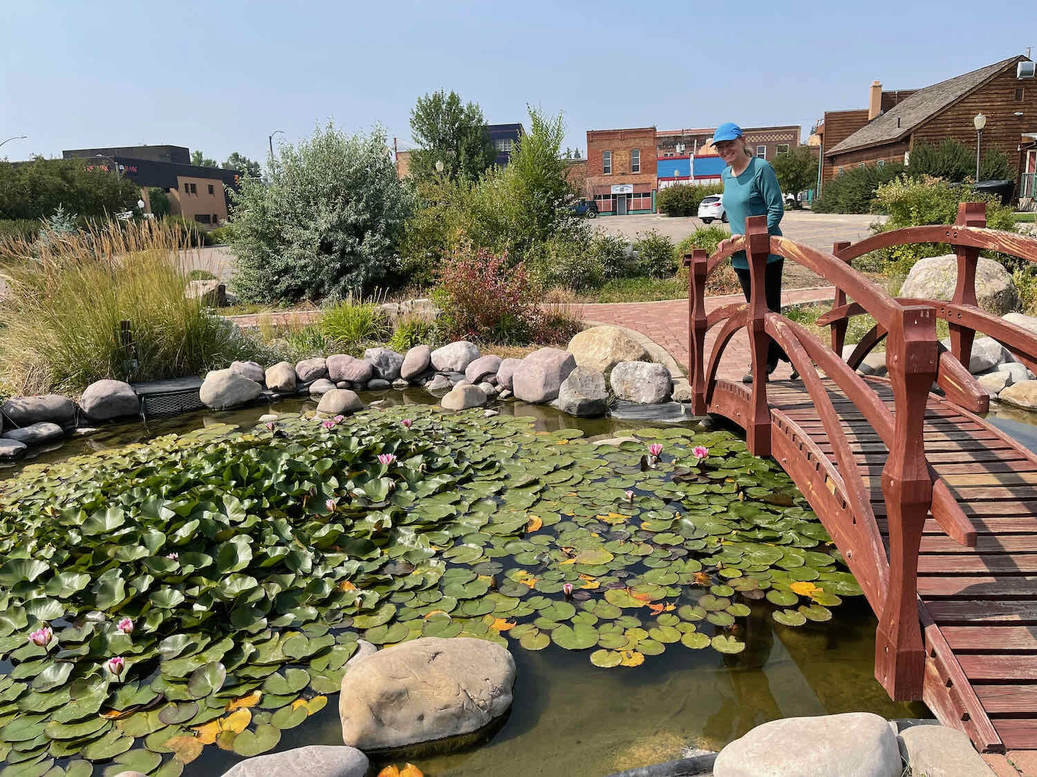
We arrived in Evanston, Woming, too early to check into our room at the Grizzly Inn, so we headed over to a shopping area for lunch. On the way back to the hotel, we checked out the Bear River Greenway, a quiet, riverside park right across the road from our hotel. The greenway has a bike path that runs for several miles along the Bear River. We saw a number of people out enjoying the warm weather or walking their dogs. It seemed like a great open space for the people of Evanston.
Over the next couple of days, we got to know our little corner of Evanston pretty well. The town has clearly invested in creating some nice public areas. In addition to the greenway there is Depot Square, which is centered around a restored railroad depot. Covering several city blocks, the square includes some other historic buildings, as well as displays about how Evanston was a featured stop on the early, cross-country Lincoln Highway, and a lovely Chinese pagoda with a water garden. We really enjoyed exploring these small treasures around town.
A Taste of the High Plains
The road out of Evanston continued to hug the Wyoming/Utah state line. For 25 miles, we zigged and zagged across the state line in a broad, grassland valley between sage-covered hills. This is where the long tongue of the Wyoming high plains fades into the mountains of northeastern Utah. We were surrounded by the muted browns and pale green colors of these sun-baked lands.
We loved seeing this wildly-curvy stream winding its way across the plain. Yellow Creek, Wyoming, USA. Copyright © 2019-2021 Pedals and Puffins.
The land here was reminiscent of the high prairie landscapes that dominate further to the east. South of Evanston, Wyoming, USA. Copyright © 2019-2021 Pedals and Puffins.
On our way into Coalville, Utah, we stopped to purchase some lemonade and cookies from a roadside stand run by two young boys (ages 4 and 2), and their mom. They were a really sweet family. We learned from the mom that they had just moved to Coalville in the past month, and the lemonade stand was a way to meet some of their neighbors, while also entertaining the kids. The parents were both originally from small towns, and they had been looking for a way to move back to the countryside after spending seven years in Salt Lake City. They jumped at the chance to move to Coalville when a job opportunity opened up. We hope they have success in their new home.
The lovely and historic Summit County Courthouse was built with hand-carved, white sandstone that came from a local quarry. Coalville, Utah, USA. Copyright © 2019-2021 Pedals and Puffins.
Up into the Uinta Mountains
After thinking about it, we decided that we would skip riding to Park City, Utah. It’s a picturesque town. But we had spent several days there in the past, and didn’t really feel like we were in the mood for the more touristy vibe at this point in our trip. So, we decided to make a bee-line south from Coalville to head straight for the Uinta Mountains. Conveniently, the Western Widlands Route designers provide an alternative route for those who prefer to stay away from Park City.
The first 7.5 miles took us along the Historic Union-Pacific Rail Trail, a peaceful, gravel pathway that parallels I-80. Signs along the trail told stories about the early settlements in the area, and helped us gain an appreciation for the area’s pioneer history.
From there we rode along State Hwy 32, passing Rockport Lake State Park. It was interesting to see the Rockport reservoir, partly because we were able to observe just how much the 2-year drought was affecting water supplies. The water level in the lake was easily 50-75 feet below the high water line on shore (news reports say the reservoir is at only 24% of its capacity). It was also interesting to read about the lake’s history. The reservoir takes its name from the former town of Rockport, which was flooded with the building of the dam. As the story goes, the residents of the doomed town petitioned the government to name the lake Rockport, so that the memory of the town would not be lost after it was covered by water from the reservoir.
The dam is named for the existing town of Wanship. But the lake’s name recalls the doomed town of Rockport, which was flooded with the building of the reservoir. Wanship, Utah, USA. Copyright © 2019-2021 Pedals and Puffins.
After a quick lunch in the town of Kamas, we started our climb into the foothills of the Uinta Mountains. This mountain range is unusual because it runs east-to-west, straddling across the main, north-to-south line of the Rocky Mountains. As a result, it lay directly across our path as we headed southward.
A statue at the entrance to a residential development evokes the wilderness spirit of the Uinta Mountains. Wolf Creek Ranch, Utah, USA. Copyright © 2019-2021 Pedals and Puffins.
The road up the mountain was paved almost all the way to our target campground. That helped us move very fast, even while tackling the 3,000 ft climb uphill in the heat of the day. We headed up a canyon in the company of the Provo River, which was studded with beaver dams. The resulting willow thickets and wetlands looked like they’d be perfect habitat for moose, but we didn’t see any.
As has happened to us before, we were starting to think the day would pass easily and we might even arrive at the campground early. Not so fast. The final three miles to the Mill Hollow Campground were incredibly difficult. We turned off of the paved road onto a gravel ramp with a very steep gradient, often exceeding 10%. It’s always tough to tackle these at the end of a long day, both physically and mentally. It was exhausting.
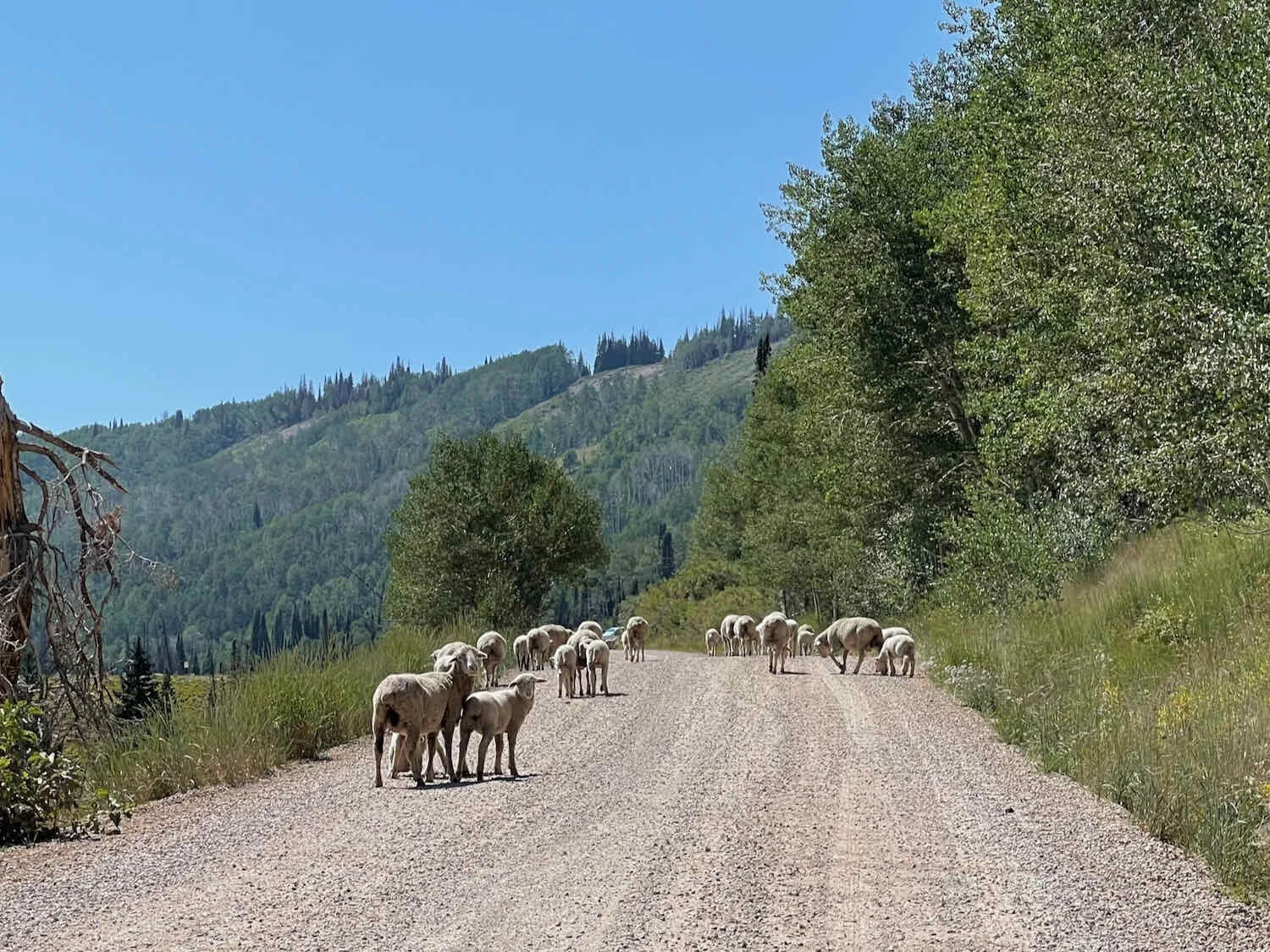
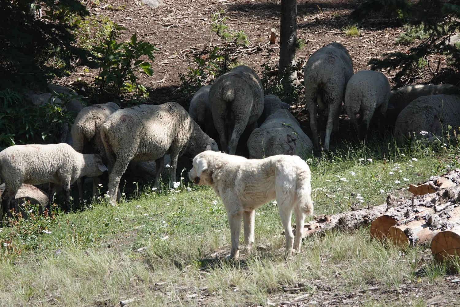
We did have a diversion right near the end. About a quarter mile from the campground, we came upon a huge herd of sheep in, and all around, the road. There were hundreds of them. As we got closer, the sheep started to run away and the resident guard dog - a handsome, white, Great Pyrenees dog - decided that he didn’t like the looks of us. He approached quite close, barking fiercely. We dismounted and walked with our bikes between us and the dog. But after a while he seemed to decide that we weren’t a threat and wandered off. As we would later learn, Great Pyrenees are the guard dog of choice for sheep herders in this part of Utah. Large flocks of sheep will often have 2-3 dogs guarding them. Their primary job seems to be protecting the sheep from bears and coyotes. But they can sometimes be aggressive toward cyclists who approach sheep - which can be difficult to avoid when they surround the road on both sides.
We were delighted that the campground wasn’t full, and we were able to find a good campsite with a shaded picnic table. After settling in, we wandered down to Mill Hollow Reservoir, which borders the campground. We waded into the cool, clear water, rinsing our our arms and legs of the dust from the trail. At that time, there were still quite a few sheep milling around at the edge of the campground and along the far side of the lake. They can make quite a racket - constantly calling out to each other. Things finally quieted down when they moved away, later in the evening.
Our campsite was close to the shore of Mill Hollow Reservoir, a lovely, clear lake in the mountains. Uinta Mountains, Utah, USA. Copyright © 2019-2021 Pedals and Puffins.
We had just gotten into our tent and were getting set up for the night, when we heard someone approaching, calling out, “Hello, hello!” Down the trail came another cyclist who we had first met (and last seen) a couple weeks ago in Elk City, Idaho. She’s traveling on a lightweight bike, much faster than us. But she had taken a long layover in Park City for some bike repairs, so we were back on the same part of the route. There are very few cyclists on the WWR route, so it was great to visit.
We sat at our picnic table and chatted with her, catching up on what each of us had been up to since leaving Elk City, laughing about the abysmal quality of some water sources we’d seen, and sharing adventure stories about the crossing of the Arco Desert or the chewed-up road in the Crawford Mountains. It was fun to spend time with someone who had experienced many of the same trials and triumphs that we had. She had arrived at the campground much later than us, and still had to have dinner, so we said goodbye as the light was fading.
Three Ridges and a Reservoir
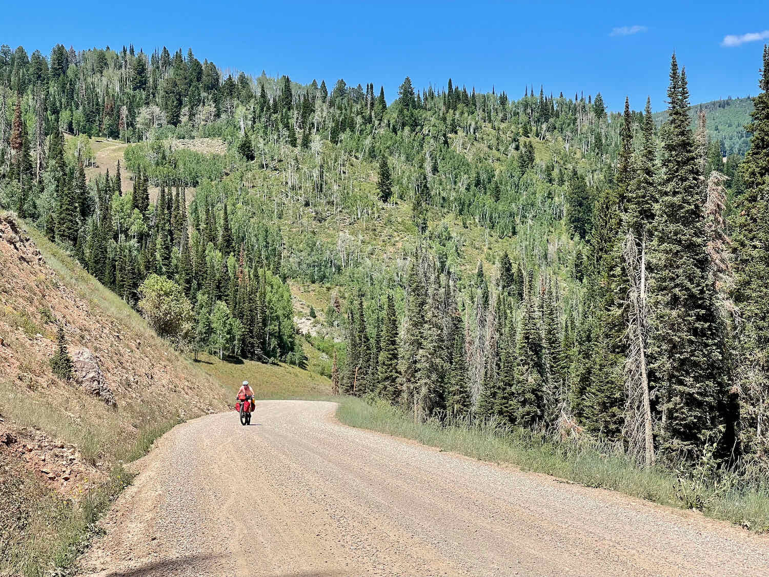
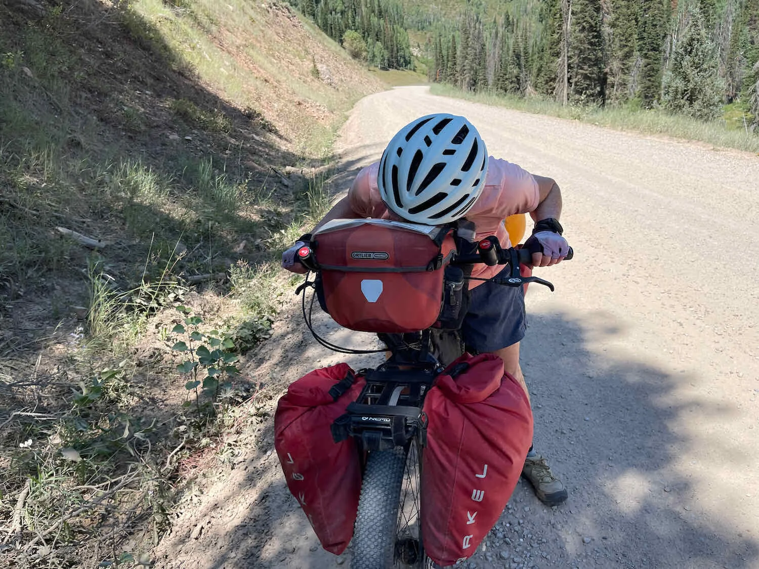
The next day was a big day in the mountains, with three, serious ridges to cross. All three passes involved fairly short, 3-5 mile climbs. But by being short, they were also pretty steep. In addition, the gravel on the road was often deep and slippery, making the steep climbs all that more challenging as our not-so-knobby tires slid and skidded on the loose rocks.
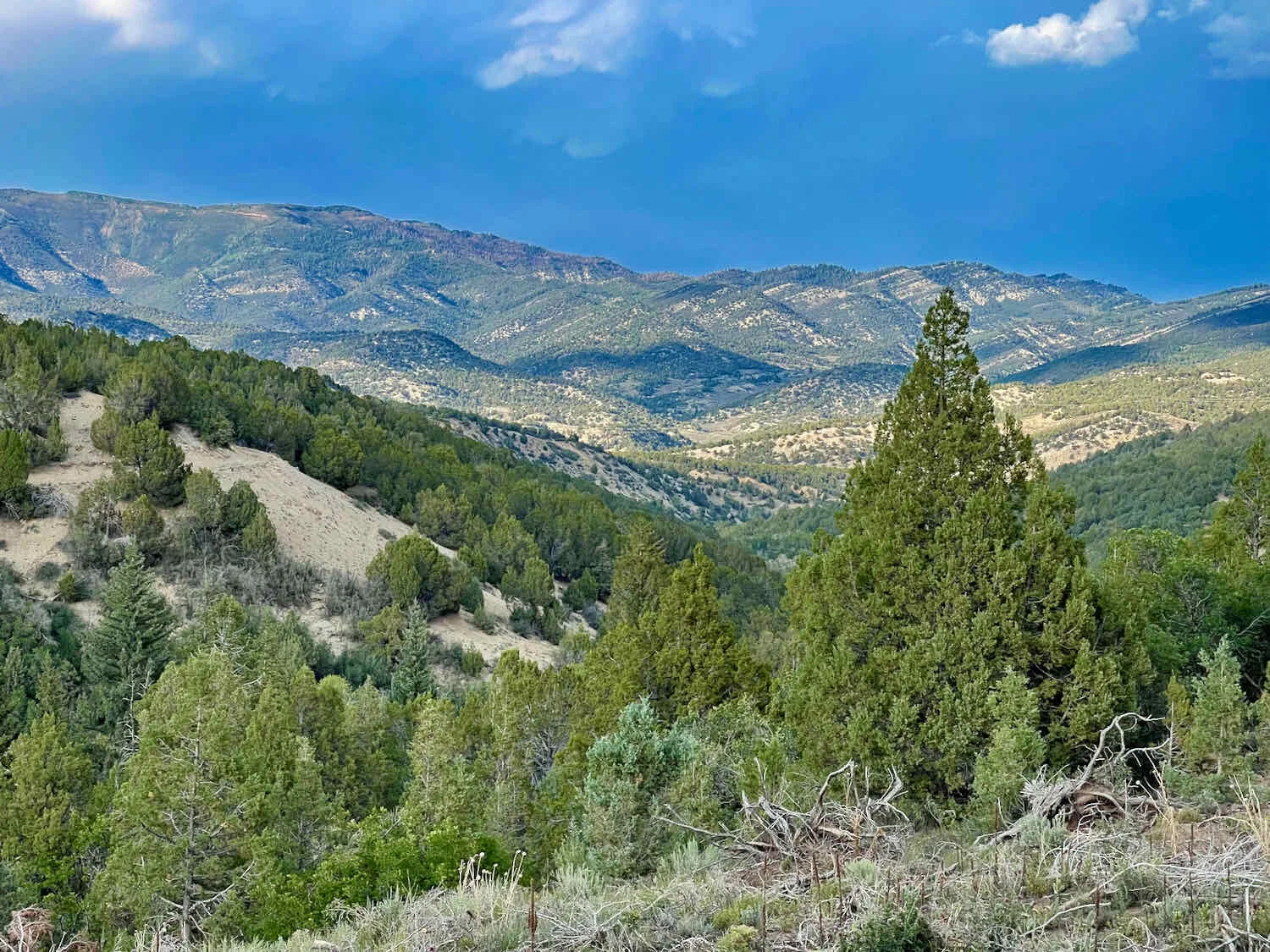
Making up for all this, the scenery was absolutely gorgeous. Large flocks of Mountain Bluebirds flitted around in the trees and fields. Clumps of Engelmann spruce and quaking aspen groves dotted a landscape of lush, grassy, mountain meadows. The vegetation was surprisingly green, compared to the muted browns and grays of the sagebrush. Wildflowers were also abundant - along with a hoard of bees. We stopped often to soak up the views and admire the loveliness of these mountains. Very beautiful.
A bluebird of happiness, brightening our day. The Mountain Bluebirds aren’t that blue this time of year, but we still enjoyed being surrounded by flocks of them in the mountain meadows. Uinta Mountains, Utah, USA. Copyright © 2019-2021 Pedals and Puffins.
On the higher ridges we could see the Wasatch Mountains to our southwest. We will be cycling along that ridge line within a couple of days. Uinta Mountains, Utah, USA. Copyright © 2019-2021 Pedals and Puffins.
Clumps of trees in verdant, flower-studded meadows created some of the most enchanting scenery we had seen so far on the WWR. Uinta Mountains, Utah, USA. Copyright © 2019-2021 Pedals and Puffins.
Large groves of quaking aspen created an elegant backdrop to our ride, as well as providing much-appreciated shade. Uinta Mountains, Utah,, USA. Copyright © 2019-2021 Pedals and Puffins.
It was a Friday, which meant that there were quite a few motorized vehicles on the road, heading out to camp in the National Forest. Some motorists are very considerate, and slow down to avoid dusting cyclists. Unfortunately, others are oblivious or inconsiderate, and leave us choking in a cloud of dust. Copyright © 2019-2021 Pedals and Puffins.
By the time we made it to the top of the third ridge, we were both tired but looking forward to a long, 2,000 ft, downhill ride to Strawberry Reservoir. At the bottom of the descent, we stopped at the Strawberry Reservoir visitor’s center to get water. And while we were there, our cyclist friend also arrived. She was planning to go to the Strawberry Bay Marina Cafe for supper, and we decided that sounded like a great idea.
But she’s traveling a lot lighter and faster than us, on a bike built for racing as opposed to our slow and bombproof expedition bikes. So she headed up the road, as if she were the rabbit to our tortoise.
By the time we got to the turnoff for the marina, we had decided to check on whether they had any campsites available. It was just too appealing to have a leisurely dinner at the cafe, and then call it a day in the nearby campground. We were in luck, because they had a number of sites still available. We were able to snag a site that had a canopy over the picnic table for shade (many of the sites did not). After staking out our claim on a campsite, we headed down the road to the cafe.
When we arrived at the marina, our cyclist friend had already finished her meal. We said our good-byes, and she headed up the road.
We hung out in the shade at the cafe until after 6pm, when it finally started to cool down. It was pleasant to sit on the deck, looking out over the boats at the marina and the broad expanse of Strawberry Bay. There was a bit of excitement when a small bat flew over our heads and into the restaurant, where it landed on the floor. One of the ladies who worked at the cafe threw a bucket over it, then picked it up with a towel and let it go outside. We were impressed with how she kept her cool, and didn’t make a fuss about a bat in her workplace. In a more urban setting, a bat in the restaurant would have caused general panic. Here, everyone just took it in stride.
So-long to the Uintas
In the morning, we attracted the attention of some of the other campers. Neighbors from both sides of our campsite came over to talk to us - clearly intrigued by seeing only bicycles and no car. The first neighbor had grown up in the area, and was very familiar with all of the surrounding national forest lands. He wanted to know, in great detail, which roads we had taken. And he offered his own thoughts about the places we had traveled, as well as advice about the road ahead. It was clear that he loved these natural landscapes, and was pleased to share his enthusiasm for the mountains with us. He was traveling in an RV with his wife, and found it incredible that we were cycling on such rugged roads.
After he departed, our neighbor from the other side came over to chat, followed by a quiet but curious girl who looked like she was 11-12 years old. They were part of a large, extended family group that had arrived in multiple vehicles, and set up three tents, in addition to having some folks sleep in the back of a pickup truck. He had also lived in the area for many years, and he was astounded that we were cycling as far as we were, over tough mountain roads. He expressed admiration for our effort, and told the young girl maybe she could do something like that one day. She didn’t seem convinced.
Sunrise extending its glow over our tent. It wouldn’t be long before we were fielding questions about our ride from each of our campsite neighbors. Strawberry Bay Campground, Utah, USA. Copyright © 2019-2021 Pedals and Puffins.
With all of the visiting, it took us a bit longer than usual to get out on the road. But eventually we cycled off along the shore of Strawberry Reservoir, towards the next mountain pass.
A Swainson’s Hawk survey’s its domain along the shore of Strawberry Reservoir. Utah, USA. Copyright © 2019-2021 Pedals and Puffins.
After topping up our water bottles at another campground near the shore of the reservoir, we started the 1,300 ft climb for the day. It was a Saturday, and we were passed by lots and lots of cars and ATVs. It’s always unpleasant to get covered with dust from cars, but by now we were also in the middle of a 7-day stretch with no showers. So washing off the dust was getting a bit less effective each evening. The fine grit was seeping into all of our stuff, and we could create our own, small dust clouds by shaking out our clothes.
Fortunately, as we got higher into the mountains the traffic slowly subsided and we could enjoy the beauty around us. As in the previous days, it was the quaking aspen groves and the meadows dotted with spruce trees that captivated us.
Our bikes, relaxing in the shade of an aspen grove. Willow Creek Ridge, Utah, USA. Copyright © 2019-2021 Pedals and Puffins.
Looking back on the road we had climbed. Willow Creek Pass, Utah, USA. Copyright © 2019-2021 Pedals and Puffins.
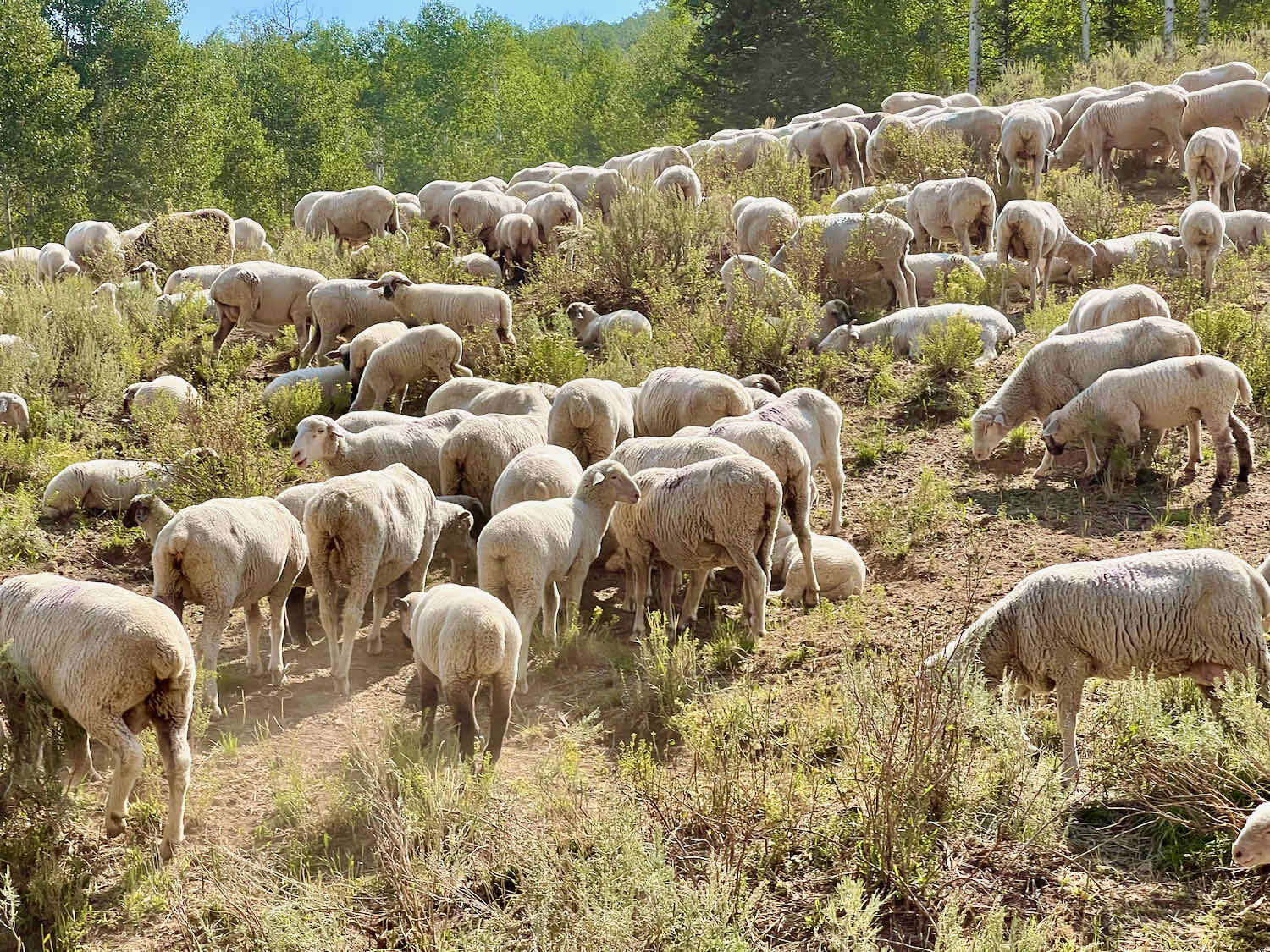
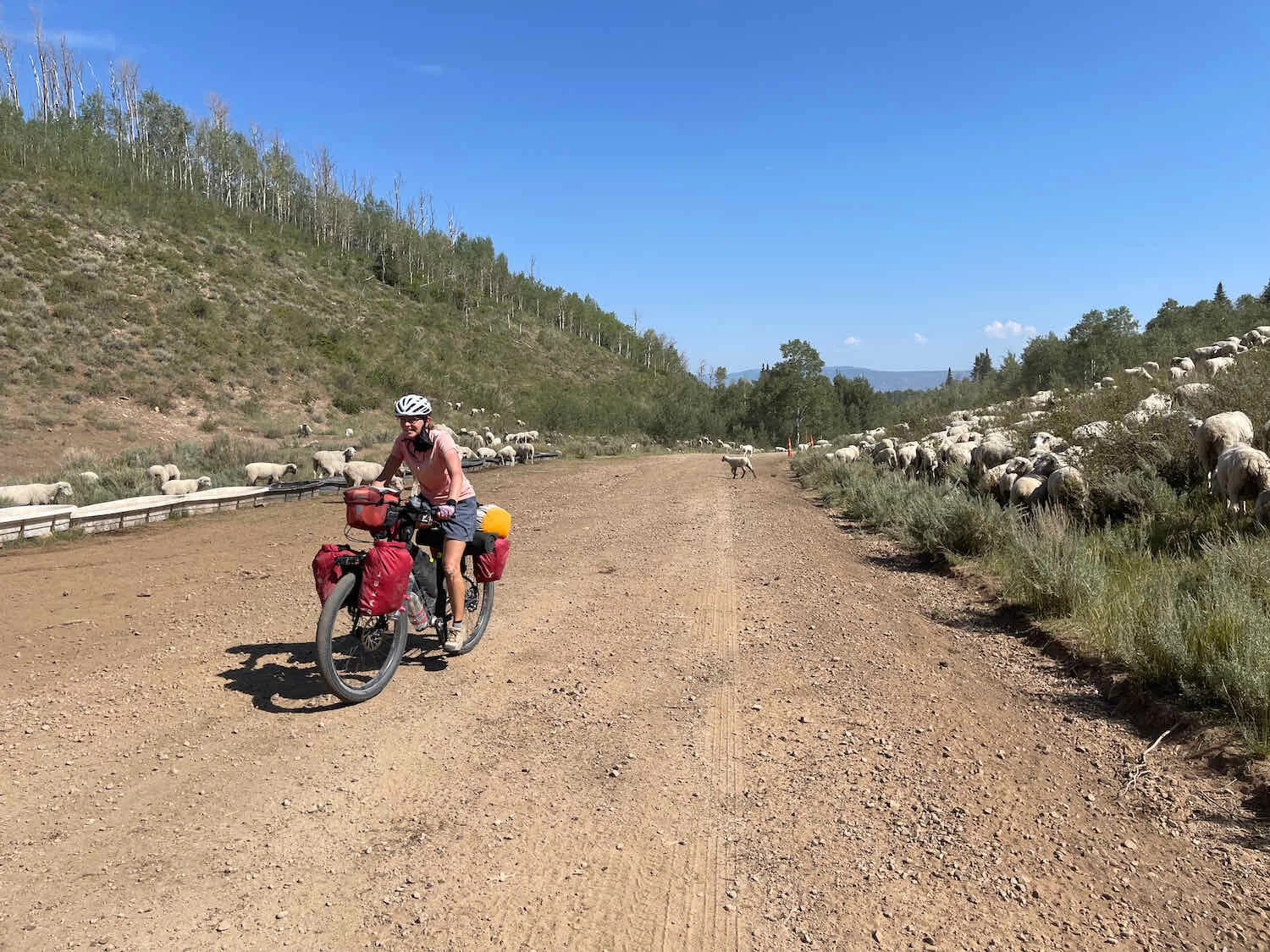
Encounters with sheep are also becoming a daily occurrence.
It was exciting to reach the top of the ridge. We could see all the way down into the valley where we would descend to the community of Soldier Summit, at the end of this segment of the Western Wildlands Route. As you might surmise, we were pretty high in the mountains, since we needed to cycle downhill in order to get to a community with a name like Soldier Summit. And across the valley loomed the even higher Wasatch Plateau - our next adventure.
Looking down into Spanish Fork Canyon, where we’ll be after a 2,500 ft descent off of the mountain. The Wasatch Plateau, our next big adventure, looms in the distance. Willow Creek Ridge, Utah, USA. Copyright © 2019-2021 Pedals and Puffins.
The descent into the canyon was winding, steep, and gravelly but we both made it down without any mishaps.
The last push to Soldier Summit. Spanish Fork Canyon, Utah, USA. Copyright © 2019-2021 Pedals and Puffins.
In the canyon, we headed for the last bit of civilization we would see for several days - the convenience store at Soldier Summit. It was still reasonably early in the afternoon, so we took our time and enjoyed some cold drinks, pizza and ice cream while relaxing in the shade. The clerk at the store was very friendly, and thought that what we were doing was pretty cool. He let us use an electrical outlet to charge some of our spare batteries and devices while we ate, and let us fill up lots of water bottles - 16 L - from a sink in the store.
But the rest stop had to end at some point. Around 5:30 in the evening we set out again, with the goal of making it at least three miles up the climb onto Skyline Drive (on the Wasatch Plateau) before pitching camp. After a brief stop to read a couple of signs about the history of Soldier Summit, we were on our way.
A relic from Soldier Summit’s early days. The Denver & Rio Grande Railroad tried to establish a town at the mountain pass to service its trains, and built housing for a community here. But the winter weather was too harsh, and the town was eventually abandoned. Now, only a couple of houses and a convenience store remain. Soldier Summit, Utah, USA. Copyright © 2019-2021 Pedals and Puffins.
A fast, 7-mile descent on the highway brought us to the entrance to Skyline Drive - one of the more remote and rugged stretches of the WWR. There were lots of warnings about this section of the route. In particular, it is considered impassible and dangerous in any wet weather. The canyons and roads are steep and subject to flash floods. Unfortunately, the weather forecast looked unpredictable. It would take us 4-5 days to cycle all the way across Skyline Drive, and rain was predicted after a couple days. As we headed up onto the plateau, we crossed our fingers - hoping that the forecast would improve.
Given the choice between these two options, we chose the second left. Near Soldier Summit, Utah, USA. Copyright © 2019-2021 Pedals and Puffins.
After leaving the highway, we were immediately back on gravel, grinding our way up onto the Wasatch Plateau. It was hard work after a long day, but we managed to make it 2.5 miles up the side of the mountain. We found a nice spot to camp with a grand view back towards Spanish Fork Canyon. But our thoughts were more focused on the road ahead, and the next leg of our cycling adventure.