Baja Divide Part 5: Cycling from Mulegé to Ciudad Constitución
23 March - 13 April 2023
Baja Divide Section #14
23 March - Mulegé to Playa el Burro (17.3 mi, 27.8 km)
24 March - Layover at Playa el Burro
25 March - Playa el Burro to Wild Camp North of Loreto (55.0 mi, 88.5 km)
26 March - Wild Camp North of Loreto to Loreto (14.2 mi, 22.9 km)
27-28 Layover in Loreto
Baja Divide Section #15
29 March - Loreto to San Javier (23.3 mi, 37.5 km)
30 March - San Javier to Wild Camp in Arroyo San Lucas (30.4 mi, 48.9 km)
31 March - Wild Camp in Arroyo San Lucas to Wild Camp North of Ley Federal de Aguas #1 (23.4 mi, 37.7 km)
1 April - Wild Camp North of Ley Federal de Aguas #1 to Ciudad Constitución (31.4 mi, 50.5 km)
2-13 April - Layover in Ciudad Constitución
Fast Internet in a Remote Cabin
From Mulegé there are two ways to proceed on the Baja Divide. One way requires hiring a boat to take you across the mouth of a large bay (Bahía de Concepción) where you then pick up a dirt road on the other side of the bay. The other way, which we decided to take, follows the coastline of the bay by land on a recommended, alternate route to the town of Loreto.
That decision relieved us of the somewhat tricky task of hiring a fishing boat to haul ourselves and our gear across the mouth of Bahía de Concepción (a step required on the main Baja Divide route) - a process that can leave cyclists stranded in Mulegé for days. The boat trip is also known for dousing bikes with corrosive salt water, which we considered undesirable given the lack of fresh water to clean them afterwards.
Instead, we would simply get on our bicycles and head south. We thought it would be interesting to visit the town of Loreto, one of Mexico’s Pueblos Mágicos, which lies about 100 miles south of Mulegé. The Pueblos Mágicos are towns that are officially recognized by the government for their extraordinary beauty, deep historical significance, or connection to legends that are important to the country’s national identity. To achieve the status of “magical,” a town must be transcendent in one or more of these qualities. We decided to go see the magic for ourselves.
It had been a long time since we’d had good internet access. So before leaving Mulegé we searched for an overnight destination with known, high-speed wifi. We decided to take a short hop down the highway. Our target was a remote cabin near the shores of Bahía de Concepción that boasted super-fast, Starlink satellite internet as part of a “glamping” experience. We’d never been “glamping” before, so we weren’t exactly sure what to expect. But it sounded like it might be fun.
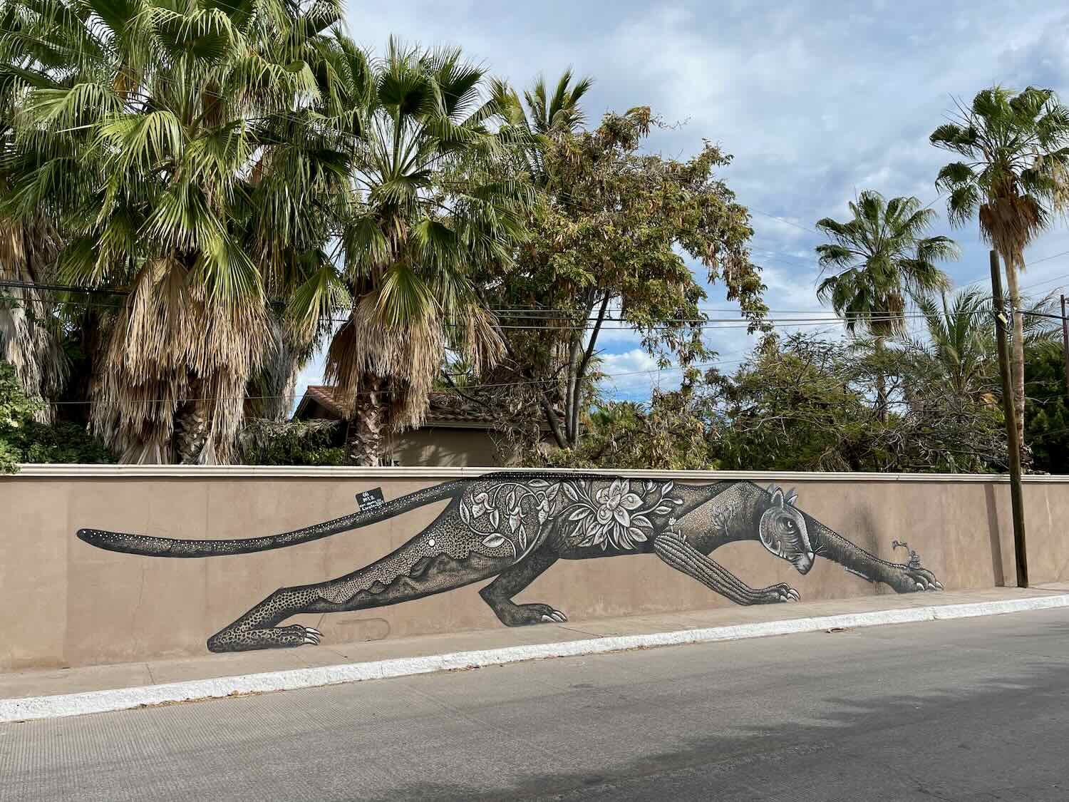
At the edge of town, we stopped for a photo at the Mulegé city sign. Almost every town in Baja with more than 1,000 residents, and even some smaller ones, have brightly colored signs of the city’s name in capital letters. They’re often found at the primary entrance to the city, or at a major focal point like the central town square or waterfront. This one was positioned to capture the attention of people driving north along Hwy 1 from La Paz.
The big, bold letters marking the entrance to the town. The “H” in front refers to the town’s official name, “Heroica Mulegé” (e.g., heroic Mulegé) which was bestowed upon the citizens after they successfully repelled an attack by the U.S. Navy during the Mexican American War (1847). Mulegé, Baja California Sur, Mexico. Copyright © 2019-2023 Pedals and Puffins.
While we were stopped next to the sign, a van pulled up and about a dozen Canadians piled out to take their own photos of the landmark. A couple of friendly folks from Quebec came over to chat with us briefly about our trip. But they didn’t stay very long. All the photos were snapped and the van was gone in a matter of minutes.
The H Mulegé sign overlooks the palm-lined banks of the Mulegé River as it ambles toward the Sea of Cortez. Mulegé, Baja California Sur, Mexico. Copyright © 2019-2023 Pedals and Puffins.
We soon found ourselves cycling along the edge of Bahía de Concepción, a long, very narrow bay that draws visitors to its relatively unspoiled and low-key beaches. The views were incredible, especially whenever the road would climb up onto a ridge high above the water. Then we would have breathtaking vistas of the royal blue bay lined with desert mountains and secluded, sandy coves. The mountains on the far side of the bay rounded out the picture by providing a rugged border between the sea and the sky, as magnificent frigatebirds circled overhead on their dark, pointed wings.
View of Bahía de Concepción from Hwy 1. Playa Santispac, Baja California Sur, Mexico. Copyright © 2019-2023 Pedals and Puffins.
Boats in an aqua-blue bay off Bahía de Concepción. Playa Santispac, Baja California Sur, Mexico. Copyright © 2019-2023 Pedals and Puffins.
A magnificent frigatebird soars overhead as we reach the top of a bluff. Playa Armenta, Baja California Sur, Mexico. Copyright © 2019-2023 Pedals and Puffins.
The place we were staying had a couple of cabins, plus a number of large, “glamorous” tents. We had called ahead to book a cabin. So even though we arrived before noon, and the proprietor was not on-site, she had left our cabin open. That was awesome, because it allowed us to rest inside, out of the sun, before the afternoon got too hot. Even better, we immediately had access to the wifi, and the download speed was blazingly fast. We finally were able to get some stuff synced to the cloud - ensuring we wouldn’t lose any photos or other digital items as our electronic devices bounced along with us on Baja’s dirt roads.
So, what is glamping? It’s a pretty flexible term. But at its most basic it implies a rustic camping experience that is enhanced with a few premium touches. At Baja Glamping the fast wifi was one of those touches, but there were others as well. The beds in the cabin were very comfortable and covered with nice linens, the floor was draped with genuine cowhide rugs, and we had 24-hr solar-powered electricity.
Inside the cabin at Baja Glamping. Playa El Burro, Baja California Sur, Mexico. Copyright © 2019-2023 Pedals and Puffins.
One of the local cats found a nice resting spot on the table in the shared kitchen. Playa El Burro, Baja California Sur, Mexico. Copyright © 2019-2023 Pedals and Puffins.
Although the campground was pretty far from any towns, there were a couple of restaurants within walking distance that served seasonal visitors to the tiny community at Playa El Burro (year round pop. 14). Our first evening at the campground, we wandered over to JC’s, a rustic restaurant popular for its live music. They were expecting a large party that evening, so we were lucky to get a table. The special was a seafood platter, and we decided to go for it. Before long, we were being serenaded by two wonderful musicians singing Latin American standards like Guantanamera, Somos Novios, and Cielito Lindo in harmony, accompanied by a Spanish guitar and bongos. The dinner portions were generous, the Margaritas were strong, and the music was superb. It was a wonderful evening.
The musicians at JC’s Restaurant. Playa El Burro, Baja California Sur, Mexico. Copyright © 2019-2023 Pedals and Puffins.
The seafood platter at JC’s Restaurant. Playa El Burro, Baja California Sur, Mexico. Copyright © 2019-2023 Pedals and Puffins.
The next day we took a long walk along Playa El Burro. It’s one of the more developed beaches that line Bahía de Concepción, with a long string of eclectic, bamboo and palm cabins lining the waterfront. They were perched in the sand, surprisingly close to the high tide line. It seemed like a risky place to put a bunch of cabins. But their inexpensive construction gave them local charm, and also meant they would be relatively easy to repair if they got damaged in a storm. In fact, a few of them were in the process of being repaired, while others looked like they could use some TLC.
Cabañas along the beach. Playa El Burro, Baja California Sur, Mexico. Playa El Burro. Copyright © 2019-2023 Pedals and Puffins.
Return to the Desert
The road south from Playa El Burro continued along the edge of the bay for another 20 miles (32 km). There were lots of rolling hills, and a couple more big ridges that provided expansive views of the water, and intimate glimpses of the sandy coves.
Palapas on the beach. Playa Armenta, Baja California Sur, Mexico. Copyright © 2019-2023 Pedals and Puffins.
Once we reached the southern end of the bay, it was time to head back into the mountains. It took us an hour to reach the top of the 1,000 ft (305 m) climb away from the bay. From the heights of the ridge, an undulating valley descended slowly toward the coastal city of Loreto, still a day and a half away by bicycle. Tall, weathered, sandstone peaks formed a scenic backdrop to the cactus forests below. And between us and Loreto, a series of rolling hills with deep-cut arroyos quickly swallowed any view of the road ahead.
View of the mountains lining our route. South of Bahía de Concepción, Baja California Sur, Mexico. Copyright © 2019-2023 Pedals and Puffins.
As luck would have it, we arrived at the unassuming Las Palmas Restaurant - the only food between Bahía de Concepción and Loreto - just in time for lunch. Inside, the restaurant was buzzing with activity. Eight to ten kids were using the dining area as part of their play area, teasing each other, laughing, and singing along with the songs belting loudly from a hidden speaker. It was a very jovial place. The quesadillas were tasty and very filling. We were stuffed by the time we left.
Hitting the road after lunch at Las Palmas Restaurant, stuffed. El Rosarito, Baja California Sur, Mexico. Copyright © 2019-2023 Pedals and Puffins.
As our route gently descended, the surrounding mountains grew higher and higher. South of El Rosarito, Baja California Sur, Mexico. Copyright © 2019-2023 Pedals and Puffins.
A couple of miles past a military checkpoint - where again we were just waived through without even stopping - we decided to call it a day. We wanted to put some distance between ourselves and the highway, so we headed down a dirt side road to look for a camping spot. At first it seemed like there might not be any good campsites to be had. But after cycling about a mile away from the highway, we finally found a secluded, flat spot hidden from the dirt road. We had to shoo away four free range horses that had been there first. But eventually they decided we weren’t going to stop pestering them, and they let us have the spot to ourselves.
Preparing dinner at camp, using our wood-burning stove. North of Loreto, Baja California Sur, Mexico. Copyright © 2019-2023 Pedals and Puffins.
A western screech owl serenaded us to sleep.
The Magical Town of Loreto
The next day’s ride into Loreto was pretty quick and easy. As we descended from the mountains towards the coast, we had beautiful views of the Sea of Cortez.
A roosting turkey vulture is silhouetted against the sky, with the Sea of Cortez and Isla Carmen in the background. North of Loreto, Baja California Sur, Mexico. Copyright © 2019-2023 Pedals and Puffins.
In fact, the ride went by so quickly that we arrived in Loreto before 10am. It seemed wise to kill some time before heading over to our hotel and attempting to check in. We decided to stop at a convenience store at the edge of town, right next to the sign proclaiming Loreto to be a Pueblo Mágico. There, we helped ourselves to a second breakfast. (When on a long distance cycling tour, it’s always easy to talk yourself into believing that a little more food won’t hurt.)
The sign welcoming highway travelers to the magical town of Loreto. Baja California Sur, Mexico. Copyright © 2019-2023 Pedals and Puffins.
The mini mart on the edge of town where we enjoyed our second breakfast. Loreto, Baja California Sur, Mexico. Copyright © 2019-2023 Pedals and Puffins.
We spent the next couple of days relaxing and strolling the streets of Loreto. Most of the key sights are clustered within the city’s historic district, stretching about half a mile inland from the sea. The historic buildings are well preserved, evoking the charm and tranquility of Old Mexico. And many of the narrow streets are pedestrian-only, making it a pleasant place to wander. We visited the Loreto Mission Church, first of the Spanish missions to be established in Baja (1667), explored the streets of the old town, admired the art and architecture, and took in views of the sea from the city’s beautiful waterfront. Here are some photos from our visit:
The sign on the Old Town Hall reads, “Capital Historica de las Californias.” As the first successful Spanish settlement in Baja, Loreto served as the launching pad and administrative center for the Church’s expansion of missions all the way up the Pacific Coast of America. Loreto, Baja California Sur, Mexico. Copyright © 2019-2023 Pedals and Puffins.
The Misión de Loreto is the oldest, and one of the best-preserved mission churches in Baja. It has undergone multiple renovations, including having its roof replaced after it collapsed during an earthquake in the late 1800s. As a result, the church looks relatively new - especially the modern clock tower that actually keeps the correct time. Loreto, Baja California Sur, Mexico. Copyright © 2019-2023 Pedals and Puffins.


The Andador Juan María de Salvatierra is a peaceful pedestrian street shaded by some of the most painstakingly sculpted trees we’ve ever seen. Loreto, Baja California Sur, Mexico. Copyright © 2019-2023 Pedals and Puffins.


A tortilla-making machine in action. Little shops running these machines can be found in practically every town, churning out 30-60 tortillas per minute. You need a lot of tortillas when they are served with every meal. Loreto, Baja California Sur, Mexico. Copyright © 2019-2023 Pedals and Puffins.
Metal and carved statues of geckos, lizards and frogs can be seen everywhere. They’re very popular home and business decorations. Loreto, Baja California Sur, Mexico. Copyright © 2019-2023 Pedals and Puffins.
Loreto has a beautiful waterfront with a sleek and modern boardwalk (el malecón). There are lots of benches to sit and watch the sea, and even themed trash cans in the shape of fish and turtles.
Loreto’s capital letter sign adorns the boardwalk by the sea (el malecón). Loreto, Baja California Sur, Mexico. Copyright © 2019-2023 Pedals and Puffins.
A graceful statue of a mama and baby whale, on the waterfront. Loreto, Baja California Sur, Mexico. Copyright © 2019-2023 Pedals and Puffins.
A Mission in the Mountains
Visiting Loreto is considered an alternate route on the Baja Divide. To get back to the main route, we had to work our way back up into the mountains. We would have to climb more than 2,200 ft (670 m) in approximately 10 miles. That’s a lot. We were lucky that there was a nice, paved road the whole way. A ride like that goes a whole lot faster on pavement. And we wanted to reach the top before the day got too hot.
By taking the road from Loreto to the mountain village of San Javier, we would be cycling in the footsteps of some of the first Spaniards to settle in Baja. Loreto had been their first outpost. Unfortunately, the Loreto mission struggled with an unreliable water supply, endangering the new village’s ability to grow crops. When the native people told the missionaries there was a place in the mountains with permanent water, they sent out a party to search for it. They found a perennial spring in a mountain valley, which quickly became the second mission in Baja - San Javier.
The road to San Javier follows the same basic route used for more than three centuries. It climbs along a river valley to a pass in the Sierra La Giganta mountains, then drops down into the basin fed by the San Javier spring. Before long we found ourselves cycling up steep stretches of road, interspersed with flatter, easier sections. And as the morning progressed, the steep sections got longer and more frequent, while the milder gradients became fewer and shorter. Just a regular day on the Baja Divide.
A couple of hours into the ride we started getting gorgeous views back toward the Sea of Cortez. We had to laugh, because even after all that work, Loreto didn’t look that far away.
The view back down the Loreto River Valley, toward the Sea of Cortez. The road we had just cycled up stretches down through the valley below. Between Loreto and San Javier, Baja California Sur, Mexico. Copyright © 2019-2023 Pedals and Puffins.
Date palms in the Loreto River valley. Road to San Javier, Baja California Sur, Mexico. Copyright © 2019-2023 Pedals and Puffins.
Cycling up the road between Loreto and San Javier, Baja California Sur, Mexico. Copyright © 2019-2023 Pedals and Puffins.
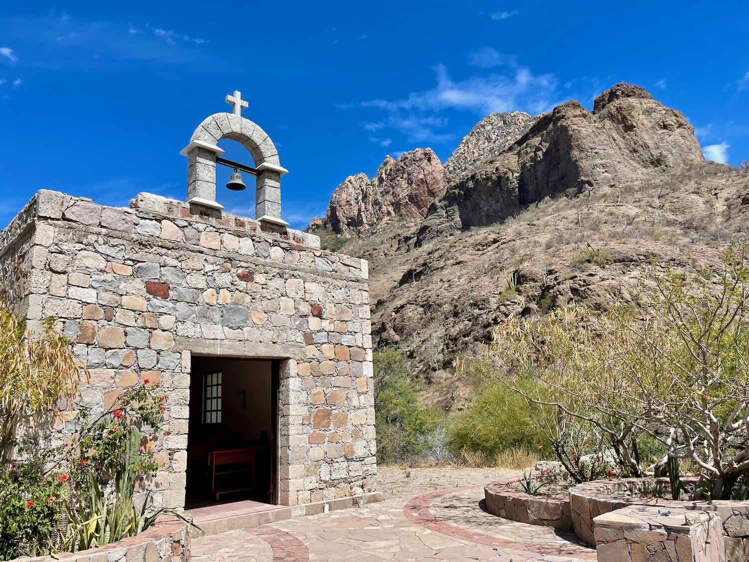
The final few miles to the top of the pass were particularly challenging. By that time the sun was beating down on us and the road was heading upwards at a steady gradient in excess of 12%. We took a break on the side of the road, in the shade of a lofty cliff to help cool off. We also stopped to admire a beautiful, little chapel in the tiny community of Las Parras (pop. 5). These roadside chapels, often built by individual ranchers, are always lovingly decorated and maintained.
It was an awesome feeling when we finally made it to the top of the pass. Even better, it was still before noon. We could look forward to cycling downhill in the heat of the day.
One last look back at the road we had just conquered, from the top of the pass. Road to San Javier, Baja California Sur, Mexico. Copyright © 2019-2023 Pedals and Puffins.
As we cycled down the far side of the pass, there were 5-6 spots where we cycled through water in the road. Luckily the water was just a few inches deep, and we were able to ride through it without dismounting from our bikes. But it was a taste of things to come in the backcountry, once we passed San Javier.
One of the water crossings coming off the top of the pass. Road to San Javier, Baja California Sur, Mexico. Copyright © 2019-2023 Pedals and Puffins.
We arrived in San Javier (pop. 155) shortly after noon. Following a brief rest and cold drinks in the shade, we headed over to a home where a local family had a couple of cabañas in back that they rented to visitors. The Cabañas Misioneras had a room available, but it needed some cleaning. So we parked our bikes in their courtyard and walked down the block to visit the historic, mission church.
Arriving in the small, mountain village of San Javier. Baja California Sur, Mexico. Copyright © 2019-2023 Pedals and Puffins.
Our bikes, resting after the long climb up the mountain. San Javier, Baja California Sur, Mexico. Copyright © 2019-2023 Pedals and Puffins.
Although the mission at San Javier was established in 1699, the church wasn’t built until 1758. It still retains most of its original stonework (unlike the highly renovated church in Loreto). Consequently, it feels much more authentically historical.
The Misión San Javier church, in a valley oasis of the Sierra la Giganta. San Javier, Baja California Sur, Mexico. Copyright © 2019-2023 Pedals and Puffins.
As we approached the church we met a group of four travelers, one couple from Oregon and the other from Southern California. When they learned we were riding bicycles, they realized that they had seen us cycling up from Loreto. They had passed us in their vehicles on the road into town. They had lots of questions about our trip, and we ended up talking with them for quite a while about our travels. In a “small world” twist, we also learned that the landlord for one of the couples was a guy named Darren Alff, also known as “The Bicycle Touring Pro,” who has a large online presence. When we were getting started in bike touring years ago, we had watched some of his videos. It was fun to feel that connection with them.
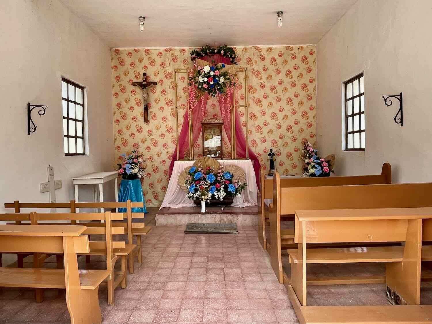
Both outside and inside, the mission church was one of the most attractive that we’d seen in Baja. It was in great condition, but it still looked old and weathered. According to the docent inside, the weekly Sunday mass is still attended by as many as 200 people from the surrounding area. And for several days every December, the church is the focal point of a pilgrimage, with up to six thousand worshipers descending on this tiny town during the Festival of San Javier.


After a pleasant, late lunch at an open-air restaurant on the plaza facing the church, we finally were able to check into our room. It was a simple, adobe structure with a palapa-style, palm thatched roof. There were a few spots where we could see daylight through the palm fronds, so we were pretty glad there wasn’t any rain in the forecast. The beds were covered with flamboyantly-colored, plush blankets that we have noticed are pretty common in Baja, especially in smaller, independent establishments.
Inside our cabaña. San Javier, Baja California Sur, Mexico. Copyright © 2019-2023 Pedals and Puffins.
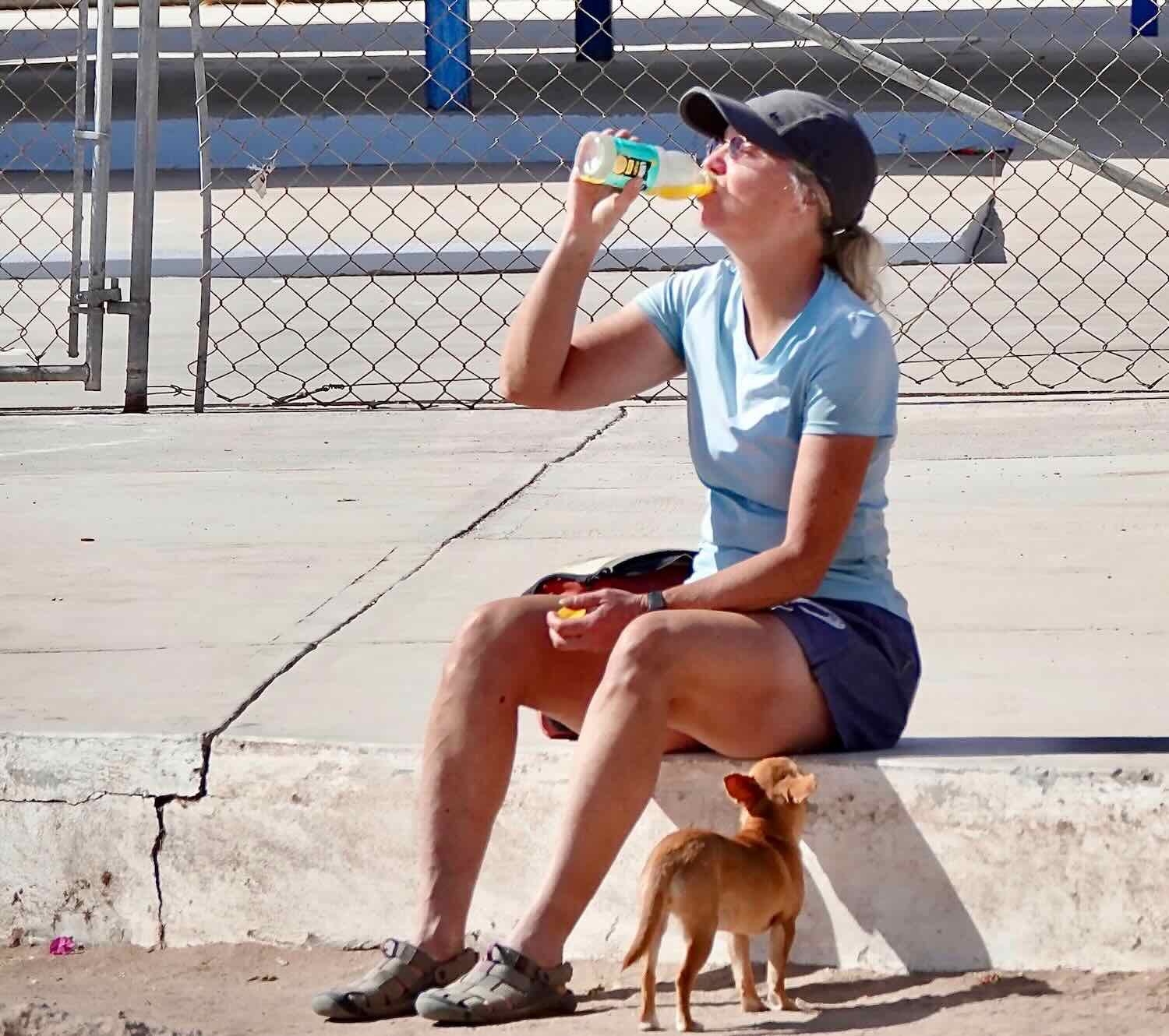
In the early evening we went for a stroll. Along the way we picked up a dog escort. A friendly German shepherd followed us all around town. Whenever we passed other dogs, he stayed close to us as if it gave him confidence as he passed through the other dogs’ territory. Other times he would trot out ahead of us, periodically looking back to make sure we were still following. It seems like there are quite a few dogs that live on the streets in Baja’s towns. They are usually looking to adopt a human if they can. This one seemed like a sweet-tempered dog. But we’re always careful not to get too friendly. Some dogs have been known to follow cyclists when they ride out of town, potentially stranding the dogs in an unknown place without food or water. We’d feel really bad if that ever happened.
Relaxing on a bench near the San Javier sign. Baja California Sur, Mexico. Copyright © 2019-2023 Pedals and Puffins.
Arroyos of the Sierra La Giganta
The next morning, the road out of town followed the Arroyo San Javier as it cut a valley southward through the Sierra La Giganta. On both sides of the valley, the canyon walls rose up into lofty buttes. But, in fact, the name Sierra La Giganta did not originally refer to the great heights of these peaks. Instead, a better translation would be “Mountains of the Giant.” Supposedly the native people told the early missionaries legends about giants that had lived here in the past, and who had created the ancient cave paintings that can be found throughout the region.
Heading out of San Javier on the well-maintained, gravel road. Lofty buttes lined the valley on both sides. Arroyo San Javier, Baja California Sur, Mexico. Copyright © 2019-2023 Pedals and Puffins.
For most of the distance to Rancho Santo Domingo the road was quite well maintained. The primary obstacles in our path at this point were the water crossings, which started almost right away. There were at least four, wet crossings of the arroyo by the time we reached Rancho Santo Domingo.
One of at least four water crossings as we rode along the Arroyo San Javier. Even when they’re shallow you typically can’t ride across because the river bed is composed of big, slippery, loose, cobblestones. Baja California Sur, Mexico. Copyright © 2019-2023 Pedals and Puffins.
A goat herder walks his goats along the road through the valley. Arroyo San Javier, Baja California Sur, Mexico. Copyright © 2019-2023 Pedals and Puffins.
The palo verdes have erupted in dazzling clusters of yellow flowers. Arroyo San Javier, Baja California Sur, Mexico. Copyright © 2019-2023 Pedals and Puffins.
We arrived at the remote Rancho Santo Domingo around 9:30am, not sure what to expect. The rancher is known to offer guided tours up to a nearby cave with rock paintings. But it was unclear if other services would be available. As we pulled up to the gate, Humberto and his father Jesus were out in their large garden tending the squash plants. When we hailed them from the road, Humberto came over to see what we might need. It turned out that he was not offering any food or drinks, but he was happy to let us refill our water bottles from his well, which was powered by a solar pump. That was fantastic. We would much rather drink the clean well water than have to filter multiple liters from a stream used heavily by cattle.
As we visited with Humberto, we learned that he was growing squash, watermelons, corn, onions, garlic, carrots and a few other things on his small farm. He also had a big patch of sunflowers. But he said he didn’t eat the seeds. They were “for the birds” - wild doves and finches, as well as his chickens.
All sorts of things get repurposed out in the backcountry. Here, two old vehicle axels or bumpers have found a new life as fence posts. Arroyo El Peloteado, just past Rancho Santo Domingo, Baja California Sur, Mexico. Copyright © 2019-2023 Pedals and Puffins.
From Rancho Santo Domingo the road turned and climbed uphill for 7.5 miles (12 km). That’s when the water crossings began in earnest. We would end up wading across 19 wet arroyos before the day was through. That was a single day record for us.
We waded across this lovely, tranquil pool that submerged part of our road. Water crossings have become a regular part of our rides in southern Baja. Arroyo El Peloteado, Baja California Sur, Mexico. Copyright © 2019-2023 Pedals and Puffins.
As we were heading up the mountain, we suddenly noticed that our GPS map showed we had gotten off the route. That seemed odd, because we hadn’t noticed any other roads. Even so, we backtracked about half a mile to where the routes diverged. But what we found was a side road that had been intentionally blocked off with some logs and stones. That didn’t bode well. We went around the barrier, but it quickly became apparent why this road had been abandoned. Within a couple of dozen yards the old road lurched over a 20-ft high cliff, and down into the rocky river bed below. We briefly considered whether we should try to lower our bikes over the cliff and continue across the rocky arroyo. But good sense got the better of us. We figured that there must be a new and better way to cross the arroyo safely.
Our GPS route for the Baja Divide had us diving off of this cliff, onto the rocks in the river bed below. We hoped there was a better way, and headed back to the main dirt road. Arroyo El Palmar, Baja California Sur, Mexico. Copyright © 2019-2023 Pedals and Puffins.
So we abandoned the old, damaged road that our GPS told us to use and went back to the main dirt road to see where that would lead us. Of course, just past where we had originally turned around there was a new crossing of the arroyo that was safe and relatively easy to maneuver. On the other side, the two roads connected with each other and we were back on the Baja Divide.
Just after noon we crested a pass in the Sierra La Giganta, and began our descent to the west. But there wasn’t any chance to relax and coast downhill. For about 10 miles the cycling was really tough. The terrain was extremely rocky, with lots of cobblestones and loose rocks on the steeper hills. We went up and down on a crazy roller coaster of ridges and arroyos. On a nice, cool morning the hills might not have seemed so bad. But with the afternoon heat sapping our energy, we even teamed up to push our bikes one at a time over some of the steeper, slippery sections.
The descent from the top of the pass, on one of the more rideable sections of road. Arroyo San Lucas, Baja California Sur, Mexico. Copyright © 2019-2023 Pedals and Puffins.
Many sections of the road were much more challenging due to piles of loose rocks or deep sand. Arroyo San Lucas, Baja California Sur, Mexico. Copyright © 2019-2023 Pedals and Puffins.
As we headed down the valley, we had to cross three big ridges. From the top of one of those ridges, we could see the Arroyo San Lucas winding its way through the valley below. Sierra La Giganta, Baja California Sur, Mexico. Copyright © 2019-2023 Pedals and Puffins.
Eventually we found a dirt side road where we could pitch the tent far enough from the main road to be discreet. It appeared to be an abandoned segment of the original road that had been bypassed by a newer route. This was a pretty common phenomenon on Baja’s back roads. They seemed to constantly be shifting, as parts of the road would get damaged and drivers would forge new paths to get around whatever obstacle got in their way. As a result, old, disused dirt tracks would often run in an arc away from the main road, and reconnect later. Many times they would stay too close to the new route to offer viable options for camping. But once in a while the old route would get far enough from the new one to make the perfect campsite, out of view from passing vehicles.
We had been having a lot of trouble with our tent zippers lately. The fine, powdery soil created a layer of dust on everything, including the zippers. It was almost impossible to keep them clean, resulting in increasingly rough and damaged sliders. So we decided to try something new. We put a ground cloth down on the ground in front of the tent, to create a barrier between the zippers and the ground. It seemed to work pretty well. Although some dust collected on the top of the ground cloth, it was way better than having the zippers dragging in the dirt.
As the evening wore on, we realized that we had accidentally camped closer to a ranch house than we would have liked. (Looking at a satellite photo later, we saw that there was a ranch house less than a half mile away.) As a matter of courtesy, we try to keep our distance from any ranches unless we have been invited to camp nearby. We only passed a couple ranches all day, so it was rather unlucky to find ourselves close to this one. We could hear some ranch animals making noises, a dog barking, and (of course) roosters crowing. The chickens seemed particularly close and may have been in an enclosure between us and the ranch. We decided to be especially careful not to make a lot of noise, and we limited our use of lights in the dark, to avoid attracting attention. We listened to the calls of another western screech owl in the dark as we drifted off to sleep
The roosters at the nearby ranch cut our night short, starting their calling by 3:30 am.
Fortunately, the next day’s route didn’t have any big hills - just lots of small ones that resulted from the road crossing back and forth across the river bed. But the river crossings were increasingly dry. We had only three more water crossings, and only one was deep. Unfortunately for PedalingGuy, that one was the deepest we had encountered. Throughout the previous day he had managed to keep his feet dry by balancing on rocks to cross the streams (PedalingGal, on the other hand, usually waded across). But today, on almost the last crossing, he finally had to get his feet wet..
Just a couple more water crossings. Arroyo San Lucas, Baja California Sur, Mexico. Copyright © 2019-2023 Pedals and Puffins.
During one of the spots where we crossed a particularly wide section of the riverbed, we spotted something else sneaking across the opening. To our delight, it was a really big mule deer buck, with a full set of antlers. Having lived most of our lives in northern zones, where deer lose their antlers much earlier in the year, we were surprised to see the rack on this deer at the end of March. But it’s actually pretty common for them to have antlers until April this far south. It was quite a thrill for us. We hadn’t seen a single mule deer since entering Mexico, so this guy was particularly special.
This mule deer buck was sneaking across the open river bed not far from us. We were thrilled to catch a glimpse of such a big deer, especially because we hadn’t seen any others since entering Mexico. Arroyo San Lucas, Baja California Sur, Mexico. Copyright © 2019-2023 Pedals and Puffins.
With the more moderate terrain, and slowly improving road surface, we made pretty good time. It was only 11:30am when we arrived at another one of the ranches that offers services to cyclists on the Baja Divide. A rough sign along the road alerted us that we would be welcome to drop by for a visit.
We’ve grown fond of the rustic look of the signs that welcome cyclists at ranches along the Baja Divide route. Arroyo San Lucas, Baja California Sur, Mexico. Copyright © 2019-2023 Pedals and Puffins.
It was helpful to have a sign out by the road, because the ranch house was set back pretty far from the main dirt road at the end of a long driveway. We cycled over to the house, and called out, “Hola, buenos días!” several times. At first it seemed like nobody was home. But then a gregarious lady named Silvia appeared and invited us inside, where we were offered a place to sit in the shade of their palapa. It was heaven because the temperature in the sun was already uncomfortably hot.
In addition to Silvia, the family included her husband, Javier, and their youngest daughter, Lufita. Javier sat and visited with us while his wife and daughter prepared a meal of eggs, beans, tortillas (made from scratch over a wood fire), and fresh goat cheese from the farm. Javier told us that he had been living on this ranch for 50 years. We also learned that, like all of the other ranches we had already visited, their two older children had moved away to work in La Paz and Cabo San Lucas. They were particularly proud of their oldest daughter, who had become a medical professional in Cabo. When it was time to eat, Javier joined us at the table for lunch.
Preparing homemade tortillas for lunch. Silvia did all of her cooking over a wood fire. Ranch in Arroyo San Lucas, Baja California Sur, Mexico. Copyright © 2019-2023 Pedals and Puffins.
They generously let us fill up with 10 liters of water from their well. At every ranch where we have stopped, the hosts have not charged us anything for the water - even though we often need a whole lot of it. There seems to be a general understanding that travelers passing by may need water, and that it’s a resource to be shared rather than sold. We always feel incredibly grateful for their generosity, as well as the hospitality they show by welcoming strangers into their homes for a rest.
As we were getting ready to leave, Silvia came over and started showing us photos of other cyclists that she had on her phone. We didn’t know many of them, but she did have a photo of two folks we had met earlier along the trail, Adam and George. Then, of course, we posed for some photos of our own.
(from left) Javier, PedalingGal, Lufita and PedalingGuy, at a ranch along the Baja Divide route. Photo by Silvia. Arroyo San Lucas, Baja California Sur, Mexico. Copyright © 2019-2023 Pedals and Puffins.
By the time we finally hit the road it was pretty hot, and it just kept getting hotter. We made good progress because the road was pretty flat, but the heat really sapped our strength. A couple of salt tablets and energy drinks helped. But the lack of shade eventually took its toll.
Making good progress along the road. Without any shade, the heat really started to get to us. Approaching Ley Federal de Aguas #1, Baja California Sur, Mexico. Copyright © 2019-2023 Pedals and Puffins.
We figured that there probably wouldn’t be many places suitable for camping once we passed the town with the ungainly name of Ley Federal de Aguas #1. Between there and the city of Ciudad Constitución we had heard that most of the land was private and used for agriculture. So even though it was still pretty early in the afternoon, we decided to stop for the day around 3pm.
With several hours to go before nightfall, we set up our camp chairs in the dappled shade of an acacia tree. It was a real siesta, and it helped restore our energy.
Taking a siesta in the shade of an acacia tree. Northeast of Ley Federal de Aguas #1, Baja California Sur, Mexico. Copyright © 2019-2023 Pedals and Puffins.
We set up the tent in the late afternoon, when the temperature finally started to feel a bit cooler. But we were not alone. A herd of about 15 cows, some of them wearing cowbells, kept coming around. Baja is mostly open range without any fences for cattle, horses or goats. The bells help the local ranchers locate their animals. Unfortunately, the bells can also keep us up at night as the animals wonder around. The cows behaved as if it was their habit to walk down our little side road every evening, to wherever they wanted to spend the night. And whenever we chased them a short distance away, they would come wandering back towards our tent. Eventually, right around dusk, PedalingGuy decided to send them packing. He herded them a long distance away, far enough that we couldn’t even hear the cowbells anymore. That seemed to do the trick. Shortly after sunset, we were serenaded by a couple of common poorwills, not far away.
But, of course, there’s always one outlier. Around 7:30pm, in the dark, a single cow wandered close to our tent mooing as he walked. It probably got separated from the rest of the herd, and was calling out to try and locate its friends. Fortunately, after about a half hour, it wandered away.
For some reason, PedalingGuy had trouble falling asleep. At first he just tossed and turned. But slowly he realized that his foot hurt. In the light of his headlamp, he took off his sock, and discovered a thorn was stuck in one of his toes. He probably picked it up while he was chasing the cows in the near darkness, wearing only his sandals. Maybe it wasn’t embedded too deeply at first, so he didn’t notice it. But as the night wore on, it worked its way into his skin, eventually causing the discomfort. Once the thorn was removed, he felt much better and sleep came quickly.
The Flatlands of the Magdalena Plain
We awoke to a gorgeous morning. We figured that the little store in Ley Federal de Aguas #1 probably would not open until 8am, and we were pretty close to the town. It didn’t make sense to get there before the store was open. So after packing up our gear, we took the time to go for a walk in the neighborhood around our tent. There was a pretty big cardón cactus nearby, where we spotted two Gila woodpeckers flirting with each other.
Morning light on the big cardón cactus near our campsite. Northeast of Ley Federal de Aguas #1, Baja California Sur, Mexico. Copyright © 2019-2023 Pedals and Puffins.
A pair of courting Gila woodpeckers spent some time chasing each other around on the big stems of the cactus. Northeast of Ley Federal de Aguas #1, Baja California Sur, Mexico. Copyright © 2019-2023 Pedals and Puffins.
Once we were on the road, the first couple of miles were a bit hilly. But in less than an hour we descended off of one, last ridge and onto a broad, flat area known as the Magdalena Plain. This is one of the flattest areas in Baja, extending over 3,000 square miles. In fact, it’s actually a huge sand spit. Because it’s so flat, there have been numerous efforts to develop large-scale agricultural operations, and farming is definitely a major contributor to the local economy. But water has been a limiting factor, since all of the crops require irrigation.
The first town we reached on the plain was Ley Federal de Aguas #1. That’s a pretty strange name for a town, meaning “federal water law #1.” Furthermore, there seem to be at least five towns with this name, and subsequent numbers. Online information about the town is scarce. But reading between the lines, the town was probably created as part of a federal government project to develop water resources for agriculture in the surrounding area.
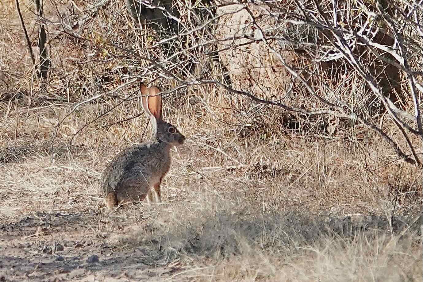
As expected, we started to see some big, cultivated fields as a we approached the town. Most of it looked like asparagus. There were also a lot of rabbits in the area - clearly drawn to the tasty offerings in the farm fields. On arrival, we went straight to the little grocery store and bought breakfast. We each drank more than a liter of fluids, and polished off a couple packages of muffins. A pack of feisty chihuahuas kept a close eye on the street near the store, harassing any other dogs that came by. They also took a keen interest in our food.

One of the local chihuahuas hoped PedalingGal would accidentally drop some of her breakfast. Ley Federal de Aguas #1, Baja California Sur, Mexico. Copyright © 2019-2023 Pedals and Puffins.
From there, we enjoyed about 4.5 miles of cycling on pavement. But just as quickly as it appeared, the pavement ended. The final 23+ miles (37 km) served up a constantly changing set of conditions. Some of the route was relatively hard-packed, making for quick and easy cycling. But mostly we battled more deep sand and rocks as we followed a nearly-straight line southward to Ciudad Constitución. Although there were some scrubby natural areas, most of the route was lined with agriculture: corn, alfalfa, and several huge orange orchards.
Citrus is a major crop on the Magdalena Plain, and we cycled through many miles of orange groves. Approaching Ciudad Constitución, Baja California Sur, Mexico. Copyright © 2019-2023 Pedals and Puffins.
We actually arrived at the edge of town sooner than expected. Ciudad Constitución turned out to be a big, sprawling city. But after about two more miles of cycling we finally reached our hotel. It ended up being a great place for a layover, living up to its name as the Hotel Oasis. We had a big room with air conditioning, strong and reasonably fast wifi, and even a refrigerator in the room (in-room refrigerators are very rare in Baja). The first thing we did was shower, and it was heavenly.
A Holiday in Ciudad Constitución
We had planned to spend a day or two in Ciudad Constitución resting and prepping for the next leg of our trip. But pretty soon we realized that Semana Santa (Holy Week) was just a few days away. In Catholic Mexico, many businesses shut down for extended periods during Semana Santa, and people travel to be with family. We became concerned about cycling in the backcountry during the holiday, when we would be dependent on small, remote, often one-person stores being open for resupply along the way. It struck us as too risky.
The receptionist at the hotel assured us that in the city there would be some shops that stayed open all week. So, given that we had found a great hotel with lots of dining options nearby, we decided to hunker down and spend the holiday in town.
Courtyard at the Oasis Hotel, our basecamp during Semana Santa. Ciudad Constitución, Baja California Sur, Mexico. Copyright © 2019-2023 Pedals and Puffins.
Ciudad Constitución is not a tourist destination. It’s much more of a commercial agricultural center for south-central Baja. But we did enjoy getting out and walking around town every morning. Here are some of the sights:
The city’s capital letter sign. Apparently they thought the name “Ciudad Constitución” would be too long, so they used the name of the valley instead. Ciudad Constitución, Baja California Sur, Mexico. Copyright © 2019-2023 Pedals and Puffins.
The main Catholic Church in town, Nuestra Señora de Lourdes. Ciudad Constitución, Baja California Sur, Mexico. Copyright © 2019-2023 Pedals and Puffins.

Symbols of the municipality of Comondú, painted on the stones of the town plaza. Ciudad Constitución, Baja California Sur, Mexico. Copyright © 2019-2023 Pedals and Puffins.
With its old stone missions and a “magical” town, this section of the Baja Divide had brought us a little bit closer to Baja’s complex Spanish heritage. The visits with rancheros gave us a glimpse into even older traditions that have helped people persist in these harsh lands for thousands of years. And our time in Ciudad Constitución connected us with one of Baja’s prosperous, contemporary centers. It’s been fascinating to see both the common threads and contrasts among the different faces of Baja, while also experiencing the tremendous solitude of cycling through remote desert mountains where human cultures still have relatively little impact. It continues to be an amazing journey.